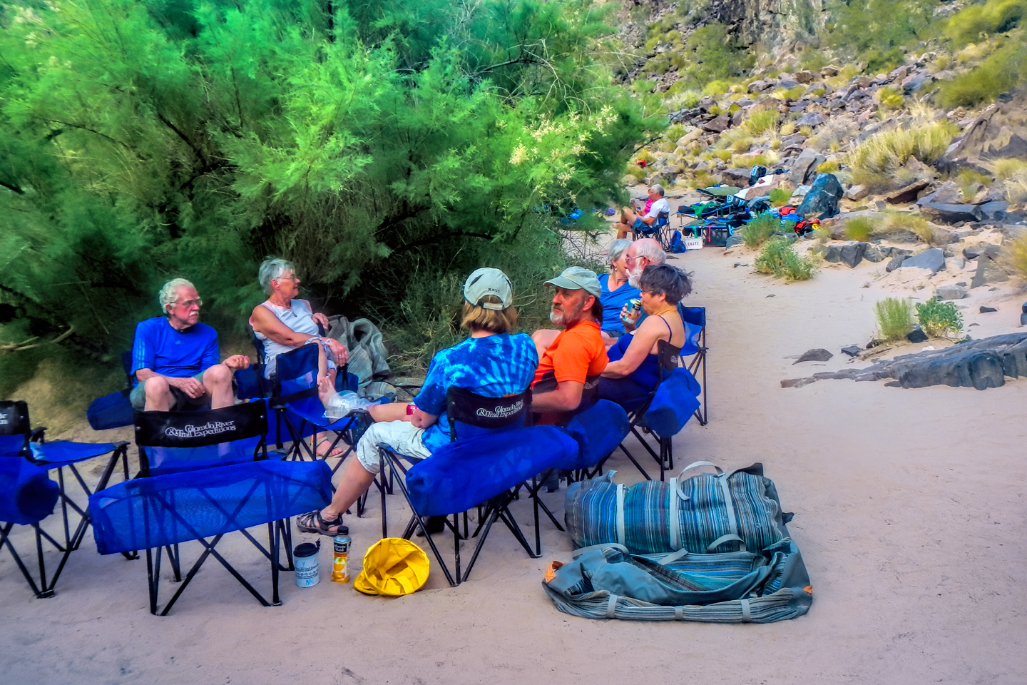
Day three! The call to “COFFEE!” was welcome indeed, followed by another good breakfast of pancakes and whatnot. With the confluence of the Little Colorado beckoning, we struck camp and loaded the rafts in record time. We started out by immediately running Kwagunt Rapid, piece of cake, followed, in short order, by 60 Mile Rapid, even easier.
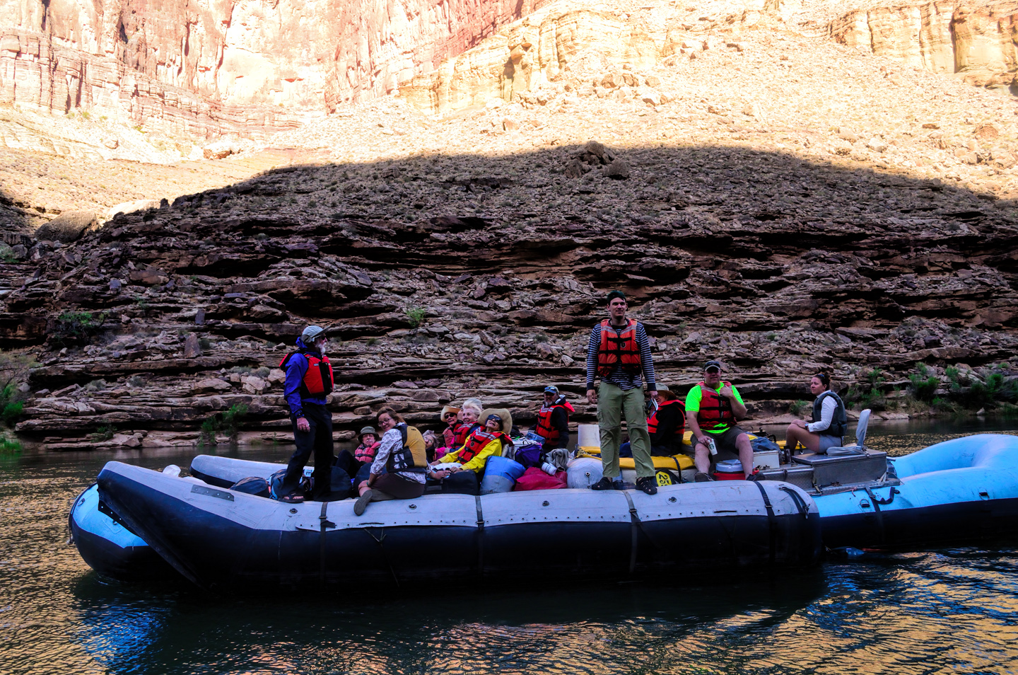
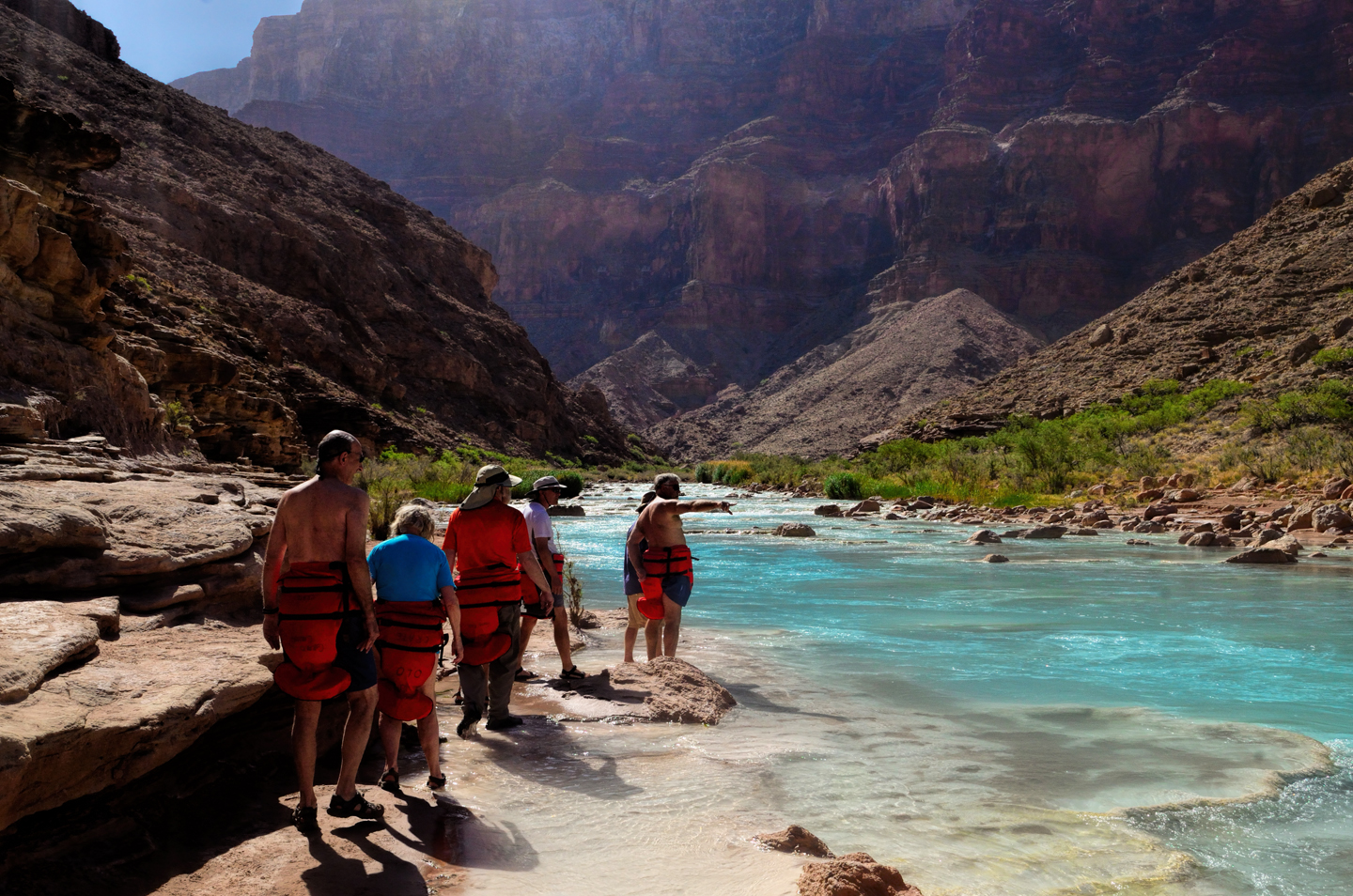
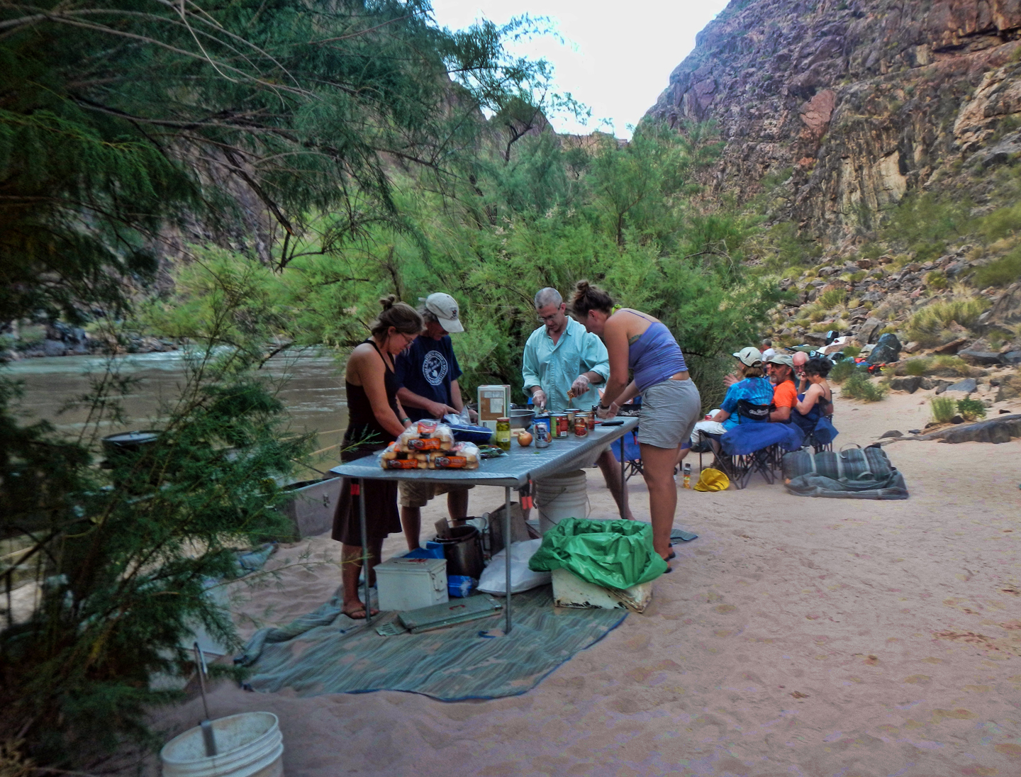
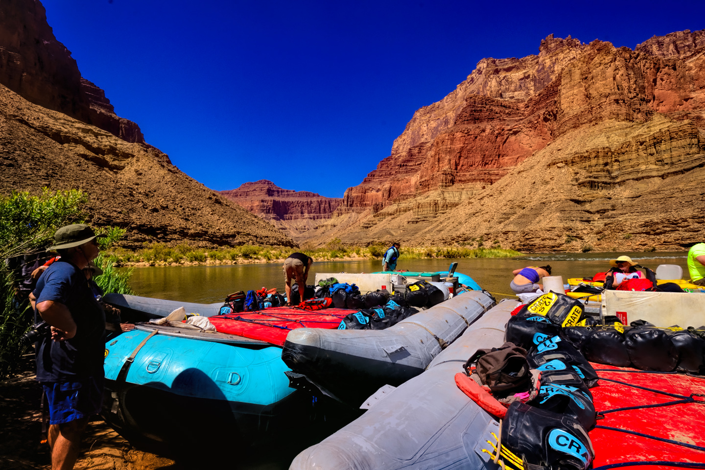
At mile 62 we came to a side canyon on river left, and that’s where we pulled over and anchored, running the bow of each big raft up onto the soft sand, so that pampered passengers wouldn’t have to get their feet wet stepping out.
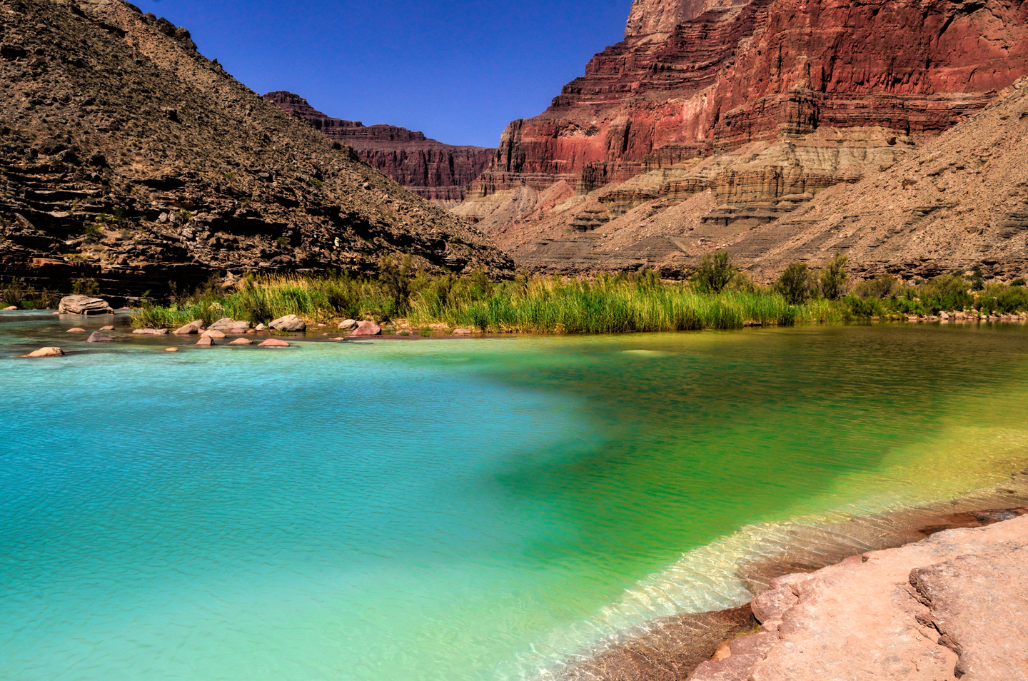
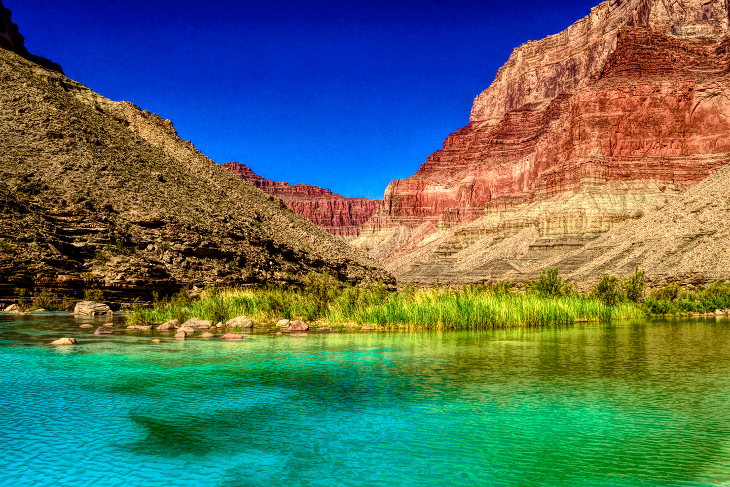
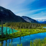
The Little Colorado River is one of just two major tributaries to the (big) Colorado River within the State of Arizona, and it travels some 300 miles from the forested mountains of Eastern Arizona to this spot on the Navajo Reservation. The confluence marks the true beginning of the Grand Canyon proper, and the entire area is sacred to the Indians, both the Navajo and the Hopi tribes. As we hiked upstream from the river, following a well-worn trail, it was immediately apparent why this place was considered so special.
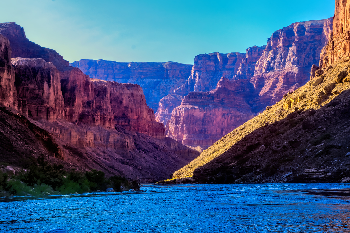
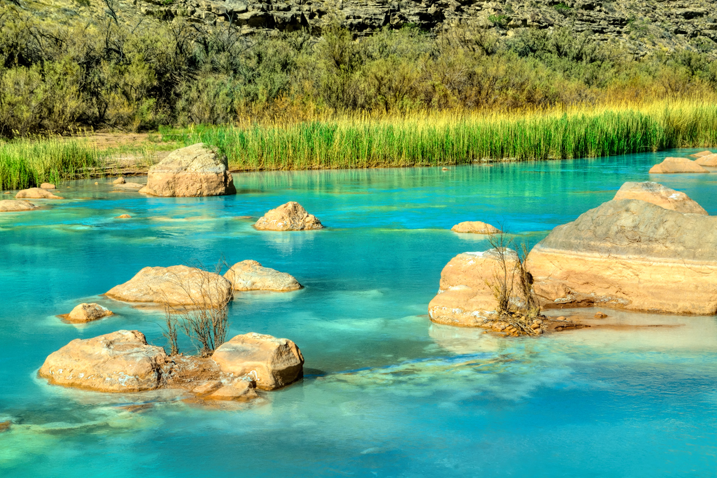
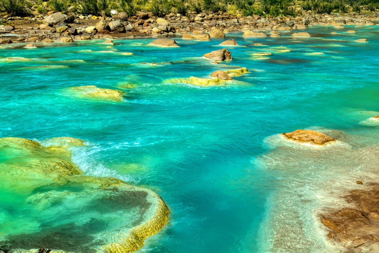
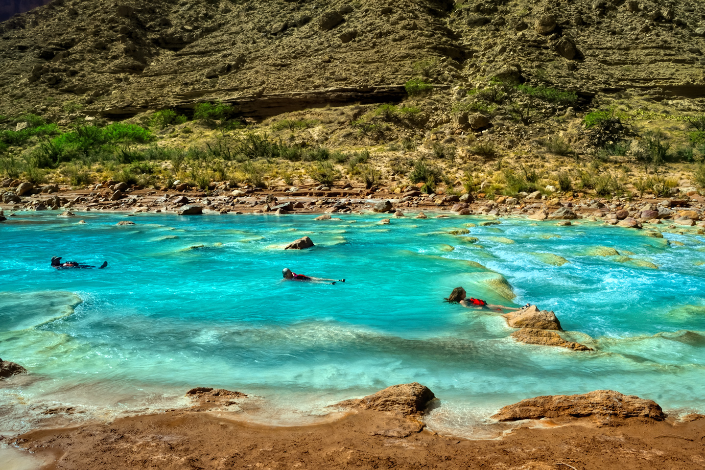
The waters of the Little Colorado are a turquoise blue that is so startlingly bright it doesn’t even look real—the result of unusually high concentrations of calcium carbonate and magnesium, refracting the light in an unusual way. There’s a well-defined spot where that warm, turquoise blue water from the small river collides with the cold, deep green water flowing upstream from the big river.
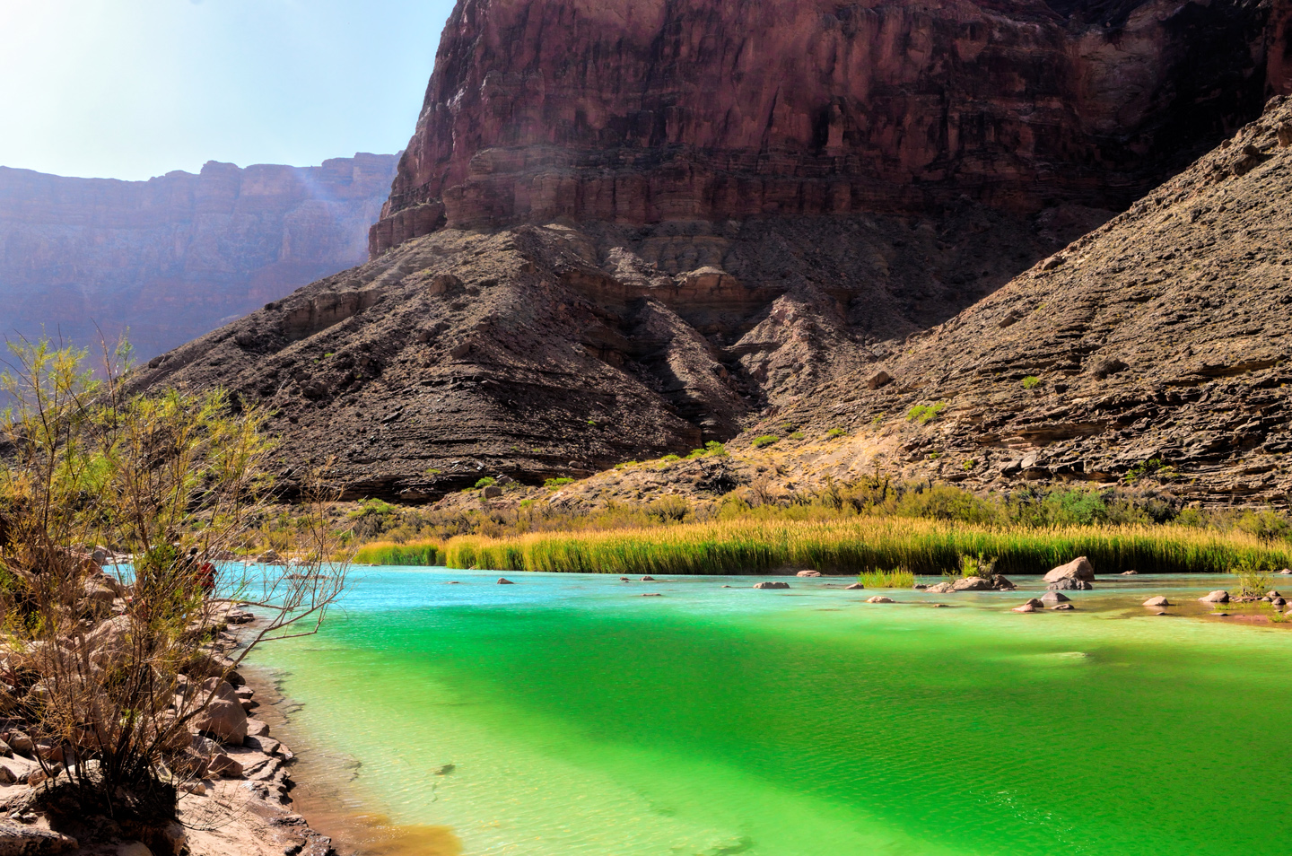 The two dramatically different colors mix, forming a shifting, swirling line of chartreuse, with dark green water downstream, and bright turquoise upstream. That spot is the confluence (see photo at the top of this post). It’s magical, and utterly unique.
A project has been proposed, backed by some of the less traditional elements on the Navajo Tribal Council, to partner with a developer and build a tramway that would ferry paying passengers from the rim to this spot. Having been there, and seen that place, the very notion of such a thing is horrifying to me. The confluence is special mainly BECAUSE it’s so isolated, a rare vision, seen only by those who have earned the privilege, by running those rapids, or by hiking the steep trails that follow the small river down—the route that’s taken by the Navajo and the Hopi when they travel there for ceremonial purpose. It’s a place that simply isn’t meant for the masses. I can only hope that cooler heads will prevail, and that this beauty will be preserved intact. Click <<here>> for information about the effort to stop this project.
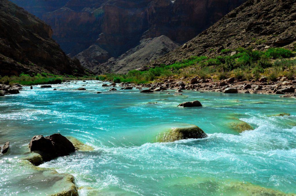
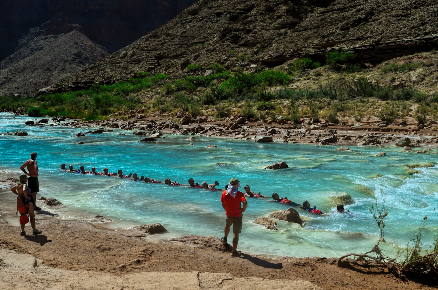
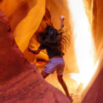
Further upstream was a popular swimming hole, more of a water-slide, where the small river flows through a channel of smooth, rounded boulders coated slick by the minerals in the water.
To protect your behind from getting bashed against submerged rocks, you had to strap your life jacket on upside down around your waist, with the neck piece under your crotch.
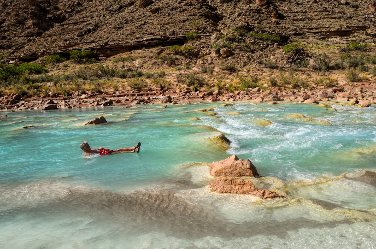
Then you entered the water and floated in a sitting position, feet forward, aiming for the slot between the white boulders at midstream. If you performed the maneuver correctly, you got a pretty good, fast ride down the chute.
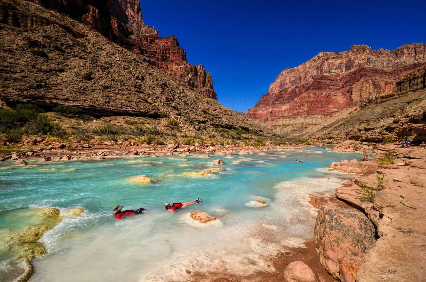
Then you let the current carry you 40 or 50 yards downstream, where you could make your way to the bank, climb out, and hike back to do it again. This was great fun, albeit a little silly, with everyone walking around with life jackets covering their bums. We kept at it for the best part of an hour, until other rafting parties started arriving, and it got a bit crowded:
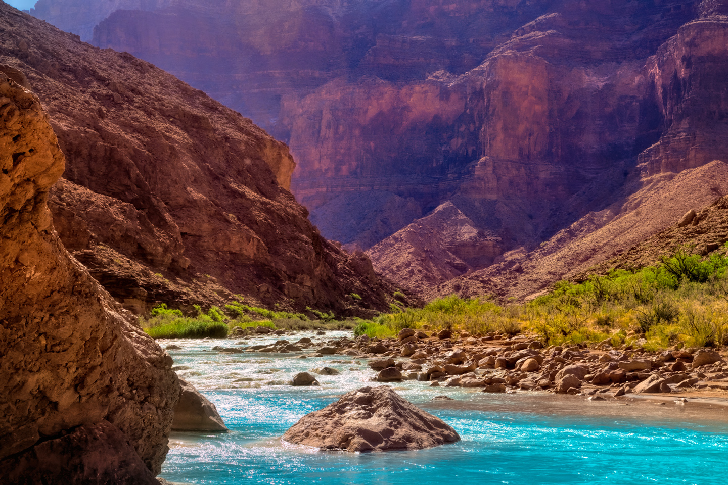
After leaving the confluence, we hit Lava Canyon rapid at mile 66, then Tanner Rapid at mile 69, and Unkar (a two-hander!) at mile 76. Somewhere along that stretch we pulled over at a shady spot on river right and had some lunch. The day was heating up, and I was starting to get a little light-headed. With all the water around, I wasn’t remembering to drink enough, and I was starting to get dehydrated. I spoke up about it, and was glad that I did: the river guides had some electrolyte tablets, which helped me quite a lot.
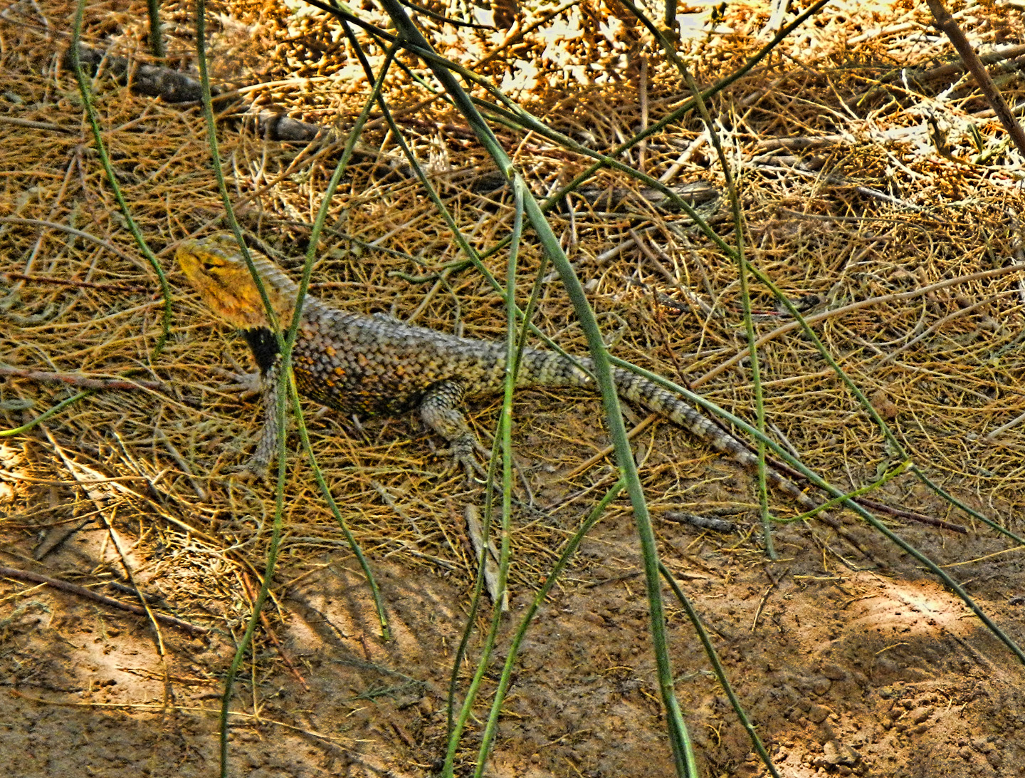
A family of geckos entertained us during lunch, scampering around the limbs of the big tree we were using for a canopy, while the ravens, ever present, watched from on high, waiting to swoop in and search for scraps the moment we pulled away.
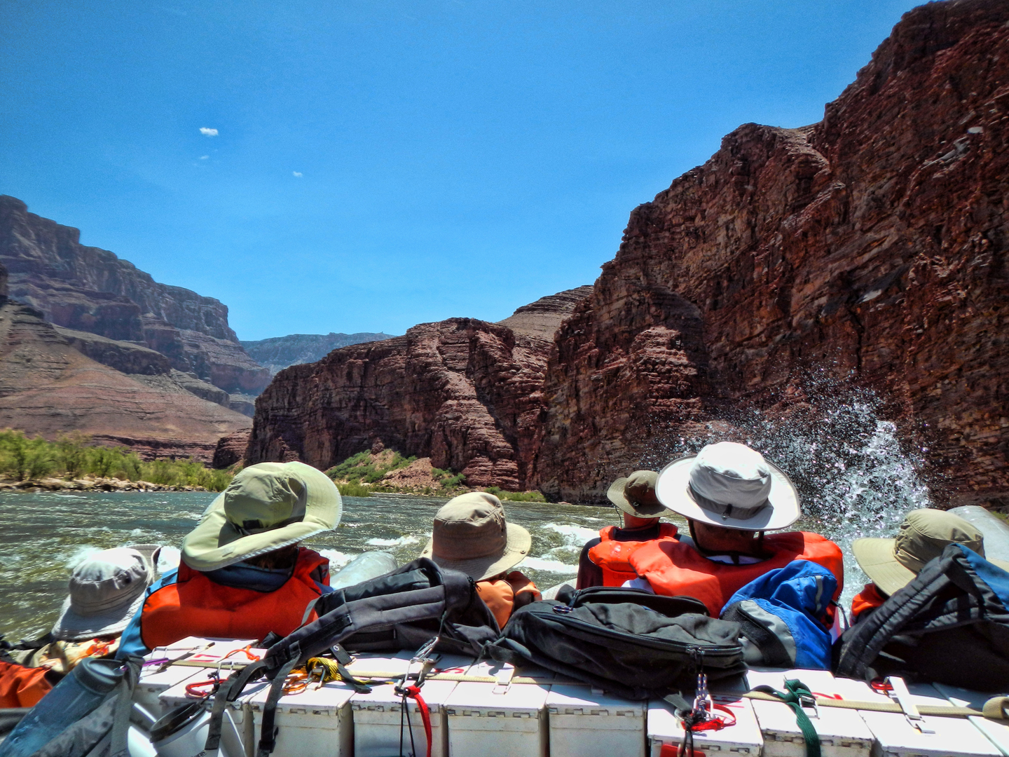
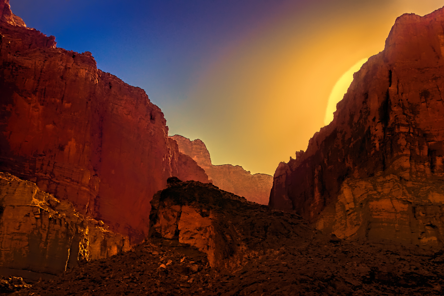
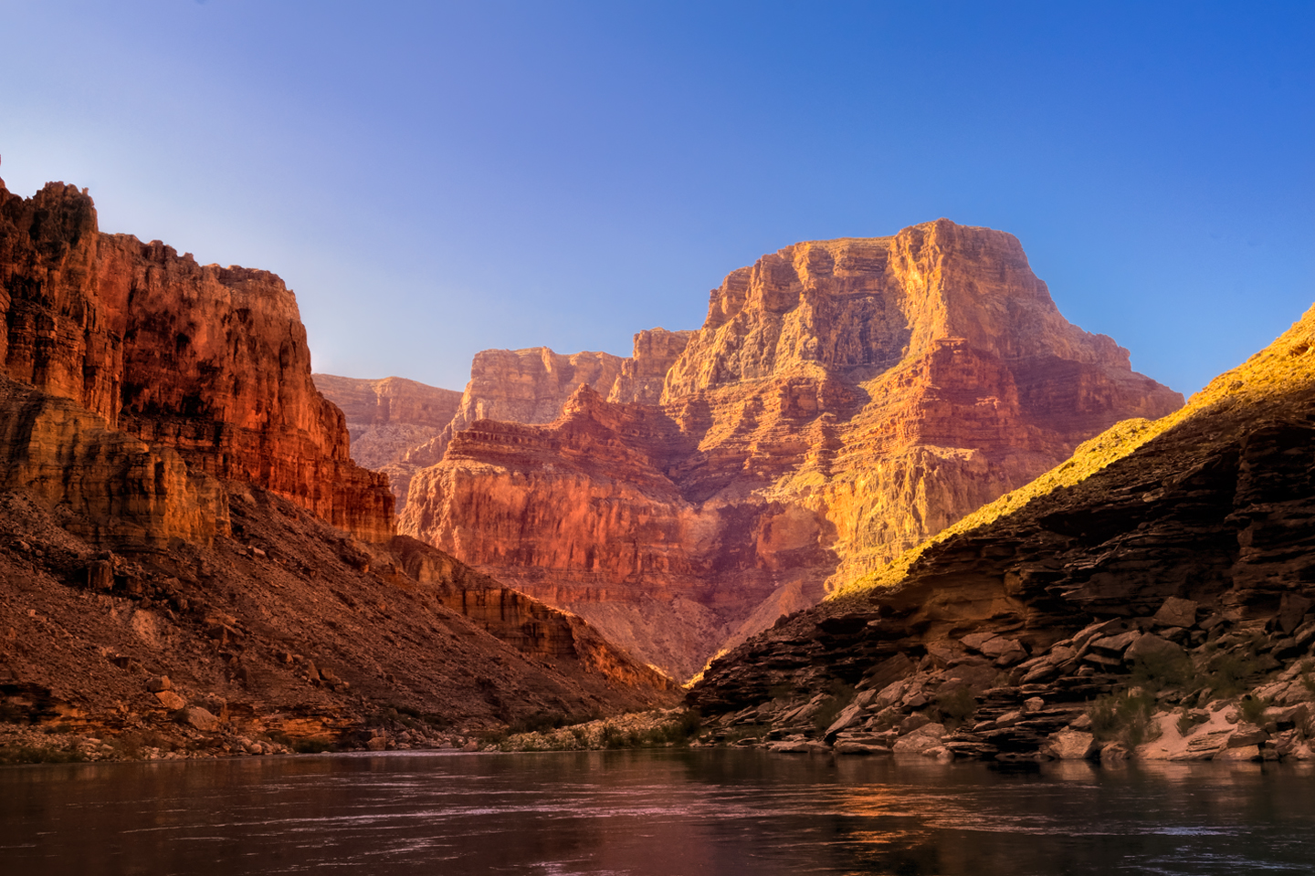
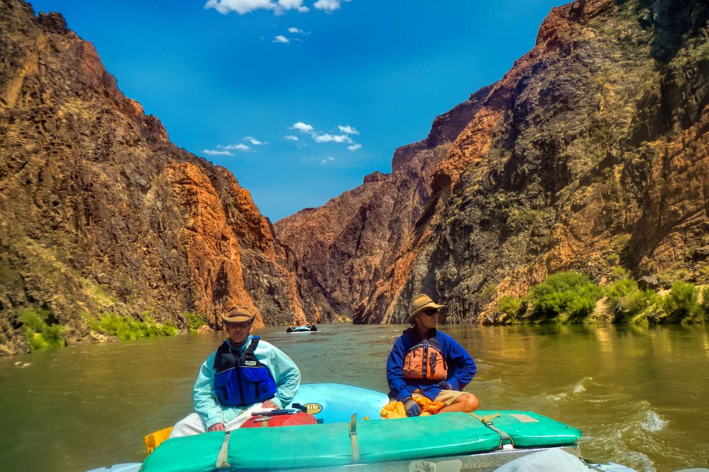
After lunch, more rapids: Nevills Rapid, a two-hander, followed by Hance Rapid, the biggest and baddest we’d seen so far. Hance was a monster—multiple large rocks constrict the channel at that point, creating powerful hydraulics. The water is extra swift, and the level of the river drops 30 feet from one end of the rapid to the other. It was serious business, and a sobering testament to the skill of our river guides. Hance was quite a ride, but the river wasn’t done with us yet. Less than two miles down we hit Sockdolager, an aptly named two-hander. (Sockdolager is archaic slang for a “knockout punch”). Three miles after that, Grapevine Rapid, another two-hander, followed by 83 Mile Rapid, Zoroaster Rapid, and last but not least, 85 Mile Rapid.
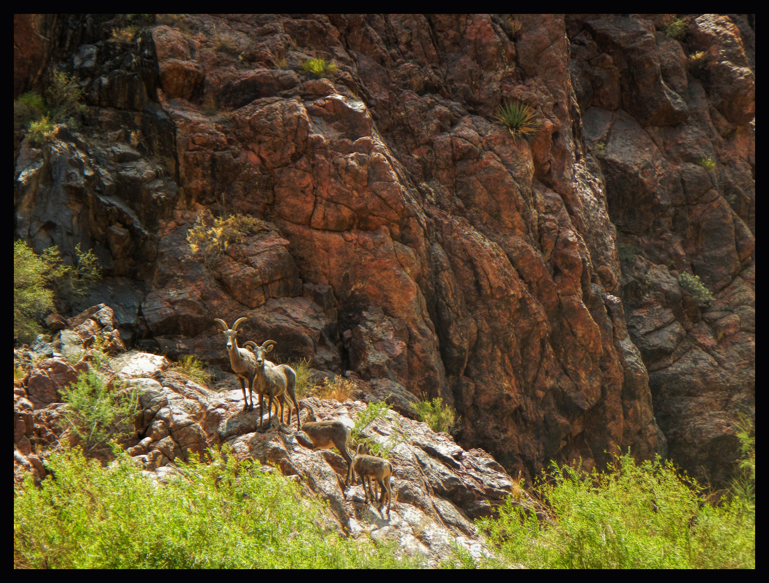
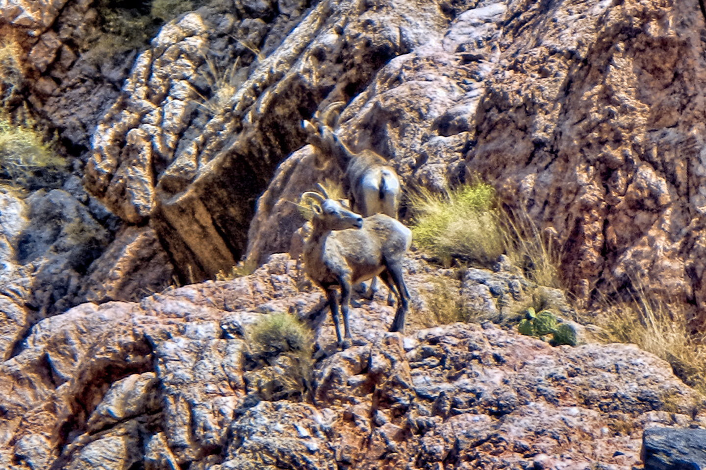
At some point along that stretch we spotted a pair of Bighorn Sheep, and as we moved past them, we realized that it was a family herd, a young ram and a ewe and a pair of youngsters. While we watched, they bounded effortlessly up the near vertical cliff and disappeared from view.
After rounding a shallow bend, we came upon a startling site: an iron suspension bridge crossing from one side of the river to the other, 50 or 60 feet above the water:
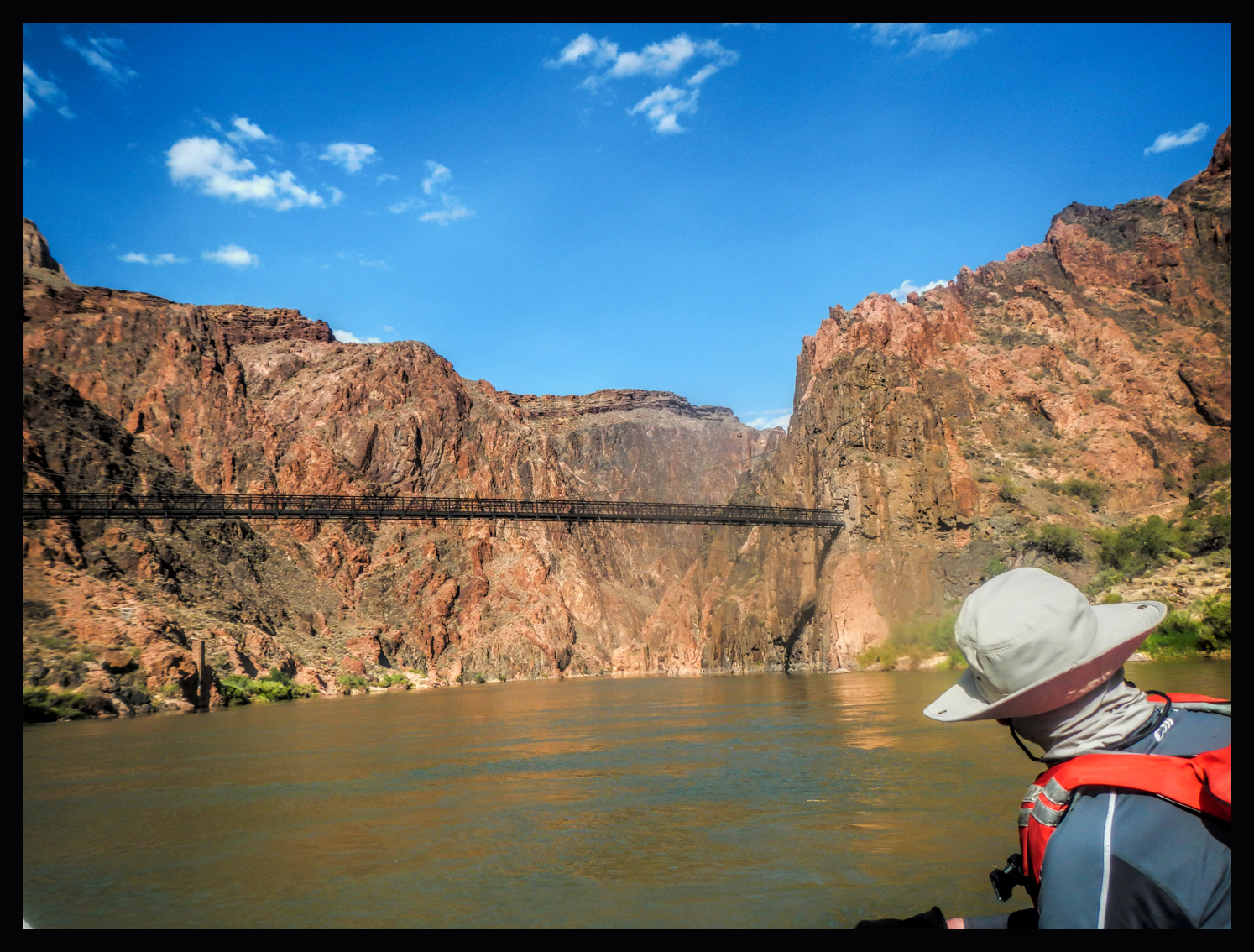
This was the Kaibab Bridge, built in 1928 and still in use by hikers and mule riders coming down from the South Rim. This bridge is part of the route to and from <<Phantom Ranch>>, a complex of rustic cabins a mile north of the river, at the very bottom of the Grand Canyon. Many rafting trips either begin or end at Phantom Ranch—shorter trips, for those without the time or the means to run the whole length of the canyon. You can get on at Lee’s Ferry, as we did, and then get off at Phantom Ranch, after which you’ll have to hike (or ride a mule) 7 miles back up to the South Rim, or 14 miles to the North Rim. Alternatively, you can hike down to Phantom Ranch from either rim, and join a rafting party that will take you the rest of the distance through the lower canyon to Pearce Ferry, or to one of the other take-out points near Lake Mead. My personal recommendation? Do the whole thing–especially if you’re only going to do it once.
Phantom Ranch has the distinction of being the only place along the length of the river where you can contact civilization. There’s a phone that you can use in an emergency, you can pick up supplies, you can recharge your water tanks, and you can buy fuel for your outboard. Not to mention ice cold lemonade. We didn’t actually need any supplies, but we still pulled over to the bank and tied up for an hour or so. Those who needed something from the store, or who just wanted to see Phantom Ranch, hiked the mile or so up the trail to the old hotel (built in the 1920’s). Those of us who didn’t feel like hiking hung out in the shade near the rafts.
We pulled away from Phantom Ranch, thinking we were just about done for the day, but the river still wasn’t finished with us, not yet. We hit Bright Angel Rapid just below the bridge, and Pipe Springs Rapid a mile further downstream. A mile beyond that? Horn Creek Rapid, even bigger than Hance, and even though the drop is a mere 9 feet, Horn Creek produces enormous waves that can make it, at certain water levels, one of the most difficult in the canyon. Do I need to add that Horn Creek was a two-hander? And that it most definitely woke us all up.
We traveled another mile at the most before pulling over at a fair-sized camping beach on river left, just above Salt Creek Rapid, a relatively easy run. As always, the crew prepared the dinner, while the passengers unwound from the rigors of–well, the rigors of being passengers! On the Colorado River through the Grand Canyon! Woo hoo!
 It was the stretch below Salt Creek that had me nervous. Our next day, Day Four? Day Four was going to be a bear. It was going to start out with a bang, so we needed to get some sleep, lying on our cots under that amazing canopy of stars…
The slide show below has a few additional pictures from Day 3. Click any of the images to expand them to full screen, with captions.
(Unless otherwise noted, all of these images are my original work, and are protected by copyright. They may not be duplicated for commercial purposes.)
The Adventure Continues:
This is an interactive Table of Contents. Click the pictures to open the pages.
A Grand Adventure! White Water Rafting on the Colorado River

Grand Canyon Rafting Expedition: Day 1
The two rafts were shoved away from the beach until they floated free, and the boat drivers eased them into the middle of the channel. We were mostly moving with the current, but the beach dropped behind us pretty quickly, and in a matter of minutes we were out there, rafting down the Colorado River, heading squarely into the enchanted depths of the Grand Canyon...
<<CLICK to Read More!>>

Grand Canyon Rafting Expedition: Day 2
The cliffs and buttes were a perfect composition, the different colored layers of stone were all but glowing in the afternoon light, and we had this incredible world all to ourselves, not another boat in sight.
<<CLICK to Read More!>>

Grand Canyon Rafting Expedition: Day 3
The waters of the Little Colorado are a turquoise blue that is so startlingly bright it doesn't even look real. There’s a well-defined spot where that warm, turquoise blue water from the small river collides with the cold, deep green water flowing upstream from the big river. The two dramatically different colors mix, forming a shifting, swirling line of chartreuse. That spot is the confluence. It's magical, and utterly unique.
<<CLICK to Read More!>>

Grand Canyon Rafting Expedition: Day 4
I was still a little dazed by the whole thing, scenes of frothing, churning whitewater playing over and over in my head. Fleecy white clouds were piling up above the canyon rim, nearly filling the narrow patch of sky, until the lowering sun set them afire, a Grand Canyon sunset display that was the finest we’d seen, worthy of the spectacular setting. A fitting end to one of the most amazing days of my life.
<<CLICK to Read More!>>

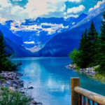
Grand Canyon Rafting Expedition: Day 5
The trail meandered for a mile or so, finally dropping down level with the creek, giving us access to a series of perfect swimming holes. There’s something about that exotic turquoise water that welcomes swimmers--you have to get in it, if only to assure yourself that it’s real. The creek was cool, but far from cold, and a welcome change from the icy water in the river. We stopped at a particularly inviting spot to swim, relax, and eat our lunch. Sitting beside that creek, with our simple repast--it was like having a picnic in the Garden of Eden.
<<CLICK to Read More!>>

Grand Canyon Rafting Expedition: Day 6
“Two Hander!” John called out rather gleefully, and we all clung to the ropes for dear life as the raft picked up speed. We were headed straight for the boil of Lava Falls, which was roaring like a freight train, bearing down. We entered the churning whitewater pretty much dead center, then moved hard to the right to avoid the standing waves and the big holes in the middle of the channel. We got good and drenched at least three times, almost like running under a series of waterfalls, bucking and lurching like crazy, but the whole thing was over in less than a minute.
<<CLICK to Read More!>>

Grand Canyon Rafting Expedition: Day 7
Immediately below that beach we hit Diamond Creek Rapid, then Travertine Rapid, where we pulled over to the bank at Travertine Canyon. The creek that entered the river here flowed across huge, slippery boulders in a series of small waterfalls, and we had great fun taking turns standing in the flow, almost like a natural shower.
<<CLICK to Read More!>>

Grand Canyon Rafting Expedition: Day 8
The river broadened as we approached Lake Mead, and at mile 278 we entered the lake itself. Pearce Ferry was right there, and we were all pretty quiet as the rafts pulled in to shore for the last time. “Thrill of a lifetime” is a pretty strong statement, but it’s appropriate for this journey. There’s nothing else like it.
<<CLICK to Read More!>>

Grand Canyon Rafting
You find a rope, any rope, and you grab on with both hands for all you're worth. The river boils like the North Sea in a gale, great, rolling green waves and troughs. The raft plummets sideways into a hole fifteen feet deep, the outboard motor shrieks, a monster wave towering ten feet above your head comes crashing down across the deck, pummeling the passengers like a gigantic liquid fist that takes your breath away, leaving you suspended, time stopped, frozen in mid-scream.
<<CLICK to Read More!>>

There's nothing like a good road trip. Whether you're flying solo or with your family, on a motorcycle or in an RV, across your state or across the country, the important thing is that you're out there, away from your town, your work, your routine, meeting new people, seeing new sights, building the best kind of memories while living your life to the fullest.
Are you a veteran road tripper who loves grand vistas, or someone who's never done it, but would love to give it a try? Either way, you should consider making the Southwestern U.S. the scene of your own next adventure.
A few years ago I wrote a book about road trips in Arizona and New Mexico that's a lot like this website, packed with interesting information, and illustrated with beautiful photographs. Check it out! You can find it on Amazon, and at all other major booksellers.


Recent Comments