
Day two, our first full day on the river, dawned clear and cool. I awoke even before first light, restless on my cot, and slept out, after going to bed so danged early.
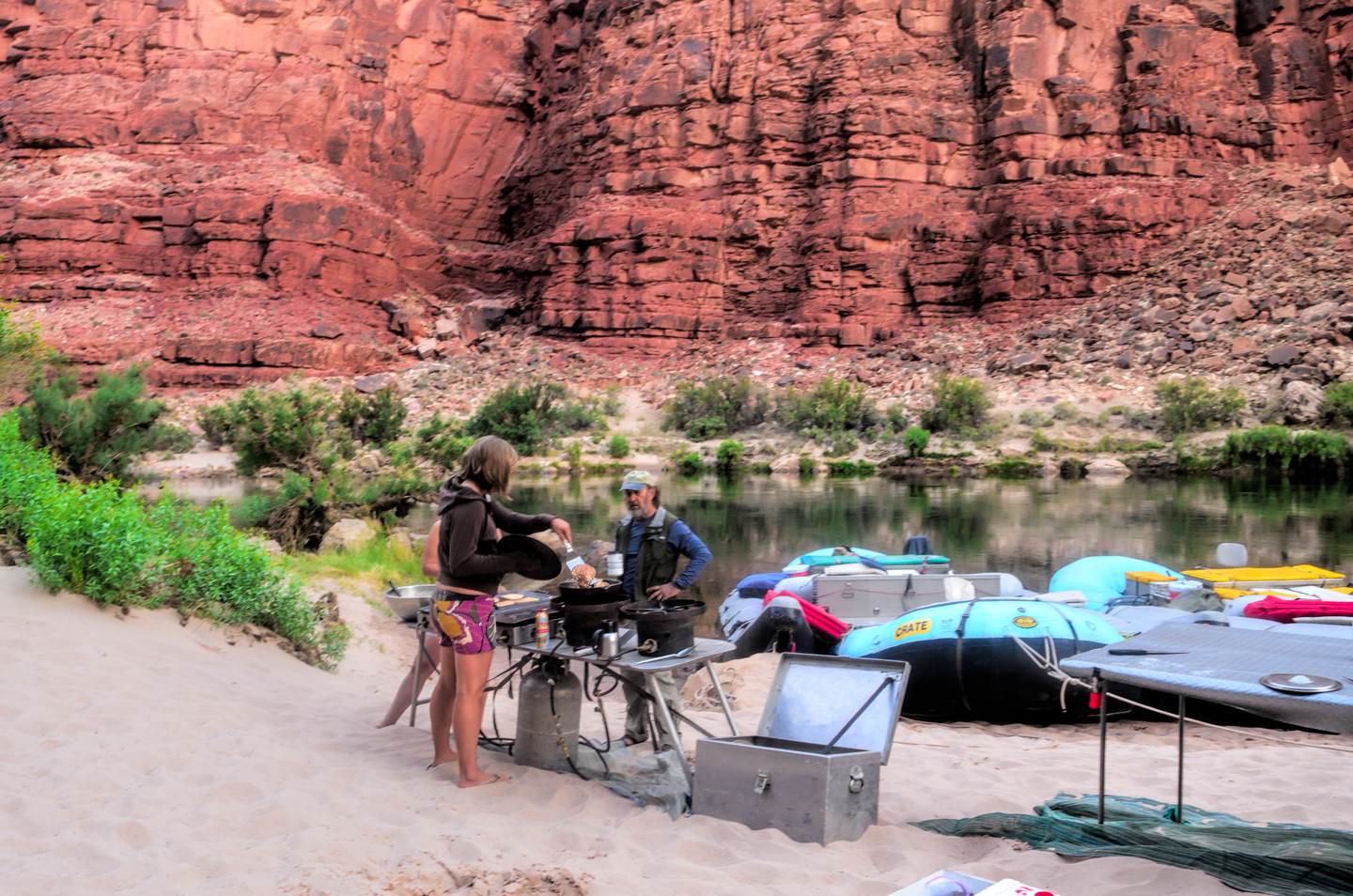
The crew was up and running around before most of the rest of the passengers even stirred, and a big pot of cowboy coffee was brewing almost immediately. (For the uninitiated: cowboy coffee is a handful of coarse grounds tossed into boiling water. The finished product is poured into your cup through a strainer.) No coffee snobs in this group–in that setting, that unfiltered coffee tasted great, and we all loved it. The raucous call to “COFFEE!” quickly became a welcome, first thing in the morning tradition, and we’d stand there sipping that stuff, sand between our toes, waiting patiently for the bacon and eggs or the pancakes and sausage or the whatever was on the menu on any given morning.
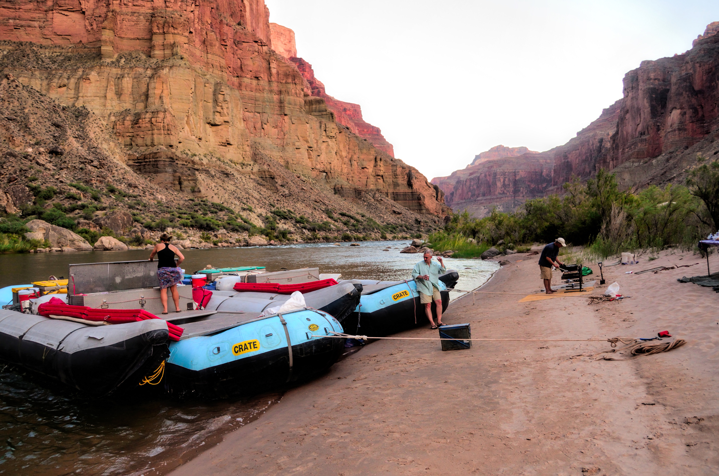
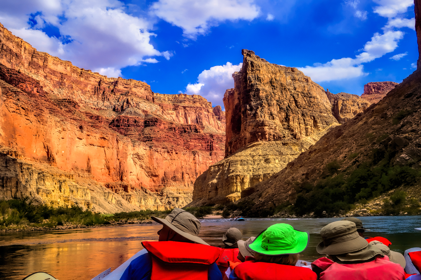
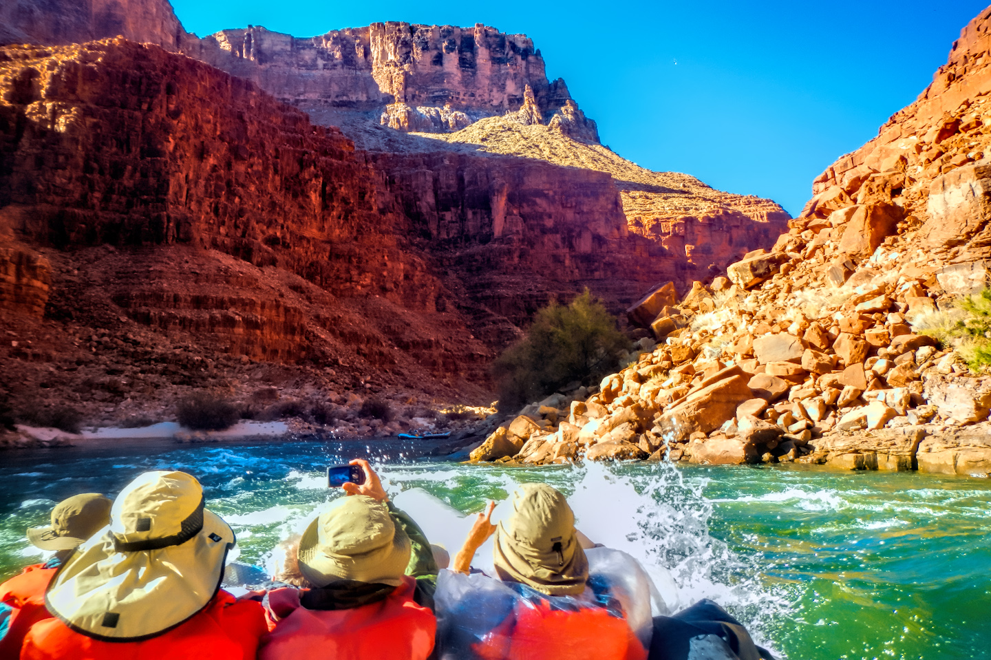
The crew didn’t overtly hurry us along, but we hadn’t come all this distance to stand around on the shore, so shortly after breakfast we started breaking down the camp. The cots were easier to take apart than they were to put up, and at that point, the design was actually starting to make sense. We shook the sand out of our belongings as best we could (the fine sand was ubiquitous, and got into pretty much everything), re-stuffed our waterproof duffels, and did our best to properly seal them, rolling down the top, squeezing out the air, and cinching the straps as tightly as was humanly possible. We staged all the bags near the boats, and a reverse version of the human chain moved the bags from the beach back onto the rafts, where the crew lashed them all into place, then we suited up, in full battle gear (hats, ponchos, raincoats), with our all-important orange life preservers over top of everything else. We’d been warned: the first section of our Day Two journey was known as the “Roaring 20’s”, an infamous series of rapids that we’d be hitting, one after another, for the next ten miles.
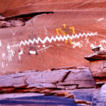
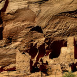
First up was North Canyon Rapid, less than a mile downstream from our camp, followed rather quickly by 21 Mile Rapid, 23.5 Mile Rapid, 24 Mile Rapid (a borderline two-hander), 24.5 Mile Rapid, Cave Springs Rapid, 27 Mile Rapid, and, last but not least, 29 Mile Rapid. Somewhere in the middle of all that, in one of the calm stretches, we pulled over on river right and climbed a small hill, where we got an up-close view of some ancient petroglyphs:
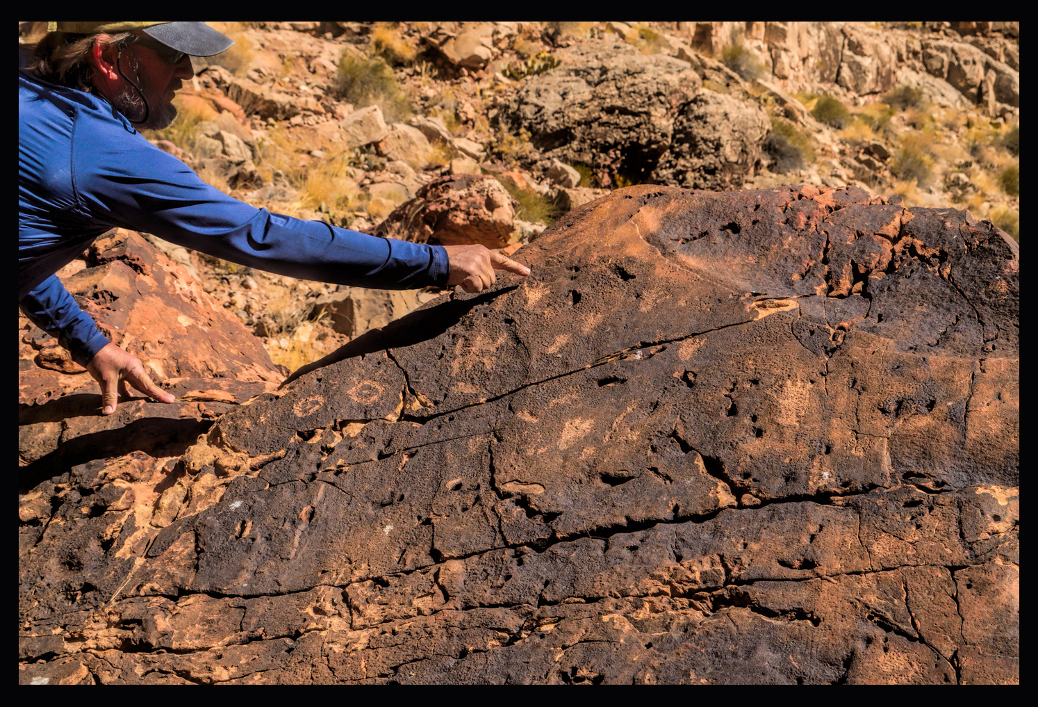
The petroglyphs were etched into the dark layer of mineral, “desert varnish”, that coats the large boulders in this area. These symbols, of uncertain significance, were left there by Indians living near or passing through this area hundreds of year ago. I couldn’t find any reference to this site on maps or in any of my guidebooks, so I’m honestly not sure what it was called.
Back on the rafts, we traveled a few more miles, hit a few more rapids, and exited the roaring ‘20’s, with no small measure of relief. At the end of that run, we really were becoming veterans, and despite the fact that we were all soaking wet, we were feeling pretty smug about ourselves. A couple of miles downriver on river right we came upon an interesting spot called Vasey’s Paradise:
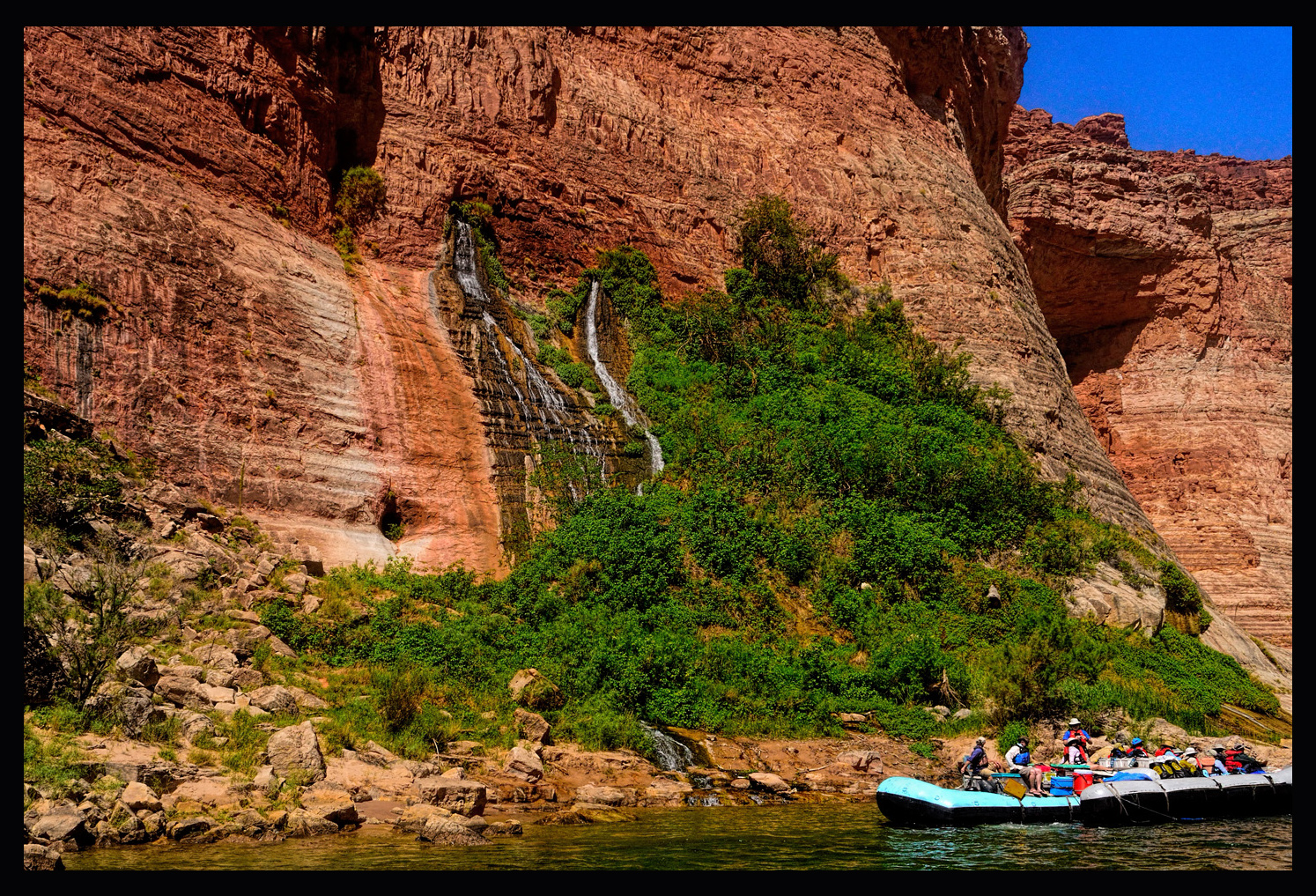
There was a natural spring flowing out of the canyon wall, creating a unique ecosystem of mosses and ferns growing wild and dense on the side of the cliff. There was also a bit of poison ivy, so it was best to look, but not touch. The place was named by John Wesley Powell, in honor of a botanist who traveled with him on his expedition through the Rockies in 1868, the year before his first exploratory journey down the Colorado.
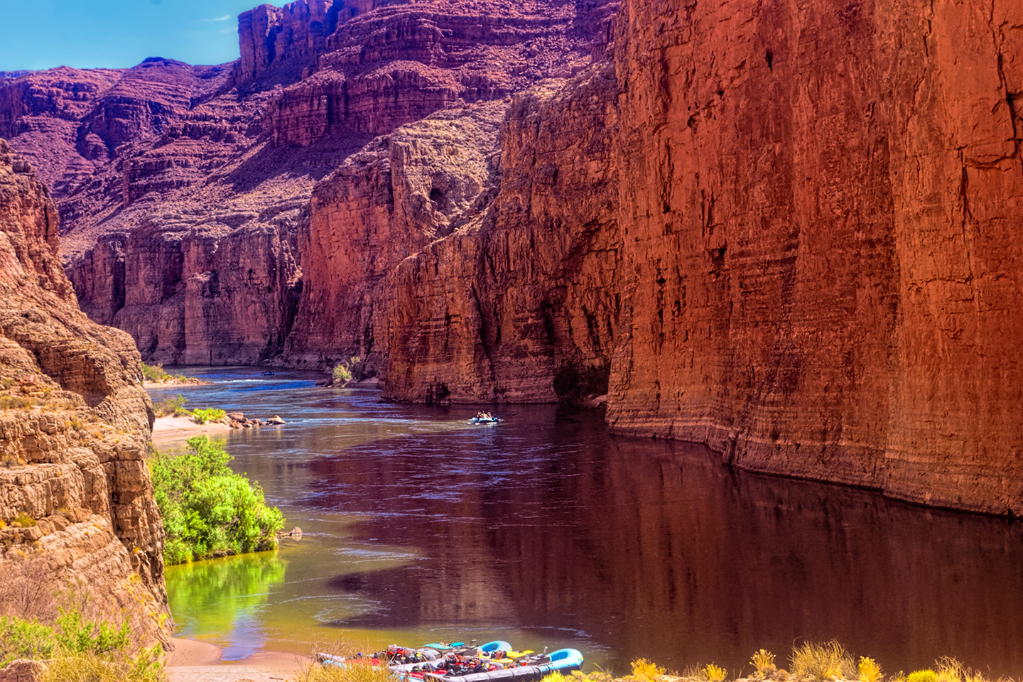
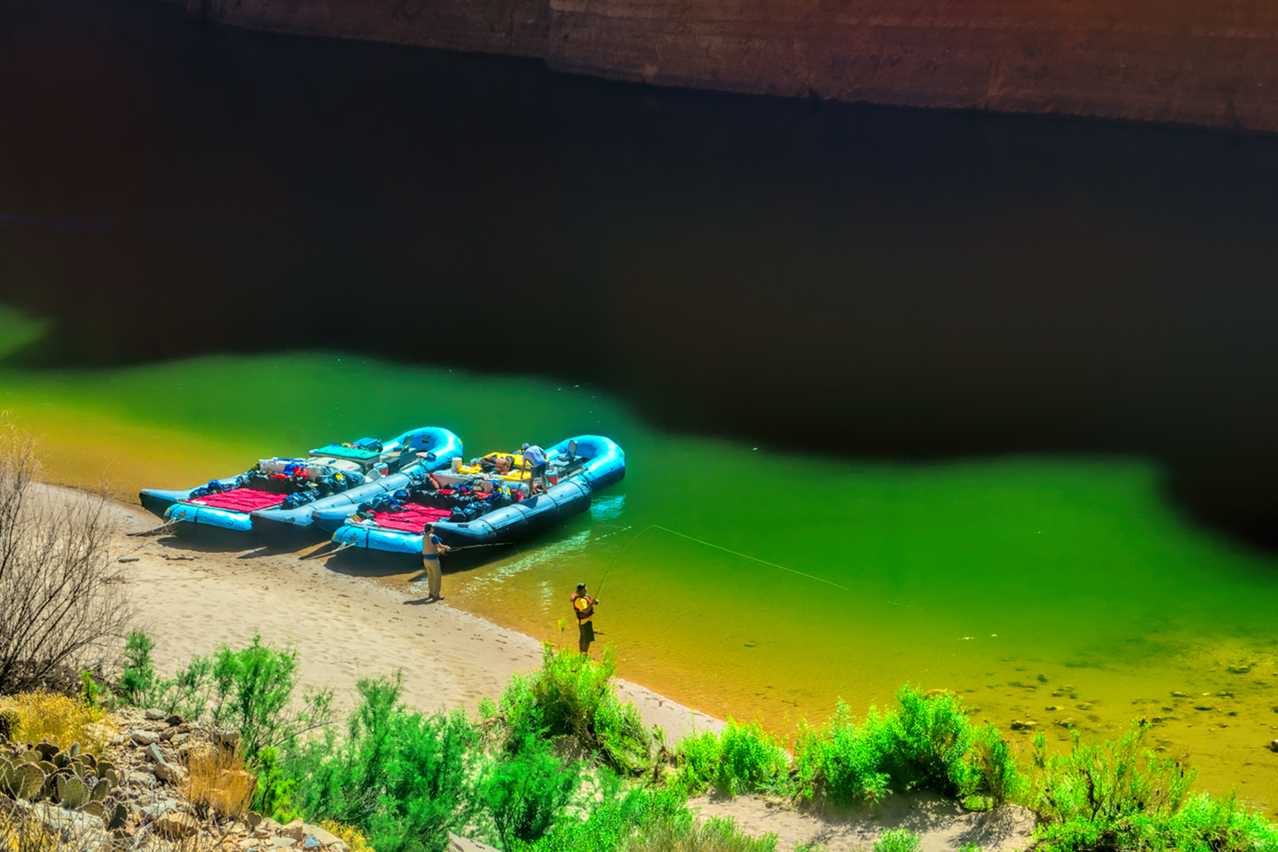
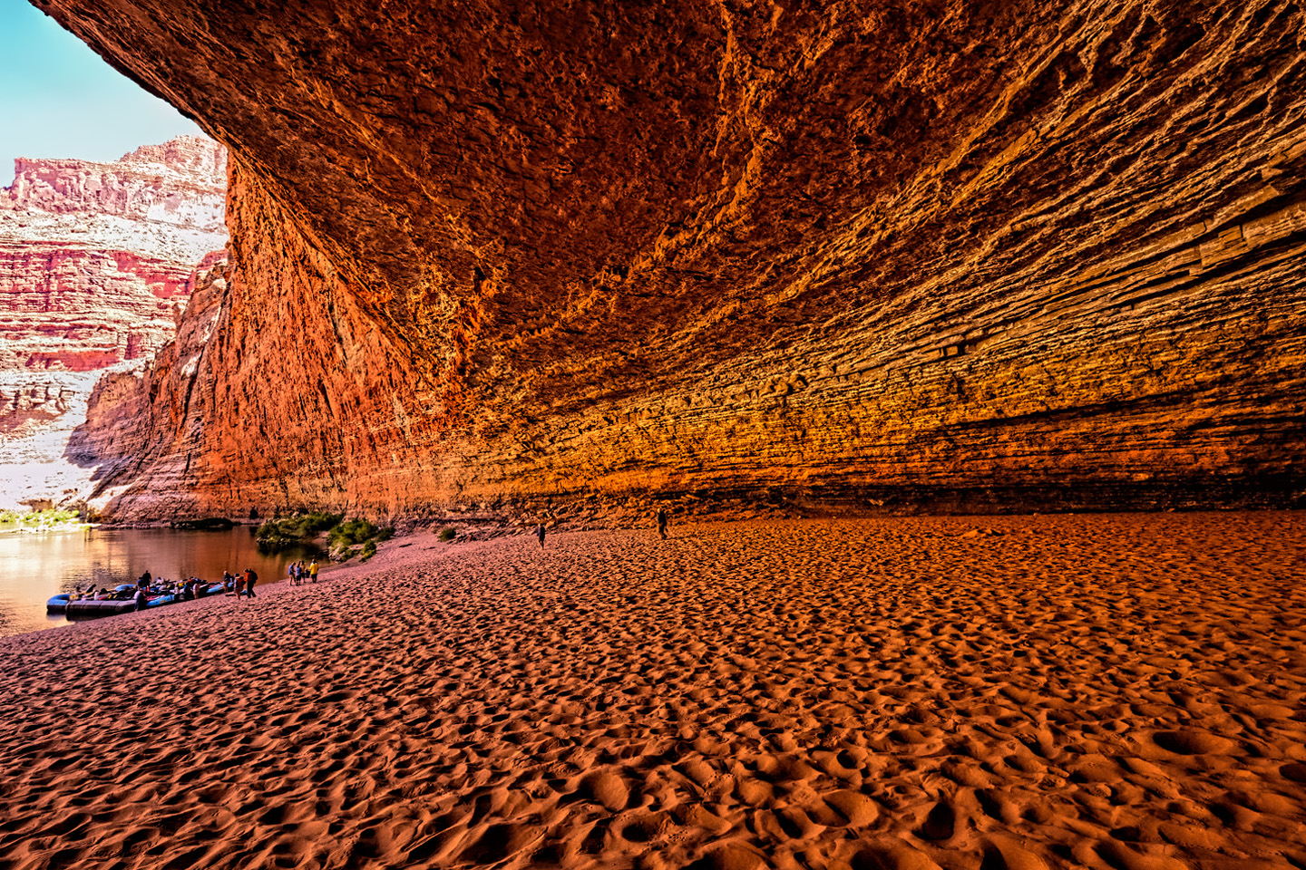
A mile or so beyond Vasey’s Paradise, on the left hand side of the river, the cliff opened up to form a massive cave at the waterline, a natural amphitheater carved out of the Redwall sandstone by the scouring action of high-water floods over the course of many thousands of years. The construction of Glen Canyon Dam put an end to those violent seasonal floods, but their cumulative effect from seasons past could be readily seen in this place, known as Redwall Cavern:
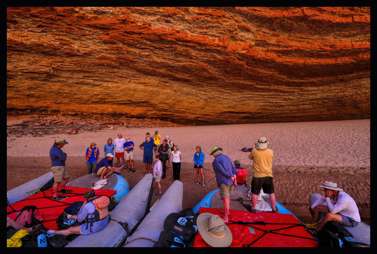
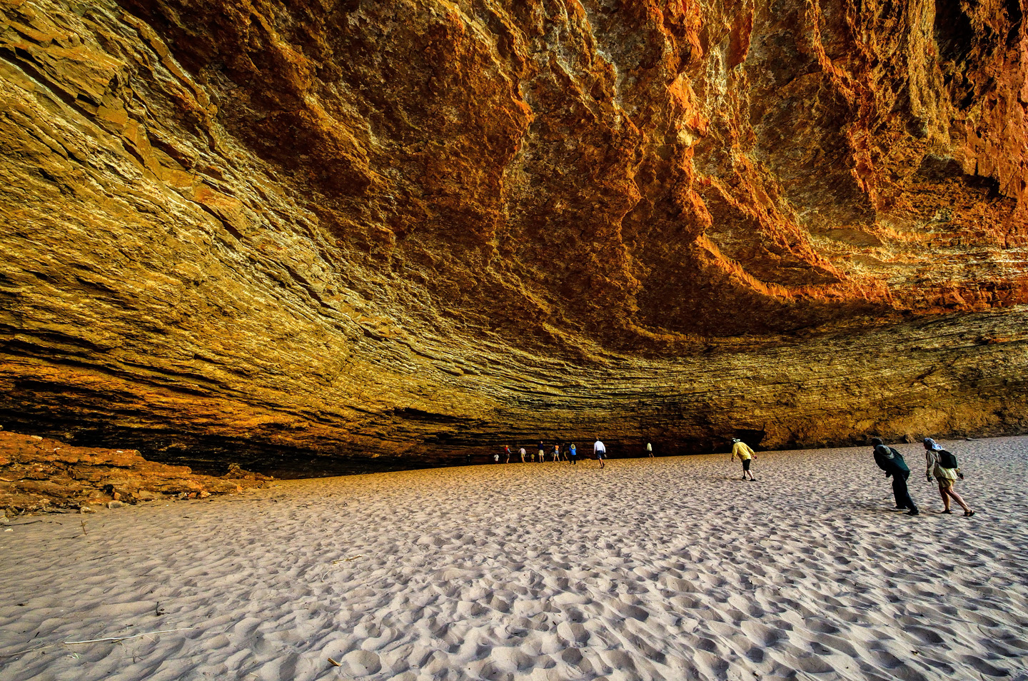
Powell, the first visitor to describe this spot for the masses, speculated that the space would accommodate 50,000 people. I’m not sure what he was thinking, or how he proposed to get them all down there, but, regardless, I think that estimate is more than a little exaggerated. It’s big, but not THAT big.
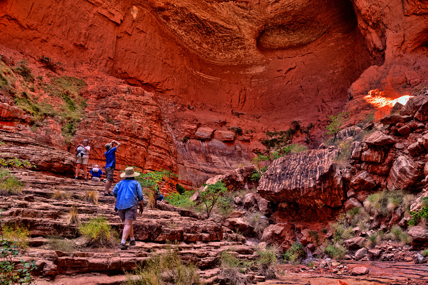
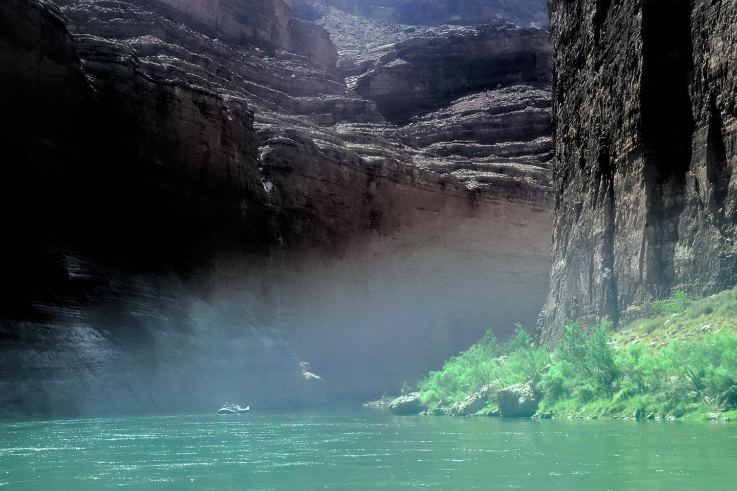
Leaving Redwall, we cruised through an area of sandstone cliffs that had been carved by wind and water into fantastic shapes reminiscent of an ancient civilization crumbling to ruin. In the middle of all that we passed a formation known as the Bridge of Sighs:
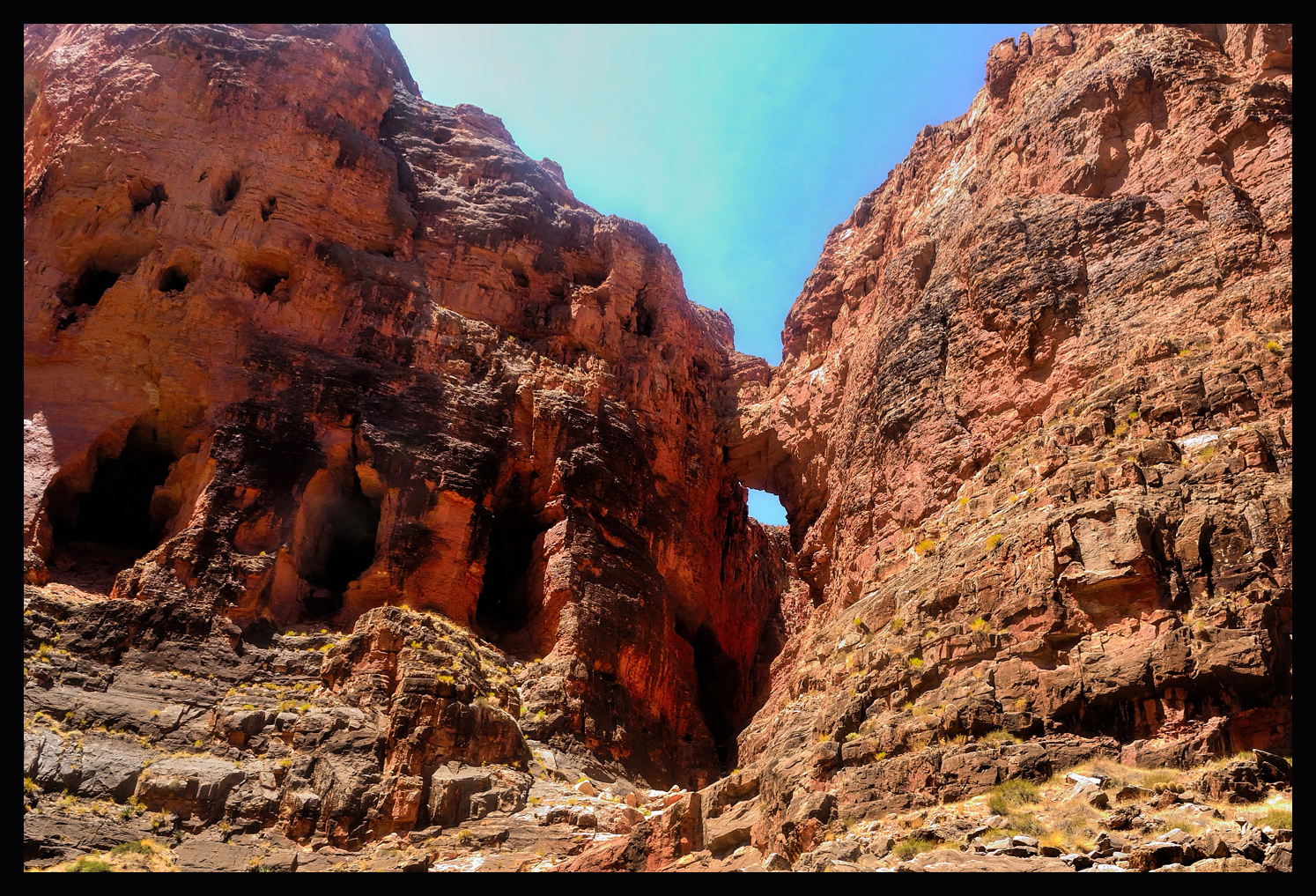
This was one of the very few natural arches in the Grand Canyon that’s visible from the river. Next, on river left, there was a jumble of logs in an alcove well up the cliff face. This was the Anasazi Bridge, remnants of what had once been a log bridge built by the ancients to traverse a gap in one of their trails.
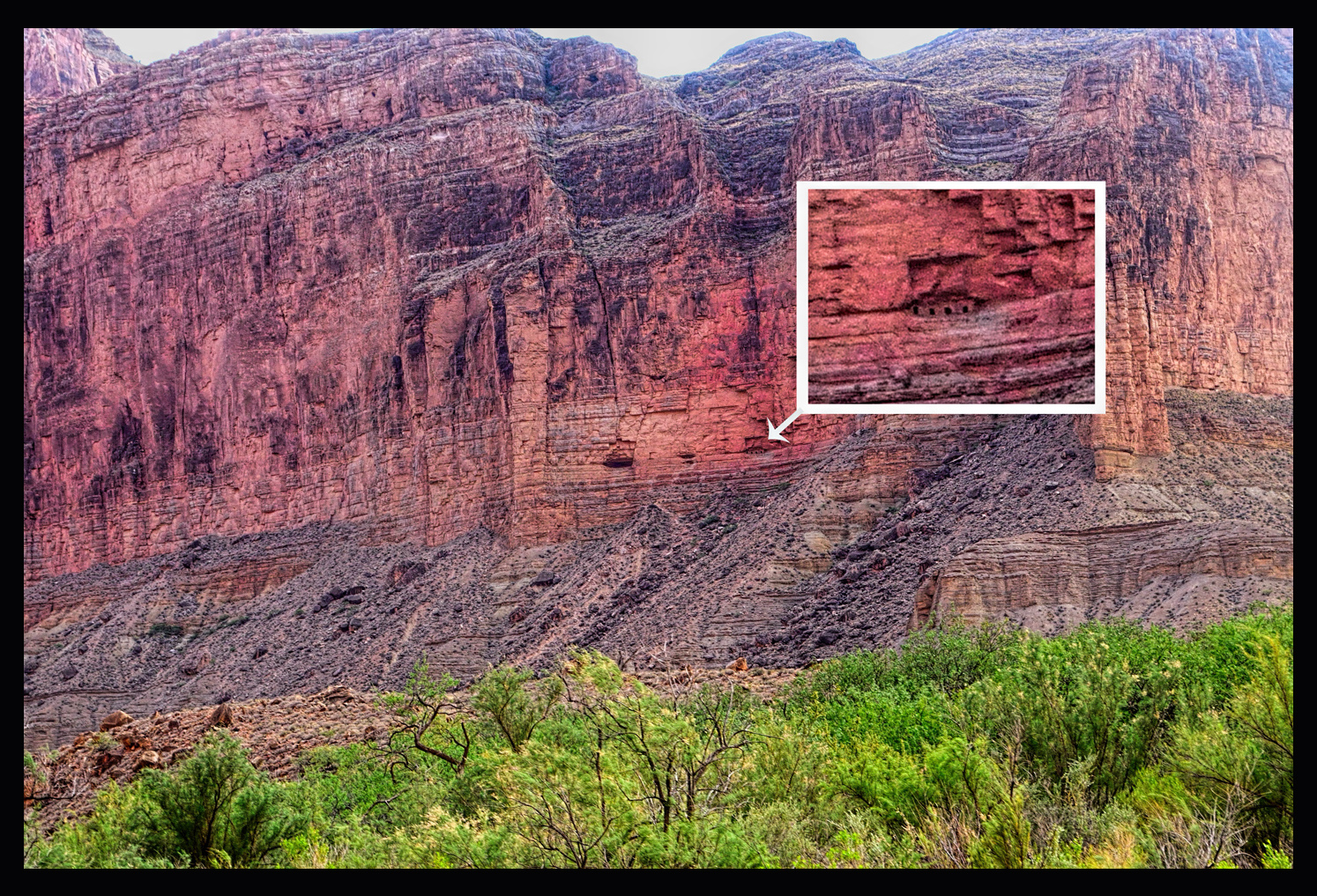
Next came President Harding Rapid, where the river splits around a large boulder in the middle of the flow, and after rounding a steep bend in the river, we got our first view of Bright Angel shale, an ancient gray rock that’s covered, everywhere but here in the Grand Canyon, by multiple layers of limestone and sandstone, each layer representing a different geologic era. Further down, Nankoweap Rapid, and there, halfway up the side of a massive cliff, the <<Nankoweap granaries>> (click link for an amazing close-up view). Nankoweap is a well known archaeological site consisting of a largely intact adobe wall, with four rectangular windows, sealing off an alcove that was used by the ancients to store grain. This was likely to have been an emergency cache, located high up the cliff, where their stores were safe from foraging animals, and, more importantly, safe from the depredations of raiding parties from other, less sedentary tribes. It’s possible to hike to the site, up a famously scenic and horrifically steep trail, but, alas, it was getting late in the day, and our group didn’t have the time. I settled for this telephoto shot, taken from the raft as we glided by.
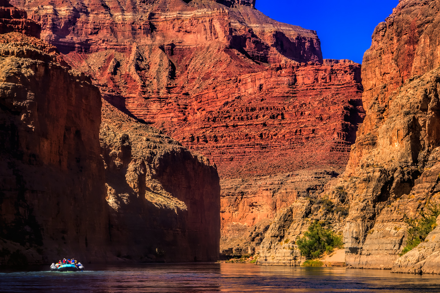
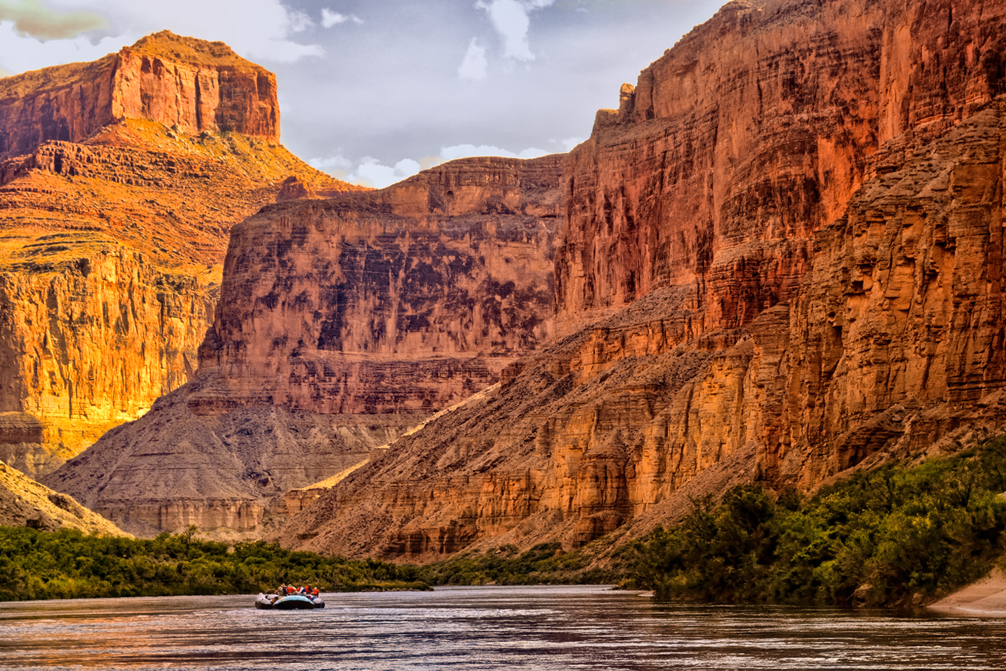
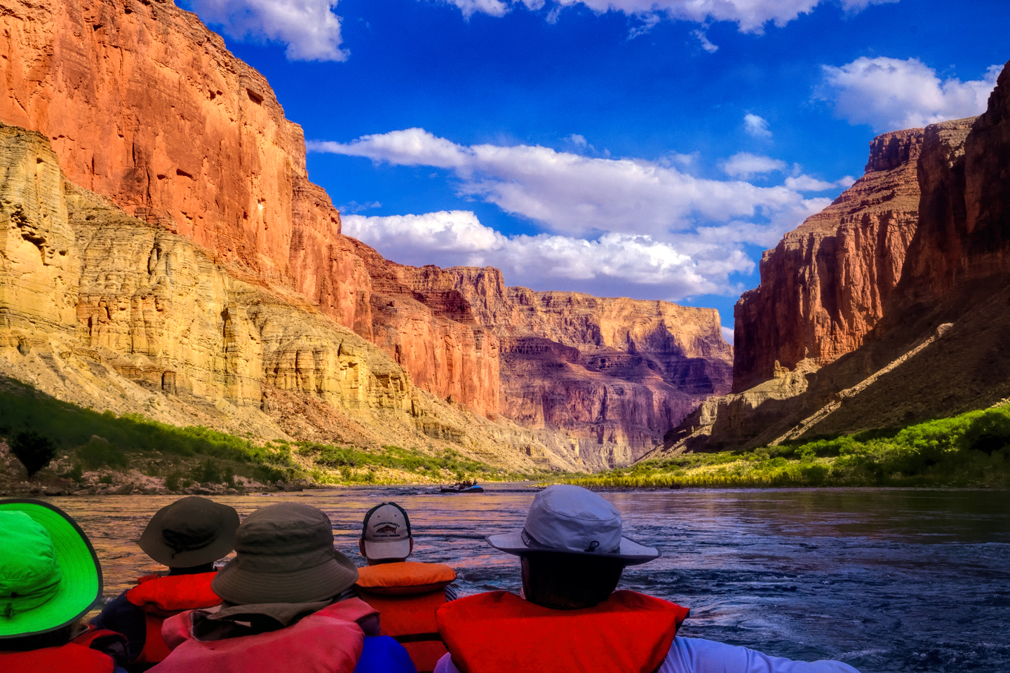
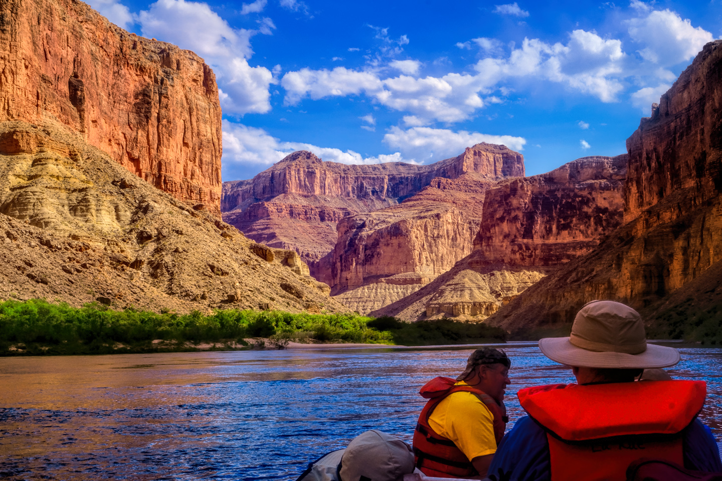
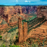
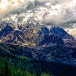
The next few miles were among the most breathtakingly scenic along the whole length of the river.
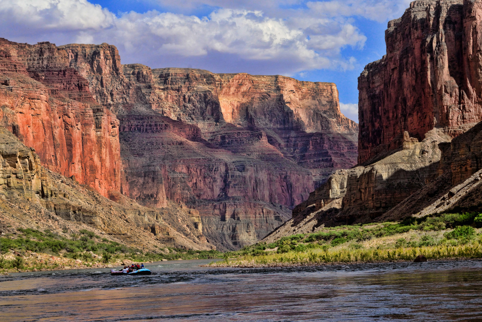
The cliffs and buttes were a perfect composition, the different colored layers of stone were all but glowing in the afternoon light, and we had this incredible world all to ourselves, not another boat in sight. Just before Kwagunt Rapid, at about mile 56, we pulled over alongside a beach. This was the last large campsite above the confluence of the Little Colorado River, which would be our first destination the next day. The confluence is one of the most popular side hikes for river runners. If we managed to get there early enough the next morning, hopefully, we’d beat the crowds.
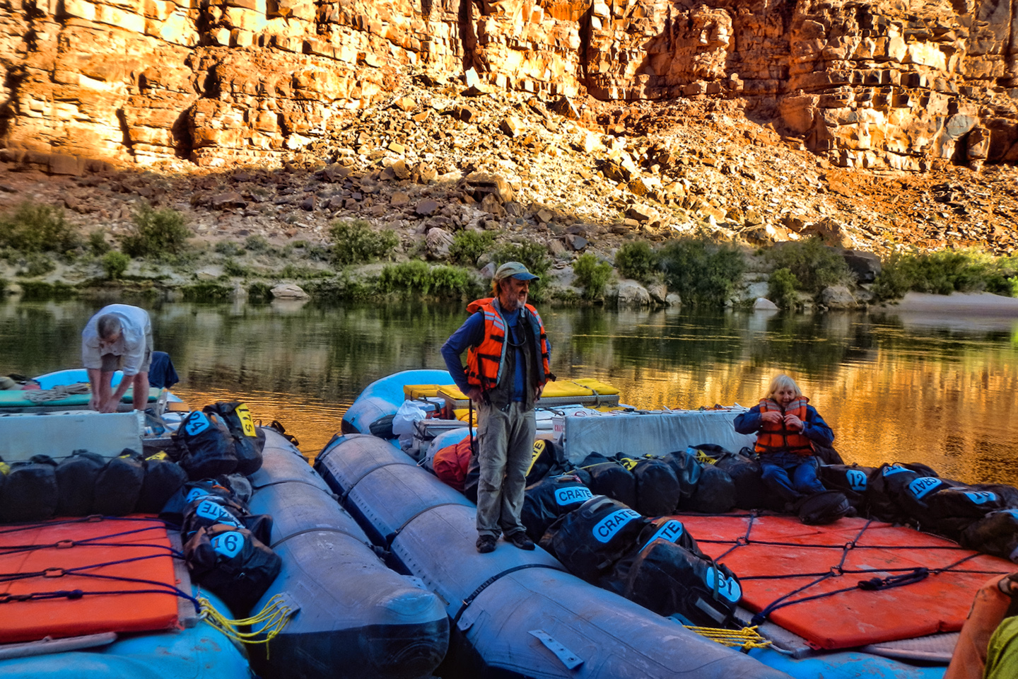
We unloaded the rafts like a well-oiled machine, then we each laid claim to our preferred sleeping spot, scouting around the area for just the right location. Near the bathrooms? Far from the bathrooms? Near the kitchen? Near the water? Everyone had their preference, and there was plenty of space, the advantage of the larger camp sites. The cots were a little easier to set up on the second night, but not by a lot.
While the crew prepared our dinner–grilled steaks with all the trimmings–us paying passengers lounged in our folding camp chairs, relaxing with juice or cold beer, marveling at the surroundings. This had been quite a day. Rapids galore in the roaring ‘20’s, amazing caves, Indian ruins, extraordinary vistas. All of that, and this trip had just barely started! What next?
The slide show below has a few additional pictures from Day 2. Click any of the images to expand them to full screen, with captions.
(Unless otherwise noted, all of these images are my original work, and are protected by copyright. They may not be duplicated for commercial purposes.)
The Adventure Continues:
This is an interactive Table of Contents. Click the pictures to open the pages.
A Grand Adventure! White Water Rafting on the Colorado River

Grand Canyon Rafting Expedition: Day 1
The two rafts were shoved away from the beach until they floated free, and the boat drivers eased them into the middle of the channel. We were mostly moving with the current, but the beach dropped behind us pretty quickly, and in a matter of minutes we were out there, rafting down the Colorado River, heading squarely into the enchanted depths of the Grand Canyon...
<<CLICK to Read More!>>

Grand Canyon Rafting Expedition: Day 2
The cliffs and buttes were a perfect composition, the different colored layers of stone were all but glowing in the afternoon light, and we had this incredible world all to ourselves, not another boat in sight.
<<CLICK to Read More!>>

Grand Canyon Rafting Expedition: Day 3
The waters of the Little Colorado are a turquoise blue that is so startlingly bright it doesn't even look real. There’s a well-defined spot where that warm, turquoise blue water from the small river collides with the cold, deep green water flowing upstream from the big river. The two dramatically different colors mix, forming a shifting, swirling line of chartreuse. That spot is the confluence. It's magical, and utterly unique.
<<CLICK to Read More!>>

Grand Canyon Rafting Expedition: Day 4
I was still a little dazed by the whole thing, scenes of frothing, churning whitewater playing over and over in my head. Fleecy white clouds were piling up above the canyon rim, nearly filling the narrow patch of sky, until the lowering sun set them afire, a Grand Canyon sunset display that was the finest we’d seen, worthy of the spectacular setting. A fitting end to one of the most amazing days of my life.
<<CLICK to Read More!>>

Grand Canyon Rafting Expedition: Day 5
The trail meandered for a mile or so, finally dropping down level with the creek, giving us access to a series of perfect swimming holes. There’s something about that exotic turquoise water that welcomes swimmers--you have to get in it, if only to assure yourself that it’s real. The creek was cool, but far from cold, and a welcome change from the icy water in the river. We stopped at a particularly inviting spot to swim, relax, and eat our lunch. Sitting beside that creek, with our simple repast--it was like having a picnic in the Garden of Eden.
<<CLICK to Read More!>>

Grand Canyon Rafting Expedition: Day 6
“Two Hander!” John called out rather gleefully, and we all clung to the ropes for dear life as the raft picked up speed. We were headed straight for the boil of Lava Falls, which was roaring like a freight train, bearing down. We entered the churning whitewater pretty much dead center, then moved hard to the right to avoid the standing waves and the big holes in the middle of the channel. We got good and drenched at least three times, almost like running under a series of waterfalls, bucking and lurching like crazy, but the whole thing was over in less than a minute.
<<CLICK to Read More!>>

Grand Canyon Rafting Expedition: Day 7
Immediately below that beach we hit Diamond Creek Rapid, then Travertine Rapid, where we pulled over to the bank at Travertine Canyon. The creek that entered the river here flowed across huge, slippery boulders in a series of small waterfalls, and we had great fun taking turns standing in the flow, almost like a natural shower.
<<CLICK to Read More!>>

Grand Canyon Rafting Expedition: Day 8
The river broadened as we approached Lake Mead, and at mile 278 we entered the lake itself. Pearce Ferry was right there, and we were all pretty quiet as the rafts pulled in to shore for the last time. “Thrill of a lifetime” is a pretty strong statement, but it’s appropriate for this journey. There’s nothing else like it.
<<CLICK to Read More!>>

Grand Canyon Rafting
You find a rope, any rope, and you grab on with both hands for all you're worth. The river boils like the North Sea in a gale, great, rolling green waves and troughs. The raft plummets sideways into a hole fifteen feet deep, the outboard motor shrieks, a monster wave towering ten feet above your head comes crashing down across the deck, pummeling the passengers like a gigantic liquid fist that takes your breath away, leaving you suspended, time stopped, frozen in mid-scream.
<<CLICK to Read More!>>

There's nothing like a good road trip. Whether you're flying solo or with your family, on a motorcycle or in an RV, across your state or across the country, the important thing is that you're out there, away from your town, your work, your routine, meeting new people, seeing new sights, building the best kind of memories while living your life to the fullest.
Are you a veteran road tripper who loves grand vistas, or someone who's never done it, but would love to give it a try? Either way, you should consider making the Southwestern U.S. the scene of your own next adventure.
A few years ago I wrote a book about road trips in Arizona and New Mexico that's a lot like this website, packed with interesting information, and illustrated with beautiful photographs. Check it out! You can find it on Amazon, and at all other major booksellers.

Recent Comments