AN ALASKA ROAD TRIP IS A GRAND ADVENTURE!
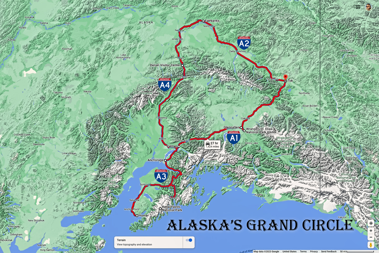
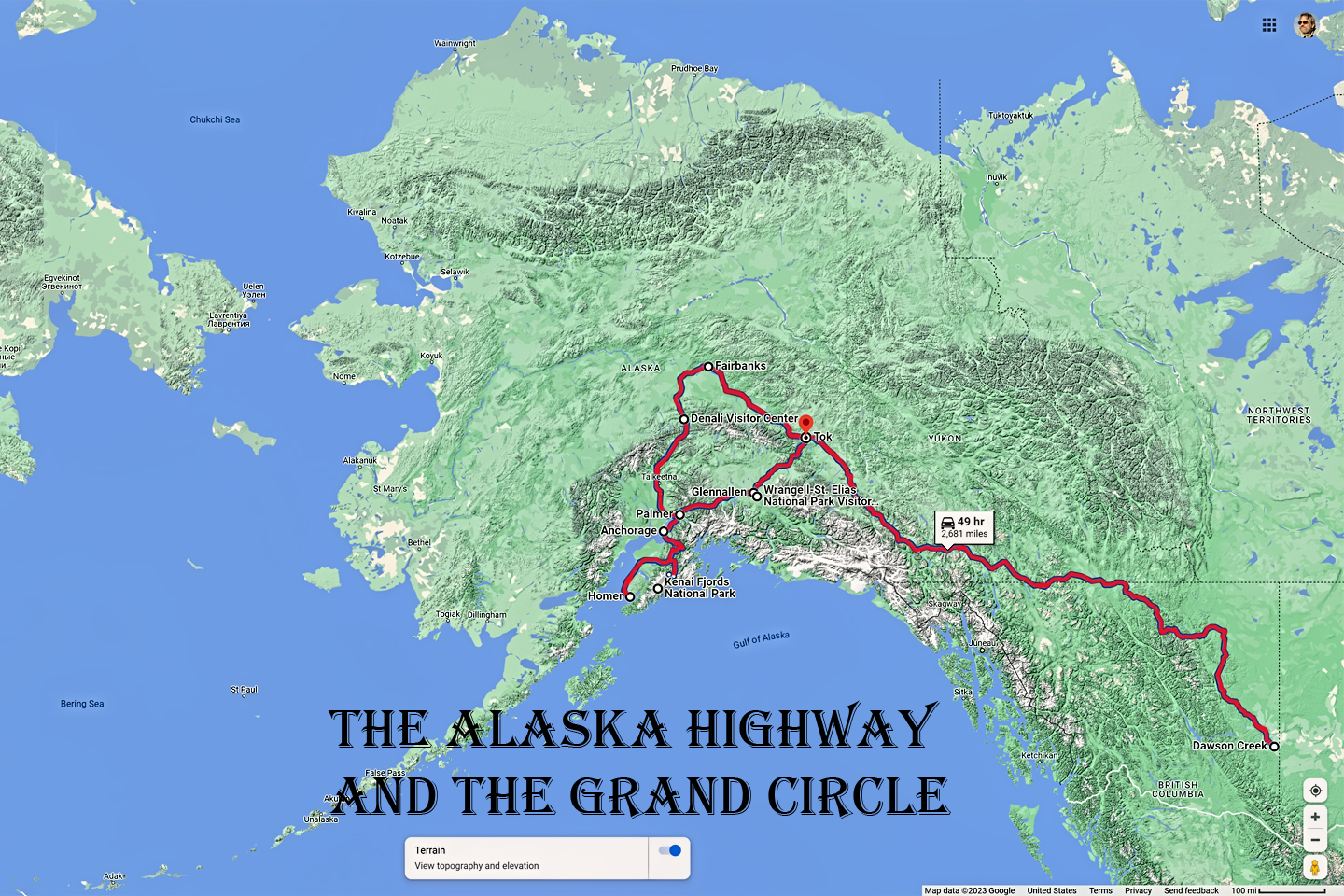
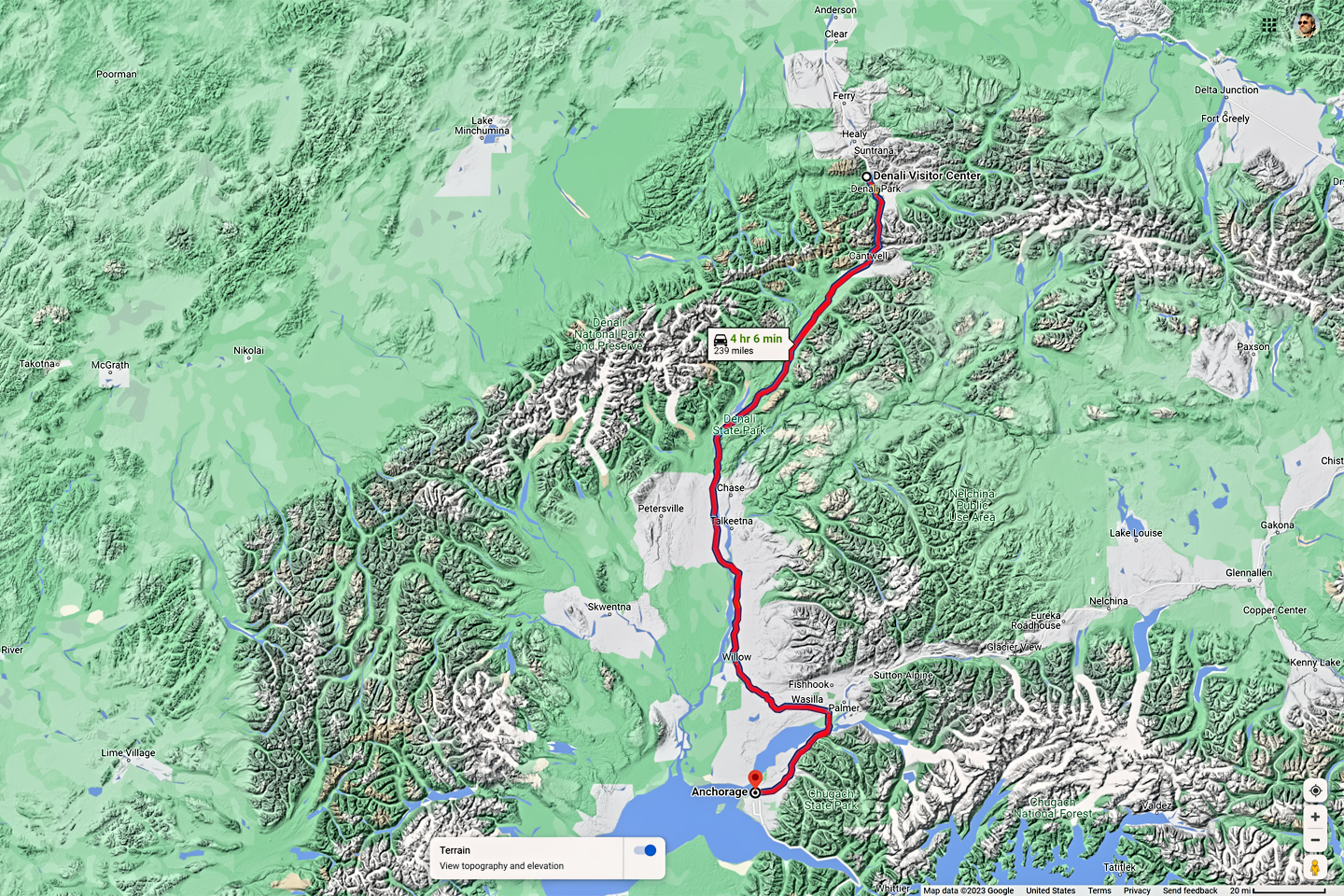
Alaska's Grand Circle is a loop route that begins in Tok and utilizes all four segments (1082 miles) of Alaska’s Interstate Highway system: Tok to Fairbanks on AK-2 (Interstate A-2); Fairbanks to Gateway (near Anchorage) on AK-3 (Interstate A-4); Anchorage to Soldotna on AK-1 (Interstate A-3); and Anchorage back to Tok on AK-1 (Interstate A-1). Most of the major towns in Alaska, as well as many of the state's most scenic areas can all be reached from this loop, which includes three of Alaska's National Parks.
DRIVING THE GRAND CIRCLE:
BEGIN AT THE AL-CAN BORDER:
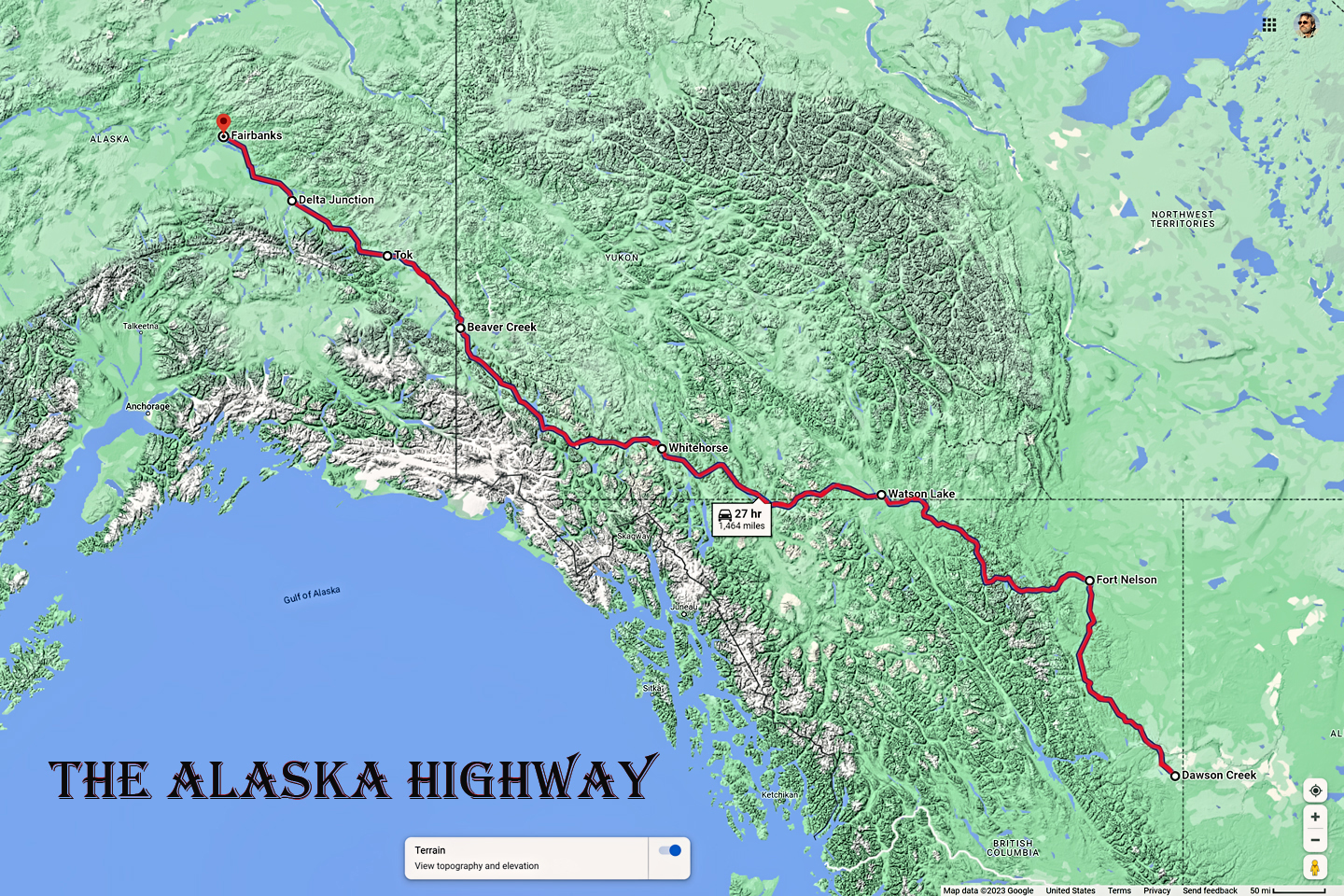
Some Alaska road trippers travel to their starting point on the Alaska Marine Highway, a system of ships and car ferrys serving the many ports of coastal Alaska from as far away as Bellingham, Washington, bypassing the overland route altogether. All other travelers who drive their own vehicles to the last frontier come in from the Yukon: a scant handful use the Top of the World Highway out of Dawson City (open in summer only), while everyone else uses the Alaska Highway, and they cross over from Canada at the Alcan Port of Entry, just west of Beaver Creek. (For details on this route, click to see my recent post, The Alaska Highway: Day 4: Beaver Creek to Fairbanks.)
CLICK MAPS AND PHOTOS FOR AN EXPANDED VIEW
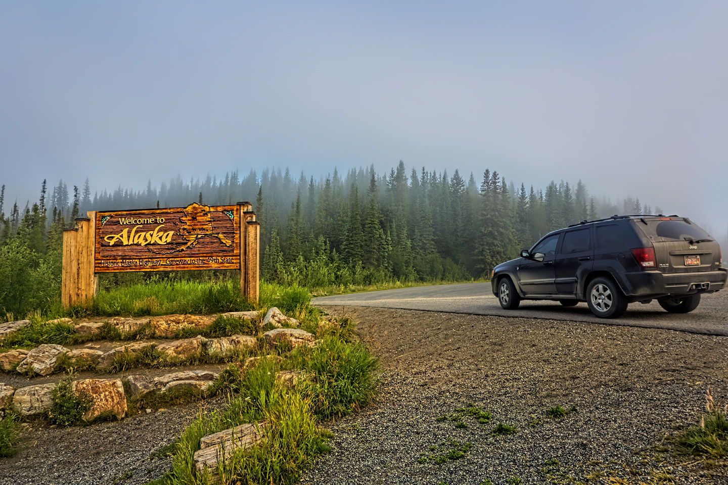
Welcome to Alaska!
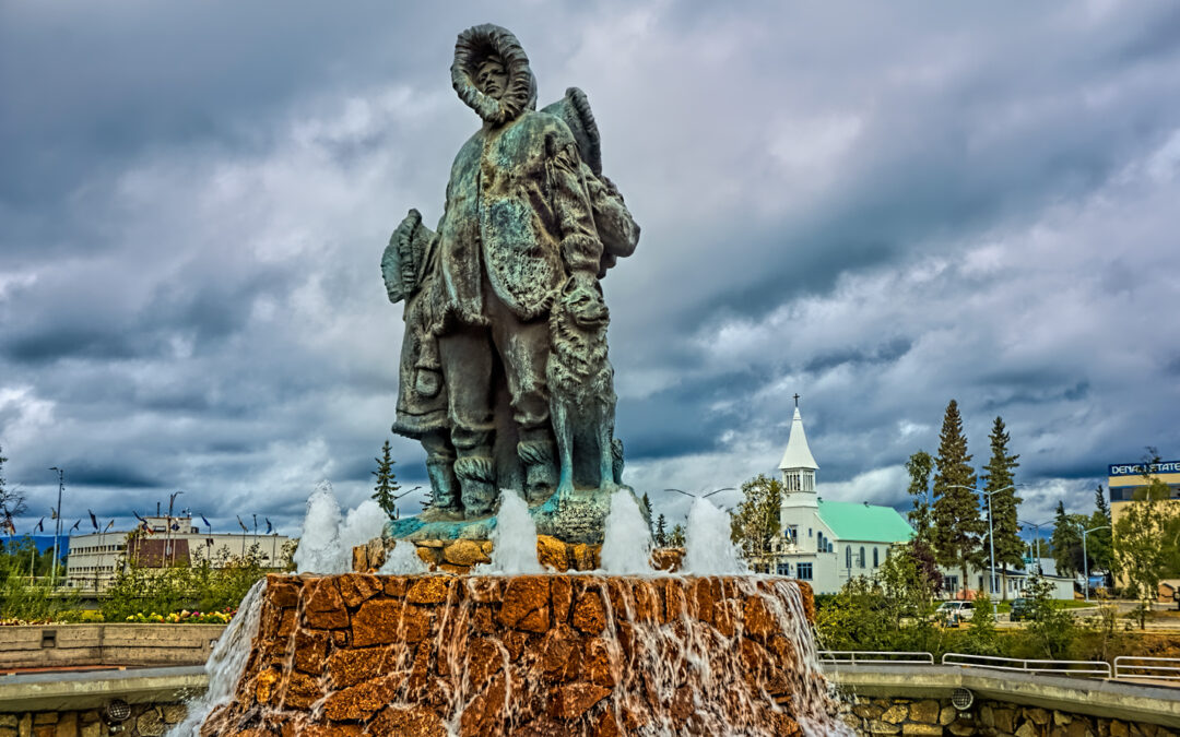
DELTA JUNCTION
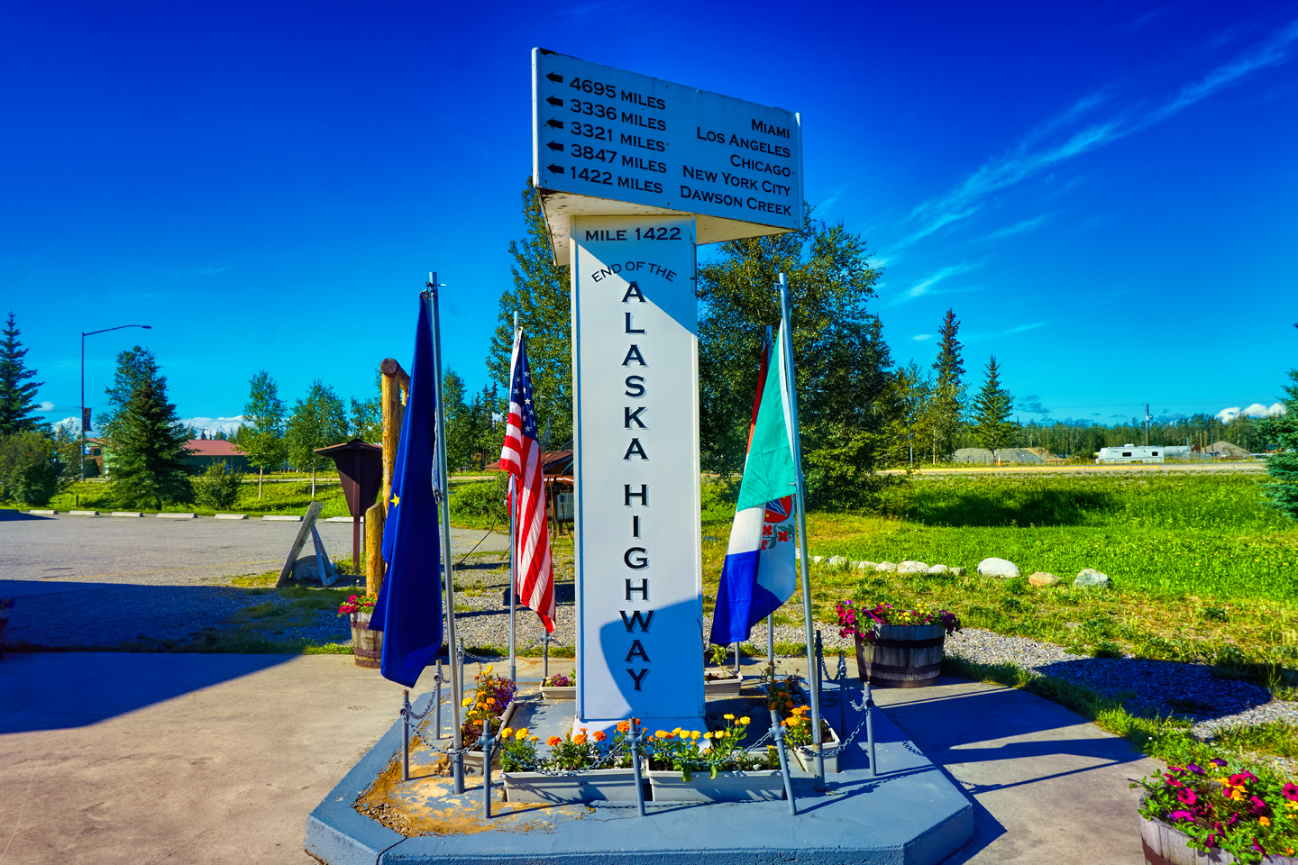
Monument marking the end of the Alaska Highway
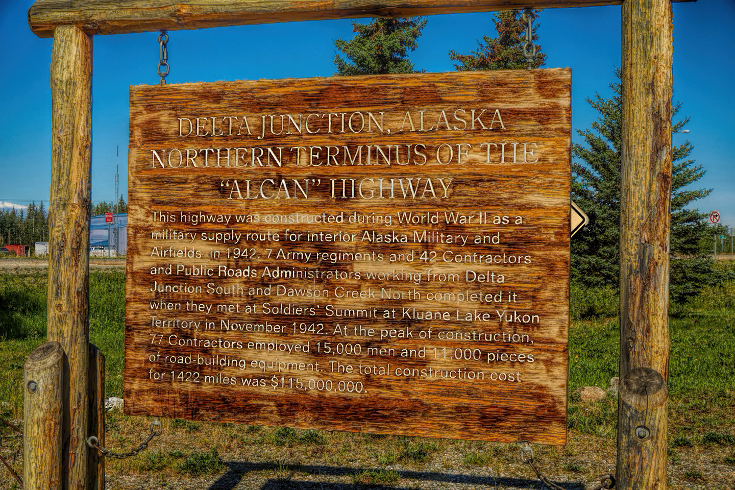
After crossing the border, you drive 100 miles to Tok, the first Alaskan town of any size, and 100 miles beyond Tok, you finally reach the official end of the Alaska Highway at a crossroads known as Delta Junction. When the Al-Can was built, during WW II, that crossroads was the point where the new road finally hooked up with the existing Alaskan road system. Connecting Alaska’s roads to the road and rail system in Canada, and, by extension, the rest of the U.S., was a strategic goal of enormous importance. The Al-Can was the first viable overland route to the Alaska Territory, built to facilitate the rapid deployment of troops and equipment if Alaska should come under attack.
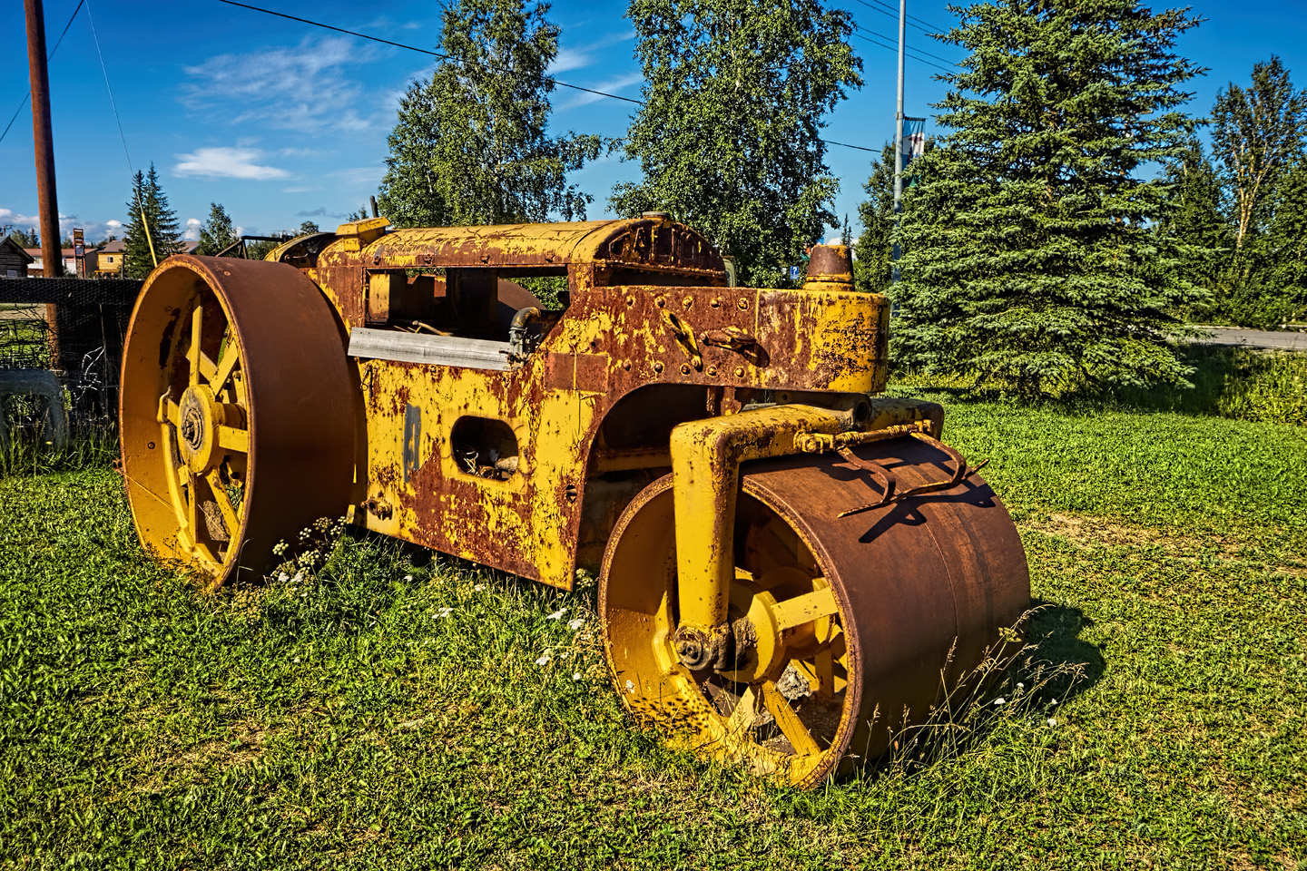
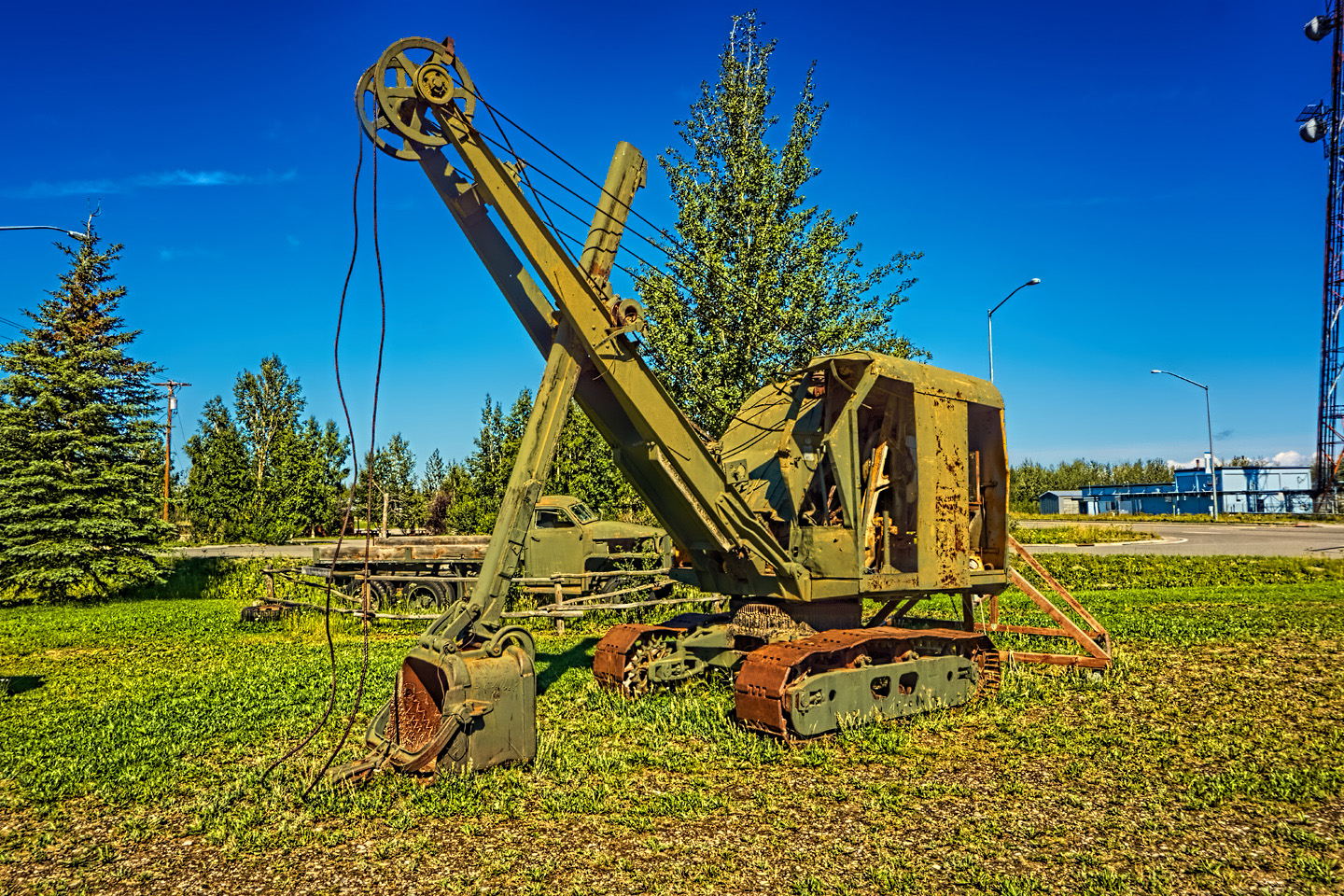
Some of the original equipment used during the construction of the the Al-Can, a massive wartime defense project that has provided lasting peacetime benefits.
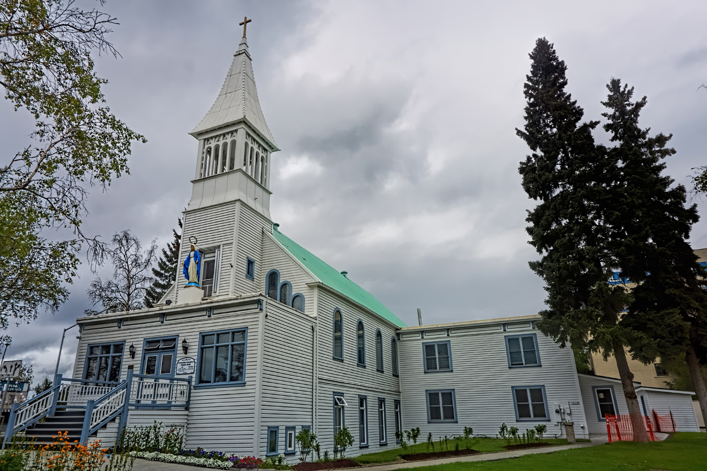
FAIRBANKS
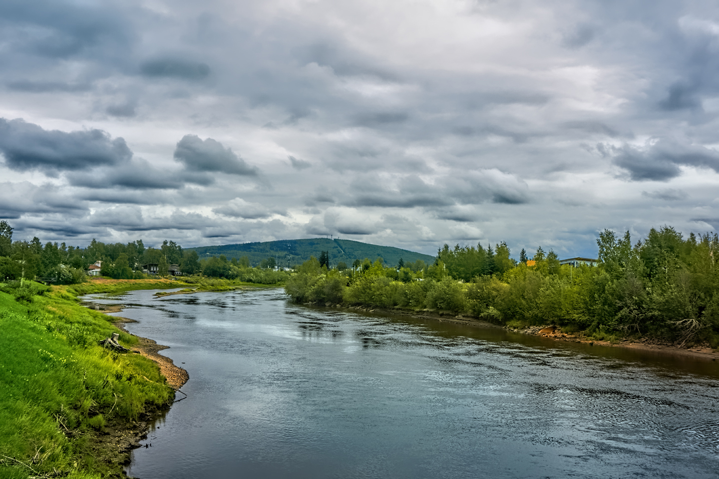
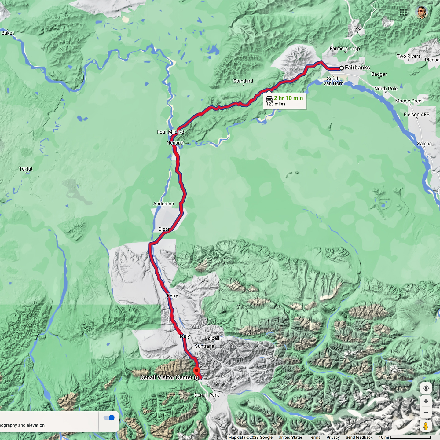
Another hundred miles or so beyond Delta Junction, you’ll come to the first major stop on the Grand Circle: Fairbanks, Alaska’s second city. There are just under 33,000 residents, making it a small town by most standards, but in the sparsely populated interior of Alaska, it’s a booming metropolis. Founded by the banks of the Chena River during the height of the Klondike gold rush, Fairbanks will always be a frontier town at its core, no matter how many fast food franchises and national chain motels you might find there. It’s a lovely part of the world in summer, which is the only real tourist season. In winter, it’s one of the coldest, darkest places where humans actually live, and that tends to weed out the riff-raff. Those who can handle the winters are rewarded: Fairbanks is one of the best places anywhere to view the Aurora, filling the arctic sky with magical light.
There are no icy mountains looming on the horizon, and Fairbanks is nowhere near Alaska’s ruggedly beautiful coast. The true beauty in Alaska’s second city is found below the surface, in the spirit and resiliance of the people who make the place their home.
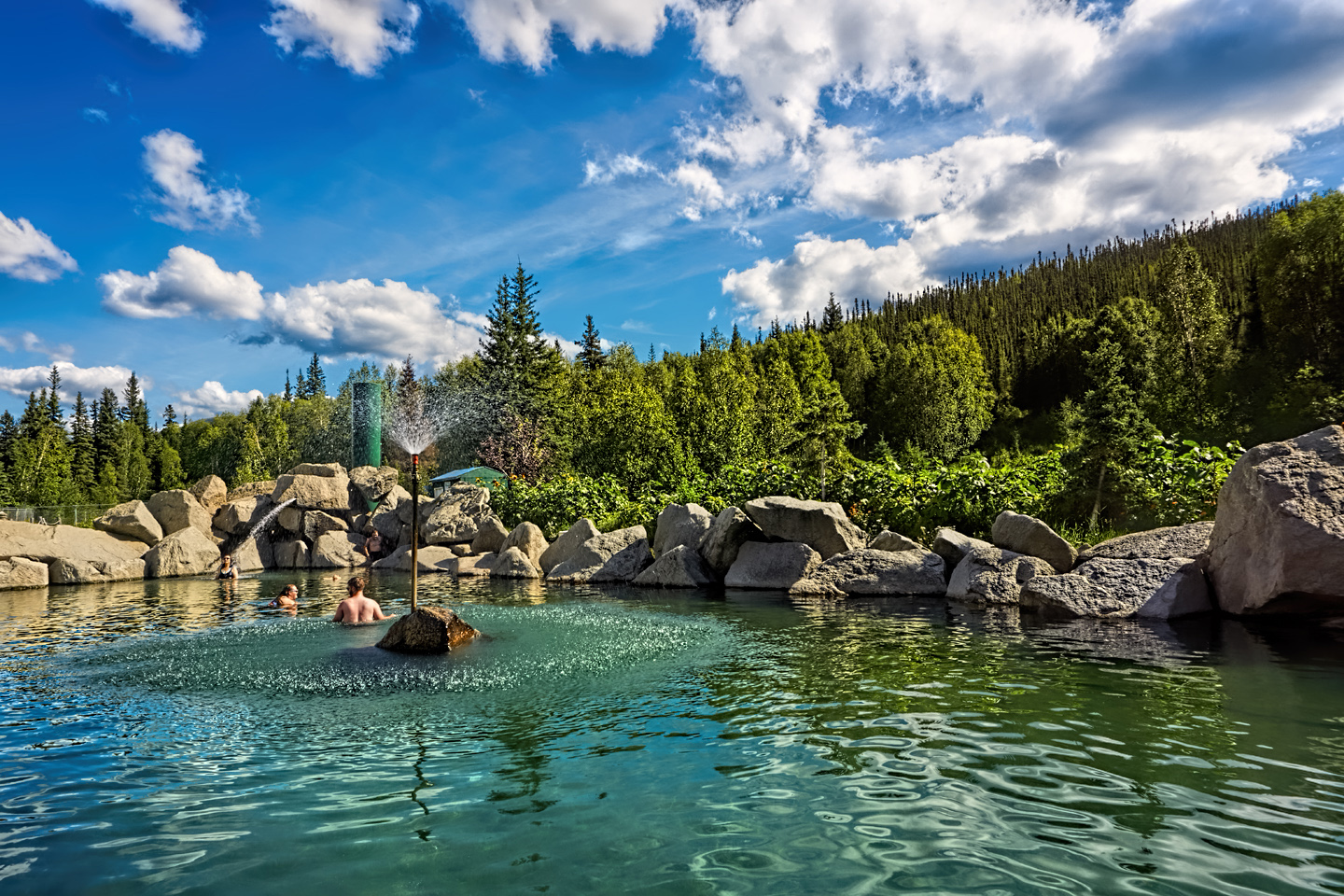
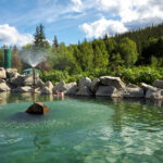
CHENA HOT SPRINGS
An hour or so northeast of Fairbanks you’ll find the Chena Hot Springs Resort, a popular lodge and campground centered around a delightful rock-lined hot springs pool that’s open all year around. All the heat and power for the resort is generated by the hot springs, and they have fascinating exhibits on the practical applications of geothermal energy, as well as dog sledding, ice sculpture, and more. If you’re in Fairbanks, it’s definitely worth your time to check it out. For more detailed information, click to see my post: Chena Hot Springs: A Fairbanks Original.
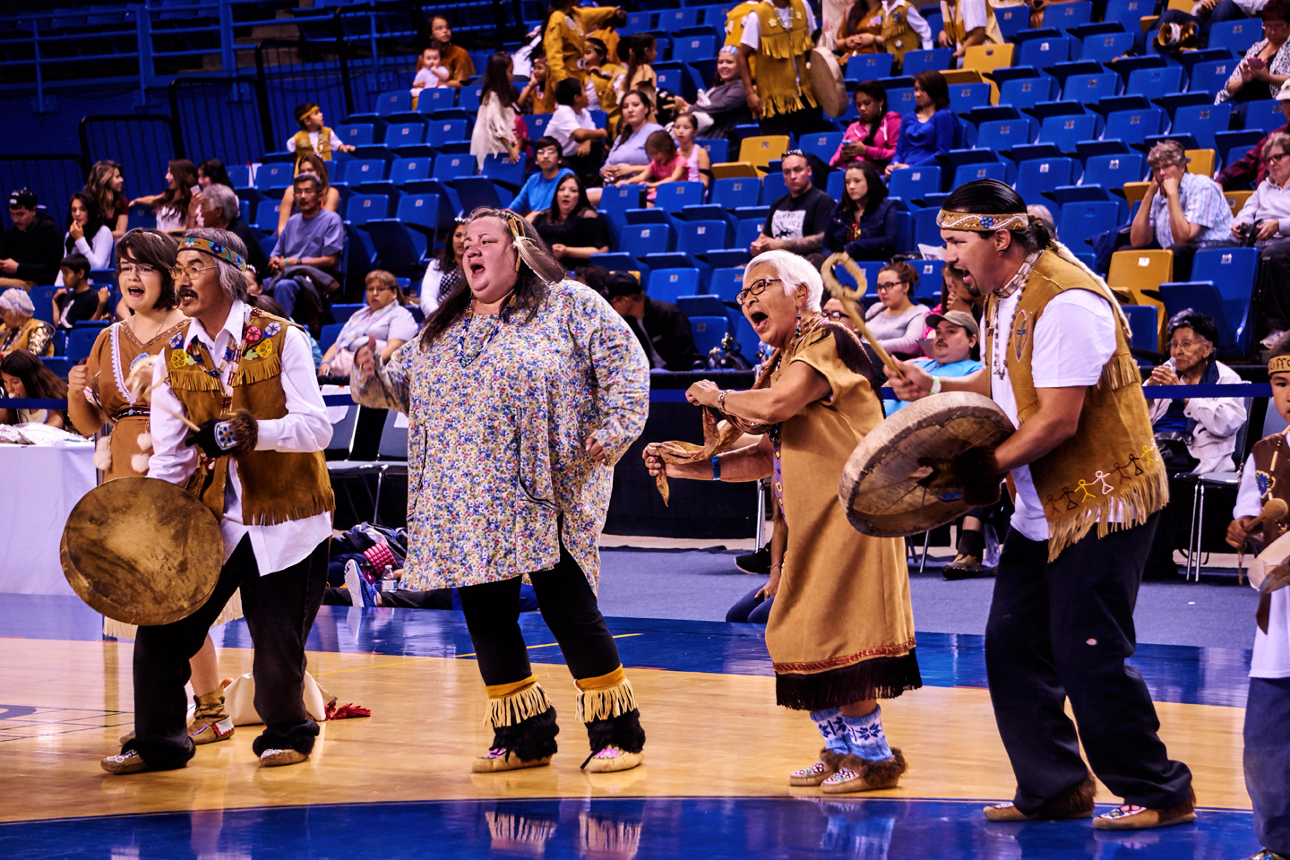
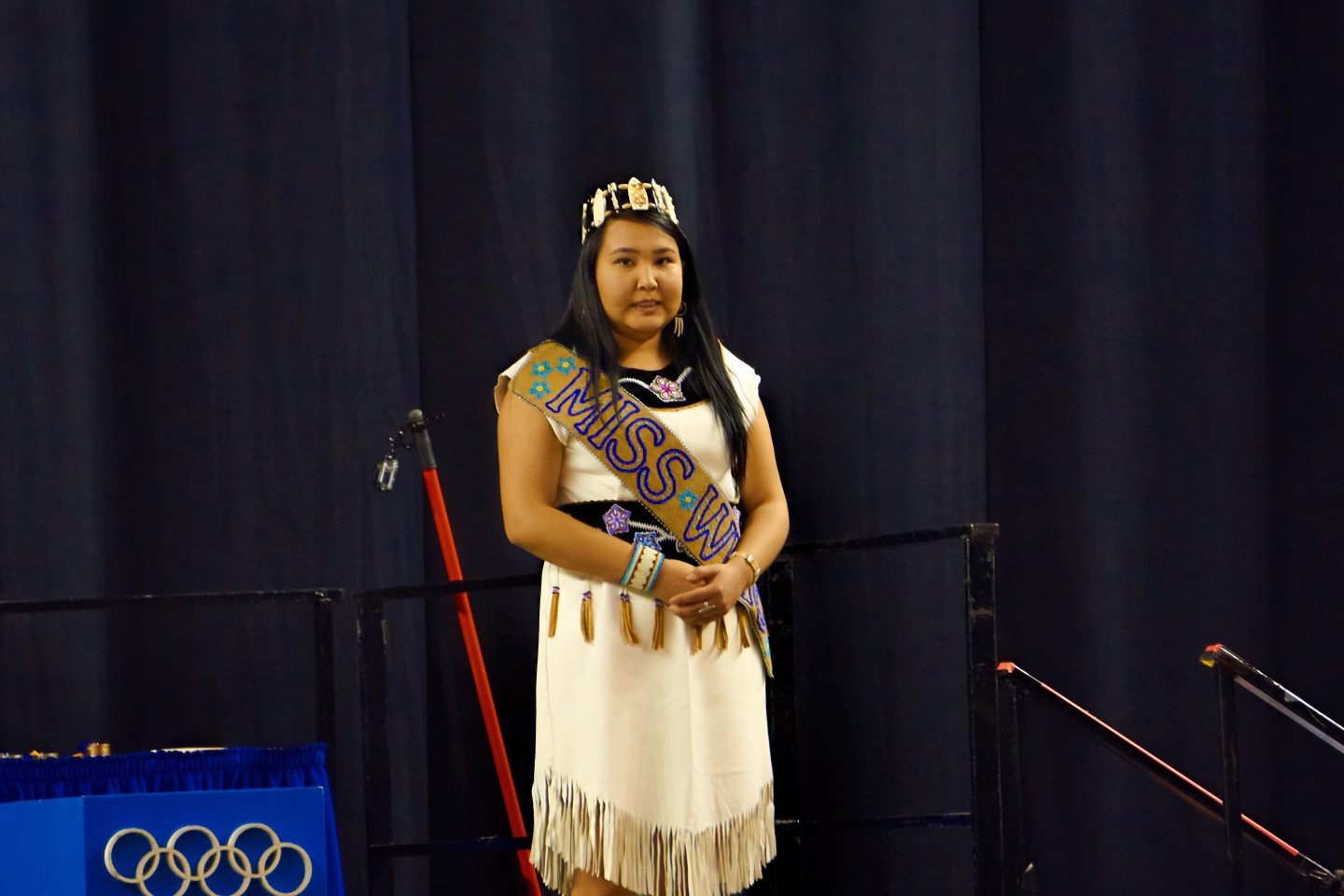
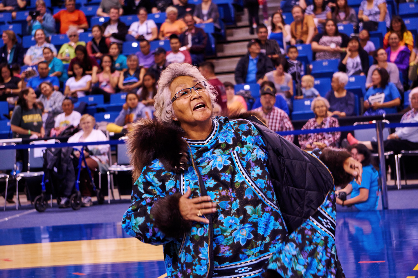
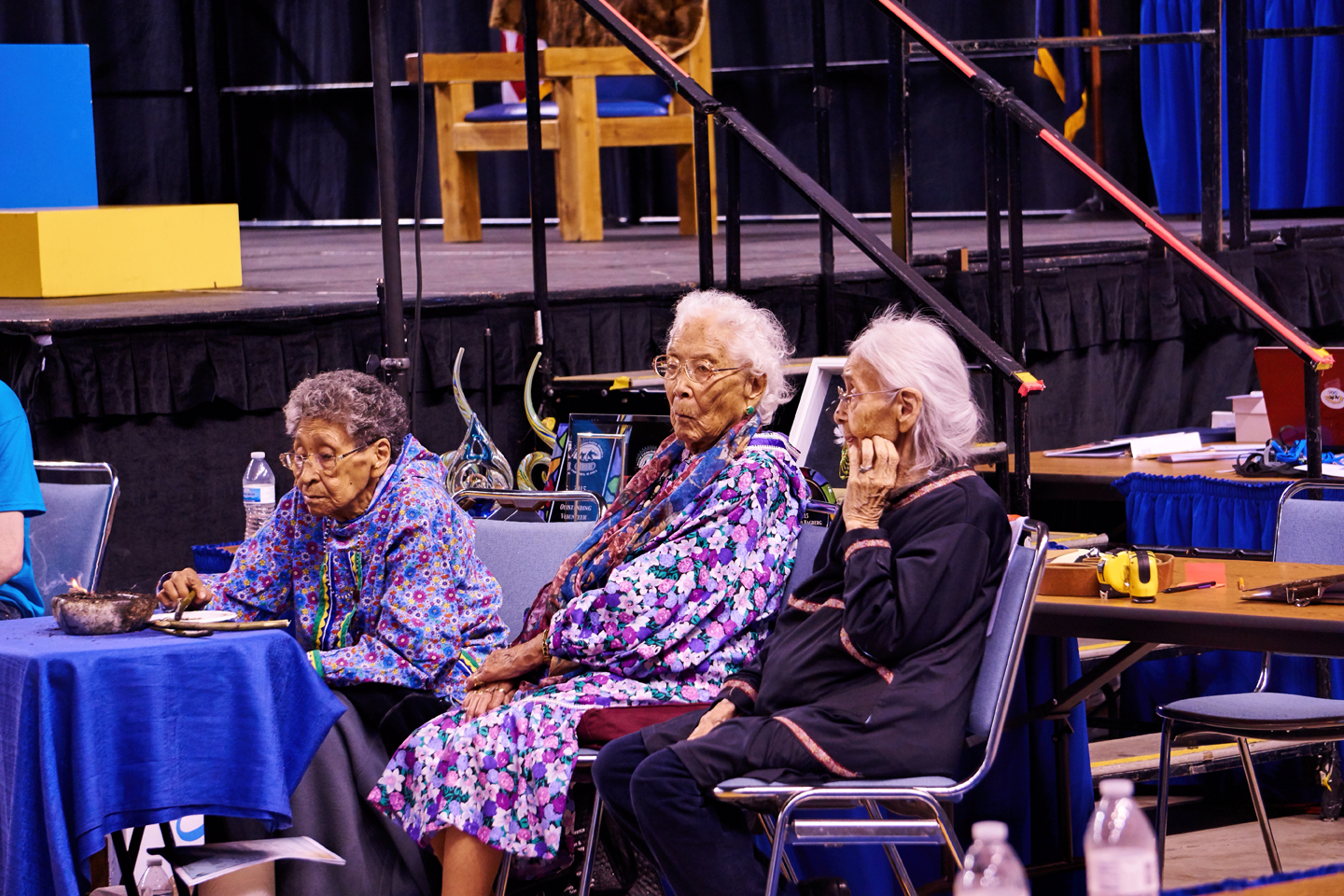
WORLD ESKIMO INDIAN OLYMPICS
Every year in early July, the city of Fairbanks hosts a week-long series of events known as the World Eskimo Indian Olympics. These games are unique contests of strength and endurance that demonstrate the skills needed to survive in the harsh environment of the arctic, and draw contestants from all over Alaska. In addition to the sporting events, there are dances, beauty contests, and more. All in all, a fascinating celebration of Native Alaskan culture.

Click to check it out: Two-Foot High Kick: World Eskimo Indian Olympics.


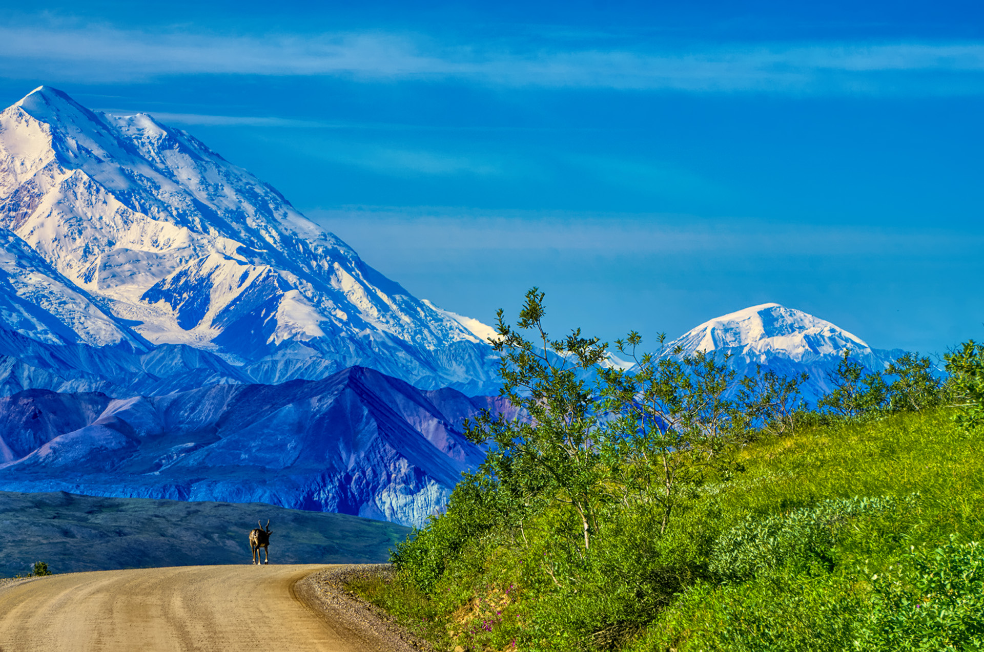
DENALI NATIONAL PARK
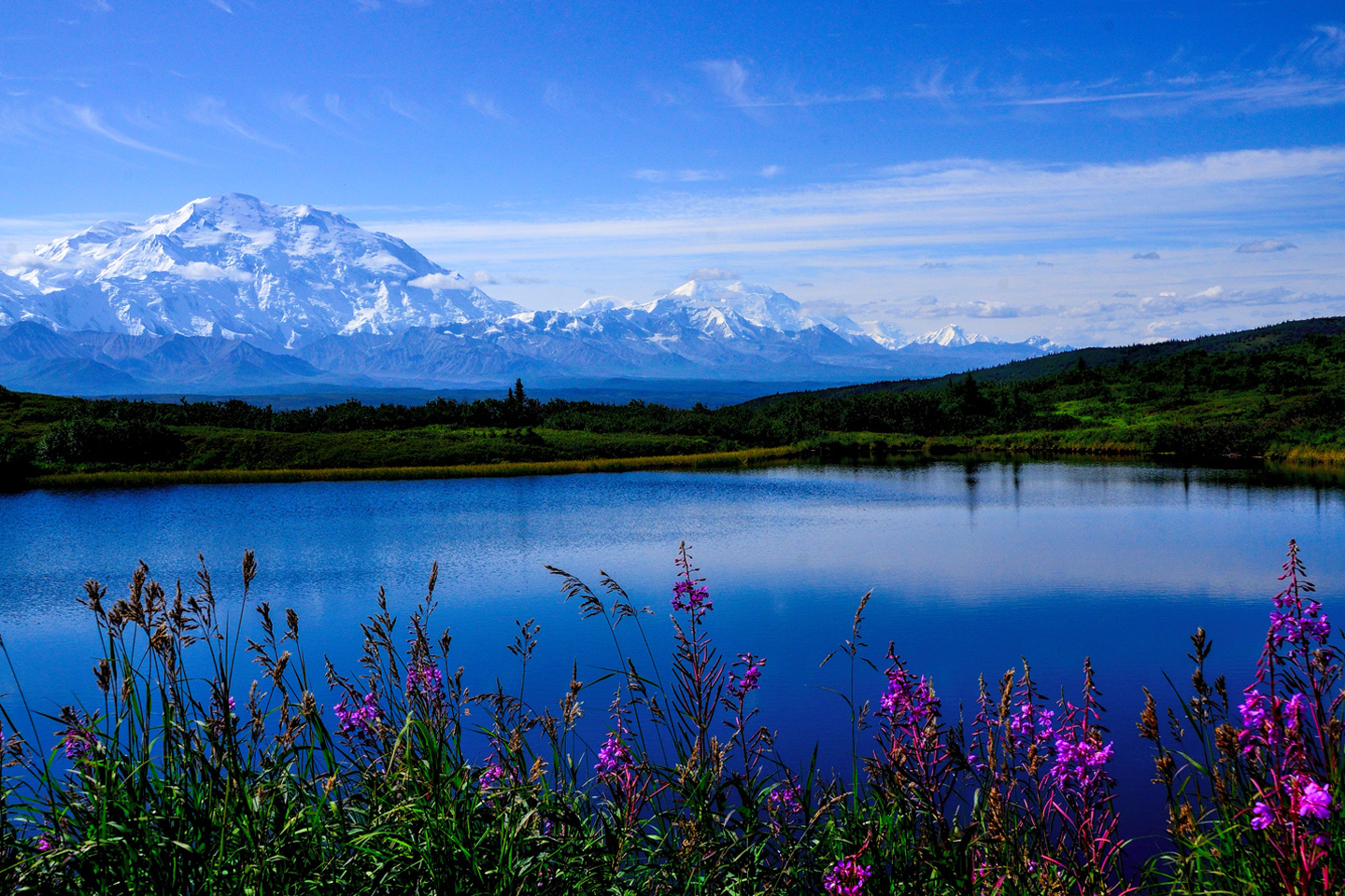
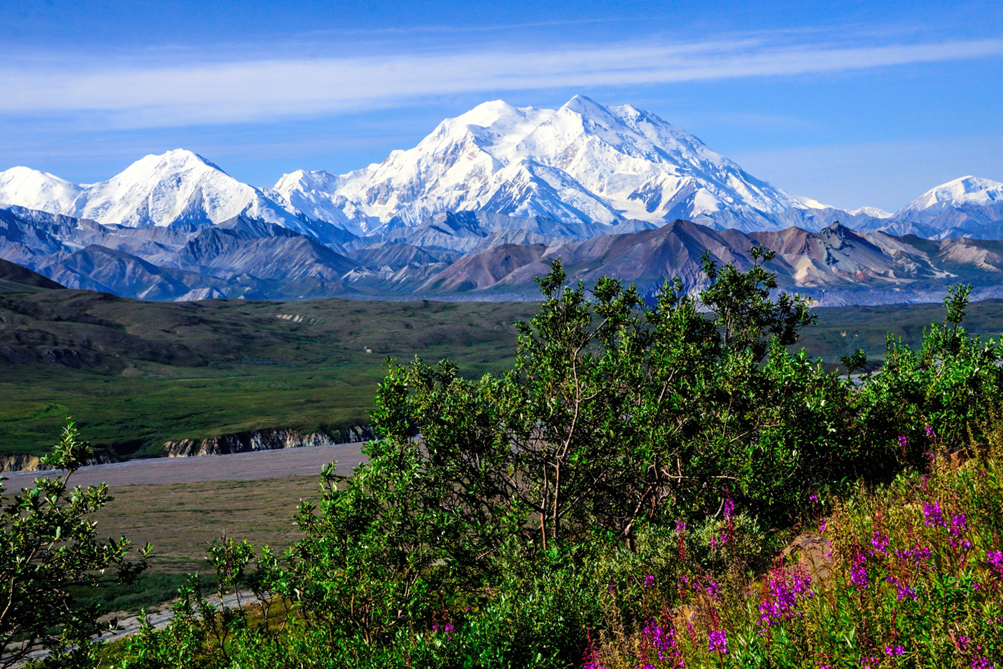
Driving counter-clockwise around Alaska’s Grand Circle, the biggest thing on the whole route comes along about 120 miles south/southwest of Fairbanks. I’m talking about that 20,308 foot chunk of rock, earth, and ice known as Denali, formerly called Mt. McKinley, the biggest, tallest, and most definitely the baddest mountain in North America.
Denali is frequently obscured by clouds, especially in the summer, which is when most people visit. It’s so bad that only one visitor out of every three actually gets to see the mountain, at least, not the whole thing.
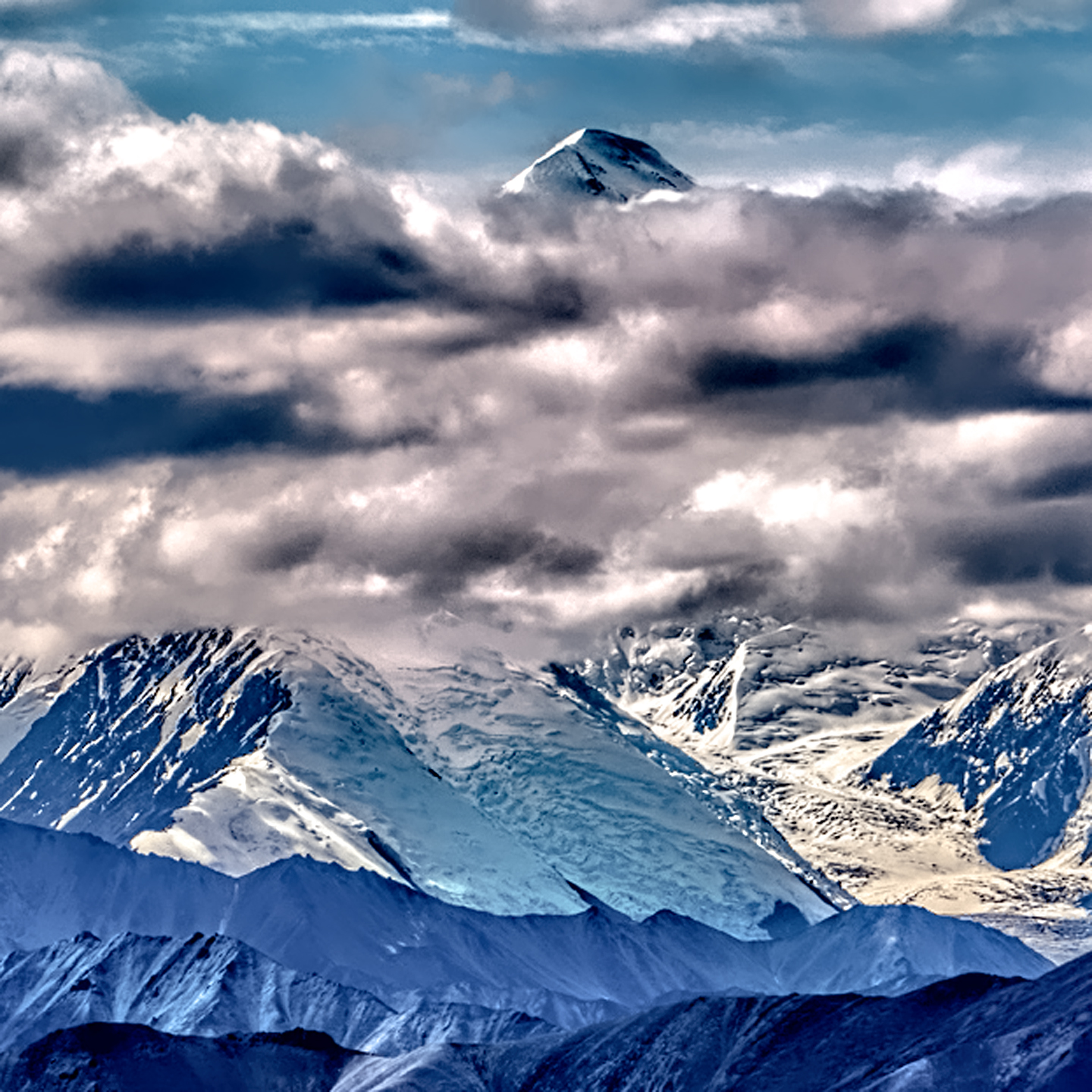

The lucky visitors who catch this extraordinary mountain on a clear day are automatically qualified for membership in the “30% Club,” and they’ll even sell you a T-shirt attesting to your elite status.
When I went to Denali, I wanted to stack the odds in my favor, so I started checking the weather forecast well in advance. The weather service predicted predominantly cloudy skies and chance of rain every day but one, a Friday, which they claimed would be at least partly sunny. I was hoping for a window, and this was the best I was likely to get, so I delayed an extra day in Fairbanks, hoping that the modestly cheerful prediction would hold true.
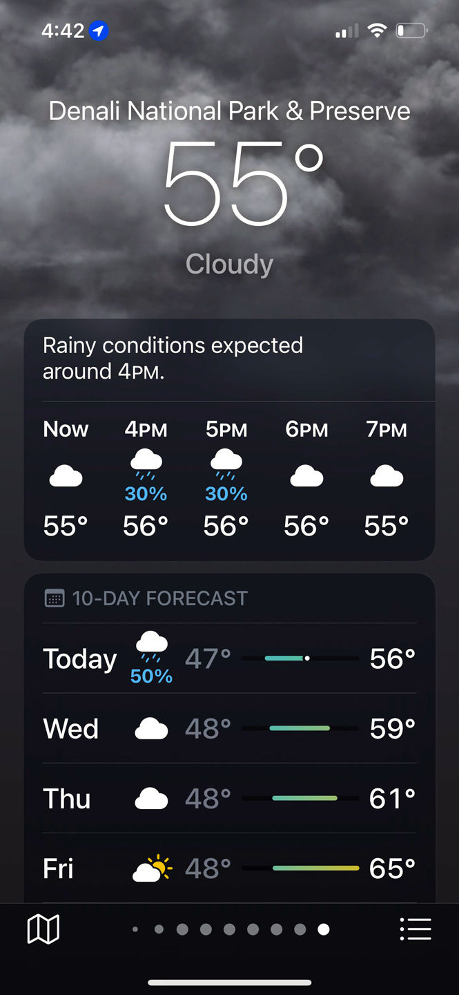
The weather anywhere near that big mountain is so changeable, no forecast will ever be truly reliable, epecially if you’re planning a week ahead, but in my case, that ploy actually worked. The mountain was beautifully clear that day, so I got some terrific pictures, and I officially joined the club. (For more on all that, click to read my post: Dreaming of Denali.)
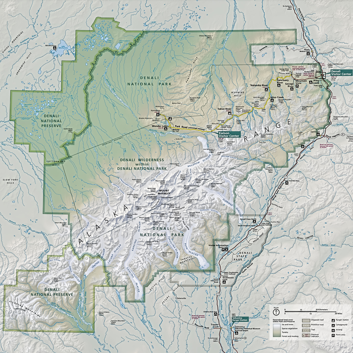
Until just a couple of years ago, six million acre Denali National Park was the most popular of the eight National Parks in Alaska, with as many as 600,000 visitors annually. The COVID-19 Pandemic put the skids on travel in general, hitting the cruise industry particularly hard. Since most visitors to Denali were either cruise ship passengers or travelers on package tours, visitation numbers plummeted to a fraction of the pre-pandemic level. The situation was further disrupted by a natural disaster: in August of 2021, a major landslide destroyed a critical section of Denali Park Road, cutting off visitor access to much of the park’s interior.
PRETTY ROCKS LANDSLIDE
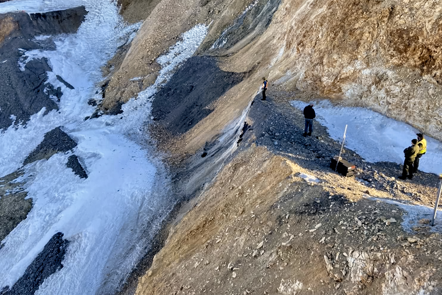
Pretty Rocks Landslide that cut off much of the Denali Park Road in August of 2021. Photo Courtesy of the National Park Service.
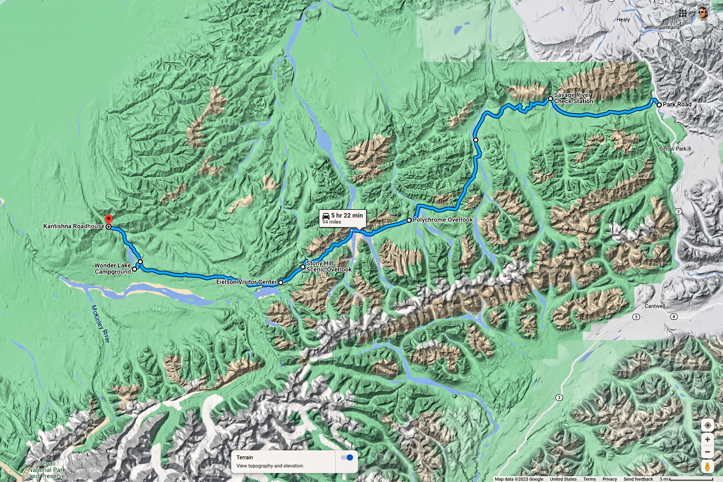
IN AUGUST, 2021: A serious landslide in the area of Polychrome Pass forced the closure of Denali Park Road at mile 43. Until repairs can be completed, probably not until the summer of 2026, all the tour buses turn around at that point, and the area west of Polychrome, including the Eielson Center and Wonder Lake, is not accessible to visitors.
My own trip to Denali National Park took place in 2015, six years before the landslide, when the entire park was still open and unrestricted. Most of my photos of the mountain and the wildlife were taken in areas of the park that are currently inaccessible. If you’re planning a visit to Denali, and you have some flexibility in your schedule, I would strongly encourage you to wait until repairs to the road are complete.
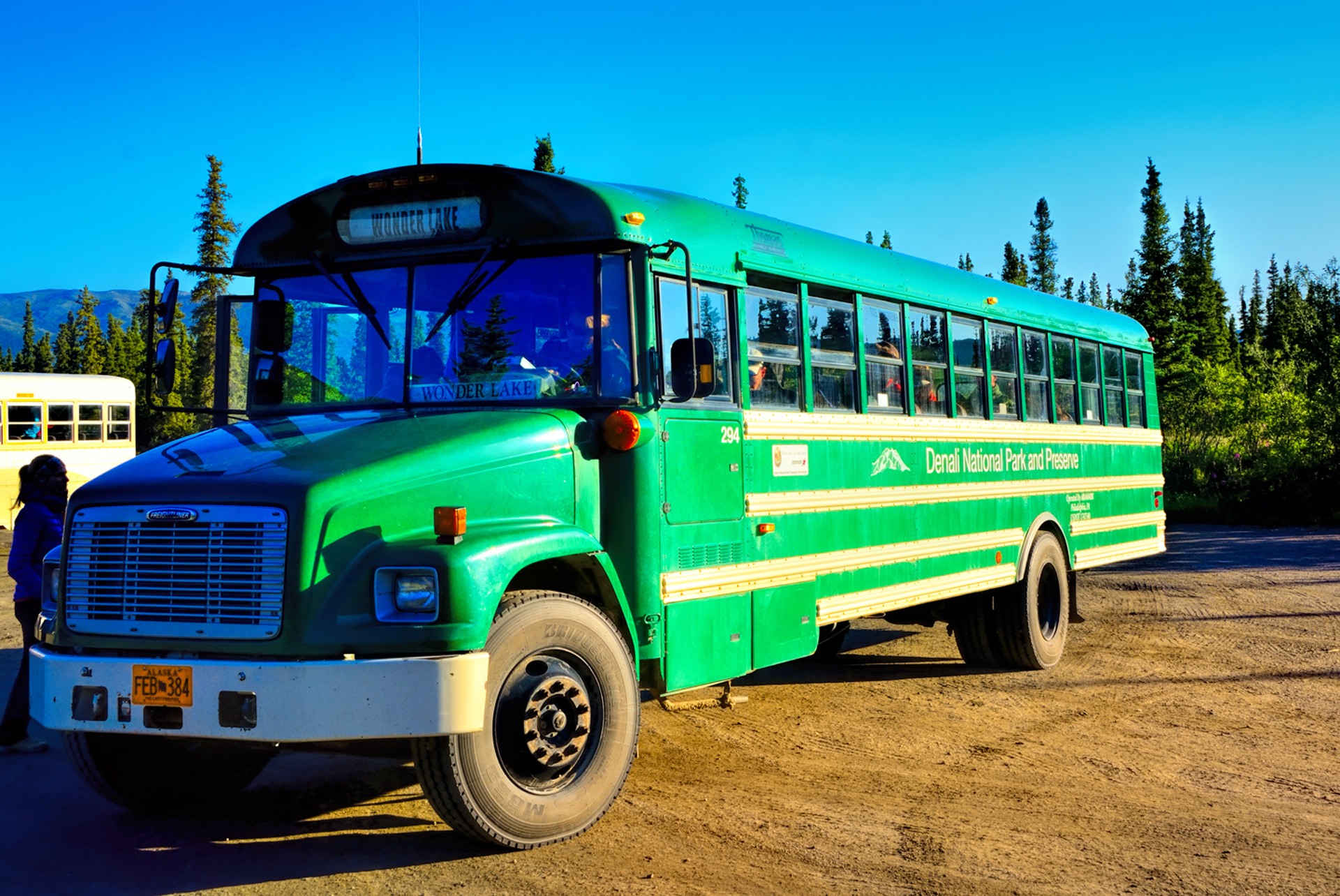
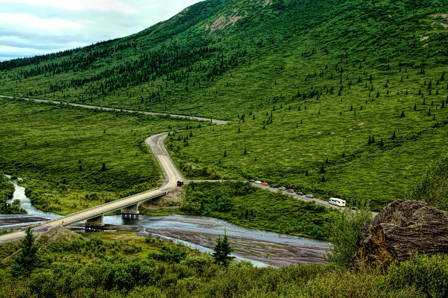
There are a number of ways to explore Denali National Park, ranging from wilderness hiking to flightseeing excursions to mountaineering expeditions, but for most visitors, there’s really only one practical choice. With rare exceptions, the 92 mile long Denali Park Road that takes you to the park’s interior is closed to private vehicles beyond the Savage River Bridge, at Mile 15. To go deeper into the park, the only option is to book a seat on one of the tour buses that leave from the Visitor’s Center. There are half day and full day tours, with and without professional guides; it’s time and money very well spent.
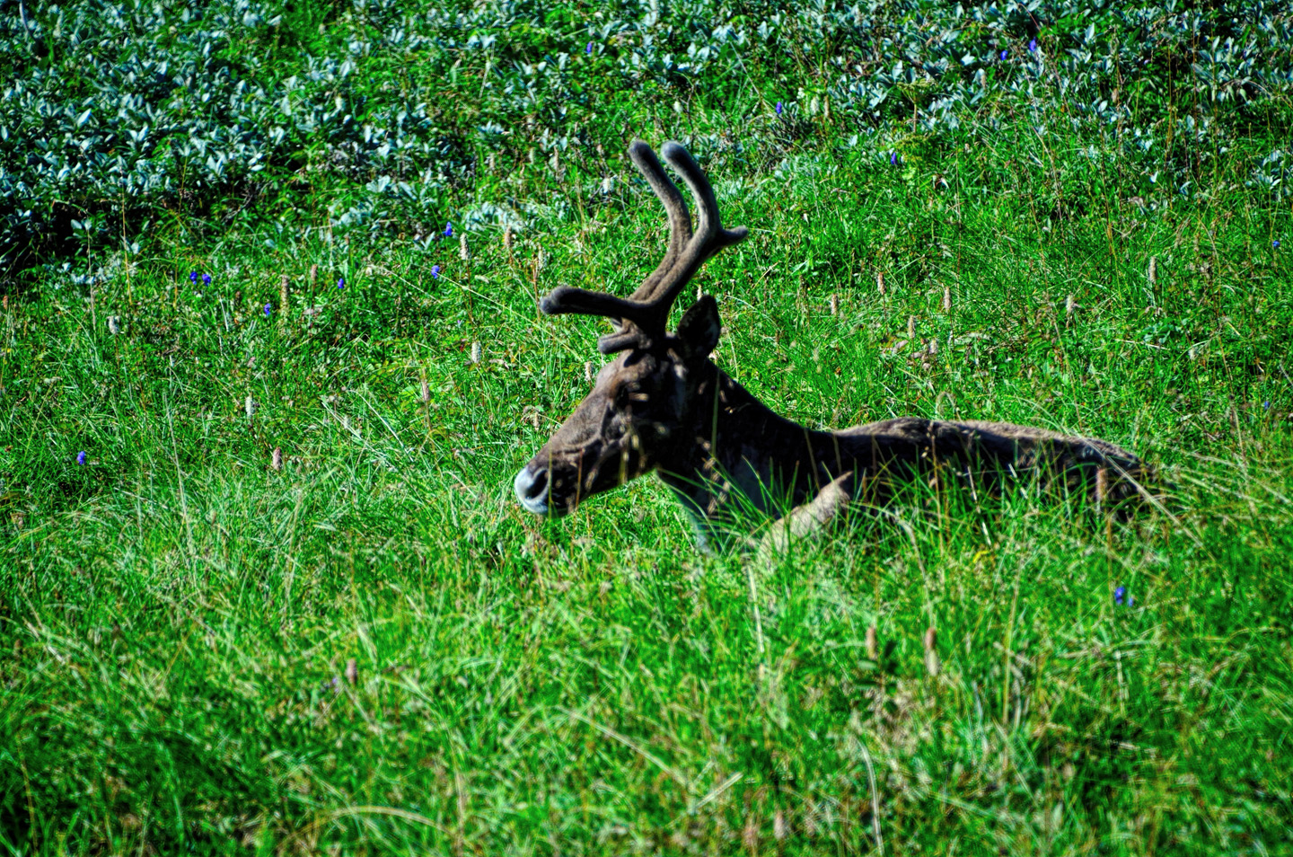
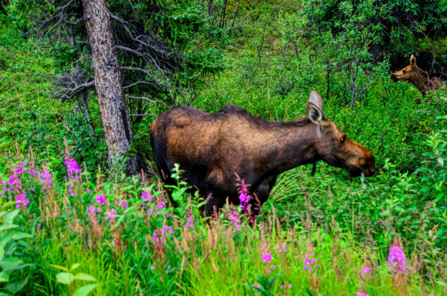
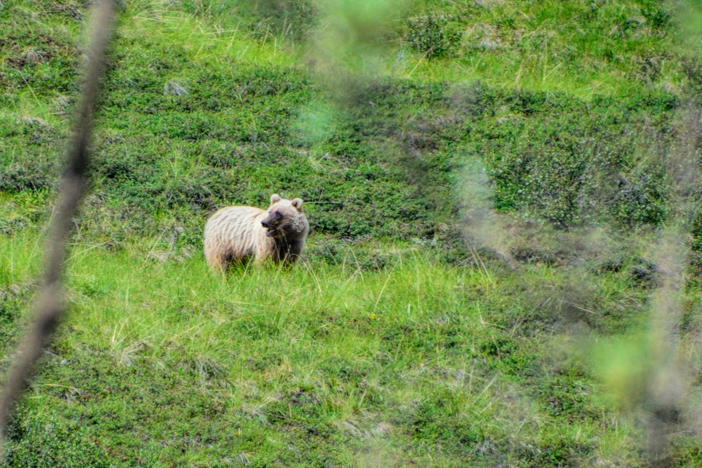
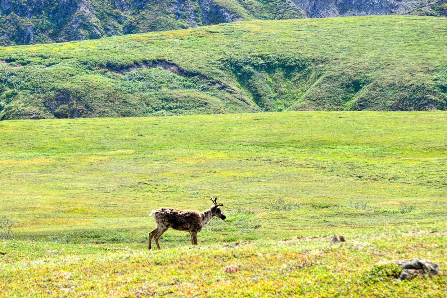
Because the traffic on Denali Park Road is so severely restricted, the park’s wildlife does not feel threatened by vehicles or by park visitors. The rules about keeping your distance from the animals are strictly enforced, so if you want photos, you’ll need a good telephoto lens.
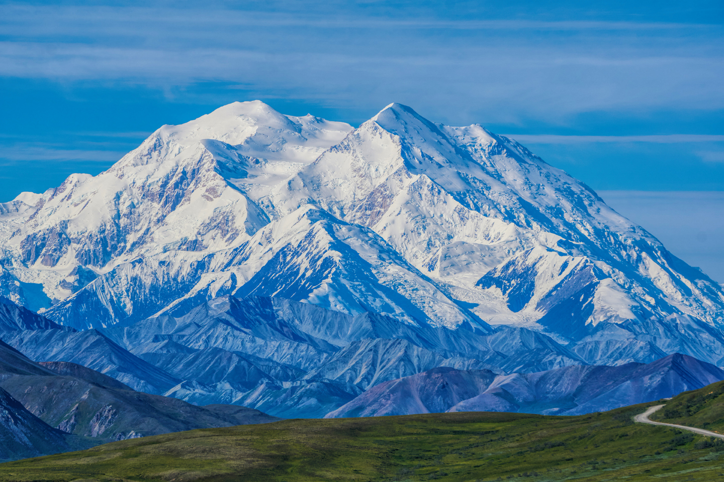
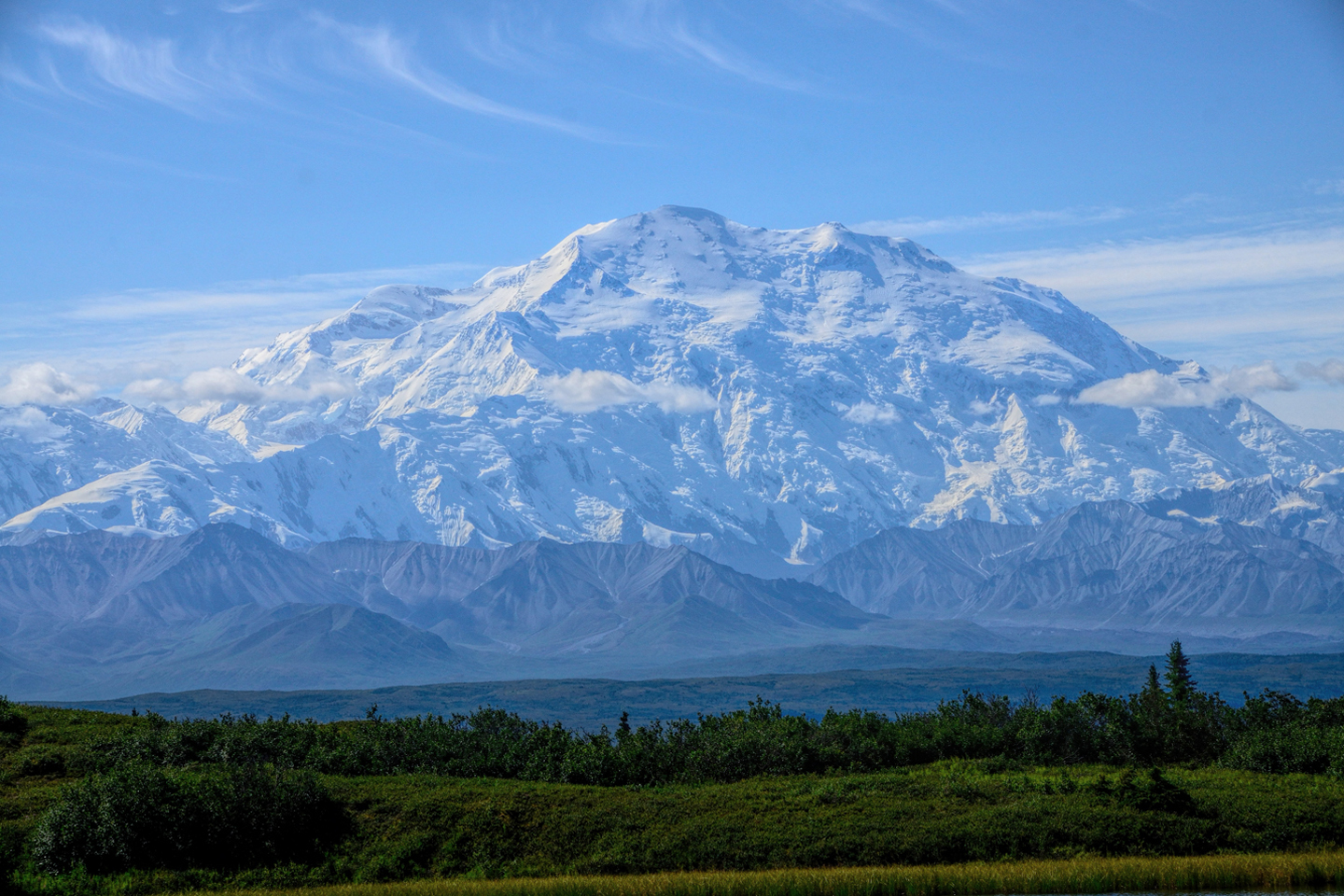
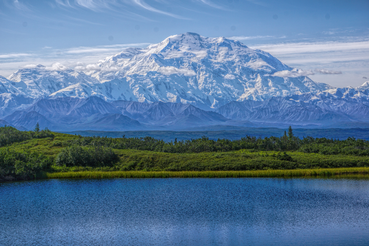
The best views of the mountain come beyond the halfway point, beginning about mile 62. Sadly, until the road repairs are complete, all tour buses turn around at Mile 43, Polychrome Pass, well before arriving at those classic overlooks. Guests at the exclusive Kantishna Road House, at the absolute end of the road, have the option of flying in, despite the closure.
Denali on a clear day, as seen from the Stony Hill Overlook at Mile 62, the Eielson Center at mile 66, and the Wonder Lake area near the end of the Denali Park Road. All of these viewpoints will remain inaccessible until the road is repaired.
Continuing along the Grand Circle from Denali National Park, you travel south on the Parks Highway, Interstate A-4. This is an excellent paved road built to Interstate Highway standards, so you’ll make short work of the distance. The next major stop along the circle is Anchorage, Alaska’s largest, some would say the state’s only real city, a mere 240 miles, or 4 to 5 hours of driving, from the biggest mountain in North America.
Click any map or photo to expand the image to full screen
To return to the previous post, or to continue reading the series, click the buttons below:
MORE ABOUT THE ALASKA HIGHWAY:
This is an interactive Table of Contents. Click the pictures to open the pages.
Alaska Road Trip

The Alaska Highway: Prelude: The Road to Dawson Creek
Even if you start in Seattle, the closest American city, it’s still more than 800 miles to Dawson Creek, wending your way that much further north, so far north that there will be a noticeable change in the hours of daylight. It’s the latitude that distinguishes the north country, including every bit of Alaska. Dawson Creek is where it all begins.
<<CLICK to Read More>>

The Alaska Highway: Day 1: Dawson Creek to Fort Nelson
Past Fort St. John, the terrain got a lot wilder. No more towns, very few people, and very little traffic. Saw a few U.S. license plates, Michigan, California, Oregon, South Carolina; people that were obviously headed to Alaska!
<<CLICK to Read More>>

The Alaska Highway: Day 2: Fort Nelson to Whitehorse
Every time I rounded a curve in the road there was another stupendous vista; it was nothing short of astonishing! I was literally yipping out loud, and a couple of times I actually pulled over and stopped while I pounded on my chest to “re-start” my heart!
<<CLICK to Read More>>

The Alaska Highway: Day 3: Whitehorse to Beaver Creek
Approaching the mountains, I started pulling over with serious frequency, taking LOTS of photos! Mountains, clouds, lakes, flowers—I was pretty sure I must have died and gone to heaven, but I couldn’t for the life of me remember the fiery crash.
<<CLICK to Read More>>

The Alaska Highway: Day 4: Beaver Creek to Fairbanks
Delta Junction, the end of the Al-Can, was only 200 miles away, and the border? Twenty miles, maybe half an hour, and I was finally going to cross into Alaska! I’d been on the road more than three weeks, and in just half a day more, I’d be in Fairbanks.
<<CLICK to Read More>>

Chena Hot Springs: A Fairbanks Original
The Chena hot spring puts out steaming water at a temperature of 150 degrees, producing enough power to meet all the needs of the resort, as well as filling the hot springs pools used by the guests. In addition to the lodge and restaurant, they offer camping and horseback riding, and they have exhibits featuring sled dogs, greenhouses, ice sculptures, and geothermal energy.
<<CLICK to Read More>>

Two-Foot High Kick: World Eskimo Indian Olympics
Contestants take a running leap, then they make this crazy jackknife move, touch the ball suspended high above the floor with both feet, then come back down and stick the landing. If that sounds difficult? You have no idea.
<<CLICK to Read More>>

Dreaming of Denali
When I drove my Jeep to Alaska that first summer after I retired, my main goal, the single most important thing I wanted to do, was to see Denali, the biggest mountain in North America.
<<CLICK to Read More>>

Follow the Fireweed
Visualize a summertime journey through that part of the world, a world filled with mountains and glaciers and boreal forests, ice blue rivers, turquoise lakes, and billowing clouds that fill the sky. Imagine your vision as a beautiful piece of music. The fundamental, underlying theme of that symphony would be a gently rising swell of perfect harmony, pinkish lavender in its hue.
<<CLICK to Read More>>

Kenai Fjords National Park: Seabirds, Glaciers, and Whales on the Wild Coast of Alaska
At this latitude, during the summer months, the sun stays low in the sky all day, and never really goes down. The traditional “golden hour” when the light is best for landscape photos is extended accordingly, and there are more opportunities for great shots than you’ll know what to do with.
<<CLICK to Read More>>

Kenai Fjords National Park: Exit Glacier: Up Close and Personal
Compared to the huge tidewater glaciers that flow directly into the sea along the coast of Kenai Fjords, Exit Glacier is just a baby–a baby that’s getting smaller every year–but it’s still big enough to permanently alter the landscape through which it passes.
<<CLICK to Read More>>

Alaska Road Trip: Driving Alaska’s Grand Circle
Most of the major towns in Alaska, as well as three of the state’s incredible National Parks, can all be reached by driving Alaska’s Grand Circle: a loop route beginning in Tok that utilizes all four segments (1082 miles) of Alaska’s Interstate Highway system.
<<CLICK to Read More>>

Alaska Road Trip: The Grand Circle: From Tok to Denali
There are no icy mountains looming on the horizon, and Fairbanks is nowhere near Alaska’s ruggedly beautiful coast. The true beauty in Alaska’s second city is found below the surface, in the spirit and resiliance of the people who make the place their home.
<<CLICK to Read More>>

Alaska Road Trip: The Grand Circle: Anchorage and the Kenai Peninsula
The massive ice field in the park’s wild interior has spawned dozens of glaciers which, over the course of many millenia, have carved the landscape into fjords so heart-breakingly beautiful, humpback whales swim all the way from Hawaii just to cavort in the deep blue water.

Alaska Road Trip: The Grand Circle: Wrangell-St. Elias National Park
So, just exactly how big is Wrangell-St. Elias National Park? You could combine Yellowstone with Yosemite, throw in the entire country of Switzerland, and you still wouldn’t match it in terms of size.
<<CLICK to Read More>>

Alaska Road Trip: Driving to the Top of the World
The rough dirt road gave way to a newly paved modern highway. This was it, the Top of the World, and right on cue, the haze peeled back, just enough to give me a glimpse of the beauty my friends assured me would be there…
<<CLICK to Read More>>

There’s nothing like a good road trip. Whether you’re flying solo or with your family, on a motorcycle or in an RV, across your state or across the country, the important thing is that you’re out there, away from your town, your work, your routine, meeting new people, seeing new sights, building the best kind of memories while living your life to the fullest.
Are you a veteran road tripper who loves grand vistas, or someone who’s never done it, but would love to try? Either way, you should consider making the Southwestern U.S. the scene of your own next adventure.
A few years ago I wrote a book about road trips in Arizona and New Mexico that’s a lot like this website, packed with interesting information, and illustrated with beautiful photographs. Check it out! You can find it on Amazon, and at all other major booksellers.

ALASKA ROAD TRIP:
MEXICAN ROAD TRIP (IN THE LAND OF THE MAYA):
ARIZONA AND NEW MEXICO:
SOUTH AMERICA:
PHOTOGRAPHY:
TRIBAL LANDS:


Recent Comments