Click Maps and Photos for an expanded view.
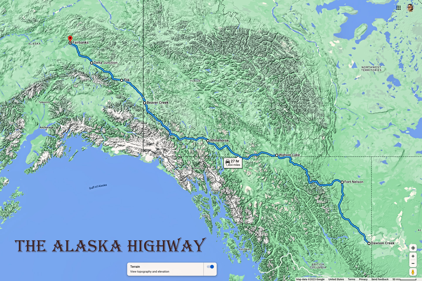
After a restless night in my funky motel in Beaver Creek, Yukon, I was raring to get back on the road. Fairbanks was only 300 miles away. Delta Junction, the end of the Al-Can, was only 200 miles away, and the border? Twenty miles, maybe half an hour, I was finally going to cross into Alaska! I’d been on the road more than three weeks, and in just half a day more, I’d be in Fairbanks. I’d already covered enough miles and seen enough sights to make this the trip of a lifetime–and in point of fact, I was just getting started!
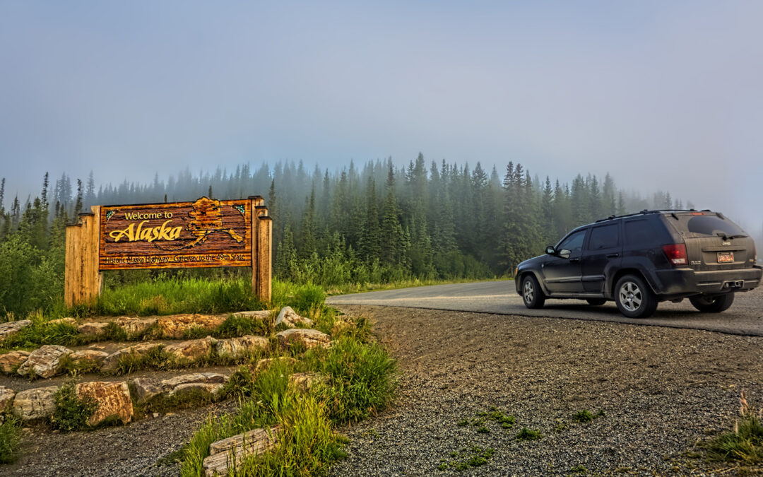
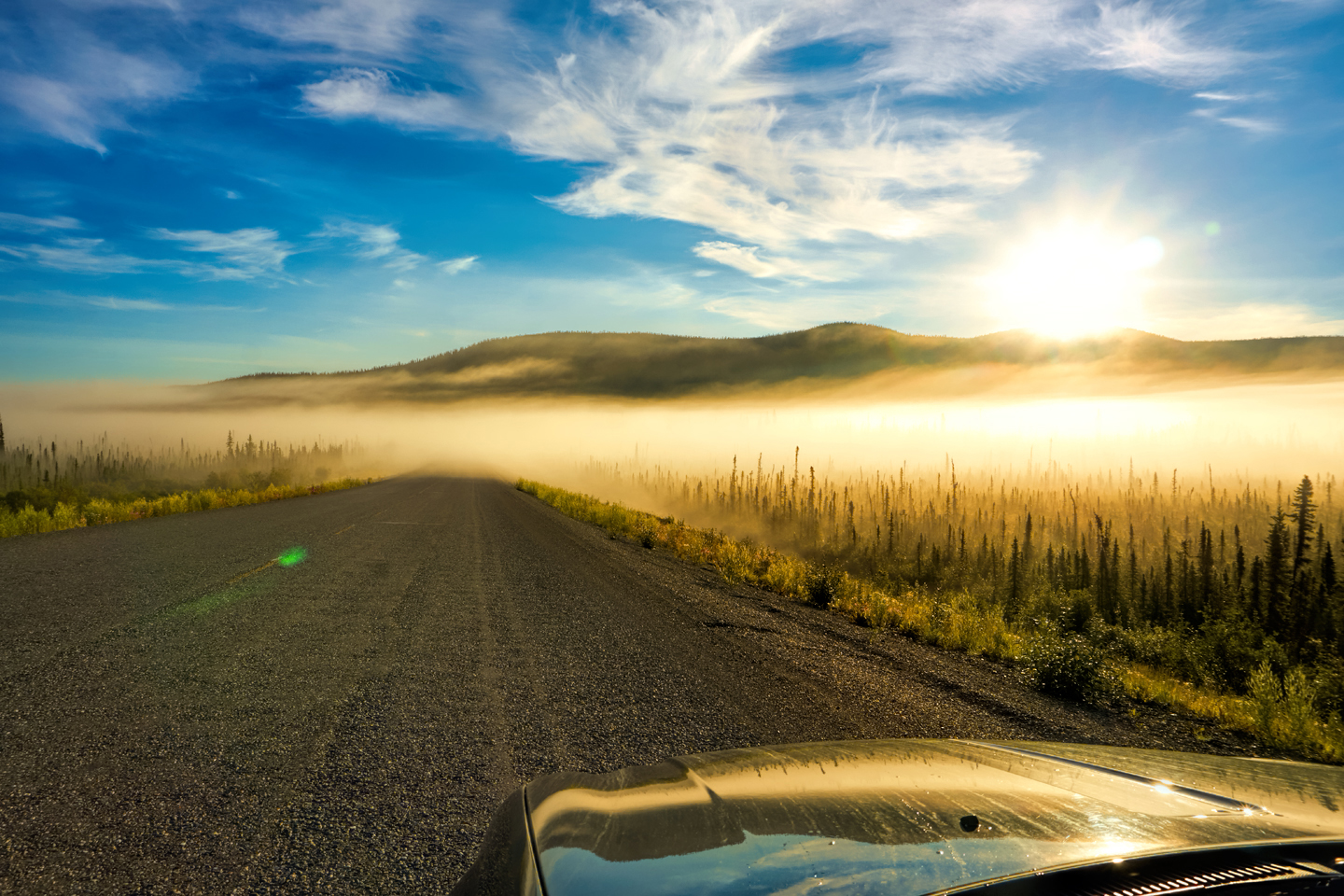
The sun rose at 4 AM, and I rose right along with it. I was having a heck of a time synchronizing my sleep cycle with all those extra hours of daylight, so I was losing out on much needed rest, which is never a good thing. Even so, I left Ida’s Motel and Cafe with nary a backward glance, and sailed past the Canadian customs facility, just up the highway. The actual border was 20 miles further, through a sort of a no man’s land of low hills blanketed by scrubby conifers. It was a foggy morning, and I was the only vehicle on the road, so the whole scene was a bit surreal.
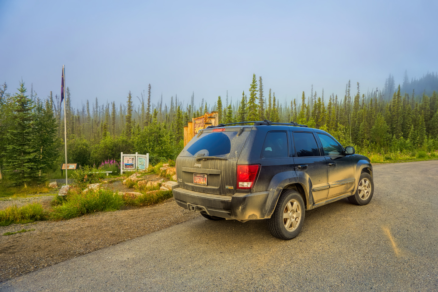
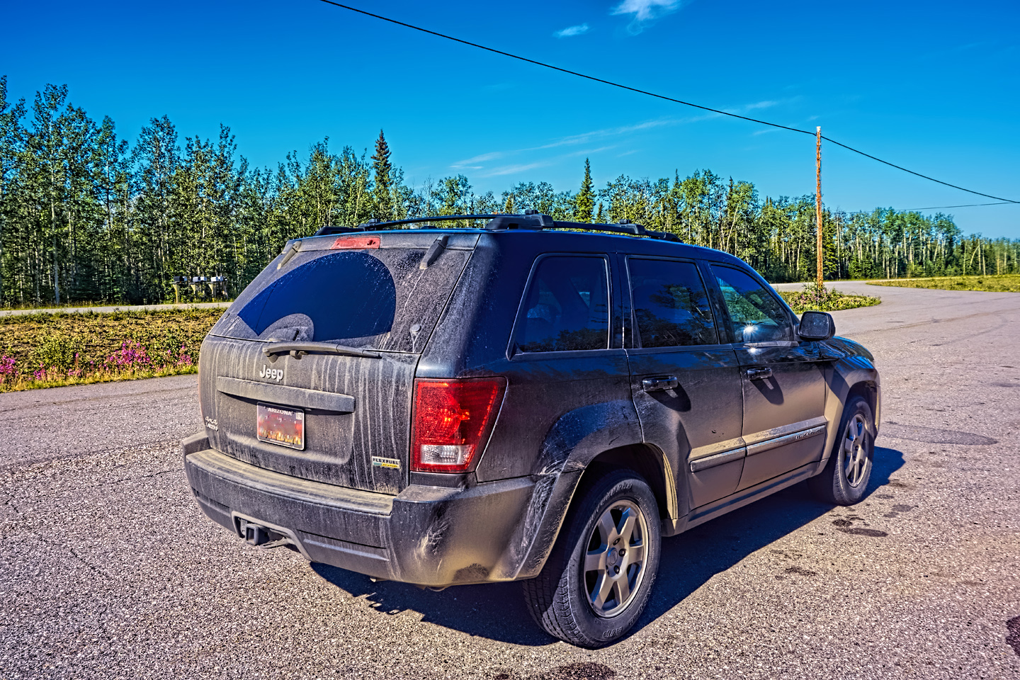
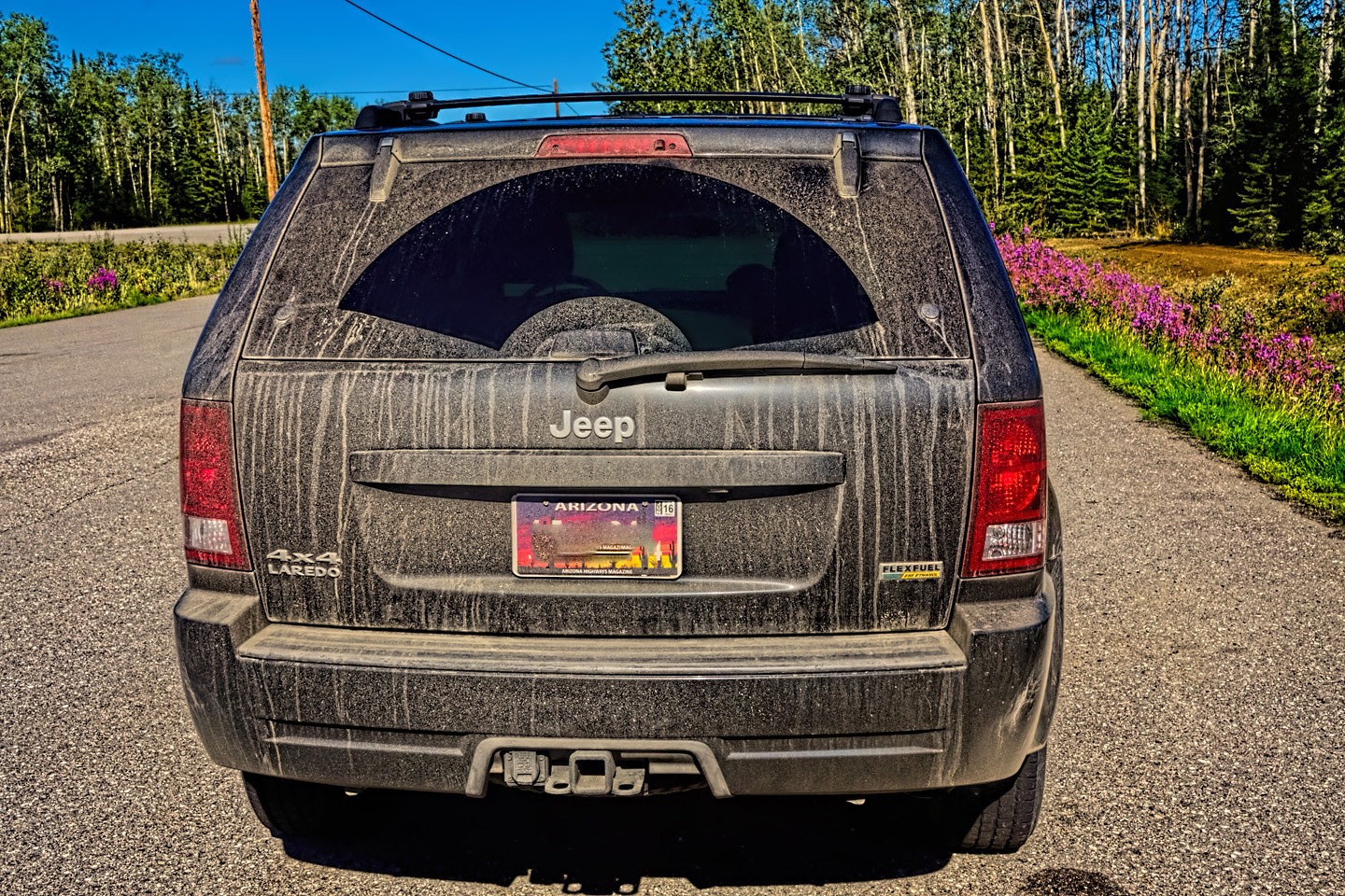
La Reina Sucia and her smiling driver arrive at the Alaska border
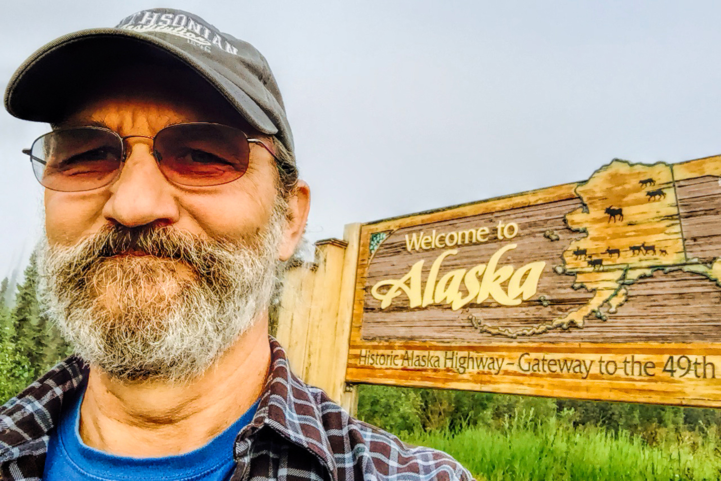
I stopped at the “Welcome to Alaska” sign and took some pictures, then drove just a little further to the U.S. customs, expecting to be inspected. I stopped at a drive thru window, handed my passport to a very pleasant customs agent who asked me some basic questions about where I was from and where I was going and why, and if I’d purchased anything in Canada. My answers were apparently satisfactory because she waved me on through, no inspection of anything. It was a bit like the way US Customs at the Mexican border used to be, back before it all got so crazy.
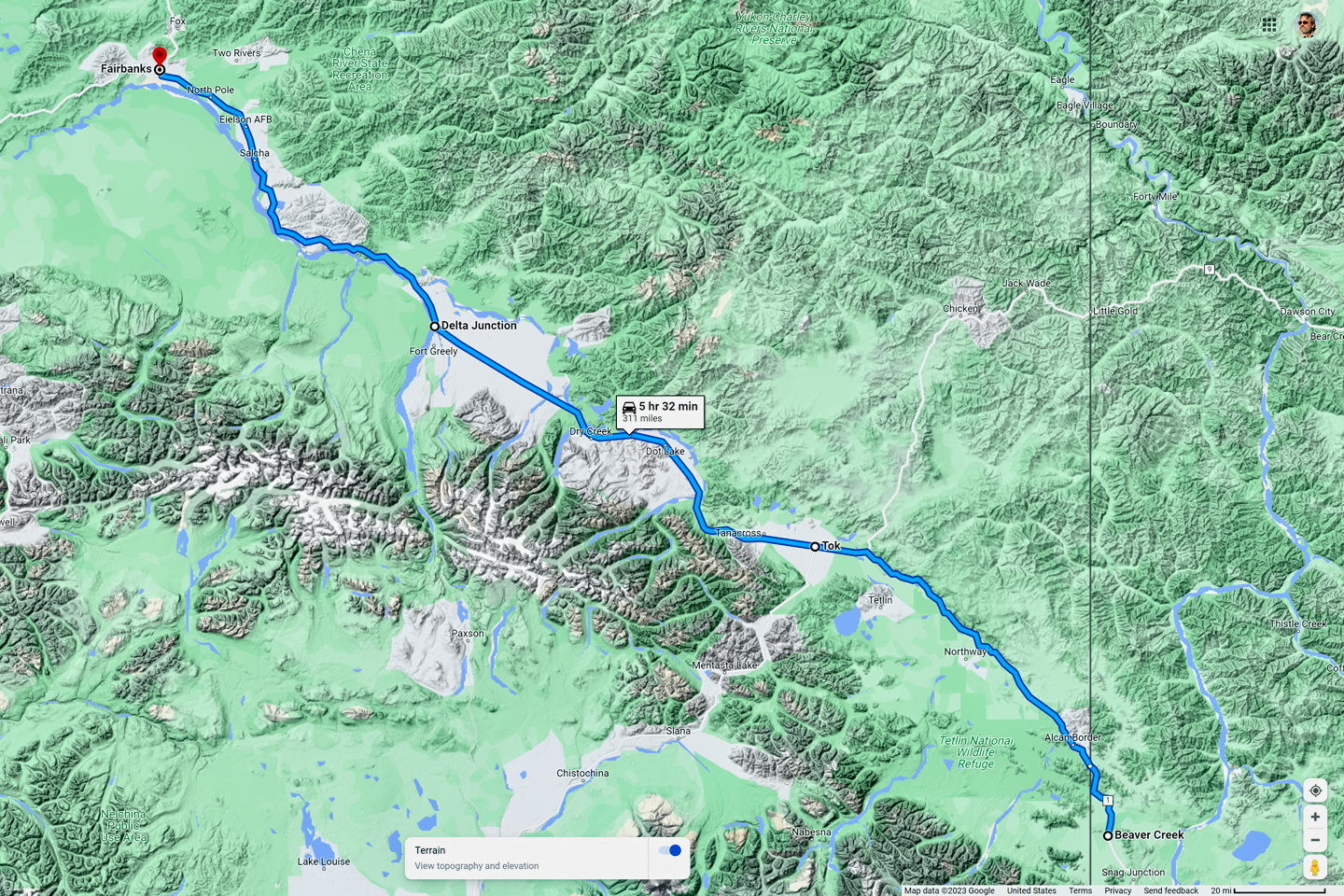
I stopped at a place called Border City, nothing there but a funky motel and gas station. I topped off my tank, got some coffee, and chatted with the owner, a very friendly older woman. She told me she’d had a stroke 13 years earlier, and was a bit crippled by it. I asked the price of the rooms—just in case I needed a place to stay on the drive back. $85 a night, not much cheaper than Beaver Creek, (but at least she had Wi-Fi 😉 ). The first real town, Tok, was 90 miles away.
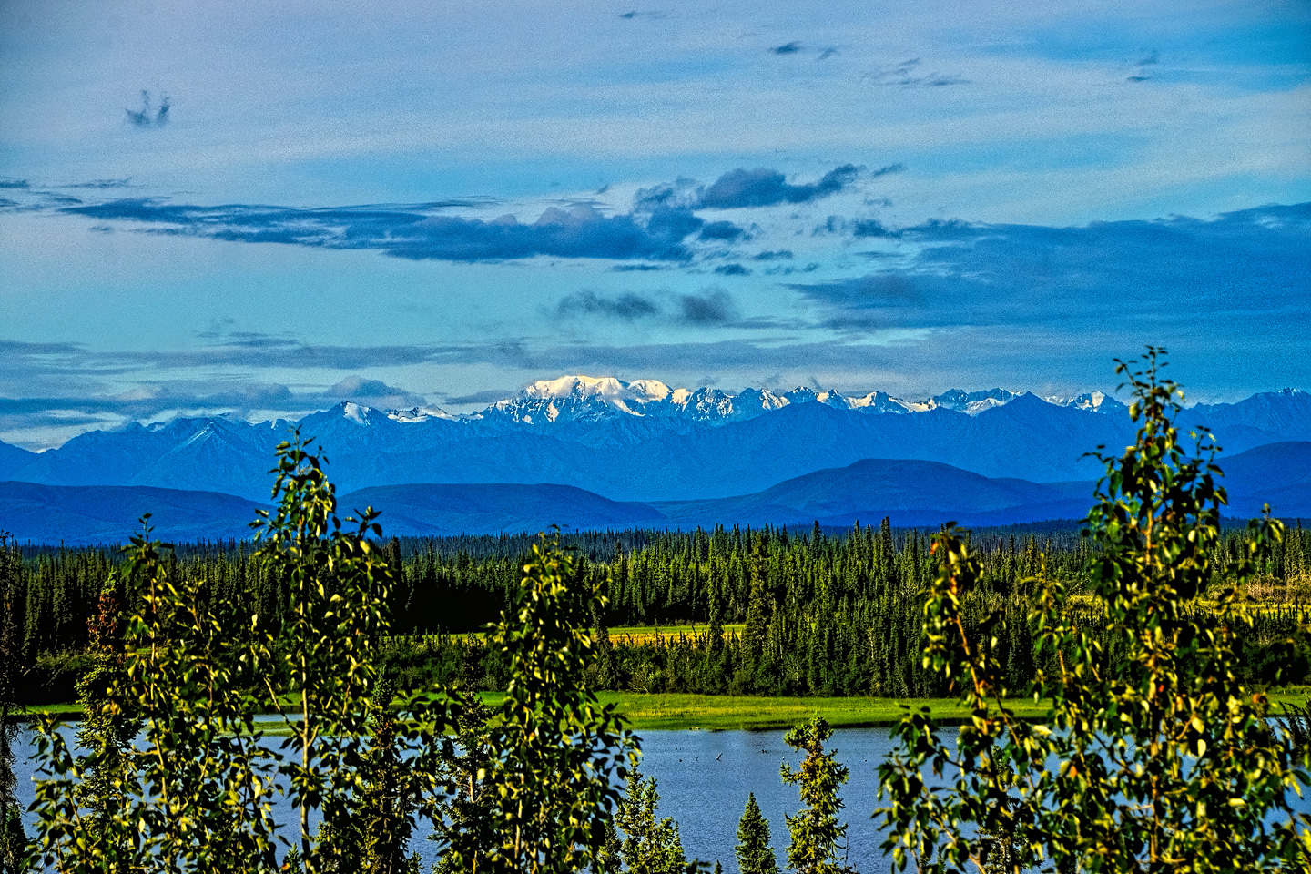
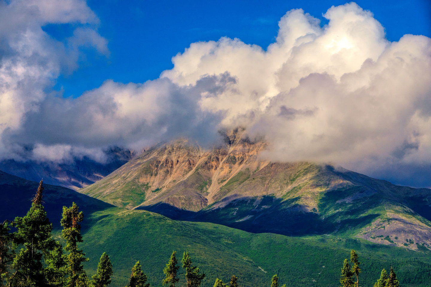
The Alaska Range, as seen from the Alaska Highway near Tok. Denali? Maybe!
Driving on, off to my left I could see the Alaska Range, and I was pretty sure I saw Denali, though it was from a considerable distance. I took some pictures with my telephoto lens, just in case. That day was crystal clear, but, given all the rain in the upcoming weather forecast, there was no guarantee that I’d ever see those mountains again. Stopped at Fast Eddie’s, a popular restaurant in Tok, and had a quite decent thoroughly American breakfast. My phone magically started working again, buzzing like an alarm clock as I received a dozen texts and a whole mess of emails.
I had another cup of coffee and sent some responses to my friends and family. I was excited to be in Alaska, overjoyed to be back on a 4G phone network! I never really think about that sort of thing at home. Mostly, my smart-phone just works, even when I’m out on the road. In remote sections of western Canada, the opposite had been true, at least for me. Most of the time, my phone did NOT have any service, and I hate to say this, but I really missed it; not being connected, in this day and age, was as bad as being lost.
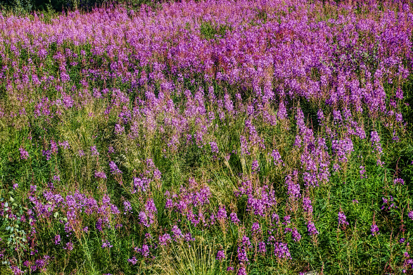
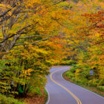
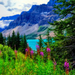
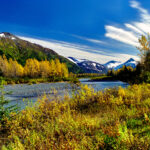
From Tok, I drove on toward Fairbanks. There were some gorgeous views of mountains and clouds, and fireweed along the roadside practically everywhere.
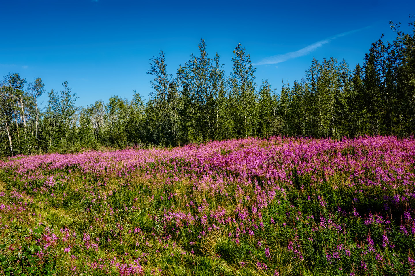
Views along the highway between Tok and Delta Junction; pinkish-lavender fireweed lines the roads throughout Alaska every summer
I made a stop at Delta Junction, which was Mile 1422, the official end of the Alaska Highway. I took pictures of the signpost, proof that I was actually there, and I checked out a bunch of ancient rusty road graders and tractors and the like—some of the original equipment used to build the Al-Can, back during WW II. At that point, my poor Jeep was so dirty, it looked like it belonged with the time-worn exhibits!
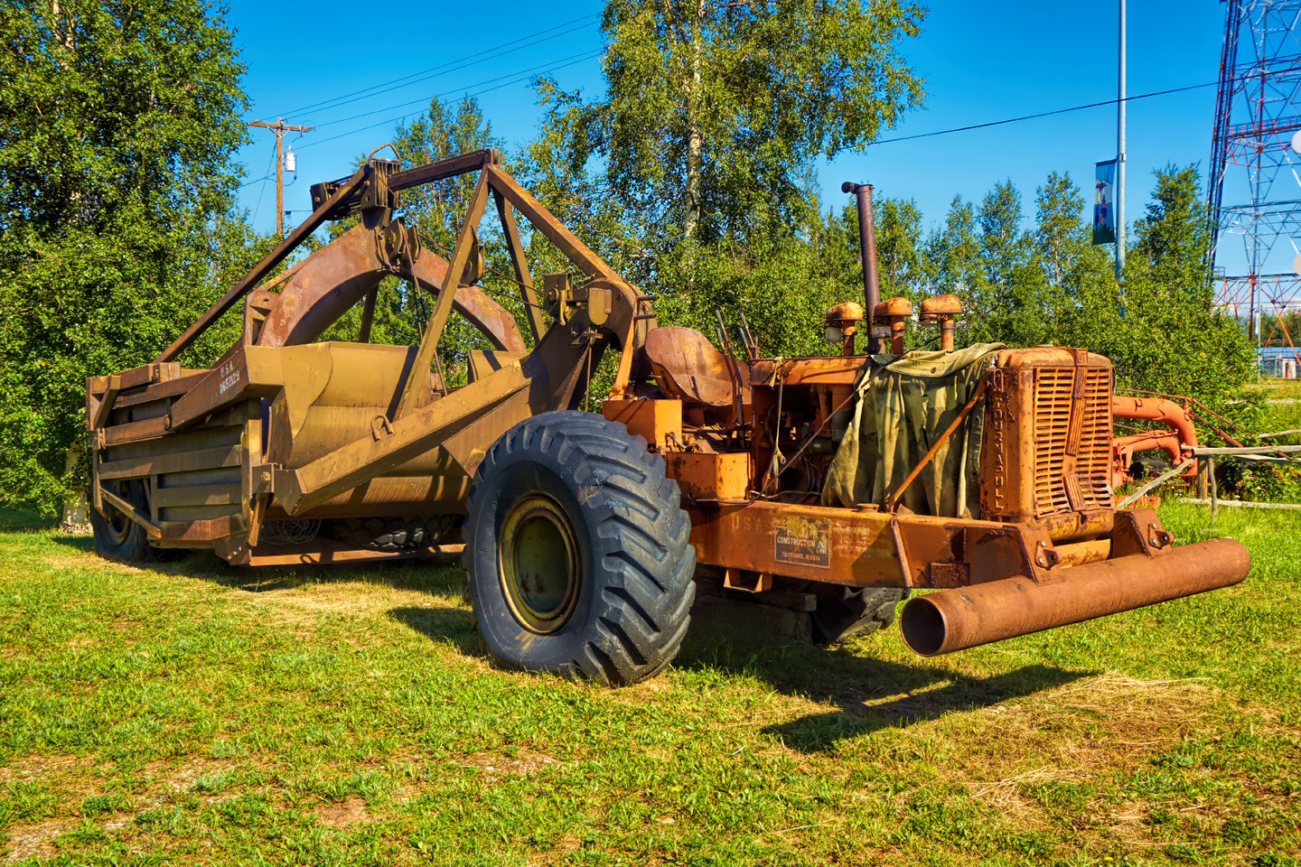
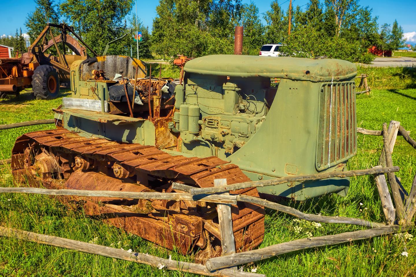
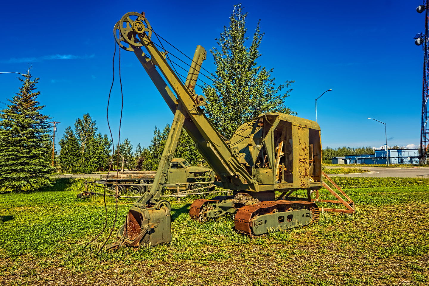
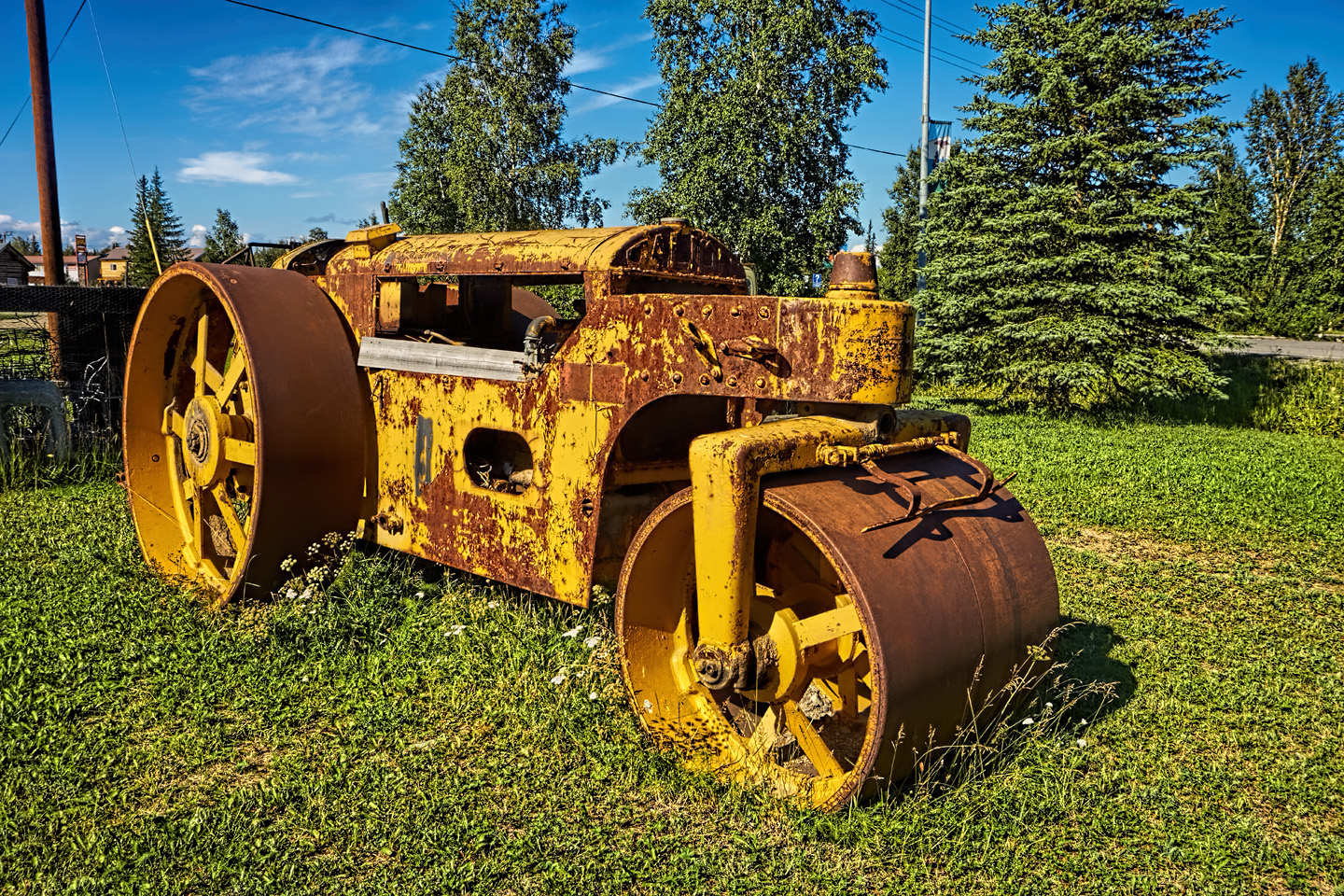
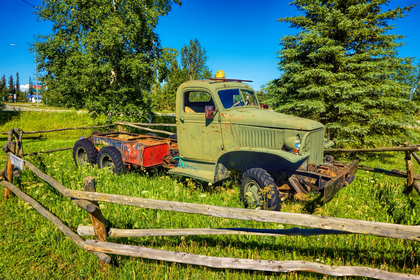
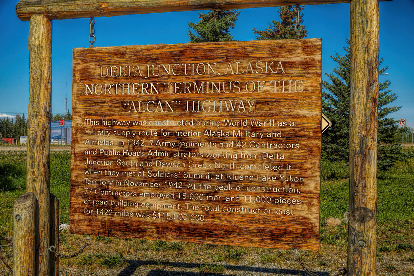
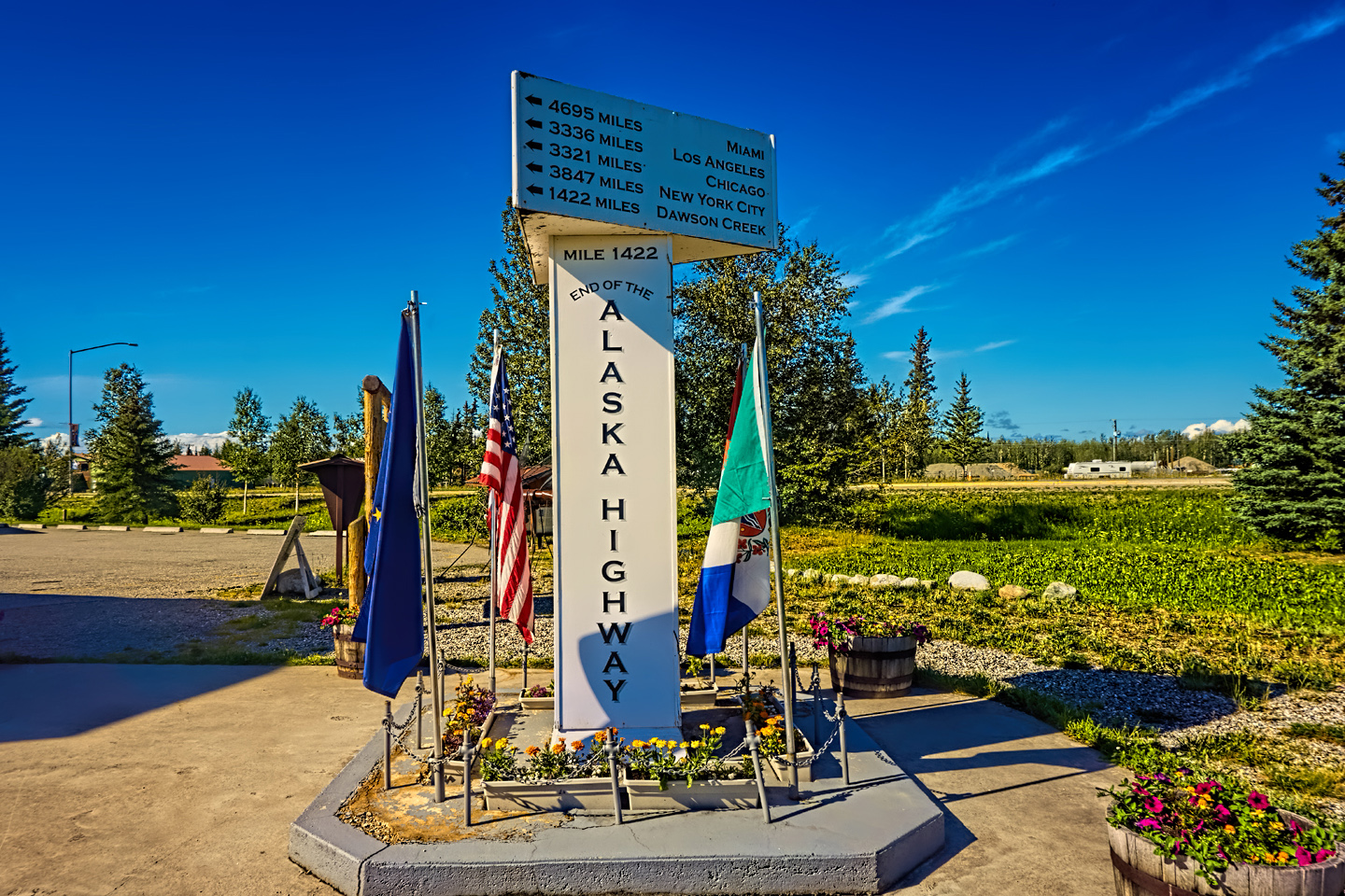
End of the Alaska Highway, Delta Junction, with an exhibit of the original road building equipment used to construct the Al-Can
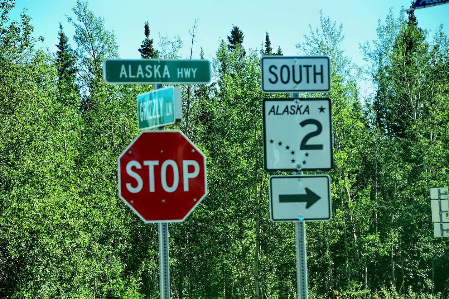
Sure “signs” that I wasn’t in Canada anymore
After that? On to Fairbanks! That last leg was an uneventful drive, on markedly improved roads. I passed Eielson Air Force base, then the town of North Pole, which has a Santa Clause theme. The road was now a real freeway, the first divided highway I’d seen since leaving the Vancouver area. When I arrived in Fairbanks, I was eager to stop and decompress, so I immediately started looking for a motel. Since I had the use of Siri again, I asked her for a Motel 6. No dice, none of those in Fairbanks, so I asked for a Super 8, and she led me to one. They had rooms available, but wanted $150 a night? Yikes! I was a little freaked out, just at the thought of actually being in Fairbanks. So I took the room.
I’d gained an hour with a change to the Alaska Time Zone, so it was only noon, and check-in wasn’t until 3:00. The clerk was adamant: not one minute sooner, and that left me with time to do a little exploring. I drove around Fairbanks, which to me was a fairly uninteresting town, at least on the surface. It was kind of funky, but modern, and built for severe weather. I stopped at a Fred Meyer (a grocery store with general merchandise, like a Target or a Wal-Mart). I bought some work gloves, since I needed some for my tool kit, as well as a cheap sleep mask, thinking it might be useful if I try camping under the midnight sun. Stopped at the Super 8 again and tried playing on the girl’s sympathies: “Can’t you take a little pity on an old man who just drove 5,000 miles? I’m sooo tired!” But no way, not until 3:00! Phooey!
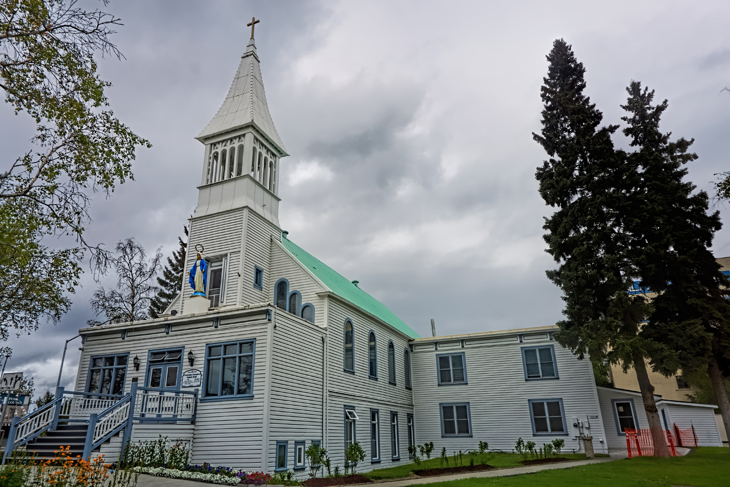
I went to Pioneer Park, where there were all sorts of Alaska history exhibits, including an old paddle wheel steamer that used to ply the Yukon River during the gold rush, and a rail car that carried President Harding to Alaska, back in the day. I checked out a bunch of dioramas of Alaska towns at the turn of the century, and then I just sat by the playground, enjoying the amazing clouds. I called my wife and chatted for a bit, very happy to be back on the U.S. phone network with unlimited minutes. Three o’clock finally came ‘round, so I headed for the motel.
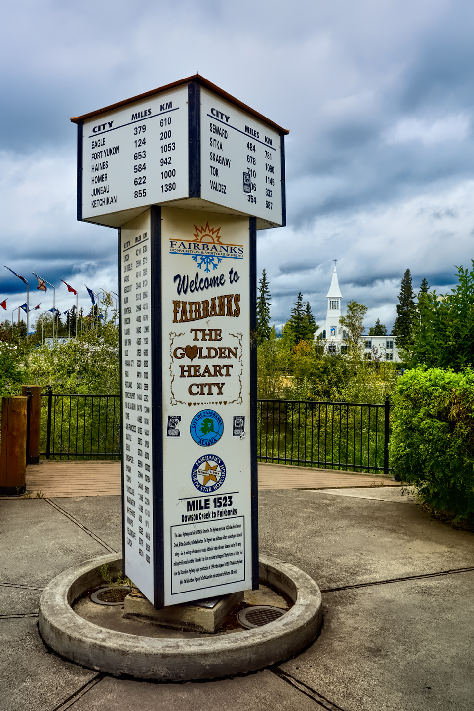
Golden Heart Plaza, Fairbanks: the ‘unofficial’ Last Milepost
There was a bit of a line to check in—apparently, all those other people had been told to wait until 3:00, same as me. The guy in front of me was also from Phoenix, which was quite a coincidence. He’d been visiting a friend who was stationed up there in the military, and they’d been fishing. The world’s best fishing, to hear him tell it, and I suspect that’s true. I checked in to my room and immediately sent a bunch of emails with the fabulous Yukon pictures I’d processed the night before. Had some dinner at the world’s most northerly Denny’s—Alaska salmon, overcooked, unfortunately, and there was a family next to me with two small kids who were having a screaming contest. I couldn’t get out of there fast enough!
Back at my room, I started plotting my itinerary. My friend Carl, the guy I’d visited when I passed through San Francisco on my way north, was planning to ride along with me on the last leg of my trip. He was going to fly to Edmonton, and we’d arranged to rendezvous there on August 5th, which was three weeks away. Three weeks was a good amount of time for what I wanted to do in Alaska, but if I kept blowing $150 a night on motels, I was going to run through three grand on lodging alone in those three weeks. I decided, then and there, that I was going to use my tent the next night, even if it was snowing! It was 10 PM local time, 11 PM on my body clock, and, of course, the sun was still up. No matter; I pulled my blackout curtains and crashed. It had been quite a long day, but I was actually in Alaska! I’d done it!
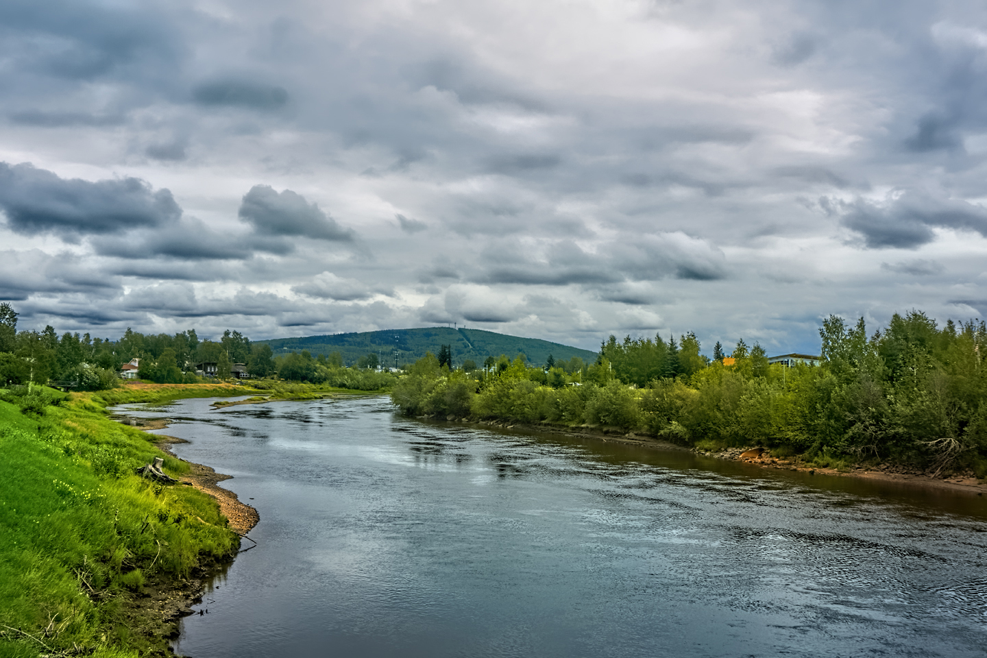
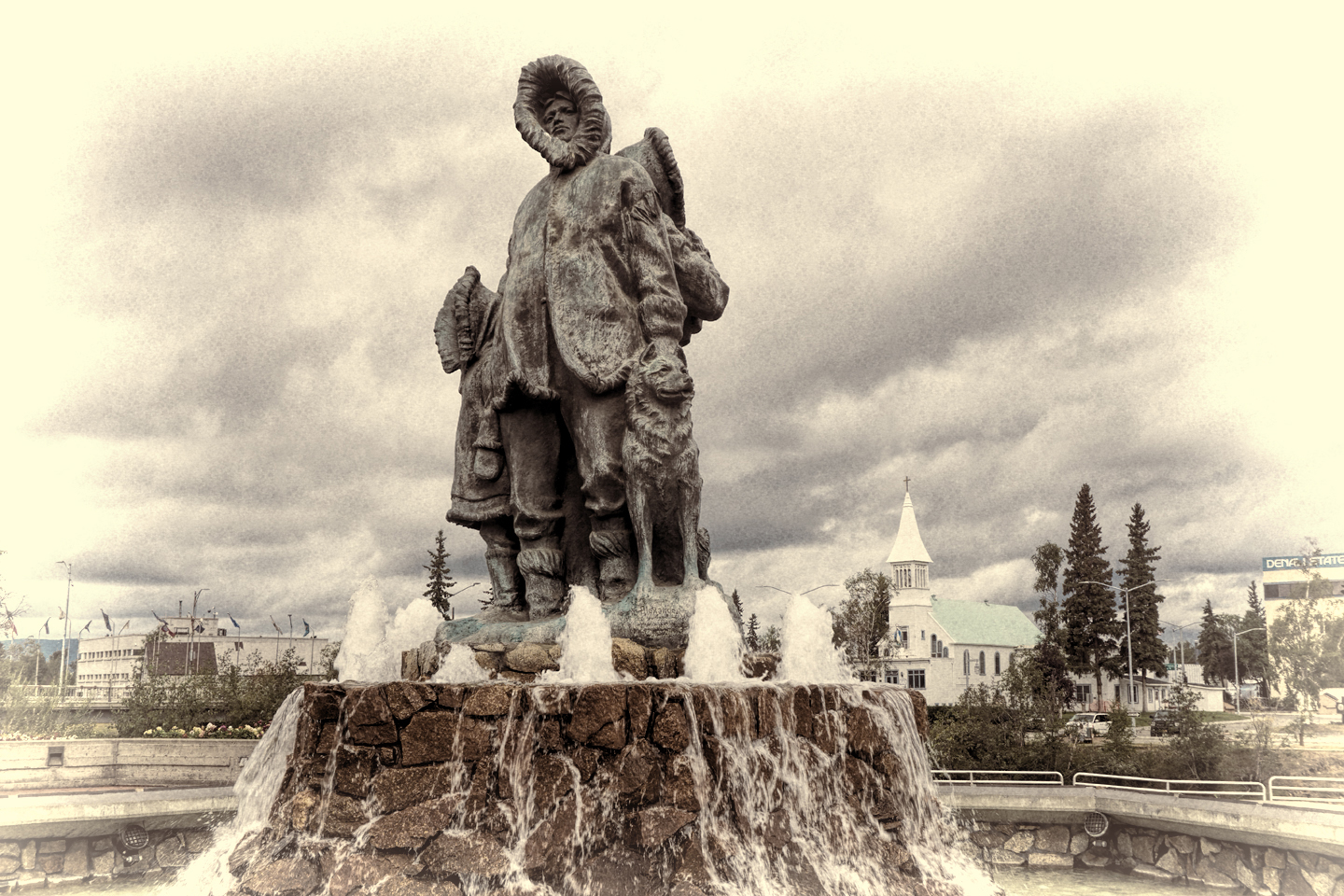
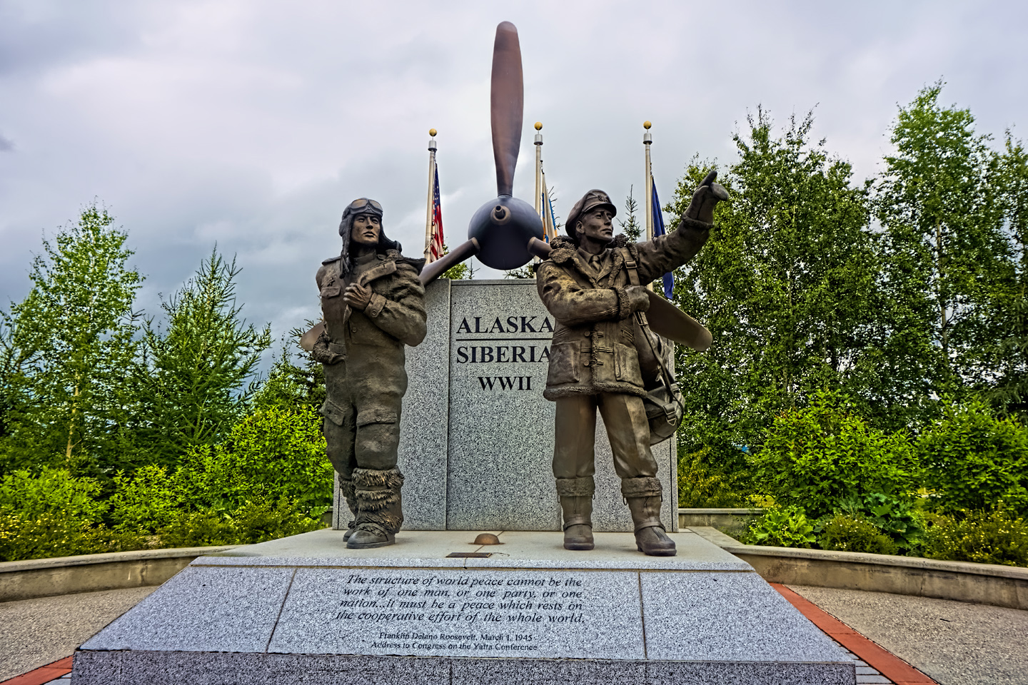
Scenes around Fairbanks
(Unless otherwise noted, all of the images in these posts are my original work, and are protected by copyright. They may not be duplicated for commercial purposes.)
Click any photo in this post to stop the slide shows and expand the images to full screen.
To return to Day 3, or to continue reading the next part of the series, click the buttons below:
MORE ABOUT THE ALASKA HIGHWAY:
This is an interactive Table of Contents. Click the pictures to open the pages.
Alaska Road Trip

The Alaska Highway: Prelude: The Road to Dawson Creek
Even if you start in Seattle, the closest American city, it’s still more than 800 miles to Dawson Creek, wending your way that much further north, so far north that there will be a noticeable change in the hours of daylight. It’s the latitude that distinguishes the north country, including every bit of Alaska. Dawson Creek is where it all begins.
<<CLICK to Read More>>

The Alaska Highway: Day 1: Dawson Creek to Fort Nelson
Past Fort St. John, the terrain got a lot wilder. No more towns, very few people, and very little traffic. Saw a few U.S. license plates, Michigan, California, Oregon, South Carolina; people that were obviously headed to Alaska!
<<CLICK to Read More>>

The Alaska Highway: Day 2: Fort Nelson to Whitehorse
Every time I rounded a curve in the road there was another stupendous vista; it was nothing short of astonishing! I was literally yipping out loud, and a couple of times I actually pulled over and stopped while I pounded on my chest to “re-start” my heart!
<<CLICK to Read More>>

The Alaska Highway: Day 3: Whitehorse to Beaver Creek
Approaching the mountains, I started pulling over with serious frequency, taking LOTS of photos! Mountains, clouds, lakes, flowers—I was pretty sure I must have died and gone to heaven, but I couldn’t for the life of me remember the fiery crash.
<<CLICK to Read More>>

The Alaska Highway: Day 4: Beaver Creek to Fairbanks
Delta Junction, the end of the Al-Can, was only 200 miles away, and the border? Twenty miles, maybe half an hour, and I was finally going to cross into Alaska! I’d been on the road more than three weeks, and in just half a day more, I’d be in Fairbanks.
<<CLICK to Read More>>

Chena Hot Springs: A Fairbanks Original
The Chena hot spring puts out steaming water at a temperature of 150 degrees, producing enough power to meet all the needs of the resort, as well as filling the hot springs pools used by the guests. In addition to the lodge and restaurant, they offer camping and horseback riding, and they have exhibits featuring sled dogs, greenhouses, ice sculptures, and geothermal energy.
<<CLICK to Read More>>

Two-Foot High Kick: World Eskimo Indian Olympics
Contestants take a running leap, then they make this crazy jackknife move, touch the ball suspended high above the floor with both feet, then come back down and stick the landing. If that sounds difficult? You have no idea.
<<CLICK to Read More>>

Dreaming of Denali
When I drove my Jeep to Alaska that first summer after I retired, my main goal, the single most important thing I wanted to do, was to see Denali, the biggest mountain in North America.
<<CLICK to Read More>>

Follow the Fireweed
Visualize a summertime journey through that part of the world, a world filled with mountains and glaciers and boreal forests, ice blue rivers, turquoise lakes, and billowing clouds that fill the sky. Imagine your vision as a beautiful piece of music. The fundamental, underlying theme of that symphony would be a gently rising swell of perfect harmony, pinkish lavender in its hue.
<<CLICK to Read More>>

Kenai Fjords National Park: Seabirds, Glaciers, and Whales on the Wild Coast of Alaska
At this latitude, during the summer months, the sun stays low in the sky all day, and never really goes down. The traditional “golden hour” when the light is best for landscape photos is extended accordingly, and there are more opportunities for great shots than you’ll know what to do with.
<<CLICK to Read More>>

Kenai Fjords National Park: Exit Glacier: Up Close and Personal
Compared to the huge tidewater glaciers that flow directly into the sea along the coast of Kenai Fjords, Exit Glacier is just a baby–a baby that’s getting smaller every year–but it’s still big enough to permanently alter the landscape through which it passes.
<<CLICK to Read More>>

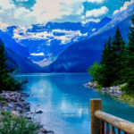
Alaska Road Trip: Driving Alaska’s Grand Circle
Most of the major towns in Alaska, as well as three of the state’s incredible National Parks, can all be reached by driving Alaska’s Grand Circle: a loop route beginning in Tok that utilizes all four segments (1082 miles) of Alaska’s Interstate Highway system.
<<CLICK to Read More>>

Alaska Road Trip: The Grand Circle: From Tok to Denali
There are no icy mountains looming on the horizon, and Fairbanks is nowhere near Alaska’s ruggedly beautiful coast. The true beauty in Alaska’s second city is found below the surface, in the spirit and resiliance of the people who make the place their home.
<<CLICK to Read More>>

Alaska Road Trip: The Grand Circle: Anchorage and the Kenai Peninsula
The massive ice field in the park’s wild interior has spawned dozens of glaciers which, over the course of many millenia, have carved the landscape into fjords so heart-breakingly beautiful, humpback whales swim all the way from Hawaii just to cavort in the deep blue water.

Alaska Road Trip: The Grand Circle: Wrangell-St. Elias National Park
So, just exactly how big is Wrangell-St. Elias National Park? You could combine Yellowstone with Yosemite, throw in the entire country of Switzerland, and you still wouldn’t match it in terms of size.
<<CLICK to Read More>>

Alaska Road Trip: Driving to the Top of the World
The rough dirt road gave way to a newly paved modern highway. This was it, the Top of the World, and right on cue, the haze peeled back, just enough to give me a glimpse of the beauty my friends assured me would be there…
<<CLICK to Read More>>

There's nothing like a good road trip. Whether you're flying solo or with your family, on a motorcycle or in an RV, across your state or across the country, the important thing is that you're out there, away from your town, your work, your routine, meeting new people, seeing new sights, building the best kind of memories while living your life to the fullest.
Are you a veteran road tripper who loves grand vistas, or someone who's never done it, but would love to give it a try? Either way, you should consider making the Southwestern U.S. the scene of your own next adventure.
A few years ago I wrote a book about road trips in Arizona and New Mexico that's a lot like this website, packed with interesting information, and illustrated with beautiful photographs. Check it out! You can find it on Amazon, and at all other major booksellers.

ALASKA ROAD TRIP:
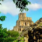
MEXICAN ROAD TRIP (IN THE LAND OF THE MAYA):
ARIZONA AND NEW MEXICO:
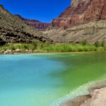
SOUTH AMERICA:
PHOTOGRAPHY:
TRIBAL LANDS:

Recent Comments