Click Maps and Photos for an expanded view.
The sun was up and pouring through my window at 4:30 AM, so I arose early and rolled out of Fort Nelson at 6:00. The plan was to drive at least as far as Watson Lake, 319 miles and about 7 hours away, but clear over on the other side of the northernmost section of the Rockies. According to all my guide books, that was the usual goal for Day 2 of the drive, but I figured I’d play it by ear. I had the most current version of The Milepost, a mile-by-mile guide to everything there is to know about the Alaska Highway, so I was confident in my ability to deviate from the “usual” whenever that made good sense.
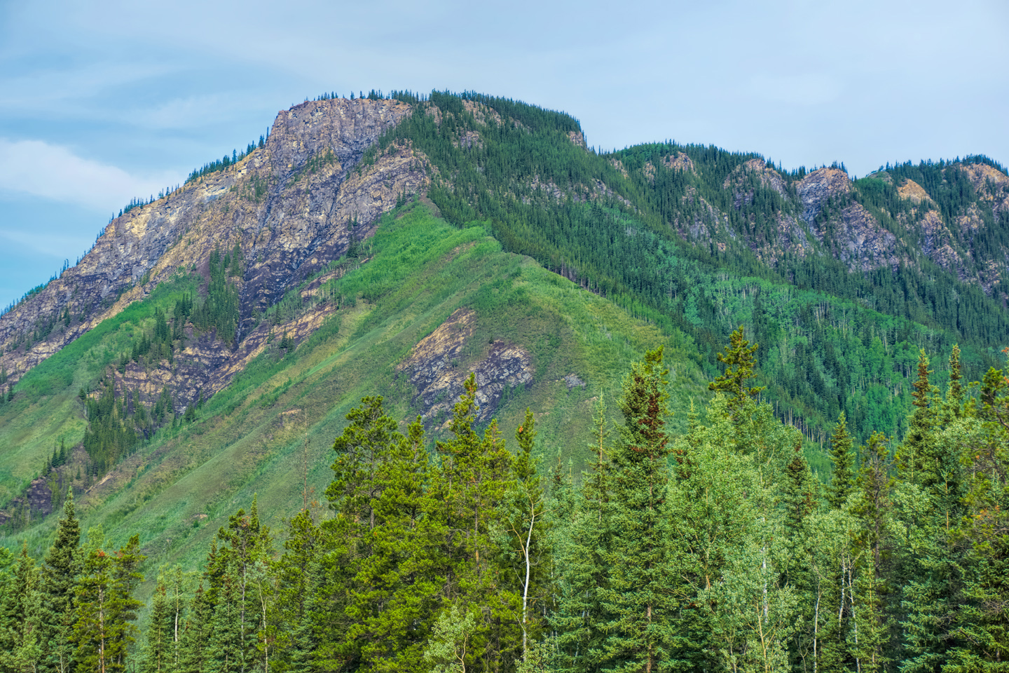
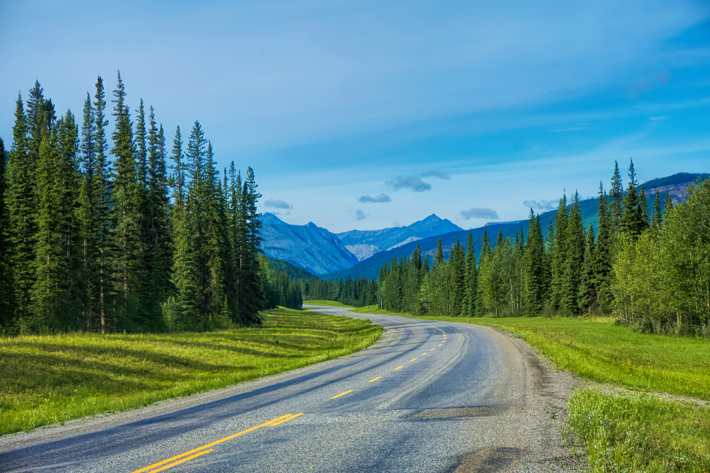
There was no other northbound traffic anywhere near me—one car passed me early on, and though I saw numerous oncoming vehicles headed south, I saw nobody else headed north for the first three hours or more. It was such an odd sensation, to be so alone on such a major road through such a vast countryside. The highway wound up into the mountains; the scenery was quite beautiful, and the sunny weather was holding.
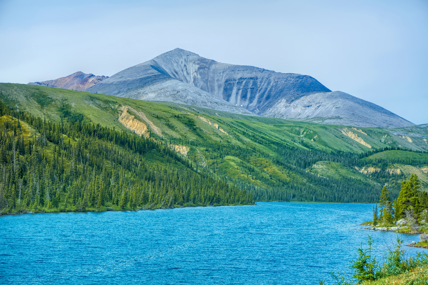
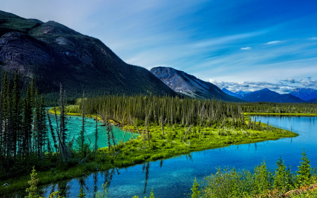
At one point I passed a rest stop and spotted the rig from Arizona with the old prospector I’d met the day before, so I pulled over and greeted him a good morning before driving off. Spotted a couple of moose along the road and took pictures, then drove on to Muncho Lake, a particularly beautiful body of water with gorgeous greenish turquoise color in the shallows due to high mineral content.
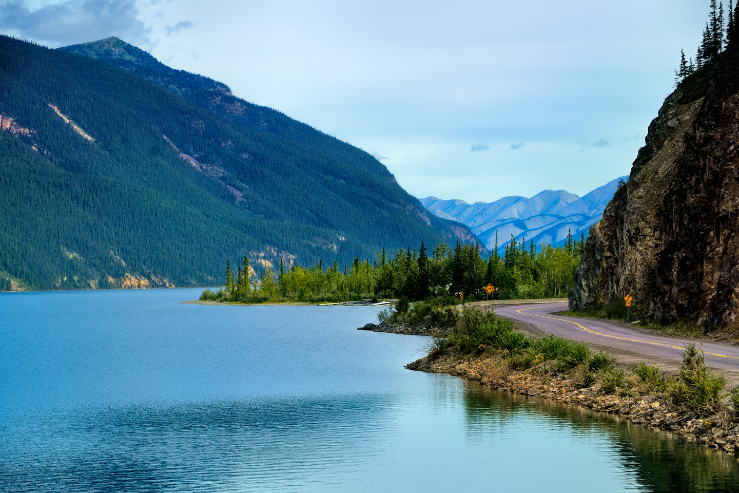
Several views of Muncho Lake, in the Rocky Mountains of northern British Columbia
I took numerous photos, and then drove on. Spotted several wild bison along the road, and took more photos! This truly was an extraordinary stretch of road, and my Al-Can adventure was starting to get seriously real for me.
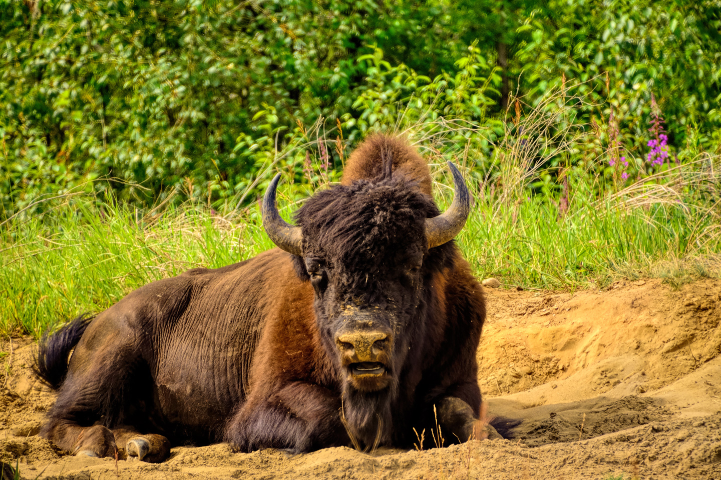
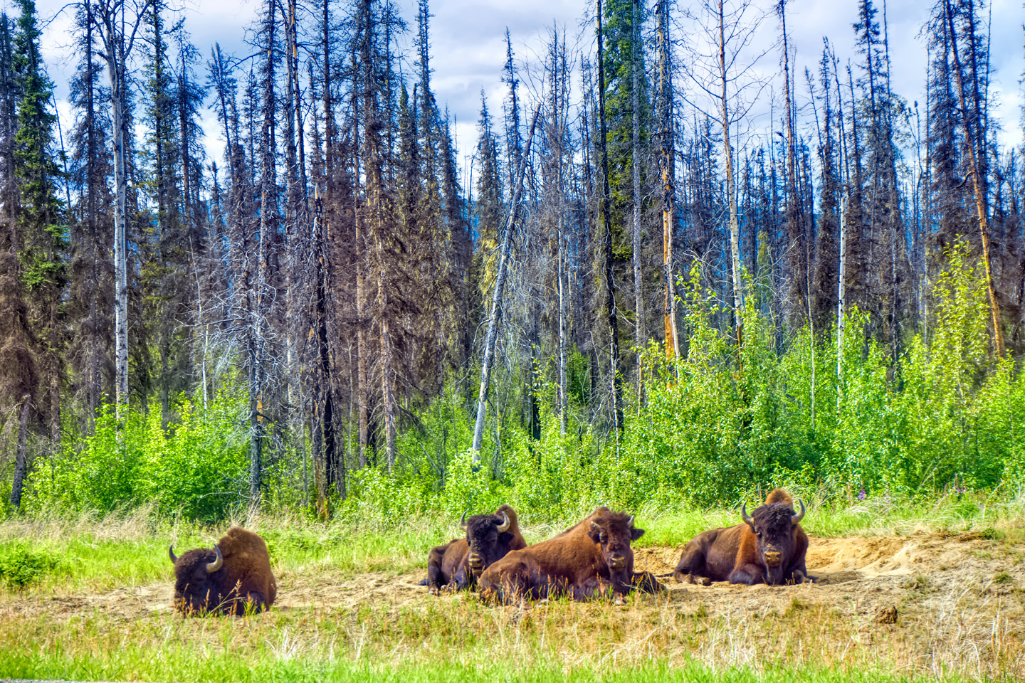
Canadian Bison, taking a break from their primary occupation (namely, eating)
There was a construction delay, with one-way traffic waiting for escort by a pilot vehicle, so I shut off the Jeep and played a game on my phone to pass the time. Somebody honked, and I realized that traffic had started moving, so I quickly restarted my engine. I’m not sure what I did that was different, but an electrical problem I’d had in Yosemite was suddenly back again. My engine was running, but all my accessories were dead, so I had no radio, no AC, I couldn’t roll down the windows, and the windshield wipers didn’t work! It wasn’t nearly as hot as it had been in Yosemite, so it wasn’t as instantly miserable—but I was still panicked, for fear it wouldn’t self-resolve this time. The Alaska Highway without windshield wipers would be a disaster just waiting to happen.
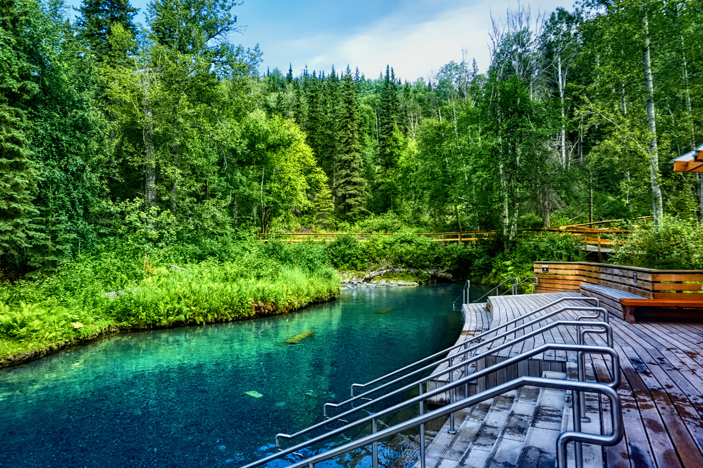
20 miles down the road there was a BC provincial campground with a well-known hot spring that Christopher, the prospector, had highly recommended (lamenting the days when it used to be wild and free of charge). I pulled in and shut off the Jeep, hiked ten minutes to the hot spring pool, soaked for another very pleasant ten or fifteen minutes, then hiked back, praying under my breath. Fingers crossed, I inserted the key and turned it. Bing-Bing-Bing-Bing! Everything was working again! Hallelujah, one more time. Vastly relieved, I drove on, and crossed the border to the Yukon.
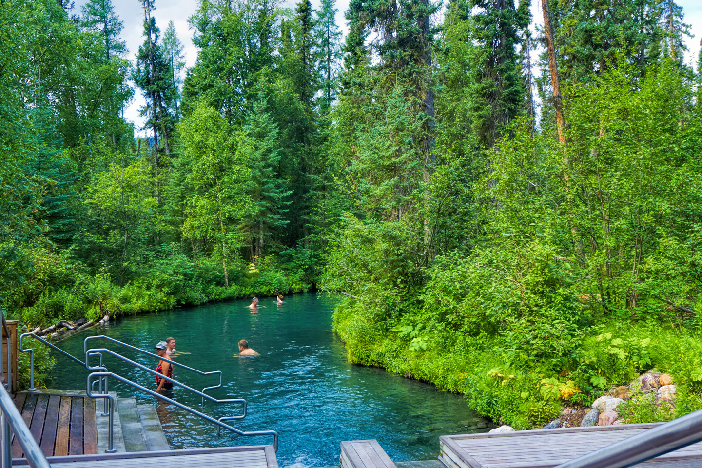
Liard River Hot Springs Provincial Park, northern British Columbia
I was running low on gas so I stopped at Contact Creek—billed as the cheapest gas on the Alaska Highway. Fuel is expensive in Canada, mostly because the taxes assessed at the pump are significantly higher than in the U.S. In remote areas, you have to add in the cost of transportation, and that bumps the price per liter into the stratosphere (as much as double what it costs in the U.S.). I talked to the owner of the isolated gas station, who told me about the terrible fires still burning only 8 miles away. Scary stuff!
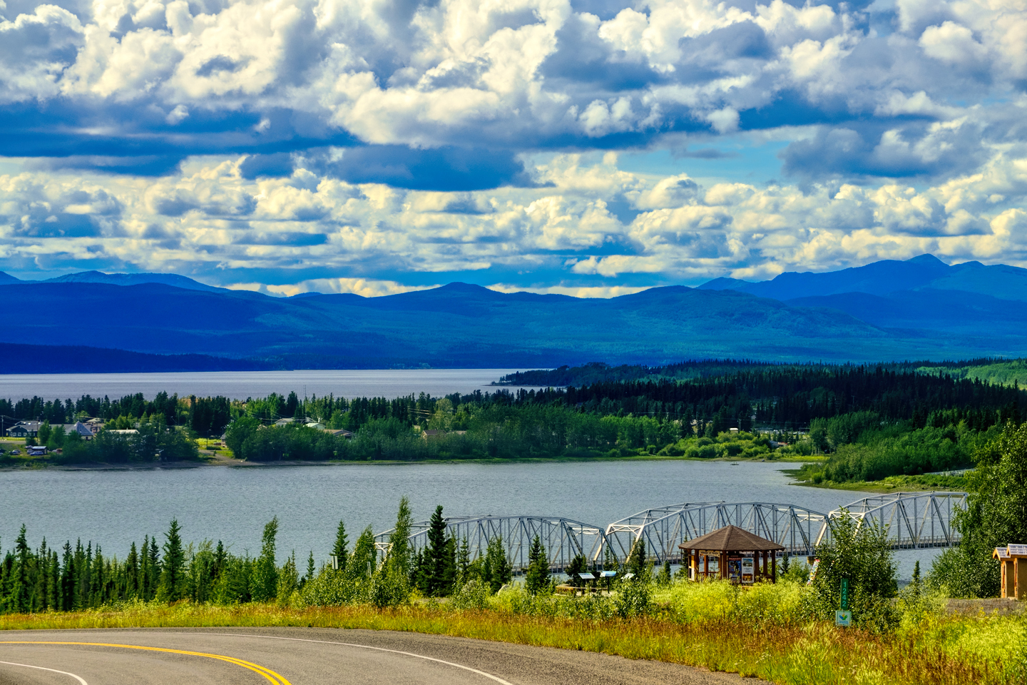
I pulled into Watson Lake at about 1:30, just as it started raining. This was nominally my goal for the day—I’d done 300 miles and I had in fact been driving 7 hours, including the stop at the hot springs, the construction delays, and the stops for photos. There on the town’s main drag, there were a couple of motels that looked a bit worn around the edges, and a couple of restaurants. The one campground was already packed cheek by jowl with RV’s.
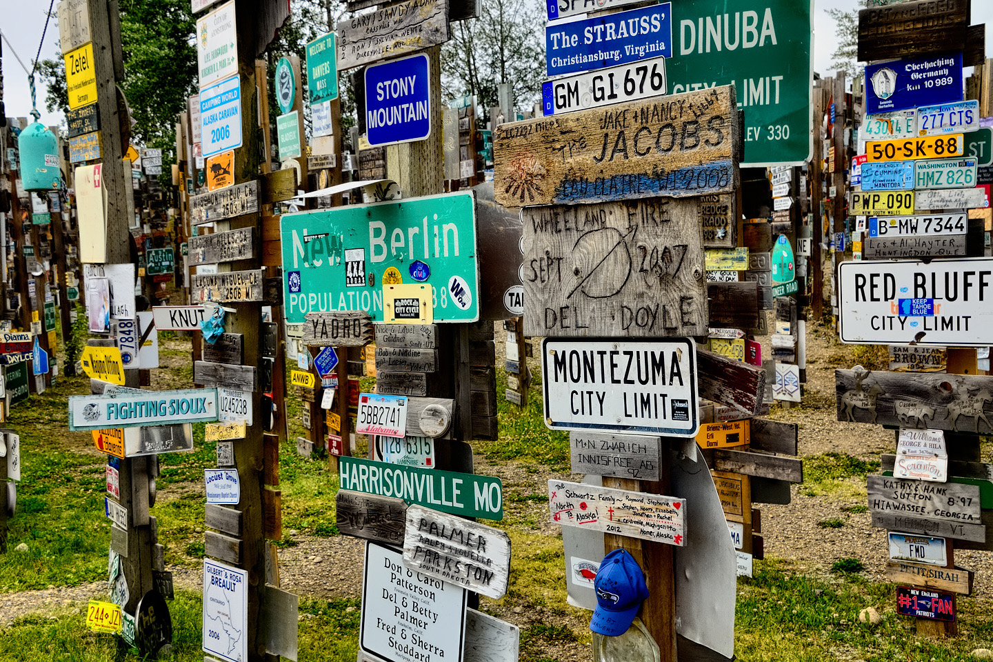
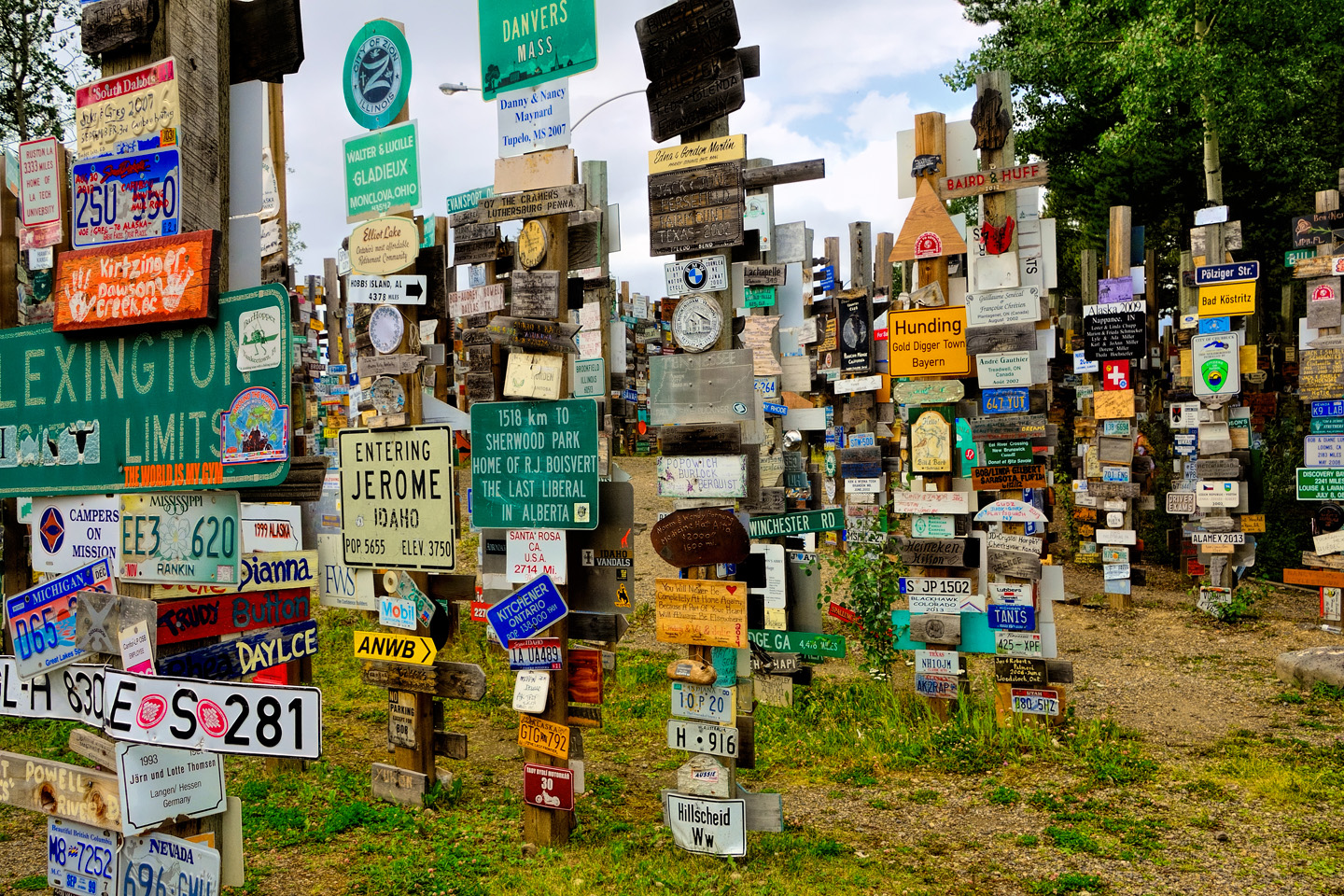
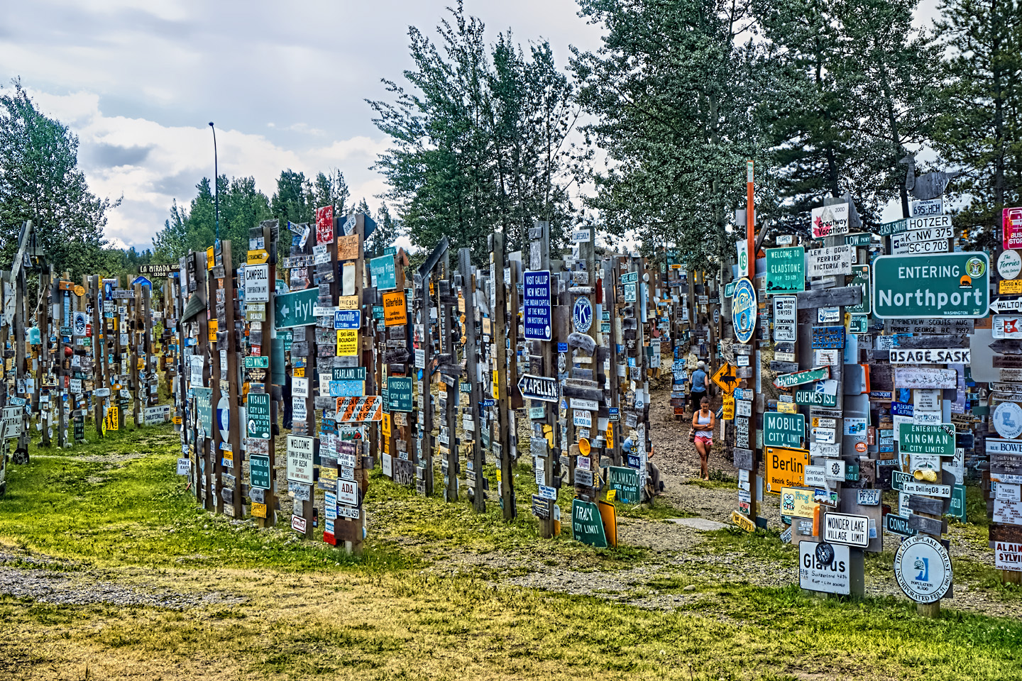
I checked out the famous sign post forest, which was started by a homesick G.I. who was part of the original road crew building the first version of the Alaska Highway during WWII. While erecting road signs for the new highway, he added a sign of his own that stated the mileage to his home town in Illinois. Others did the same, and it turned into a tradition that grew—and grew—until there were tens of thousands of road signs from all over the world, creating one of the most well-known roadside attractions on the Alaska Highway.
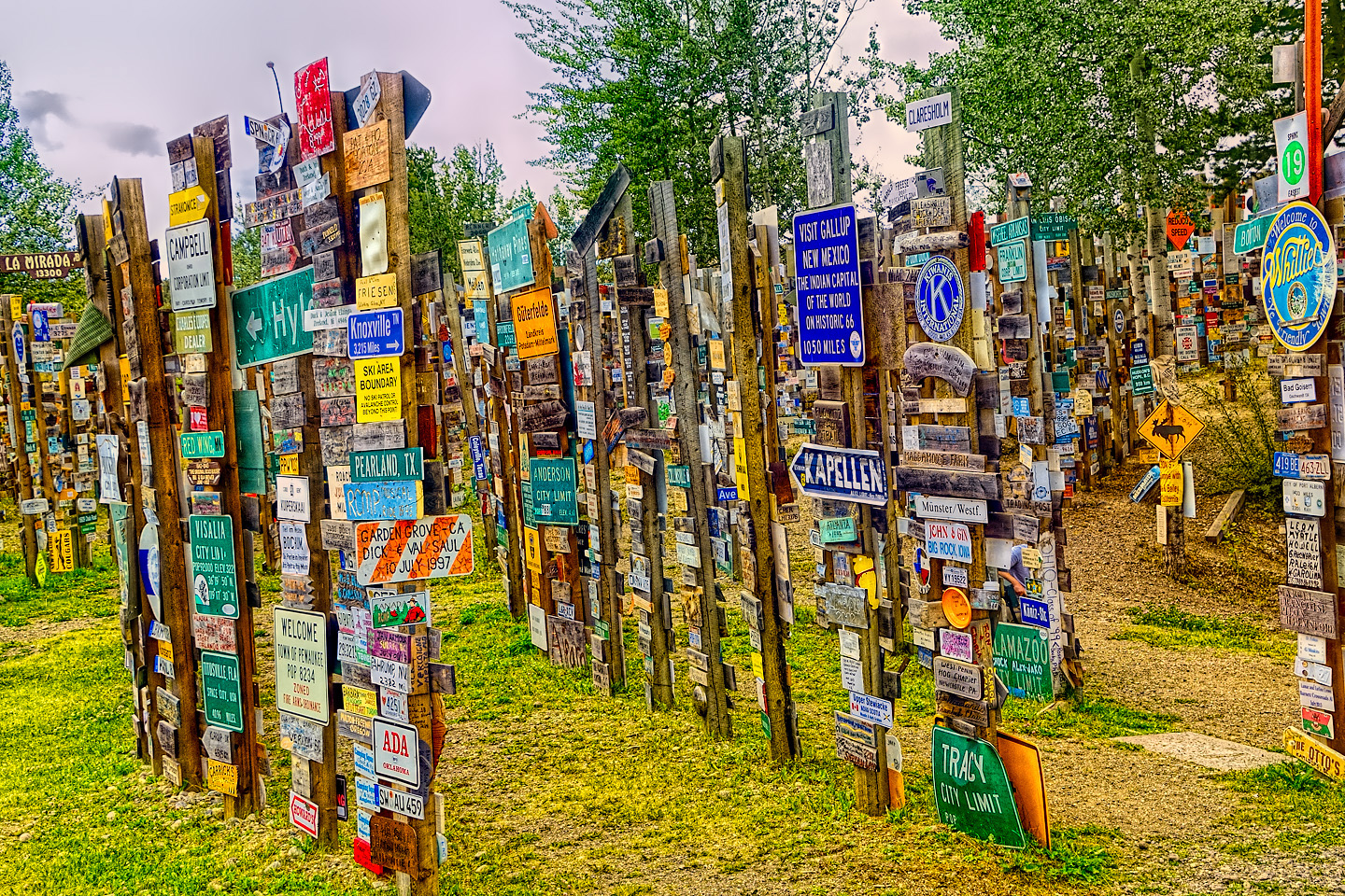
Signpost Forest, Watson Lake, Yukon
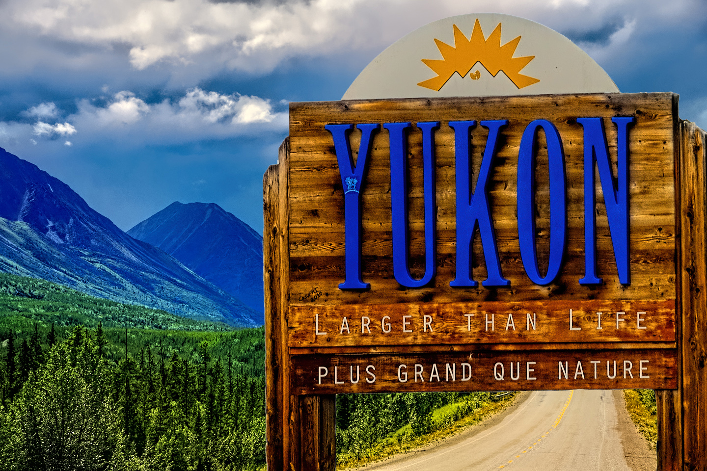
I stopped at the market, and bought some fried chicken in their little deli. My guide book told me that Whitehorse, my next recommended overnight stop, was another eight hours of driving. I asked the old guy at the counter, and he said it could be done in four hours in good weather—but that I should watch my speed at milepost 770 (or something like that), because there was a Mountie on patrol there who loved to write tickets. Since it was still pretty early, and since Watson Lake wasn’t exactly singing to me (no offense), I took a good hard look at my map. Four hours to Whitehorse was hopelessly unrealistic, but five? Maybe, and five was a lot less than eight. The rain had already stopped, and the sky was clearing. If the good weather held, I could do another five hours, and if I got too tired, I could always pull over and sleep in the Jeep. I studied the map one more time, and said “What the hell!” (Or words to that effect,) I topped up the gas tank, and drove on, into the Yukon!
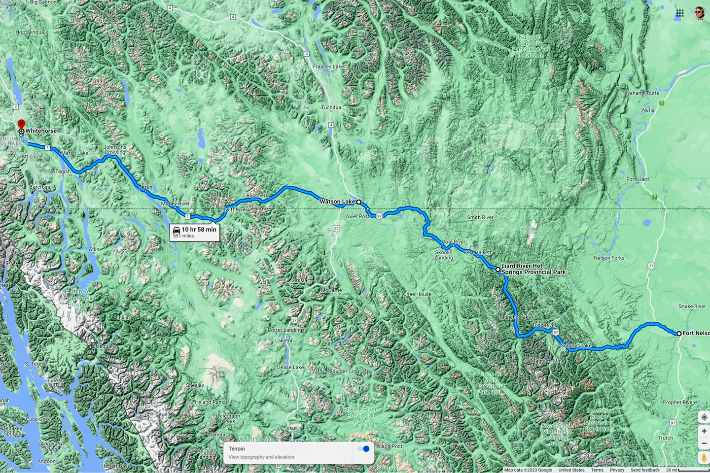
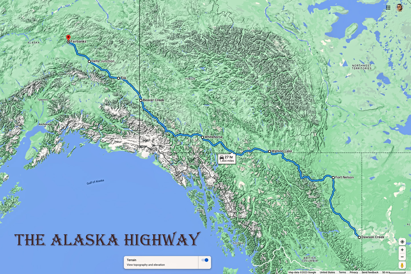
Second and Third Legs of the Alaska Highway: Fort Nelson to Watson Lake, and on to Whitehorse, 591 miles, about 12 hrs
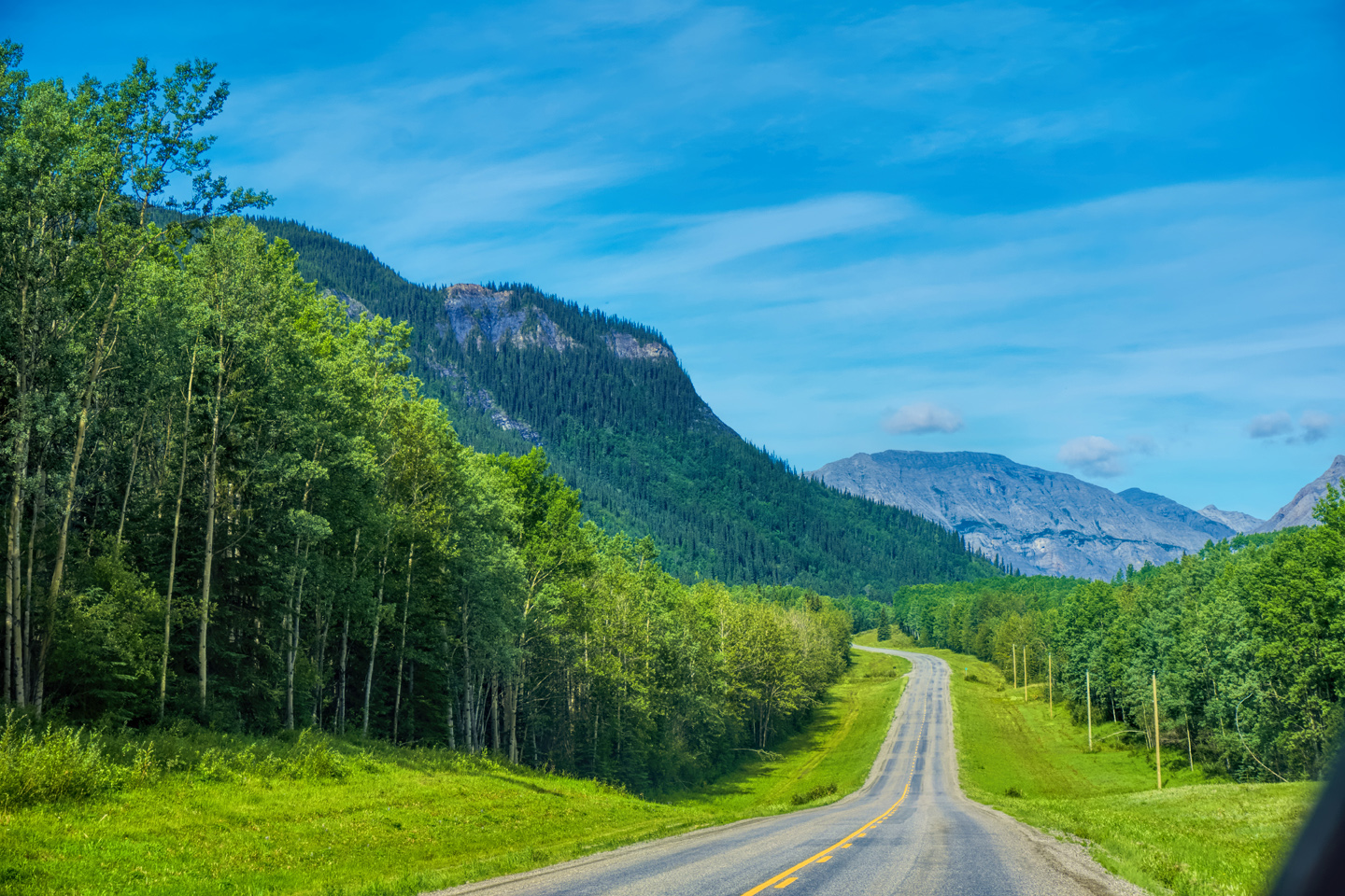
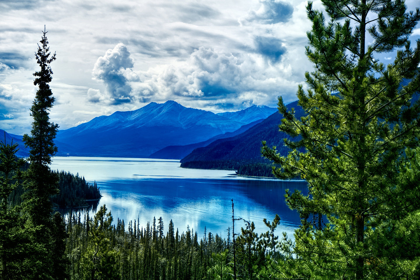
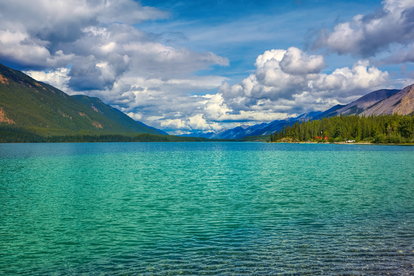
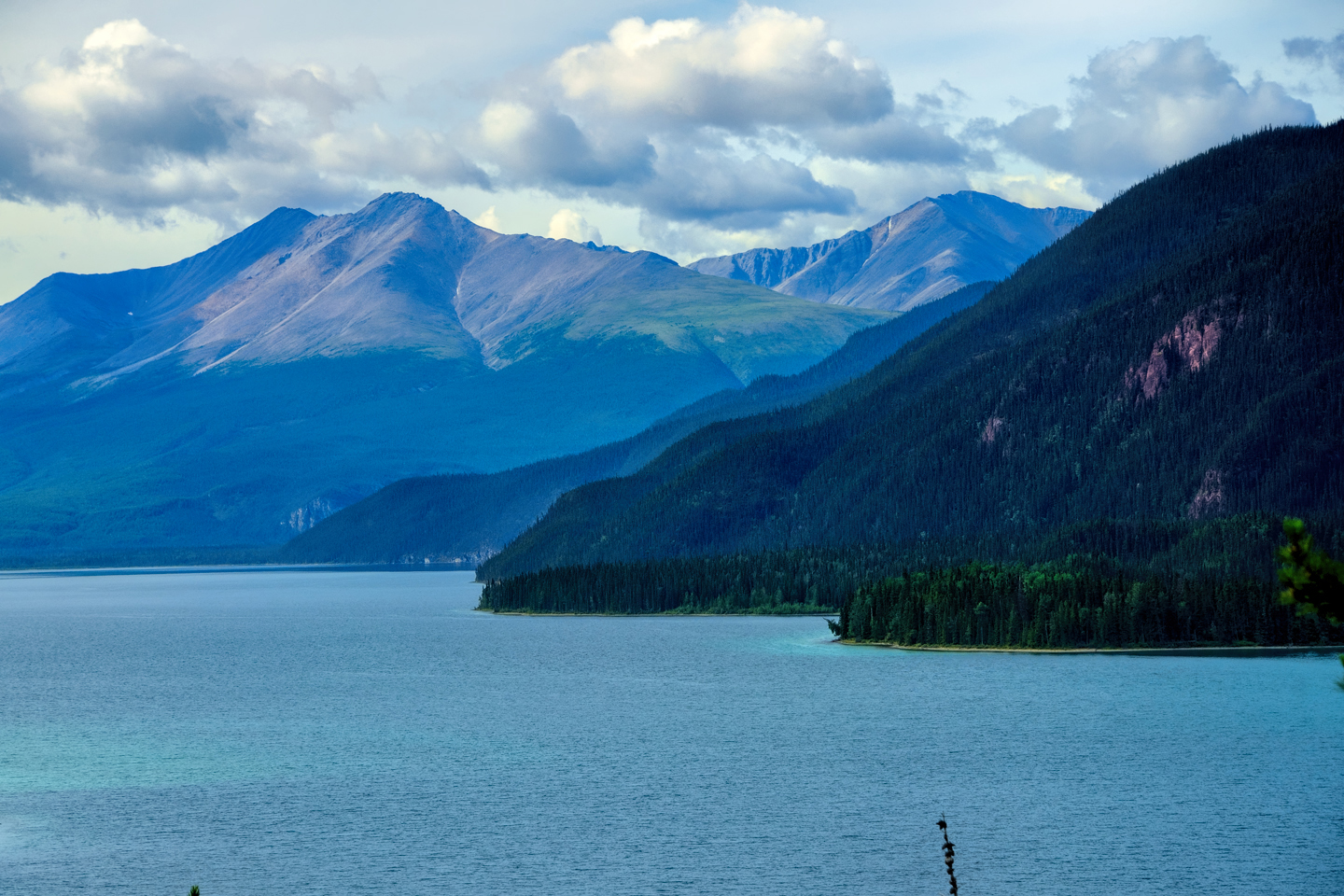
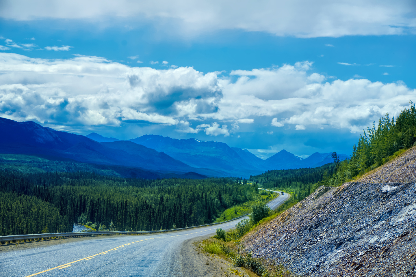
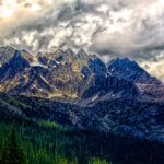
The next three hundred miles, which I fairly flew through in a bit more than 5 hours—was one of the most spectacular stretches of road I’ve ever driven–and that’s saying a LOT!
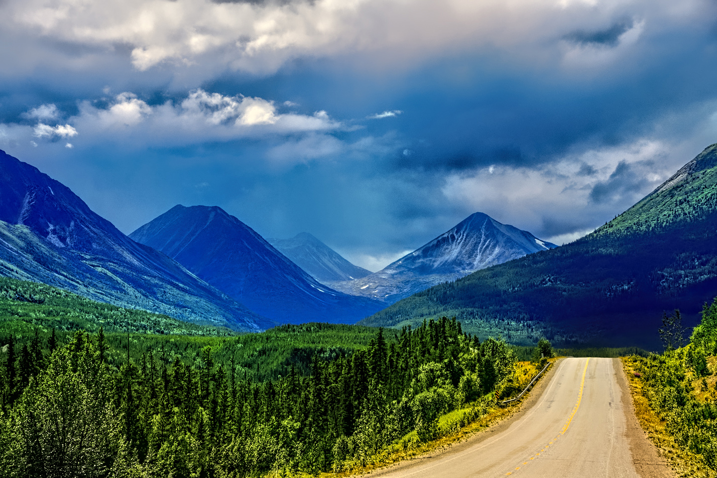
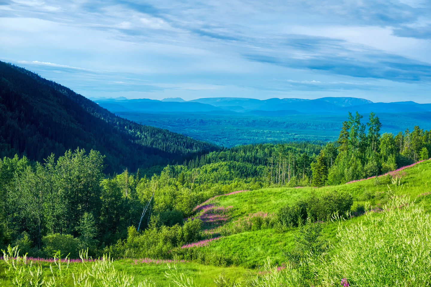
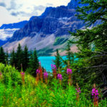
Incredible mountains with a dozen shades of green, rushing rivers, beautiful lakes…
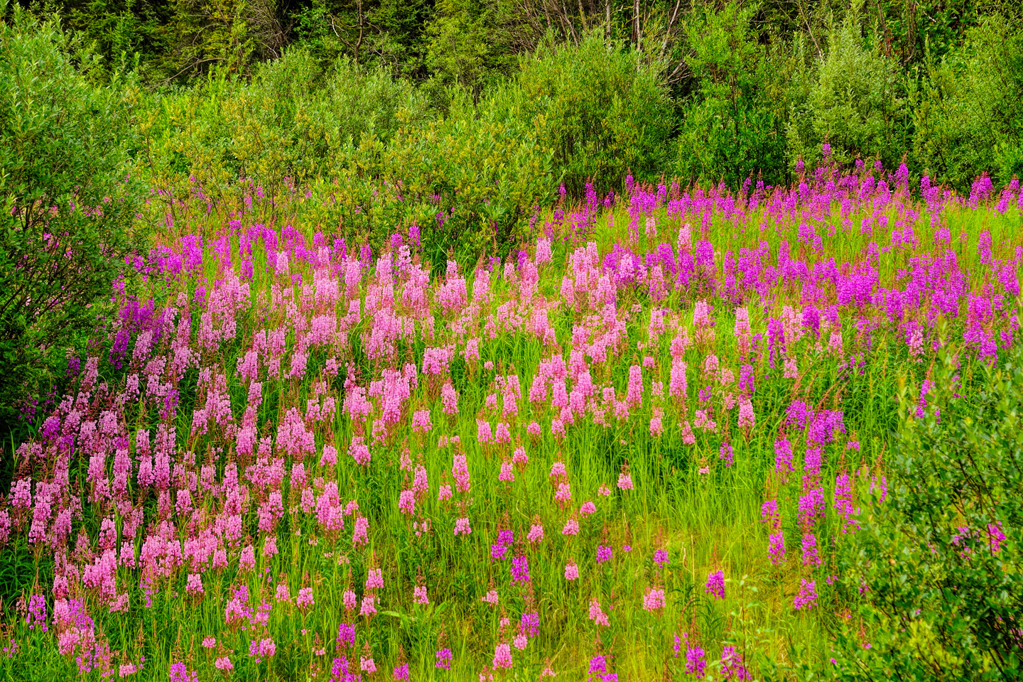
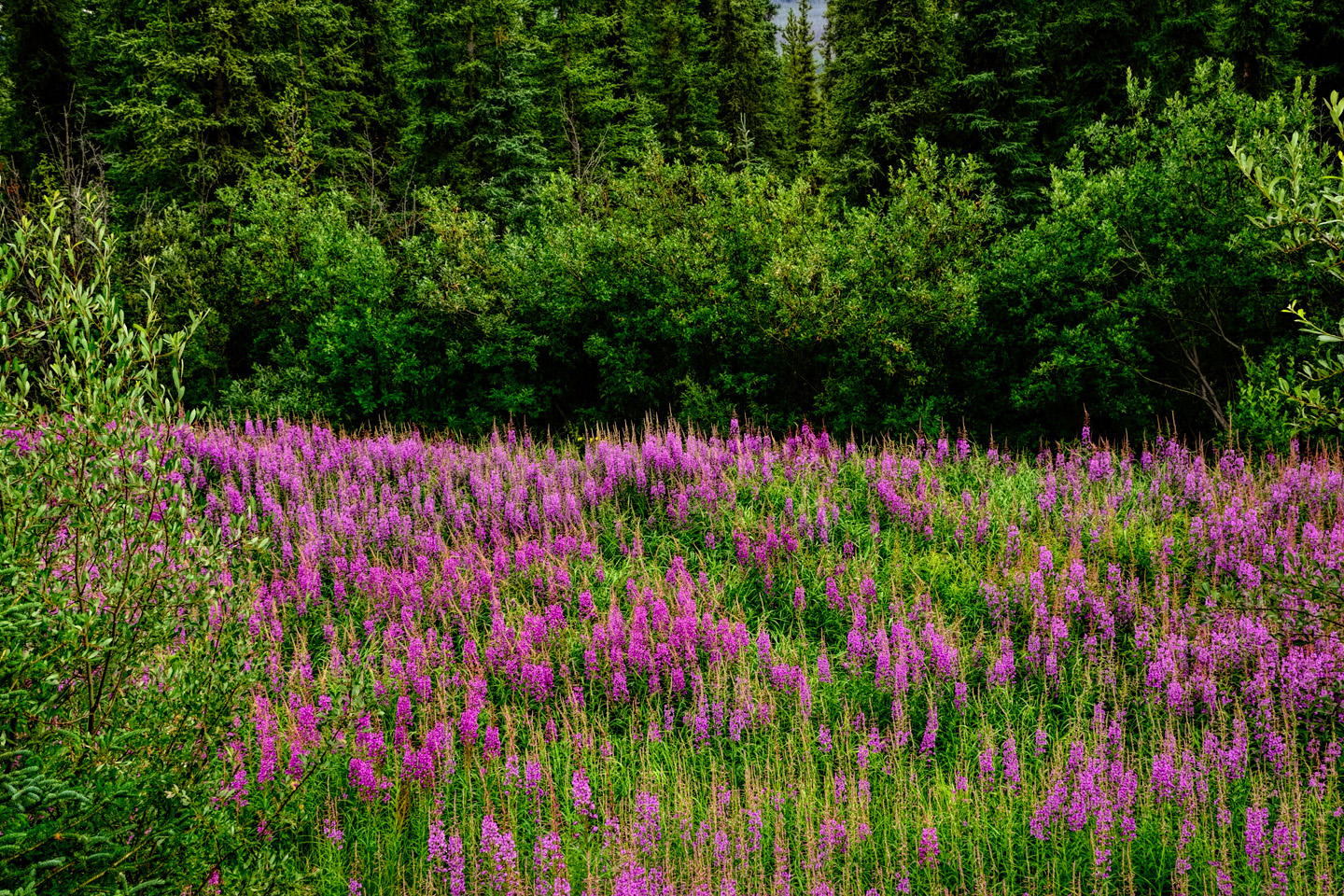
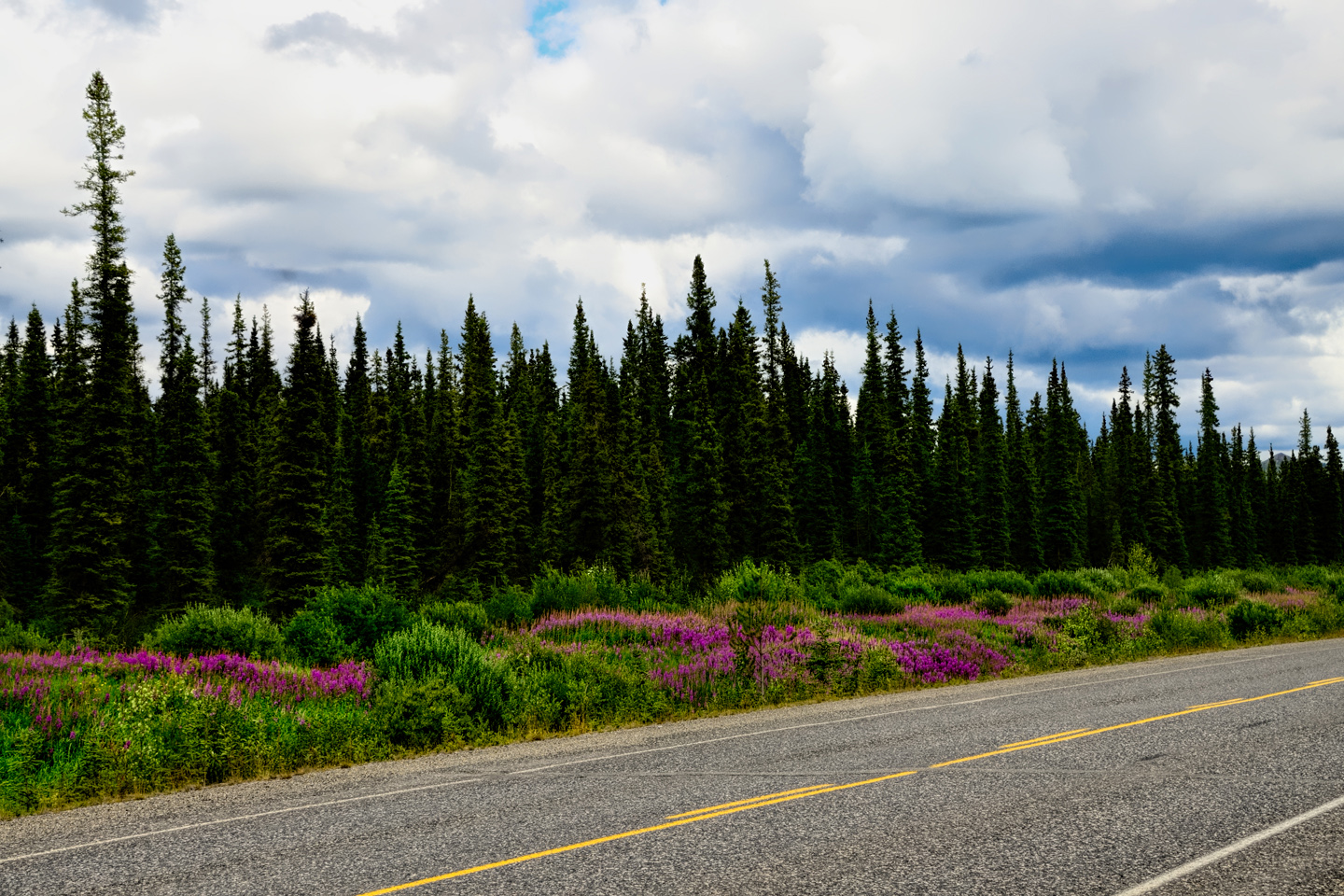
…and purple wildflowers called fireweed lining the road like cosmic landscaping, mile after mile.
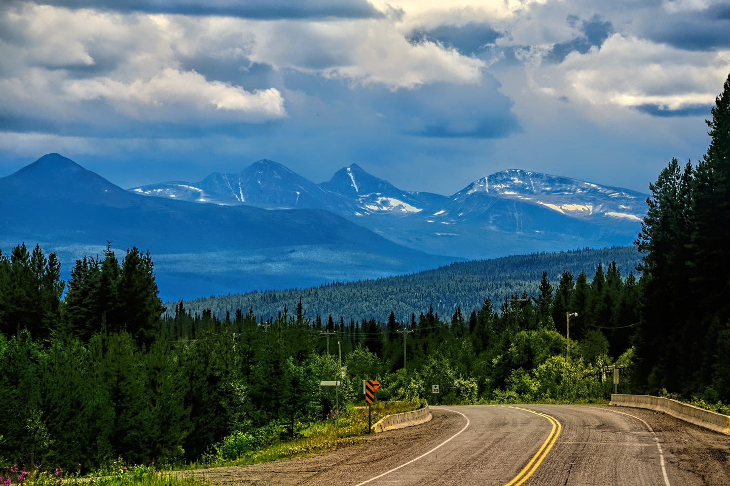
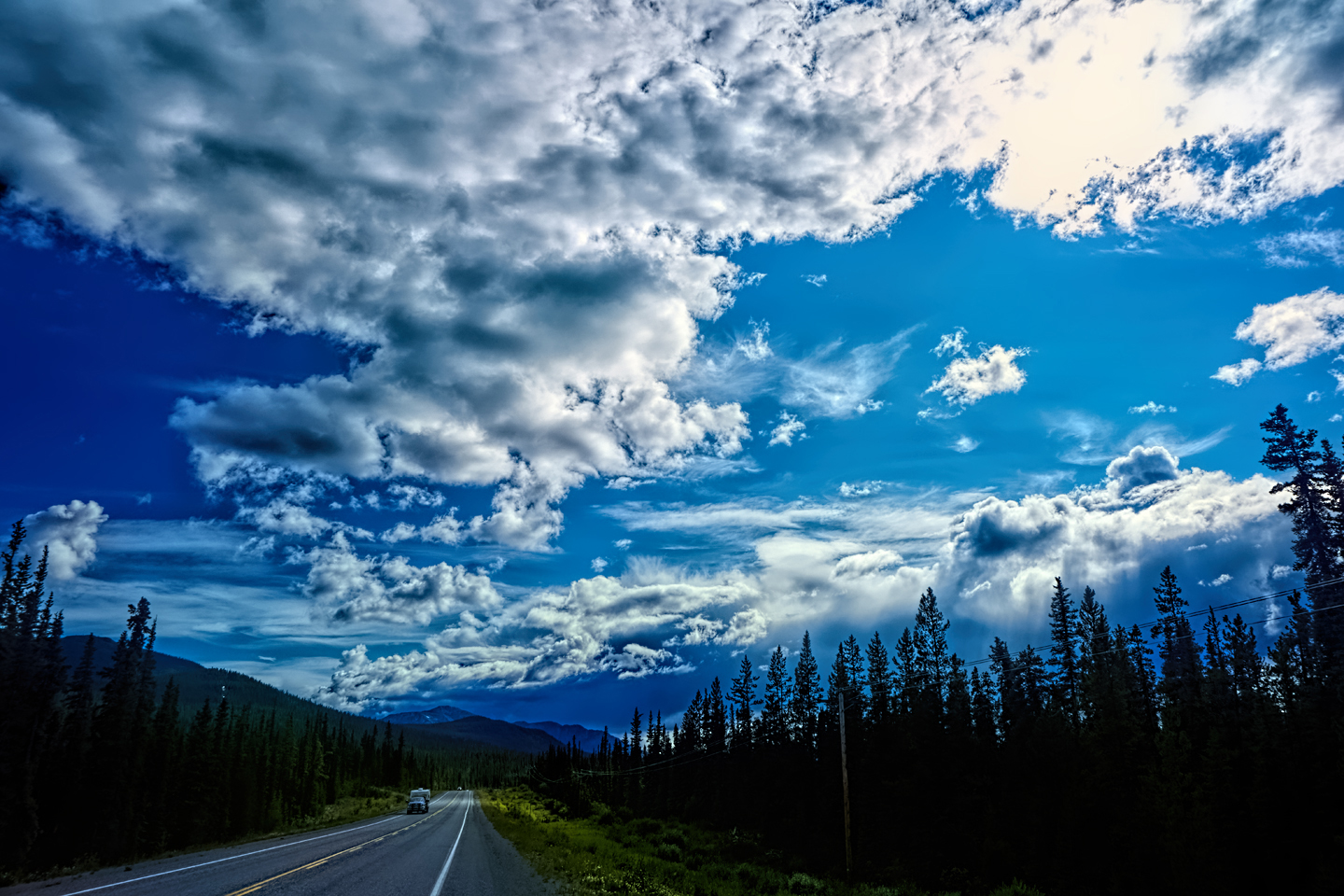
The big Yukon sky held some of the most amazing clouds I’ve ever seen!
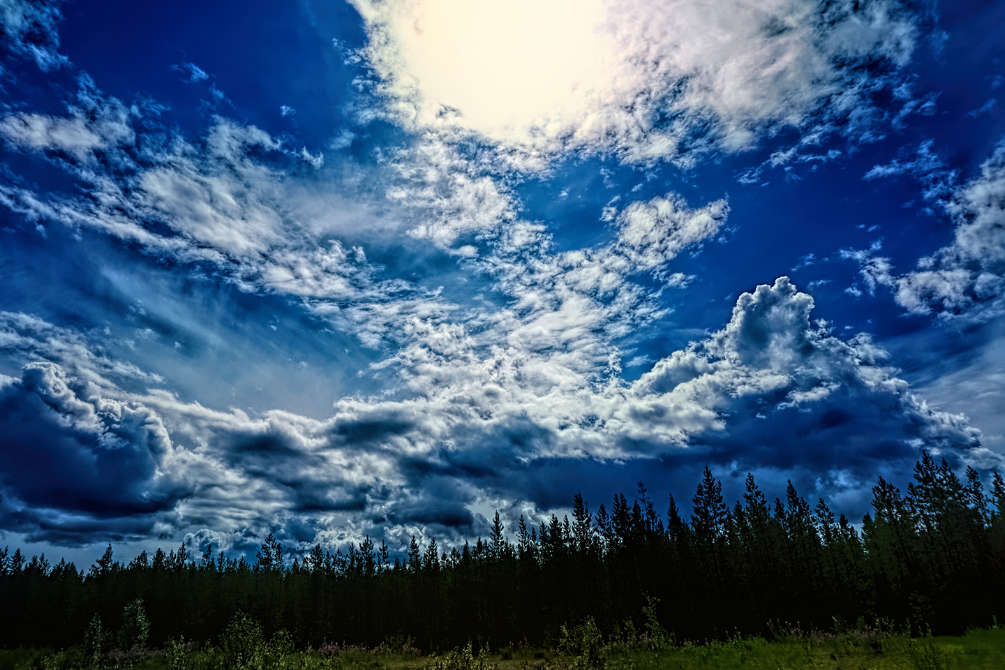
Every time I rounded a curve in the road there was another stupendous vista; it was nothing short of astonishing! I was literally yipping out loud, and a couple of times I actually pulled over and stopped while I pounded on my chest to “re-start” my heart! Made it to Whitehorse, the largest town in the Yukon, by 6:30 or so, and decided to splurge on a Day’s Inn. That’s considered a budget motel chain in the U.S., but in Canada, they’re a bit more upscale, and that turned out to be the nicest paid lodging I’d stayed in up to that point in the trip. The room set me back $159 Canadian for the night—which worked out to about $125 U.S. The hotel had real internet, so I was able to catch up on correspondence. It was great to relax after such an amazing day of driving. The room had a good set of blackout curtains, so I was able to crash at 10:00 and got a good night’s sleep. (Outside my blacked-out window, the sun didn’t go down until 11:30!) This was truly a wonderful, wonderful day—all my expectations for the Alaska Highway were not simply met, they were exceeded, in a spectacular fashion! “Awesome” is a word that gets badly overused, but in this case, it was entirely appropriate.
Between the extremely short periods of darkness and the rain that was predicted for the coming week, I realized I’d be staying in motels more often than not. That meant the trip was going to end up costing me a lot more than my original estimates, but at this point? I had no regrets whatsoever!
Click any photo to expand the image to full screen
To return to Day 1, or to continue reading the next part of the series, click the buttons below:
MORE ABOUT THE ALASKA HIGHWAY:
This is an interactive Table of Contents. Click the pictures to open the pages.
Alaska Road Trip

The Alaska Highway: Prelude: The Road to Dawson Creek
Even if you start in Seattle, the closest American city, it’s still more than 800 miles to Dawson Creek, wending your way that much further north, so far north that there will be a noticeable change in the hours of daylight. It’s the latitude that distinguishes the north country, including every bit of Alaska. Dawson Creek is where it all begins.
<<CLICK to Read More>>

The Alaska Highway: Day 1: Dawson Creek to Fort Nelson
Past Fort St. John, the terrain got a lot wilder. No more towns, very few people, and very little traffic. Saw a few U.S. license plates, Michigan, California, Oregon, South Carolina; people that were obviously headed to Alaska!
<<CLICK to Read More>>

The Alaska Highway: Day 2: Fort Nelson to Whitehorse
Every time I rounded a curve in the road there was another stupendous vista; it was nothing short of astonishing! I was literally yipping out loud, and a couple of times I actually pulled over and stopped while I pounded on my chest to “re-start” my heart!
<<CLICK to Read More>>

The Alaska Highway: Day 3: Whitehorse to Beaver Creek
Approaching the mountains, I started pulling over with serious frequency, taking LOTS of photos! Mountains, clouds, lakes, flowers—I was pretty sure I must have died and gone to heaven, but I couldn’t for the life of me remember the fiery crash.
<<CLICK to Read More>>

The Alaska Highway: Day 4: Beaver Creek to Fairbanks
Delta Junction, the end of the Al-Can, was only 200 miles away, and the border? Twenty miles, maybe half an hour, and I was finally going to cross into Alaska! I’d been on the road more than three weeks, and in just half a day more, I’d be in Fairbanks.
<<CLICK to Read More>>

Chena Hot Springs: A Fairbanks Original
The Chena hot spring puts out steaming water at a temperature of 150 degrees, producing enough power to meet all the needs of the resort, as well as filling the hot springs pools used by the guests. In addition to the lodge and restaurant, they offer camping and horseback riding, and they have exhibits featuring sled dogs, greenhouses, ice sculptures, and geothermal energy.
<<CLICK to Read More>>

Two-Foot High Kick: World Eskimo Indian Olympics
Contestants take a running leap, then they make this crazy jackknife move, touch the ball suspended high above the floor with both feet, then come back down and stick the landing. If that sounds difficult? You have no idea.
<<CLICK to Read More>>

Dreaming of Denali
When I drove my Jeep to Alaska that first summer after I retired, my main goal, the single most important thing I wanted to do, was to see Denali, the biggest mountain in North America.
<<CLICK to Read More>>

Follow the Fireweed
Visualize a summertime journey through that part of the world, a world filled with mountains and glaciers and boreal forests, ice blue rivers, turquoise lakes, and billowing clouds that fill the sky. Imagine your vision as a beautiful piece of music. The fundamental, underlying theme of that symphony would be a gently rising swell of perfect harmony, pinkish lavender in its hue.
<<CLICK to Read More>>

There’s nothing like a good road trip. Whether you’re flying solo or with your family, on a motorcycle or in an RV, across your state or across the country, the important thing is that you’re out there, away from your town, your work, your routine, meeting new people, seeing new sights, building the best kind of memories while living your life to the fullest.
Are you a veteran road tripper who loves grand vistas, or someone who’s never done it, but would love to give it a try? Either way, you should consider making the Southwestern U.S. the scene of your own next adventure.
A few years ago I wrote a book about road trips in Arizona and New Mexico that’s a lot like this website, packed with interesting information, and illustrated with beautiful photographs. Check it out! You can find it on Amazon, and at all other major booksellers.

ALASKA ROAD TRIP:
MEXICAN ROAD TRIP (IN THE LAND OF THE MAYA):
ARIZONA AND NEW MEXICO:
SOUTH AMERICA:
PHOTOGRAPHY:
TRIBAL LANDS:

Recent Comments