Click Maps and Photos for an expanded view.
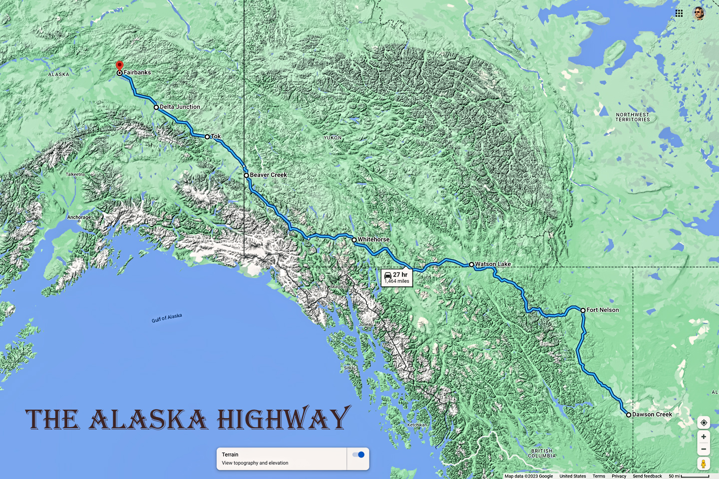
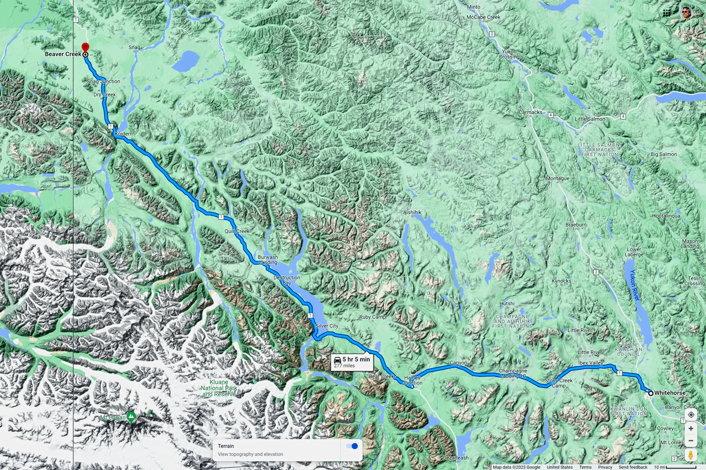
Most travel guides divide the trip from Dawson Creek to the Alaska Border into four segments, allowing a full day for each. I went a little crazy on my second day, driving from Fort Nelson all the way to Whitehorse, instead of stopping for the night in Watson Lake. That put me a whole day ahead of schedule–but as I kept telling myself, I didn’t really HAVE a schedule, and after 35 years working a day job, I rather liked that idea. Whitehorse put me in striking distance of the border: Beaver Creek, the last town in Canada, was less than 300 miles away, and Fairbanks was less than 300 miles further.
I woke up early on that third day—despite the blackout curtains at my expensive motel, and despite my exhaustion from driving almost 600 miles the day before. I was anxious to get going, but I wanted to at least process a few photos from the day before, and hopefully send a few emails. (As an aside: digital photos don’t really require processing, but my roots as a photographer date back to the days of 35mm film and wet darkrooms, so I have a tendency to think in those terms. When I shoot digital, I use software to balance the color, then I convert the RAW image files into a user-friendly jpg format before shrinking them down to a size suitable for sharing). Unfortunately, the Canadian version of my email service was completely different from what I was accustomed to, and I couldn’t figure out how to attach photos (which was the whole point of sending out the emails). So much for that! I checked out of the hotel at about 9:00, and after a quick bite to eat and some coffee, I stopped at a “full service” service station. They checked my oil and tires and all of that, had to add at least a quart of coolant; my windshield washer fluid reservoir was nearly empty, so they filled it, and then sold me a bottle to take along with me. I gratefully tipped the pump jockey (attendant) because he’d been so efficiently helpful. When I started the Jeep, the “check engine” light came on, and wouldn’t go off. That worried me a little, as I was about to head off on one of the most remote sections of the Al-Can, and it was still 600 miles to Fairbanks. I asked the mechanic at the service station, and he said my best bet would be to take it to a Jeep dealer!?
Luckily for me, Whitehorse actually had a Jeep dealership, the only one in the Yukon Territory, and it was right around the corner on the next block! Somebody was definitely watching over me, because, seriously, what are the odds? I drove over there, more than a little nervous. The service writer was super cool. He dropped what he was doing and took his scanner out to my Jeep in the parking lot, plugged it in under the dash, and read the error codes. “Had any battery trouble?” he asked me. I told him about the electrical problem the day before, when the accessories shut down. “That’s it,” he said. “It’s a glitch in the system. No worries—just be careful and have a safe trip.” No problem, no charge. And! When I started the vehicle, the warning light went out, like magic, and with that, I drove off toward Alaska.
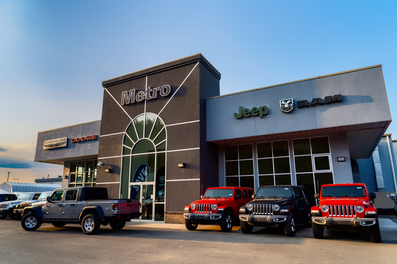
Metro Chrysler Ltd., Whitehorse, Yukon; they have my endorsement as the most helpful service department I’ve ever encountered!
(Another aside: I worried about that electrical problem for the rest of the trip, but, thankfully, it never recurred. A year later, long after the trip ended, I got a recall notice in the mail from Chrysler. Seems the ignition switch was defective on that model of Jeep, and would sometimes stick in the wrong position after starting, causing the very problem that had happened to me: engine running, all accessories inoperable. They replaced the switch and both of my key fobs, and all has been well ever since.)
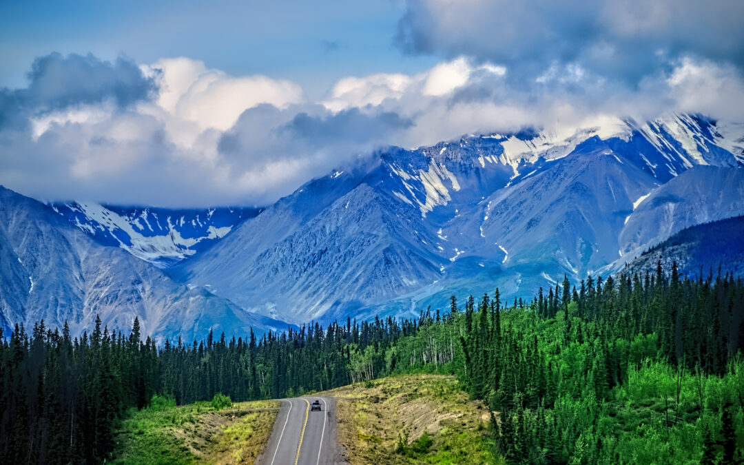
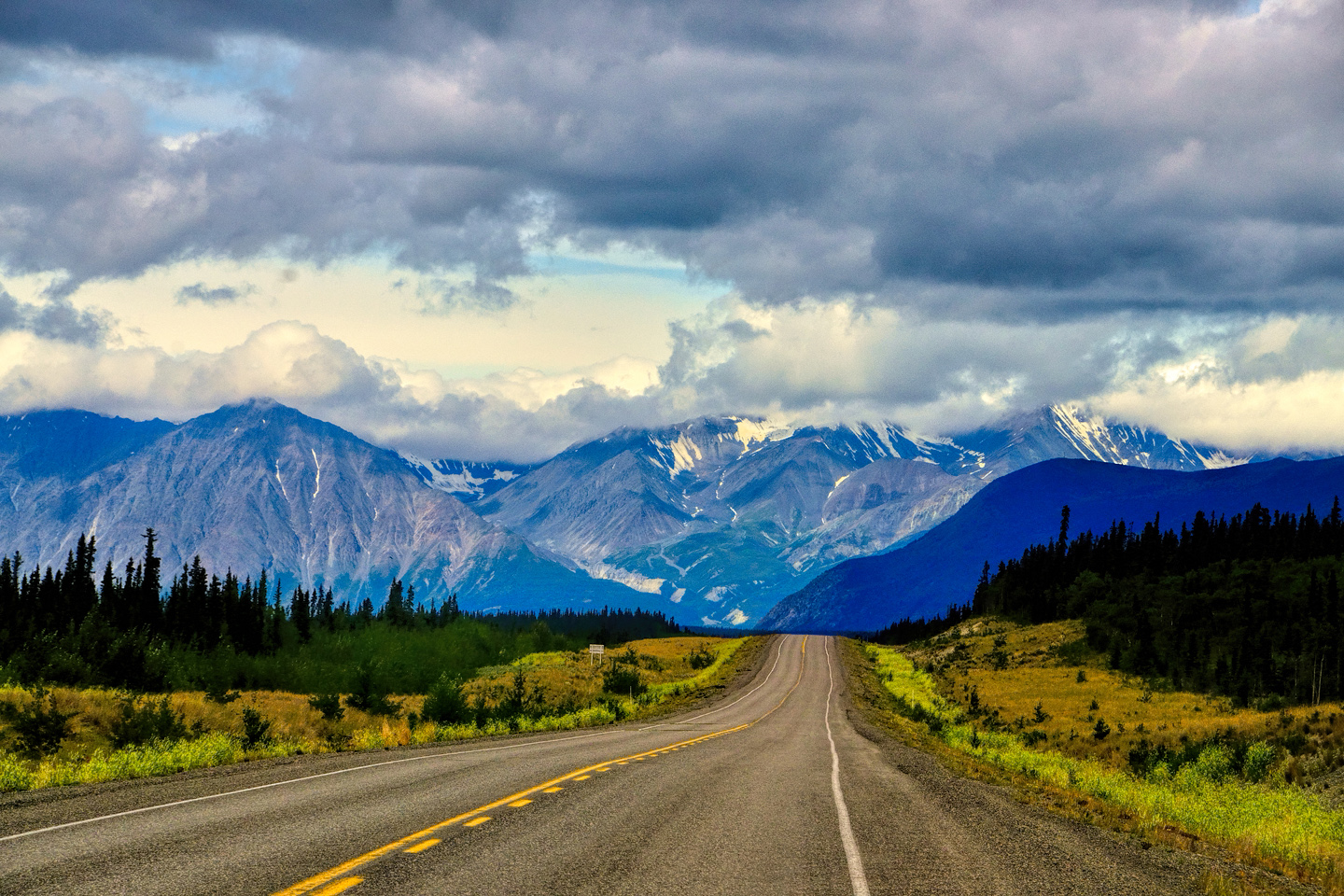
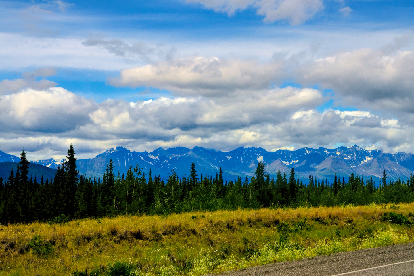
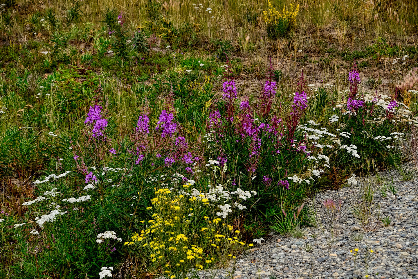
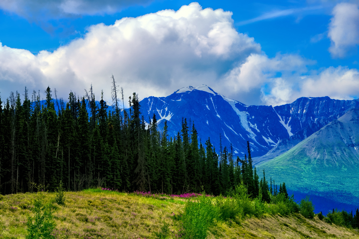
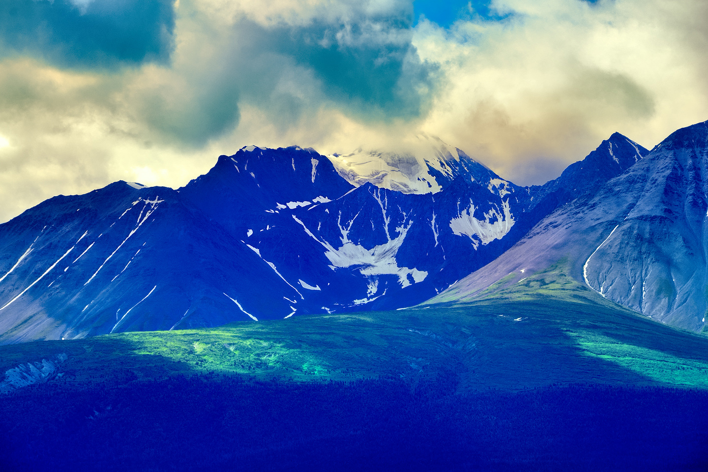
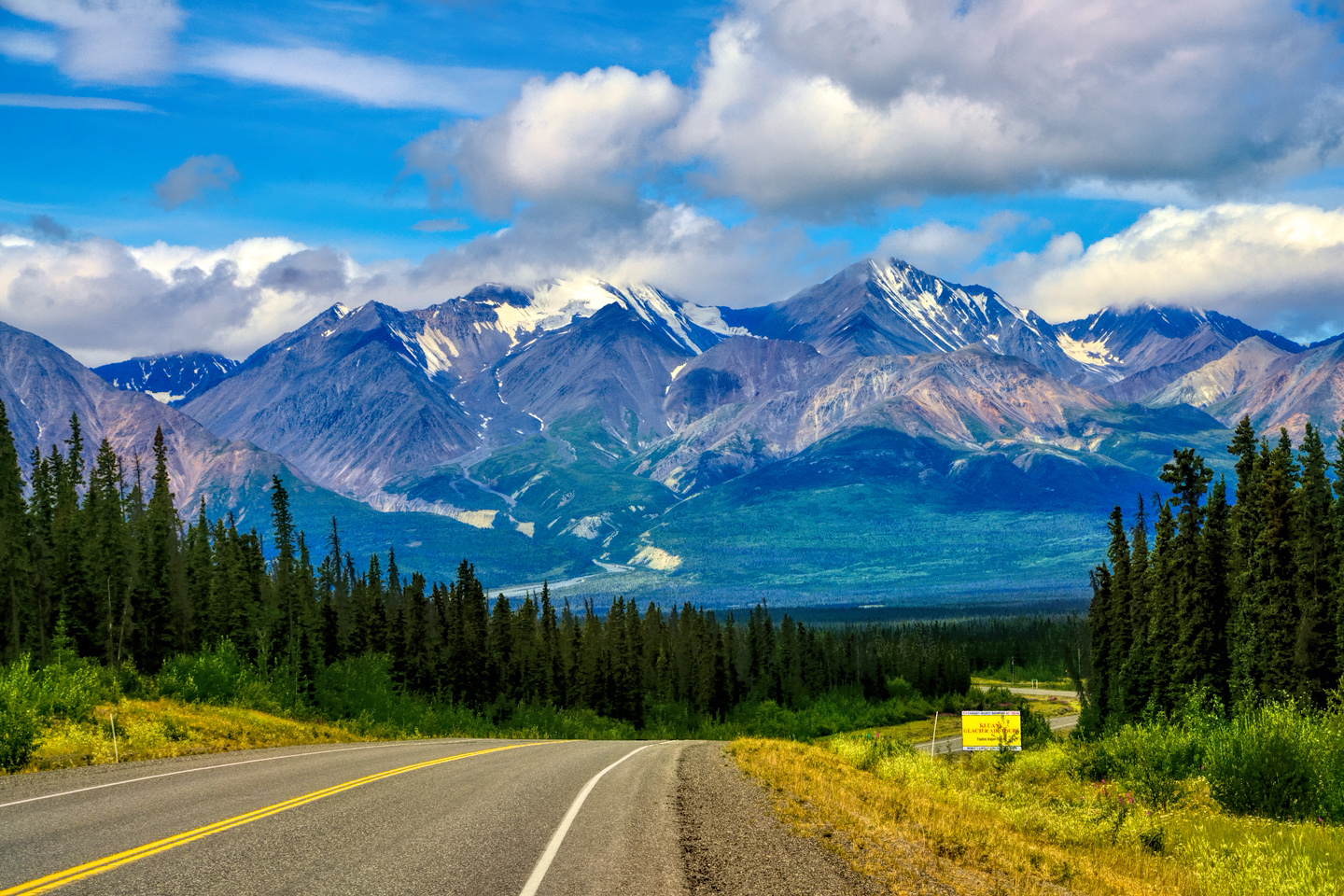
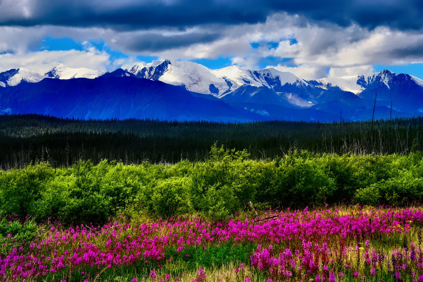
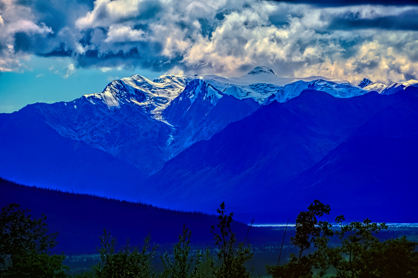
The road was incredible—easily as amazing as the day before, with the snow-capped peaks of the Wrangell-St. Elias range dominating the horizon, more fireweed lining the road on both sides—more wildflowers than I’ve ever seen—they were literally everywhere! I started to fade a little bit after just an hour, my eyes getting droopy, so I pulled over at a rest stop to splash some water on my face. All those miles, day after day, were starting to stack up on me, but it was much too early to give in to fatigue.
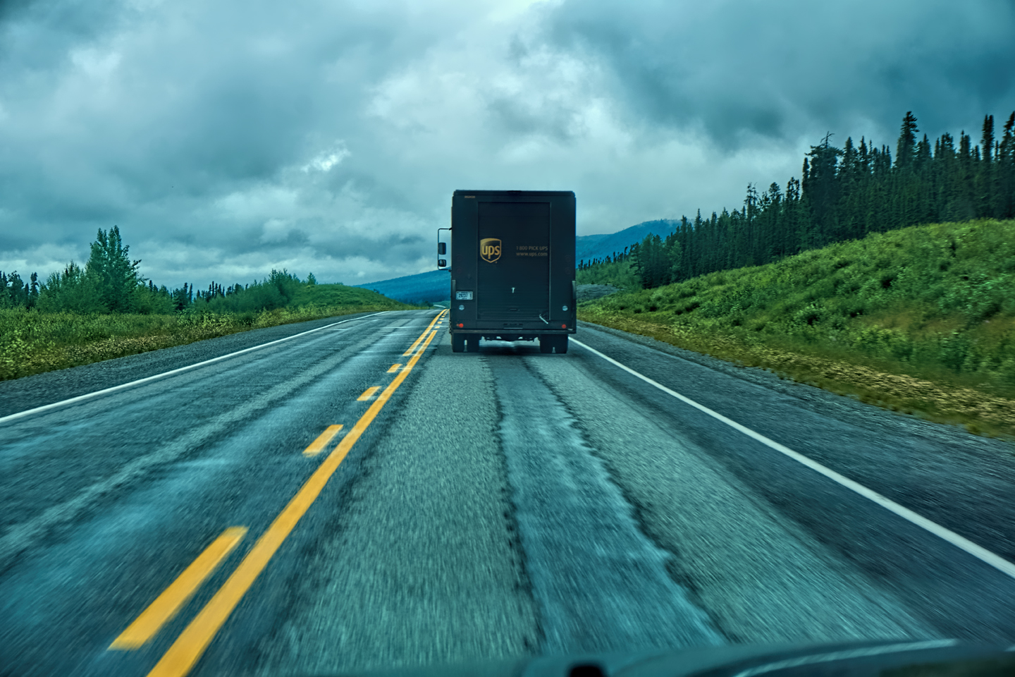
A big brown UPS truck pulled in just after me and the driver, who was not in uniform, got out. I’d passed several UPS trucks on remote sections of the highway and wondered how it could be economically feasible for UPS to travel such long, empty stretches of road with their delivery vehicles. Turned out the driver didn’t even work for UPS, and he wasn’t delivering packages—he was hired to deliver the truck from the factory in Indiana to Fairbanks, because that was the cheapest way for them to get it there. Pretty wild! I talked to him for at least 20 minutes—he was an interesting guy. Thankfully, the conversation pretty well woke me up, so off I went again.
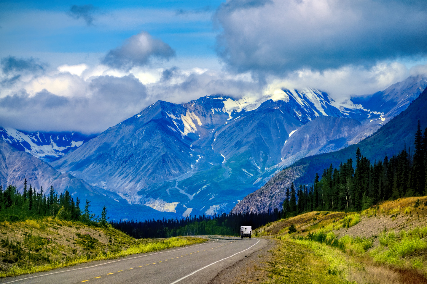
Approaching the mountains, I started pulling over with serious frequency, taking LOTS of photos! Mountains, clouds, lakes, flowers—I was pretty sure I must have died and gone to heaven, but I couldn’t for the life of me remember the fiery crash. I made many U-turns to snap photos of stuff I’d just passed. I wasn’t in a hurry, and I got some great pictures.
This was the Alaska Highway, and it truly was larger than life!
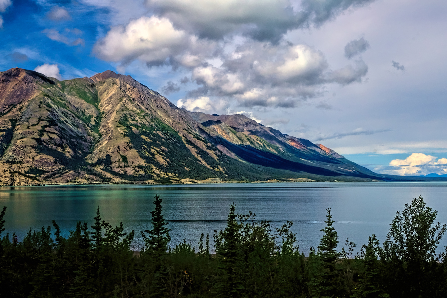
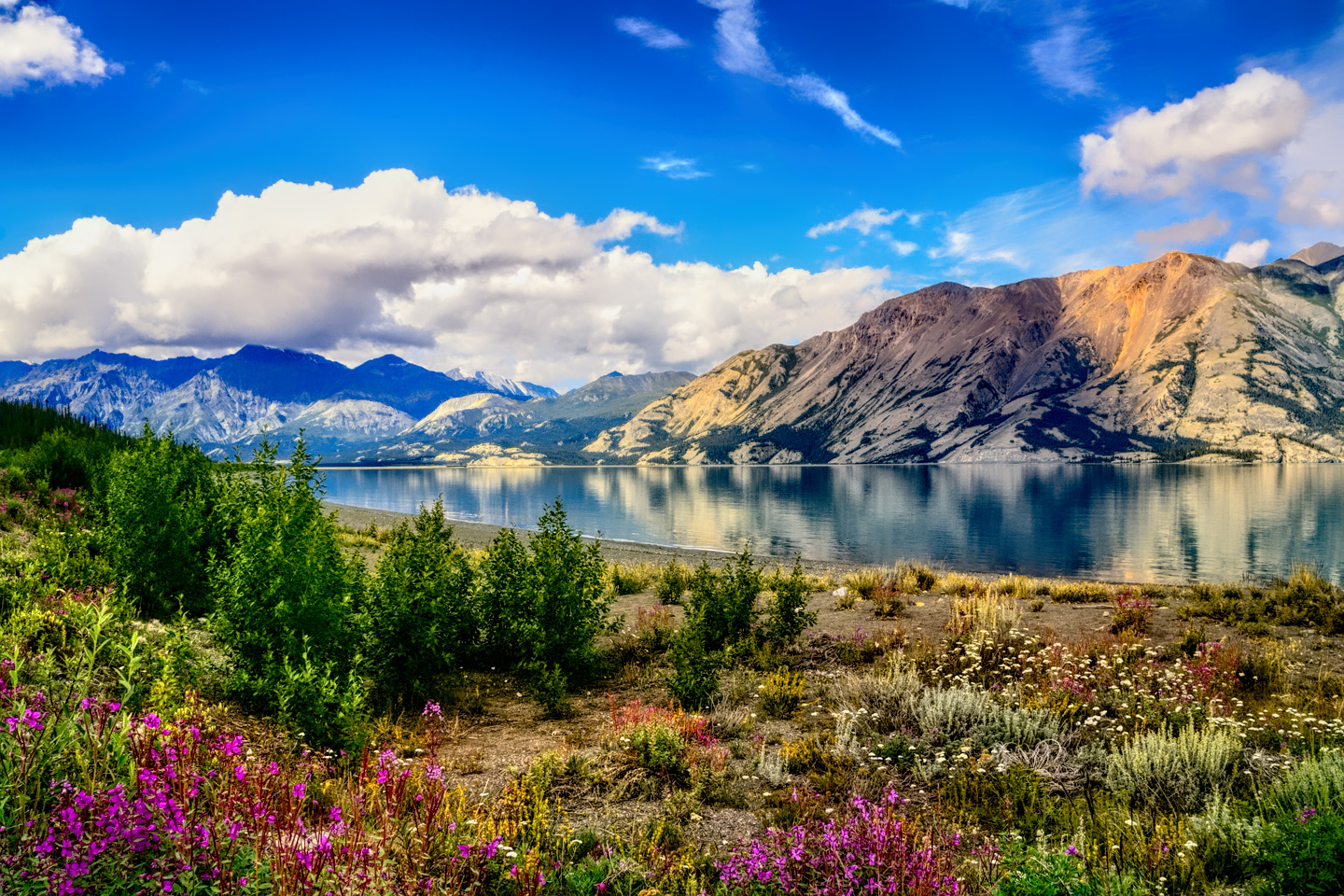
After Haines Junction I entered Canada’s Kluane National Park—which was absolutely stunning. There was a huge turquoise colored lake, and at a bend in the road, I spied a perfect photo op—mountains and clouds reflected in the still clear water of the lake, what you call a money shot (complete with fireweed)!
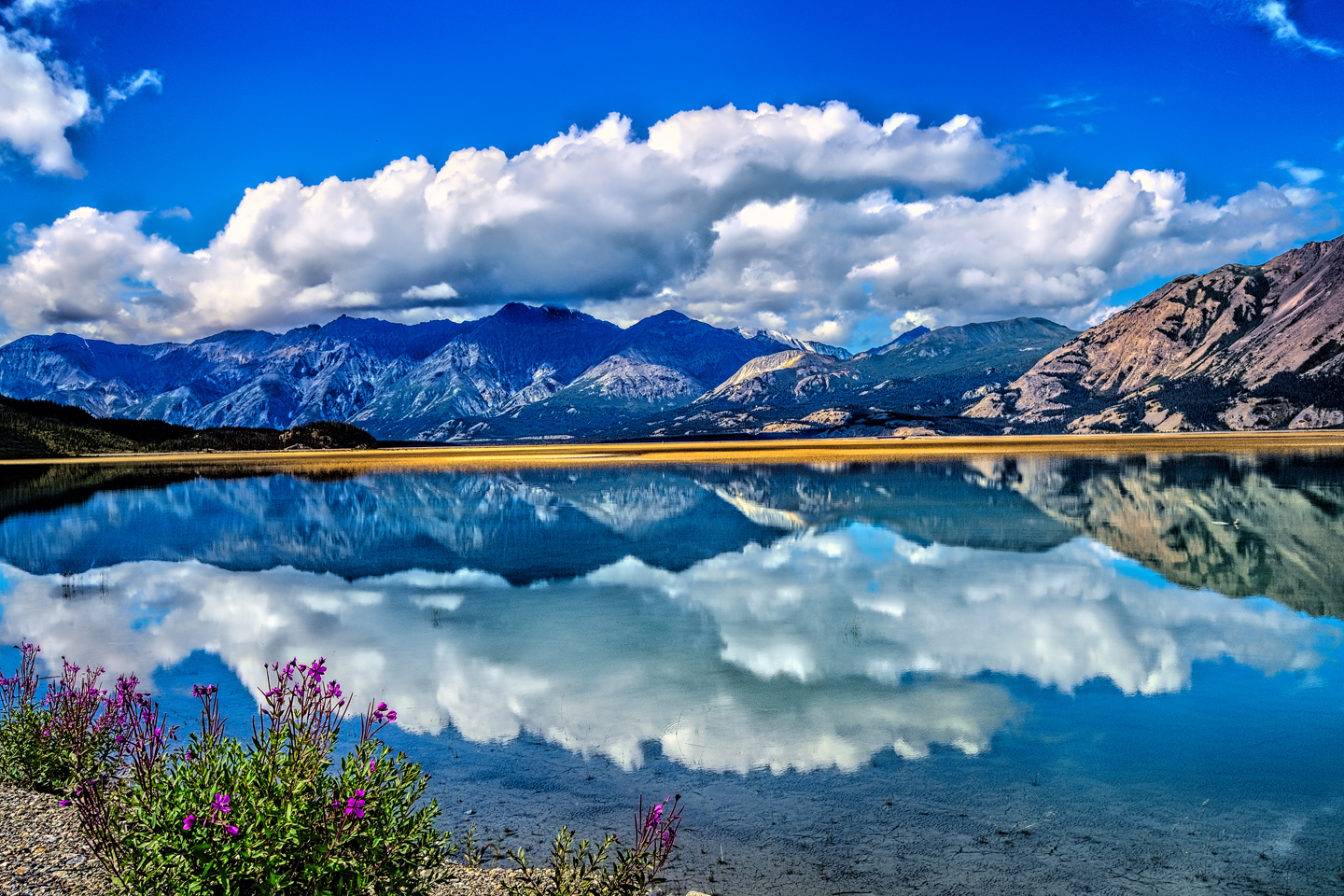
Approaching Kluane Lake, in Kluane National Park, largest lake in the Yukon Territory
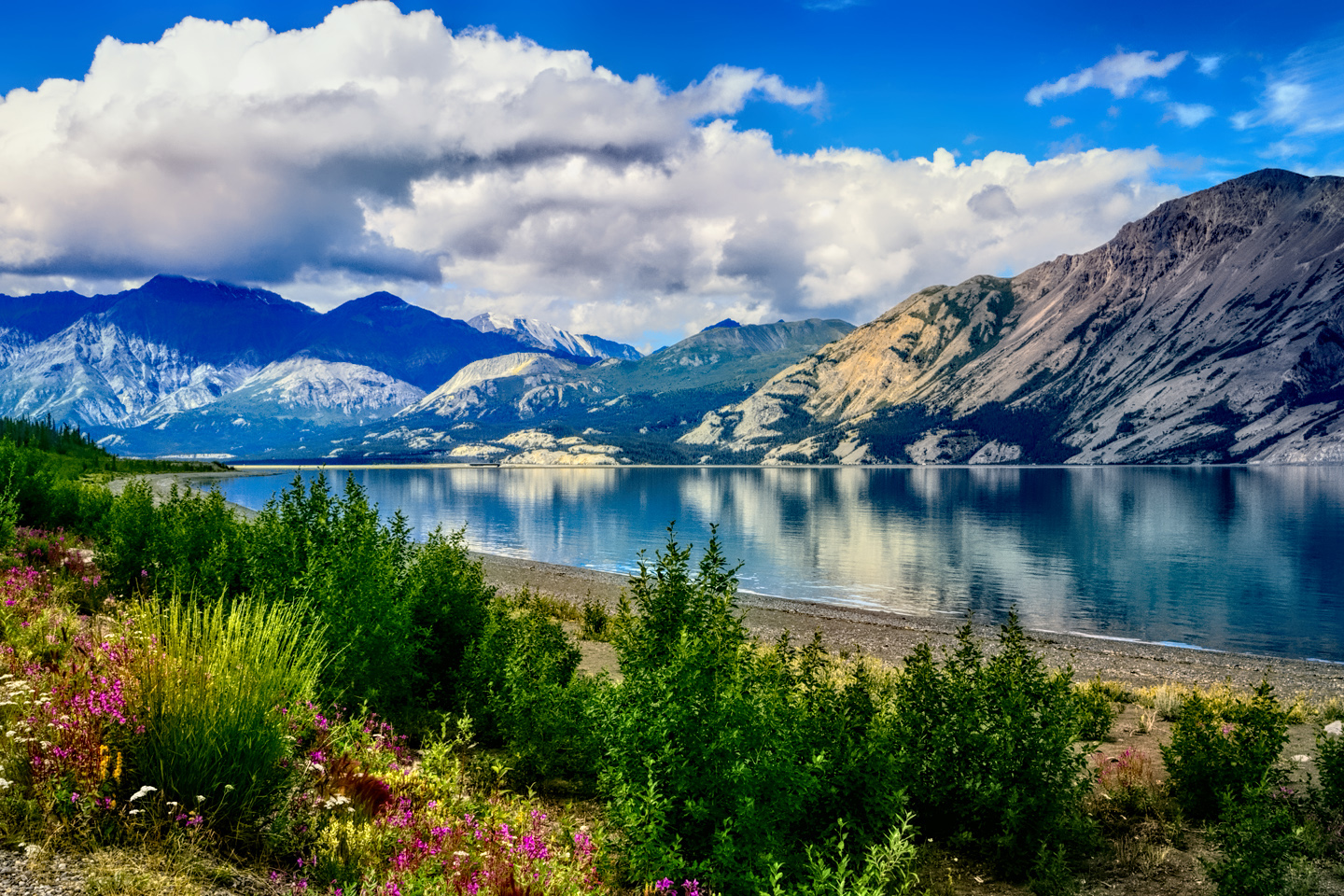
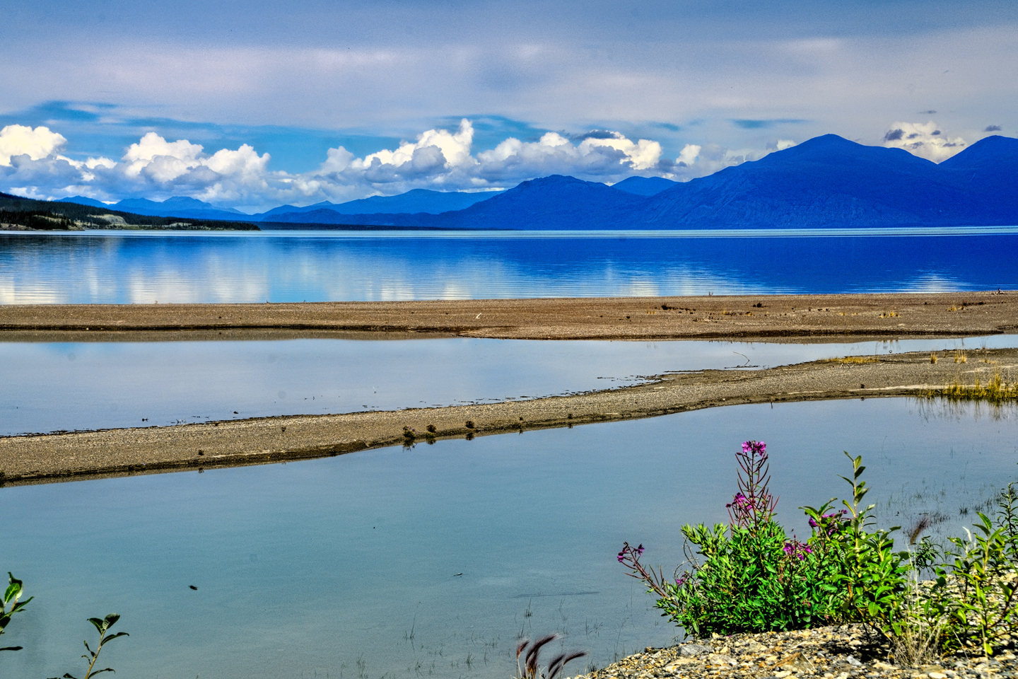
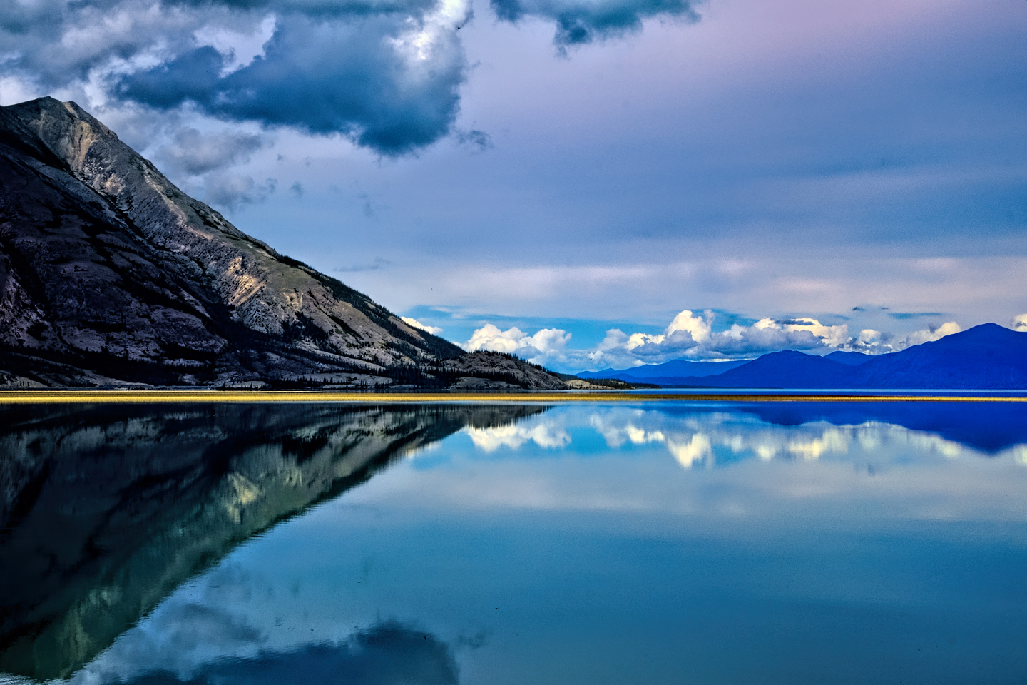
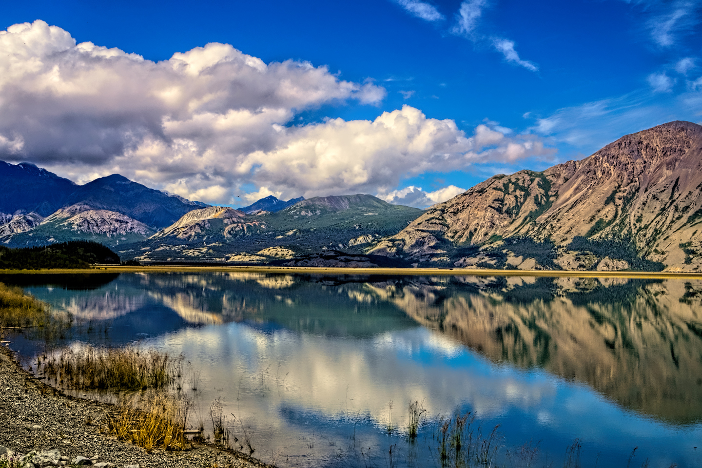
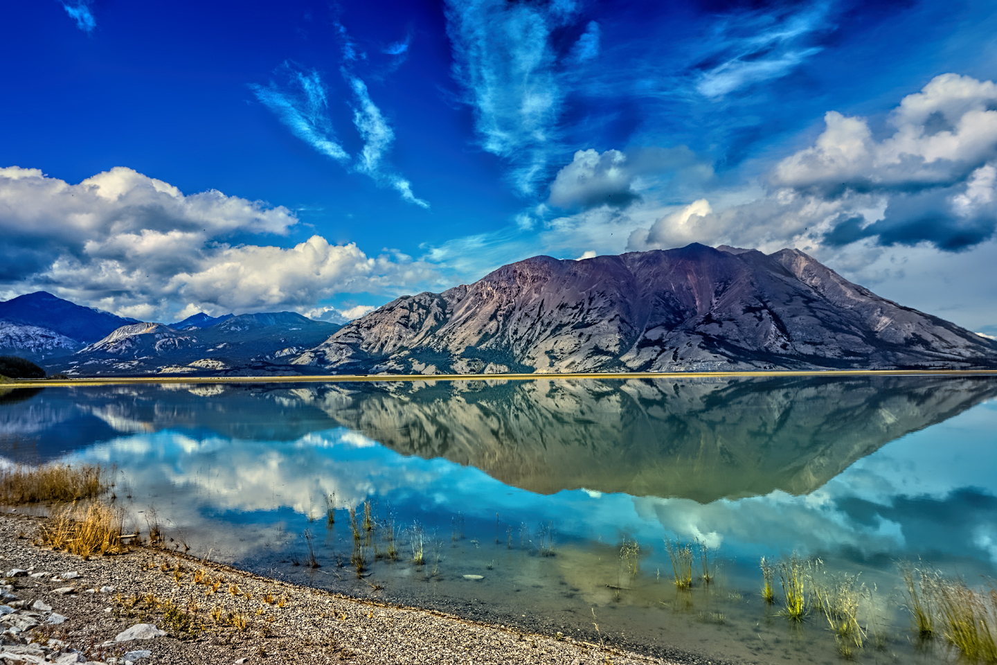
Here’s the sad part: this beautiful lake, at the time I saw it, was fed by the Slims River, which carried a large volume of glacial meltwater from the Kaskawulsh Glacier, located within Kluane National Park. Over the course of four days in May of 2016, less than a year after my visit, the Slims River suddenly disappeared, leaving mud flats where the Alaska Highway crosses the inlet. Shrinking glaciers, the direct result of climate change, abruptly altered the topography of the region, and the water that used to flow into the lake, and on to the Bering Sea, now flows into the Gulf of Alaska, leaving the lake cut off from its primary water source. Over the next few years, this lake will become an isolated basin, forever altered from the way it appears in my photographs, and the crystal clear air that once graced this region is frequently filled with dust.
Kluane Lake in 2015, before the River changed its course.
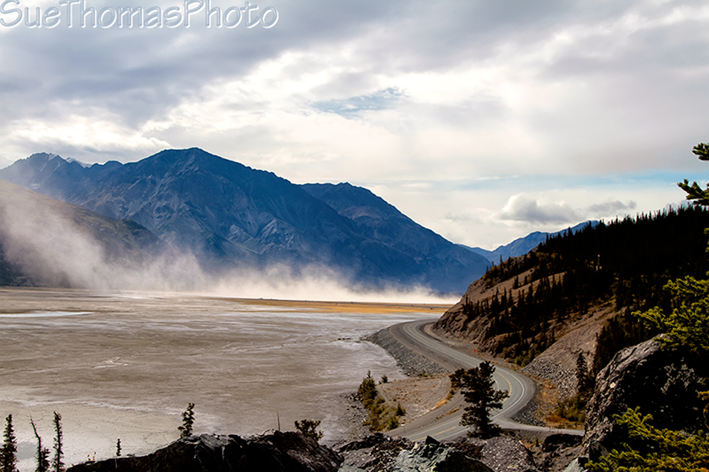
And again after the dry-up. “After” photo © Sue Thomas
Climate change is real, it is relentless, and if you’re anywhere near either of the poles of our planet, it’s right there in your face, screaming into the hurricane. We all have to do our part to slow it down. Partisan politics has no place in this, and critical strategies, such as the shift away from our reliance on fossil fuels, simply can’t be open to negotiation. Climate change is, without question, the most important issue of our age, and we’re teetering on the cusp of disaster!
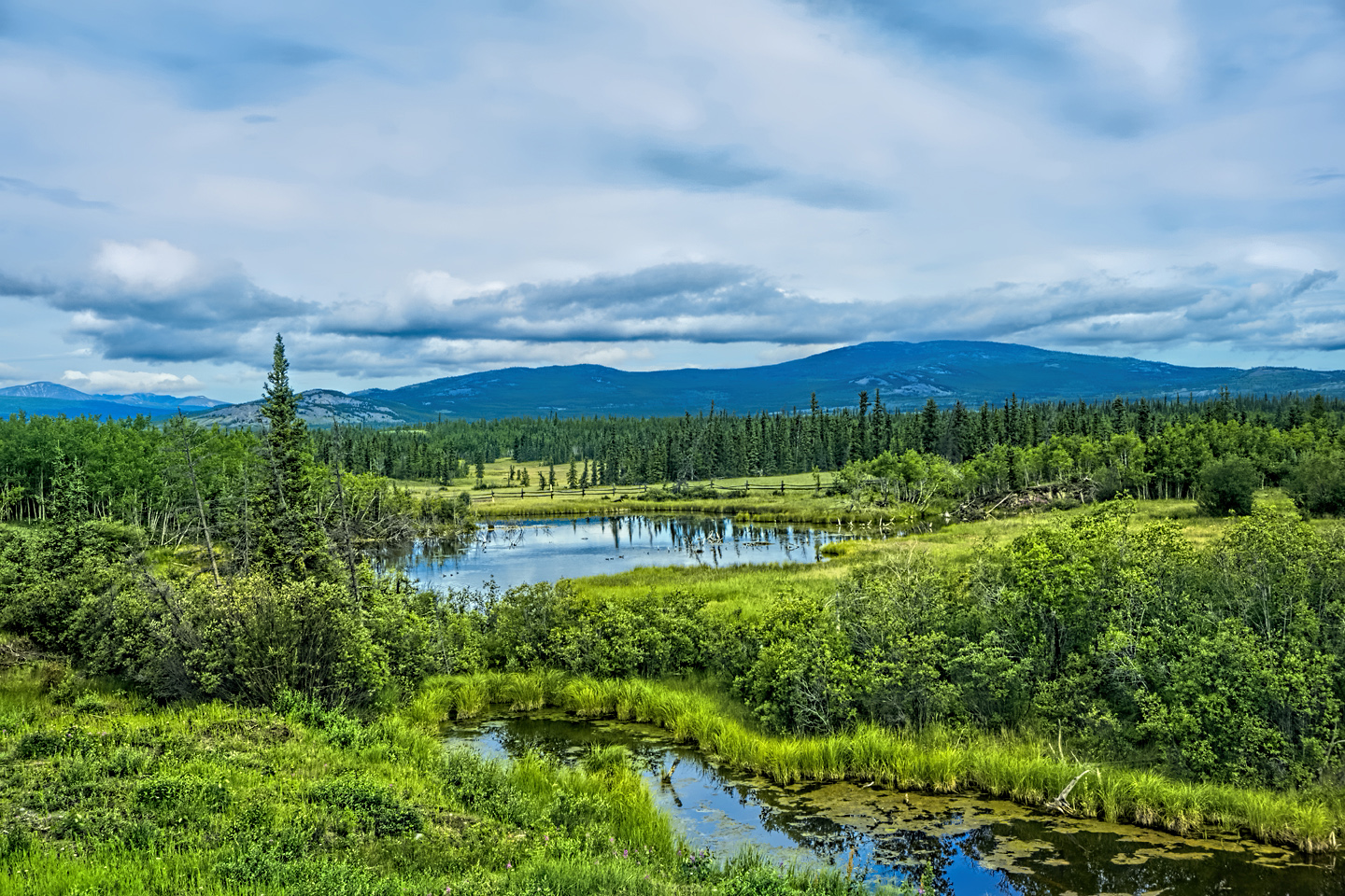
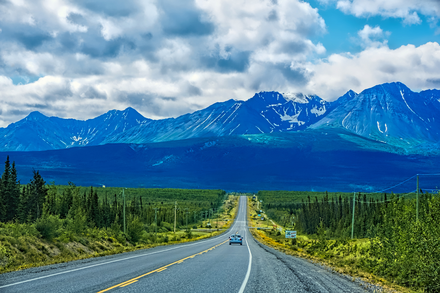
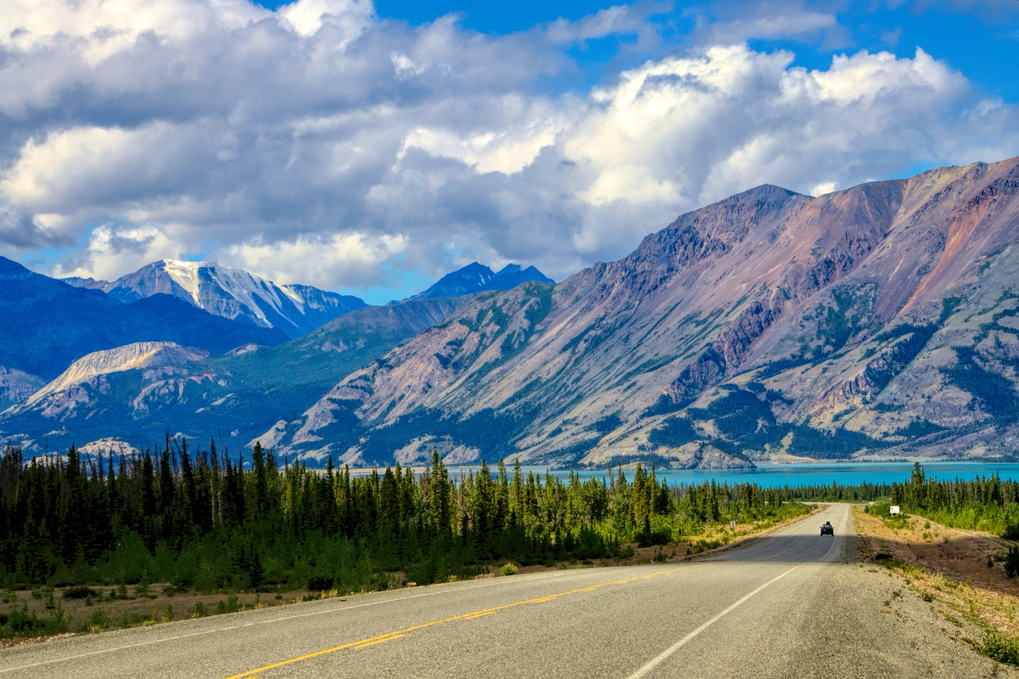
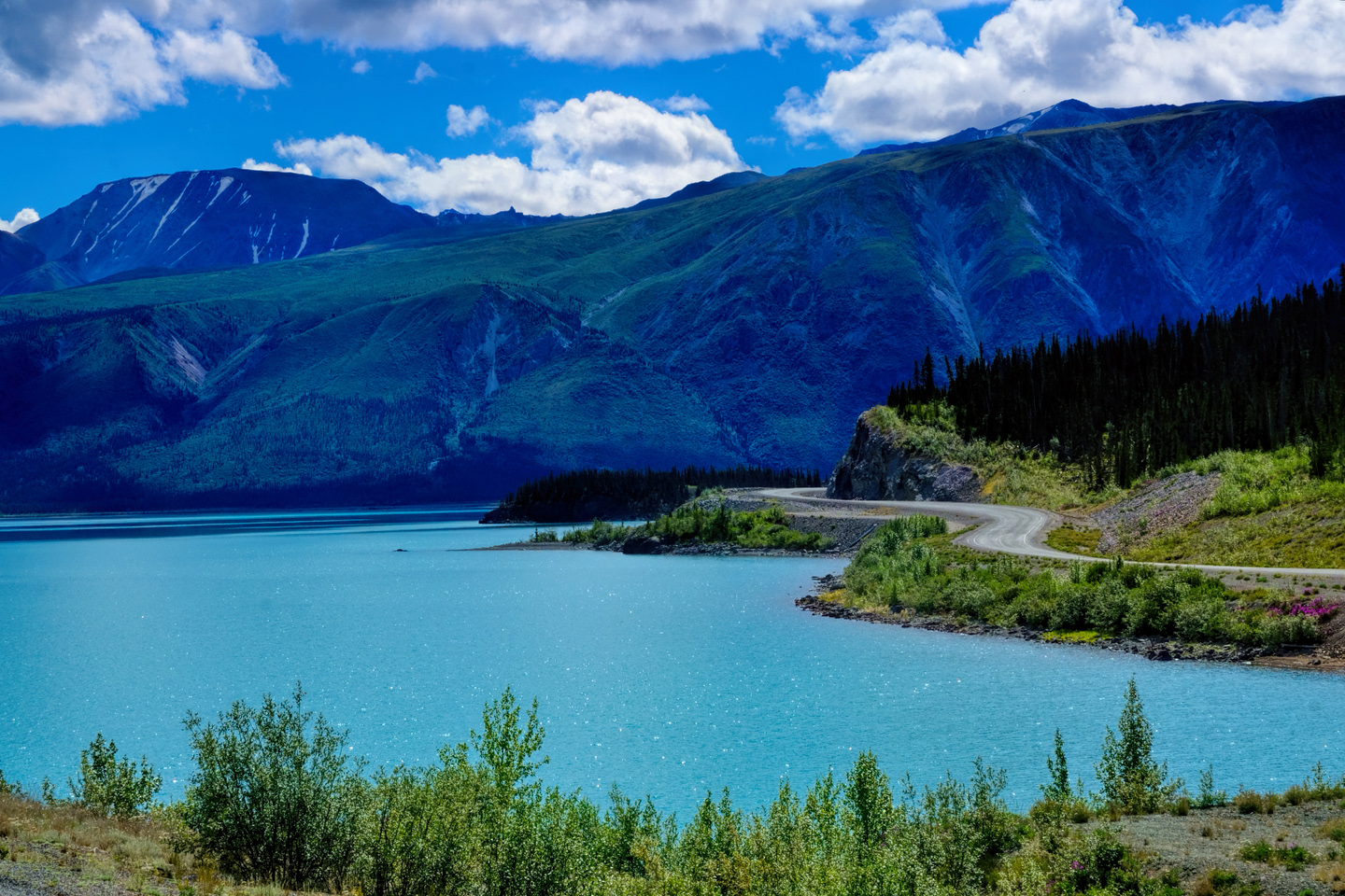
Scenes along the Alaska Highway, north of Kluane National Park
Driving on toward the Alaska border, the road surface went to hell with potholes, cracks, and rippling frost heaves, caused by the freezing and thawing of permafrost under the road bed. I had to slow down quite a bit to avoid blowing a tire or damaging the suspension. Then I came to a construction zone, where there was no pavement at all for almost 30 miles. The road became the wild, rugged sort of surface that I’d always expected of the Alaska Highway. It took quite a while to get through that section, and once I did, it started to rain, lightly at first, and then it poured, rain coming down in sheets.
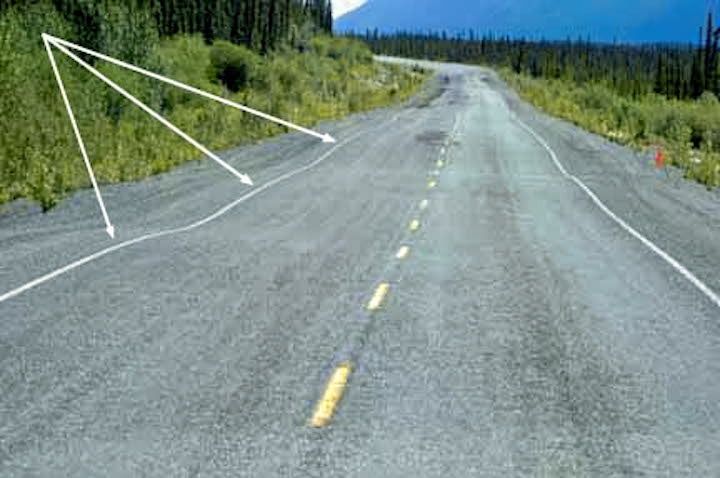
Beware of frost heaves!
At the very end of the unpaved stretch, a car was pulled over, and they shouted as I passed, so I stopped. There was a mother grizzly bear with two cubs on the hill above the road, which was pretty exciting! I snapped a quick picture, but I was a little too slow to catch what would have been a perfect shot of the momma looking straight at me. Instead, I got her from the side as she shooed her cubs into the trees.
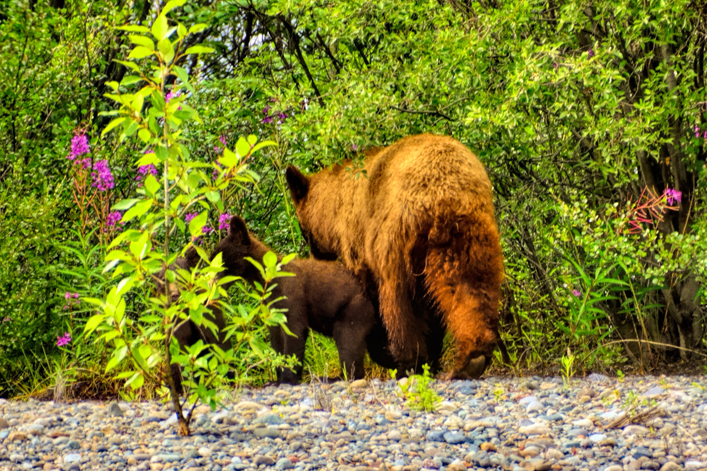
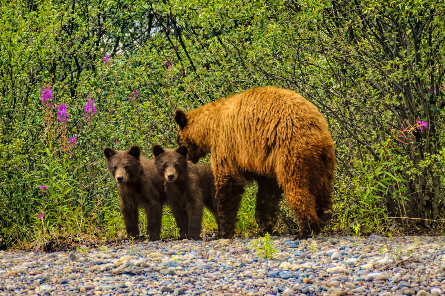
Mother Grizzly and cubs
It was still raining heavily, and was quite cold by the time I got to Beaver Creek, the last Canadian town on the Alaska Highway. It was about 4:30, I’d driven 300 amazing miles, and some of it was pretty intense. I thought about pushing on into Alaska, if only so that I’d have a chance at phone service and connectivity—but when I discovered that the first real town in Alaska, a place called Tok, was another 120 miles away, I decided I’d best stay in Beaver Creek. I got an overpriced room at a very funky motel—Ida’s Motel and Café, which sounded folksy, but wasn’t. Just like a lot of motels in small-town U.S.A., it was run by East Indians, and, sadly, was not well-maintained. I was charged $100 for a very basic room that was scarcely worth half that amount; unfortunately, there were no other choices. I had a lousy dinner of overcooked, tasteless Salisbury steak that set me back $20, and then I went back to my room and spent several hours processing my amazing pictures. No Wi-Fi, no phone service, so I was totally incommunicado for the evening. The rain stopped (naturally), and I ended up regretting not having driven on to Tok. Oh, well! Stopping before the border made it a relatively easy driving day, which was probably for the best—but I was spending WAY too much money on overpriced motels!
Click any photo in this post to stop the slide shows and expand the images to full screen.
To return to Day 2, or to continue reading the next part of the series, click the buttons below:
MORE ABOUT THE ALASKA HIGHWAY:
This is an interactive Table of Contents. Click the pictures to open the pages.
Alaska Road Trip

The Alaska Highway: Prelude: The Road to Dawson Creek
Even if you start in Seattle, the closest American city, it’s still more than 800 miles to Dawson Creek, wending your way that much further north, so far north that there will be a noticeable change in the hours of daylight. It’s the latitude that distinguishes the north country, including every bit of Alaska. Dawson Creek is where it all begins.
<<CLICK to Read More>>

The Alaska Highway: Day 1: Dawson Creek to Fort Nelson
Past Fort St. John, the terrain got a lot wilder. No more towns, very few people, and very little traffic. Saw a few U.S. license plates, Michigan, California, Oregon, South Carolina; people that were obviously headed to Alaska!
<<CLICK to Read More>>

The Alaska Highway: Day 2: Fort Nelson to Whitehorse
Every time I rounded a curve in the road there was another stupendous vista; it was nothing short of astonishing! I was literally yipping out loud, and a couple of times I actually pulled over and stopped while I pounded on my chest to “re-start” my heart!
<<CLICK to Read More>>

The Alaska Highway: Day 3: Whitehorse to Beaver Creek
Approaching the mountains, I started pulling over with serious frequency, taking LOTS of photos! Mountains, clouds, lakes, flowers—I was pretty sure I must have died and gone to heaven, but I couldn’t for the life of me remember the fiery crash.
<<CLICK to Read More>>

The Alaska Highway: Day 4: Beaver Creek to Fairbanks
Delta Junction, the end of the Al-Can, was only 200 miles away, and the border? Twenty miles, maybe half an hour, and I was finally going to cross into Alaska! I’d been on the road more than three weeks, and in just half a day more, I’d be in Fairbanks.
<<CLICK to Read More>>

Chena Hot Springs: A Fairbanks Original
The Chena hot spring puts out steaming water at a temperature of 150 degrees, producing enough power to meet all the needs of the resort, as well as filling the hot springs pools used by the guests. In addition to the lodge and restaurant, they offer camping and horseback riding, and they have exhibits featuring sled dogs, greenhouses, ice sculptures, and geothermal energy.
<<CLICK to Read More>>

Two-Foot High Kick: World Eskimo Indian Olympics
Contestants take a running leap, then they make this crazy jackknife move, touch the ball suspended high above the floor with both feet, then come back down and stick the landing. If that sounds difficult? You have no idea.
<<CLICK to Read More>>

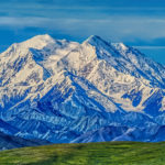
Dreaming of Denali
When I drove my Jeep to Alaska that first summer after I retired, my main goal, the single most important thing I wanted to do, was to see Denali, the biggest mountain in North America.
<<CLICK to Read More>>

Follow the Fireweed
Visualize a summertime journey through that part of the world, a world filled with mountains and glaciers and boreal forests, ice blue rivers, turquoise lakes, and billowing clouds that fill the sky. Imagine your vision as a beautiful piece of music. The fundamental, underlying theme of that symphony would be a gently rising swell of perfect harmony, pinkish lavender in its hue.
<<CLICK to Read More>>

Kenai Fjords National Park: Seabirds, Glaciers, and Whales on the Wild Coast of Alaska
At this latitude, during the summer months, the sun stays low in the sky all day, and never really goes down. The traditional “golden hour” when the light is best for landscape photos is extended accordingly, and there are more opportunities for great shots than you’ll know what to do with.
<<CLICK to Read More>>

Kenai Fjords National Park: Exit Glacier: Up Close and Personal
Compared to the huge tidewater glaciers that flow directly into the sea along the coast of Kenai Fjords, Exit Glacier is just a baby–a baby that’s getting smaller every year–but it’s still big enough to permanently alter the landscape through which it passes.
<<CLICK to Read More>>

Alaska Road Trip: Driving Alaska’s Grand Circle
Most of the major towns in Alaska, as well as three of the state’s incredible National Parks, can all be reached by driving Alaska’s Grand Circle: a loop route beginning in Tok that utilizes all four segments (1082 miles) of Alaska’s Interstate Highway system.
<<CLICK to Read More>>

Alaska Road Trip: The Grand Circle: From Tok to Denali
There are no icy mountains looming on the horizon, and Fairbanks is nowhere near Alaska’s ruggedly beautiful coast. The true beauty in Alaska’s second city is found below the surface, in the spirit and resiliance of the people who make the place their home.
<<CLICK to Read More>>

Alaska Road Trip: The Grand Circle: Anchorage and the Kenai Peninsula
The massive ice field in the park’s wild interior has spawned dozens of glaciers which, over the course of many millenia, have carved the landscape into fjords so heart-breakingly beautiful, humpback whales swim all the way from Hawaii just to cavort in the deep blue water.

Alaska Road Trip: The Grand Circle: Wrangell-St. Elias National Park
So, just exactly how big is Wrangell-St. Elias National Park? You could combine Yellowstone with Yosemite, throw in the entire country of Switzerland, and you still wouldn’t match it in terms of size.
<<CLICK to Read More>>

Alaska Road Trip: Driving to the Top of the World
The rough dirt road gave way to a newly paved modern highway. This was it, the Top of the World, and right on cue, the haze peeled back, just enough to give me a glimpse of the beauty my friends assured me would be there…
<<CLICK to Read More>>

There’s nothing like a good road trip. Whether you’re flying solo or with your family, on a motorcycle or in an RV, across your state or across the country, the important thing is that you’re out there, away from your town, your work, your routine, meeting new people, seeing new sights, building the best kind of memories while living your life to the fullest.
Are you a veteran road tripper who loves grand vistas, or someone who’s never done it, but would love to try? Either way, you should consider making the Southwestern U.S. the scene of your own next adventure.
A few years ago I wrote a book about road trips in Arizona and New Mexico that’s a lot like this website, packed with interesting information, and illustrated with beautiful photographs. Check it out! You can find it on Amazon, and at all other major booksellers.

ALASKA ROAD TRIP:
MEXICAN ROAD TRIP (IN THE LAND OF THE MAYA):
ARIZONA AND NEW MEXICO:
SOUTH AMERICA:
PHOTOGRAPHY:
TRIBAL LANDS:


Recent Comments