The main attraction at Kenai Fjords National Park is the incredible scenery. Rivers of ice and untamed geography flow together here, and everything that’s amazing about the wild coast of Alaska is on full display. Tidewater glaciers spawn icebergs right before your eyes, while seabirds by the thousands wheel overhead and humpback whales blow their spouts in playful unison. The rocky shoreline, the impossibly green foliage, the water ranging from deepest blue to iridescent aquamarine, and the light! There is a palette of color here like nothing you’ve ever seen. If you’re sufficiently fit and more than a little adventurous, you can explore on your own by hiking or kayaking into the park. If you’re wealthy, you can charter a boat or a float plane to take you wherever you like. For everyone else, the only practical way to see much of anything is to book passage on one of the half day or full day boat tours that leave every morning from Seward.
When I visited the park myself, I truly enjoyed my half day tour of Resurrection and Aialik Bay. (See my previous post: Kenai Fjords National Park: Seabirds, Glaciers, and Whales on the Wild Coast of Alaska.) I drove down from Anchorage without planning ahead, in the middle of July, no less, and was lucky enough to grab the last seat on the last boat of the day. If I had done my research, or at least gotten there earlier, I would have had more, possibly better options, but the tour I ended up with turned out to be perfect for me. Between that half day on the boat and the beautiful drive to the Kenai, I had a very full day indeed, and I couldn’t have been more satisfied. That night, I slept in my tent in one of the Municipal campgrounds, right near the water in Seward, still not quite used to the twilight that passes for darkness during the Alaskan summer.
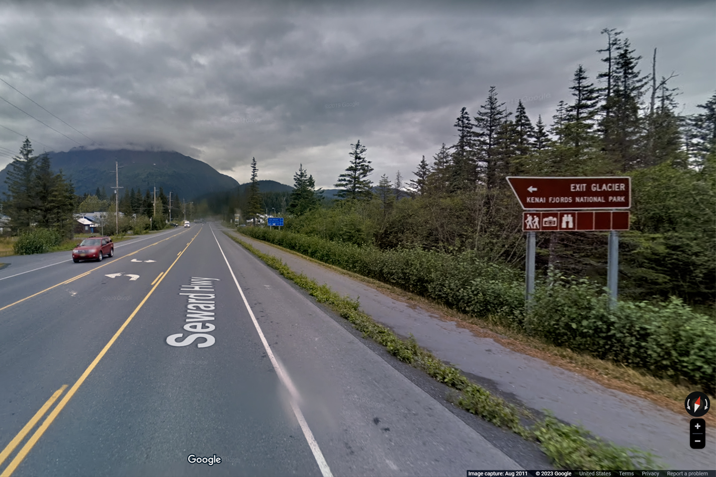
After breakfast the next morning, I set out on the Seward Highway, headed for Homer, four hours away, on the other side of the Kenai Peninsula. At Mile 3, just outside the Seward town limits, I spotted a sign beside the highway that read, “Exit Glacier: Kenai Fjords National Park.” That sign marked the road to the only section of the National Park that is accessible to private vehicles. I’d read about it in my Park Brochure, and here it was; so I took a little time out from my drive to Homer, to see what I could see.
Click Maps and Photos for an expanded view.
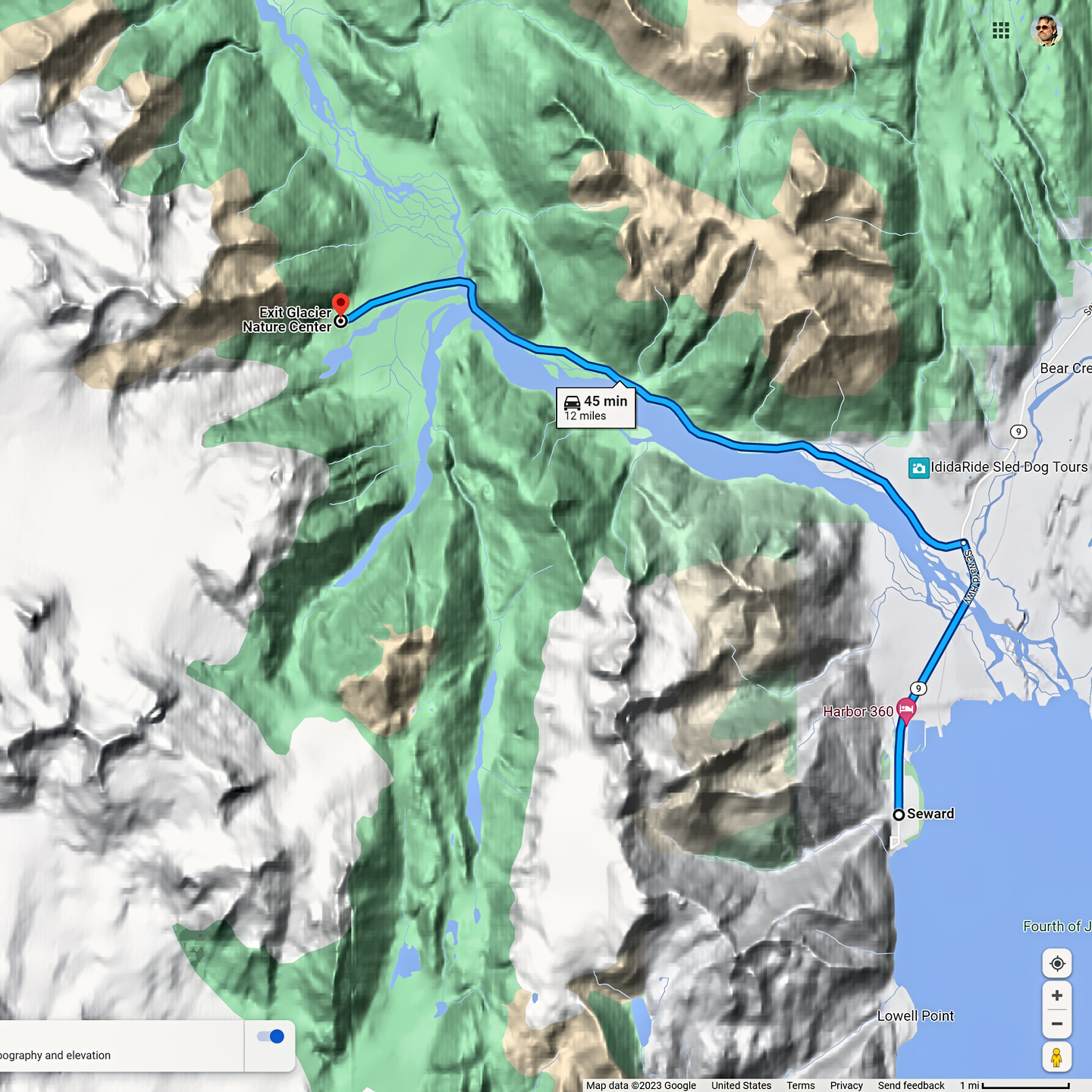
The eight mile drive back to the Exit Glacier Nature Center followed the course of the Resurrection River, one of many rivers and streams flowing down toward the sea from the Harding Ice Field and its many subordinate glaciers. There are hundreds of square miles of ice, all of it melting merrily away in the warmth of the Alaskan summer.
These days, the ancient glacial ice is melting much faster than it can be replaced by new winter snow, so the glaciers are retreating, a consequence of rapidly accelerating climate change. Exit Glacier is a graphic portent of a potentially devastating future: Signs mark the point of the glacier’s leading edge in various years dating back to the 1890’s, and the signs grow farther and farther apart. We can see that the ice has retreated more than a mile in the last hundred years, a lot of that in the last ten years. In 2016 alone, the glacier shrank by 300 feet!
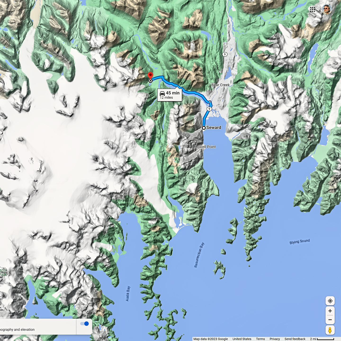
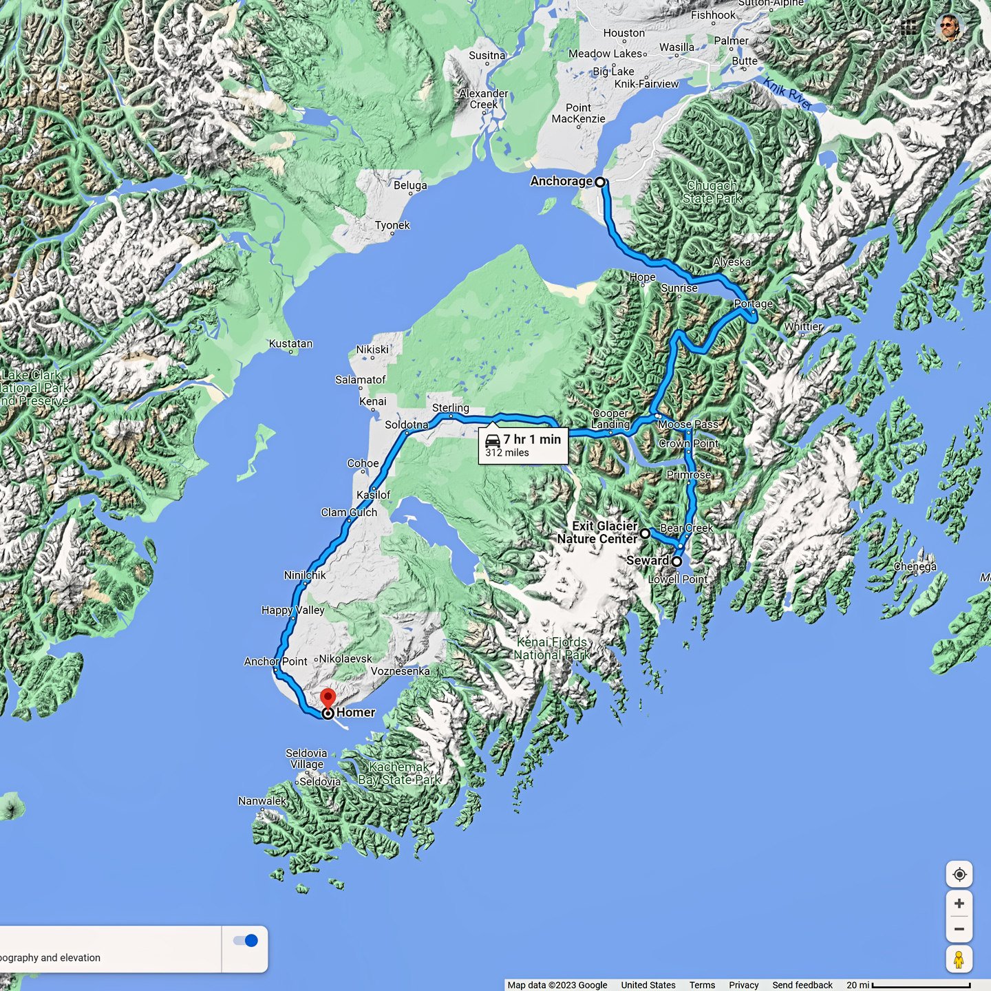
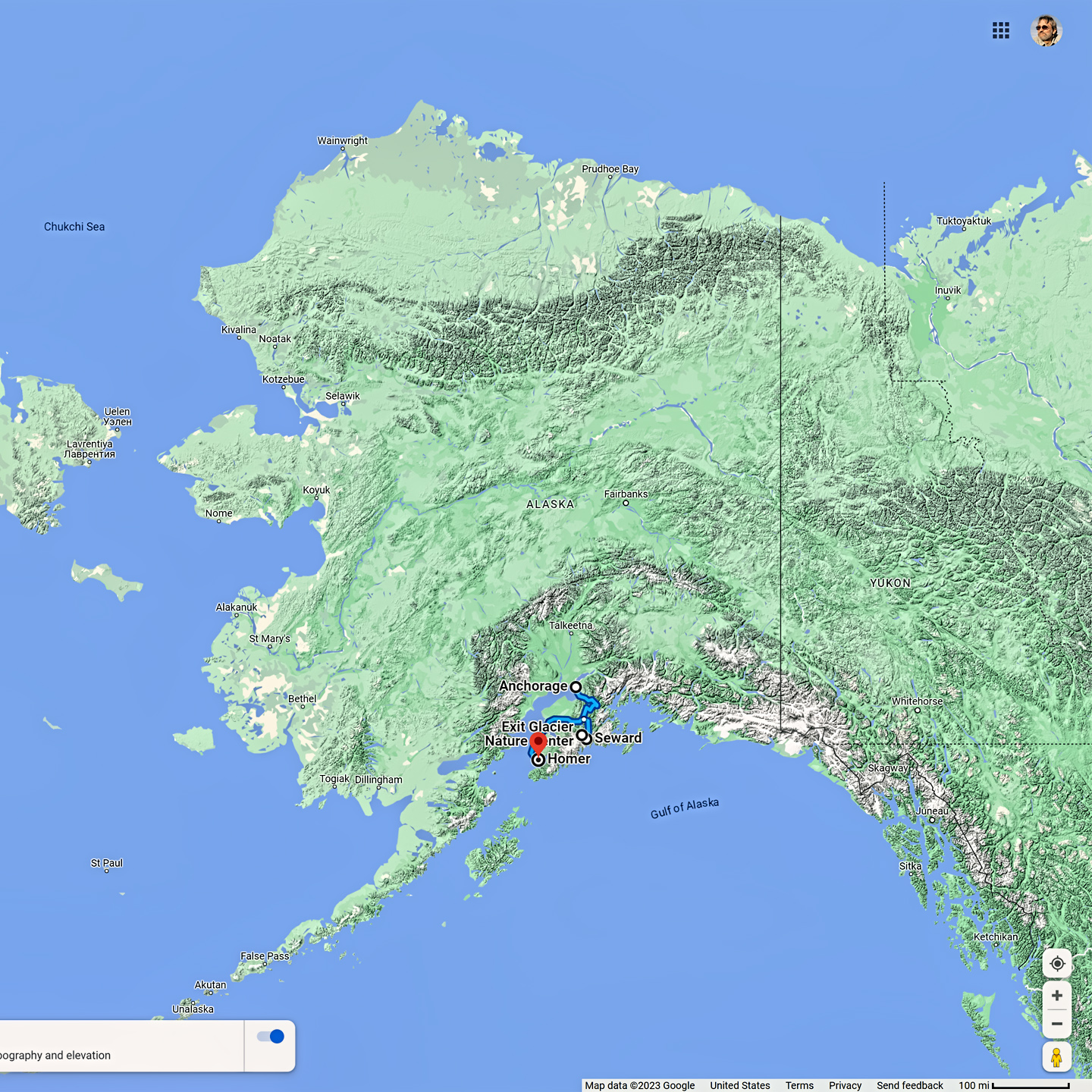
Location of Exit Glacier in relation to Seward, to the rest of Kenai Fjords N.P., and to the vast State of Alaska!
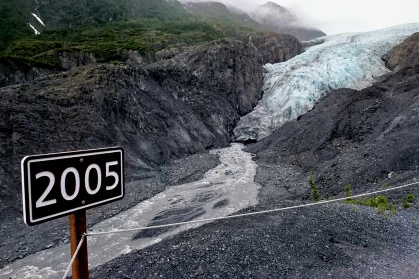
Exit Glacier’s retreat since 2005; photo © Marc Lester, Alaska Dispatch News
Exit Glacier got its name in 1968, when the first documented party of mountaineers successfully crossed the rugged Harding Ice Field. Of the ten adventurers who started out from Homer, four made it all the way across after eight grueling days on the ice, and the route that they took on their way back down followed the course of a valley glacier known as Resurrection. Since that was their point of exit, the glacier was popularly renamed the “Exit Glacier,” and that’s what it’s been called ever since.
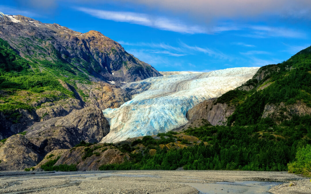
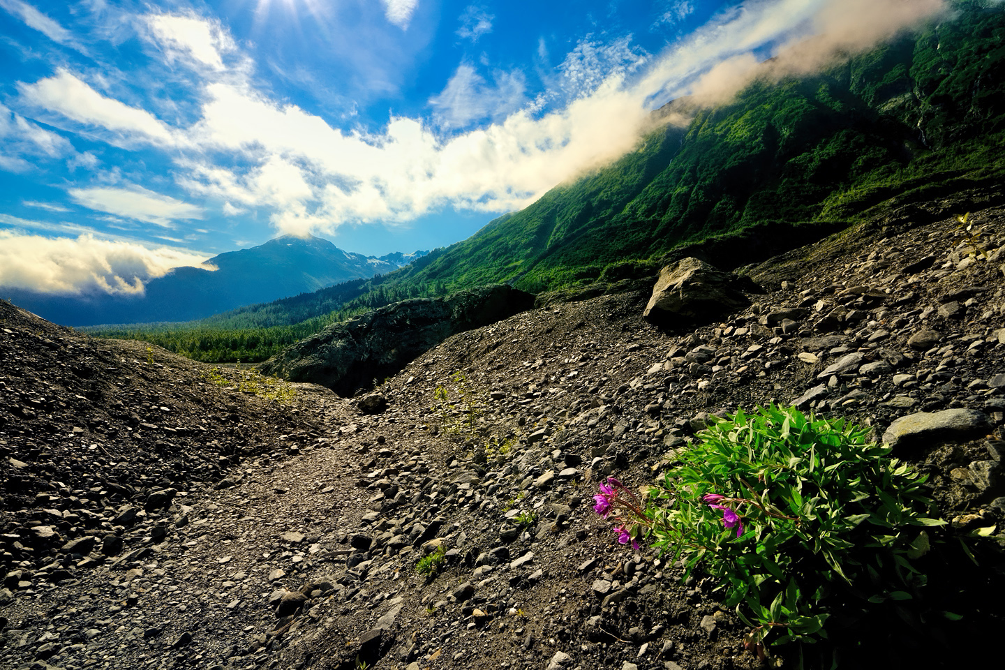
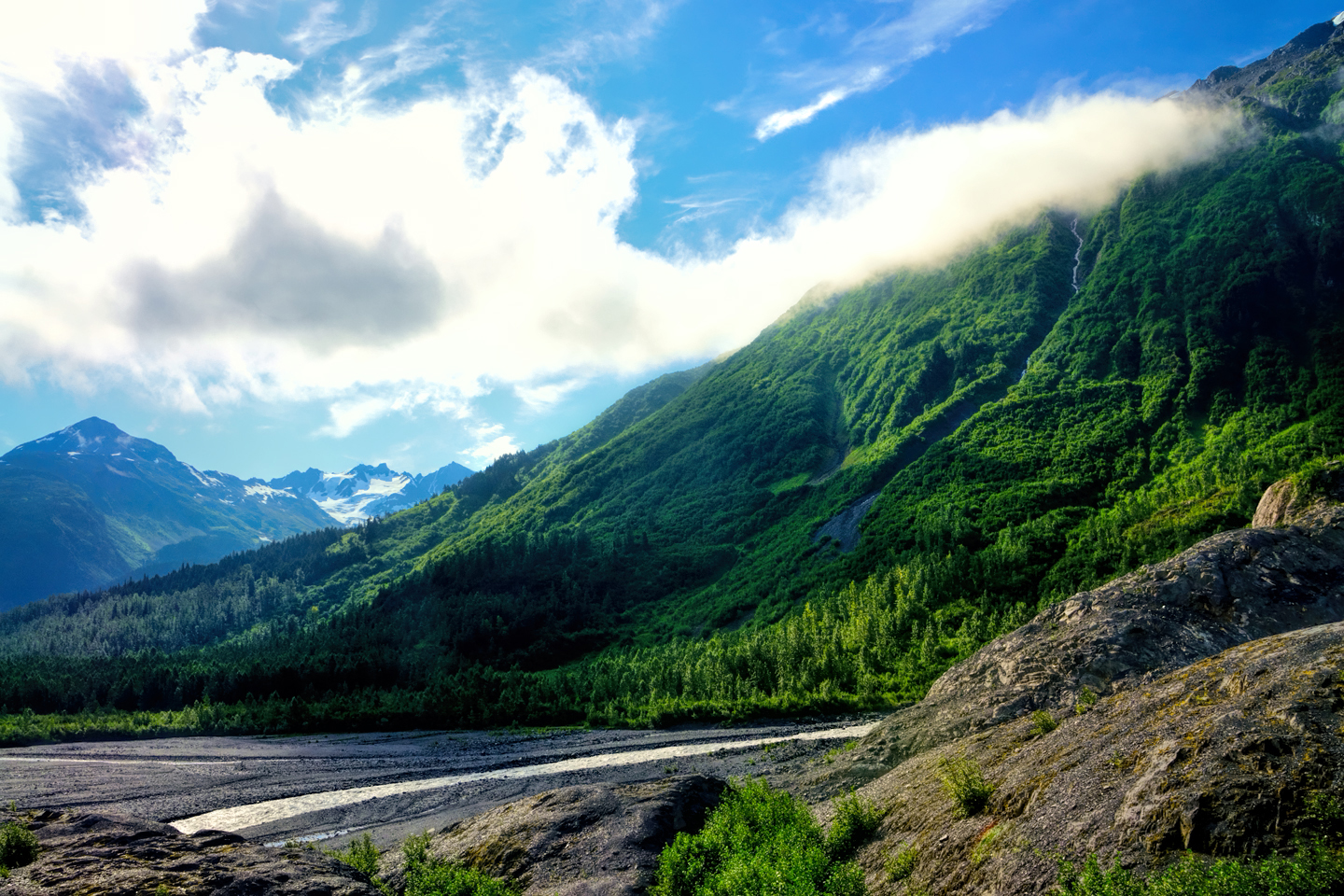
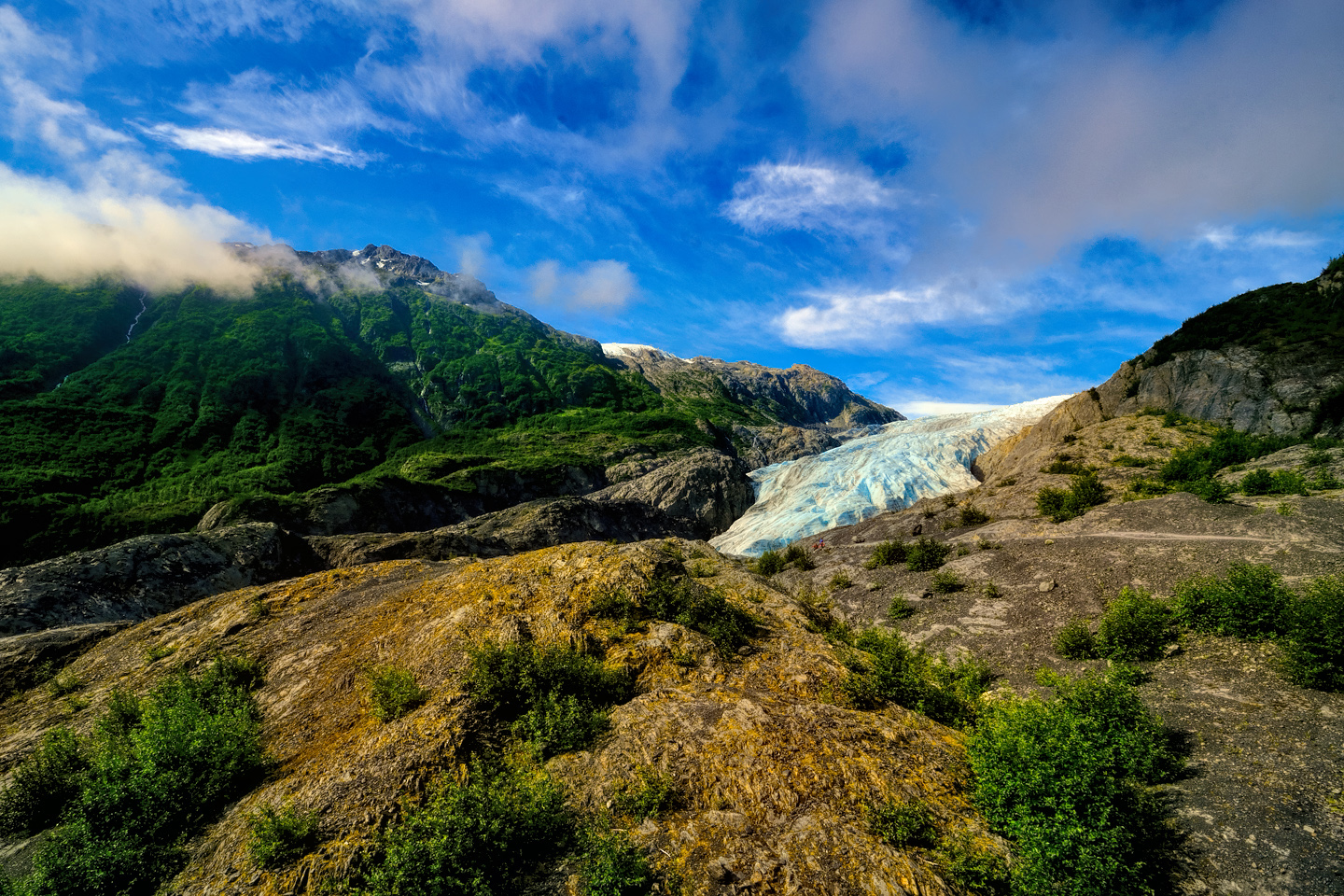
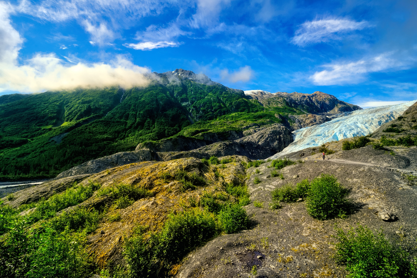
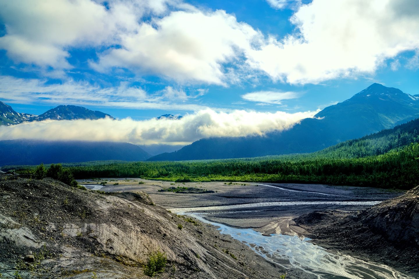
The first view of the glacier comes a mile or two before the end of the road, when you see it off in the distance, on the far side of the outwash plain with its braided streams. The surrounding mountains are bright green, laced by torrents of melting icewater.
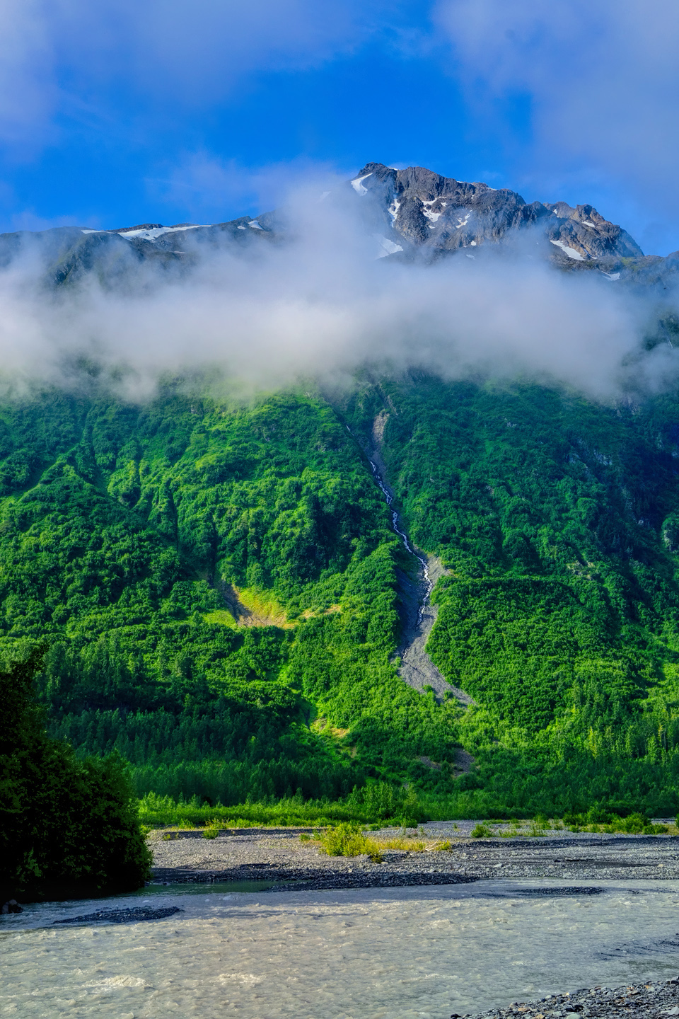
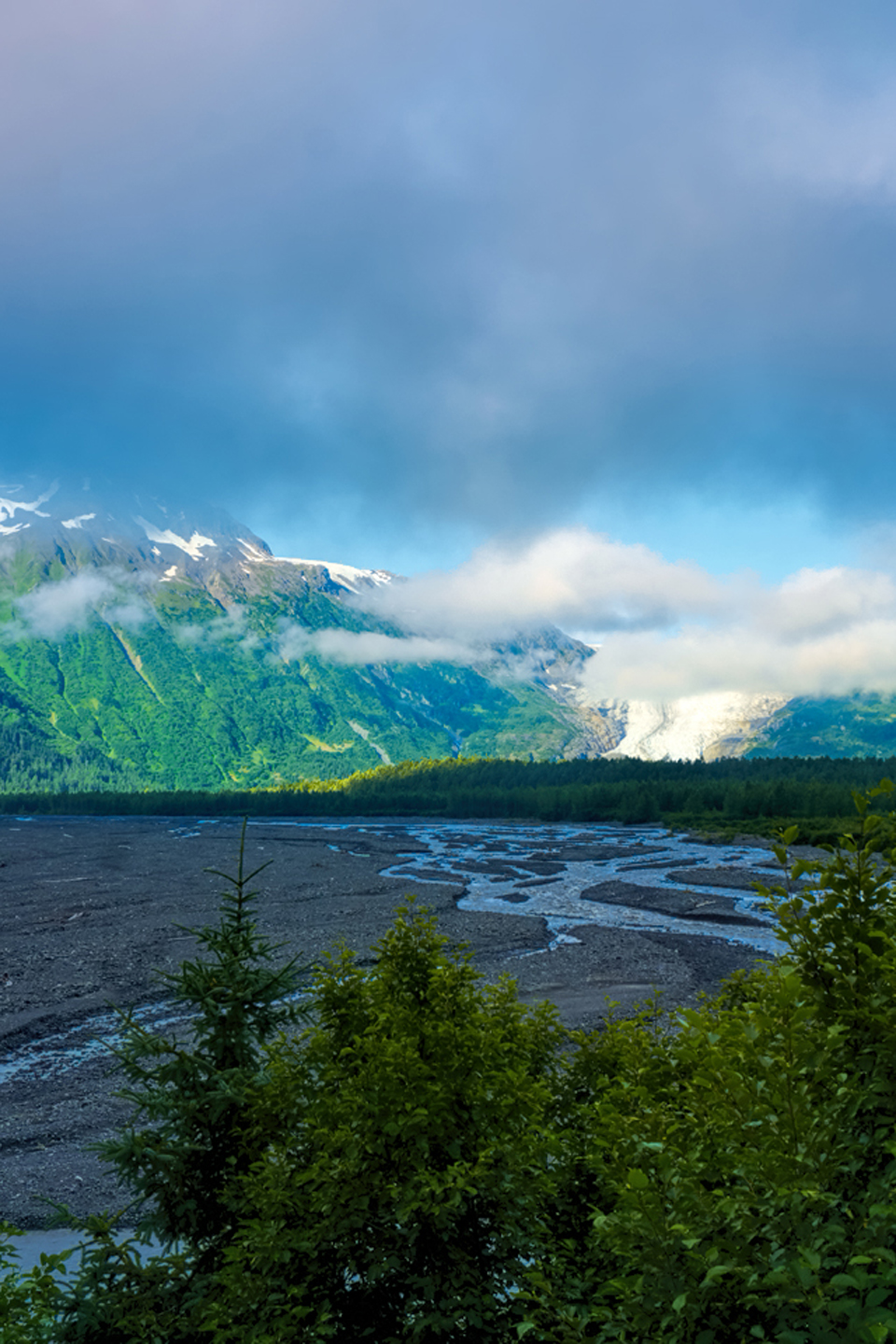
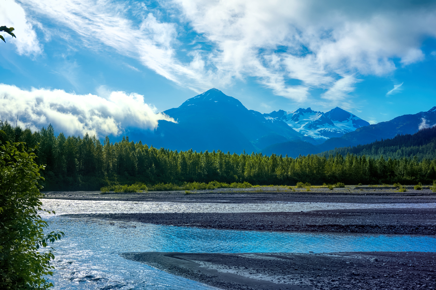
The outwash plain from the Exit Glacier, filled with braided streams of meltwater. The Kenai Mountains rise up in the distance.
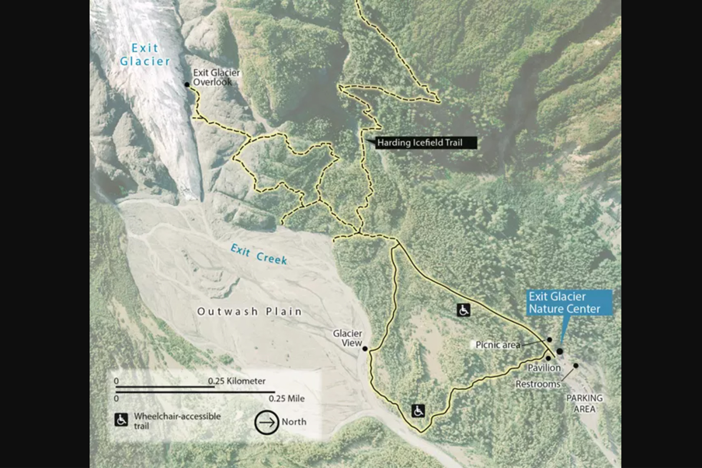
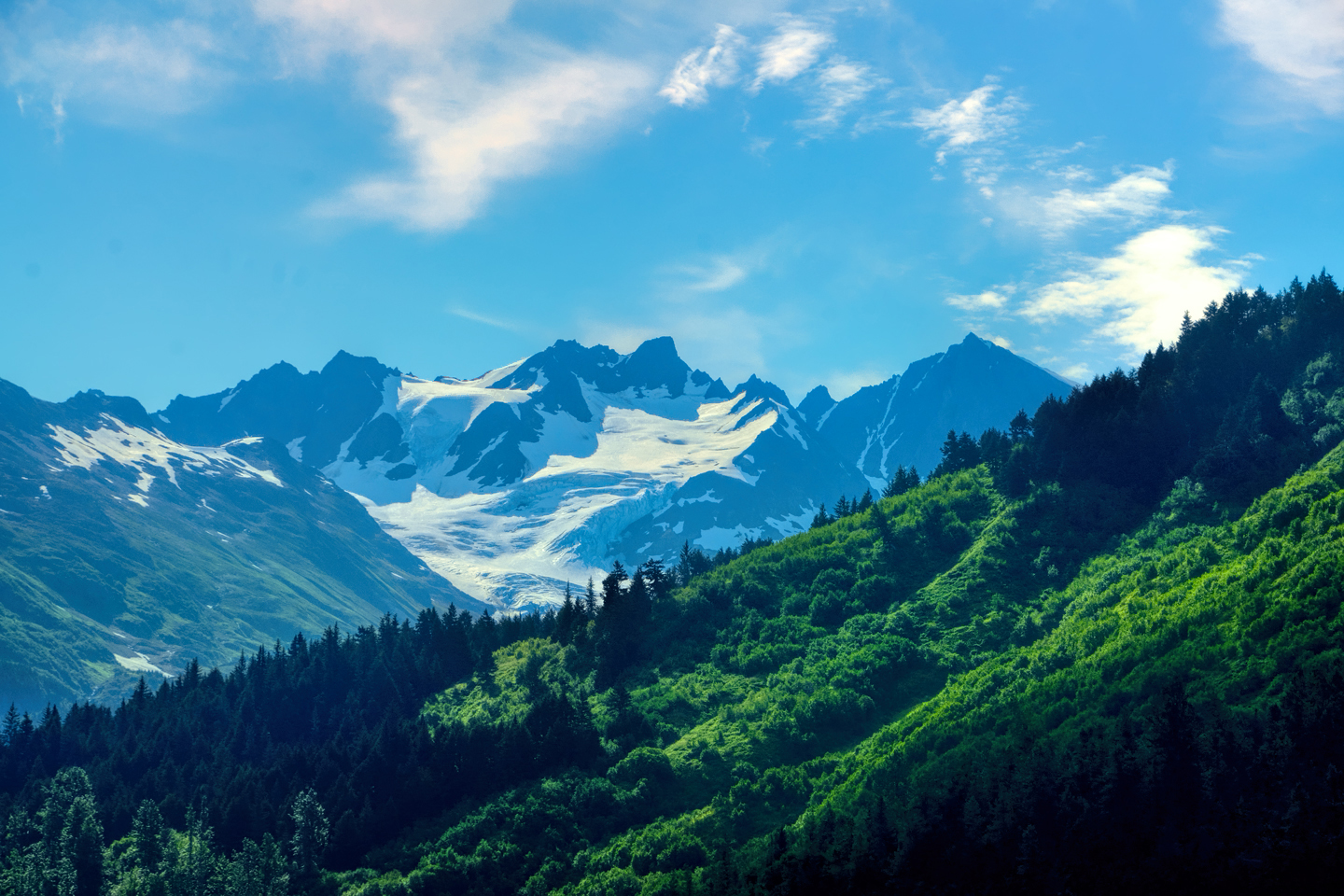
There’s a parking area near the Nature Center, and trails lead off from there. You can hike all the way up to the Harding Ice Field, where there are stunning views of the vast mile-thick sheet of ice that encases entire mountains, nothing showing above the icy expanse but their disembodied peaks. That hike is classed as strenuous and takes a bit of time, so I skipped it (regrettably), and settled for the much shorter path to the glacier viewing platforms.

Views from the path between the parking lot and the glacier viewing area
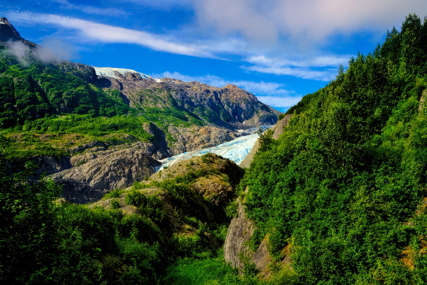
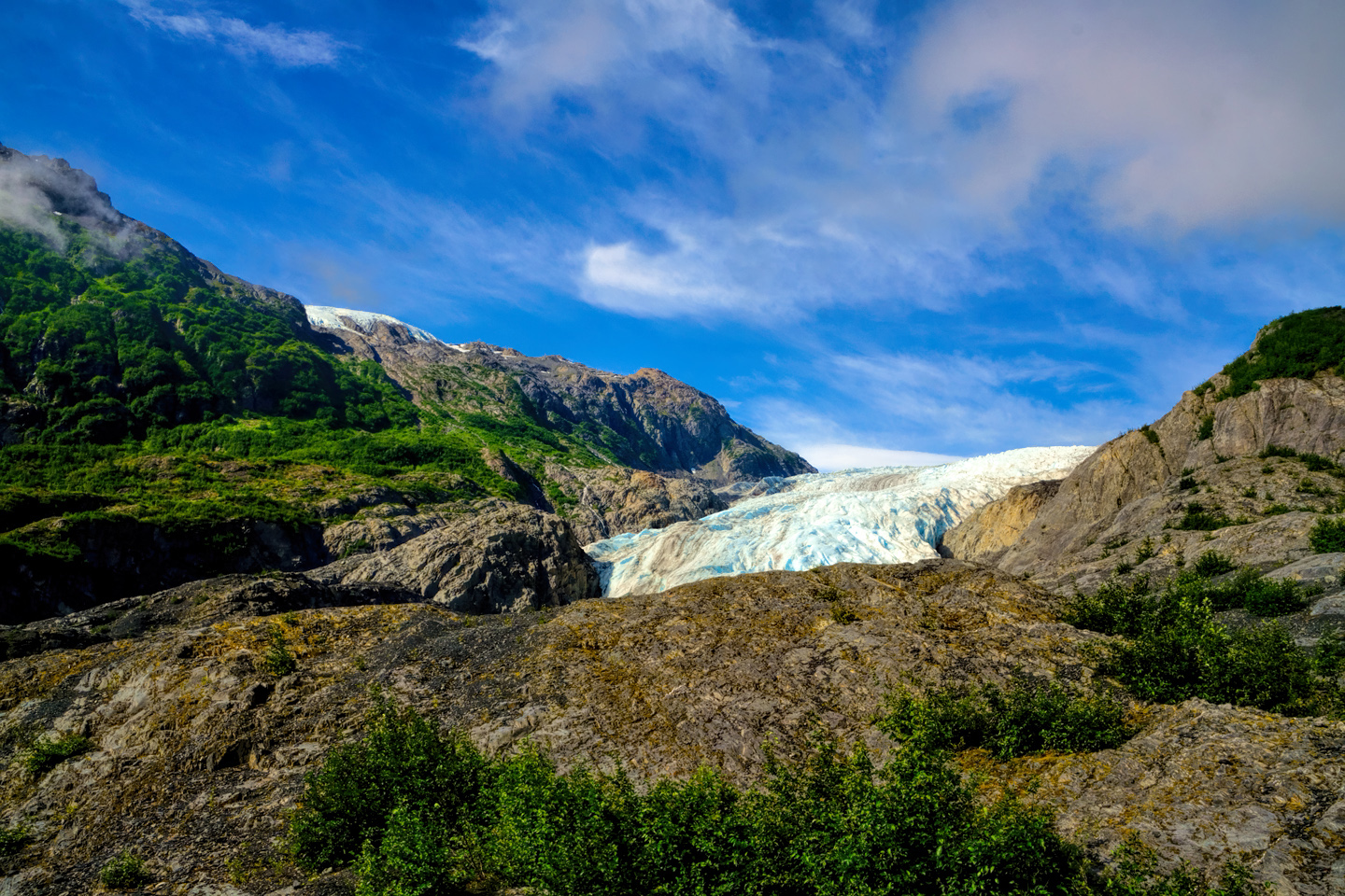
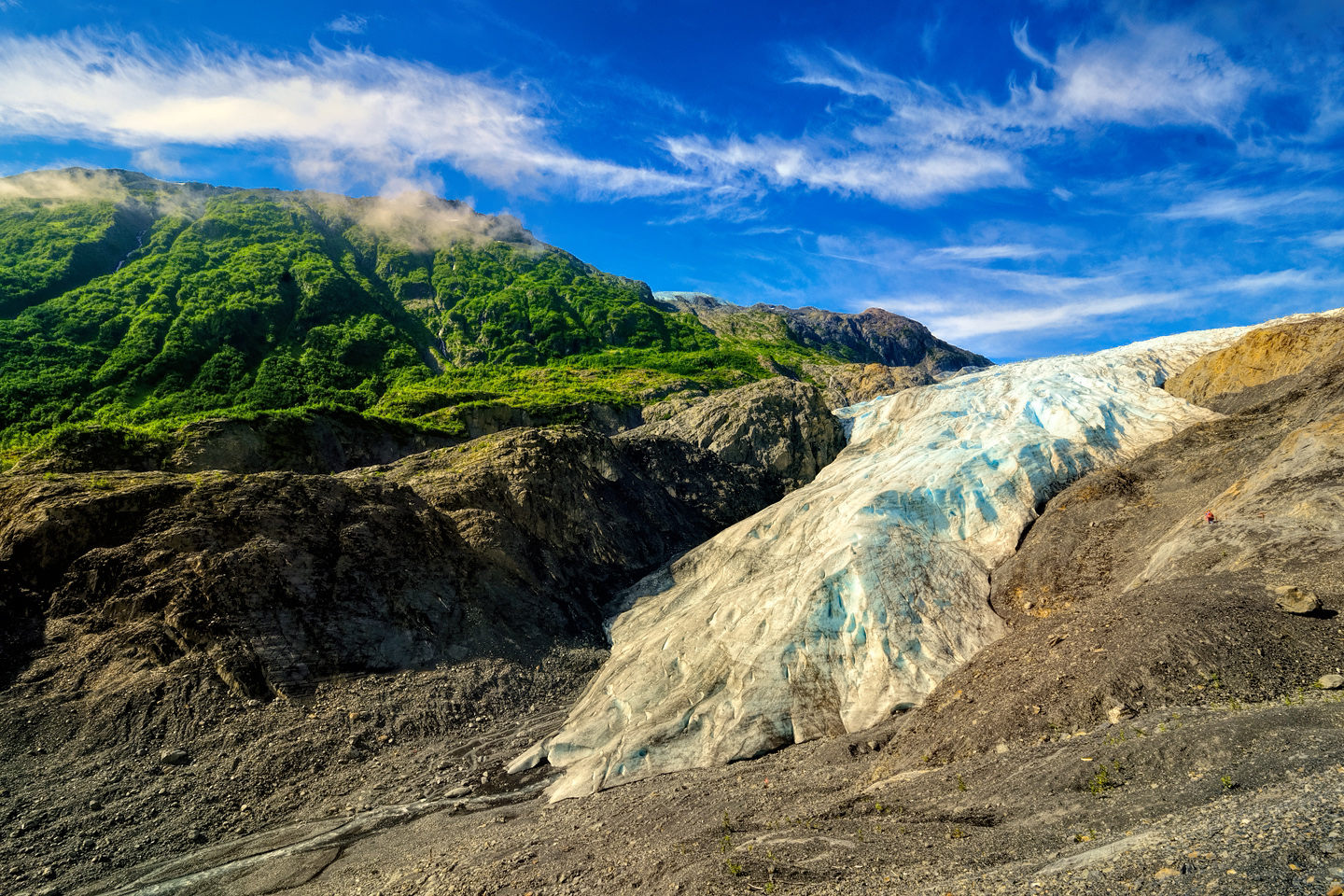
Exit Glacier grows larger as you hike closer to it
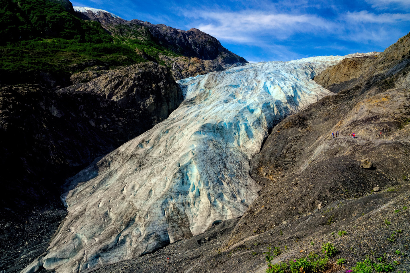
Exit Glacier, with a few tiny people beside it for scale. CLICK PHOTOS TO EXPAND!
Exit Glacier doesn’t draw nearly as many visitors as the boat tours of Kenai Fjords, because the cruise ship passengers who make up a high percentage of the total aren’t in port long enough to do both. The day I was there, I only saw a handful of other people. There are points on the path where you can see the trail ahead, and those tiny tourists came in handy for purposes of scale, showing just how BIG that danged glacier is!
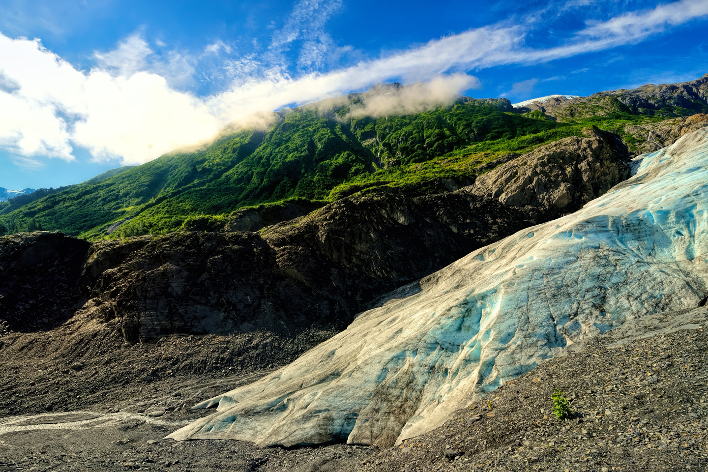
Glaciers are all about the beauty of the ice, and Exit Glacier is no exception. The Harding Ice Field from which this finger-like river of frozen water flows was formed 23,000 years ago, formed from compacted snow that fell long before any recorded human civilization. You would think it would be utterly pure, yet they still warn against drinking unfiltered meltwater from this, or any other glacier. There’s always the chance of dangerous bacteria, so why risk it?
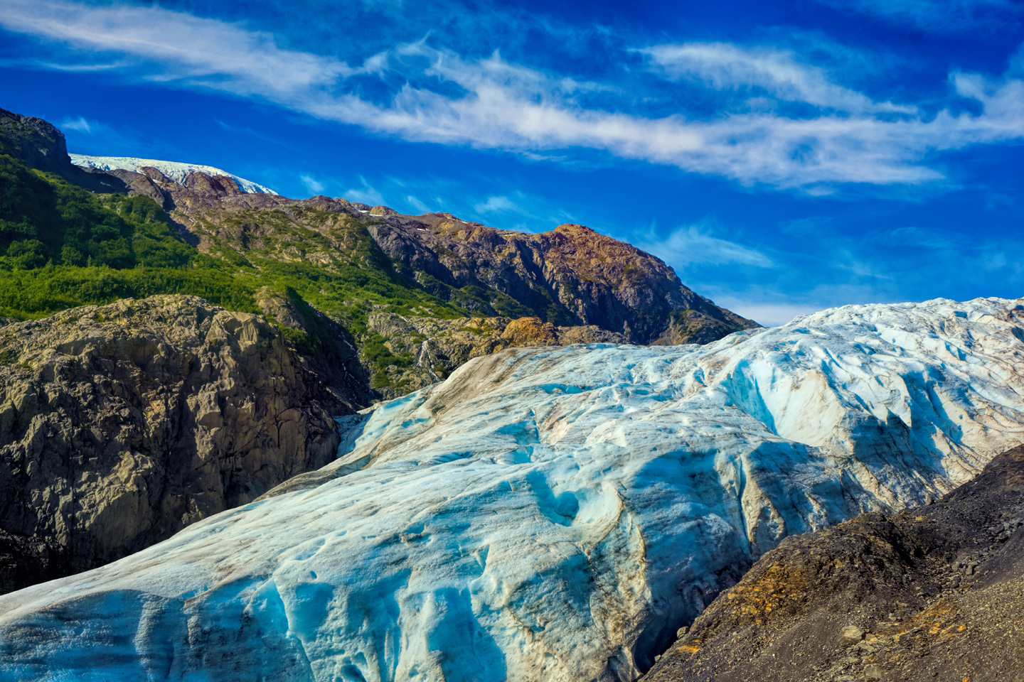
The color in glacial ice comes from suspended minerals and pulverized rock that refracts the sunlight, absorbing the red spectrum, while transmitting and scattering the blue.
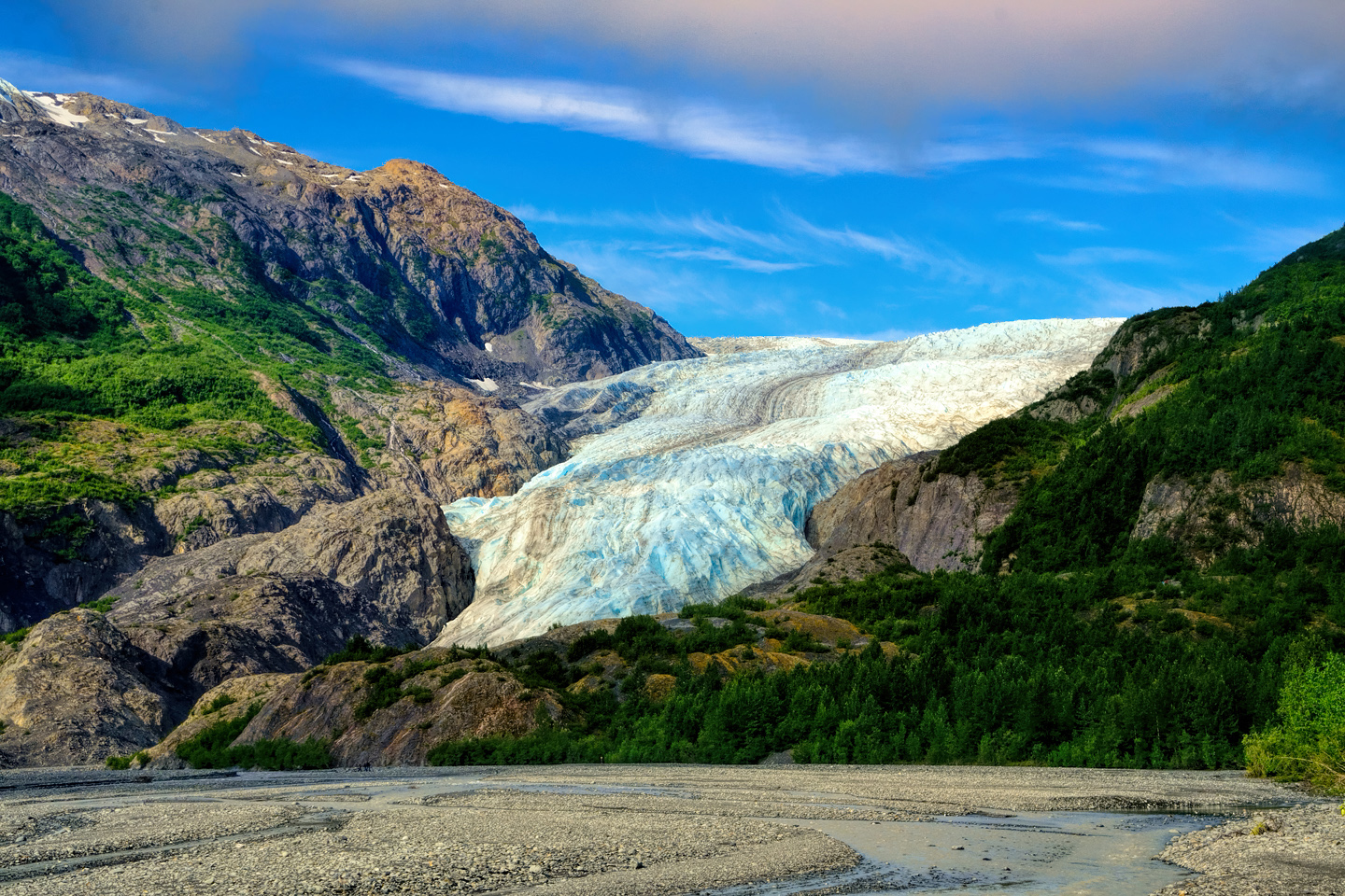
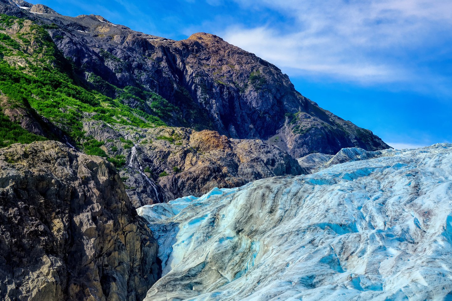
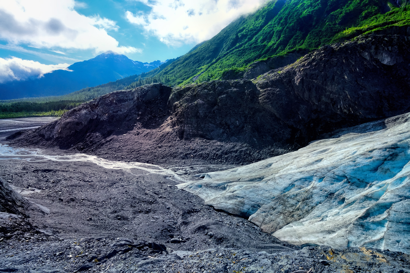
Exit is what’s known as a Valley Glacier. The relentless force of the downward flowing ice has gouged a steep-sided ravine into the side of the mountain. At its maximum known extension, the ice stopped at what’s known as the outwash plain, where the meltwater forms braided channels that ultimately merge into the Resurrection River, which flows into the sea in Resurrection Bay. Compared to the huge tidewater glaciers that flow directly into the sea along the coast of Kenai Fjords, Exit Glacier is just a baby–a baby that’s getting smaller every year–but it’s still big enough to permanently alter the landscape through which it passes.
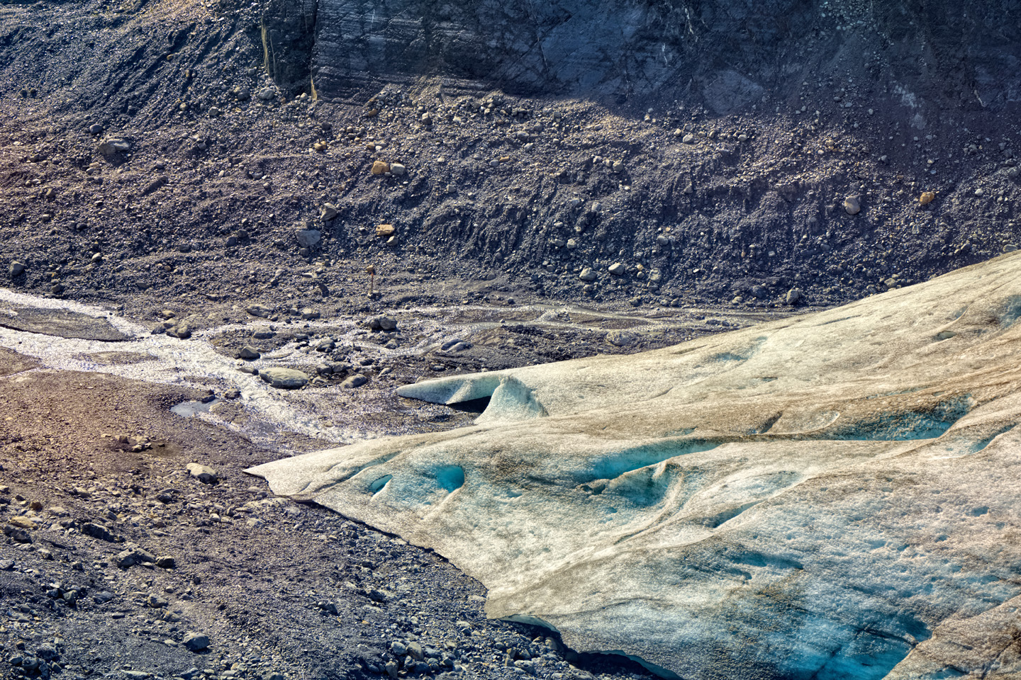
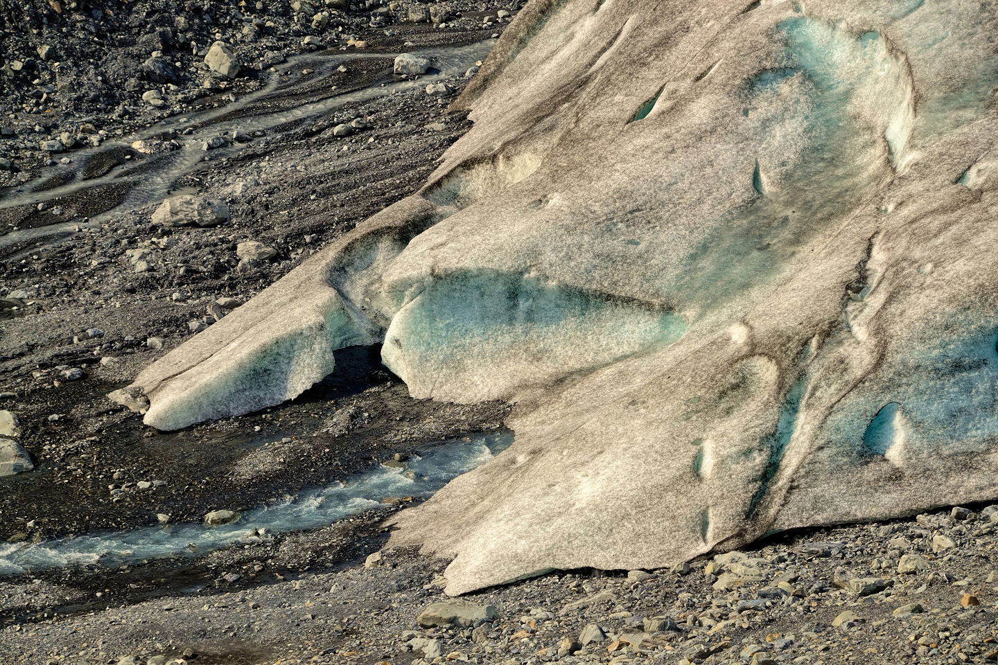
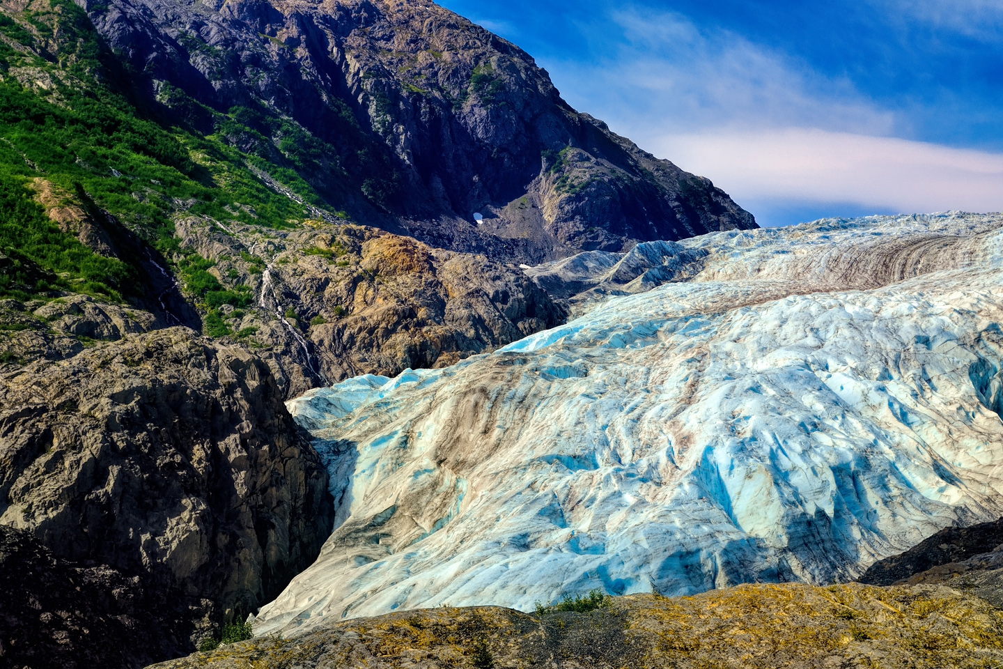
Unlike the tidewater glaciers that have a leading edge the size and height of a cliff, Exit Glacier tapers down to a single point known as a “Toe.” In the warmer months, most of the meltwater from this valley-filling block of ice flows from the toe, gaining volume as it streams downhill to the outwash plain. These photos of the toe, particularly the close-ups, demonstrate the constant flow of water from beneath the glacier as it melts its way back up the slope, faster and faster every year. At the current rate of attrition, Exit Glacier might well make a permanent exit before the end of this century.
DANGER ZONE!
The area around the toe and sides of Exit Glacier have been identified as an ice fall hazard zone, due to unstable blocks and slabs of ice that could give way at any time. If an ice fall should occur, the canyon between the toe and the outwash plain is susceptible to sudden outburst flood events. At the present time (2025) warning signs and barriers prohibit visitors from entering either location.
CLICK HERE for more information about current alerts and closures.
Photos taken, I followed the path back to my car, pausing at the fork where the trail led upward to the top of the glacier, and a view of the Ice Field. Being old and out of shape is a sad thing to admit, but there I was, and no way around it. So I gave a long sigh, hiked back downhill to my Jeep, and drove back out to the highway, pausing one last time to admire the view:
Click any photo to expand the images to full screen
To return to the previous post, or to continue reading the next part of the series, click the buttons below:
MORE ABOUT THE ALASKA HIGHWAY:
This is an interactive Table of Contents. Click the pictures to open the pages.
Alaska Road Trip

The Alaska Highway: Prelude: The Road to Dawson Creek
Even if you start in Seattle, the closest American city, it’s still more than 800 miles to Dawson Creek, wending your way that much further north, so far north that there will be a noticeable change in the hours of daylight. It’s the latitude that distinguishes the north country, including every bit of Alaska. Dawson Creek is where it all begins.
<<CLICK to Read More>>

The Alaska Highway: Day 1: Dawson Creek to Fort Nelson
Past Fort St. John, the terrain got a lot wilder. No more towns, very few people, and very little traffic. Saw a few U.S. license plates, Michigan, California, Oregon, South Carolina; people that were obviously headed to Alaska!
<<CLICK to Read More>>

The Alaska Highway: Day 2: Fort Nelson to Whitehorse
Every time I rounded a curve in the road there was another stupendous vista; it was nothing short of astonishing! I was literally yipping out loud, and a couple of times I actually pulled over and stopped while I pounded on my chest to “re-start” my heart!
<<CLICK to Read More>>

The Alaska Highway: Day 3: Whitehorse to Beaver Creek
Approaching the mountains, I started pulling over with serious frequency, taking LOTS of photos! Mountains, clouds, lakes, flowers—I was pretty sure I must have died and gone to heaven, but I couldn’t for the life of me remember the fiery crash.
<<CLICK to Read More>>

The Alaska Highway: Day 4: Beaver Creek to Fairbanks
Delta Junction, the end of the Al-Can, was only 200 miles away, and the border? Twenty miles, maybe half an hour, and I was finally going to cross into Alaska! I’d been on the road more than three weeks, and in just half a day more, I’d be in Fairbanks.
<<CLICK to Read More>>

Chena Hot Springs: A Fairbanks Original
The Chena hot spring puts out steaming water at a temperature of 150 degrees, producing enough power to meet all the needs of the resort, as well as filling the hot springs pools used by the guests. In addition to the lodge and restaurant, they offer camping and horseback riding, and they have exhibits featuring sled dogs, greenhouses, ice sculptures, and geothermal energy.
<<CLICK to Read More>>

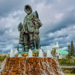
Two-Foot High Kick: World Eskimo Indian Olympics
Contestants take a running leap, then they make this crazy jackknife move, touch the ball suspended high above the floor with both feet, then come back down and stick the landing. If that sounds difficult? You have no idea.
<<CLICK to Read More>>

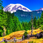
Dreaming of Denali
When I drove my Jeep to Alaska that first summer after I retired, my main goal, the single most important thing I wanted to do, was to see Denali, the biggest mountain in North America.
<<CLICK to Read More>>

Follow the Fireweed
Visualize a summertime journey through that part of the world, a world filled with mountains and glaciers and boreal forests, ice blue rivers, turquoise lakes, and billowing clouds that fill the sky. Imagine your vision as a beautiful piece of music. The fundamental, underlying theme of that symphony would be a gently rising swell of perfect harmony, pinkish lavender in its hue.
<<CLICK to Read More>>

Kenai Fjords National Park: Seabirds, Glaciers, and Whales on the Wild Coast of Alaska
At this latitude, during the summer months, the sun stays low in the sky all day, and never really goes down. The traditional “golden hour” when the light is best for landscape photos is extended accordingly, and there are more opportunities for great shots than you’ll know what to do with.
<<CLICK to Read More>>

Kenai Fjords National Park: Exit Glacier: Up Close and Personal
Compared to the huge tidewater glaciers that flow directly into the sea along the coast of Kenai Fjords, Exit Glacier is just a baby–a baby that’s getting smaller every year–but it’s still big enough to permanently alter the landscape through which it passes.
<<CLICK to Read More>>

Alaska Road Trip: Driving Alaska’s Grand Circle
Most of the major towns in Alaska, as well as three of the state’s incredible National Parks, can all be reached by driving Alaska’s Grand Circle: a loop route beginning in Tok that utilizes all four segments (1082 miles) of Alaska’s Interstate Highway system.
<<CLICK to Read More>>

Alaska Road Trip: The Grand Circle: From Tok to Denali
There are no icy mountains looming on the horizon, and Fairbanks is nowhere near Alaska’s ruggedly beautiful coast. The true beauty in Alaska’s second city is found below the surface, in the spirit and resiliance of the people who make the place their home.
<<CLICK to Read More>>

Alaska Road Trip: The Grand Circle: Anchorage and the Kenai Peninsula
The massive ice field in the park’s wild interior has spawned dozens of glaciers which, over the course of many millenia, have carved the landscape into fjords so heart-breakingly beautiful, humpback whales swim all the way from Hawaii just to cavort in the deep blue water.

Alaska Road Trip: The Grand Circle: Wrangell-St. Elias National Park
So, just exactly how big is Wrangell-St. Elias National Park? You could combine Yellowstone with Yosemite, throw in the entire country of Switzerland, and you still wouldn’t match it in terms of size.
<<CLICK to Read More>>

Alaska Road Trip: Driving to the Top of the World
The rough dirt road gave way to a newly paved modern highway. This was it, the Top of the World, and right on cue, the haze peeled back, just enough to give me a glimpse of the beauty my friends assured me would be there…
<<CLICK to Read More>>

There’s nothing like a good road trip. Whether you’re flying solo or with your family, on a motorcycle or in an RV, across your state or across the country, the important thing is that you’re out there, away from your town, your work, your routine, meeting new people, seeing new sights, building the best kind of memories while living your life to the fullest.
Are you a veteran road tripper who loves grand vistas, or someone who’s never done it, but would love to try? Either way, you should consider making the Southwestern U.S. the scene of your own next adventure.
A few years ago I wrote a book about road trips in Arizona and New Mexico that’s a lot like this website, packed with interesting information, and illustrated with beautiful photographs. Check it out! You can find it on Amazon, and at all other major booksellers.

ALASKA ROAD TRIP:
MEXICAN ROAD TRIP (IN THE LAND OF THE MAYA):
ARIZONA AND NEW MEXICO:
SOUTH AMERICA:
PHOTOGRAPHY:
TRIBAL LANDS:


Recent Comments