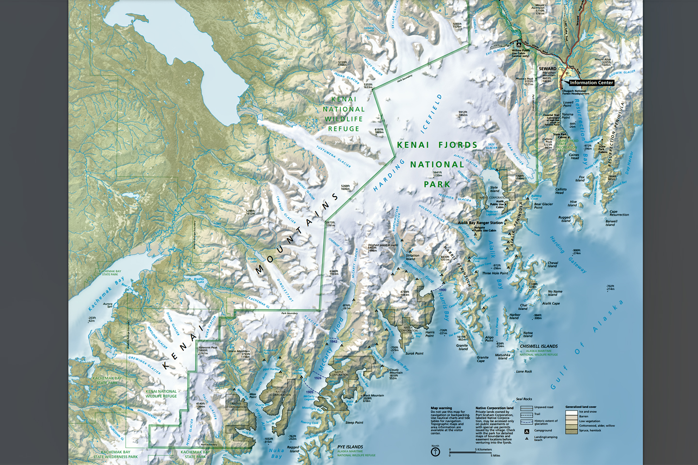
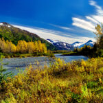
Kenai Fjords was established as a National Park when Congress implemented the Alaska National Interest Lands Conservation Act (ANILCA) of 1980. The protected area covers a bit more than 1,000 square miles of the wild southeastern coastline of the Kenai Peninsula, and is centered around the Harding Ice Field, one of the largest in the United States. This massive, mile-thick sheet of ice has spawned no less than three dozen glaciers, and those glaciers have carved deep, steep-sided valleys into the terrain as they inch their way down toward the sea. The largest of these valleys are the fjords for which the park is named, and they are home to a vast array of wildlife, ranging from seabirds by the thousands to cantankerous sea lions, playful otters, and breaching humpback whales.
Click Maps and Photos for an expanded view.
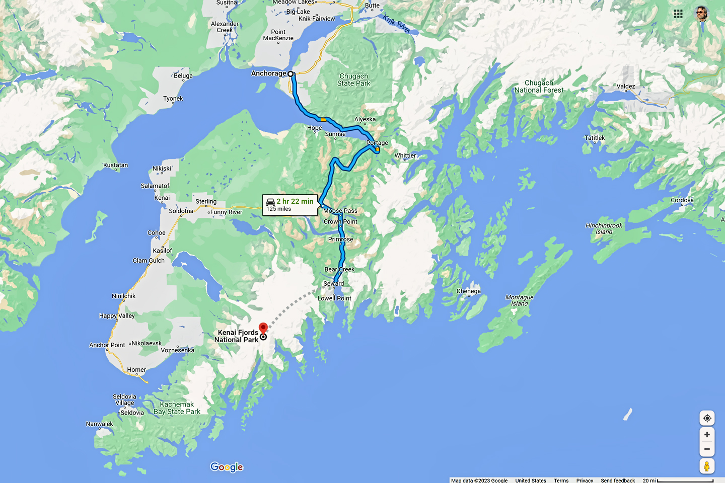
Kenai Fjords is almost as large as California’s Yosemite, but that makes it small when compared to the other National Parks in Alaska. Seward, the location of the Visitor’s Center and the primary point of entry is just two hours by car from Anchorage, so it’s easily the most accessible of Alaska’s parks. One small section of Kenai Fjords, the Exit Glacier, can be accessed by road (in summer only), and offers stunning close-up views of a retreating glacier, along with hiking trails leading to the park’s rugged interior. Everything else, the icefield, the fjords, the tidewater glaciers, can only be reached on foot, in an airplane, or, most commonly, by boat. Some intrepid souls rent kayaks, and travel along the coast using muscle power, and many local residents have their own boats. The rest of us buy tickets from one of the tour companies that service the park, offering half day and full day voyages of discovery on comfortable, motorized vessels, leaving from the docks at Seward.
The five and six hour tours generally cover the whole of Resurrection Bay, where Seward is located, along with Aialik Bay, the next fjord over. The full day tours travel farther down the peninsula and make more stops, for closeup views of the rugged coast with it’s booming glaciers and abundant wildlife.
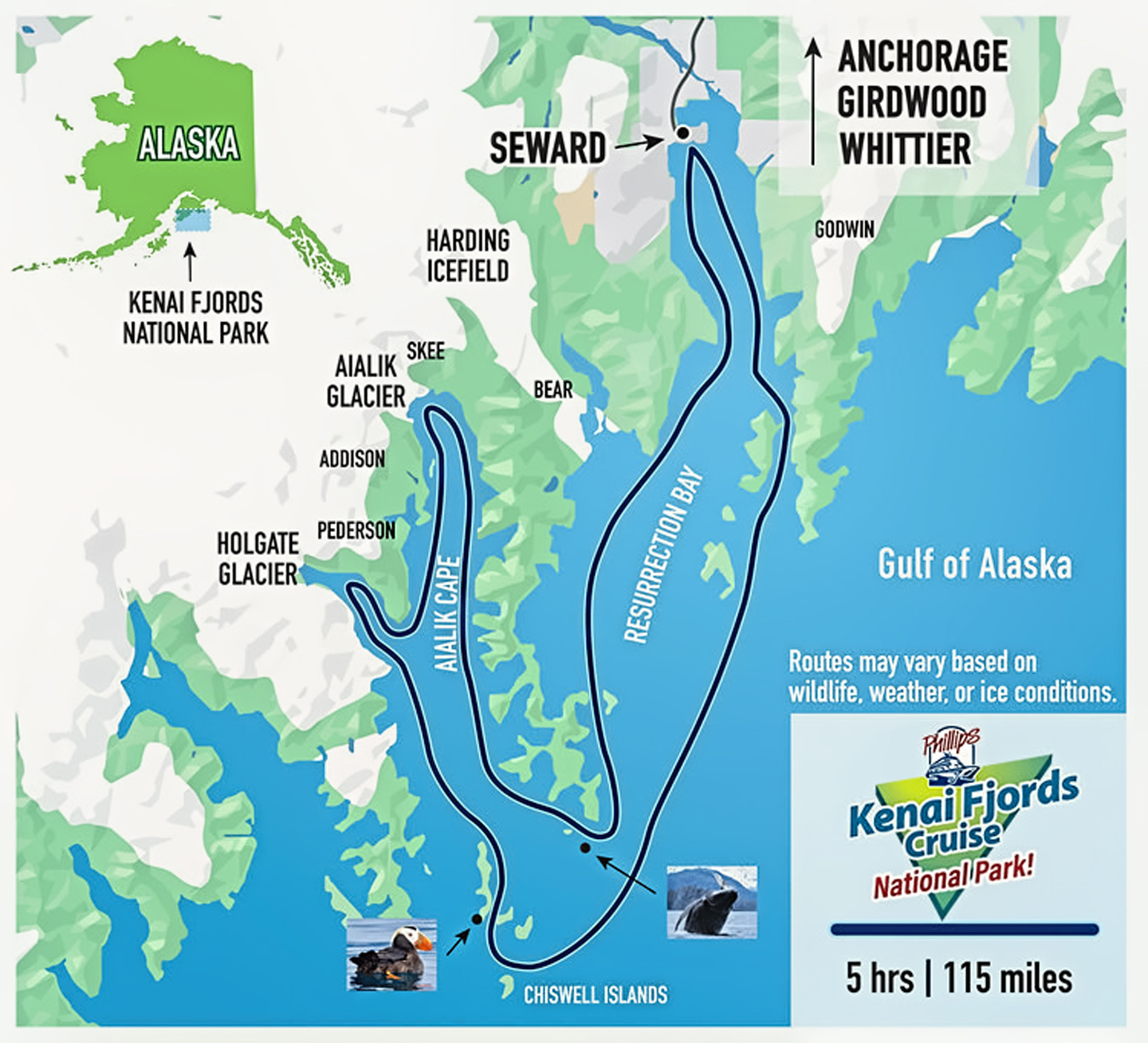
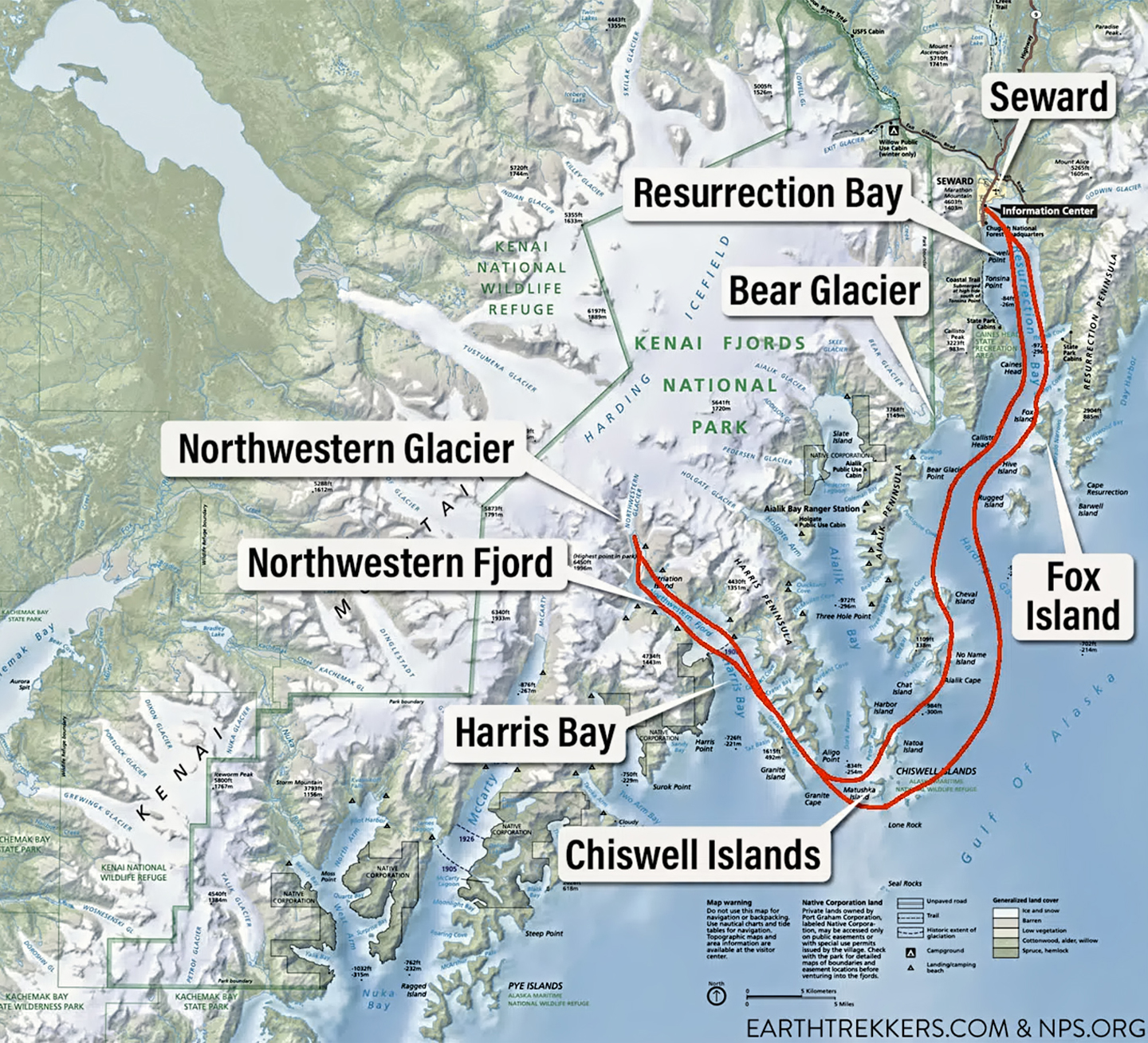
Approximate routes of full day and half day boat tours
The day I went, I drove down from Anchorage, taking my chances, because it was mid-July, the peak summer season, and I had nothing reserved or pre-planned. I secured a tent camping spot for myself at the Waterfront Park in Seward ($10, cheap!), then drove over to the dock to inquire about the boat tours. It was noon by then, and the only tour not already gone was the last of the day, a six hour excursion on one of the larger vessels. They had one seat left, and it was leaving in 15 minutes. Came to $162.93 (not cheap!)–but I figured it was fate, so I grabbed it.
It was a relatively new boat, clean, and well-appointed, and we had a Ranger from the National Park giving a running commentary on the loudspeakers, really great information, especially about the wildlife. Almost all of the passengers had come straight off a huge cruise ship that was docked in Seward; this tour was one of their “optional excursions”.
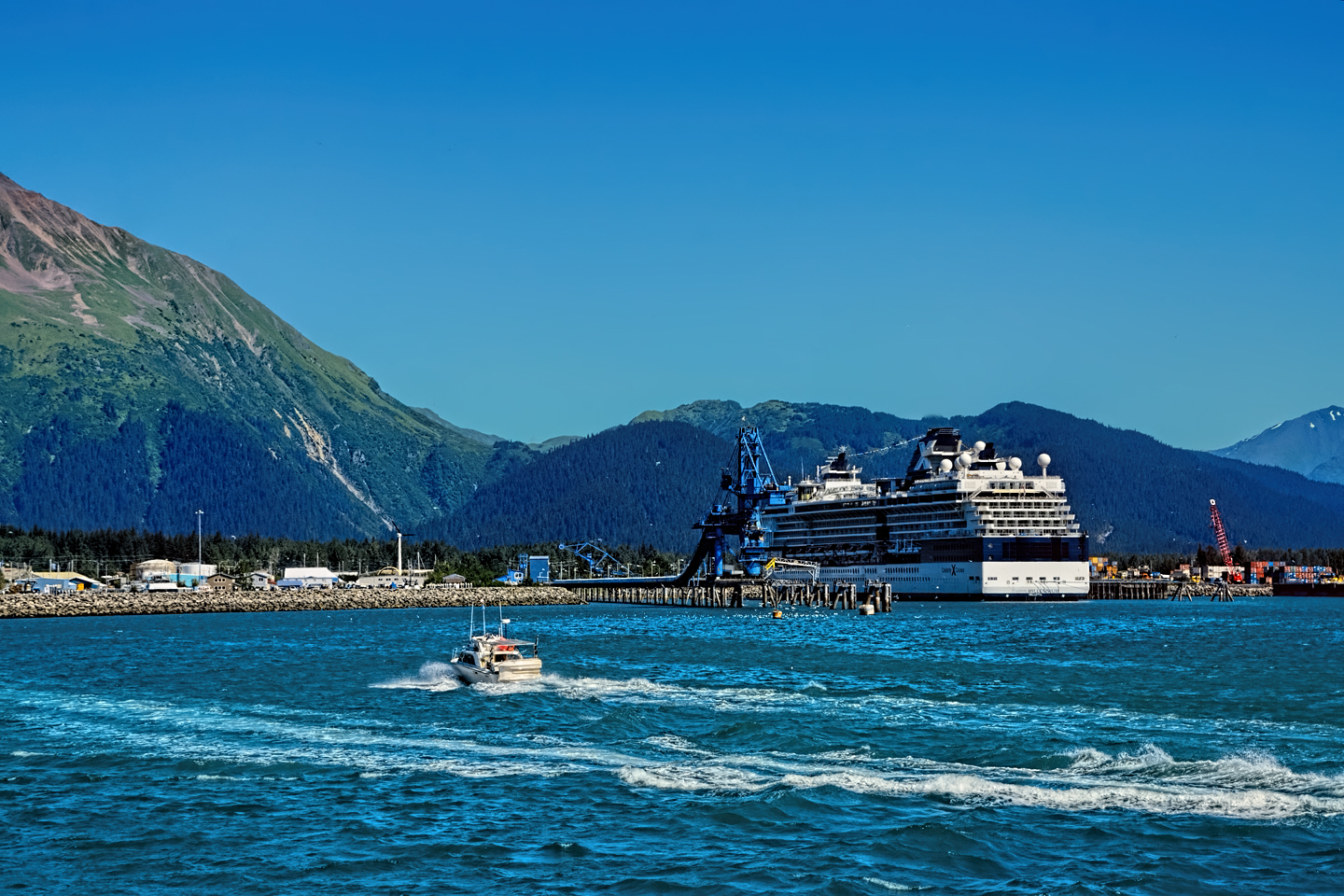
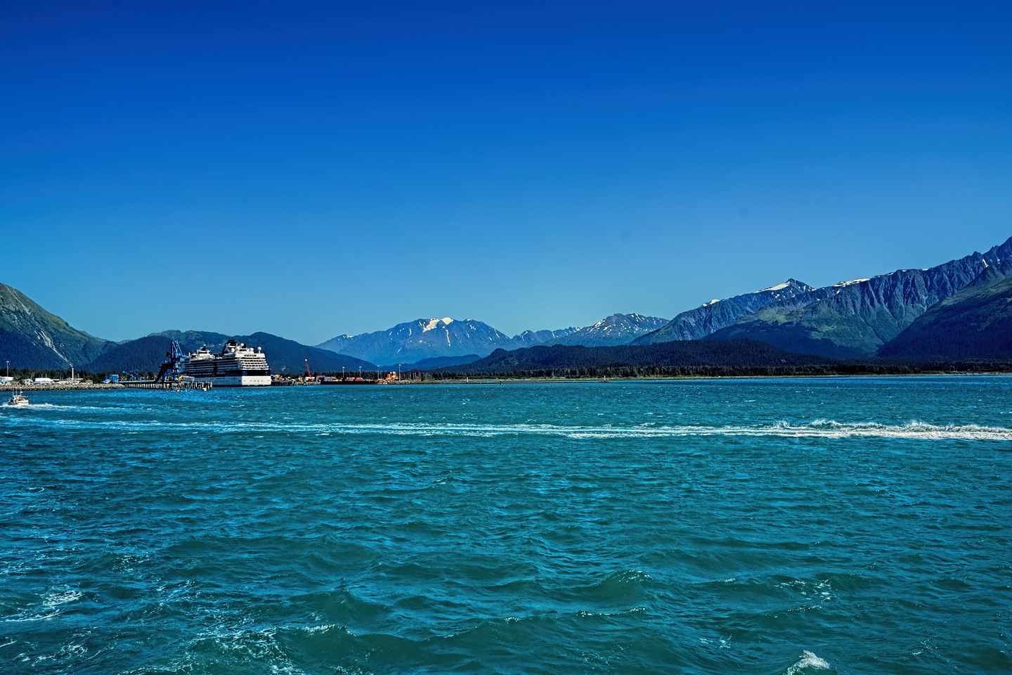
Looking back at the cruise ship docks in Seward as our tour boat motors out into Resurrection Bay
I felt quite apart from those other passengers. I’d been on the road for a month, roughing it through every kind of weather and terrain, and now, here I was, grabbing a beer at the bar with a crowd of people who hadn’t done any of that. It was almost as if I’d crawled out of the bush and straight into a fancy cocktail party; the contrast was sufficiently surreal, it would have made a great gimmick for an episode of the Twilight Zone.
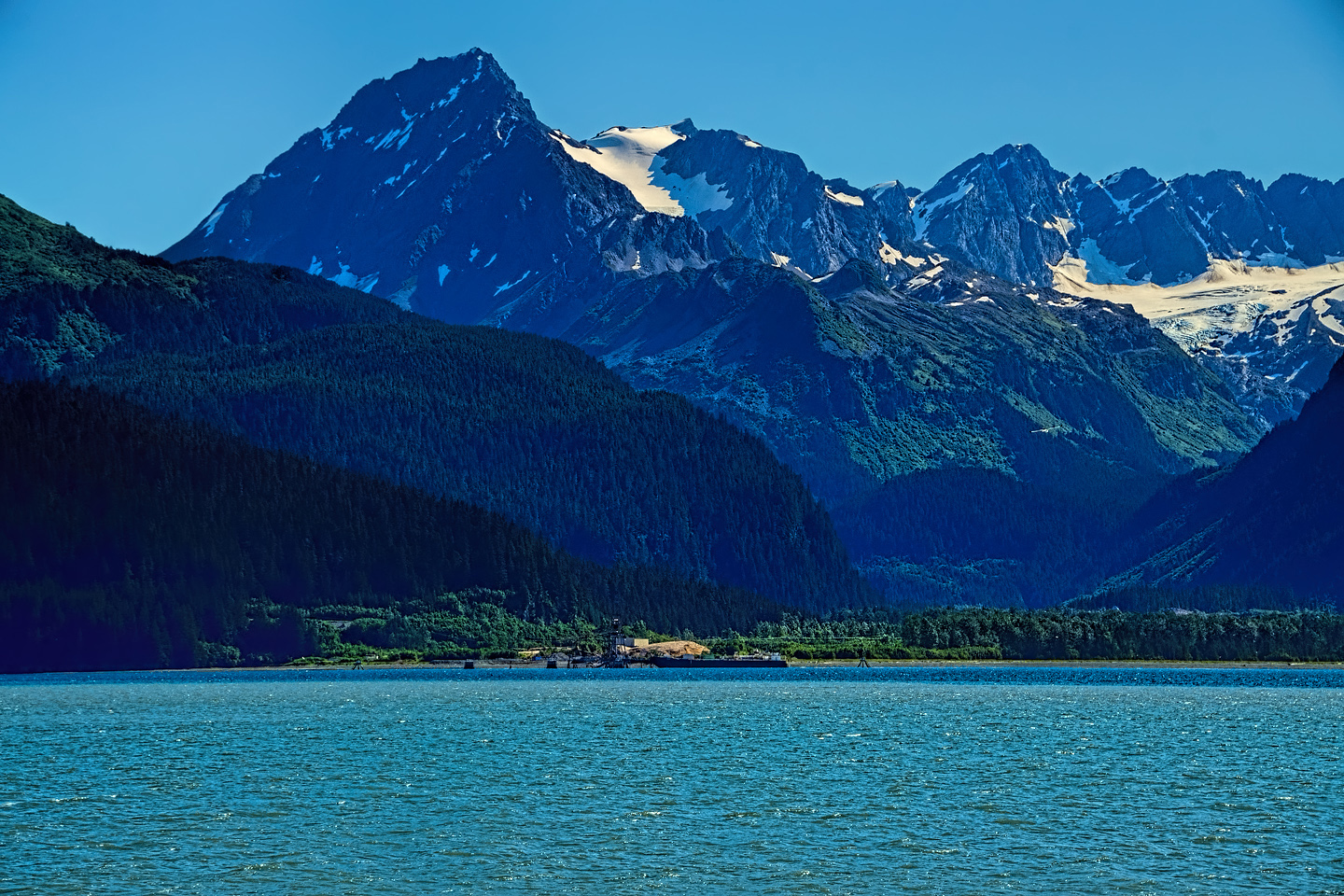
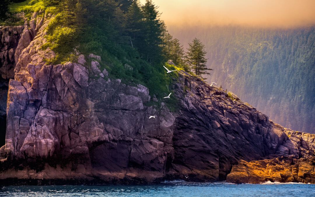
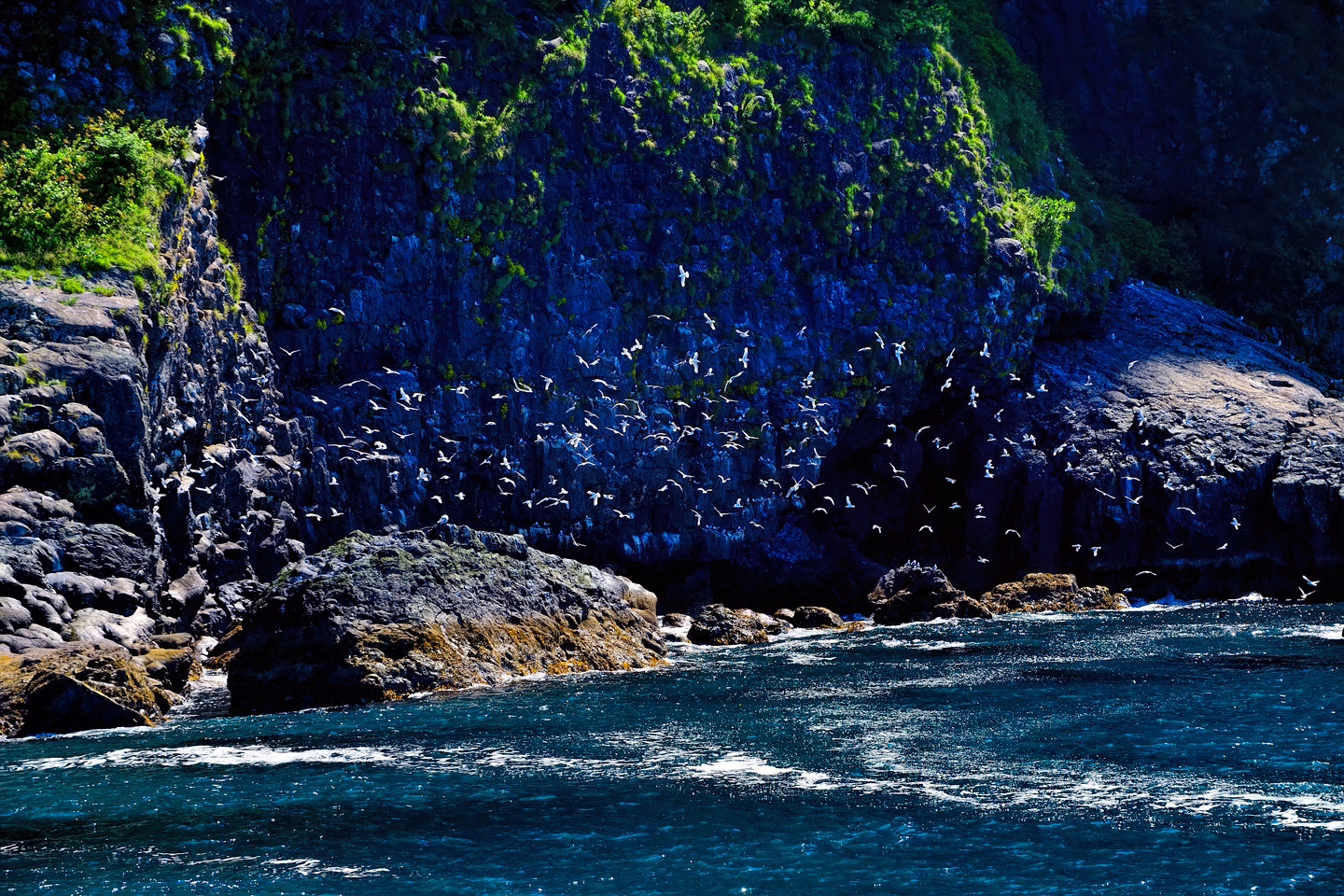
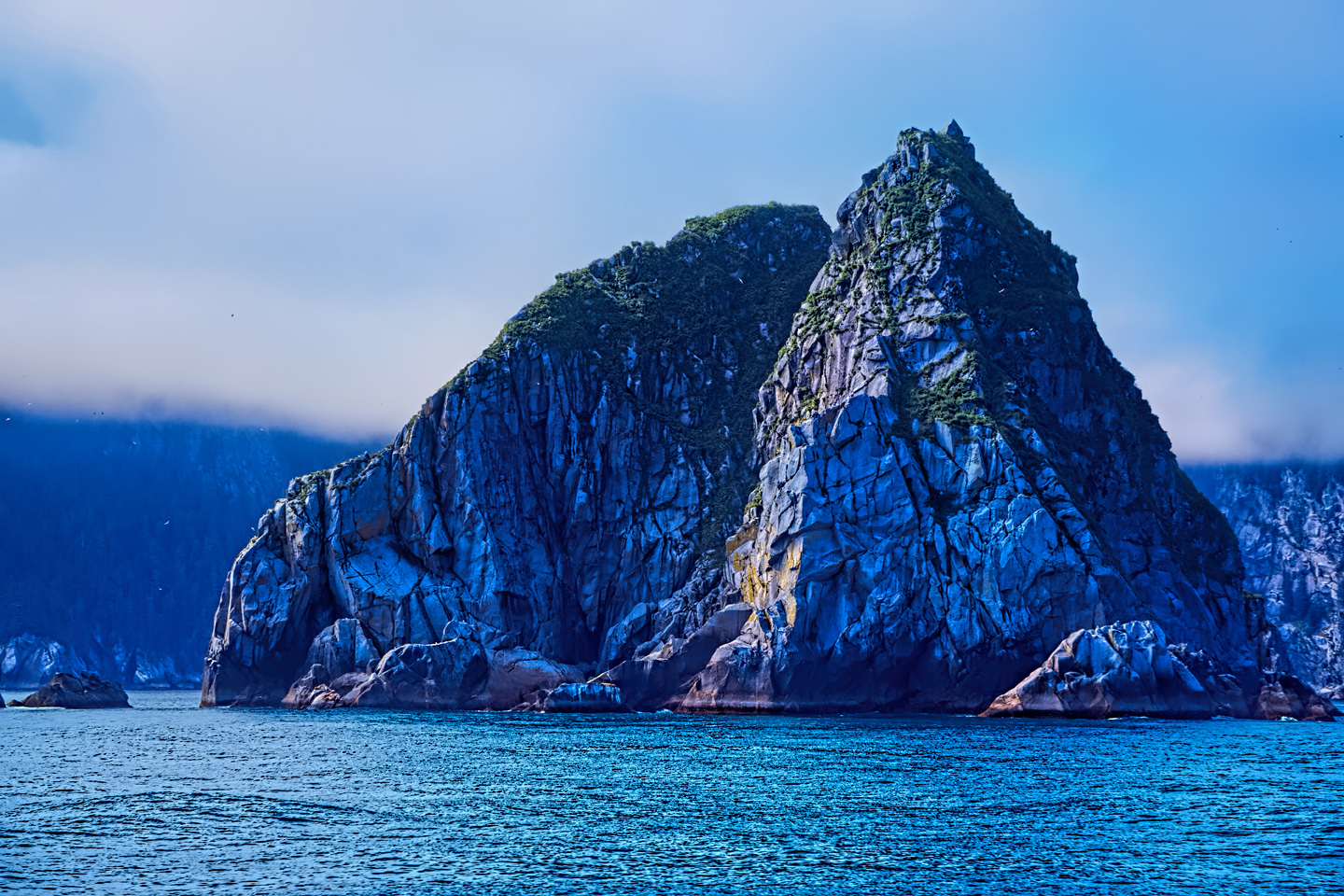
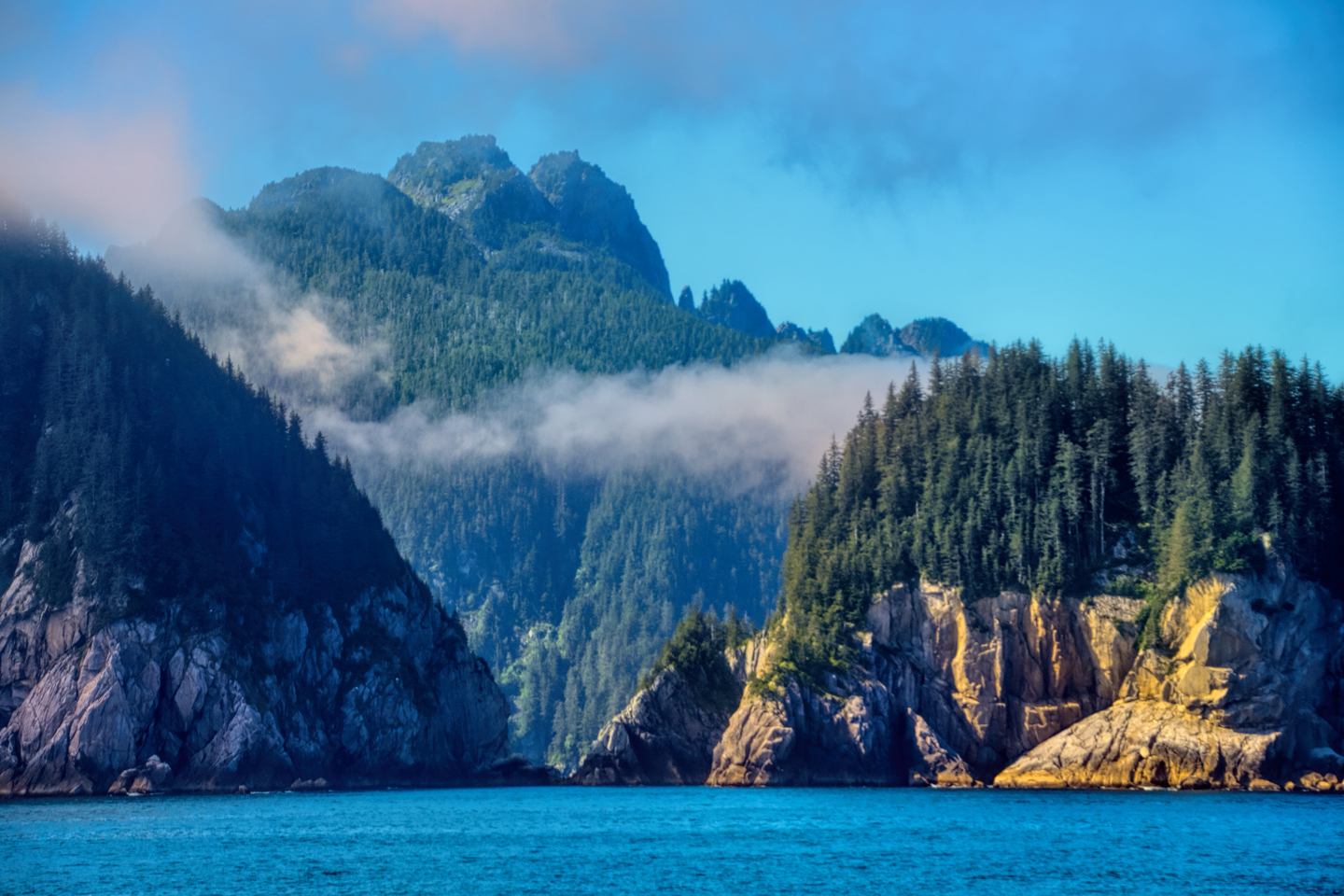
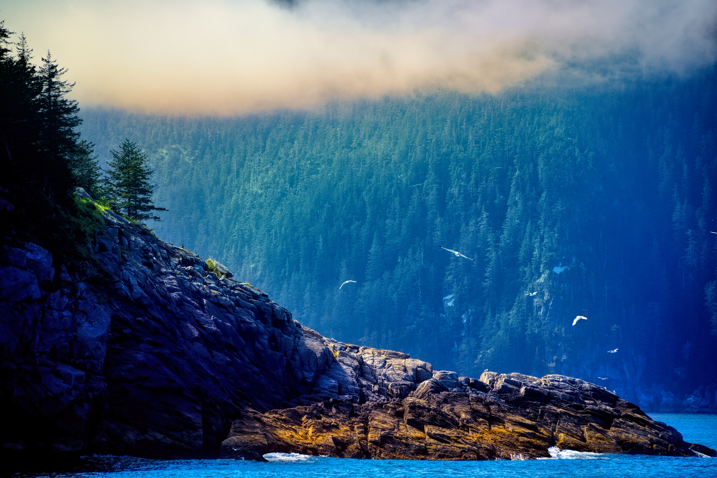
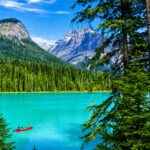
Starting out, we hugged the shoreline on the eastern side of Resurrection Bay, the largest of the fjords on this part of the coastline. There is no development beyond the town of Seward, so in no time at all, we were out there in the thick of it, cruising past verdant green hillsides cloaked with thick stands of trees, and pockets of ice crowning the low mountains in the middle distance.
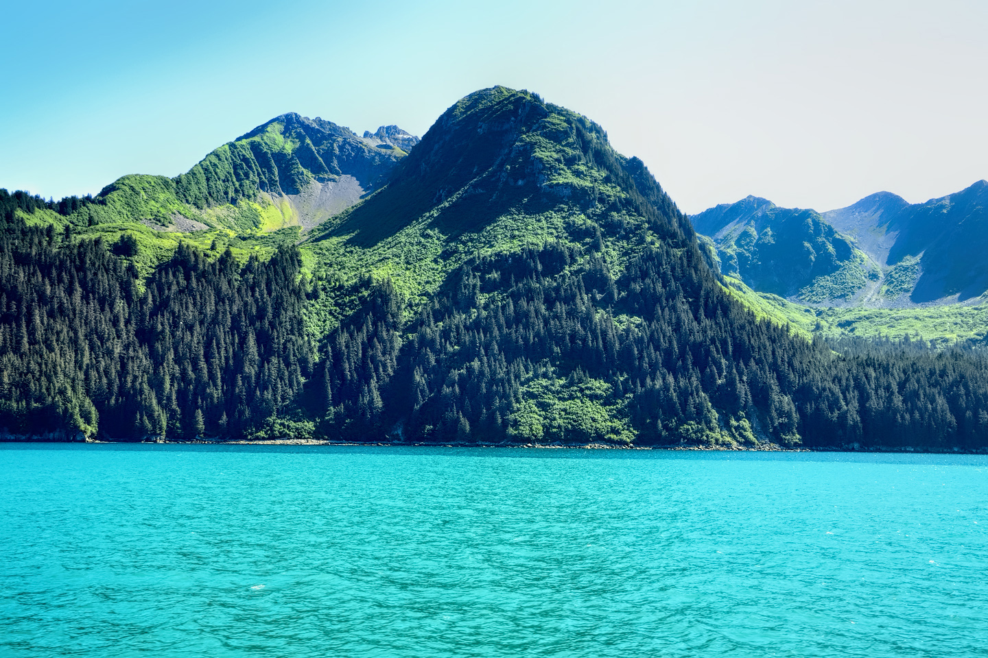
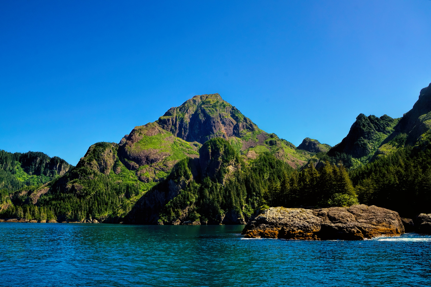
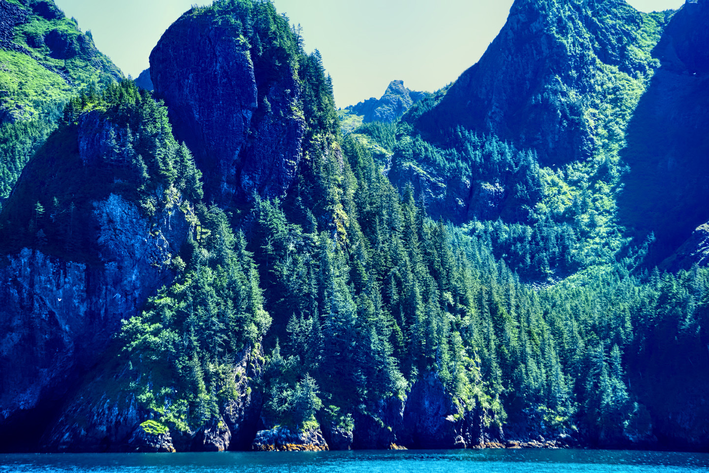
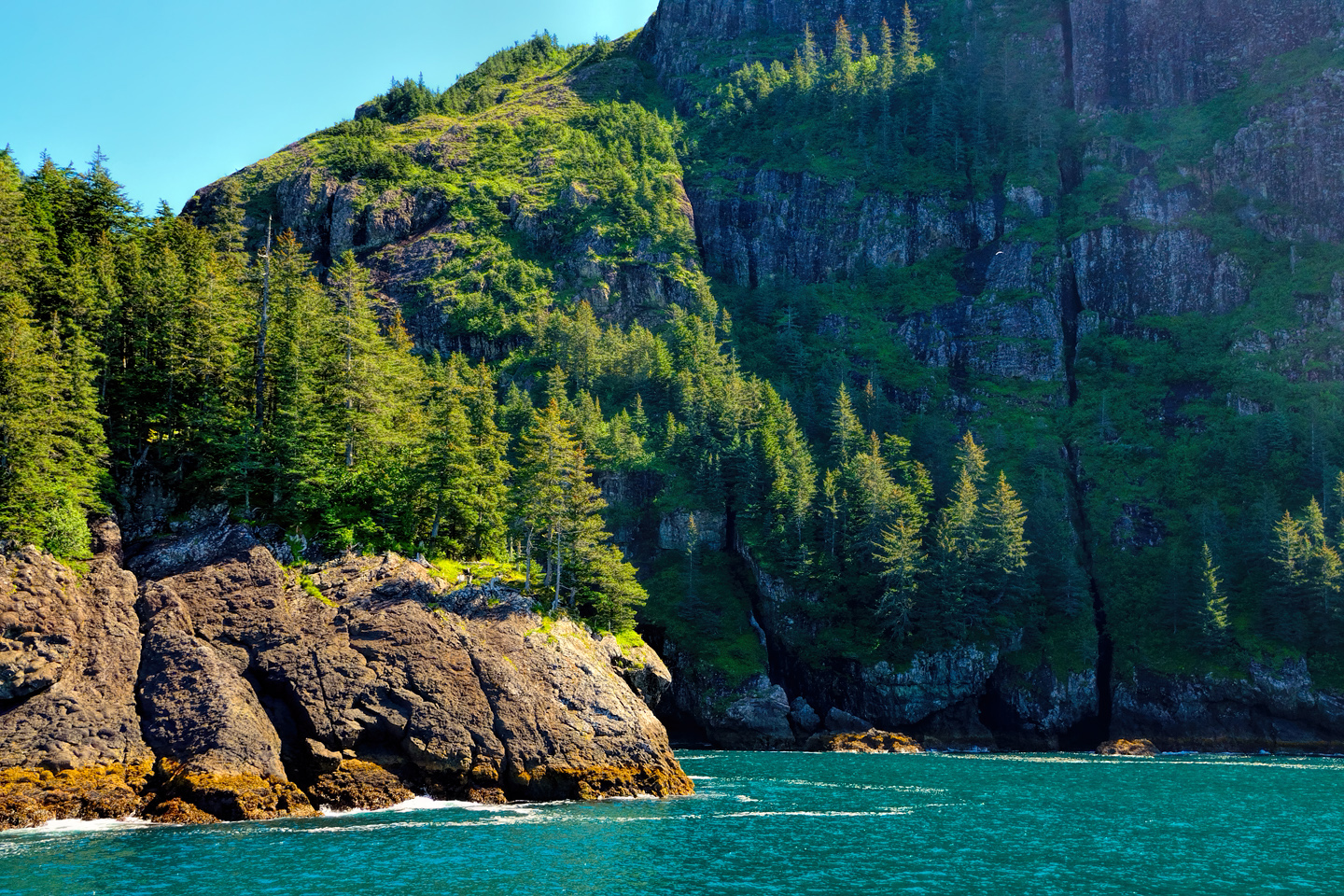
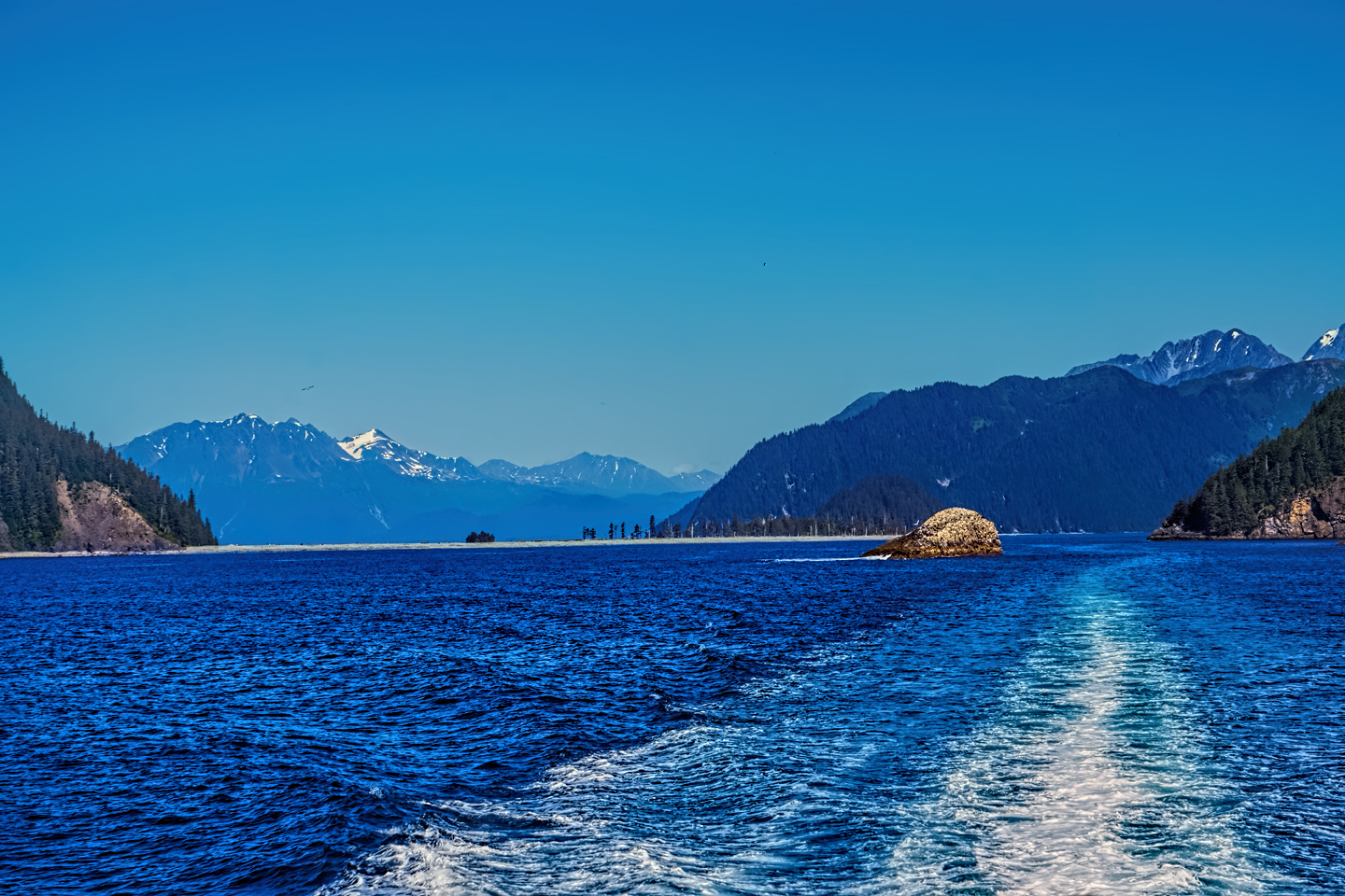
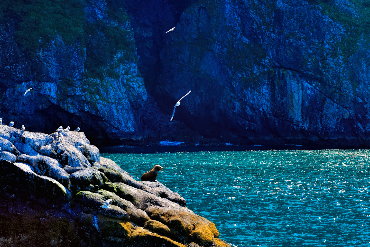
Close to the shore, the water takes on a turquoise hue from the sediment in the glacial meltwater, while the mountainsides are cloaked in every shade of green that you can imagine.
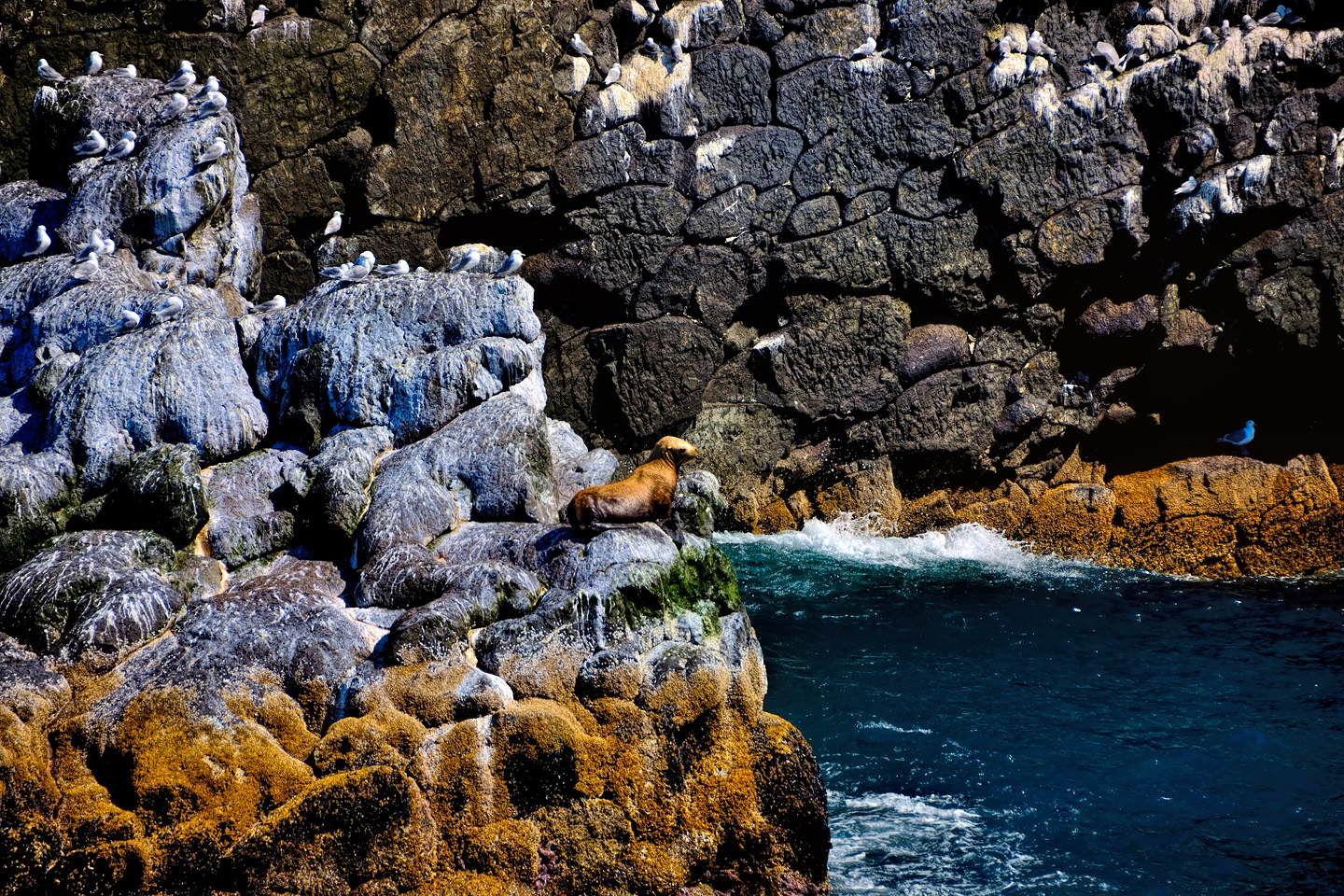
The ship pulled in quite close to the rocks for a closeup view of nesting seabirds. The grey and white Kittiwakes were the most numerous, with hundreds of nesting pairs on a single rock face. A small colony of puffins posed for us on a rocky ledge surrounded by wildflowers. The Park Ranger warned us not to be fooled by their comical looks: if you get too close to a puffin and extend your hand, you’re likely to lose a finger!
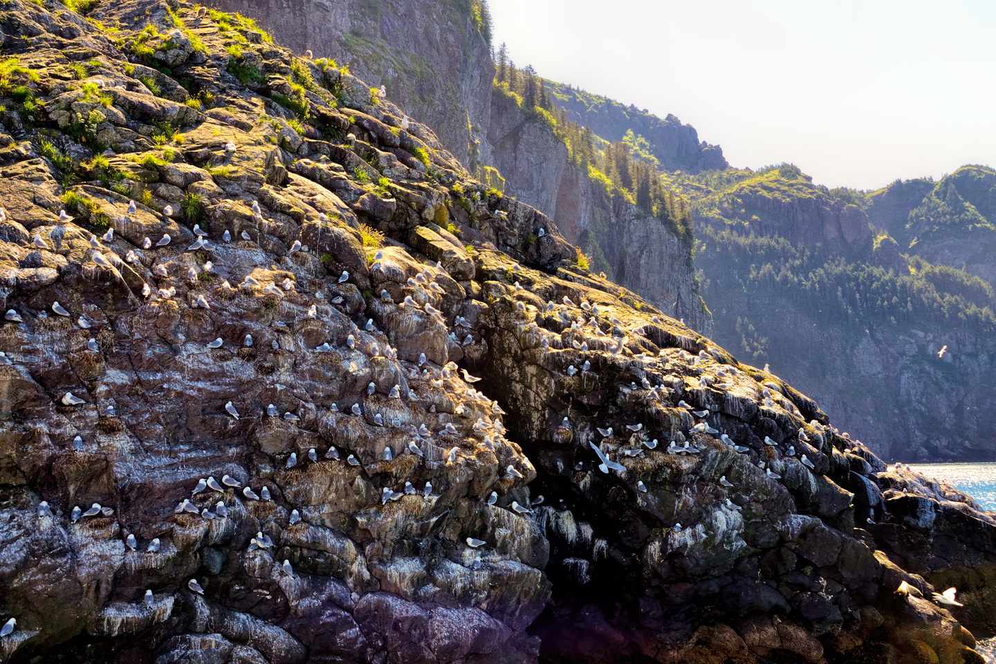
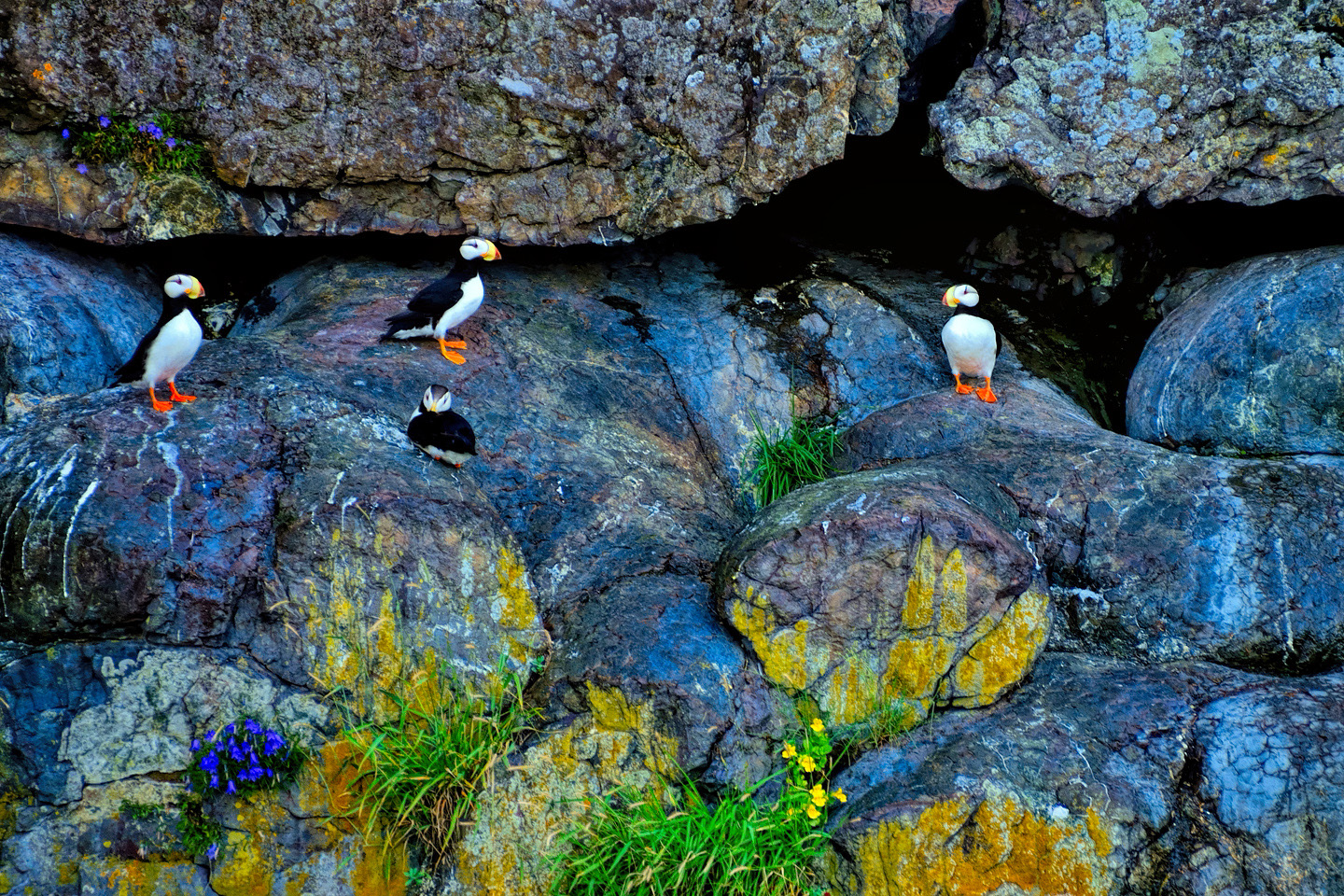
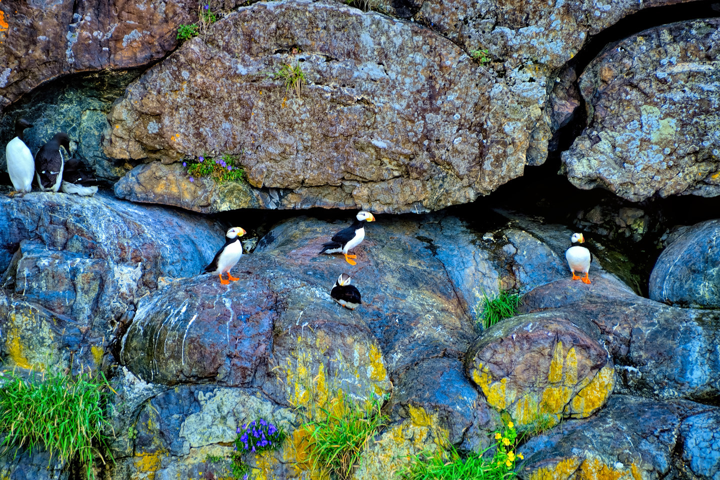
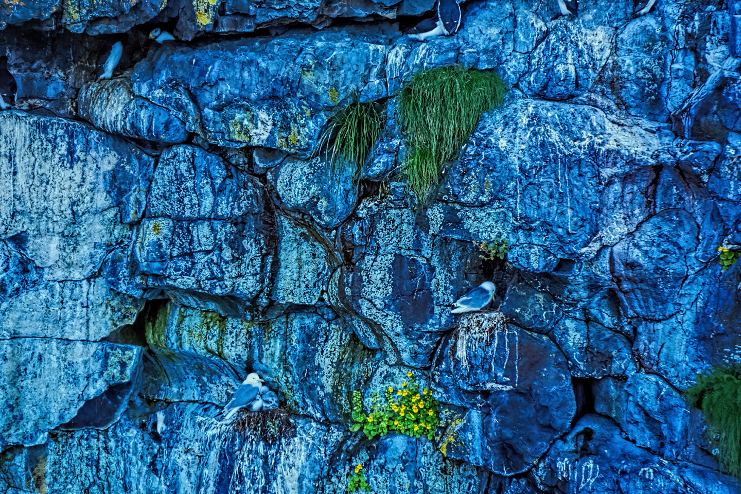
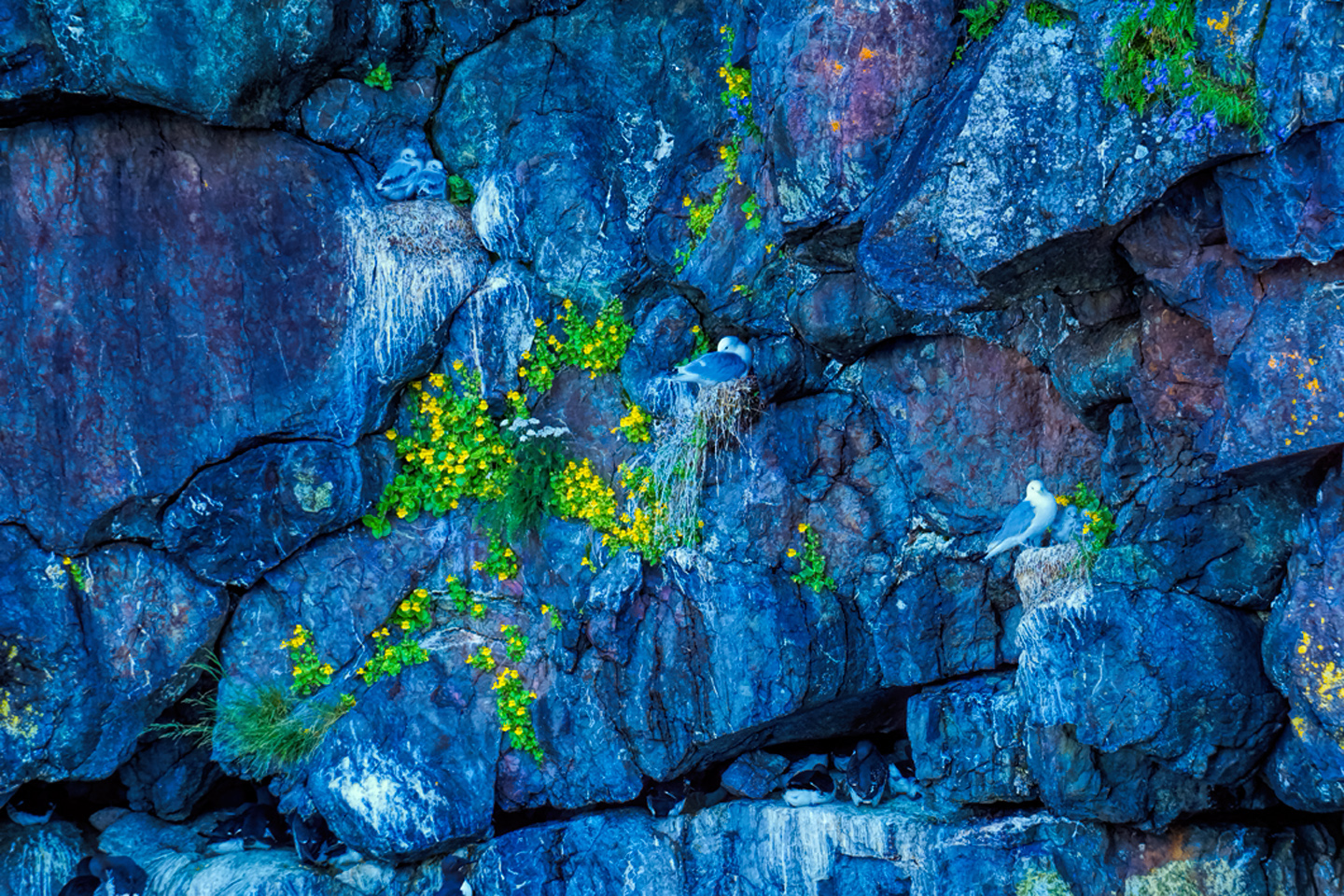
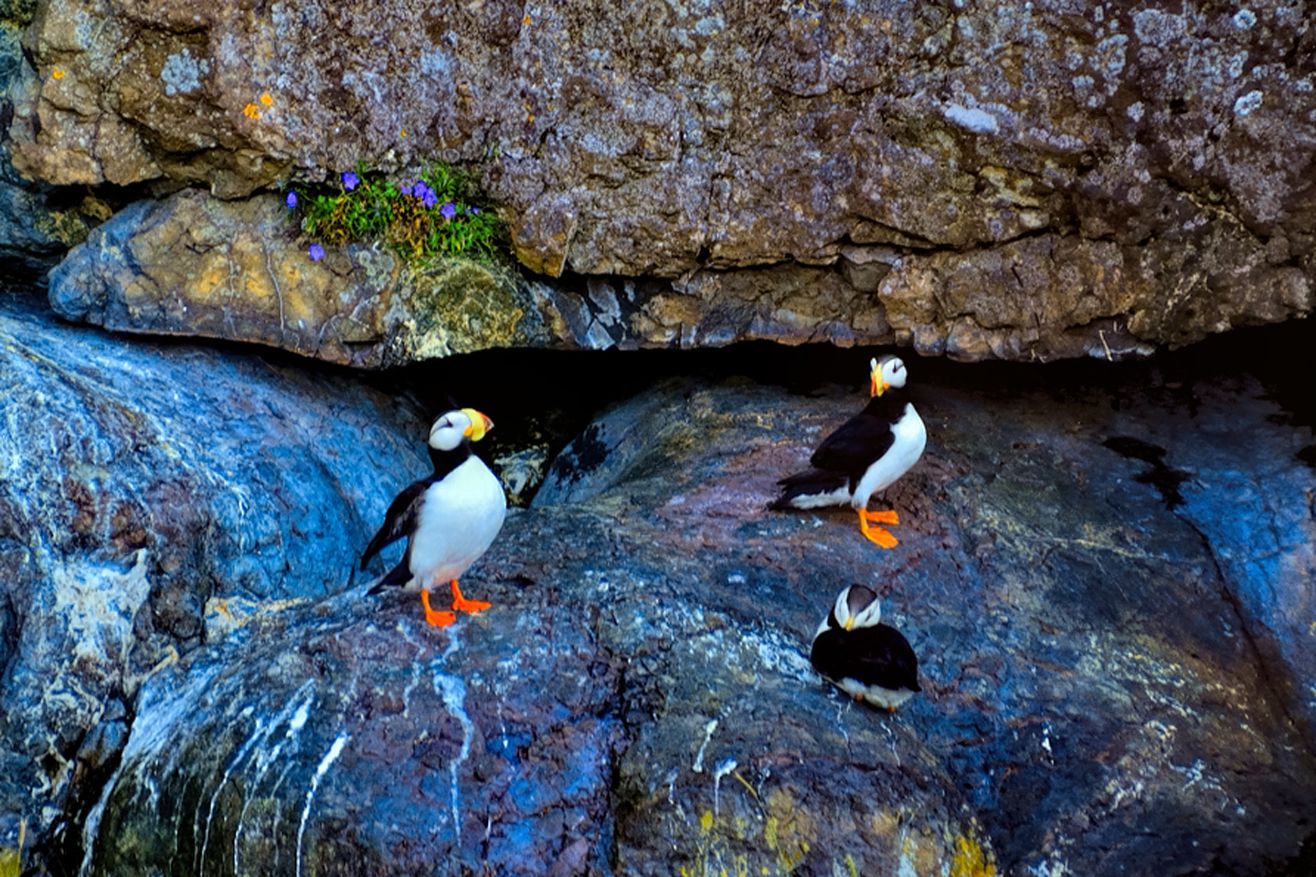
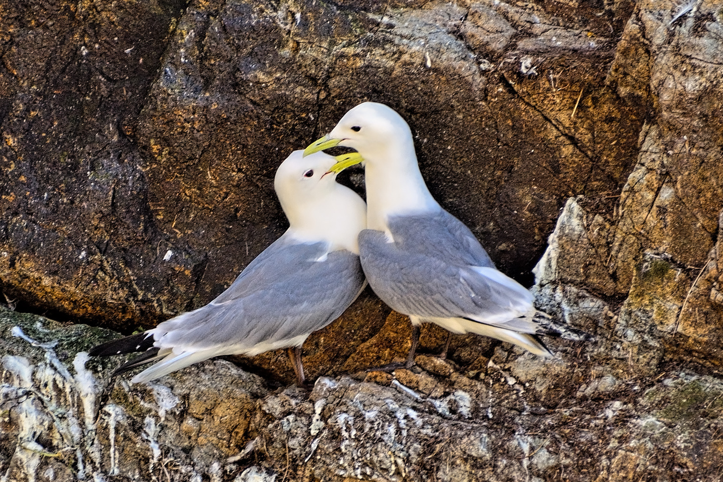
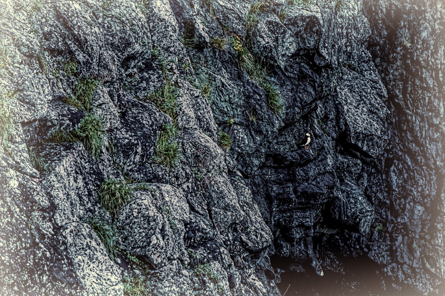
Kittiwakes and Puffins nesting among the rocks
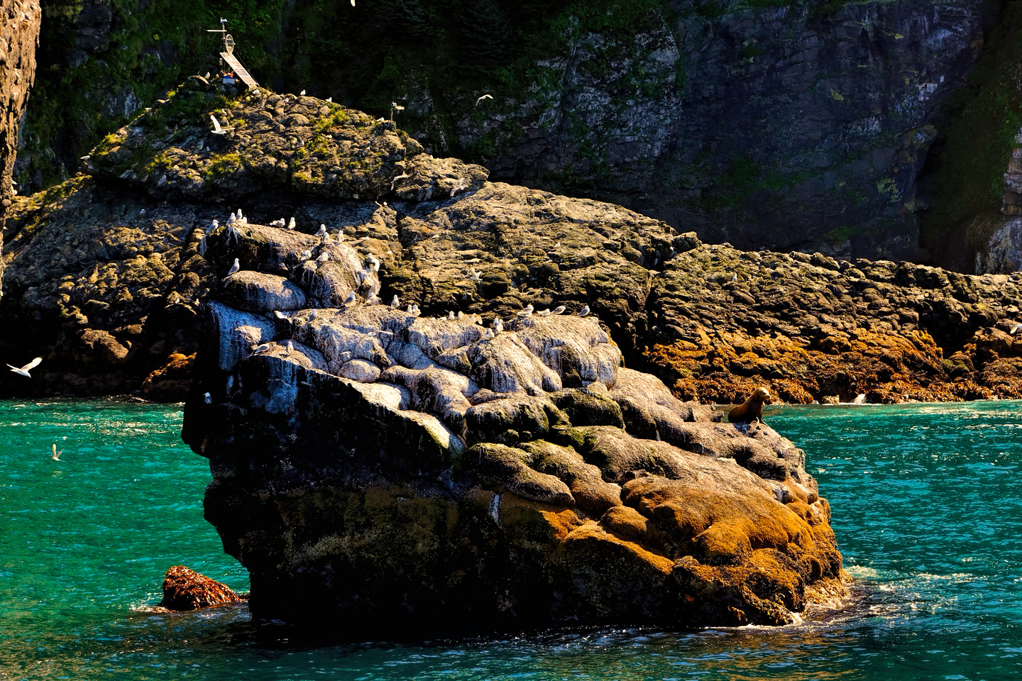
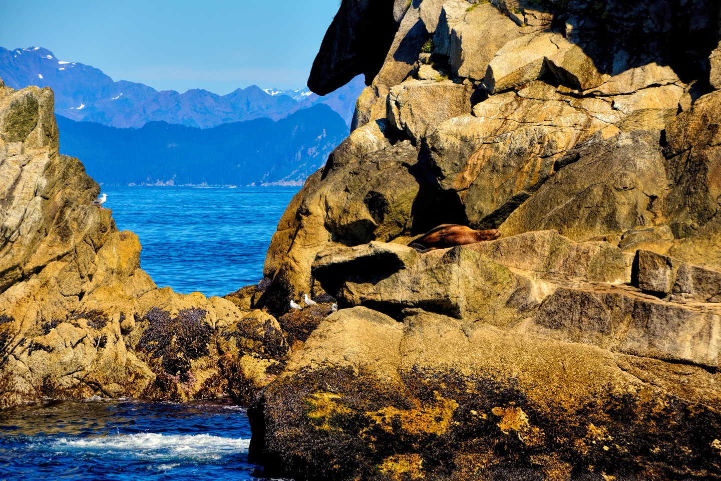
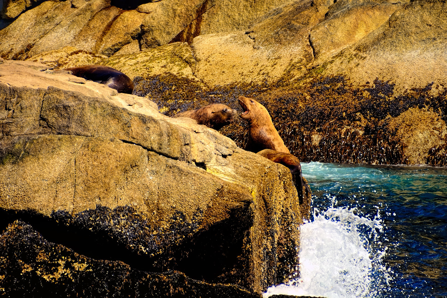
Stellar Sealions shared the rocks with the birds, taking a break from gorging on fish, climbing up out of the water and stretching out in the sun for their afternoon nap. There’s a definite pecking order among those beasts, and we watched with some amusement as an alpha male bellowed in the face of one of his rivals, chasing him off from a prime sunbathing location.
Click any photo to stop the slide shows and expand the images to full screen.
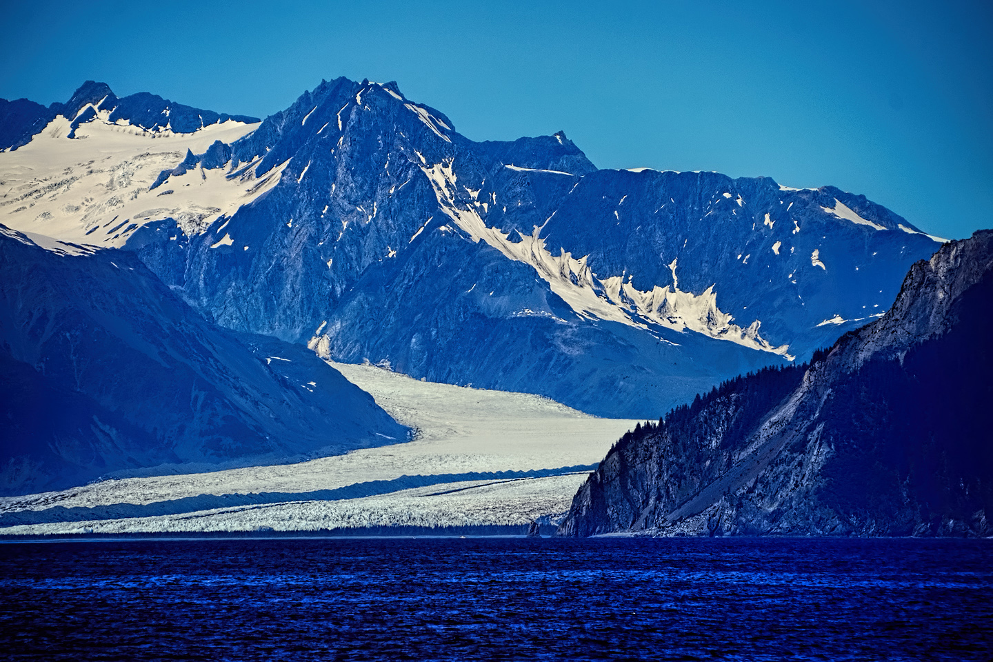
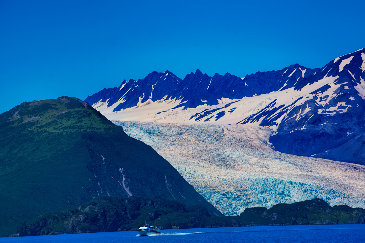
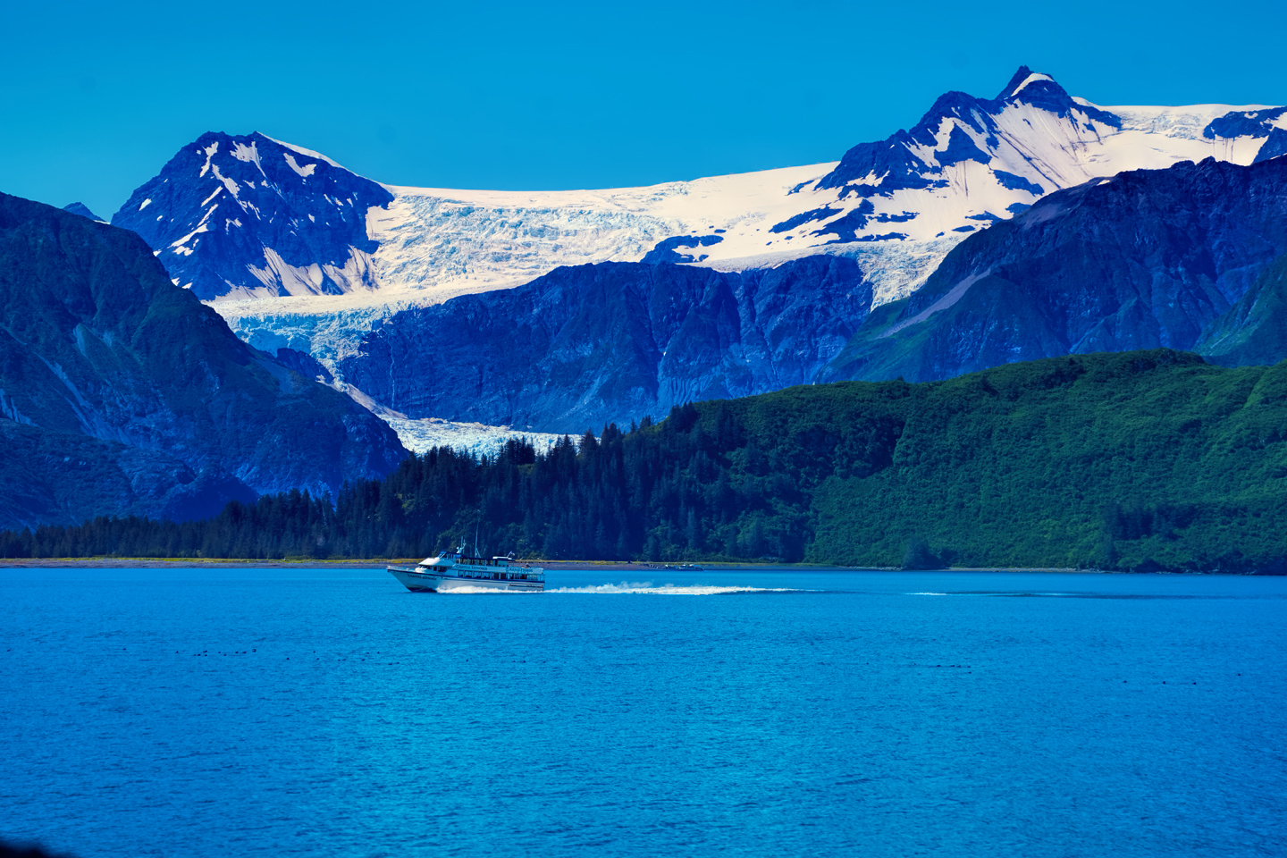
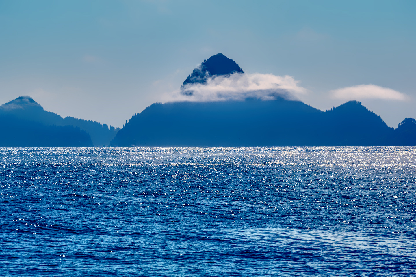
After leaving the seabird rookery, the ship motored out into the open water of the Gulf of Alaska. The Captain opened up the throttle on the big vessel and covered this next stretch fairly quickly, south/southwest to the rocky Chiswell Islands before turning north into Aialik Bay, a fjord with several large and very active glaciers, also known to be a good location for spotting humpback whales and Orcas.
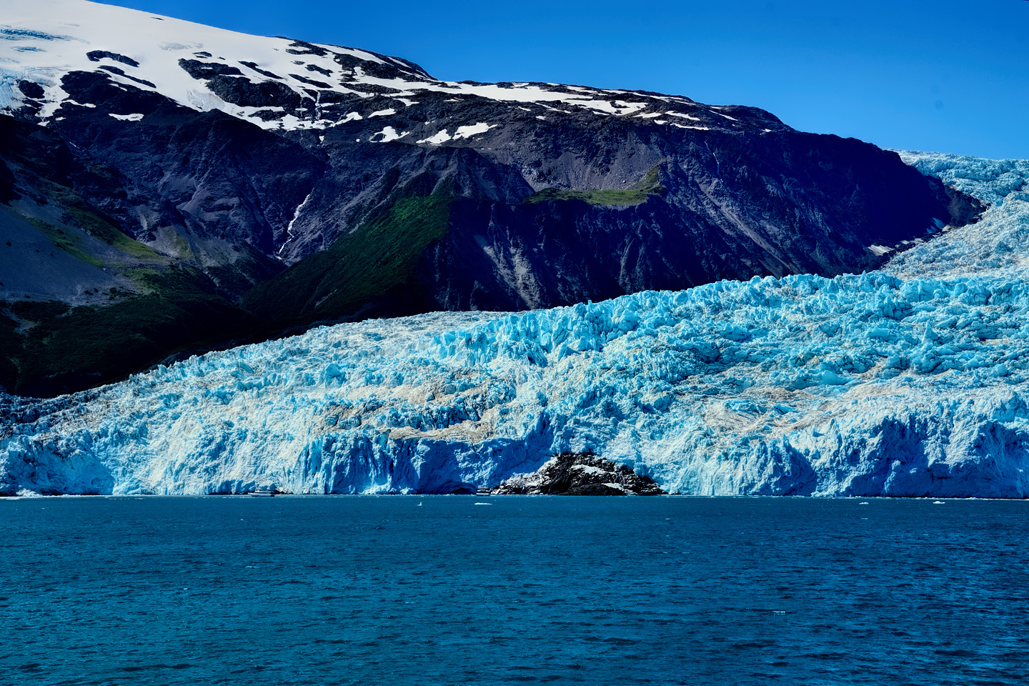
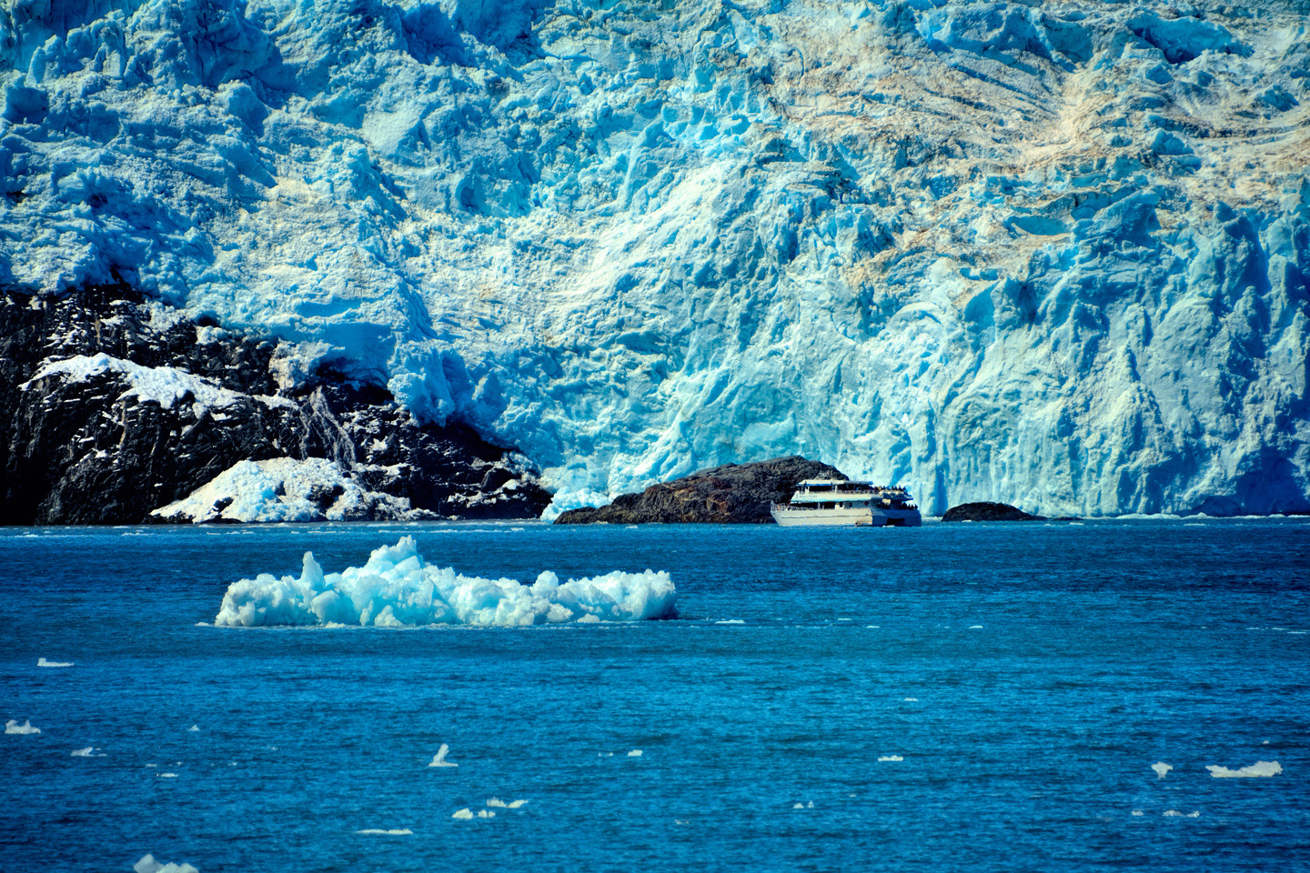
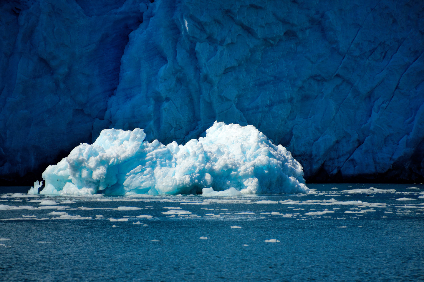
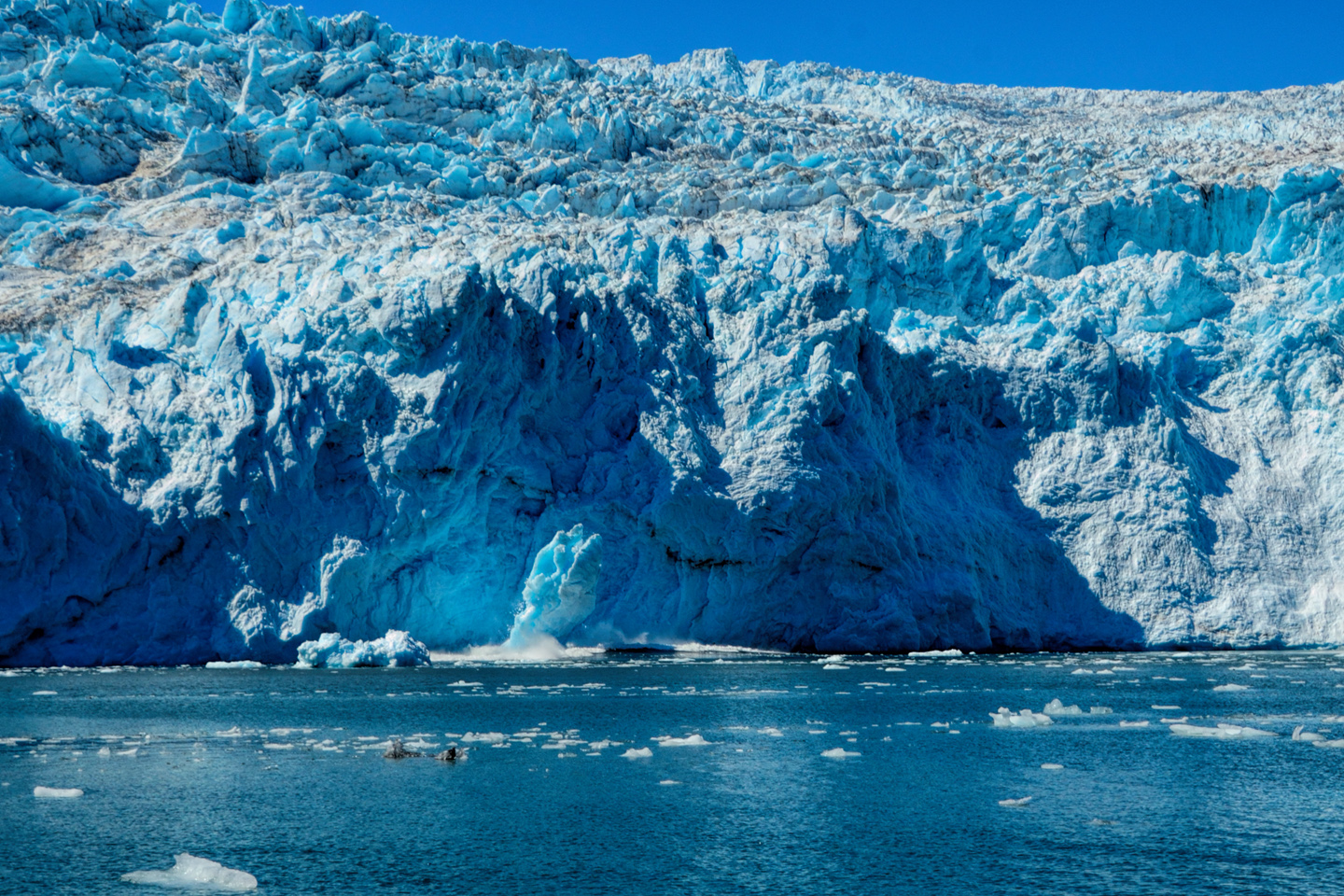
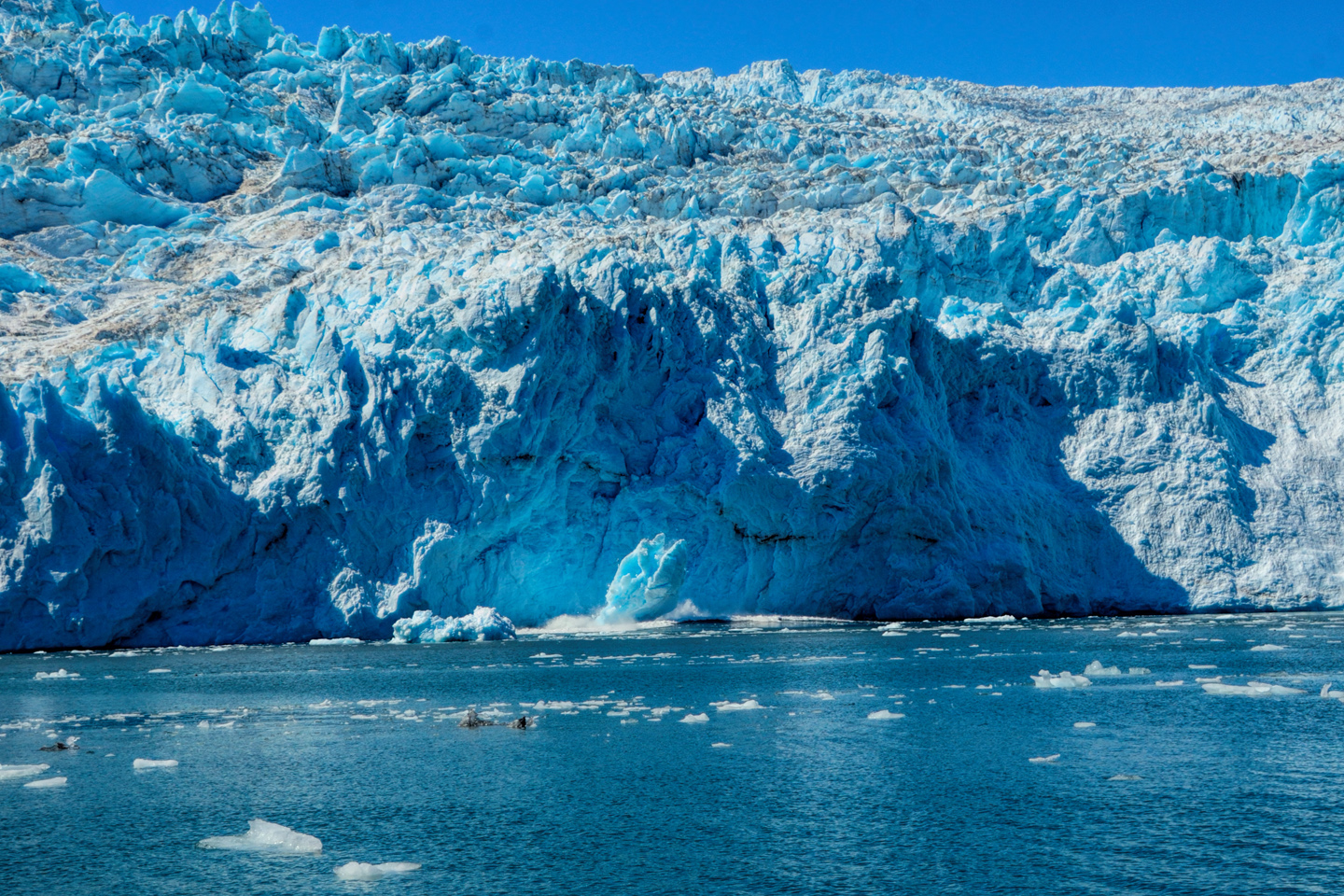
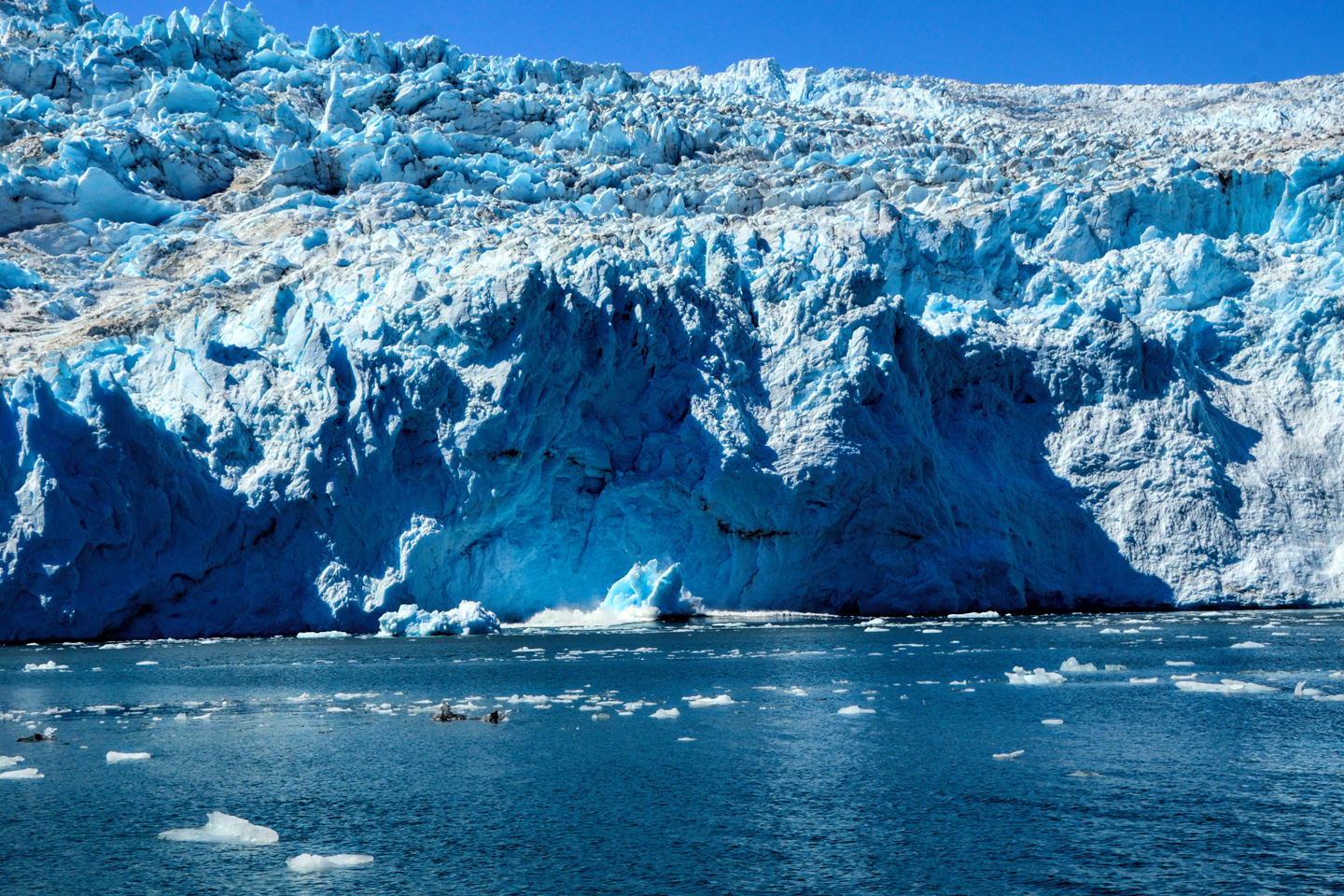
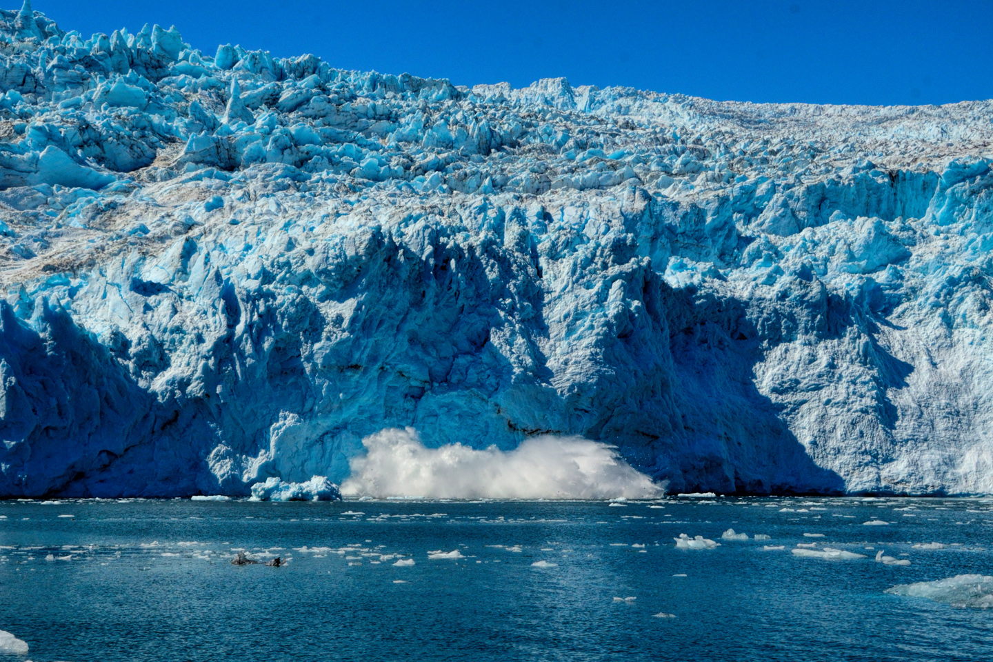
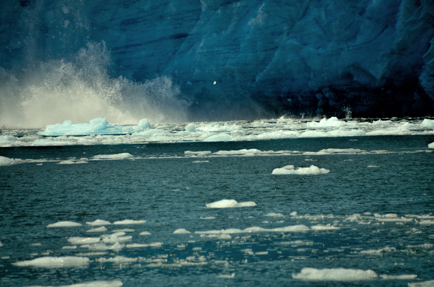
Tidewater glaciers are slow moving rivers of ice that flow from an ice field, such as the Harding, and make it all the way down to the sea before melting. When the leading face of the moving glacier enters the water, it begins to break apart, and large chunks of ice split off. There is a booming CRACK that’s louder than cannon fire, followed by a resounding splash as the newly ‘calved’ icebergs hit the water. (See below.)
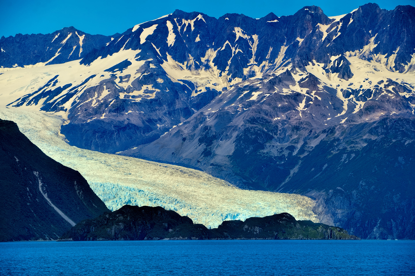
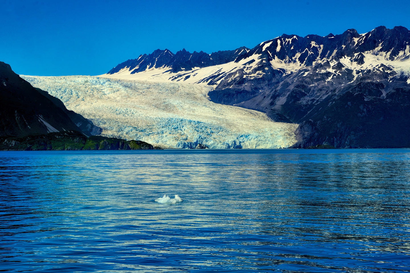
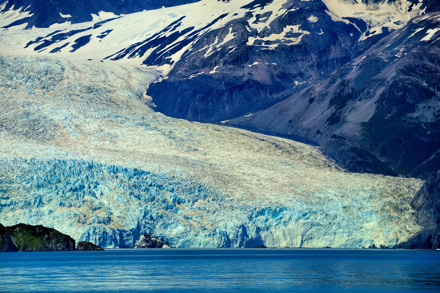
The tidewater glaciers in Aialik Bay are perfect examples of the process
Larger boats have to stay back some distance from the glaciers, but they’re still close enough for amazing views. Some of the smaller vessels are considerably more maneuvarable, with a shallower draft, so they’re able to move in much closer to the action. After watching some of those newly created icebergs fall, I was just as happy to be farther back, using a telephoto lens!

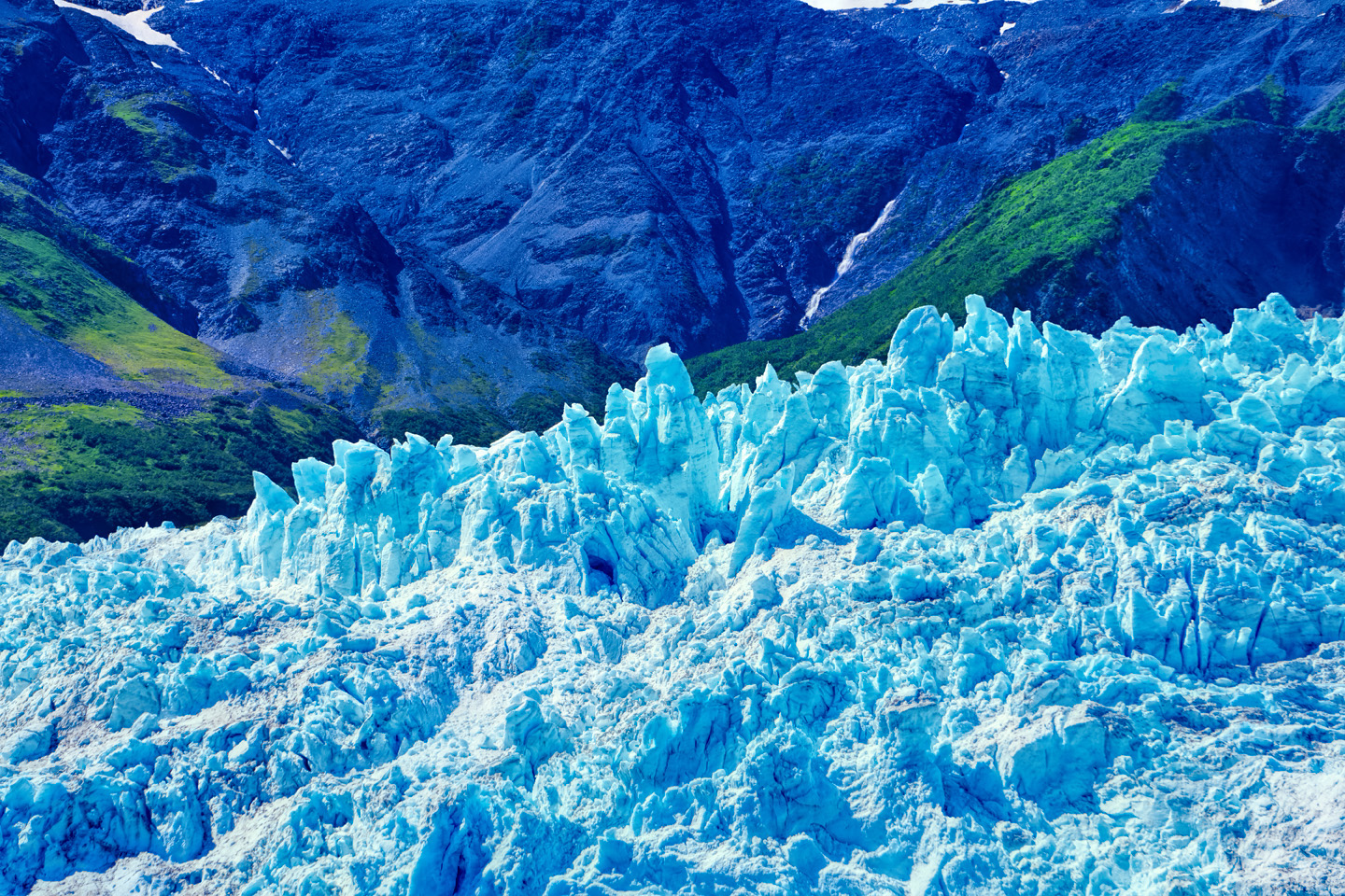
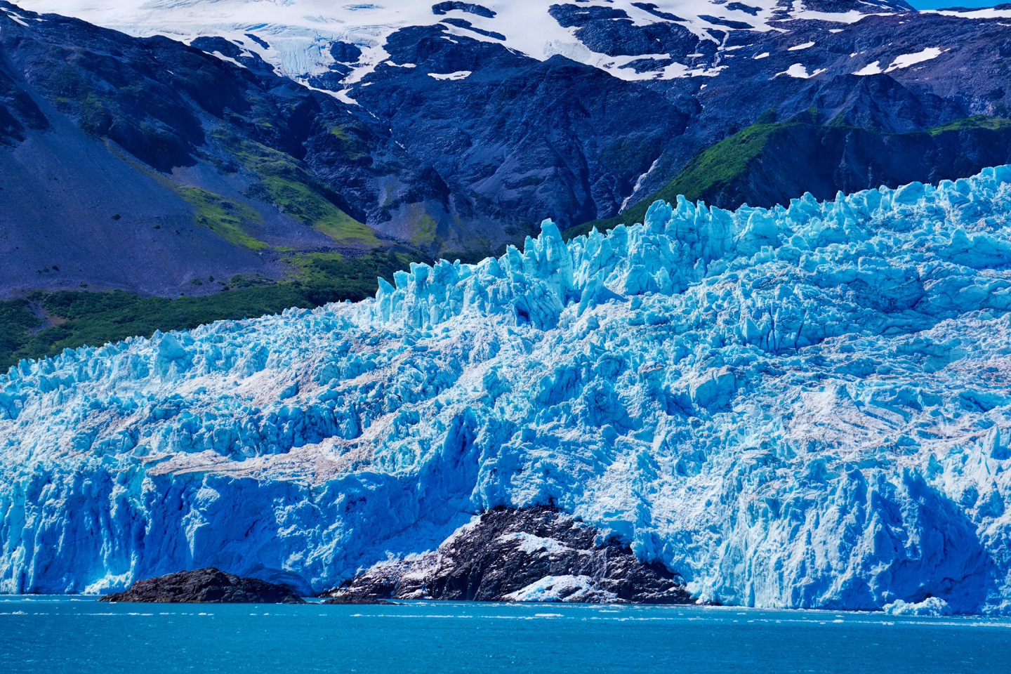
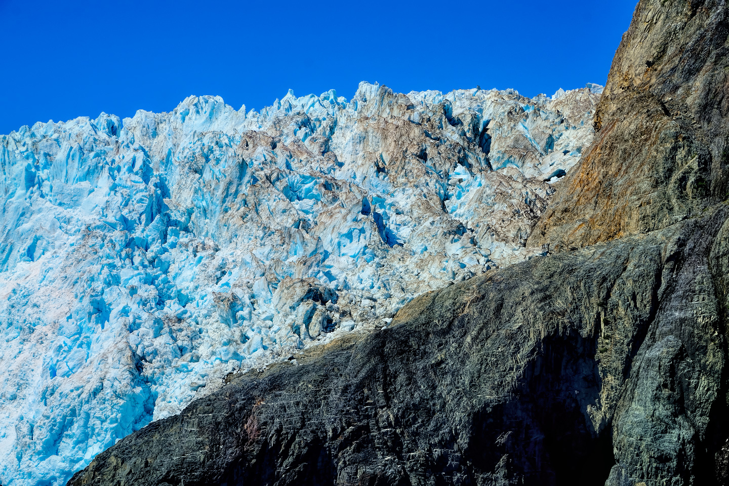
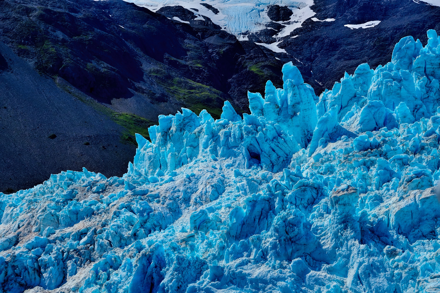
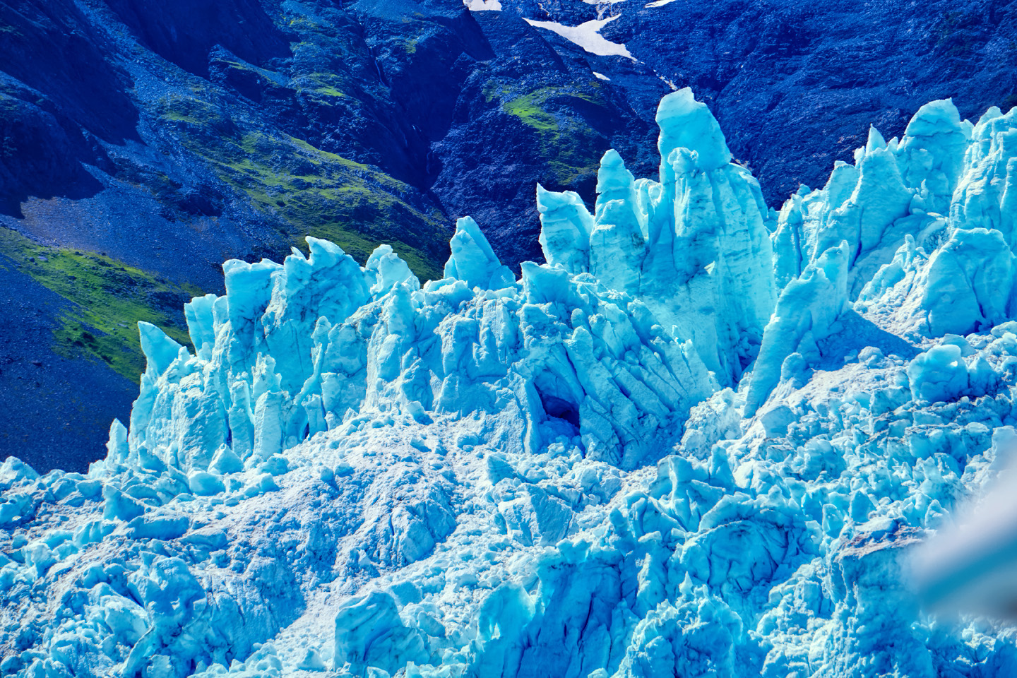
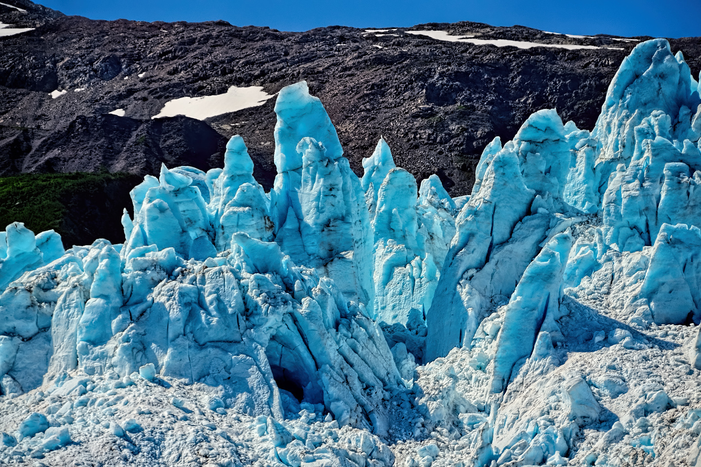
As the tremendous weight of the moving glacier pushes forward, the pressure buckles the ice into fantastic pillars and columns, like frozen fairy castles gleaming blue as the suspended glacial sediment refracts the sunlight.
In the slide show at right (below, on mobile or tablet screens), a block of ice the approximate size of a two-story house splits off from the face of the glacier and tumbles into the sea, where it becomes an instant iceberg.
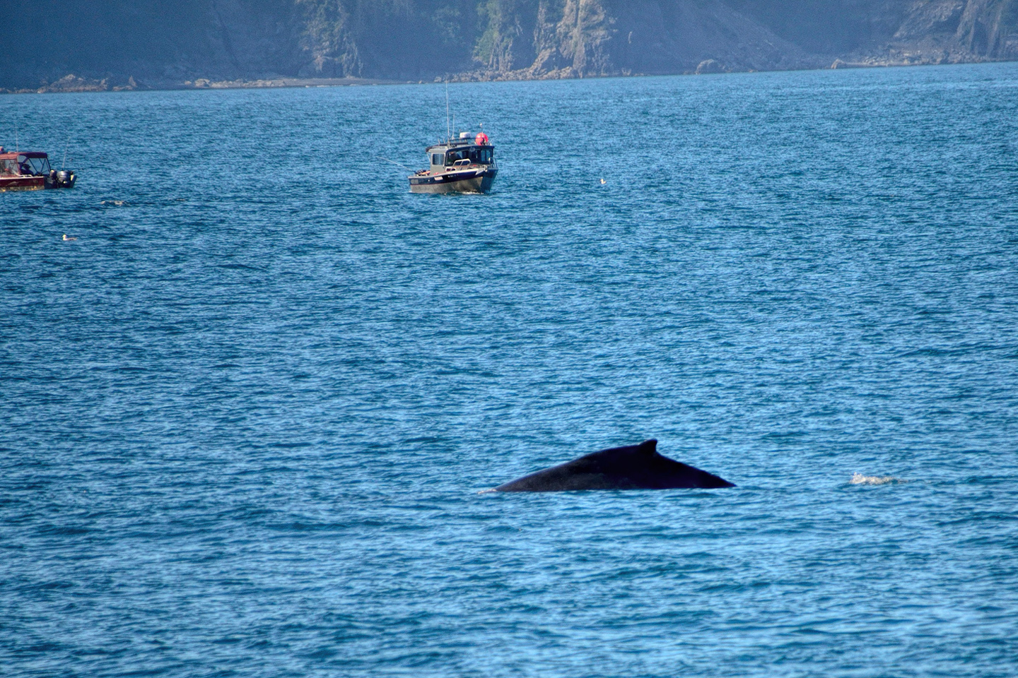
For a creature so incomprehensibly large,humpback whales are notoriouly difficult to photograph. If you’re underwater with scuba gear and the right equipment, no problem, because you’re in their element, and you can SEE them, in all their glory. Once in awhile they’ll get playful, and enter OUR element, flying up out of the water in a leap known as a breach. In that case, it’s a question of fortunate timing when, once again, you can actually SEE them! Far more typically, the best you can hope for is to catch them when they’re in between, taking a breath at the intersection between their world and ours.
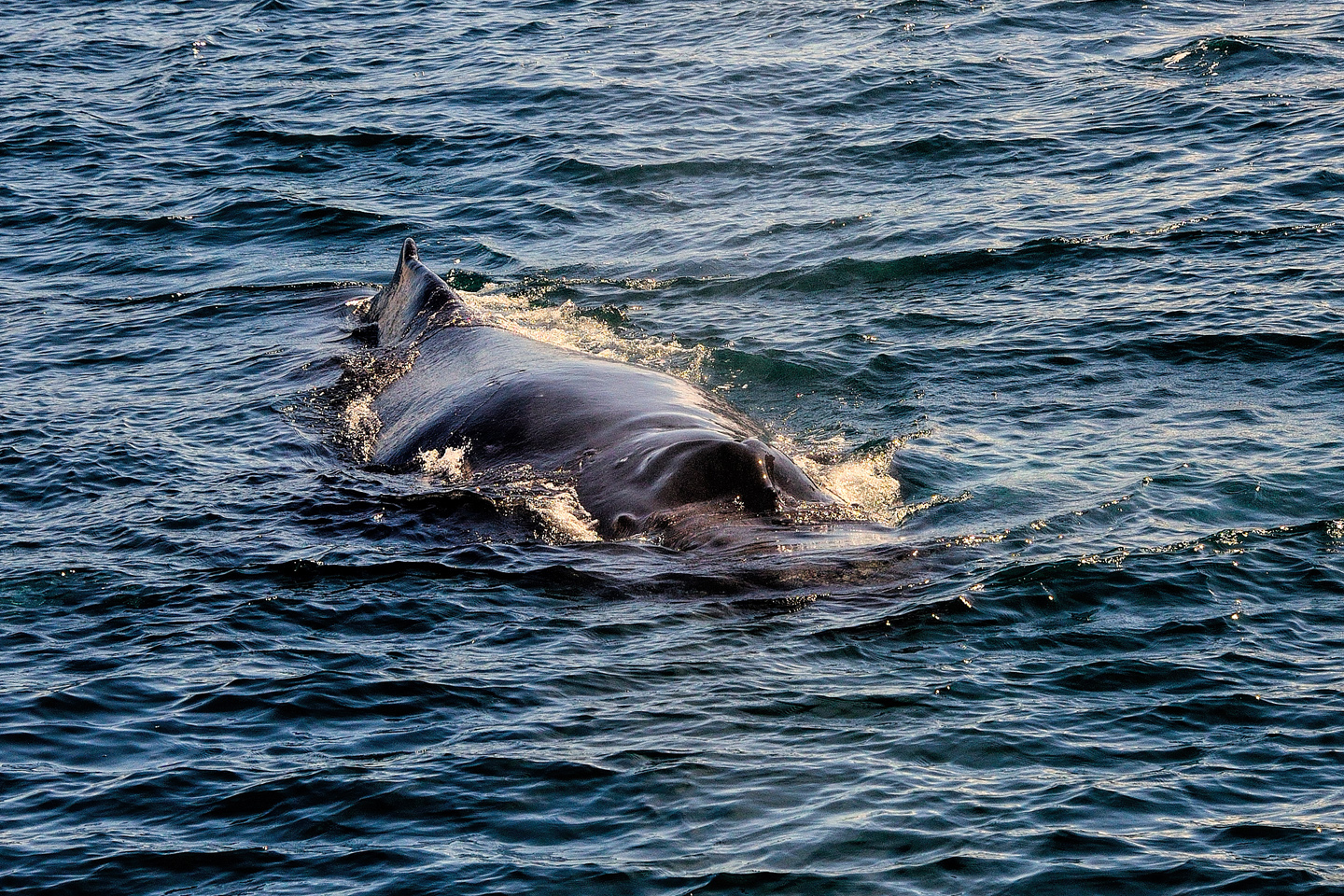
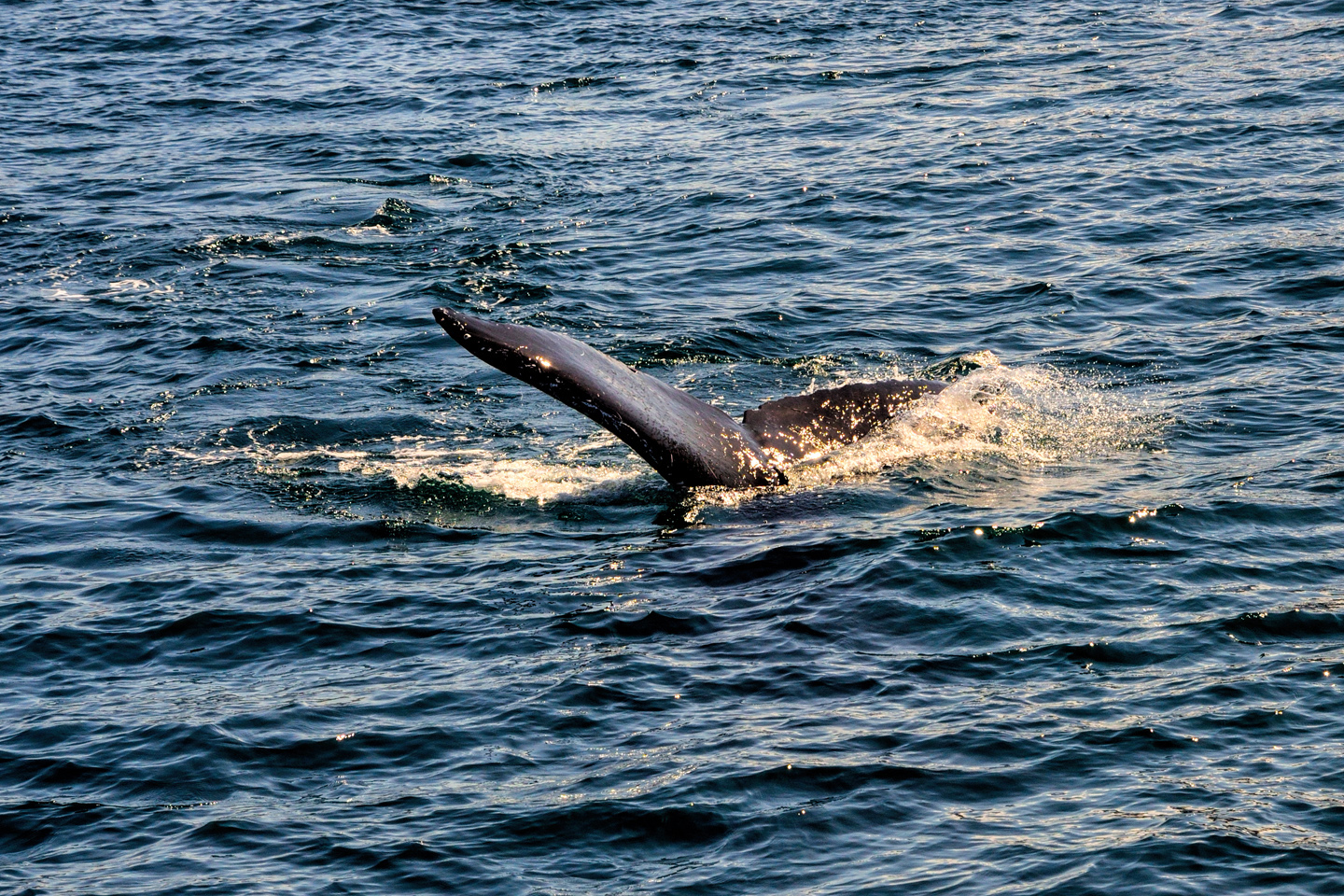
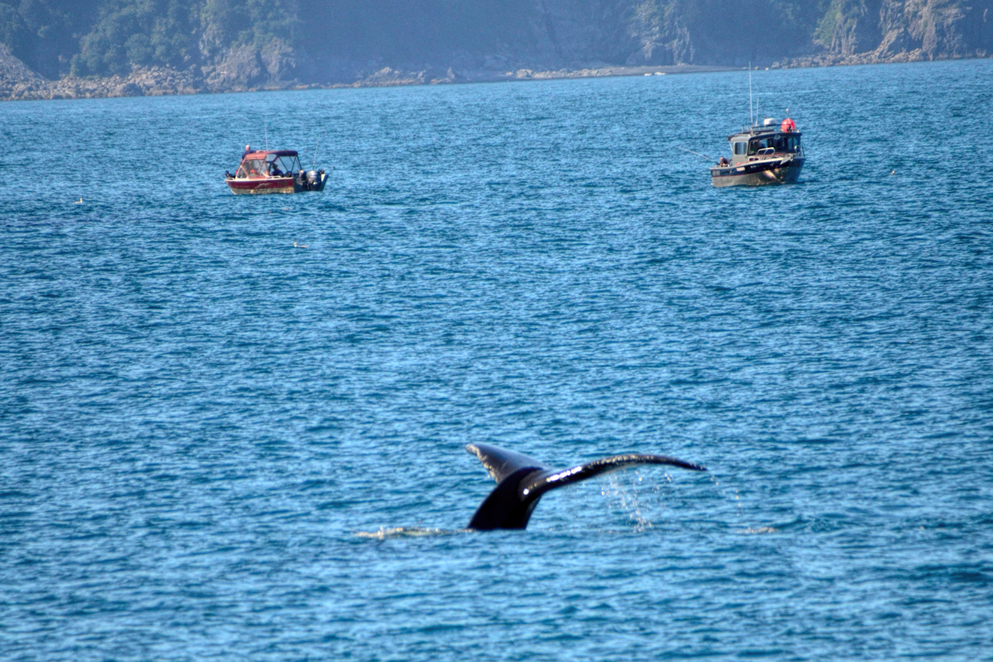
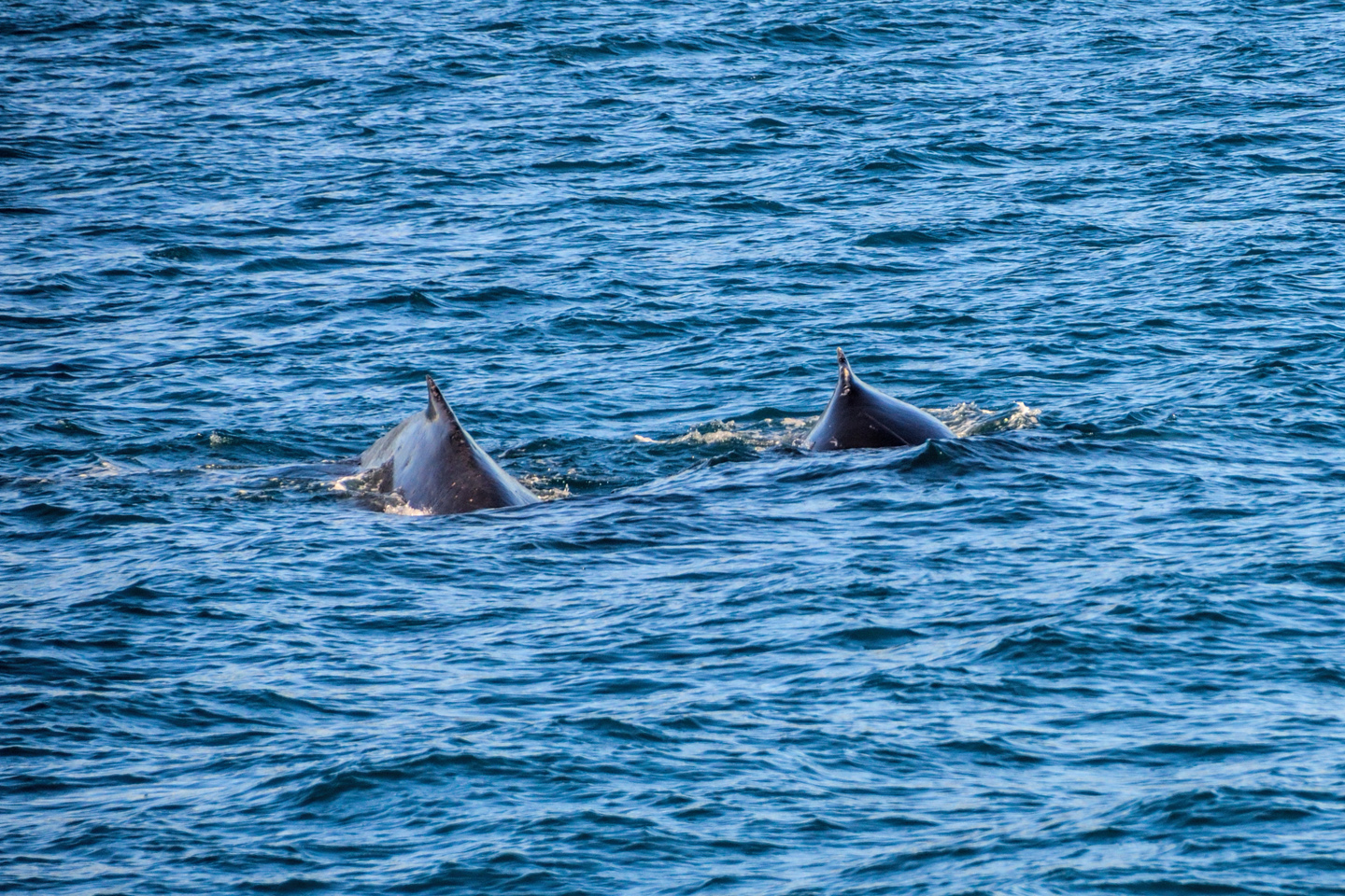
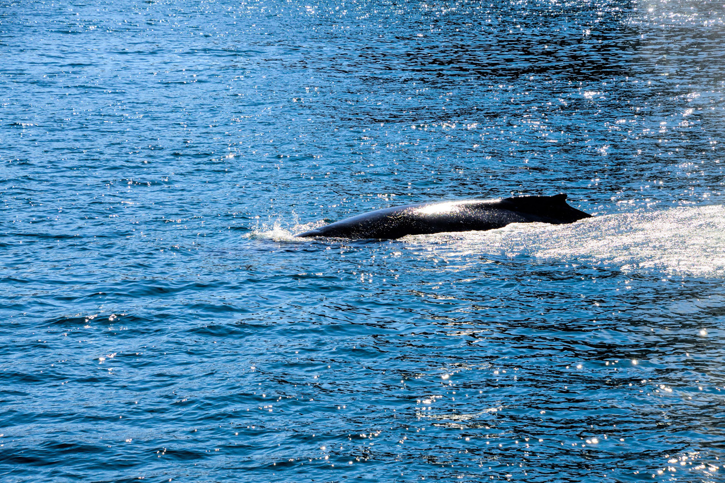
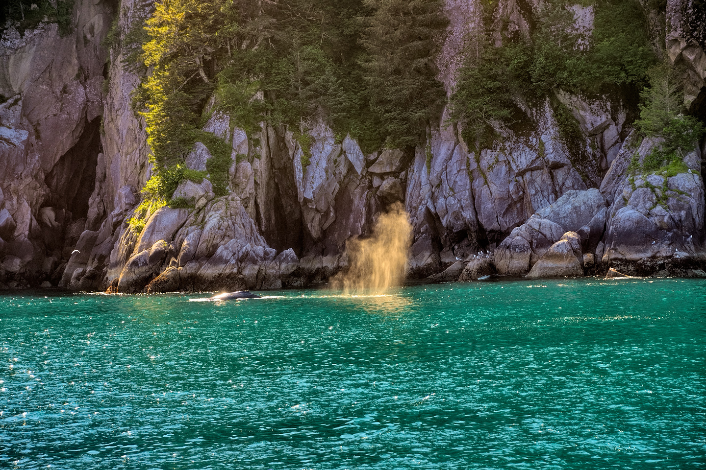
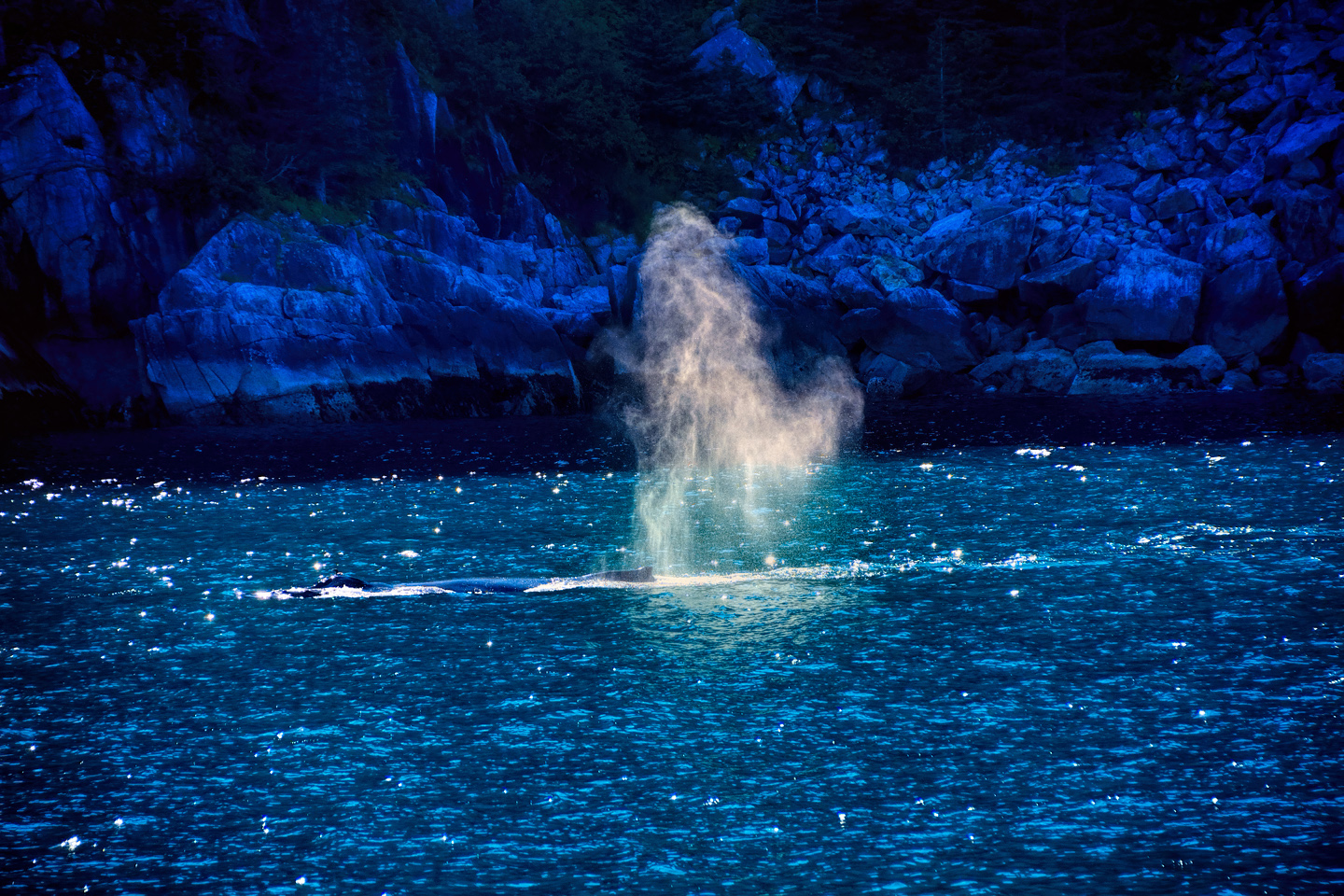
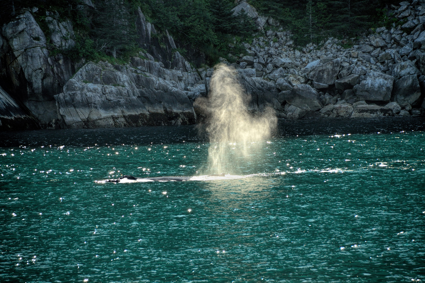
A massive shape in the water, a huge hump rising just above the surface, gargantuan flukes when the creature dives, and a spout, raising great clouds of spray as the air is expelled from whale-sized lungs.
After watching the whales for a bit, including closeup views of a mother humpback and her calf, swimming side by side, we reached our turnaround point. It was late afternoon, but at this latitude, during the summer months, the sun stays low in the sky all day, and never really goes down. The traditional “golden hour” when the light is best for landscape photos is extended accordingly, and I got some lovely shots of the scenery on the way back to Seward.
For the truly adventurous visitors who are fit enough to handle hiking and kayaking in the Alaskan Wilderness, Kenai Fjords National Park offers unmatched opportunities for a full immersion plunge into some of the wildest country on the planet. For those of us who aren’t in that kind of excellent condition, the opportunities are still there, in milder form, in exchange for the price of a boat ticket. The most intimate experience is on the smaller vessels, but even the bigger boats are well worth the cost. If you’ve never seen a puffin, or a tidewater glacier, or a whale, up close and personal? Make Kenai Fjords National Park a part of your Alaskan adventure, you’ll check off all of those boxes, and more.
Click any photo to expand the images to full screen
(Unless otherwise noted, all of the images in these posts are my original work, and are protected by copyright. They may not be duplicated for commercial purposes.)
To return to the previous post, or to continue reading the next part of the series, click the buttons below:
MORE ABOUT THE ALASKA HIGHWAY:
This is an interactive Table of Contents. Click the pictures to open the pages.
Alaska Road Trip

The Alaska Highway: Prelude: The Road to Dawson Creek
Even if you start in Seattle, the closest American city, it’s still more than 800 miles to Dawson Creek, wending your way that much further north, so far north that there will be a noticeable change in the hours of daylight. It’s the latitude that distinguishes the north country, including every bit of Alaska. Dawson Creek is where it all begins.
<<CLICK to Read More>>

The Alaska Highway: Day 1: Dawson Creek to Fort Nelson
Past Fort St. John, the terrain got a lot wilder. No more towns, very few people, and very little traffic. Saw a few U.S. license plates, Michigan, California, Oregon, South Carolina; people that were obviously headed to Alaska!
<<CLICK to Read More>>

The Alaska Highway: Day 2: Fort Nelson to Whitehorse
Every time I rounded a curve in the road there was another stupendous vista; it was nothing short of astonishing! I was literally yipping out loud, and a couple of times I actually pulled over and stopped while I pounded on my chest to “re-start” my heart!
<<CLICK to Read More>>

The Alaska Highway: Day 3: Whitehorse to Beaver Creek
Approaching the mountains, I started pulling over with serious frequency, taking LOTS of photos! Mountains, clouds, lakes, flowers—I was pretty sure I must have died and gone to heaven, but I couldn’t for the life of me remember the fiery crash.
<<CLICK to Read More>>

The Alaska Highway: Day 4: Beaver Creek to Fairbanks
Delta Junction, the end of the Al-Can, was only 200 miles away, and the border? Twenty miles, maybe half an hour, and I was finally going to cross into Alaska! I’d been on the road more than three weeks, and in just half a day more, I’d be in Fairbanks.
<<CLICK to Read More>>

Chena Hot Springs: A Fairbanks Original
The Chena hot spring puts out steaming water at a temperature of 150 degrees, producing enough power to meet all the needs of the resort, as well as filling the hot springs pools used by the guests. In addition to the lodge and restaurant, they offer camping and horseback riding, and they have exhibits featuring sled dogs, greenhouses, ice sculptures, and geothermal energy.
<<CLICK to Read More>>

Two-Foot High Kick: World Eskimo Indian Olympics
Contestants take a running leap, then they make this crazy jackknife move, touch the ball suspended high above the floor with both feet, then come back down and stick the landing. If that sounds difficult? You have no idea.
<<CLICK to Read More>>

Dreaming of Denali
When I drove my Jeep to Alaska that first summer after I retired, my main goal, the single most important thing I wanted to do, was to see Denali, the biggest mountain in North America.
<<CLICK to Read More>>

Follow the Fireweed
Visualize a summertime journey through that part of the world, a world filled with mountains and glaciers and boreal forests, ice blue rivers, turquoise lakes, and billowing clouds that fill the sky. Imagine your vision as a beautiful piece of music. The fundamental, underlying theme of that symphony would be a gently rising swell of perfect harmony, pinkish lavender in its hue.
<<CLICK to Read More>>

Kenai Fjords National Park: Seabirds, Glaciers, and Whales on the Wild Coast of Alaska
At this latitude, during the summer months, the sun stays low in the sky all day, and never really goes down. The traditional “golden hour” when the light is best for landscape photos is extended accordingly, and there are more opportunities for great shots than you’ll know what to do with.
<<CLICK to Read More>>

Kenai Fjords National Park: Exit Glacier: Up Close and Personal
Compared to the huge tidewater glaciers that flow directly into the sea along the coast of Kenai Fjords, Exit Glacier is just a baby–a baby that’s getting smaller every year–but it’s still big enough to permanently alter the landscape through which it passes.
<<CLICK to Read More>>

Alaska Road Trip: Driving Alaska’s Grand Circle
Most of the major towns in Alaska, as well as three of the state’s incredible National Parks, can all be reached by driving Alaska’s Grand Circle: a loop route beginning in Tok that utilizes all four segments (1082 miles) of Alaska’s Interstate Highway system.
<<CLICK to Read More>>

Alaska Road Trip: The Grand Circle: From Tok to Denali
There are no icy mountains looming on the horizon, and Fairbanks is nowhere near Alaska’s ruggedly beautiful coast. The true beauty in Alaska’s second city is found below the surface, in the spirit and resiliance of the people who make the place their home.
<<CLICK to Read More>>

Alaska Road Trip: The Grand Circle: Anchorage and the Kenai Peninsula
The massive ice field in the park’s wild interior has spawned dozens of glaciers which, over the course of many millenia, have carved the landscape into fjords so heart-breakingly beautiful, humpback whales swim all the way from Hawaii just to cavort in the deep blue water.

Alaska Road Trip: The Grand Circle: Wrangell-St. Elias National Park
So, just exactly how big is Wrangell-St. Elias National Park? You could combine Yellowstone with Yosemite, throw in the entire country of Switzerland, and you still wouldn’t match it in terms of size.
<<CLICK to Read More>>

Alaska Road Trip: Driving to the Top of the World
The rough dirt road gave way to a newly paved modern highway. This was it, the Top of the World, and right on cue, the haze peeled back, just enough to give me a glimpse of the beauty my friends assured me would be there…
<<CLICK to Read More>>

There’s nothing like a good road trip. Whether you’re flying solo or with your family, on a motorcycle or in an RV, across your state or across the country, the important thing is that you’re out there, away from your town, your work, your routine, meeting new people, seeing new sights, building the best kind of memories while living your life to the fullest.
Are you a veteran road tripper who loves grand vistas, or someone who’s never done it, but would love to try? Either way, you should consider making the Southwestern U.S. the scene of your own next adventure.
A few years ago I wrote a book about road trips in Arizona and New Mexico that’s a lot like this website, packed with interesting information, and illustrated with beautiful photographs. Check it out! You can find it on Amazon, and at all other major booksellers.

ALASKA ROAD TRIP:
MEXICAN ROAD TRIP (IN THE LAND OF THE MAYA):
ARIZONA AND NEW MEXICO:
SOUTH AMERICA:
PHOTOGRAPHY:
TRIBAL LANDS:


Recent Comments