AN ALASKA ROAD TRIP IS A GRAND ADVENTURE!
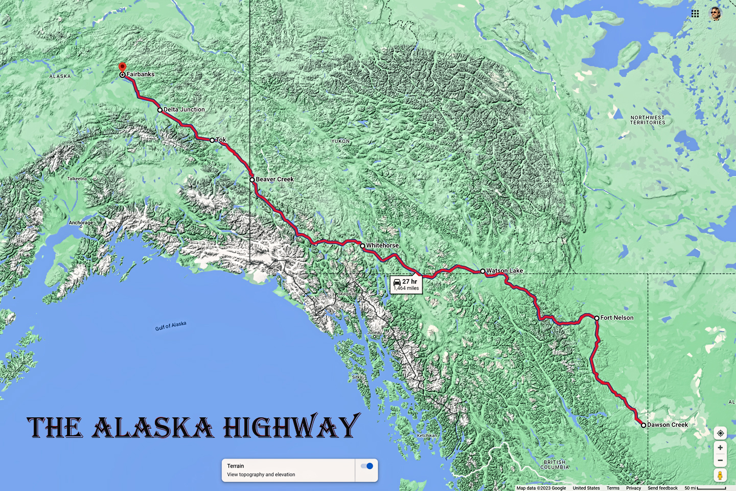
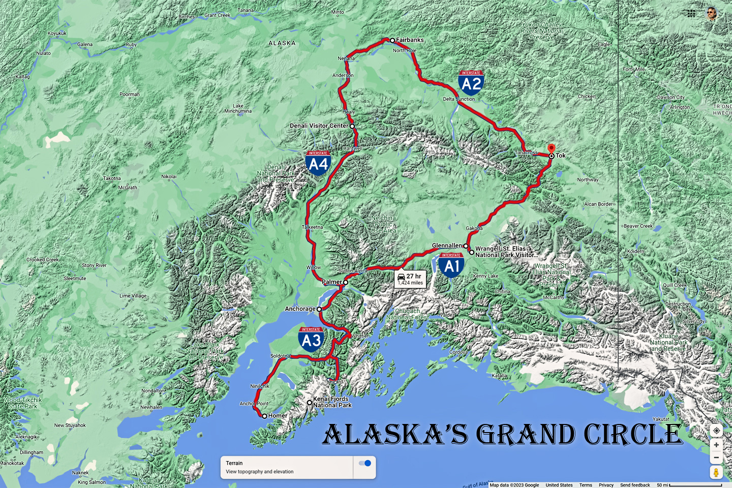
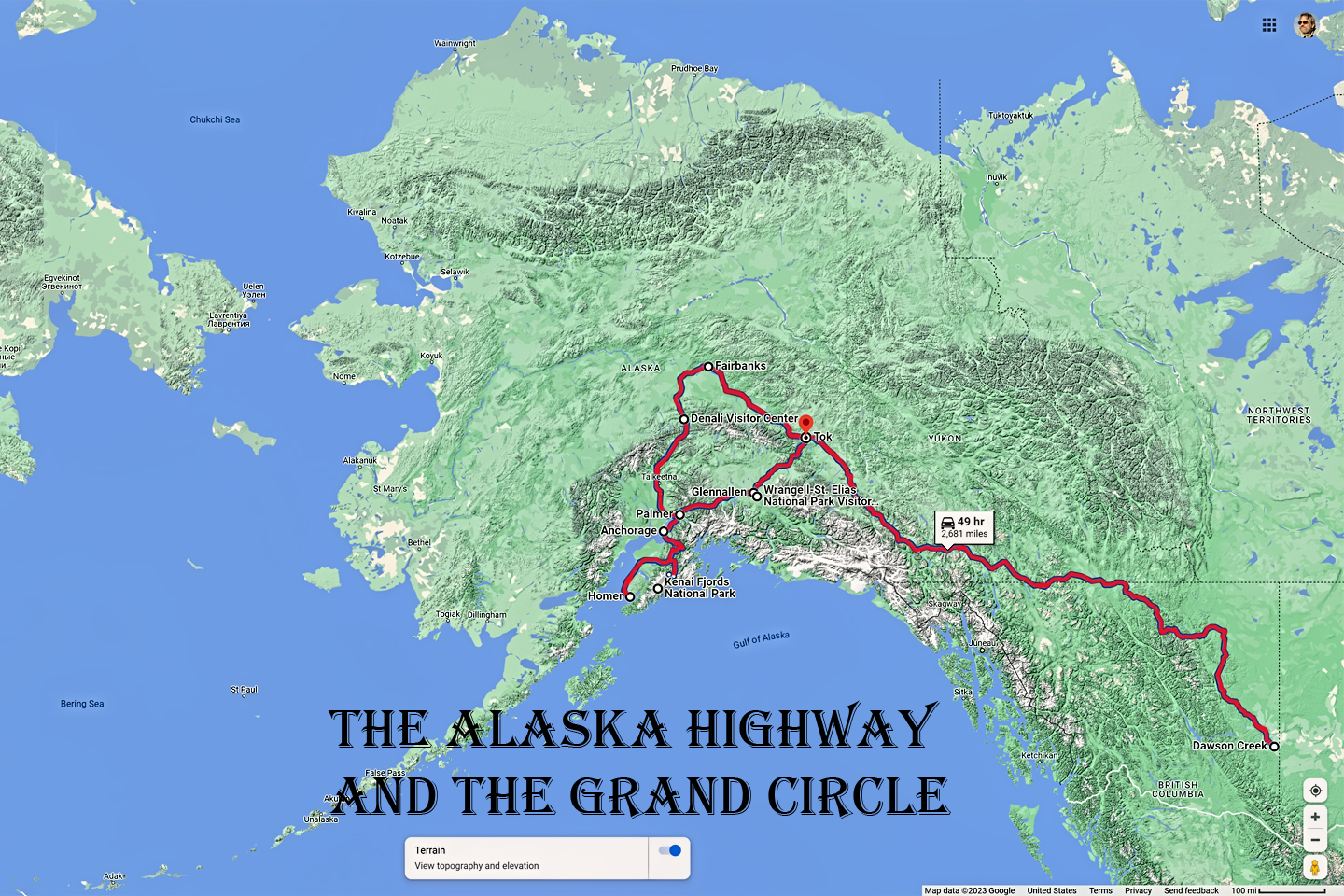
Alaska's Grand Circle is a loop route that begins in Tok and utilizes all four segments (1082 miles) of Alaska’s Interstate Highway system: Tok to Fairbanks on AK-2 (Interstate A-2); Fairbanks to Gateway (near Anchorage) on AK-3 (Interstate A-4); Anchorage to Soldotna on AK-1 (Interstate A-3); and Anchorage back to Tok on AK-1 (Interstate A-1). Most of the major towns in Alaska, as well as many of the state's most scenic areas can all be reached from this loop, which includes three of Alaska's National Parks.
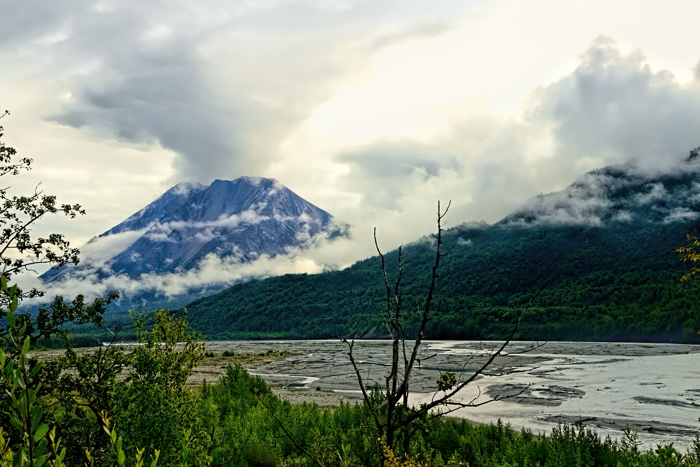
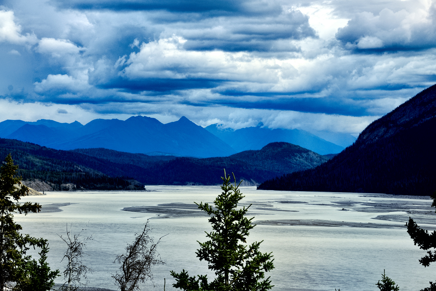
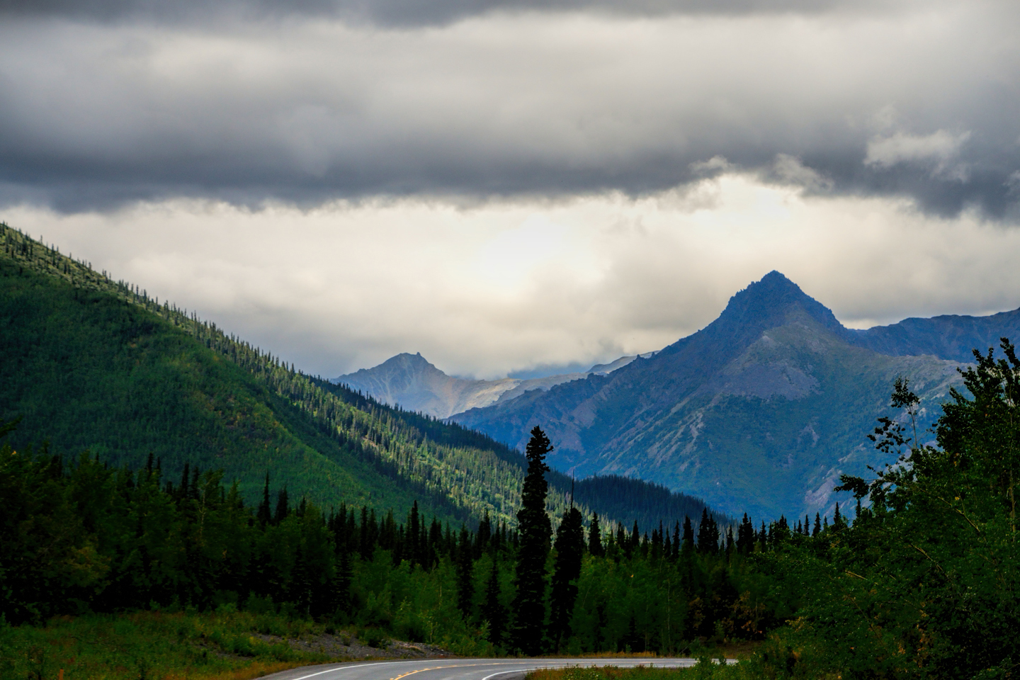
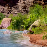
Snow capped mountains, ice blue rivers, and billowing clouds that fill the sky, such are the hallmark scenes along the highways in Southeast Alaska. North and east of Anchorage, between Palmer and Glennallen, the broad valley of the Matanuska River lies between the Chugach and the Talkeetna mountain ranges. It’s a surprisingly fertile swath of farmland, the best in the state, reknowned for producing gigantic world-record cabbages and other vegetables during the abbreviated growing season. The Glenn Highway, Interstate A1, follows the course of the river along its entire 75 mile length, a smooth, fast road that makes short work of the distance.
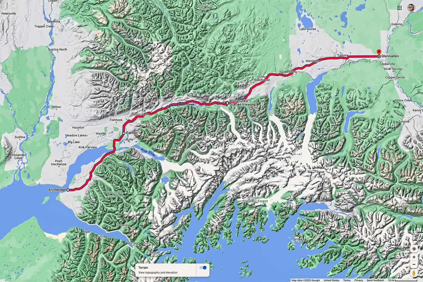
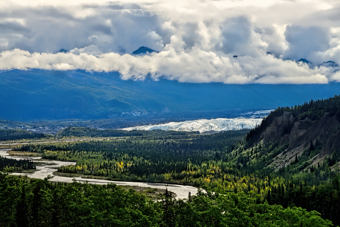
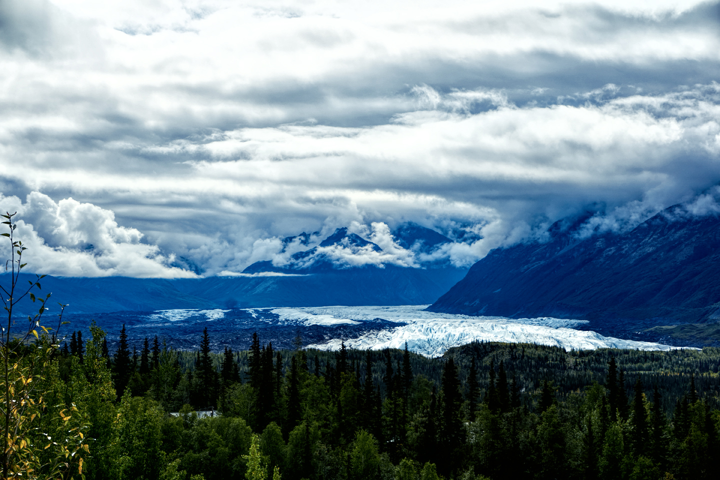
Scenes along the road between Palmer and Glennallen, including several views of the Matanuska Glacier.
Click maps and photos to expand the images to full screen
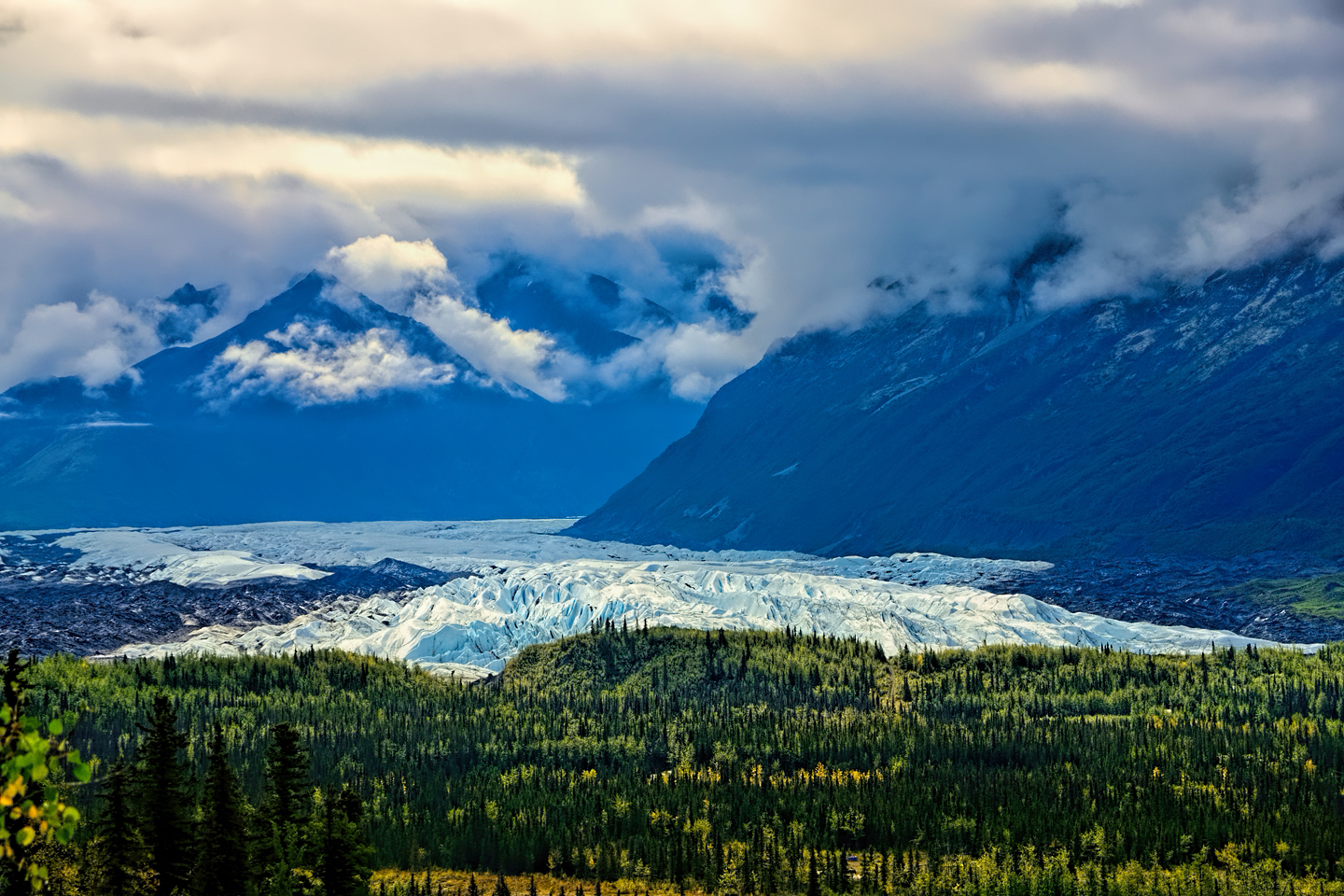
Near the halfway point, about 60 miles past Palmer, there’s a parking area that offers fantastic views of the Matanuska Glacier, a 27 mile long river of ice, the largest glacier in the United States that can be accessed by road. It’s an impressive sight in any season, the hands-down highlight of this next-to-the-last segment of Alaska’s Grand Circle. The Glenn Highway ends at the town of Glennallen, where it intersects with the Richardson Highway. With a population just under 500, Glennallen is the biggest town in this part of the state, which gives you an idea of the extremely rural nature of the area.
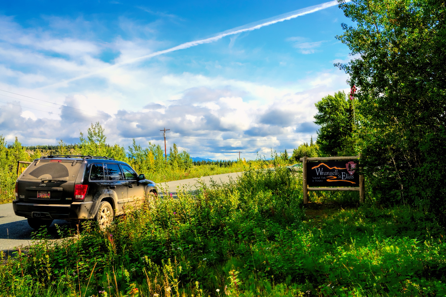
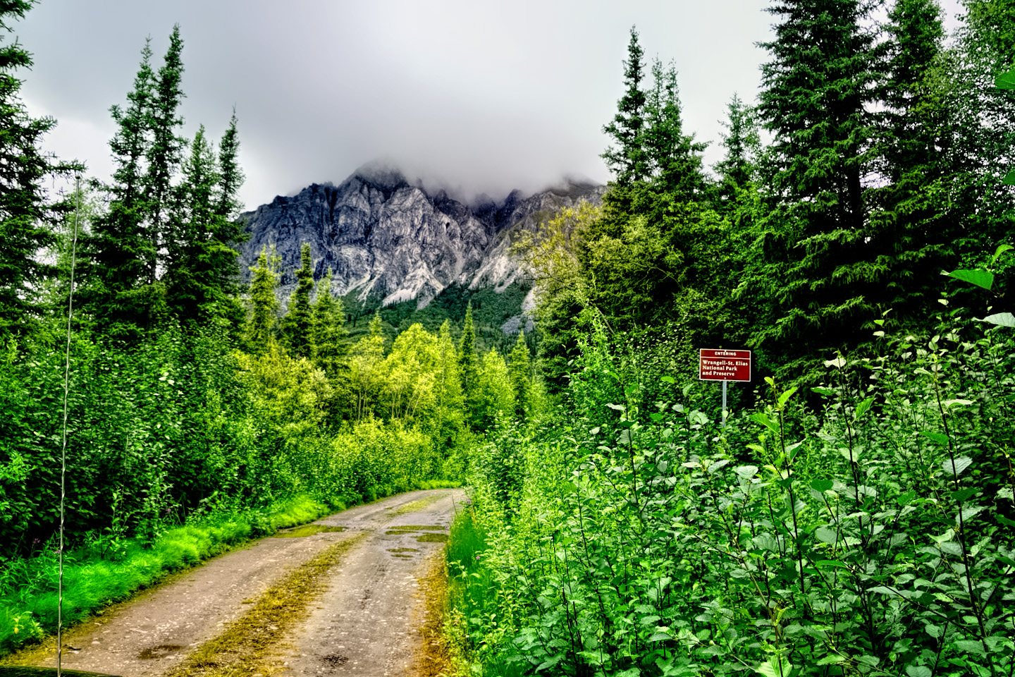
Wrangell-St. Elias National Park, the largest of all the National Parks in the U.S., lies due east of Glennallen, making the town an ideal base for exploring the limited sections of the massive preserve that you can actually drive to. The main Visitors Center for the park is located in Copper Center, 8 miles south of Glennallen, just off the Richardson. That’s where you can pick up a park map and brochure, along with good advice from the Park Rangers about the best ways to spend your time in this extraordinary place.

CLOSING THE GRAND CIRCLE
WRANGELL-ST. ELIAS NATIONAL PARK
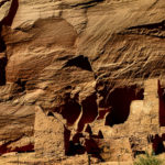
So, just exactly how big is Wrangell-St. Elias National Park? 13.2 million acres, and to put that in perspective, you could combine Yellowstone National Park with Yosemite, throw in the entire country of Switzerland, and you still wouldn’t match it in terms of size. Established in 1980, the park comprises most of the territory of Southeast Alaska, and straddles the Canadian border, merging with Canadian parks on the other side, creating one of the largest protected areas in the world.
Like most of Alaska’s National Parks, Wrangell St. Elias is primarily a trackless wilderness with very little infrastructure for visitors. The best way to truly see the place is a flightseeing excursion out of Glennallen, Chitina, or McCarthy. You’ll get one to two hours flying around some of the biggest mountains in North America, spectacular sights reserved for the privileged few.
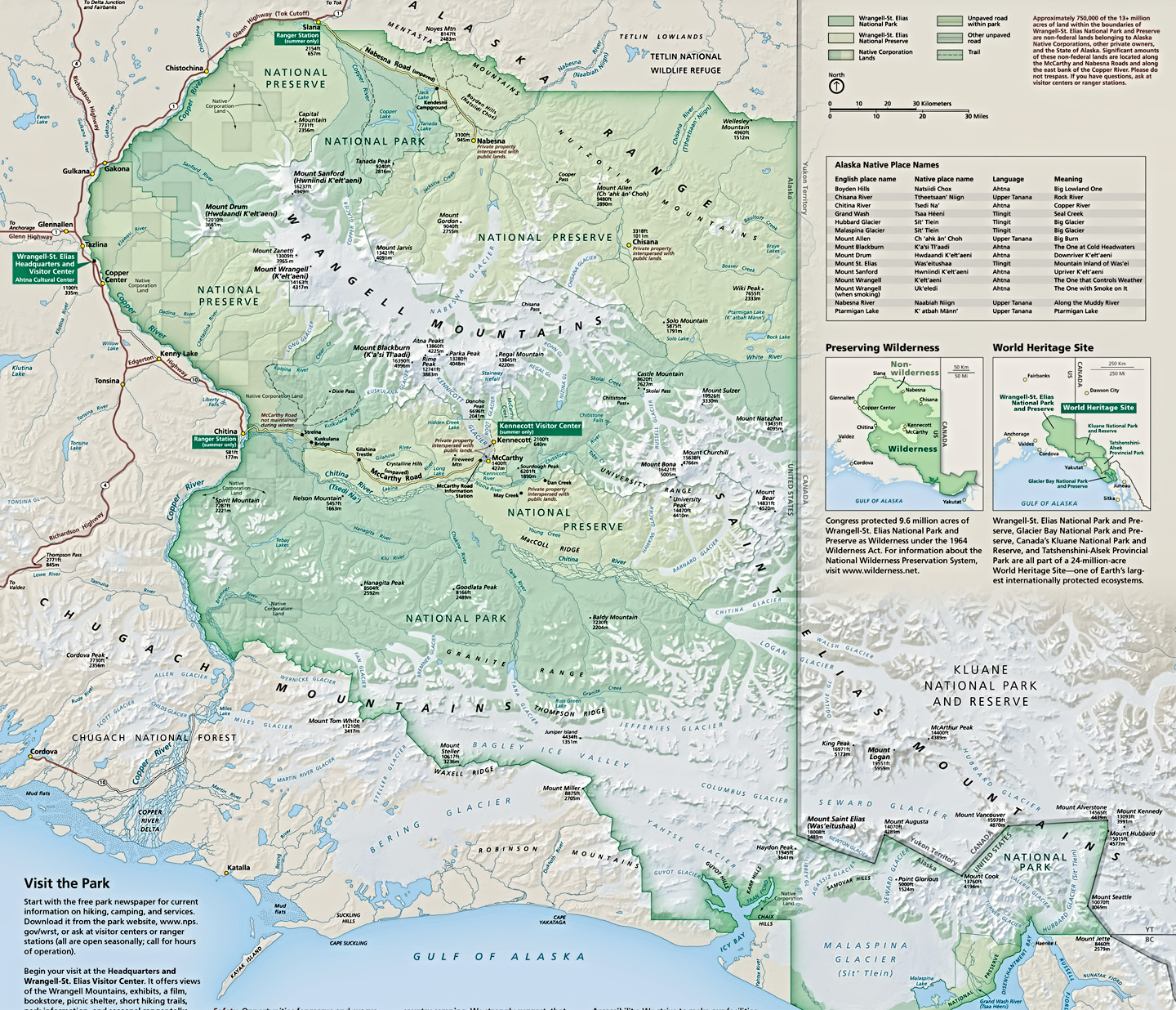
National Park Service map of Wrangell-St.Elias, along with a Google road map showing the points of access for private vehicles.
Alternatively, you can hike in, or you can have one of those small planes drop you off somewhere in the back country for a wilderness experience that is unmatched in all our nation’s National Parks. The caveat to that approach: you’d best be a highly experienced wilderness hiker, able to bivouac and survive in extreme weather, and able to find your way back out, or to a rendezvous at your pick-up point in an area with no permanent trails. Permits aren’t required for groups of fewer than 8 people, but it’s a very good idea to file your itinerary at one of the visitors centers, as well as with friends and family. If you don’t make it back out when you’re supposed to, the park service won’t initiate a search until one of those friends or family members specifically requests it. The word “remote” does not even begin to describe this area.
Something that Wrangell-St. Elias DOES have that you won’t find in most National Parks is a checkerboard grid of private land. At the time this National Park was created, there were numerous private land holdings within its boundaries, some of which started out as homesteads. Because the private parcels predate the formation of the park, they were simply incorporated within it, and the rights of the private landowners are protected by federal statute, in much the same way that the ecosystems and the wild animals are protected. The Homestead Act of 1862, which gave free federal land to anyone who was willing to settle on it and eke out a living for themselves, was one of the primary driving factors in the westward expansion of the United States, and in Alaska, the provisions of that act were still official policy all the way up until 1986. Legally, culturally, and in every other way, homesteaders are as much a part of the ambience of the Alaskan wilderness as the caribou and the grizzlies, so there was never any question about eminent domain, about kicking any of the old codgers out of the arbitrary confines of the new National Park.
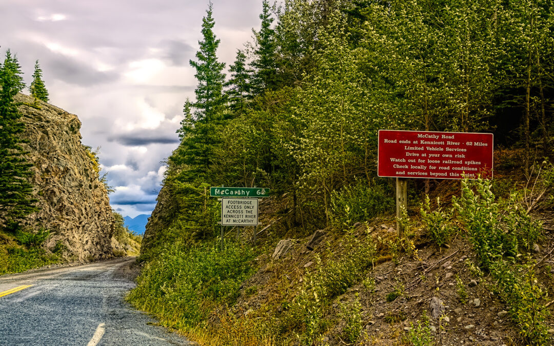
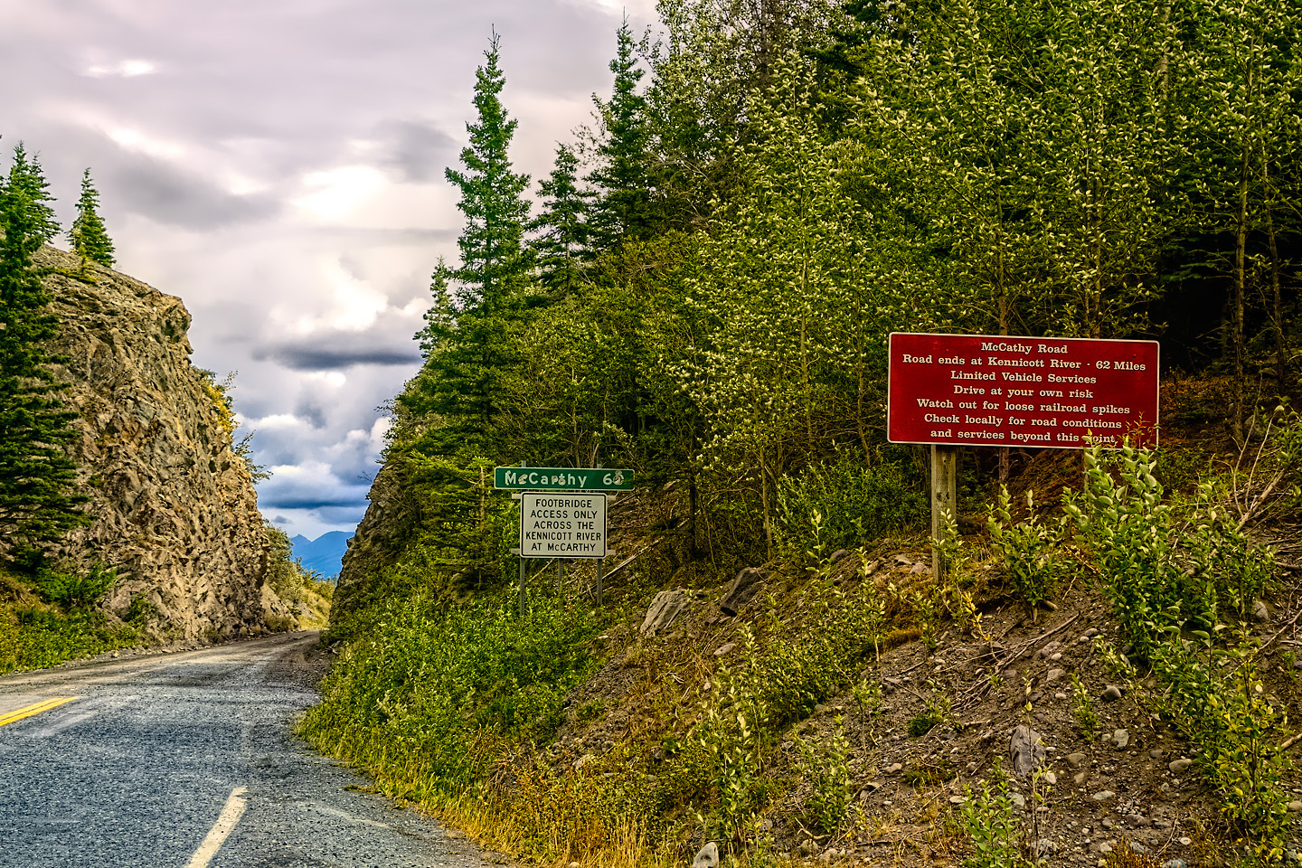
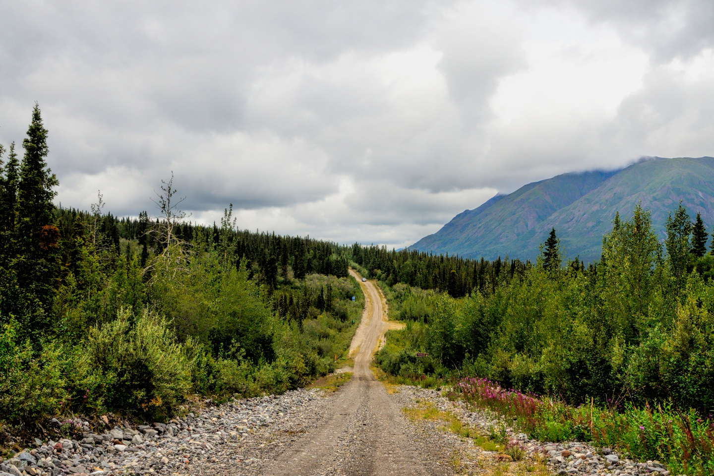
There are two roads that enter the wilderness: McCarthy Road, and Nabesna Road. These roads also predate the park, and their primary purpose is not to provide access for park visitors; rather, the two roads are there to provide access to the scant handful of hardy souls who actually live in that wilderness. As you drive along the Nabesna road, for example, you enter and leave the National Park numerous times, as you cross in and out of the private land that’s interspersed along the route.
Since I was lacking the budget for a flightseeing excursion, and lacking the skills for a wilderness backpacking trip, I settled for driving those two roads (though I didn’t make it all the way to McCarthy, as I’m about to explain). After checking in to a room in Glennallen, I decided to check out the National Park, which I knew very little about at that point.
THE McCARTHY ROAD
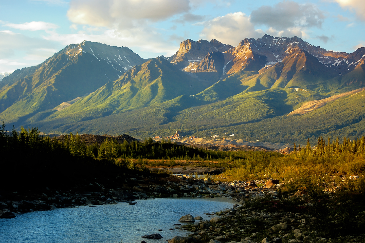
I drove south on the Richardson Highway toward Valdez, and after about 8 miles I came across signs for that National Park Visitor’s Center, so I stopped in. The Rangers gave me a map and some other information, and I ended up driving about 70 miles on AK 10, the Edgerton Highway, a paved road (with many roller coaster frost heaves) to a tiny town called Chitina, the gateway to the McCarthy Road/ Kennecott section of the huge National Park.
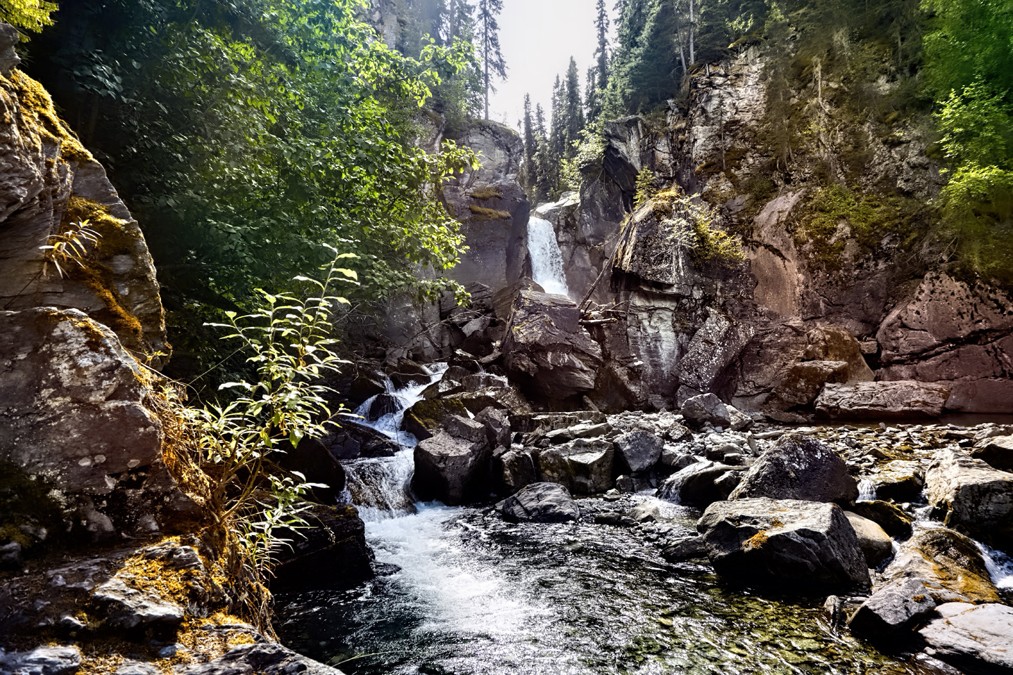
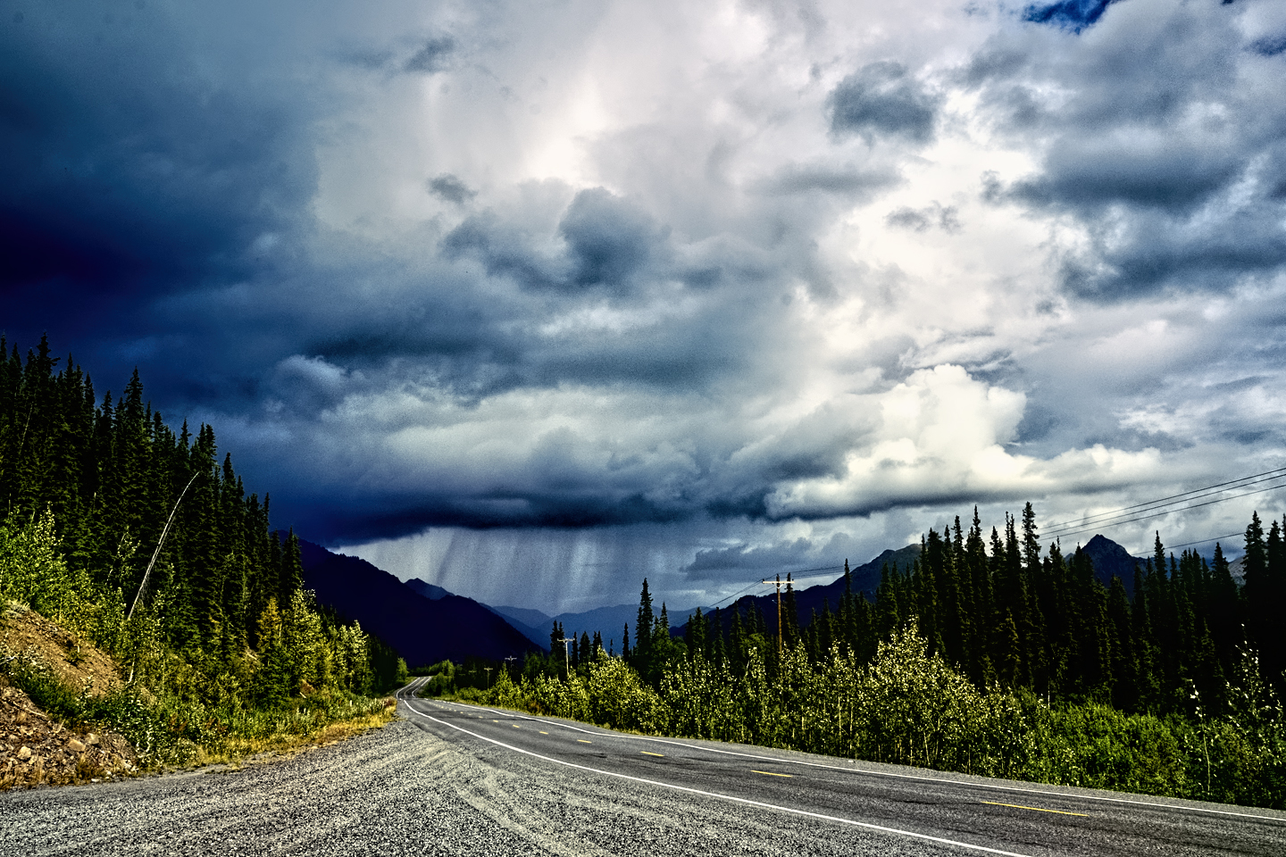
Scenes along the Edgerton Highway, between Glennallen and Chitina, including Liberty Falls State Park, the Copper River, and the point where the McCarthy Road begins.

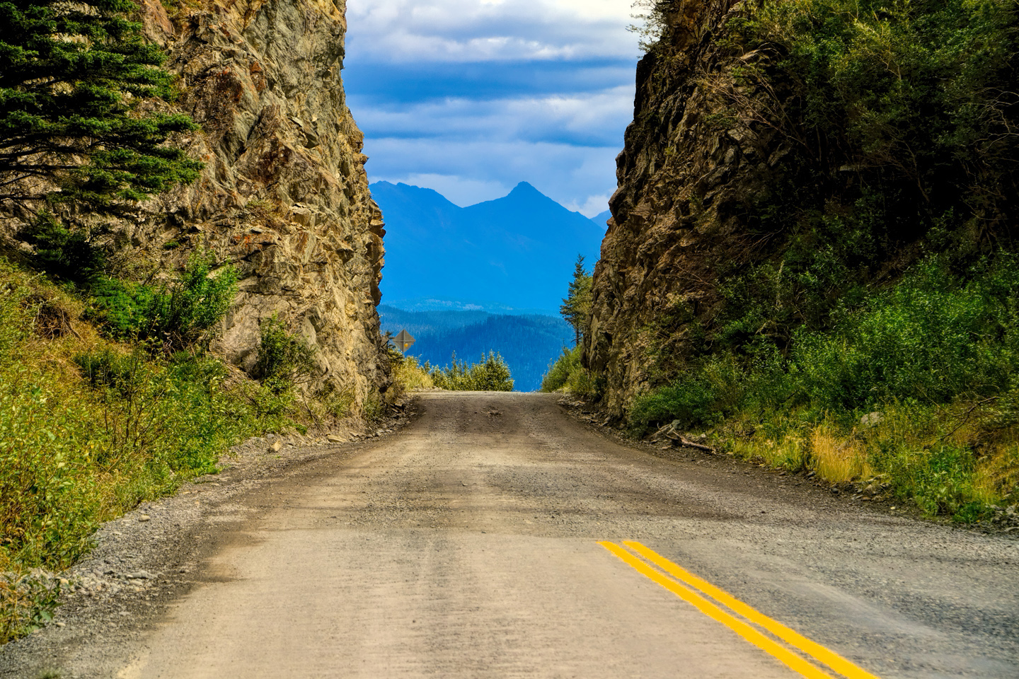
It was a pretty drive. The sky was filled with beautiful clouds, and there were mountains and rivers of the sort you’ll only see in Alaska. I made a brief stop at Liberty Falls State Park. The namesake waterfall wasn’t much, but the surroundings were lovely; I’m told that it’s a favorite picnic spot for area families. I hadn’t planned on such a long drive when I left Glennallen, so I must admit that I wasn’t well prepared. I knew I didn’t have enough fuel to make it all the way to McCarthy and back, so I was counting on buying more in Chitina. Much to my chagrin, I discovered that it isn’t possible to buy gas in that tiny town. In fact, the closest gas station was most of the way back to Glennallen, sixty miles in the wrong direction. I hadn’t realized it at the time, but my goose was cooked the moment I left the big town without filling my tank.
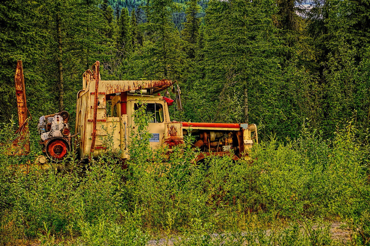
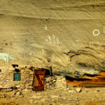
That was a shame, really. McCarthy is a town with 100 residents, situated in a remote section of this wilderness park. Until the 1930’s, it was a bedroom community for workers at the Kennecott copper mine, five miles deeper into the mountains. When the price of copper fell, the mine and the adjacent company-owned town of Kennecott were shut down and abandoned. The population of nearby McCarthy fell dramatically, but enough of a hard core hung on to keep the town from dying. When the National Park was created, the tourists arrived, providing a much needed boost to the local economy. Visitors were intrigued by the ghost town in a wilderness area. McCarthy was suddenly back on the map.
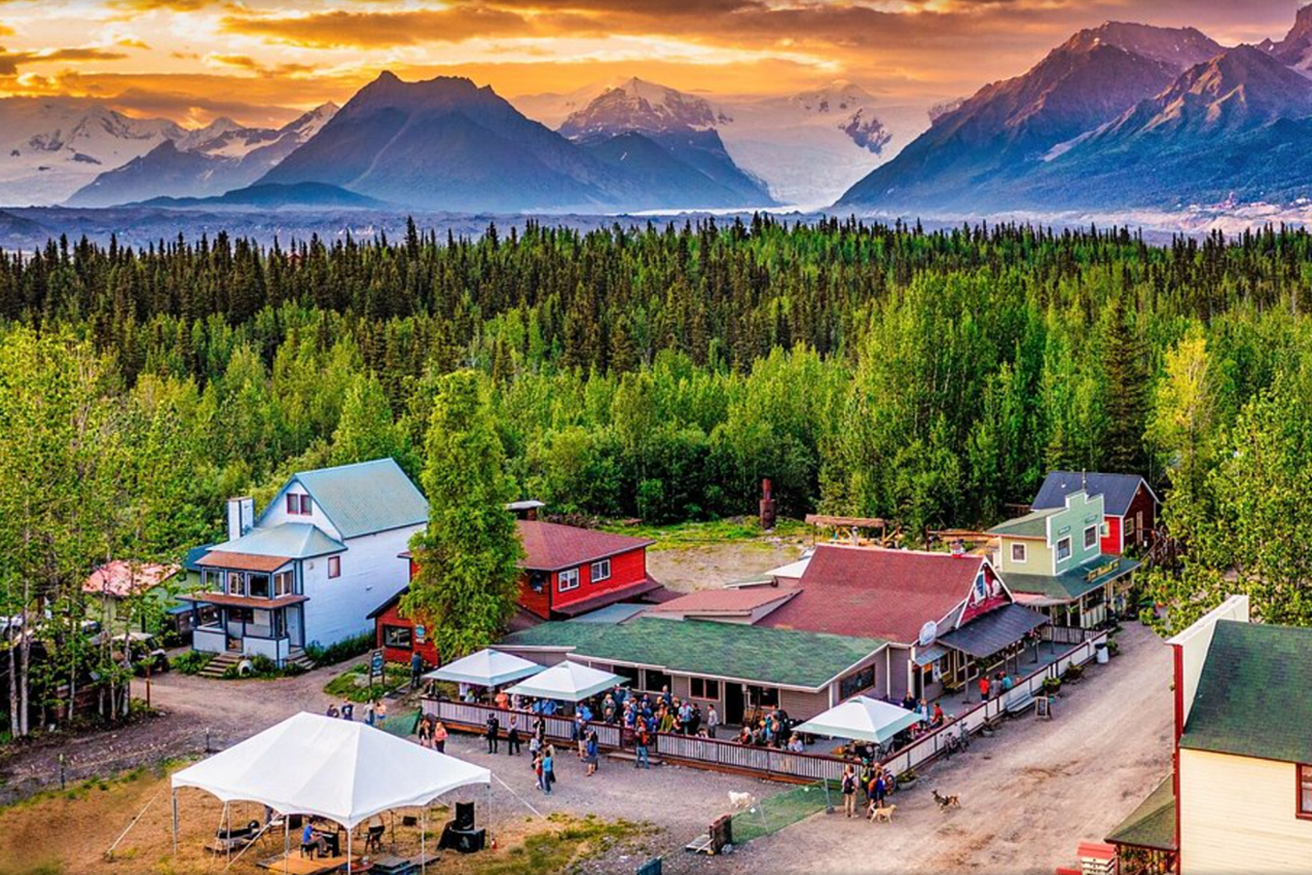
Photo of McCarthy courtesy of Ma Johnson’s Hotel
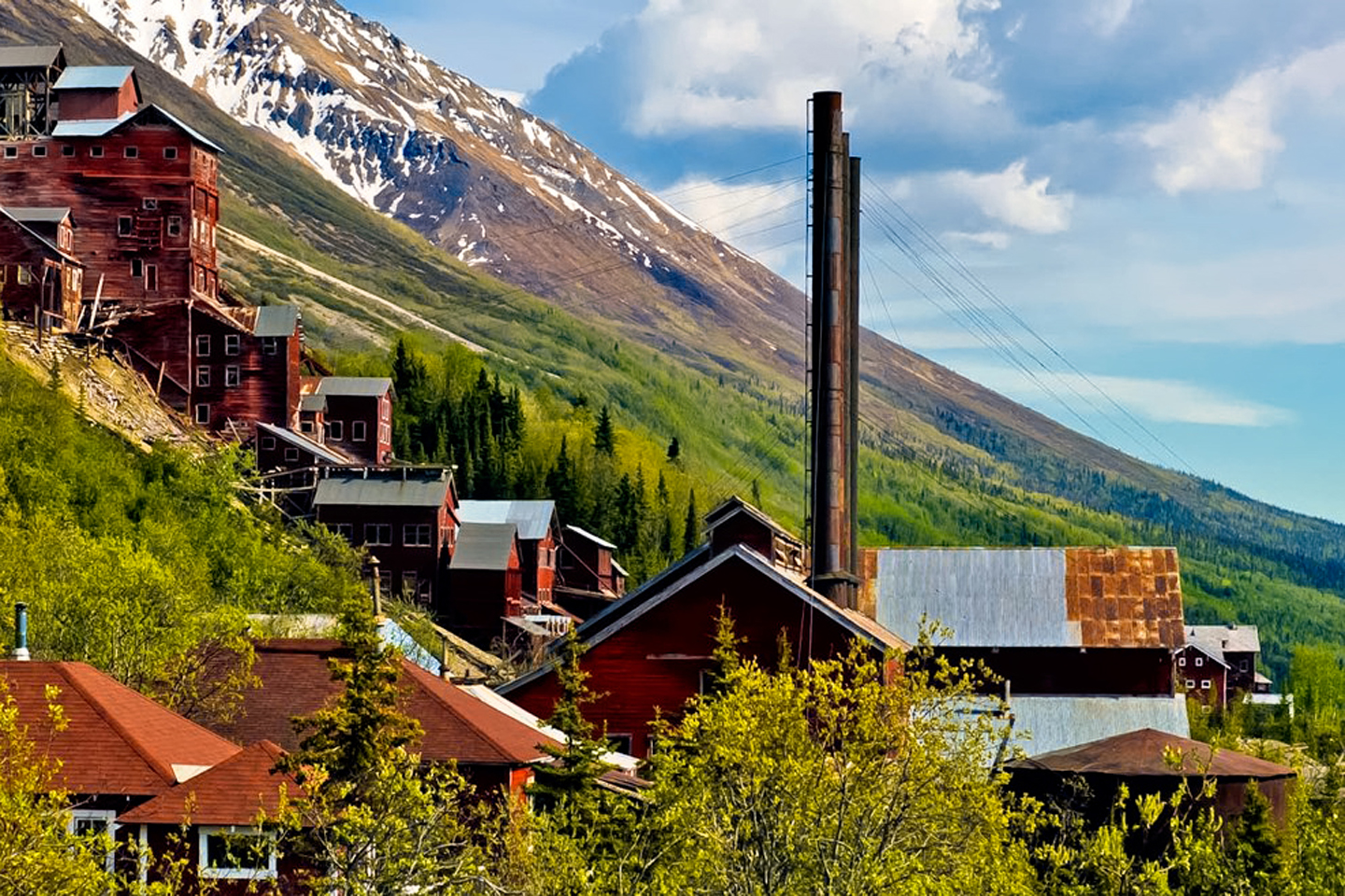
Photos of Kennecott ©National Park Service and Brian Petrtyl
The copper mine, and Kennecott, with its largely intact depression-era buildings is now a historic site, a shell of a small town, frozen in time in this remarkable setting. It’s a five mile hike to Kennecott from the end of the road in McCarthy, but there is a privately operated shuttle service that will transport you for a fee. I would have loved to have seen all that, but at that point, I had cost myself more time than I had to spare. That whole day was as good as gone, and the days I had left before I had to leave Alaska were already committed. I drove back to my hotel in Glennallen, disappointed in myself for planning so poorly. There’s a lesson that I learned long ago in my native Southwest, and should have applied here:
When traveling in an area where gas stations are few and far between, don’t ever pass one up; top off your tank at every opportunity!
THE NABESNA ROAD
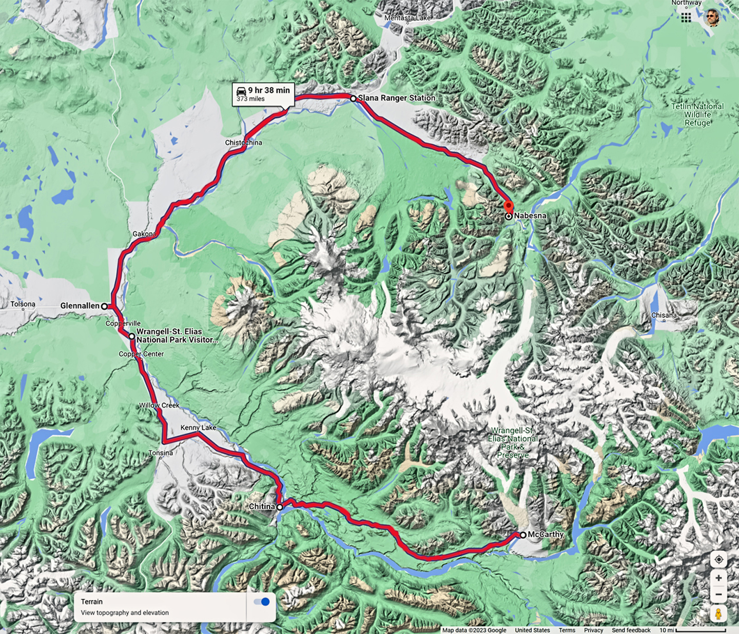
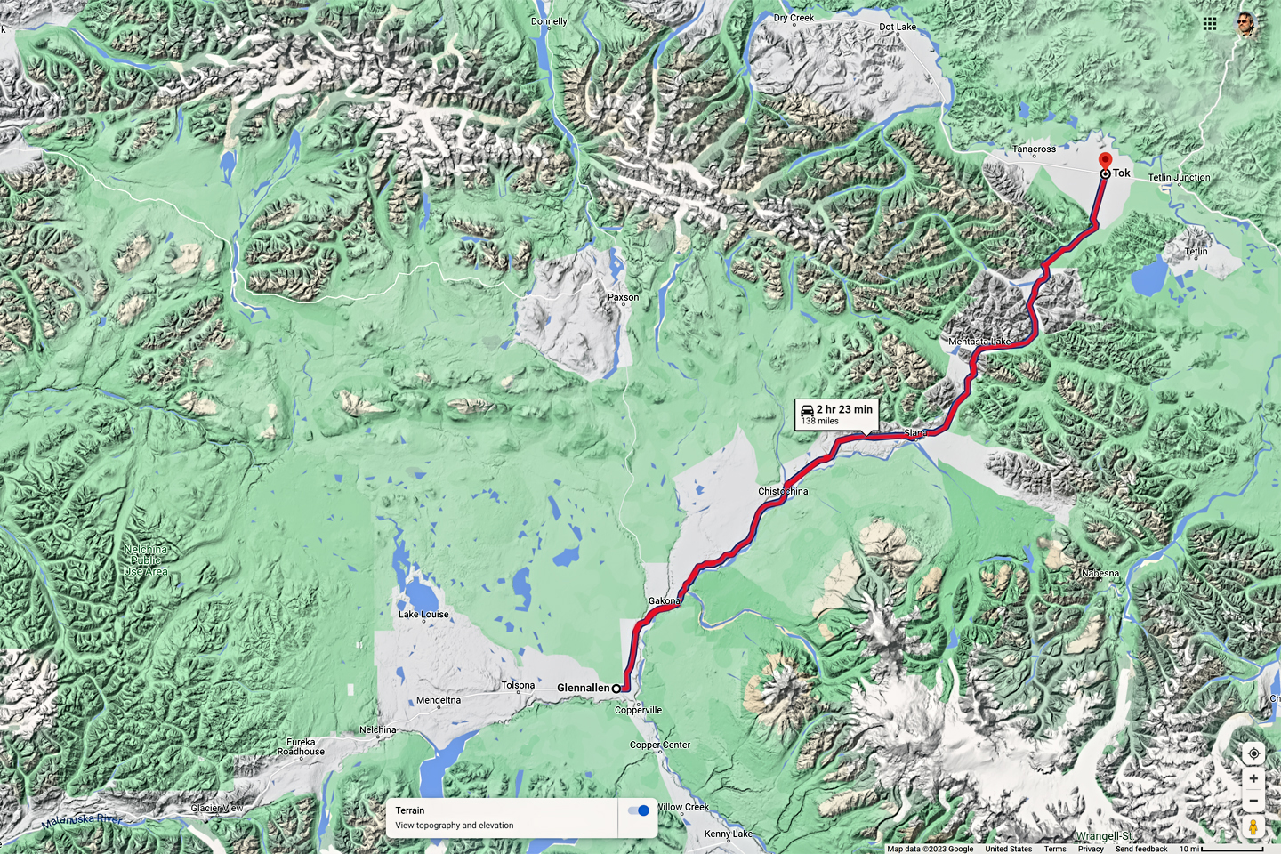
Since I’d blown my opportunity to follow the McCarthy Road into Wrangell-St. Elias, I didn’t want to leave the area until I’d at least driven the Nabesna Road, the northern access point to the sprawling National Park. The sky was totally overcast and threatening rain that next morning, but the weather report indicated a possibility of partial sun in the afternoon. Checkout time at my hotel was 11 AM, so I stalled until close to that point, then loaded the Jeep and drove north toward Tok on Alaska Route 1, keeping a sharp eye out for the turn into the National Park at Slana, an hour or so beyond Glennallen.
I stopped at the Slana ranger station for information, and they loaned me an audio CD to play in my car. As long as I drove at the speed limit, and turned it off whenever I stopped, the sound track stayed in synch with the mileposts, providing interesting descriptions of the various segments of the road as I drove along. There was information about the geology, plantlife, wildlife, and the fascinating history of the area; it was almost as good as having a tour guide riding with me.
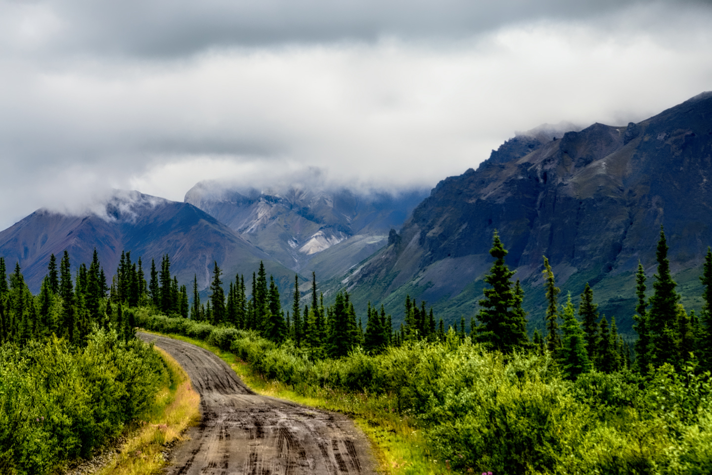
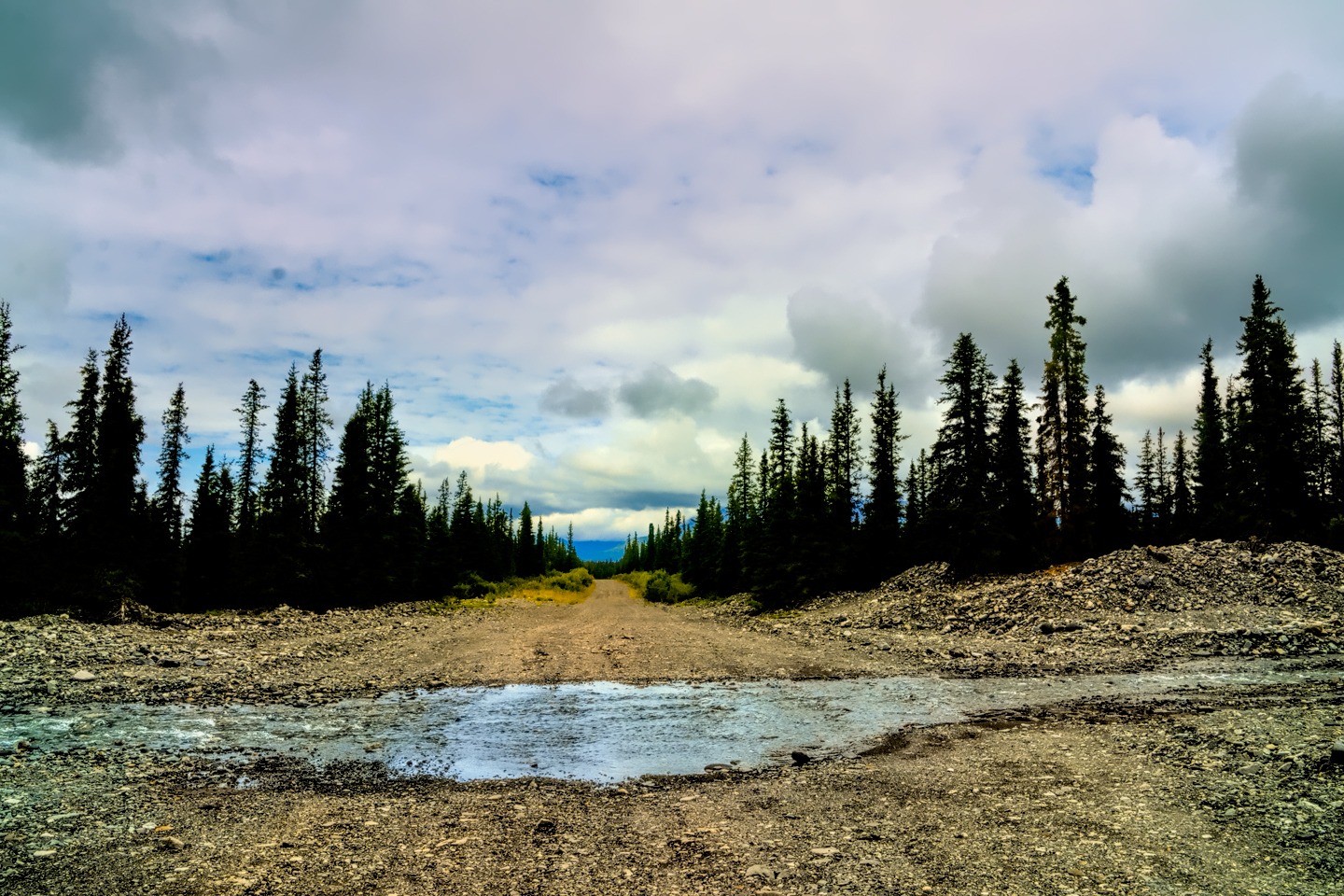
Nabesna Road was paved the first 15 miles, but the next 25 miles were rough, and great fun to drive in my Jeep. Several unbridged streams crossed the road, and the road itself merged into some seriously rocky stream beds. There were zillions of potholes filled with muddy rainwater that made wonderful BEGOOSH geysers when I hit them just right. Crossing a couple of those shallow streams, I gunned it to avoid getting stuck, and sprayed a rooster tail of water off to either side that was higher than the roof of my vehicle!
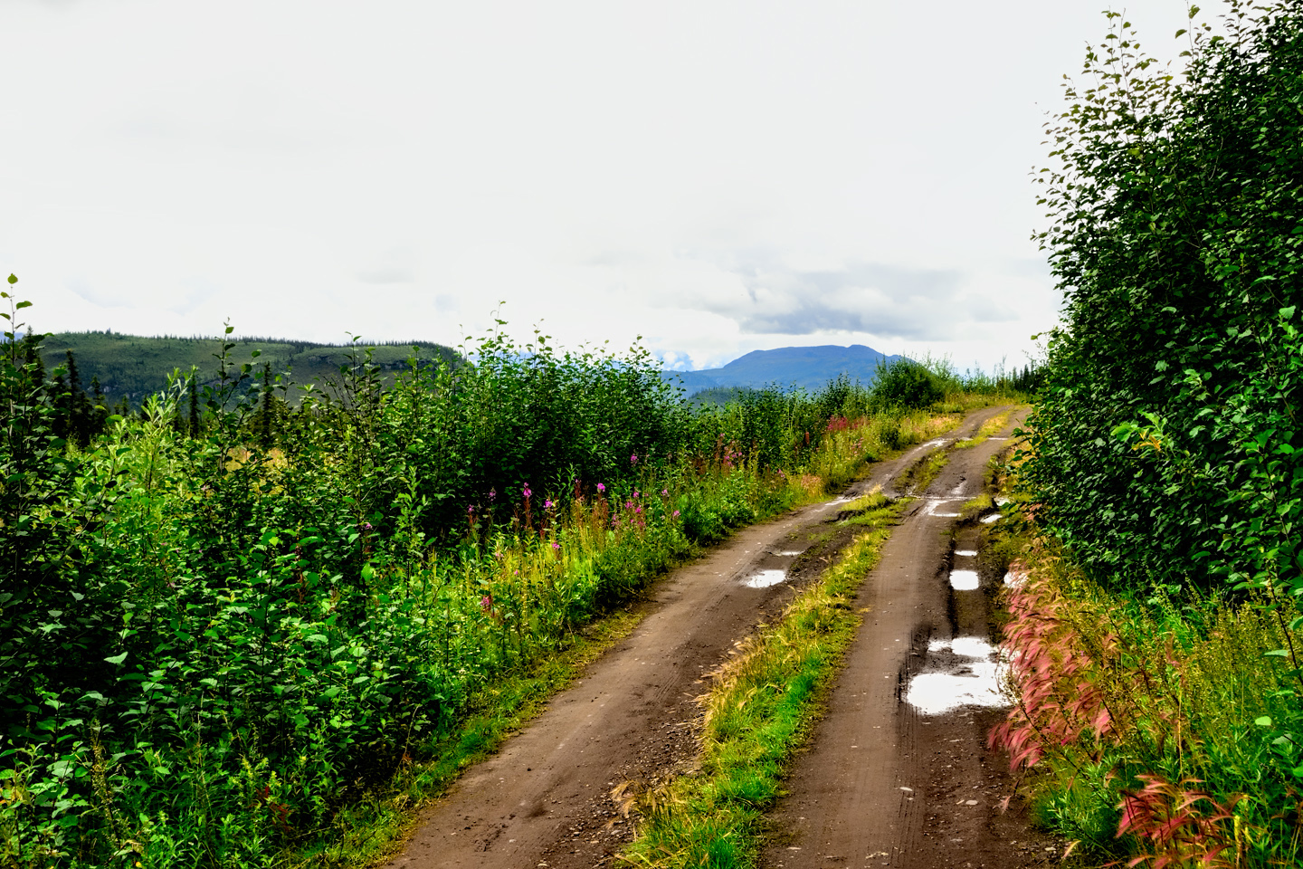
One thing that caught my attention: all of those private parcels had rural mailboxes, even those that were all the way at the end of the road—which was originally built to access a gold mine that is no longer commercially viable, but still being worked by its owner. When I inquired about the mail service, I was told that a rural carrier out of Slana delivers to those boxes three days a week, even in winter (depending on conditions). The Postal Service has long been a lifeline for rural Americans, even here, in one of the most remote parts of Alaska. There were actually two B&B’s at the end of the road—it would have been an interesting place to stay! The last section of the road still goes to the gold mine, but it’s strictly private.
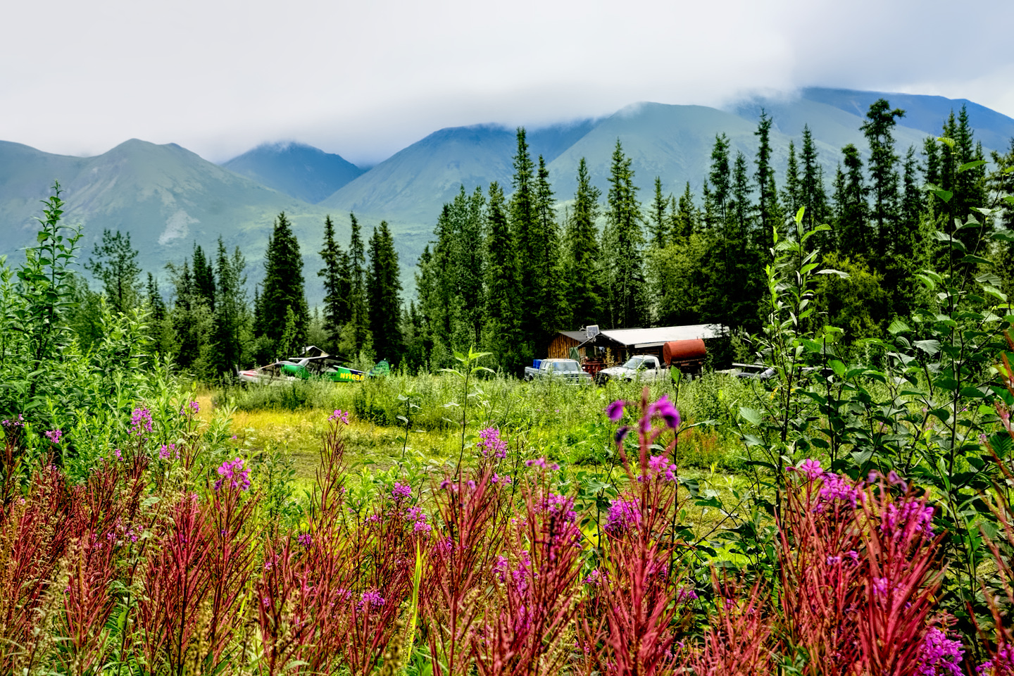
There was also a small airstrip, where flight-seeing excursions can be arranged.
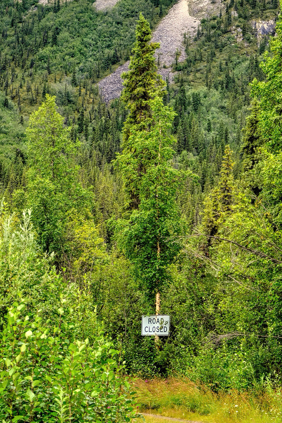
The end of Nabesna Road; beyond the sign is private land
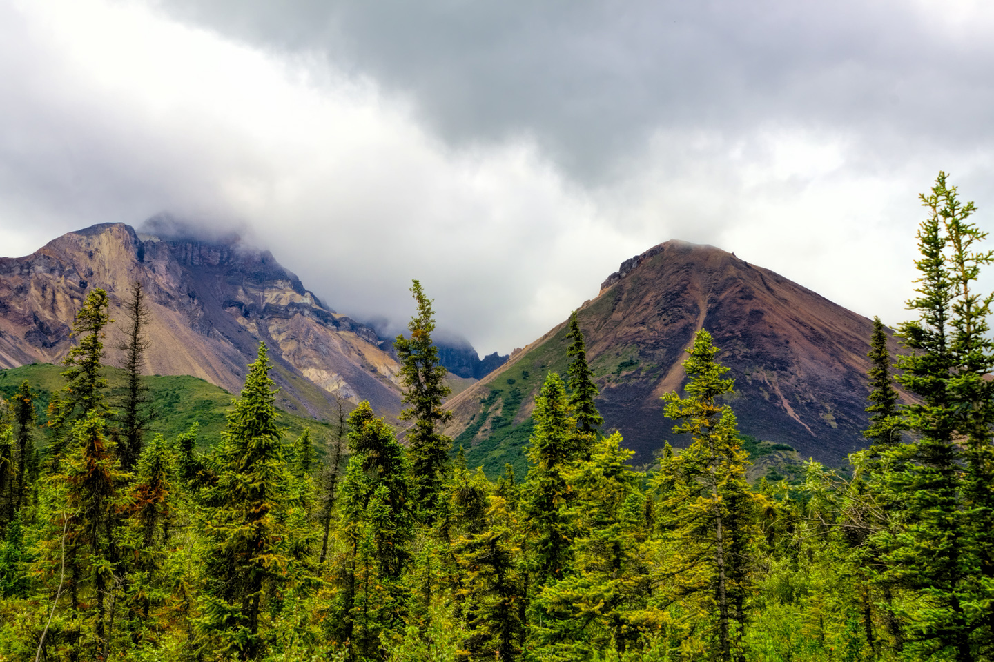
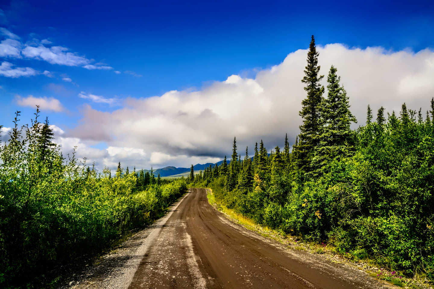
I took very few pictures on the way in—too cloudy—but the sun came partway out as I was driving back and I made numerous stops to take in the views. My visit to Wrangell-St. Elias was great fun, but, compared to the other places I’d been, not the greatest in terms of photo ops. Had the weather been clear, it would have been better; sometimes you have to just live the experience, and not worry about capturing a place with photos. I stopped at the Ranger Station to return the Audio CD, chatted briefly with the staff, then drove on to Tok. It rained on and off along the way, but it was a very pretty drive on this, the final segment of Alaska’s Grand Circle!
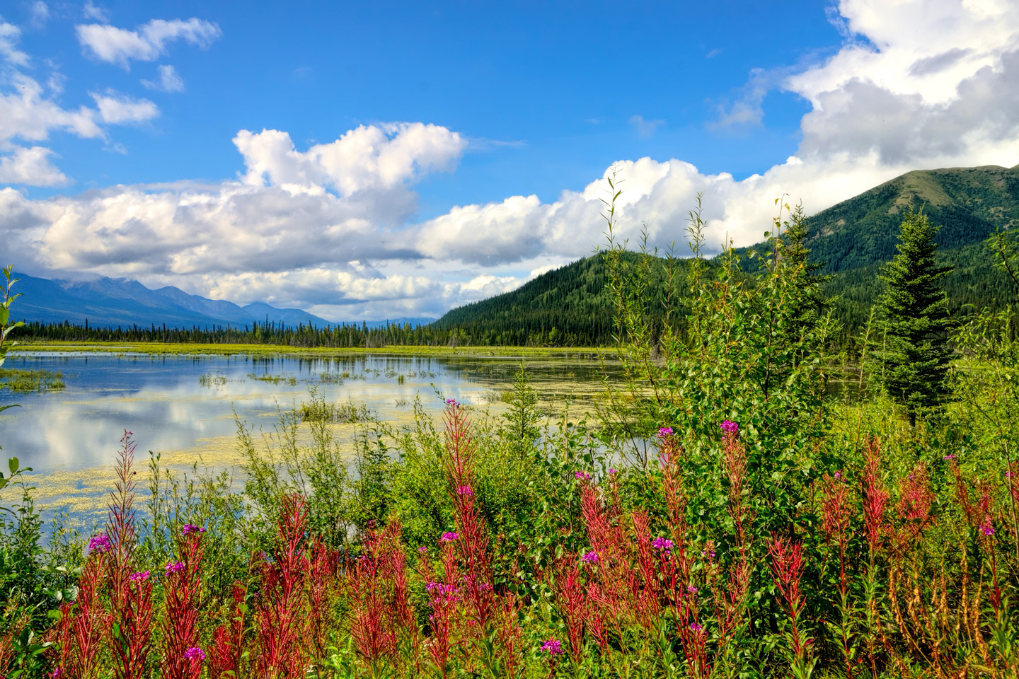
Scenes along the road between Glennallen and Tok
On my own Alaska Road Trip, I added one final extension to my Grand Circle Adventure. Instead of leaving Tok on the Alaska Highway, and then driving back to the Al-Can border and on to Beaver Creek in the Yukon, I turned north at Tetlin Junction, and followed the Taylor Highway, through Chicken, to the Top of the World. If you’d like to read about it, check out the final post in this series: Alaska Road Trip: Driving to the Top of the World
Click maps and photos to expand the images to full screen
To return to the previous post, or to continue reading the conclusion to this series, click the buttons below:
MORE ABOUT THE ALASKA HIGHWAY:
This is an interactive Table of Contents. Click the pictures to open the pages.
Alaska Road Trip

The Alaska Highway: Prelude: The Road to Dawson Creek
Even if you start in Seattle, the closest American city, it’s still more than 800 miles to Dawson Creek, wending your way that much further north, so far north that there will be a noticeable change in the hours of daylight. It’s the latitude that distinguishes the north country, including every bit of Alaska. Dawson Creek is where it all begins.
<<CLICK to Read More>>

The Alaska Highway: Day 1: Dawson Creek to Fort Nelson
Past Fort St. John, the terrain got a lot wilder. No more towns, very few people, and very little traffic. Saw a few U.S. license plates, Michigan, California, Oregon, South Carolina; people that were obviously headed to Alaska!
<<CLICK to Read More>>

The Alaska Highway: Day 2: Fort Nelson to Whitehorse
Every time I rounded a curve in the road there was another stupendous vista; it was nothing short of astonishing! I was literally yipping out loud, and a couple of times I actually pulled over and stopped while I pounded on my chest to “re-start” my heart!
<<CLICK to Read More>>

The Alaska Highway: Day 3: Whitehorse to Beaver Creek
Approaching the mountains, I started pulling over with serious frequency, taking LOTS of photos! Mountains, clouds, lakes, flowers—I was pretty sure I must have died and gone to heaven, but I couldn’t for the life of me remember the fiery crash.
<<CLICK to Read More>>

The Alaska Highway: Day 4: Beaver Creek to Fairbanks
Delta Junction, the end of the Al-Can, was only 200 miles away, and the border? Twenty miles, maybe half an hour, and I was finally going to cross into Alaska! I’d been on the road more than three weeks, and in just half a day more, I’d be in Fairbanks.
<<CLICK to Read More>>

Chena Hot Springs: A Fairbanks Original
The Chena hot spring puts out steaming water at a temperature of 150 degrees, producing enough power to meet all the needs of the resort, as well as filling the hot springs pools used by the guests. In addition to the lodge and restaurant, they offer camping and horseback riding, and they have exhibits featuring sled dogs, greenhouses, ice sculptures, and geothermal energy.
<<CLICK to Read More>>

Two-Foot High Kick: World Eskimo Indian Olympics
Contestants take a running leap, then they make this crazy jackknife move, touch the ball suspended high above the floor with both feet, then come back down and stick the landing. If that sounds difficult? You have no idea.
<<CLICK to Read More>>

Dreaming of Denali
When I drove my Jeep to Alaska that first summer after I retired, my main goal, the single most important thing I wanted to do, was to see Denali, the biggest mountain in North America.
<<CLICK to Read More>>

Follow the Fireweed
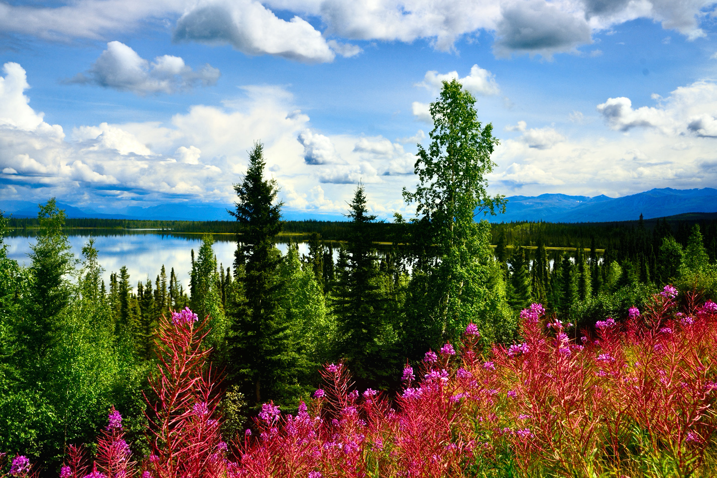
Visualize a summertime journey through that part of the world, a world filled with mountains and glaciers and boreal forests, ice blue rivers, turquoise lakes, and billowing clouds that fill the sky. Imagine your vision as a beautiful piece of music. The fundamental, underlying theme of that symphony would be a gently rising swell of perfect harmony, pinkish lavender in its hue.
<<CLICK to Read More>>

Kenai Fjords National Park: Seabirds, Glaciers, and Whales on the Wild Coast of Alaska
At this latitude, during the summer months, the sun stays low in the sky all day, and never really goes down. The traditional “golden hour” when the light is best for landscape photos is extended accordingly, and there are more opportunities for great shots than you’ll know what to do with.
<<CLICK to Read More>>

Kenai Fjords National Park: Exit Glacier: Up Close and Personal
Compared to the huge tidewater glaciers that flow directly into the sea along the coast of Kenai Fjords, Exit Glacier is just a baby–a baby that’s getting smaller every year–but it’s still big enough to permanently alter the landscape through which it passes.
<<CLICK to Read More>>

Alaska Road Trip: Driving Alaska’s Grand Circle
Most of the major towns in Alaska, as well as three of the state’s incredible National Parks, can all be reached by driving Alaska’s Grand Circle: a loop route beginning in Tok that utilizes all four segments (1082 miles) of Alaska’s Interstate Highway system.
<<CLICK to Read More>>

Alaska Road Trip: The Grand Circle: From Tok to Denali
There are no icy mountains looming on the horizon, and Fairbanks is nowhere near Alaska’s ruggedly beautiful coast. The true beauty in Alaska’s second city is found below the surface, in the spirit and resiliance of the people who make the place their home.
<<CLICK to Read More>>

Alaska Road Trip: The Grand Circle: Anchorage and the Kenai Peninsula
The massive ice field in the park’s wild interior has spawned dozens of glaciers which, over the course of many millenia, have carved the landscape into fjords so heart-breakingly beautiful, humpback whales swim all the way from Hawaii just to cavort in the deep blue water.

Alaska Road Trip: The Grand Circle: Wrangell-St. Elias National Park
So, just exactly how big is Wrangell-St. Elias National Park? You could combine Yellowstone with Yosemite, throw in the entire country of Switzerland, and you still wouldn’t match it in terms of size.
<<CLICK to Read More>>

Alaska Road Trip: Driving to the Top of the World
The rough dirt road gave way to a newly paved modern highway. This was it, the Top of the World, and right on cue, the haze peeled back, just enough to give me a glimpse of the beauty my friends assured me would be there…
<<CLICK to Read More>>

There’s nothing like a good road trip. Whether you’re flying solo or with your family, on a motorcycle or in an RV, across your state or across the country, the important thing is that you’re out there, away from your town, your work, your routine, meeting new people, seeing new sights, building the best kind of memories while living your life to the fullest.
Are you a veteran road tripper who loves grand vistas, or someone who’s never done it, but would love to give it a try? Either way, you should consider making the Southwestern U.S. the scene of your own next adventure.
A few years ago I wrote a book about road trips in Arizona and New Mexico that’s a lot like this website, packed with interesting information, and illustrated with beautiful photographs. Check it out! You can find it on Amazon, and at all other major booksellers.

ALASKA ROAD TRIP:
MEXICAN ROAD TRIP (IN THE LAND OF THE MAYA):
ARIZONA AND NEW MEXICO:
SOUTH AMERICA:
PHOTOGRAPHY:
TRIBAL LANDS:


Recent Comments