Once you’ve driven the Alaska Highway, and arrived in Fairbanks (or wherever), what’s next? You’re not going to turn around and go home without seeing the sights, but Alaska is breathtakingly huge, so how do you prioritize your possibilities? Fortunately, or unfortunately, if you’re traveling by road, the highway system in our 49th state narrows those possibilities for you, rather dramatically. Despite it’s size, there are fewer miles of roads in Alaska than in any other state. 99.9% of the land is still untamed wilderness–hundreds of thousands of square miles of trees, ice-clad mountains, rivers, lakes, and tundra. If you look very closely at a map, you’ll see a few tiny towns in the interior, but it would be impossibly expensive to connect them by road; instead, most travel is by air. If a village has as many as ten people, it will also have an airstrip, and, while there may be fewer roads, Alaska boasts more small planes per capita than anywhere else in the world. Coastal communities are, of course, accessible by boat, as are those towns in the interior near the larger rivers, (at least, in the warmer months), but either way, you’re never (ever) going to get there in your minivan. The long list of populated places in Alaska that are nowhere near the state’s highway system includes Juneau, the state capital, as well as Ketchikan, Sitka, and Nome. Skagway is a special case: you can drive there from Canada, but not from anywhere in Alaska!
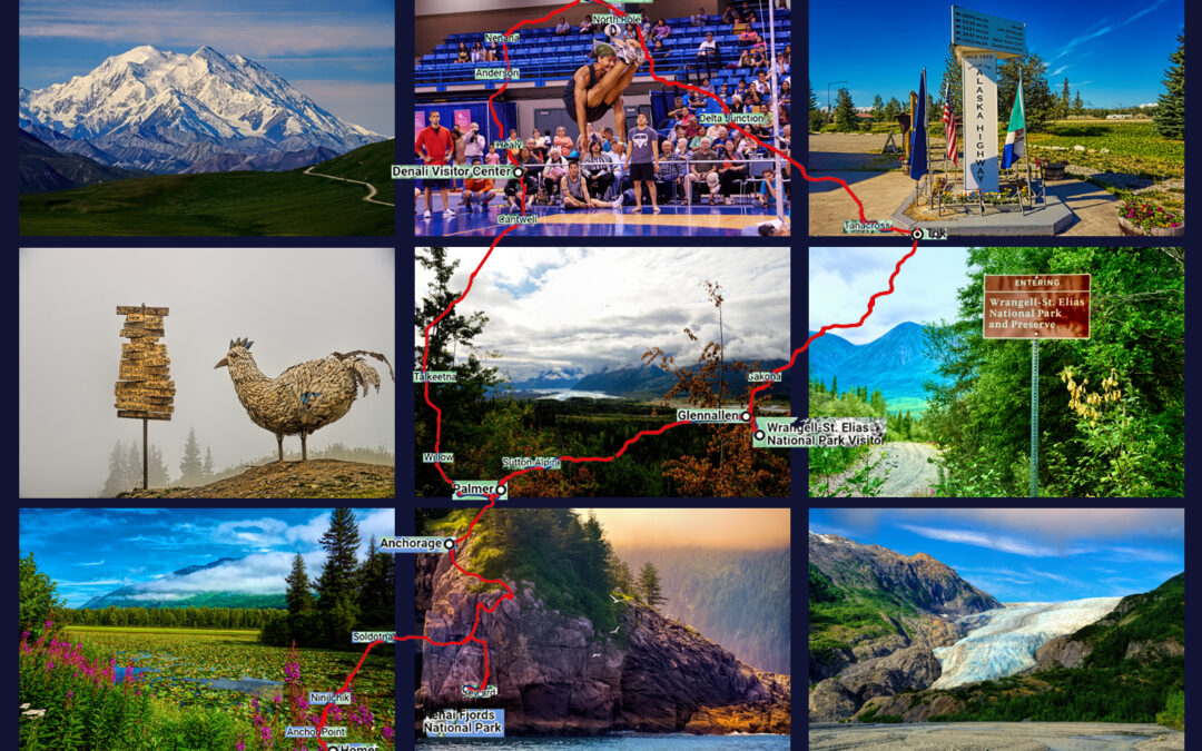
So what does that leave us? Quite a lot, actually, and here’s the good news: most of the major towns in Alaska, as well as many of the state’s most scenic locations, can all be reached by driving what I call Alaska’s Grand Circle: a loop route beginning in Tok that utilizes all four segments (1082 miles) of Alaska’s Interstate Highway system: Tok to Fairbanks on AK-2 (Interstate A-2); Fairbanks to Gateway (near Anchorage) on AK-3 (Interstate A-4); Anchorage to Soldotna on AK-1 (Interstate A-3); and Anchorage back to Tok on AK-1(Interstate A-1). Besides all the cities and towns, the Grand Circle takes you to Denali, Kenai Fjords, and Wrangell-St. Elias National Parks.
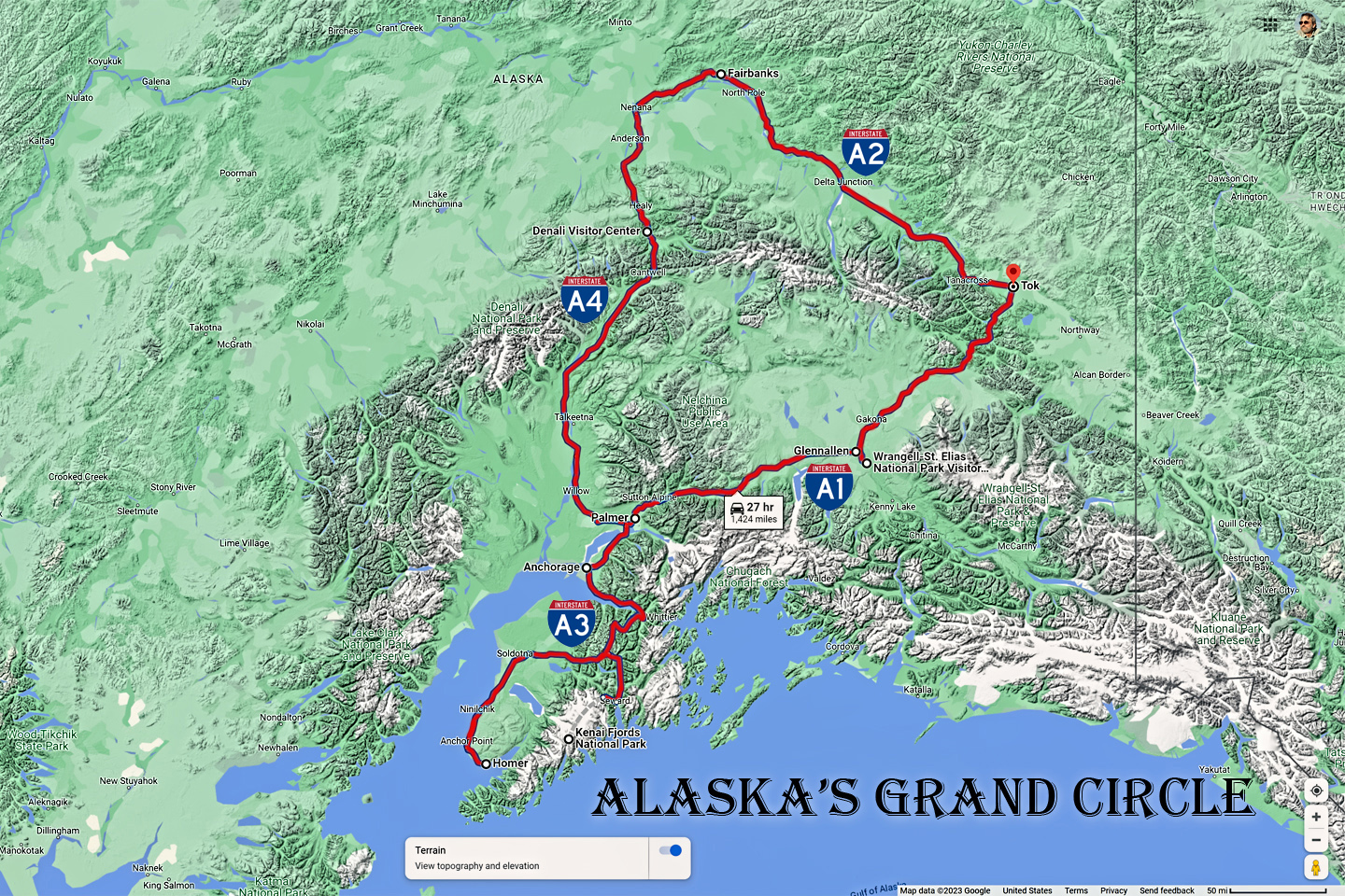
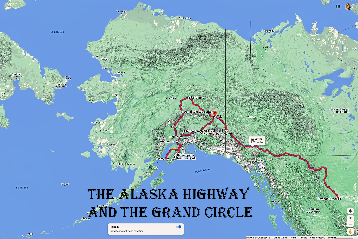
Alaska's Grand Circle is a loop route that begins in Tok and utilizes all four segments (1082 miles) of Alaska’s Interstate Highway system: Tok to Fairbanks on AK-2 (Interstate A-2); Fairbanks to Gateway (near Anchorage) on AK-3 (Interstate A-4); Anchorage to Soldotna on AK-1 (Interstate A-3); and Anchorage back to Tok on AK-1 (Interstate A-1). Most of the major towns in Alaska, as well as many of the state's most scenic areas can all be reached from this loop, which includes three of Alaska's National Parks.
Touching on both Seward and Homer in the Kenai brings the total distance covered on that rough circle to a bit more than 1,400 miles, which is a minimum of 27 hours on the road, not counting stops or delays. (Trust me–there will be plenty of both!)
Depending on how much time you have, and how much you want to see, you can add spurs to the circle, and cover every important highway in Alaska as extensions off that base route. (Technically, both Anchorage and the Kenai are on a spur off the main circle, but that’s one extension that shouldn’t be considered optional.) The greater portion of the base route is a divided, multi-lane, limited access road built to Interstate Highway standards. Other sections are State Highways with one lane in each direction, and when you get off on the extensions you’ll run into pavement that’s not so well maintained (lots of potholes and frost heaves), as well as long stretches of dirt and gravel. Many of the smaller roads are seasonal, closed in the winter (which, in Alaska, is most of the year). The summer is generally safe, but once you get to the cold months–late September all the way into May–travel on many of Alaska’s highways can be dangerous. Always check 511.Alaska.gov before starting out into any remote area.
CLICK MAPS AND PHOTOS FOR AN EXPANDED VIEW
My own Alaskan Road Trip ended up looking like this:
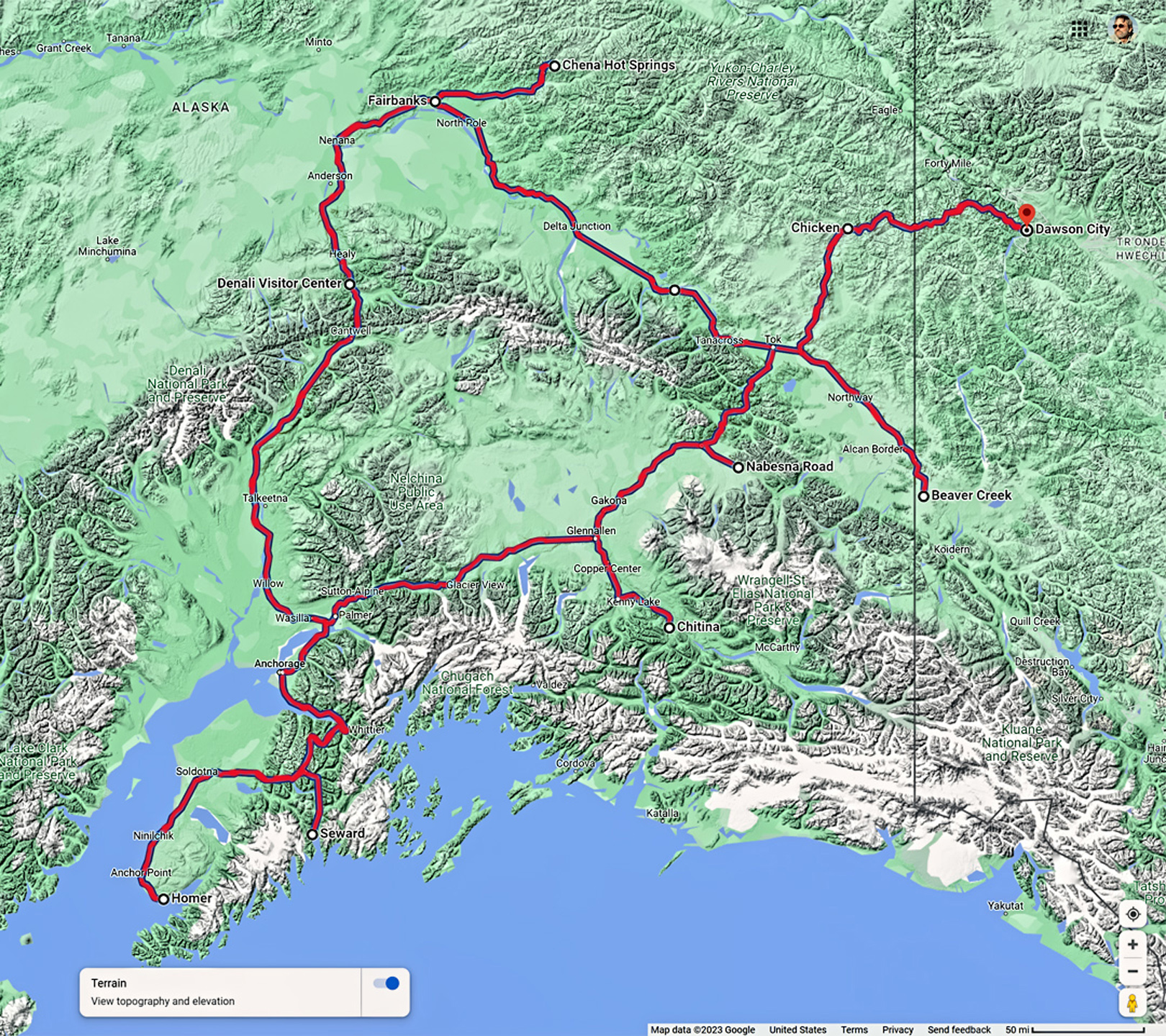
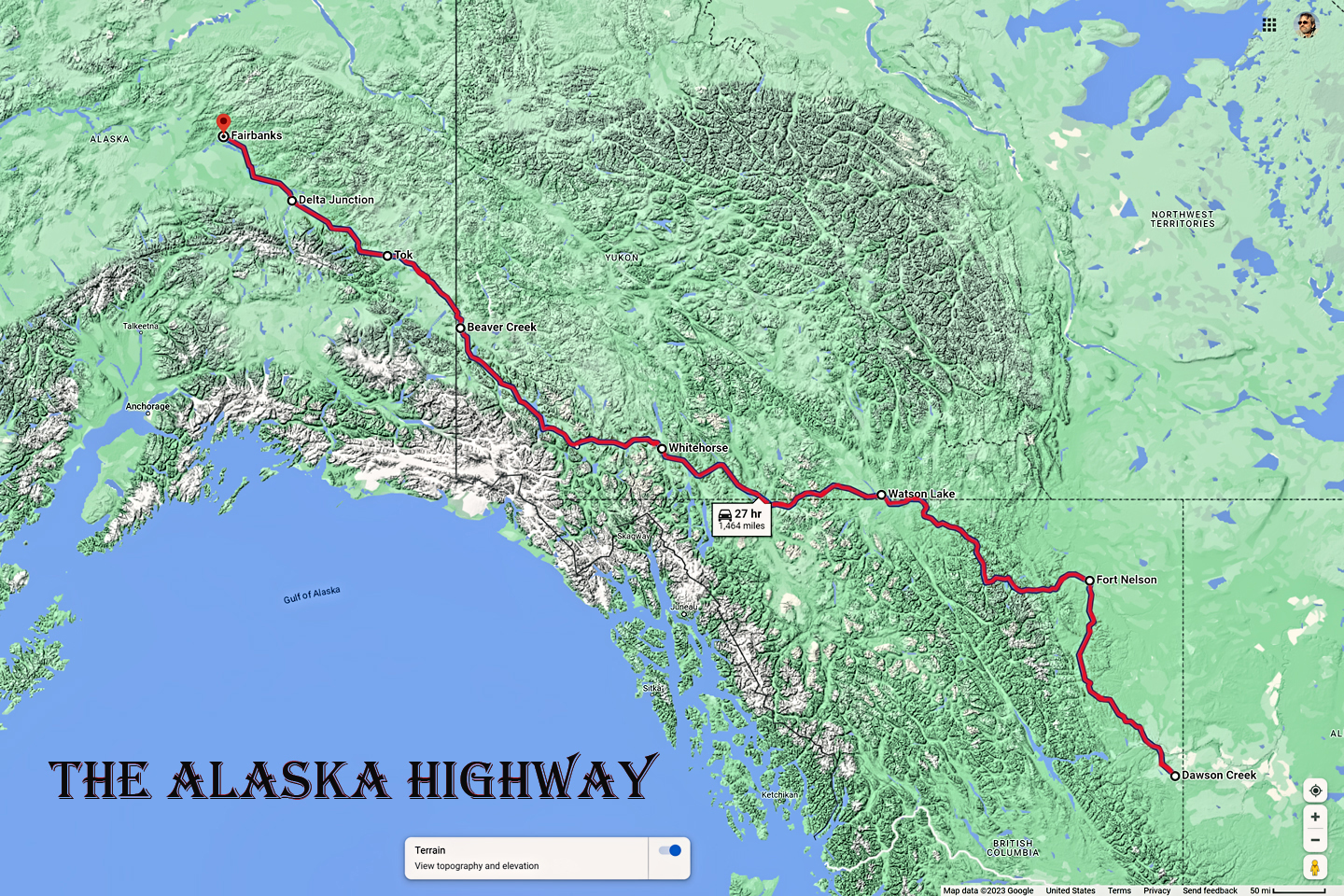
I drove in on the Alaska Highway, from Beaver Creek, Yukon to Tok, and then on to Fairbanks, the first leg of the Grand Circle. From Fairbanks, I took a little side trip up to Chena Hot Springs and back, and then followed the Circle counter-clockwise, to Denali National Park, Anchorage, then Seward, Kenai Fjords National Park, and Homer on the Kenai Peninsula. From there, back north through Palmer to Glenallen, which I used as my base for two forays by road into Wrangell St. Elias National Park. Driving on to Tok completed the Circle, but I added one last extension: I turned north to Chicken, and then drove the Top of the World Highway, which took me back out of Alaska, and on to Dawson City, Yukon. My total distance covered along this route was about 2,000 miles, spread over three weeks. That was a comfortable pace. Rarely more than 5 or 6 hours of driving in any one day, and plenty of time for exploring and sightseeing.
That said, there’s never enough time for everything on a road trip, and there were three optional extensions I seriously considered, but, regrettably, chose not to drive:
The Dalton Highway:
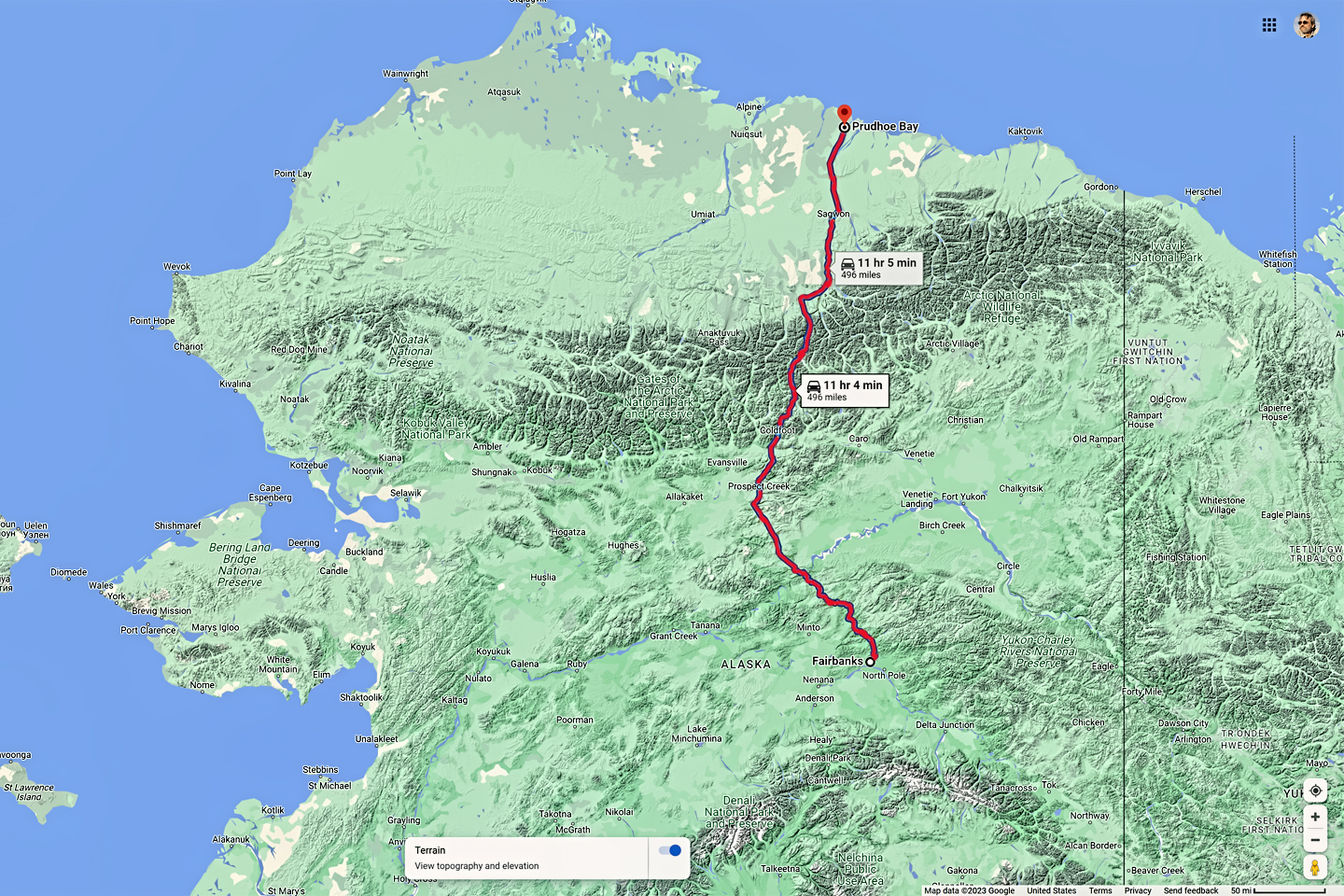
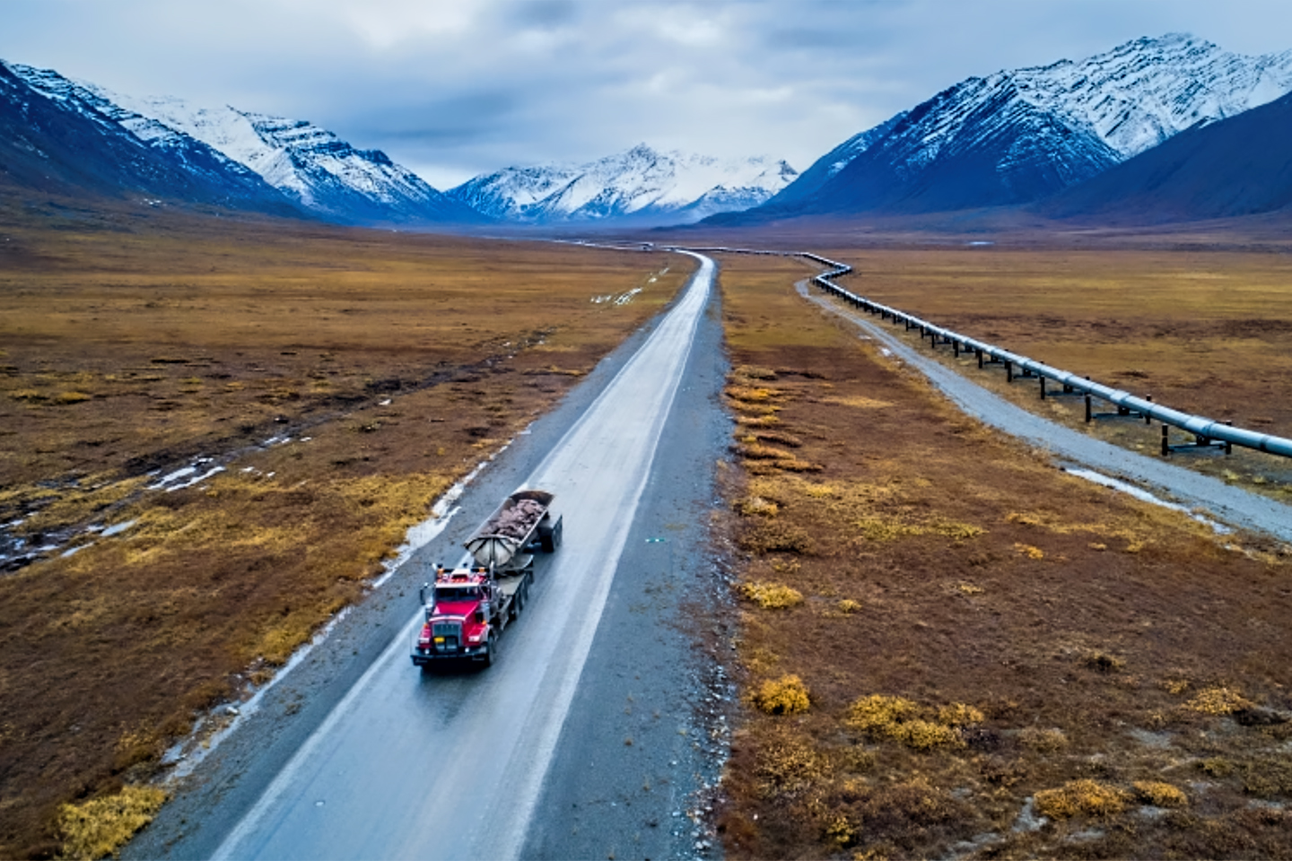
A gravel road that takes you from Fairbanks all the way to the top of the state at Prudhoe Bay, well above the Arctic Circle, following the route of the Alaska Pipeline much of the way. It’s the most northerly road anywhere, and a real adventure. It’s also a narrow road traveled by big rigs that speed along it with careless abandon, spraying loose gravel kicked up by their big wheels. I didn’t want to risk trashing the glass and ruining the paint on my Jeep, so I skipped the Dalton.
The Richardson Highway
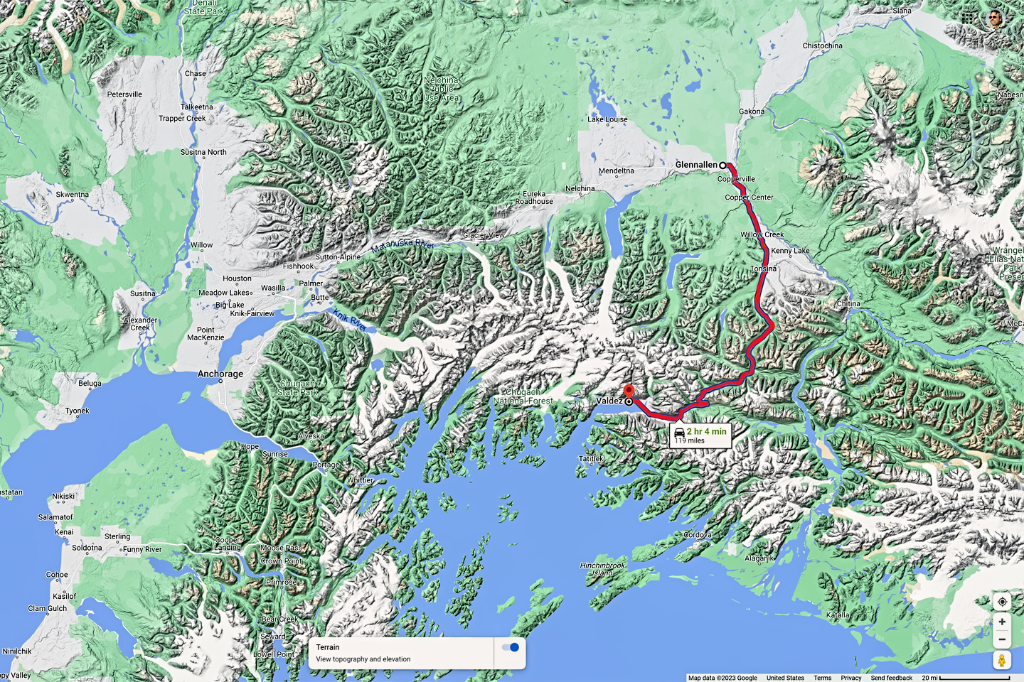
From Glenallen to Valdez (of Exxon Valdez fame): said to be quite beautiful, a 240 mile round trip on an excellent paved highway. It would have cost me just one extra day, but on the day I would have gone, it was drizzling in Glenallen, and pouring in Valdez, so I wouldn’t have seen a thing on the drive, just clouds and fog. I didn’t have any days to waste at that point. I had to be in Edmonton the following week, to rendezvous with a friend who was flying up to join me on my road trip.
The McCarthy Road
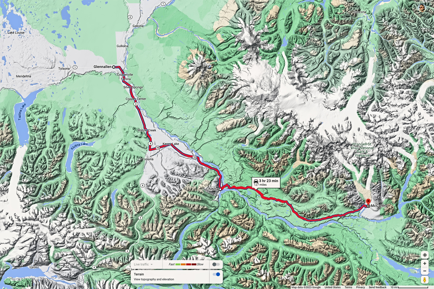
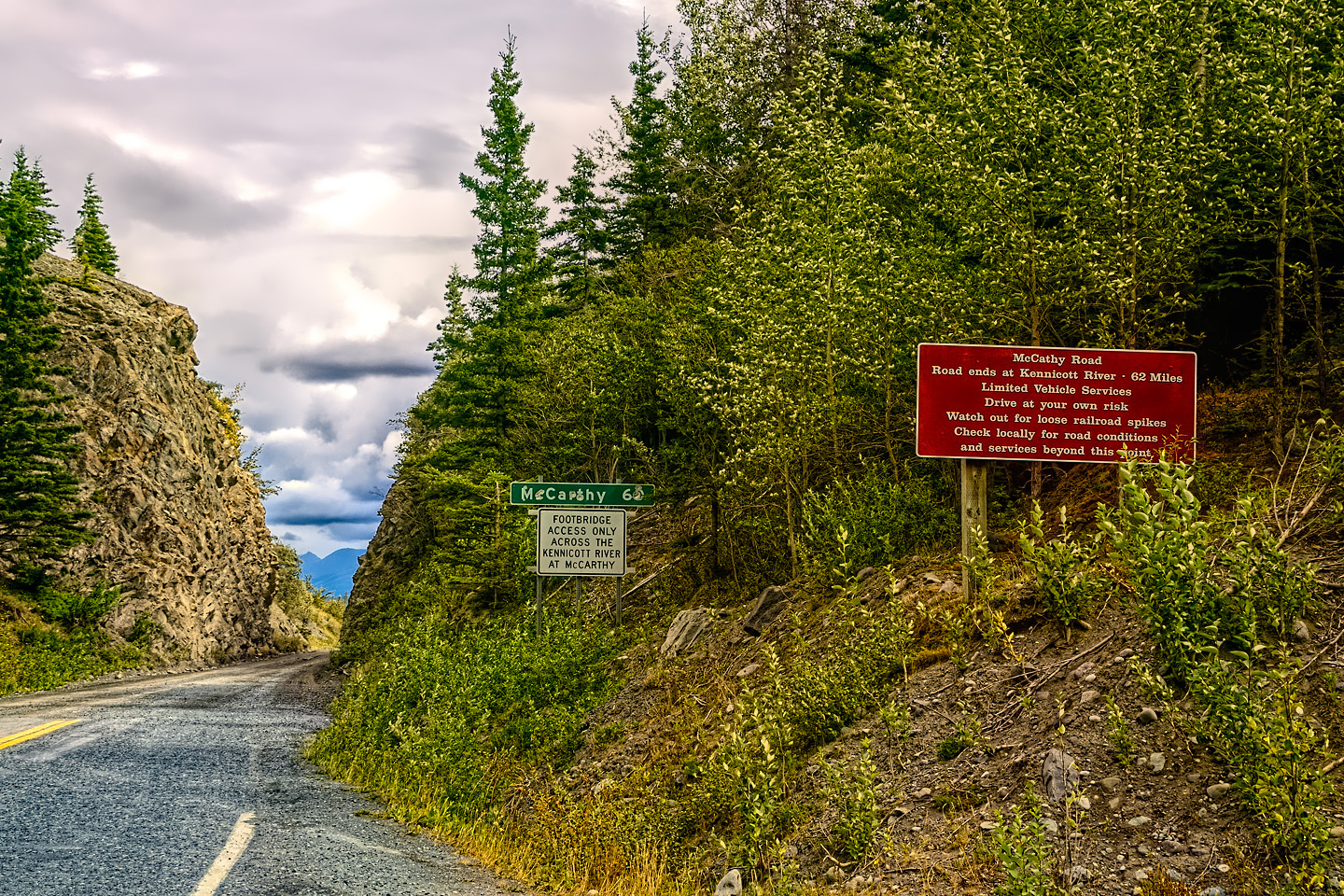
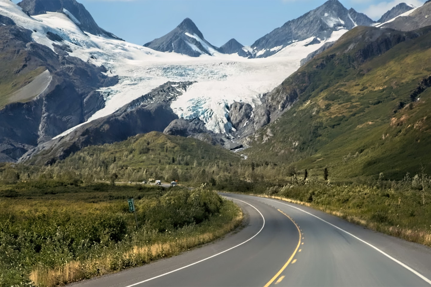
In Wrangell St. Elias National Park: a mostly dirt road that takes you from Chitina to tiny McCarthy, access point to Kennecott, an abandoned mining town and historical site that’s frozen in time, and isolated as the dickens. It’s a 250 mile round trip from Glenallen, and you need to allow at least a full day. I got as far as Chitina, about halfway, when I realized I didn’t have enough fuel to get all the way to McCarthy and back, and the closest gas was sixty miles behind me, back in Glenallen.
There were a few other named highways that didn’t make the cut for my own road trip, for one reason or another:
The Denali Highway, 135 miles of mostly gravel road between Cantwell, on the Parks Highway (near Denali) and Paxson, on the Richardson Highway south of Delta Junction. Before the Parks Highway was completed in 1971, the Denali Highway was the only overland route to Denali National Park. Today, it’s mostly obsolete, very lightly traveled, and closed in the winter. There are supposed to be great views of the mountains, but, personally, I try to avoid long gravel roads.
The rest of the Richardson Highway, a good paved road that runs 153 miles north from Glenallen to Delta Junction (the end of the Alaska Highway). I was headed to Tok, not Delta Junction, so I skipped the Richardson and took the shortcut, the Glenn Highway-Tok Cutoff, instead.
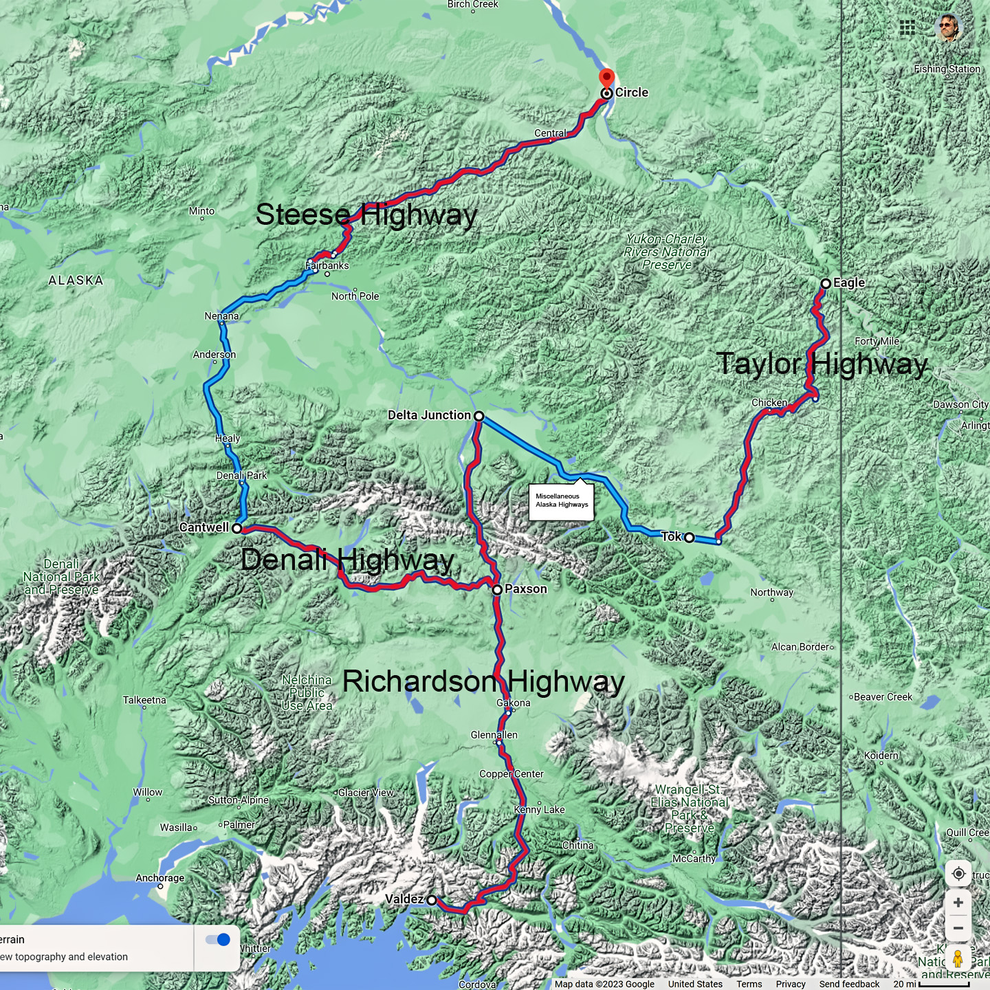
The Steese Highway, 161 miles of mostly gravel road from Fairbanks to Circle, where there is a hot spring. Circle is just 50 miles from the Arctic Circle. The route is said to be quite beautiful, but, again–it’s gravel!
The Taylor Highway, 160 miles of partly paved, partly gravel road from Tetlin Junction, near Tok, through Chicken, up to the tiny community of Eagle. I actually did drive most of that route, but I missed the last 62 miles, when the Taylor turns north from the Top of the World, the rest of the way to Eagle. And why not? Gravel!
There are other lesser roads, of course, that can’t really be considered highways, but I believe I’ve listed all the majors, and I should reiterate that all of these roads, without exception, connect to the Grand Circle. You can easily add any, all, or none of them to your own Alaskan Road Trip, depending on how much time you have, and how many miles you don’t mind driving into some seriously remote countryside.
When it comes to road trips, I’ve had far more experience than most, having traveled exensively by road on four different continents, over the course of more than half a century. I even have a book to my credit: RoadTrip America’s Arizona and New Mexico: 25 Scenic Side Trips, all of which makes me something of an authority on the subject. That, along with about $3.00, will barely buy me a cup of coffee, but it does mean that when I say this, it’s a statement that should be taken seriously: (Ahem): “My Alaska Road Trip was one of the most amazing things I’ve ever done!” Period; full stop.
Click any photo in this post to stop the slide shows and expand the images to full screen.
To return to the previous post, or to read the first post of my Alaska Road Trip series, click the buttons below:
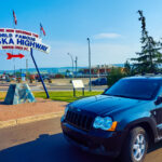
MORE ABOUT THE ALASKA HIGHWAY:
This is an interactive Table of Contents. Click the pictures to open the pages.
Alaska Road Trip

The Alaska Highway: Prelude: The Road to Dawson Creek
Even if you start in Seattle, the closest American city, it’s still more than 800 miles to Dawson Creek, wending your way that much further north, so far north that there will be a noticeable change in the hours of daylight. It’s the latitude that distinguishes the north country, including every bit of Alaska. Dawson Creek is where it all begins.
<<CLICK to Read More>>

The Alaska Highway: Day 1: Dawson Creek to Fort Nelson
Past Fort St. John, the terrain got a lot wilder. No more towns, very few people, and very little traffic. Saw a few U.S. license plates, Michigan, California, Oregon, South Carolina; people that were obviously headed to Alaska!
<<CLICK to Read More>>

The Alaska Highway: Day 2: Fort Nelson to Whitehorse
Every time I rounded a curve in the road there was another stupendous vista; it was nothing short of astonishing! I was literally yipping out loud, and a couple of times I actually pulled over and stopped while I pounded on my chest to “re-start” my heart!
<<CLICK to Read More>>

The Alaska Highway: Day 3: Whitehorse to Beaver Creek
Approaching the mountains, I started pulling over with serious frequency, taking LOTS of photos! Mountains, clouds, lakes, flowers—I was pretty sure I must have died and gone to heaven, but I couldn’t for the life of me remember the fiery crash.
<<CLICK to Read More>>

The Alaska Highway: Day 4: Beaver Creek to Fairbanks
Delta Junction, the end of the Al-Can, was only 200 miles away, and the border? Twenty miles, maybe half an hour, and I was finally going to cross into Alaska! I’d been on the road more than three weeks, and in just half a day more, I’d be in Fairbanks.
<<CLICK to Read More>>

Chena Hot Springs: A Fairbanks Original
The Chena hot spring puts out steaming water at a temperature of 150 degrees, producing enough power to meet all the needs of the resort, as well as filling the hot springs pools used by the guests. In addition to the lodge and restaurant, they offer camping and horseback riding, and they have exhibits featuring sled dogs, greenhouses, ice sculptures, and geothermal energy.
<<CLICK to Read More>>

Two-Foot High Kick: World Eskimo Indian Olympics
Contestants take a running leap, then they make this crazy jackknife move, touch the ball suspended high above the floor with both feet, then come back down and stick the landing. If that sounds difficult? You have no idea.
<<CLICK to Read More>>

Dreaming of Denali
When I drove my Jeep to Alaska that first summer after I retired, my main goal, the single most important thing I wanted to do, was to see Denali, the biggest mountain in North America.
<<CLICK to Read More>>

Follow the Fireweed
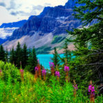
Visualize a summertime journey through that part of the world, a world filled with mountains and glaciers and boreal forests, ice blue rivers, turquoise lakes, and billowing clouds that fill the sky. Imagine your vision as a beautiful piece of music. The fundamental, underlying theme of that symphony would be a gently rising swell of perfect harmony, pinkish lavender in its hue.
<<CLICK to Read More>>

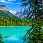
Kenai Fjords National Park: Seabirds, Glaciers, and Whales on the Wild Coast of Alaska
At this latitude, during the summer months, the sun stays low in the sky all day, and never really goes down. The traditional “golden hour” when the light is best for landscape photos is extended accordingly, and there are more opportunities for great shots than you’ll know what to do with.
<<CLICK to Read More>>

Kenai Fjords National Park: Exit Glacier: Up Close and Personal
Compared to the huge tidewater glaciers that flow directly into the sea along the coast of Kenai Fjords, Exit Glacier is just a baby–a baby that’s getting smaller every year–but it’s still big enough to permanently alter the landscape through which it passes.
<<CLICK to Read More>>

Alaska Road Trip: Driving Alaska’s Grand Circle
Most of the major towns in Alaska, as well as three of the state’s incredible National Parks, can all be reached by driving Alaska’s Grand Circle: a loop route beginning in Tok that utilizes all four segments (1082 miles) of Alaska’s Interstate Highway system.
<<CLICK to Read More>>

Alaska Road Trip: The Grand Circle: From Tok to Denali
There are no icy mountains looming on the horizon, and Fairbanks is nowhere near Alaska’s ruggedly beautiful coast. The true beauty in Alaska’s second city is found below the surface, in the spirit and resiliance of the people who make the place their home.
<<CLICK to Read More>>

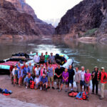
Alaska Road Trip: The Grand Circle: Anchorage and the Kenai Peninsula
The massive ice field in the park’s wild interior has spawned dozens of glaciers which, over the course of many millenia, have carved the landscape into fjords so heart-breakingly beautiful, humpback whales swim all the way from Hawaii just to cavort in the deep blue water.

Alaska Road Trip: The Grand Circle: Wrangell-St. Elias National Park
So, just exactly how big is Wrangell-St. Elias National Park? You could combine Yellowstone with Yosemite, throw in the entire country of Switzerland, and you still wouldn’t match it in terms of size.
<<CLICK to Read More>>

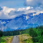
Alaska Road Trip: Driving to the Top of the World
The rough dirt road gave way to a newly paved modern highway. This was it, the Top of the World, and right on cue, the haze peeled back, just enough to give me a glimpse of the beauty my friends assured me would be there…
<<CLICK to Read More>>

There’s nothing like a good road trip. Whether you’re flying solo or with your family, on a motorcycle or in an RV, across your state or across the country, the important thing is that you’re out there, away from your town, your work, your routine, meeting new people, seeing new sights, building the best kind of memories while living your life to the fullest.
Are you a veteran road tripper who loves grand vistas, or someone who’s never done it, but would love to give it a try? Either way, you should consider making the Southwestern U.S. the scene of your own next adventure.
A few years ago I wrote a book about road trips in Arizona and New Mexico that’s a lot like this website, packed with interesting information, and illustrated with beautiful photographs. Check it out! You can find it on Amazon, and at all other major booksellers.

ALASKA ROAD TRIP:
MEXICAN ROAD TRIP (IN THE LAND OF THE MAYA):
ARIZONA AND NEW MEXICO:
SOUTH AMERICA:
PHOTOGRAPHY:
TRIBAL LANDS:


Thank you so very much for the time, energy and talent involved in creating this most helpful site. It has really helped me in planning the epic bucket list trip for my sister and myself while she still has good health.
It is really appreciated.
I appreciate your kind remarks. I’m very glad that you found this material useful!