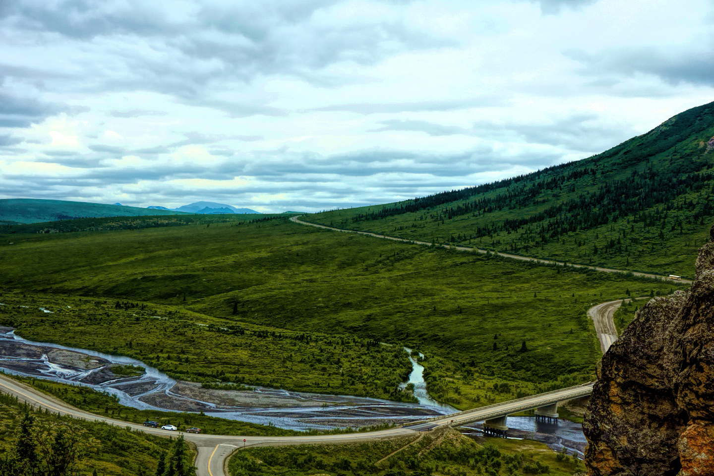
PRETTY ROCKS LANDSLIDE
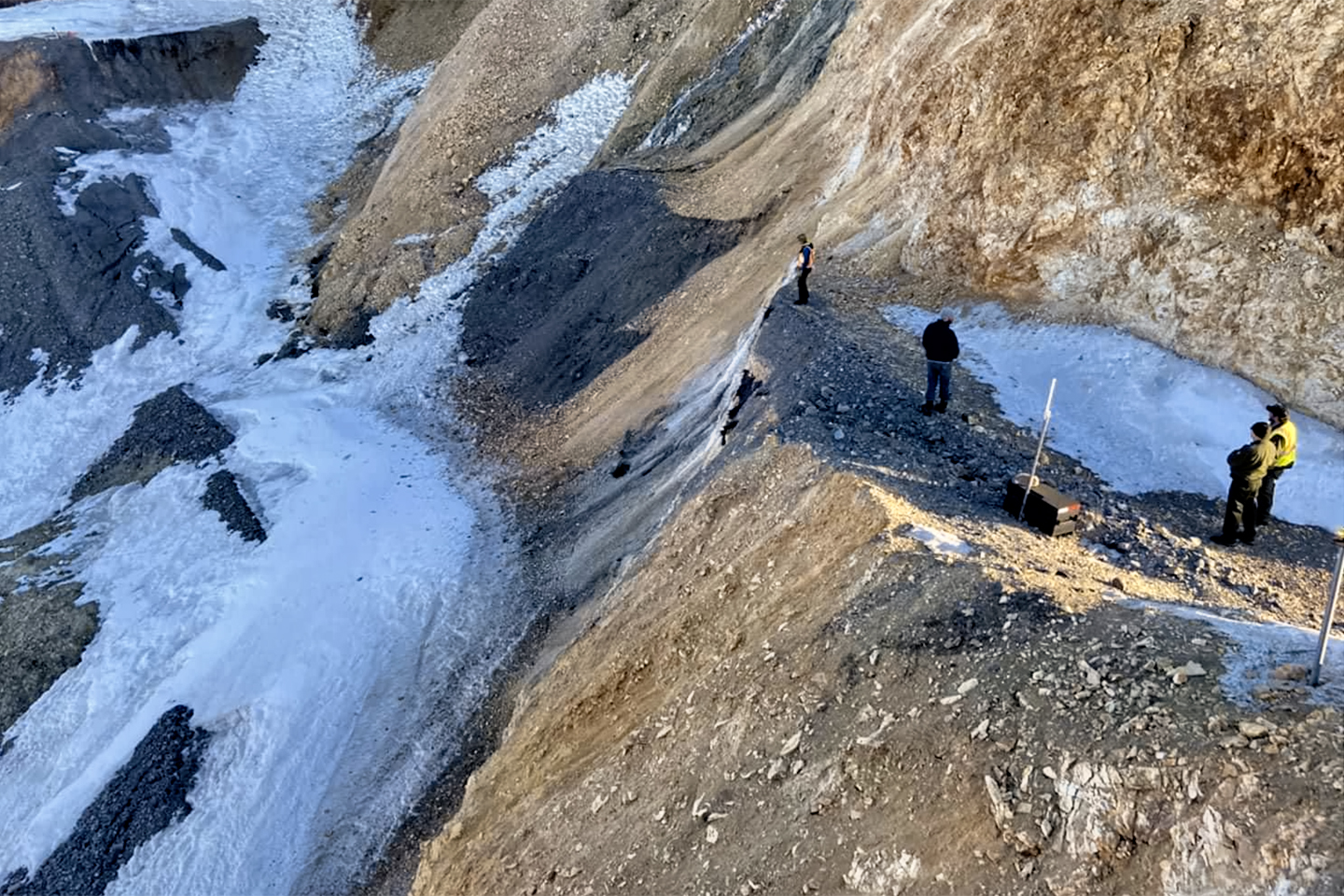
Pretty Rocks Landslide that cut off much of the Denali Park Road in August of 2021. Photo Courtesy of the National Park Service.
IN AUGUST, 2021: A serious landslide in the area of Polychrome Pass forced the closure of Denali Park Road at mile 43. Until repairs can be completed, probably not until the summer of 2026, all the tour buses turn around at that point, and the area west of Polychrome, including the Eielson Center and Wonder Lake, is not accessible to visitors.
The trip that I describe in this post took place in 2015, six years before the landslide, when the entire park was still open and unrestricted. In this re-write of my original article, I’ve divided the material into two sections: Before, and After the break in the road at Polychrome Pass. Pay special attention to the photos in the “After” section; those are the views you’ll be missing if you go to Denali before they finish fixing the road. Given a choice? I think I’d wait!
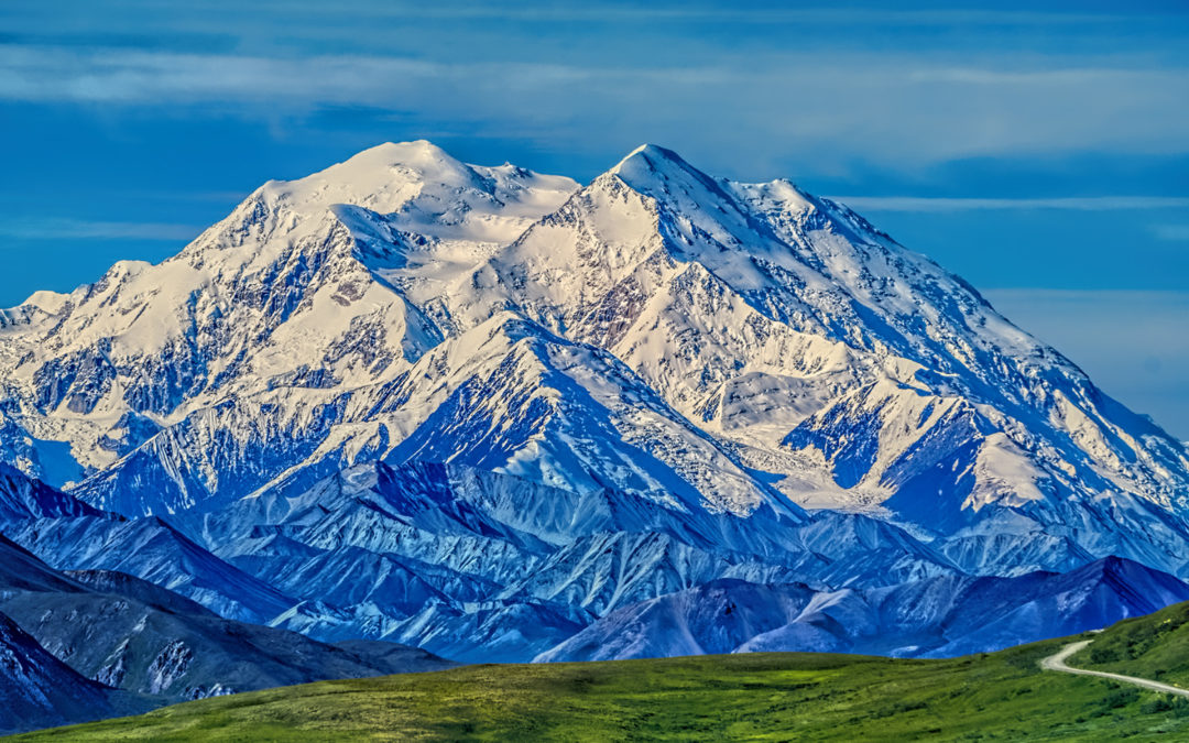
When I drove my Jeep to Alaska in the summer of 2015, my primary goal, the single most important thing I wanted to do, was to see Denali, the biggest mountain in North America. It was a bucket list item, somewhere in my top five, and even though there were plenty of other amazing sights and scenes along the way, the High One reigned supreme in my dream.
I did some research before I went there, and I learned a few things. The summit of Denali rises to a breathtaking 20,308 feet, and the rise is so steep that it’s the third most prominent mountain peak anywhere, right after Mount Everest (the biggest mountain in the world), and Aconcagua, (the biggest mountain in South America). A thing like that literally disrupts the jet stream, and in the process, Denali creates its own weather, with heavy rain on the menu more often than not.
What that means for visitors can be summed up with a number: Thirty. Of the 600,000 people who make their way to this six million acre National Park in an average year, only 30%, less than 200,000, will actually see the mountain, at least, not the whole thing, the way it looks in all those beautiful pictures. For everyone else, Denali cloaks herself in cloud. What you see on the day you go is simply what you get, and that’s just the luck of the draw.
I really wanted to improve those odds if possible, so I started checking the weather forecast ten days ahead, and I timed my visit for what appeared to be a rare window of clear skies, on one single day, a Tuesday in mid-July. On the Sunday prior, I drove down from Fairbanks in pouring rain. What should have been a two hour journey took closer to three, but no matter, I wasn’t in a hurry.
I headed straight to the Visitor’s Center where they take reservations for the park shuttle buses, and booked myself a space on the 6:15 AM run out to Wonder Lake, on my hopefully sunny Tuesday, the only day in the proximate future that the weather forecast predicted sunshine—and so far, according to the weather app on my phone, that cheery forecast had not changed. The bus ride To Wonder Lake is a 170 mile round trip on the Denali Park Road that takes at least 11 hours. My ticket set me back almost fifty bucks, priced separately from entry to the National Park (which was free for me in any case, with my Senior Pass ;-). The bus is the only practical way to travel into the interior of the park, because private vehicles aren’t allowed beyond the Savage River Bridge, at mile 15. By restricting the volume of traffic on the road, they’ve greatly improved the odds of spotting wildlife near the road, and that’s a good thing for all park visitors.
DESKTOP AND TABLET USERS: CLICK THE PHOTOS BELOW TO EXPAND THE IMAGES TO FULL SCREEN
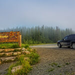
SAVAGE RIVER
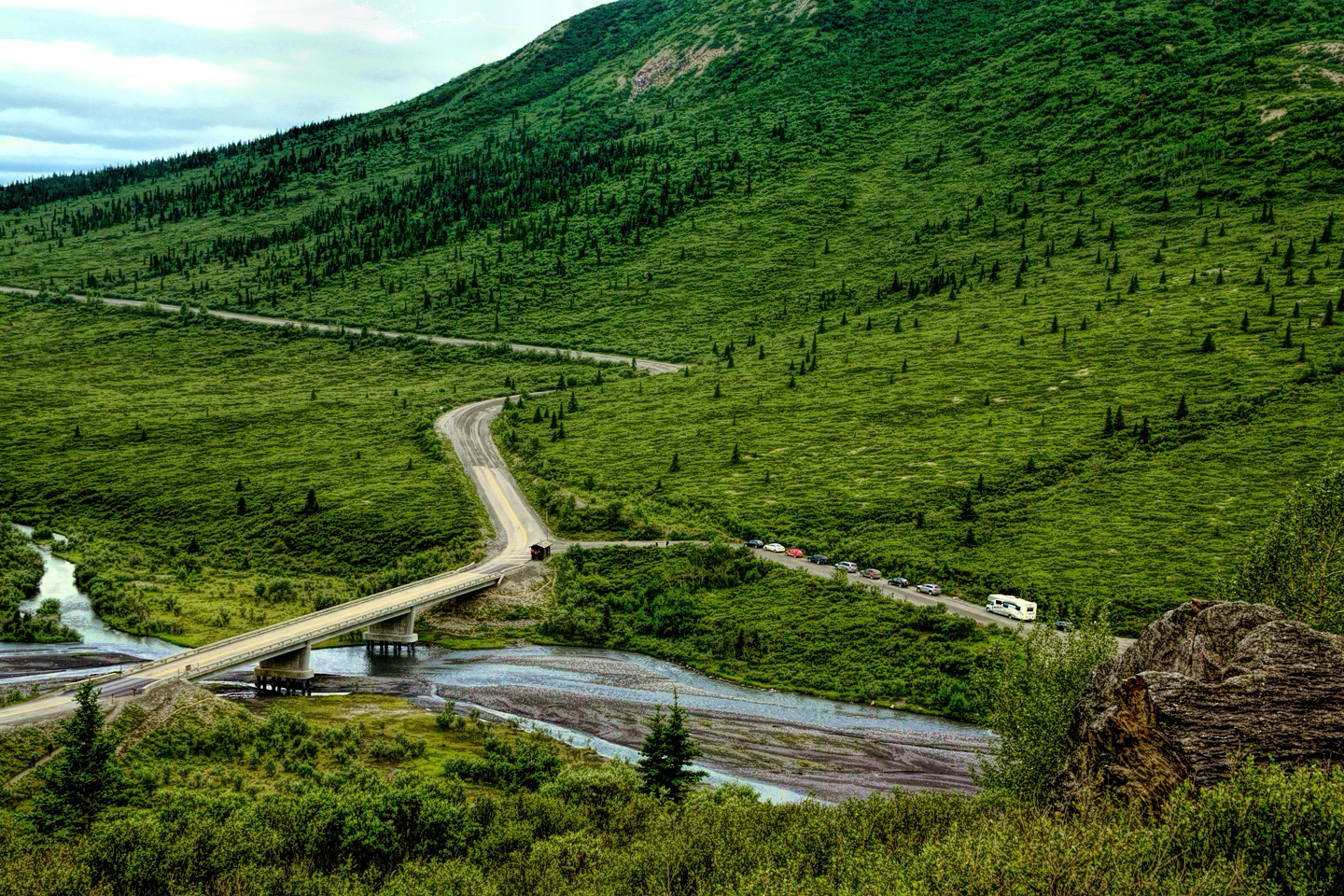
The Savage River Bridge, Mile 15 on the Denali Park Road; there is a parking area, a campground, and several trailheads
I had two days to kill before my tour, so I booked a “dry cabin” at a place called the Grizzly Bear Resort. You get heat, and a roof, but the bathroom is down the hill, so you save a small fortune. The Grizzly worked out well for me, so I’ll go so far as to recommend them!
On my second day at the park, I went back to the Visitor’s Center to check out the exhibits and the films, and to talk to one of the rangers about the area. Since I had my Jeep, he suggested that I drive out to the Savage River at mile 15, which was the farthest I’d be able to go without special permits.
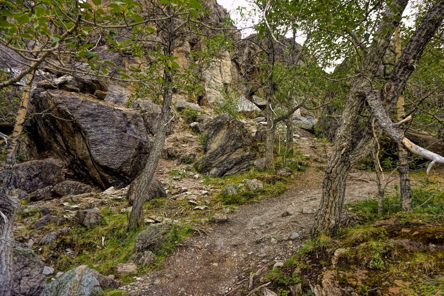
I did as he suggested, and it was a very pretty drive, despite the cold and overcast. I hiked around a bit, even climbed part way up a ridge—but only part way. I find that I’ve become much more timid about heights than I used to be. My balance isn’t great anymore, and I have an old man’s brittle bones, so a slip, trip, or fall, out there by myself in a remote place like Denali? That could be a disaster. At the risk of cliché: better safe than sorry!
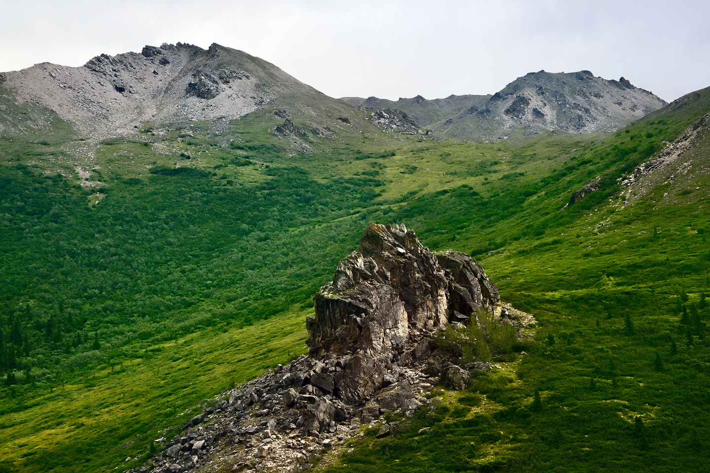
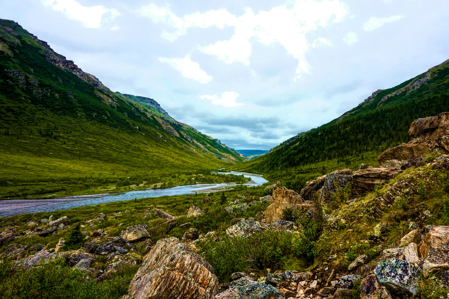
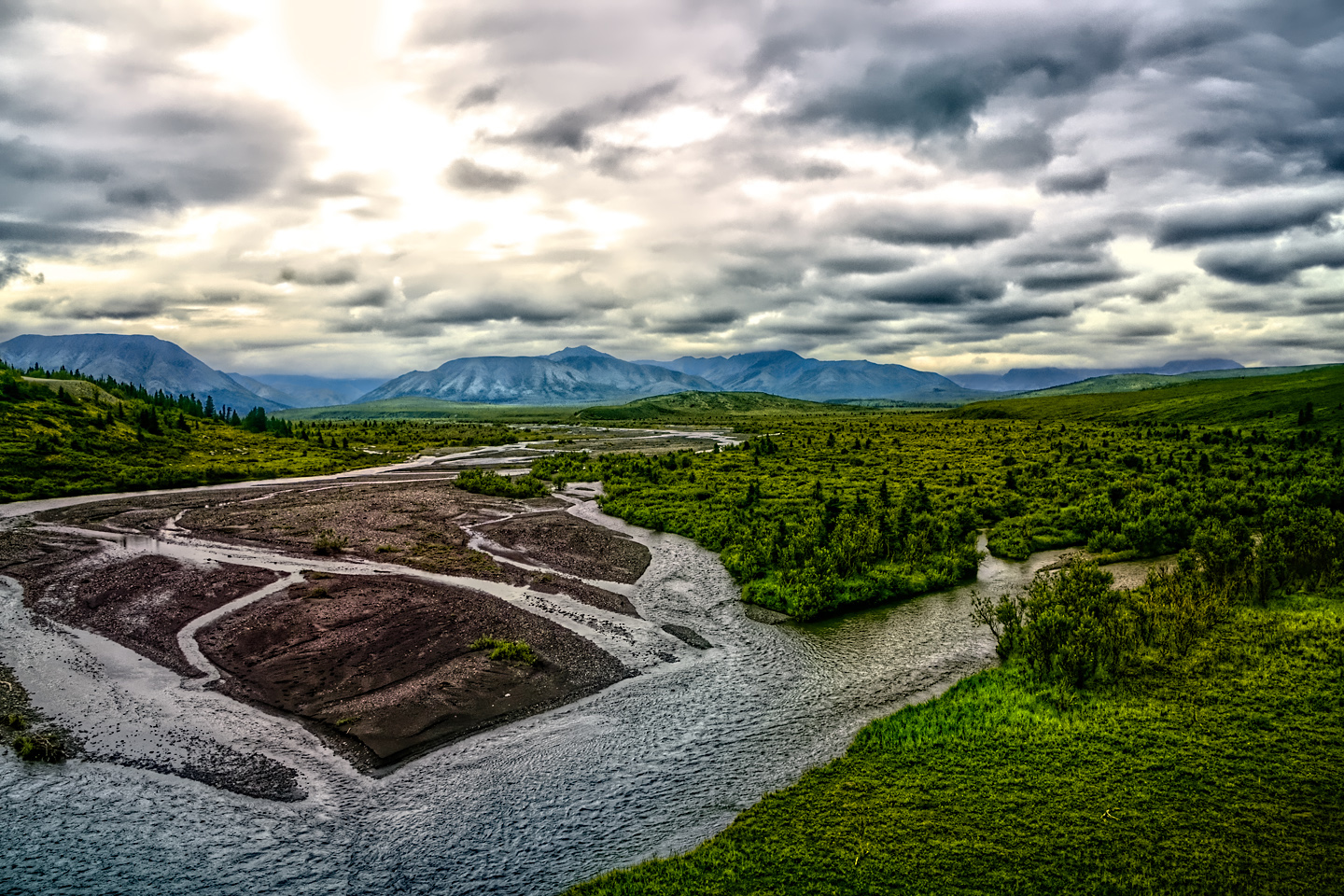
Several views of the scenery in the area near the Savage River Bridge
BEFORE THE LANDSLIDE
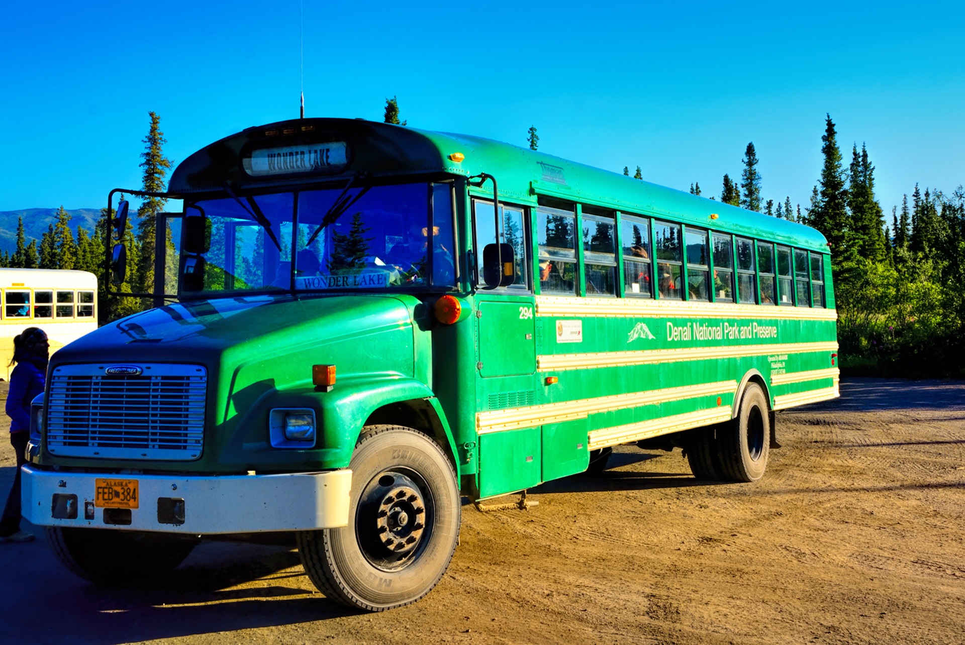
The Green bus to Wonder Lake. One advantage to the Green buses (in addition to the lower cost): you can get off anywhere you like, and as often as you like, and when you’re ready to get back on, you can flag down any green bus that comes along to continue on your way.
On the day of my tour, I set the alarm on my phone for 5 AM, just in case, but I was out of bed long before it went off, excited at the prospect of finally seeing Denali. There wasn’t a cloud in the sky as I drove to the National Park Wilderness Center to catch my bus. I was early, despite a construction delay on the road. Fortunately, they had both coffee and pastries available for sale, and I needed both!
There are two kinds of tour buses at Denali: the Brown buses, which are professionally guided tours, and the less expensive Green buses, which provide point-to-point transportation and knowledgeable drivers (almost as good as the guides).
The first fifteen miles were already familiar to me from my drive to the Savage River Bridge the previous day. There are no views of the mountain until well after that. The bus rounds a curve at Mile 20, and suddenly there she is, just the top, peeking up above the ridge line. Smaller mountains that rise up in between obcure most of the view from this part of the road, but there can be no doubt about which peak is Denali.
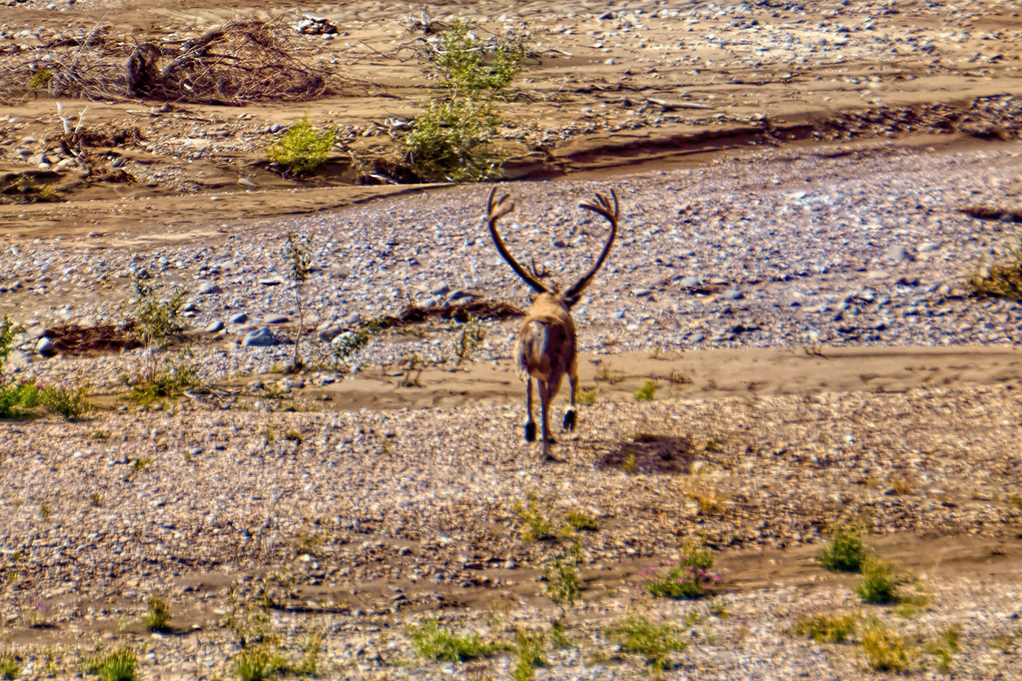
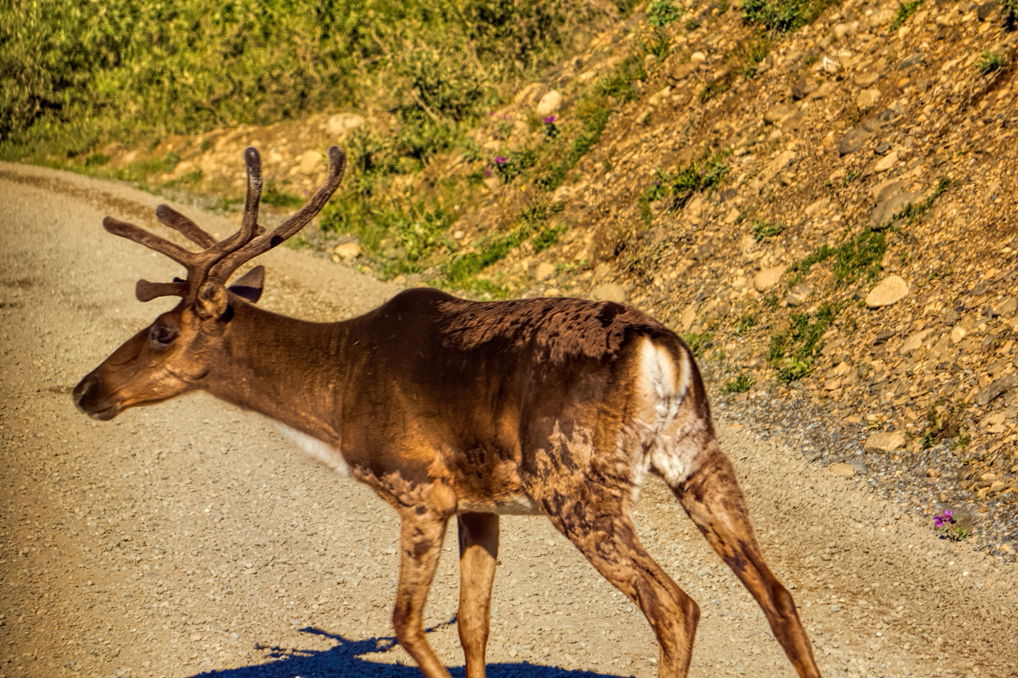
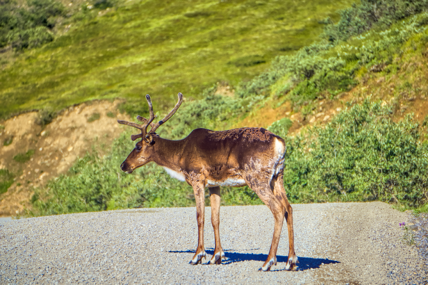
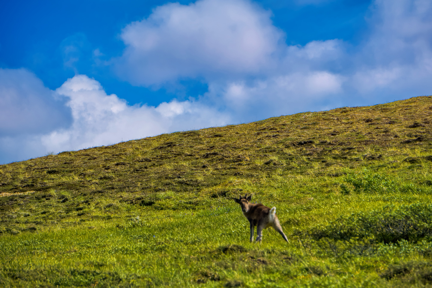
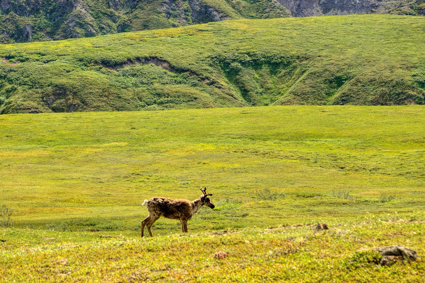
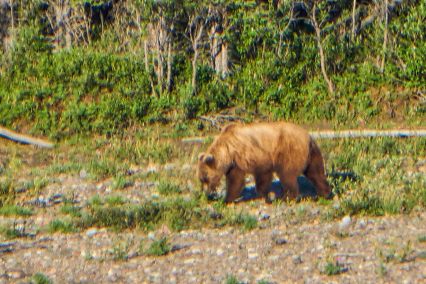
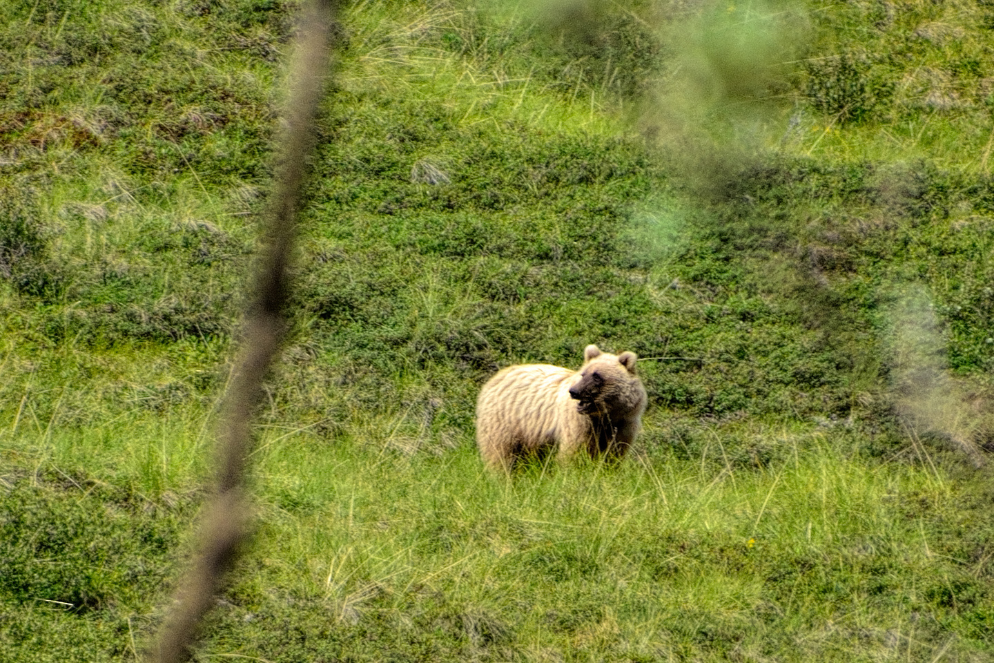
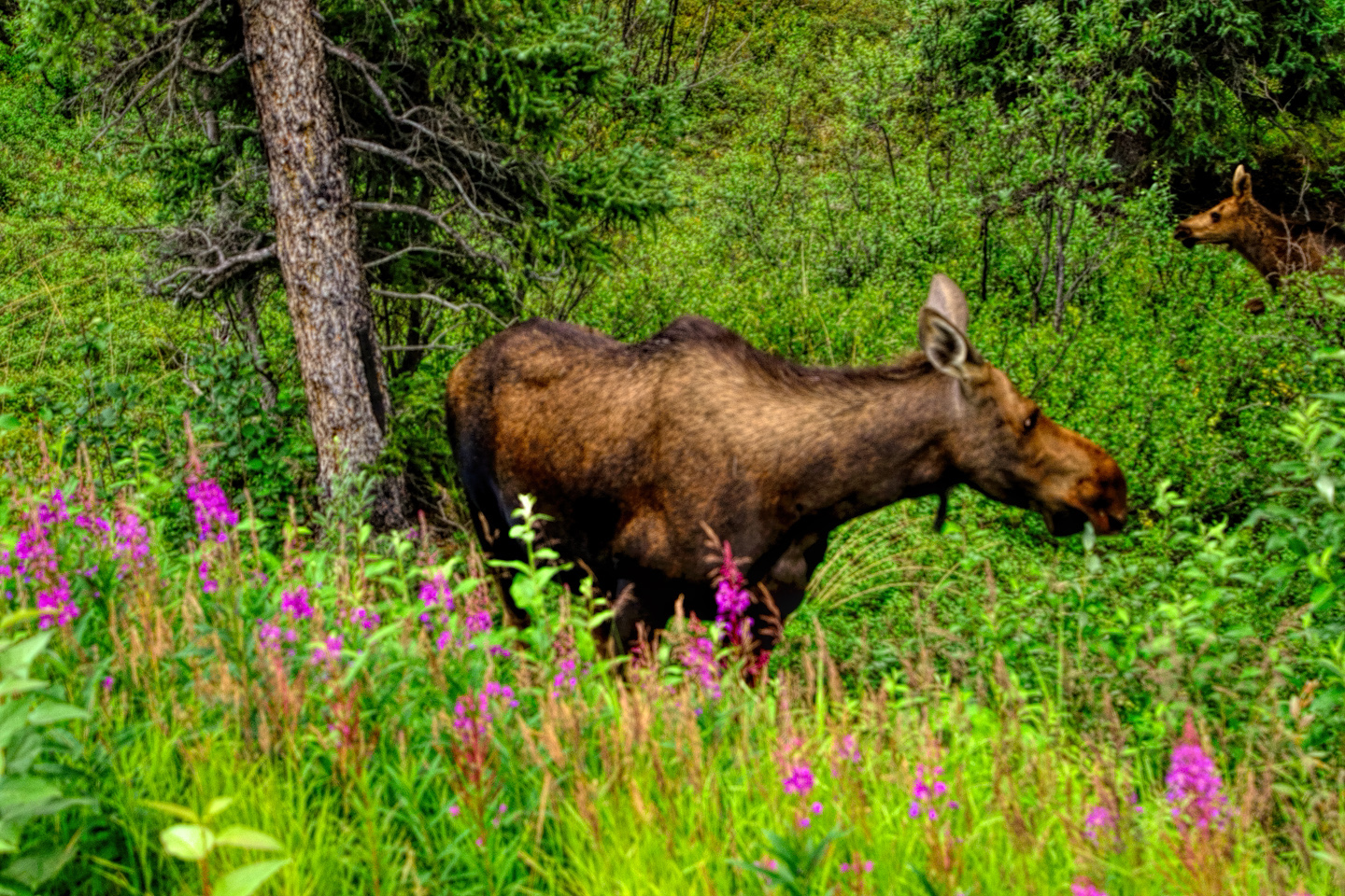
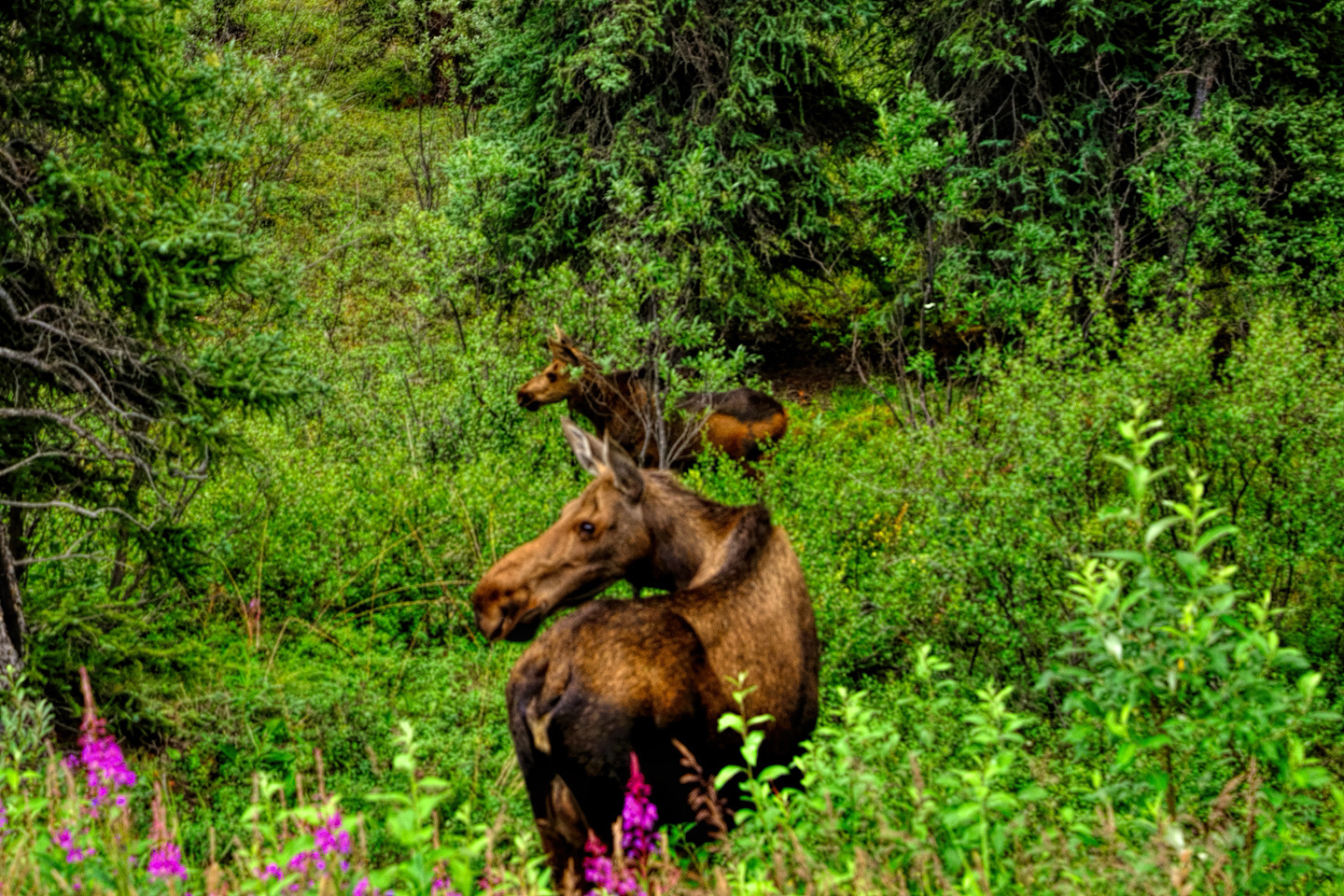
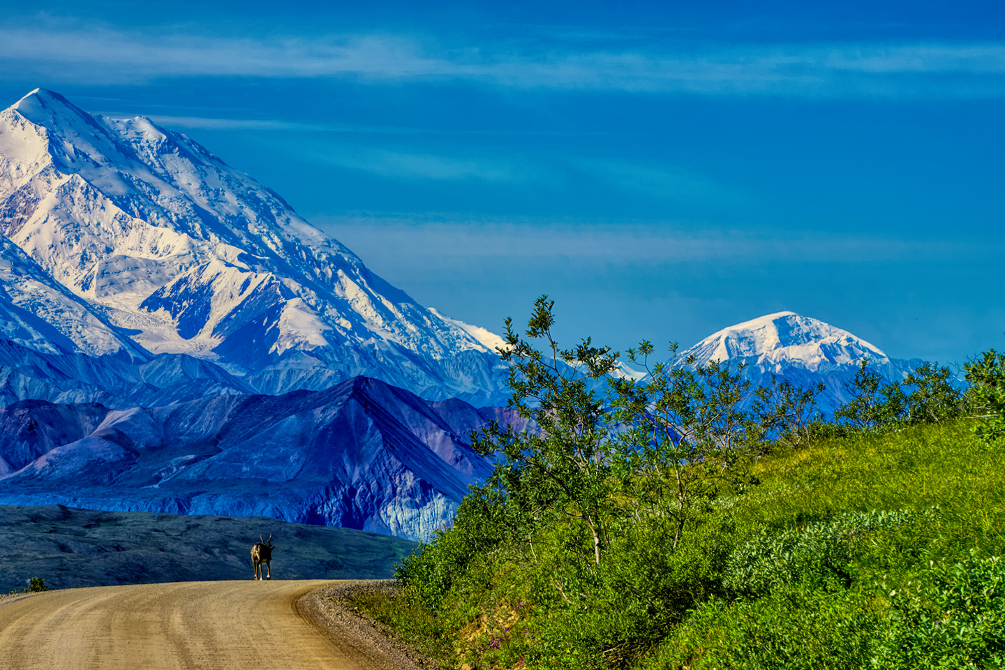
Moving on down the road, the bus makes frequent stops for views, and also for wildlife. Through the day we saw at least three grizzlies, a couple of moose, at least a half dozen caribou, and because of the strict park rules prohibiting interaction with wildlife, the animals didn’t feel threatened, and ignored us like we weren’t even there.
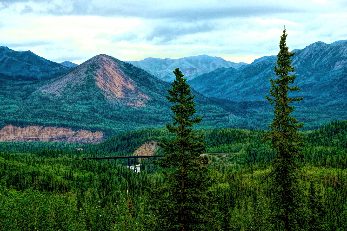
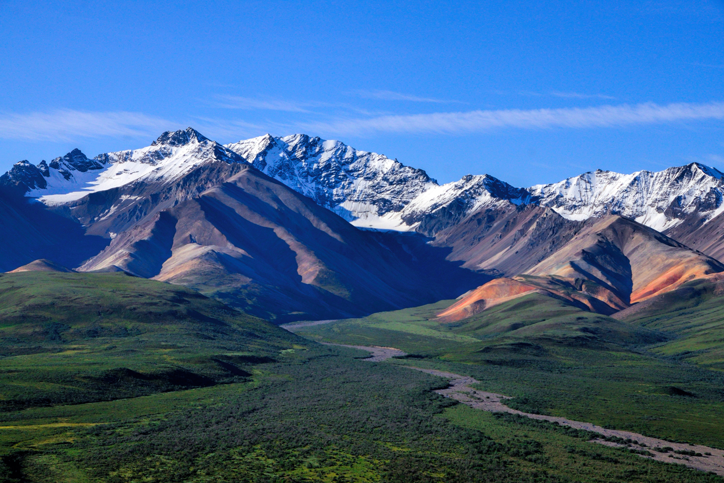
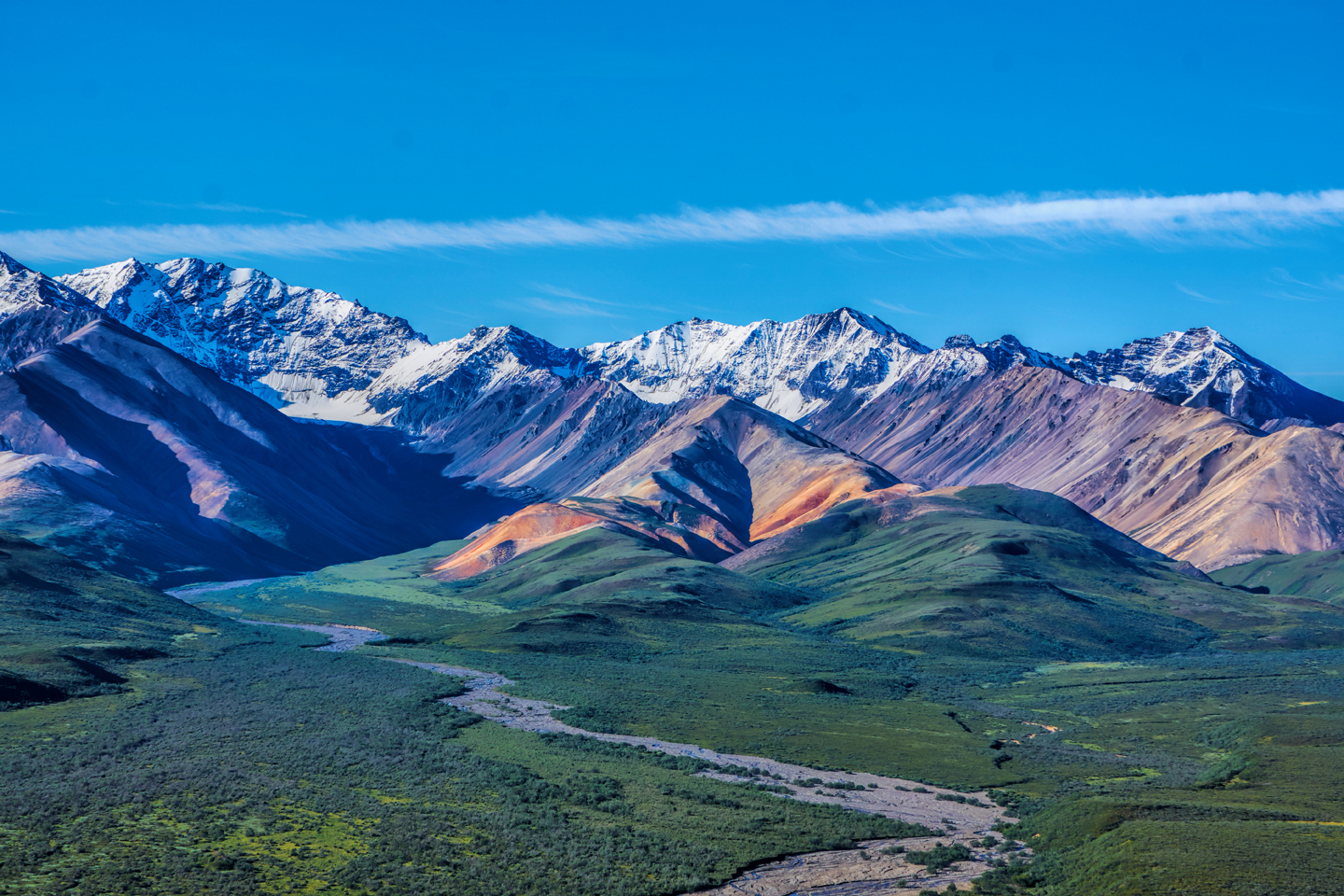
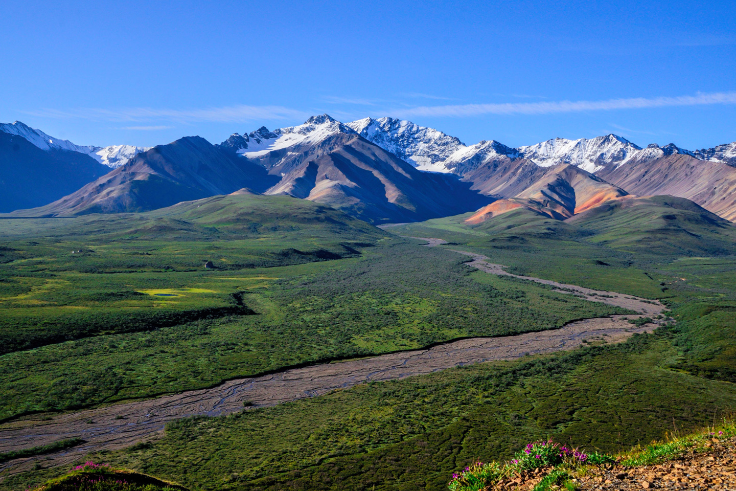
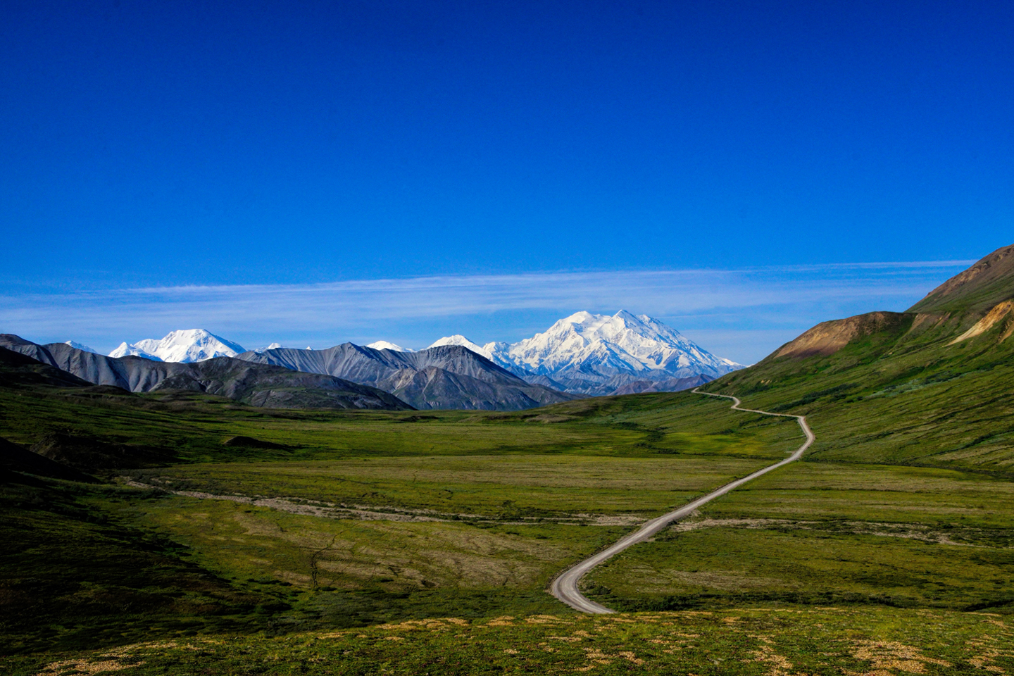
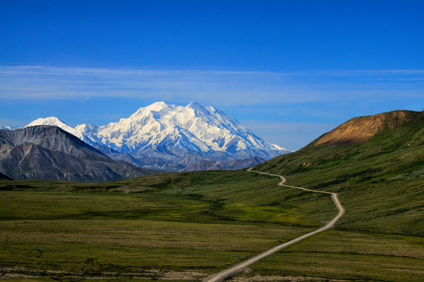
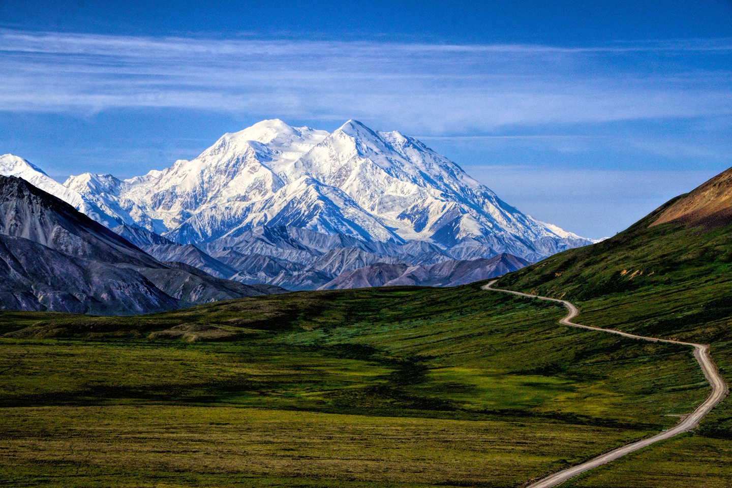
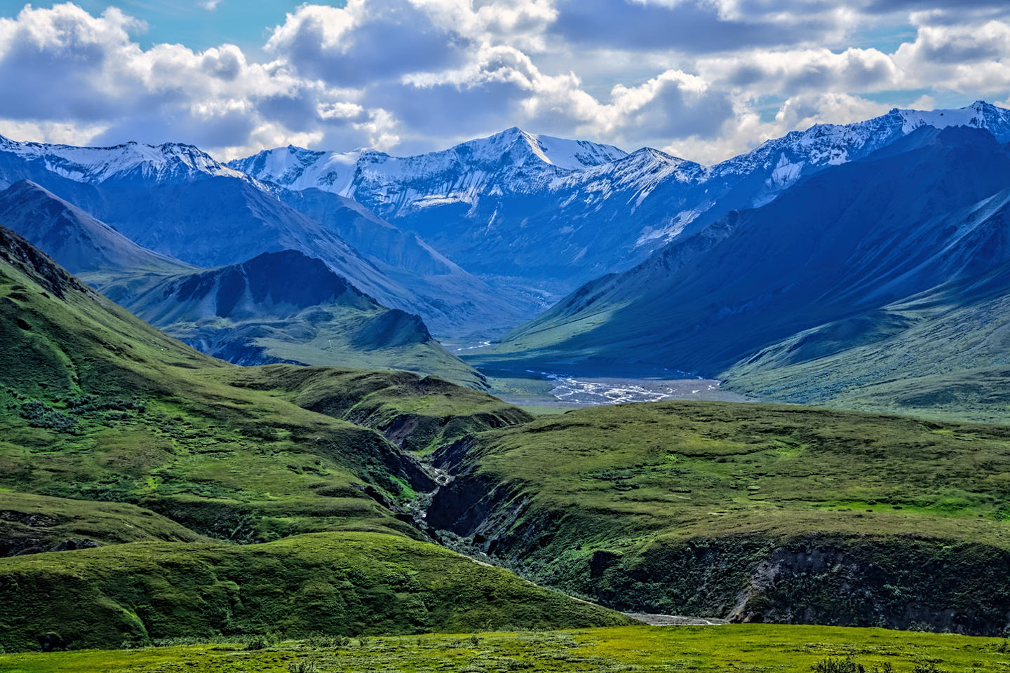
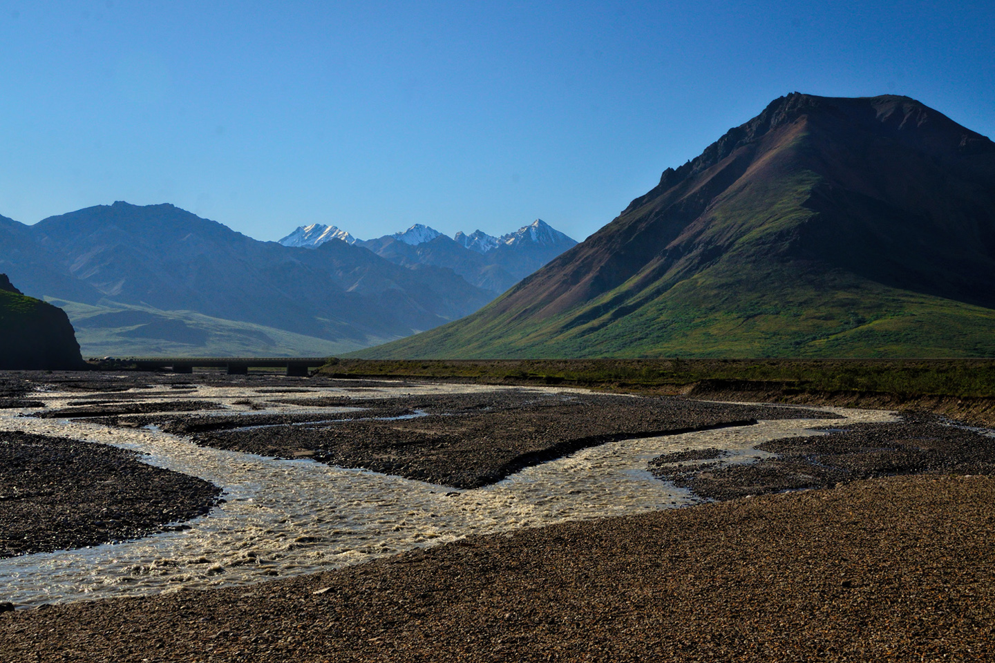
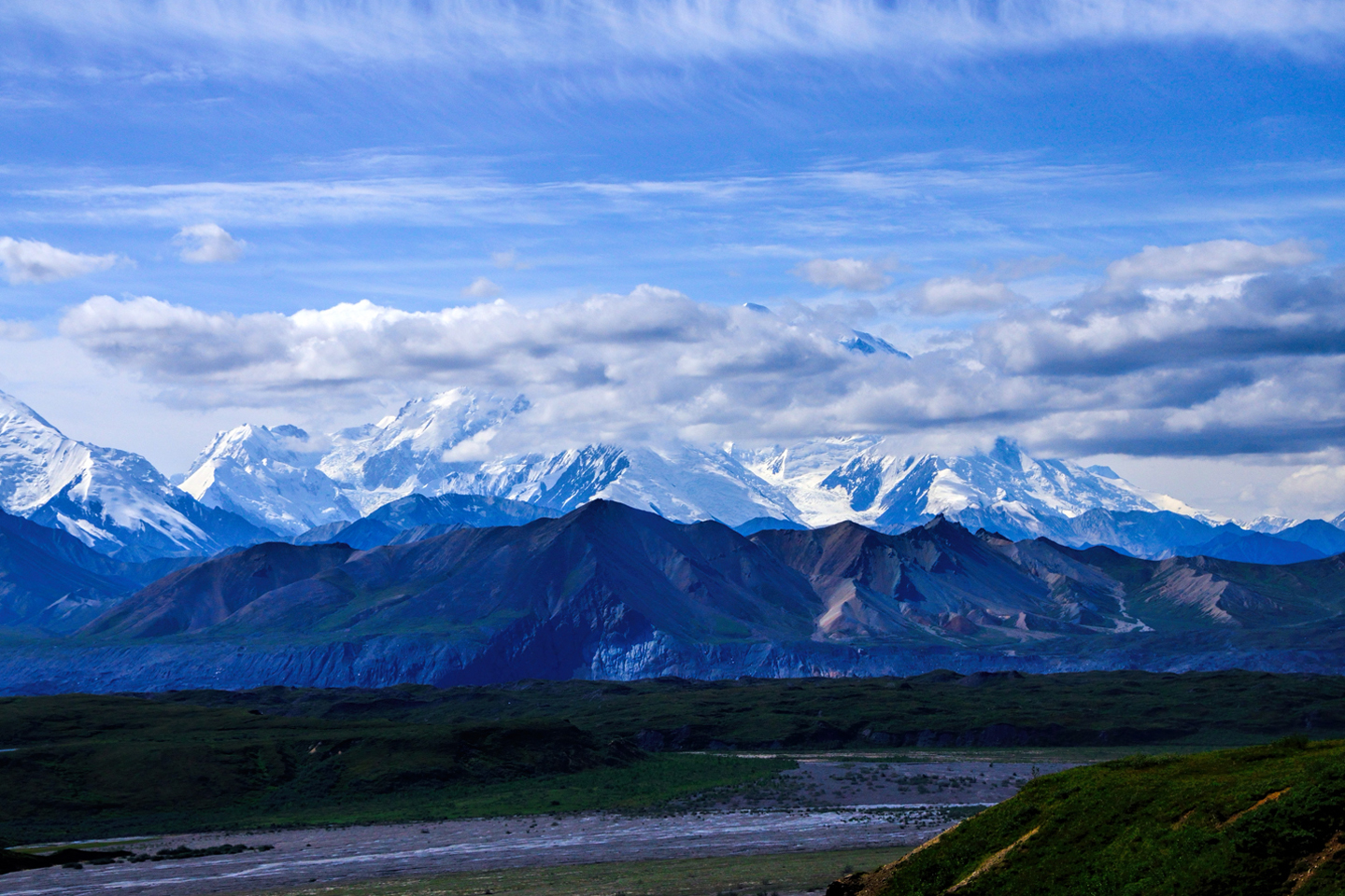
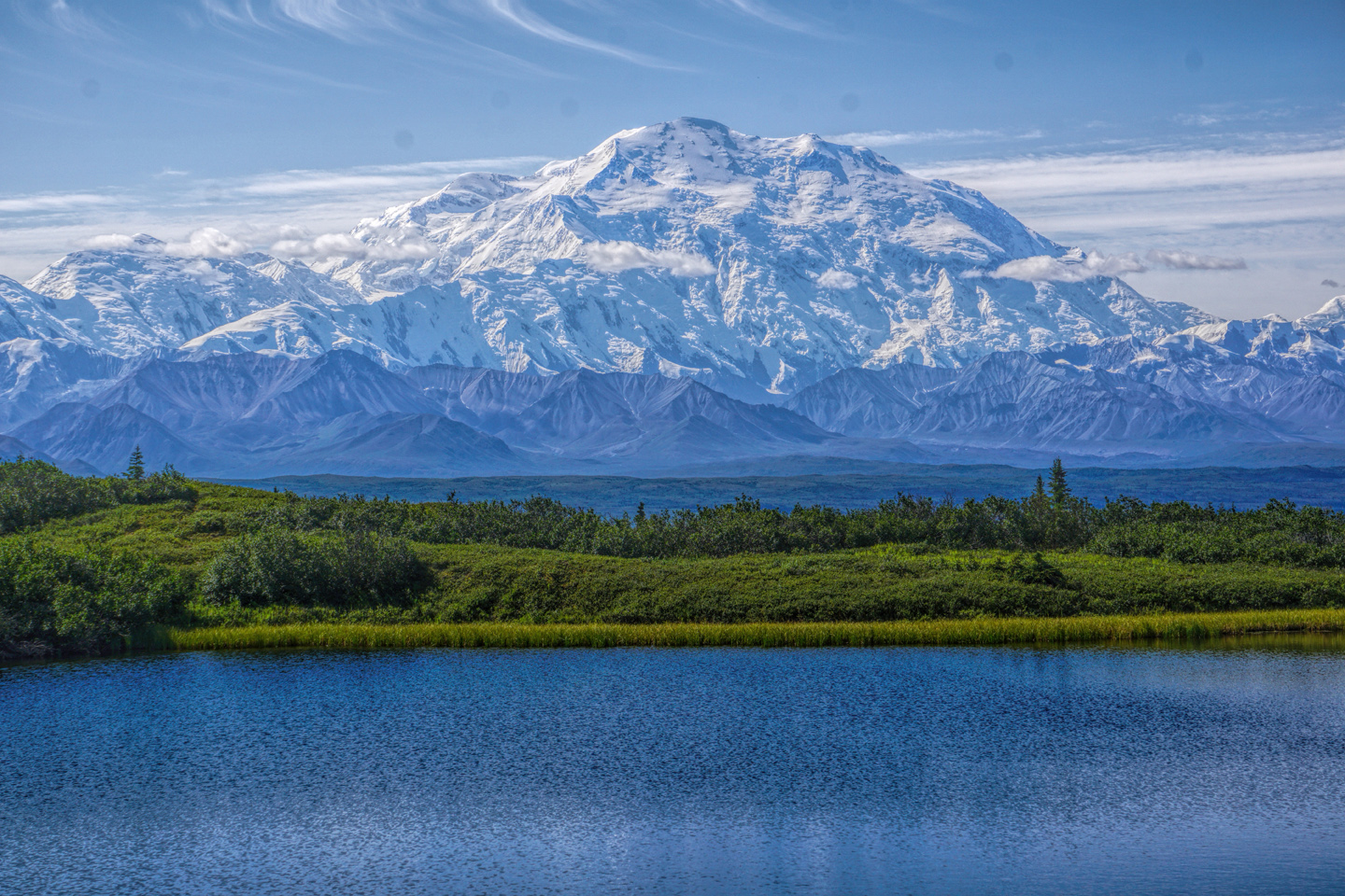
Each vantage point was closer to the mountain, each had a different perspective, and the farther we traveled, the bigger Denali loomed. At mile 43, we reached the Polychrome Overlook, where there are stunning views of a multi-colored ridge of mountains, with a good-sized stream flowing steadily from melting ice on the mountains flanks.
Until the damage from the landslide has been repaired, this is the turnaround point for all tour buses. At the present time, the only way to travel any deeper into the park is on foot, or by taking a rather expensive flight to the airstrip at Kantishna Road House, the Lodge at the end of Denali Park Road.
AFTER THE LANDSLIDE
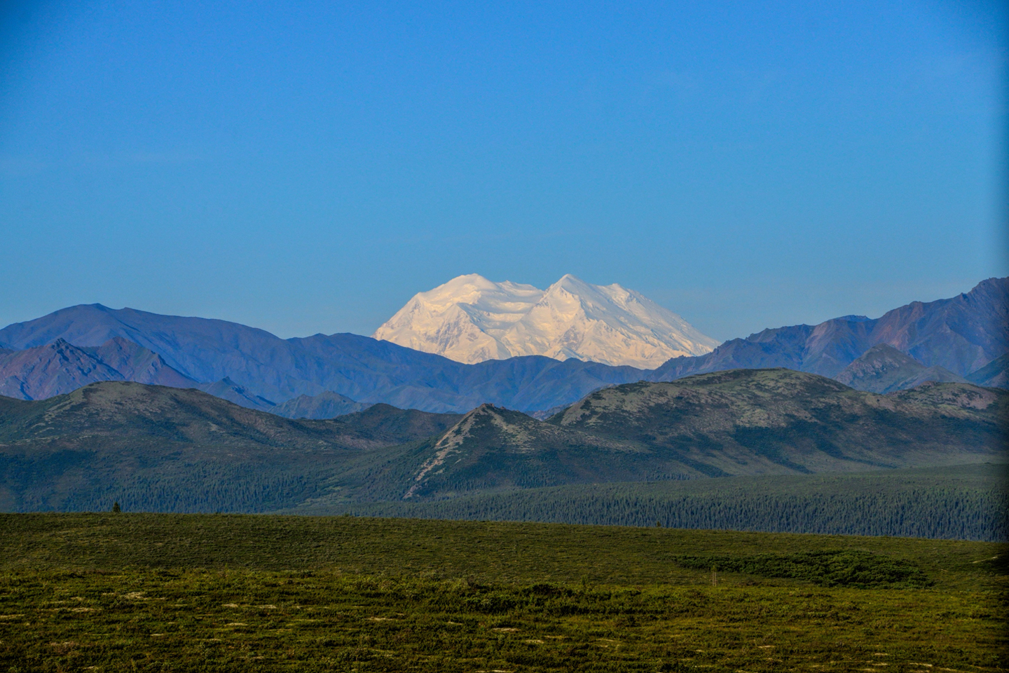
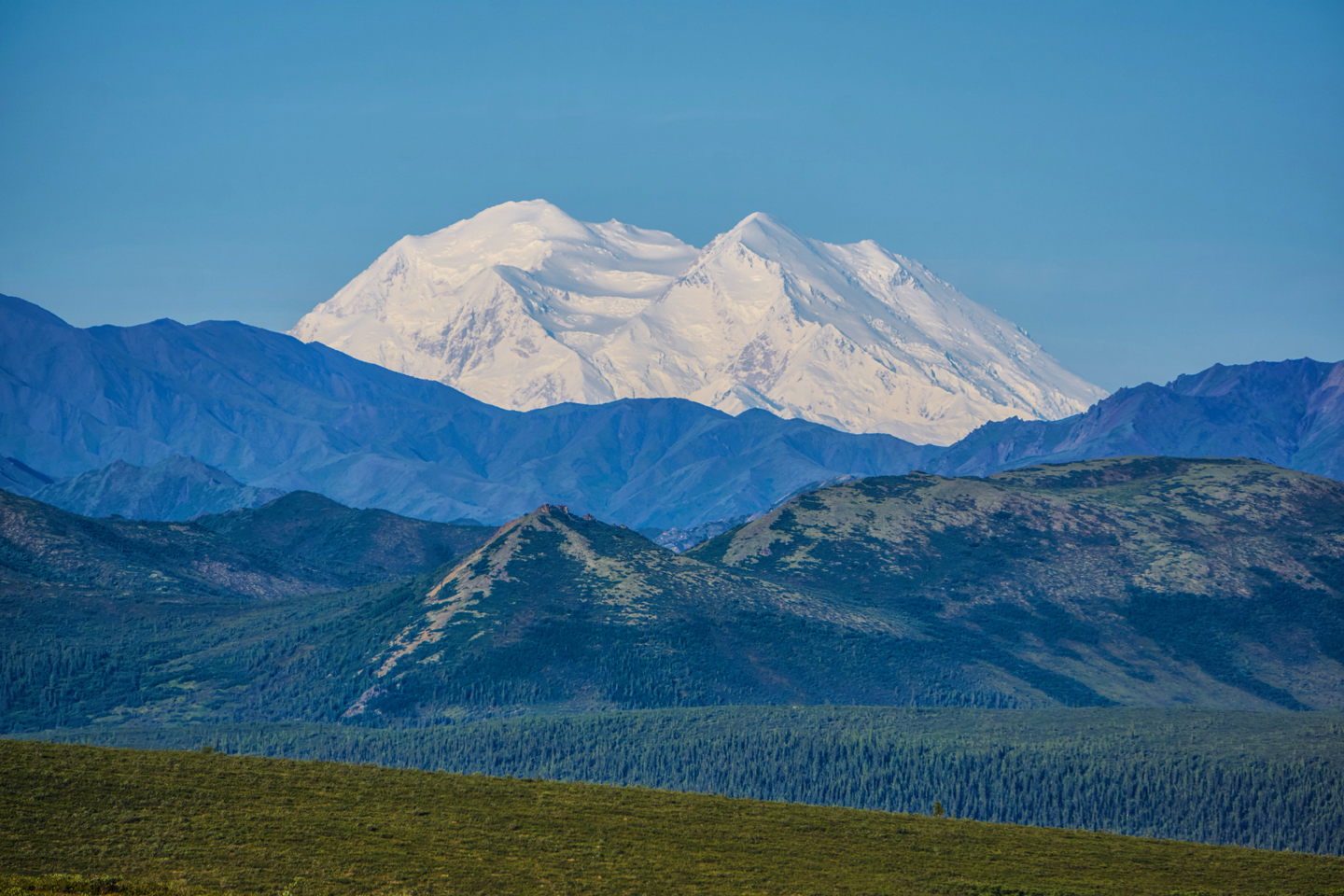
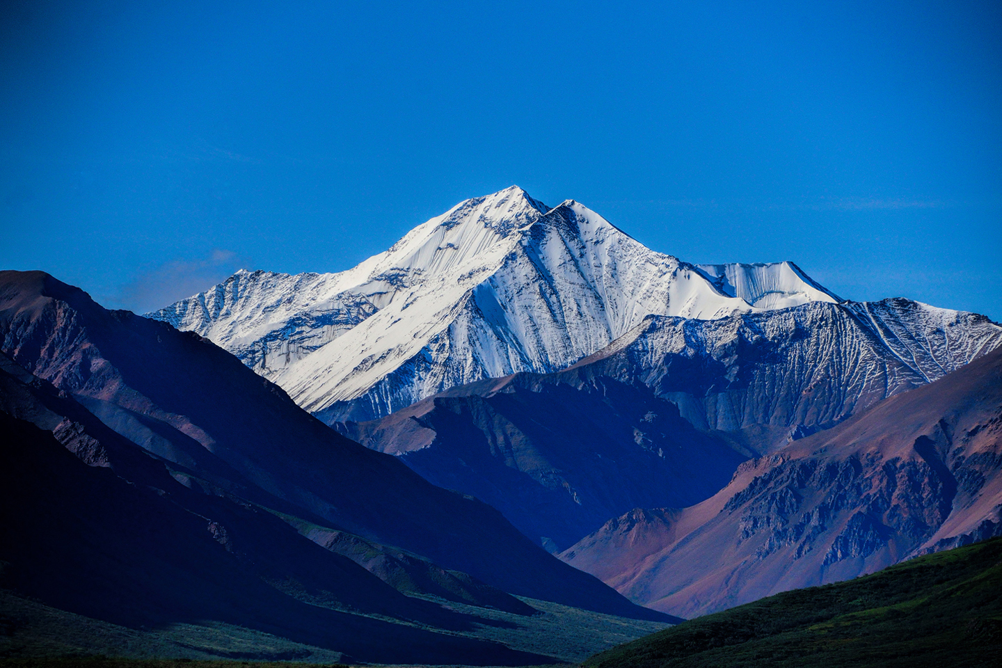
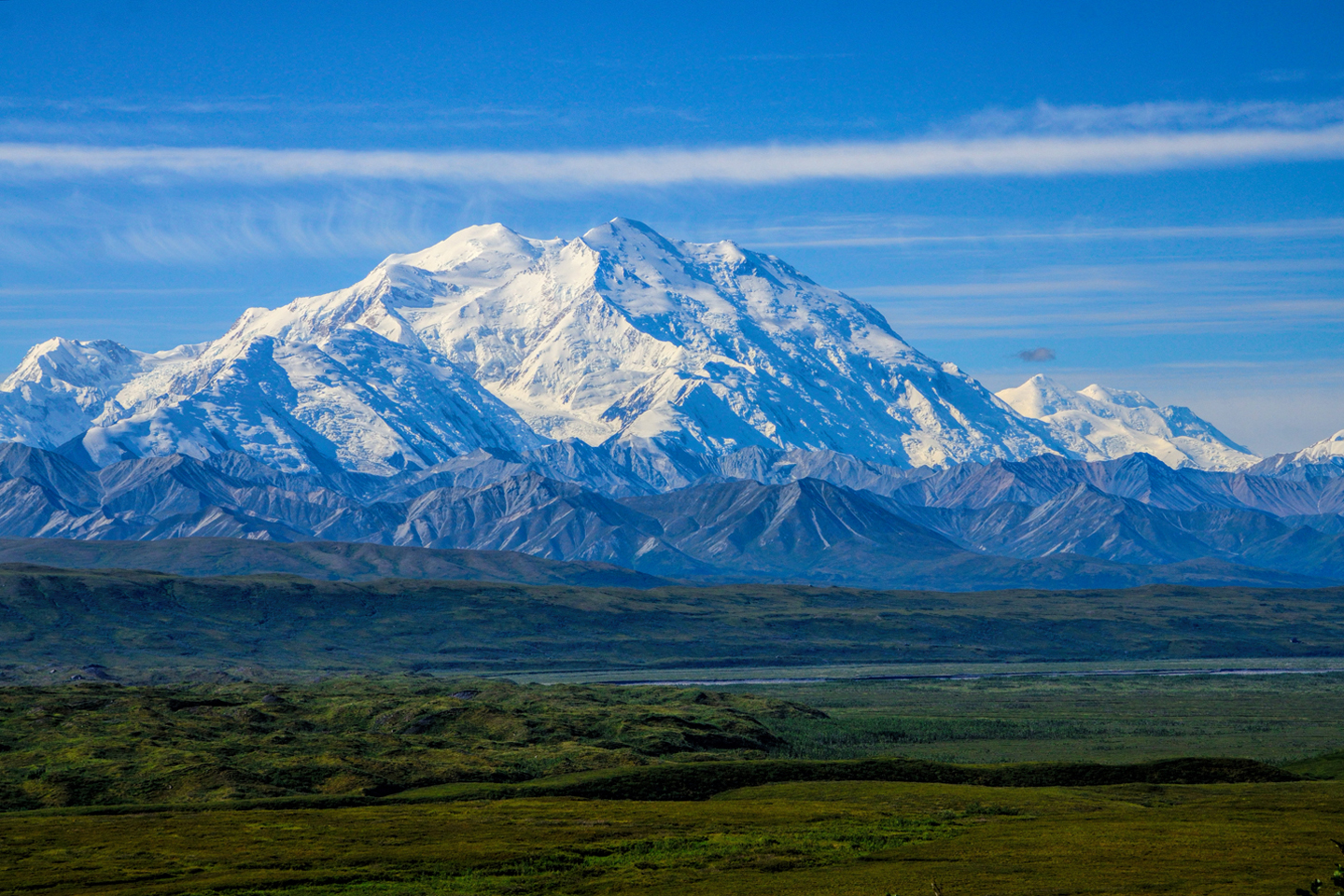
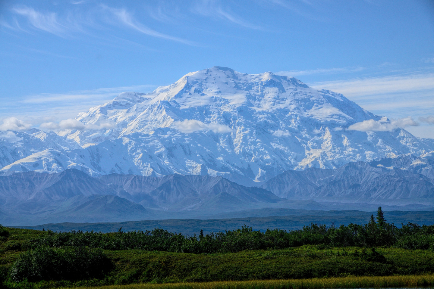
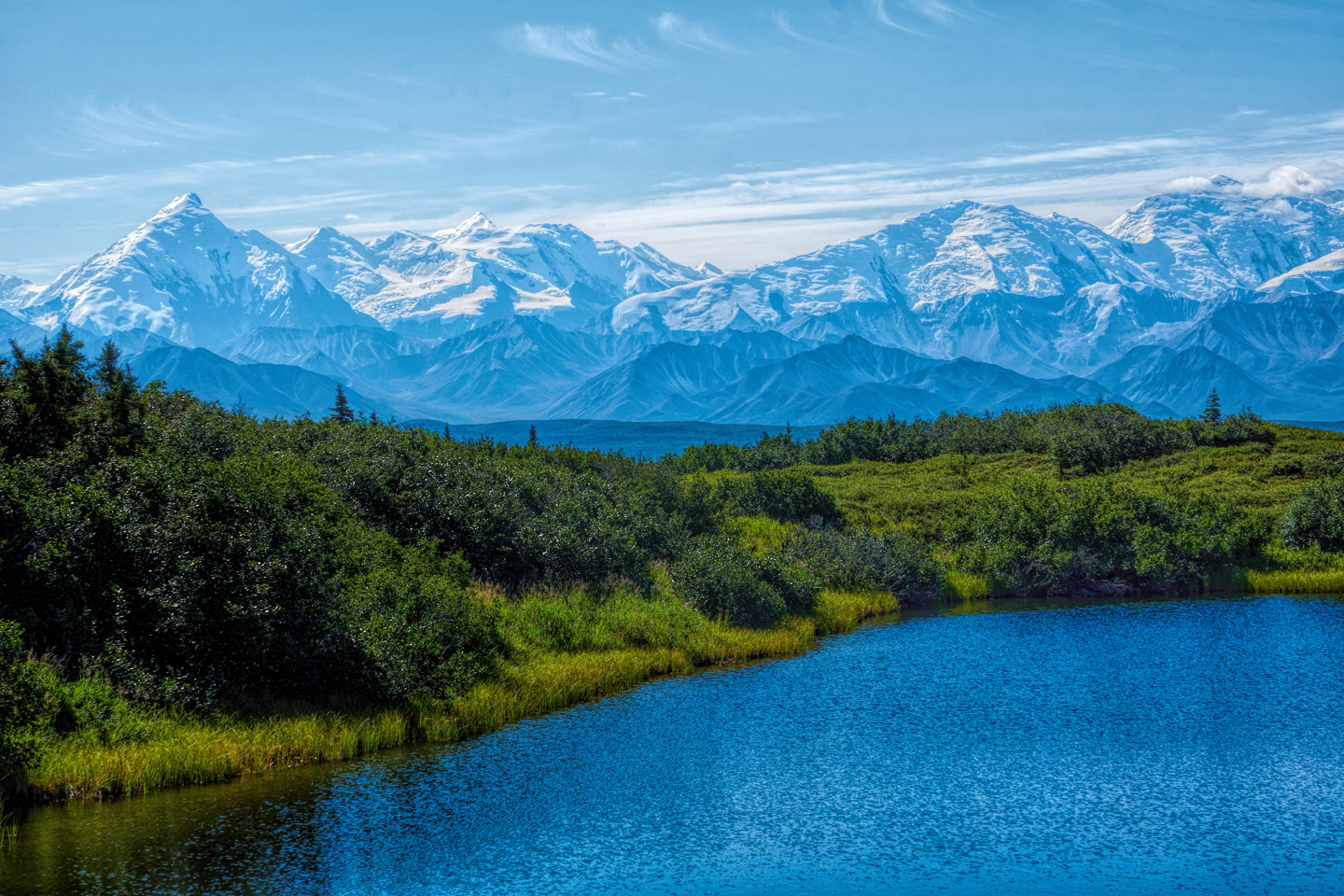
In 2015, the landslide hadn’t happened yet, so the Polychrome Overlook was just another photo stop, and we continued on from there, heading ever closer to the mountain. The views get serious here, with Denali beginning to stand apart from the surrounding lesser peaks. By the time the bus reached Mile 62, the Stony Hill Overlook, the mountain leapt free of the landscape, and we were rewarded with some of the finest views available of the biggest mountain in North America. I was doubly blessed to catch it on a wonderfully clear morning. I’ll let the resulting photos speak for themselves: watch as the mountain draws closer, and closer, until it fills the whole sky.
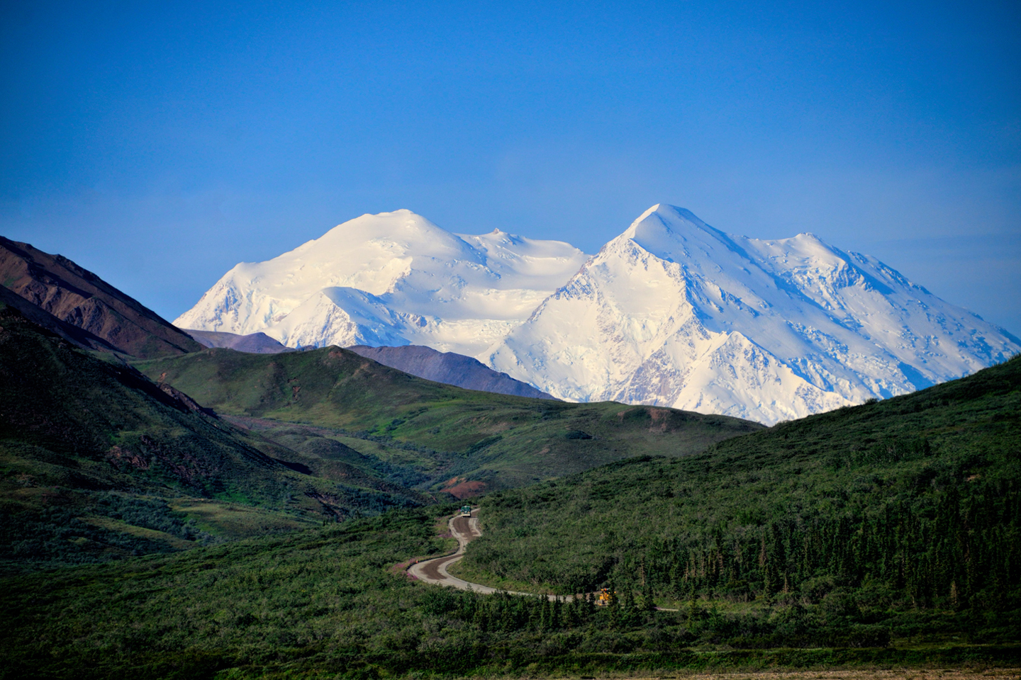

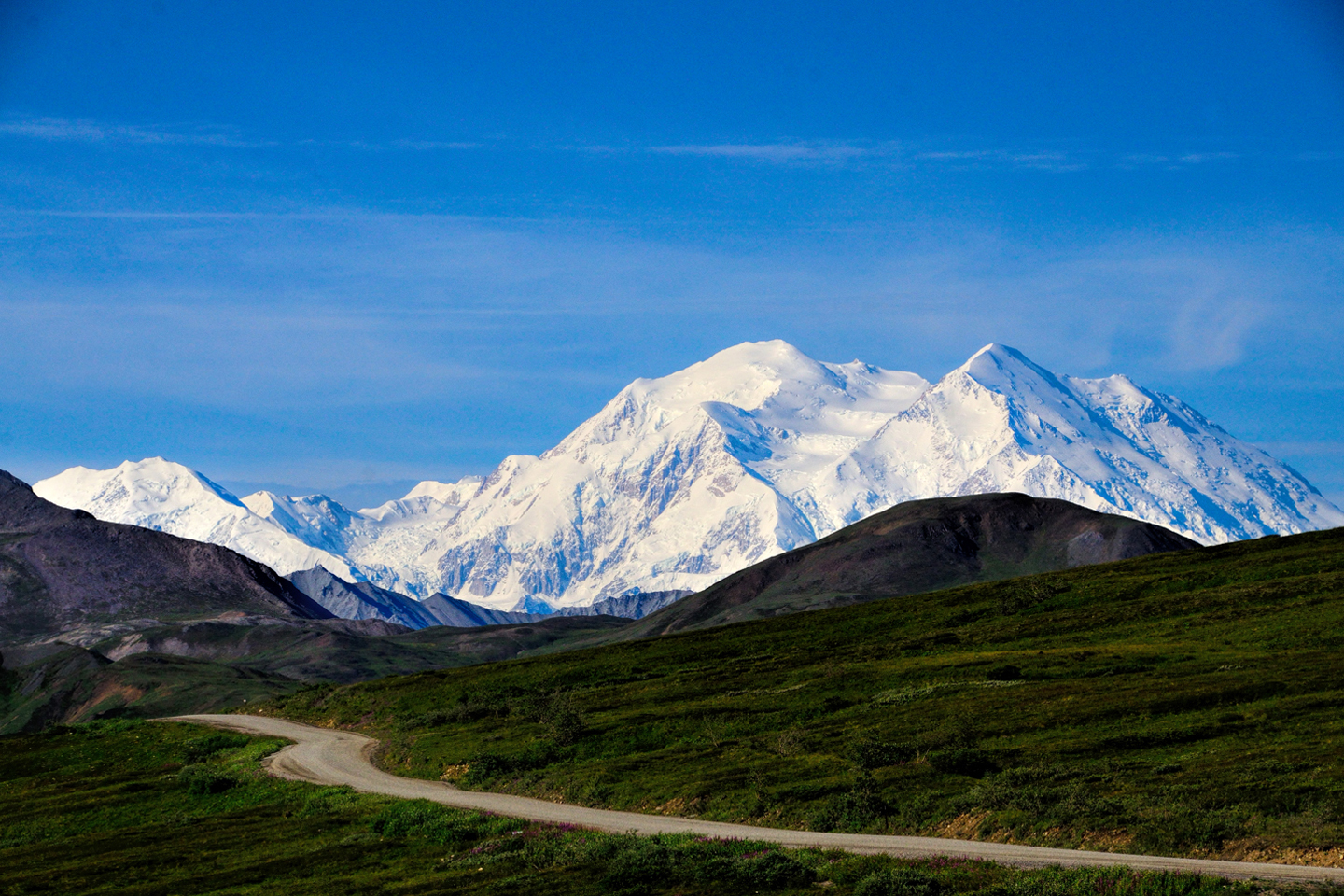
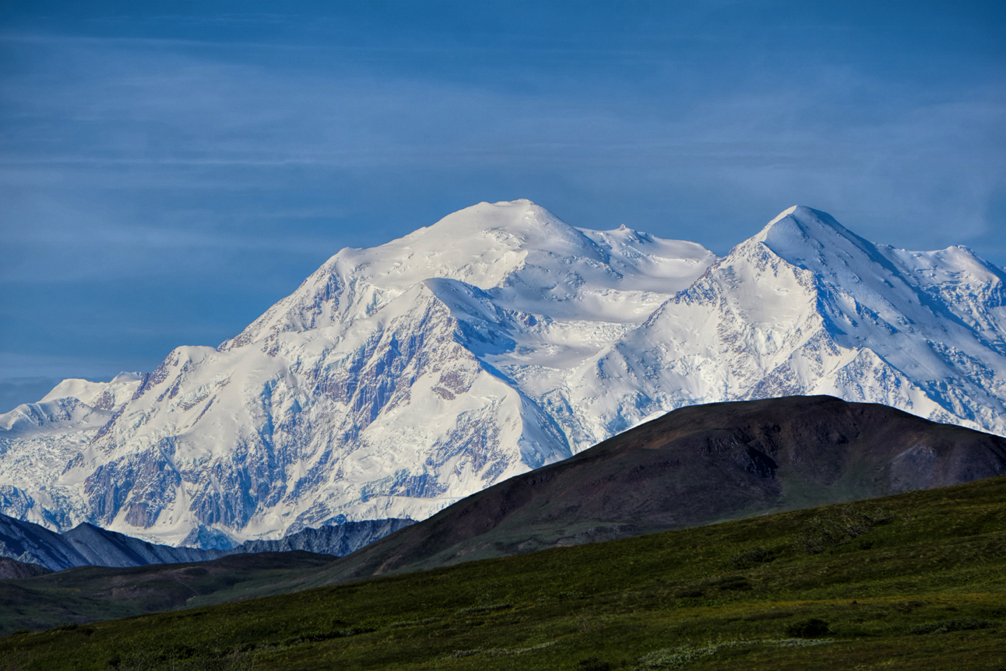
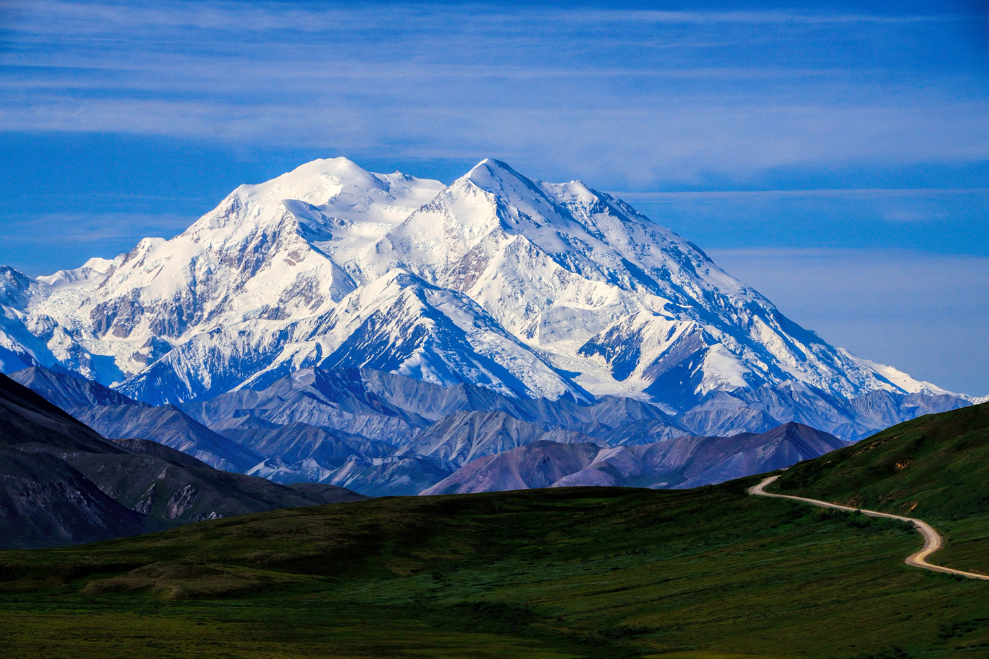
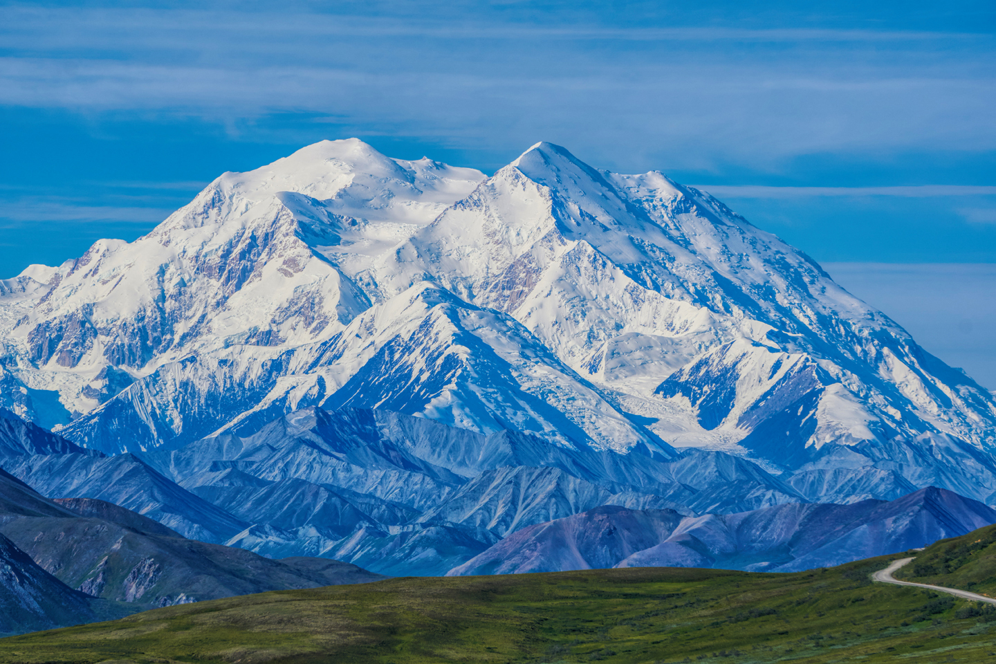
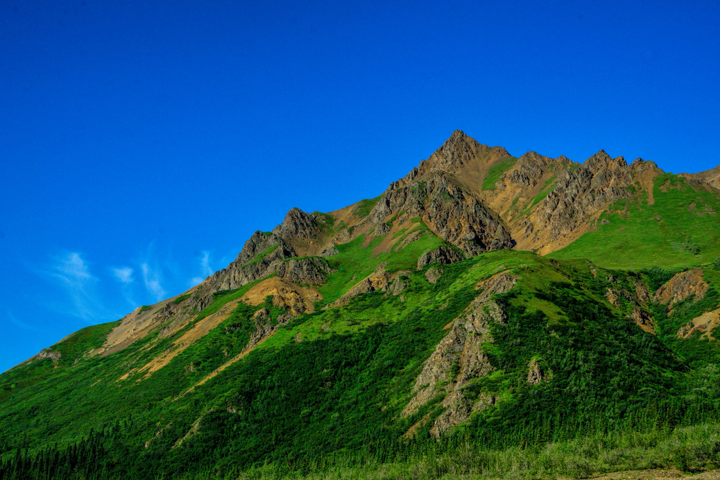
Views of Denali grow ever larger as you travel the road beyond Polychrome Pass
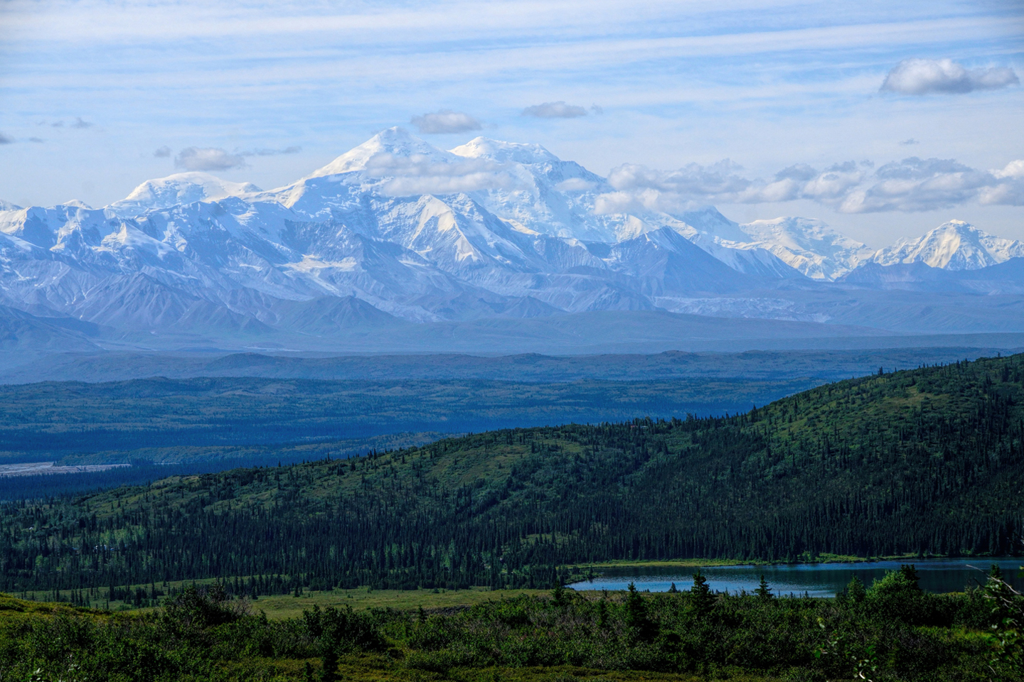
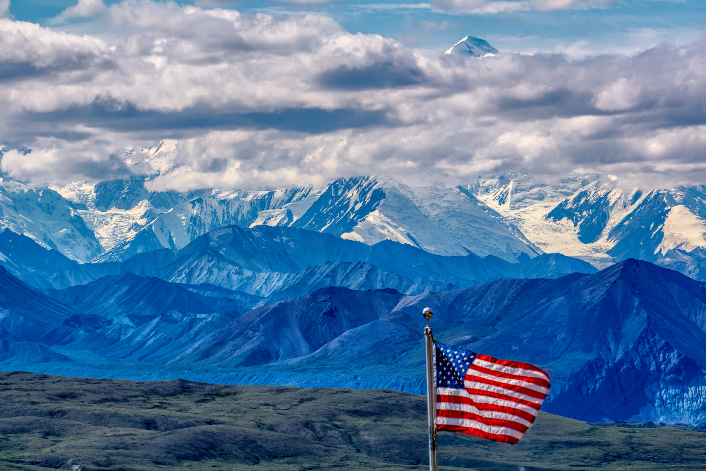
Beyond the Stony Hill Overlook, the bus continued on over the pass to a broad open area. At Mile 66, we came to the Eielson Visitor Center, a rest stop and interpretive center established in that spot by the National Park Service. When the weather is clear, as it was for us that day, the views of the mountain from Eielson are some of the best anywhere. Wildlife abounds in the area; we saw caribou and bears on the nearby mountain slopes.
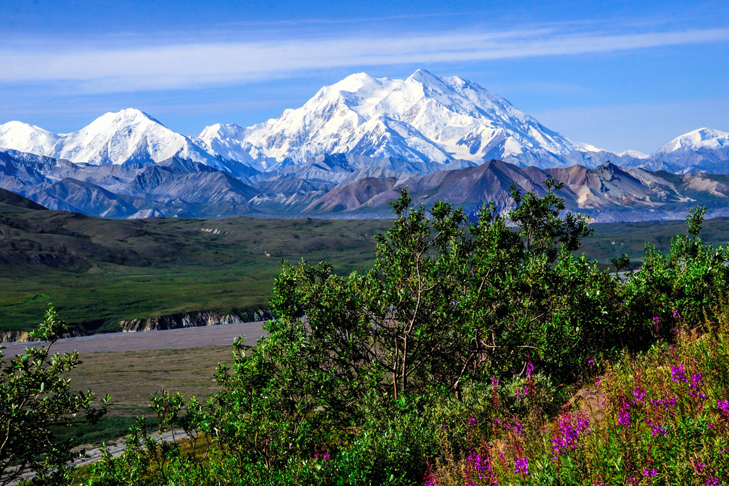
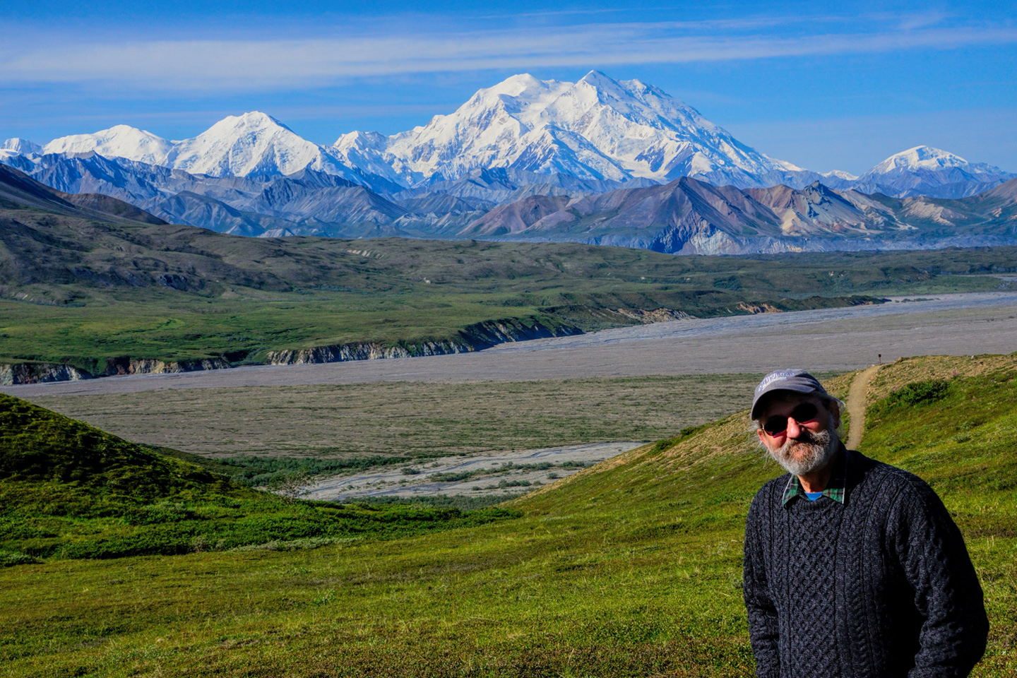
Extraordinary views from the area near the Eielson Visitor Center at Mile 66 (Currently Closed)
The turnaround point for my bus that day was at Wonder Lake, Mile 85. The end of the road is at Mile 93, the Kantishna Roadhouse, a highly exclusive Back country Lodge that has remained open despite the road closure. (Guests, staff, and all supplies have to be flown in, at significant cost.)
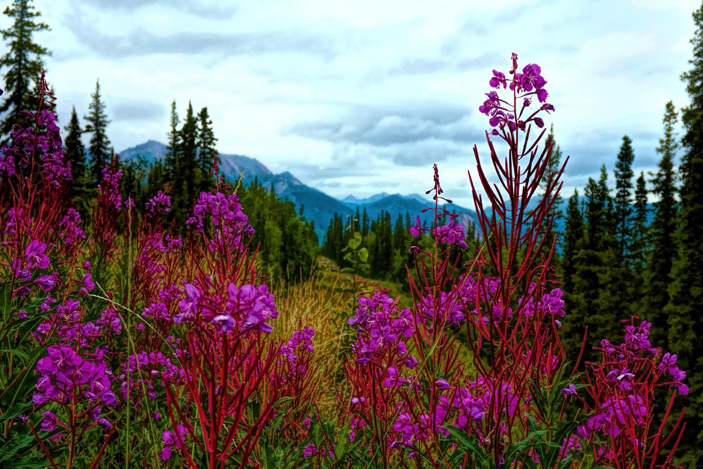
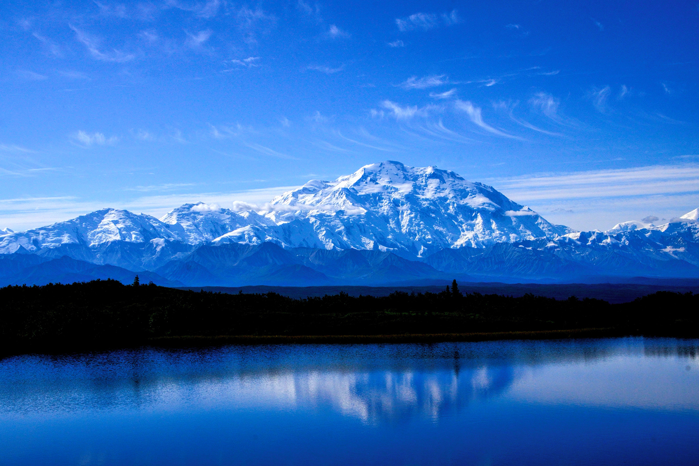
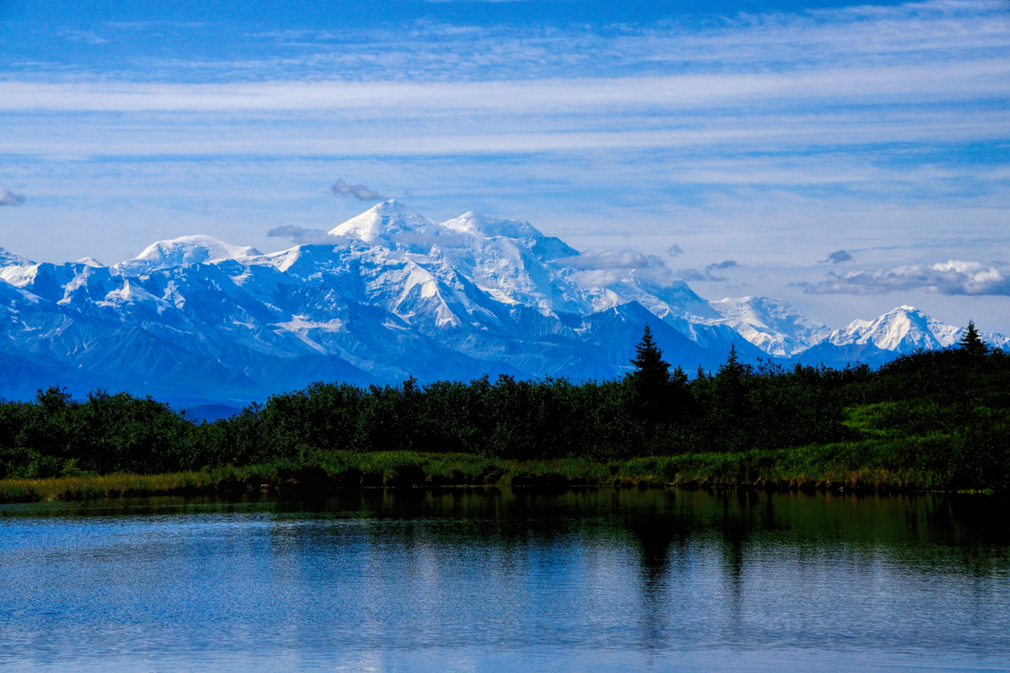
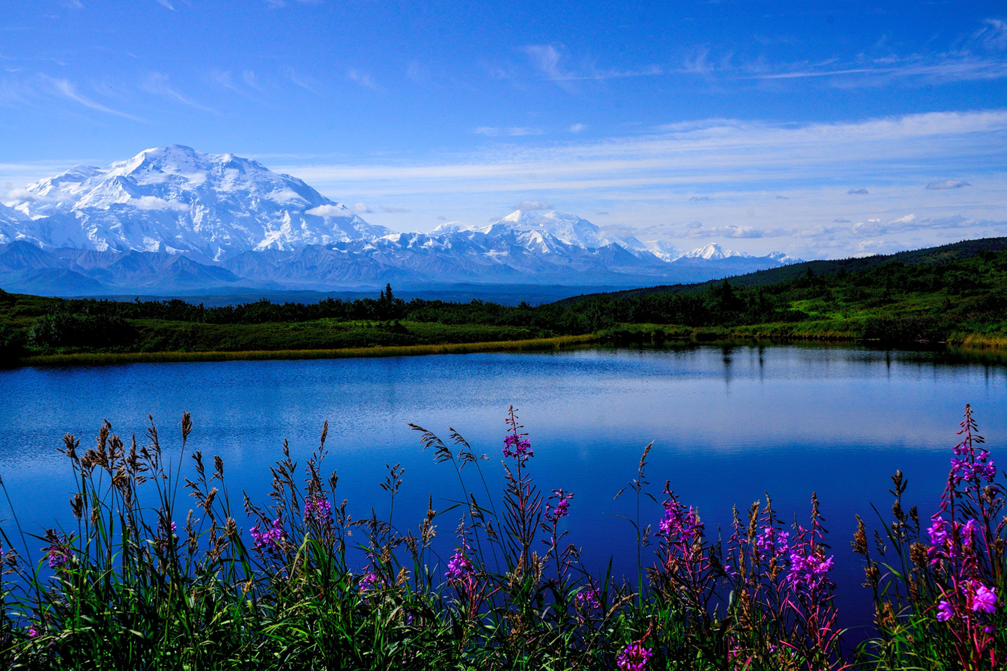
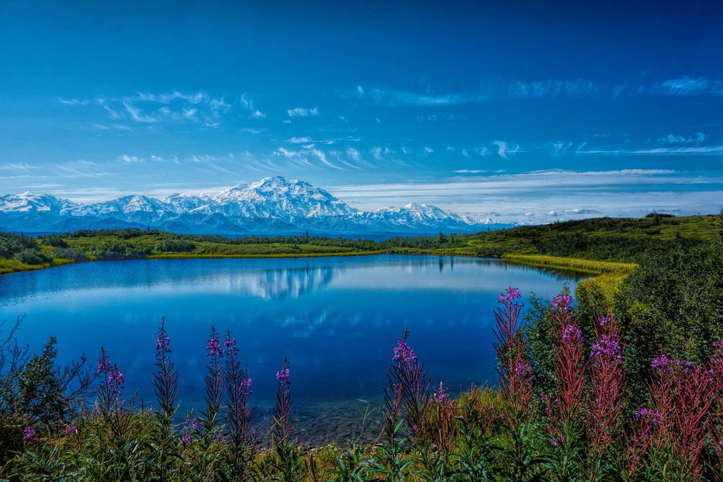
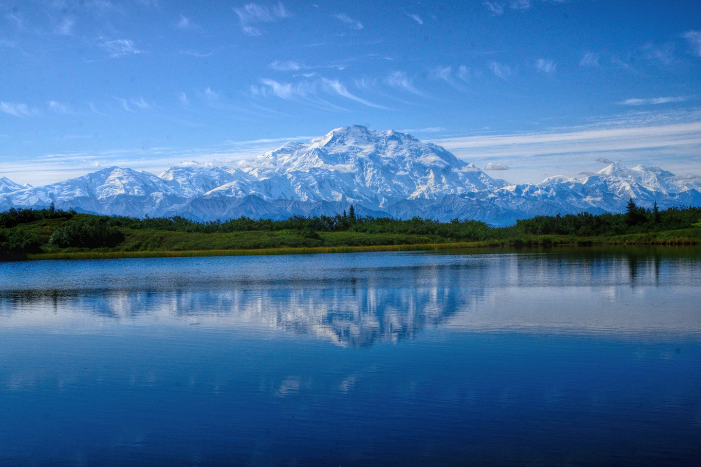
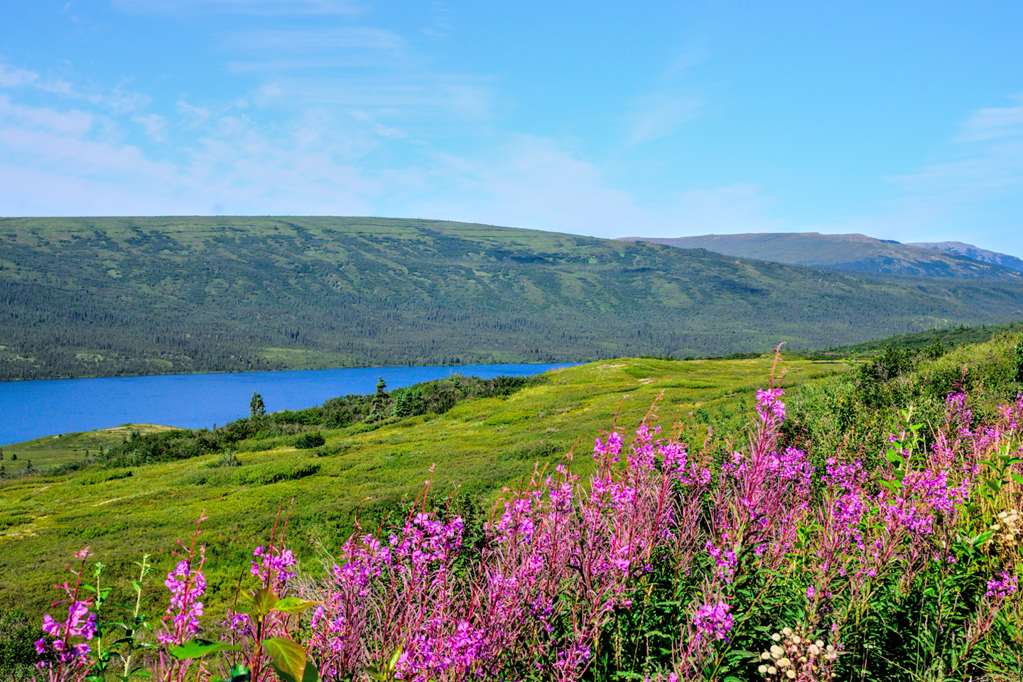
At my bus driver’s suggestion, I got off at a Y junction just before the lake, and then hiked a mile or so to the “Reflection Pond,” a smaller lake, surrounded by fireweed, which was perfectly positioned to catch a reflection of the mountain in the water. The light wasn’t quite perfect, and the water was stirred slightly by a light breeze, so it wasn’t a perfect mirror—but it was well worth the short hike there and back.
Views of Denali and Reflection Pond, near Wonder Lake
Back on the main road, my same bus picked me up again after turning around at Wonder Lake, and off we went, headed back, albeit slowly, toward the beginning of the road at the entrance to the park. The mountain was starting to gather a few clouds, and by the time we got back to the Eielson Visitor’s Center, Denali was already greatly obscured, and getting worse by the minute. My coveted window of clear skies was already closing, after just a few short hours, but that had been enough. I saw the mountain, and I joined the 30% club, on my very first try.
View of Denali from the Eileson Visitor Center, as clouds begin to gather
The cloud cover thickened as we retraced our route and drove out of the park. That night, it rained again, a cold, relentless rain, and the following day was more of the same, steady rain and solid overcast that obscured every view of the mountain.
(Unless otherwise noted, all of the images in these posts are my original work, and are protected by copyright. They may not be duplicated for commercial purposes.)
To return to the previous post, or to continue reading the next part of the series, click the buttons below:
MORE ABOUT THE ALASKA HIGHWAY:
This is an interactive Table of Contents. Click the pictures to open the pages.
Alaska Road Trip

The Alaska Highway: Prelude: The Road to Dawson Creek
Even if you start in Seattle, the closest American city, it’s still more than 800 miles to Dawson Creek, wending your way that much further north, so far north that there will be a noticeable change in the hours of daylight. It’s the latitude that distinguishes the north country, including every bit of Alaska. Dawson Creek is where it all begins.
<<CLICK to Read More>>

The Alaska Highway: Day 1: Dawson Creek to Fort Nelson
Past Fort St. John, the terrain got a lot wilder. No more towns, very few people, and very little traffic. Saw a few U.S. license plates, Michigan, California, Oregon, South Carolina; people that were obviously headed to Alaska!
<<CLICK to Read More>>

The Alaska Highway: Day 2: Fort Nelson to Whitehorse
Every time I rounded a curve in the road there was another stupendous vista; it was nothing short of astonishing! I was literally yipping out loud, and a couple of times I actually pulled over and stopped while I pounded on my chest to “re-start” my heart!
<<CLICK to Read More>>

The Alaska Highway: Day 3: Whitehorse to Beaver Creek
Approaching the mountains, I started pulling over with serious frequency, taking LOTS of photos! Mountains, clouds, lakes, flowers—I was pretty sure I must have died and gone to heaven, but I couldn’t for the life of me remember the fiery crash.
<<CLICK to Read More>>

The Alaska Highway: Day 4: Beaver Creek to Fairbanks
Delta Junction, the end of the Al-Can, was only 200 miles away, and the border? Twenty miles, maybe half an hour, and I was finally going to cross into Alaska! I’d been on the road more than three weeks, and in just half a day more, I’d be in Fairbanks.
<<CLICK to Read More>>

Chena Hot Springs: A Fairbanks Original
The Chena hot spring puts out steaming water at a temperature of 150 degrees, producing enough power to meet all the needs of the resort, as well as filling the hot springs pools used by the guests. In addition to the lodge and restaurant, they offer camping and horseback riding, and they have exhibits featuring sled dogs, greenhouses, ice sculptures, and geothermal energy.
<<CLICK to Read More>>

Two-Foot High Kick: World Eskimo Indian Olympics
Contestants take a running leap, then they make this crazy jackknife move, touch the ball suspended high above the floor with both feet, then come back down and stick the landing. If that sounds difficult? You have no idea.
<<CLICK to Read More>>

Dreaming of Denali
When I drove my Jeep to Alaska that first summer after I retired, my main goal, the single most important thing I wanted to do, was to see Denali, the biggest mountain in North America.
<<CLICK to Read More>>

Follow the Fireweed
Visualize a summertime journey through that part of the world, a world filled with mountains and glaciers and boreal forests, ice blue rivers, turquoise lakes, and billowing clouds that fill the sky. Imagine your vision as a beautiful piece of music. The fundamental, underlying theme of that symphony would be a gently rising swell of perfect harmony, pinkish lavender in its hue.
<<CLICK to Read More>>

Kenai Fjords National Park: Seabirds, Glaciers, and Whales on the Wild Coast of Alaska
At this latitude, during the summer months, the sun stays low in the sky all day, and never really goes down. The traditional “golden hour” when the light is best for landscape photos is extended accordingly, and there are more opportunities for great shots than you'll know what to do with.
<<CLICK to Read More>>

Kenai Fjords National Park: Exit Glacier: Up Close and Personal
Compared to the huge tidewater glaciers that flow directly into the sea along the coast of Kenai Fjords, Exit Glacier is just a baby–a baby that’s getting smaller every year–but it’s still big enough to permanently alter the landscape through which it passes.
<<CLICK to Read More>>

Alaska Road Trip: Driving Alaska's Grand Circle
Most of the major towns in Alaska, as well as three of the state’s incredible National Parks, can all be reached by driving Alaska’s Grand Circle: a loop route beginning in Tok that utilizes all four segments (1082 miles) of Alaska’s Interstate Highway system.
<<CLICK to Read More>>

Alaska Road Trip: The Grand Circle: From Tok to Denali
There are no icy mountains looming on the horizon, and Fairbanks is nowhere near Alaska’s ruggedly beautiful coast. The true beauty in Alaska’s second city is found below the surface, in the spirit and resiliance of the people who make the place their home.
<<CLICK to Read More>>

Alaska Road Trip: The Grand Circle: Anchorage and the Kenai Peninsula
The massive ice field in the park’s wild interior has spawned dozens of glaciers which, over the course of many millenia, have carved the landscape into fjords so heart-breakingly beautiful, humpback whales swim all the way from Hawaii just to cavort in the deep blue water.

Alaska Road Trip: The Grand Circle: Wrangell-St. Elias National Park
So, just exactly how big is Wrangell-St. Elias National Park? You could combine Yellowstone with Yosemite, throw in the entire country of Switzerland, and you still wouldn’t match it in terms of size.
<<CLICK to Read More>>

Alaska Road Trip: Driving to the Top of the World
The rough dirt road gave way to a newly paved modern highway. This was it, the Top of the World, and right on cue, the haze peeled back, just enough to give me a glimpse of the beauty my friends assured me would be there...
<<CLICK to Read More>>

There's nothing like a good road trip. Whether you're flying solo or with your family, on a motorcycle or in an RV, across your state or across the country, the important thing is that you're out there, away from your town, your work, your routine, meeting new people, seeing new sights, building the best kind of memories while living your life to the fullest.
Are you a veteran road tripper who loves grand vistas, or someone who's never done it, but would love to try? Either way, you should consider making the Southwestern U.S. the scene of your own next adventure.
A few years ago I wrote a book about road trips in Arizona and New Mexico that's a lot like this website, packed with interesting information, and illustrated with beautiful photographs. Check it out! You can find it on Amazon, and at all other major booksellers.

ALASKA ROAD TRIP:
MEXICAN ROAD TRIP (IN THE LAND OF THE MAYA):
ARIZONA AND NEW MEXICO:
SOUTH AMERICA:
PHOTOGRAPHY:
TRIBAL LANDS:


Recent Comments