When you start a Canadian Road Trip in Edmonton, your Rocky Mountain adventure will almost undoubtedly begin in Jasper National Park, some 200 miles west on AB-16, the Yellowhead Highway. Beginning from Calgary, or points further east, your fun will more likely start in Banff. Banff National Park is by far the best-known destination in the Canadian Rockies, drawing as many as four million visitors every year, from every corner of the globe, and its reputation for extraordinary natural beauty is well deserved. Lake Louise, in its iconic setting of glacier-clad peaks is a spot that should be on every travelers “must-see” bucket list.
With five other Canadian National Parks in the area, three of them literally adjacent to Banff, it might surprise you to learn that as many as half of Banff’s four million visitors don’t venture beyond its boundaries. In my view, that’s a tragedy, because when it comes to scenic splendor, Banff is merely the tip of the iceberg. (Or perhaps the tip of the Icefield!)
My first post in this series, Canadian Road Trips: Rolling through the Rockies, presents several possible itineraries, different ways to route your visit to take in as much of the area as possible. So long as you have a few days to spare, and you’re willing to do a bit of driving, it’s a relatively simple matter to check off the highlights of all six Rocky Mountain parks in a single wonderful road trip. Those routing suggestions are at the opposite end of the scale from a vacation that doesn’t extend beyond Banff. Are you looking for a compromise? For travelers who want to see a little more, rather than a lot more, I have two additional suggestions:
Option 1: Let’s say you’ve taken the time to explore Banff, and possibly even Kootenay, as I suggest in my post, Canadian Road Trips: Banff and Kootenay National Parks. You’d really like to do at least one more thing, but you can only spare, let’s say, half a day?
In my personal opinion, the best short side trip for visitors to Banff and Lake Louise would be a foray into adjacent Yoho National Park. The Visitors Center in Field is less than 18 miles west of Lake Louise, and Emerald Lake is less than 8 miles from Field. There’s much more to Yoho than that, of course, but if you can only squeeze in one thing? Your first view of Emerald Lake, that first glimpse through the trees, will rock your world!
Option 2: Now, let’s say you have as much as two whole extra days, but you’d like to keep it simple. If that’s the case, you’re in luck, my friend, because this second option will take you from Banff into the heart of Jasper, following what is arguably the most scenic stretch of road on the entire planet! I’m taking about Alberta Highway 93, better known as the:
ICEFIELDS PARKWAY
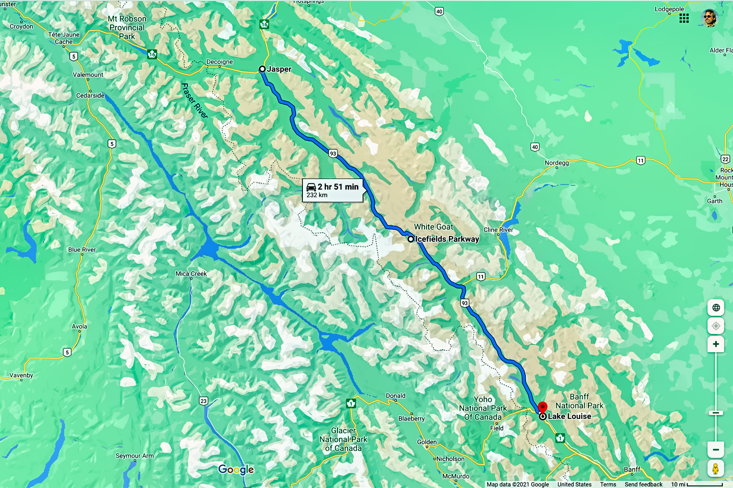
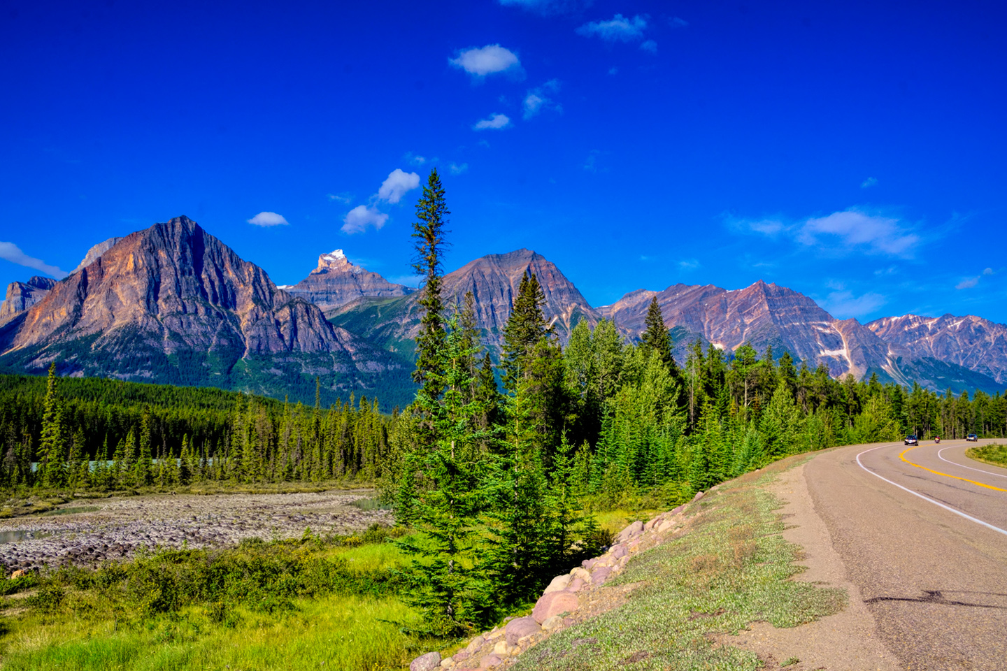
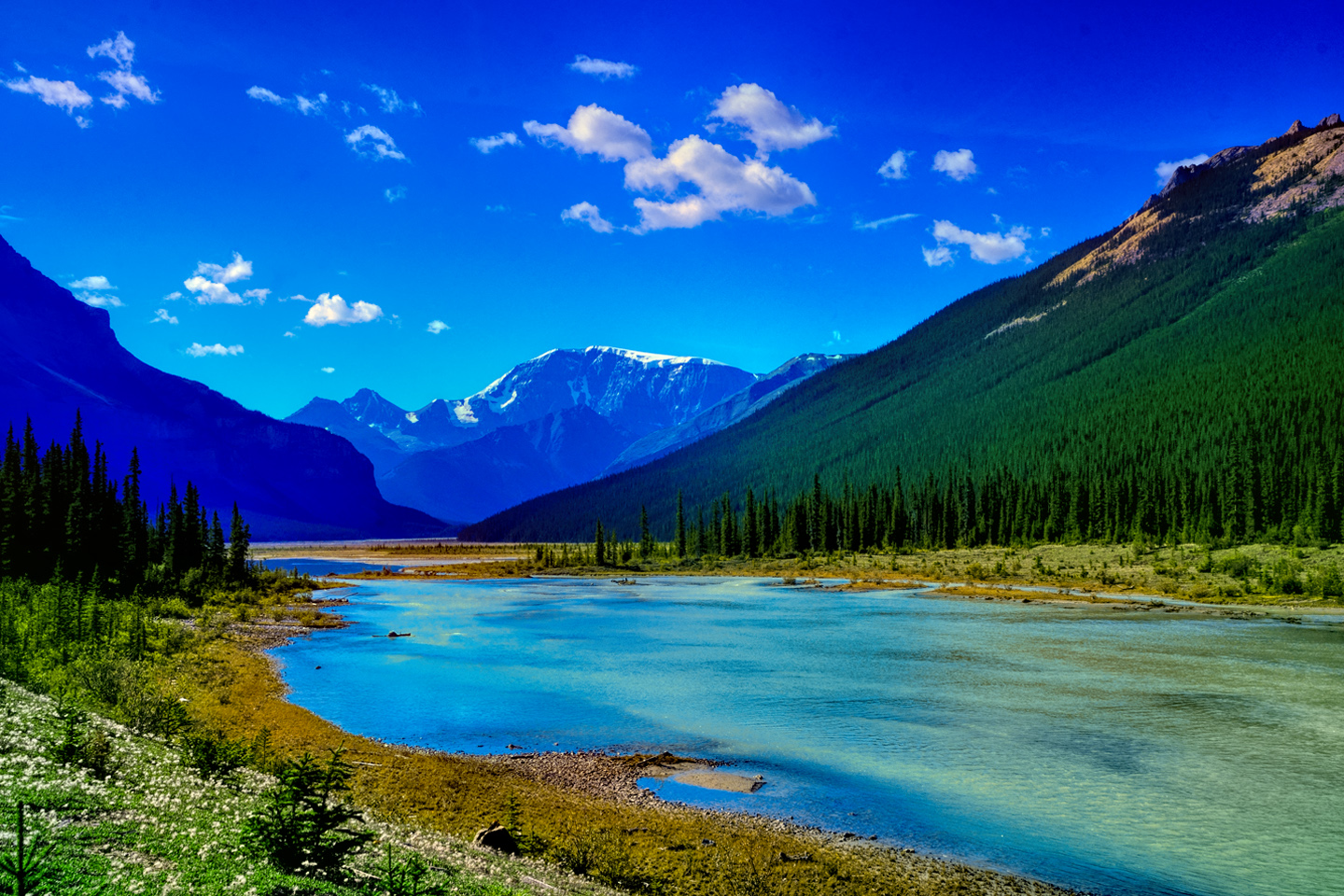
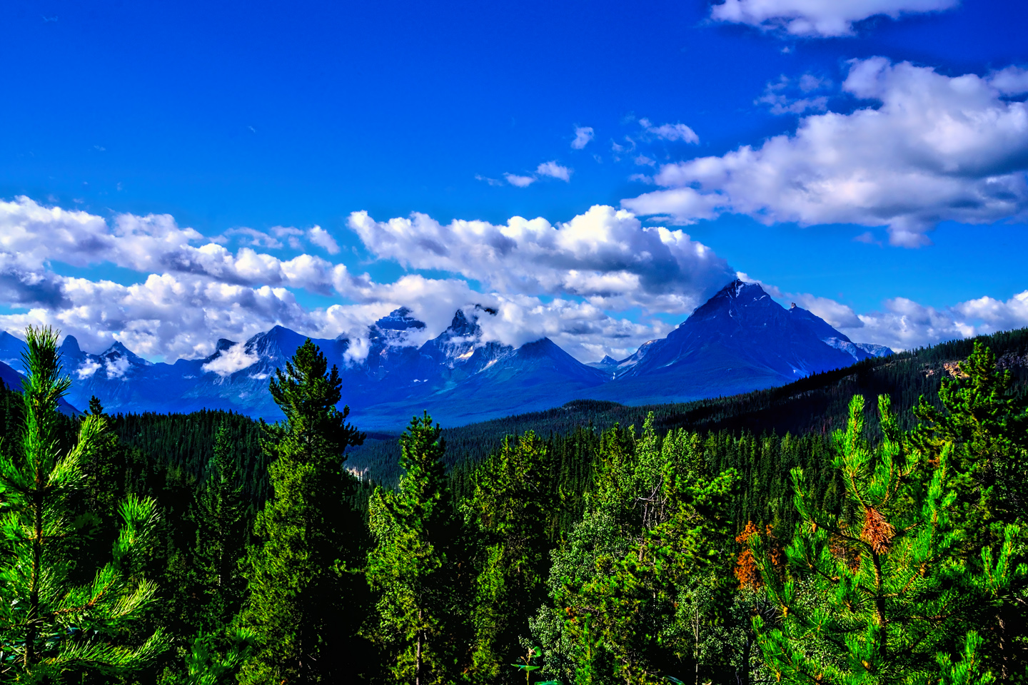
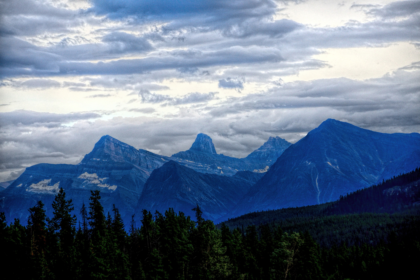
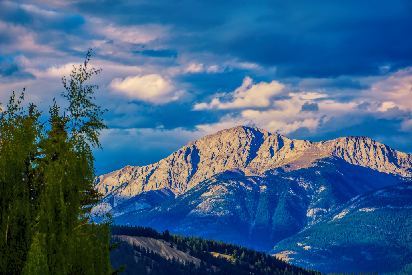
The Icefields Parkway, runs for 140 miles, connecting Lake Louise, in Banff National Park, with the town of Jasper, in Jasper National Park. The original road was built by hand during the Great Depression, and was completed in 1940. After World War II, automobile traffic greatly increased, so a modern paved road replaced the original in 1961. The road takes its number, AB-93, from the north-south U.S. Highway 93 that meets it at the border, 222 miles south of Lake Louise. It takes it’s name, the Icefield Parkway, from the Columbia Icefield, one of the many spectacular sights to be seen along the route.
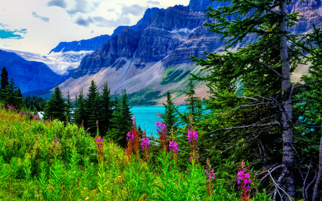
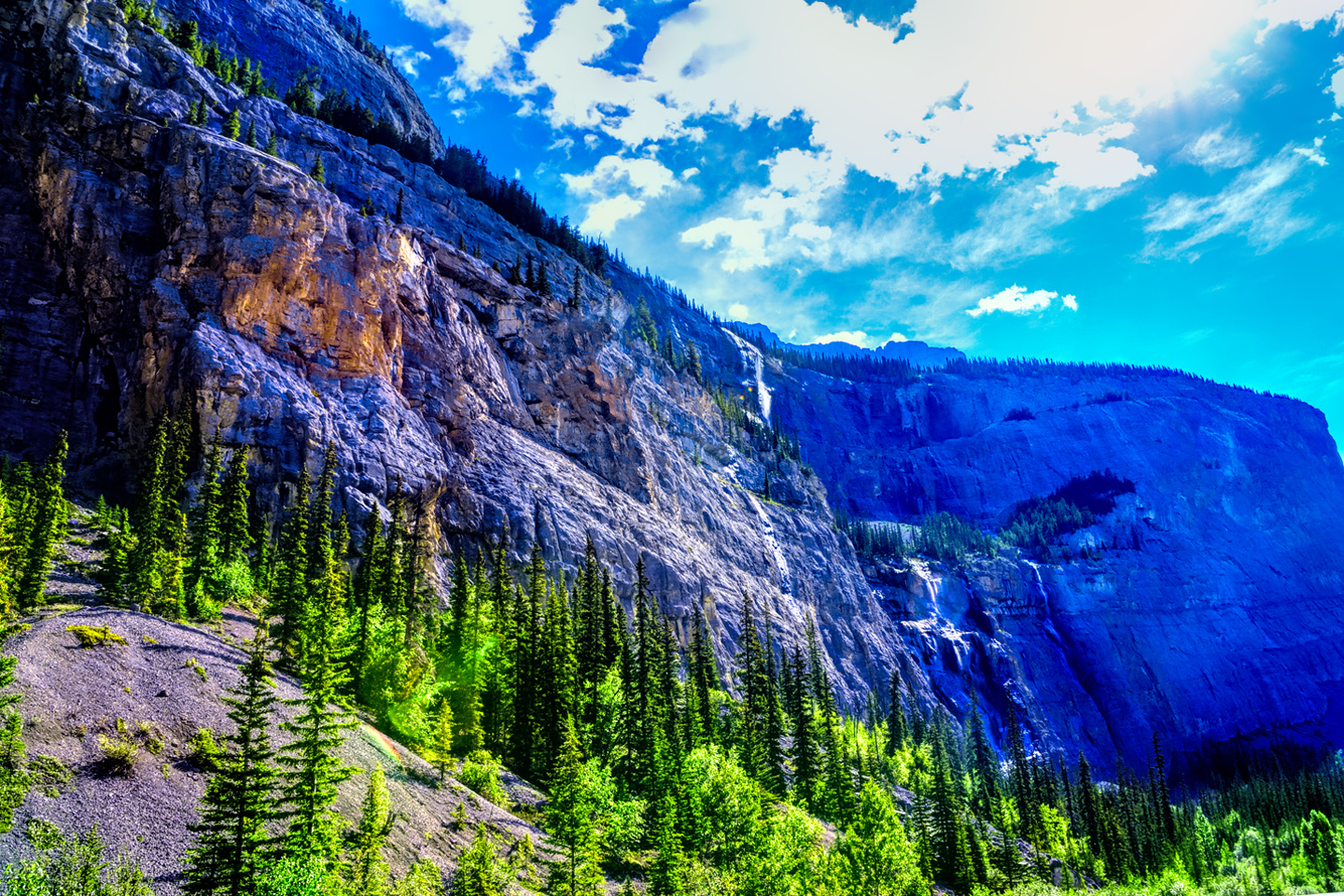
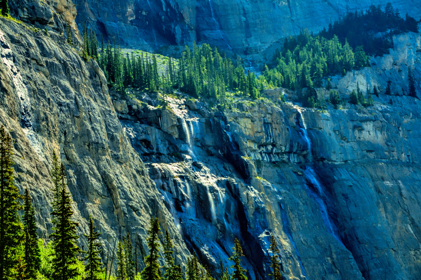
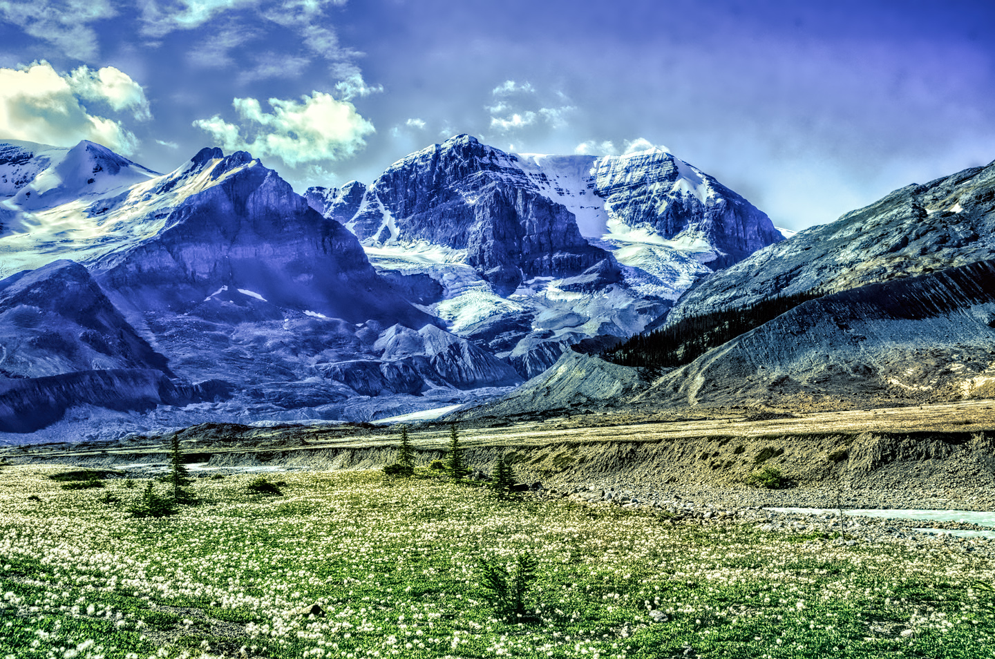
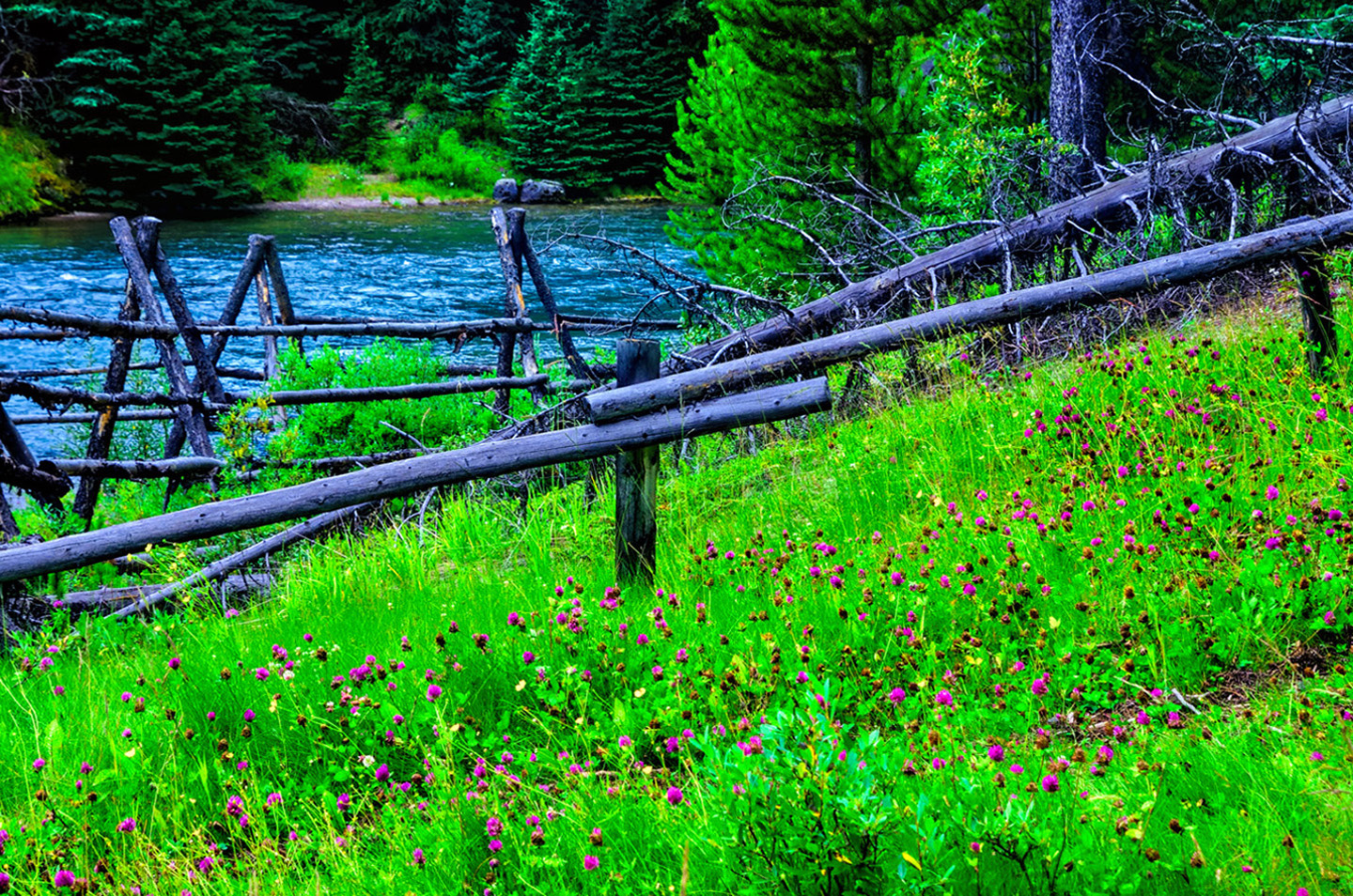
During the winter, the mountains and valleys are buried in snow, the rivers and lakes are frozen, but come spring, that frozen world begins to melt, to extraordinary effect. You’ll see glaciers, waterfalls, rushing rivers and turquoise lakes surrounded by wildflowers, all of it fed by steadily melting ice. Snowclad peaks with vibrant green flanks line the road on both sides, and every turnout, every wide spot in the road offers a new and dramatic perspective.
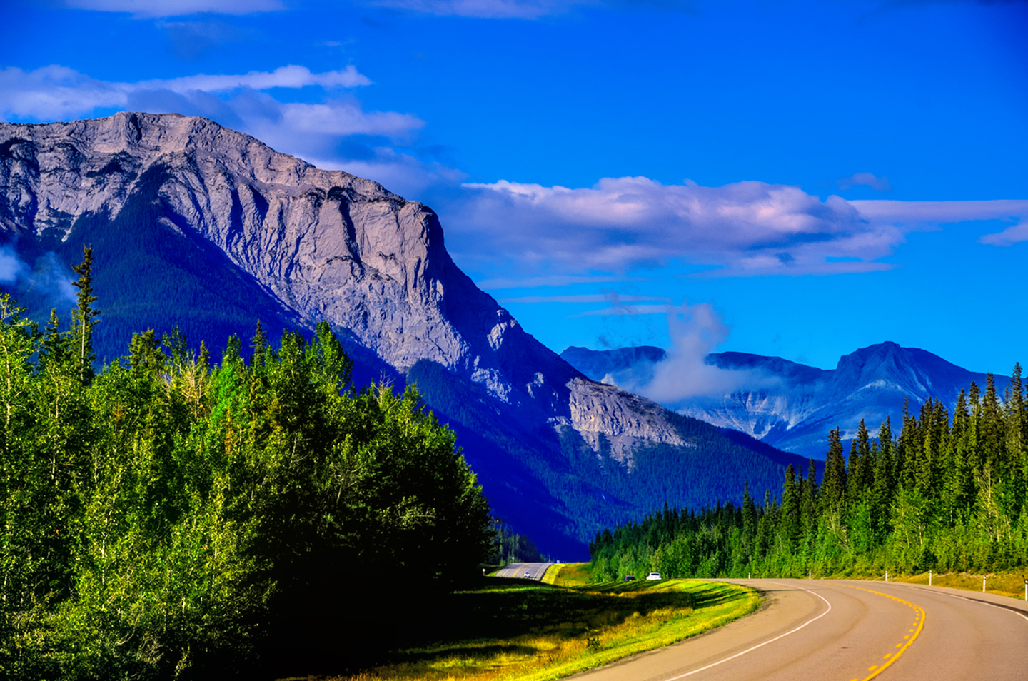
Regardless of how you’ve come to be driving this wonderful road, whether it’s north from Lake Louise, or south from Jasper, whether you’re following one of my humble suggestions, or some other routing of your own, take your time, because this is a byway to be savored. Stop often. Get out of your vehicle, and walk around some, if only beside the road. Survey this landscape in every direction, and breathe deeply of that crisp, clean mountain air!
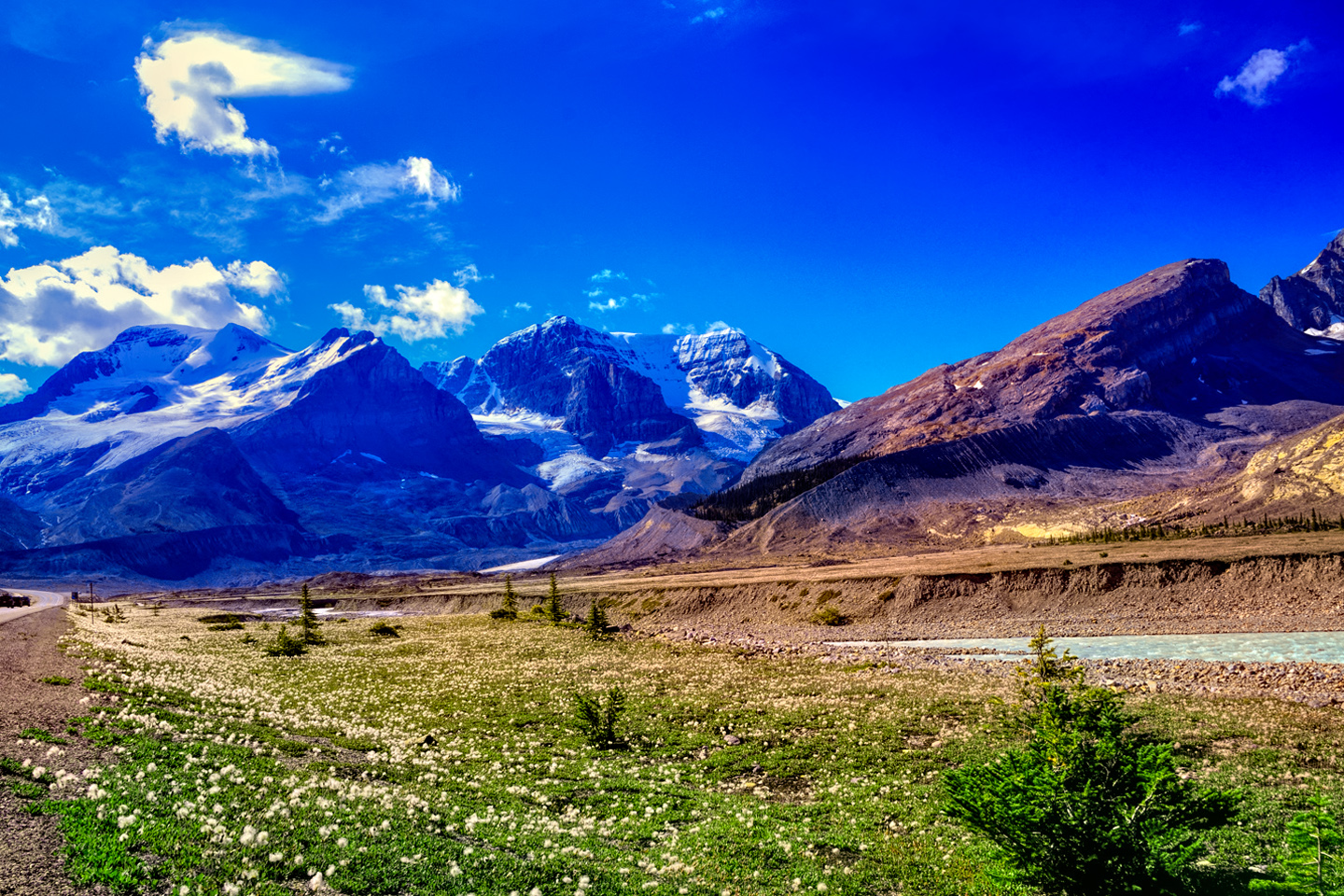
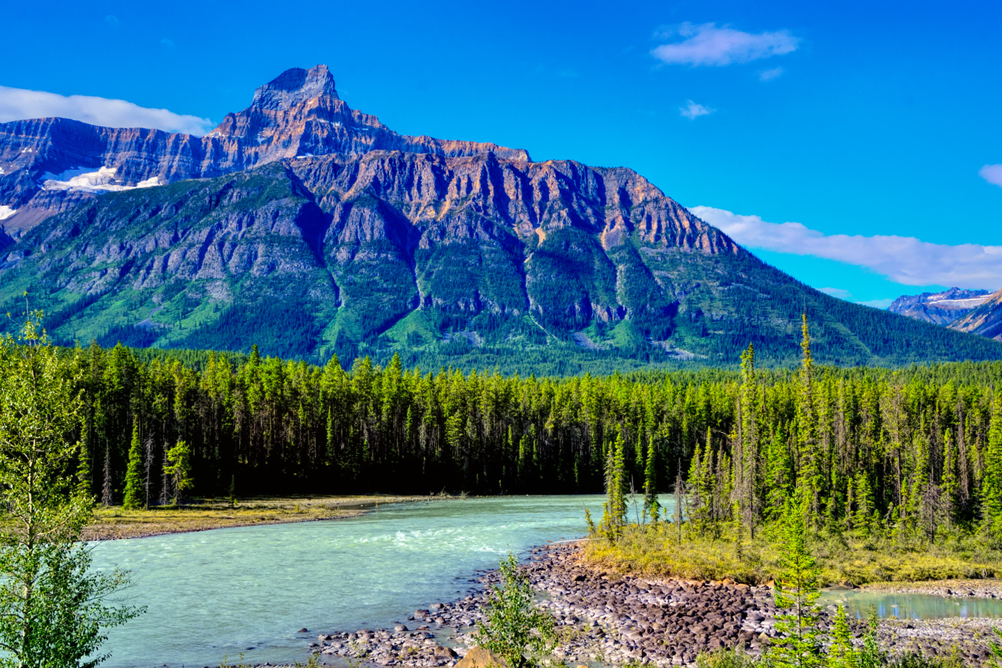
Some of the standout highlights along the way include ongoing views of the Bow River, and Bow Lake, fed by glacial melt filled with suspended minerals that lend a startling turquoise hue to the water. You’ll see the Weeping Wall, a vertical face threaded by cascades pouring down from the melting ice above. There are mountains and glaciers all along the route, including the majestic bulk of Mount Athabasca, and the Columbia Icefield, from which this scenic byway takes its name.
Click any photo in any slideshow to blow the images up to full screen, with captions.

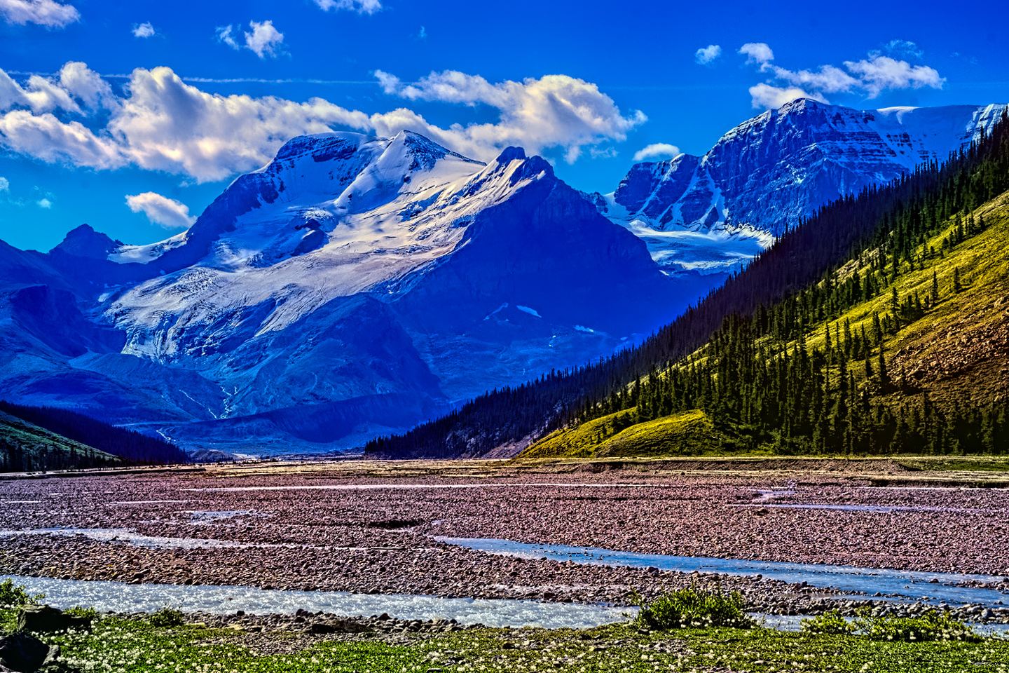
The Icefields Parkway is, without any doubt, one of the most scenic stretches of highway on the entire planet!

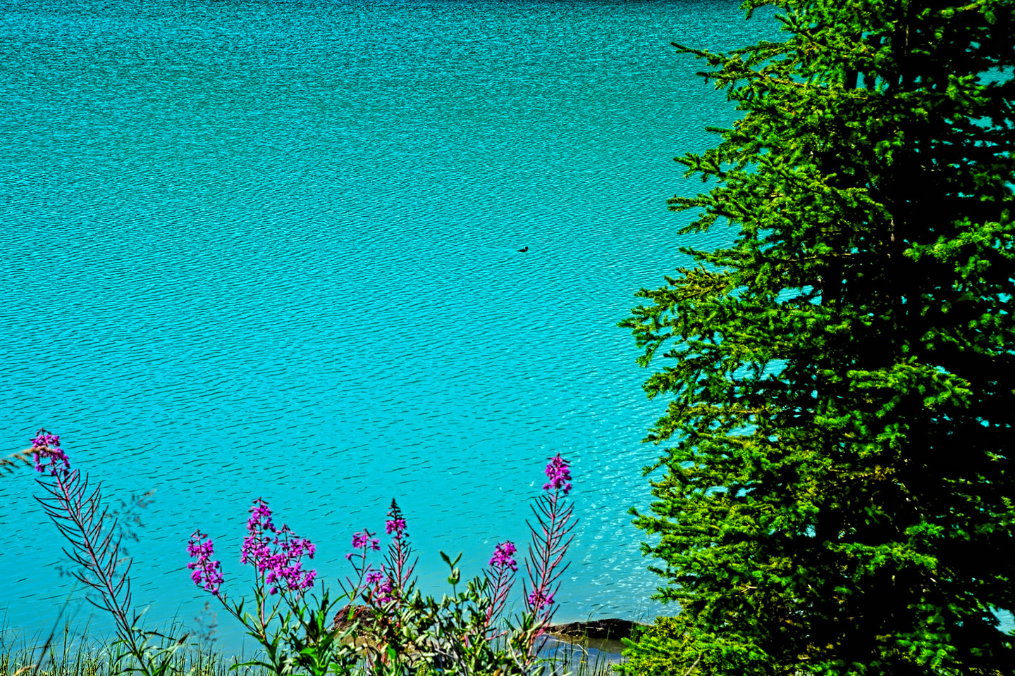
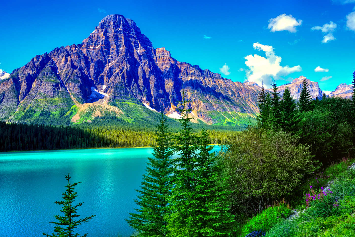
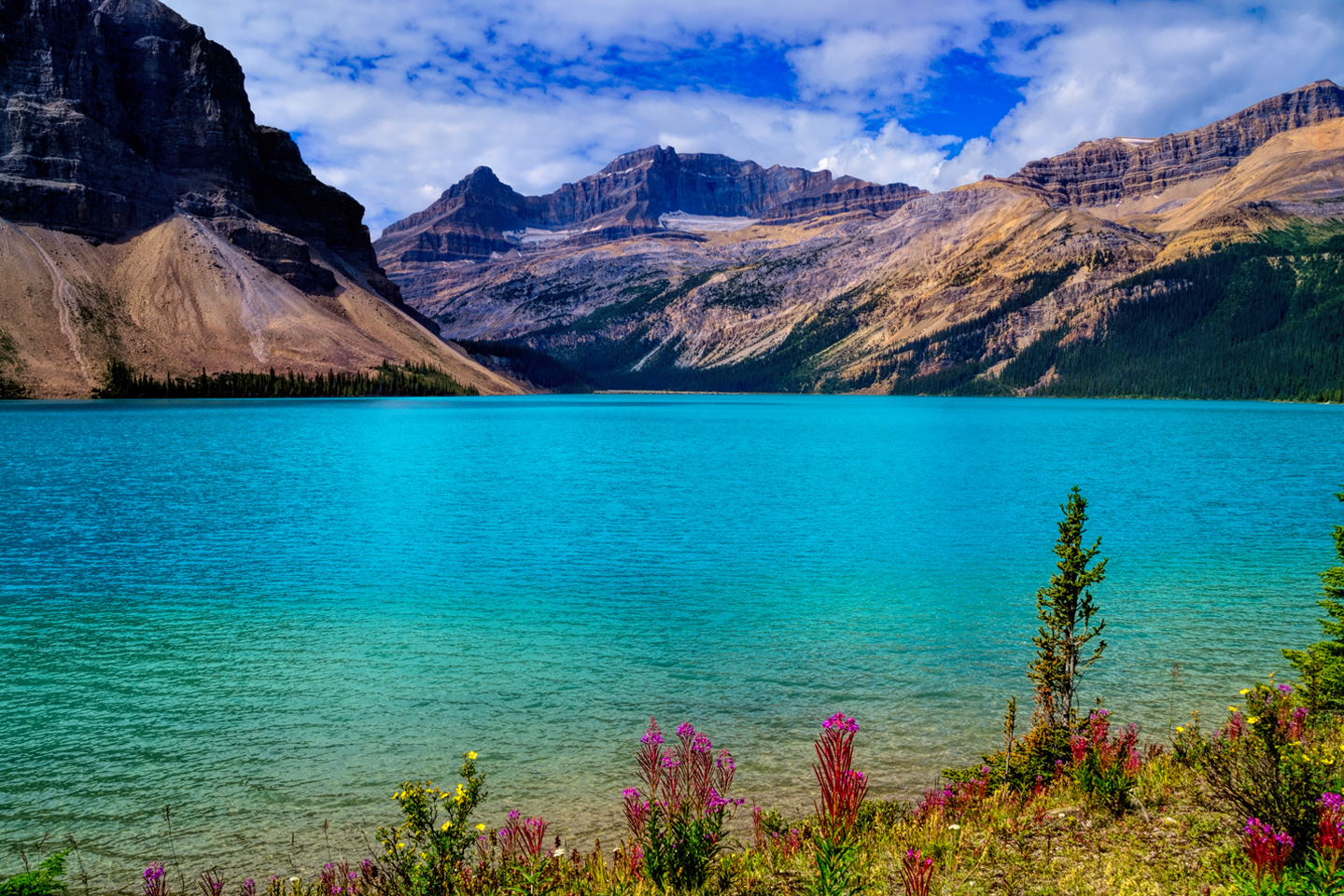
Sediment in the melting glacial ice refracts sunlight in such a way that the water appears a beautiful turquoise color.
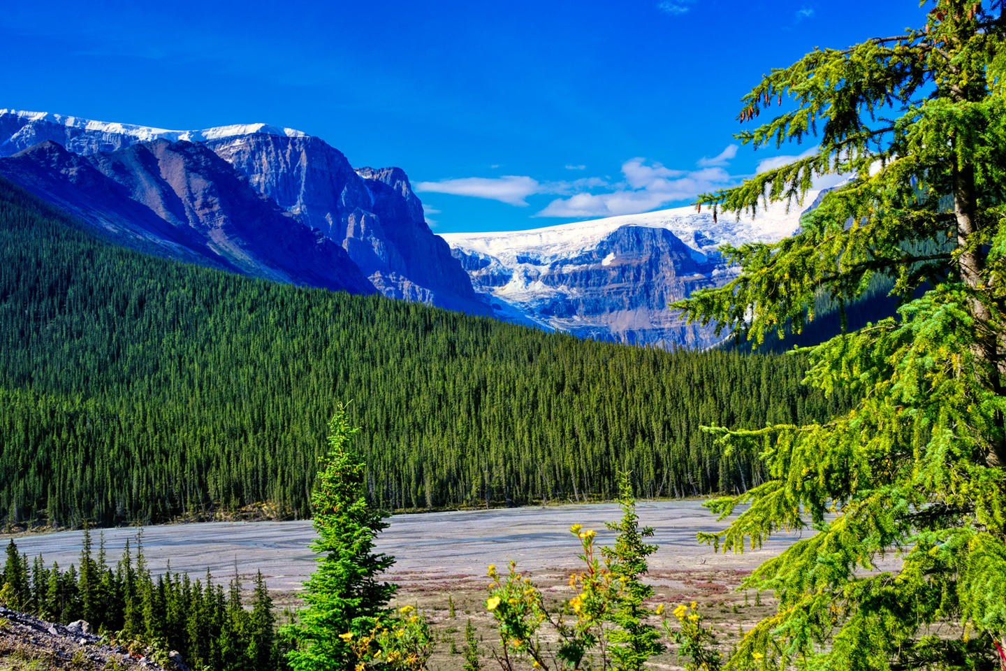
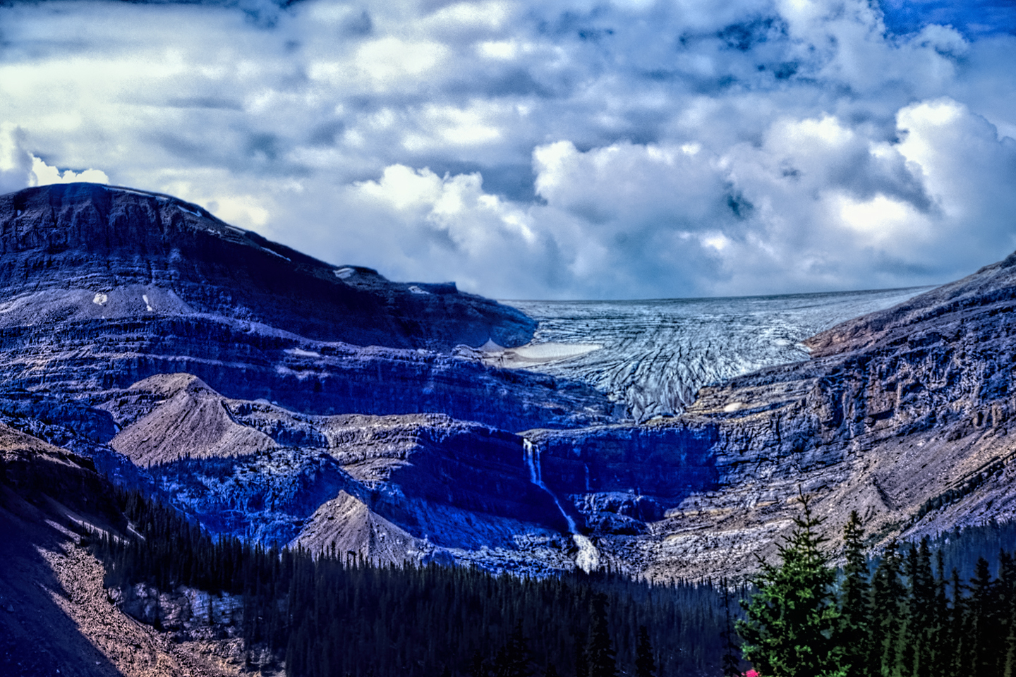
The boundary between Banff and Jasper National Parks is right near the mid-point of the Parkway, where the Columbia Icefield and the Athabasca Glacier both come near the road. For up-to-the-minute information about the area, and a fascinating up-close view of the glacier, be sure to stop in at the Icefield Center, located just off the highway. If you’re coming from the south, allow at least another hour for the rest of your drive to the town of Jasper, (or more, if you make frequent stops!)
What’s next? If you’re coming from Banff, your next stop will be:
JASPER NATIONAL PARK
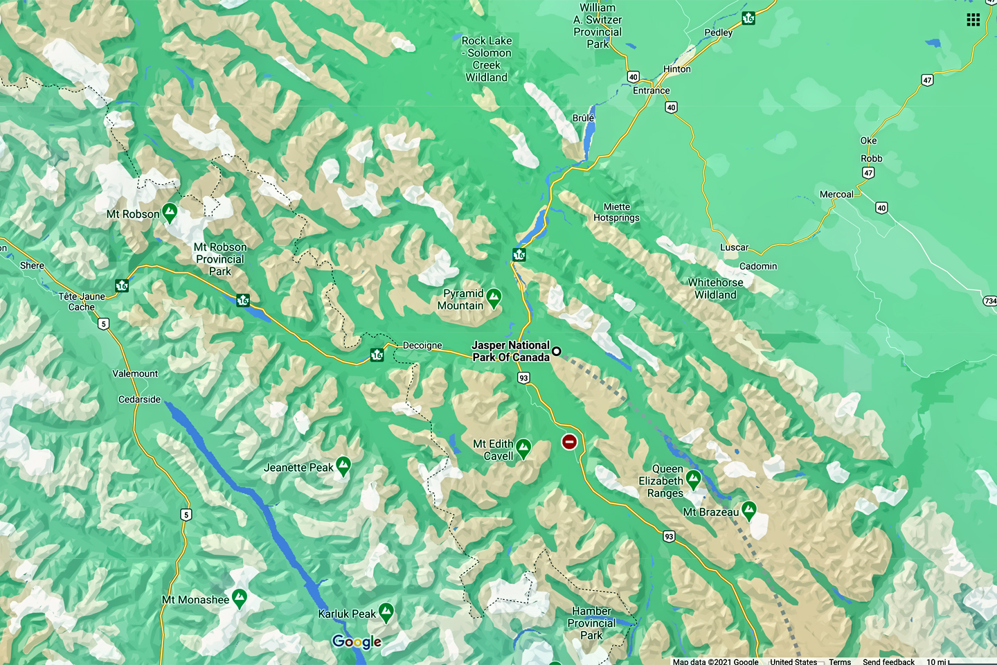
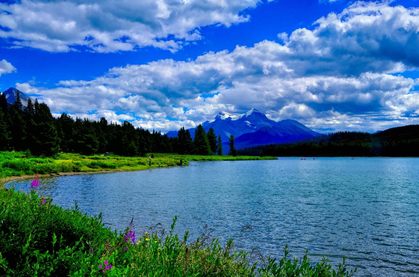
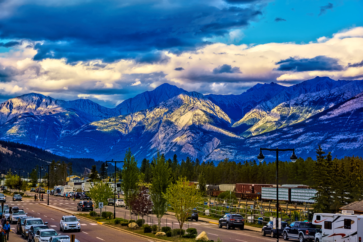
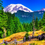
At 4200 square miles, Jasper is the largest of Canada’s Rocky Mountain National Parks, and many would say it’s the most majestic, if only for the sheer size of the place. Like Banff and all the others, Jasper National Park features towering, snow-capped mountains, massive glaciers, amazing lakes, hot springs, caves, waterfalls, and rivers that flow blue with glacial meltwater. There is an abundance of wildlife, as well as abundant opportunities for hiking, fishing, climbing, kayaking, and more, as well as great skiing and other winter sports in the colder months. The town of Jasper, in the middle of the park, is a cool place to hang out in between your adventures, offering a wide selection of accommodations and eateries, and a laid-back, mountain town atmosphere.
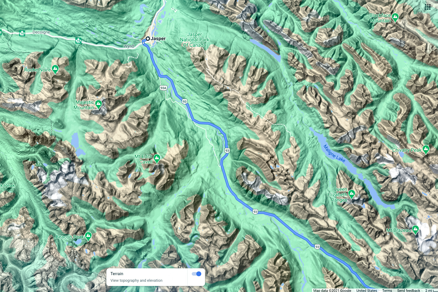
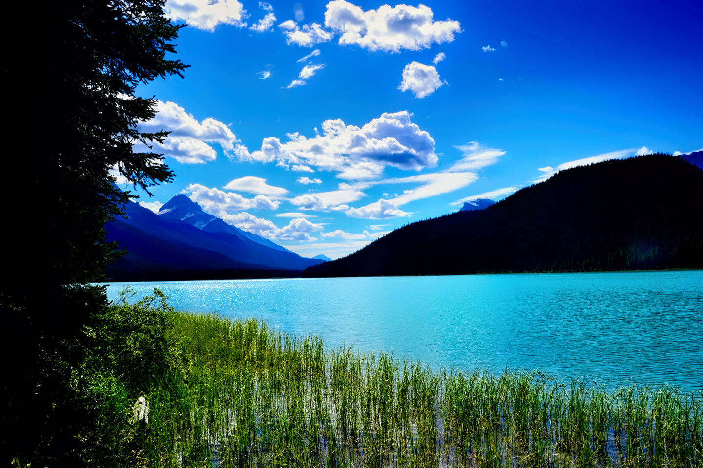
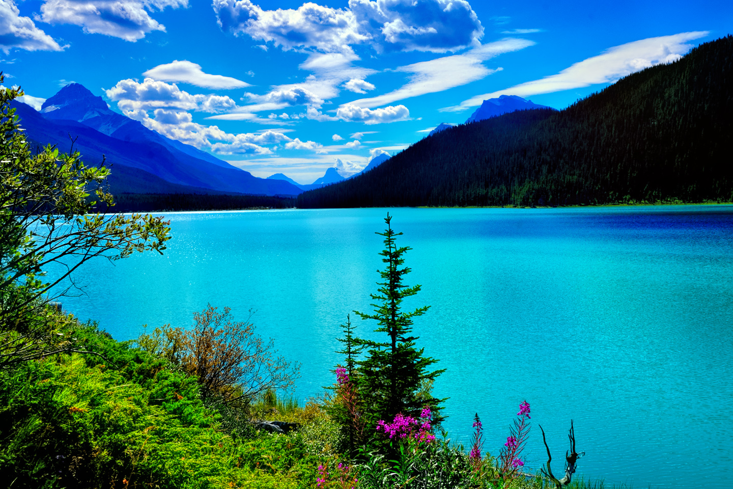
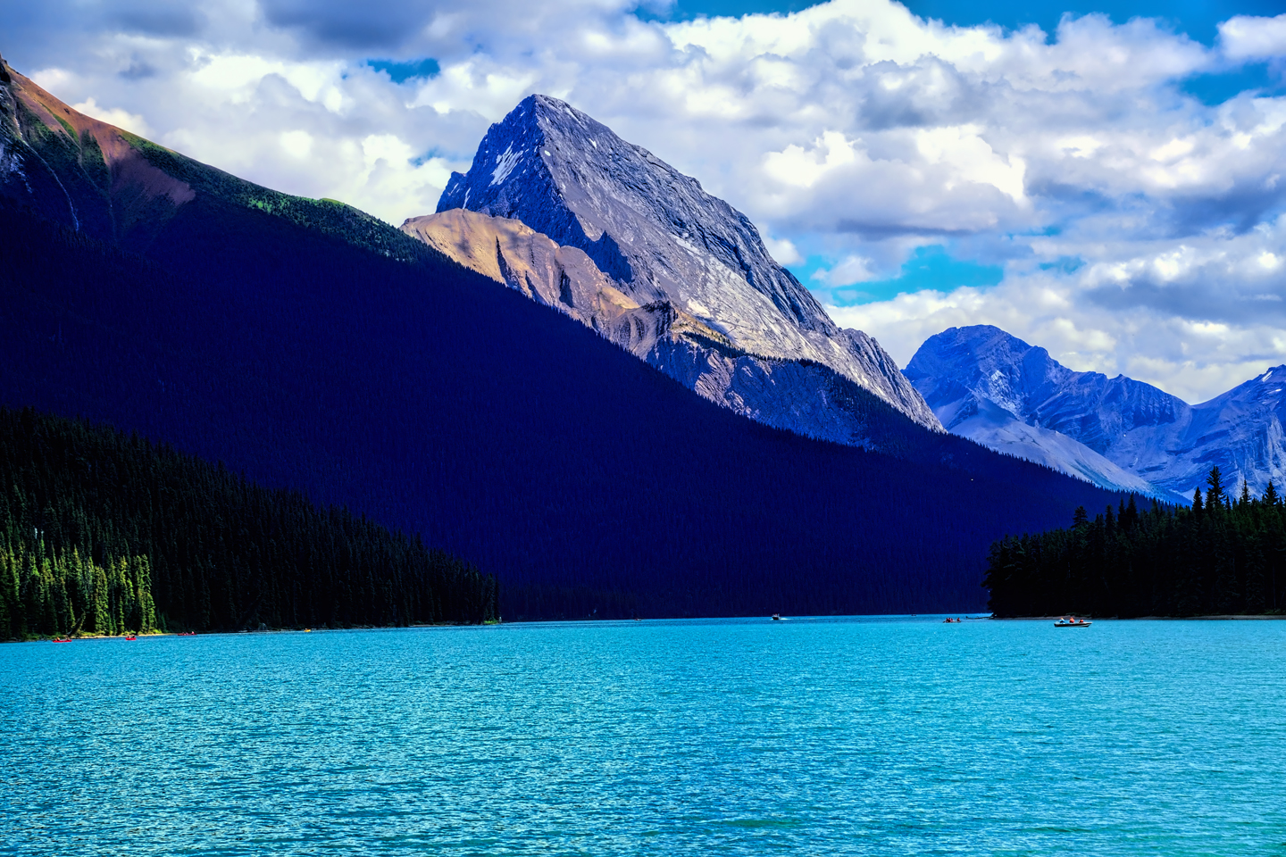
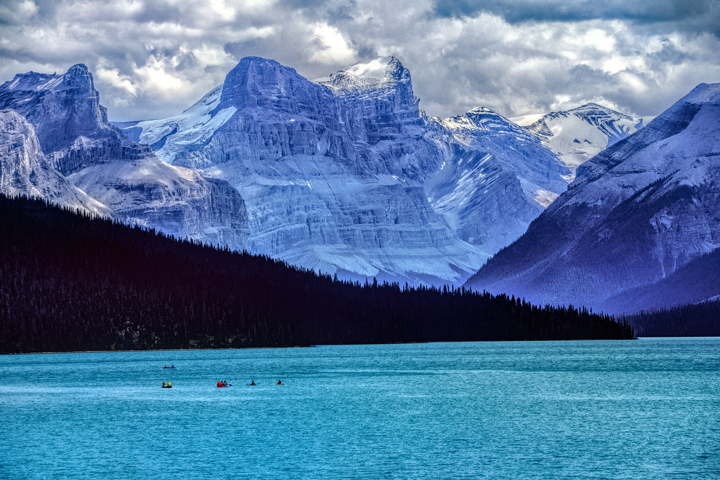
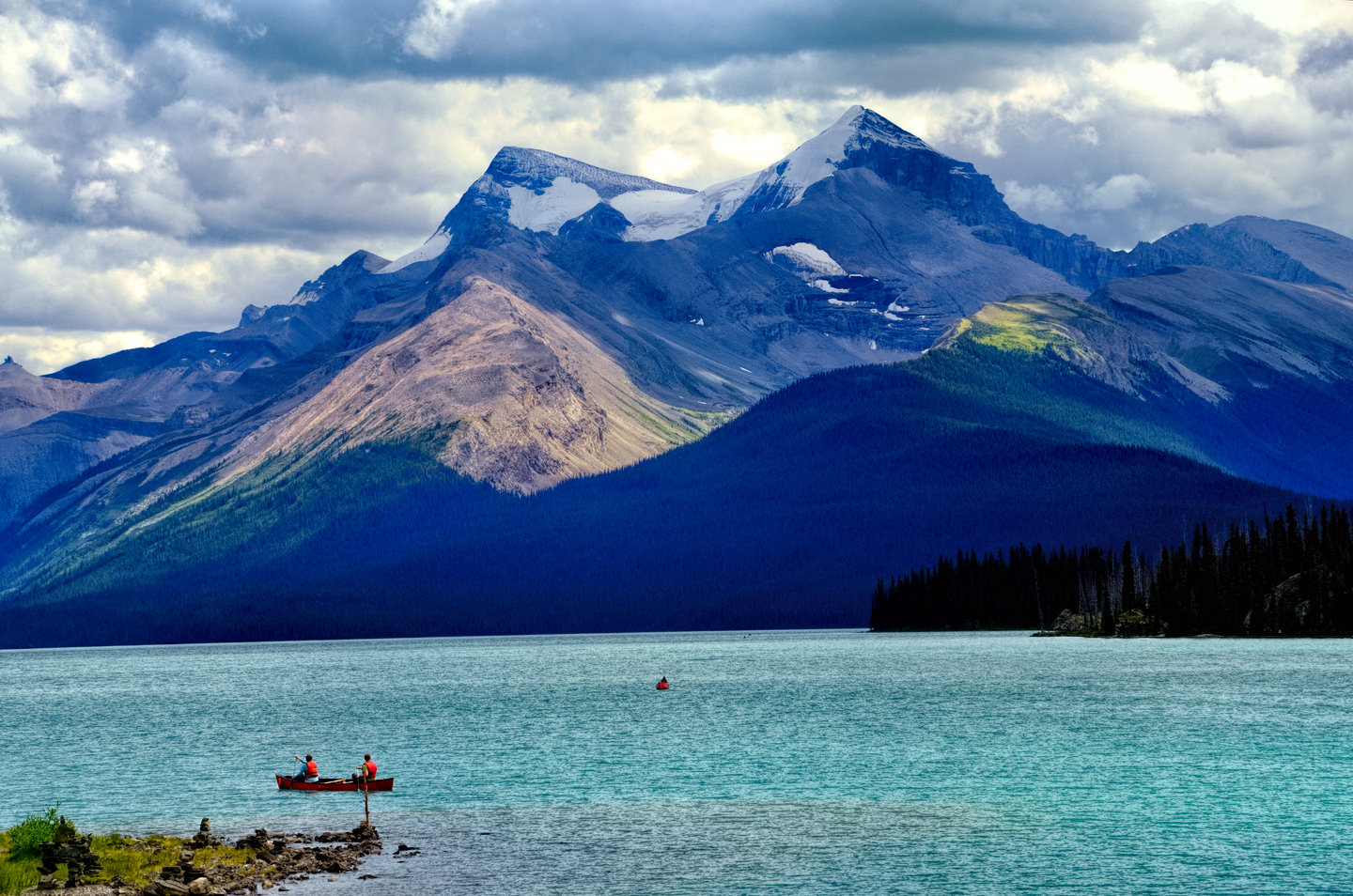
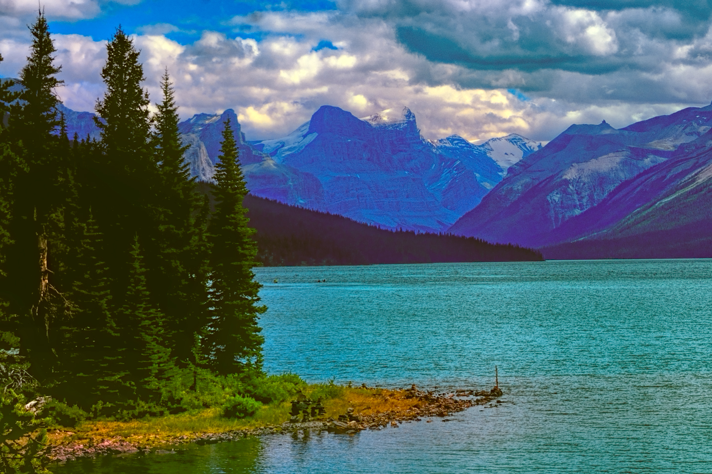
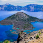
One of the must-see locations in the park is Maligne Lake, the largest natural lake in the Canadian Rockies. To get to it from Jasper, head east on the Yellowhead Highway, AB-16, to Maligne Lake Road, about a mile and a half past the town limits. Follow that road for 27 miles, part of that distance along the shores of smaller, but still quite lovely Medicine Lake. Once you reach the end of the road, on the shores of the larger lake, you’ll see what all the fuss was about. Maligne Lake is a stunner, a tranquil body of blue-green water set among soaring, ice-clad peaks. Other lakes in the Canadian Rockies might fit that same description, but this one is bigger–and bluer–and those ice-clad peaks of the Queen Elizabeth Range are nothing short of outrageous! In the warmer months, it’s a popular spot for hiking, picnicking, fishing, and boating, with canoes and kayaks available for rent. In the summer, there’s a Lake Cruise out to Spirit Island, a beautiful spot that’s only accessible by boat.
Other popular activities include short hikes to Athabasca Falls and Sunwapta Falls, both amazing, both accessible right off the Icefields Parkway south of the town. At the extreme south end of the park, right where Jasper and Banff come together, you’ll find the Columbia Icefield and the Athabasca Glacier. The Icefield is massive, the last surviving remnant of the ice sheet that once covered most of these mountains, and the Athabasca, the glacier coming down off the ice sheet is so accessible, right across from the Icefields Visitors Center, that it is, officially, the most visited glacier in North America.
(Click any of the photos in the slideshow to expand the images to full screen, with captions)
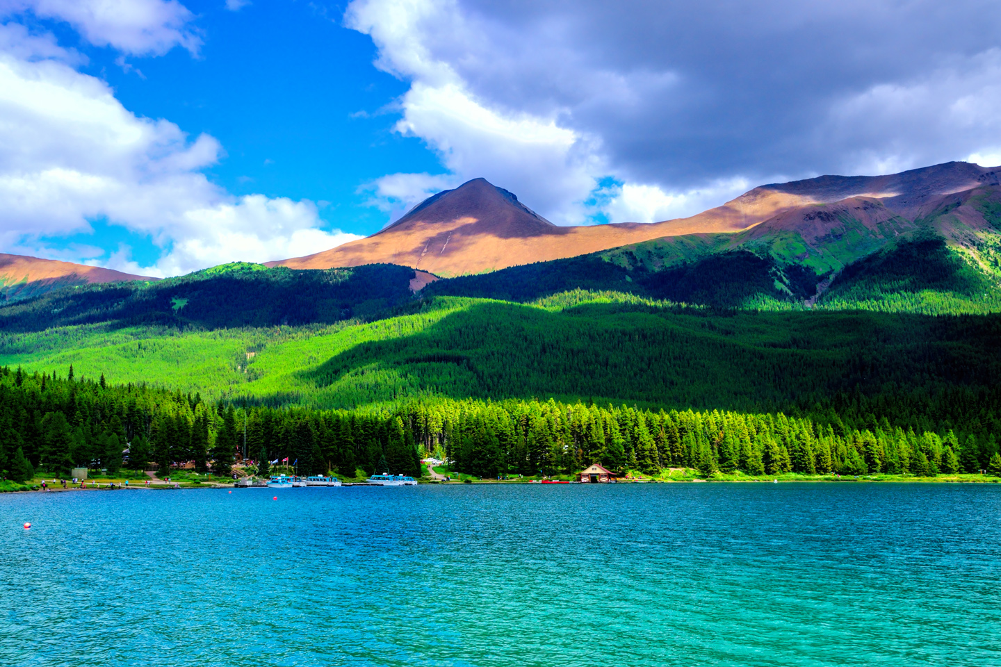
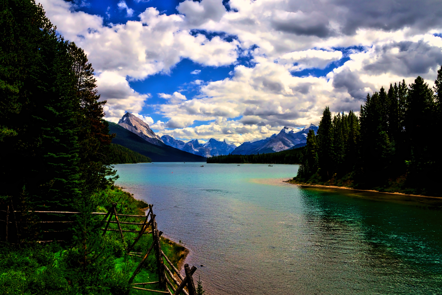
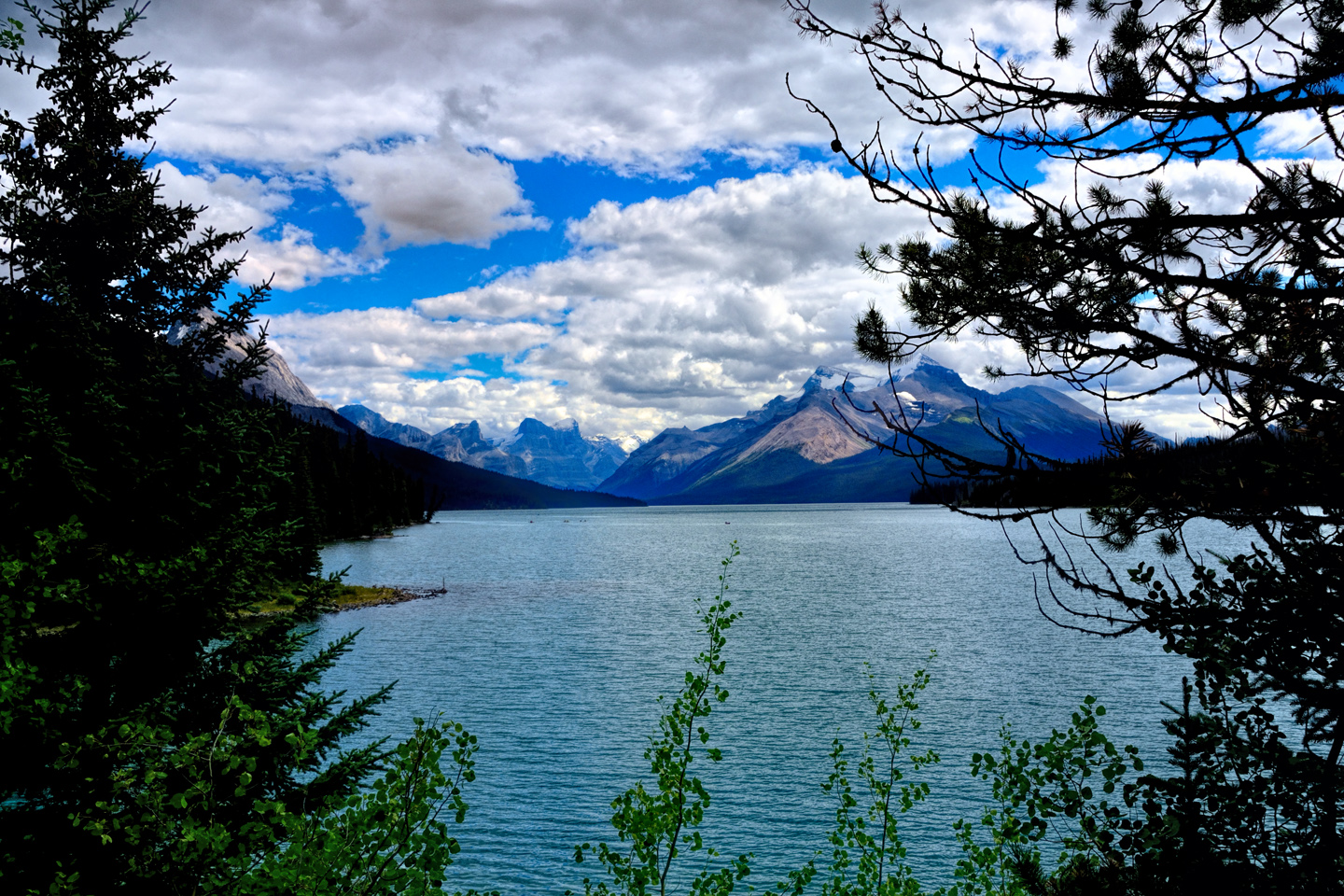
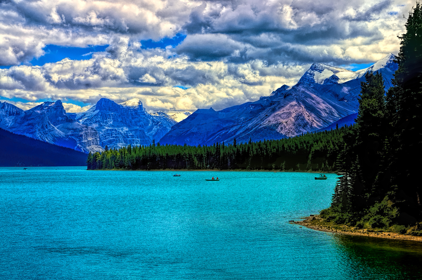
Malign Lake, in Jasper National Park, is one of the region’s most beautiful bodies of turquoise blue water.
Be sure to stop in at the Jasper National Park Visitors Center at 500 Connaught Drive in Jasper, for up to the minute information about facilities, road conditions, and anything else you need to know about this remarkable area.
~~~~
If you live in Calgary or Edmonton, or even Vancouver, a road trip in the Canadian Rockies is simple to arrange. For the rest of us, it takes a bit of planning, but it’s well worth the trouble. You’ll come away with memories that will last a lifetime!
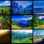
For more specific information on the Canadian Rocky Mountain Parks–-and a LOT more photographs–check out the rest of my Canadian Road Trip series:
Unless otherwise noted, the images in these posts are my original work, and are protected by copyright. They may not be duplicated for commercial purposes.
CANADIAN ROAD TRIPS
This is an interactive Table of Contents. Click the pictures to open the pages.
Canadian Road Trips

Canadian Road Trips: Rolling through the Rockies
The goal here is to get you thinking about the different ways to tie these iconic parks together, and the distances involved, in order to get the most out of a visit to one of the most wonderfully scenic areas on the entire planet.
<<CLICK to Read More!>>

Canadian Road Trips: Banff and Kootenay National Parks
Banff gets four million visitors in an average year, and even though the park covers more than 1.6 million acres, 90% of those four million visitors head straight to the same spot, to Lake Louise, and the Fairmont Chateau.
<<CLICK to Read More!>>

Canadian Road Trips: Jasper and the Icefields Parkway
You'll see glaciers, waterfalls, rushing rivers and turquoise lakes surrounded by wildflowers, all of it fed by steadily melting ice. Snowclad peaks with vibrant green flanks line the road on both sides, and every turnout, every wide spot in the road offers a new and dramatic perspective.
<<CLICK to Read More!>>

Canadian Road Trips: Yoho National Park
Less than five miles along, the first break in the trees offered a glimpse, a flash of improbable color followed by a larger clearing that brought me screeching to a halt. There, beyond the spread of roadside wildflowers and a verge of spindly pines was the most extraordinary lake I had ever seen, backed by an ice-clad mountain.
<<CLICK to Read More!>>

Canadian Road Trips: Glacier and Mt. Revelstoke National Parks
The centerpiece of Revelstoke is it’s namesake mountain, and the most popular activity is the drive up the Meadows in the Sky Parkway, a twisting, turning roller coaster of a road that climbs all the way to the top of the mountain. It’s only 16 miles long, and it’s paved the whole distance, but you’ll gain more than 4,000 feet in elevation, and there are enough hairpins to satisfy the needs of an old-fashioned beauty pageant.
<<CLICK to Read More!>>

Follow the Fireweed
Visualize a summertime journey through that part of the world, a world filled with mountains and glaciers and boreal forests, ice blue rivers, turquoise lakes, and billowing clouds that fill the sky. Imagine your vision as a beautiful piece of music. The fundamental, underlying theme of that symphony would be a gently rising swell of perfect harmony, pinkish lavender in its hue.
<<CLICK to Read More!>>

There's nothing like a good road trip. Whether you're flying solo or with your family, on a motorcycle or in an RV, across your state or across the country, the important thing is that you're out there, away from your town, your work, your routine, meeting new people, seeing new sights, building the best kind of memories while living your life to the fullest.
Are you a veteran road tripper who loves grand vistas, or someone who's never done it, but would love to give it a try? Either way, you should consider making the Southwestern U.S. the scene of your own next adventure.
A few years ago I wrote a book about road trips in Arizona and New Mexico that's a lot like this website, packed with interesting information, and illustrated with beautiful photographs. Check it out! You can find it on Amazon, and at all other major booksellers.

ALASKA ROAD TRIP:
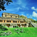
MEXICAN ROAD TRIP (IN THE LAND OF THE MAYA):
ARIZONA AND NEW MEXICO:
SOUTH AMERICA:
PHOTOGRAPHY:
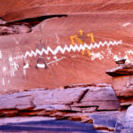
TRIBAL LANDS:
This is an interactive Table of Contents. Click the pictures to open the pages.
Alaska Road Trip

The Alaska Highway: Prelude: The Road to Dawson Creek
Even if you start in Seattle, the closest American city, it’s still more than 800 miles to Dawson Creek, wending your way that much further north, so far north that there will be a noticeable change in the hours of daylight. It’s the latitude that distinguishes the north country, including every bit of Alaska. Dawson Creek is where it all begins.
<<CLICK to Read More>>

The Alaska Highway: Day 1: Dawson Creek to Fort Nelson
Past Fort St. John, the terrain got a lot wilder. No more towns, very few people, and very little traffic. Saw a few U.S. license plates, Michigan, California, Oregon, South Carolina; people that were obviously headed to Alaska!
<<CLICK to Read More>>

The Alaska Highway: Day 2: Fort Nelson to Whitehorse
Every time I rounded a curve in the road there was another stupendous vista; it was nothing short of astonishing! I was literally yipping out loud, and a couple of times I actually pulled over and stopped while I pounded on my chest to “re-start” my heart!
<<CLICK to Read More>>

The Alaska Highway: Day 3: Whitehorse to Beaver Creek
Approaching the mountains, I started pulling over with serious frequency, taking LOTS of photos! Mountains, clouds, lakes, flowers—I was pretty sure I must have died and gone to heaven, but I couldn’t for the life of me remember the fiery crash.
<<CLICK to Read More>>

The Alaska Highway: Day 4: Beaver Creek to Fairbanks
Delta Junction, the end of the Al-Can, was only 200 miles away, and the border? Twenty miles, maybe half an hour, and I was finally going to cross into Alaska! I’d been on the road more than three weeks, and in just half a day more, I’d be in Fairbanks.
<<CLICK to Read More>>

Chena Hot Springs: A Fairbanks Original
The Chena hot spring puts out steaming water at a temperature of 150 degrees, producing enough power to meet all the needs of the resort, as well as filling the hot springs pools used by the guests. In addition to the lodge and restaurant, they offer camping and horseback riding, and they have exhibits featuring sled dogs, greenhouses, ice sculptures, and geothermal energy.
<<CLICK to Read More>>

Two-Foot High Kick: World Eskimo Indian Olympics
Contestants take a running leap, then they make this crazy jackknife move, touch the ball suspended high above the floor with both feet, then come back down and stick the landing. If that sounds difficult? You have no idea.
<<CLICK to Read More>>

Dreaming of Denali
When I drove my Jeep to Alaska that first summer after I retired, my main goal, the single most important thing I wanted to do, was to see Denali, the biggest mountain in North America.
<<CLICK to Read More>>

Follow the Fireweed
Visualize a summertime journey through that part of the world, a world filled with mountains and glaciers and boreal forests, ice blue rivers, turquoise lakes, and billowing clouds that fill the sky. Imagine your vision as a beautiful piece of music. The fundamental, underlying theme of that symphony would be a gently rising swell of perfect harmony, pinkish lavender in its hue.
<<CLICK to Read More>>

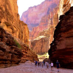
Kenai Fjords National Park: Seabirds, Glaciers, and Whales on the Wild Coast of Alaska
At this latitude, during the summer months, the sun stays low in the sky all day, and never really goes down. The traditional “golden hour” when the light is best for landscape photos is extended accordingly, and there are more opportunities for great shots than you’ll know what to do with.
<<CLICK to Read More>>

Kenai Fjords National Park: Exit Glacier: Up Close and Personal
Compared to the huge tidewater glaciers that flow directly into the sea along the coast of Kenai Fjords, Exit Glacier is just a baby–a baby that’s getting smaller every year–but it’s still big enough to permanently alter the landscape through which it passes.
<<CLICK to Read More>>
There’s nothing like a good road trip. Whether you’re flying solo or with your family, on a motorcycle or in an RV, across your state or across the country, the important thing is that you’re out there, away from your town, your work, your routine, meeting new people, seeing new sights, building the best kind of memories while living your life to the fullest.
Are you a veteran road tripper who loves grand vistas, or someone who’s never done it, but would love to give it a try? Either way, you should consider making the Southwestern U.S. the scene of your own next adventure.
A few years ago I wrote a book about road trips in that area that’s a lot like this website, packed with interesting information, and heavily illustrated with beautiful photographs. Check it out! You can find it on Amazon, and at all other major booksellers.
ALASKA ROAD TRIP:
MEXICAN ROAD TRIP (IN THE LAND OF THE MAYA):
ARIZONA AND NEW MEXICO:
SOUTH AMERICA:
PHOTOGRAPHY:
TRIBAL LANDS:


Recent Comments