AN ALASKA ROAD TRIP IS A GRAND ADVENTURE!

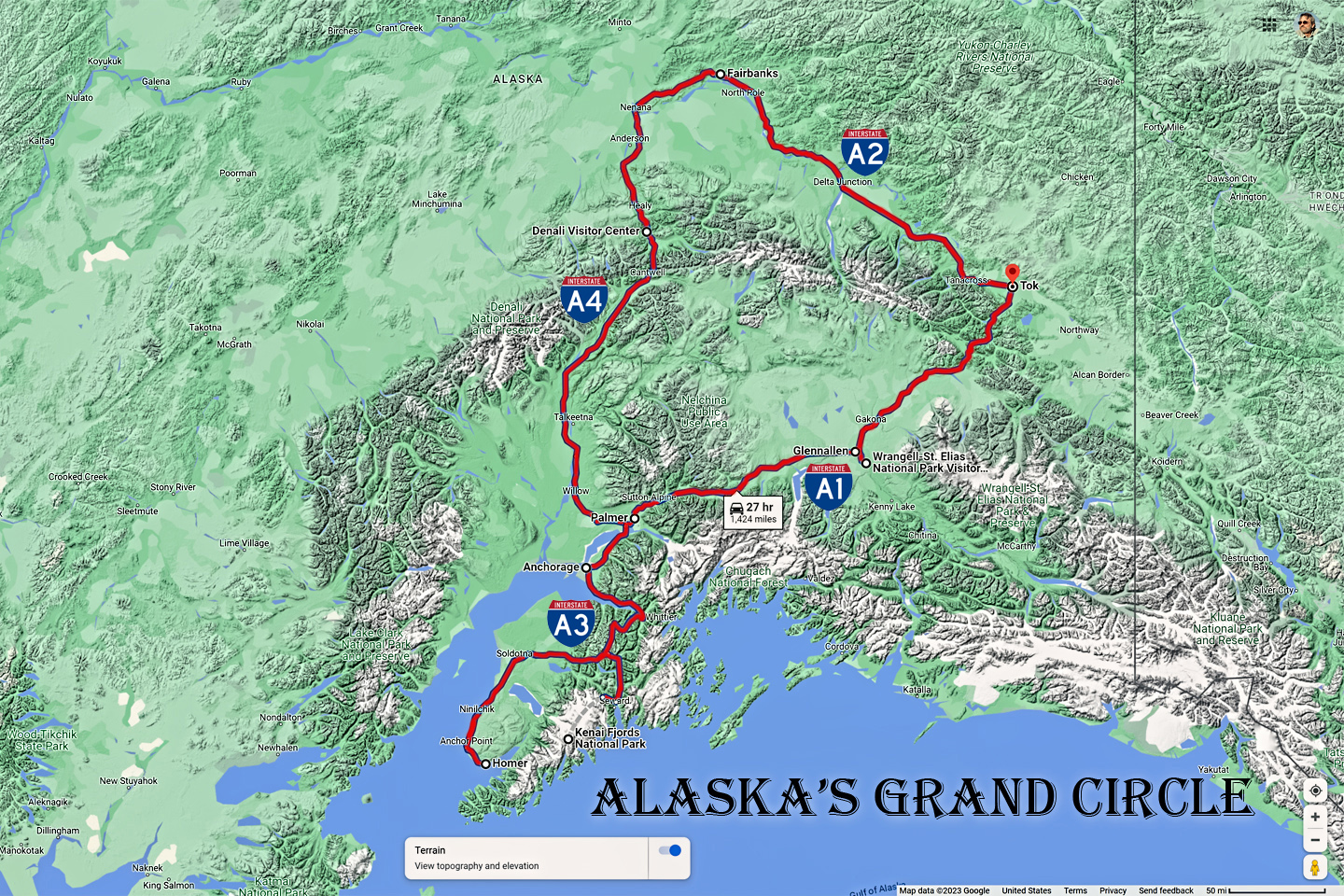
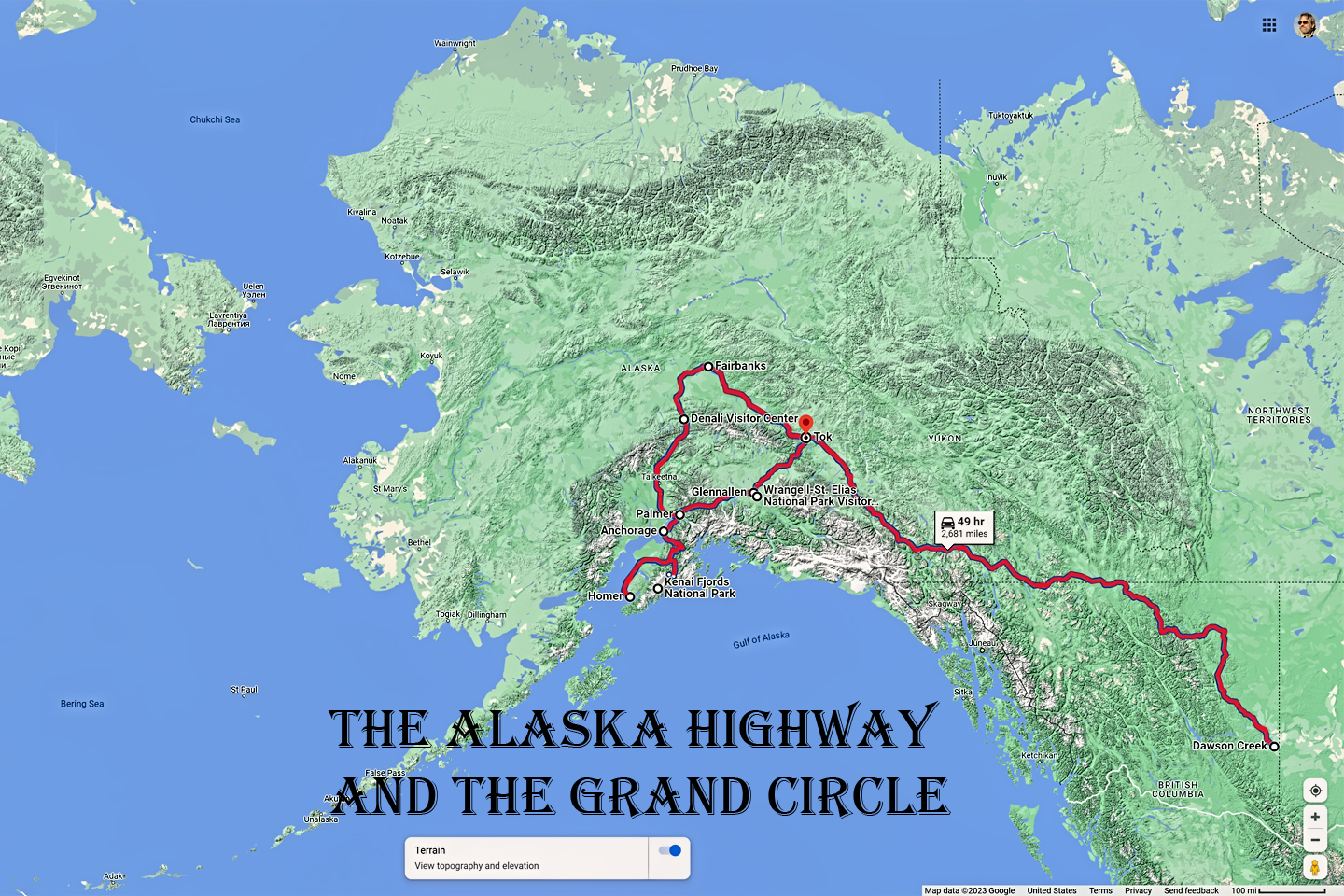
Alaska's Grand Circle is a loop route that begins in Tok and utilizes all four segments (1082 miles) of Alaska’s Interstate Highway system: Tok to Fairbanks on AK-2 (Interstate A-2); Fairbanks to Gateway (near Anchorage) on AK-3 (Interstate A-4); Anchorage to Soldotna on AK-1 (Interstate A-3); and Anchorage back to Tok on AK-1 (Interstate A-1).  Most of the major towns in Alaska, as well as many of the state's most scenic areas can all be reached from this loop, which includes three of Alaska's National Parks.

On my own Alaska Road Trip, I came to the end of the Grand Circle when I drove from Glennallen to Tok. I’d been to Tok once before, on my first day in Alaska, passing through on my way to Fairbanks when I rolled in from the Yukon on the Alaska Highway. That first time, I stopped just long enough for a good breakfast at Fast Eddie’s. This time I stayed the night, and discovered that there was more to Tok than my fleeting first impression.  With a population of almost 1,200, it’s one of Alaska’s larger towns, and it’s beautifully situated, with stunning mountain views of the nearby Alaska Range.

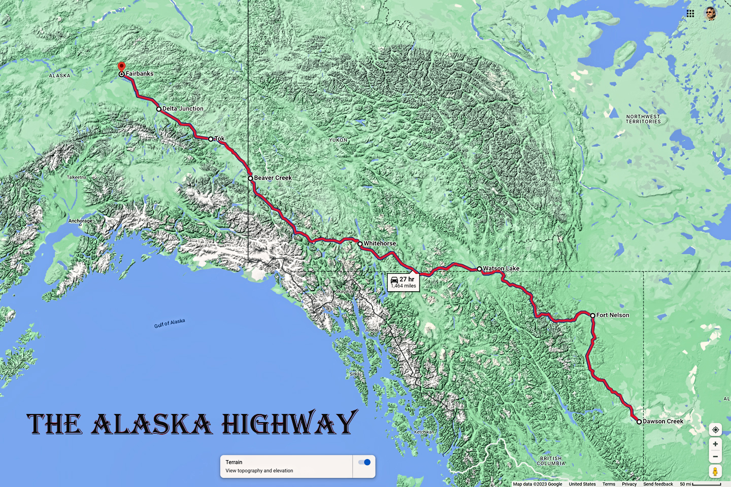
Most Alaska Road Trippers leave the state the same way they came in, on the Alaska Highway. They simply reverse course, and drive from Tok back to the Canadian Border; from there, it’s on to Beaver Creek and points east in the Yukon. That was my original plan, but in the course of my travels, I’d come up with something different. 

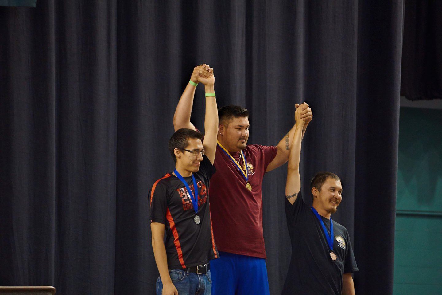
When I first arrived in Alaska, I stopped in at the World’s Northernmost Denny’s, and I struck up a conversation with a couple at the next table. They were local people, and they gave me two great suggestions: told me I should check out the World Eskimo Indian Olympics, an annual event taking place that very week in Fairbanks:        <<Click here for more info and many photographs>>

Two-foot high kick

Olympic gold!

They also told me that when I left Alaska, I should drive north from Tok to a place called Chicken, and from there, take the Top of the World Highway to Dawson City, across the border in Canada. If you catch that road on a clear day,” they said, “you can see for a hundred miles. It’s more amazing than anything you’ll see at Denali!” Their tip about the WEIO had been spot on–I sincerely enjoyed what I saw at that event, which was undoubtedly the most “Alaskan” thing that I experienced during all of my time in the state. I figured their ‘Top of the World Highway’ recommendation had to be equally worth my while–but there was going to be chance involved. I’d been warned: that business about catching it on a clear day.

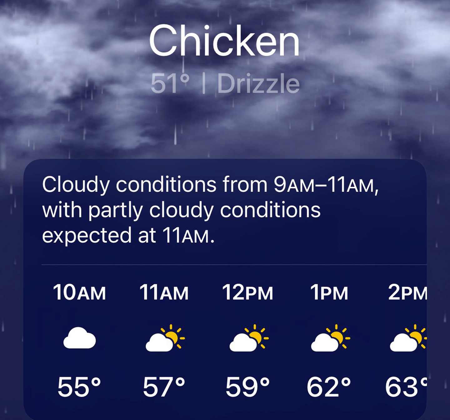
I knew from experience that clear skies in Alaska were both rare and fleeting, but I also knew the best way to stack the odds. The weather service predicted heavy rain for most of the next week, but the forecast for the following day showed “partly cloudy” in and around Chicken from mid-day until late afternoon. That was as much of a window as I was likely to get. I spent a pleasant night in Tok, and took off early the next morning, headed for the Yukon, and points east.

THE TOP OF THE WORLD!

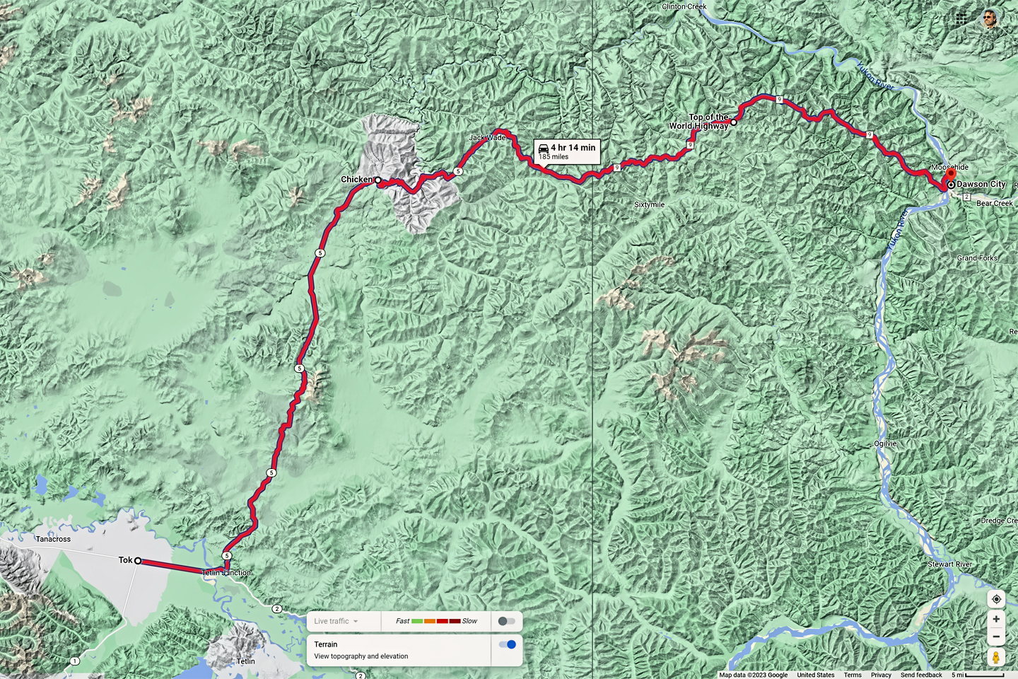
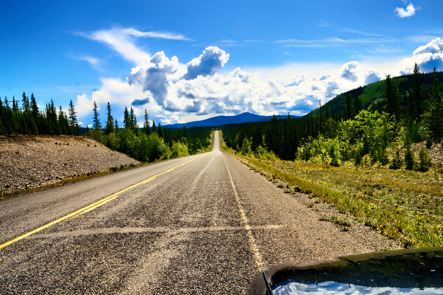
The Taylor Highway, AK Route 5, is one of Alaska’s secondary roads. It begins in Tetlin Junction, 12 miles east of Tok on the Alaska Highway, and takes you 160 miles north to the little town of Eagle (population 86). On the way, you pass through Chicken, and about 30 miles north and east of Chicken, there’s a road junction. The Taylor Highway continues due north to Eagle, while the Top of the World Highway, which begins at that junction, splits off to the east for a total of 79 miles. The picturesque highway crosses the border into Canada, and ends at the banks of the Yukon River, in the Klondike Gold Rush town of Dawson City. From there, you can follow the Klondike Highway 330 miles south to Whitehorse, where you can rejoin the Alaska Highway.

Click maps and photos to expand the images to full screen.

The Alaska Highway: The Back Road Out

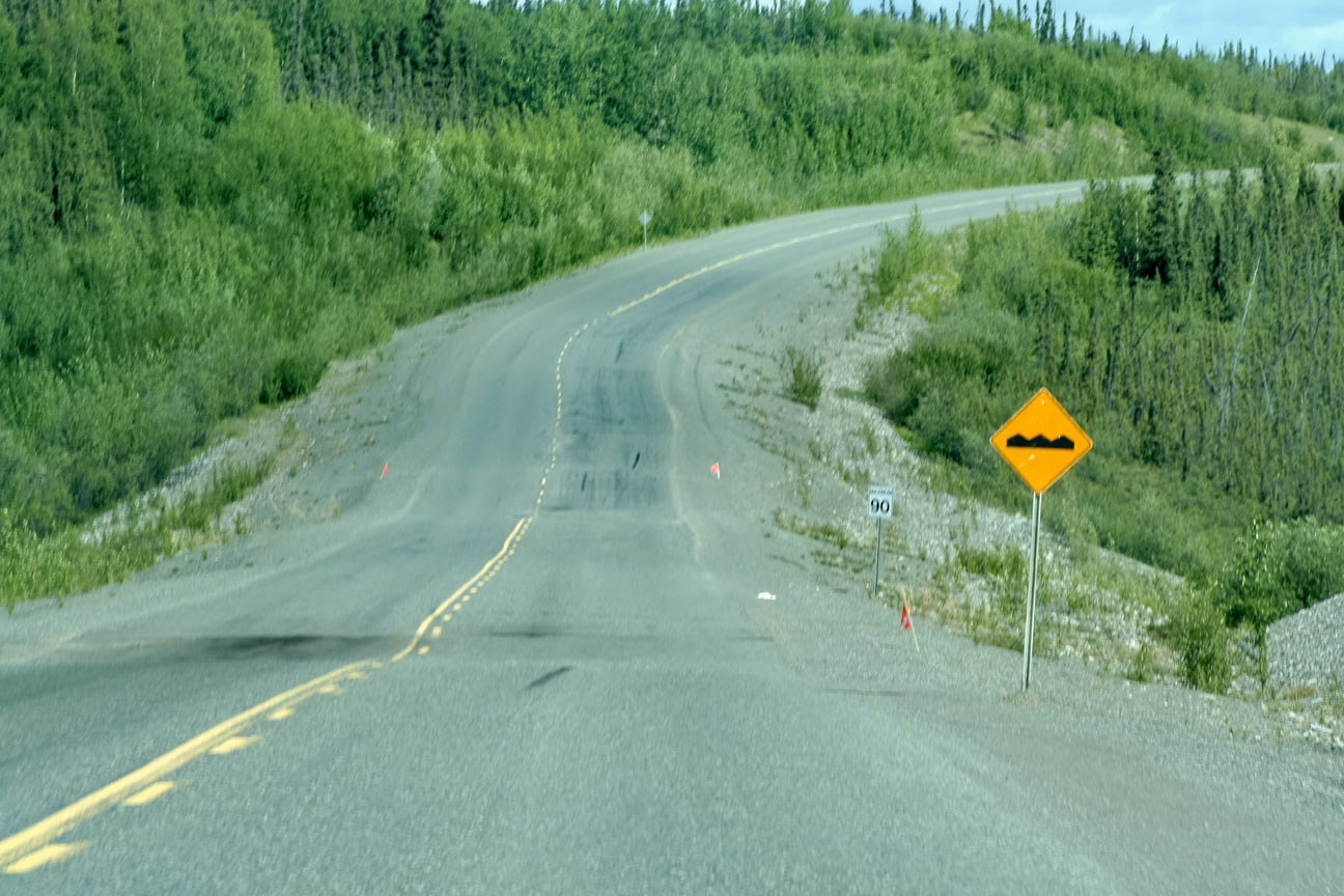
Frost heaves! Photo from Google Images.

The first 60 miles of the Taylor Highway was paved, if you could call it that. I’d never seen so many frost heaves—sections of road where the pavement has been buckled by expansion and contraction of the water-soaked soil beneath the road bed, which alternately freezes and thaws with the changing seasons. They’re usually marked, but not always; (they say you haven’t really lived until you’ve hit unexpected frost heaves at highway speed). Once that rippled pavement ended, the road pretty well went to the dogs. I’d never seen that many potholes! They would have been better off scraping away the last of asphalt and making a plain dirt road out of it.

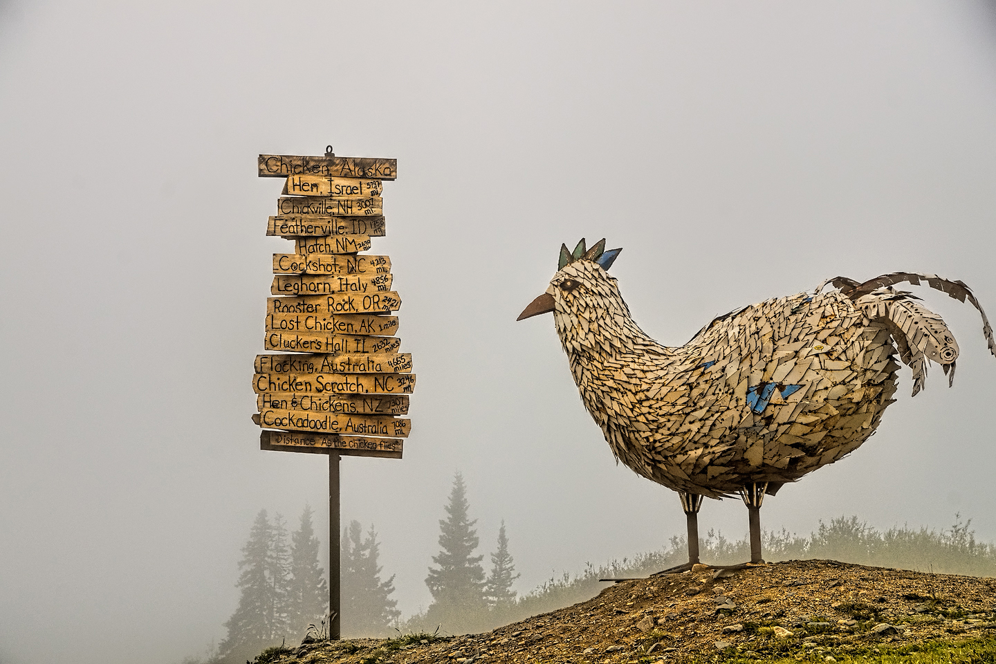
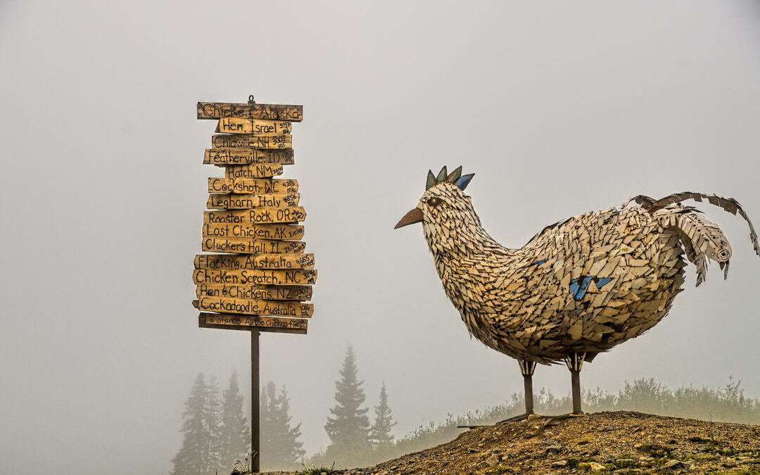
 Mr. Eggee, Chicken, Alaska

The area around Chicken was so foggy I could scarcely see the road at all. Chicken started as a mining camp during the Klondike Gold Rush, and it’s one of the very few such places that is still producing gold more than a century later. The mining operations have scaled back pretty dramatically, such that the primary industry in Chicken, with a permanent population of 12 souls, is tourism. Why call it “Chicken”? When the mining camp grew large enough to need a Post Office, back in 1902, residents had to come up with a name for the place.

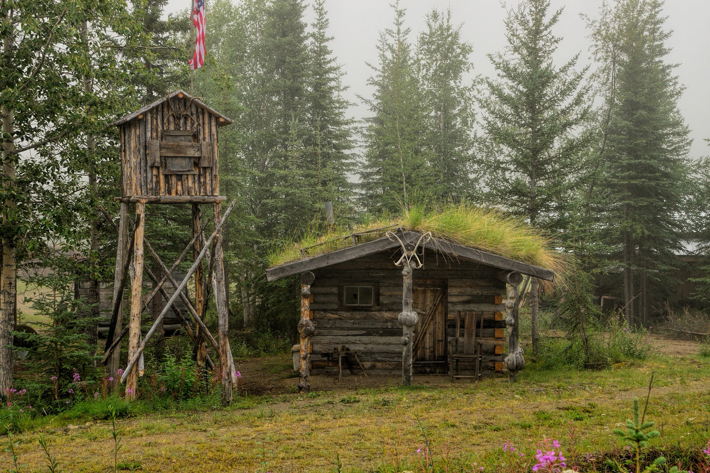
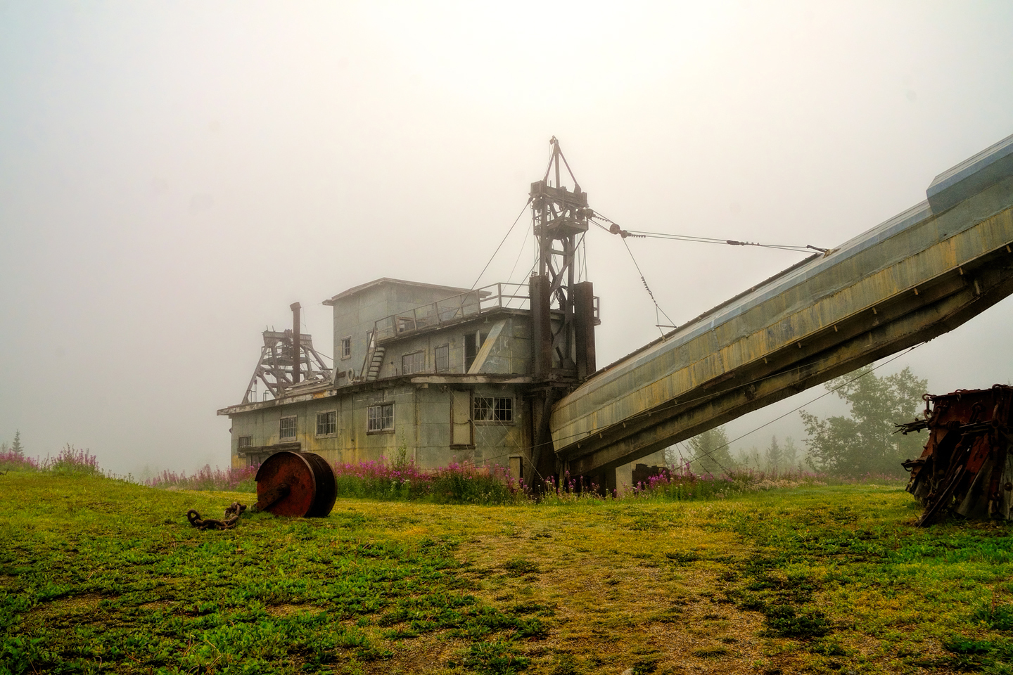
Miner’s cabin and abandoned gold dredge, scenes in Chicken, Alaska

They wanted to call their town Ptarmigan, which is the Alaska State Bird. Unfortunately, nobody knew how to spell Ptarmigan, so they settled on Chicken, and that’s what it’s been ever since. The Monumental Chicken sculpture is a relatively recent addition. Known as “Mr. Eggee,” the 12 foot tall barnyard fowl has an internal metal framework overlaid with metal “feathers” cut from recycled school lockers.  A high school welding teacher and his students made the beast for the annual Chickenstock Music Festival, back in 2012, then had it transported 600 miles from Homer to it’s current place of honor, on a hill above the Chicken Gold Camp RV Park.  

The price of gas in Chicken was the highest I’d seen, but I topped up my tank anyway, because there’s a simple truth about the price of fuel in that part of the world: Even the most expensive gas in Alaska is cheaper than any gas in Canada. Significantly higher taxes push Canada’s price at the pump into the stratosphere. Fuel is dispensed by the liter and priced in Canadian Dollars, so while you’re fueling, those dials spin faster than the reels on an old-fashioned slot machine.

It wasn’t looking good for those “partly cloudy” skies predicted in the weather forecast; you can never really rely on the weather report in that part of the world. I didn’t want to hang out in Chicken, didn’t want to go north to Eagle, and I wasn’t about to turn around and drive back to Tok, so I really only had one choice: I put my Jeep in gear, and drove east, to the Yukon!

It seemed like it took forever to cover the 30 miles to the road junction. When I started getting closer, the fog actually lifted, but not all the way, and it left a layer of haze in its wake that cut visibility to a mile at the most. That was disappointing, but I wasn’t giving up just yet.

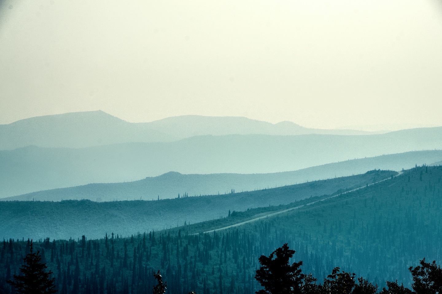
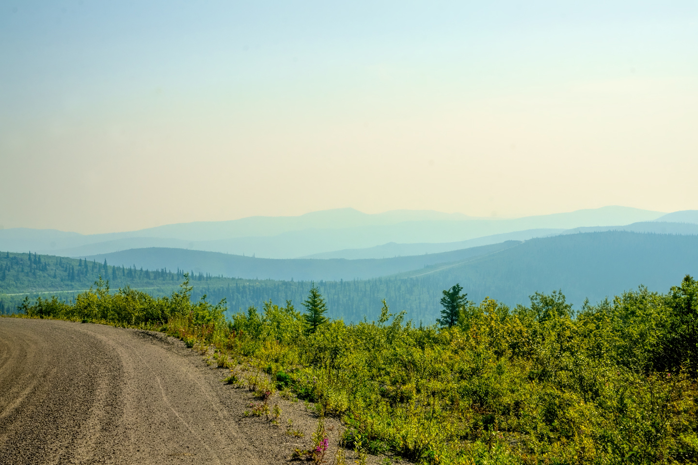
Hazy view from the Taylor Highway

The rough dirt road gave way to a newly paved modern highway. This was it, the Top of the World, and right on cue, the haze peeled back, just enough to give me a glimpse of the beauty my friends in Fairbanks assured me would be there:

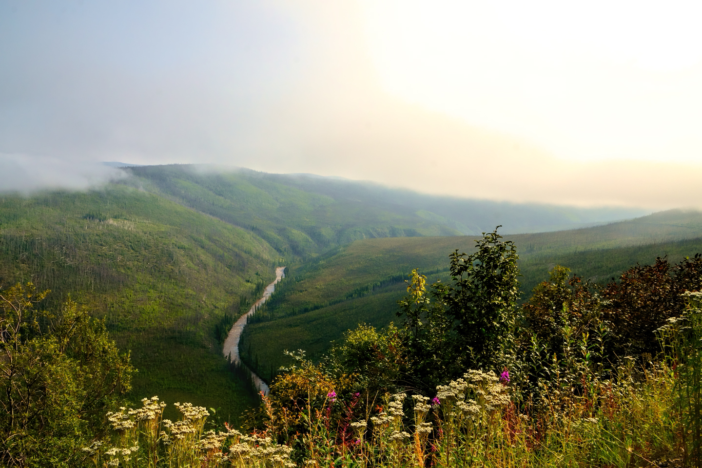
The view from the Top of the World Highway. Better than Denali? If the clouds had all lifted, who knows?

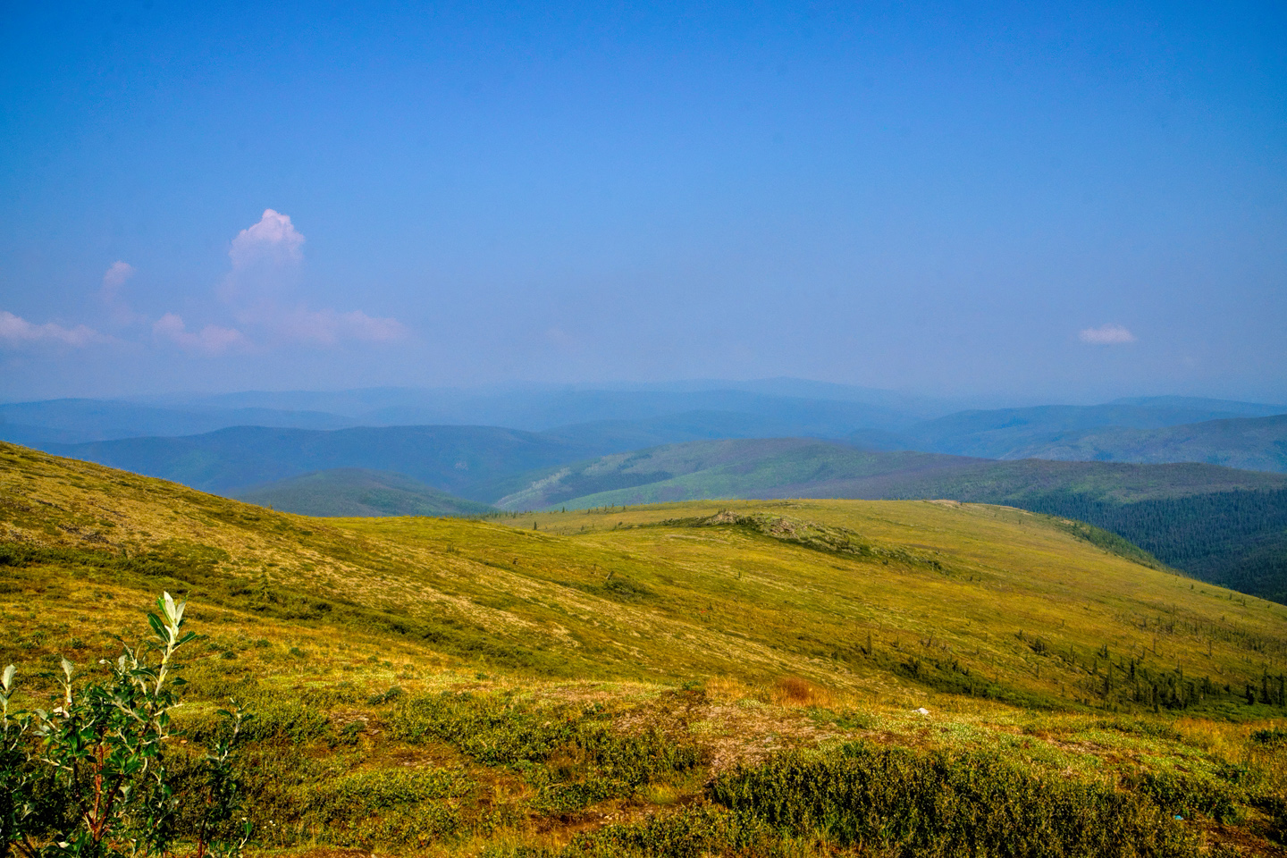
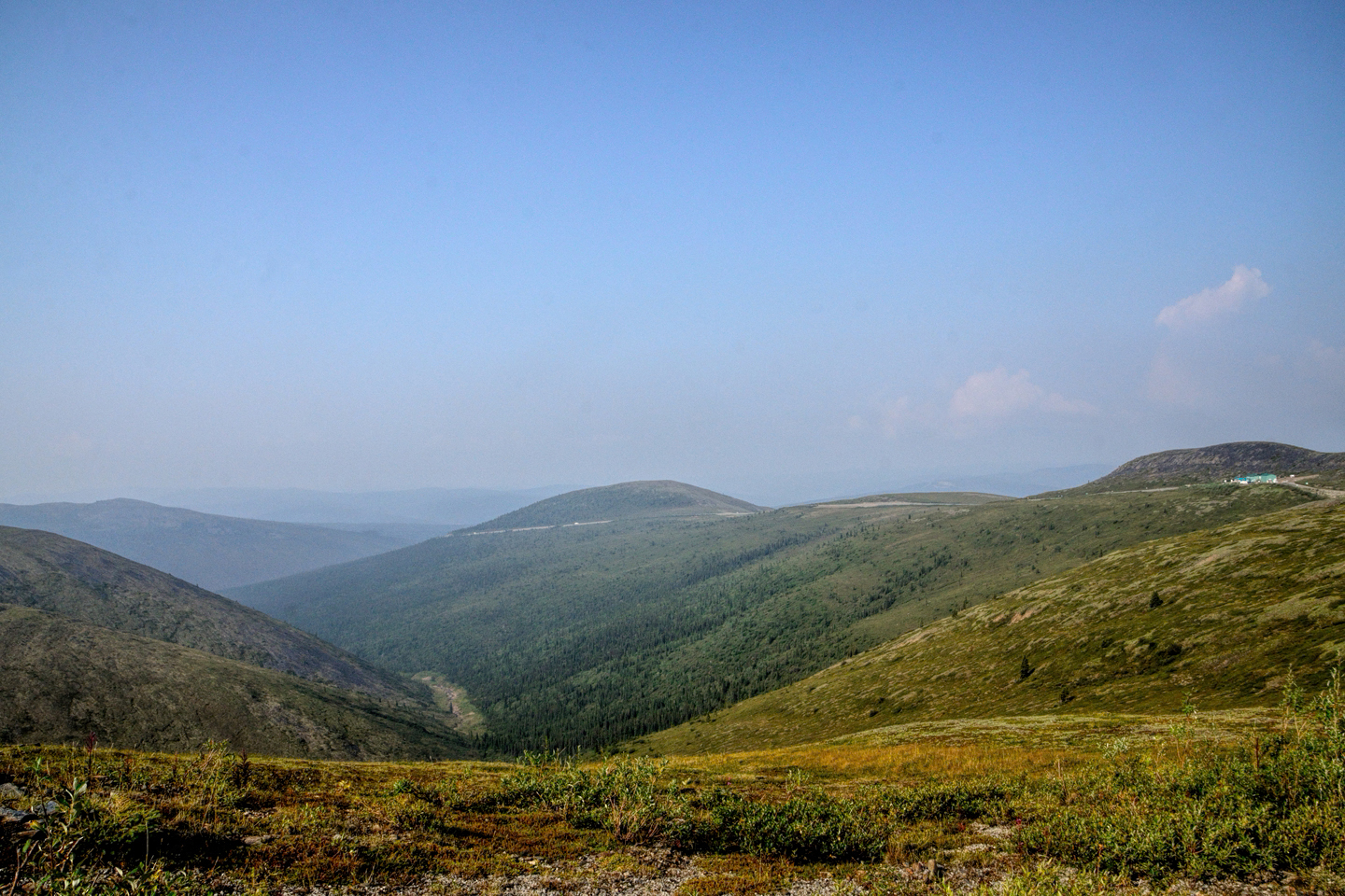
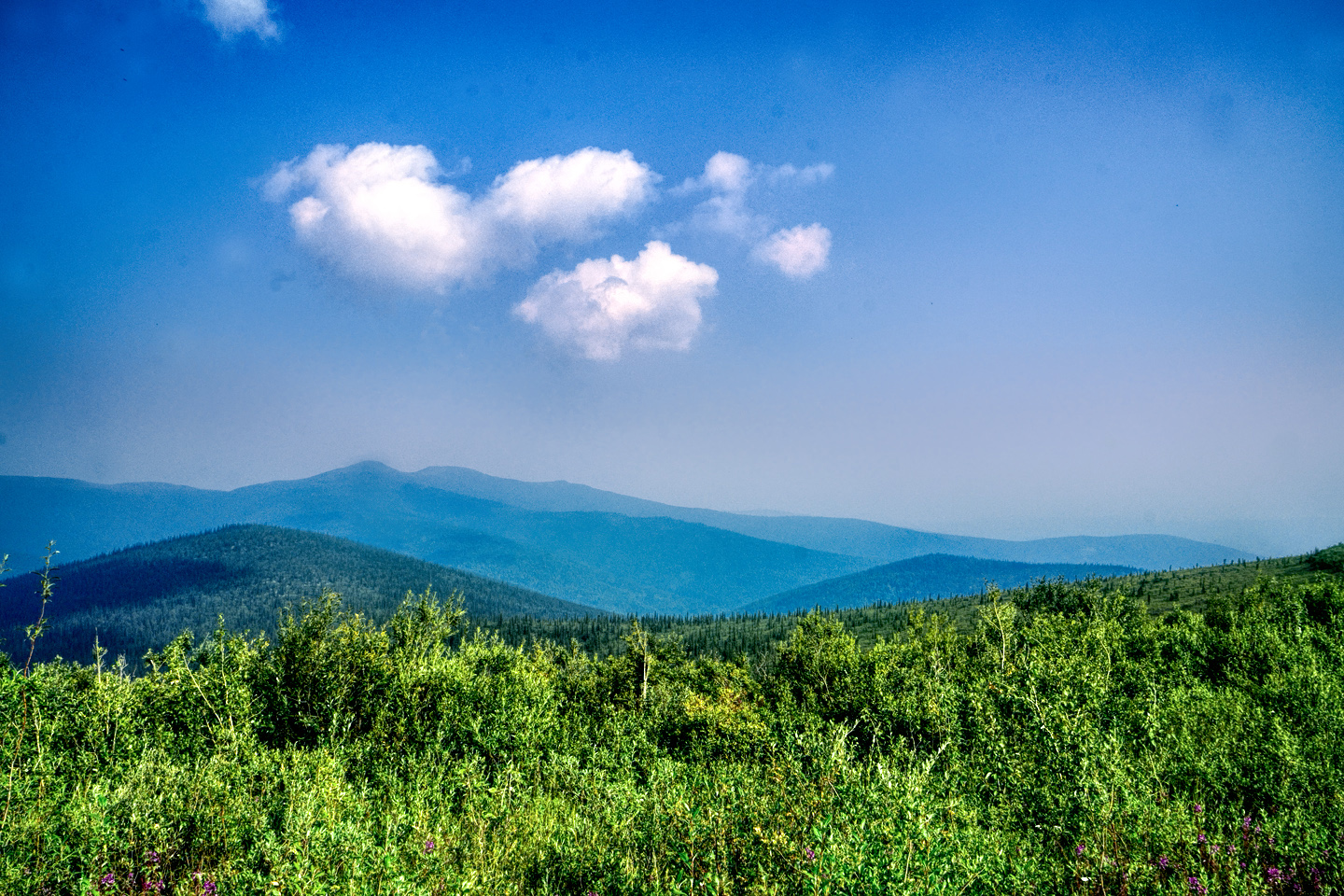
On a clear day, there would have been views of the snow-covered Alaska Range all along the horizon, and there’s no doubt that it would have been a beautiful sight. As for me, I had to be content with deep valleys flanked by verdant mountains rolling off into the distance, before disappearing into blank white space. There was another simple truth in evidence: on an Alaska Road Trip, just as in life, sometimes you just have to take what you can get!

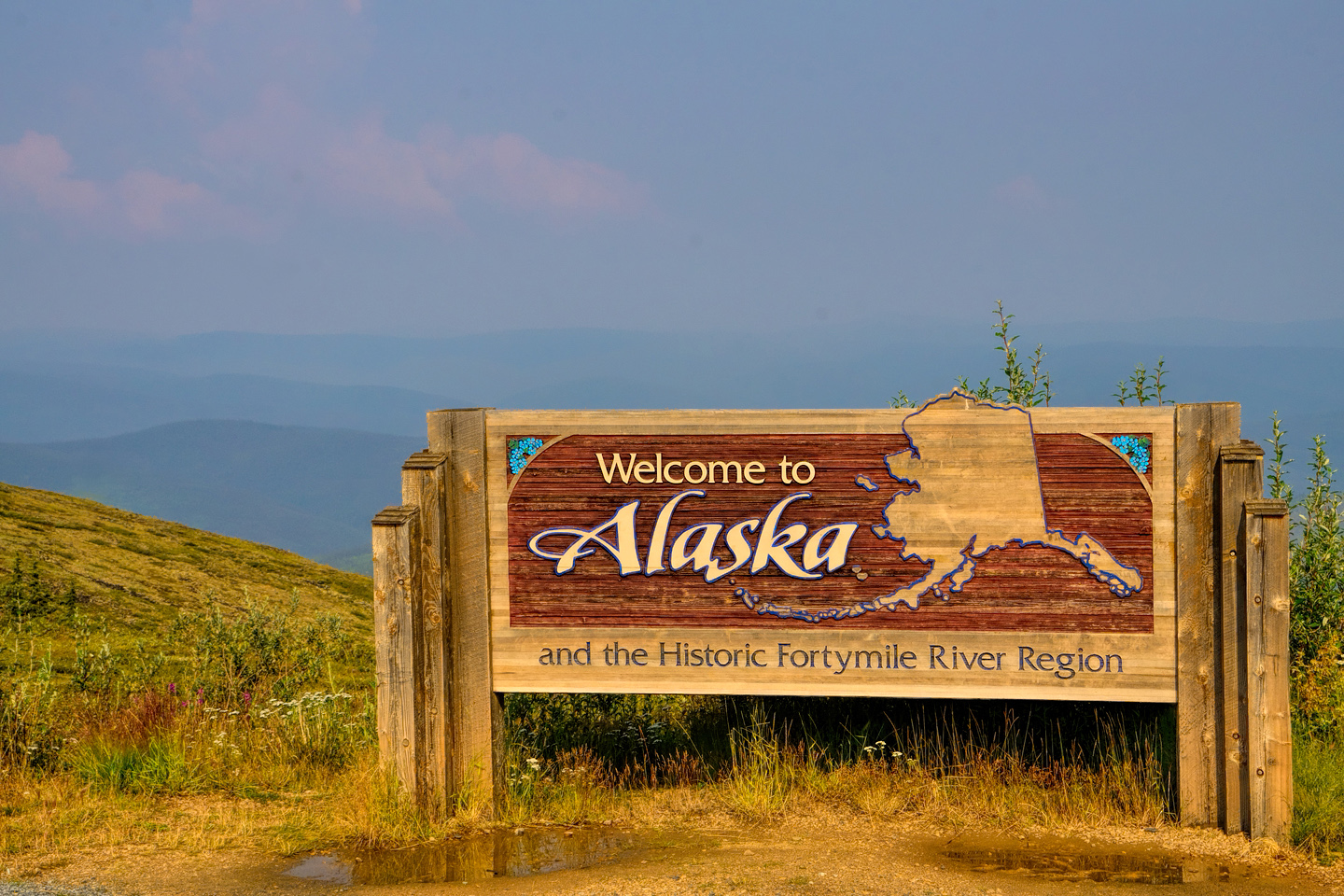
The first indication of the approaching border was the “Welcome to Alaska” sign, facing in the other direction, to greet travelers entering the state on this road. 

Poker Creek-Little Gold Creek Customs Post

Just around the bend from the sign was a long, low building painted green, the Poker Creek-Little Gold Creek Customs Post. The United States and Canada share the building, a rare circumstance in the realm of International borders, made even more unusual by the fact that Alaska and the Yukon are in different time zones, meaning one end of the building is an hour ahead of the other; a line painted on the floor marks the border inside the structure. This is a seasonal customs post, in both directions. The border, and by extension, the highway, is open only in the summer months, and only from 8AM to 8PM (Alaska Time); crossings are strictly disallowed outside those hours, and prominent signs make that perfectly clear. My Jeep was the only vehicle in sight, so I didn’t have to get in line, I just rolled up on the building and stopped. After a quick check of my identification, I was welcomed to Canada, no inspection required.

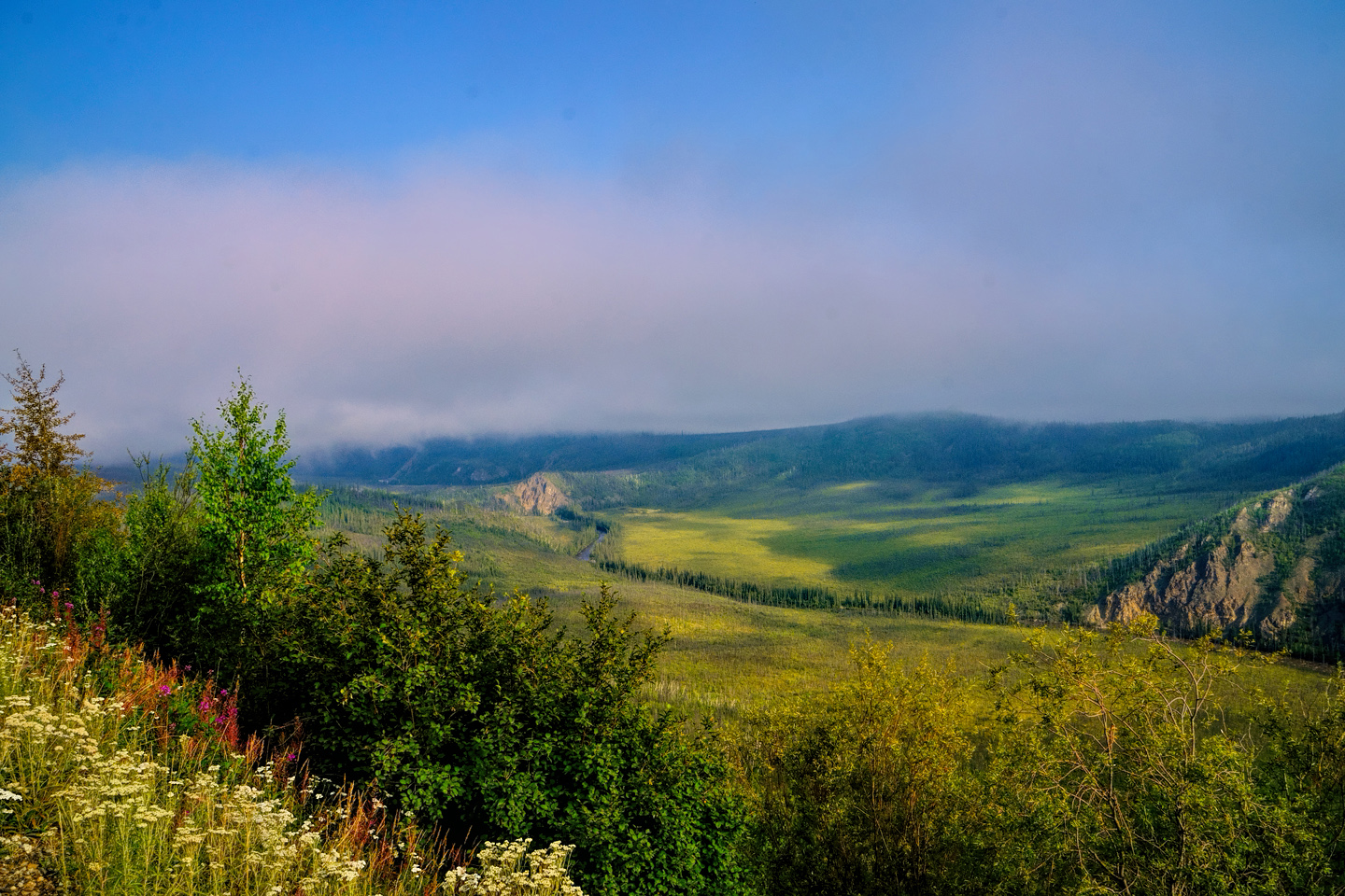
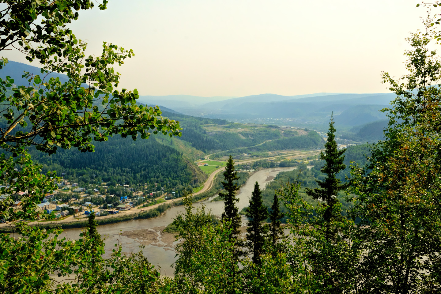
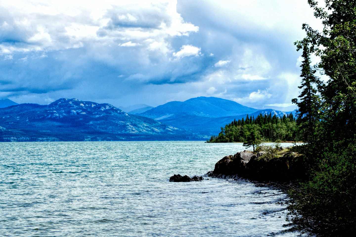
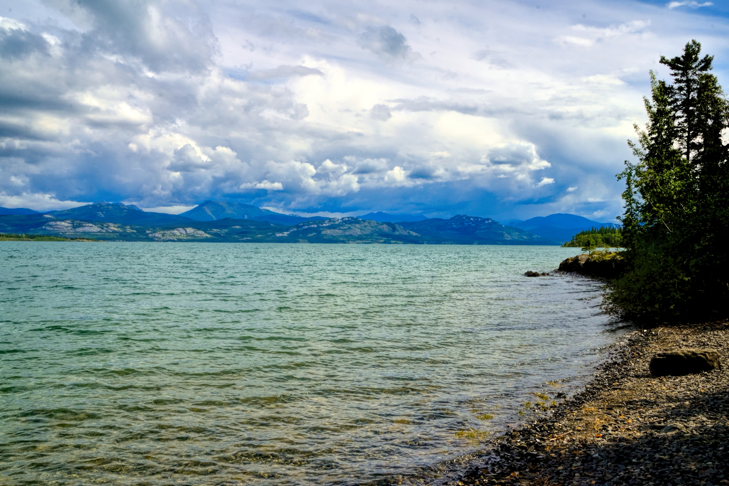
Approaching Dawson City, Yukon, on the Top of the World Highway

The Top of the World Highway continued east from the border, running along the crest of the ridges. The sky was clear overhead, but still hazy along the horizon, so I never did catch the full benefit of those “Top of the World” views. After 50 or 60 miles, the mostly gravel highway started dropping in elevation. I drove around a curve and stopped at a pullout above a bend in the Yukon River, and there, spread out below me, was the gold rush town of Dawson City, tucked in along the banks of the famous waterway.

There is no bridge over the Yukon River at Dawson City, so travelers on the Top of the World Highway, as well as any local people living west of the river, use the George Black Ferry to make their crossing. The ferry runs more or less continuously in the summer months; during the busiest times, the wait can be as much as three hours. Service stops in the winter, when the highway, and the border, are closed for the season. The river itself freezes during the winter. When the ice gets sufficiently solid, an ice road is created to provide access to West Dawson, but that’s as far as you can go until the spring thaw, when they plow the Top of the World, and resume ferry service.

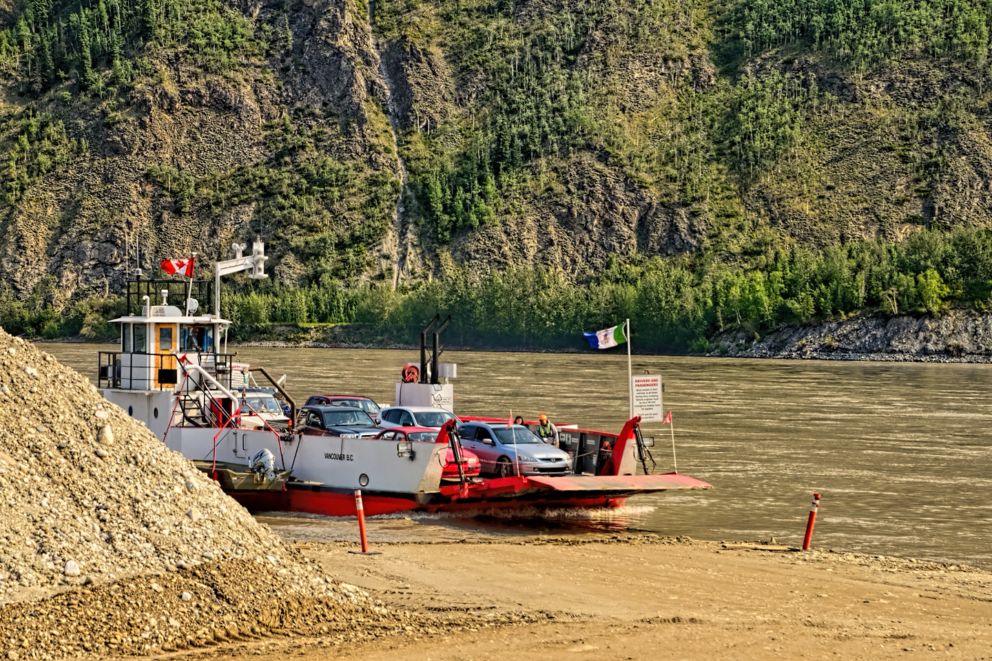
George Black Ferry, Dawson City, Yukon

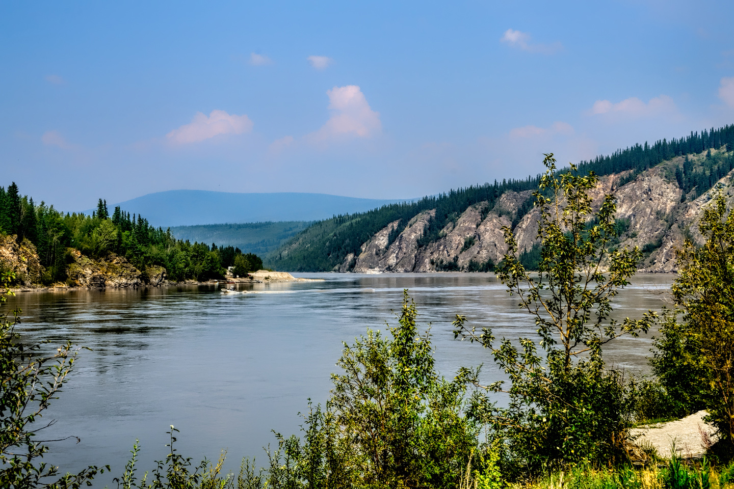
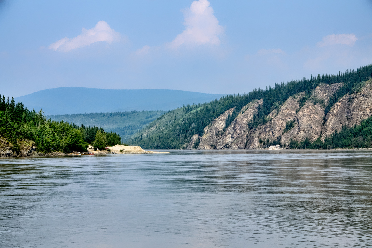
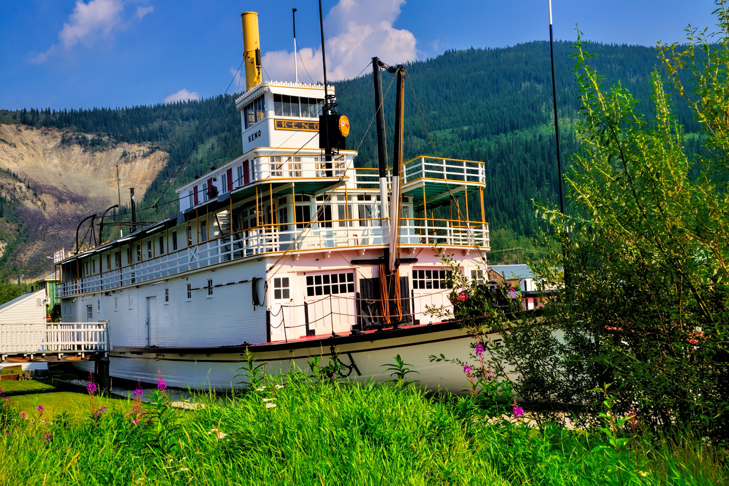
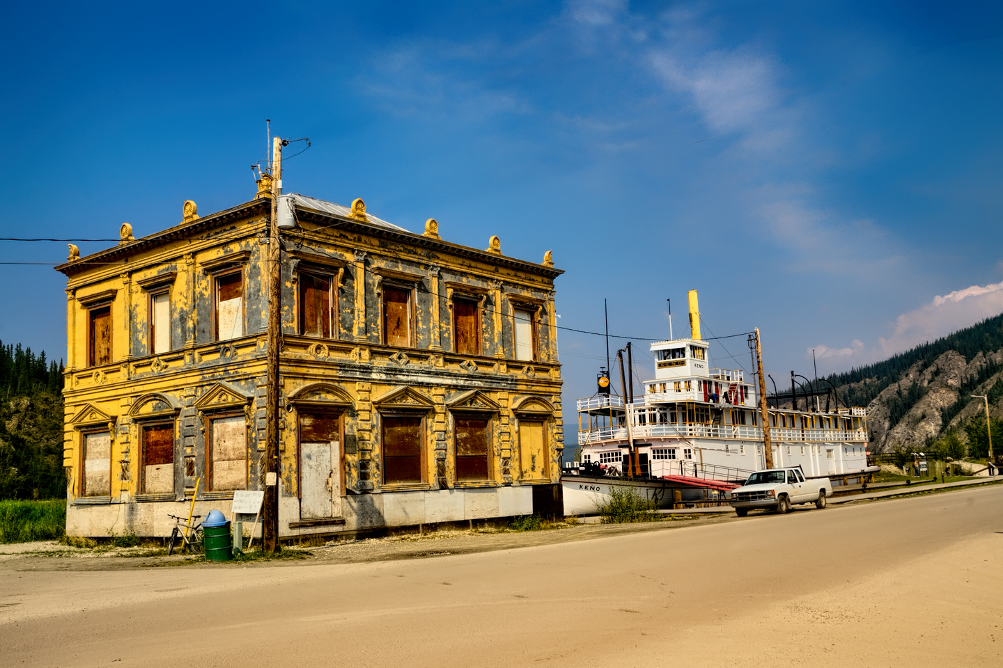
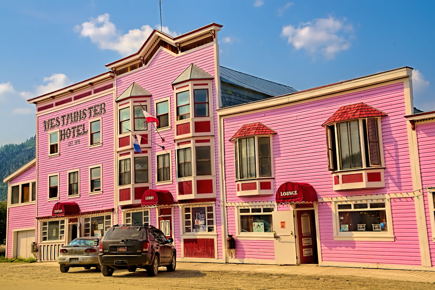
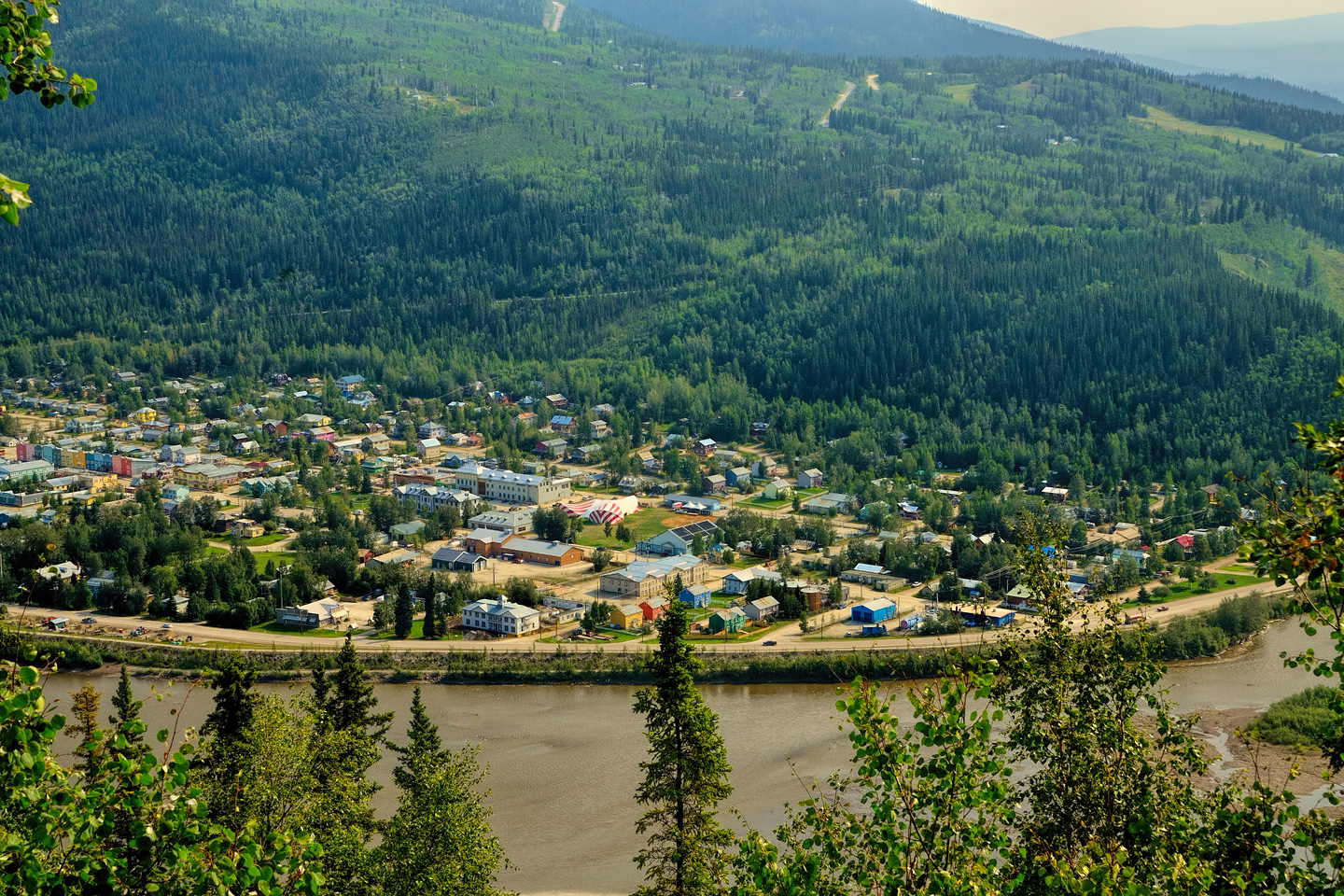
Scenes in and around Dawson City and the Yukon River

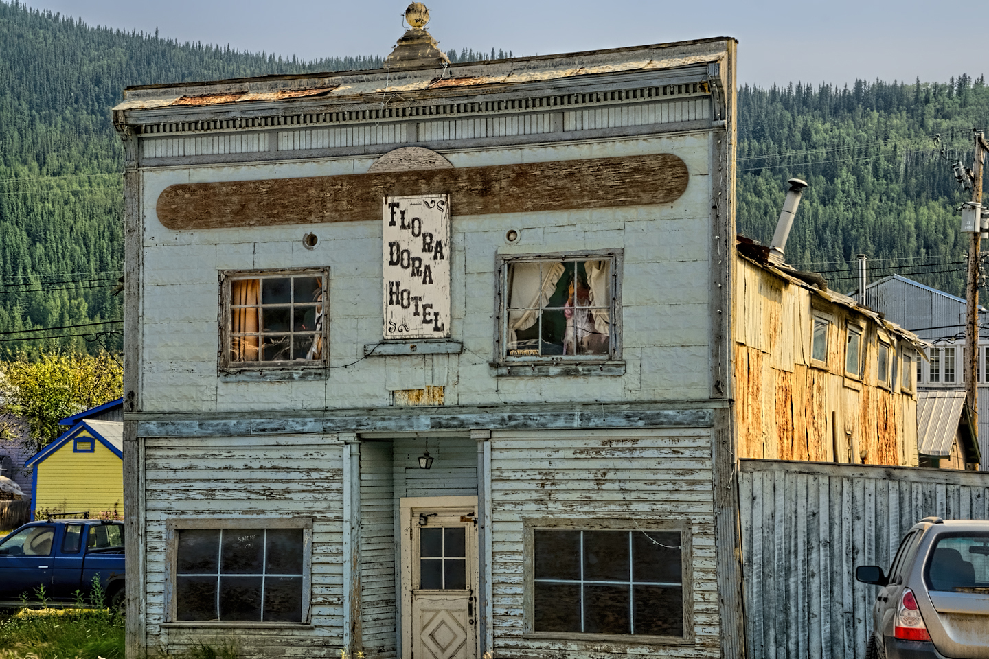
Dawson City is an interesting place. It was founded in 1896, on the site of what was once a fishing camp at the confluence of the Klondike and Yukon Rivers, and by 1898 it had become the primary staging area for thousands of hopeful gold prospectors, seeking their fortunes in the frozen rivers and streams of the Klondike. When the height of the gold fervor ended, in 1899, the population dropped from 16,000 to half that number, but it was still the biggest city in northern Canada, and the capital of the Yukon Territory for more than 50 years. The writer, Jack London, lived in Dawson City in those early years, so many of his most famous stories, including Call of the Wild, are set there.

Today, Dawson City is struggling a bit. When the Alaska Highway was built in the late 1940’s, the route that they chose passed through Whitehorse, missing Dawson by more than 300 miles. To say their economy suffered would be putting it mildly. Whitehorse replaced Dawson as the territorial capital in 1952, and the place went into serious decline. Half a century later, tourism picked up a bit, and because tourists need hotels, restaurants, and numerous services, the old town was at least partially revitalized. Dawson City is a VERY long way from anything else. Four to five hours from Tok via the Top of the World, and at least five hours from Whitehorse on the Klondike Highway.  You have to be reasonably serious about wanting to go there, so they’ve done their best to make it worth your while.

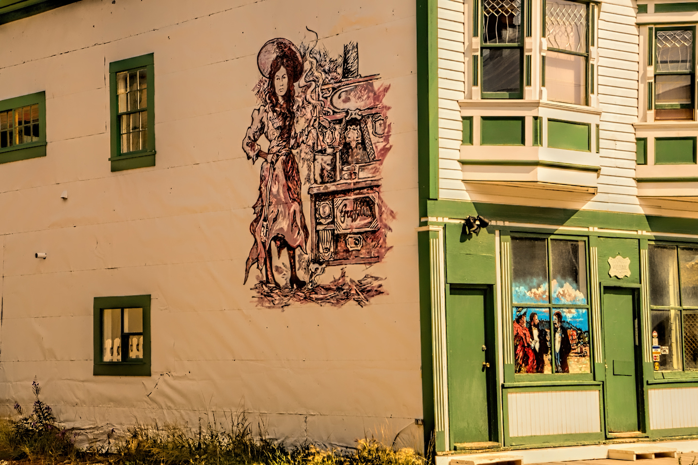
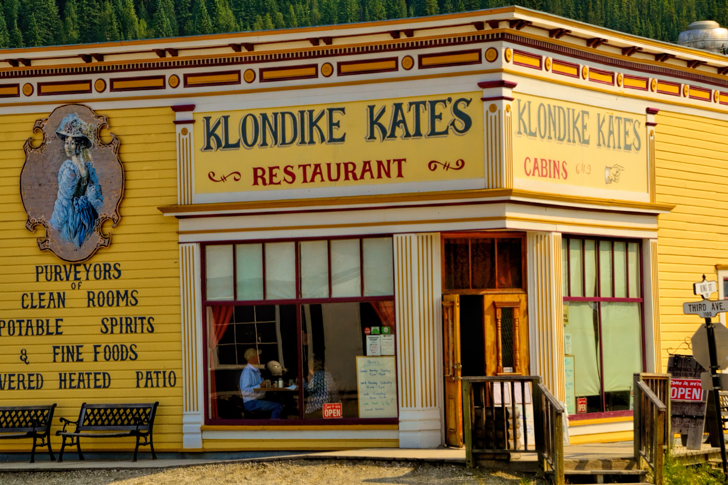
What I found when I passed through was a turn of the century gold rush town—partially restored, partially dilapidated original, hanging on tight to their 19th century ambience. The tourists tended to be senior citizens with RV’s, but among the locals, there were a lot of young people. There seemed to be sort of a hippy type community, mostly Canadians from other parts of the country, with a bit of an art and music scene. I stayed in an extremely funky hotel that was well beyond dilapidated. The floors were literally tilting, in several different directions, as if the building was on the brink of collapse.

Scenes along the Klondike Highway, and the Yukon River

The next day, I gassed up my Jeep, and headed south on the Klondike Highway, running parallel to the Yukon River most of the way. I didn’t see that much of the river, since it was mostly hidden by trees. I also didn’t see many other vehicles. In the first half of the drive, I passed two pickup trucks, and after that, I had the entire highway to myself for the next three hours. There wasn’t a single other vehicle, traveling in either direction. In 300 miles, there were no homesteads visible, and almost no towns. It wasn’t exactly desolate, but it had to be the loneliest stretch of highway I’ve ever driven.

This was essentially the same route followed by tens of thousands of desperate men during the gold rush, overland to the Yukon from the coast of Alaska, then up the Yukon River, by boat when it wasn’t frozen, and by any means possible the rest of the year. I tried to imagine it, just a bit more than a hundred years before, and it brought to mind the poems of Robert Service, the bard of the Yukon, who lived most of his life in Whitehorse. There was one poem of his that has always stuck in my mind. It’s a tale told in verse, about two men traveling the Dawson Trail in the dead of winter. One of them succumbs to the bitter cold, but before he dies, he extracts a promise from his partner:

I want you to swear that, foul or fair, you’ll cremate my last remains.”

The rest of the poem, The Cremation of Sam McGee. provides explicit details about the difficult execution of that task, but what’s always stayed with me is the first stanza:

There are strange things done in the midnight sun

By the men who moil for gold;

The Arctic trails have their secret tales

That would make your blood run cold;

The Northern Lights have seen queer sights,

But the queerest they ever did see

Was that night on the marge of Lake Lebarge

I cremated Sam McGee.

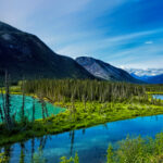
Lake Leberge, just outside Whitehorse, Yukon

Toward the end of my drive that day, just outside of Whitehorse, I saw a turnoff, and a sign beside the road that read Lake Leberge Campground. I followed the dirt road for maybe half a mile, until I came to a picnic area, on the shores of a large, deep blue lake. I got out of the Jeep and just stood there for a bit, surveying the scene; beautiful, but with the overcast skies and no other people around, it was a bit cold and desolate, even in summer.

I’ll be damned,” I said to myself. “I’m actually standing on the marge of Lake Lebarge!

The actual  Lake Leberge (which Service spelled “Lebarge,” to fit his rhyme) is actually a widening of the Yukon River that runs for 50 miles, and extends as much as five miles across. The whole thing freezes solid in the winter. Quite apart from its claim to fame in old poetry, it’s a popular recreation area for Whitehorse residents, and I could certainly see why.

Arriving back in Whitehorse was borderline surreal. I’d stayed the night there on my way to Alaska, and that first time through, the town seemed like an exotic, remote outpost, a place you could only get to after days on the road. The remote aspect was still true, but this time, because it seemed so familiar, it almost felt like home, or at least, the first step on the road back home. I’d been traveling for 39 days, and I was still at least 3,000 miles away from the end of the trip. My plan was to rendezous with a buddy who was flying up to meet me in Edmonton, and then we’d travel back south together, following the Rockies through the Canadian National Parks and on into Montana, Wyoming, and Utah. All of that went very well! If you’d like to read about it, start here: Canadian Road Trips: Rolling through the Rockies.

Click any map or photo to expand the images to full screen

This is the final post in this series. To return to the previous post, or to go back to the beginning, click the buttons below:

Some of the text and many of the photos in my Alaska Highway series first appeared on RoadTrip America’s website. A few years ago, I posted a detailed account of my entire 57 day, 13,000 mile “Mother of All Road Trips,” and RTA has kept that account available in their archive of Field Reports. If you’d like to read it, the link below will take you there:

The Mother of All Road Trips: From Arizona to Alaska and back through 24 National Parks!

A day-by-day account of my own drive to Alaska in 2015, as posted on RoadTrip America.

MORE ABOUT THE ALASKA HIGHWAY:

This is an interactive Table of Contents. Click the pictures to open the pages.

Alaska Road Trip

The Alaska Highway: Prelude: The Road to Dawson Creek

Even if you start in Seattle, the closest American city, it’s still more than 800 miles to Dawson Creek, wending your way that much further north, so far north that there will be a noticeable change in the hours of daylight. It’s the latitude that distinguishes the north country, including every bit of Alaska. Dawson Creek is where it all begins.

<<CLICK to Read More>>

The Alaska Highway: Day 1: Dawson Creek to Fort Nelson

Past Fort St. John, the terrain got a lot wilder. No more towns, very few people, and very little traffic. Saw a few U.S. license plates, Michigan, California, Oregon, South Carolina; people that were obviously headed to Alaska!

<<CLICK to Read More>>

The Alaska Highway: Day 2: Fort Nelson to Whitehorse

Every time I rounded a curve in the road there was another stupendous vista; it was nothing short of astonishing! I was literally yipping out loud, and a couple of times I actually pulled over and stopped while I pounded on my chest to “re-start” my heart!

<<CLICK to Read More>>

The Alaska Highway: Day 3: Whitehorse to Beaver Creek

Approaching the mountains, I started pulling over with serious frequency, taking LOTS of photos! Mountains, clouds, lakes, flowers—I was pretty sure I must have died and gone to heaven, but I couldn’t for the life of me remember the fiery crash.

<<CLICK to Read More>>

The Alaska Highway: Day 4: Beaver Creek to Fairbanks

Delta Junction, the end of the Al-Can, was only 200 miles away, and the border? Twenty miles, maybe half an hour, and I was finally going to cross into Alaska! I’d been on the road more than three weeks, and in just half a day more, I’d be in Fairbanks.

<<CLICK to Read More>>

Chena Hot Springs: A Fairbanks Original

The Chena hot spring puts out steaming water at a temperature of 150 degrees, producing enough power to meet all the needs of the resort, as well as filling the hot springs pools used by the guests. In addition to the lodge and restaurant, they offer camping and horseback riding, and they have exhibits featuring sled dogs, greenhouses, ice sculptures, and geothermal energy.

<<CLICK to Read More>>

Two-Foot High Kick: World Eskimo Indian Olympics

Contestants take a running leap, then they make this crazy jackknife move, touch the ball suspended high above the floor with both feet, then come back down and stick the landing. If that sounds difficult? You have no idea.

<<CLICK to Read More>>

Dreaming of Denali

When I drove my Jeep to Alaska that first summer after I retired, my main goal, the single most important thing I wanted to do, was to see Denali, the biggest mountain in North America.

<<CLICK to Read More>>

Follow the Fireweed

Visualize a summertime journey through that part of the world, a world filled with mountains and glaciers and boreal forests, ice blue rivers, turquoise lakes, and billowing clouds that fill the sky. Imagine your vision as a beautiful piece of music. The fundamental, underlying theme of that symphony would be a gently rising swell of perfect harmony, pinkish lavender in its hue. 

<<CLICK to Read More>>

Kenai Fjords National Park: Seabirds, Glaciers, and Whales on the Wild Coast of Alaska

At this latitude, during the summer months, the sun stays low in the sky all day, and never really goes down. The traditional “golden hour” when the light is best for landscape photos is extended accordingly, and there are more opportunities for great shots than you’ll know what to do with.

<<CLICK to Read More>>

Kenai Fjords National Park: Exit Glacier: Up Close and Personal

Compared to the huge tidewater glaciers that flow directly into the sea along the coast of Kenai Fjords, Exit Glacier is just a baby–a baby that’s getting smaller every year–but it’s still big enough to permanently alter the landscape through which it passes.

<<CLICK to Read More>>

Alaska Road Trip: Driving Alaska’s Grand Circle

Most of the major towns in Alaska, as well as three of the state’s incredible National Parks, can all be reached by driving Alaska’s Grand Circle: a loop route beginning in Tok that utilizes all four segments (1082 miles) of Alaska’s Interstate Highway system.

<<CLICK to Read More>>

Alaska Road Trip: The Grand Circle: From Tok to Denali

There are no icy mountains looming on the horizon, and Fairbanks is nowhere near Alaska’s ruggedly beautiful coast. The true beauty in Alaska’s second city is found below the surface, in the spirit and resiliance of the people who make the place their home.

<<CLICK to Read More>>

Alaska Road Trip: The Grand Circle: Anchorage and the Kenai Peninsula

The massive ice field in the park’s wild interior has spawned dozens of glaciers which, over the course of many millenia, have carved the landscape into fjords so heart-breakingly beautiful, humpback whales swim all the way from Hawaii just to cavort in the deep blue water.

<<CLICK to Read More>>

Alaska Road Trip: The Grand Circle: Wrangell-St. Elias National Park

So, just exactly how big is Wrangell-St. Elias National Park? You could combine Yellowstone with Yosemite, throw in the entire country of Switzerland, and you still wouldn’t match it in terms of size.

<<CLICK to Read More>>

Alaska Road Trip: Driving to the Top of the World

The rough dirt road gave way to a newly paved modern highway. This was it, the Top of the World, and right on cue, the haze peeled back, just enough to give me a glimpse of the beauty my friends assured me would be there…

<<CLICK to Read More>>

There’s nothing like a good road trip. Whether you’re flying solo or with your family, on a motorcycle or in an RV, across your state or across the country, the important thing is that you’re out there, away from your town, your work, your routine, meeting new people, seeing new sights, building the best kind of memories while living your life to the fullest.

Are you a veteran road tripper who loves grand vistas, or someone who’s never done it, but would love to try? Either way, you should consider making the Southwestern U.S. the scene of your own next adventure.

A few years ago I wrote a book about road trips in Arizona and New Mexico that’s a lot like this website, packed with interesting information, and illustrated with beautiful photographs. Check it out! You can find it on Amazon, and at all other major booksellers.

ALASKA ROAD TRIP:

Alaska Road Trip: The Grand Circle: Wrangell-St. Elias National Park

So, just exactly how big is Wrangell-St. Elias National Park? You could combine Yellowstone with Yosemite, throw in the entire country of Switzerland, and you still wouldn’t match it in terms of size.

Alaska Road Trip: The Grand Circle: Anchorage and the Kenai Peninsula

The massive ice field in the park’s wild interior has spawned dozens of glaciers which, over the course of many millenia, have carved the landscape into fjords so heart-breakingly beautiful, humpback whales swim all the way from Hawaii just to cavort in the deep blue water.

Alaska Road Trip: The Grand Circle: From Tok to Denali

There are no icy mountains looming on the horizon, and Fairbanks is nowhere near Alaska’s ruggedly beautiful coast. The true beauty in Alaska’s second city is found below the surface, in the spirit and resiliance of the people who make the place their home.

Alaska Road Trip: Driving Alaska’s Grand Circle

Most of the major towns in Alaska, as well as three of the state’s incredible National Parks, can all be reached by driving Alaska’s Grand Circle: a loop route beginning in Tok that utilizes all four segments (1082 miles) of Alaska’s Interstate Highway system.

Kenai Fjords National Park: Exit Glacier: Up Close and Personal

Compared to the huge tidewater glaciers that flow directly into the sea along the coast of Kenai Fjords, Exit Glacier is just a baby–a baby that’s getting smaller every year–but it’s still big enough to permanently alter the landscape through which it passes.

Kenai Fjords National Park: Seabirds, Glaciers, and Whales on the Wild Coast of Alaska

As the tremendous weight of the moving glacier pushes forward, the pressure buckles the ice into fantastic pillars and columns, like frozen fairy castles gleaming translucent blue as the suspended glacial sediment refracts the sunlight.

Two-Foot High Kick: World Eskimo Indian Olympics

Contestants take a running leap, then they make this crazy jackknife move, touch the ball suspended high above the floor with both feet, then come back down and stick the landing. If that sounds difficult? You have no idea.

Dreaming of Denali

When I drove my Jeep to Alaska that first summer after I retired, my primary goal, the single most important thing I wanted to do, was to see Denali, the biggest mountain in North America.

Chena Hot Springs: A Fairbanks Original

The Chena hot spring puts out steaming water at a temperature of 150 degrees, producing enough power to meet all the needs of the resort, as well as filling the hot springs pools used by the guests. In addition to the lodge and restaurant, they offered camping and horseback riding, and they had exhibits featuring sled dogs, greenhouses, ice sculptures, and geothermal energy.

The Alaska Highway: Day 4: Beaver Creek to Fairbanks

Delta Junction, the end of the Al-Can, was only 200 miles away, and the border? Twenty miles, maybe half an hour, and I was finally going to cross into Alaska! I’d been on the road more than three weeks, and in just half a day more, I’d be in Fairbanks.

The Alaska Highway: Day 3: Whitehorse to Beaver Creek

Approaching the mountains, I started pulling over with serious frequency, taking LOTS of photos! Mountains, clouds, lakes, flowers—I was pretty sure I must have died and gone to heaven, but I couldn’t for the life of me remember the fiery crash.

The Alaska Highway: Day 2: Fort Nelson to Whitehorse

Every time I rounded a curve in the road there was another stupendous vista; it was nothing short of astonishing! I was literally yipping out loud, and a couple of times I actually pulled over and stopped while I pounded on my chest to “re-start” my heart!

The Alaska Highway: Day 1: Dawson Creek to Fort Nelson

Past Fort St. John, the terrain got a lot wilder. No more towns, very few people, and very little traffic. Saw a few U.S. license plates, Michigan, California, Oregon, South Carolina; people that were obviously headed to Alaska!

The Alaska Highway: Prelude: The Road to Dawson Creek

Even if you start in Seattle, the closest American city, it’s still more than 800 miles to Dawson Creek, wending your way that much further north, so far north that there will be a noticeable change in the hours of daylight. It’s the latitude that distinguishes the north country, including every bit of Alaska. Dawson Creek is where it all begins.

Follow the Fireweed

Visualize a summertime journey through that part of the world, a world filled with mountains and glaciers and boreal forests, ice blue rivers, turquoise lakes, and billowing clouds that fill the sky. Imagine your vision as a beautiful piece of music. The fundamental, underlying theme of that symphony would be a gently rising swell of perfect harmony, pinkish lavender in its hue.

MEXICAN ROAD TRIP (IN THE LAND OF THE MAYA):

Mexican Road Trip: Back to the Border: San Miguel de Allende to Eagle Pass

Saltillo was our crossroads: if we turned east here, we’d be retracing our previous route to the border at Nuevo Laredo (along the Highway of Death). This time, we knew better, so we turned north, toward Monclova, and Piedras Negras.

Mexican Road Trip: Three Days of the Dead in San Miguel de Allende

By mid-afternoon, the Jardin was beginning to fill with people. Painted faces were literally everywhere! It was like a costume party, but the venue wasn’t some hall or other indoor space, it was the whole entire town! Mike and I were definitely getting into the spirit of the thing–but we still drew the line at the notion of painting our beards…

Dia de Los Muertos: A Gallery of Photographs

A smorgasbord of colorful images, capturing the essence of the vibrant festival known as the Dia de Los Muertos, in the charming colonial city of San Miguel de Allende.

Mexican Road Trip: Flashing Lights in the Rear View: Officer Plata and La Mordida

As we drove away from the toll plaza, a State Police car that had been parked off to one side made a fast U-Turn and started following me. A moment later, he turned on his flashers and gave me a short blast on his siren, motioning for me to pull over. Two uniformed policemen got out, and approached me on the driver’s side. One of them hung back, apparently checking out my license plate before making a phone call.

I wasn’t sure if I was being stopped for some infraction, or if these guys were just fishing…

Mexican Road Trip: Cruising the Sierra Madre, from San Cristobal to Oaxaca

Today, we’d be driving as far as the city of Oaxaca, 380 miles of curves, switchbacks, and rolling hills that would require at least ten hours of our full attention, crossing the Sierra Madre de Chiapas, and entering the rugged, agave studded landscape of the Sierra Madre de Oaxaca. If you’d like to know what that was like, read on!

Mexican Road Trip: Crossing the Chiapas Highlands, to San Cristobal de las Casas

MX 199 crosses the Chiapas Highlands from Palenque to San Cristobal de las Casas. The distance is only 132 miles, but it’s 132 miles of curvy mountain roads with switchbacks, steep grades, slow trucks, and villages chock-a-block with topes and bloqueos, unofficial road blocks. Everything I read, and everything I heard, described the drive as  alternatively spectacular, dangerous, and fascinating, in seemingly equal measure.

Mexican Road Trip: The Road to Bonampak

Rainwater seeping through the limestone walls of the temple soaked the Bonampak Murals with a mineral-rich solution that, each time it dried, left behind a sheen of translucent calcite. The built-up coating protected the paintings for more than 1200 years. As a result, we’re left with the finest examples of ancient art from the Americas to have survived into our modern era.

Mexican Road Trip: Adventures along the Puuc Route

All of these communities in the Puuc region were allied, politically, culturally, economically, and socially. The Puuc was the cradle of the Golden Age of the Maya. Labna and Sayil were among the brightest jewels in the crown of a realm that never quite coalesced into an empire.

Mexican Road Trip: Edzná, and Campeche, Where They Dance La Guaranducha!

La Guaranducha, a traditional dance from Campeche, is a celebration of life, community, and the joy of existence. On stage, there was a group of young men and women in traditional dress, but it was clear that the guys were little more than props, because all eyes were on the girls. So colorful, and so elegant, hiding coyly behind their pleated, folding hand fans.

Mexican Road Trip: Circling the Yucatan, from Quintana Roo to Campeche

The Castillo at Muyil isn’t huge, as Mayan pyramids go, topping out at just over 50 feet, but it’s definitely imposing. Try to imagine: the equivalent of a five story building, with a three story grand staircase, just appearing, out in the middle of nowhere? Boo-yah!

Mexican Road Trip: Cancun, Tulum, and the Riviera Maya

The millions of tourists who fly directly to Cancun from the U.S. or Canada are seeing the place out of context. They can’t possibly appreciate the fact that they’re 2,000 miles south of the border; a whole country, a whole culture, a whole history away from the U.S.A. Just looking around, on the surface? The second largest city in southern Mexico could easily pass for a beach town in Florida.

Mexican Road Trip: Uxmal vs Chichén Itzá

From the parking lot, the building where they sell the tickets to Uxmal looks a bit like the entrance to a shopping mall, or a multiplex, but the moment you step through the door, you’ll discover that it’s actually a time machine. That entryway is a portal to the world of the ancient Maya, a thousand years into the past. 

Mexican Road Trip: Merida and the Meridanos

Merida is the largest city in southern Mexico, with a population of almost a million. Statistically, Yucatan is the safest of Mexico’s states, and Merida is widely considered the safest of all Mexico’s cities.

Mexican Road Trip: Mayan Ruins and Waterfalls in the Lacandon Jungle

The next morning, we were waiting at the entrance to the Archaeological Park a half hour before they opened for the day. We were the only ones there, so they let us through early, and I had the glorious privelege of photographing that wonderful ruin in the golden light of early morning, without a single fellow tourist cluttering my view.

Mexican Road Trip: Zapatista Road Blocks in Chiapas

“Good morning,” I said. “We’re driving to Palenque. Will you allow us to pass?”

The leader of the group, a young Mayan lad, walked up beside my Jeep, and fixed me with a menacing glare. “The road is closed,” he said, keeping his hand on the hilt of his machete. “By order of the Ejército Zapatista de Liberación Nacional!”

“Is it closed to everyone?” I asked innocently. “How about if we pay a toll? How much would the toll be?”

He gave me an even more menacing glare. “That will cost you everything you’ve got,” he said gruffly, brandishing his machete, while his companions did the same.

Mexican Road Trip: Heading South, from Laredo to Villahermosa

When it was our turn, soldiers in SWAT gear surrounded my Jeep, and an officer with a machine gun gestured for me to roll down my window. He asked me where we were going. I’d learned my lesson in customs, and knew better than to mention the Yucatan. “We’re going to Monterrey,” I said, without elaborating.

He checked our ID’s and our travel documents, then handed them back. “Don’t stop along the way,” he advised. “You need to get off this road and to a safe place as quickly as you can!”

Mexican Road Trip: How to Plan and Prepare for a Drive to the Yucatan

The published threat levels are a “full-stop” deal breaker for the average tourist. That’s unfortunate, because Mexican road trips are fantastic! Yes, there are risks, but all you have to do to reduce those risks to to an acceptable level is follow a few simple guidelines.

Day of the Dead in San Miguel de Allende

In San Miguel de Allende, they’ve adopted a variation on the American version of Halloween and made it a part of their Day of the Dead celebration. Costumed children circle the square seeking candy hand-outs from the crowd of onlookers. It’s a wonderful, colorful parade that’s all about the treats, with no tricks!

Chichén Itzá: Requiem for the Feathered Serpent

The feathered serpent with the unquenchable thirst for blood may be gone now, or at least fallen out of favor, but as long as the ruins of this ancient city remain standing, he won’t be forgotten.

Tulum: The City that Greets the Dawn

Tulum is not all that large, as Mayan cities go, but its spectacular location, right on the east coast of the Yucatan Peninsula, makes it one of the best known, and definitely one of the most picturesque. 

The Mayan City of Edzná, First House of the Itzás

The Mayan city of Edzná is nothing less than epic, lyrical poetry, an extraordinary sonnet comprised of temples and palaces carved in stone that have stood, in regal grandeur, for more than a thousand years.

Uxmal: Architectural Perfection in the Land of the Maya

The Pyramid of the Magician is the most impressive monument I’ve ever seen. There’s a powerful energy in that spot–something to do with all the blood that was spilled on the altars of human sacrifice at the top of those impossibly steep steps. More than any ancient ruin I’ve ever visited, more than any demonic ancient sculpture I’ve ever seen, that pyramid at Uxmal flat scared the hell out of me!

The Amazing Mayan Murals of Bonampak

Out of that handful of Mayan sites where mural paintings have survived, there is one in particular that stands head and shoulders above the rest. One very special place. Down by the Guatemalan border, in a remote corner of the Mexican State of Chiapas: a small Mayan ruin known as Bonampak.

Palenque: Mayan City in the Hills of Chiapas

Palenque! Just hearing the name conjures images of crumbling limestone pyramids rising up out of the the jungle, of palaces and temples cloaked in mist, ornate stone carvings, colorful parrots and toucans flitting from tree to tree in the dense forest that constantly encroaches, threatening to swallow the place whole.

San Miguel de Allende, Mexico’s Colonial Gem

If you include the chilangos, (escapees from Mexico City), close to 20% of the population of San Miguel de Allende is from somewhere else, a figure that includes several thousand American retirees.

Southern Colonials: Merida, Campeche, and San Cristobal

Visiting the Spanish Colonial cities of Mexico is almost like traveling back in time. Narrow cobblestone streets wind between buildings, facades, and stately old mansions that date back three hundred years or more, along with beautiful plazas, parks, and soaring cathedrals, all of similar vintage.

The Puuc Hills: Apex of Mayan Architecture

The Puuc style was a whole new way of building. The craftsmanship was unsurpassed, and some of the monumental structures created in this period, most notably the Governor’s Palace at Uxmal, rank among the greatest architectural achievements of all time.

Becan and Chicanna: Mayan Cities in the Rio Bec Style

Much about the Rio Bec architectural style was based on illusion: common elements include staircases that go nowhere and serve no function, false doorways into alcoves that end in blank walls, and buildings that appear to be temples, but are actually solid structures with no interior space.

Coba and Muyil: Mayan Cities in Quintana Roo

Coba was a trading hub, positioned at the nexus of a network of raised stone and plaster causeways known as the sacbeob, the white roads, some of which extended for as much as 100 kilometers, connecting far-flung Mayan communities and helping to cement the influence of this powerful city.

Photographer’s Assignment: Chichen Itza

To get the best photos, arrive at the park before it opens at 8 AM. There will only be a handful of other visitors, and you’ll have the place practically all to yourself for as much as two hours! Take your time composing your perfect shot.There won’t be a single selfie stick in sight.

ARIZONA AND NEW MEXICO:

San Xavier del Bac: The White Dove of the Desert

San Xavier has all of the traditional elements of a Spanish Colonial church, along with many others that are quite unique. The craftsmanship of the original building is superb, and features many fascinating details.

Granada Park: An Avian Oasis in the Heart of Phoenix

Granada Park is a City Park that’s adjacent to a Mountain Preserve. Its location, along with certain other advantages, make it unique in some very specal ways.

A Sunset at White Sands

Dropping down out of the Sacramento Mountains near Alamogordo, the sky was filled with the colors of the widest rainbow I’ve ever seen. Down on the flat, another rainbow came spearing down through the clouds before setting out in pursuit of a downpour, off in the middle distance.

New Mexico’s Golden Autumn

When you think of autumn foliage, the list of places that comes to mind is much more likely to include New England than New Mexico–but the Land of Enchantment is full of fall surprises!

Grand Canyon Rafting

You find a rope, any rope, and you grab on with both hands for all you’re worth. The river boils like the North Sea in a gale, great, rolling green waves and troughs. The raft plummets sideways into a hole fifteen feet deep, the outboard motor shrieks, a monster wave towering ten feet above your head comes crashing down across the deck, pummeling the passengers like a gigantic liquid fist that takes your breath away, leaving you suspended, time stopped, frozen in mid-scream.

Grand Canyon Rafting Expedition: Day One

The two rafts were shoved away from the beach until they floated free, and the boat drivers eased them into the middle of the channel.  We were mostly moving with the current, but the beach dropped behind us pretty quickly, and in a matter of minutes we were out there, rafting down the Colorado River, heading squarely into the enchanted depths of the Grand Canyon.

Grand Canyon Rafting Expedition: Day Two

The cliffs and buttes were a perfect composition, the different colored layers of stone were all but glowing in the afternoon light, and we had this incredible world all to ourselves, not another boat in sight. 

Grand Canyon Rafting Expedition: Day Three

The waters of the Little Colorado are a turquoise blue that is so startlingly bright it doesn’t even look real.  There’s a well-defined spot where that warm, turquoise blue water from the small river collides with the cold, deep green water flowing upstream from the big river. The two dramatically different colors mix, forming a shifting, swirling line of chartreuse.  That spot is the confluence. It’s magical, and utterly unique.

Grand Canyon Rafting Expedition: Day Four

I was still a little dazed by the whole thing, scenes of frothing, churning whitewater playing over and over in my head.  Fleecy white clouds were piling up above the canyon rim, nearly filling the narrow patch of sky, until the lowering sun set them afire, a Grand Canyon sunset display that was the finest we’d seen, worthy of the spectacular setting.  A fitting end to one of the most amazing days of my life.

Grand Canyon Rafting Expedition: Day Five

The trail meandered for a mile or so, finally giving us access to a series of perfect swimming holes.  There’s something about that exotic turquoise water that welcomes swimmers; the creek was cool, but far from cold, and a welcome change from the icy water in the river.  We stopped at an inviting spot to swim, relax, and eat our lunch. Sitting beside that creek, with our simple repast–it was like having a picnic in the Garden of Eden. 

Grand Canyon Rafting Expedition: Day Six

“Two Hander!” John called out, and we all clung to the ropes for dear life as the raft picked up speed.  We were headed straight for the boil of Lava Falls, roaring like a freight train, bearing down. We entered the churning whitewater dead center, then moved hard to the right to avoid the standing waves and the big holes in the middle of the channel.  We got good and drenched, almost like running under a series of waterfalls, bucking and lurching like crazy, but the whole thing was over in less than a minute. 

Grand Canyon Rafting Expedition: Day Seven

Immediately below that beach we hit Diamond Creek Rapid, then Travertine Rapid, where we pulled over to the bank at Travertine Canyon.  The creek that entered the river here flowed across huge, slippery boulders in a series of small waterfalls, and we had great fun taking turns standing in the flow, almost like a natural shower.

Grand Canyon Rafting Expedition: Day Eight

The river broadened as we approached Lake Mead, and at mile 278 we entered the lake itself.  Pearce Ferry was right there, and we were all pretty quiet as the rafts pulled in to shore for the last time. “Thrill of a lifetime” is a pretty strong statement, but it’s appropriate for this journey.  There’s nothing else like it.

SOUTH AMERICA:

Magnificent Monoliths: The Enigmatic Idols of San Agustin

At least 200 monolithic statues are preserved within the boundaries of the San Agustin Archaeological Park, along with 20 monumental burial mounds. Each statue is unique, but taken as a group they provide a fascinating overview of the rituals and beliefs of one of the earliest complex societies in the Americas. The enigmatic idols of San Agustin are truly unmatched among the world’s ancient monuments.

An Overabundance of Bowlers: A Brief History of the Headgear on the High Plateau

Andean natives have adapted to the intensity of the high altitude sun by taking a very simple precaution: everyone, almost without exception, wears a hat when they venture outdoors. From infants to ancients, everyone covers their head with something, ranging from shawls to leather helmets to proper English bowlers.

Chinchero: The Place Where Rainbows are Born

Candid portraits of villagers in traditional dress, taken in Chinchero, Peru in 1971, before the outside world intruded.

Children of the Altiplano

Candid portraits of Andean villagers taken in Peru and Bolivia in 1971. This set of photographs focuses on the children: their joy, and their innocence.

Puno Day Festival: A Centuries-Old Tradition on the Shores of Lake Titicaca

Historic photos of Peru’s Puno Day festival, taken in 1971. Included is the reenactment of the birth of the Inca empire on the shore of Lake Titicaca, with costumed dancers lining the streets of Puno.

Portraits of a People, Lost in Time

50 year old portraits of Andean natives in their traditional dress, taken in mountain villages not yet tainted by outside influences.

In the Vale of the Stone Monkeys: Peril and Petroglyphs in the Colombian Jungle

El Manco was easy to spot; he had a right arm that had been severed above the elbow, and that wasn’t his only problem. He was also missing his right eye, nothing there but an ugly knot of scar tissue. “Tough old bird” doesn’t begin to describe a hardscrabble character like Manco; he had a face with creases like a roadmap straight to his own personal version of hell.

Tumaco: The Arhuaco Connection

What we really know of history is like an ancient tapestry, worn, and threadbare, with missing patches confusing the grand design. When we make a new connection, we restore a missing thread, and little by little, thread by thread, we fill in those troublesome blanks.

Tairona Gold: The Curse of the Coiled Serpent

Paul dug with his hands then, finally sticking his arm into a hollow space, pulling out a dark object. Grinning at me from the bottom of his hole, he handed up what he’d found. A round blackware vessel representing a coiled serpent, open in the middle, with a spout at the top of the head. I’d seen a lot of Tairona artifacts, but I’d never seen anything remotely like that one.

Tairona Gold: The Rape of Bahia Concha

It was the Tairona gold that triggered a blood lust in the Spanish invaders, ultimately causing the destruction of the entire Tairona civilization. That cycle was repeated in modern times, when the lust for Tairona gold infected the guaqueros, causing the destruction of the last refuge of the Tairona ancestors, in one final humiliation, one last indignity: the RAPE of Bahia Concha!

Machu Picchu Sunrise

The five of us had Machu Picchu entirely to ourselves for at least twelve hours. It was like a dream, and a very fine dream, at that.

PHOTOGRAPHY:

Photographer’s Assignment: Mount Rainier

The road to Sunrise Park climbs into the foothills of Mount Rainier on the eastern side. The volcano is the biggest mountain around, and the treeless upper slopes, cloaked in glacial ice, catch and reflect the full brunt of the rising sun’s bright rays; a spectacle well worth the long drive, and the early wake-up call.

Photographer’s Assignment: Crater Lake

It simply isn’t possible to gaze upon Crater Lake and not be awed by the view. It’s like staring into the eye of the Creator, a heavenly vision reflected by water so clear, and so deep, and so intensely BLUE, you’ll find yourself neglecting to breathe.

Granada Park: An Avian Oasis in the Heart of Phoenix

Granada Park is a City Park that’s adjacent to a Mountain Preserve. Its location, along with certain other advantages, make it unique in some very specal ways.

Kenai Fjords National Park: Seabirds, Glaciers, and Whales on the Wild Coast of Alaska

As the tremendous weight of the moving glacier pushes forward, the pressure buckles the ice into fantastic pillars and columns, like frozen fairy castles gleaming translucent blue as the suspended glacial sediment refracts the sunlight.

Dreaming of Denali

When I drove my Jeep to Alaska that first summer after I retired, my primary goal, the single most important thing I wanted to do, was to see Denali, the biggest mountain in North America.

A Sunset at White Sands

Dropping down out of the Sacramento Mountains near Alamogordo, the sky was filled with the colors of the widest rainbow I’ve ever seen. Down on the flat, another rainbow came spearing down through the clouds before setting out in pursuit of a downpour, off in the middle distance.

Photographing the Sunrise at the Lincoln Memorial

The slightly elevated position of the Lincoln Memorial gives photographers a clear line of sight from every vantage point, with a multitude of options for interesting compositions. But if you want the very best light, and the smallest crowds, you’re going to have to get out there at sunrise!

The Many Moods of the Jefferson Memorial

As a subject for photographers, the Jefferson has it all: columns and curves, sculpture, carved inscriptions, a dome! The Tidal Basin serves as a reflecting pool, and, for a couple of weeks every spring, the whole business is surrounded by flowering cherry trees.

Washington D.C., By the Dawn’s Early Light

Each weekend I’d focus on a different monument, and I’d shoot them from every conceivable angle, before, during, and after the golden hour of the sunrise. Why the weekend? Because, grasshopper, on weekend mornings, there are no commuters, so there is no traffic, no parked cars, no people in the way of your photo shoot!

New Mexico’s Golden Autumn

When you think of autumn foliage, the list of places that comes to mind is much more likely to include New England than New Mexico–but the Land of Enchantment is full of fall surprises!

Blossoms by the Billions: Photographing the Cherry Blossoms in Washington D.C.

Shoot the flower buds when they first emerge, shoot them again when they’re in full florescence, and if you can swing it, one last time when they start to drop, and you have pink petals falling around you like rain…

Follow the Fireweed

Visualize a summertime journey through that part of the world, a world filled with mountains and glaciers and boreal forests, ice blue rivers, turquoise lakes, and billowing clouds that fill the sky. Imagine your vision as a beautiful piece of music. The fundamental, underlying theme of that symphony would be a gently rising swell of perfect harmony, pinkish lavender in its hue.

Antelope Canyon: Conjuring a Beam of Light: Take 2

Today, thanks to Instagram, Pinterest, Facebook, and all the other photo sharing sites out there, every human on the face of the earth knows about Antelope Canyon, and the volume of visitors has mushroomed into the millions. Instagram, alas, is its own worst enemy,

Buffalo Sunrise: Grand Teton National Park

We could have planned our photo shoot, set up for it, and no doubt we would have gotten even BETTER pictures. But if we’d done that? We would have missed out on the jaw-dropping surprise of a completely unexpected herd of wild buffalo! At sunrise! In the Grand Tetons! That kind of a surprise? It’s almost enough to make your eyeballs explode. It’s just about the very best feeling there is, in this whole big beautiful world!

Photographer’s Assignment: Chichen Itza

To get the best photos, arrive at the park before it opens at 8 AM. There will only be a handful of other visitors, and you’ll have the place practically all to yourself for as much as two hours! Take your time composing your perfect shot.There won’t be a single selfie stick in sight.

Antelope Canyon: Conjuring a Beam of Light

Ephemeral “God beams” appear like magic in the confined space, slanting across the canyon floor like spotlights on a theater stage, only to disappear after a few minutes as the earth spins another fraction of a degree, breaking the perfect alignment.

Antelope Canyon: Part 1

Slot canyons are formed, over the course of many thousands of years, when torrents of rainwater borne from the monsoon storms of summer sluice through channels and cracks in the soft sandstone. Powerful floods strike repeatedly, carving narrow, twisting pathways into the cross-bedded layers of rock, sculpting swirling formations that look like petrified waves.

TRIBAL LANDS:

Canyon de Chelly: The Oldest White House

At the center of the upper section is a large room, 12 by 20 feet, with a front wall that is 12 feet high and made of stone that is two feet thick. This wall was coated in white plaster, decorated with a yellow band, and it is this white wall, which can still be seen, that inspired the name La Casa Blanca, the White House, to this ancient dwelling that has endured in this place for nearly a thousand years.

Canyon de Chelly: Riding the Rainbow to the Universe: The Legend of Spider Woman

Viewing Spider Rock from below provides a dramatically different perspective on this extraordinary formation. From above, you’re looking down on the whole tableau, and Spider Rock, shorter than the soaring canyon walls, appears as one small part of the larger scene. From below, from the floor of the canyon looking up at it, you can see just how BIG the danged thing is. At 800 feet in height, it’s a good bit taller than your average 50 story sky scraper, and it completely dominates the landscape.

Canyon de Chelly: Part 4: The Road to Spider Rock

The twin pillars of Spider Rock were left behind, like a pair of stubborn hold-outs, when everything else around them slowly weathered away. To me, these are fingers of cosmic proportions, thrusting from the earth, pointing toward the heavens in a gesture of unity. When you view these monolithic towers, you will be captivated by their majesty, and by the sheer insolence of their improbable existence.

Canyon de Chelly: Blue Bull and Mummy Cave

300 feet above the canyon floor, there are two deep alcoves filled with ruins, and on a wide ledge between them, a large, multi-story pueblo, partially reconstructed, and quite impressive. The setting is a natural amphitheater, and the overall aspect of the place is simply stunning.

Canyon de Chelly: Standing Cow: A Home Among the Ruins

The hogan, much newer than the other structures, was built using sandstone bricks recycled from the surrounding ruins. Today, even though it’s not really ancient, Standing Cow is on all the maps, as much a part of the human landscape of Canyon de Chelly as the White House and the Mummy Cave.

Canyon de Chelly: Antelope House Ruin

Of all the ruins and other archaeological sites in Canyon de Chelly, Antelope House is the most thoroughly investigated. That’s at least partially due to simple ease of access: unlike most of the ruins in the canyon, all the primary structures at this site are at ground level. Researchers have found the remains of several different cultures in the stratified soil beneath the ruins, each group contributing to the timeline of an area that’s exceptionally rich in history.

Canyon de Chelly: Ruins and Rock Art

We got out, and walked through the trees to a place where a thirty-foot long segment of the sandstone cliff had crumbled away near the base, leaving a section of wall that was set back a couple of feet, protected by an overhang. We could see black pictographs of horses and riders filling that rough stone canvas from left to right.

Canyon de Chelly: Part 3: Canyon del Muerto

The left hand fork is the spectacular work of nature known as Canyon del Muerto. The star attraction of this route is the Mummy Cave Ruin, the largest in the area, built on a ledge between a pair of deep caves, high on the face of a cliff in an extraordinary natural amphitheater.

Canyon de Chelly: Where Canyons Collide

“First Ruin is right over there!” Sylvia pointed to our left, where segments of ancient adobe walls filled a natural alcove halfway up the side of the cliff.

“First Ruin. Wait, don’t tell me. Do they call it that because it’s the oldest?”

“No,” she said with a chuckle. “They call it First Ruin, because it’s the first ruin that we see!”

Canyon de Chelly: Kokopelli and the Lightning Spear

I was probably getting a bit starry-eyed at that point. Barely three miles into the canyon, we’d traveled a thousand years in just under a hundred minutes, and we were barely even underway!

Canyon de Chelly: Ancient Stories Etched in Stone

The petroglyphs we’d just seen, and those we were about to see, were an artistic expression of the highest order, representing the hopes, the dreams, and the spiritual quest of the ancients who created them. These symbols, laboriously etched in stone, were left there for our benefit, and if there are lessons to be learned, we’d be well advised to take heed.

Canyon de Chelly: A Timeless Journey into the Heart of the Navajo Nation

Our first stop was a prehistoric bulletin board Sylvia called Newspaper Rock. A smooth segment of cliff face coated with dark desert varnish, featuring an area at least forty feet wide filled hundreds of petroglyphs. The intriguing symbols were created hundreds of year ago by artists who pecked away the dark varnish, exposing the lighter colored rock underneath.

Canyon de Chelly: Part 2: Chinle Wash to the Junction

A Navajo guide can take you into the canyon in their SUV, or, if you prefer, you can join a guided hike, or a trail ride on horseback. The standard Jeep tours, which are the most popular, range from three to six hours in length. The longer tours cover the highlights of both Canyon De Chelly, and Canyon del Muerto.

Canyon de Chelly: The North Rim Drive

The payoff at the Overlook is a fabulous bird’s-eye view of a quite wonderful Anasazi ruin known as the Antelope House. You can still see the crumbling foundations of dozens of rooms, a tower, and at least four circular kivas, special rooms used by the Ancestral Pueblo people for religious ceremonies.

Canyon de Chelly: Overlooking the White House

The White House Overlook offers a fabulous panorama of the Canyon, and an unobstructed view of the White House, one of the best preserved ruins in the National Monument. Set into a sheer cliff striped with desert varnish, the tableau is instantly recognizable as one of the best-known photographs of Ansel Adams, who once described Canyon de Chelly as “the most beautiful place on earth.” He shot some of his favorite images from the canyon rim.

Canyon de Chelly: The South Rim Drive

The canyon is filled with fascinating contrasts between the cliff dwellings of the Anasazi and the archaic way of life of the Navajo. These views into the canyon literally transcend time.

Canyon de Chelly: Part 1: The Rim Drives

Canyon de Chelly is so much more interesting than the Grand Canyon, because it also has a history, a fascinating history that actually comes alive when you view it up close. Native people have lived in this canyon for almost 5,000 years, which is a very long time indeed, by any standard. What those ancients left behind is the most extraordinary concentration of cliff dwellings and rock art panels to be found anywhere in the desert southwest.

A Serendipitous Sunset at Shiprock

I noticed an odd rock formation coming up fast on the left side of the road, almost like a wall built of angular blocks. Shiprock was close, but hidden from view by the wall as I zoomed toward it. After I passed the odd formation, I stole a quick glance in my rearview mirror, and what I saw was a scene so other-wordly, it literally stopped me in my tracks:

Antelope Canyon: Conjuring a Beam of Light: Take 2

Today, thanks to Instagram, Pinterest, Facebook, and all the other photo sharing sites out there, every human on the face of the earth knows about Antelope Canyon, and the volume of visitors has mushroomed into the millions. Instagram, alas, is its own worst enemy,

Antelope Canyon: Conjuring a Beam of Light

Ephemeral “God beams” appear like magic in the confined space, slanting across the canyon floor like spotlights on a theater stage, only to disappear after a few minutes as the earth spins another fraction of a degree, breaking the perfect alignment.

Antelope Canyon: Part 1

Slot canyons are formed, over the course of many thousands of years, when torrents of rainwater borne from the monsoon storms of summer sluice through channels and cracks in the soft sandstone. Powerful floods strike repeatedly, carving narrow, twisting pathways into the cross-bedded layers of rock, sculpting swirling formations that look like petrified waves.