We broke camp perhaps a bit less eagerly on Day Four, most of us thinking about the huge rapids we’d be hitting, pretty much straight out of the gate. Whitewater—that was one of the main attractions on this river trip, but yesterday we’d had our first taste of the serious rapids, and the line-up today was, hands down, the heaviest of the entire trip, a linear maelstrom known as the Inner Gorge. I can’t speak for the rest of our party, but for me, at least, it gave me pause. I’m not a strong swimmer, never have been, and the thought of something going wrong, and of me being tossed into that mess without the raft? With the express-train currents and the towering waves and the submerged boulders, the raft-swallowing holes, the whirlpools? That thought wasn’t just sobering; it was, quite frankly, terrifying. This day wasn’t going to be a leisurely float down an occasionally rowdy river. This day was going to be either the thrill of a lifetime, or a watery hell.
Some of the rafters had formidable gear—head-to-toe rain suits, Gore-Tex parkas, pricey, well designed, and properly fitting protection against the elements. Others had the equivalent of a disposable raincoat from the Dollar store, and they were perfectly content with that. Me, I was in between the extremes, with a hodgepodge of an old windbreaker, a raincoat I wore when I worked as a Letter Carrier (thirty years before), and some rain pants that I picked up for ten bucks at Sports Authority. (Note to self—in 20/20 hindsight–when it comes to rain gear, you get what you pay for). Anyway, I was neither the best, nor the least prepared, but when it came down to it? It’s only water. And I wasn’t going to die—not as long as I managed to stay with the boat. The pontoon rafts are well designed for running these rapids. They’re literally hinged in the middle so that they’ll flex in both directions when rolling over big waves. The pontoons lend stability, and the boats are heavy, with a low center of gravity, so they’re hard to flip. That’s not to say that it’s impossible to turn one over—it happens, and even though it’s rare, it definitely isn’t pretty. A lot depends on the skill and experience of the person piloting the raft. Our guides were among the best, and they’d run these same rapids dozens of times, so my confidence level was high.
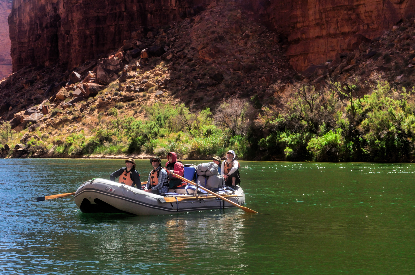
The crew reiterated all their warnings and safety precautions while we suited up. And most of the group was excited, eager at the prospect of our impending challenge. That mood was infectious, and by the time I settled into my spot, at the back side of the front portion of the raft, I was excited as well. “Bring it on,” said that little voice in my head. “This is the real deal—it’s why you’re here!”
Salt Creek Rapid was first, Just a short distance down from the camp site. We sailed right through that one, breached a couple of small waves that sent playful splashes across the deck. But then, after a few hundred yards of calm water, we eased around a bend. I could hear a low rumble ahead, and caught a glimpse of whitecaps in a jagged line. << Granite Rapid>>—an 8 on the Western River scale of 1 to 10, with an 18 foot drop. “Two-Hander!” John called out, his tone speaking more loudly than his voice. The raft started picking up speed. The water ahead was boiling chaos. We hit the first set of waves, raising great clouds of spray. The raft bucked, lurched, crashed through a big wave that washed completely across the deck, high enough to hit the passengers above and behind me on “the couch”, the cushioned row of seats atop the storage bins, just aft of the point where the raft flexes. I was spluttering, soaked all the way to my neck, and all the way through every bit of my clothing, those cheap rain pants useless against that kind of a deluge. Another wave crashed across the deck, and a third. John gunned the engine, barely audible over the roar of the currents, motoring hard to the left to avoid being swept against the rock wall on the right—and then we were though it, intact, upright, still pointed nose first downriver, just as we’d started out. A hooting and hollering cheer went up from the passengers, a loud “YEAH!” from my friend Rick, and then John stood up from his seat in the stern and called for our attention. “That was the warm-up,” he said. “Next up is the <<Hermit>>. It’s a THREE hander.” John and his partner grinned at each other as he sat back down and twisted the throttle, accelerating the big raft downstream.
“Bring it on?” questioned the little voice in my head, as I shifted around for a better position, a small stream of water pouring from the puddle in my lap. Once again, there was a stretch of calm water, and once again, we heard an ominous rumbling in the distance before we could even see the rough water ahead. Around a slight bend, the level of the river dropped visibly and the current rushed forward like a horizontal waterfall, huge standing waves churning in the middle distance. Once again, the raft picked up speed, and once again, we were pointed straight into the middle of it. The raft nosed up a big wave, creaking loudly as it flexed, then it fell into a trough, lurched, and rolled up over the next big wave, no longer pointed quite so straight. Spray was everywhere, we were already soaked, and then, as if out of nowhere, a wave that towered over our heads completely engulfed us. For the space of a few seconds, I had the sensation of drowning– I was unexpectedly and completely underwater, and I needed air! We bobbed up out of it, the outboard shrieking, and then another wave crashed across the deck, almost as big as the first, slapping me square in the face. We bobbed up behind that one, bucked a few more times, caught just a little more spray, and then we were through it, still moving pretty fast, but back to flat water. “YEAH!” Rick yelled, pumping a fist in the air. And then came loud cheers from the rest of the group, congratulating John on the magnificent job he’d done, getting us through that monster in one piece.
A mile further on, we were still a little shell-shocked as we negotiated Boucher Rapid, a mere 4-5 on the 1 to 10 scale. It was big enough to splash us, but after Granite and the Hermit, it was really nothing, and we were starting to feel pretty smug once again. Reading our minds, John stood up in the stern. “Don’t get too comfortable,” he warned. “The next one is <<Crystal>>. Some say it’s the toughest rapid on the river. That’s an opinion, but it is a Class Ten. Hermit was only a Nine.”
“Is it the only Class 10 we’ll run into?” someone asked.
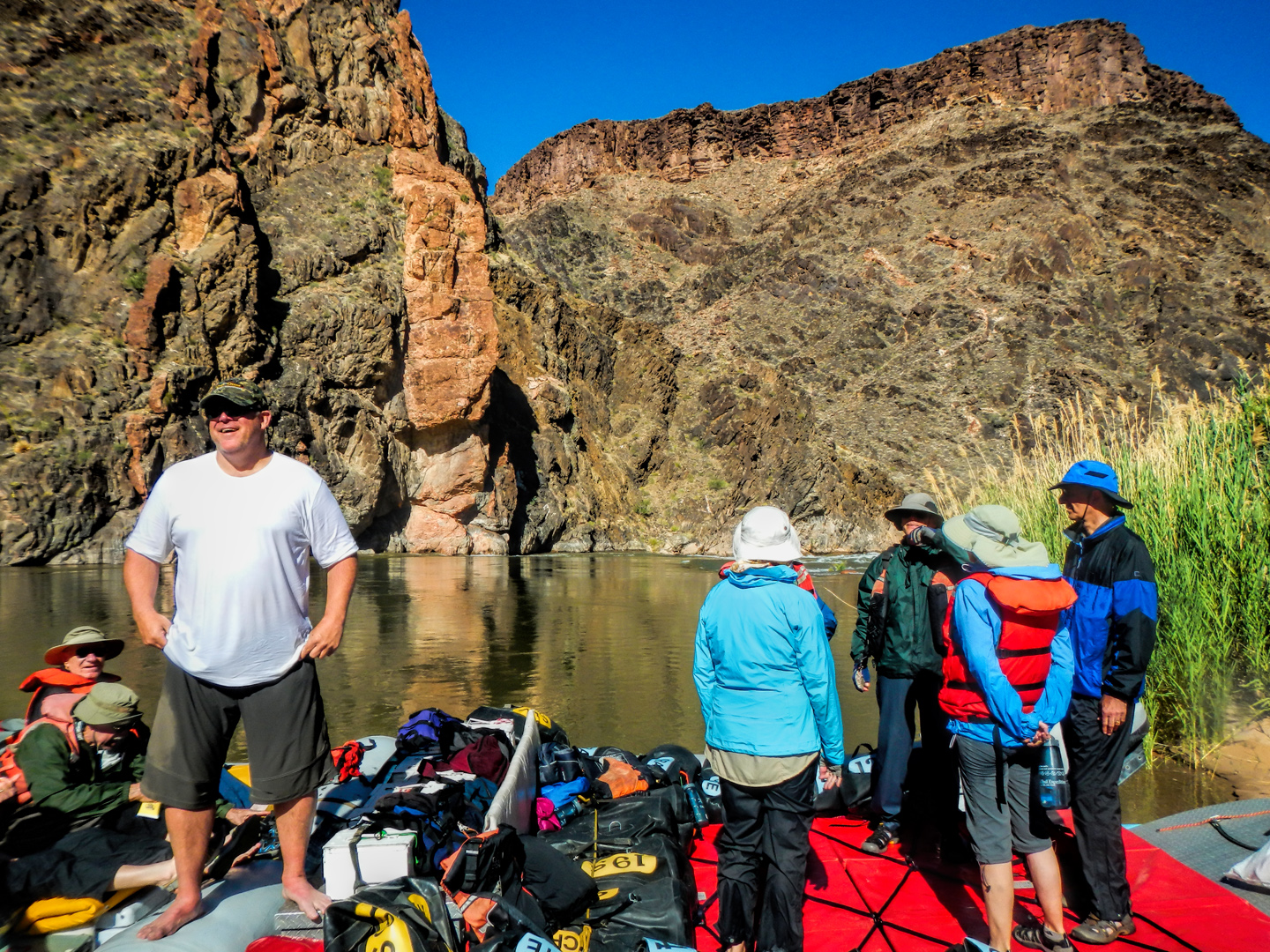
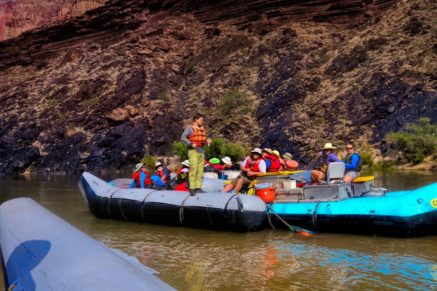
“Lava Falls is a 10,” John replied. “But that’s not today. Crystal is today. Crystal is right now.” We approached the big rapid, but just before we got to it, John pulled over to the bank, at the base of a small hill. The other raft followed us in, and pulled up alongside, Mikenna at the helm. “I’m going to scout it,” John explained. “The currents are tricky here. From the top of the hill I can get a preview, so I’ll know how it’s running today.” The two Johns disappeared up the slope, and were gone at least ten minutes. Mikenna gave us some background on the rapid. Prior to 1966 Crystal was little more than a riffle, but in December of that year a history making storm dumped as much as 14 inches of rain at the North Rim, and the resulting floods down the side canyons created a debris field at the mouth of Crystal Creek that restricted the flow of the river by 80%. At that point, Crystal Rapid became a monster, literally a killer, until a massive flood released from Glen Canyon Dam in 1983 significantly rearranged the riverbed, and tamed the worst of the danger by spreading underwater boulders downstream. Even at that? It was still a Class 10.
The two men came down from the hill, and they seemed to be smiling, so we took that as a good sign. They climbed back aboard, and the rafts pulled away from the bank, back into the accelerating flow. We hit the rapid, and the river roared and boiled, rolling waves of emerald green water capped with froth. We hurtled past an island of rocks in the center of the channel, keeping right, and then we entered the main rapid, a churning mass of foaming water and standing waves, currents running in every direction, holes big enough to trap even a raft as big as ours. John chose the safest course, well to the right, which still gave us a hell of a ride, climbing high over waves, plummeting through troughs, bucking and splashing and hooting and hollering, but it was more fun than fear. It was technically more challenging, and a powerful testament to John’s skill, but not as brutal on us passengers as the Hermit.
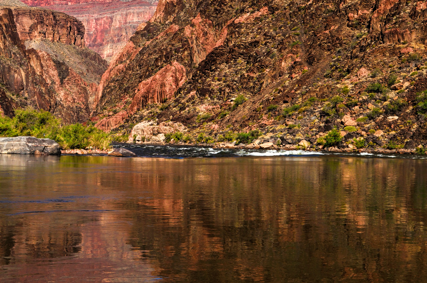
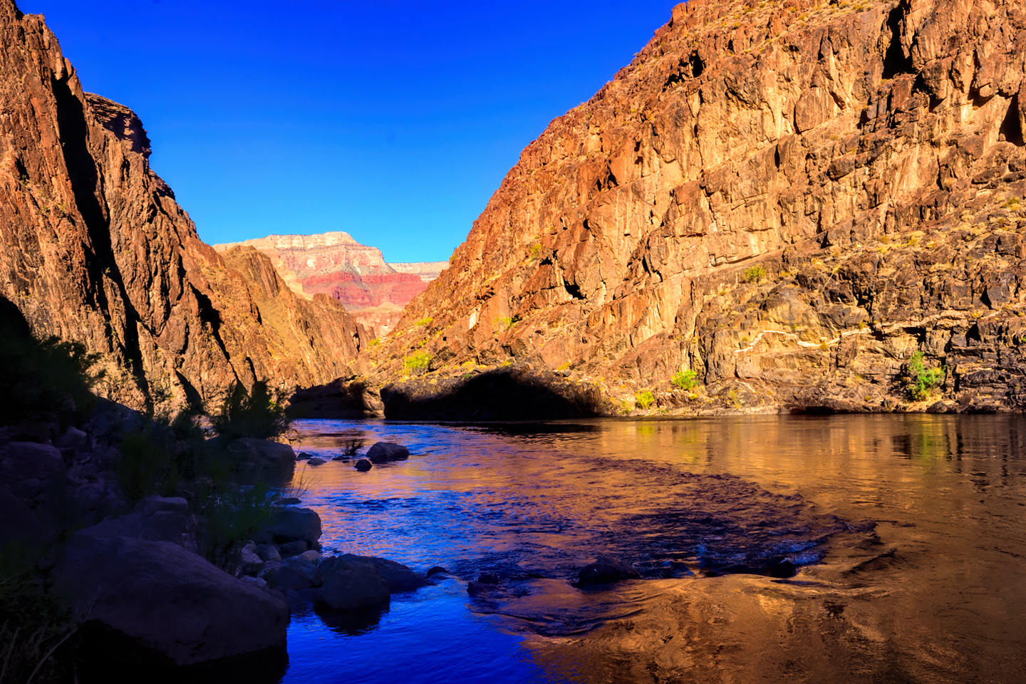
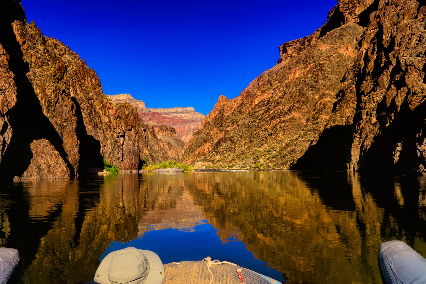
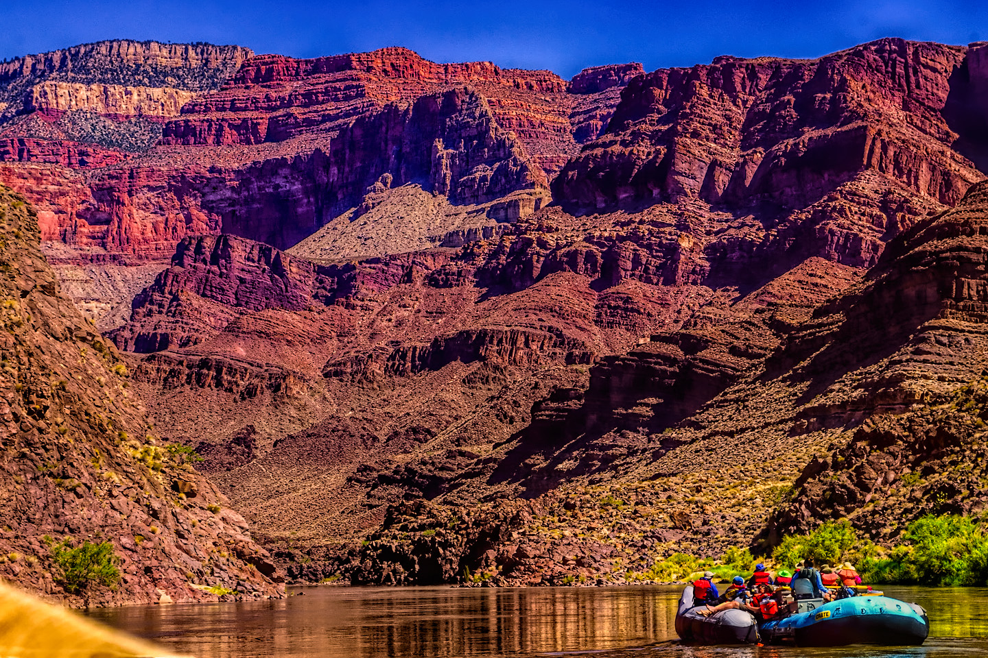
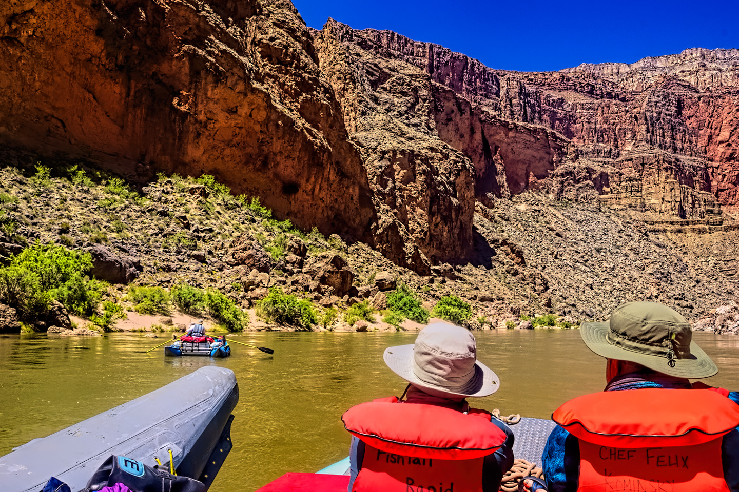
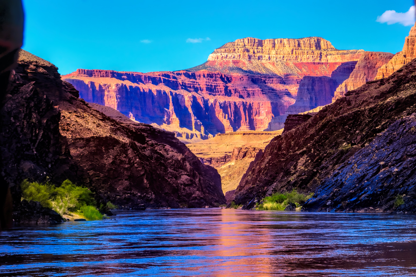
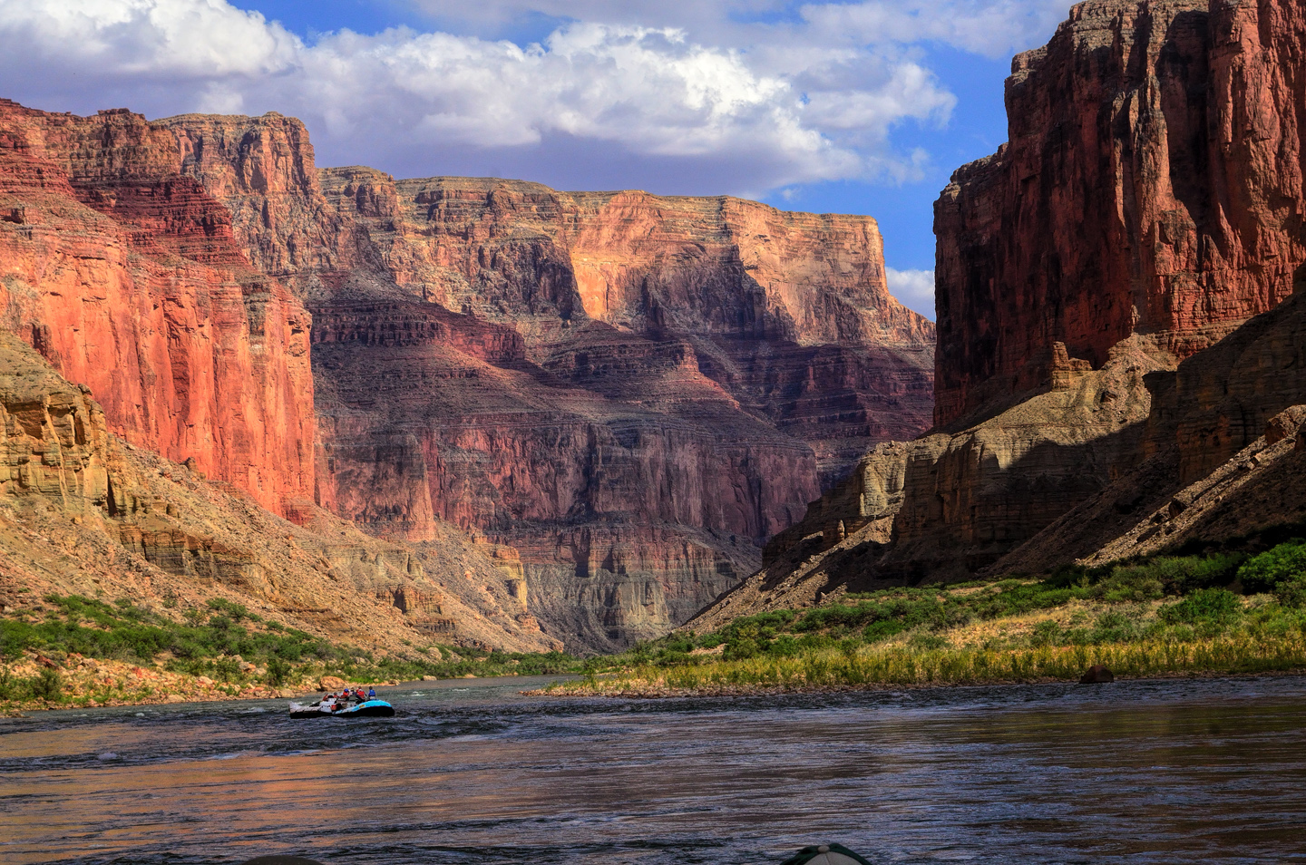
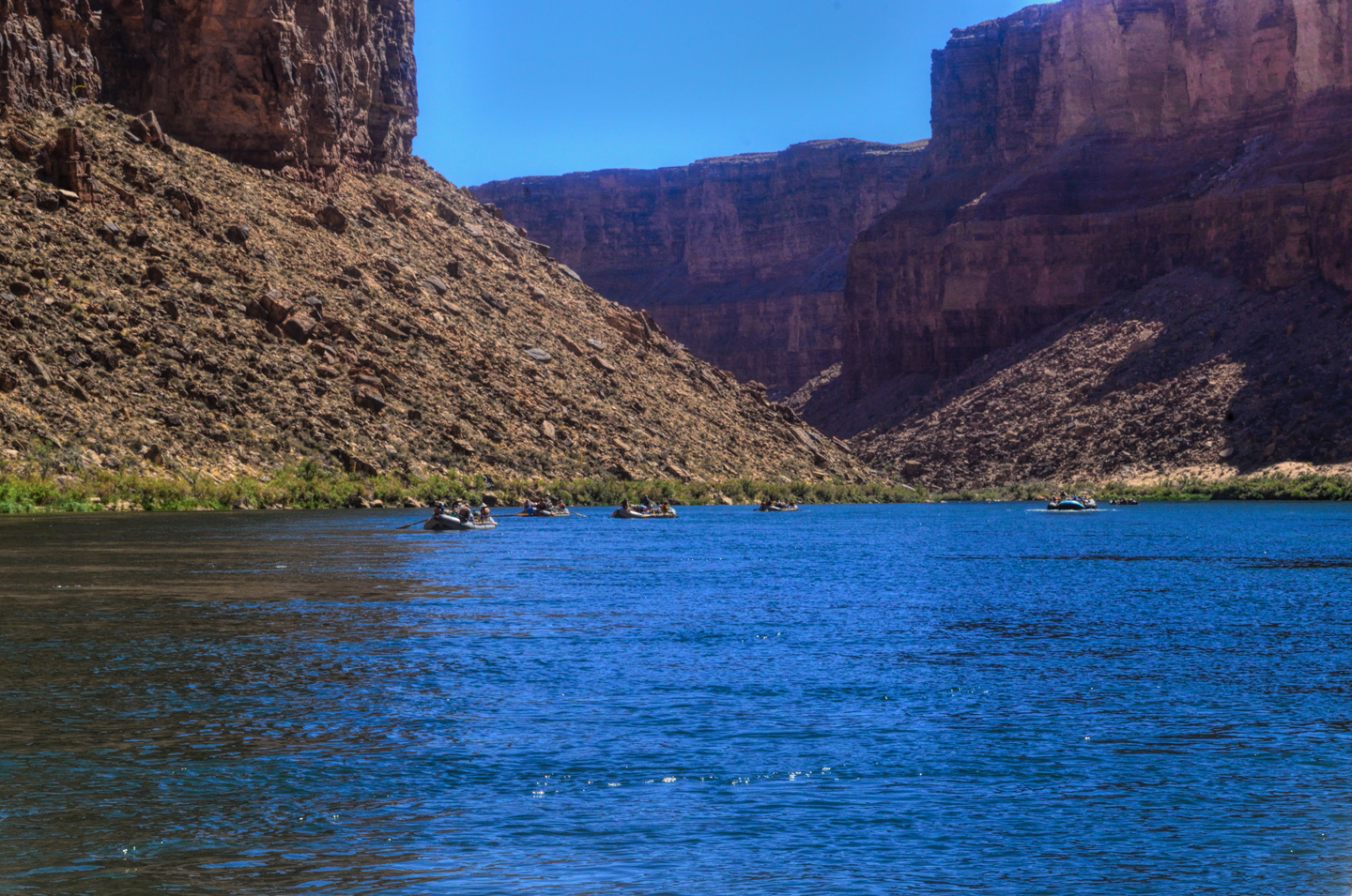
We pulled over for a few minutes in between the sets of rapids, just to breathe. There was no point at all in trying to dry off, because we were far from finished. The next hour was relentless, one rapid after another, but none that matched the intensity of that Grand Trio: Granite, Hermit, and Crystal. That run, in the heart of the inner gorge of the Grand Canyon, is some of the most thrilling whitewater in the world, the magnificent setting adding exponentially to the experience. Downstream from Crystal we hit Tuna Creek, a major rapid in its own right, then Lower Tuna (sometimes known as Willie’s Necktie), followed by the Jewels: Agate, Sapphire, Turquoise, 104 Mile (Emerald), Ruby, and finally, Serpentine. After Tuna, the others are pretty much of a blur, but I’ll have to tell you, that whole section of river, starting from the moment we left our camp that morning, really had been the thrill of a lifetime, and we were barely two hours into our day.
At mile 108, just before Bass Rapid, we pulled over on river left, where we could see an old steel boat chained to the rocks, maybe twenty feet up the slope from the small beach.
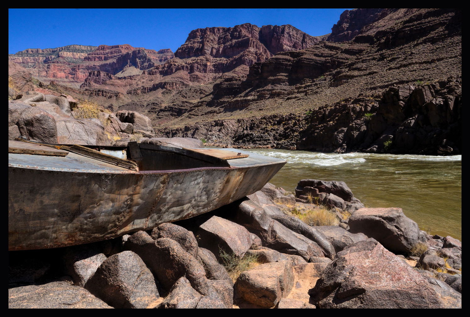
This was the Ross Wheeler, abandoned in this spot in 1915 by a guy named Charles Russell, who was trying to make a movie about the river, only to be utterly defeated by the rapids, losing everything save for his life and this hulk of a boat. He hiked out of the canyon on South Bass trail, leaving the Wheeler to the elements. After nearly 100 years, the old girl was still in remarkably good shape. Personally, I can’t even imagine running those rapids in a boat like that. The pioneers who did this sort of thing first, the original river runners? Those people were either completely fearless, or crazy out of their minds.
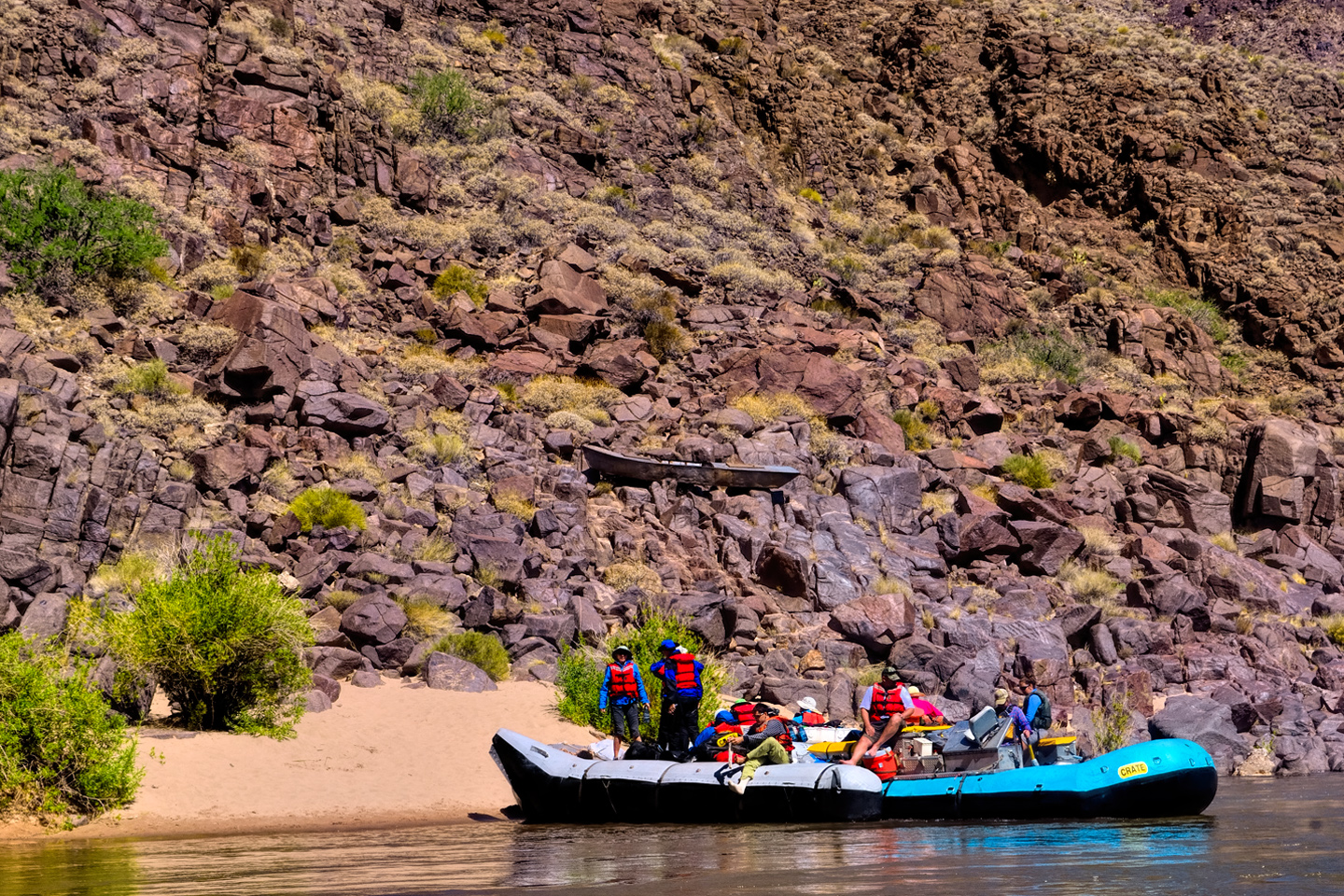
Leaving the Ross Wheeler site, we immediately hit Bass Rapid, then Shinumo, 110 Mile, Hakatai, and Waltenberg. Any one of them by itself would have been a thrill. Taken all together, after the morning we’d just had? They were nothing but another blur. You can only get just so wet. Once you get to that point, being splashed by yet another cold wave doesn’t matter nearly as much, and in the warm sun, it was actually quite refreshing.
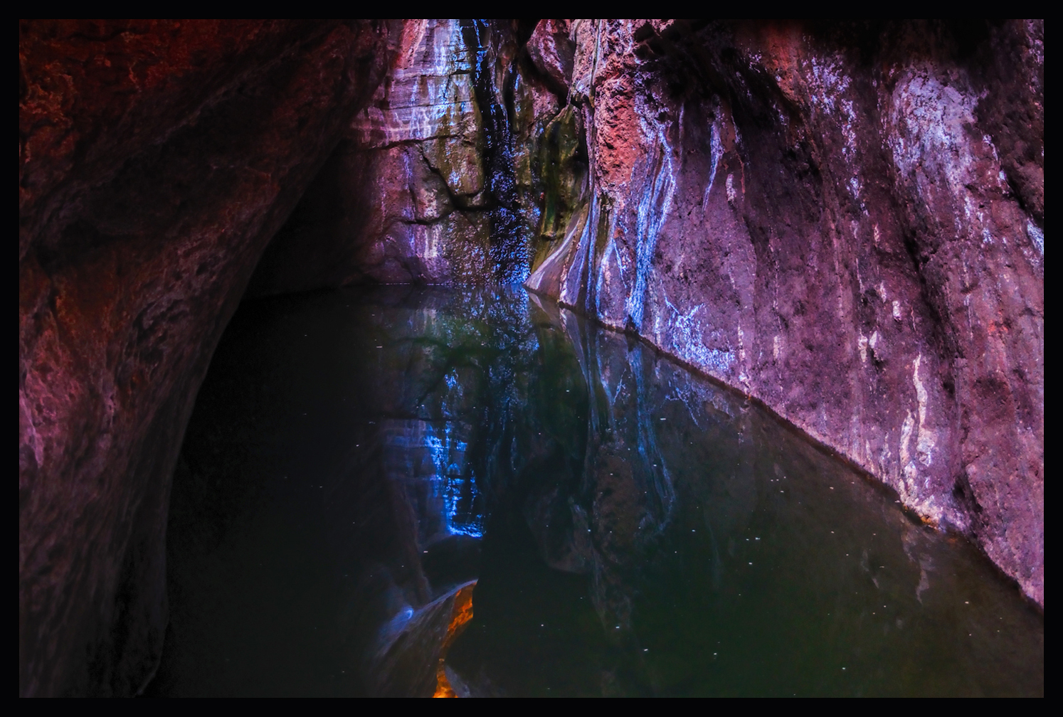
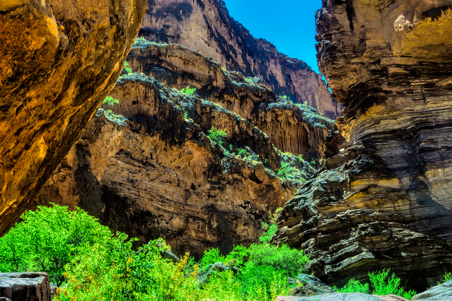
At mile 116, we finally got a break, when the rafts pulled over to river left at a side canyon known as Elves Chasm. There were waterfalls running over smooth rock into pools lined with moss and algae, at the base of a narrow canyon walled by chunky cliffs built of hundreds of layers of various kinds of stone, with shelf-like terraces studded with bright green scrubby plant growth. Half the party followed John on the trail up the canyon to Elves Chasm proper, a grotto in the cliffs where small waterfalls pour over mossy boulders into clear pools, surrounded by beautiful ferns. The trail involved some climbing. “A scramble,” as John described it.
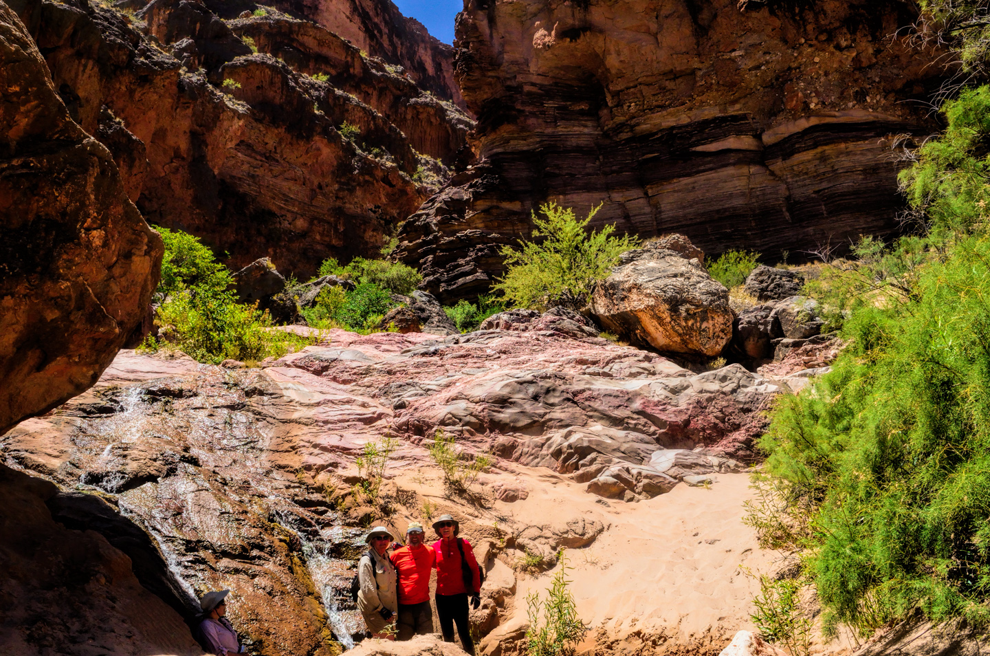
Some of us chose to stay below, enjoying the far more accessible, if less dramatic waterfalls near the river bank. We had lunch somewhere along this stretch, and then continued a few miles downriver to another stopping point:
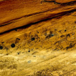
A place called Blacktail Canyon, where we’d get an up close look, close enough to touch, of <<The Great Unconformity>>. We were deep, deep into the Grand Canyon’s inner gorge, where there were layers of rock that are among the oldest naturally exposed strata anywhere in the world. The strata are like tree rings, a measure of the geological history of the earth, and their sequence is predictable. The Redwall limestone that was level with the river in Marble Canyon was now high up the cliffs, atop various other exposed layers of Muav Limestone, Bright Angel Shale, Tapeats Sandstone, and at the very bottom, black Vishnu Schist, and pinkish Zoroaster Granite, the basement rocks, stone that dates back 1.7 billion years. Normally, there are multiple layers of sedimentary rock known as the Grand Canyon Super Group sitting atop the basement rocks, and the Super Group is topped by the Tapeats Sandstone, various layers of limestone, and more, ending with the Kaibab formation at the very top. In this section of the Grand Canyon, the Super Group, which represents nearly a billion years of history, is missing. The Tapeats Sandstone sits directly atop the Vishnu Schist—the Super Group, that entire section, is just plain gone, worn away by the geological process over the course of an incomprehensible span of time.
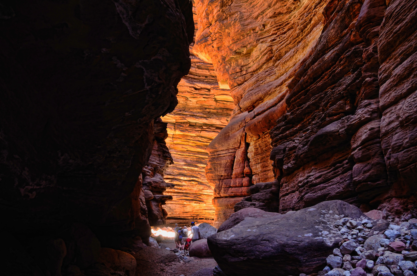
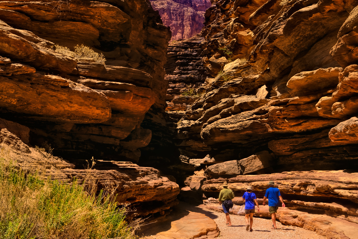
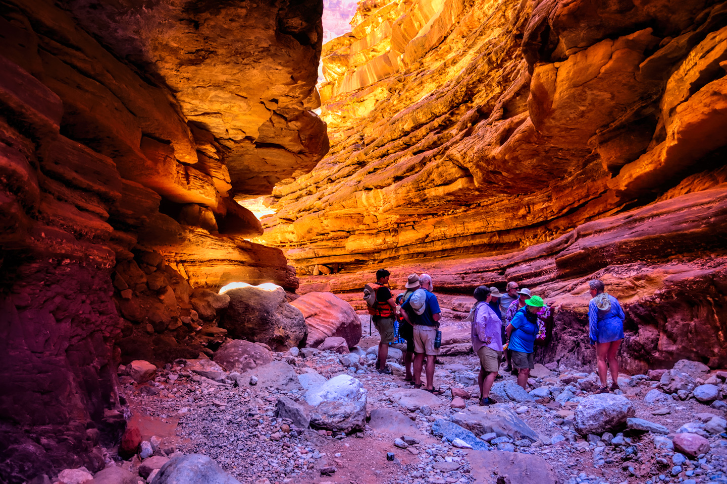
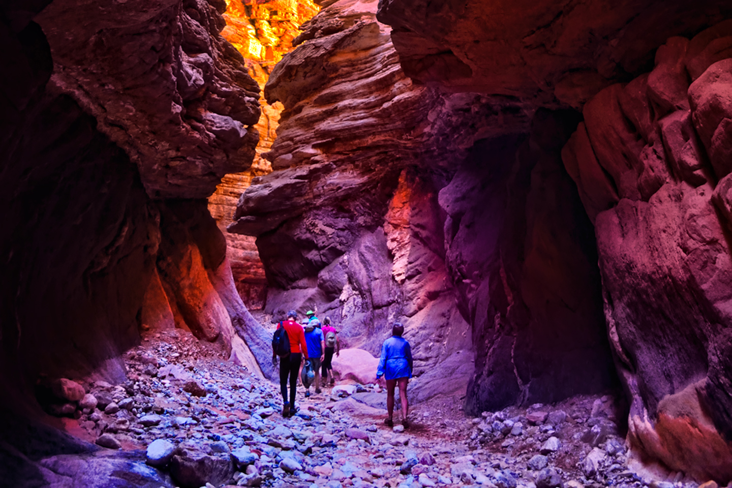
Blacktail was a slot canyon, like a crack in the earth, but it wasn’t smooth sandstone.:
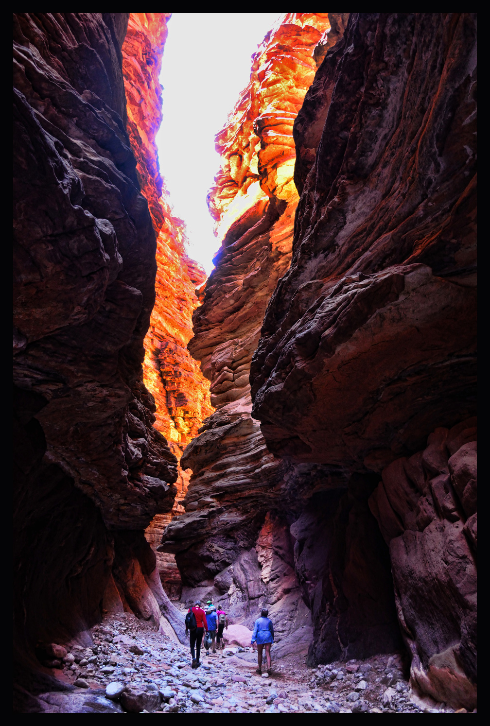
Angular blocky walls of stone comprised of dozens of layers rose up steeply on both sides of a narrow trail. We made our way up the path from the river into the cool, deep shadows of the canyon, following twists and turns. John stopped at a particular spot and pointed out a section where the schist was still separated from the sandstone by a layer of lighter-colored rock that tapered to a wedge:
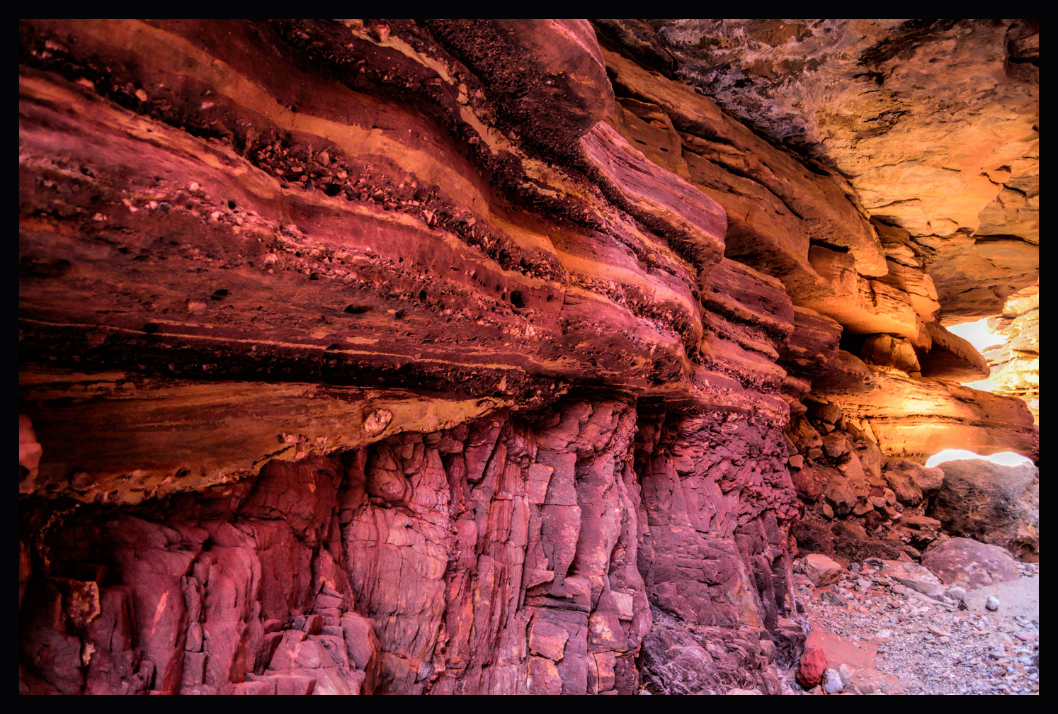
Beyond the point of the wedge, the sandstone and the schist sloped together and joined, one atop the other. “That’s a remnant of the Super Group,” John explained. “And that point, right there, is where a billion years of history go missing.” I walked over and peered at it, tried to imagine what it represented—volcanoes, ancient seas that rose and fell and drained away, millions of years of wind and water scouring the rock into sand, and blowing it across the landscape. I took a close look, spanned it with thumb and forefinger. A billion years, right there. It truly was incomprehensible. We moved on up the trail then, heading deeper into the canyon through narrow corridors of light and shadow. Blacktail Canyon was extraordinary. It was like walking through a deep cave that was open to the sky through a narrow gap, revealing this fairyland of stone and shifting shadows. The trail dead-ended, at least for our purposes, at a deep pool of water, dark green and thick with algae.
A hidden treasure, not seen by all that many people in the broad scheme of things, and there was an overwhelming sense of isolation. We were intruders here in this secret place, and we spoke in hushed tones, for fear of disturbing the perfect silence.
We made our way back out of the canyon to find the other John, the assistant boat driver, standing beside the head of the trail, tuning a guitar:
As the rest of the party made their way out of Blacktail Canyon we all stopped in this spot, and had a seat, while John played his guitar and sang for us, his voice echoing eerily in that narrow space, but beautiful, and a perfect coda to our magical excursion in the bowels of the earth.
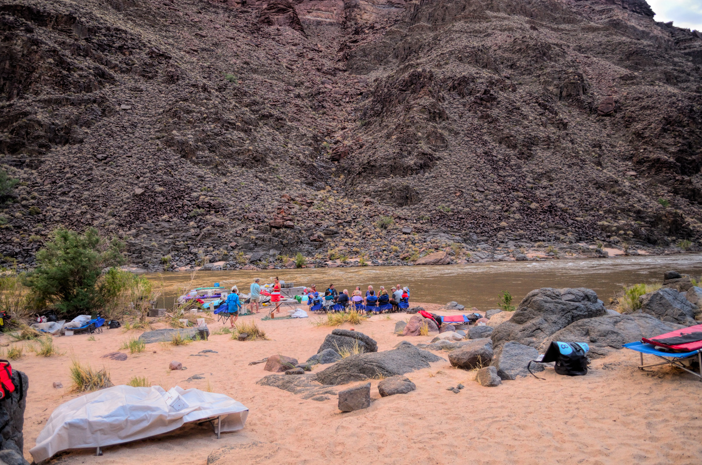
It was after 3:00 when we left Blacktail, and the shadows were already growing longer in the Inner Gorge, but we had more rapids to negotiate before we could call it a day. In the next ten mile stretch we hit eight of them: 122 Mile Rapid, Forster Rapid, then Fossil, with a 15 foot drop, followed by Mile 127, Mile 128, Specter (which was quite respectable), finishing off with a pair of 8’s, both two-handers for real: Bedrock, which skirted around a large rocky outcropping, and Deubendorff, with some scary holes that John skillfully bypassed. We were barely fazed by any of it. We’d been splashed, dashed, bucked, bounced, swooped, swirled, and swept in so many different directions it was becoming old hat, but it really had been a very long day. When we finally pulled over to a beach on river right, Stone Creek, I’ll have to admit that it felt pretty good to be stopped.
Camp was set up, a familiar routine now, and while the crew prepared our dinner, we sprawled in our camp chairs.
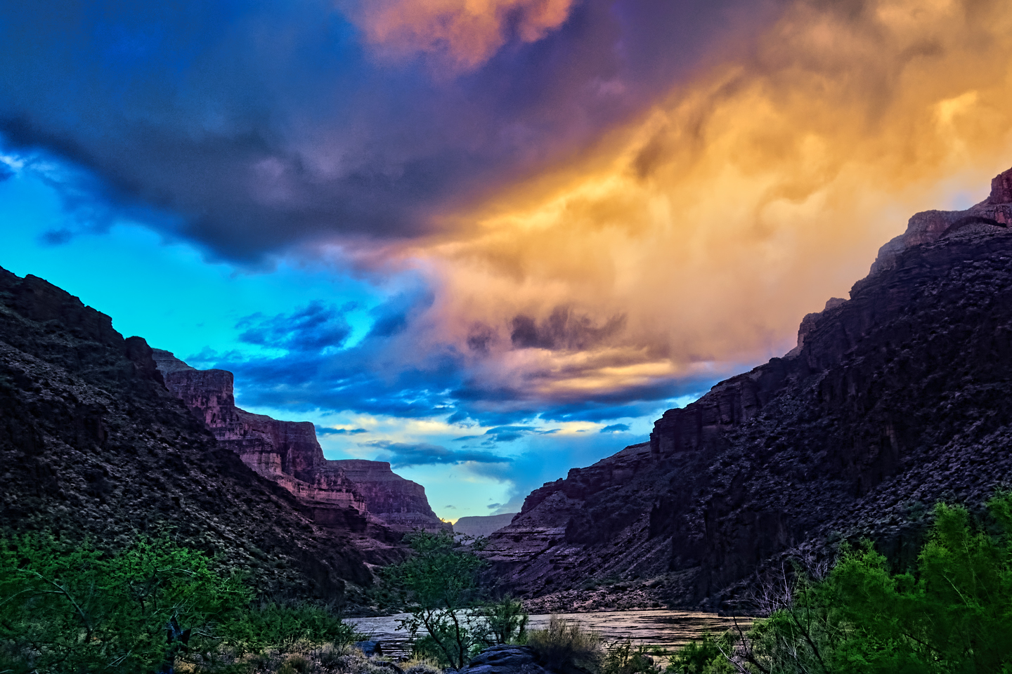
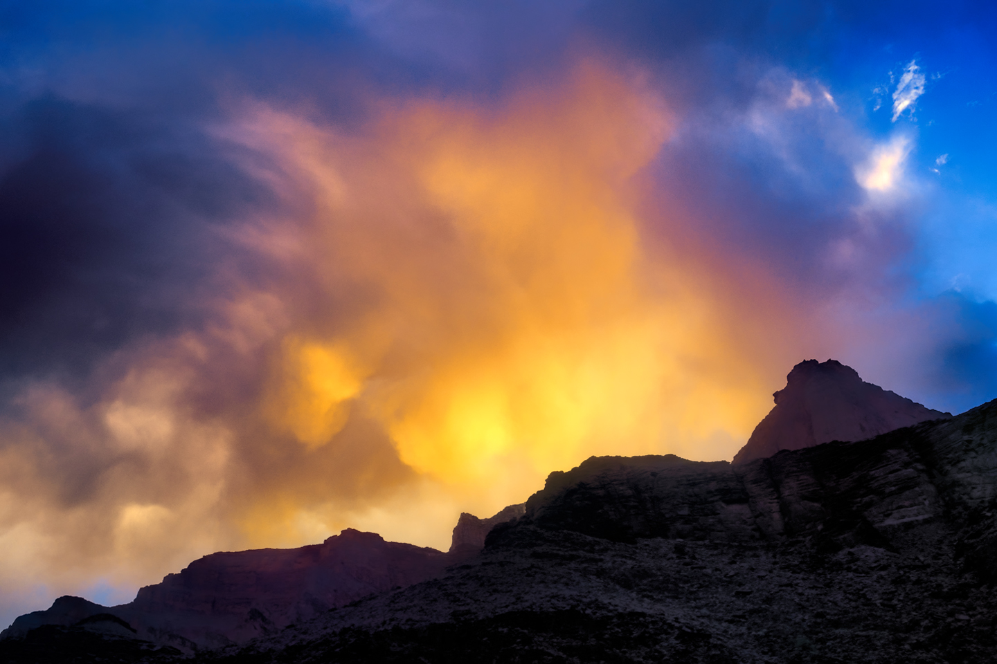
I was still a little dazed by the whole thing, scenes of frothing, churning whitewater playing over and over in my head. Fleecy white clouds were piling up above the canyon rim, nearly filling the narrow patch of sky, until the lowering sun set them afire, a Grand Canyon sunset display that was the finest we’d seen, worthy of the spectacular setting. A fitting end to one of the most amazing days of my life.
The photo collage below has a few additional pictures from Day 4.
Click any of the images to expand them to full screen.
(Unless otherwise noted, all of these photographs are my original work, and are protected by copyright. They may not be duplicated for commercial purposes.)
The Adventure Continues:
This is an interactive Table of Contents. Click the pictures to open the pages.
A Grand Adventure! White Water Rafting on the Colorado River

Grand Canyon Rafting Expedition: Day 1
The two rafts were shoved away from the beach until they floated free, and the boat drivers eased them into the middle of the channel. We were mostly moving with the current, but the beach dropped behind us pretty quickly, and in a matter of minutes we were out there, rafting down the Colorado River, heading squarely into the enchanted depths of the Grand Canyon...
<<CLICK to Read More!>>

Grand Canyon Rafting Expedition: Day 2
The cliffs and buttes were a perfect composition, the different colored layers of stone were all but glowing in the afternoon light, and we had this incredible world all to ourselves, not another boat in sight.
<<CLICK to Read More!>>

Grand Canyon Rafting Expedition: Day 3
The waters of the Little Colorado are a turquoise blue that is so startlingly bright it doesn't even look real. There’s a well-defined spot where that warm, turquoise blue water from the small river collides with the cold, deep green water flowing upstream from the big river. The two dramatically different colors mix, forming a shifting, swirling line of chartreuse. That spot is the confluence. It's magical, and utterly unique.
<<CLICK to Read More!>>

Grand Canyon Rafting Expedition: Day 4
I was still a little dazed by the whole thing, scenes of frothing, churning whitewater playing over and over in my head. Fleecy white clouds were piling up above the canyon rim, nearly filling the narrow patch of sky, until the lowering sun set them afire, a Grand Canyon sunset display that was the finest we’d seen, worthy of the spectacular setting. A fitting end to one of the most amazing days of my life.
<<CLICK to Read More!>>

Grand Canyon Rafting Expedition: Day 5
The trail meandered for a mile or so, finally dropping down level with the creek, giving us access to a series of perfect swimming holes. There’s something about that exotic turquoise water that welcomes swimmers--you have to get in it, if only to assure yourself that it’s real. The creek was cool, but far from cold, and a welcome change from the icy water in the river. We stopped at a particularly inviting spot to swim, relax, and eat our lunch. Sitting beside that creek, with our simple repast--it was like having a picnic in the Garden of Eden.
<<CLICK to Read More!>>

Grand Canyon Rafting Expedition: Day 6
“Two Hander!” John called out rather gleefully, and we all clung to the ropes for dear life as the raft picked up speed. We were headed straight for the boil of Lava Falls, which was roaring like a freight train, bearing down. We entered the churning whitewater pretty much dead center, then moved hard to the right to avoid the standing waves and the big holes in the middle of the channel. We got good and drenched at least three times, almost like running under a series of waterfalls, bucking and lurching like crazy, but the whole thing was over in less than a minute.
<<CLICK to Read More!>>

Grand Canyon Rafting Expedition: Day 7
Immediately below that beach we hit Diamond Creek Rapid, then Travertine Rapid, where we pulled over to the bank at Travertine Canyon. The creek that entered the river here flowed across huge, slippery boulders in a series of small waterfalls, and we had great fun taking turns standing in the flow, almost like a natural shower.
<<CLICK to Read More!>>

Grand Canyon Rafting Expedition: Day 8
The river broadened as we approached Lake Mead, and at mile 278 we entered the lake itself. Pearce Ferry was right there, and we were all pretty quiet as the rafts pulled in to shore for the last time. “Thrill of a lifetime” is a pretty strong statement, but it’s appropriate for this journey. There’s nothing else like it.
<<CLICK to Read More!>>

Grand Canyon Rafting
You find a rope, any rope, and you grab on with both hands for all you're worth. The river boils like the North Sea in a gale, great, rolling green waves and troughs. The raft plummets sideways into a hole fifteen feet deep, the outboard motor shrieks, a monster wave towering ten feet above your head comes crashing down across the deck, pummeling the passengers like a gigantic liquid fist that takes your breath away, leaving you suspended, time stopped, frozen in mid-scream.
<<CLICK to Read More!>>

There's nothing like a good road trip. Whether you're flying solo or with your family, on a motorcycle or in an RV, across your state or across the country, the important thing is that you're out there, away from your town, your work, your routine, meeting new people, seeing new sights, building the best kind of memories while living your life to the fullest.
Are you a veteran road tripper who loves grand vistas, or someone who's never done it, but would love to give it a try? Either way, you should consider making the Southwestern U.S. the scene of your own next adventure.
A few years ago I wrote a book about road trips in Arizona and New Mexico that's a lot like this website, packed with interesting information, and illustrated with beautiful photographs. Check it out! You can find it on Amazon, and at all other major booksellers.

ALASKA ROAD TRIP:
MEXICAN ROAD TRIP (IN THE LAND OF THE MAYA):
ARIZONA AND NEW MEXICO:
SOUTH AMERICA:
PHOTOGRAPHY:
TRIBAL LANDS:


Recent Comments