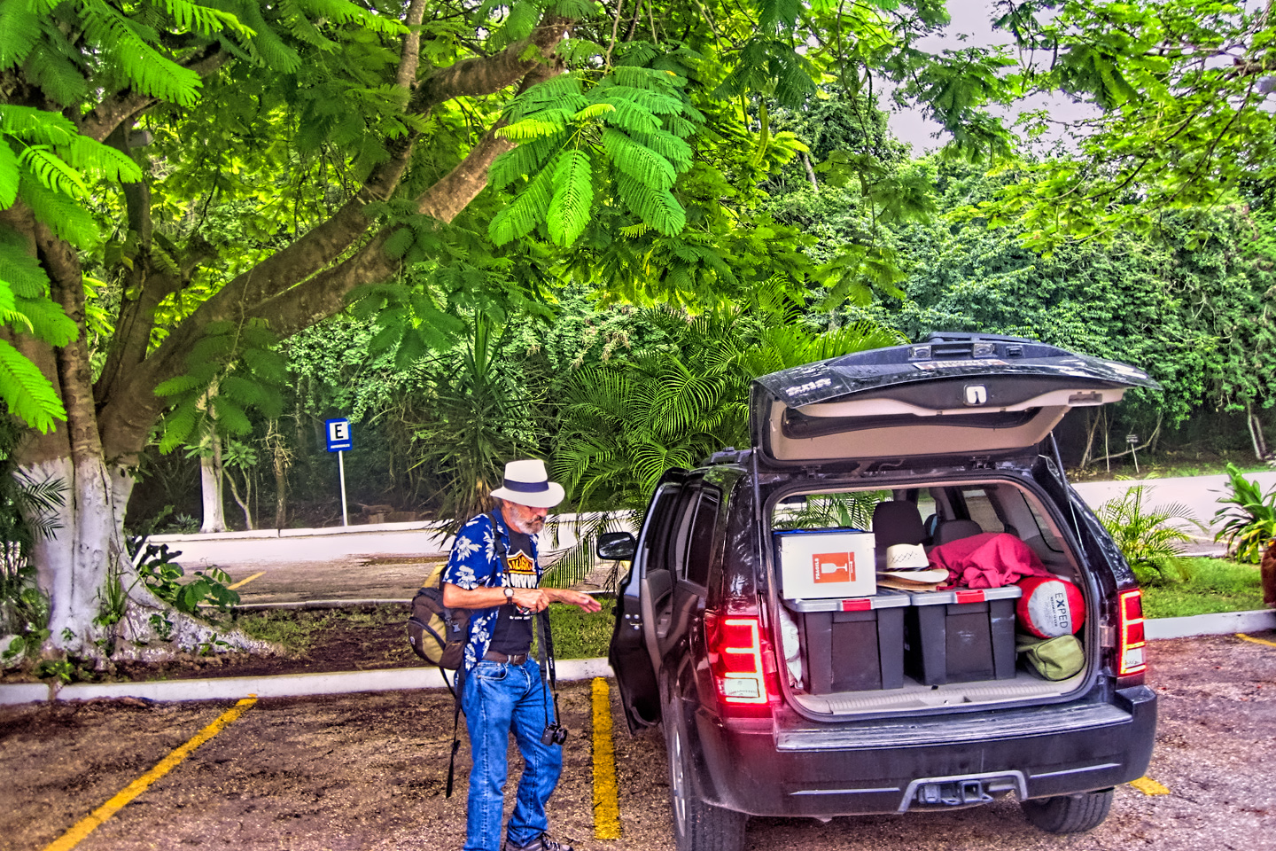
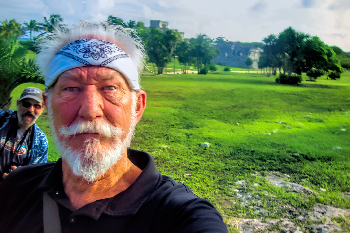
In October of 2015, shortly after I returned from my Alaska RoadTrip, my old friend Michael and I packed up my Jeep and drove it to the Yucatan. I’d wanted to see the Mayan ruins for as long as I could remember, but considering all the negative reports I’d been hearing about Mexico, I realized going into it that I’d have to take a few precautions. Recruiting Mike to ride along with me was one of them, because everything I’d been reading, including the Mexico Travel Advisory put out by the U.S. Department of State, advised against traveling alone. I took that to heart, and gladly, because it was a lot more fun that way. In my experience? Road trips with old friends are the best kind of fun that there is.
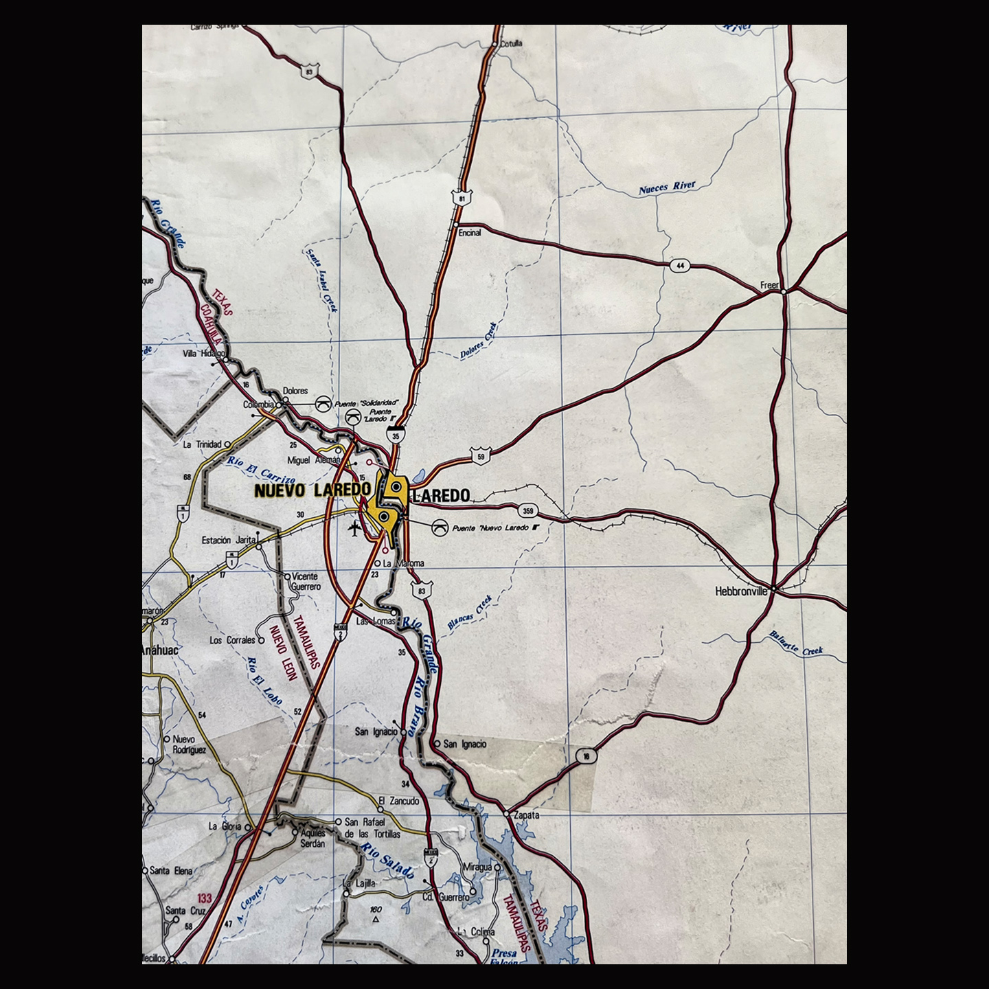
I rendezvoused with Michael in Austin, and we left from there. My research told me that the Eagle Pass/Agua Prieta border crossing was the easiest and least congested, but Laredo was 100 miles closer, which gave it the edge for the sake of convenience. (For details about the border, Mexican Customs, and the permits required for a Mexican Road Trip, see my previous post: Mexican Road Trip: How to Plan and Prepare for a Drive to the Yucatan.)
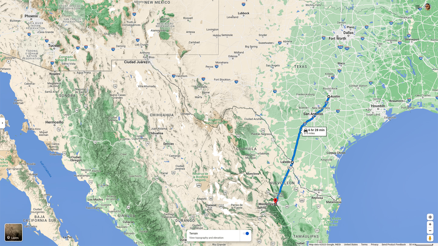
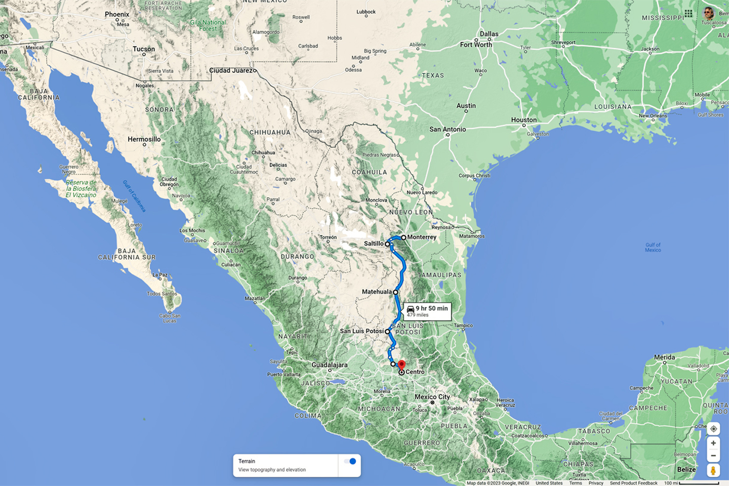
Austin to Laredo is a simple enough drive, 235 miles south/southwest on Interstate 35, a freeway that’s as straight and flat as any you’ll find. The trip takes about 4 hours if you don’t make any stops, and the city of Monterrey, where we planned to stay that first night, was another three hours south of Laredo. I wasn’t quite sure what to expect at the border, or how long it would take, but the drive itself was only seven hours altogether, so I figured we were allowing plenty of time. We had a liesurely breakfast in Austin, then ran some last minute errands. All that took longer than I expected, so we didn’t get on the road until almost 10:00. Looking back with 20/20 hindsight, that lack of urgency was a definite mistake.
We arrived in Laredo about 2:00 PM. I had not pre-purchased my Mexican auto insurance, but I saw signs advertising the service in the windows of at least half a dozen offices in the downtown area. All I had to do was park, but do you think I could find an empty parking space in that busy downtown? Oh, hell no! The traffic so near the border crossing was totally nuts, moving at a snail’s pace on confusing one-way streets. After at least half an hour of circling, I finally got lucky and snagged a spot, then rushed into the closest Insurance brokerage, where it took another half hour to fill out the paperwork and pay the fee. By the time we finished, it was after 3 PM, which was hardly ideal. I made a firm resolution, then and there, that the next time, I would A.) buy my insurance online, and B.) get an earlier start! At that time, in 2015, thirty days of insurance coverage set me back about $160. The cost in 2023 is a little higher (naturally), but they give you six months of coverage for the same price as one month, so it isn’t all that bad. Once we had the insurance in hand, we were ready to cross, so I followed the signs that said “MEXICO.” And that’s where the adventure began:
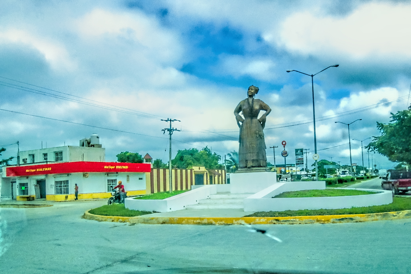
DAY 1: THE HIGHWAY OF DEATH, FROM LAREDO TO MONTERREY
First day of travel, from Austin Texas to Laredo, and from Laredo to Monterrey, where we stayed our first night.
CLICK PHOTOS AND MAPS TO EXPAND
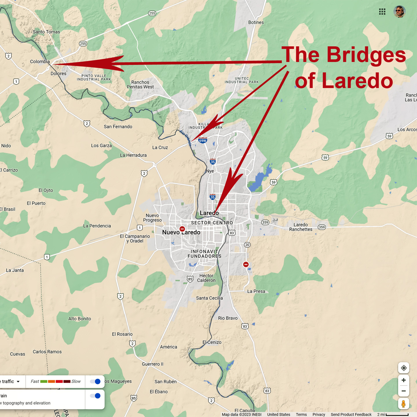
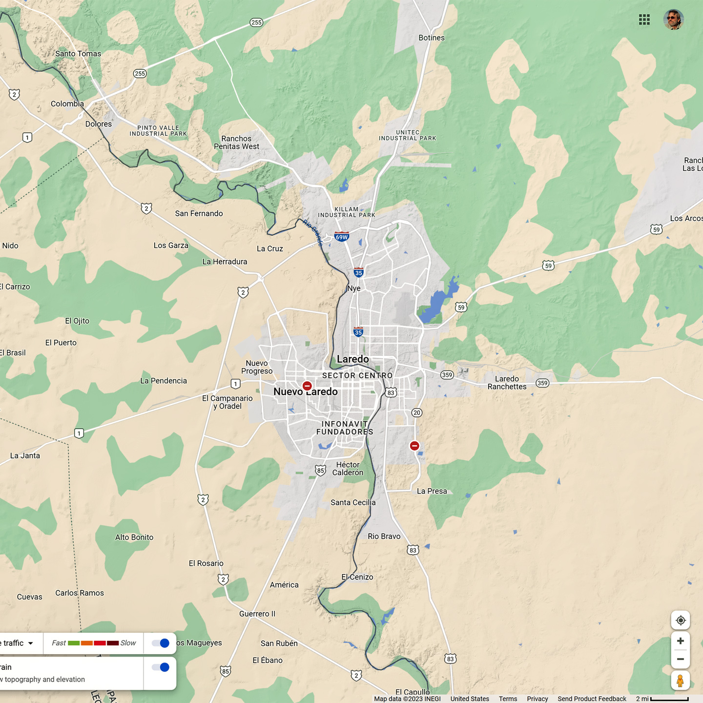
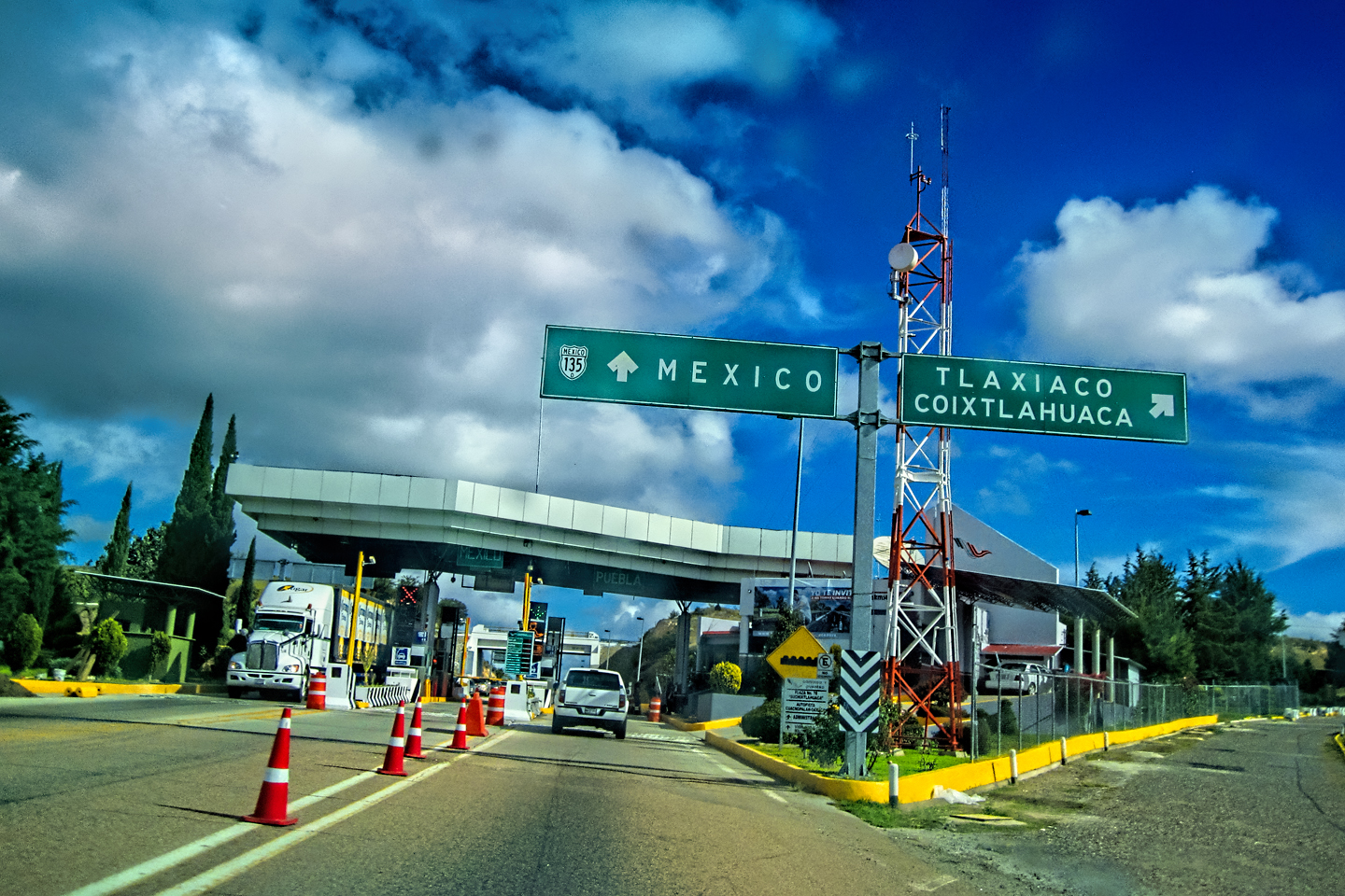
The Rio Grande runs smack through the middle of Laredo, separating the storied town in Texas from Nuevo Laredo, its’ Mexican counterpart. When you’re headed south from the U.S., there are three different bridges that will take you across the river, and each of them leads directly to a Mexican Customs facility. I’ve been told that the least congested of the three is the Colombia Crossing, the bridge that’s off by itself, 25 miles upriver from the other two. I didn’t know about the Colombia bridge when we crossed, so I chose the main bridge in the middle of the city, and that one was busy as the dickens.
We’d packed for a month-long trip through several climate zones, so we had a wide range of clothing, along with too many cameras, a laptop, and other assorted road-trip gear. The inspector asked where we were headed, and when I told him the Yucatan, he suddenly came on full alert. “Yucatan” wasn’t the usual answer, so he asked more questions as he dug through our luggage, paying special attention to the photo equipment. Michael had a drone that he’d brought along, hoping to get aerial shots of the Mayan ruins. It was in a box right on top, so it was the first thing the inspector came across. As it turned out, drones are prohibited practically everywhere in Mexico, so the mere fact that we had one made us that much more suspicious. The inspector had just started pawing through our stuff in earnest when there was a sudden flurry of activity and excited shouting in the next lane over. They apparently found some actual contraband in a minivan full of college students, so our guy abruptly wrapped up our inspection, wished us a “Buen viaje,” and rushed off to assist with the bust. Feeling a bit like I’d just dodged a bullet, I closed up my Jeep and skedaddled the heck out of there.
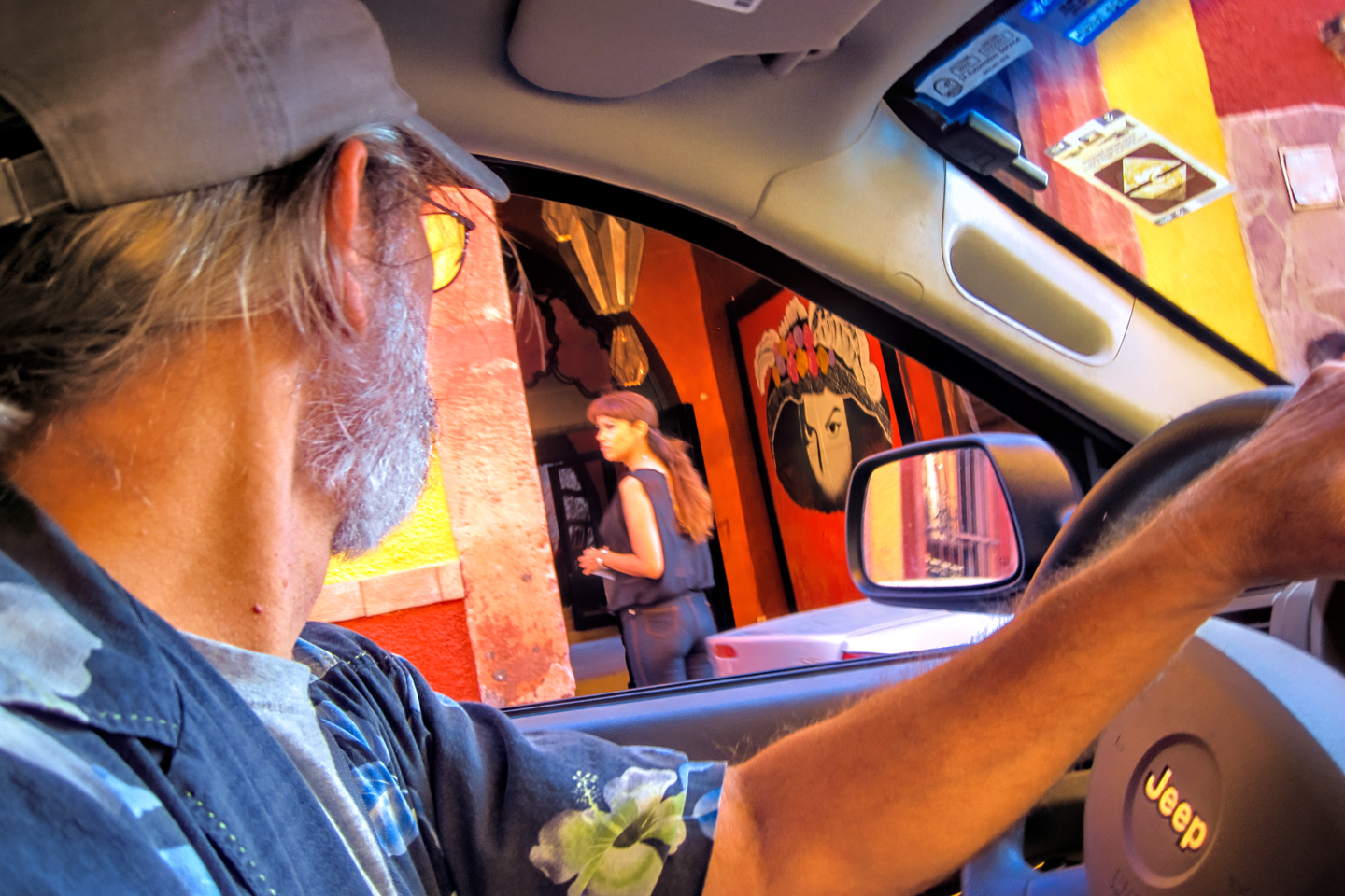
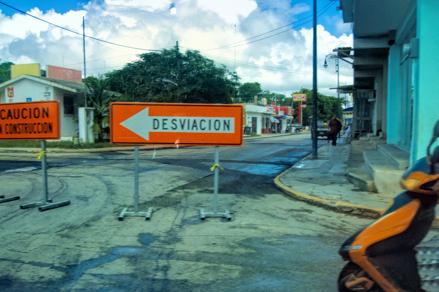
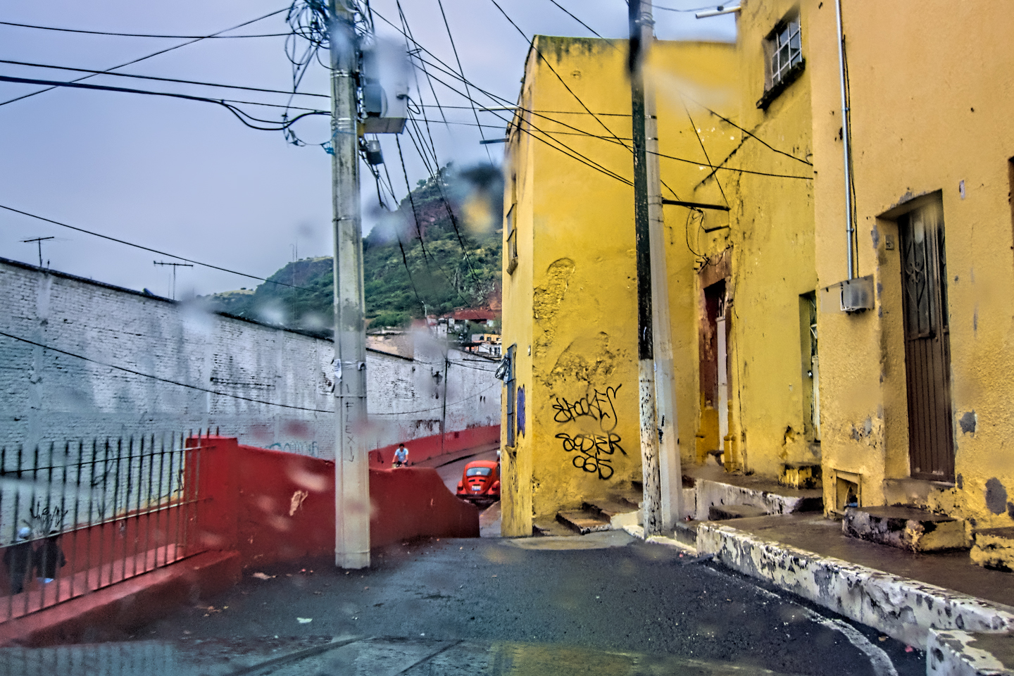
When you cross the border into Mexico, there are differences that are immediately apparent. The signs are suddenly all in Spanish, the streets and sidewalks swell with crowds of pedestrians, most of them selling one thing or another, and everything, from the pavement to the buildings to the window displays in the shops, it’s all a little bit funky, outdated, and crumbling around the edges. Some of that is the natural ambience that goes along with the border towns; the rest is Puro Mexico. You get used to it. You might even learn to love it!
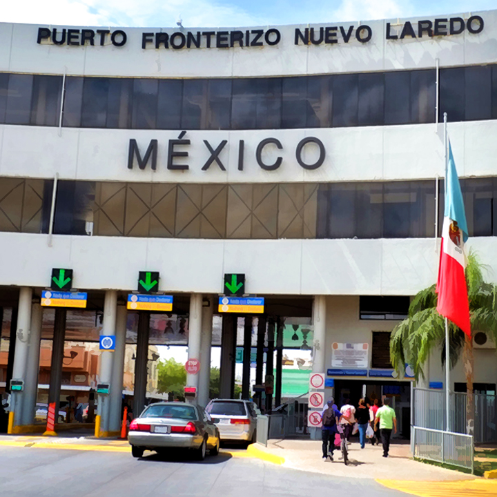
Our next stop was Immigration, but I didn’t see any signs, so I ended up driving away from the border area, deeper into the city on one-way streets. By the time I got my bearings, we were already on the highway headed south. I found a place to make a U-turn, which was a lot harder than it should have been, and we ended up back at the Customs area. I still didn’t see Immigration, so I parked and started messing with my phone, hoping Google Maps might be of service. Just then, a guy came up to the Jeep and rapped on my window.
“Are you guys lost?” he asked in English. “I saw you drive away, and now you’re back.”
“Which way is Immigration?” I replied, leaving my window rolled up.
“My name is Jose,” he said, smiling, and giving us a friendly wave. “I work as a tour guide. For ten bucks, I’ll take you there myself.”
Mike and I exchanged a glance. “Why don’t you just point the way?” I replied.
“Ten bucks,” Jose repeated, holding out his hand.
I’d already wasted too much time driving in circles, so I extracted a ten from my wallet, lowered my window, and gave it to him.
He tucked the bill in his pocket, then pointed at the building across the street. “That’s Immigration.”
“No way!” I protested. “That’s customs! We’ve already been there!”
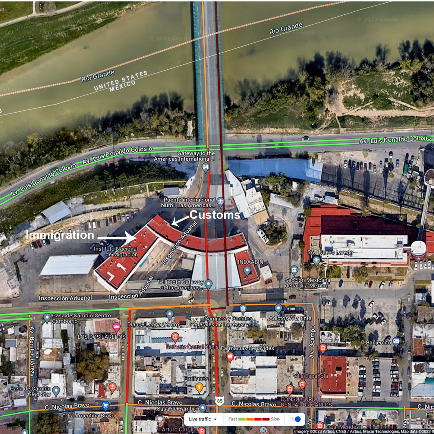
“Immigration, Customs, same building, different parts. You have to go up the ramp to that glass door, and get in line.” He had me, fair and square, and I felt like an idiot. We weren’t even officially in Mexico yet, and we’d already been hustled!
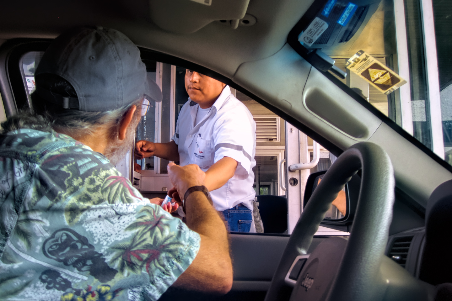
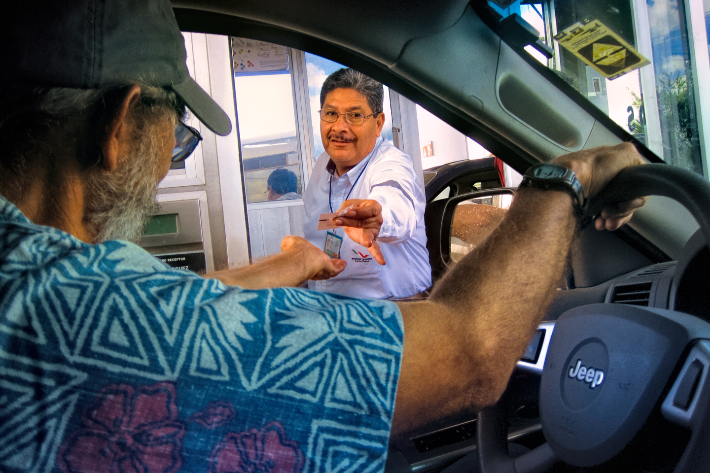
Inside the building, there was a row of service windows, and each one had a long line in front of it. After waiting half an hour for our turn at the Immigration window, we paid the fee of $30 apiece for our tourist cards (FMM Visas) and got them stamped. Next, we got into the line for the Vehicle Import Permits, where we waited another half an hour, only to be told, when we finally got to the front, that we were doing things out of sequence! We were supposed to go to the Banjercito Window first, to pay the required deposit! So we got into the third line, a bank teller’s window, and waited yet another 30 minutes. I put a $400 charge on my Visa card that would serve as a deposit for the Vehicle Permit; the teller explained to me that when I left the country again and properly cancelled the permit, they would simply reverse the $400 charge, back onto the same credit card. We got back into the Vehicle Permit line once again, and we waited, once again. This time, fortunately, we had everything we needed. They went outside with us to visually inspect my Jeep and compare the VIN number, then they affixed a holographic sticker to the inside of my windshield.
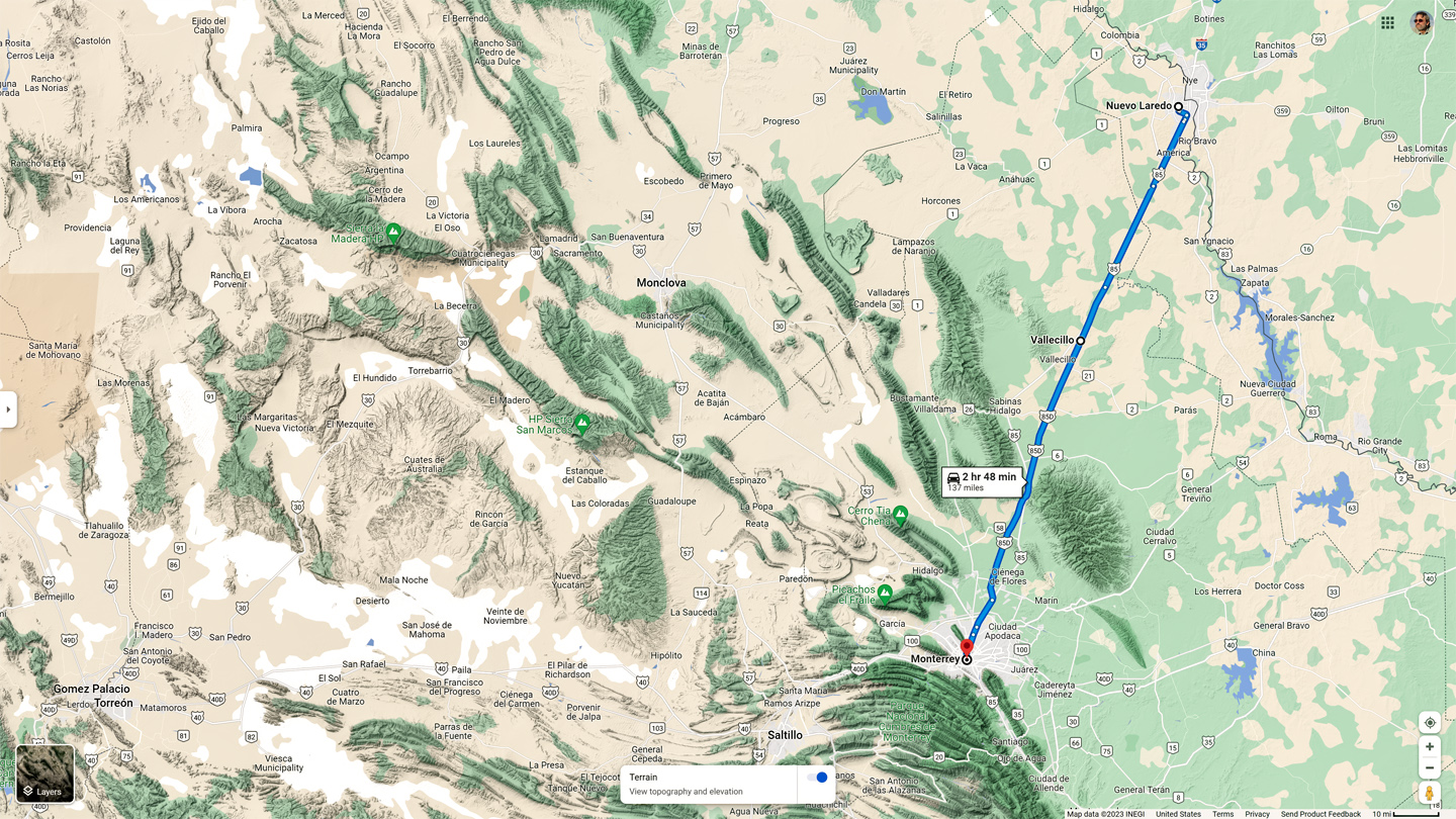
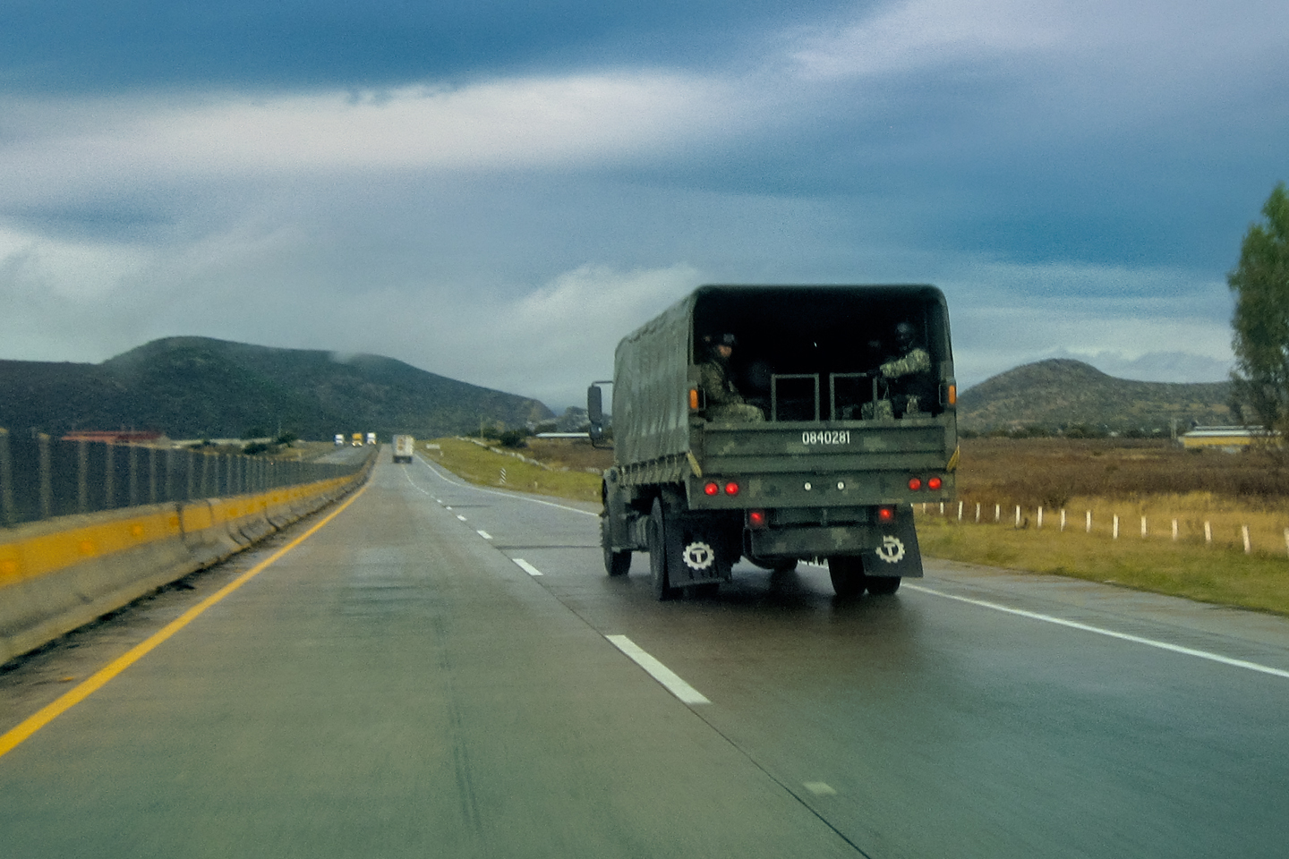
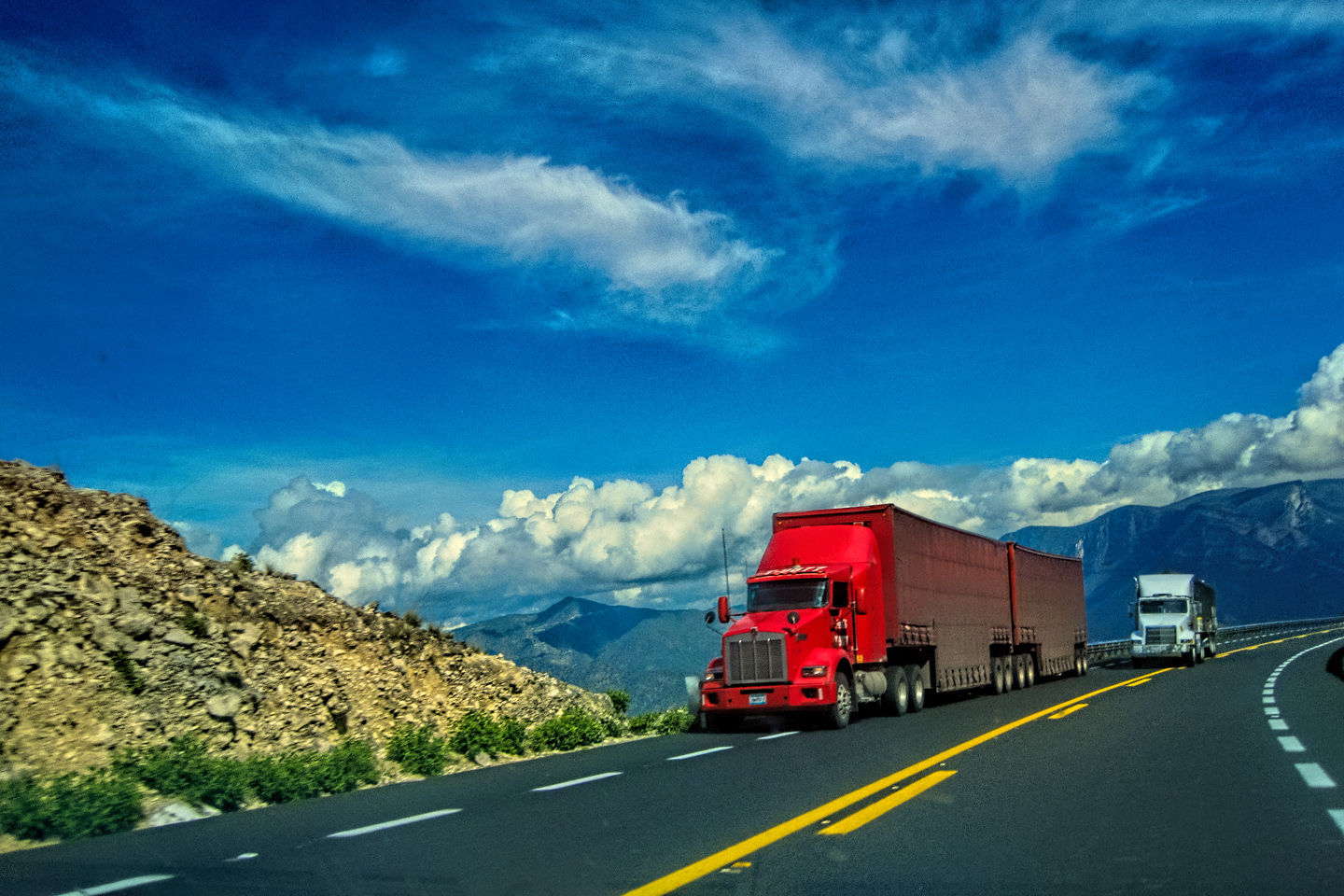
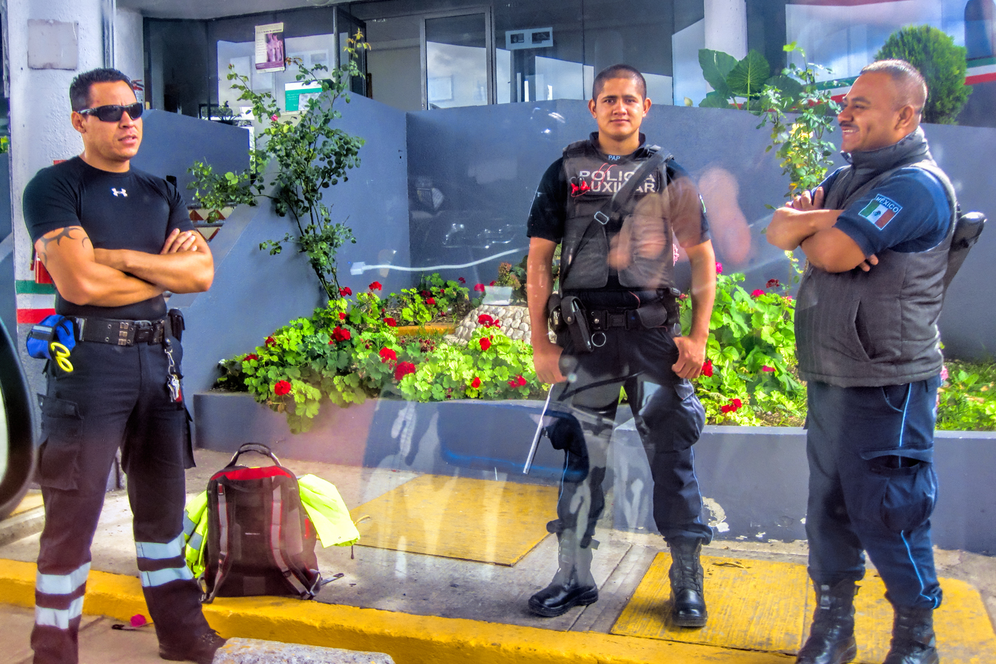
It was already after 5 PM at this point, and we still had a three hour drive to Monterrey. I realized, with a sinking feeling in my gut, that there was no way in hell we were going to make it before dark. Monterrey is a big city of well over a million people, a relatively sophisticated center of industry and commerce anchoring the third largest metropolitan area in the entire country. Monterrey itself is generally considered safe, and is often referred to as one of the most liveable cities in Mexico. Under the surface, however, the Cartels are unreasonably active, using the city as a base for a broad range of criminal activity, and one of the areas where they are MOST active is on the highway between Monterrey and Nuevo Laredo. The press refers to that 137 mile stretch of MX 85 as the “Highway of Death,” in reference to all the shootouts, mass kidnappings, and murders that have taken place along that road. I didn’t know any of that at the time. What I did know was the simple fact that driving it at night was a bad idea.
I already knew the way out of town, and we already had a full tank of gas, so we got straight to it. MX 85 was a divided highway with a fair bit of traffic. We’d no sooner gotten up to cruising speed when we ran into what appeared to be a military road block, a lot of trucks and troops, stopping everyone passing in either direction. When it was our turn, soldiers in SWAT gear surrounded my Jeep, and an officer with a machine gun gestured for me to roll down my window. He asked me where we were going. I’d learned my lesson in customs, and knew better than to mention the Yucatan. “We’re going to Monterrey,” I said, without elaborating.
He checked our ID’s and our travel documents, then handed them back. “Don’t stop along the way,” he advised. “You need to get off this road and to a safe place as quickly as you can.” As if I needed to be told!
At the halfway point, MX 85 changed to MX 85D, a toll road. There was another checkpoint by the toll booths, this time the National Police, and they were even more heavily armed and armored than the soldiers. We had no license plate on the front of the Jeep; Arizona is one of several states that no longer issues front plates. The Federales saw us coming and pulled us out of line, demanding an explanation for the missing plate, wanting to know what we’d done with it. My rusty Spanish was coming back surprisingly well, so I was able to explain that my home state was “too cheap” to give us two license plates. They actually thought that was pretty funny, so we all had a good laugh, and they waved us on, after cautioning us not to dawdle along the way. While we were talking to them, I noticed a carload of young Mexican guys getting yanked out of their vehicle. Half a dozen cops in full SWAT gear had them spread-eagled on the ground, while another half dozen cops literally tore their car apart, even ripping open the upholstery on the seats. Michael watched all that for a moment, then turned toward me, raising one eyebrow quizzically. “Welcome to Mexico,” I said with a smile.
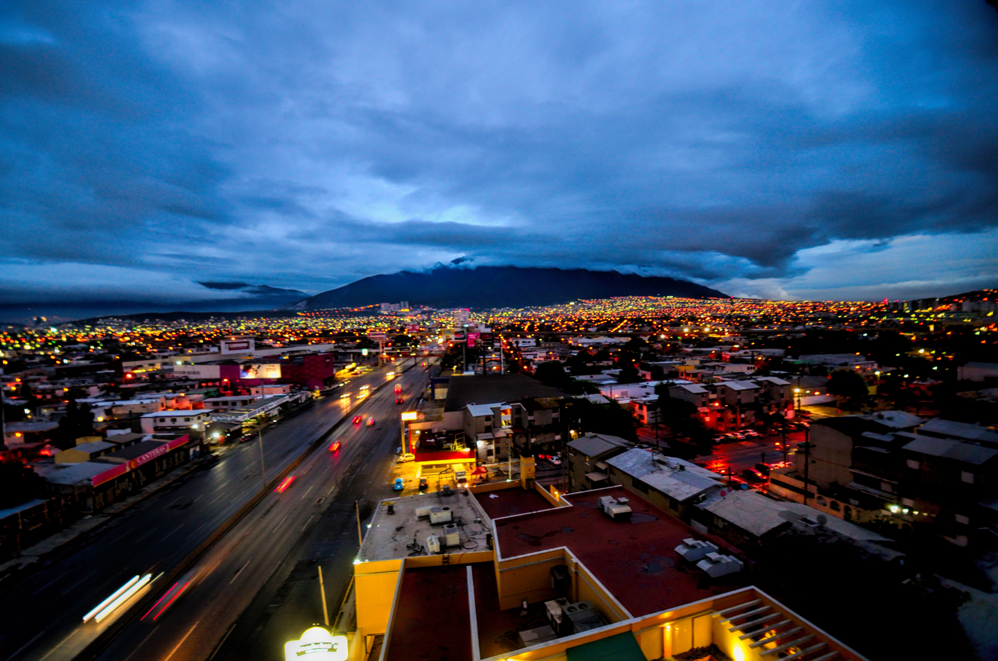
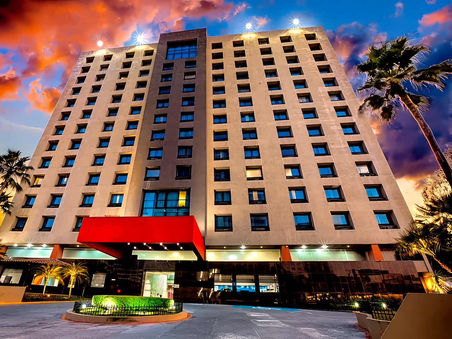
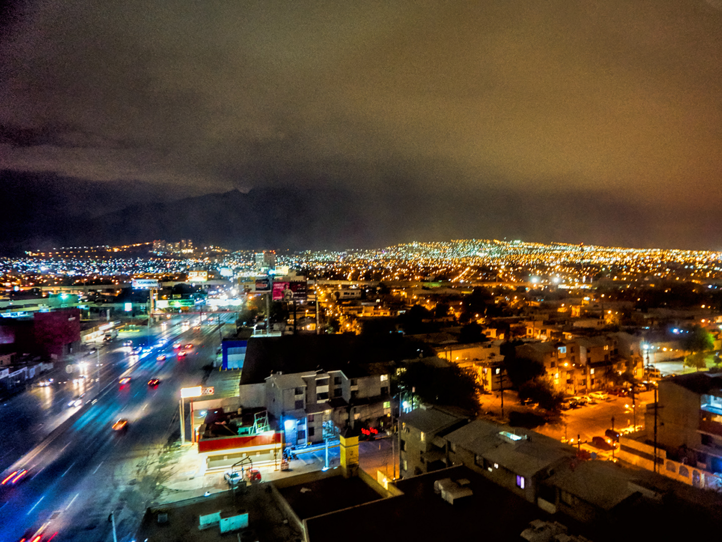
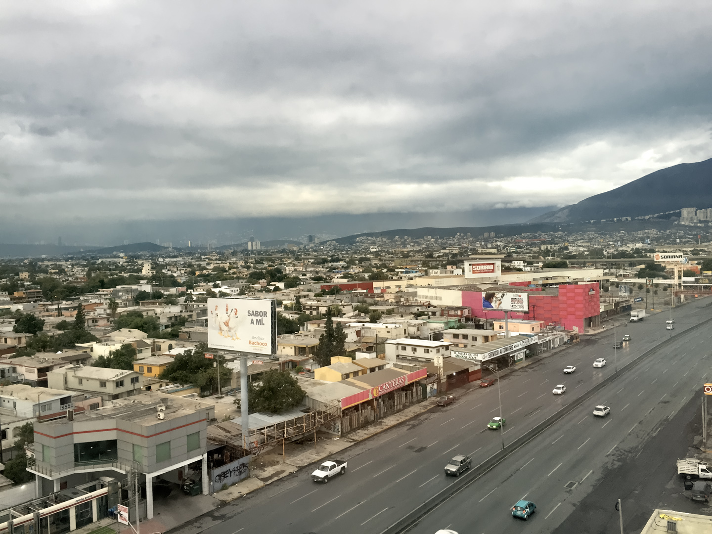
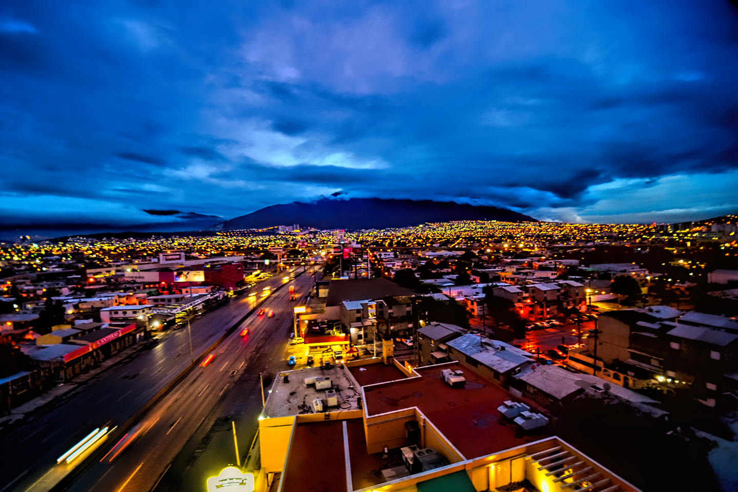
We fairly flew down that highway, not slowing down for anything other than the roadblocks and toll booths, and we rolled into Monterrey just after 7:30. The sun had long-since set, but the city was lit like a Christmas tree, with crazy traffic zooming along wide boulevards. We knew nothing about the place and had no idea where to stay, but we were so rattled by the tense drive south from Laredo, we would have been fine with just about anything. I spotted a La Quinta Inn. It was new, fancy, and undoubtedly expensive, but I really didn’t care; I was desperate to stop driving! I whipped in, we checked in, and got a room with a great view, all the way up on the 10th floor. We’d made it, and that felt like a victory!
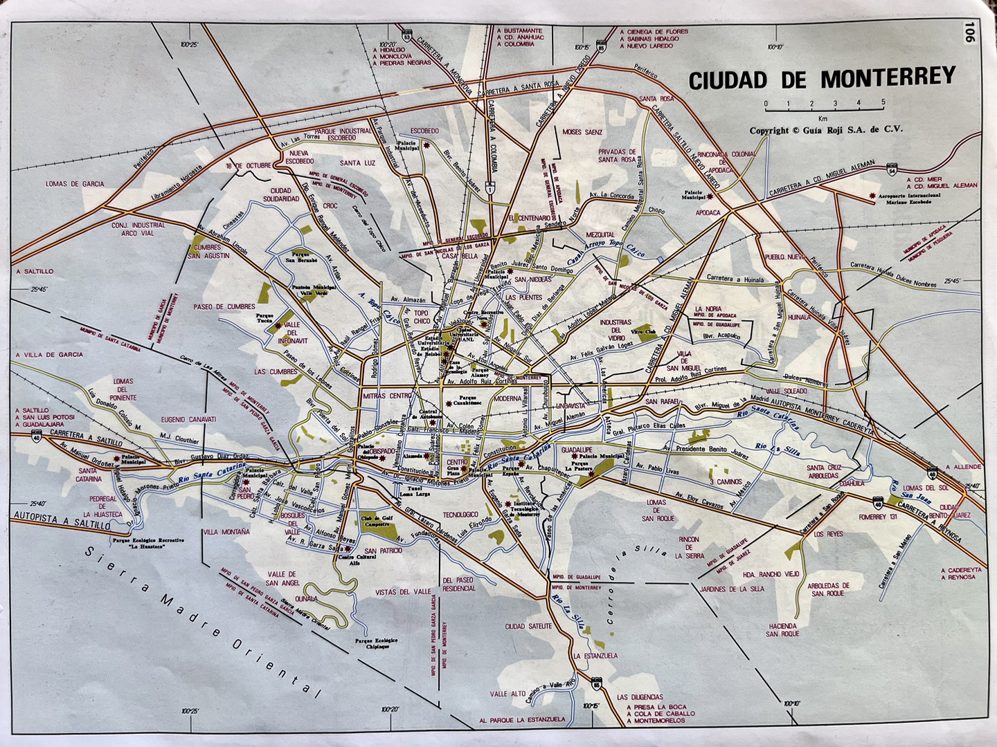
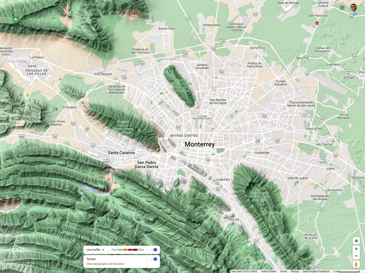
Maps of Monterrey, and views of the city from the 10th floor of La Quinta Inn.
DAY 2: FROM MONTERREY TO QUERETARO
That first morning, we took advantage of the complimentary breakfast at our hotel. There were a few other travelers in the dining room, but most of the guests were Mexican businessmen, and if it wasn’t for that, we could easily have been at a La Quinta Inn across the border in Texas, or anywhere else in the U.S. Mike and I made a pact over our scrambled eggs: from that point forward, we were going to scrupulously AVOID American chain hotels and restaurants. We were in Mexico, after all, and it made no sense to settle for homogenized lodging that was the exactly same as what we would have found at home.
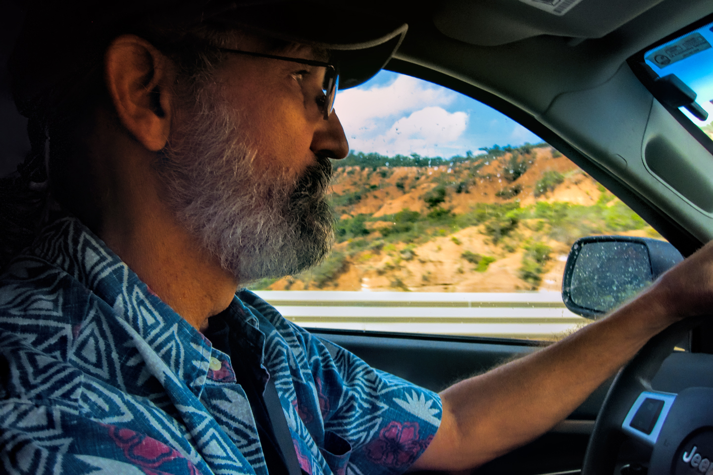
We checked out and hit the road a little after 8:00, anxious to get moving, and hopefully cover some distance. Unfortunately, the City of Monterrey had other ideas. It was rush hour, and the traffic was packed so tightly together it was nearly impossible to change lanes. We kept missing our exits, and before long it was obvious that we were driving in circles. There were mountains behind the skyline to the south, so I kept one eye on on the tallest peak, and the other eye on the compass on my dash board. That got me going in the right direction until I finally saw signs for Saltillo, the next big town along our line of travel.
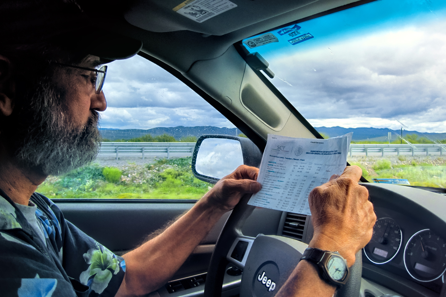
I’d mapped out a route that stuck to the toll roads, using an App provided by Mexico’s Secretary of Transportation: <<Traza de Ruta: Toll Calculator and Route Planner>>. The tolls are actually a bit expensive, but well worth it; the toll roads, known as Cuotas, save time, because they bypass all the small towns. They’re also better maintained, and safer, since they’re more frequently patrolled.
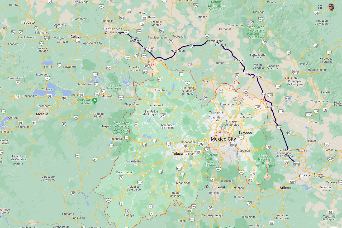
Our plan for the day was to take MX 40-D to Saltillo, then MX 57-D south from there, to San Luis Potosi and Queretaro. I wasn’t really sure how far we’d get that day. I figured we’d just play it by ear, and see where we were when the sunset hour approached.
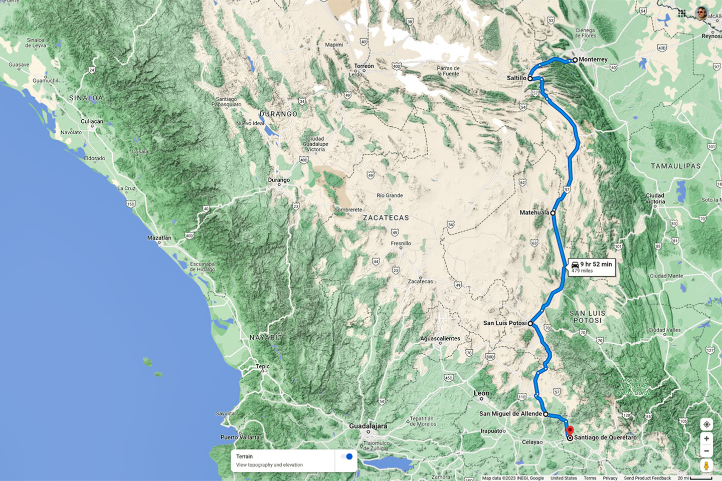
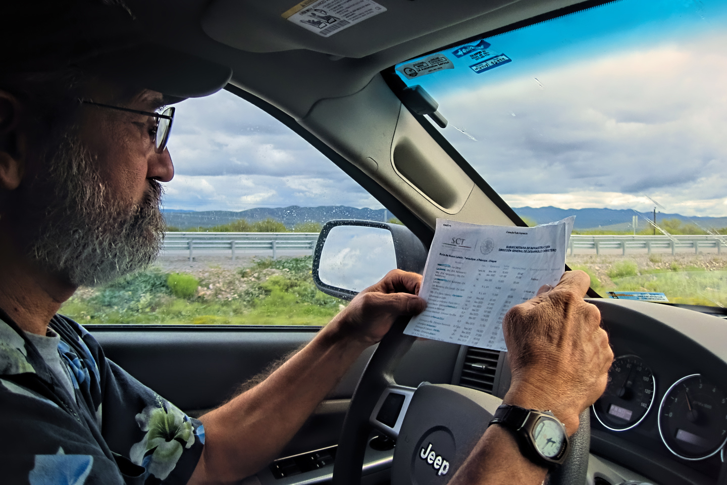
Second day of travel, from Monterrey to Queretaro; checking my “Traza de Ruta” printout of the toll roads.
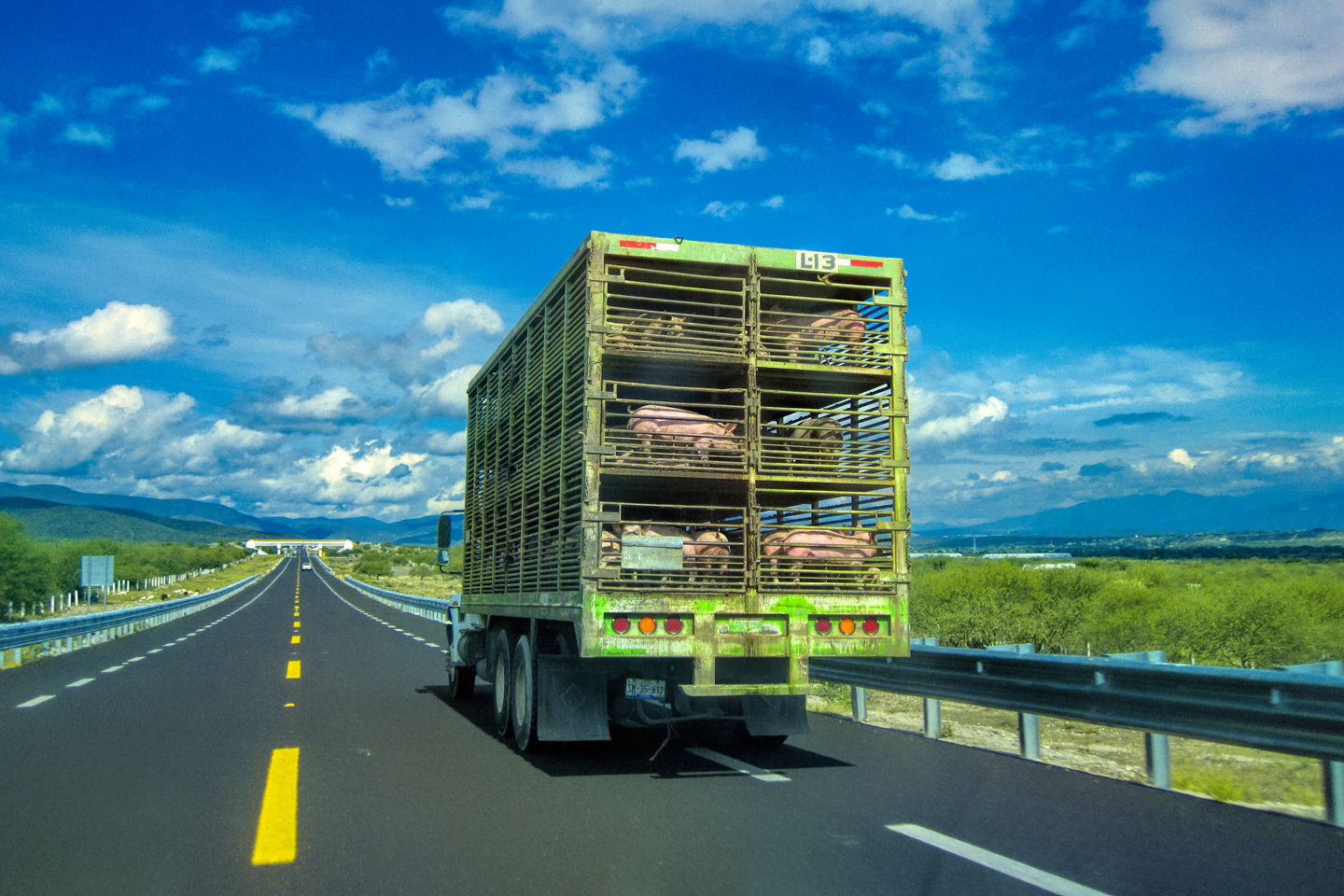
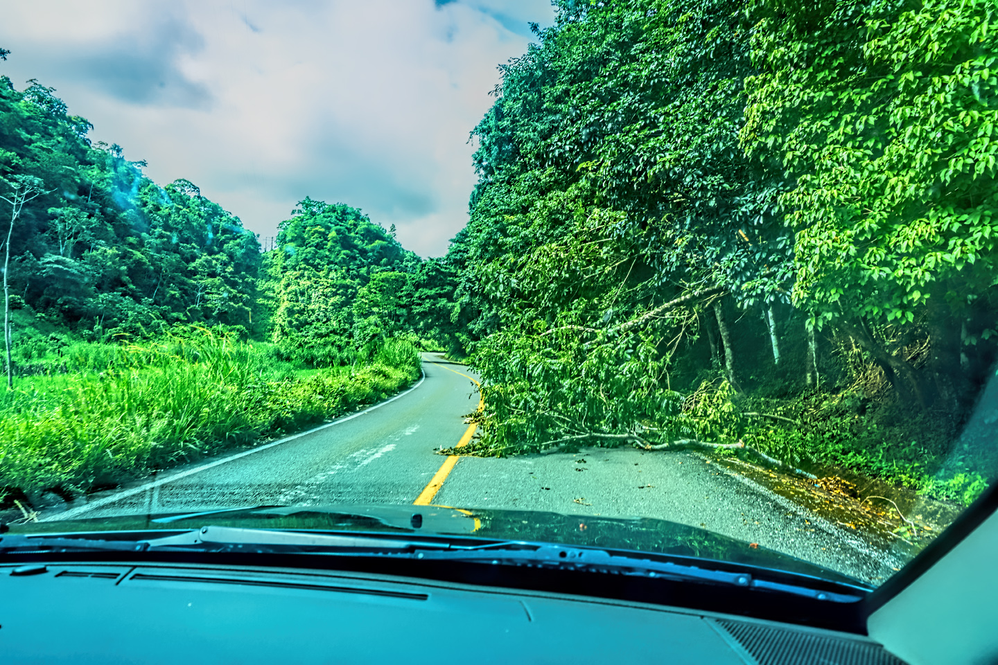
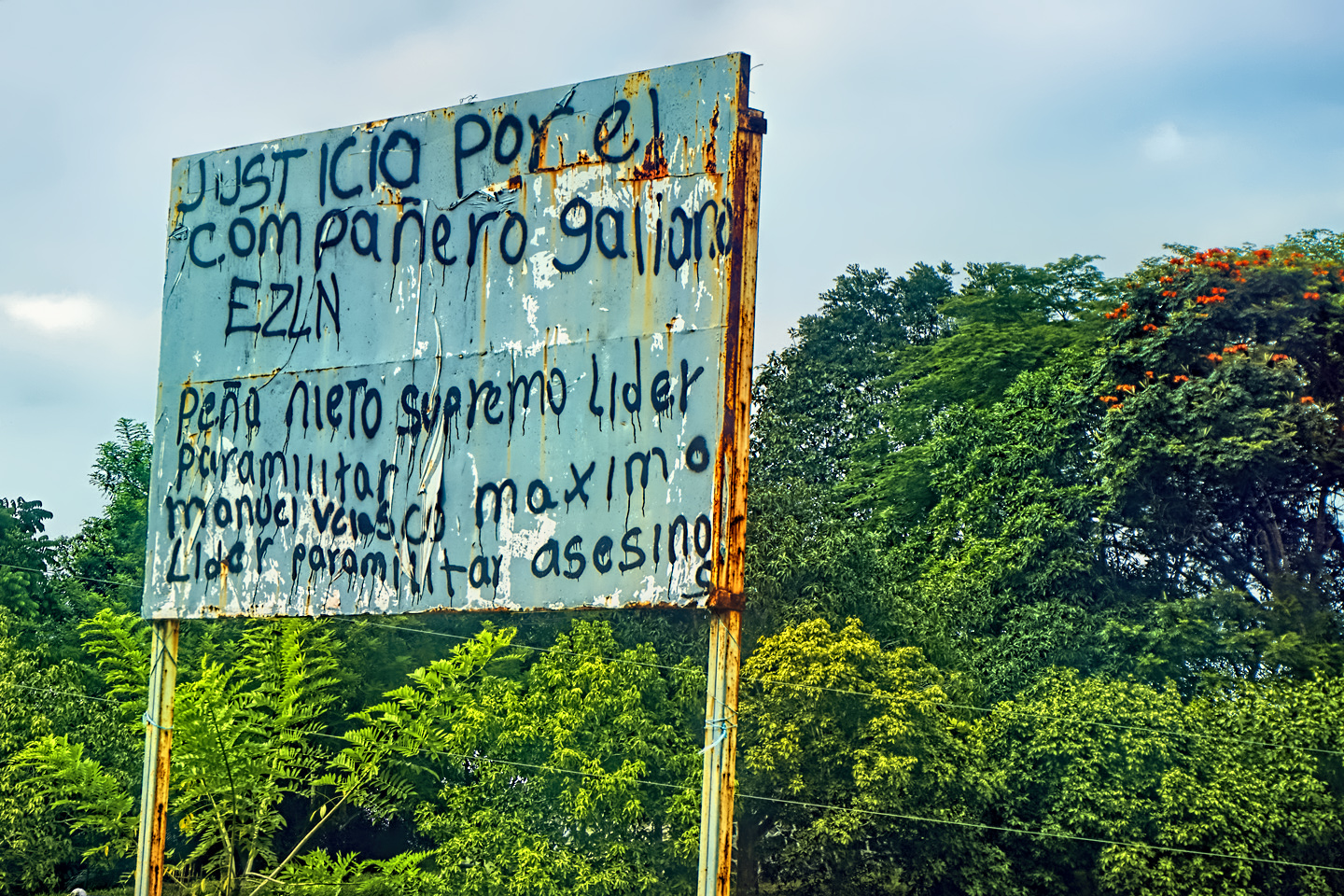
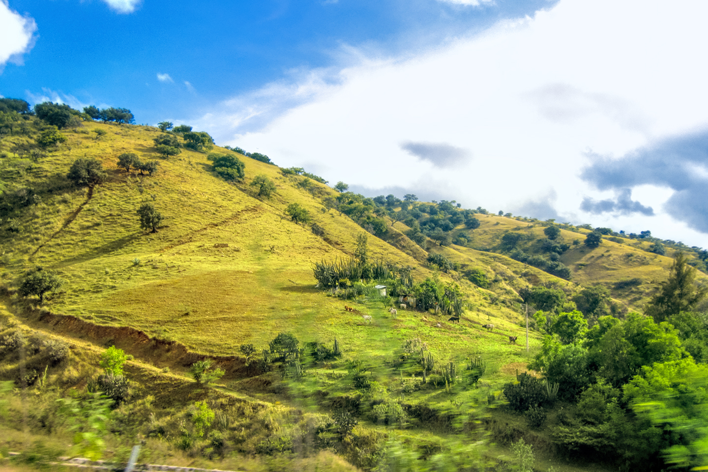
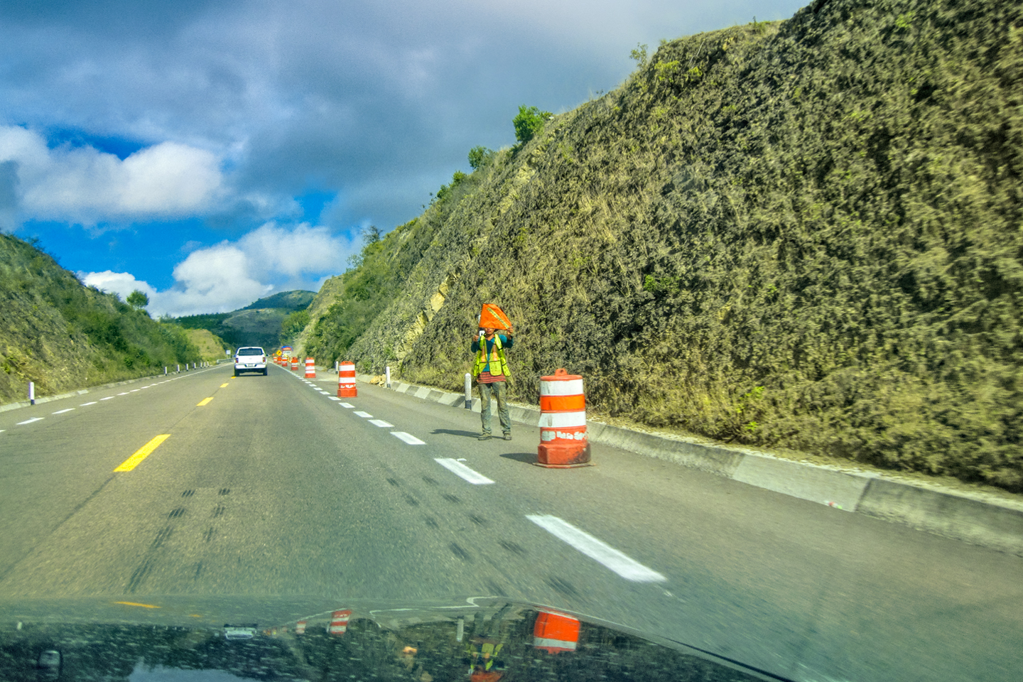
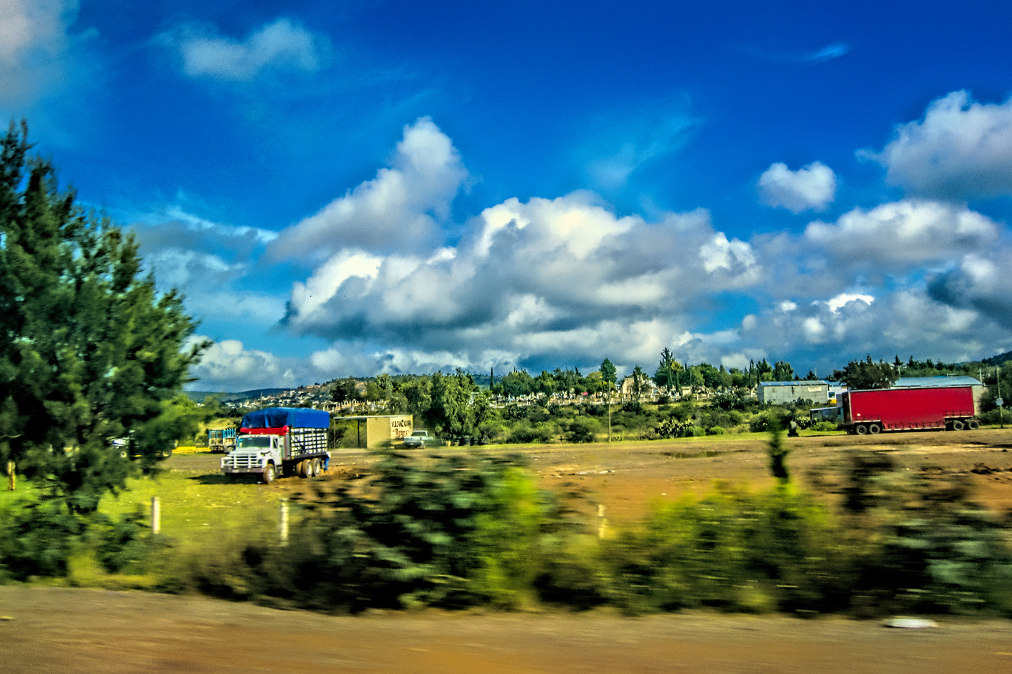
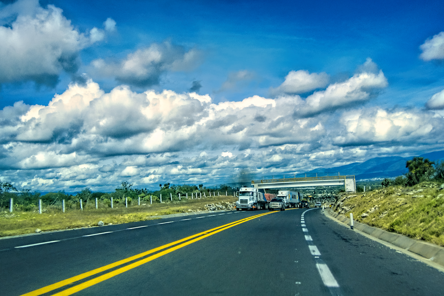
This was strictly a driving day. I hadn’t planned to make any stops, focused instead on putting as many miles as possible between us and the border. We were clearly still in the danger zone, because the army was everywhere, with more of the mobile roadblocks and truckloads of soldiers on the highways. There were camo-painted Jeeps with 50 Caliber machine guns mounted in the back, and even a few armored personnel carriers. It reminded me of the years I spent driving around in Colombia, back in the early ’70’s, when that country was under martial law, and in the throes of an ongoing civil war. Mexico clearly has a war going on as well. Hearing about it was one thing. Seeing it in person was something else again!
Scenes along the road: Saltillo to San Luis Potosi. There was a heavy police and military presence along this stretch.
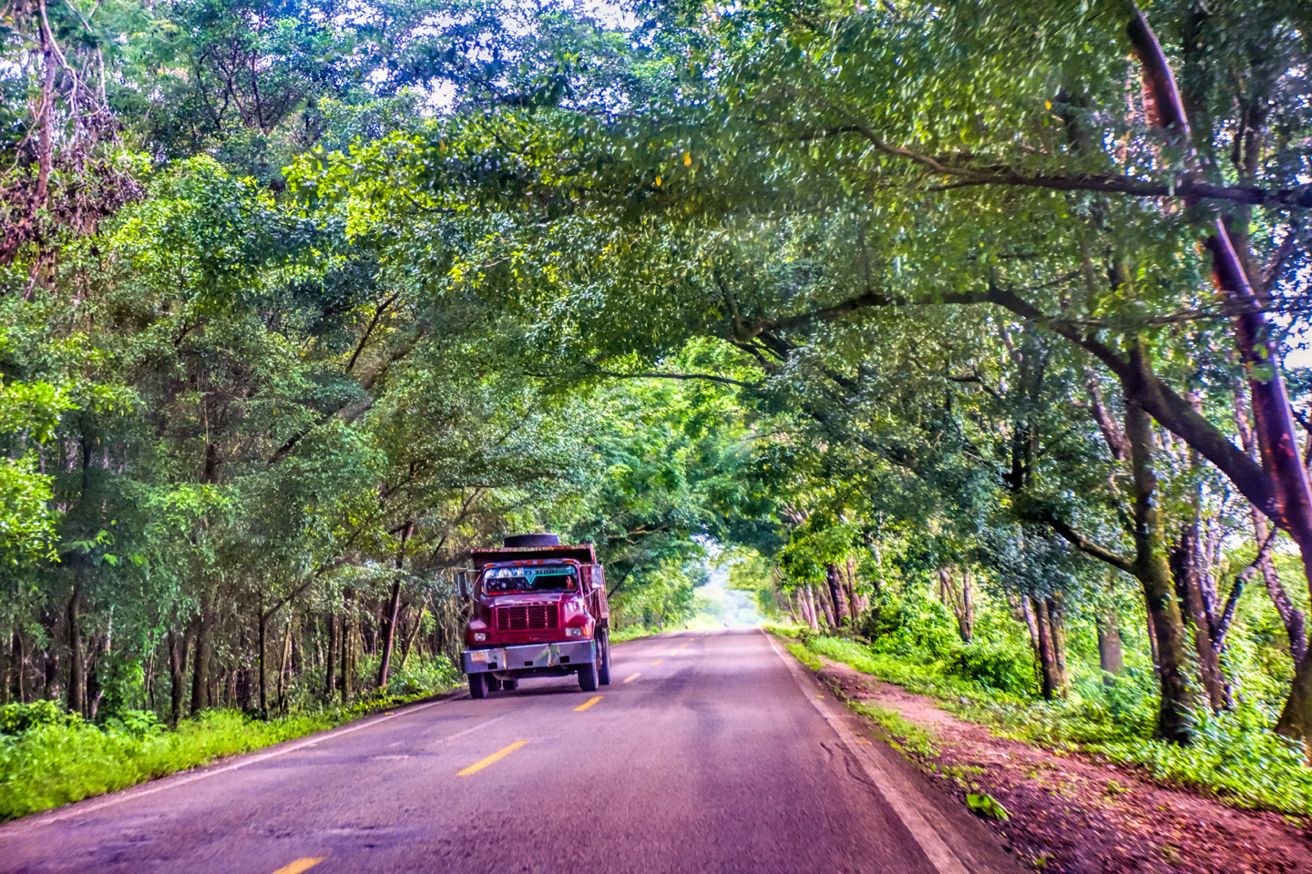
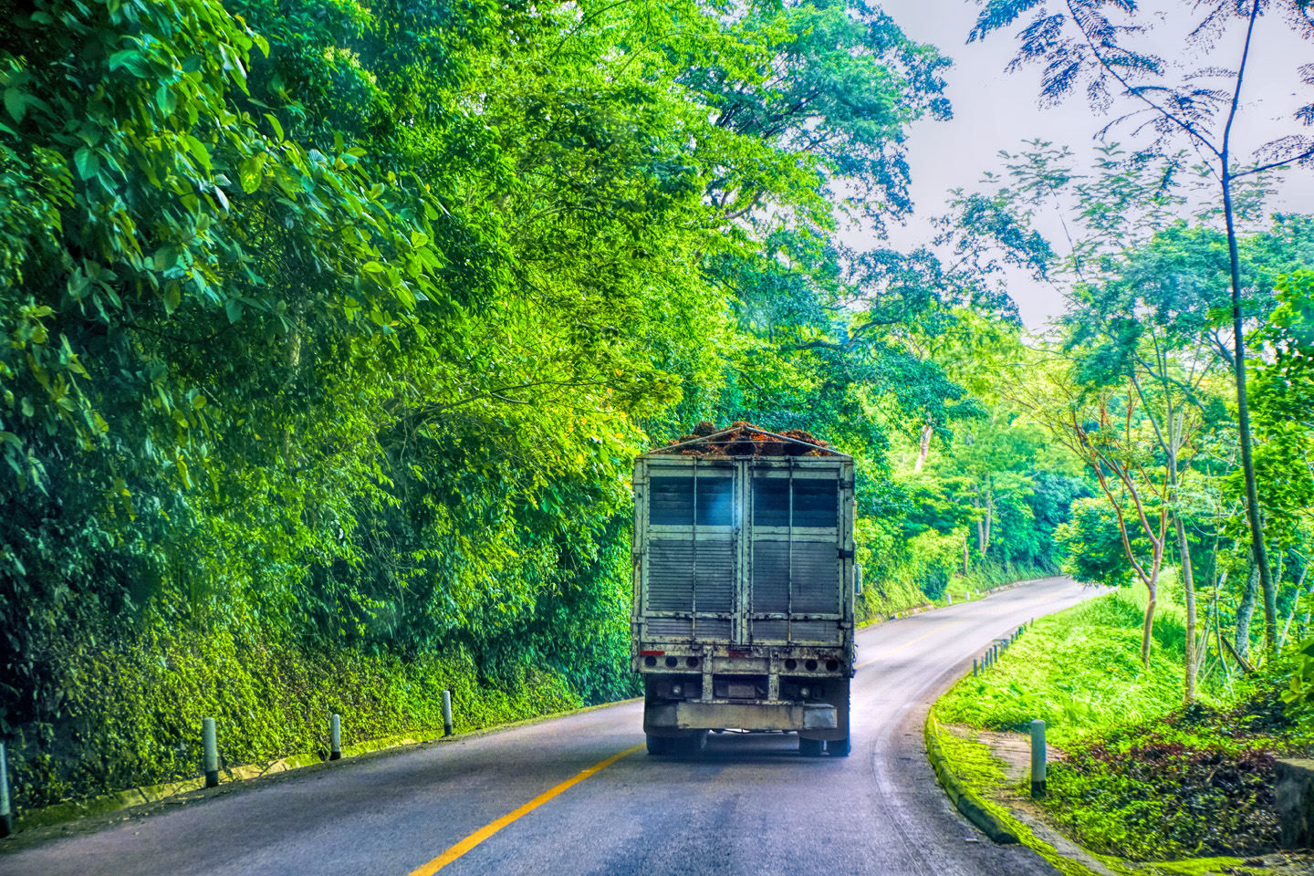
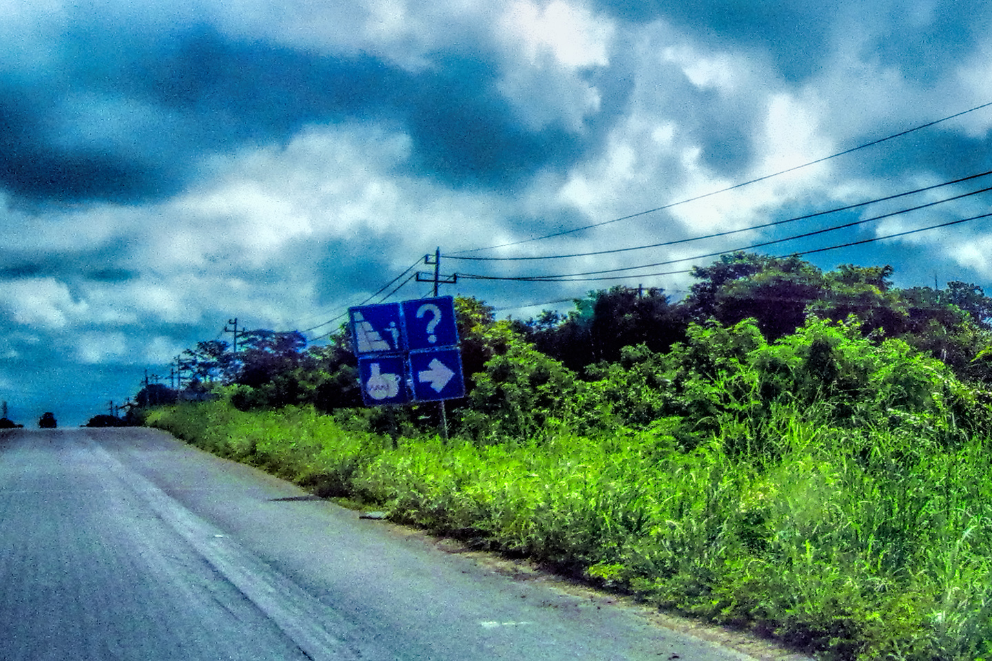
The Cuotas are expressways, in the sense that they are divided roads with limited access and no intersections. In and around the big cities like Monterrey and Queretaro, they’re built to modern standards, and carry high volumes of traffic, just like the expressways in the U.S. and Canada. Once you get away from the cities, little differences creep in, the most obvious being the presence of unexpected hazards in the roadway that require an added level of vigilance.
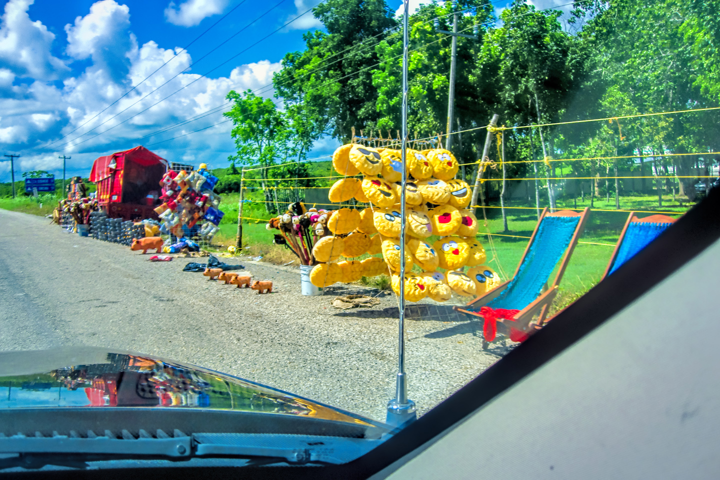
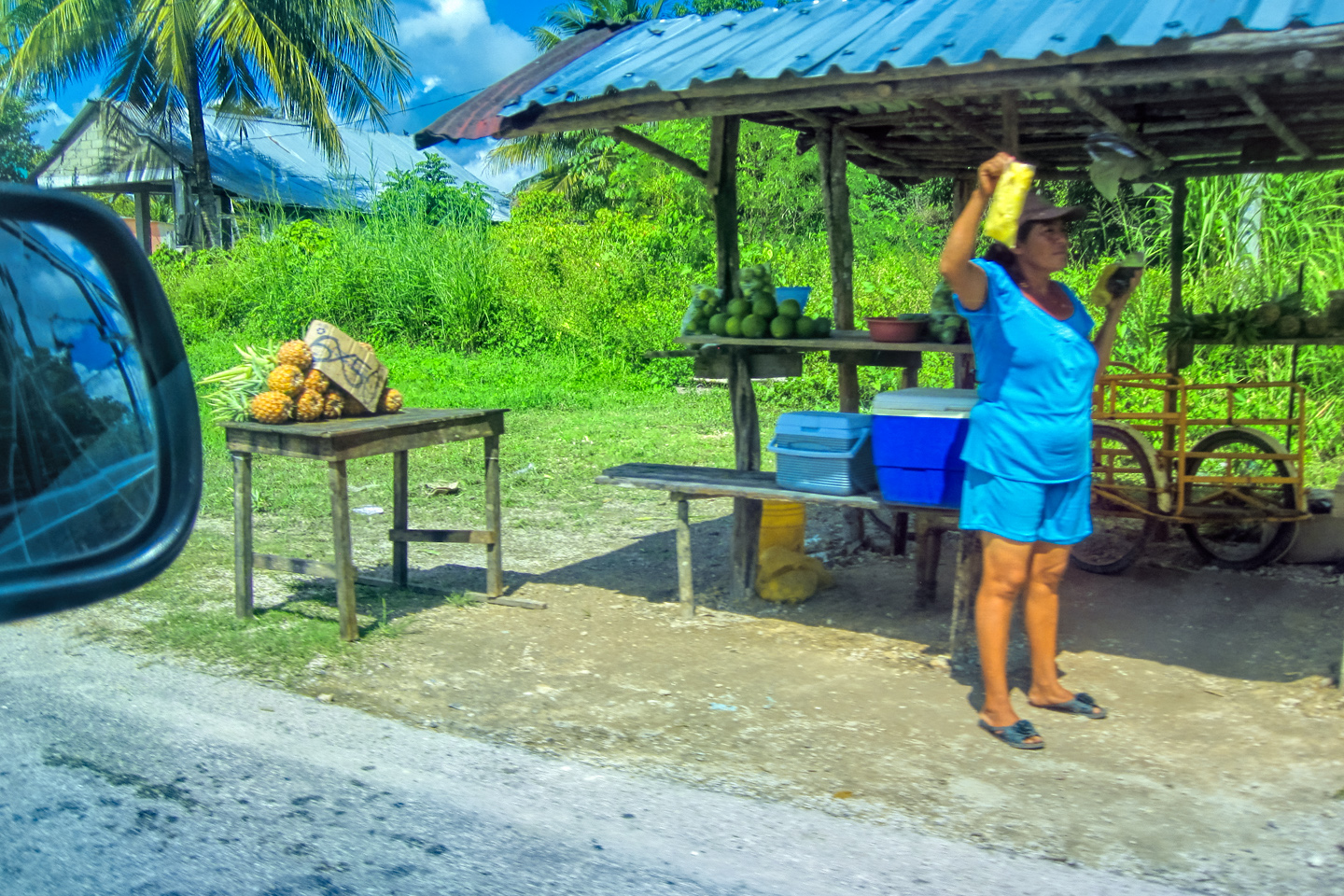
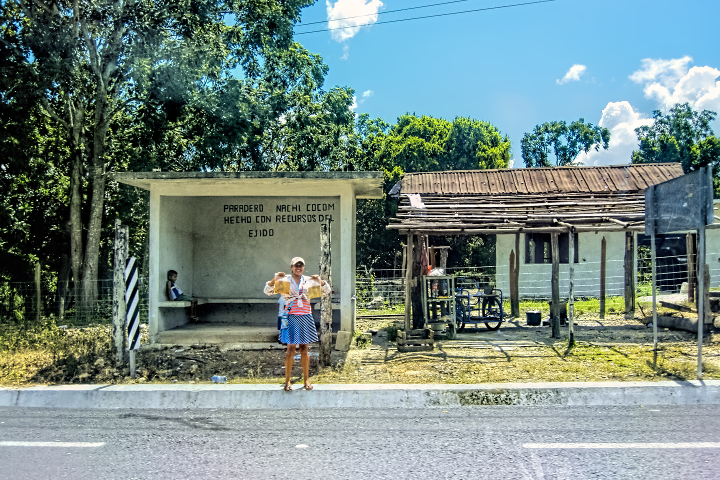
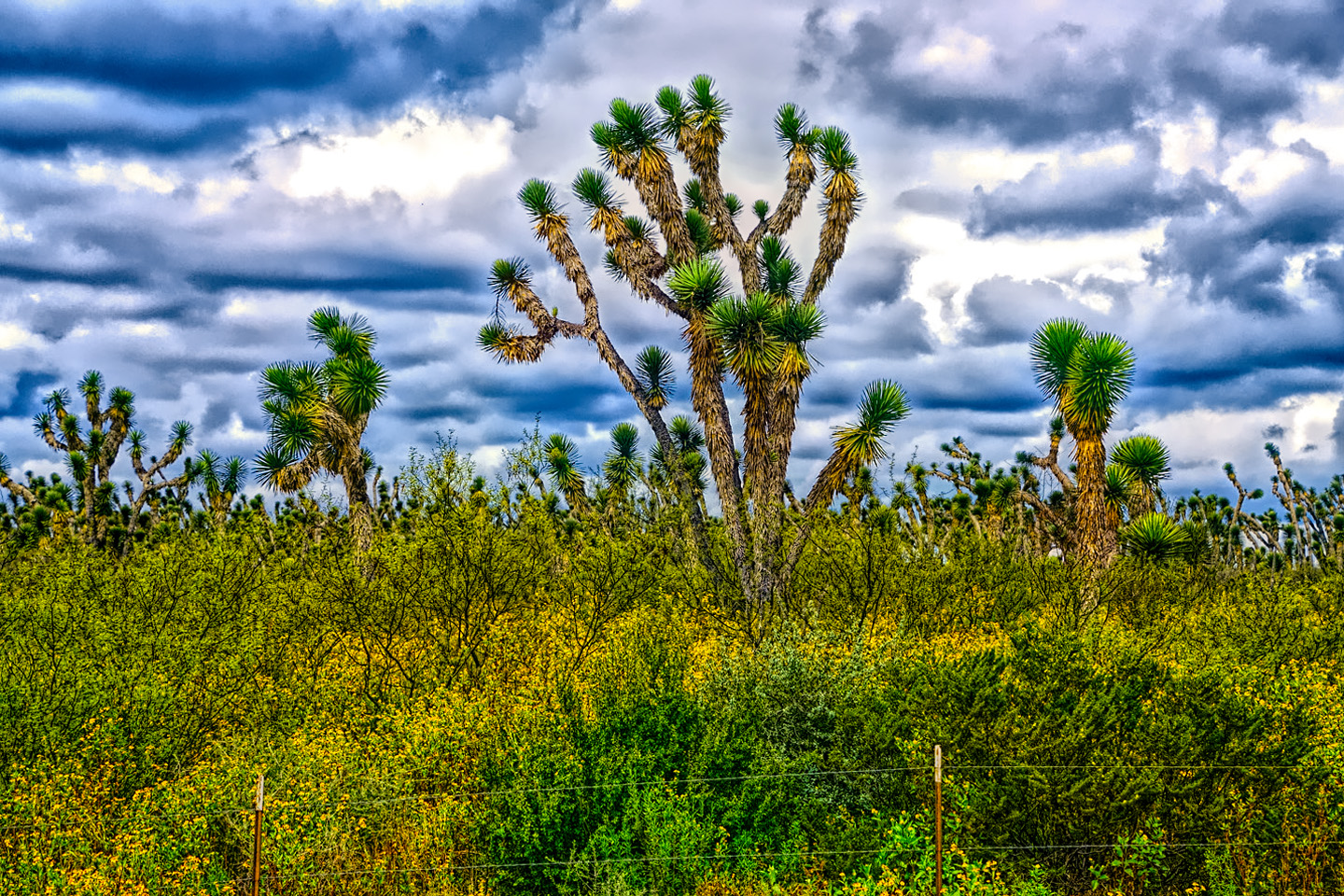
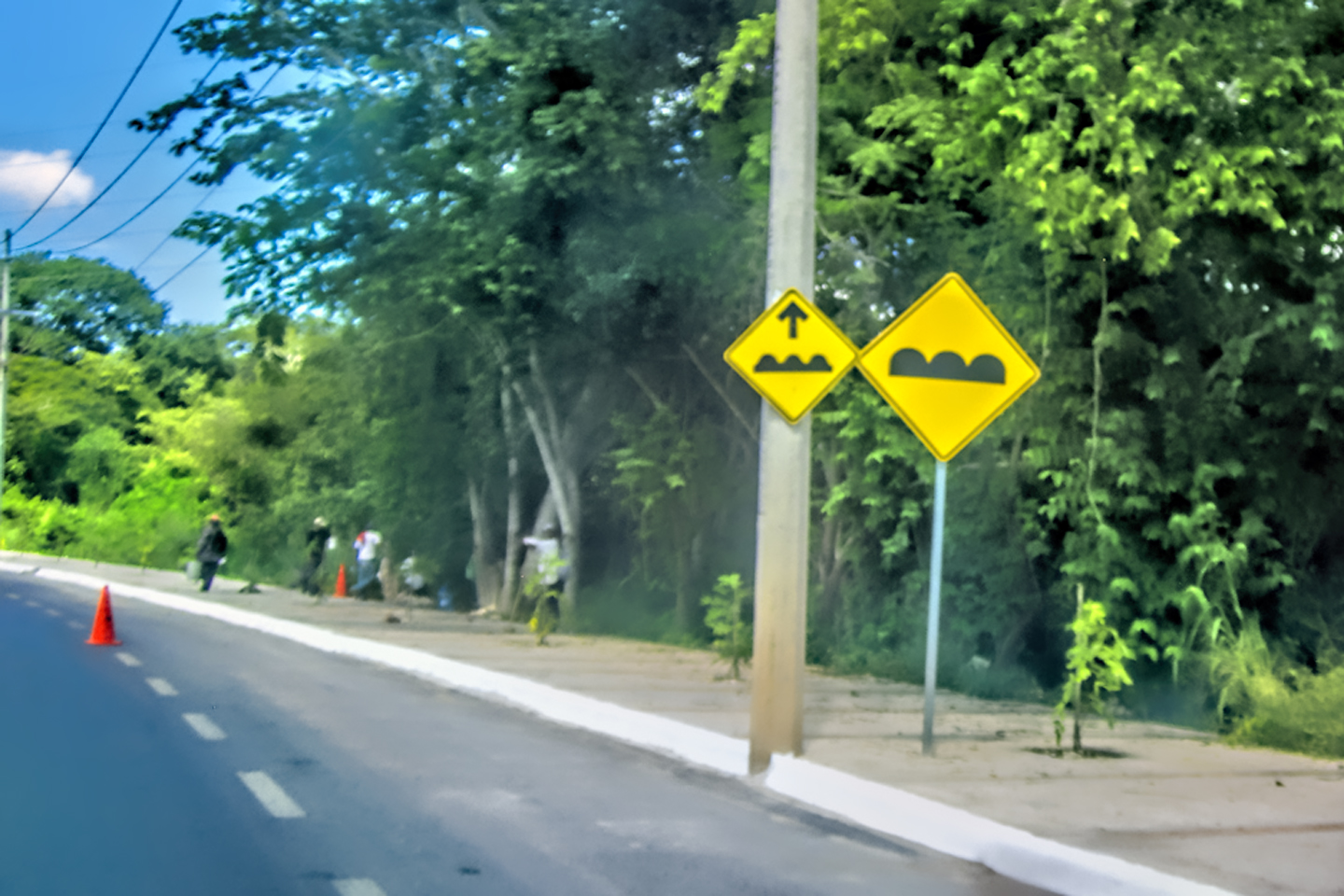
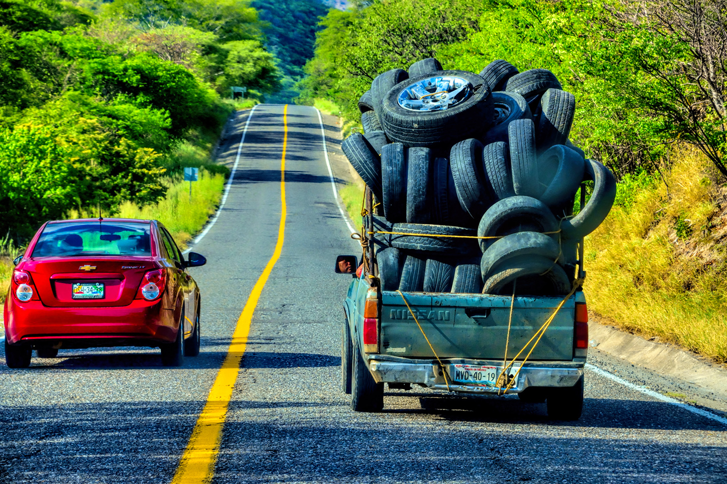
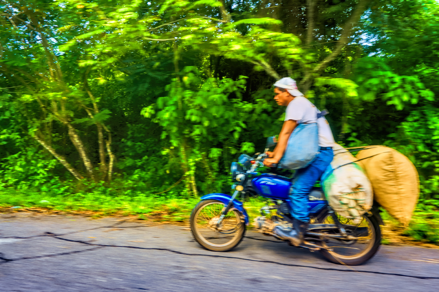
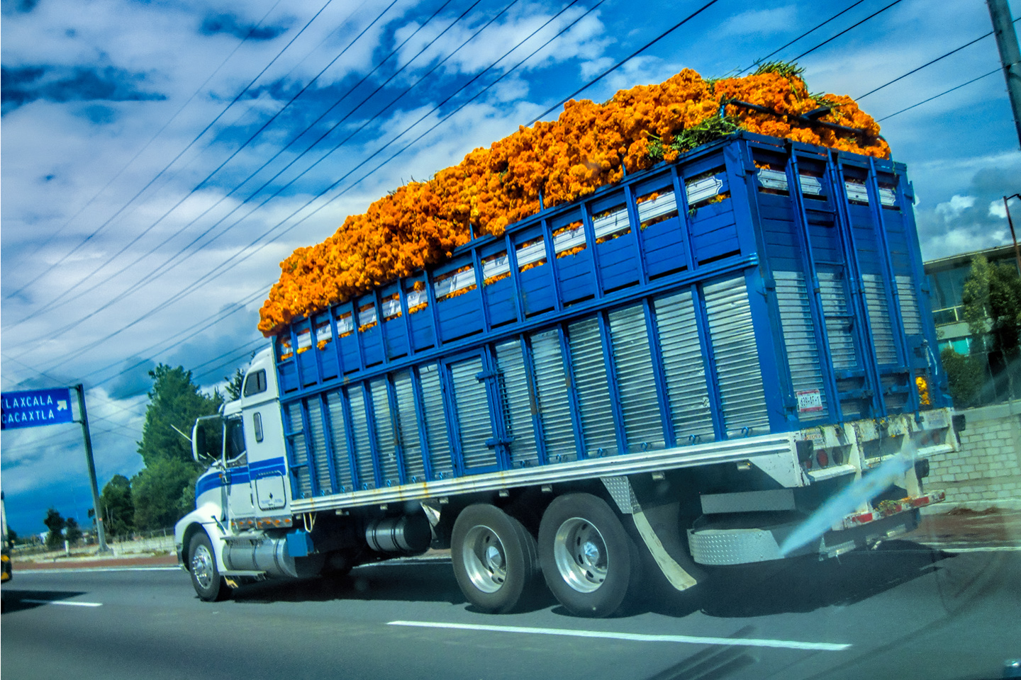
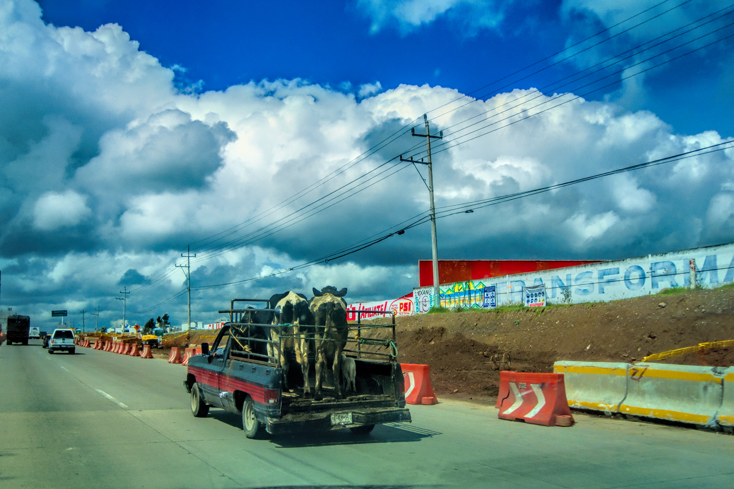
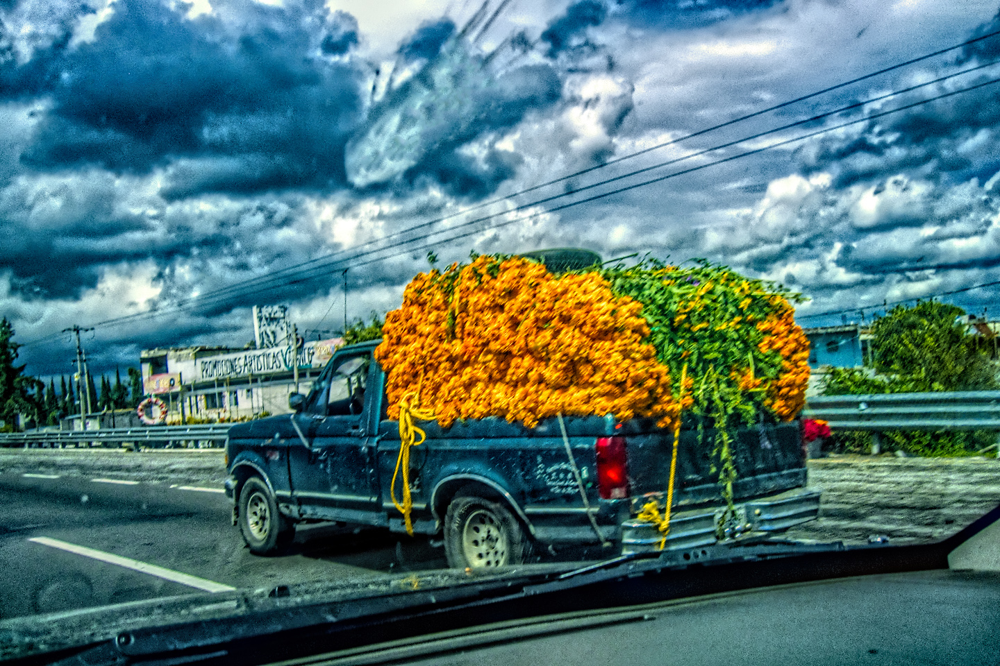
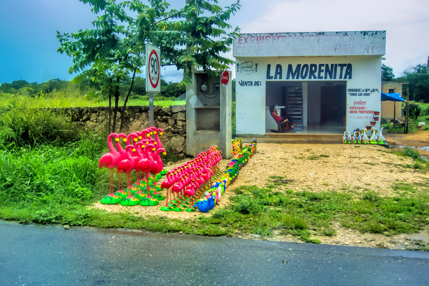
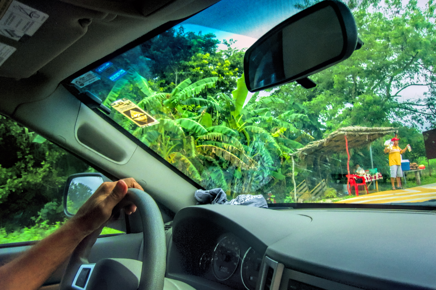
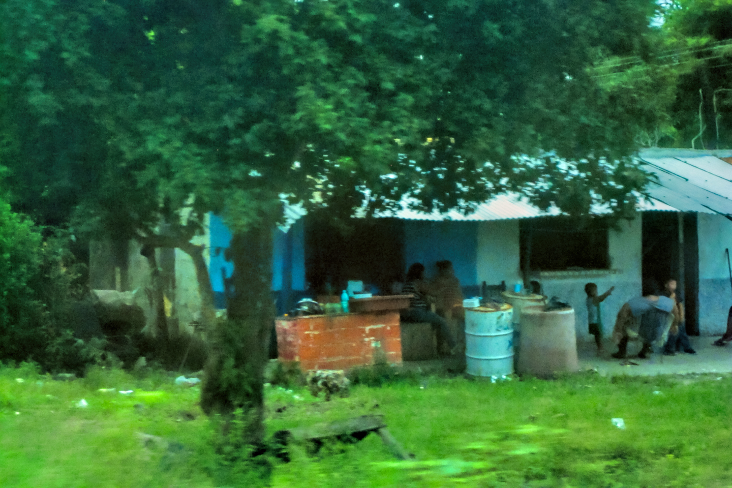
It’s not uncommon to see pedestrians in unlikely places, not to mention burros, goats, and chickens, as well as potholes large enough to damage your car if you hit them straight on. You’re not supposed to stop along these roads, much less park, but that doesn’t stop vendors from setting up stands along the shoulder selling everything from lemons and strawberries to homemade “licor de café,” (a concoction that’s presumably similar to Kahlua). The more rural the area, the more prevalent these distractions, so it definitely behooves you to hold down your speed, and keep your eyes peeled.
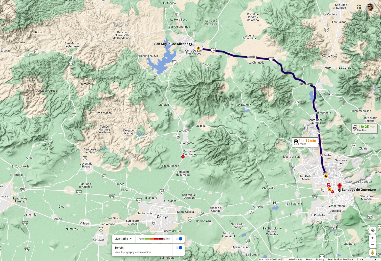
That afternoon, I realized that we’d be passing within 25 miles or so of San Miguel de Allende, a charming colonial city I’d always wanted to visit. I figured that might be the perfect place to pull up for the night, so I made a slight detour off the main highway, and we drove to San Miguel. As it turned out, our timing couldn’t have been worse. There were roadblocks manned by Federales on all the roads in or out of the town, and the central plaza was completely cordoned off by the police. It seems there was a celebrity wedding going on, and they’d taken over the whole place! I started checking hotels, but everything in the area was booked solid.
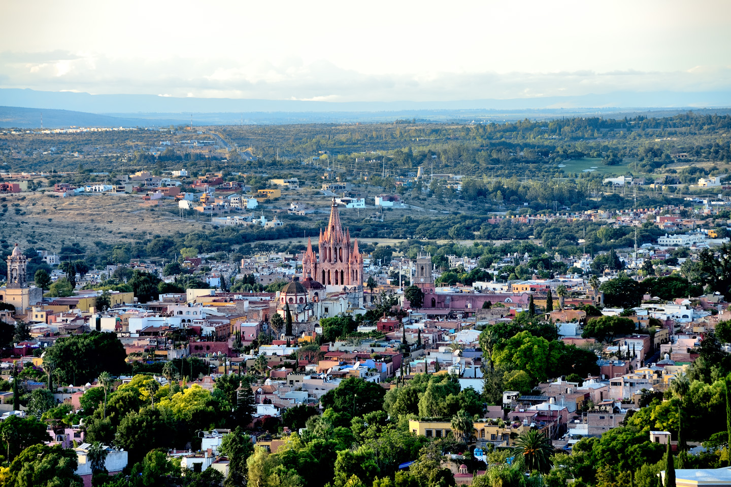
Appreciating the scenery in San Miguel de Allende. Every hotel in town was booked, so we had to move on!
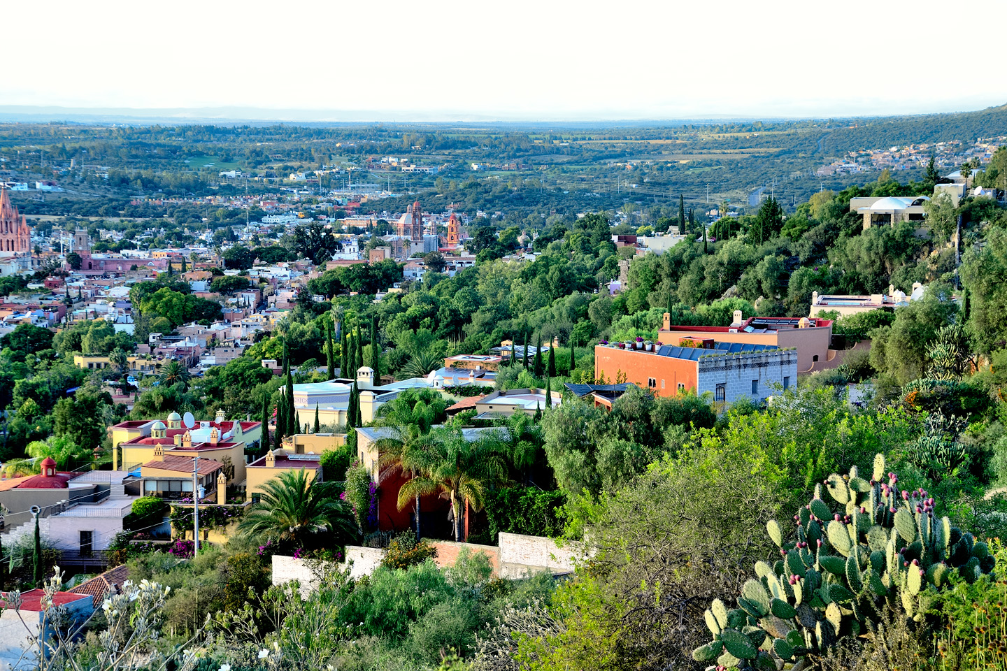
What little we saw of the town truly was charming, with steep cobblestone streets, and beautiful colonial architecture. “We’ll just have to come back here,” I said to Michael. “Maybe at the end of the month, on our way back north.”
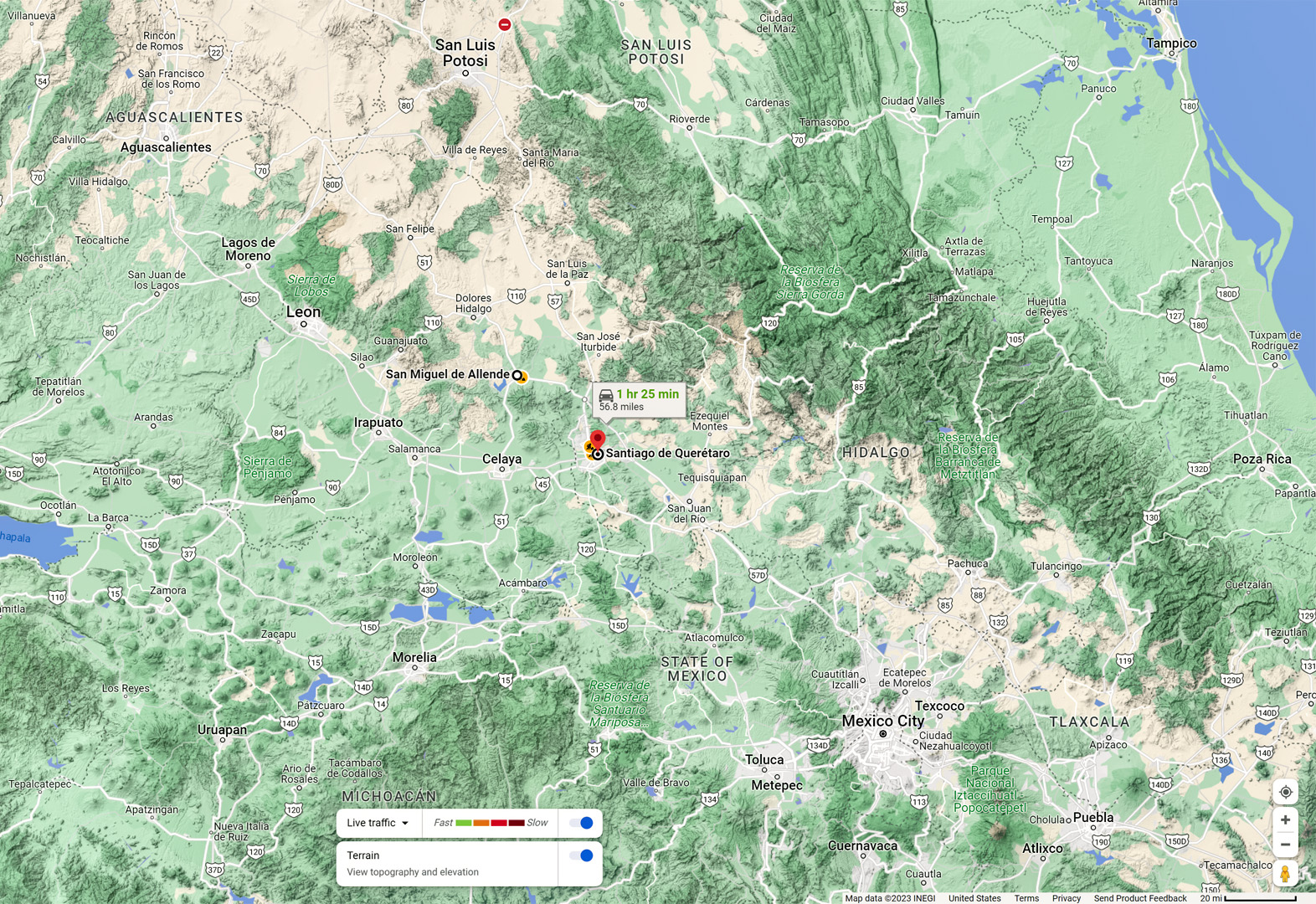
Queretaro, a much larger city, was only an hour away. I figured we’d have unlimited options for lodging in a place that size, so off we went, arriving there just as the afternoon faded into evening. Queretaro turned out to be almost as confusing as Monterrey. We cruised around searching for hotels, and simply weren’t seeing any, not until we turned down a road on the perimeter of the city, where we found a half dozen possibilities, lined up in a row. They looked more like villas than hotels, but there were neon signs advertising rooms at remarkably low prices, only $450 Pesos (about $25).
I pulled in to one of them, but didn’t see an office, just a gate that seemed to be locked. There was a call box on the wall, so I pushed the button, and a charming female voice asked what she could do for me. I inquired about rooms, and she said that they had one. I asked if the price on the sign was correct: $450 Pesos for the night? The woman giggled. “No,” she said. “It’s $450 for an hour, but that’s only if you bring your own companion. It would be more, of course, if you use our other services.” My eyes went a little wide, and I busted out laughing, no help for it. We’d stumbled into a whole neighborhood full of drive-in bordellos! I made our excuses, still laughing, and we drove back down the hill.
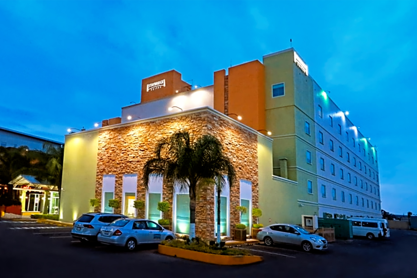
Making our way through the city, I spotted a Staybridge Suites, right alongside the freeway, so I took the next exit, and after a bit of confusion involving one-way streets, we parked in front of the lobby. What was it we’d said to ourselves about American chain hotels? This was part of the same chain as the Holiday Inn, but after our adventure up on the hill, we just wanted a bed for the night, so we swallowed our pride and went for it. The hotel was clean, and well appointed, but it was a boring clone of every business class property I’ve ever stayed in. Somehow, we were going to have to do a better job of finding hotels!
DAY 3: FROM QUERETARO TO VILLAHERMOSA
Over breakfast the next morning, we took a hard look at our maps. We’d driven 600 miles since crossing the border, and we still had almost 700 miles more to go before we’d reach our first real stop: the ancient Mayan city known as Palenque, all the way down in Chiapas, the southernmost of the Mexican states. We didn’t have any fixed itinerary beyond that. Mayan ruins were going to be a major focus of our Road Trip, and I knew which sites I most wanted to visit, but at that point, I was playing everything by ear. We were considering pushing on into Belize, possibly even Guatemala, but a lot depended on how well things went for us, and it was too early in the trip to make those decisions.
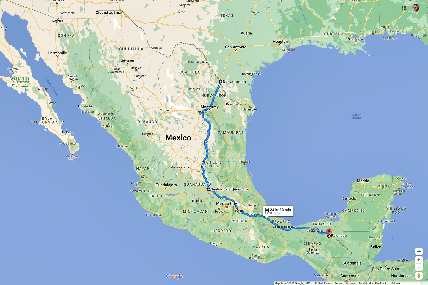
Nuevo Laredo to Palenque: From the Rio Grande to the Lacandon Jungle in a mere 24 hours of driving!
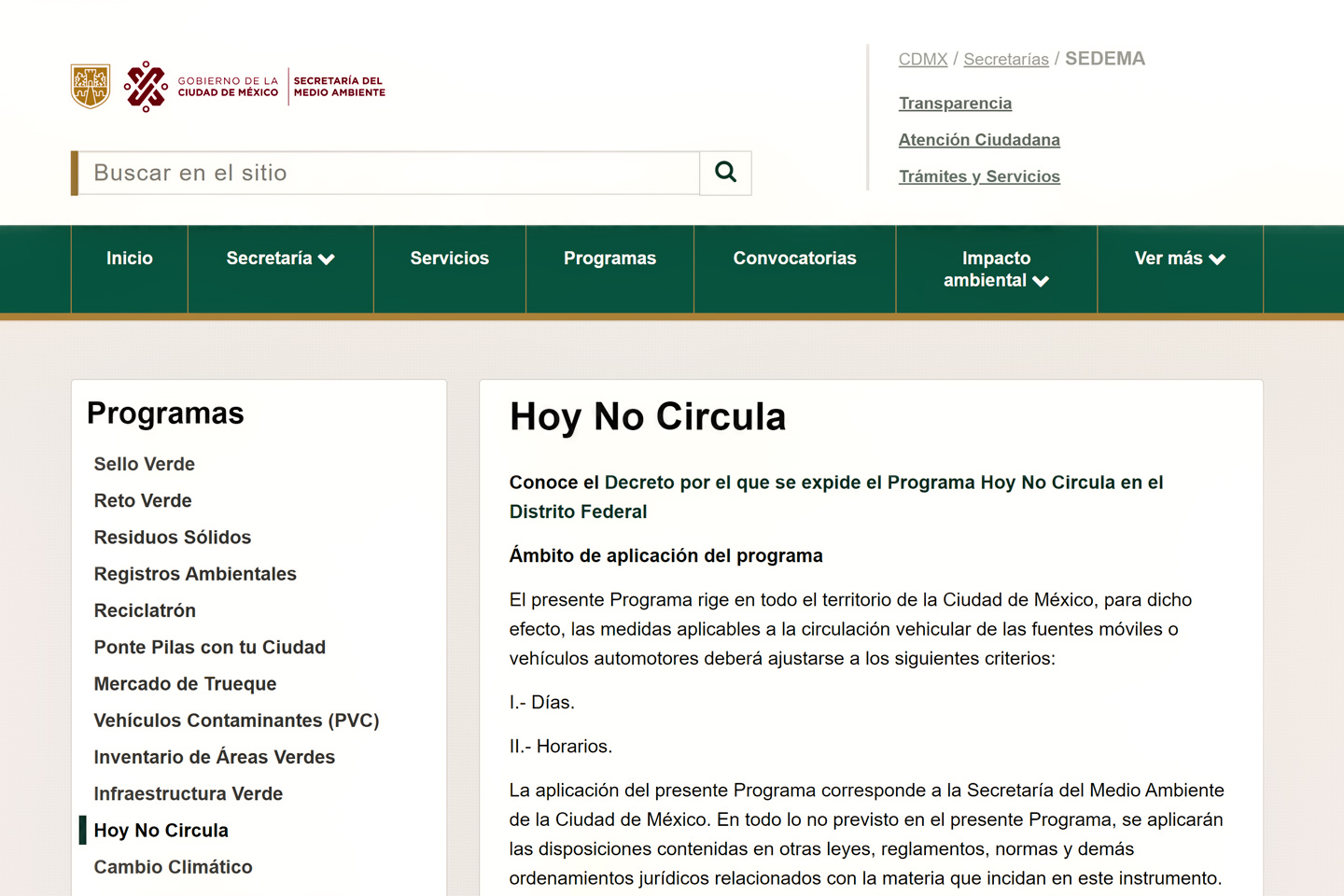
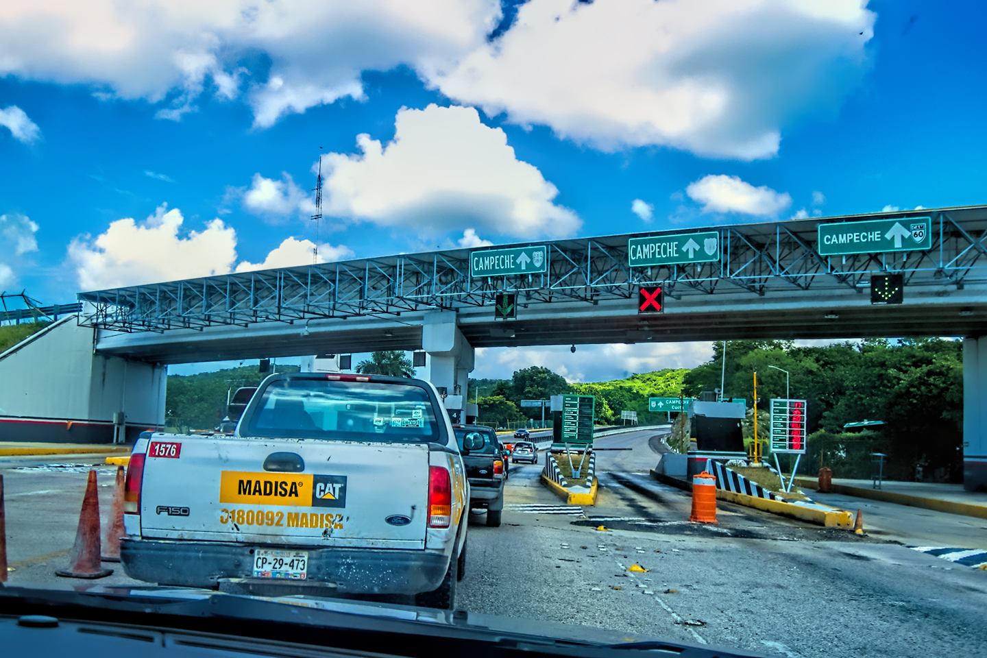
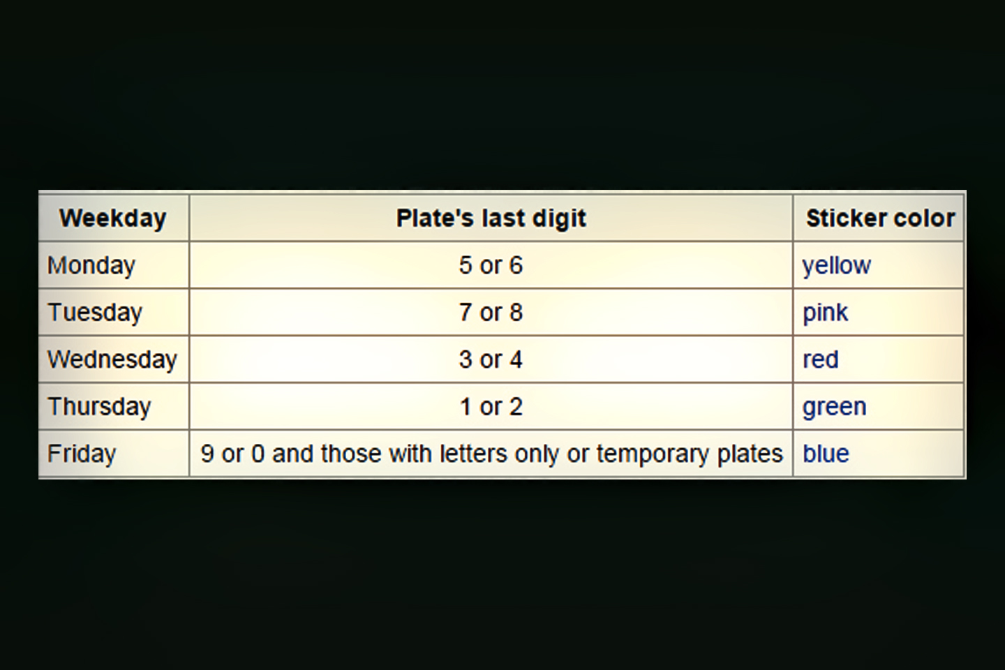
One of my biggest concerns on that 3rd day was Mexico City. I’d recently learned about a law that was in force in Mexico’s Capital, and in the surrounding State of Mexico. Called “Hoy No Circula,” (Don’t Drive Today), the law requires all drivers to leave their vehicle parked one day per week, as a way to reduce vehicle emissions. Air quality in Mexico City is literally the worst in the world, so they’re serious about enforcement, and anyone caught driving on a day when they’re not supposed to gets a citation and a significant fine. Every vehicle on the road is subject to these regulations, even tourists, like us, who are just passing through.
Residents have special holographic decals on their license plates, and they all know perfectly well which days and hours are restricted for their vehicle. The restrictions for visitors are determined by the last digit on their license plate. There is a web application, sponsored by the Mexico City Government, which drivers with foreign plates can use to figure out their schedule: <<¿Que Dias No Circulo?>> (Which Days Don’t Drive?) In my case, the last digit on my Jeep’s plate was a “4.” Under “Hologram” I select “Autos Foraneos,” (Foreign Auto), and under “Ultimo Digito” I select #4.
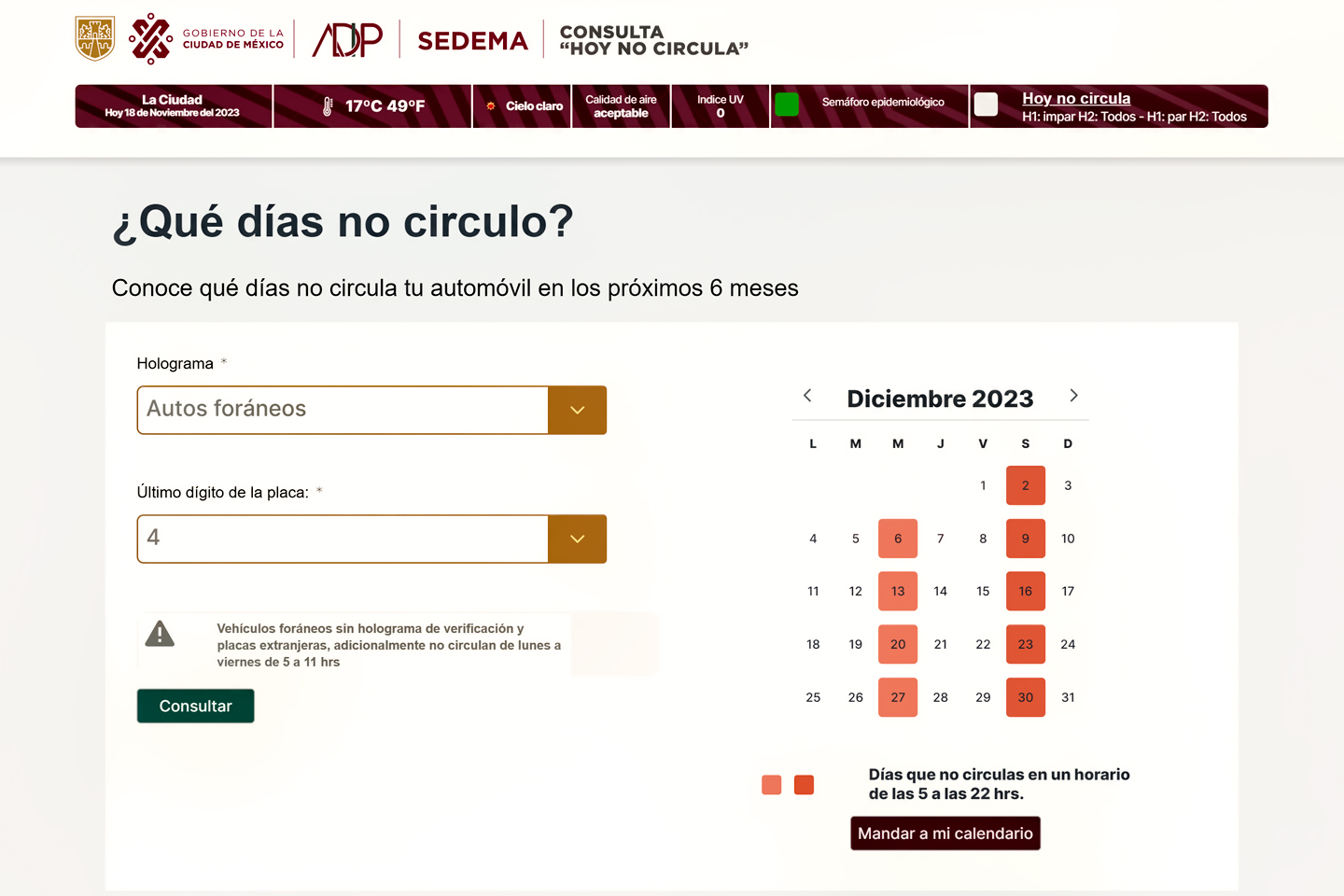
With these choices, the App tells us we won’t be allowed to drive anywhere in the D.F. (Federal District), or in the State of Mexico, between the hours of 5 AM and 10 PM on Wednesdays or Saturdays, nor could we be on the road between 5 AM and 11 AM on any weekday!
There’s a workaround for tourists who plan ahead: every six months, vehicles that are model year 2008 or newer are allowed a 14 day exemption, known as a Pase Turistico. (Either 14 continuous days, or two 7 day blocks). You have to apply for the Pass in advance, and carry it with you at all times.
I figured I could avoid the whole business by driving directly to Puebla, and steering well clear of the capital. The only problem with that was the zig-zagging border of the State of Mexico: the most direct route between Queretaro and Puebla crossed in and out of the State of Mexico three times, and since we had no Pase Turistico, every time it did that, we’d be at the mercy of any cop who felt like pulling us over. Sitting there at breakfast, I very carefully plotted out a route that stayed to the east of the problem area. It was really close, so we’d have to be extremely careful not to miss any turns.
Route from Queretaro to Puebla that avoids entering the State of Mexico (the area delineated by the dotted red line)
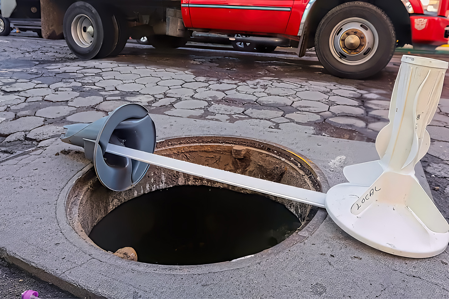
Open manhole in Puebla, marked by makeshift barricade
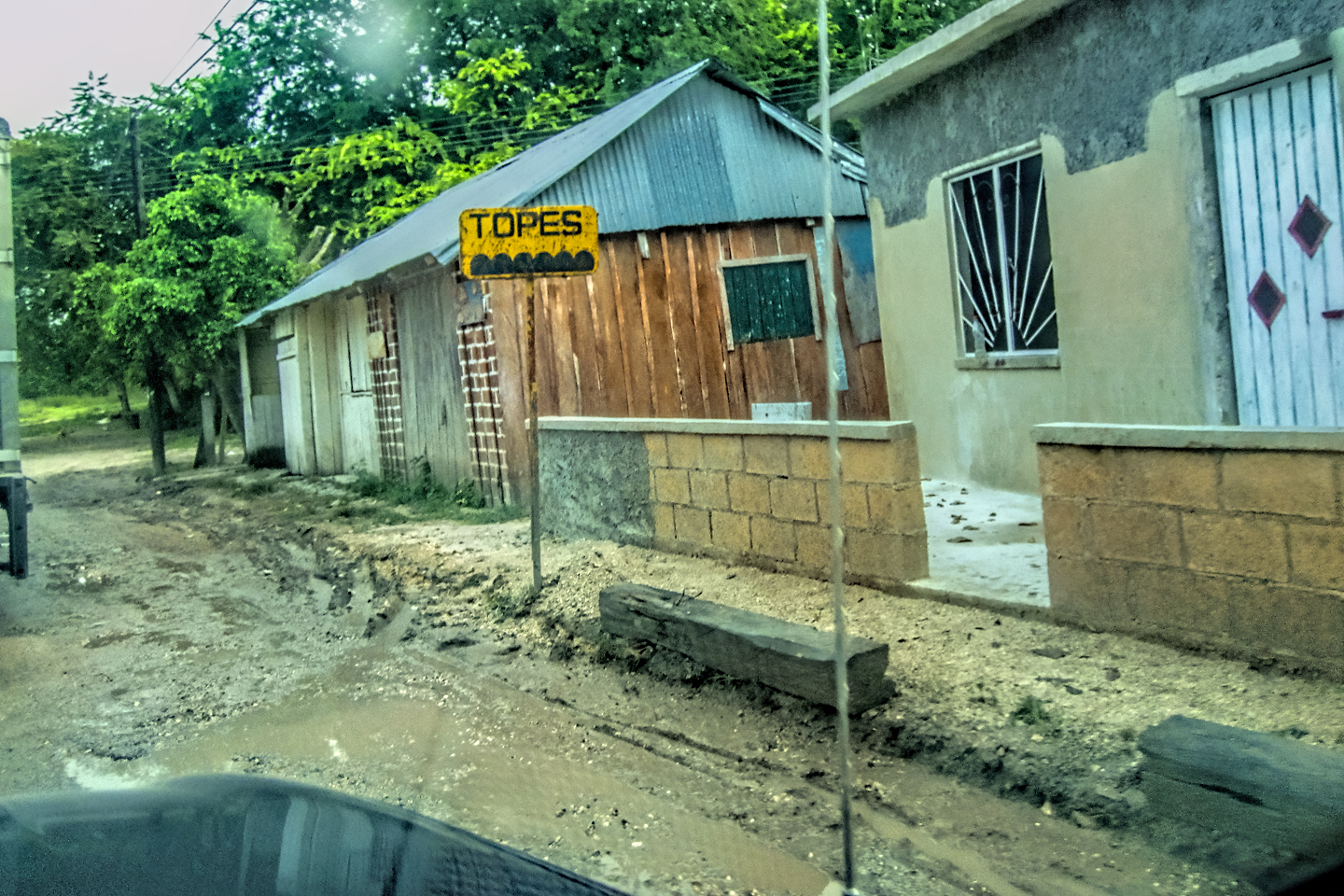
We made it to Puebla without incident, so I’d have to say that my plan worked out for us. One strange thing that we noticed when we got to Puebla was the open manholes. All over the city there were manholes missing their covers, and there were no warning barricades, so drivers were veering all over the road to avoid hitting one of the holes straight on and breaking an axle. I found out later that local thieves made a practice of stealing the covers for the value of the metal, snatching them almost as fast as they can be replaced. Frustrated local residents have taken to putting up their own makeshift barricades, to avoid serious accidents. Apparently, this has been going on for years!
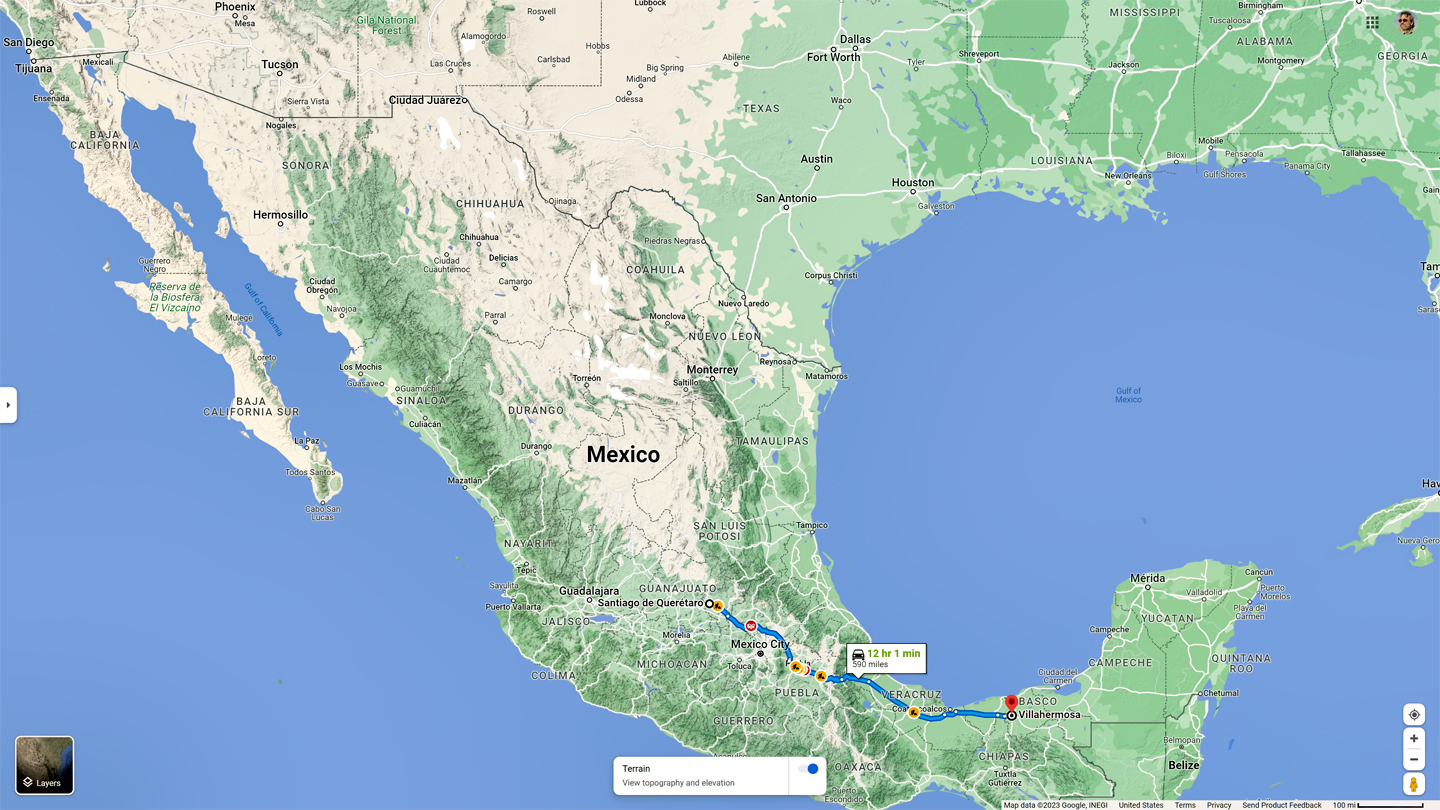
Day 3: Queretaro to Villahermosa, avoiding Mexico City!
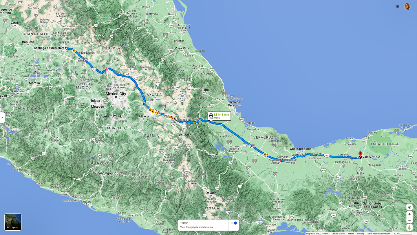
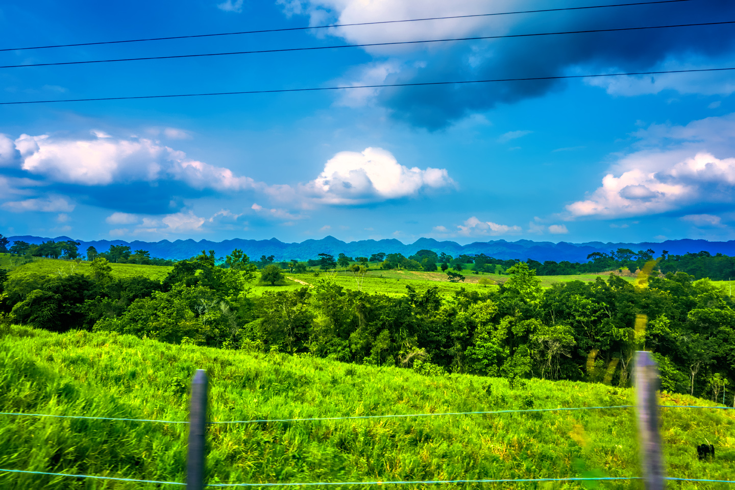
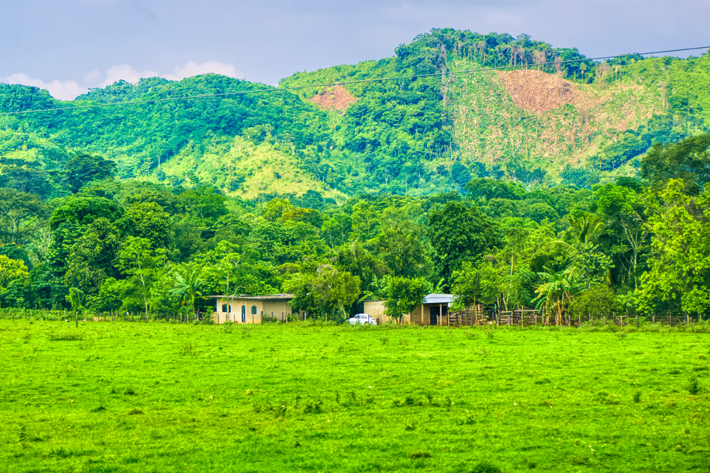
After Puebla, we turned east toward Orizaba, making our way down out of the mountains, heading toward Mexico’s Gulf Coast. This was a fantastic drive, zooming downhill on wide, smooth highways. The mountains were green, tropical, reminding me so much of the Andes that they put a nostalgic tear in my eye. Picturesque villages nestled in the folds of the valleys, little changed since the Colonial era. Mike and I traded off on the driving and made excellent time. We couldn’t decide where to stop, so we kept going, all the way to Villahermosa, a total distance of almost 600 miles.
That was really too much for a single day, but it felt great to have covered so much distance. Villahermosa was just two hours from Palenque! The town of Villahermosa most certainly has its charms, but we arrived there too late and too tired to appreciate any of that. What mattered most to us was the fact that there were plenty of hotels to choose from. We found ourselves a moderately-priced room, had a quick dinner at a nearby restaurant, and went straight to bed.

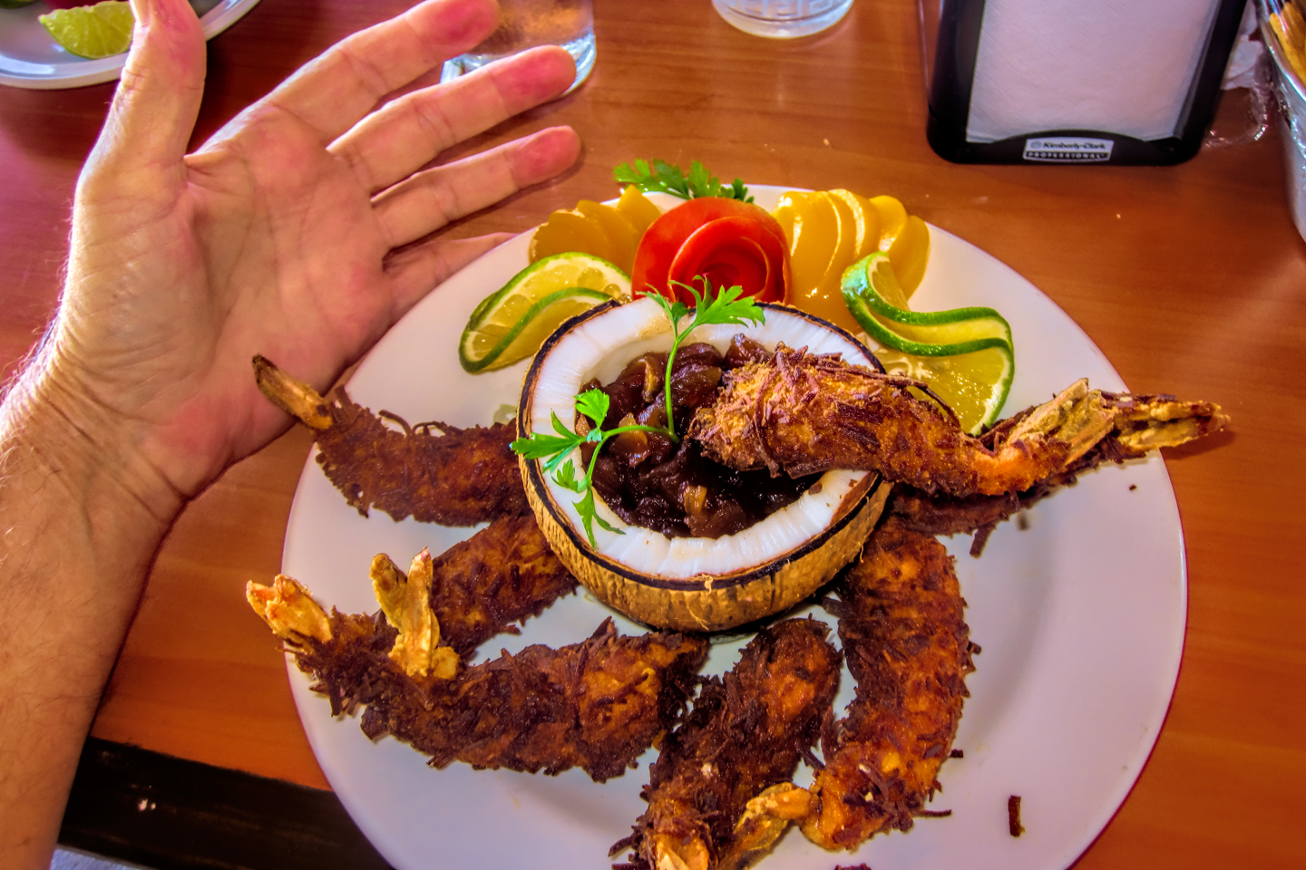
The photo collage below features additional pictures taken on the road in Mexico by my inestimable shotgun rider, Michael Fritz. Click any image to expand them to full screen:
(Unless otherwise noted, all images are my (or Michael’s) original work, and are protected by copyright. They may not be duplicated for commercial purposes.)
Click any photo to expand the image to full screen
Michael Fritz, “Elmo,” 1949-2025
READ MORE LIKE THIS:
This is an interactive Table of Contents. Click the thumbnails to open the pages.
ON THE ROAD IN MEXICO

MEXICAN ROAD TRIP: HOW TO PLAN AND PREPARE FOR A DRIVE TO THE YUCATAN
The published threat levels are a “full-stop” deal breaker for the average tourist. That’s unfortunate, because Mexican road trips are fantastic! Yes, there are risks, but all you have to do to reduce those risks to to an acceptable level is follow a few simple guidelines.
<<CLICK to Read More!>>

Mexican Road Trip: Heading South, From Laredo to Villahermosa
When it was our turn, soldiers in SWAT gear surrounded my Jeep, and an officer with a machine gun gestured for me to roll down my window. He asked me where we were going. I’d learned my lesson in customs, and knew better than to mention the Yucatan. “We’re going to Monterrey,” I said, without elaborating.
He checked our ID’s and our travel documents, then handed them back. “Don’t stop along the way,” he advised. “You need to get off this road and to a safe place as quickly as you can!”
<<CLICK to Read More!>>
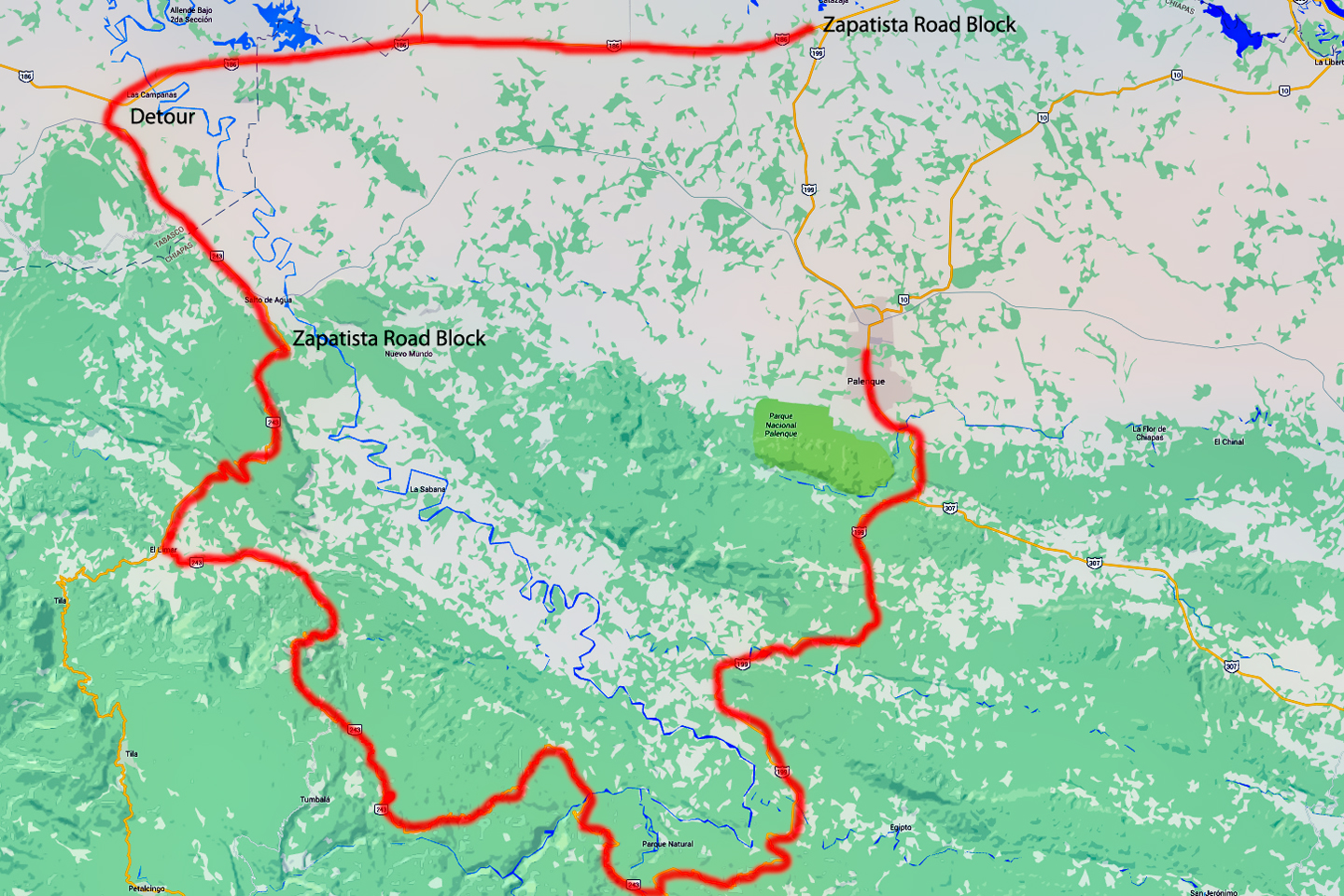
Mexican Road Trip: Zapatista Road Blocks in Chiapas
“Good morning,” I said. “We’re driving to Palenque. Will you allow us to pass?”
The leader of the group, a young Mayan lad, walked up beside my Jeep, and fixed me with a menacing glare. “The road is closed,” he said, keeping his hand on the hilt of his machete. “By order of the Ejército Zapatista de Liberación Nacional!”
“Is it closed to everyone?” I asked innocently. “How about if we pay a toll? How much would the toll be?”
He gave me an even more menacing glare. “That will cost you everything you’ve got,” he said gruffly, brandishing his machete, while his companions did the same.
<<CLICK to Read More!>>

Mexican Road Trip: Mayan Ruins and Waterfalls in the Lacandon Jungle
The next morning, we were waiting at the entrance to the Archaeological Park a half hour before they opened for the day. We were the only ones there, so they let us through early, and I had the glorious privelege of photographing that wonderful ruin in the golden light of early morning, without a single fellow tourist cluttering my view.
<<CLICK to Read More!>>

Mexican Road Trip: Merida and the Meridanos
Merida is the largest city in southern Mexico, with a population of almost a million. Statistically, Yucatan is the safest of Mexico’s states, and Merida is widely considered the safest of all Mexico’s cities.
<<CLICK to Read More!>>


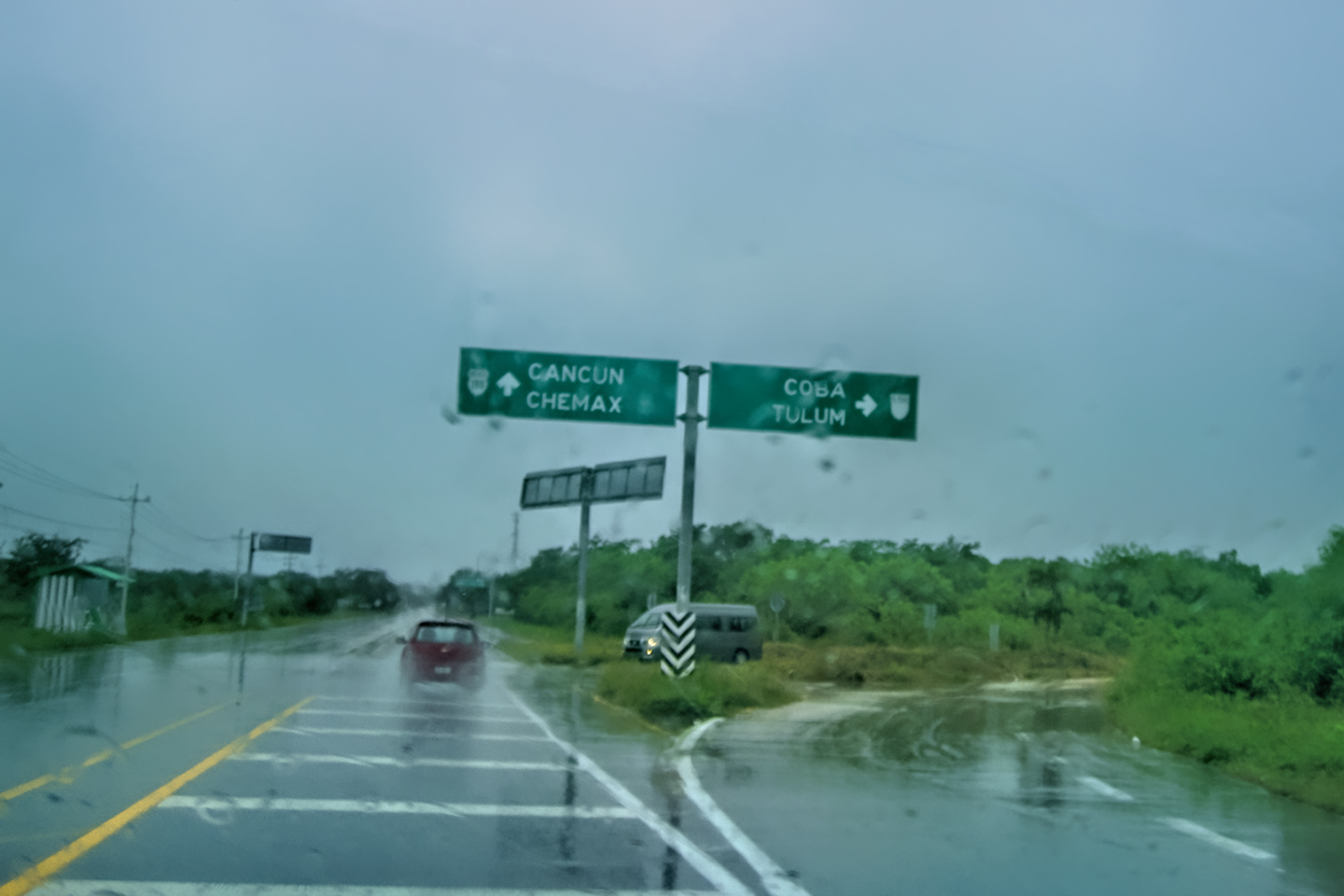
Mexican Road Trip: Cancún, Tulum, and the Riviera Maya
The millions of tourists who fly directly to Cancún from the U.S. or Canada are seeing the place out of context. They can’t possibly appreciate the fact that they’re 2,000 miles south of the border; a whole country, a whole culture, a whole history away from the U.S.A. Just looking around, on the surface? The second largest city in southern Mexico could easily pass for a beach town in Florida.
<<CLICK to Read More!>>

Mexican Road Trip: Circling the Yucatan, from Quintana Roo to Campeche
The Castillo at Muyil isn't huge, as Mayan pyramids go, topping out at just over 50 feet, but it’s definitely imposing. Try to imagine: the equivalent of a five story building, with a three story grand staircase, just appearing, out in the middle of nowhere? Boo-yah!
<<CLICK to Read More!>>

Mexican Road Trip: Edzná, and Campeche, Where They Dance La Guaranducha
La Guaranducha, a traditional dance from Campeche, is a celebration of life, community, and the joy of existence. On stage, there was a group of young men and women in traditional dress, but it was clear that the guys were little more than props, because all eyes were on the girls. So colorful, and so elegant, hiding coyly behind their pleated, folding hand fans.

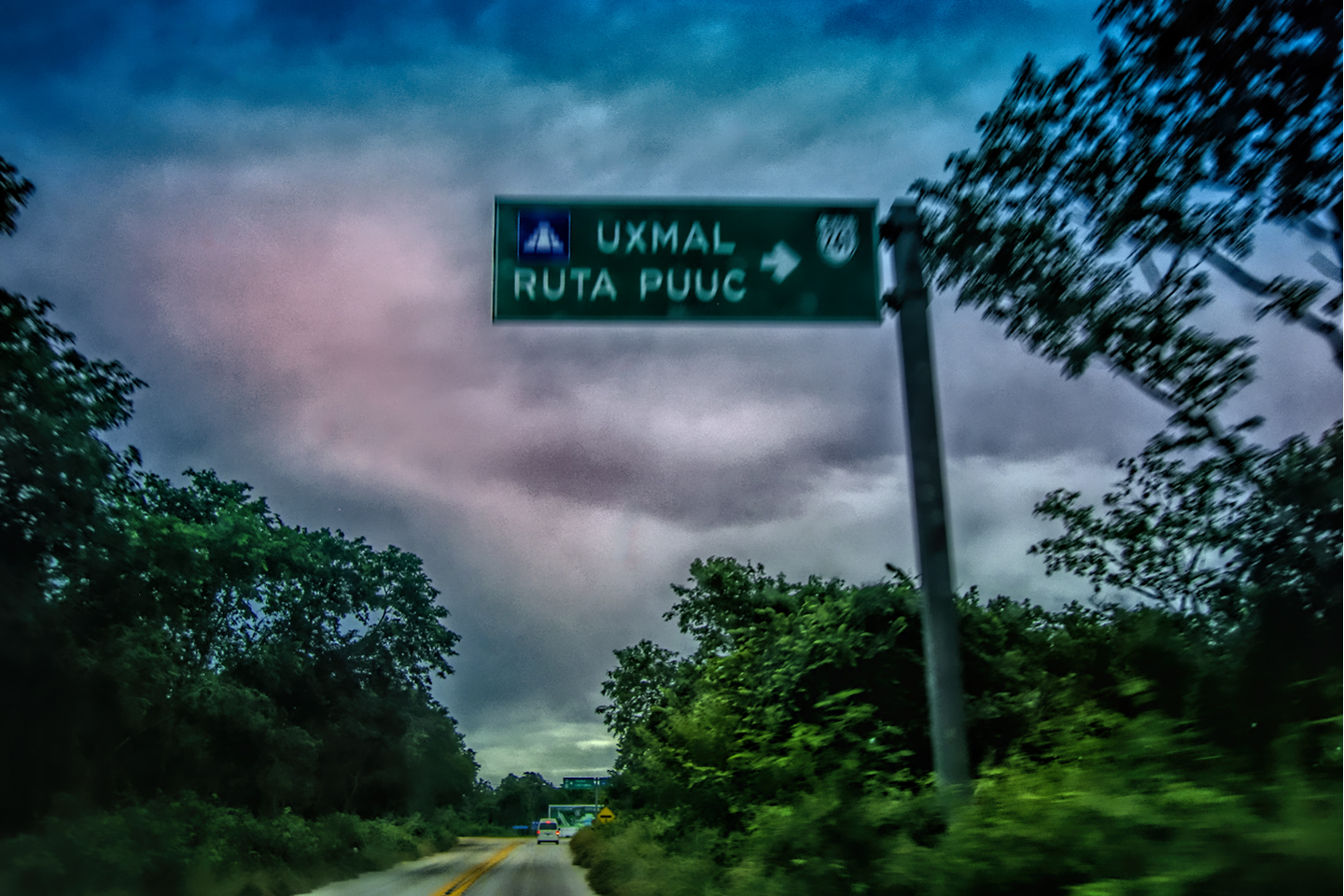
Mexican Road Trip: Adventures Along the Puuc Route
All of these communities in the Puuc region were allied, politically, culturally, economically, and socially. The Puuc was the cradle of the Golden Age of the Maya. Labna and Sayil were among the brightest jewels in the crown of a realm that never quite coalesced into an empire.
<<CLICK to Read More!>>

Mexican Road Trip: The Road to Bonampak
Rainwater seeping through the limestone walls of the temple soaked the Bonampak Murals with a mineral-rich solution that, each time it dried, left behind a sheen of translucent calcite. The built-up coating protected the paintings for more than 1200 years. As a result, we're left with the finest examples of ancient art from the Americas to have survived into our modern era.

Mexican Road Trip: Crossing the Chiapas Highlands, to San Cristobal de las Casas
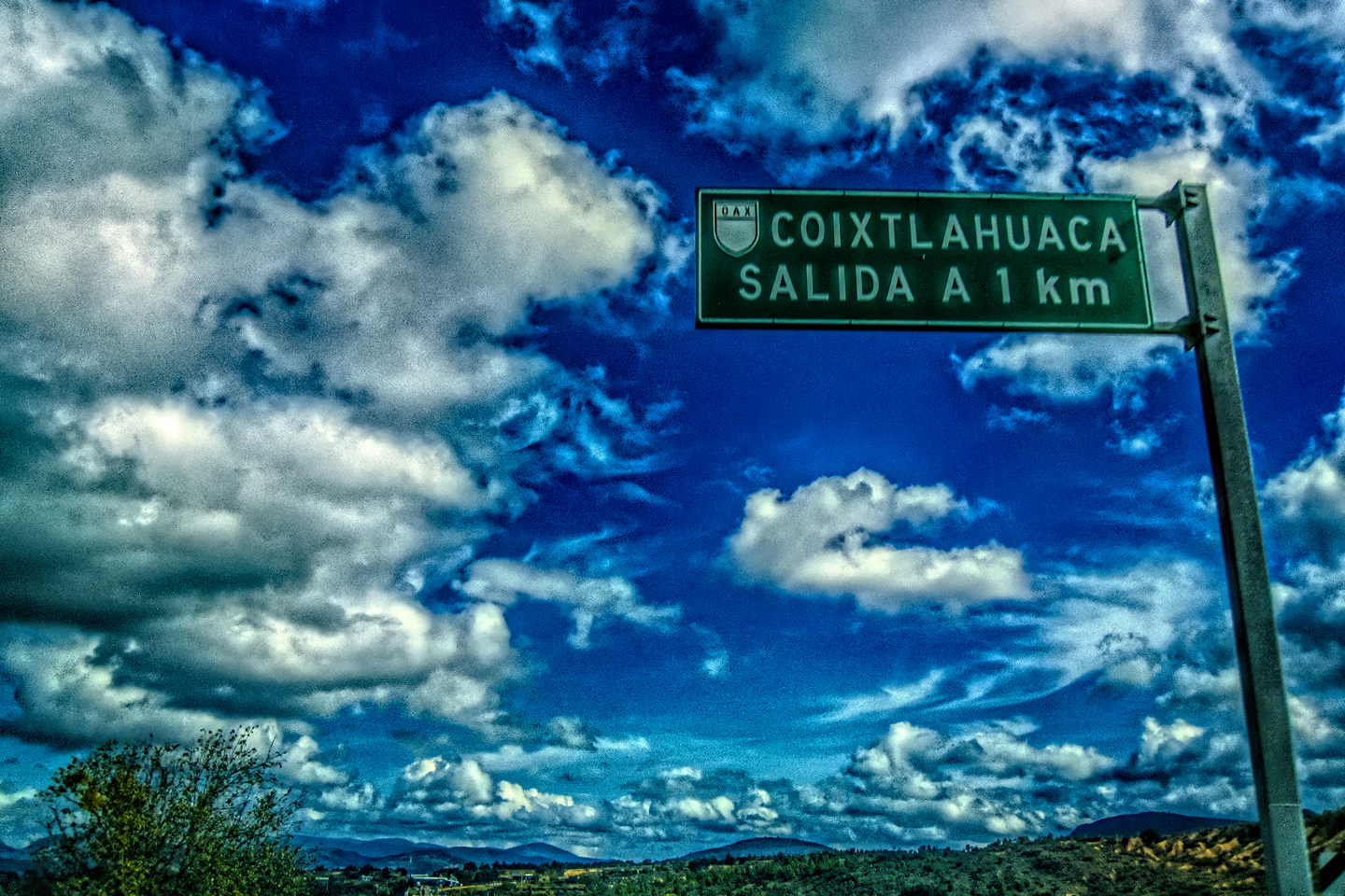
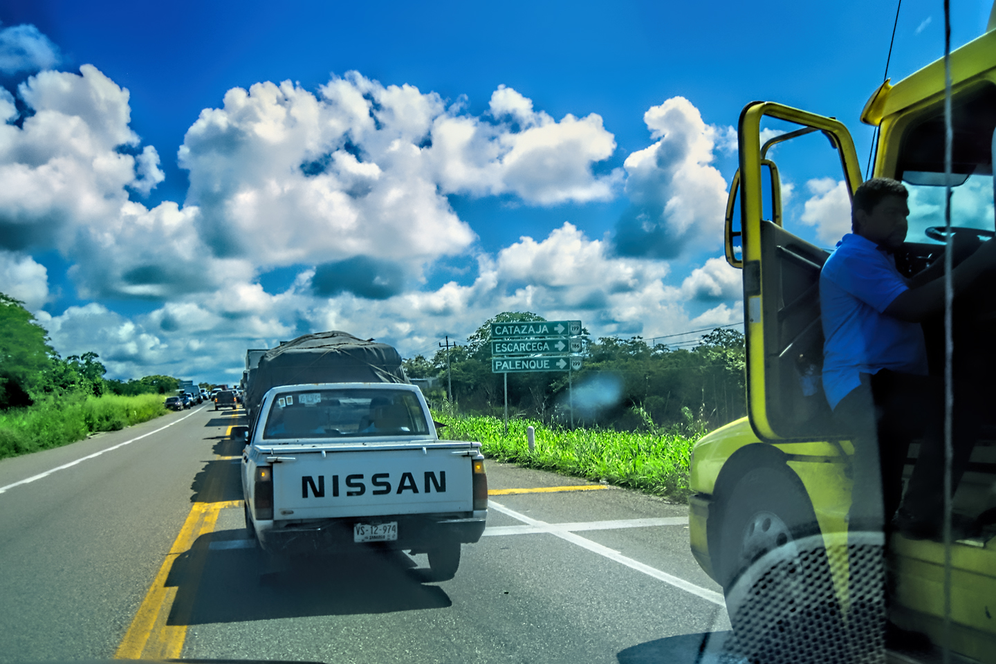
MX 199 crosses the Chiapas Highlands from Palenque to San Cristobal de las Casas. The distance is only 132 miles, but it's 132 miles of curvy mountain roads with switchbacks, steep grades, slow trucks, and villages chock-a-block with topes and bloqueos, unofficial road blocks. Everything I read, and everything I heard, described the drive as alternatively spectacular, dangerous, and fascinating, in seemingly equal measure.

Mexican Road Trip: Cruising the Sierra Madre, from San Cristobal to Oaxaca
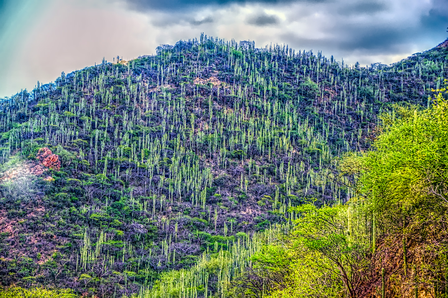
Today, we’d be driving as far as the city of Oaxaca, 380 miles of curves, switchbacks, and rolling hills that would require at least ten hours of our full attention, crossing the Sierra Madre de Chiapas, and entering the rugged, agave-studded landscape of the Sierra Madre de Oaxaca. If you’d like to know what that was like, read on!

Mexican Road Trip: Flashing Lights in the Rear View: Officer Plata and La Mordida
As we drove away from the toll plaza, a State Police car that had been parked off to one side made a fast U-Turn and started following me. A moment later, he turned on his flashers and gave me a short blast on his siren, motioning for me to pull over. Two uniformed policemen got out, and approached me on the driver's side. One of them hung back, apparently checking out my license plate before making a phone call.
I wasn't sure if I was being stopped for some infraction, or if these guys were just fishing...

Mexican Road Trip: Three Days of the Dead in San Miguel de Allende
By mid-afternoon, the Jardin was beginning to fill with people. Painted faces were literally everywhere! It was like a costume party, but the venue wasn’t some hall or other indoor space, it was the whole entire town! Mike and I were definitely getting into the spirit of the thing–but we still drew the line at the notion of painting our beards...
Mexican Road Trip: Back to the Border: San Miguel de Allende to Eagle Pass
Saltillo was our crossroads: if we turned east here, we’d be retracing our previous route to the border at Nuevo Laredo--along the Highway of Death! This time, we knew better, so we turned north, toward Monclova, and Piedras Negras.


Southern Colonials: Merida, Campeche, and San Cristobal
Visiting the Spanish Colonial cities of Mexico is almost like traveling back in time. Narrow cobblestone streets wind between buildings, facades, and stately old mansions that date back three hundred years or more, along with beautiful plazas, parks, and soaring cathedrals, all of similar vintage.
<<CLICK to Read More!>>

San Miguel de Allende, Mexico's Colonial Gem
If you include the chilangos, (escapees from Mexico City), close to 20% of the population of San Miguel de Allende is from somewhere else, a figure that includes several thousand American retirees.
<<CLICK to Read More!>>

Day of the Dead in San Miguel de Allende
In San Miguel de Allende, they've adopted a variation on the American version of Halloween and made it a part of their Day of the Dead celebration. Costumed children circle the square seeking candy hand-outs from the crowd of onlookers. It's a wonderful, colorful parade that's all about the treats, with no tricks!
<<CLICK to Read More!>>
DIA DE LOS MUERTOS: A GALLERY OF PHOTOGRAPHS


IN THE LAND OF THE MAYA

Palenque: Mayan City in the Hills of Chiapas
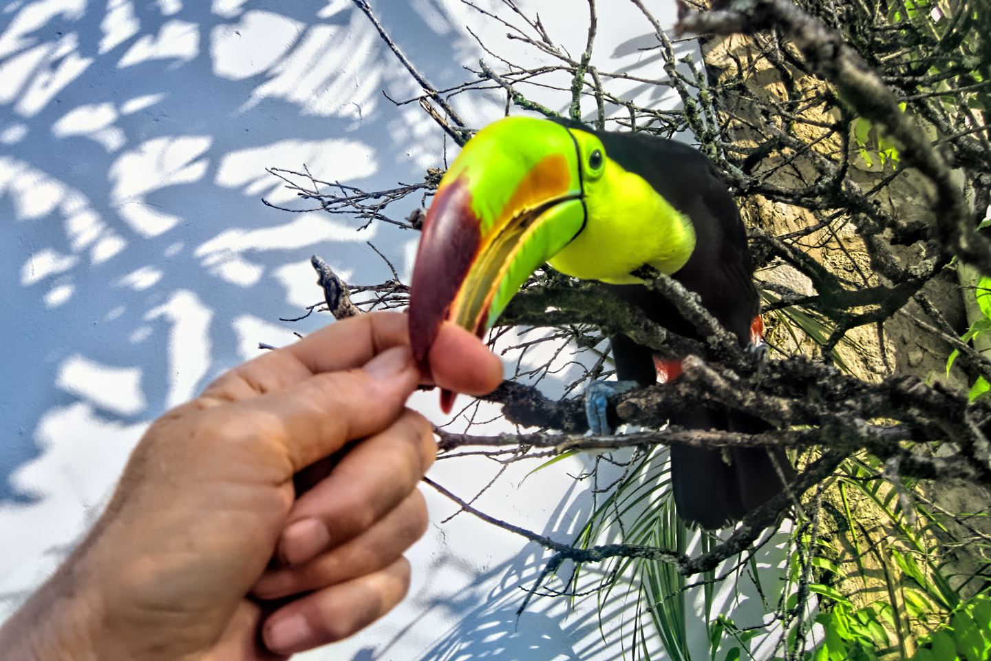
Palenque! Just hearing the name conjures images of crumbling limestone pyramids rising up out of the jungle, of palaces and temples cloaked in mist, ornate stone carvings, colorful parrots and toucans flitting from tree to tree in the dense forest that constantly encroaches, threatening to swallow the place whole.
<<CLICK to Read More!>>

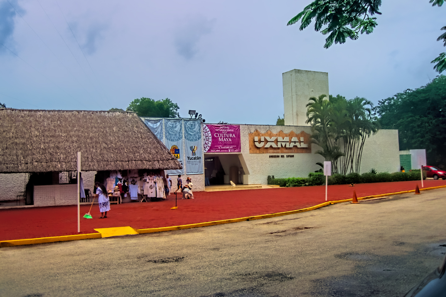
Uxmal: Architectural Perfection in the Land of the Maya
The Pyramid of the Magician is one of the most impressive monuments I've ever seen. There's a powerful energy in that spot--maybe something to do with all the blood that was spilled on the altars of human sacrifice at the top of those impossibly steep steps--but more than any building or other structure at any ancient ruin I've ever visited, more than any demonic ancient sculpture I've ever seen, that pyramid at Uxmal quite frankly scared the hell out of me!
<<CLICK to Read More!>>

The Mayan City of Edzná: First House of the Itzás
The Mayan Edzná is nothing less than epic, lyrical poetry, an extraordinary sonnet comprised of temples and palaces carved in stone that have stood, in regal grandeur, for more than a thousand years.
<<CLICK to Read More!>>

Photographer's Assignment: Chichén Itzá
To get the best photos, arrive at the park before it opens at 8 AM. There will only be a handful of other visitors, and you’ll have the place practically all to yourself for as much as two hours! Take your time composing your perfect shot.There won’t be a single selfie stick in sight.
<<CLICK to Read More!>>

Chichén Itzá: Requiem for the Feathered Serpent
The feathered serpent with the unquenchable thirst for blood may be gone now, or at least fallen out of favor, but as long as the ruins of this ancient city remain standing, he won’t be forgotten.
<<CLICK to Read More!>>

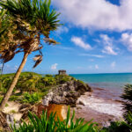
Tulum: The City that Greets the Dawn
Tulum is not all that large, as Mayan sites go, but its spectacular location, right on the east coast of the Yucatan Peninsula, makes it one of the best known, and definitely one of the most picturesque.
<<CLICK to Read More!>>

Cobá and Muyil: Mayan Cities in Quintana Roo
Cobá was a trading hub, positioned at the nexus of a network of raised stone and plaster causeways known as the sacbeob, the white roads, some of which extended for as much as 100 kilometers, connecting far-flung Mayan communities and helping to cement the influence of this powerful city.
<<CLICK to Read More!>>

Becan and Chicanná: Mayan Cities in the Rio Bec Style
Much about the Rio Bec architectural style was based on illusion: common elements include staircases that go nowhere and serve no function, false doorways into alcoves that end in blank walls, and buildings that appear to be temples, but are actually solid structures with no interior space.
<<CLICK to Read More!>>

The Puuc Hills: Apex of Mayan Architecture
The Puuc style was a whole new way of building. The craftsmanship was unsurpassed, and some of the monumental structures created in this period, most notably the Governor’s Palace at Uxmal, rank among the greatest architectural achievements of all time.
<<CLICK to Read More!>>

The Amazing Mayan Murals of Bonampak
Out of that handful of Mayan sites where mural paintings have survived, there is one in particular that stands head and shoulders above the rest. One very special place. Down by the Guatemalan border, in a remote corner of the Mexican State of Chiapas: a small Mayan ruin known as Bonampak.
<<CLICK to Read More!>>
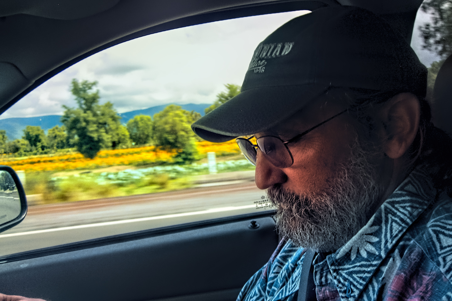
This series of posts is dedicated to my old friend Mike Fritz (aka Mr. Whiskers), my shotgun rider on my Mexican Road Trip. "Drive to the Yucatan and See Mayan Ruins" was at the top of my post-retirement bucket list, right after "Drive the Alaska Highway and see Denali." We checked off the whole Yucatan thing in a major way, and Mike was a heck of a good sport about it.
Michael passed away in February of 2025, after 75 years of a life well-lived. He was unique, and he'll be missed.

Michael Fritz ("Elmo") 1949-2025

There's nothing like a good road trip. Whether you're flying solo or with your family, on a motorcycle or in an RV, across your state or across the country, the important thing is that you're out there, away from your town, your work, your routine, meeting new people, seeing new sights, building the best kind of memories while living your life to the fullest.
Are you a veteran road tripper who loves grand vistas, or someone who's never done it, but would love to give it a try? Either way, you should consider making the Southwestern U.S. the scene of your own next adventure.
A few years ago I wrote a book about road trips in Arizona and New Mexico that's a lot like this website, packed with interesting information, and illustrated with beautiful photographs. Check it out! You can find it on Amazon, and at all other major booksellers.

ALASKA ROAD TRIP:
MEXICAN ROAD TRIP (IN THE LAND OF THE MAYA):
ARIZONA AND NEW MEXICO:
SOUTH AMERICA:
PHOTOGRAPHY:
TRIBAL LANDS:


Why are there no comments to your posting? It seems recent (last December). I drive 2-3 times a year between central Texas and Mazatlan through Laredo, around Monterrey to Torreon. From there to Durango and over the mountains to Mazatlan. Most of this is toll roads, and I only travel during the day.
I have never encountered anything scary, but officials asking for papers. Yes, I speak a little Spanish, which is very helpful since most of the officials do not speak English. I like to joke with them that “hey our border patrol are all REQUIRED to speak Spanish.. why don’t you speak English”. Of course that’s fact, but the Mexican officials insist that the US Officials do not speak Spanish. (nuts)
At any rate, I found your article a bit on the “scary” side, maybe overly so. I think if I wasn’t more experienced traveling in these areas, I might stay in Texas. My advice.. you need to put some words in there about what not to do and what to do to stay safe, and to assure tourists and travelers that you can travel safely in Mexico. It’s not a war zone. I am a resident of Mazatlan, Sinaloa. I feel very safe day or night in Mazatlan. I do travel in Sinaloa during the day.
I sincerely appreciate your comment. It’s good to know that Mazatlan is safe these days; they’ve certainly had their troubles in the past. Your suggestion about including some do’s and don’ts for driving in Mexico is a good one–and I made sure to cover that before I even wrote this post. The first article in this series goes into a fair bit of detail: Mexican Road Trip: How to Plan and Prepare for a Drive to the Yucatan. Check it out. I think it addresses your concerns reasonably well.