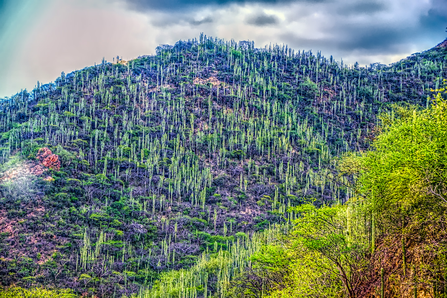
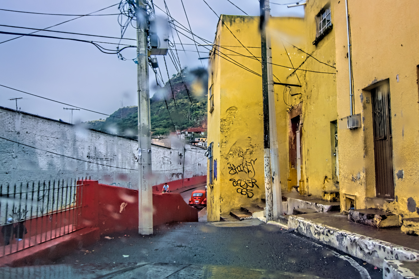
People who don’t live in Mexico tend to assume, based on what they see on the news, that the whole country is unsafe for road trips. Ask just about anyone, and they’ll tell you that driving your own vehicle anywhere south of the border is foolishly risky. It’s easy to see why they might think that way, because it’s not just a case of the media blowing minor incidents out of proportion. The Mexico Travel Advisory, a bulletin issued by the U.S. Department of State, classifies much of the country at Level 3, warning of serious risks to your safety and security due to high levels of violent crime. U.S.citizens are advised to “Reconsider Travel“ to those areas, including pretty much all the territory anywhere near the border. Worse: there are no less than six of Mexico’s 32 States (Estados) that ratchet the risk by a full order of magnitude, all the way to Level 4, “Do Not Travel,” a grim designation that’s usually reserved for active war zones! In those areas, the infamous Mexican Cartels run the show, and outsiders driving through may not be protected by the conventional rule of law. These published threat levels vary from state to state and are subject to change, but they’re still a “full-stop” deal breaker for the average tourist. That’s unfortunate, because the reality on most of Mexico’s highways is actually closer to Disneyland than it is to Damascus. Mexican road trips are fantastic! Yes, there are risks, but all you have to do to reduce those risks to to an acceptable level is follow a few simple guidelines.
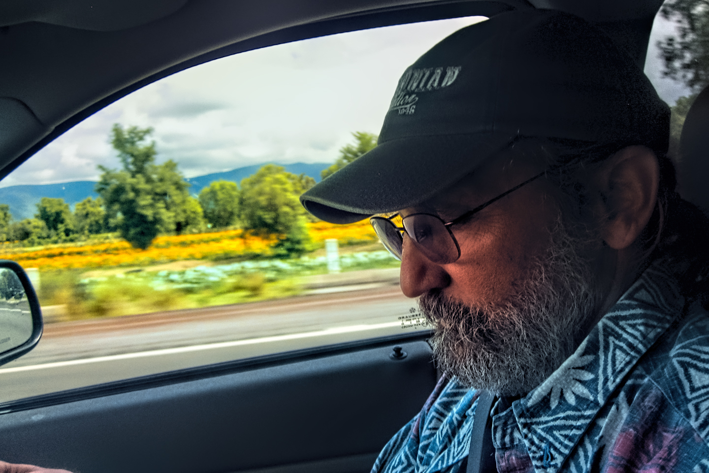
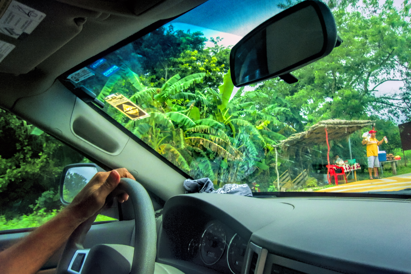
What makes me such an authority? In October of 2015, I ignored the advice of just about everyone I knew, and I traveled the length and breadth of Mexico on an epic road trip. My old friend Michael and I drove my Jeep Grand Cherokee to the Texas border town of Laredo, and from there, we motored all the way to the Yucatan and back, covering 8,000 miles over the course of a month. I wanted to see Mayan ruins, so we made that a priority, visiting no less than 14 different Mayan sites, and along the way we attended amazing festivals in five different Colonial cities, ending with the Day of the Dead celebration in San Miguel de Allende. Overall, we experienced some of the most wonderful fun I’ve ever had, and I don’t make that statement lightly.
Hassle-free good times are never a given in a place like Mexico. There’s a lot that can go wrong, and a thousand potential aggravations, which is why it’s so important to know at least a little about what you’re getting into before you cross that border. A Mexican Road Trip isn’t something you’d want to do on a whim. It requires planning, particularly as regards the route that you’re going to take, as well as a bit of preparation, in terms of readying your vehicle, and squaring away all the required paperwork. Read on, for some useful specifics:
The Planning Stage
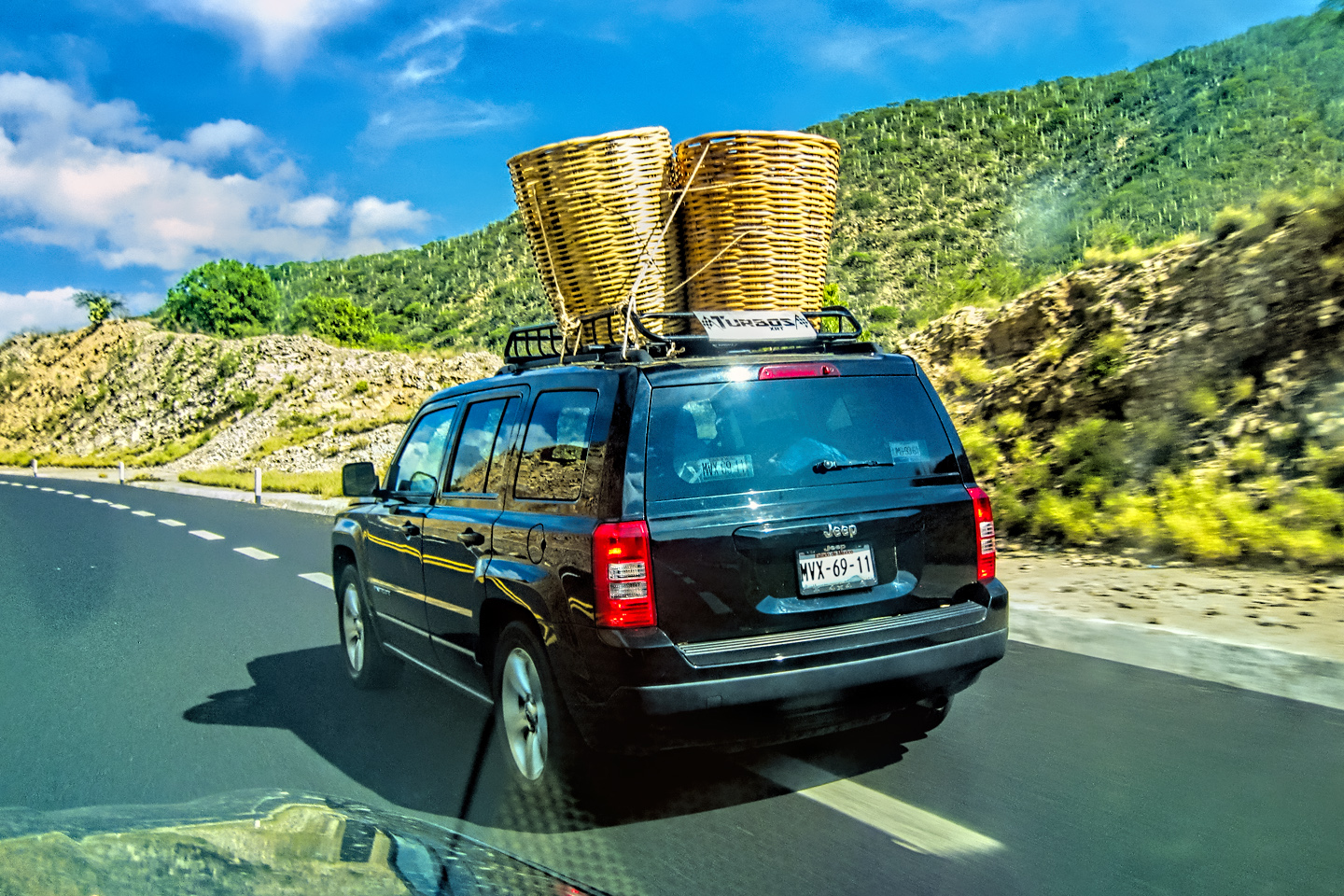
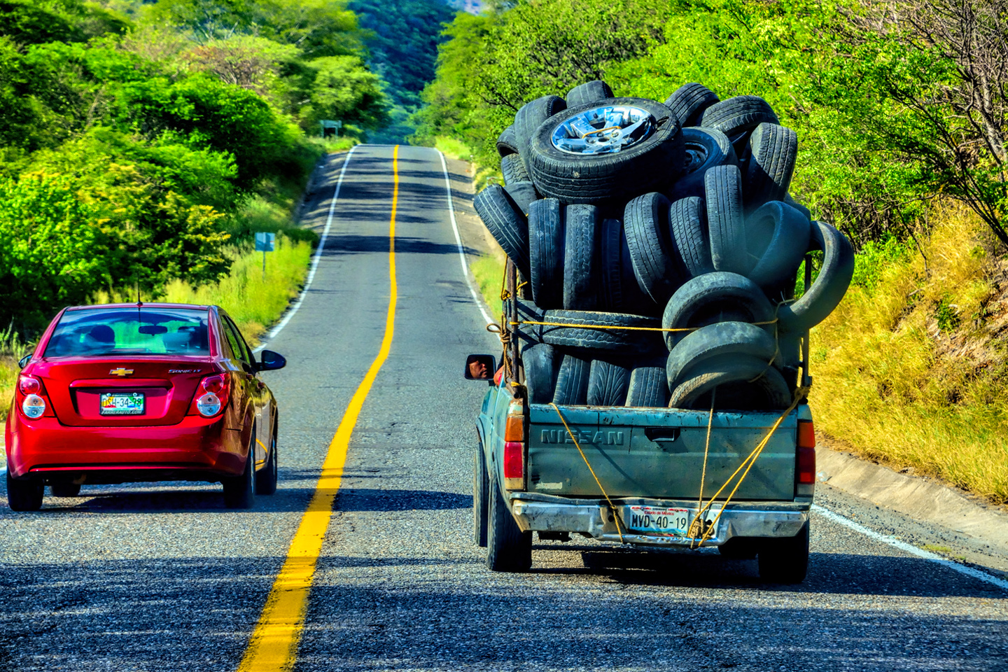
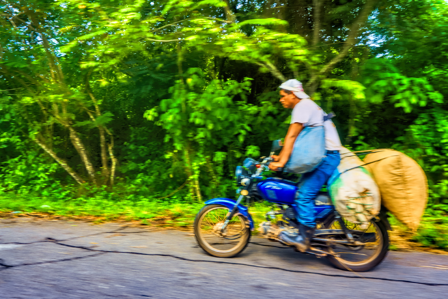
What to Drive: As a practical consideration, you’re probably going to drive whatever vehicle you normally drive, but there are a few things you should keep in mind: a top-of-the-line luxury vehicle that’s obviously very expensive will attract the wrong kind of attention, especially outside the major cities. A classic car or an exotic marque, even though it may be your pride and joy, will be impossible to find parts for if something breaks. A vehicle that’s too low to the ground, like certain sports cars, might look cool, but it will have a major problem with the ubiquitous topes (speed bumps). Electric vehicles? Mexico is many years away from installing enough charging stations to make them practical. With those few exceptions, whatever you happen to have in your driveway should serve the purpose. After all, there are millions of cars and trucks of every description traveling Mexico’s roads every single day, just the same as anywhere else.
If you drive an older vehicle, it should be well maintained and running smoothly, with good tires, good brakes, good shocks, and a solid front end. (Between the potholes and the speed bumps, your suspension and steering components are going to take a serious beating!) Before you leave home, you’ll want your mechanic to go over EVERYTHING. In addition to what I’ve already mentioned, they should inspect all belts and hoses, do a load test on the battery, and check every possible fluid reservoir, replenishing or flushing and replacing as necessary. How’s your spare tire? If it’s more than 8 years old, you should replace it, even if it’s never been used. This advice isn’t specific just to Mexico: I’m speaking from many decades of road trip experience. Nobody wants to break down while they’re on vacation, and most vehicle trouble can be avoided if you keep up with basic maintenance.
Mexican Auto Insurance: Despite anything it might say on your policy, your car insurance won’t be worth a hoot in Mexico. You’ll have to show proof that you have Mexican Insurance before they’ll issue a permit for your vehicle, and that’s for the best: if you should be involved in an accident while you’re in Mexico, and you don’t have valid insurance, good odds you’ll be jailed while they sort things out, even if you’re not at fault! You’ll need country-specific liability insurance at the absolute minimum, and you can buy that ahead of time from any of several providers, either online, or in a brick and mortar office on the U.S. side of any of the border towns. (My advice: get it online, and save the aggravation of making the extra last-minute stop.) The premium is the same for a 30 day policy as it is for six months, so it’s smart to ask for more time than you think you’ll need. The cost is directly related to the value of your vehicle, which is another reason to drive something that’s less expensive. It pays to shop around for the best rate. Use the links below to get instant quotes.
(These Links are provided for informational purposes, and should not be viewed as a personal endorsement of these companies).

Sanborn’s

Baja Bound

Mexico Insurance Services
VISAS AND PERMITS
To drive into the interior of Mexico (with the exception of Baja and the western portion of the state of Sonora), you need Visas (Tourist Cards) for each of the humans in your party, and you’ll need a TIP (a Temporary Import Permit) for your vehicle. Trailers and motorcycles require seperate permits, and pets require vaccination certificates. Motor homes are allowed, but there’s one (big) exception: they won’t grant a permit for a vehicle that’s larger than 3 ½ tons (7,716 pounds) unless it’s specifically identified as a motor home on the title. That can be a problem if your motor home is a fifth wheel trailer, hauled by a pickup that exceeds the limit. You can pre-register for the vehicle permit anywhere from six to sixty days in advance of your trip. You can access the Banjercito website at the following link:

Everything else can be done when you get to the border. You’ll need to bring along your Passport (or Passport Card), your driver’s license, the title and registration for your vehicle, and proof that you purchased your Mexican insurance. Make color copies of each of these documents, and carry the copies seperately from the originals. For more detailed information, read on:
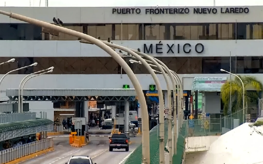
BORDER FORMALITIES
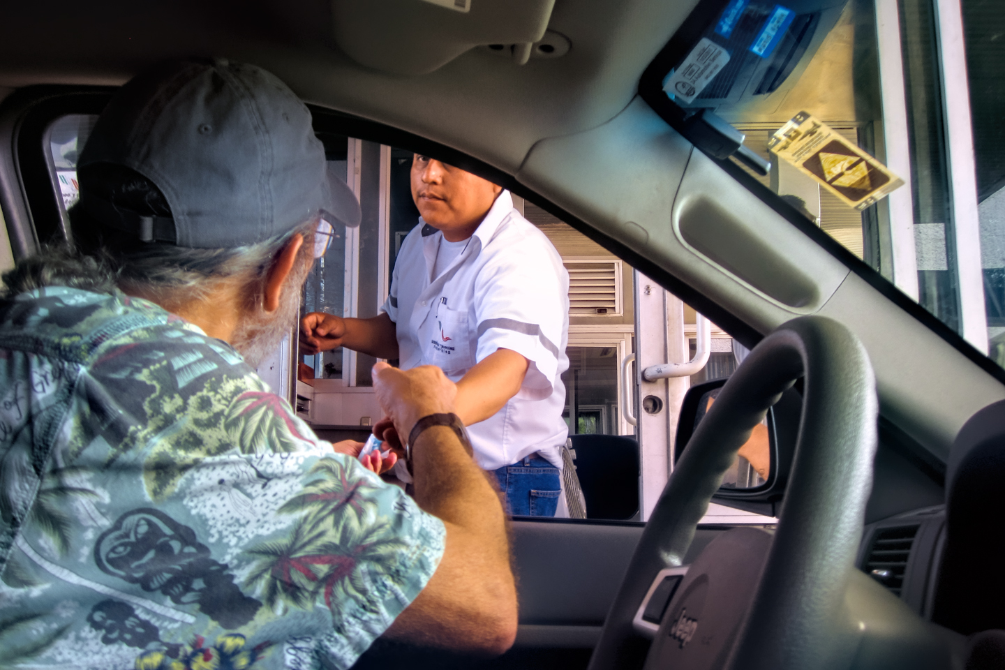
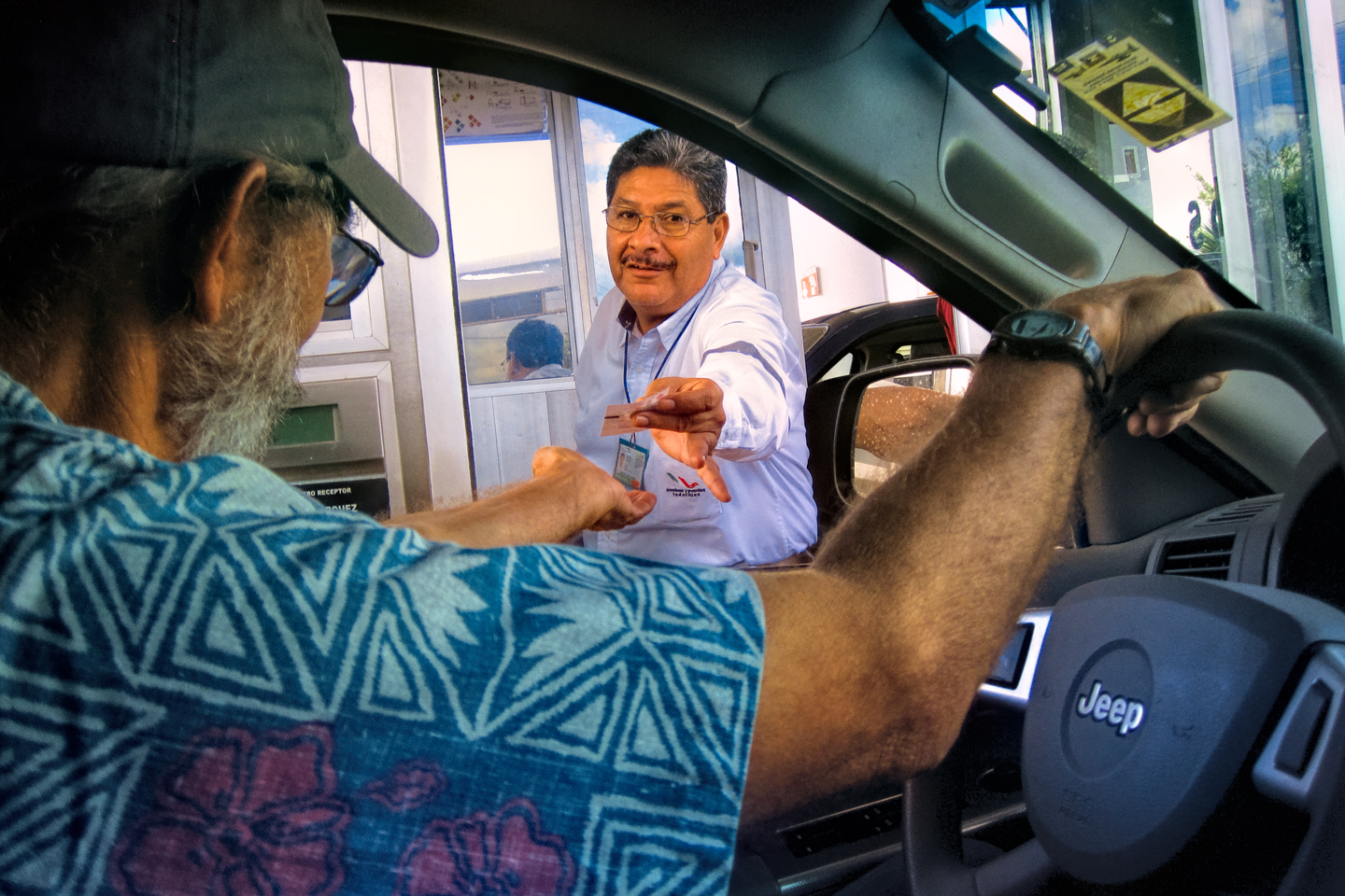
Mexico has Customs inspections, the same as the United States, and vehicles entering the country are subject to search. Your first stop in the border crossing process will be in one of the drive through inspection lanes.
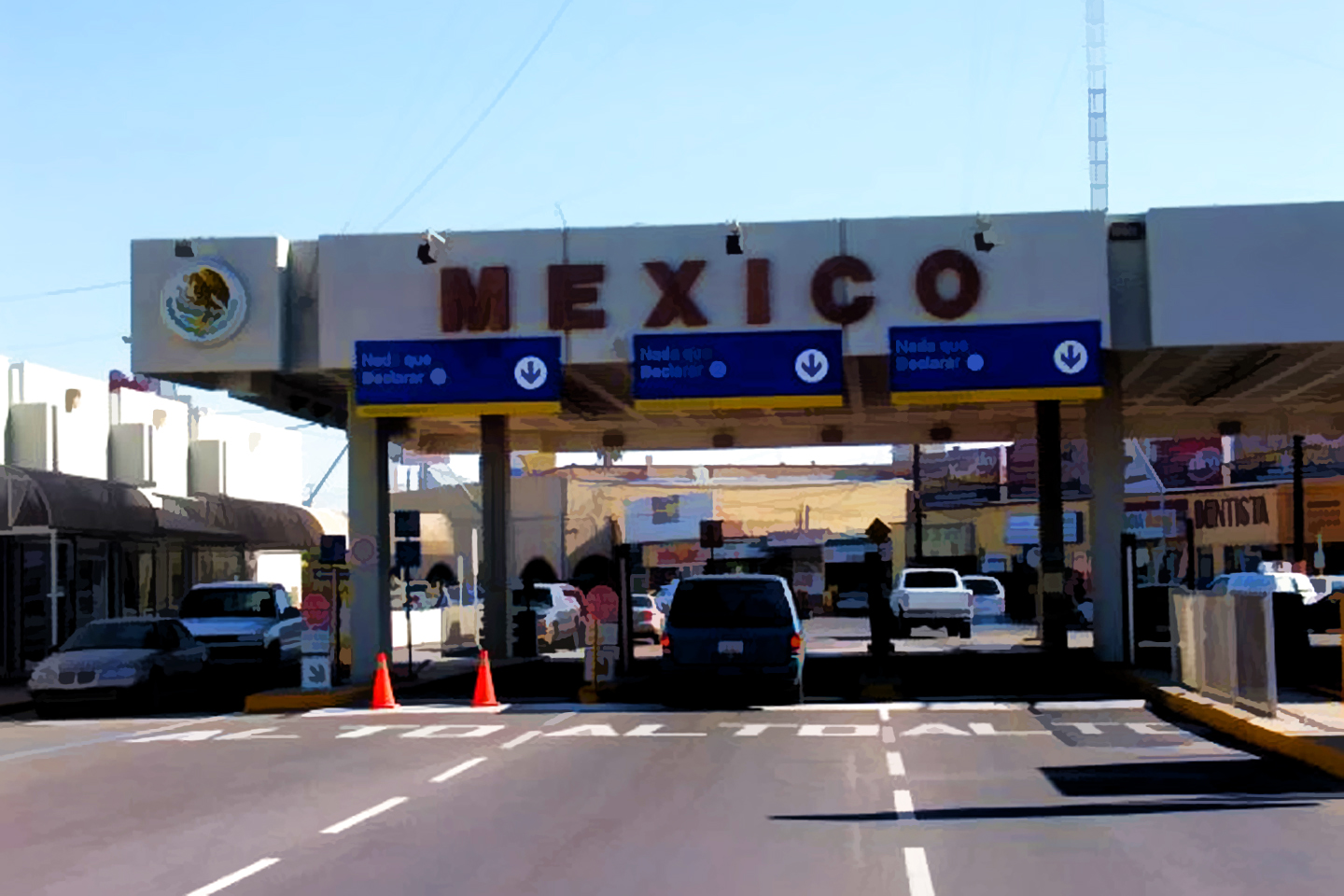
CLICK MAPS, PHOTOS, AND FORMS TO EXPAND
They’ll ask you for your identification (U.S. Citizens will need their Passport, or Passport Card). Then they’ll ask a series of questions about where you’re going and what you’re carrying in your luggage. They may or may not require you to fill out a customs form (see sample form, below), after which they may or may not physically inspect your vehicle and its contents. For a complete list of currently allowable items, check the Mexican Customs website at the following link:
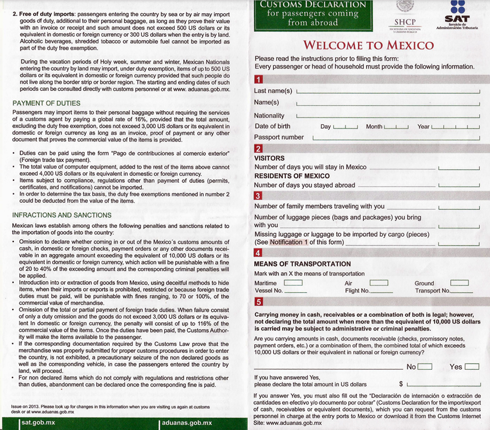
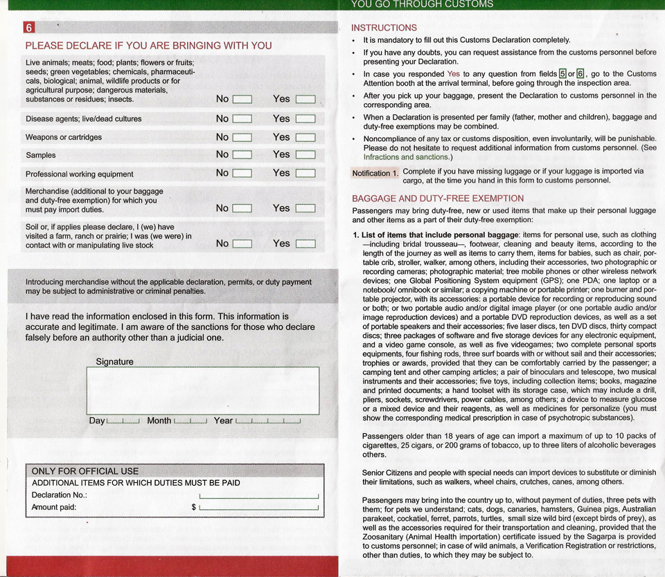
When you’re packing, never forget that they have the right to question you about every item in your vehicle, so think twice about bringing along anything that might be difficult to explain. Normal quantities of clothing and personal gear will always be acceptable. Anything outside the norm has to be declared. If you have prescription medicine, you need to declare it. You must carry it in the original prescription bottle, and bring only the amount that you’ll need for the duration of your stay in Mexico. If the medication is a narcotic or any type of anti-anxiety drug, you’ll need a letter from your physician, written in Spanish, stating your need for the medication, the dosage, and specifying the quantity that you will require during your stay.
There are also a few very definite DO-NOT’s:
Don’t bring any product or preparation containing cannabis or its derivatives in any form.
Don’t bring e-cigarettes or vape cartridges of any kind.
Don’t bring any sinus, allergy, or other medications containing pseudoephedrine or codeine.
Don’t carry more than $10,000 in cash or negotiable instruments unless you’ve declared the whole amount.
Don’t carry any firearms or ammunition in your vehicle or on your person. (Not so much as a single forgotten bullet in your coat pocket or your glove compartment!)
Check the following link: for a complete list:

As long as you’re not carrying prohibited items, you’ve got no reason to be nervous about Mexican Customs. If you maintain a respectful demeanor with the inspectors, they will usually respond in kind, and your customs inspection will be a simple formality, all perfectly cordial. If you come across like an ugly American, demanding, demeaning, or in any way uncooperative? You’ll be inviting a lot of unnecessary grief.
After you leave customs, find a place to park, and look for the Immigration window inside the building. Present your Passport, or Passport Card, and request an FMM Visa:
1.) FMM (Forma Migratoria Multiple): Anyone who is a visitor to Mexico (as opposed to a resident or a student) must obtain a tourist visa to travel beyond the border area. The required form is known as an FMM, valid for multiple entries for a period of up to 180 days. The FMM can be purchased online, or at the border, for a fee of about $30. Wherever you obtain it, you’ll have to get it stamped by Mexican Immigration when you enter the country.
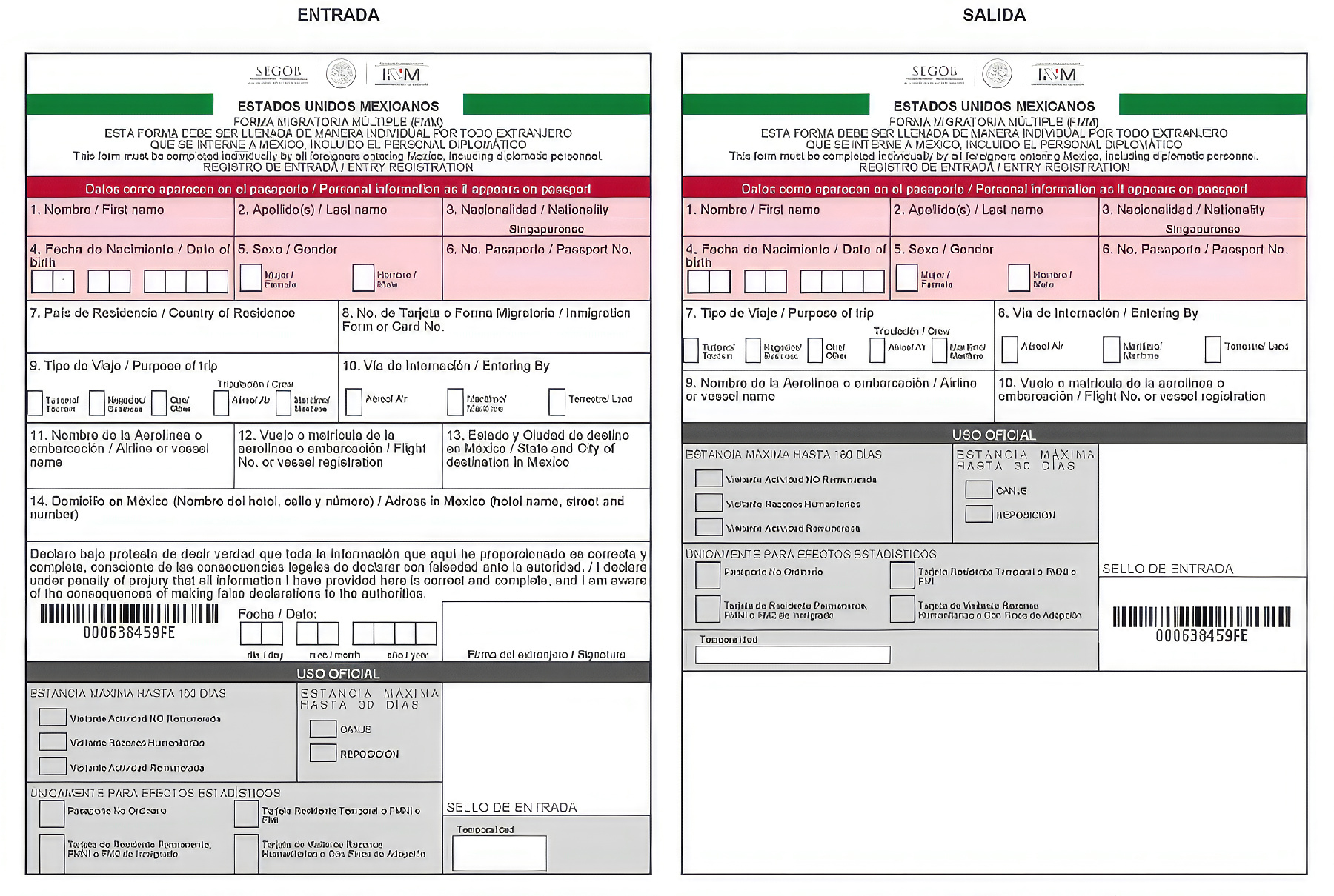
At the time of this writing, the paper FMM (above) is being phased out, to be replaced by a digital version sent to your phone, and a stamp in your passport.
Each step in the border crossing requires lining up at a different window. At a very busy port of entry, like Laredo, or Juarez, the lines can be long, and they seem to move at a snail’s pace. From start to finish, the whole process can take several hours, most of that time simply standing in one line or another. Welcome to Latin American Bureaucracy, which requires a special kind of quiet patience. You can’t beat it, so you might as well learn to roll with it.
After you’ve secured Visas for everyone in your party, you’ll need to secure the permit for your vehicle. For that, you get in line at the Banjercito window:
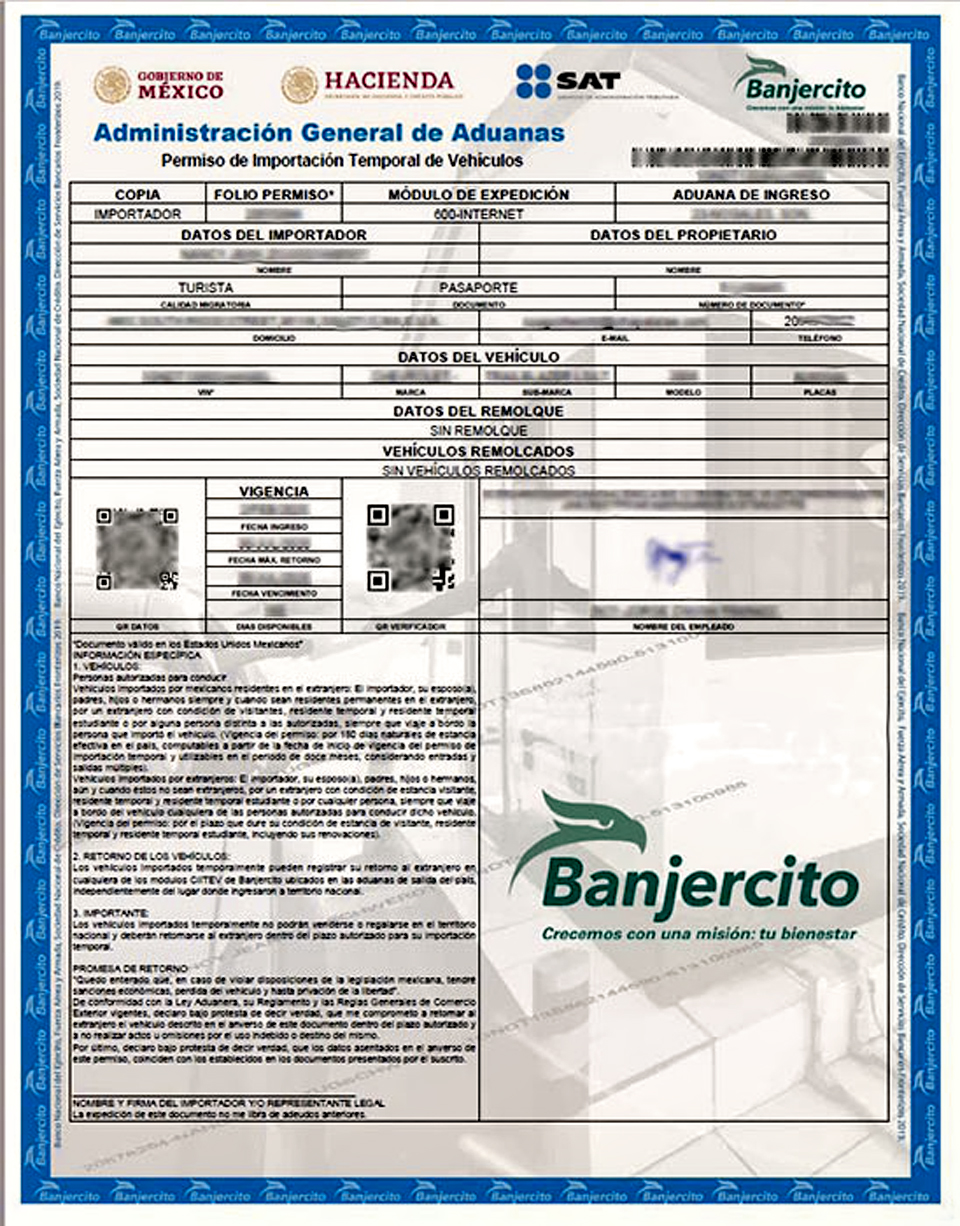
Paper copy of the Vehicle Permit currently in use; if you apply online, you’ll need to print a paper copy for yourself.
2.) Temporary Import Permit (TIP): Vehicle Permits are issued by Banjercito, the military bank charged with running the program for the Mexican Government. At the border (or online) you’ll need to provide proof of ownership, in the form of your vehicle’s title and current registration; If your vehicle is financed, you’ll need a letter from your lending institution authorizing you to take your vehicle into Mexico, and if it’s leased, you’ll need your leasing contract. You’ll also need to show proof that you’ve purchased Mexican auto insurance. There’s a non-refundable fee of about $52.00, as well as a required cash deposit that varies with the age of your vehicle. For anything that’s 2007 or newer, you’ll have to put up $400, which will be returned to you when you cancel your permit and leave the country. For vehicle models 2001 to 2006, the deposit is $300, and if 2000 or older, $200. It’s easiest to pay the deposit with a credit card; when it’s time for your refund, they simply reverse the charge. If you fail to properly cancel the permit (in person, at the border, just before you leave the country), or if you cancel it after it expires, you’ll not only cause yourself a whole lot of trouble, you’ll also forfeit your deposit.
Until recently, the TIP took the form of a holographic sticker prominenty displayed on your windshield. When you canceled it, the Banjercito employee checking out your vehicle had to literally scrape it off the glass with a razor blade. Because so many people are buying their permits online, they’ve shifted to a digital version with a scannable QR code, which they send you in an email that you carry on your phone. The goal was to make the process easier, and it would seem that they’ve succeeded! If you pay at the border, they’ll provide you with a plain paper copy of the form to use in case there’s ever a problem with your digital copy. If you pay online, you’ll have to print your paper form at home. Be sure to do that, and make several copies!
Since this post is geared toward travelers who want to tour Mexico by road, there are situations and scenarios I haven’t covered here. If you’re unsure about anything related to travel in Mexico, Mexican Immigration requirements, or the border crossing, contact the nearest Mexican Consulate:
MEXICAN CONSULATES IN THE UNITED STATES
EMBASSIES AND CONSULATES OF MEXICO WORLDWIDE
PLANNING YOUR ROUTE:
Travel in Mexico is a bit different from travel in other parts of North America, in the sense that you shouldn’t let your GPS choose your route for you. Those things always prioritize the roads that are fastest and most direct. Because there are areas you need to avoid, that methodology doesn’t always work to your advantage. Here’s what you need to do instead:
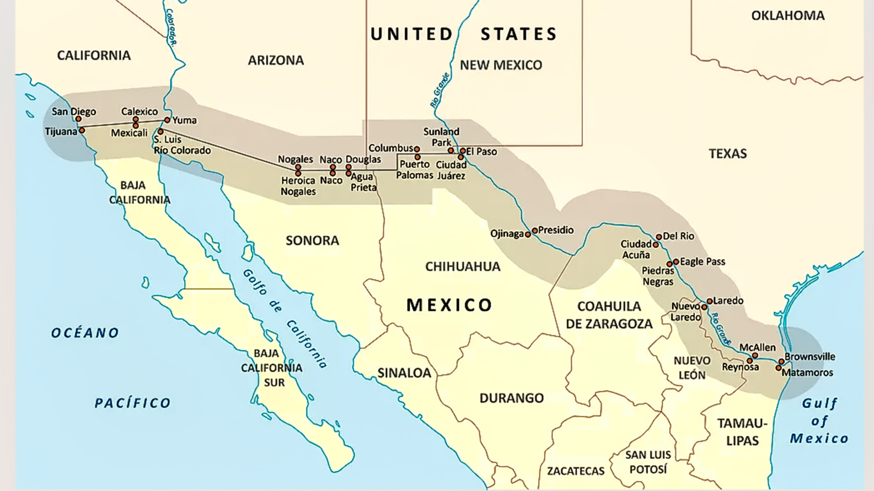
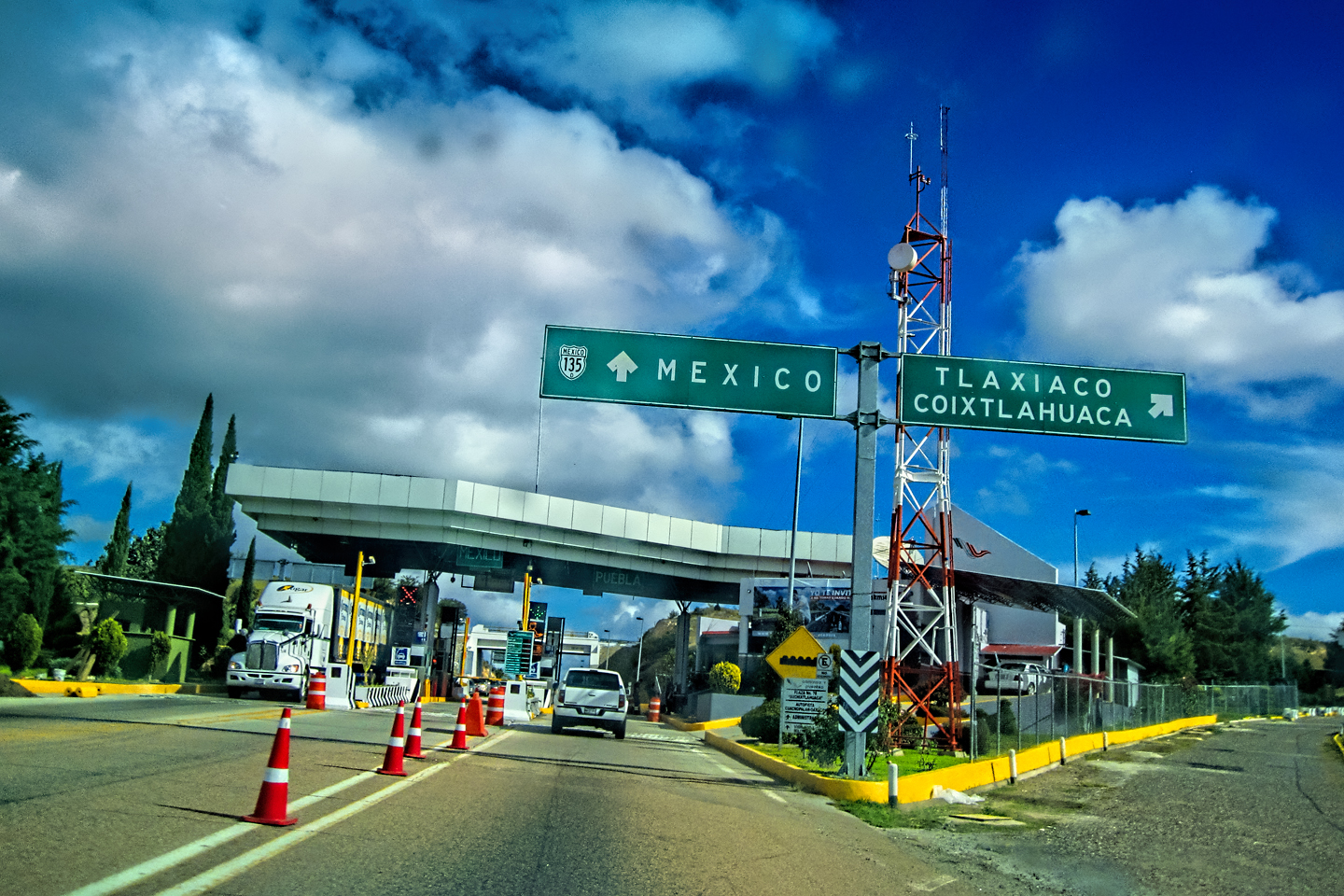
CHOOSE YOUR BORDER CROSSING
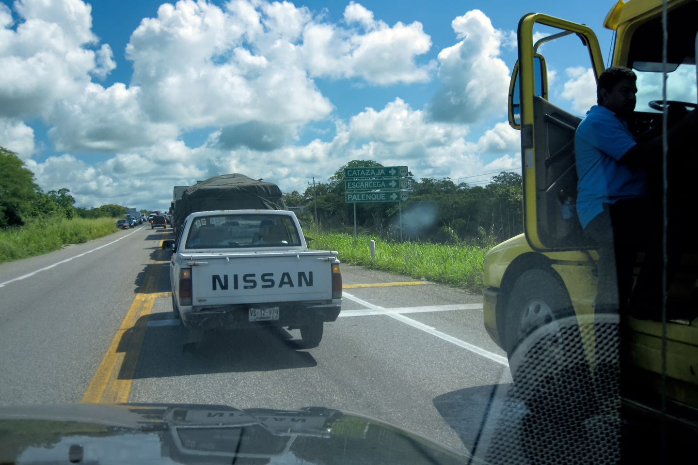
There are 50 legal crossing points on the 2,000 mile long U.S. Mexico border, but they are most definitely not all created equal. Depending on where you’re coming from, and where you’re going, there are some that will serve your purposes better than others. The route that takes you most directly from your starting point to your destination is the ideal, but there are some stretches of highway you’ll want to avoid, even if it means going out of your way. To that end, pay close attention to the most current Mexico Travel Advisory, which details specific warnings for each of Mexico’s States. If you’re headed for the interior of the country, to Central or Southern Mexico, the Colombia Crossing (Laredo Bridge #3), and Eagle Pass are generally considered safer and less congested than most.
General rule of thumb: you should give the whole state of Tamaulipas a wide berth–meaning you should avoid crossing at McAllen, Brownsville, or Downtown Laredo. (No offense to the local folk. The towns are safe enough. It’s the highways leading south from those ports of entry that are considered dangerous.)
The U.S. Border with Mexico
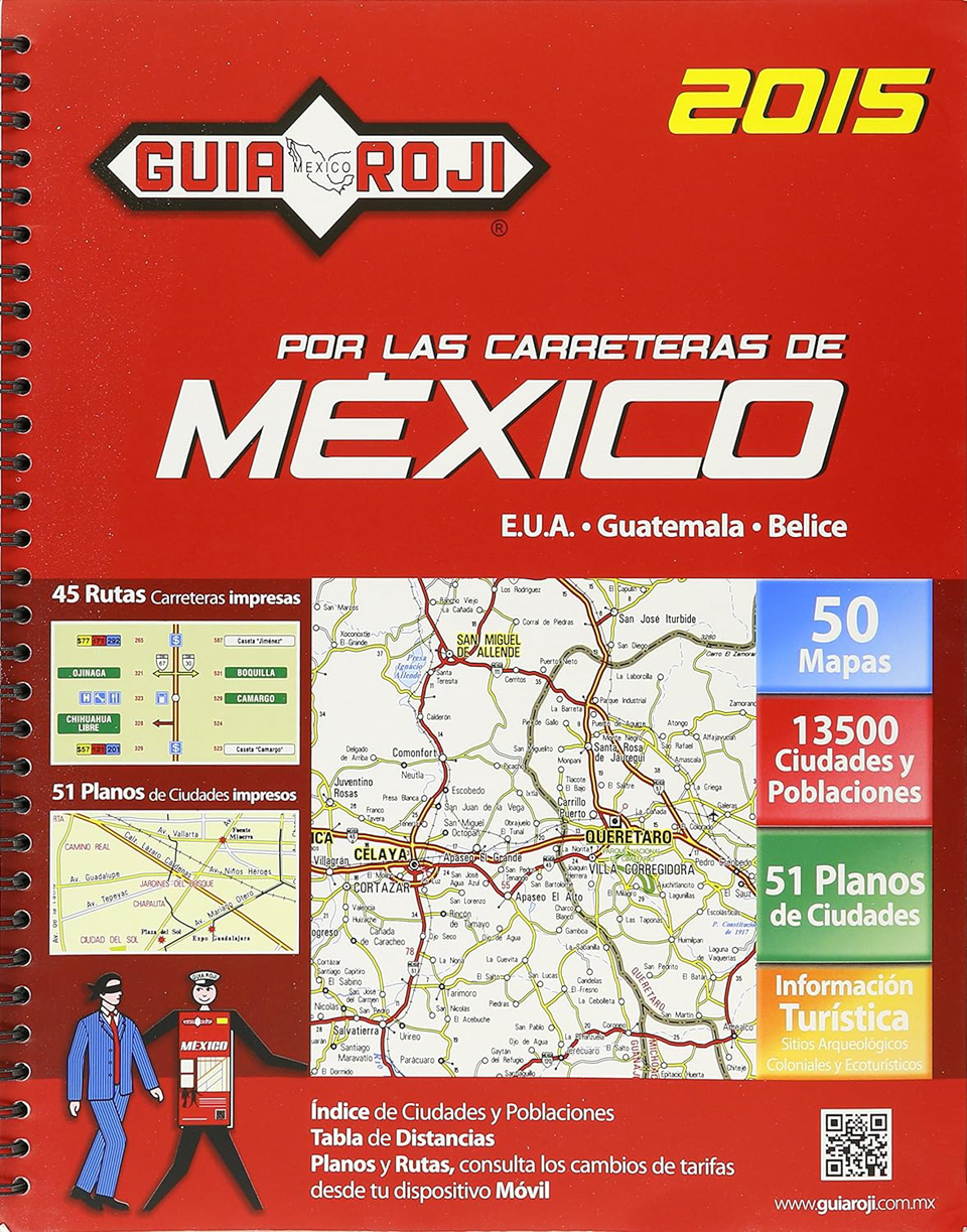
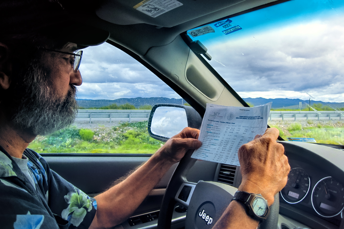
From the border, start heading south by the most direct route; consult a map to get the big picture. There’s a widespread misconception that GPS navigation systems have rendered highway maps obsolete. I’m dyed-in-the-wool old school when it comes to that sort of thing, and I beg to differ. When you’re traveling in Mexico, especially in more remote areas, GPS technology is not always reliable. If you’re not sure where you’re going, it’s wise to have a back-up, and paper maps don’t require any sort of connectivity. The best paper maps of Mexico that I know of come in a road atlas known as the Guia Roji. The most recent edition available on Amazon is from 2015, but that’s plenty current enough to get you where you’re going if Siri and the Google girl should ever go dark on you.
It’s currently $34.75 for the spiral bound version (which is a useful upgrade). That’s expensive, sure, but if you use it even once, you’ll consider it money well spent. (And I’m speaking from experience!)
<<CLICK HERE>> to order one from Amazon.
SAFETY CORRIDOR
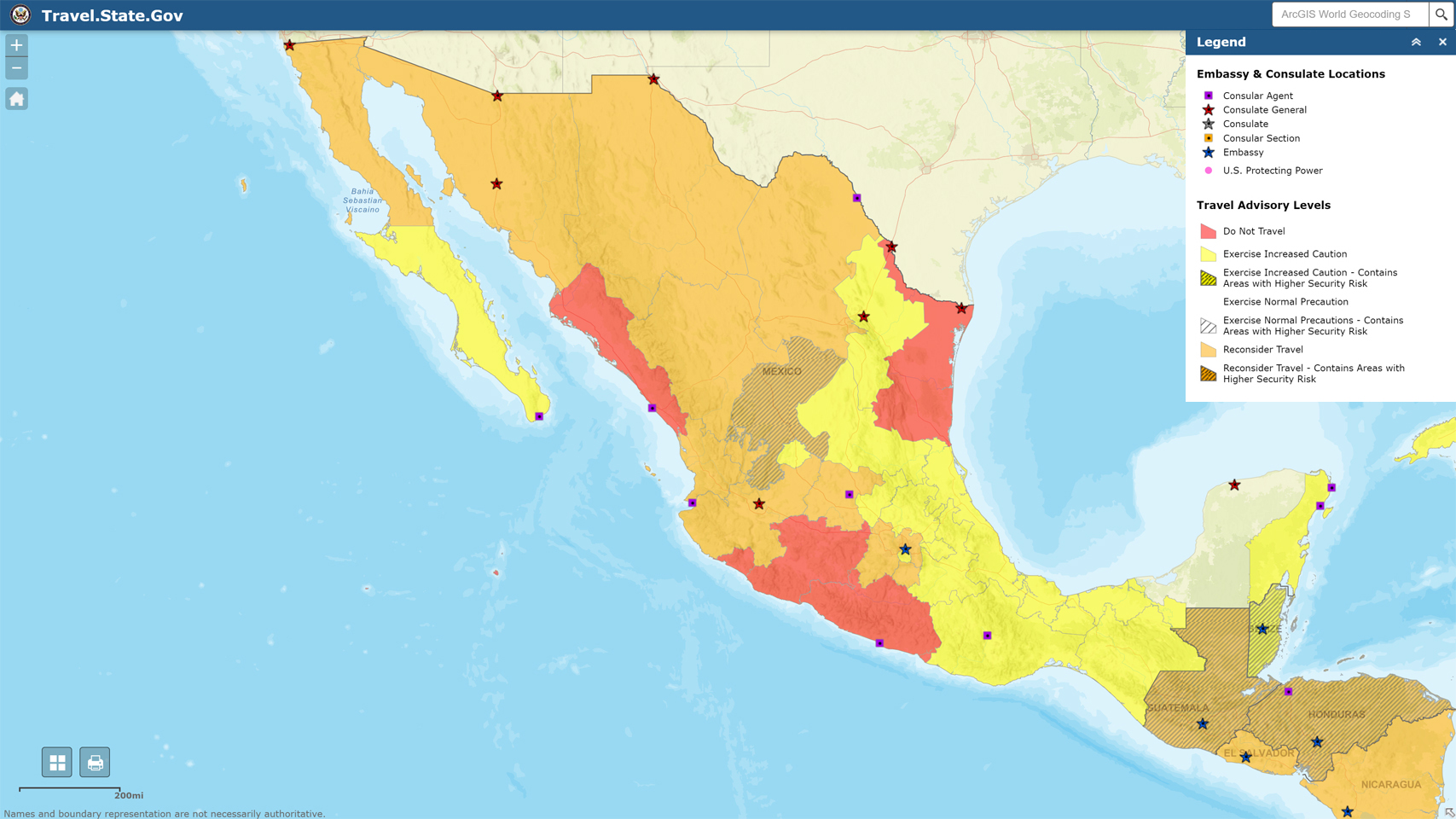
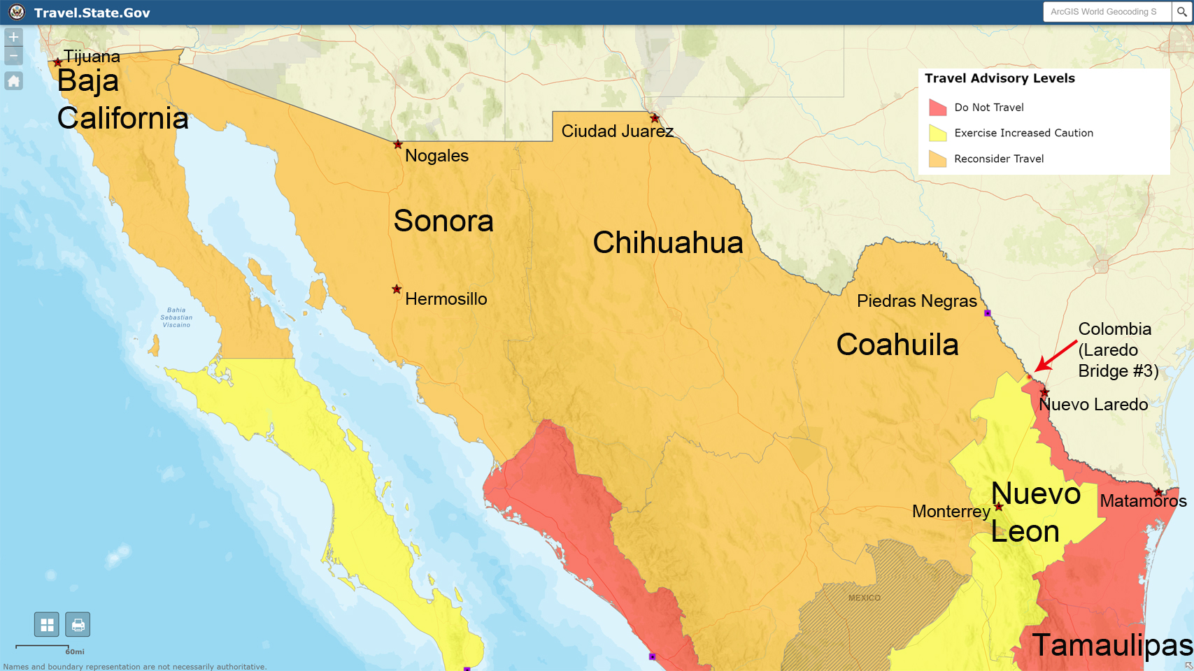
Color-coded maps of threat levels, highlighting in yellow what I call the safety corridor: all lower risk at Level 2
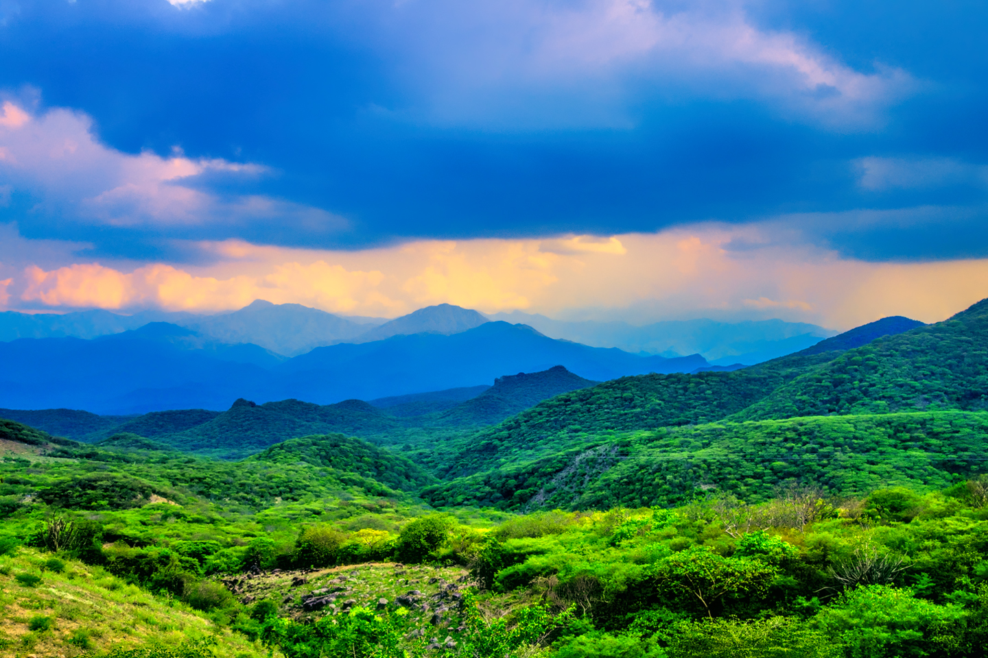
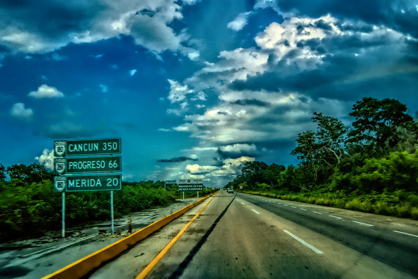
It’s time to talk about the Travel Advisories from the U.S. Department of State, which are based on current statistics related to violent crime; they are deadly serious, and should not be ignored. Is there anything you can do to minimize the risks? If you examine the color-coded Risk Map provided with the most current Travel Advisory (Left/ Above), you’ll see that there is a yellow swath of relatively safe territory that runs the length of the country, from the border near Laredo, all the way south to the Yucatan and the border with Guatemala. Yellow indicates Risk Level 2, which simply means that you should exercise increased caution. That’s hardly cause for alarm. It’s more like sensible advice that would apply practically everywhere.
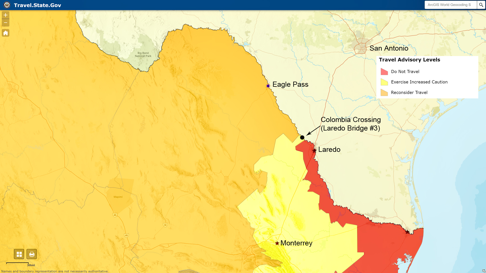
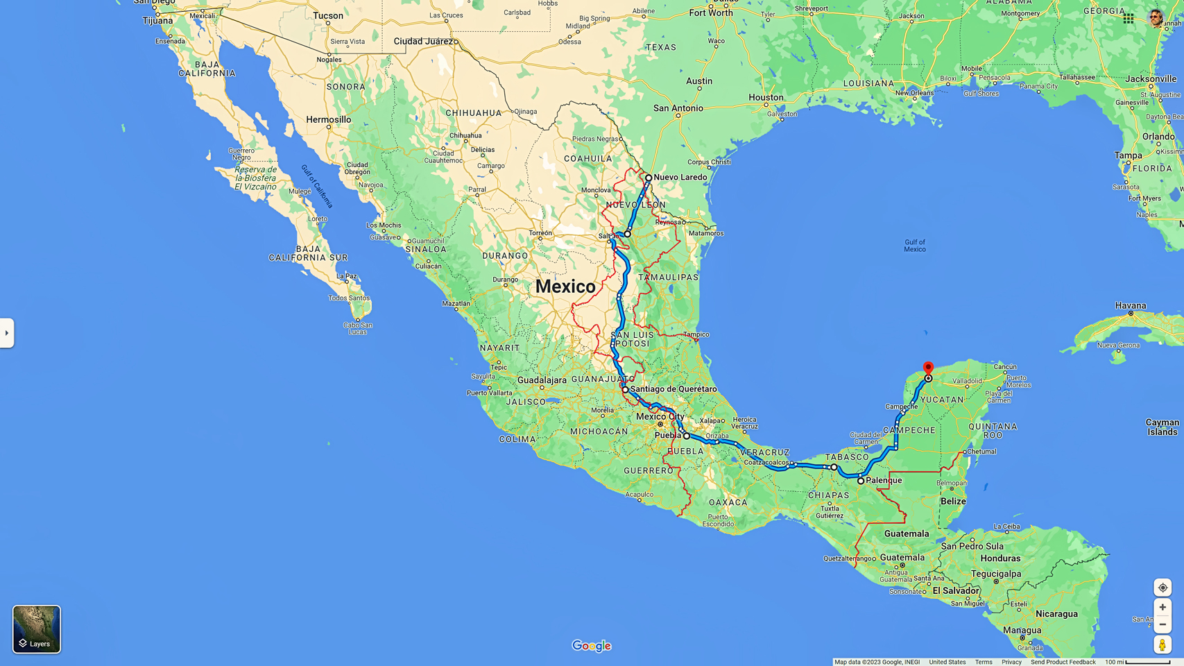
Depending on your ultimate destination in Mexico, it’s possible to stay within that yellow corridor for most, if not all of your journey south. I’ve provided an example (above-Click to Expand), tracing the route I followed myself, from Laredo, on the border, all the way to Merida, in the Yucatan. You should be aware that “Safety Corridor” is a relative concept in this context, because this is still very much a foreign country, with significantly different standards. There is an extremely heavy police and military presence on the roads, especially in the north, and they are there for a reason.
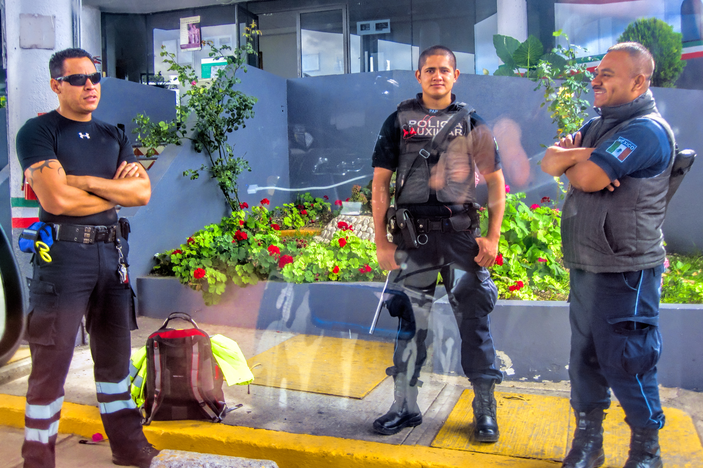
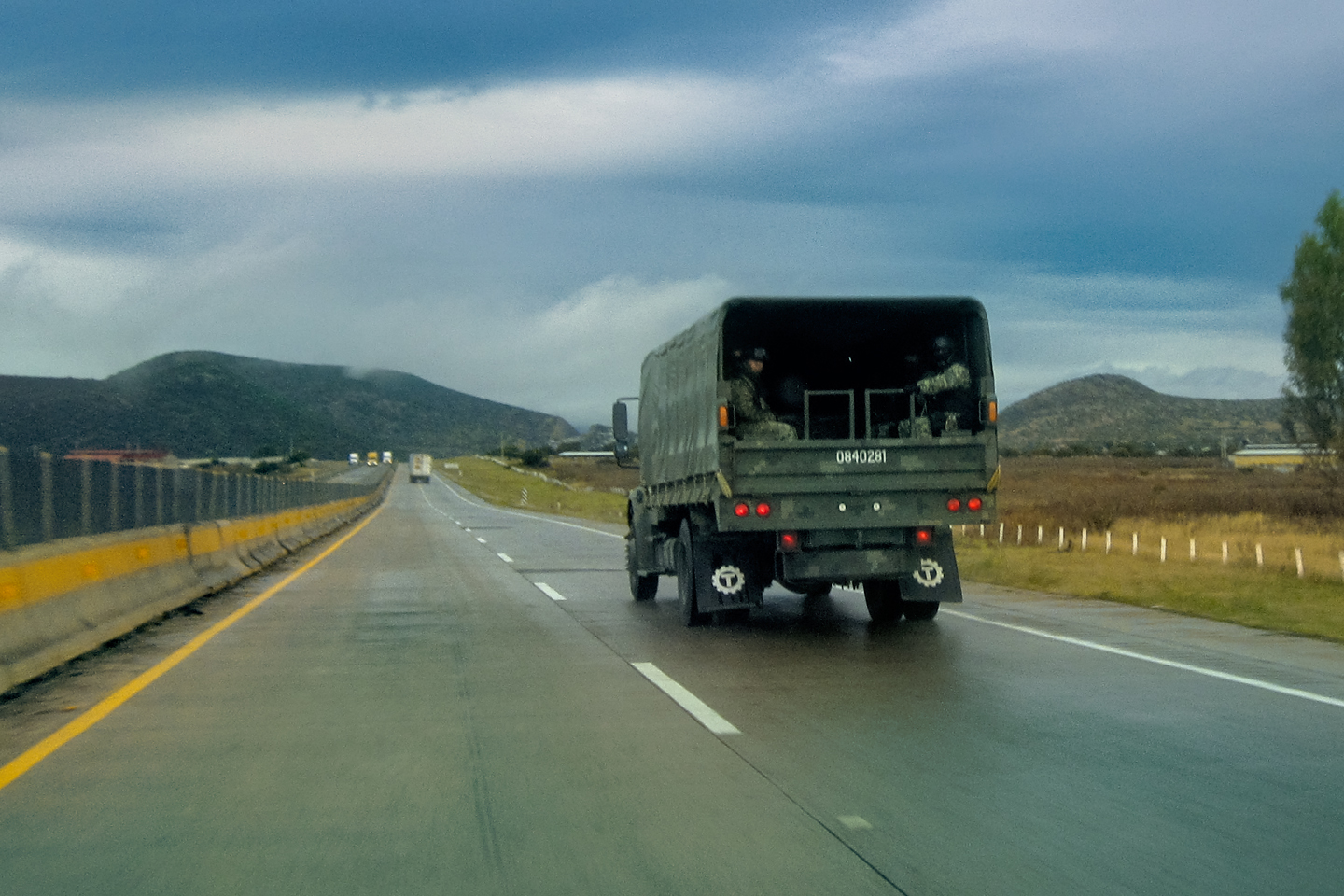
There are military and police checkpoints on every highway, some that are permanently in place, others that are mobile, moved around to keep the bad guys guessing. When you roll up on one of these checkpoints, slow down and stop where they tell you, and try not to be intimidated by all the weapons and the SWAT gear. Unless you’re a smuggler or a Cartel thug, those guys are out there for your protection, and honestly? You should be glad about that. Keep your documents handy, and practice your spiel, so that you can readily explain to them, in the best Spanish you can muster, where you’re going, and why.
Even when traveling in the Mexican States designated Level 2 on the risk assessment scale, you will still need to “Exercise increased caution,” by staying alert, and by following some very basic advice. Here are a few tips that should make your Mexican Road Trip go a bit more smoothly:
RULES OF THE ROAD
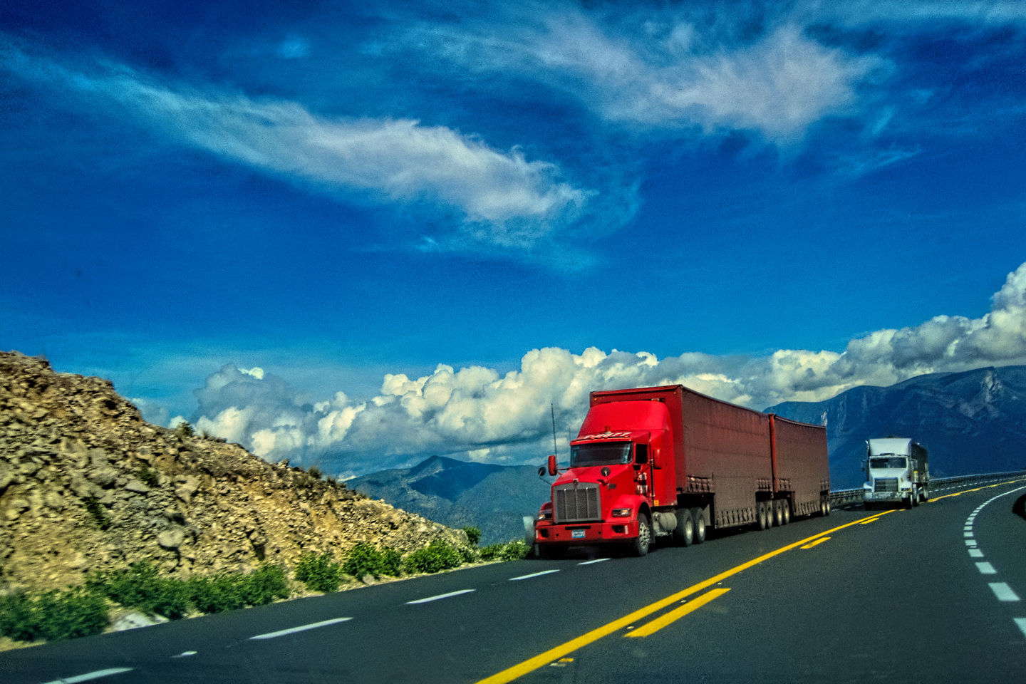
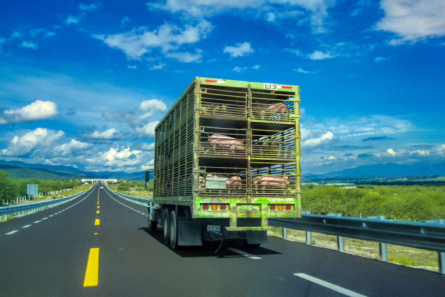
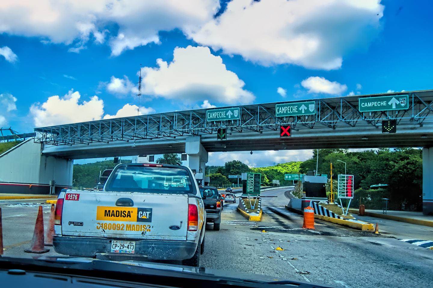
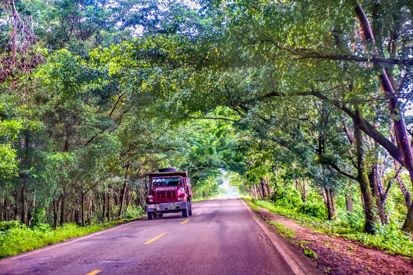
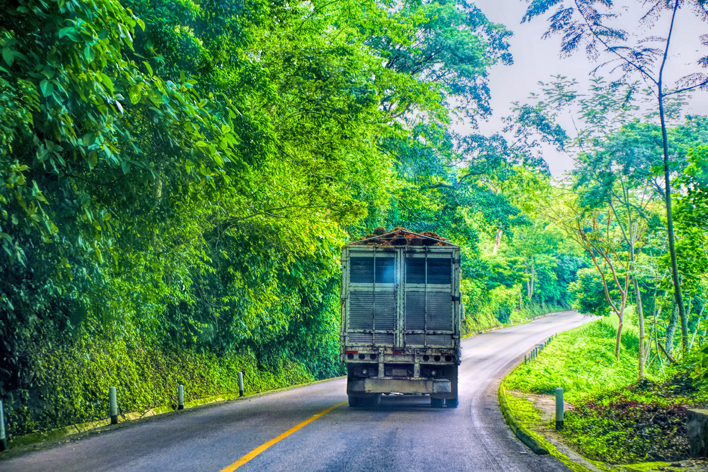
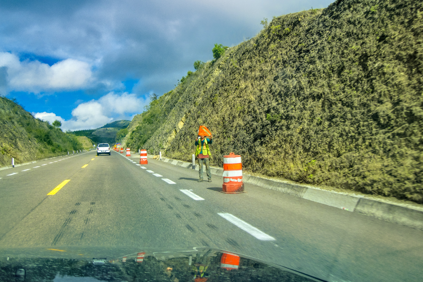
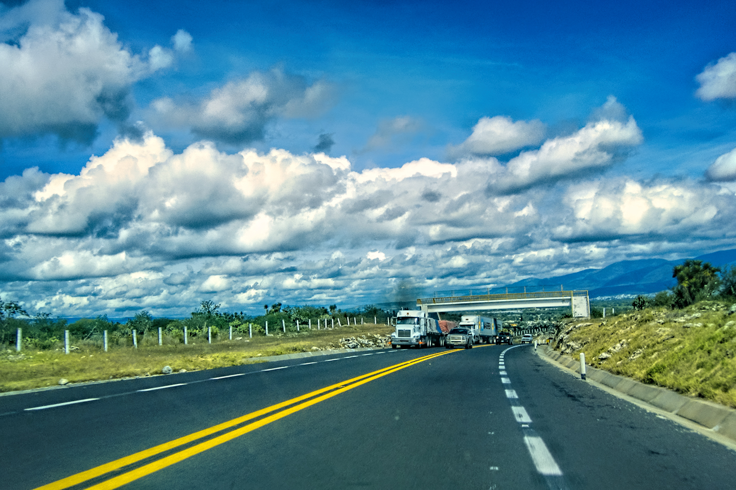
1.) MAIN ROADS: It’s very important that you stay on the main roads. These are almost always toll roads, known as Cuotas, and they are quite distinct from the Libre (free) State Highways. The tolls aren’t cheap, but they are well worth the cost. The Cuotas are newer, better maintained, faster, and safer, because they are more frequently patrolled.
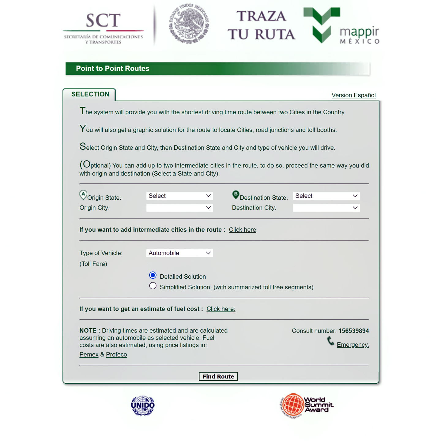
TOLL ROADS
The Mexican Government provides a Route Planning App that can help you figure out the best way to get from Point A to Point B, using the Toll Roads. (Note: to use the App, you’ll need to know which Mexican States your origin and destination cities are located in.) The application determines the most direct route and calculates the tolls for you, segment by segment, along with the drive time for each segment, and it will even give you an estimate of your cost for fuel. The results will be in Pesos; divide that number by 18 to get an estimate in U.S. Dollars.
If you click the Link (Below) you’ll be taken directly to the site, which is sponsored by Mexico’s Secretary of Communication and Transport:
2.) NIGHT TRAVEL: Never travel after dark, especially outside the major cities. Mexican Highways are particularly dangerous at night due to unpredictable hazards in the road, and, in some areas, increased criminal activity.
3.) NO-GO SO-LO: Don’t travel alone unless it’s absolutely necessary. In some areas, there are n’er-do-wells hanging around the gas stations, the toll plazas, and even the police checkpoints. Solo travelers, especially foreigners, tend to stand out, and you don’t want to look like an easy target.
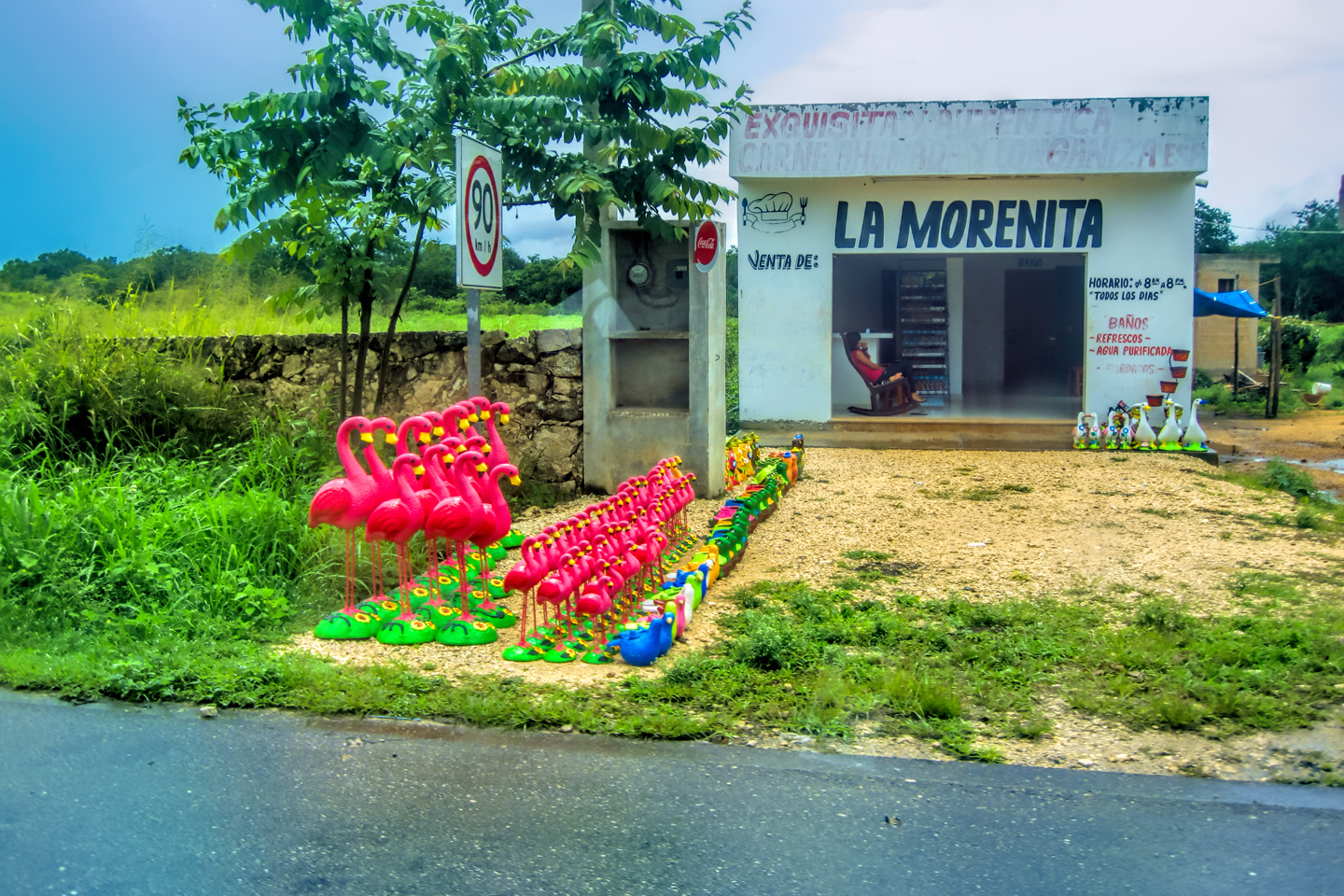
4.) LOW PROFILE: In that same vein, always try to keep a low profile. I already mentioned the ill-advisability of driving a flashy vehicle. You also shouldn’t travel wearing an expensive watch or other jewelry that might catch the eye of a thief.
5.) MONEY EXCHANGE: Dollars aren’t universally accepted, so you’ll need to exchange money from time to time. The best place to change your money into Mexican Pesos is at an ATM inside a bank (as opposed to a machine on the street). After your withdrawal, don’t carry all your cash in one place. Keep a smaller amount handy, and the rest tucked away somewhere safe and out of sight. Ideally, you should carry a credit card that doesn’t charge foreign transaction fees, and you can use that instead of cash at hotels and most restaurants. When driving, always keep a supply of small bills and coins available for tolls, as toll booths only take cash.
6.) FRONT LICENSE PLATES: Many of the individual states in the U.S. no longer issue a front license plate, and that can be a problem in Mexico. When you pull up to any of the many checkpoints on Mexico’s highways, they’ll be watching you approach, and they’ll be looking for your license plate, to determine where you’re from. If they don’t see one, (because you don’t have one), they will be immediately suspicious, especially in the south, where they don’t deal with many U.S. registered vehicles. You will have to explain, in the best Spanish you can muster, why you don’t have a plate on the front (basically, because your home state is too cheap to provide one). My Spanish is decent, so I didn’t have a problem with this, but I can only imagine how it would have gone if the guys with the machine guns hadn’t understood me.
You can save yourself from this aggravation by employing the following hack: before you leave home, find a shop where they make signs, and things like novelty license plates. (If you can’t find a sign shop locally, I can personally recommend BuildASign.com, on the internet). Provide them with a close-up photo of your current, valid license plate, and have them make a facsimile on a metal blank, which you can then attach to your front bumper. It won’t be an “official” plate, but it doesn’t have to be, because your state doesn’t require an official front plate. As long as it matches your rear plate, the inspectors at the roadblocks in Mexico will be perfectly happy.
7.) DOCUMENTS: When you’re on the road, keep your passports, tourist cards, insurance information, and all the paperwork related to your vehicle handy and in one spot, so that you can easily produce it on demand, without digging through your luggage. Before you leave home, make several good color copies of the main page of your passport, your car title, and your driver’s license. Avoid handing over the originals unless the requesting official insists, and keep the copies and the originals in separate locations.
8.) HOW’S YOUR SPANISH? You will be asked (dozens of times) where you’re coming from, where you’re going, and why. Have your answers to those questions prepared, and practice some of the basic Spanish phrases most useful to travelers. The deeper you go into Mexico, the more difficult it will be to find anyone who speaks English.
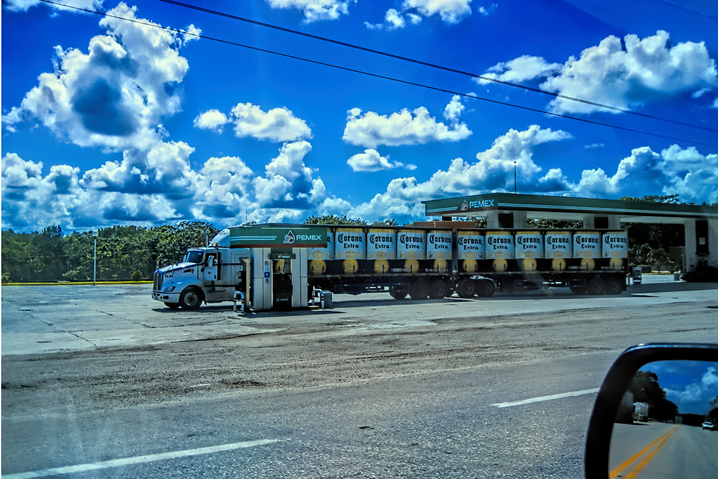
9.) GAS SCAMS: Most gas stations in Mexico are retail outlets for PEMEX, Mexico’s National oil company, though it’s increasingly common to see Shell, BP, and other international brands represented. Prices tend to be a bit high by U.S. standards and there is no self-service; every station has attendants that pump your fuel. You should always check the dials on the gas pump before the attendant begins fueling, to insure that he’s reset the pump from the previous customer’s transaction. (If they “forget” to reset, and you neglect to notice, your total will be inflated by the amount of the previous transaction, and they’ll slyly pocket the overcharge.) You’ll frequently hear the phrase, “Cero-cero!” (meaning double zero). The honest attendants like to call your attention to the “zeroes” on the pump dial, as proof of their good character. (Incidentally, if they give you good service, you should tip them 5 or 10 Pesos.)
10.) GREEN ANGELS: On Mexico’s National Highways, they have a fleet of around 200 Green and White utility trucks that patrol every major road in the country during daylight hours; the drivers are friendly mechanics whose sole function is to come to the rescue of stranded motorists. If you have a flat tire, run out of gas, or have any type of mechanical or medical issue, one of these guys, known as the Green Angels, will show up from out of the blue, and they’ll do whatever is necessary to get you back on the road. (If they don’t show quickly enough, you can call them, simply by dialing 078 on any phone, or on one of the emergency call boxes that you can find alongside the highways.) There is no charge for this extraordinary service, but if you do receive their assistance, they’ll deserve a good tip before you part ways.
11.) LEFT TURN SIGNALS: If you’re on one of the two-lane Mexican Highways, and you’re stuck behind a slow truck, it’s common to see them turn on their left turn signal. This doesn’t mean they’re about to change lanes into oncoming traffic. It’s actually a courtesy: the truck driver is letting you know that if you want to pass him, it’s safe to do so. Other drivers that are behind you expect the same courtesy, so, at least on the two-lane highways, be careful not to use your own left turn signal for any other purpose.
12.) ROUNDABOUTS: Unless you’re from Boston, the roundabouts used to control traffic at busy intersections in Mexico’s cities will probably terrify you. There are rules governing the Right of Way, but picture this: you have several lines of heavy traffic hurtling around a circle, while every other driver is willy-nilly changing lanes. It can be impossible to figure out who’s heading where, because the Right of Way seems to go to whoever has the largest vehicle, the loudest horn, or the biggest balls, not necessarily in that order. My advice? Just keep a sharp eye out, don’t panic, and be prepared to go around the circle more than once!
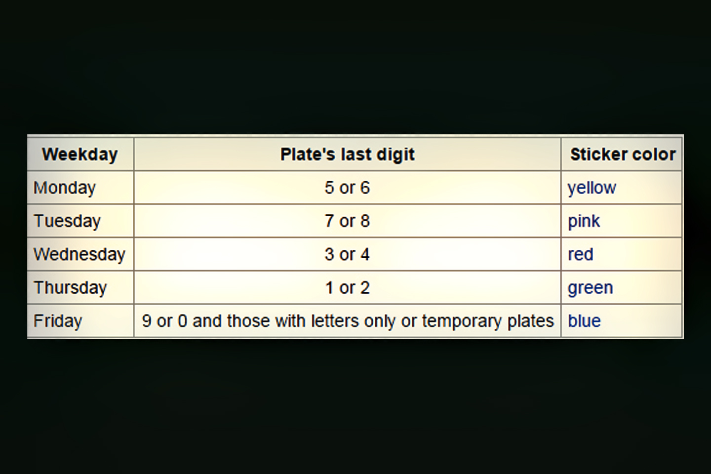
13.) HOY NO CIRCULA:
if you’re traveling in the D.F., (Distrito Federal), which consists of Mexico City and the surrounding area, there is a law, called Hoy No Circula (roughly, Don’t Drive Today), which requires all drivers to leave their car at home one day per week, as well as at certain times of day, and for some, every Saturday, to cut down on horrendous pollution from auto emissions. This law DOES apply to foreign visitors, so you either need to avoid driving in the Mexico City area, or you need to comply with the complicated rules. Click the link to a Wikipedia article that explains the details.
HOY NO CIRCULA
(DON’T DRIVE TODAY)
Use the link (above) to read up on Hoy No Circula. If they catch you driving in or near Mexico City on a day when you’re supposed to stay parked, it can get very expensive!
PASE TURISTICO
(14 DAY EXEMPTION FOR TOURISTS)
Use this link (above) to reach a Mexican Government website where you can apply for a Pase Turistico, a two week exemption to the law for vehicles 2008 and newer.
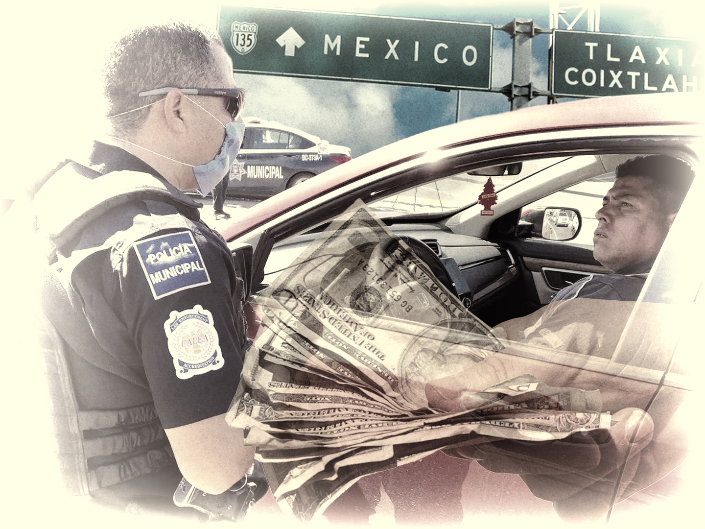
14.) LA MORDIDA (THE “BITE”):
The Police in Mexico are generally more honest than they used to be, and there is a fair bit of emphasis placed on rooting out corruption, so it’s less likely that you’ll experience “the bite.” Traditionally, that’s a situation when a policeman or some other official accuses you of something, often falsely, and demands an immediate payment. If you do enough driving in Mexico, it’s entirely possible that you’ll run into a guy like that. Here’s a common scenario: You get pulled over on the highway, and accused of speeding, or illegally changing lanes, or violating the Hoy No Circula rules (see above).
They’ll tell you that there is a fine, and they’ll want you to pay on the spot. What you should do, especially if you have doubts about the supposed infraction, is ask to see the officer’s badge, and make a show of writing down the name and number. Agree to pay, but insist on paying at the Police Station. If the charge is legitimate, the officer won’t have a problem with that, and that’s what will happen. If he’s scamming you, he’ll probably attempt to negotiate, possibly by dropping his price. Be respectful, but continue to insist that you’ll only pay at the station. Pretty good odds he’ll back down and let you off with a “warning.”
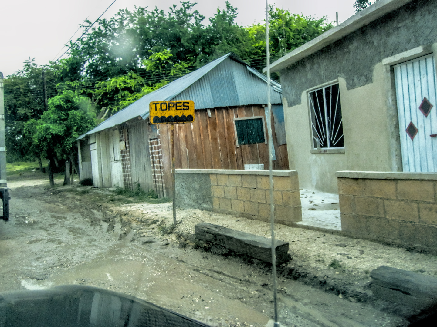
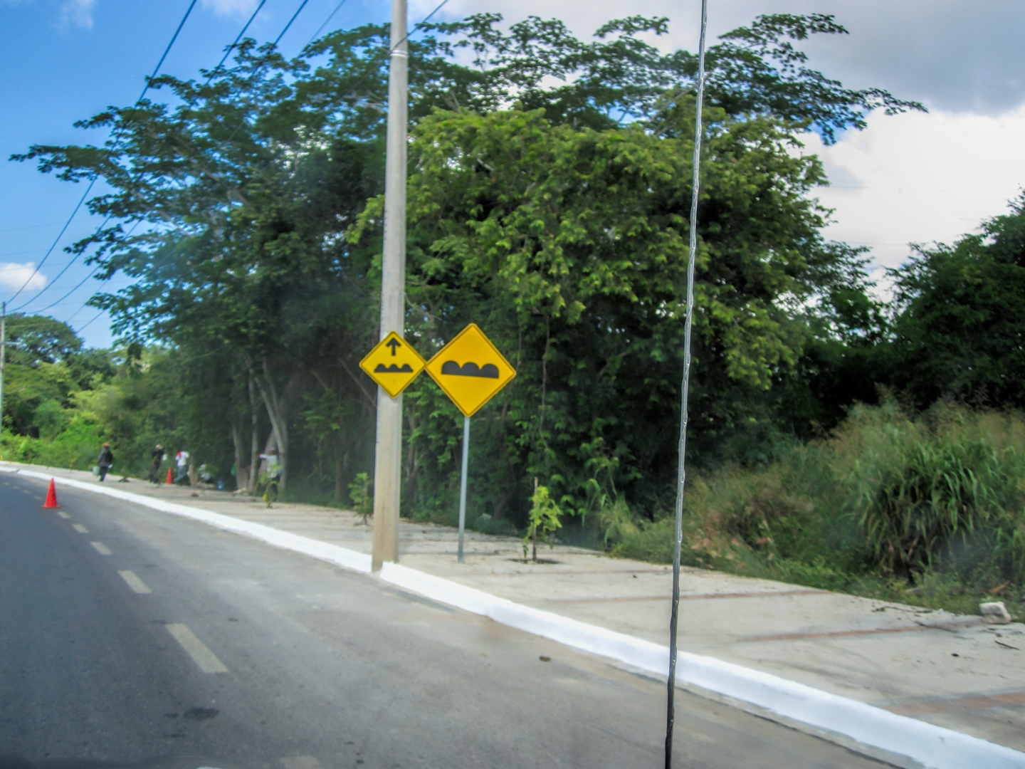
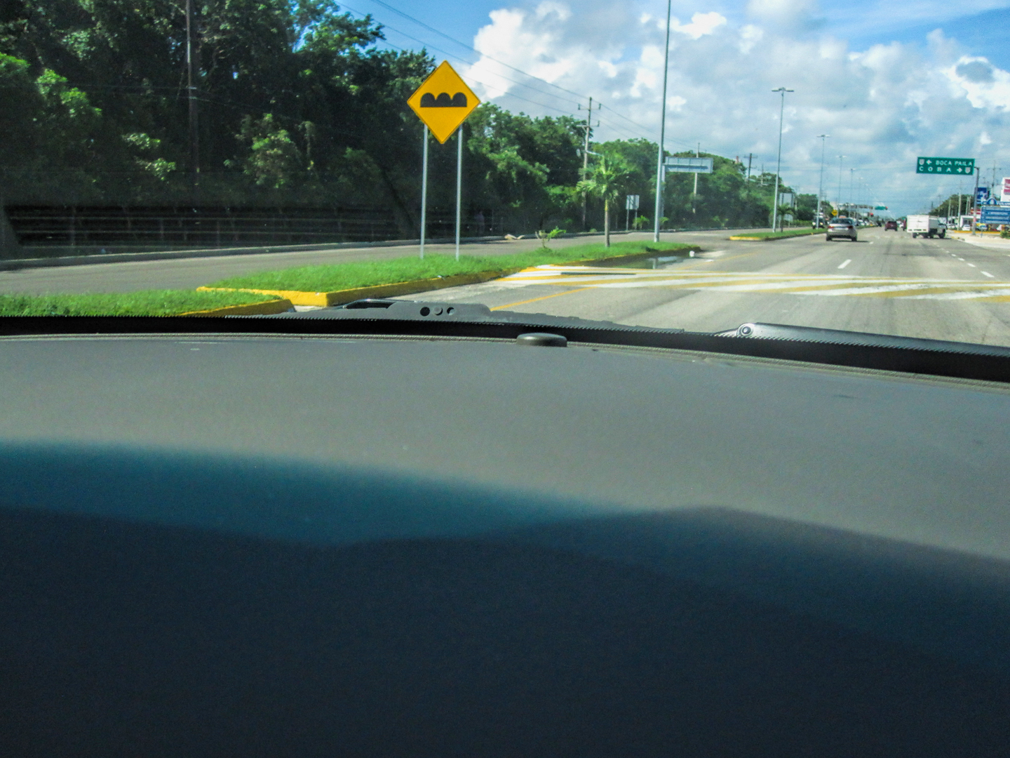
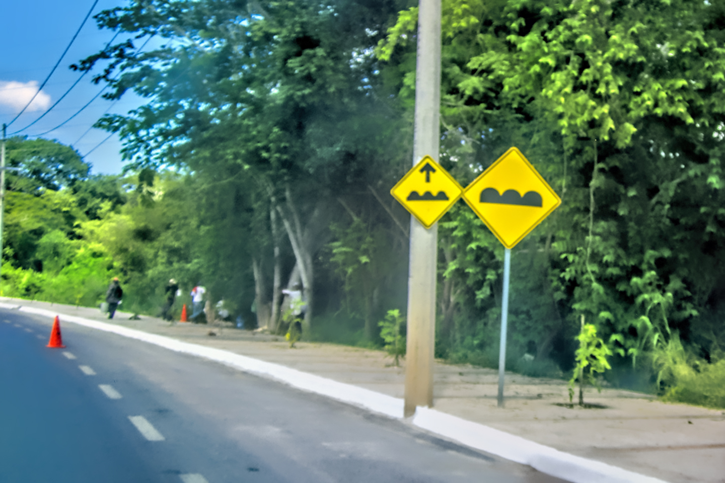
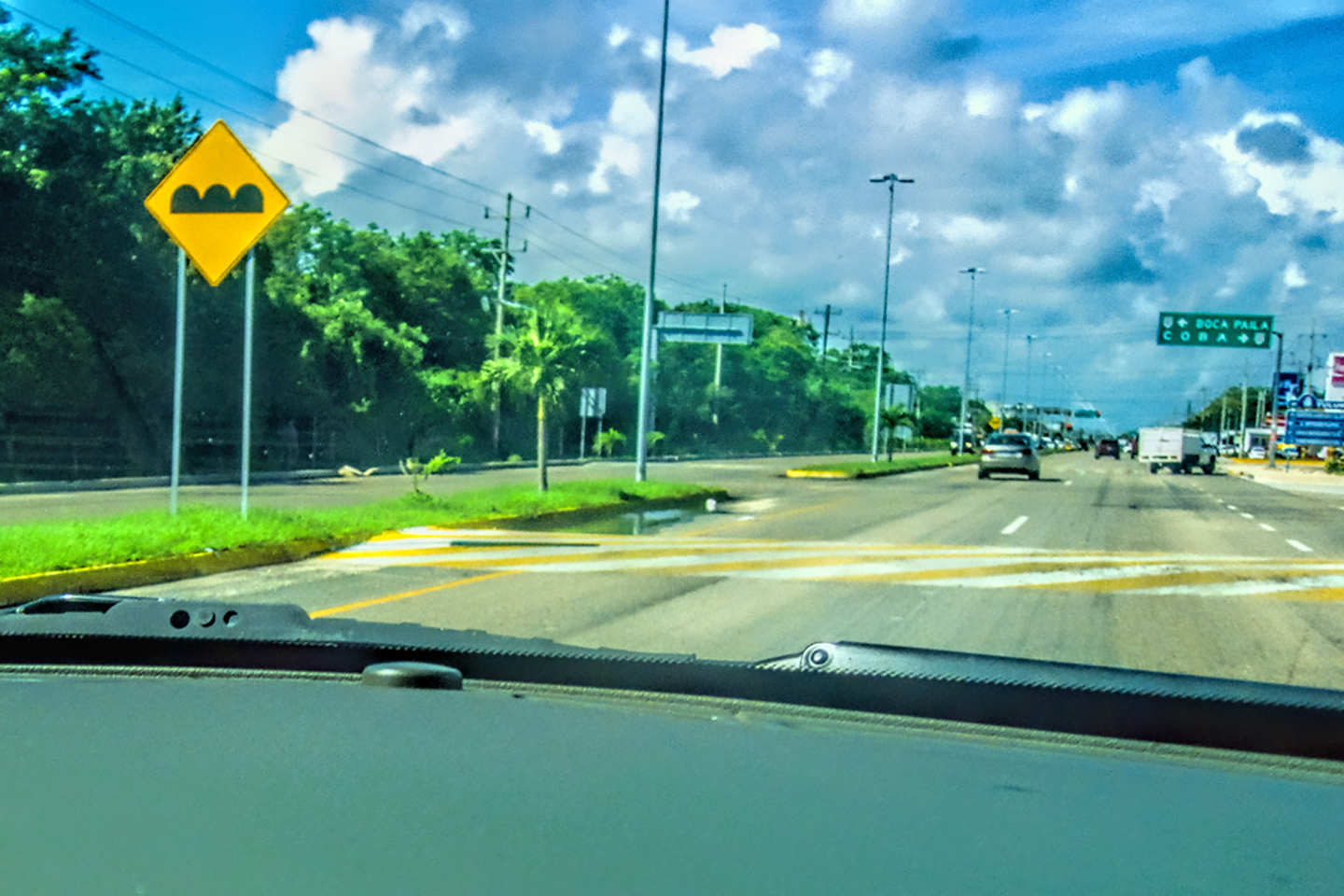
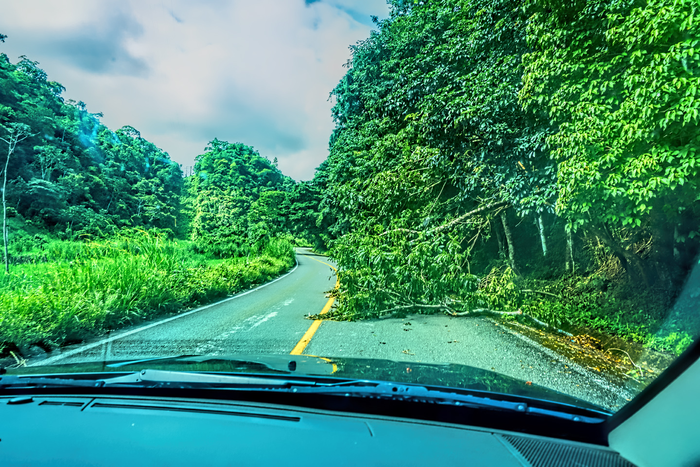
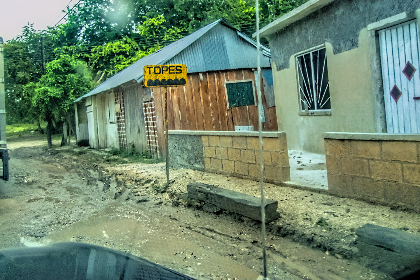
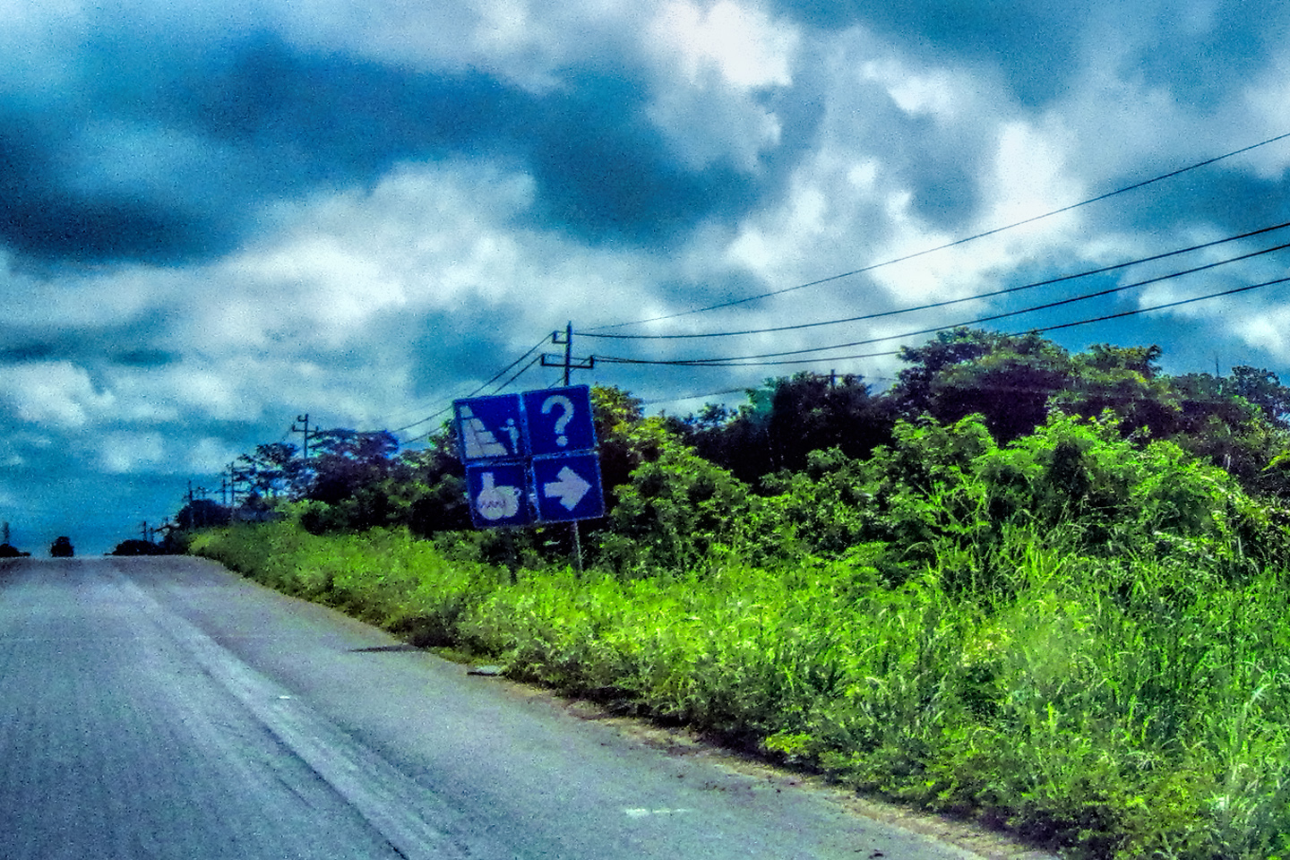
15.) TOPES: Beware of the TOPES! Most of the secondary roads, and many of the main roads in Mexico are equipped with speed bumps, put in place to slow traffic through populated areas. Some of them are well marked, painted bright yellow or reflective white, with signs posted in advance, warning drivers to slow down.
Others aren’t marked at all! They’re camouflaged, burnished by skidmarks until they’re the same color as the asphalt, and they’re anything but gentle. If you hit one of those suckers going faster than, oh, say, 5 mph? Well, let’s just say you’ll wish you hadn’t.
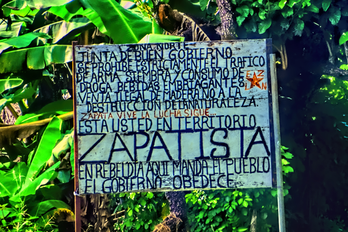
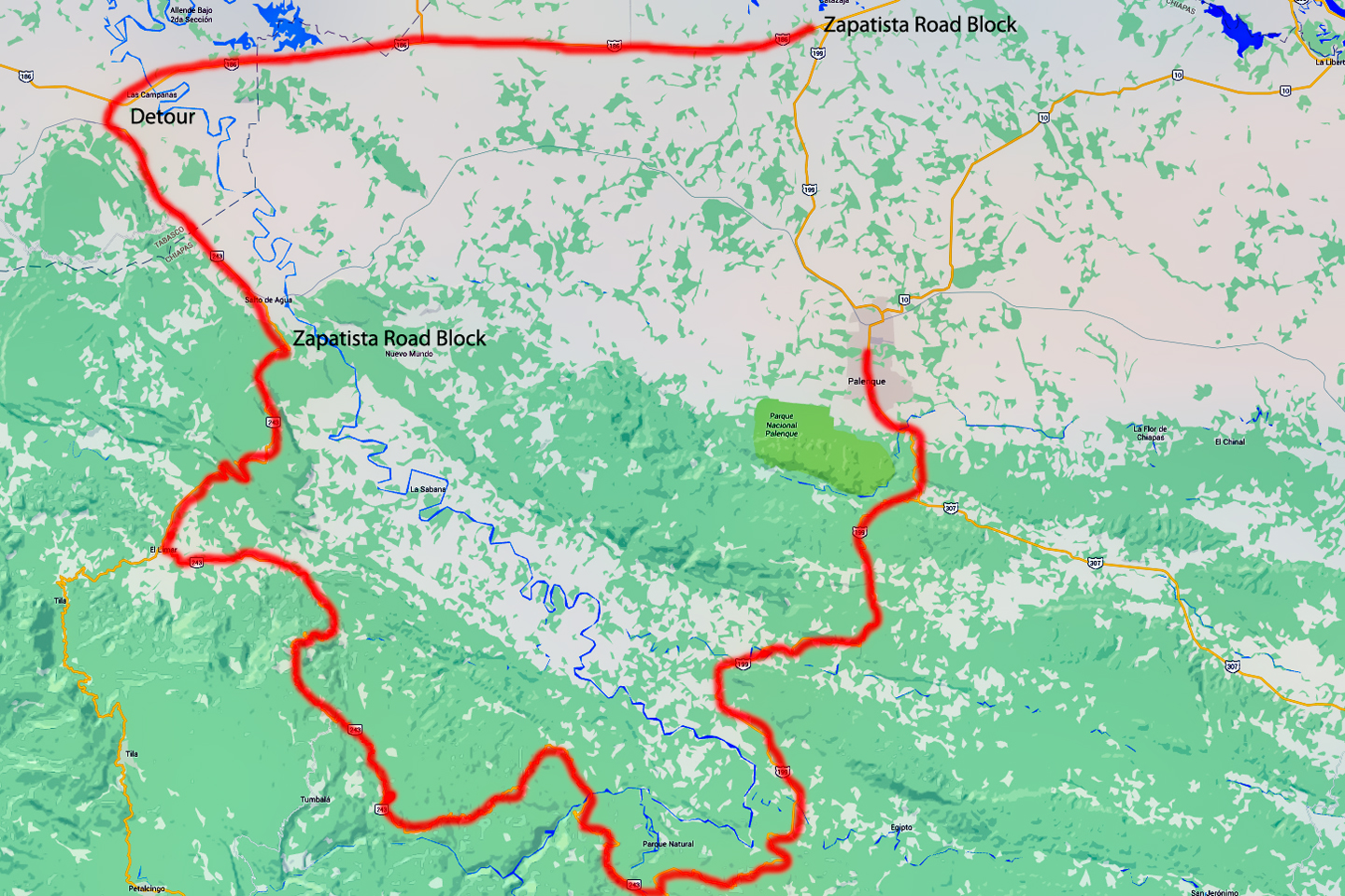
Sign on the main road through Chiapas, advising travelers that they are entering Zapatista Territory; a Zapatista roadblock has stopped all traffic headed to Palenque.
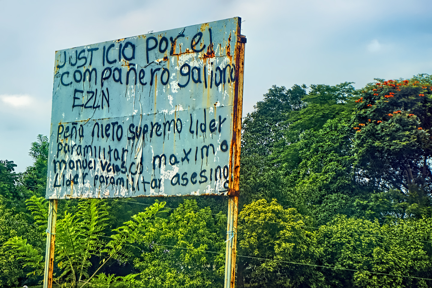
16.) ZAPATISTAS: If you’re traveling in the southernmost part of Mexico, and you cross the border into the State of Chiapas (on your way to Palenque, for example), you might run into a Zapatista road block. The Zapatistas are a loosely organized group of mostly indigenous activists. They have many legitimate economic and environmental concerns, and their favorite technique for making themselves heard is known as the “bloqueo.” They create unofficial roadblocks at critical highway junctions, stopping all traffic, sometimes for several days at a stretch. Noisy standoffs between protesters and police attracts media attention, which is really the whole purpose. These incidents are rarely violent, but if you’re in a hurry to get somewhere, they can be extremely inconvenient.
If you do run into a Bloqueo, or any other political protest involving large crowds and armed police or military, the smart move is to make a U-turn and quietly leave the area. Never involve yourself in that sort of thing, not even if you strongly sympathize with one side or the other. It’s always best to just hole up somewhere, and wait until whatever it is blows over.
If you drive off the main roads in Chiapas, you may run into small “Zapatista Bloqueos” that are really just a form of minor extortion. Locals, often children, will stretch a rope, or maybe even just a string across the road, and when you stop, they’ll demand a toll. You’re under no obligation to pay. The law would be on your side if you don’t, but these people are extremely poor, and you’re on their land, so my personal inclination is to consider the requested toll a donation.
Most of the advice and information in this post is generic. I’ve done my best to present an accurate picture of the current situation at the border, and on Mexico’s highways, and to provide useful insights that should help you navigate the country on a road trip. Wherever possible, I’ve tried to provide links to official Mexican government resources, many of which are in Spanish. If your browser doesn’t automatically translate these pages, use Google Translate, or any other Translation app to insure you understand the information presented. A Mexican Road Trip can be a transformative experience. If you go, I wish you safe travels, and the very best of luck!
~~~~~~~~

This is the first post in a multi-part series that is currently a work in progress. Next up: Mexican Road Trip: Heading South, from Laredo to Villahermosa
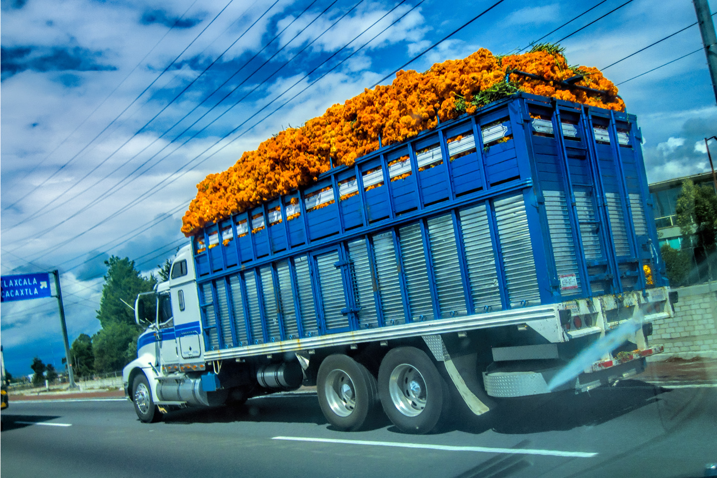
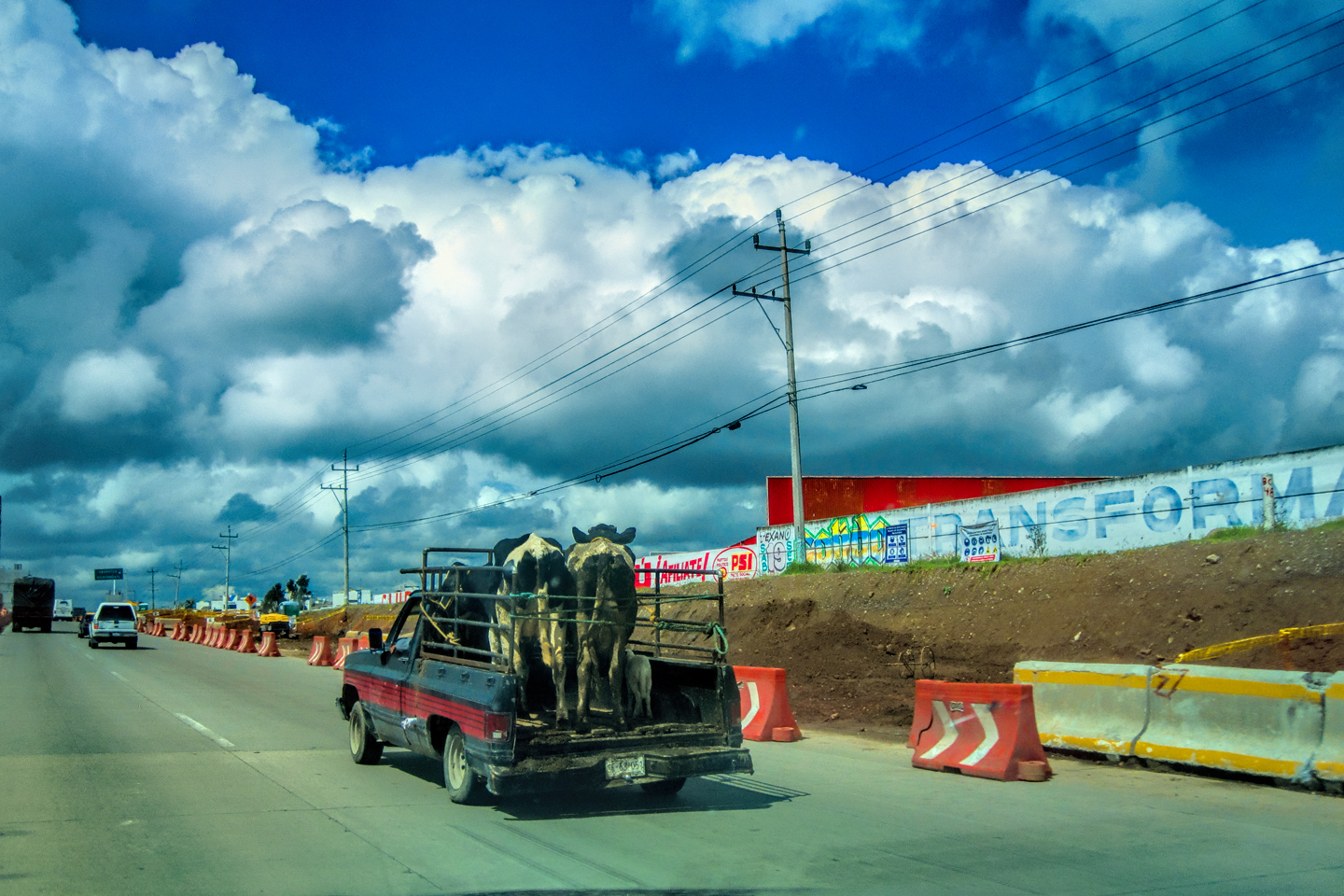
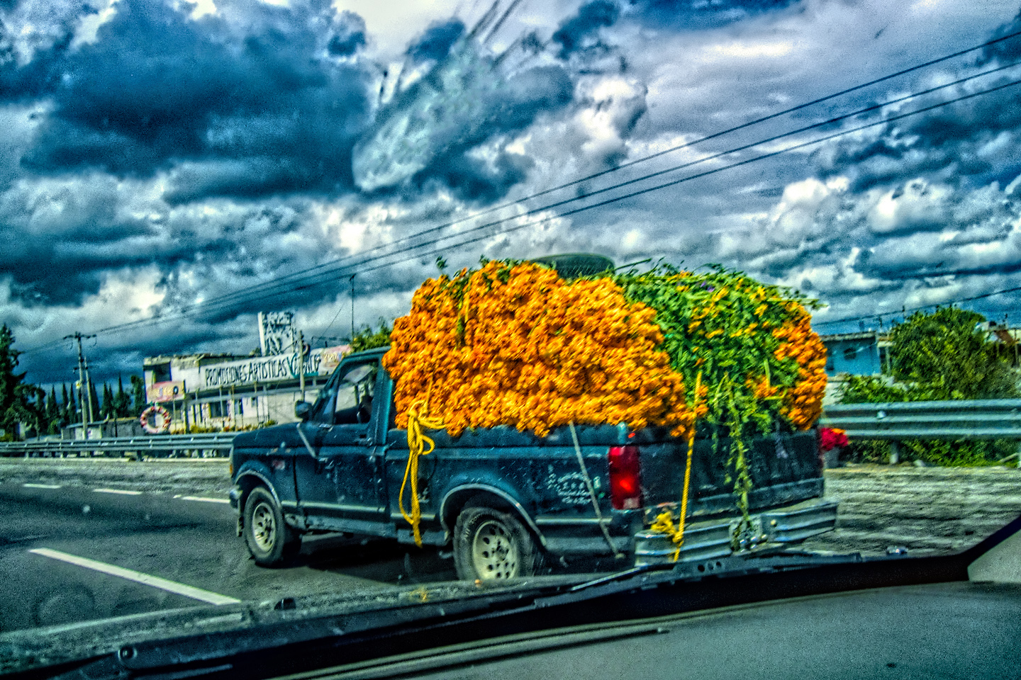
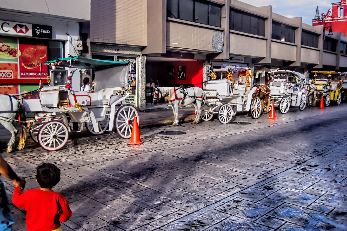
Several of the photos in this post, and most of the pictures in the photo collage of random Mexican Road Trip Images (below) are courtesy of my inestimable shotgun rider, Michael Fritz.
(Unless otherwise noted, all photos on this site are my original work, and are protected by copyright. They may not be duplicated for commercial purposes.)
Click any photo to expand the image to full screen
Michael Fritz, “Elmo,” 1949-2025
READ MORE LIKE THIS:
This is an interactive Table of Contents. Click the thumbnails to open the pages.
ON THE ROAD IN MEXICO

MEXICAN ROAD TRIP: HOW TO PLAN AND PREPARE FOR A DRIVE TO THE YUCATAN
The published threat levels are a “full-stop” deal breaker for the average tourist. That’s unfortunate, because Mexican road trips are fantastic! Yes, there are risks, but all you have to do to reduce those risks to to an acceptable level is follow a few simple guidelines.
<<CLICK to Read More!>>
Mexican Road Trip: Heading South, From Laredo to Villahermosa
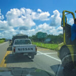
When it was our turn, soldiers in SWAT gear surrounded my Jeep, and an officer with a machine gun gestured for me to roll down my window. He asked me where we were going. I’d learned my lesson in customs, and knew better than to mention the Yucatan. “We’re going to Monterrey,” I said, without elaborating.
He checked our ID’s and our travel documents, then handed them back. “Don’t stop along the way,” he advised. “You need to get off this road and to a safe place as quickly as you can!”
<<CLICK to Read More!>>

Mexican Road Trip: Zapatista Road Blocks in Chiapas
“Good morning,” I said. “We’re driving to Palenque. Will you allow us to pass?”
The leader of the group, a young Mayan lad, walked up beside my Jeep, and fixed me with a menacing glare. “The road is closed,” he said, keeping his hand on the hilt of his machete. “By order of the Ejército Zapatista de Liberación Nacional!”
“Is it closed to everyone?” I asked innocently. “How about if we pay a toll? How much would the toll be?”
He gave me an even more menacing glare. “That will cost you everything you’ve got,” he said gruffly, brandishing his machete, while his companions did the same.
<<CLICK to Read More!>>

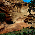
Mexican Road Trip: Mayan Ruins and Waterfalls in the Lacandon Jungle
The next morning, we were waiting at the entrance to the Archaeological Park a half hour before they opened for the day. We were the only ones there, so they let us through early, and I had the glorious privelege of photographing that wonderful ruin in the golden light of early morning, without a single fellow tourist cluttering my view.
<<CLICK to Read More!>>

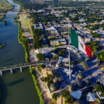
Mexican Road Trip: Merida and the Meridanos
Merida is the largest city in southern Mexico, with a population of almost a million. Statistically, Yucatan is the safest of Mexico’s states, and Merida is widely considered the safest of all Mexico’s cities.
<<CLICK to Read More!>>


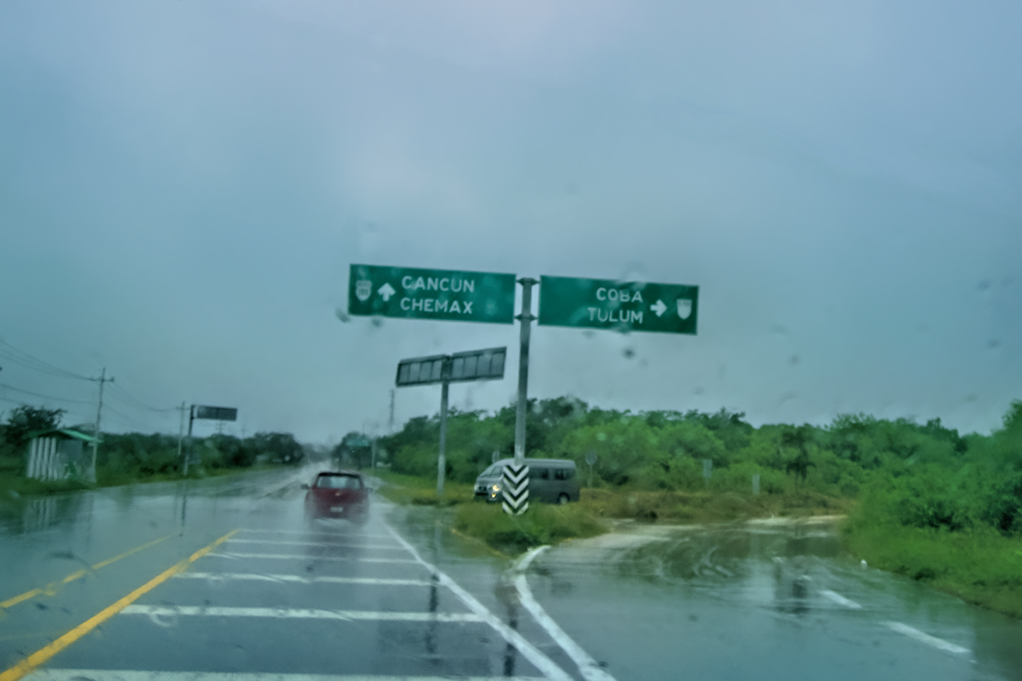
Mexican Road Trip: Cancún, Tulum, and the Riviera Maya
The millions of tourists who fly directly to Cancún from the U.S. or Canada are seeing the place out of context. They can’t possibly appreciate the fact that they’re 2,000 miles south of the border; a whole country, a whole culture, a whole history away from the U.S.A. Just looking around, on the surface? The second largest city in southern Mexico could easily pass for a beach town in Florida.
<<CLICK to Read More!>>

Mexican Road Trip: Circling the Yucatan, from Quintana Roo to Campeche
The Castillo at Muyil isn’t huge, as Mayan pyramids go, topping out at just over 50 feet, but it’s definitely imposing. Try to imagine: the equivalent of a five story building, with a three story grand staircase, just appearing, out in the middle of nowhere? Boo-yah!
<<CLICK to Read More!>>

Mexican Road Trip: Edzná, and Campeche, Where They Dance La Guaranducha
La Guaranducha, a traditional dance from Campeche, is a celebration of life, community, and the joy of existence. On stage, there was a group of young men and women in traditional dress, but it was clear that the guys were little more than props, because all eyes were on the girls. So colorful, and so elegant, hiding coyly behind their pleated, folding hand fans.

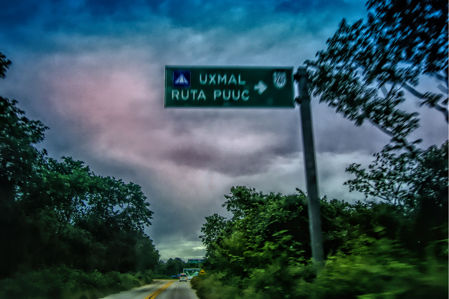
Mexican Road Trip: Adventures Along the Puuc Route
All of these communities in the Puuc region were allied, politically, culturally, economically, and socially. The Puuc was the cradle of the Golden Age of the Maya. Labna and Sayil were among the brightest jewels in the crown of a realm that never quite coalesced into an empire.
<<CLICK to Read More!>>

Mexican Road Trip: The Road to Bonampak
Rainwater seeping through the limestone walls of the temple soaked the Bonampak Murals with a mineral-rich solution that, each time it dried, left behind a sheen of translucent calcite. The built-up coating protected the paintings for more than 1200 years. As a result, we’re left with the finest examples of ancient art from the Americas to have survived into our modern era.

Mexican Road Trip: Crossing the Chiapas Highlands, to San Cristobal de las Casas
MX 199 crosses the Chiapas Highlands from Palenque to San Cristobal de las Casas. The distance is only 132 miles, but it’s 132 miles of curvy mountain roads with switchbacks, steep grades, slow trucks, and villages chock-a-block with topes and bloqueos, unofficial road blocks. Everything I read, and everything I heard, described the drive as alternatively spectacular, dangerous, and fascinating, in seemingly equal measure.

Mexican Road Trip: Cruising the Sierra Madre, from San Cristobal to Oaxaca
Today, we’d be driving as far as the city of Oaxaca, 380 miles of curves, switchbacks, and rolling hills that would require at least ten hours of our full attention, crossing the Sierra Madre de Chiapas, and entering the rugged, agave-studded landscape of the Sierra Madre de Oaxaca. If you’d like to know what that was like, read on!

Mexican Road Trip: Flashing Lights in the Rear View: Officer Plata and La Mordida
As we drove away from the toll plaza, a State Police car that had been parked off to one side made a fast U-Turn and started following me. A moment later, he turned on his flashers and gave me a short blast on his siren, motioning for me to pull over. Two uniformed policemen got out, and approached me on the driver’s side. One of them hung back, apparently checking out my license plate before making a phone call.
I wasn’t sure if I was being stopped for some infraction, or if these guys were just fishing…

Mexican Road Trip: Three Days of the Dead in San Miguel de Allende
By mid-afternoon, the Jardin was beginning to fill with people. Painted faces were literally everywhere! It was like a costume party, but the venue wasn’t some hall or other indoor space, it was the whole entire town! Mike and I were definitely getting into the spirit of the thing–but we still drew the line at the notion of painting our beards…
Mexican Road Trip: Back to the Border: San Miguel de Allende to Eagle Pass
Saltillo was our crossroads: if we turned east here, we’d be retracing our previous route to the border at Nuevo Laredo–along the Highway of Death! This time, we knew better, so we turned north, toward Monclova, and Piedras Negras.


Southern Colonials: Merida, Campeche, and San Cristobal
Visiting the Spanish Colonial cities of Mexico is almost like traveling back in time. Narrow cobblestone streets wind between buildings, facades, and stately old mansions that date back three hundred years or more, along with beautiful plazas, parks, and soaring cathedrals, all of similar vintage.
<<CLICK to Read More!>>

San Miguel de Allende, Mexico’s Colonial Gem
If you include the chilangos, (escapees from Mexico City), close to 20% of the population of San Miguel de Allende is from somewhere else, a figure that includes several thousand American retirees.
<<CLICK to Read More!>>

Day of the Dead in San Miguel de Allende
In San Miguel de Allende, they’ve adopted a variation on the American version of Halloween and made it a part of their Day of the Dead celebration. Costumed children circle the square seeking candy hand-outs from the crowd of onlookers. It’s a wonderful, colorful parade that’s all about the treats, with no tricks!
<<CLICK to Read More!>>
DIA DE LOS MUERTOS: A GALLERY OF PHOTOGRAPHS
<<CLICK to view Gallery>>


IN THE LAND OF THE MAYA

Palenque: Mayan City in the Hills of Chiapas
Palenque! Just hearing the name conjures images of crumbling limestone pyramids rising up out of the the jungle, of palaces and temples cloaked in mist, ornate stone carvings, colorful parrots and toucans flitting from tree to tree in the dense forest that constantly encroaches, threatening to swallow the place whole.
<<CLICK to Read More!>>

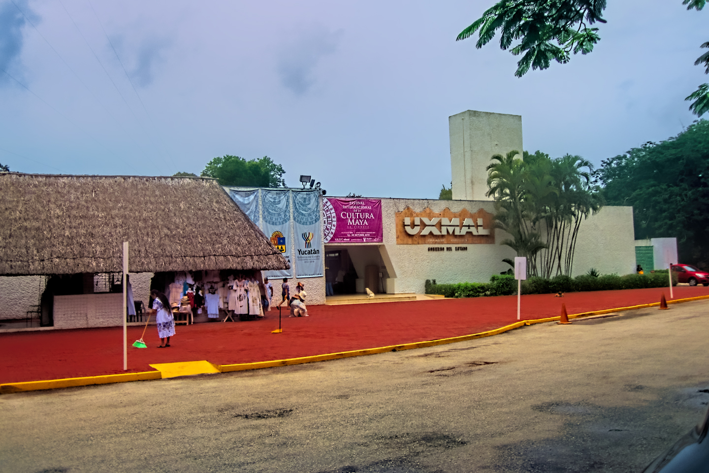
Uxmal: Architectural Perfection in the Land of the Maya
The Pyramid of the Magician is one of the most impressive monuments I’ve ever seen. There’s a powerful energy in that spot–maybe something to do with all the blood that was spilled on the altars of human sacrifice at the top of those impossibly steep steps–but more than any building or other structure at any ancient ruin I’ve ever visited, more than any demonic ancient sculpture I’ve ever seen, that pyramid at Uxmal quite frankly scared the hell out of me!
<<CLICK to Read More!>>

The Mayan City of Edzná: First House of the Itzás
The Mayan Edzná is nothing less than epic, lyrical poetry, an extraordinary sonnet comprised of temples and palaces carved in stone that have stood, in regal grandeur, for more than a thousand years.
<<CLICK to Read More!>>

Photographer’s Assignment: Chichén Itzá
To get the best photos, arrive at the park before it opens at 8 AM. There will only be a handful of other visitors, and you’ll have the place practically all to yourself for as much as two hours! Take your time composing your perfect shot.There won’t be a single selfie stick in sight.
<<CLICK to Read More!>>

Chichén Itzá: Requiem for the Feathered Serpent
The feathered serpent with the unquenchable thirst for blood may be gone now, or at least fallen out of favor, but as long as the ruins of this ancient city remain standing, he won’t be forgotten.
<<CLICK to Read More!>>

Tulum: The City that Greets the Dawn
Tulum is not all that large, as Mayan sites go, but its spectacular location, right on the east coast of the Yucatan Peninsula, makes it one of the best known, and definitely one of the most picturesque.
<<CLICK to Read More!>>

Cobá and Muyil: Mayan Cities in Quintana Roo
Cobá was a trading hub, positioned at the nexus of a network of raised stone and plaster causeways known as the sacbeob, the white roads, some of which extended for as much as 100 kilometers, connecting far-flung Mayan communities and helping to cement the influence of this powerful city.
<<CLICK to Read More!>>

Becan and Chicanná: Mayan Cities in the Rio Bec Style
Much about the Rio Bec architectural style was based on illusion: common elements include staircases that go nowhere and serve no function, false doorways into alcoves that end in blank walls, and buildings that appear to be temples, but are actually solid structures with no interior space.
<<CLICK to Read More!>>

The Puuc Hills: Apex of Mayan Architecture
The Puuc style was a whole new way of building. The craftsmanship was unsurpassed, and some of the monumental structures created in this period, most notably the Governor’s Palace at Uxmal, rank among the greatest architectural achievements of all time.
<<CLICK to Read More!>>

The Amazing Mayan Murals of Bonampak
Out of that handful of Mayan sites where mural paintings have survived, there is one in particular that stands head and shoulders above the rest. One very special place. Down by the Guatemalan border, in a remote corner of the Mexican State of Chiapas: a small Mayan ruin known as Bonampak.
<<CLICK to Read More!>>
This series of posts is dedicated to my old friend Mike Fritz (aka Mr. Whiskers), my shotgun rider on my Mexican Road Trip. “Drive to the Yucatan and See Mayan Ruins” was at the top of my post-retirement bucket list, right after “Drive the Alaska Highway and see Denali.” We checked off the whole Yucatan thing in a major way, and Mike was a heck of a good sport about it.
Michael passed away in February of 2025, after 75 years of a life well-lived. He was unique, and he’ll be missed.

Michael Fritz (“Elmo”) 1949-2025

There’s nothing like a good road trip. Whether you’re flying solo or with your family, on a motorcycle or in an RV, across your state or across the country, the important thing is that you’re out there, away from your town, your work, your routine, meeting new people, seeing new sights, building the best kind of memories while living your life to the fullest.
Are you a veteran road tripper who loves grand vistas, or someone who’s never done it, but would love to give it a try? Either way, you should consider making the Southwestern U.S. the scene of your own next adventure.
A few years ago I wrote a book about road trips in Arizona and New Mexico that’s a lot like this website, packed with interesting information, and illustrated with beautiful photographs. Check it out! You can find it on Amazon, and at all other major booksellers.

ALASKA ROAD TRIP:
MEXICAN ROAD TRIP (IN THE LAND OF THE MAYA):
ARIZONA AND NEW MEXICO:
SOUTH AMERICA:
PHOTOGRAPHY:
TRIBAL LANDS:


One of the ABSOLUTE BEST We have read. THANK YOU VRRY MUCH.