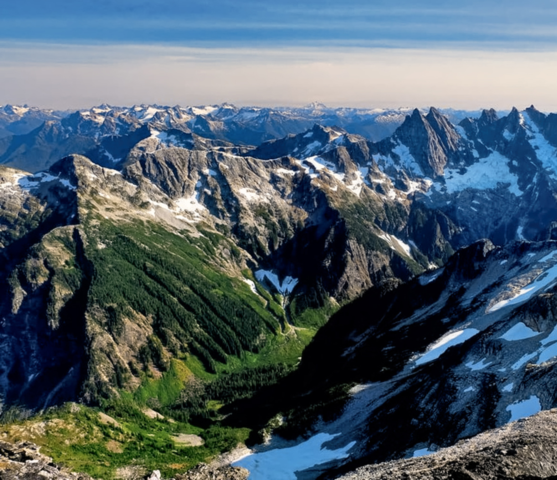
The Cascade Range is a major chain of mountains that begins in northern California, and runs through Oregon and Washington before crossing the border into Canada. Many of the peaks in the range are volcanoes, most long dormant, but some still active, part of the famous “Ring of Fire” that encircles the Pacific Ocean. The Cascades are a broad upheaval of earth and volcanic rock that divides the Pacific Northwest up the middle, encompassing some of our country’s most beautiful forests, and many iconic mountain peaks. One of those, Mount Mazama, blew its top in a massive eruption some 7,700 years ago, an event that has been told and retold in the ancestral legends of the people who occupied these lands in antiquity; legends that are confirmed by the geological record. After that eruption, the volcano’s caldera collapsed, and over the ensuing millenia, the crater filled with rainwater and snow melt, creating one of the world’s most extraordinary lakes.
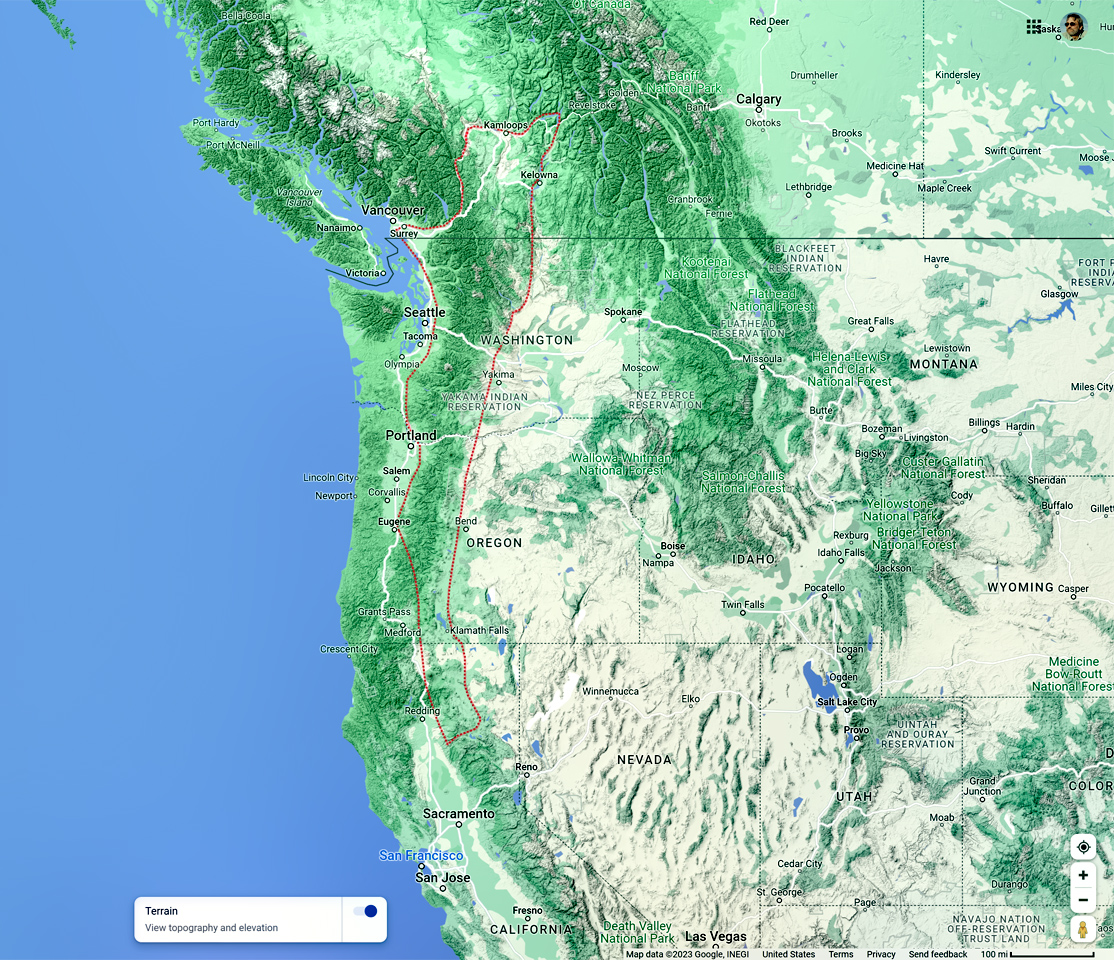
The Cascades
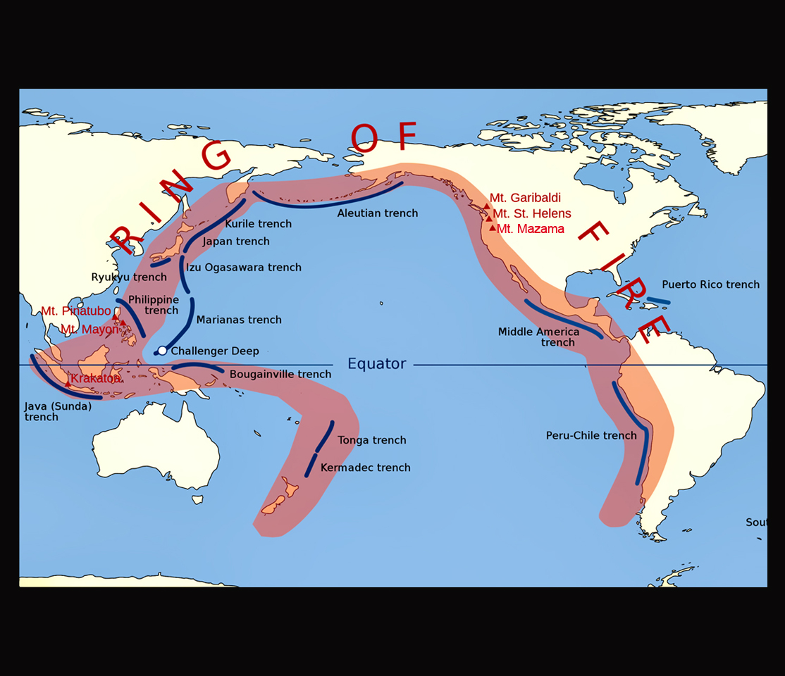
Mt. Mazama, and Crater Lake are part of the chain of volcanoes surrounding the Pacific Ocean, known as the “Ring of Fire.”
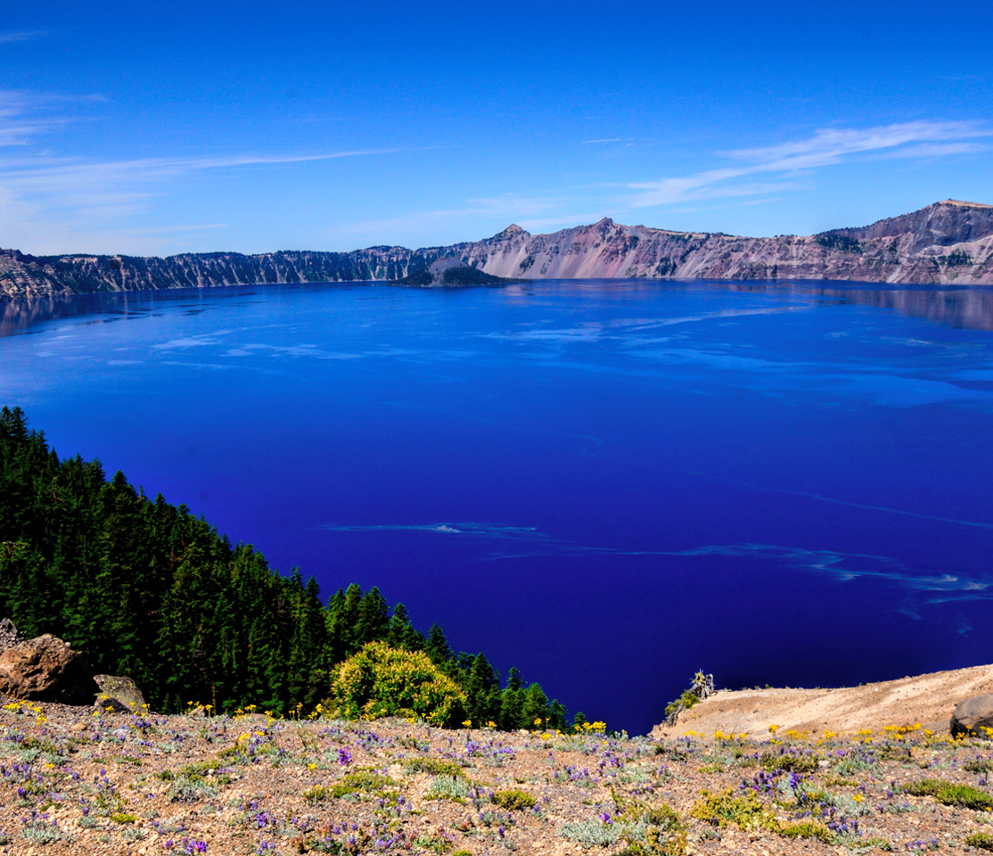
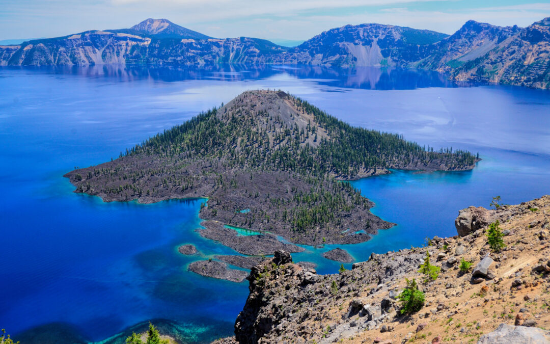
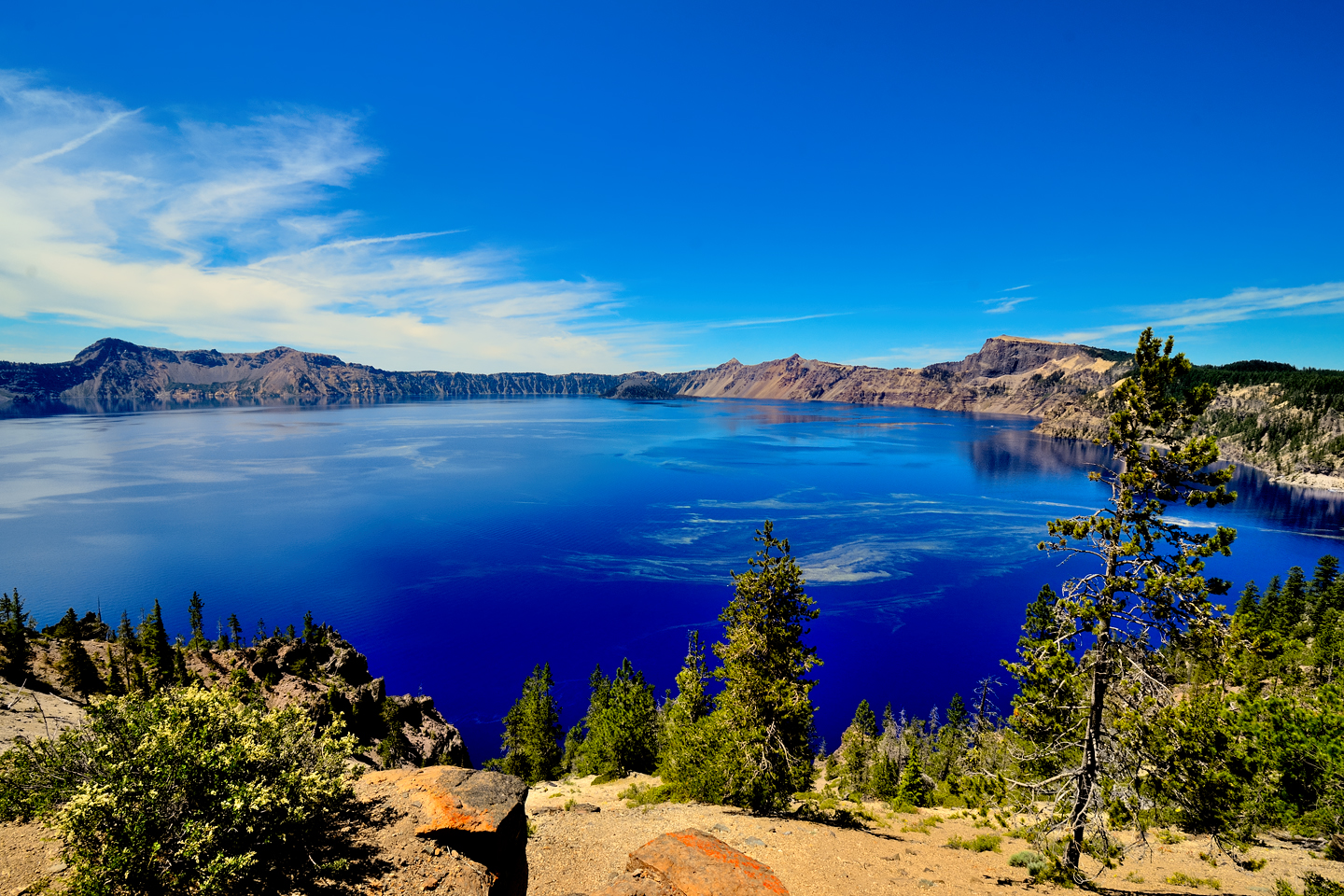
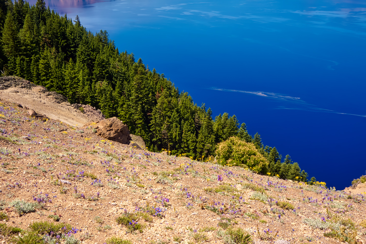
The caldera itelf is 2,148 feet deep. It’s filled with water to a maximum depth of 1,949 feet and a mean average depth of 1,148 feet, which makes it the deepest lake in the Western Hemisphere, and the third deepest on the planet. There are no rivers or streams flowing into or out of the crater; ALL of the water is from precipitation. More fresh water comes in than what’s lost through evaporation, but there’s just enough seepage through the upper layers of rock to maintain a near constant water level. The lake is entirely free of sediment, algae, and environmental pollutants. It’s said that the water is the purest in the world, and the legendary clarity is one of several factors influencing the dramatic blue color. Water that’s so pure as this reflects only the blue spectrum of light, absorbing all the other colors, an effect that’s amplified even more by the depth and the cold temperature of the water. The lake has a surface area of 20.6 square miles, that whole expanse reflecting nothing but blue, a Royal Blue more intense than any natural color you’ll ever see.
CRATER LAKE NATIONAL PARK
Native Americans in the Pacific Northwest have known about Crater Lake for thousands of years, but they considered it a sacred place, so they never spoke of it to outsiders. In June of 1853, prospectors searching for gold found the lake by chance while traversing the mountains east of Roseburg, and news of their discovery soon spread. Within a few years, traveler’s accounts describing this uniquely beautiful body of water started appearing in Oregon newspapers, arousing widespread curiosity, and prompting a steady stream of visitors, despite the remote location. Fast forward half a century, to 1902, when the efforts of dedicated conservationists persuaded Congress to establish Crater Lake and the surrounding area as a National Park, to protect and preserve this pristine natural wonder for future generations.
Crater Lake was only the fifth location in the United States to be made a National Park, and there was never a question as to whether or not it was deserving of that status. It simply isn’t possible to gaze upon that lake and not be awed by the view. It’s like staring into the eye of the Creator, a heavenly vision reflected by water so clear, and so deep, and so intensely BLUE, you’ll find yourself neglecting to breathe. I call that an “Oh, WOW!” moment, a scene so splendid, it stops you in your tracks. Those moments, especially when they’re unexpected, are one of the main reasons why I love to travel, and I’ll tell you this: our National Parks, Crater Lake included, are among the best places in the world to experience that sort of thing.
Tip: Any time you see Bold Blue Text, it’s a clickable link to a web page with more information
GETTING THERE
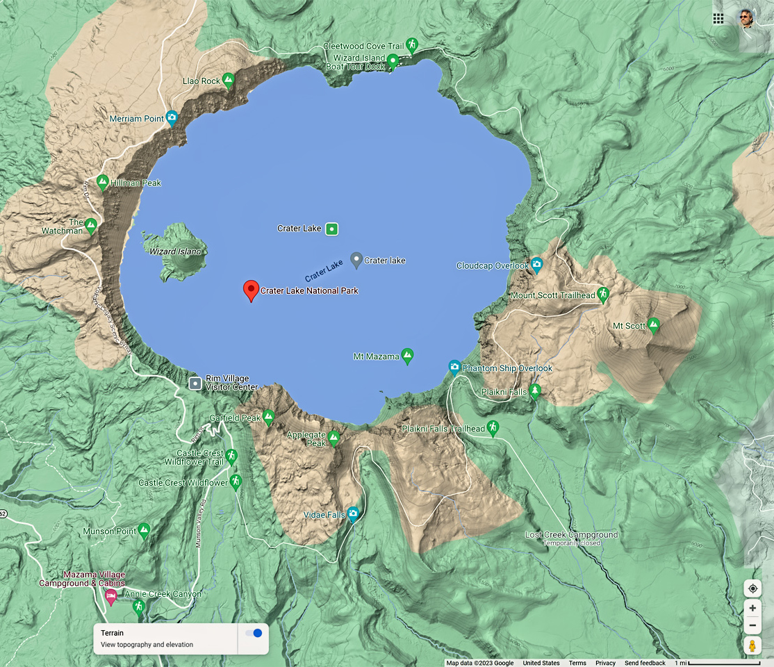
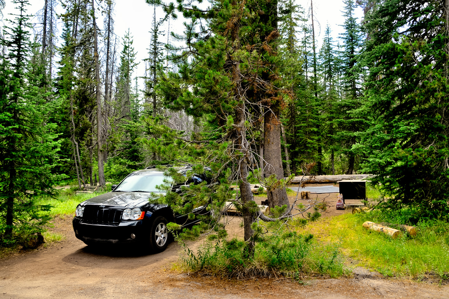
There are half a dozen highways that will take you toward Crater Lake, but they all funnel down to either the north entrance, off Highway 138 (closed in winter), or the main south entrance, off Highway 62, which is open year round. The south entrance is where you’ll find Mazama Village and the Rim Village, where all the visitor’s amenities like dining and lodging are clustered, as well as the National Park Headquarters and Visitor Center. There are two campgrounds: a big one at Mazama Village with hookups for RV’s, and a small one, Lost Creek, which is for tent camping only. Lost Creek is first come, first served, so the tent spaces can’t be reserved. (I got a space there myself, on the 4th of July weekend, no less, but I have to admit I was extremely lucky!)
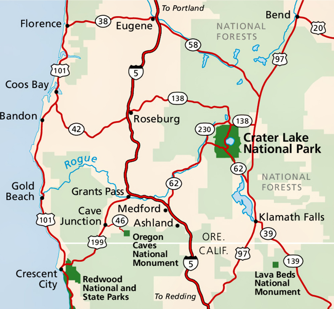
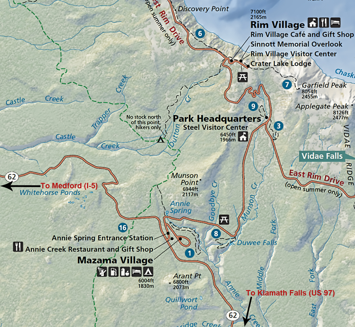
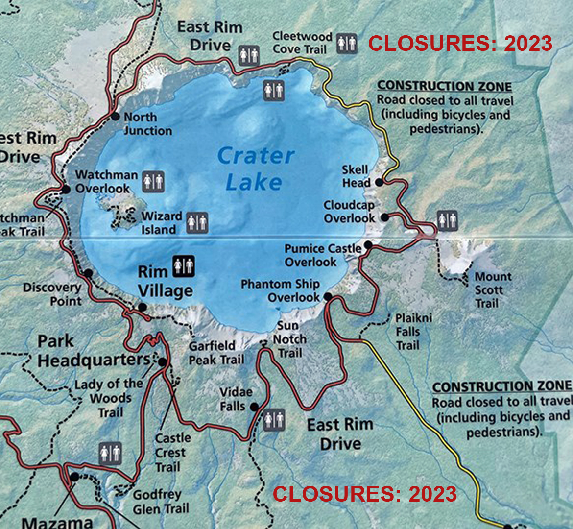
Location of North Entrance, South Entrance, and Road Closures (2023)
If you’re serious about getting the best photos possible, you need to stay in the park overnight, so that you can catch the golden hour of the sunset on the first day of your visit, as well as the sunrise the next morning. Plan ahead, because reservations for lodging and reservable campsites fill up far in advance. Crater Lake Lodge in the Rim Village is highly recommended, offering fine views of the lake from many of the rooms.

Crater Lake Lodge, photo © NPS
The historic lodge was built on the edge of the caldera, nearly 1000 feet above Crater Lake. It first opened in 1915, and was re-constructed and earthquake-stabilized in 1995. The Lodge is typically open from mid-May through early-October.
CLOSURES AND RESTRICTIONS: 2023 SEASON
A Section of East Rim Drive Closed for Construction:
East Rim Drive from the north just past Cleetwood Cove east to Grotto Gove is closed. From Grotto Cove to Park Headquarters in the south, East Rim Drive is open. This means Cleetwood Cove, Mount Scott and Sun Notch Trails are open and the trailheads may be accessed by vehicles.
Pinnacles Road is open again after a recent closure, but the Lost Creek Campground off Pinnacles Road will not be open (at all) during the 2023 Season. Plaikni Falls Trail is open, but Pinnacles Trail is closed.
Steel Information Center remains under construction so it is closed. Visit Rim Village Visitor Center instead.
CLICK MAPS AND PHOTOS FOR AN EXPANDED VIEW

TIPS FROM AN OLD PHOTOGRAPHER

Landscape photography is an art form with almost as many styles as there are practitioners. The subject matter is everywhere, the competition all but limitless. If you want your image to rise above the herd, you need three things:
1.) An eye for composition, which is the instinctive ability to frame or crop a scene in a visually pleasing manner. Your experience tells you where to take your photos. Your eye tells you where and how to point your camera.
2.) Light, great light, of the sort you can only find when you put yourself in the right place at exactly the right moment. Sometimes, you get lucky, and you stumble into it. Far more often, you have to find a promising spot, and wait for the sun.
3.) Last, but obviously not least: Something interesting, unique, or iconic, either on the horizon, or in the foreground, to draw the eye, and lend a sense of scale.
Crater Lake, as seen from any of the many viewpoints, will hand you #3 on a sky blue platter, and with a bare minimum of patience, #2 will magically appear. (All you need is a break in the clouds). #1 is a little trickier, because that’s your “photographer’s eye.” Some people are born with it. The rest of us have to develop it, and that can take years.
FROM MY SOAP BOX:
 Never make the mistake of confusing artistic talent with technical proficiency. You need both to make a great photograph, and they’re equally important.
New cameras are wonderful. They have capabilities we never even imagined, back in the old days, but that can be dangerous. Some photographers get so obsessed with the gear, they forget why they’re out there in the first place.
PLANNING YOUR CRATER LAKE PHOTO SHOOT
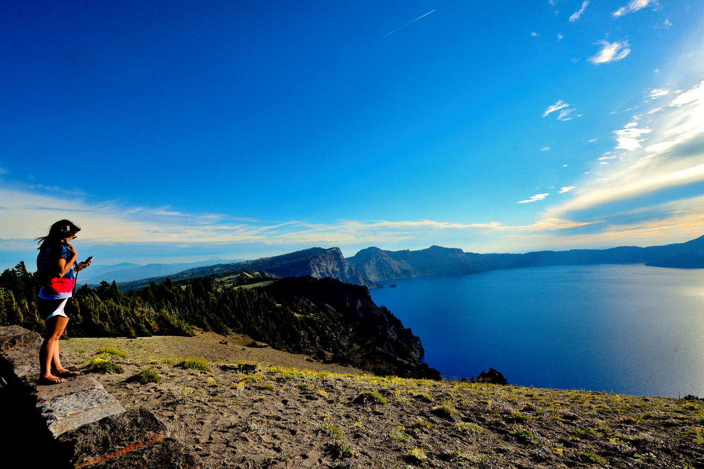
Crater Lake National Park gets close to half a million visitors in an average year, but the vast majority are day trippers who are not staying in the park overnight. They’re coming from Medford, or Roseburg, or perhaps they were just passing by on I-5 or US 97, and took advantage of the easy detour. Regardless, the bulk of the traffic, even on the busiest days, doesn’t arrive before the entrance kiosk opens at 8 AM. There will usually be a line of cars on the highway, waiting to pay their fee or to present their pass, and once through the gate, they all head for the restrooms, the snack bar, and the Visitor’s Center, in that order. Those early birds all start out at the same time, and nearly everyone, almost without exception, turns left out of the concession area and takes the West Rim Drive. The lead Winnebago sets the pace for a conga line of cars, all traveling in a slow-moving pack to Discovery Point, then the Watchman Overlook, the two spots that offer the best views of Wizard Island. Those are the views everyone most wants to see, so they can post that all-important “been there, done that” selfie on their Instagram/Facebook/X account. The parking areas are overflowing everywhere the flock of early birds travels, and there are people everywhere at the overlooks. I realize that some photographers like to have random tourists in their photos, for scale, or human interest, but if you’re looking for clean landscape shots, those crowds can be a real drag.
There’s a way to minimize the crowds. It worked for me on a holiday weekend, so even though my trip was a few years back, there’s a good chance this will work for you as well. Here’s what I suggest: arrive as early as possible. If you have a Pass, or if you’ve pre-paid your entry fee, you don’t have to wait for the kiosk to open. You can drive right past it, and get started with your photos as soon as there’s enough light to see by. (Don’t worry about missing the park brochure with the map; it’s okay to come back for it later). If you’re super early, so early there’s nobody else in sight, head for the Watchman Overlook; it’s a great place to watch the sun come up over the lake. Otherwise, it’s best to avoid the West Rim Drive, and all the other visitors who tend to go there first. Instead, you should turn RIGHT out of the concession area, onto the East Rim Drive, and save Wizard Island for later. You’re going to be in the park all day! You’ll be able to circle the whole lake at least three times, so you’ll have more opportunities to see Wizard Island than you’ll know what to do with.
EAST RIM DRIVE
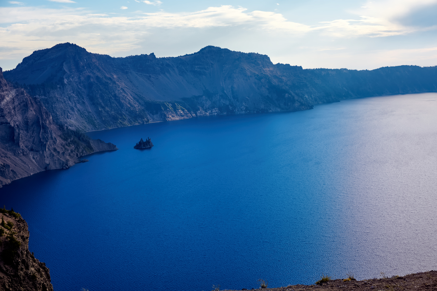
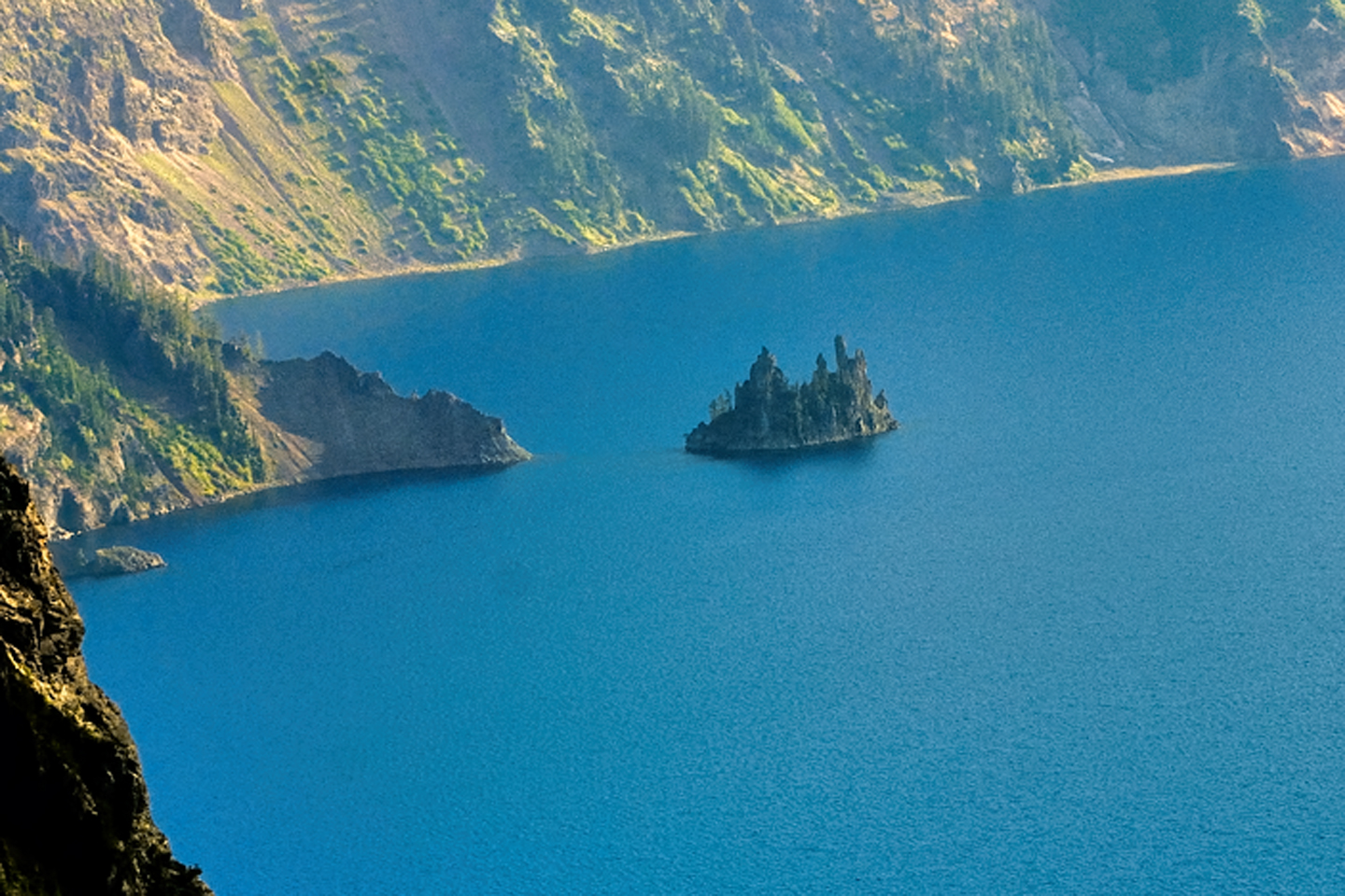
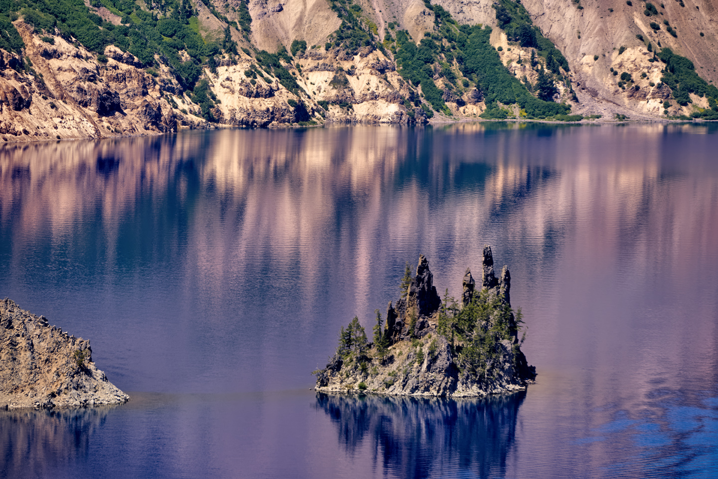
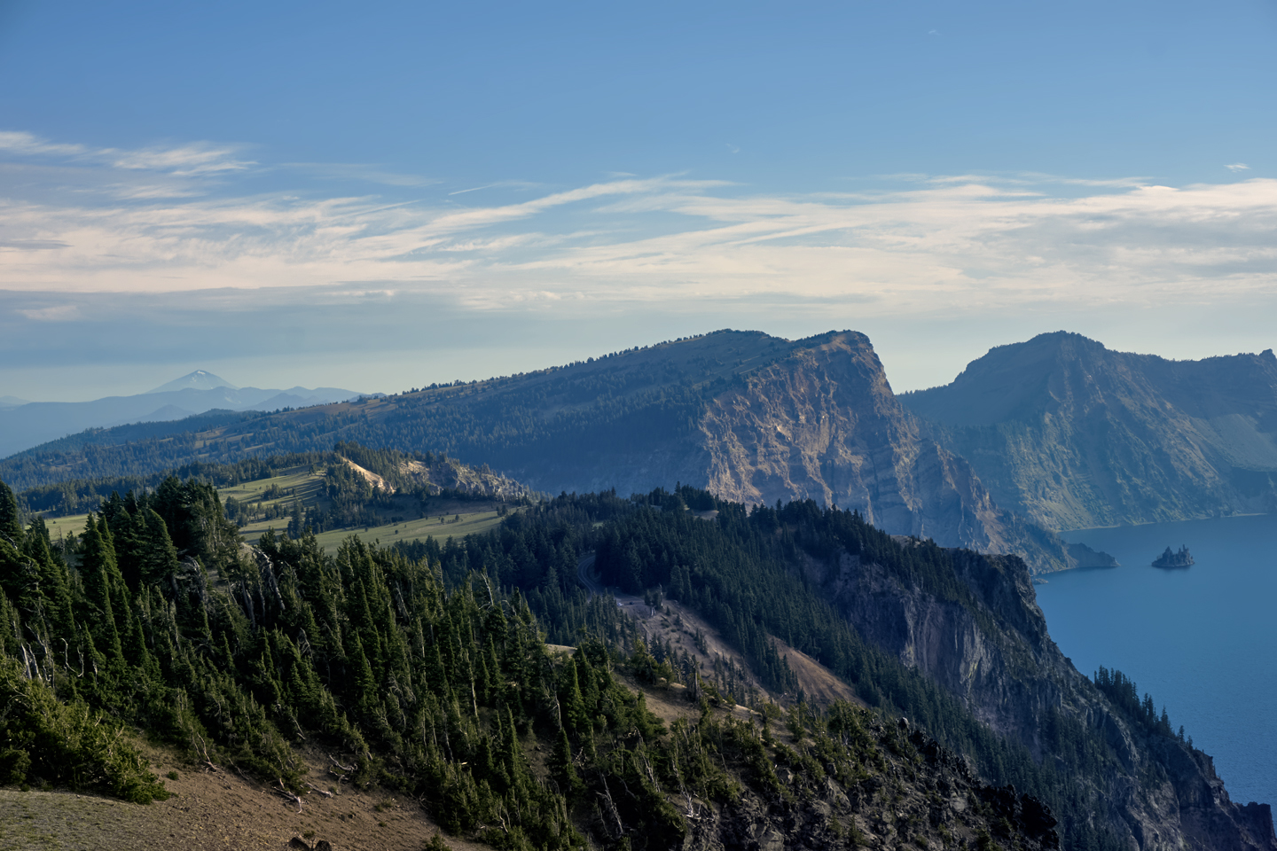
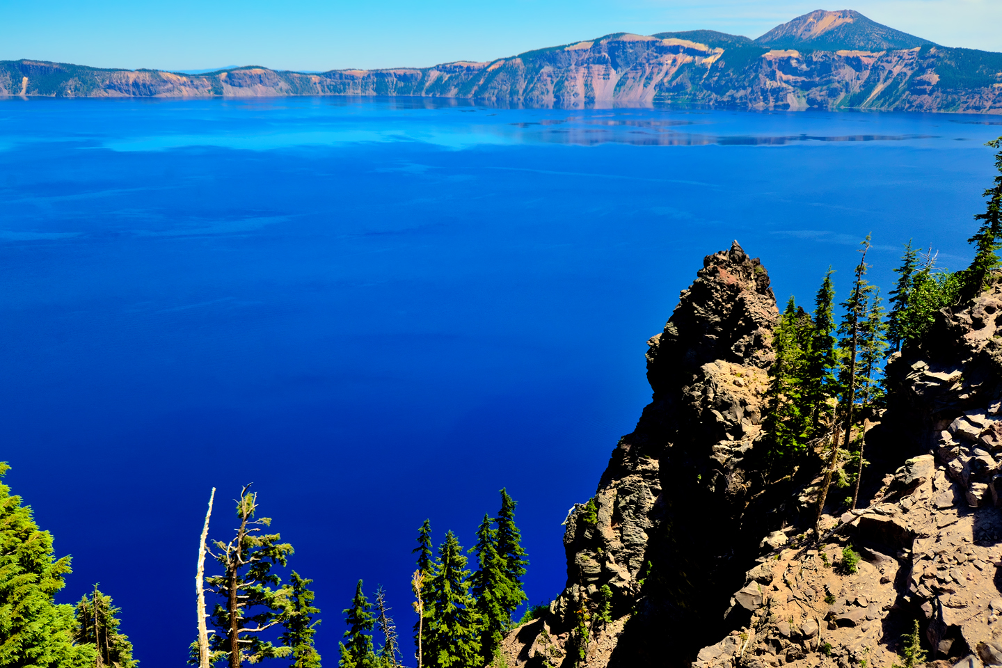
There won’t be a lot of traffic in this direction, and most of what traffic there is will start pulling over and stopping the moment they see something interesting: Vidae Falls, the Sun Notch Trailhead. Don’t join them; save all that for later. Instead, make a beeline for the first real overlook on the East Rim Drive: the Phantom Ship, a bit more than eight miles from the turnoff. By heading straight to it, you might actually have it all to yourself, even on a busy day. The Phantom Ship Overlook is one of the good ones, so you’ll get terrific photos in the early morning light.
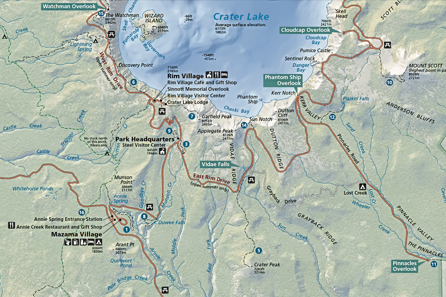
The East Rim Drive, from the South Entrance to the Cloudcap Overlook
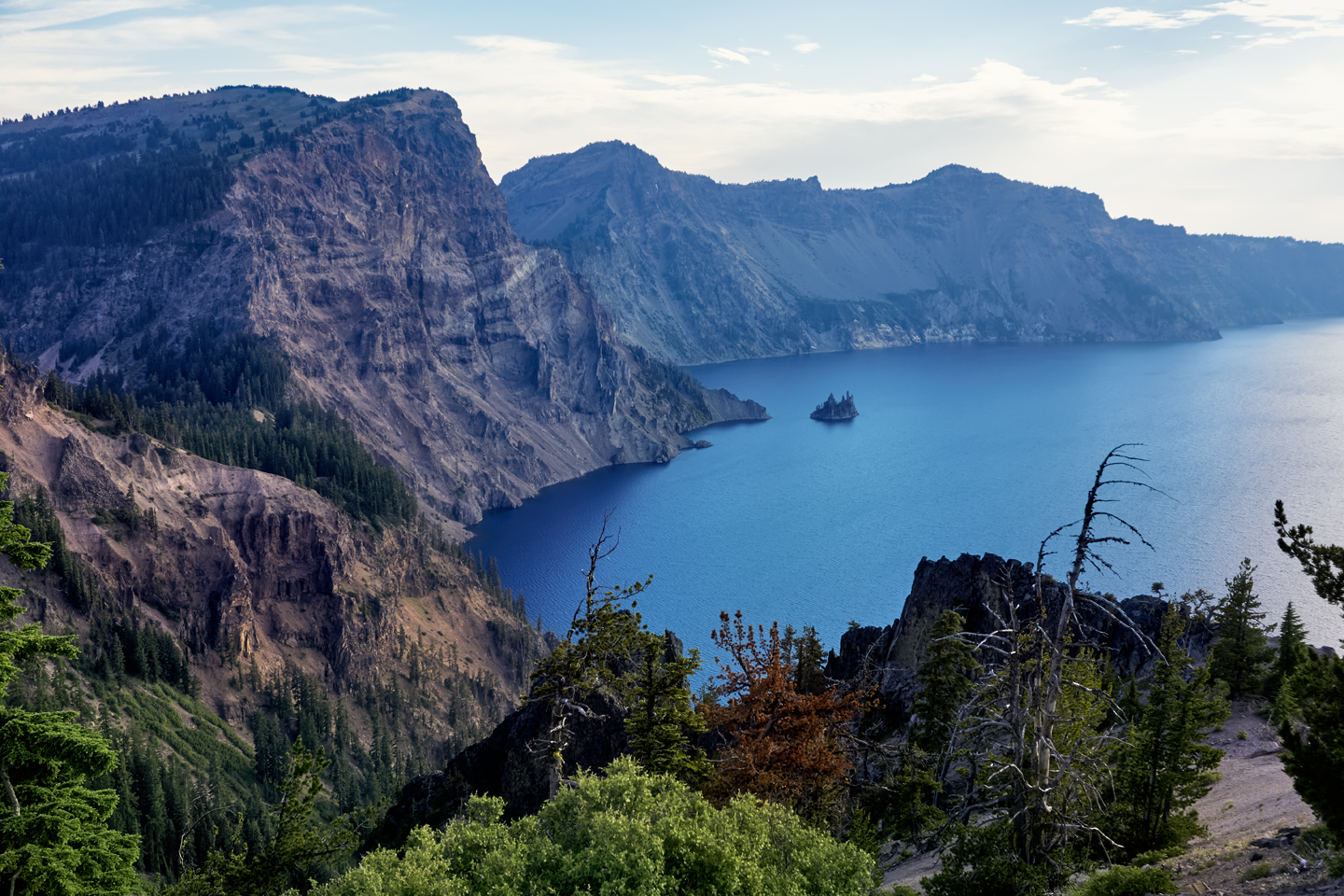
The Phantom Ship is a small volcanic island near the southern shore of the lake, but appearances are deceiving, because it’s actually the tip of a pillar that rises all the way up from the floor of the crater, as much as 1,000 feet below the surface of the water. When viewed in profile, as in the photos above, the rocky islet is thought to resemble an old-time sailing ship.
Pinnacles Road
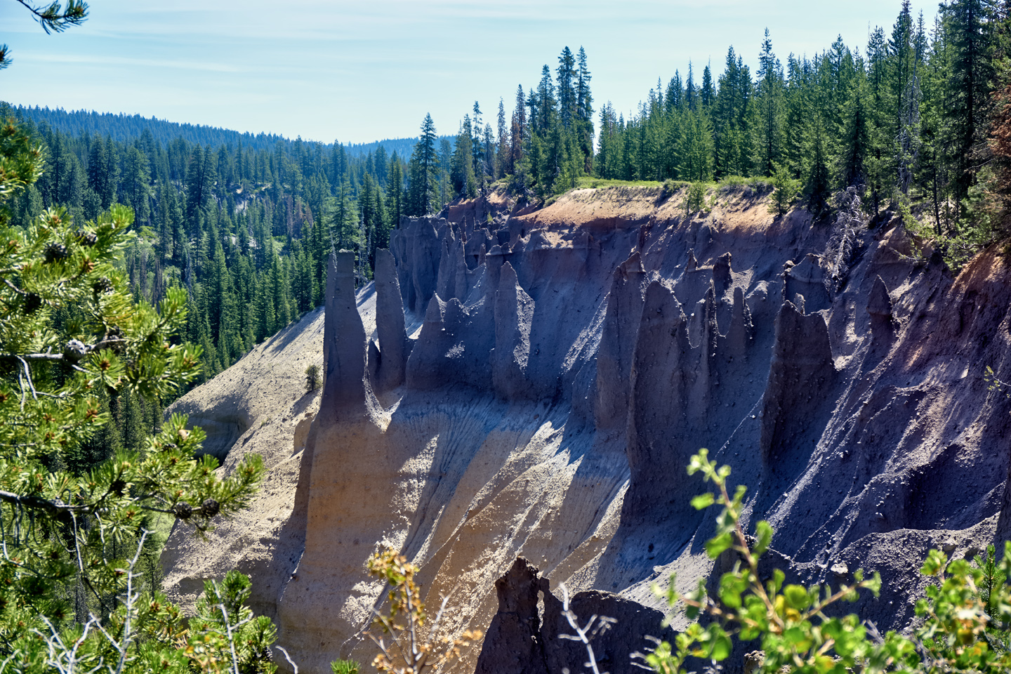
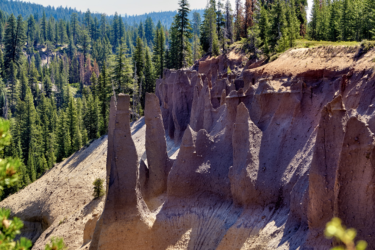
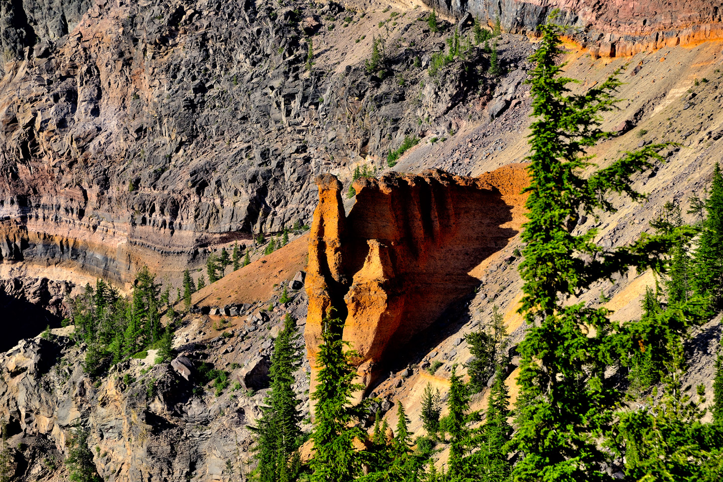
Just before the Phantom Ship Overlook, you’ll come to the turnoff for Pinnacles Road, a paved spur off the Rim Drive that dead ends after 6 miles at the Pinnacles Overlook, a good spot for viewing the Pinnacles. These are a grouping of fossil fumaroles, as much as 100 feet tall, created when intensely hot volcanic gas seeped upward through ash deposits, hardening them into rock that was then carved by the elements into these unique volcanic spires.
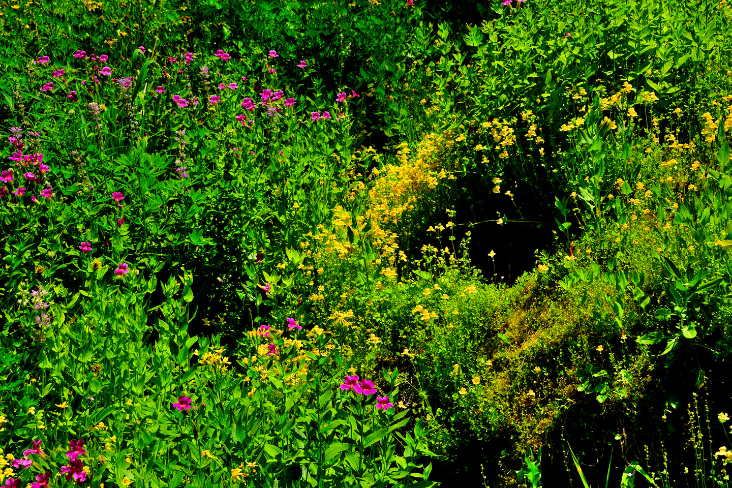
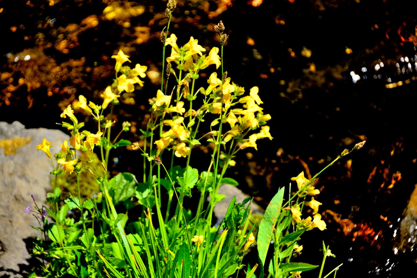
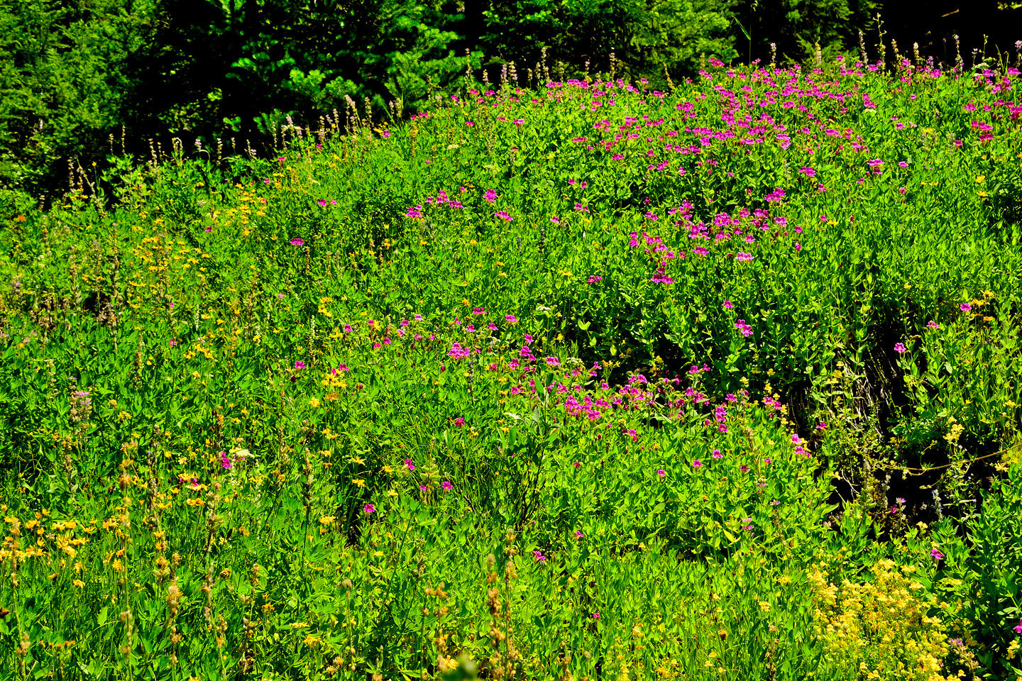
Pinnacles Trail begins at the Overlook and leads to an even better viewpoint, quite close to the Pinnacles. NOTE: Pinnacles Trail is currently CLOSED for the 2023 Season. Another trailhead, closer to the intersection with the Rim Drive, leads to Plaikni Falls, a small waterfall on Sand Creek; the whole area abounds in wildflowers during the spring and summer. The Lost Creek Campground is just off Pinnacles Road, about halfway to the end. There are just 16 spaces, for tents only. The spaces are first-come, first-served, so they can’t be reserved in advance. If you want to try for a space, get there EARLY! NOTE: Lost Creek Campground will NOT be open during the 2023 Season!
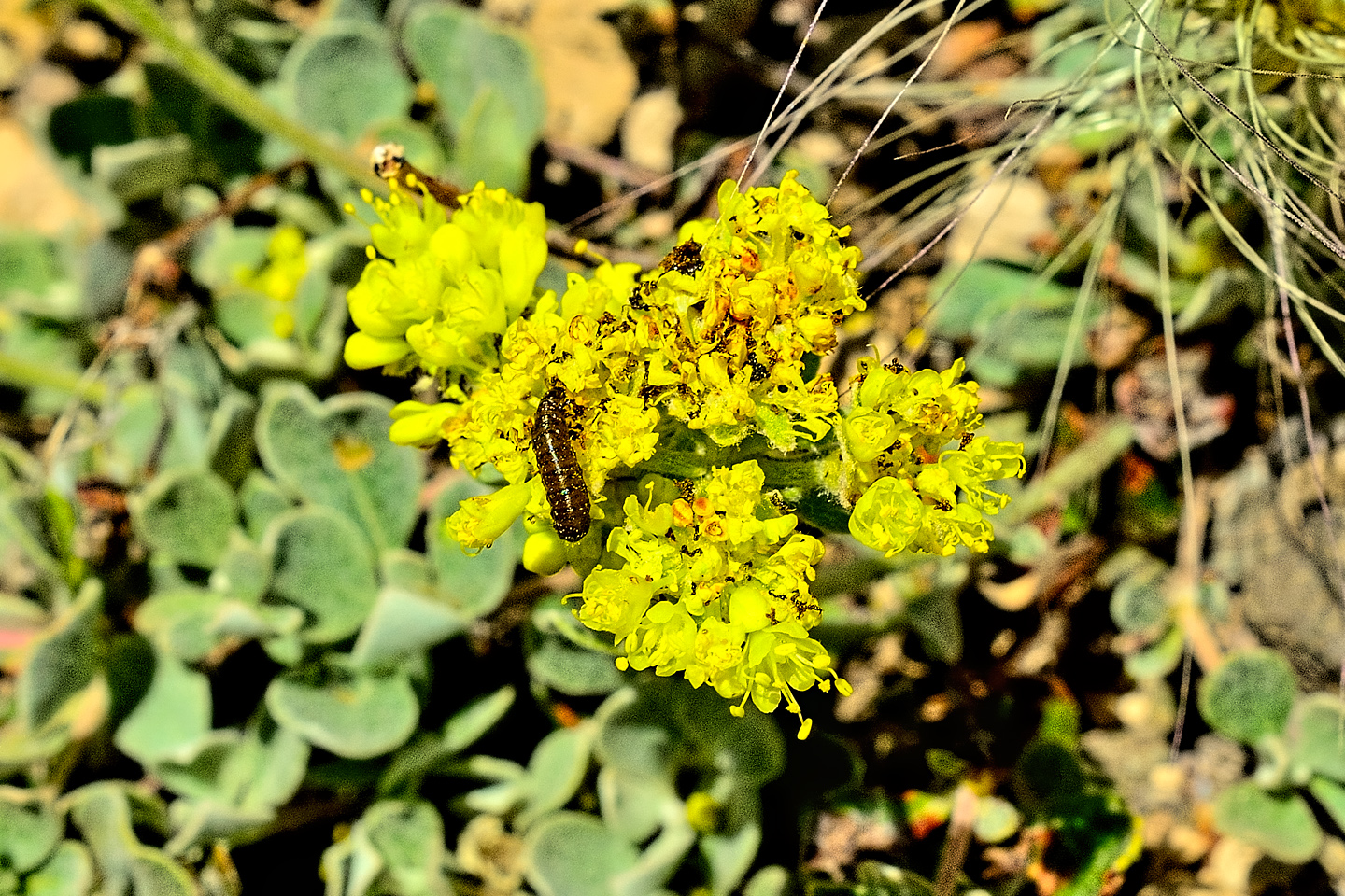
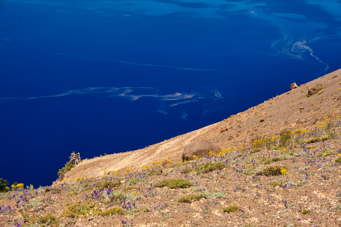
Wildflowers along Pinnacles Road, near Lost Creek Campground
Keep in mind, as you travel counter-clockwise around the lake, that you’ll be back to all of these viewpoints again. Different times of day offer different qualities of light, and you’ll want to capture them all. Stay ahead of the traffic, if you possibly can. Concentrate on the lake, and save the Pinnacles for later. You’ll see the Pumice Castle, worth a quick shot, and then the Cloudcap Overlook, where you’ll want to spend some time. The views are extraordinary!
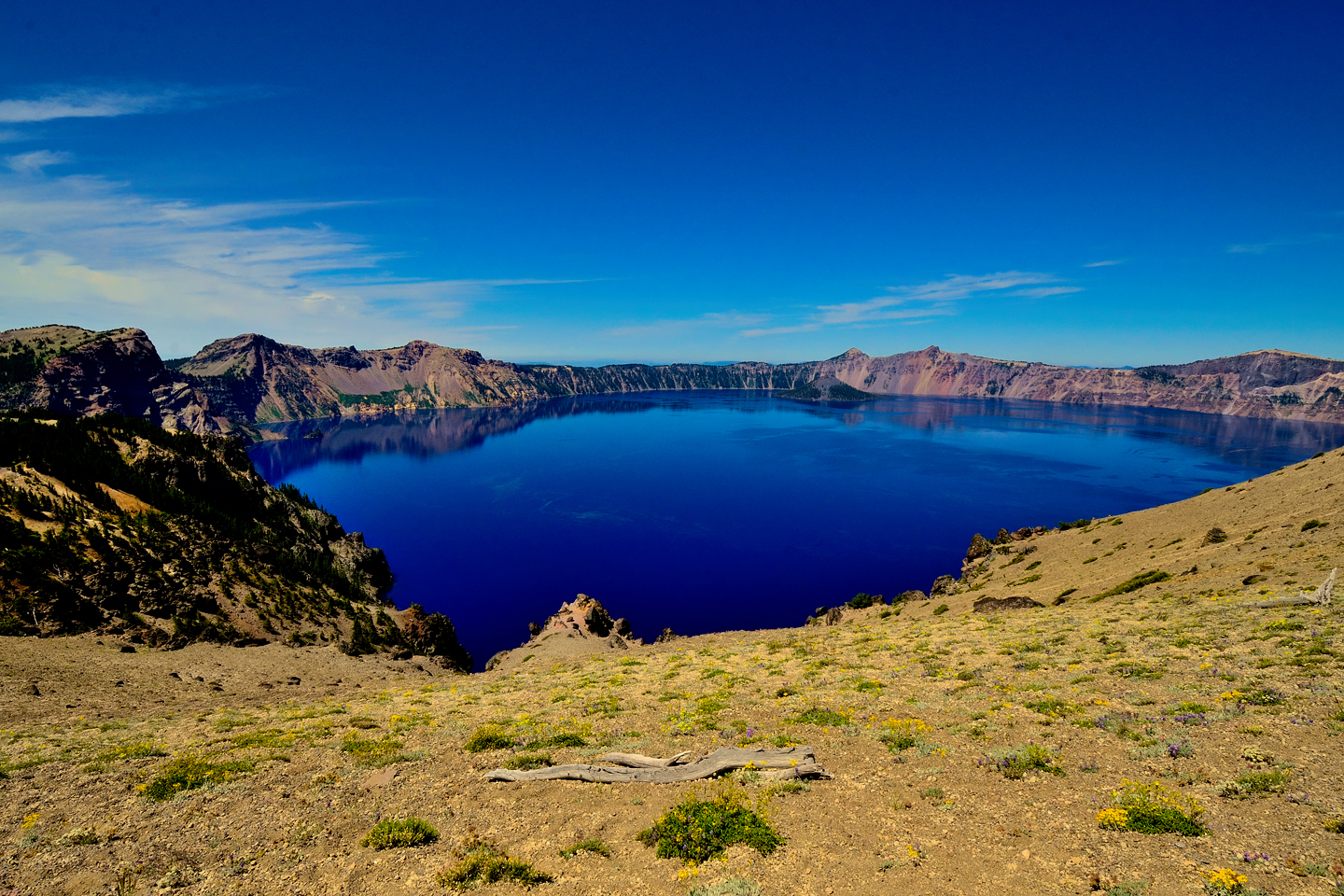
The Pumice Castle, and expansive views of the Lake from the Cloudcap Overlook
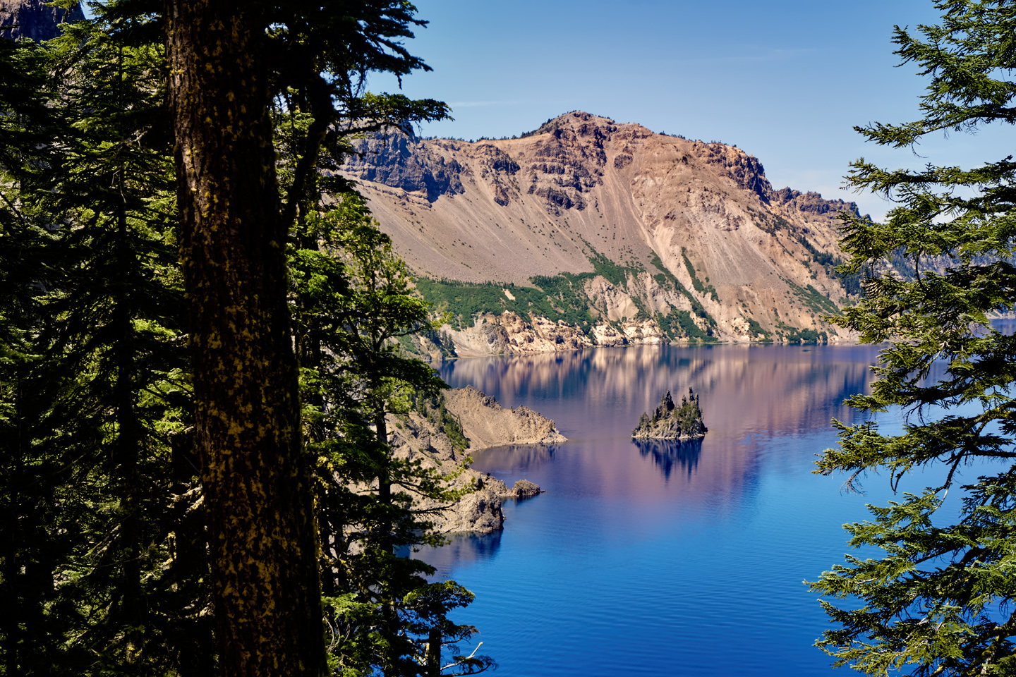
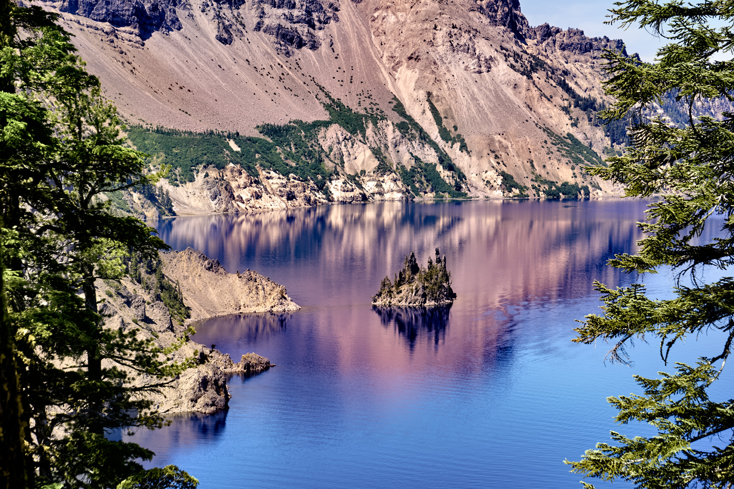
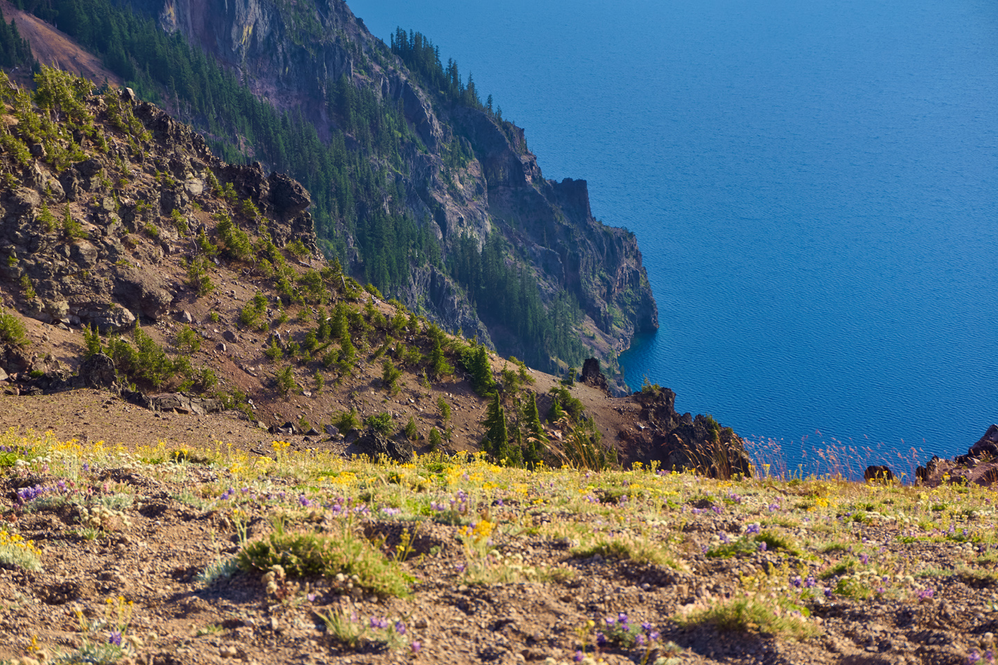
Several views of the lake from the Phantom Ship and Cloudcap Overlooks. Wildflowers abound in spring and summer.
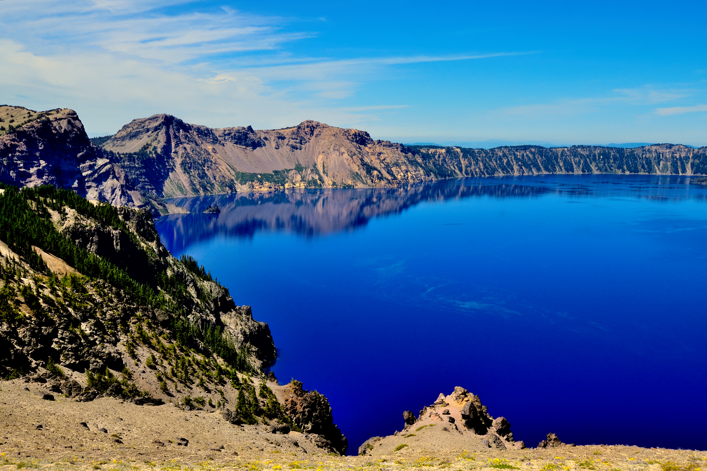
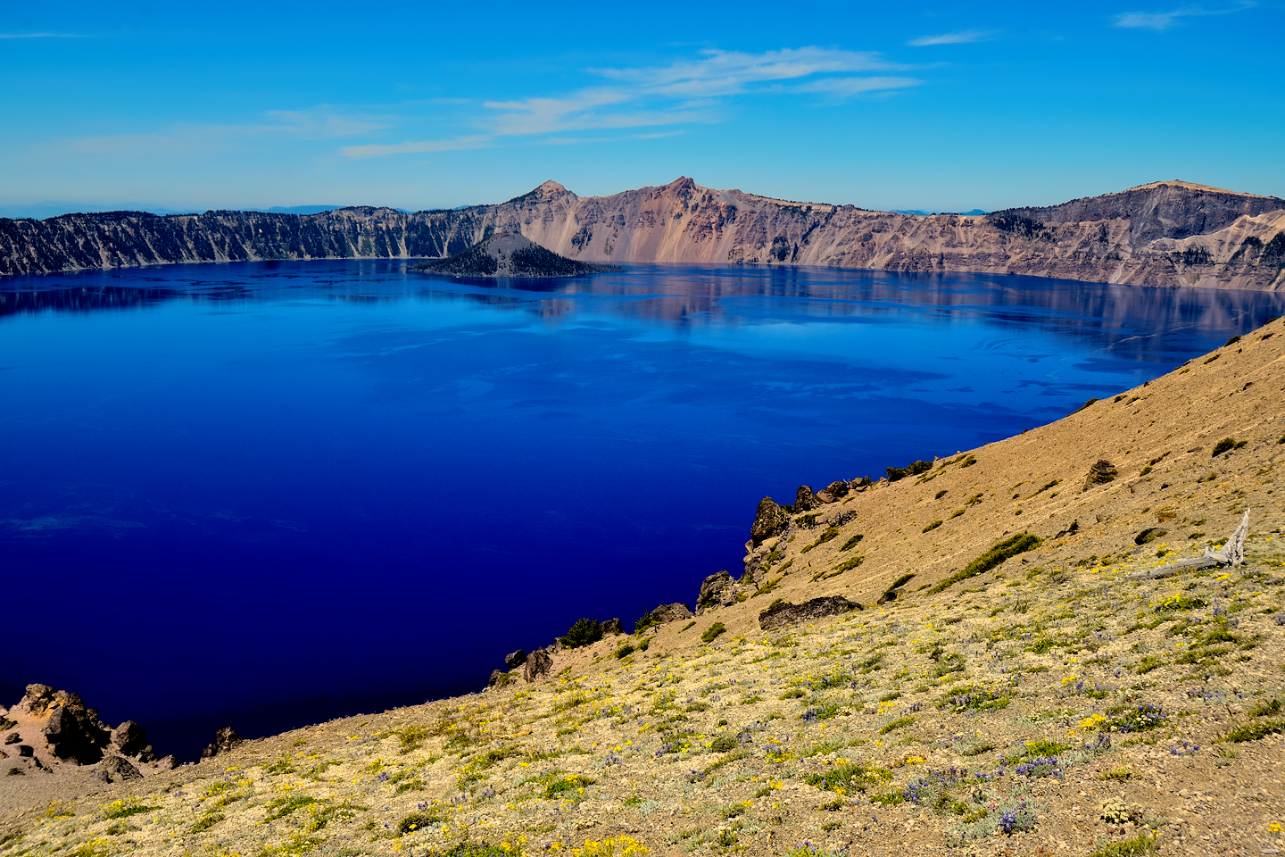
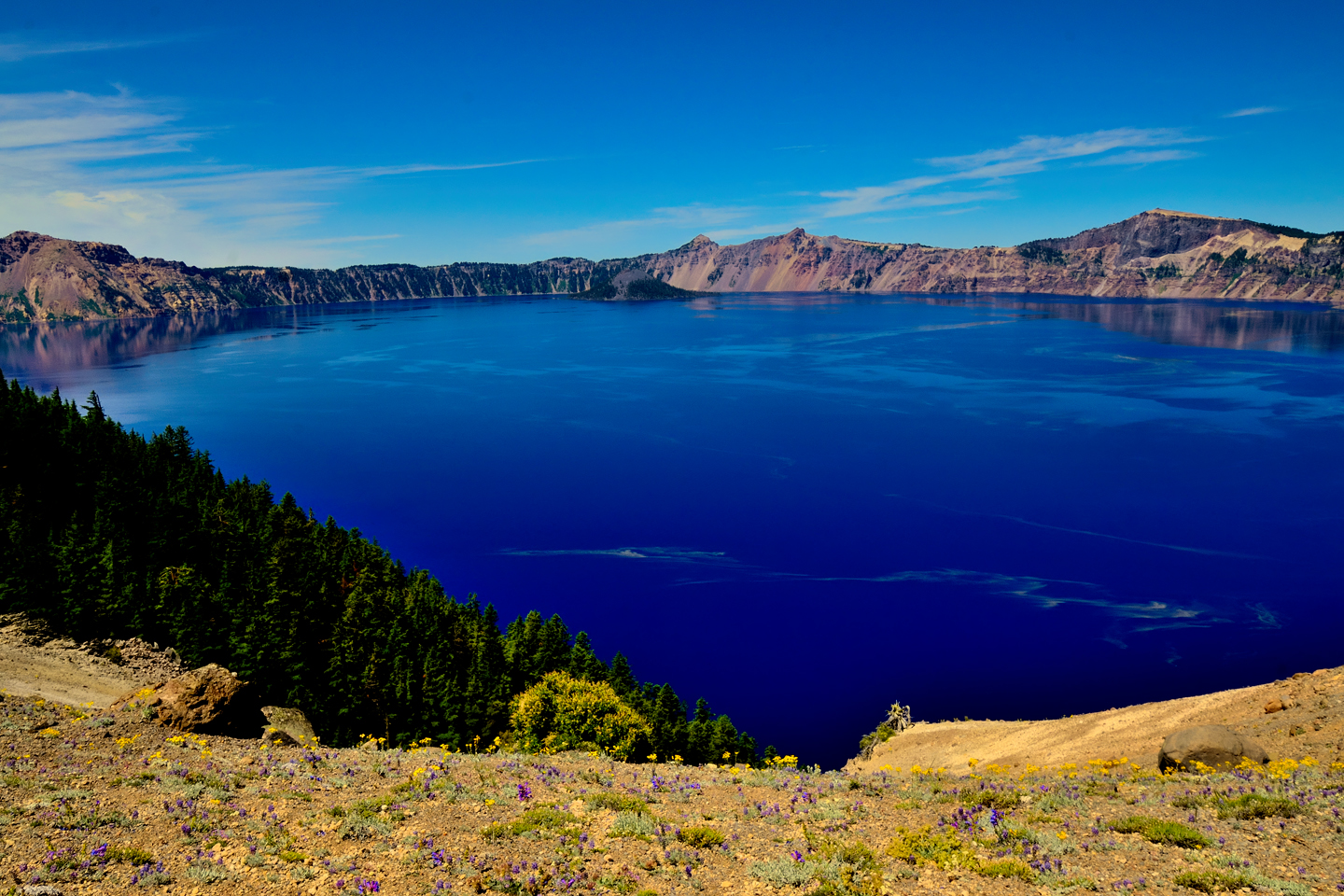
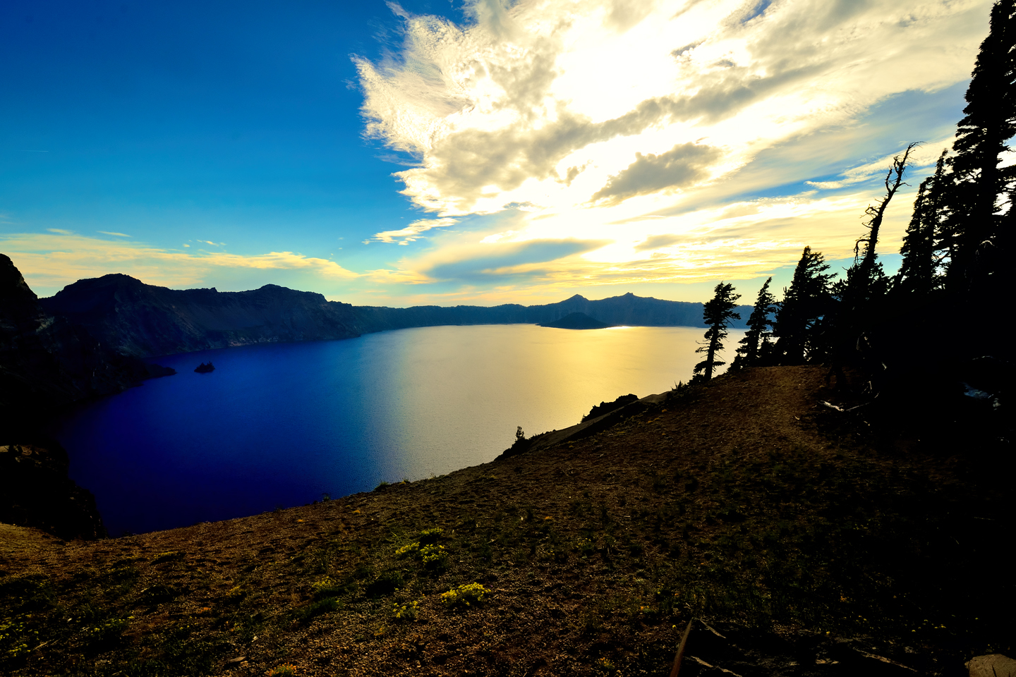
Both the Phantom Ship and the Cloudcap Overlooks face off across the lake toward Wizard Island and the western horizon. You’ll want to come back again late in the day, because these two locations are among the best in the park for views of the sunset over the lake. (See below).
On your first pass around the lake, early in the day, you’ll want to continue on from the Cloudcap Overlook, past Grotto Cove, to Cleetwood Cove, and the North Side of the crater. NOTE: This section of the East Rim Drive, from Grotto Cove to Cleetwood Cove, is currently closed for major repairs. Until those repairs are complete, visitors will have to turn around at the barricades and return to the Visitors Center before they can access the other sections of the park, by way of the West Rim Drive.
NORTH SIDE
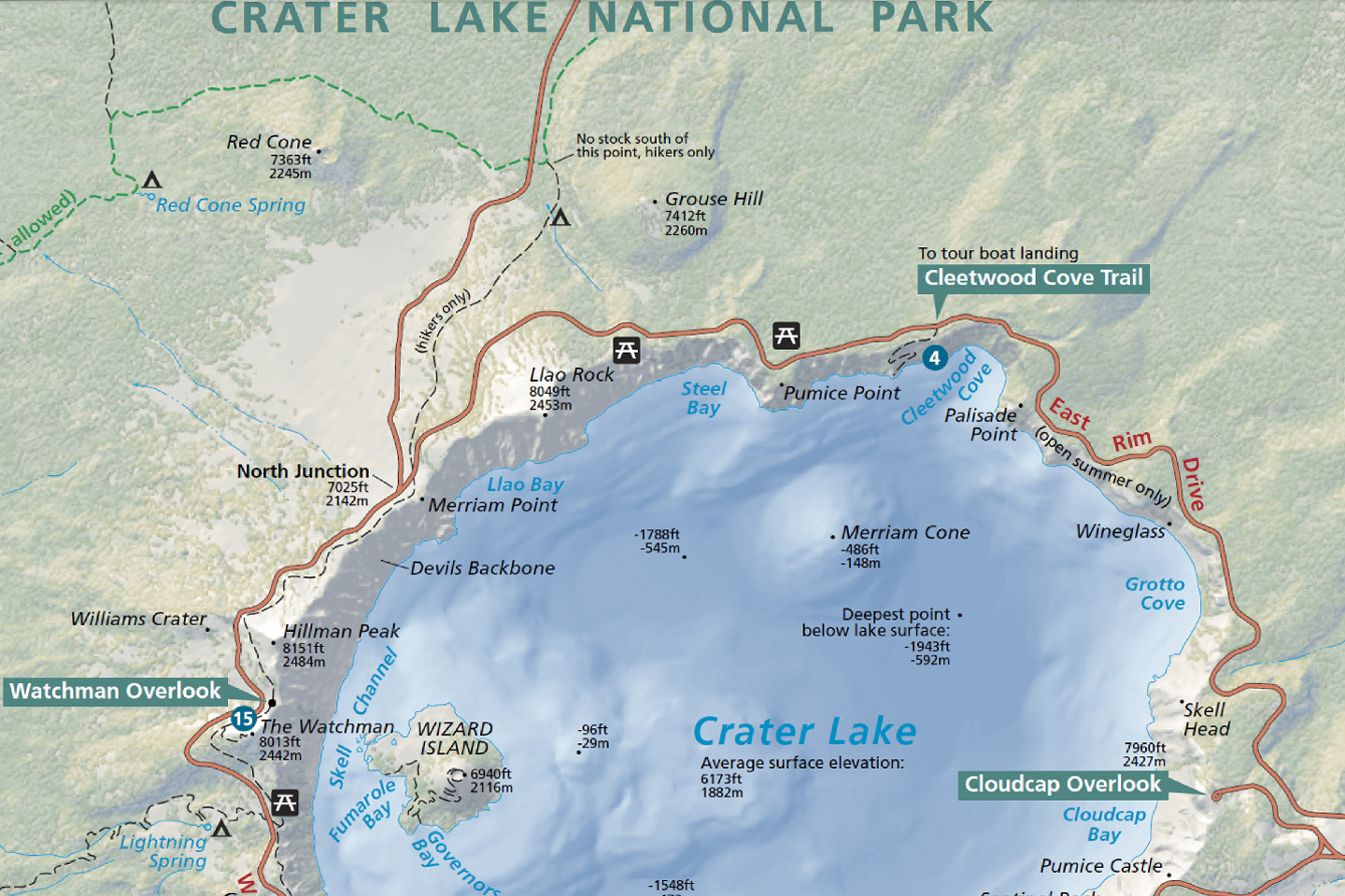
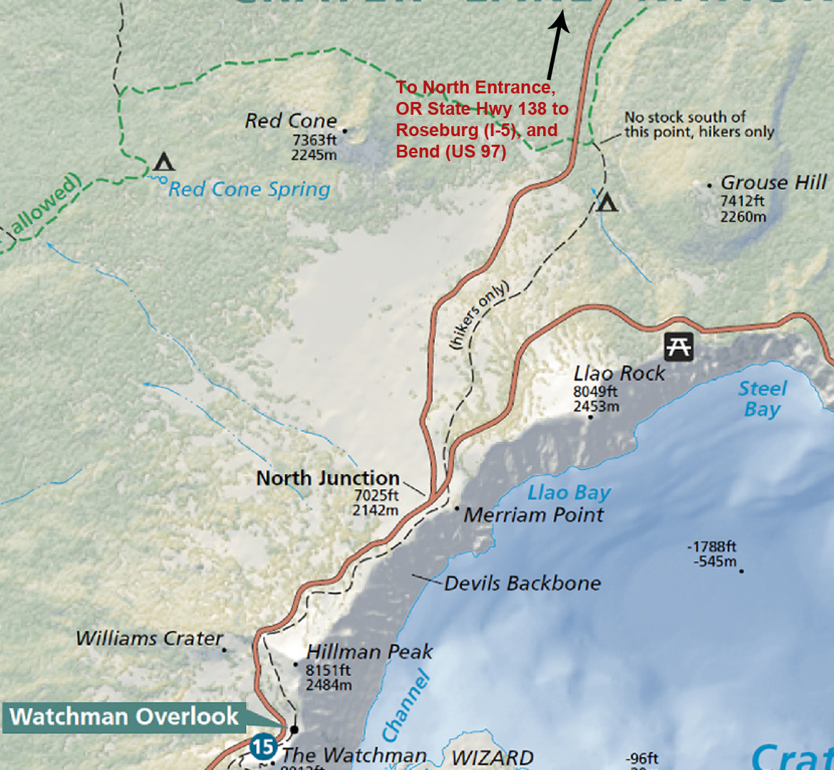
North Side of Crater Lake, from Watchman Overlook to Cleetwood Cove
Cleetwood Cove is the only point around the shores of Crater Lake where visitors are allowed access to the water. The Cleetwood Cove Trail leads from the parking area on the Rim Drive down to the tour boat docks on the shore. The trail is about a mile long, and drops 700 feet in elevation. Keeping in mind that basic premise: he who hikes down, must hike back up again, don’t even try it if you’re not in reasonably good shape. At the bottom, there are safe areas for swimming, and you can fish for the trout and salmon that were stocked in the lake in the last century. (There have never been native fish in the lake).
There are Boat Tours from Cleetwood Cove that last two hours; they circumnavigate the lake, and provide up close views of Wizard Island and the Phantom Ship. Conditions can start out bright and sunny, and wind up cold and wet, so if you take the tour, be sure you’re prepared for the whole range.
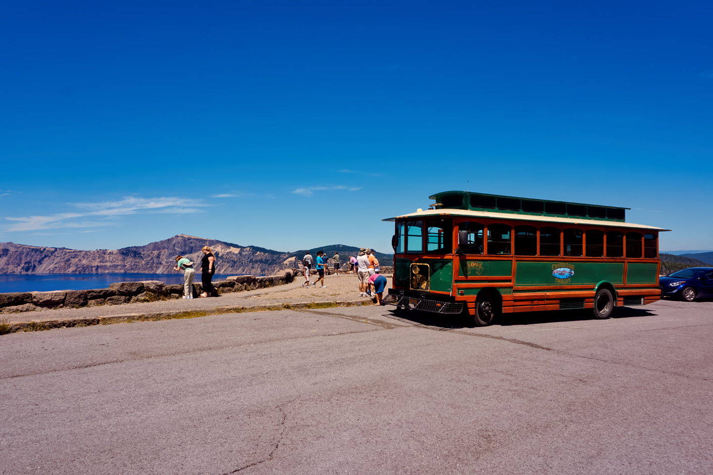
For landlubbers, a seperate concession offers Trolley Tours that begin at the Rim Village and circle the lake by road, stopping at all the major observation points. That’s a great way to enjoy the scenery without the hassle of driving and parking. Tickets can be reserved in advance, and that’s a good idea in the busy summer season.
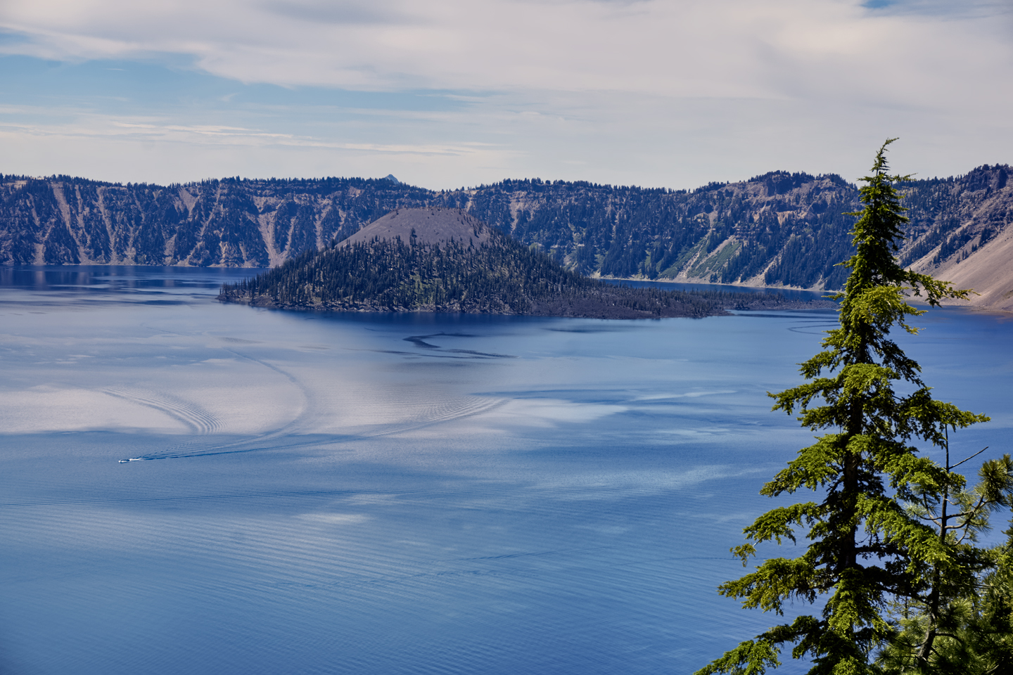
It’s difficult to appreciate the size of the lake when viewing it from the road, because there’s rarely anything in your field of view to provide an appropriate sense of scale. If you look closely at this photo (click to expand it), you can see the wake of a tour boat, and if you follow the lines on the water, you’ll spot the tiny boat itself.
WEST RIM DRIVE
The West Rim Drive, with Discovery Point, the Watchman Overlook, and Merriam Point, is the first section of the park that you’ll see if you follow the main flow of the visitor traffic clockwise around the crater. If you’ve taken my advice and traveled counter-clockwise instead, you’ll reach this section last, and with any luck at all, the bulk of the early bird crowd will have already left the National Park (or headed for the East Rim, where you’ve already been.) These viewpoints offer the best possible views of Wizard Island, Crater Lake’s most famous feature.
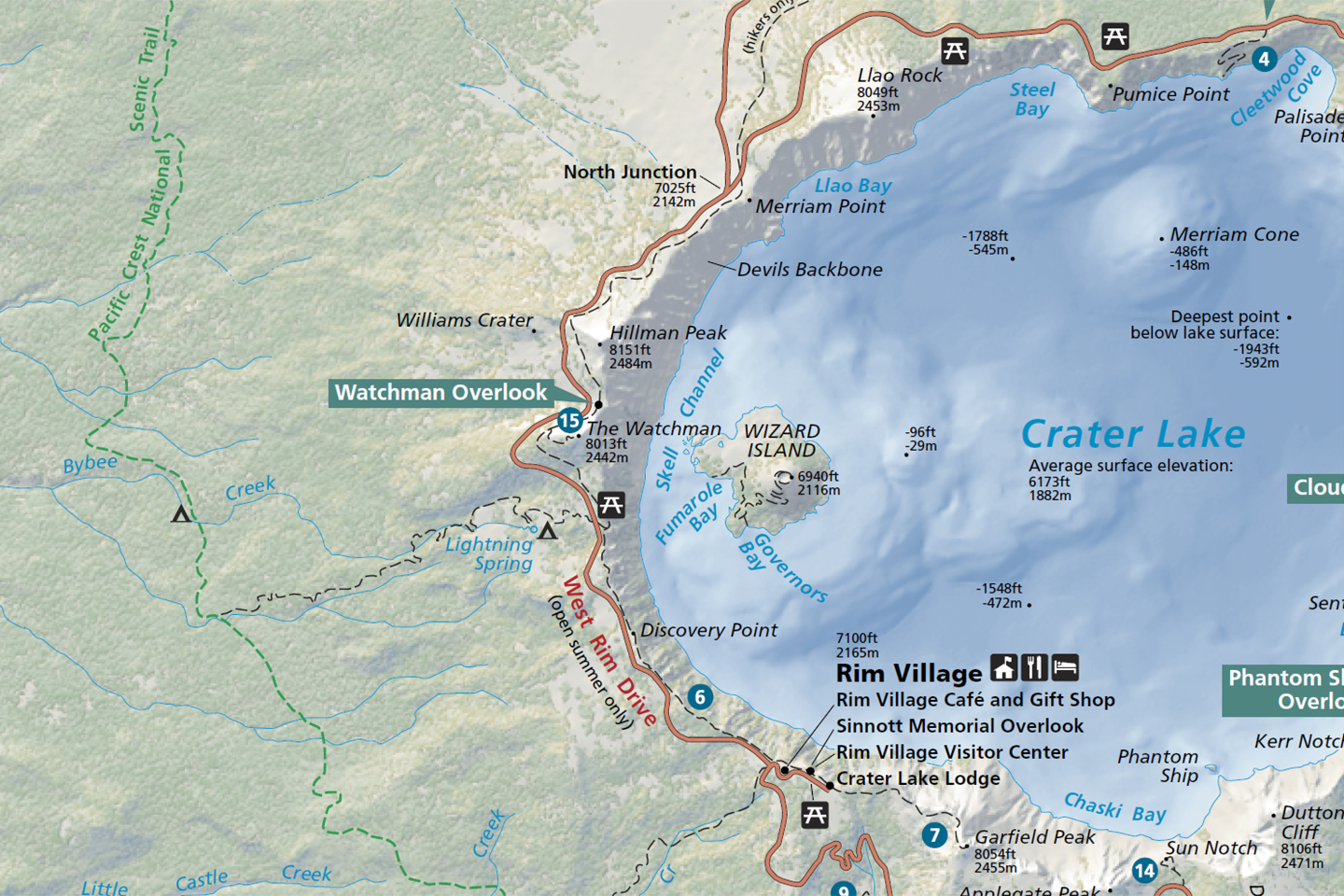
West Rim Drive, from Rim Village to Merriam Point and Llao Rock
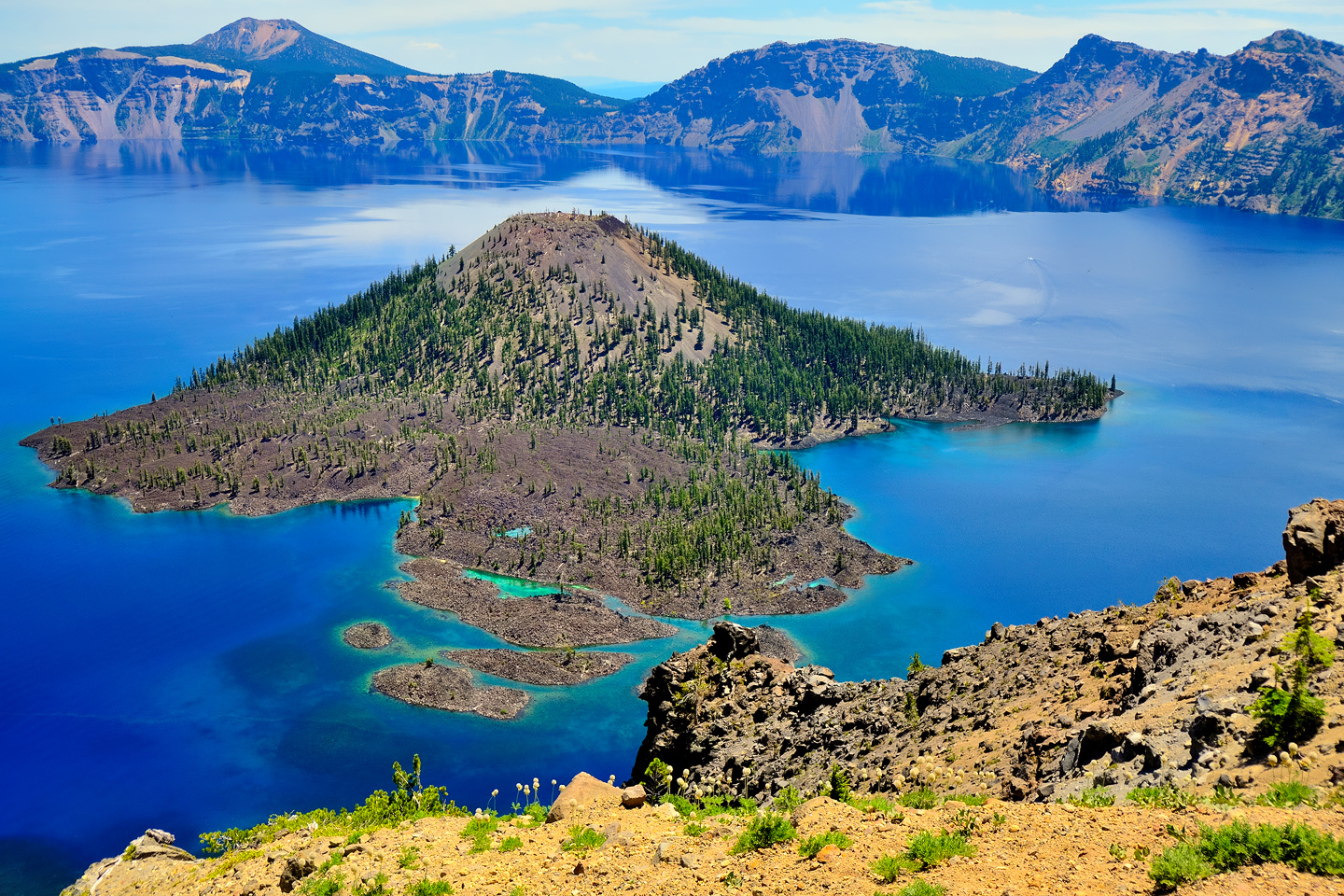
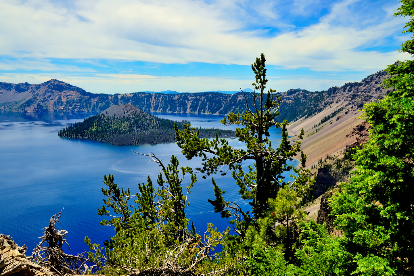
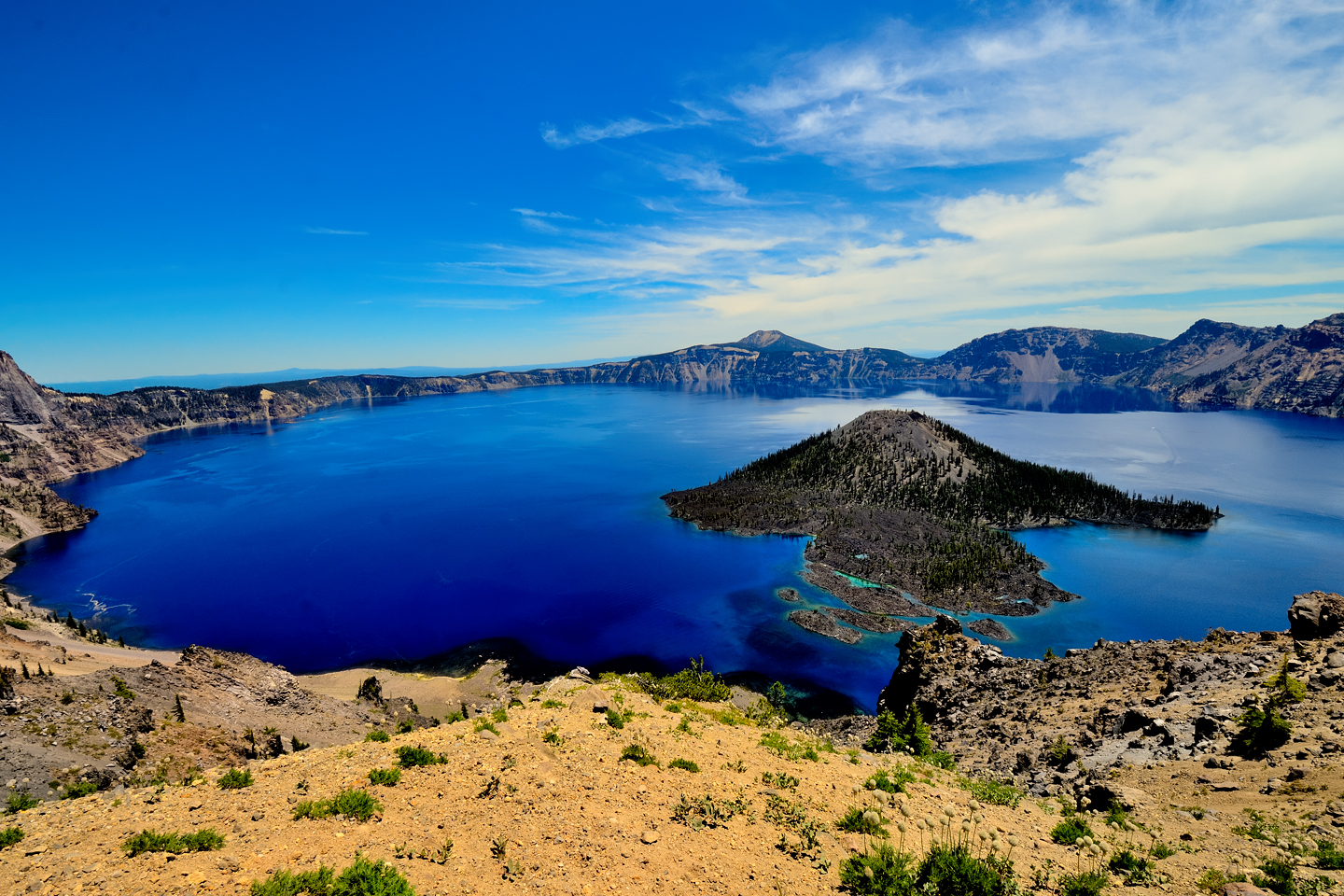
Wizard Island is a volcano within a volcano. There are actually four new volcanoes that have formed inside the massive caldera since the original eruption and collapse, but Wizard Island is the only one that rises high enough to extend above the surface of the water. To give you an idea of the size: the part you can see represents just 2% of the total bulk of that “smaller” volcano. All the rest is underwater! The eruption that created this cinder cone took place within 750 years of the cataclysmic eruption of Mount Mazama, around 5,000 BC, give or take a few centuries. The last eruption to take place within the caldera was 4,800 years ago; just a small one, on the flank of Wizard Island, below the surface of the lake. Mount Mazama is currently considered dormant, rather than extinct. According to the U.S. Geological Survey, it’s a virtual certainty that the volcano will erupt again, so it’s closely monitored to insure that we’ll know about it before it happens.
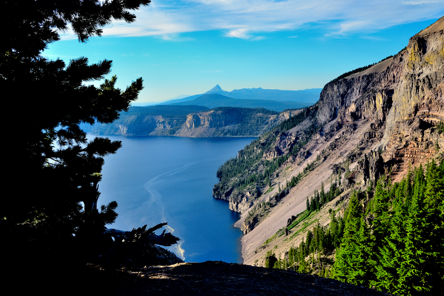
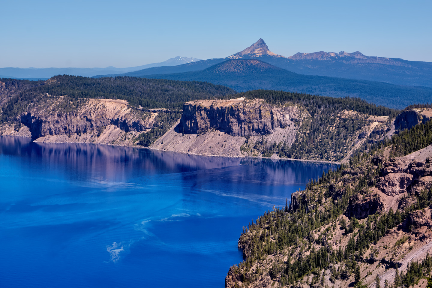
Views of the lake and surrounding area, including Mount Thielsen, to the north
SUNSET TO SUNRISE
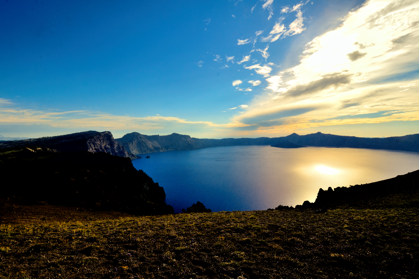
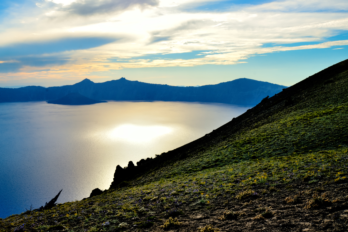
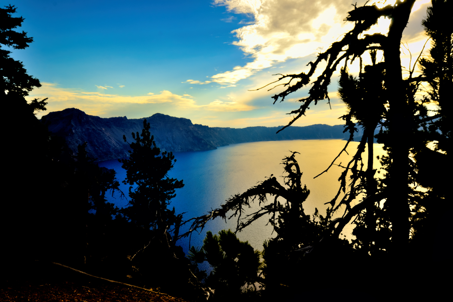
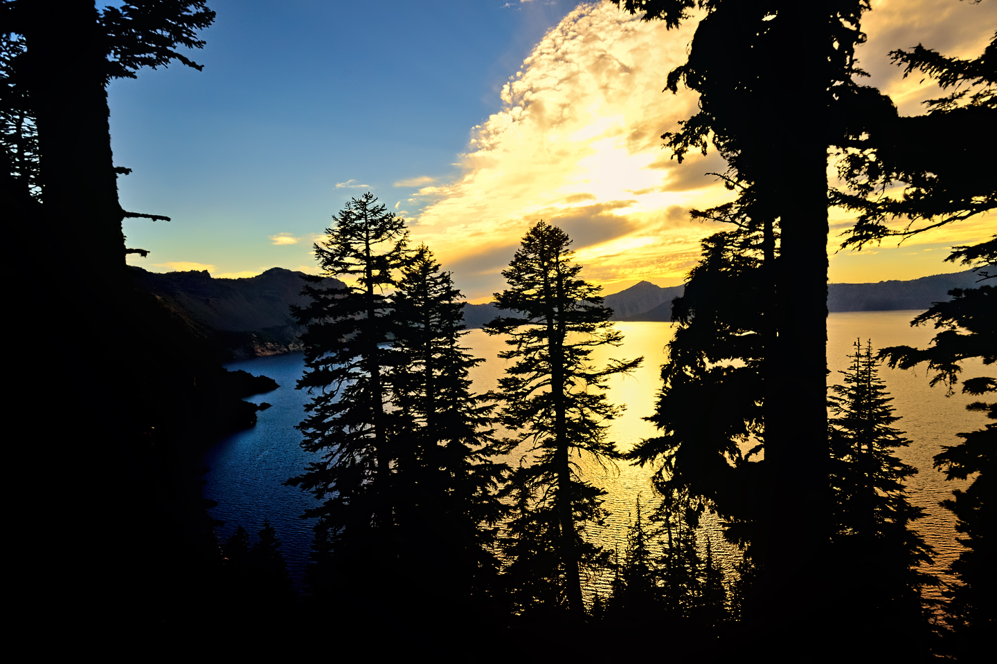
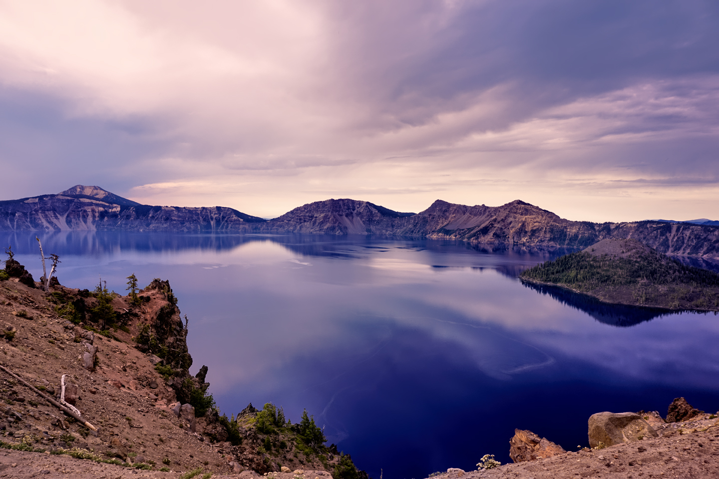
With Daylight Savings time, sunsets in the summer don’t happen until after 8:00 PM. If you’re not staying in the park, and you want good photos of the sunset, be aware that you’ll be leaving the area quite late, and you’ll have a long drive ahead on some incredibly dark mountain roads. If you ARE staying in the park (as I was), you can be a lot more relaxed about it. The Phantom Ship Overlook is a terrific place to capture the sunset over the lake. All of the photos below were shot there.
Sunset views, looking west from the Phantom Ship Overlook
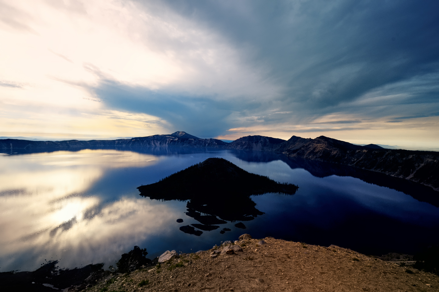
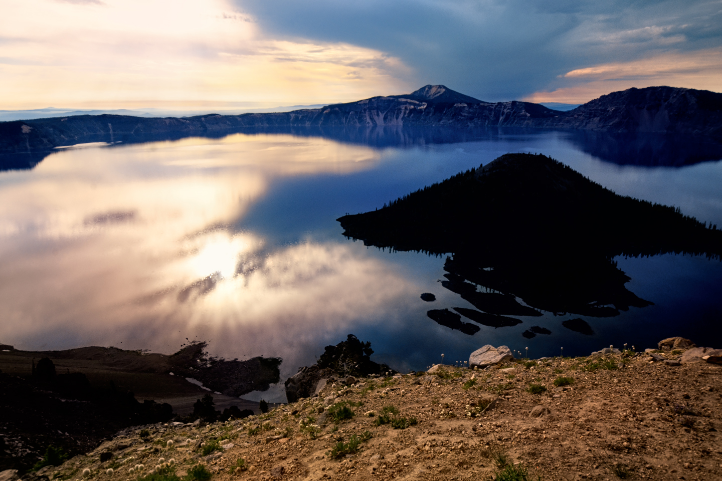
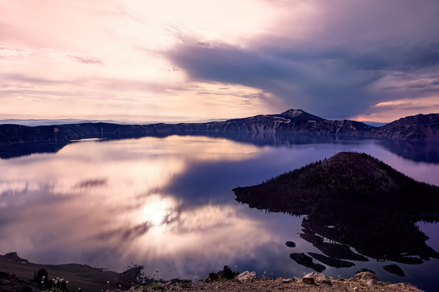
Another definite advantage to staying in the park: you’ll have to get up mighty early to photograph the 6:00 AM sunRISE. If you’re already there, at least you won’t have to factor in any travel time. The Watchman Overlook on the West Rim Drive is perfect for catching the event, with Wizard Island in the foreground. The lake is like a mirror reflecting the sky, so the caldera looks like a bowl filled with clouds.
Extraordinary sunrise views, looking east from the Watchman Overlook
Crater Lake offers exceptional opportunities for landscape photography. With just a little bit of advance planning, you’ll come away with Five Star images that you’ll treasure forever, the best possible souvenirs from your magical day at this amazing volcano, this astonishing lake, this extraordinary National Park!
Click any photo in this post to stop the slide shows and expand the images to full screen.
(Unless otherwise noted, all of the images in these posts are my original work, and are protected by copyright. They may not be duplicated for commercial purposes.)
PHOTO ROAD TRIP: PACIFIC NORTHWEST
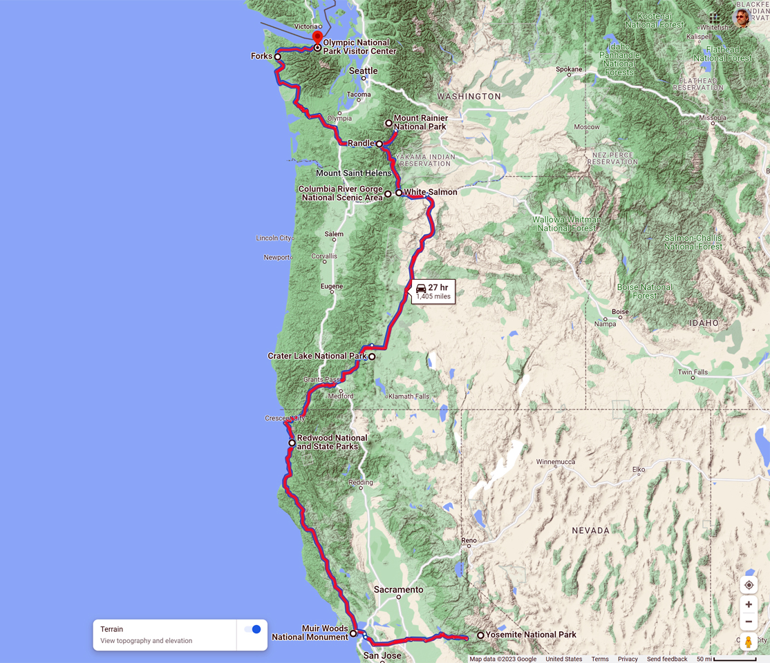
The Pacific Northwest is one of the best areas in the country for a Road Trip. When I drove my Jeep to Alaska, back in 2015, I traveled an extra thousand miles out of my way, just so that I could pass through northern California, Oregon, and Washington on my way to Canada. The route that I followed took in five National Parks, one National Monument, and a National Scenic Area, an ideal itinerary for a guy who loves landscape photography. In this brief series of posts, I'll walk you through the lessons that I learned in each remarkable location.

PHOTOGRAPHER'S ASSIGNMENT: CRATER LAKE
It simply isn’t possible to gaze upon Crater Lake and not be awed by the view. It’s like staring into the eye of the Creator, a heavenly vision reflected by water so clear, and so deep, and so intensely BLUE, you’ll find yourself neglecting to breathe.
<<CLICK to Read More>>

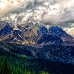
PHOTOGRAPHER'S ASSIGNMENT: MT. RAINIER
The road to Sunrise climbs into the foothills of Mount Rainier on the eastern side. The volcano is the biggest mountain around, and the treeless upper slopes, cloaked in glacial ice, catch and reflect the full brunt of the rising sun's bright rays; a spectacle well worth the long drive, and the early wake-up call.
<<CLICK to Read More>>

PHOTOGRAPHER'S ASSIGNMENT: OLYMPIC NATIONAL PARK
(Coming Soon!)
Some of the text and many of the photos in my Alaska Highway series first appeared on RoadTrip America’s website. A few years ago, I posted a detailed account of my entire 57 day, 13,000 mile “Mother of All Road Trips,” and RTA has kept that account available in their archive of Field Reports. If you’d like to read it, the link below will take you there:

This is an interactive Table of Contents. Click the pictures to open the pages.
Alaska Road Trip

The Alaska Highway: Prelude: The Road to Dawson Creek
Even if you start in Seattle, the closest American city, it’s still more than 800 miles to Dawson Creek, wending your way that much further north, so far north that there will be a noticeable change in the hours of daylight. It’s the latitude that distinguishes the north country, including every bit of Alaska. Dawson Creek is where it all begins.
<<CLICK to Read More>>

The Alaska Highway: Day 1: Dawson Creek to Fort Nelson
Past Fort St. John, the terrain got a lot wilder. No more towns, very few people, and very little traffic. Saw a few U.S. license plates, Michigan, California, Oregon, South Carolina; people that were obviously headed to Alaska!
<<CLICK to Read More>>

The Alaska Highway: Day 2: Fort Nelson to Whitehorse
Every time I rounded a curve in the road there was another stupendous vista; it was nothing short of astonishing! I was literally yipping out loud, and a couple of times I actually pulled over and stopped while I pounded on my chest to “re-start” my heart!
<<CLICK to Read More>>

The Alaska Highway: Day 3: Whitehorse to Beaver Creek
Approaching the mountains, I started pulling over with serious frequency, taking LOTS of photos! Mountains, clouds, lakes, flowers—I was pretty sure I must have died and gone to heaven, but I couldn’t for the life of me remember the fiery crash.
<<CLICK to Read More>>

The Alaska Highway: Day 4: Beaver Creek to Fairbanks
Delta Junction, the end of the Al-Can, was only 200 miles away, and the border? Twenty miles, maybe half an hour, and I was finally going to cross into Alaska! I’d been on the road more than three weeks, and in just half a day more, I’d be in Fairbanks.
<<CLICK to Read More>>

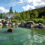
Chena Hot Springs: A Fairbanks Original
The Chena hot spring puts out steaming water at a temperature of 150 degrees, producing enough power to meet all the needs of the resort, as well as filling the hot springs pools used by the guests. In addition to the lodge and restaurant, they offer camping and horseback riding, and they have exhibits featuring sled dogs, greenhouses, ice sculptures, and geothermal energy.
<<CLICK to Read More>>

Two-Foot High Kick: World Eskimo Indian Olympics
Contestants take a running leap, then they make this crazy jackknife move, touch the ball suspended high above the floor with both feet, then come back down and stick the landing. If that sounds difficult? You have no idea.
<<CLICK to Read More>>

Dreaming of Denali
When I drove my Jeep to Alaska that first summer after I retired, my main goal, the single most important thing I wanted to do, was to see Denali, the biggest mountain in North America.
<<CLICK to Read More>>

Follow the Fireweed
Visualize a summertime journey through that part of the world, a world filled with mountains and glaciers and boreal forests, ice blue rivers, turquoise lakes, and billowing clouds that fill the sky. Imagine your vision as a beautiful piece of music. The fundamental, underlying theme of that symphony would be a gently rising swell of perfect harmony, pinkish lavender in its hue.
<<CLICK to Read More>>

Kenai Fjords National Park: Seabirds, Glaciers, and Whales on the Wild Coast of Alaska
At this latitude, during the summer months, the sun stays low in the sky all day, and never really goes down. The traditional “golden hour” when the light is best for landscape photos is extended accordingly, and there are more opportunities for great shots than you’ll know what to do with.
<<CLICK to Read More>>

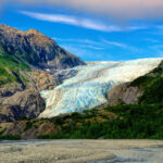
Kenai Fjords National Park: Exit Glacier: Up Close and Personal
Compared to the huge tidewater glaciers that flow directly into the sea along the coast of Kenai Fjords, Exit Glacier is just a baby–a baby that’s getting smaller every year–but it’s still big enough to permanently alter the landscape through which it passes.
<<CLICK to Read More>>

Alaska Road Trip: Driving Alaska’s Grand Circle
Most of the major towns in Alaska, as well as three of the state’s incredible National Parks, can all be reached by driving Alaska’s Grand Circle: a loop route beginning in Tok that utilizes all four segments (1082 miles) of Alaska’s Interstate Highway system.
<<CLICK to Read More>>

Alaska Road Trip: The Grand Circle: From Tok to Denali
There are no icy mountains looming on the horizon, and Fairbanks is nowhere near Alaska’s ruggedly beautiful coast. The true beauty in Alaska’s second city is found below the surface, in the spirit and resiliance of the people who make the place their home.
<<CLICK to Read More>>

Alaska Road Trip: The Grand Circle: Anchorage and the Kenai Peninsula
The massive ice field in the park’s wild interior has spawned dozens of glaciers which, over the course of many millenia, have carved the landscape into fjords so heart-breakingly beautiful, humpback whales swim all the way from Hawaii just to cavort in the deep blue water.

Alaska Road Trip: The Grand Circle: Wrangell-St. Elias National Park
So, just exactly how big is Wrangell-St. Elias National Park? You could combine Yellowstone with Yosemite, throw in the entire country of Switzerland, and you still wouldn’t match it in terms of size.
<<CLICK to Read More>>

Alaska Road Trip: Driving to the Top of the World
The rough dirt road gave way to a newly paved modern highway. This was it, the Top of the World, and right on cue, the haze peeled back, just enough to give me a glimpse of the beauty my friends assured me would be there…
<<CLICK to Read More>>
CANADIAN ROAD TRIPS
This is an interactive Table of Contents. Click the pictures to open the pages.
Canadian Road Trips

Canadian Road Trips: Rolling through the Rockies
The goal here is to get you thinking about the different ways to tie these iconic parks together, and the distances involved, in order to get the most out of a visit to one of the most wonderfully scenic areas on the entire planet.
<<CLICK to Read More!>>

Canadian Road Trips: Banff and Kootenay National Parks
Banff gets four million visitors in an average year, and even though the park covers more than 1.6 million acres, 90% of those four million visitors head straight to the same spot, to Lake Louise, and the Fairmont Chateau.
<<CLICK to Read More!>>

Canadian Road Trips: Jasper and the Icefields Parkway
You'll see glaciers, waterfalls, rushing rivers and turquoise lakes surrounded by wildflowers, all of it fed by steadily melting ice. Snowclad peaks with vibrant green flanks line the road on both sides, and every turnout, every wide spot in the road offers a new and dramatic perspective.
<<CLICK to Read More!>>

Canadian Road Trips: Yoho National Park
Less than five miles along, the first break in the trees offered a glimpse, a flash of improbable color followed by a larger clearing that brought me screeching to a halt. There, beyond the spread of roadside wildflowers and a verge of spindly pines was the most extraordinary lake I had ever seen, backed by an ice-clad mountain.
<<CLICK to Read More!>>

Canadian Road Trips: Glacier and Mt. Revelstoke National Parks
The centerpiece of Revelstoke is it’s namesake mountain, and the most popular activity is the drive up the Meadows in the Sky Parkway, a twisting, turning roller coaster of a road that climbs all the way to the top of the mountain. It’s only 16 miles long, and it’s paved the whole distance, but you’ll gain more than 4,000 feet in elevation, and there are enough hairpins to satisfy the needs of an old-fashioned beauty pageant.
<<CLICK to Read More!>>

Follow the Fireweed
Visualize a summertime journey through that part of the world, a world filled with mountains and glaciers and boreal forests, ice blue rivers, turquoise lakes, and billowing clouds that fill the sky. Imagine your vision as a beautiful piece of music. The fundamental, underlying theme of that symphony would be a gently rising swell of perfect harmony, pinkish lavender in its hue.
<<CLICK to Read More!>>

There's nothing like a good road trip. Whether you're flying solo or with your family, on a motorcycle or in an RV, across your state or across the country, the important thing is that you're out there, away from your town, your work, your routine, meeting new people, seeing new sights, building the best kind of memories while living your life to the fullest.
Are you a veteran road tripper who loves grand vistas, or someone who's never done it, but would love to give it a try? Either way, you should consider making the Southwestern U.S. the scene of your own next adventure.
A few years ago I wrote a book about road trips in Arizona and New Mexico that's a lot like this website, packed with interesting information, and illustrated with beautiful photographs. Check it out! You can find it on Amazon, and at all other major booksellers.

ALASKA ROAD TRIP:
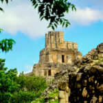
MEXICAN ROAD TRIP (IN THE LAND OF THE MAYA):
ARIZONA AND NEW MEXICO:
SOUTH AMERICA:
PHOTOGRAPHY:
TRIBAL LANDS:


Recent Comments