DAY 23:
from TEQUISQUIAPAN to SAN MIGUEL DE ALLENDE!
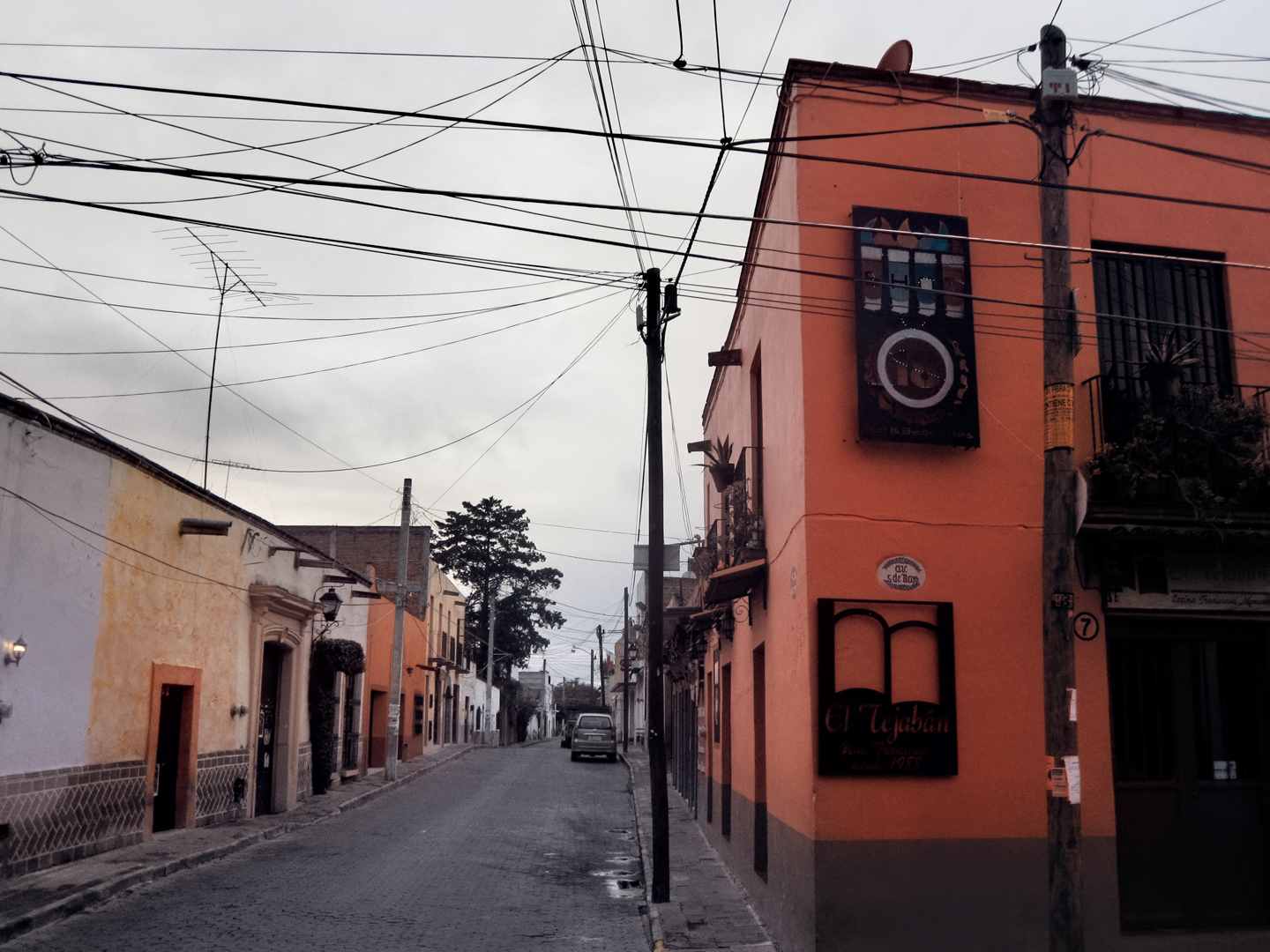
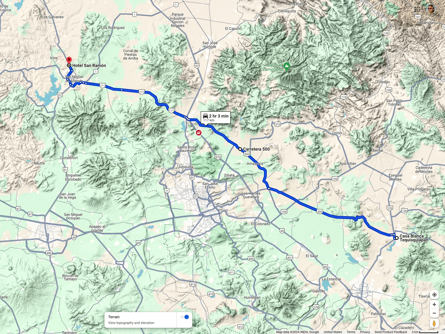
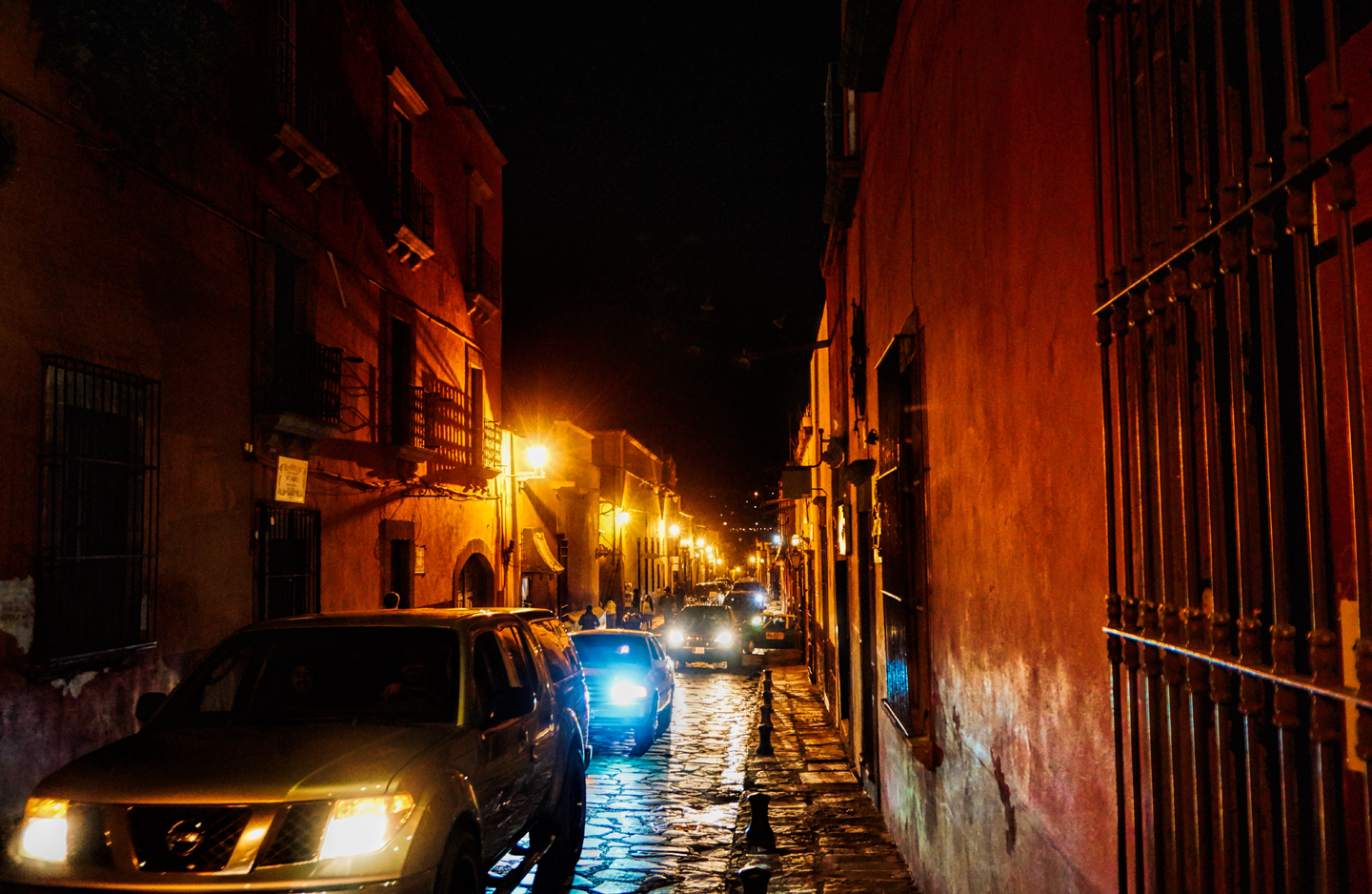
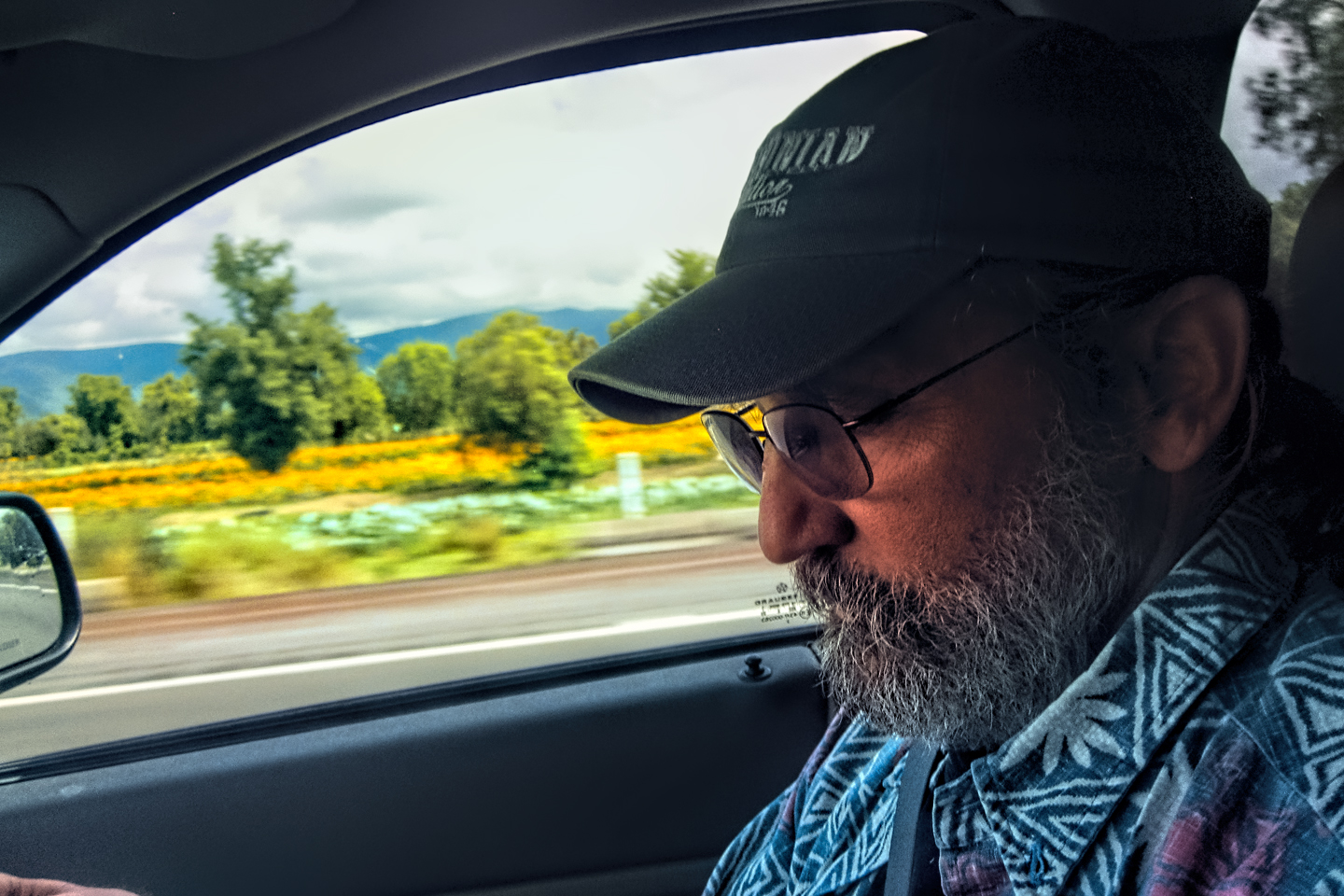
We started Day #23 of our road trip at the Hotel Casablanca in Tequisquiapan, a colonial era town an hour or so east of the city of Queretaro. It’s said to be quite charming, but, sadly, we didn’t get to stay long enough to check it out. We arrived after dark, and we had to leave right after breakfast. San Miguel de Allende was still two hours away by road, and our goal was to get there, as quickly as possible! This was the first day of the Dia de los Muertos celebration, and after everything we’d gone through to make it there on time, we didn’t want to miss a single minute of the festivities.
HOTEL CASABLANCA
TEQUISQUIAPAN, QUERETARO
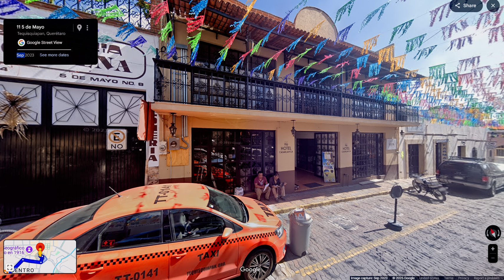
Tequisquiapan is a popular weekend getaway spot for residents of Mexico City, as well as the nearby city of Queretaro. The town is known for its cobblestone streets and 300 year-old Spanish Colonial architecture, and for the surrounding vineyards that produce some of the region’s better wines. The Hotel Casablanca is reasonably priced and centrally located. <<CLICK HERE>> for more info.


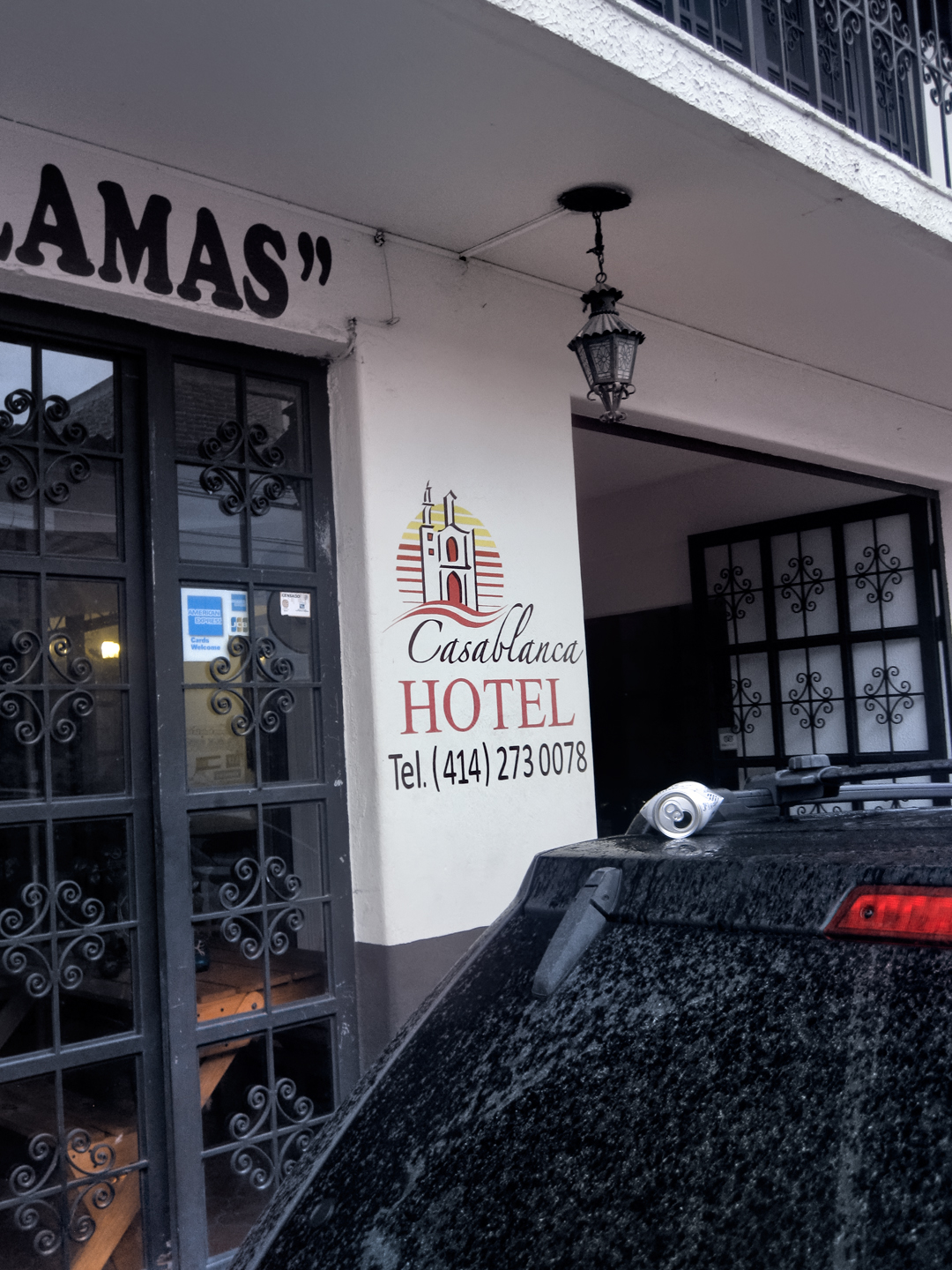
We ended up at this quaint hotel by mistake. When I booked the room, I thought “Tequisquiapan” was a neighborhood in Queretaro, as opposed to a seperate town that was two hours out of our way!
Computer and Tablet Users: Click any map or Photo to Expand the Image to Full Screen
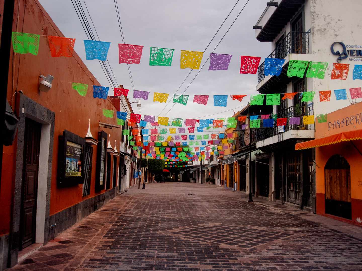
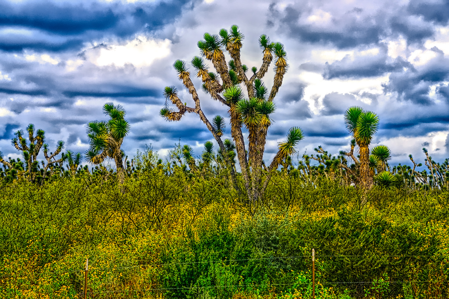
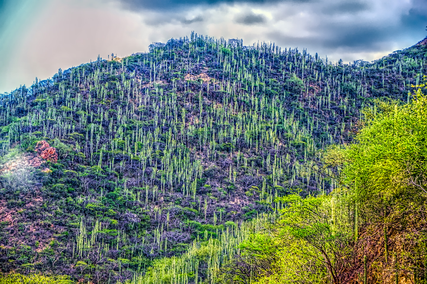
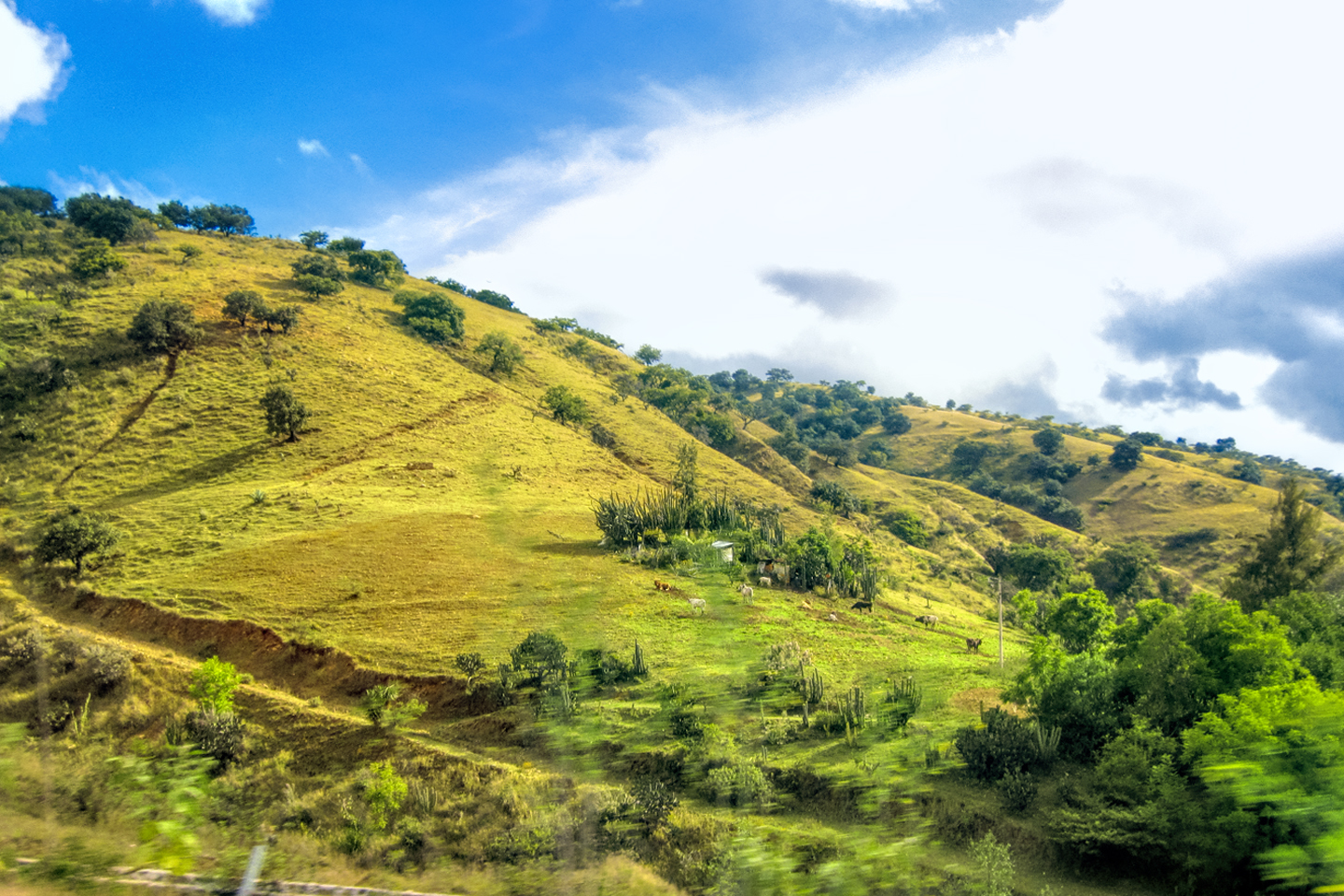
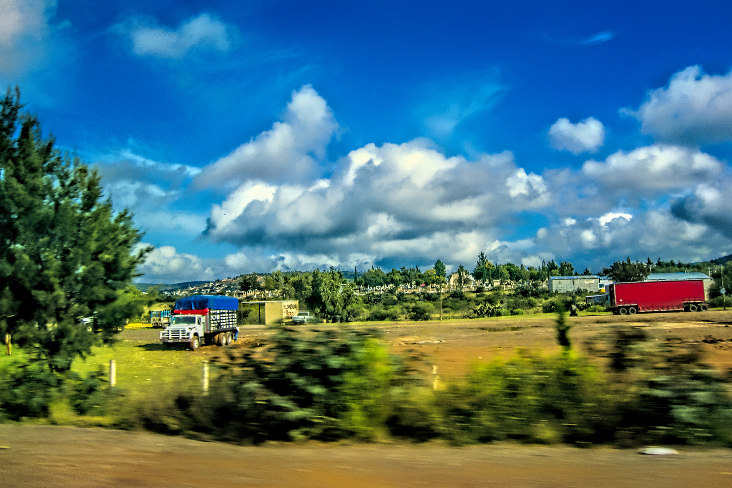
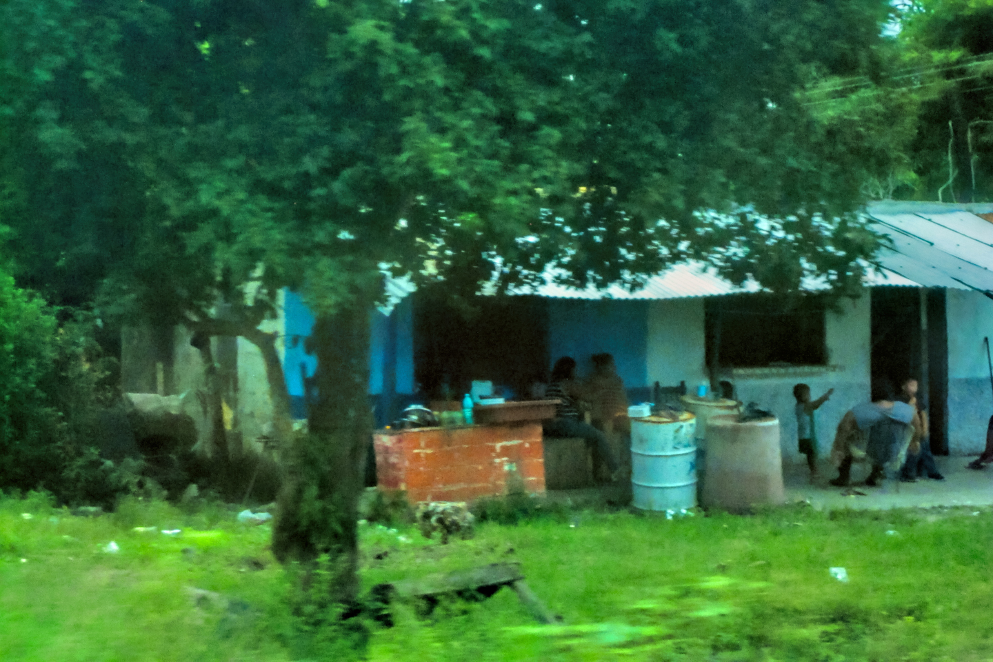
In and around Tequisquiapan, Queretaro
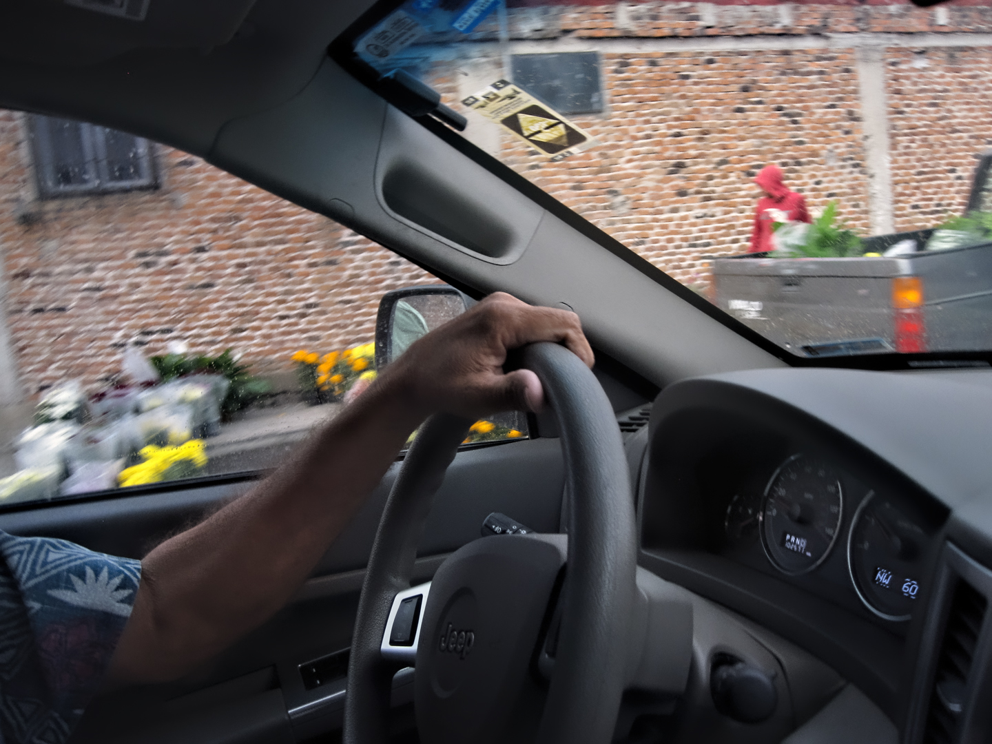
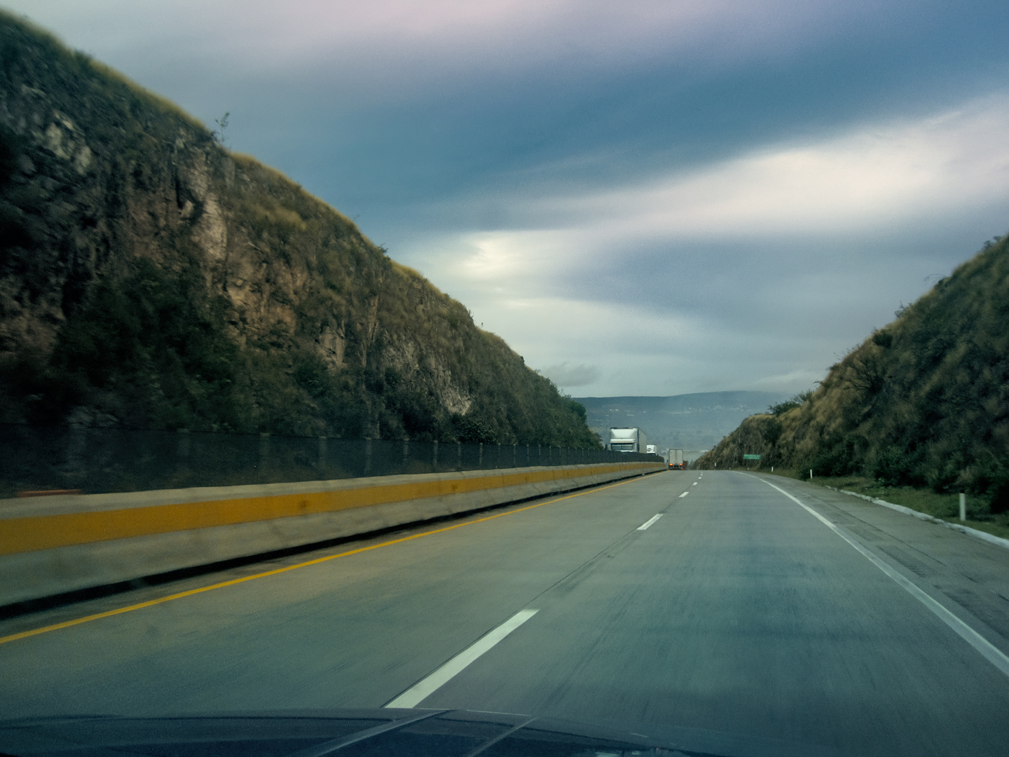
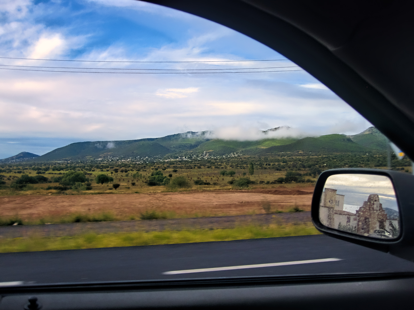
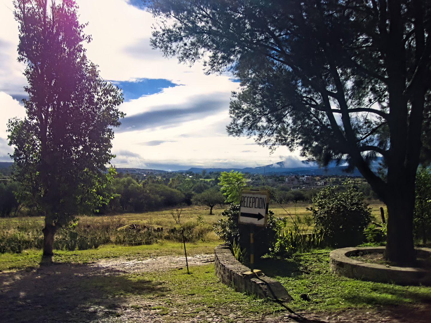
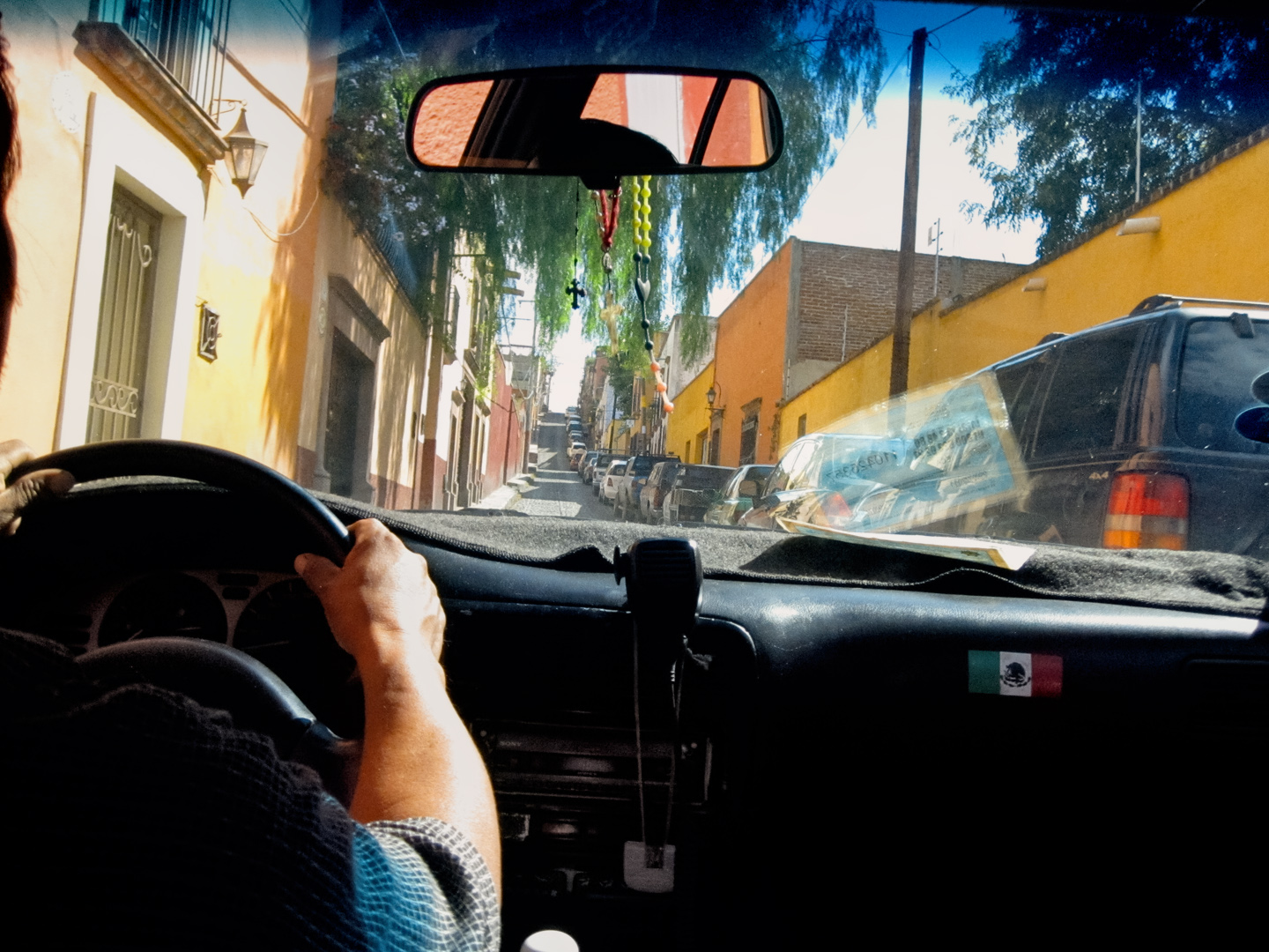
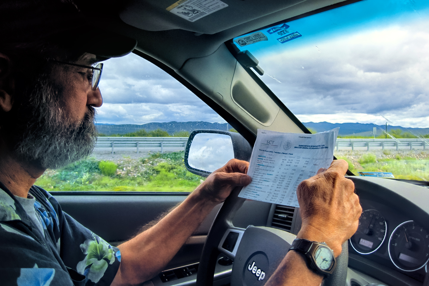
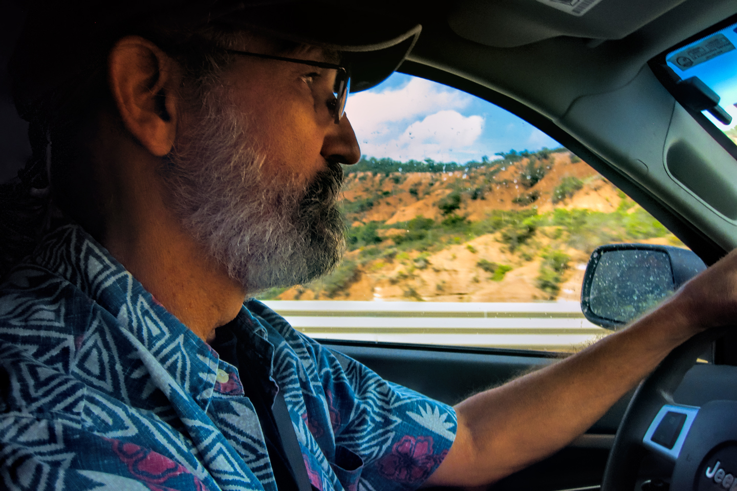
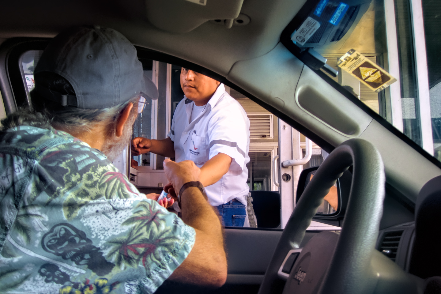
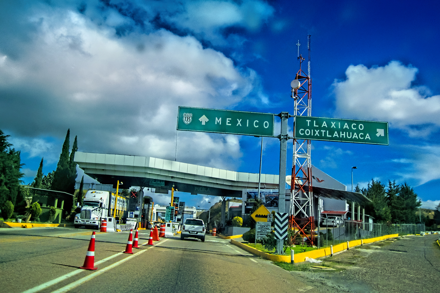
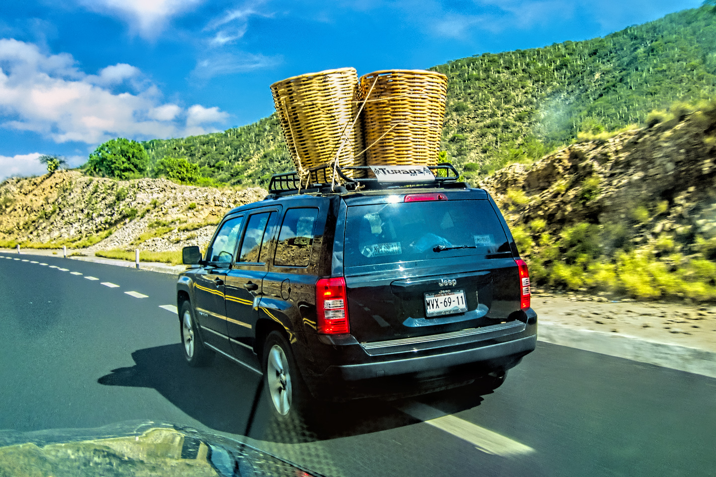
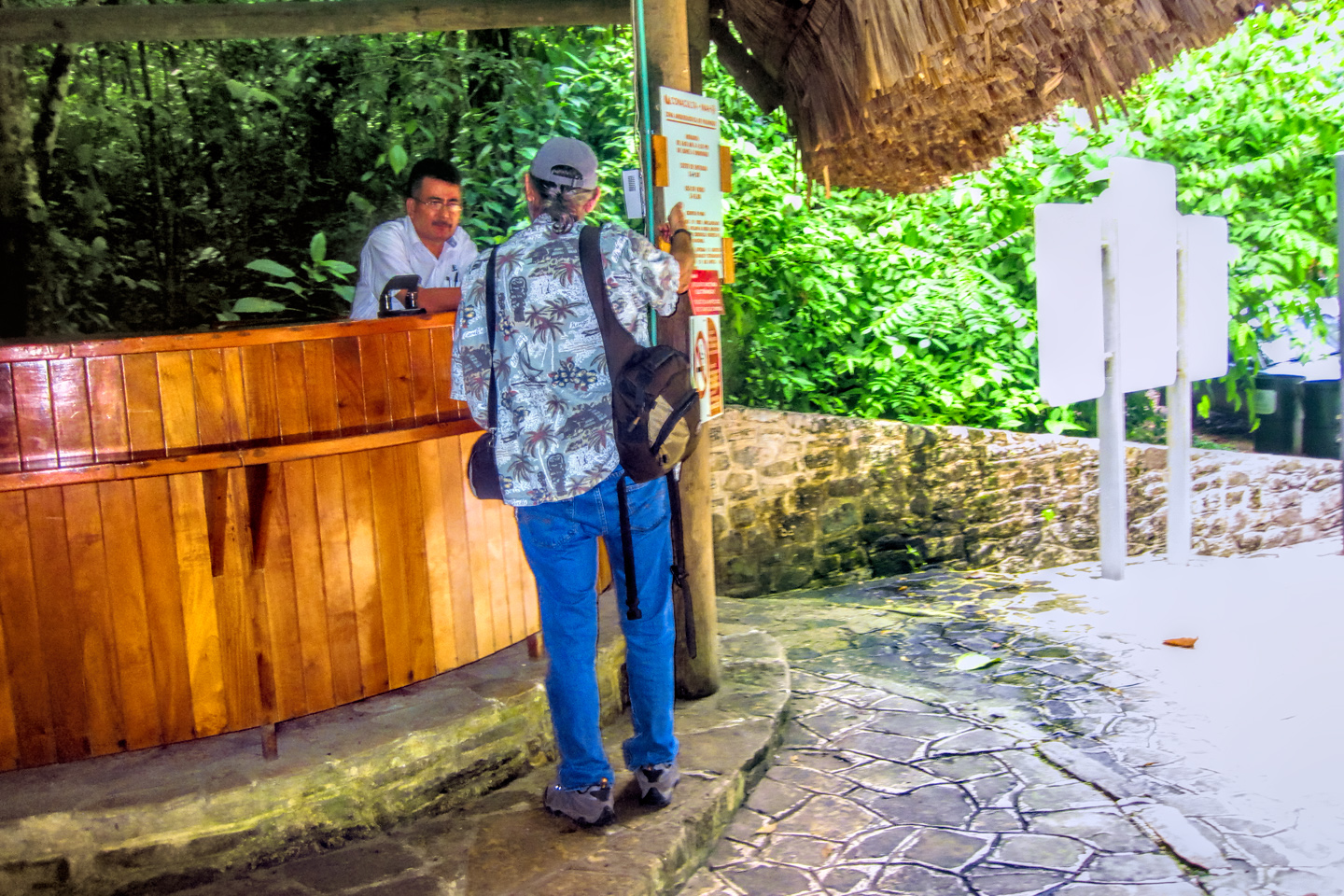
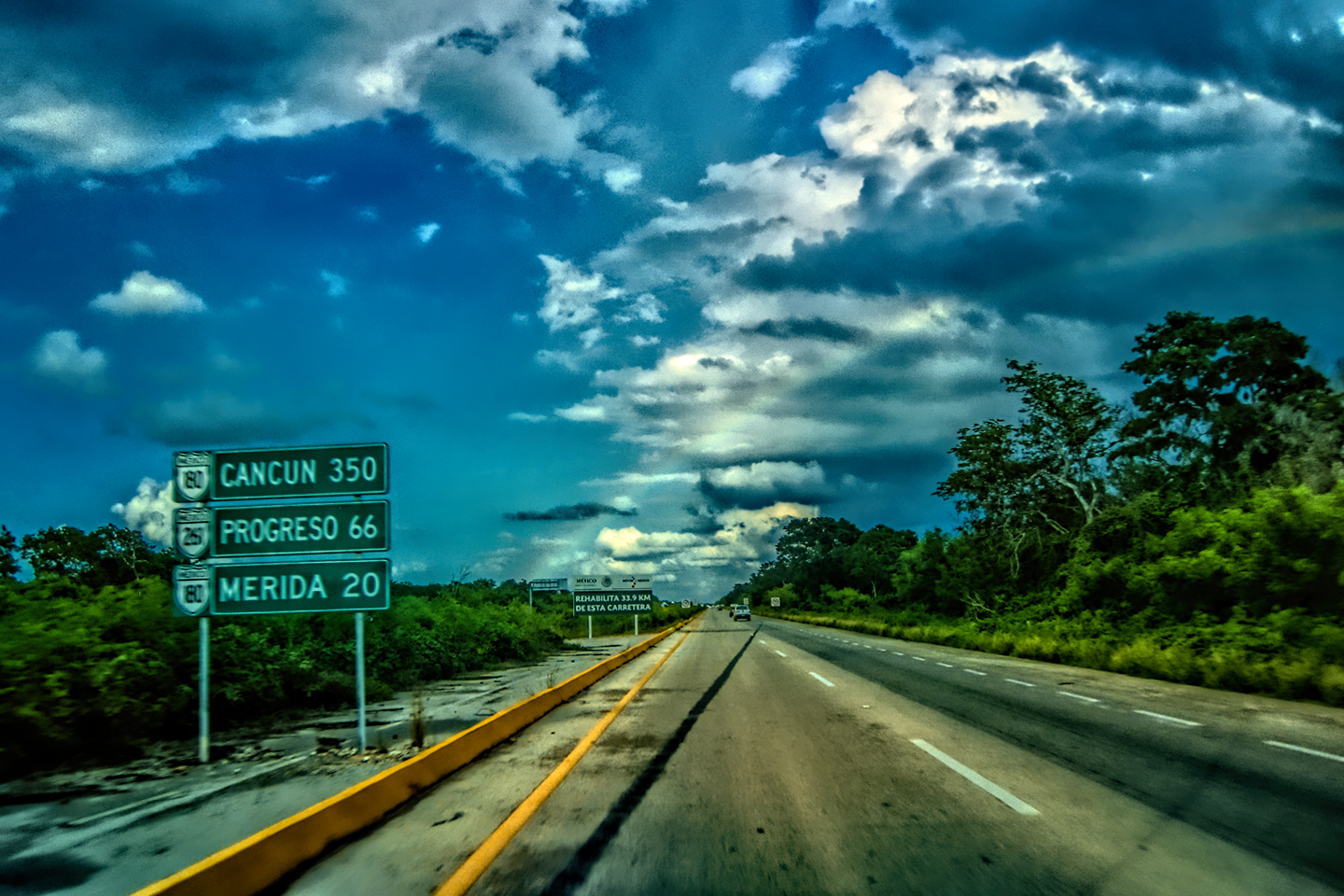
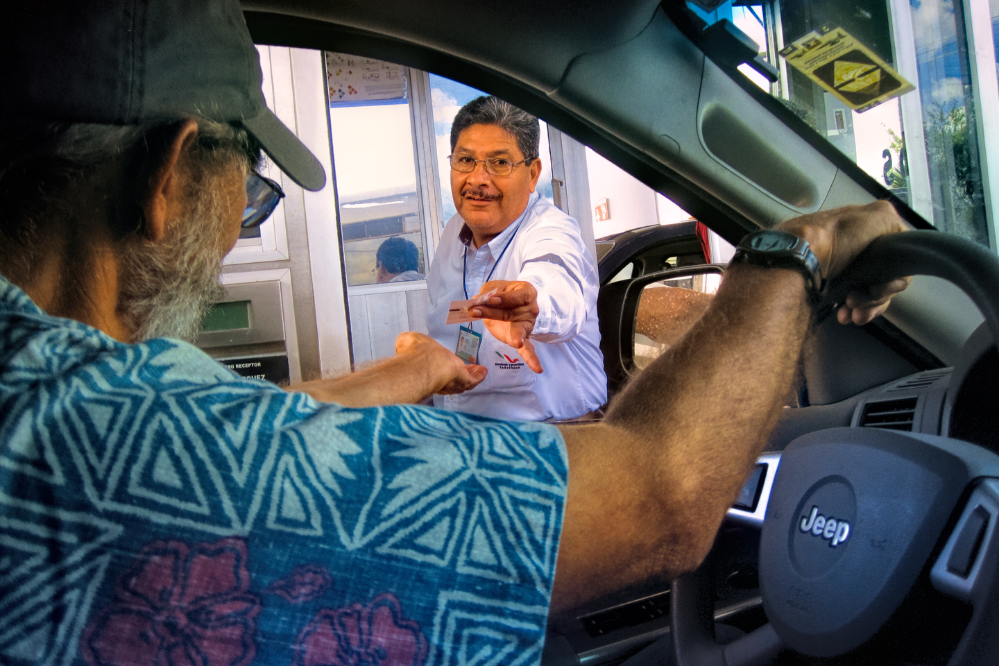
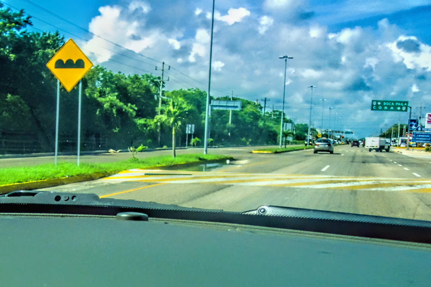
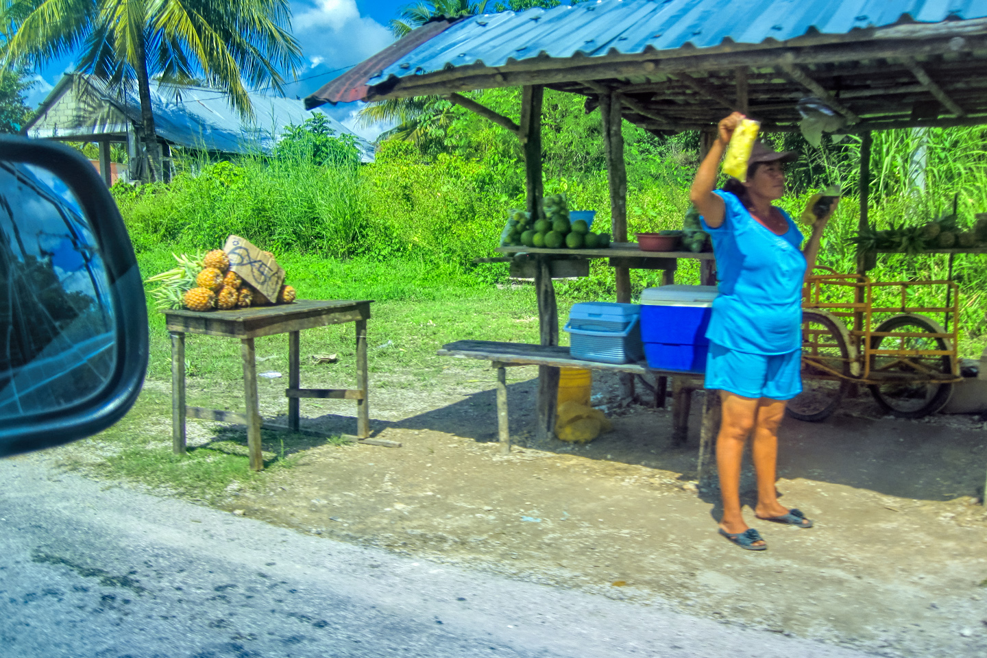
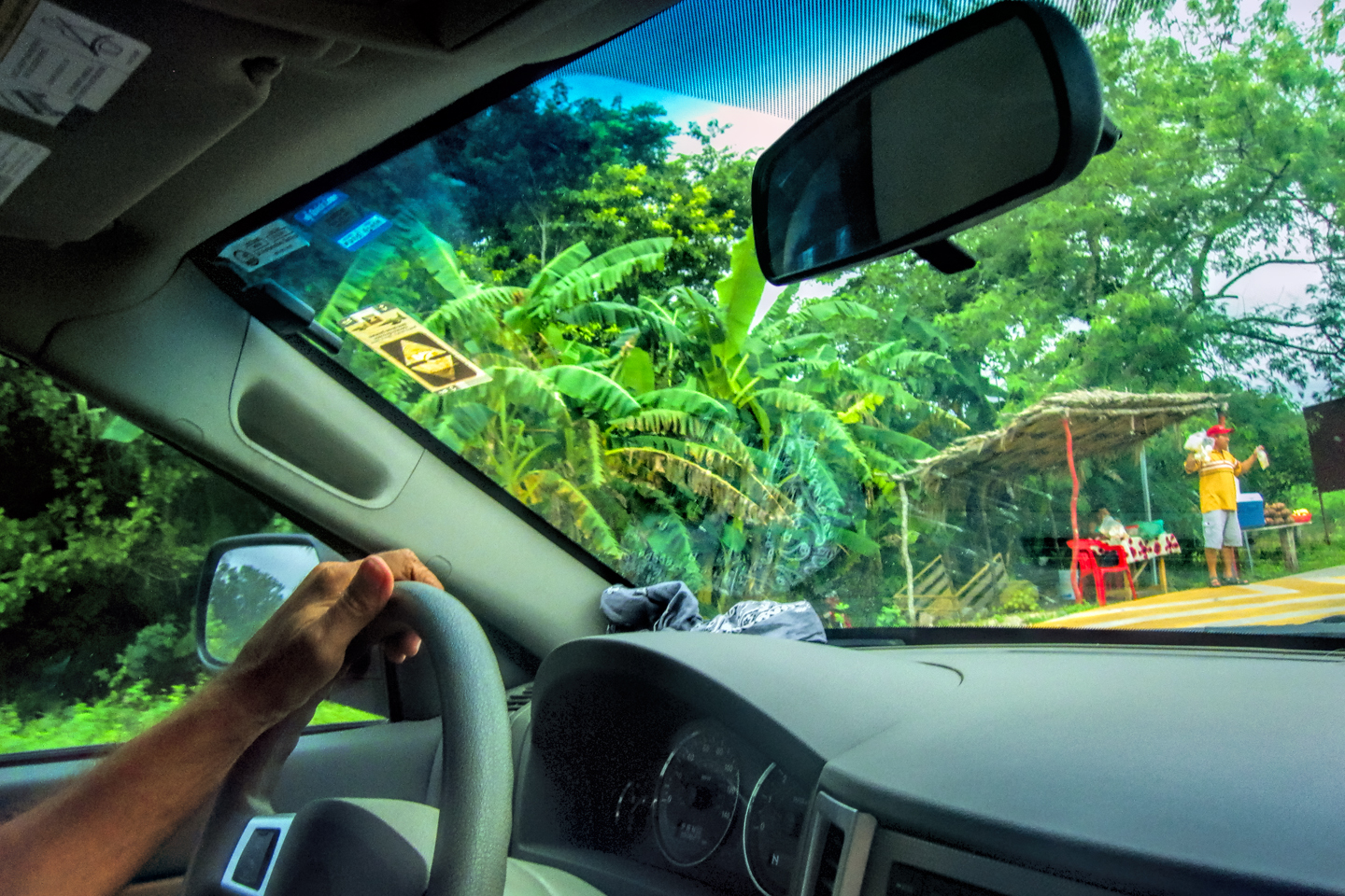
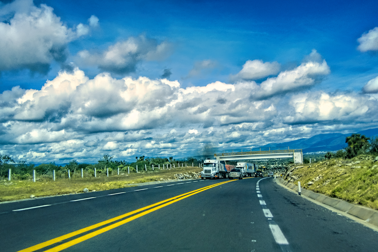
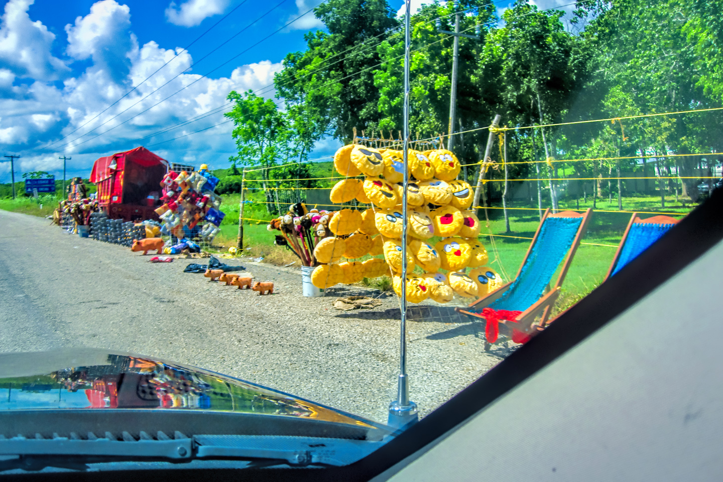
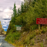
Tequisquiapan was about 75 miles from San Miguel de Allende, but it was likely to take us two hours to travel that distance. We first had to retrace our steps back to the city of Queretaro, and from there, it was at least another hour to our destination. We had reservations for the next three nights at the “Hotel/RV Park San Ramon,” just outside the town. I’d put in so many long days behind the wheel, the thought of stopping in one place for three days in a row had enormous appeal.
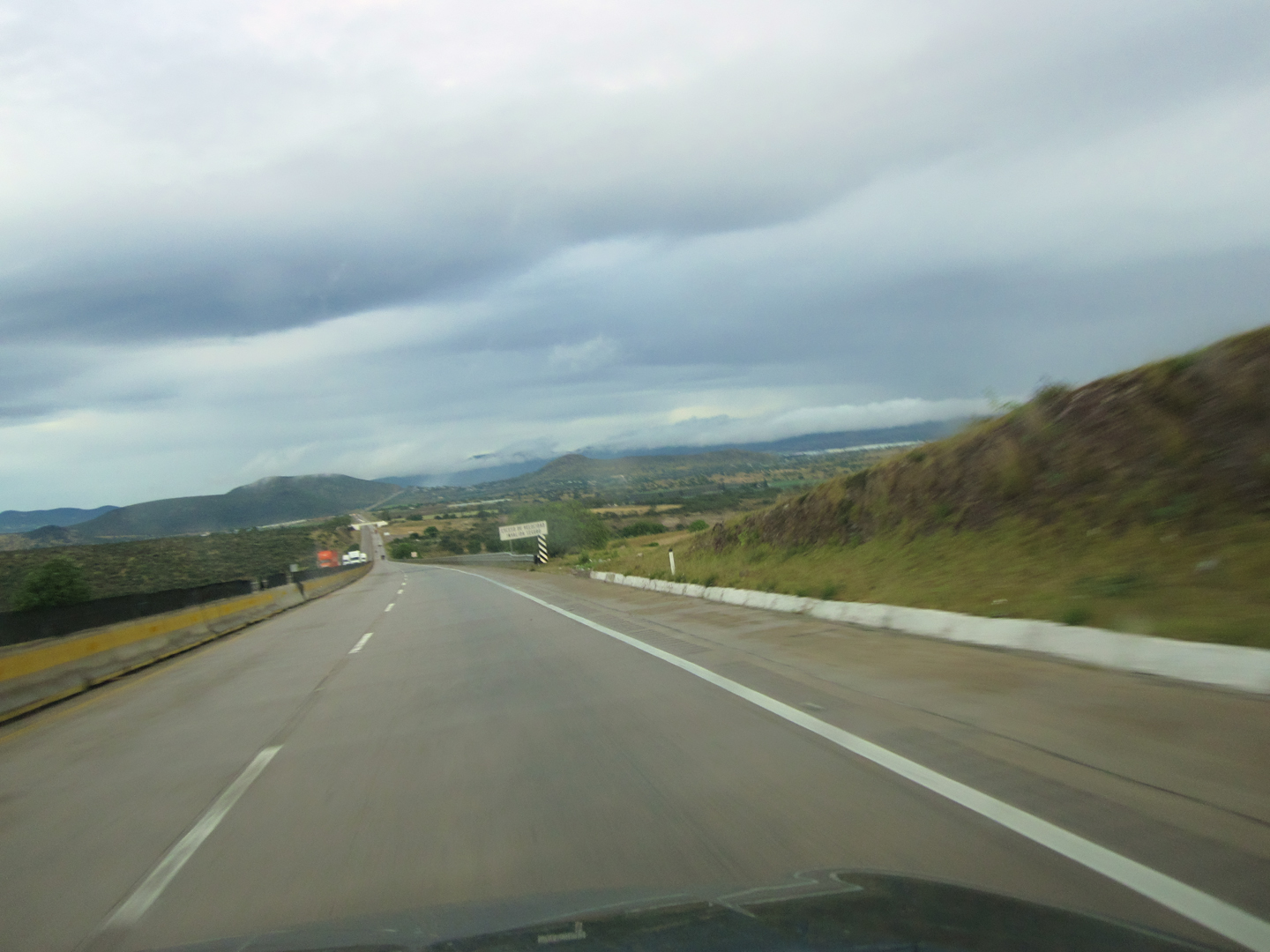
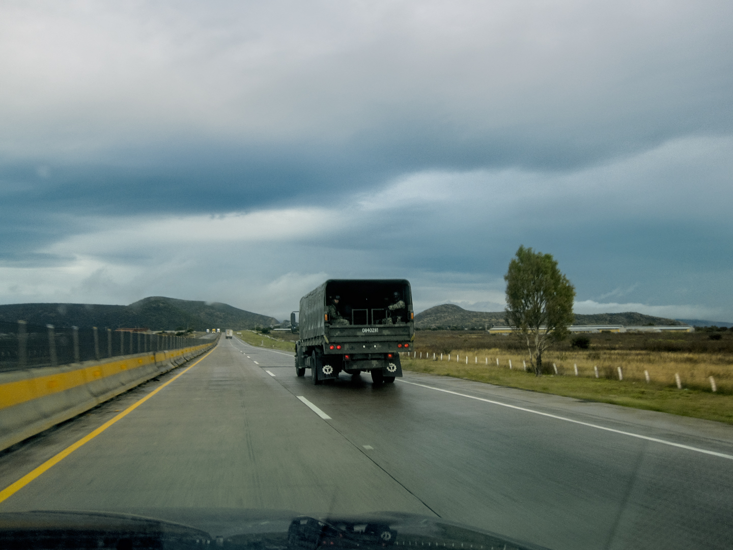
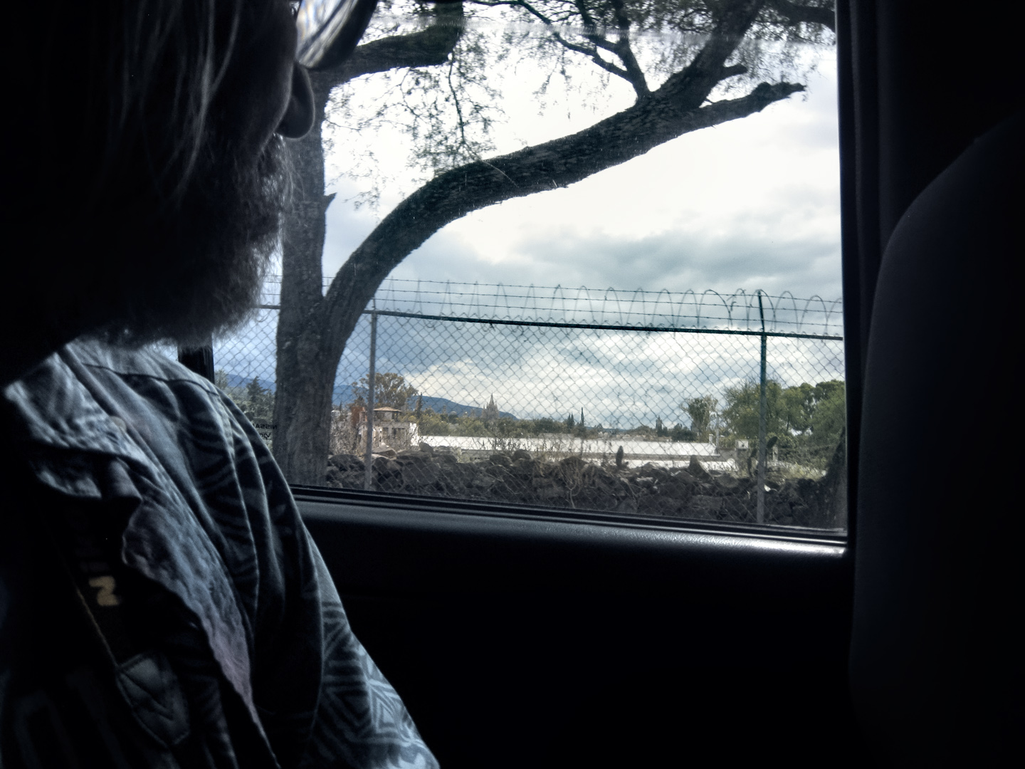
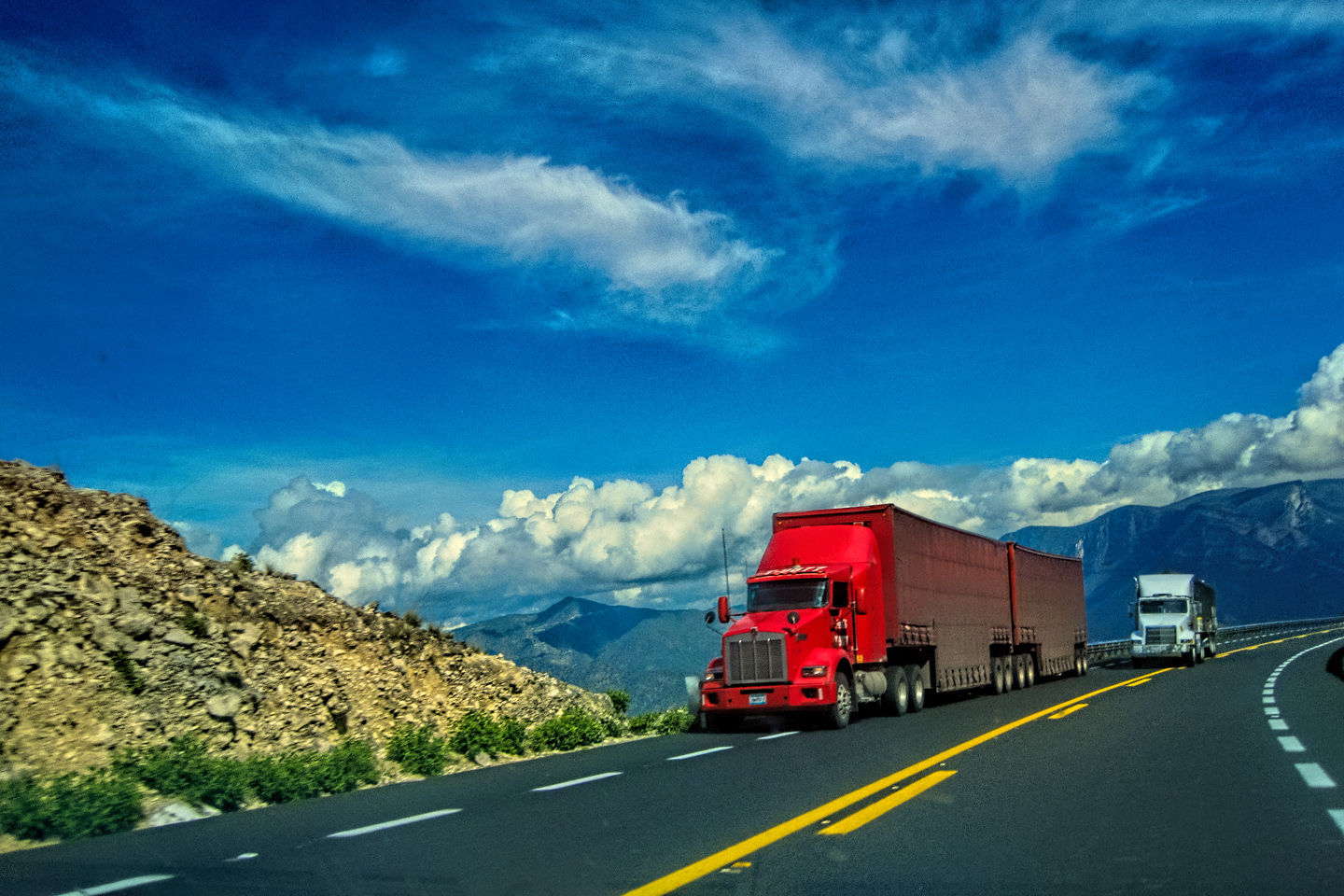
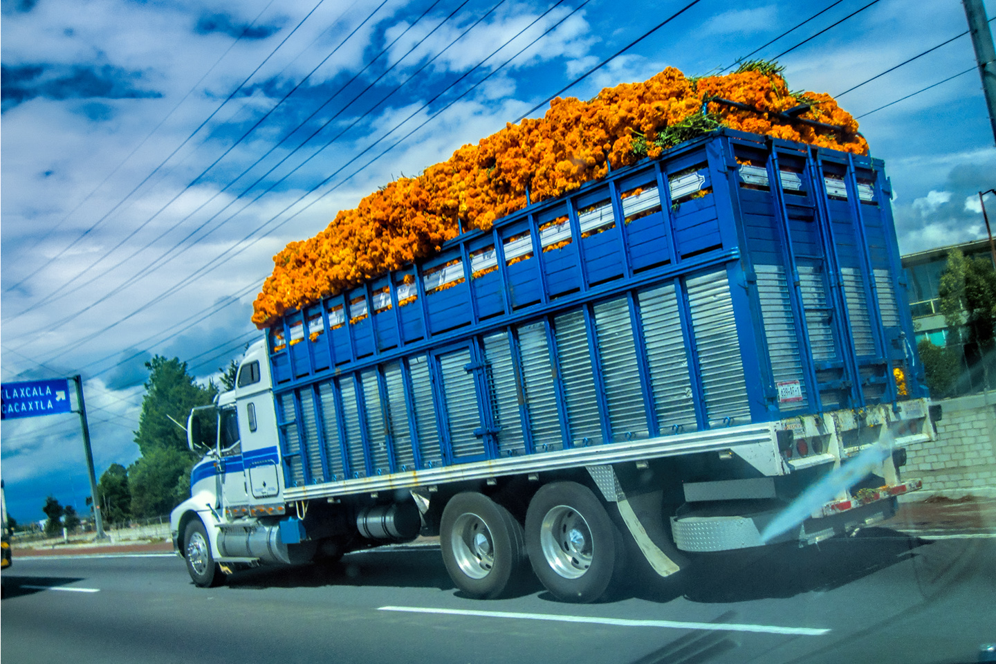
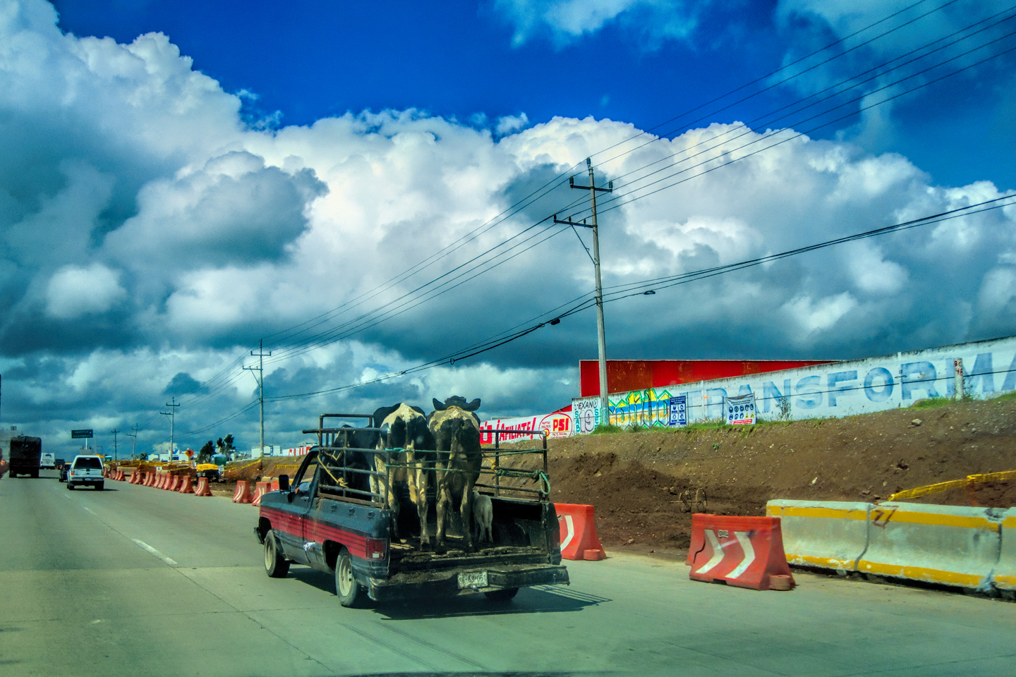
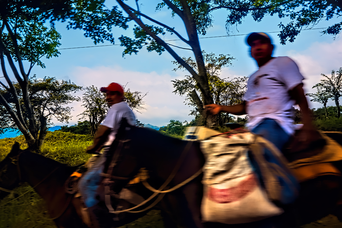
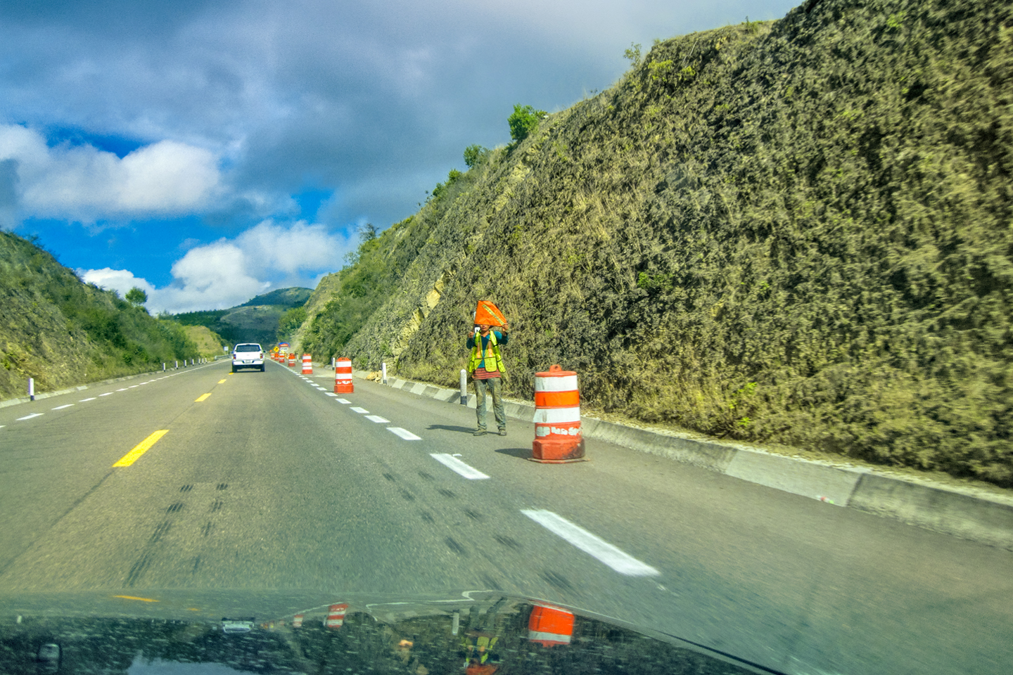
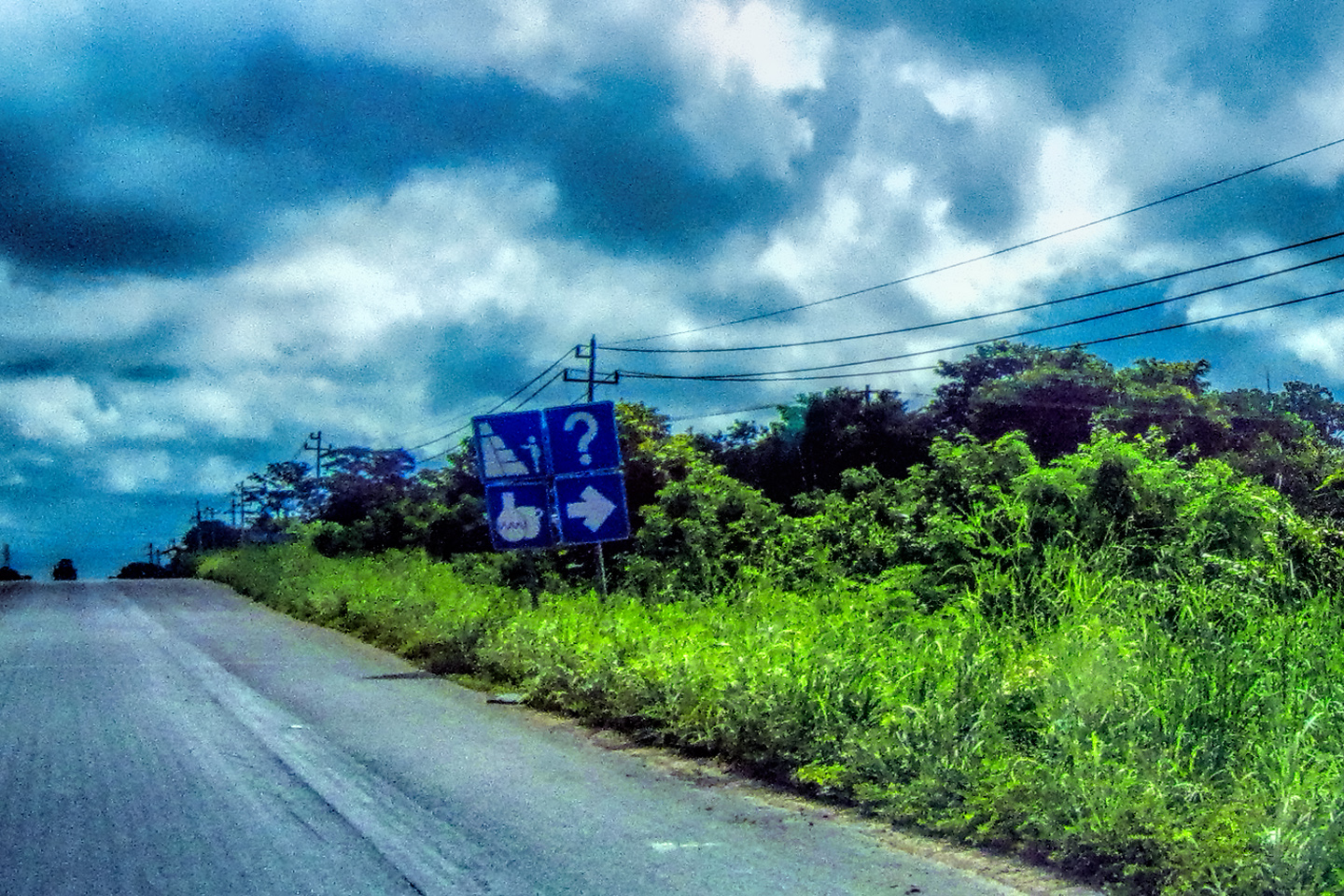
The sky was overcast, and traffic was light. One of the few vehicles we saw on the road was a truckload of soldiers.

DAY 1: OCTOBER 31st: ALL SAINTS EVE
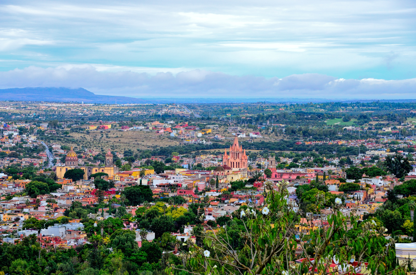
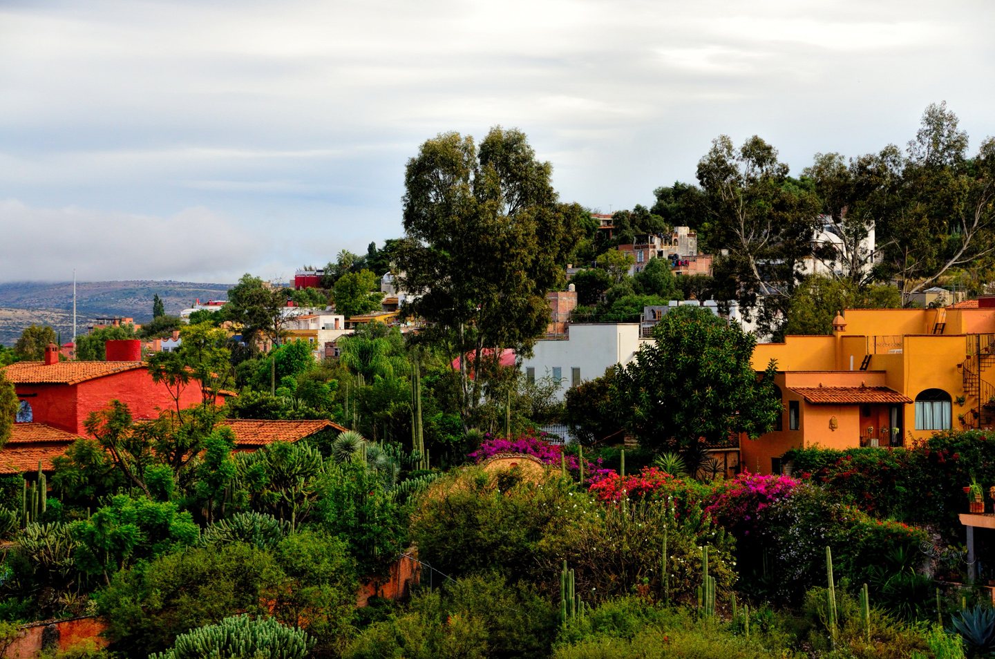
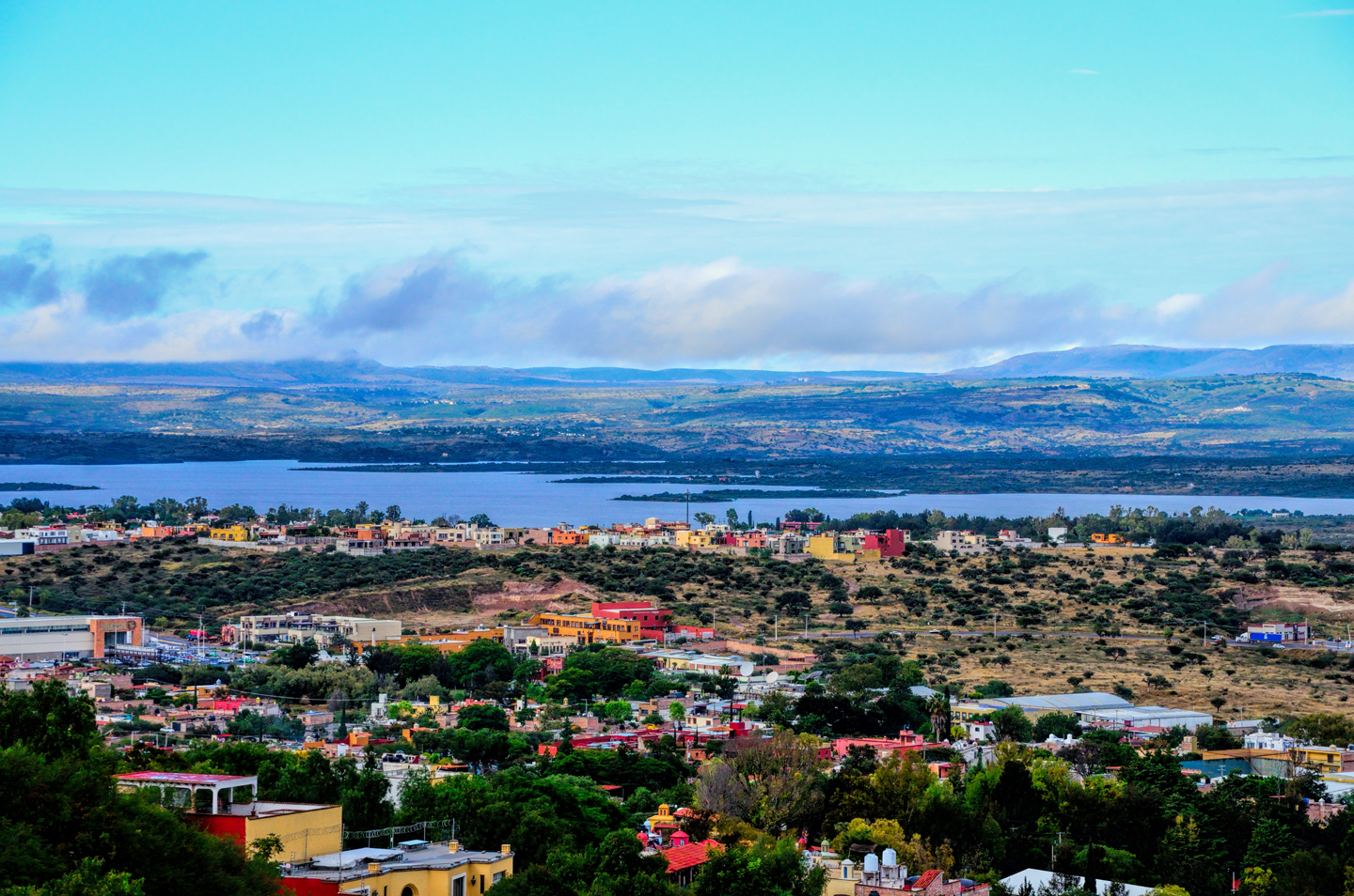
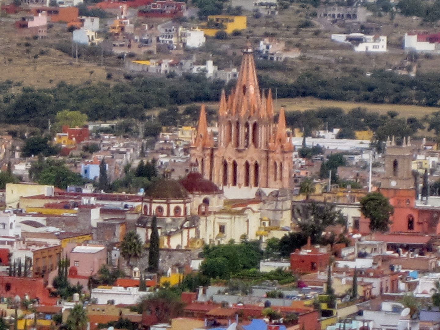
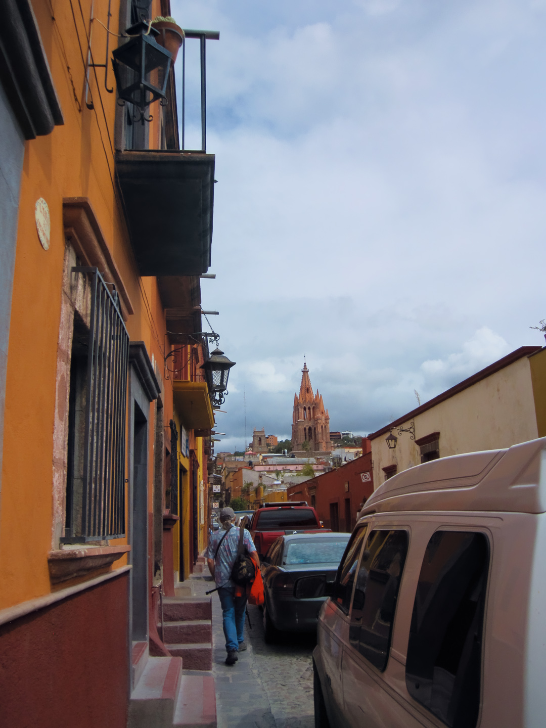
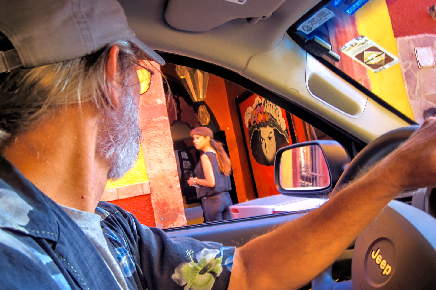
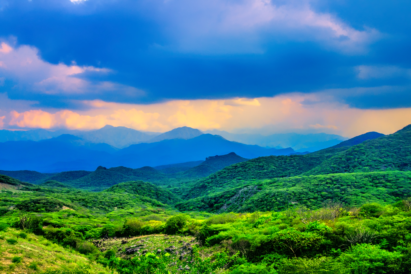
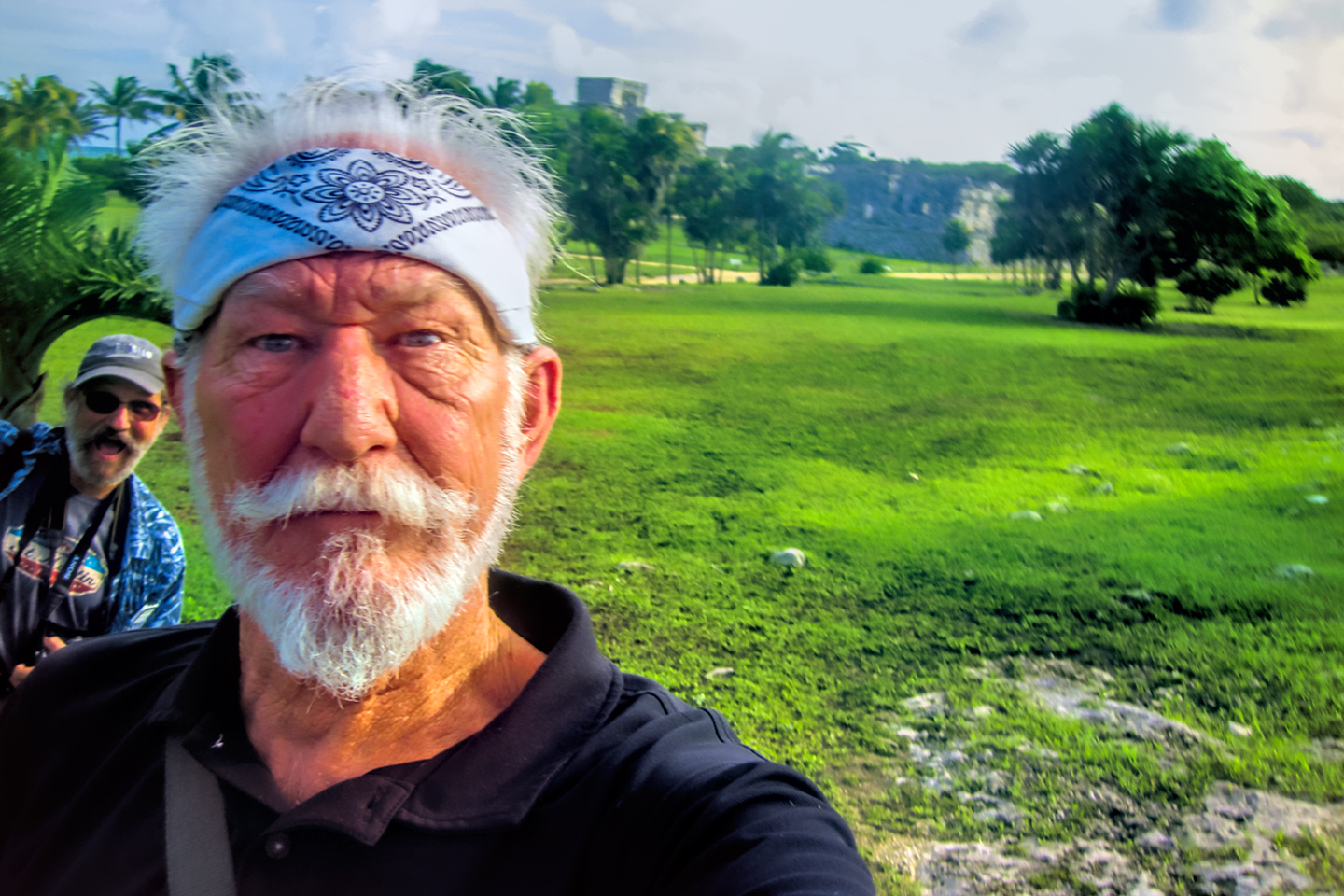
We arrived in San Miguel at about 11 AM. That was too early to check in to our hotel, so we had a little time to kill. We found a nice spot to park in the hills above the city. There were expansive views of the whole area, and the neighborhood that was built to take advantage of those views was lovely, replete with flowering trees that filled the air with their perfumed scent. San Miguel, at an altitude of 6,400 feet and a tropical latitude has a climate that is very close to perfection, with pleasant days and cool nights, rarely an uncomfortable extreme.


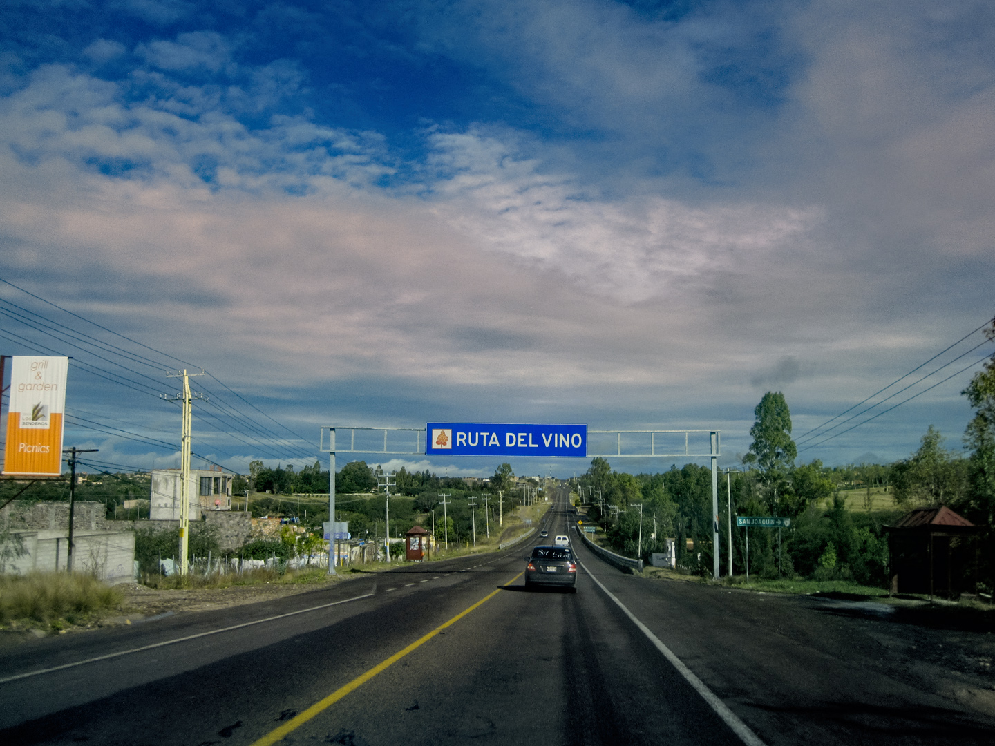
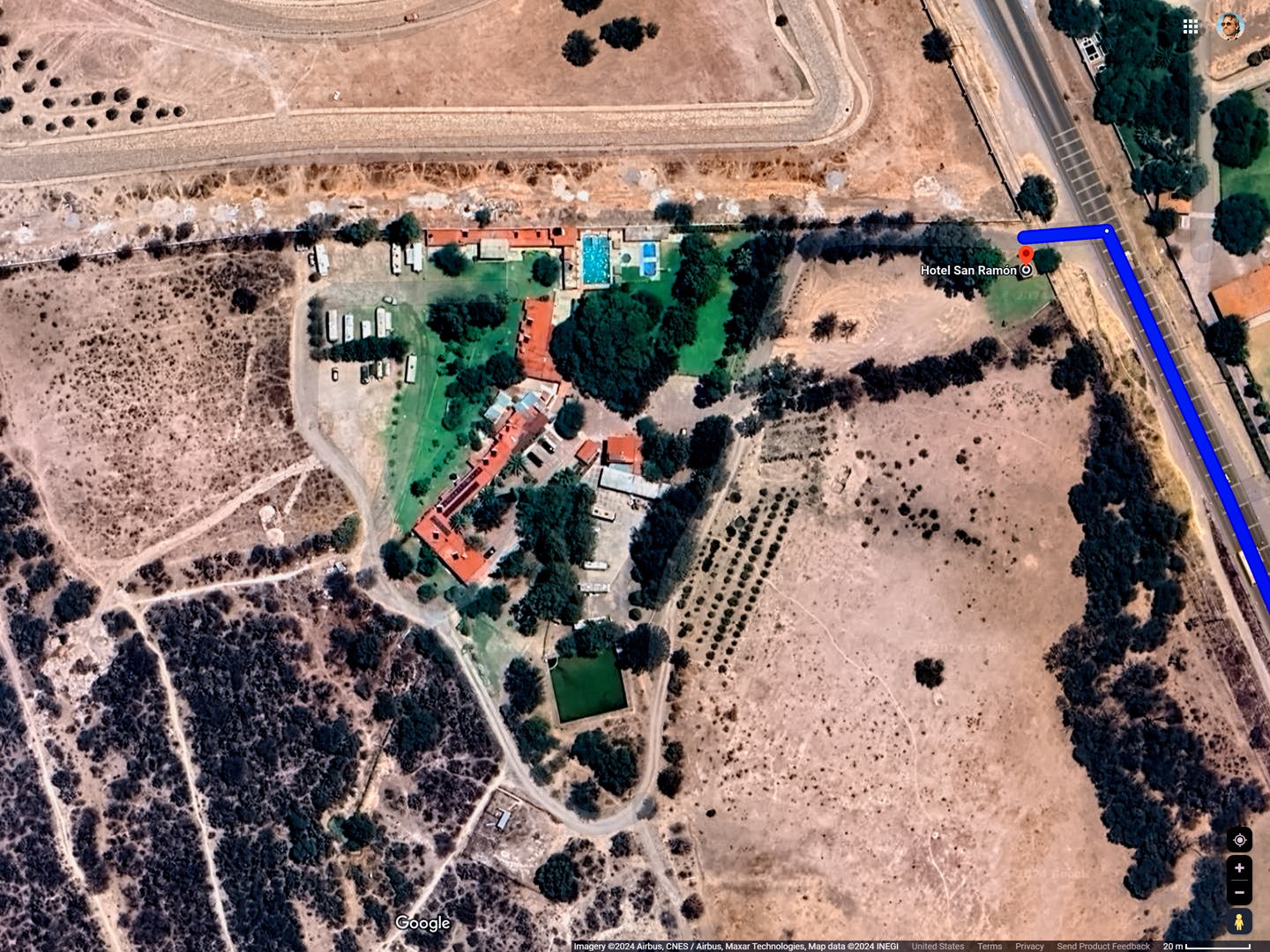
We drove down out of the hills, and stopped at a roadside cafe for a bite to eat before searching for our hotel. The San Ramon was just beyond the city limits on the road to Dolores Hidalgo. There are vineyards in the area, so the road itself is part of what’s been designated as the Ruta del Vino (Wine Route).
<<CLICK HERE>> for more information
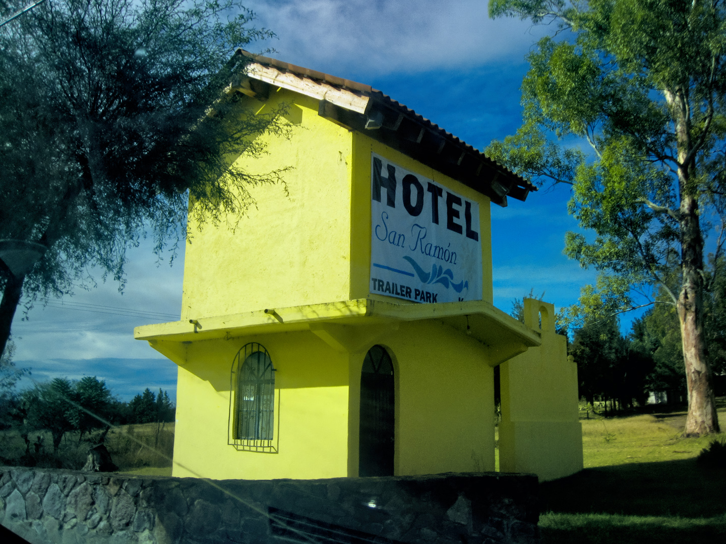
HOTEL SAN RAMON
The Hotel San Ramon features fairly basic motel-style accommodations, including a swimming pool (which was not in use when we were there). They have a large lot out back that fills with RV’s in the busy summer season. It’s the perfect spot to leave your rig while you explore San Miguel on foot. Hop on one of the buses that pass by every half hour; they’ll whisk you downtown in 10 minutes or less, for 10 Pesos!
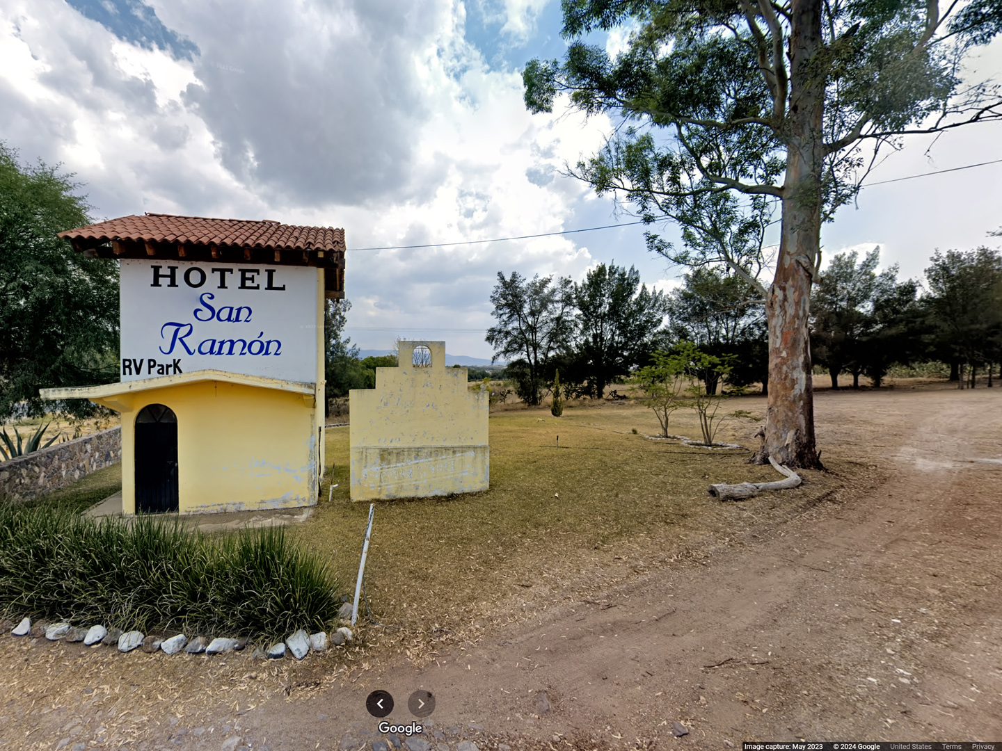
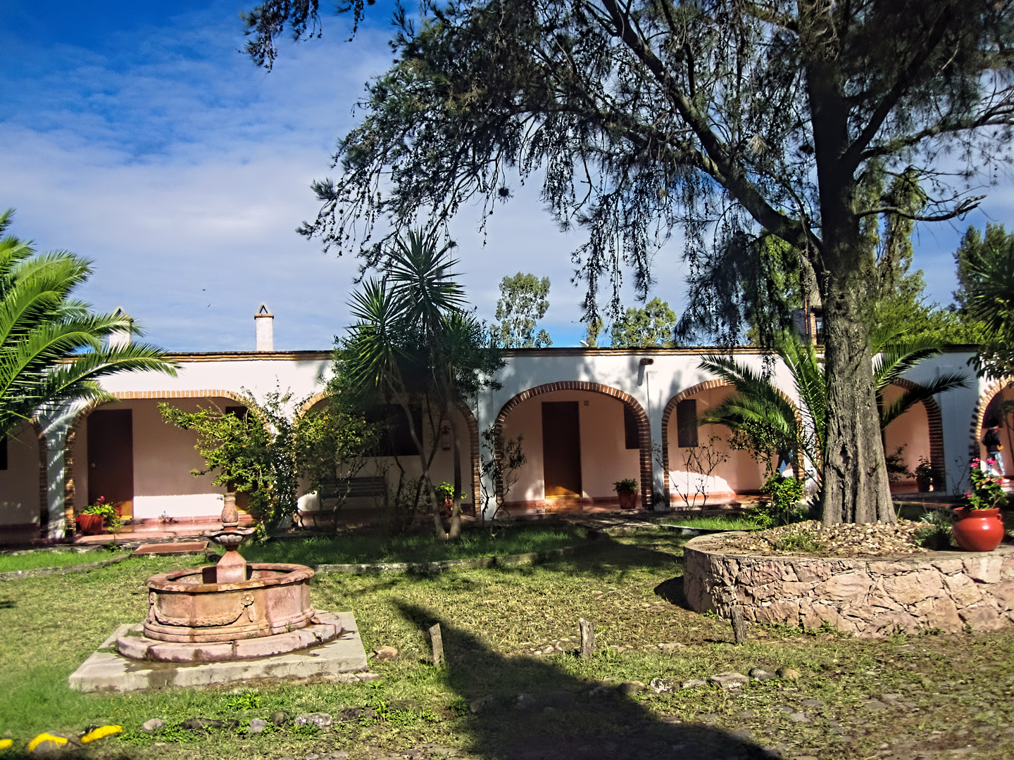
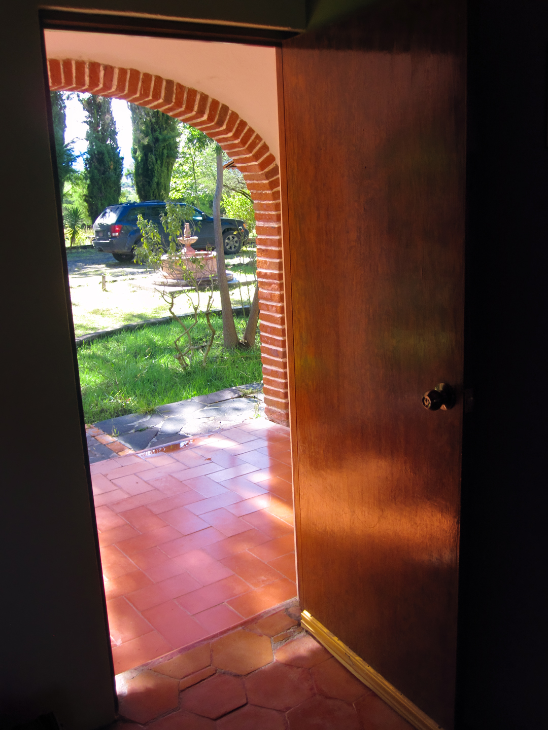
The San Ramon was not the least bit fancy, but it was exactly what we needed!
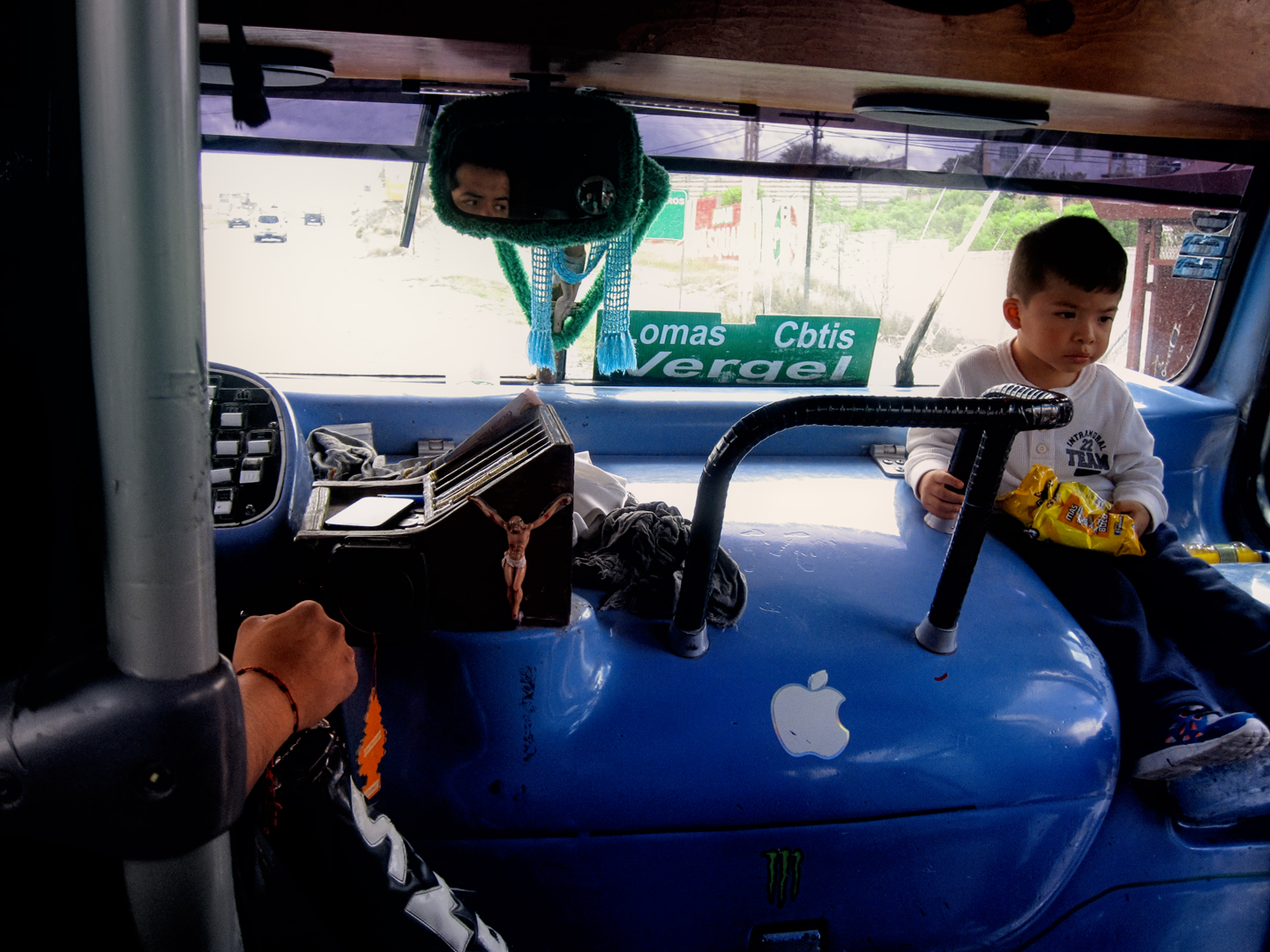
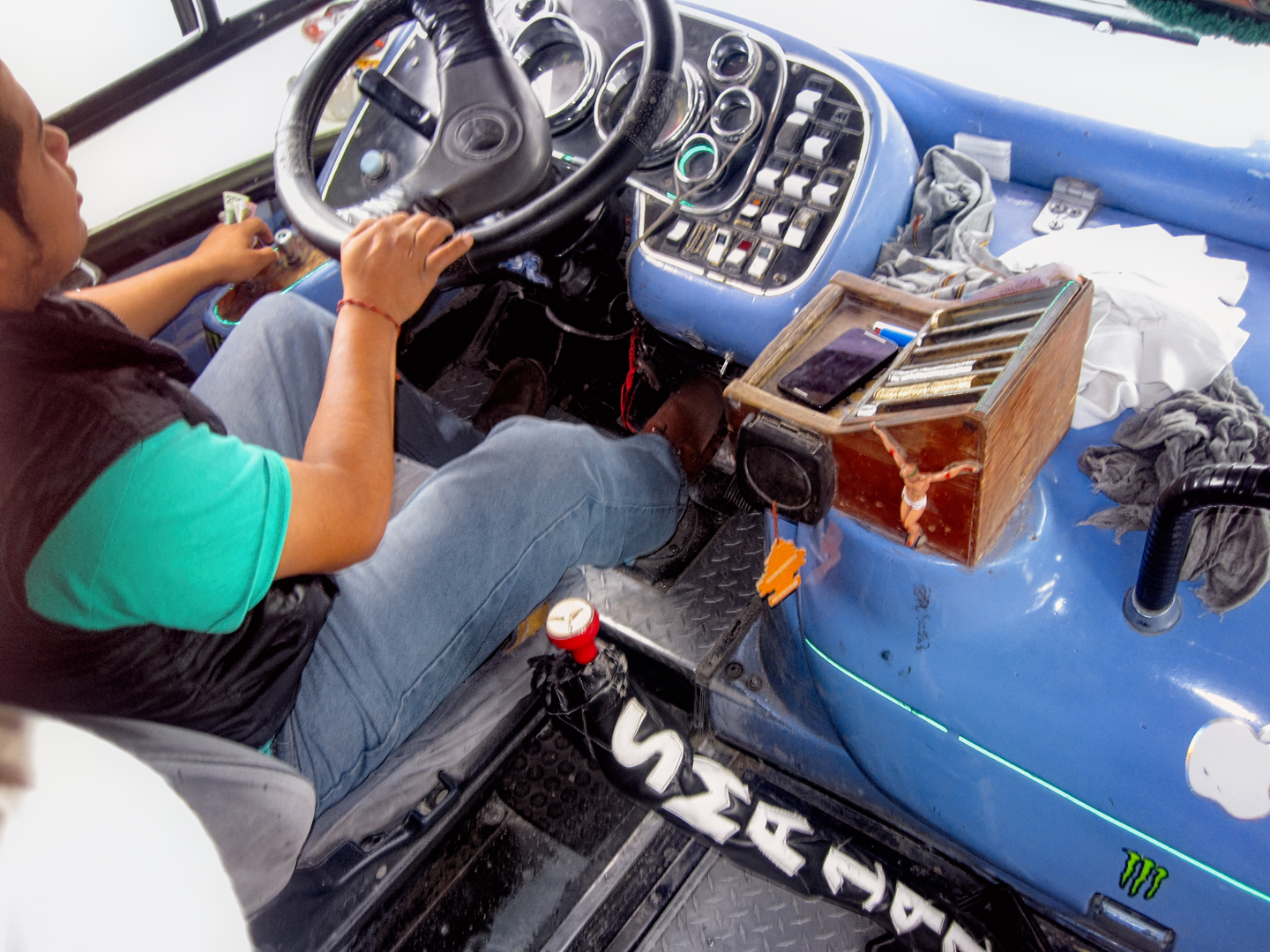
Parking in San Miguel de Allende is a nightmare, even when there isn’t a festival going on, so we left the Jeep at the San Ramon, and took a bus into town. So easy!
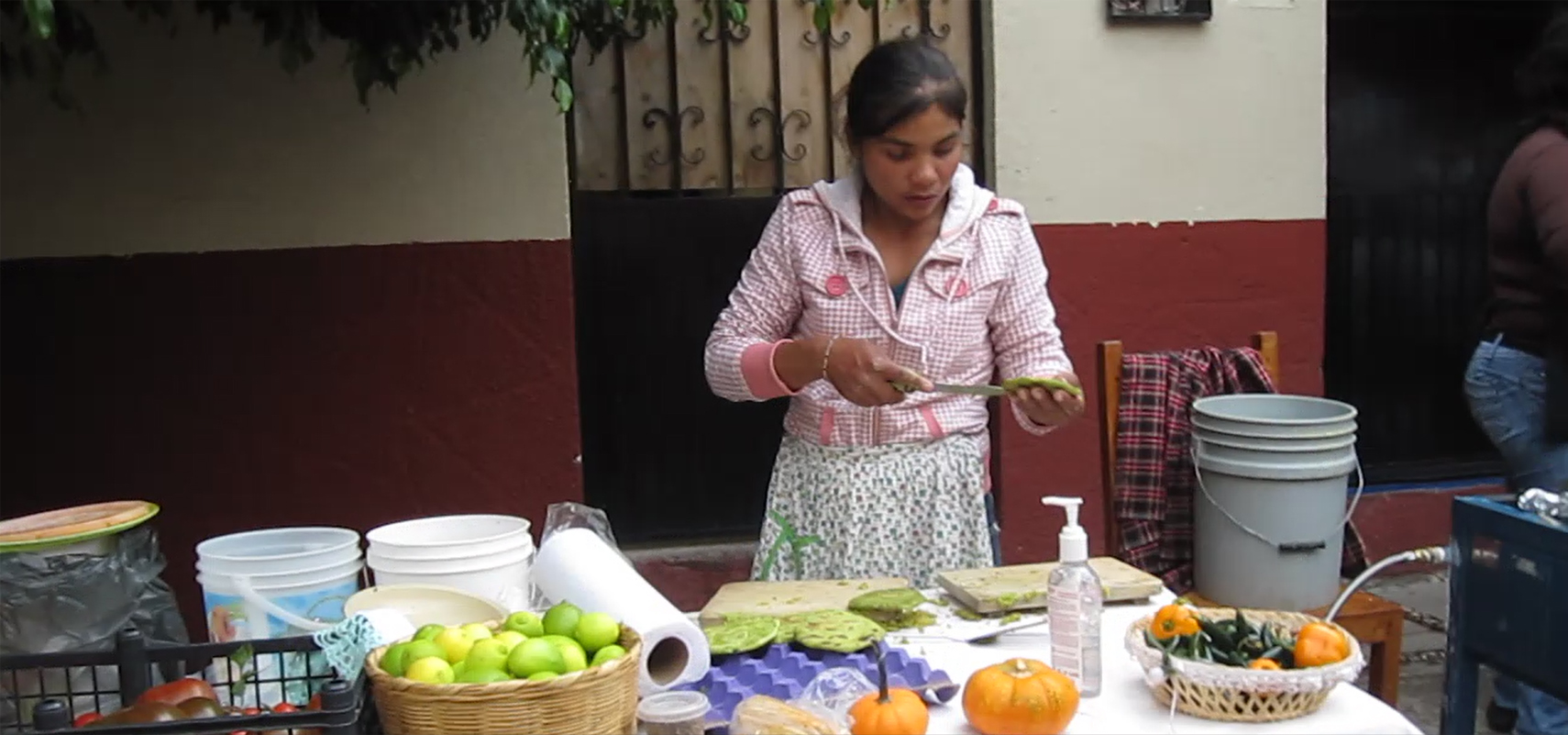
The bus stopped in a neighborhood near the center of town. There was a street fair happening, with a guitar player and fresh food being served. The people, all local folk, were welcoming, and a carnival-like atmospere was already building.
Computer and Tablet Users: Click on any Photo to Expand the Image to Full Screen
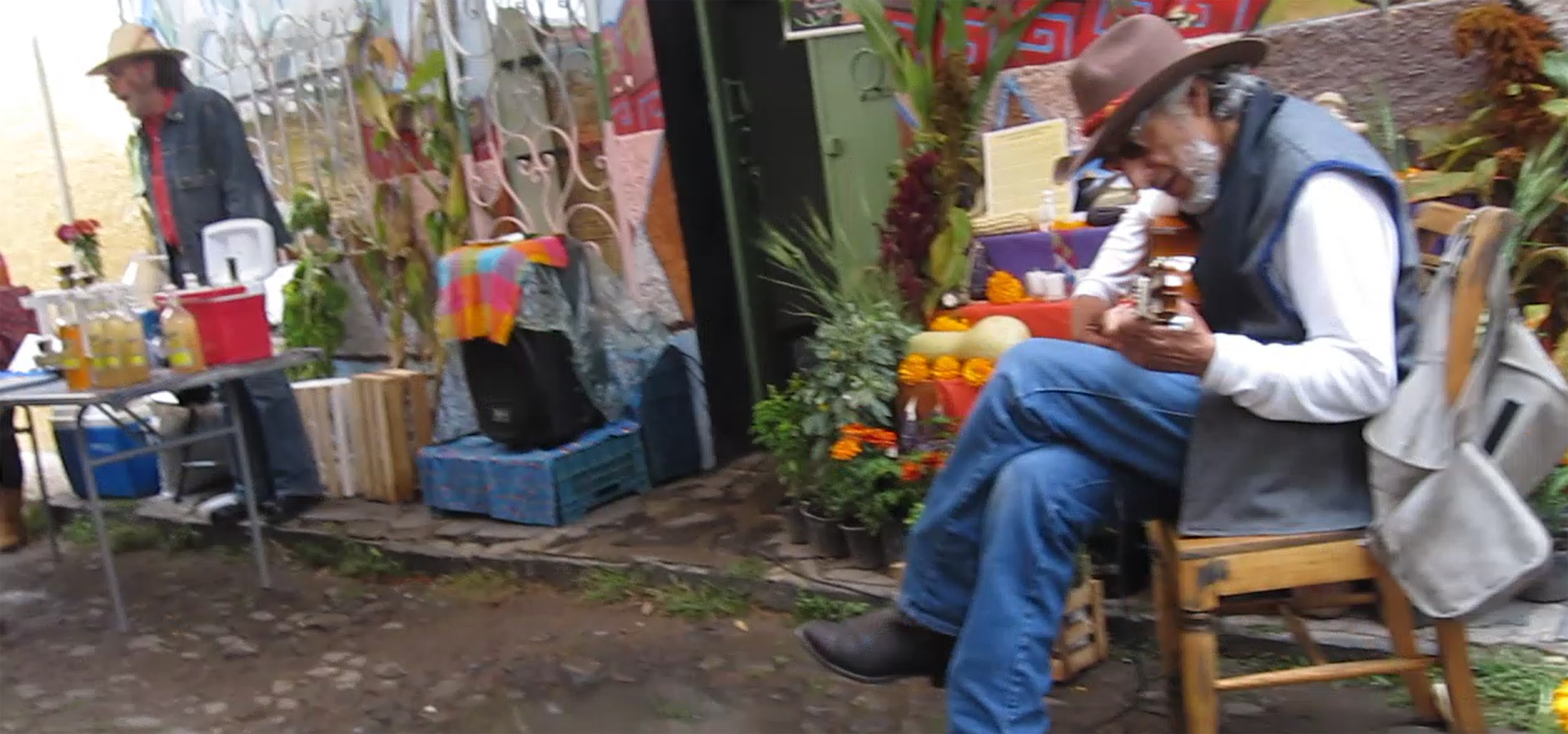
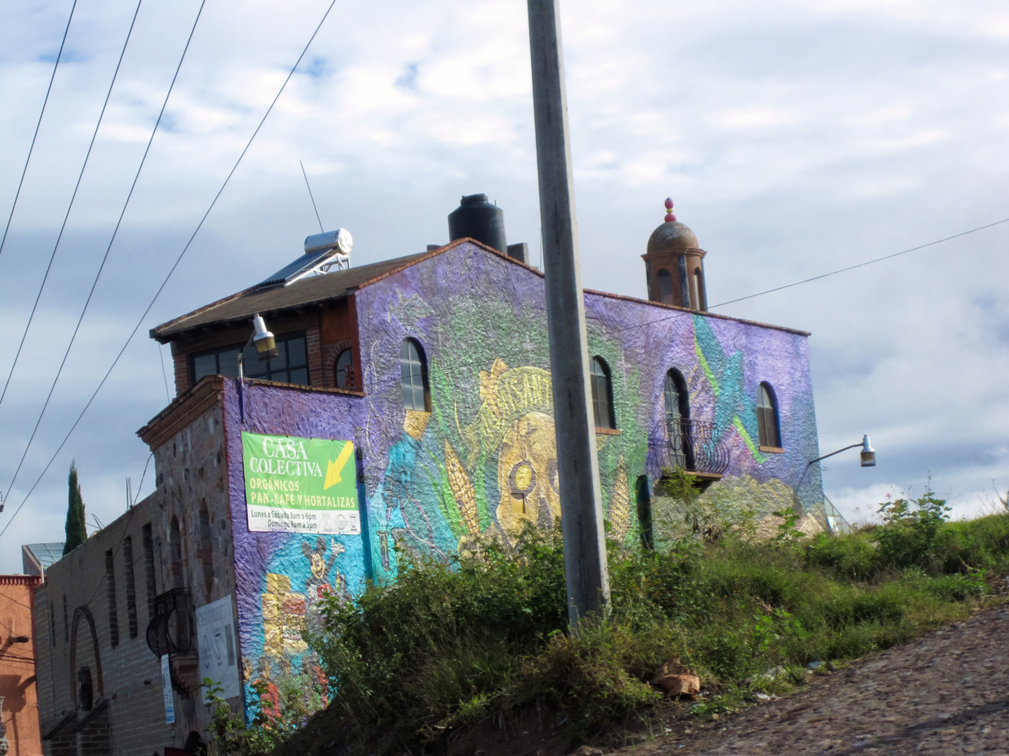
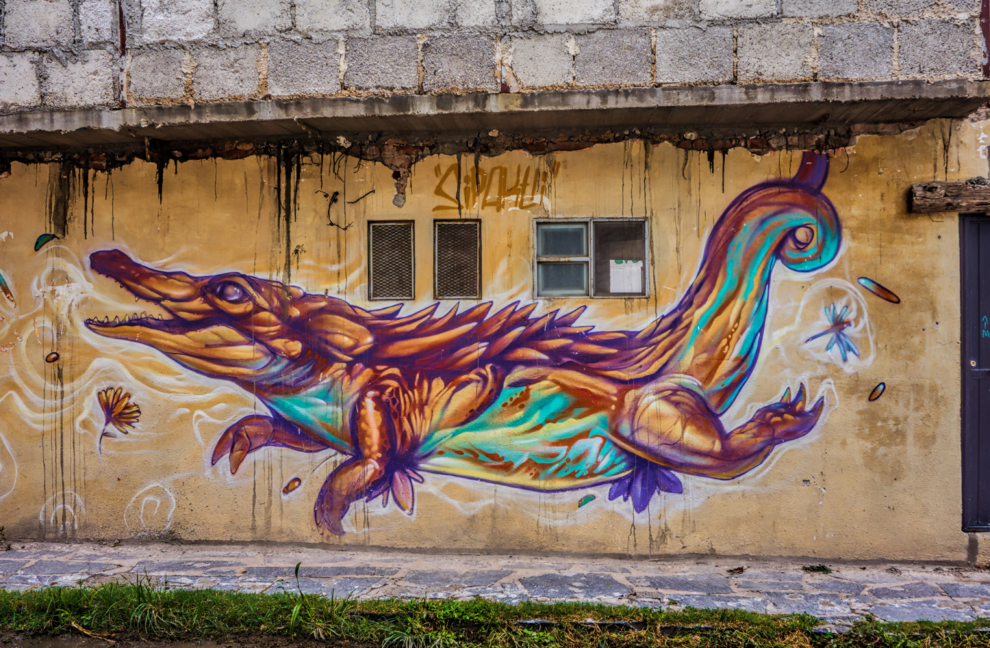
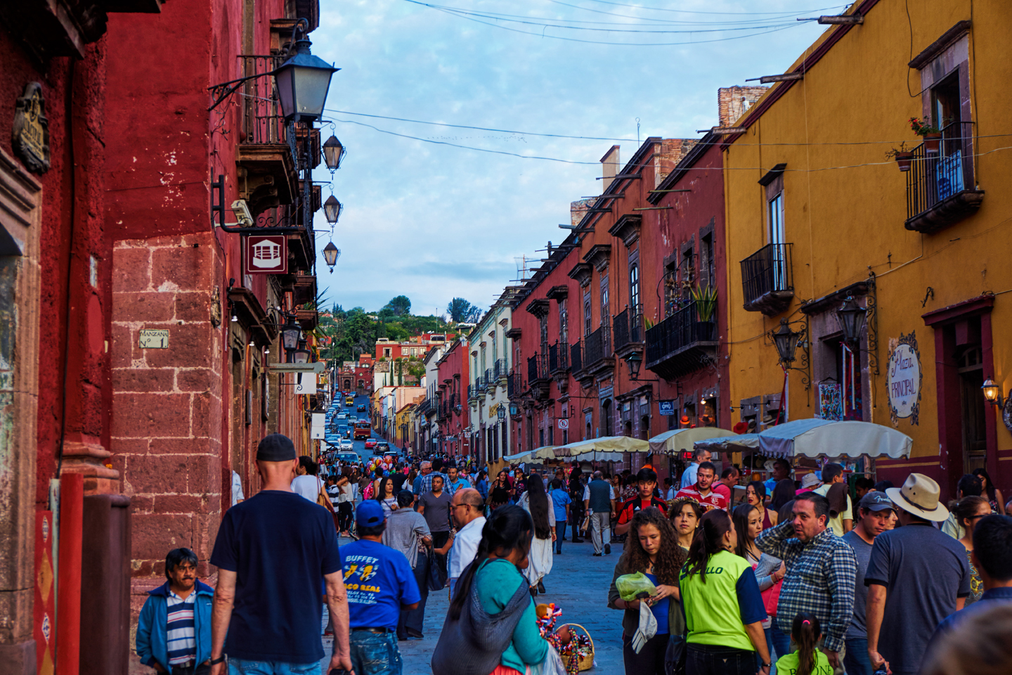
Walking toward the Jardin, San Miguel de Allende’s main plaza, we passed through a barrio called the Colonia Guadalupe, famous for colorful murals:
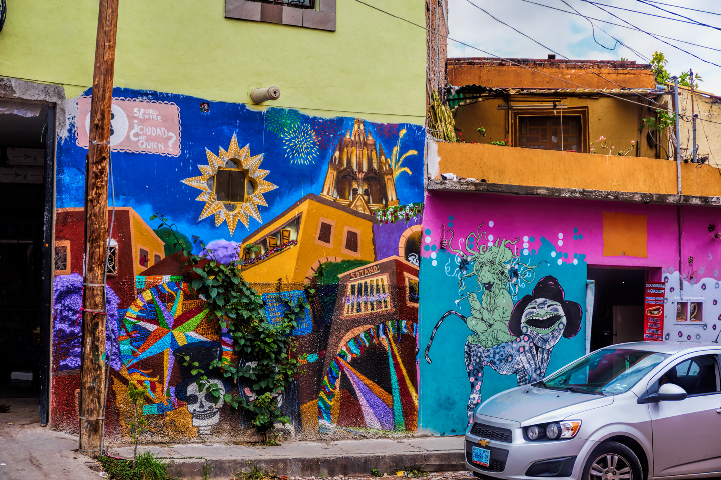
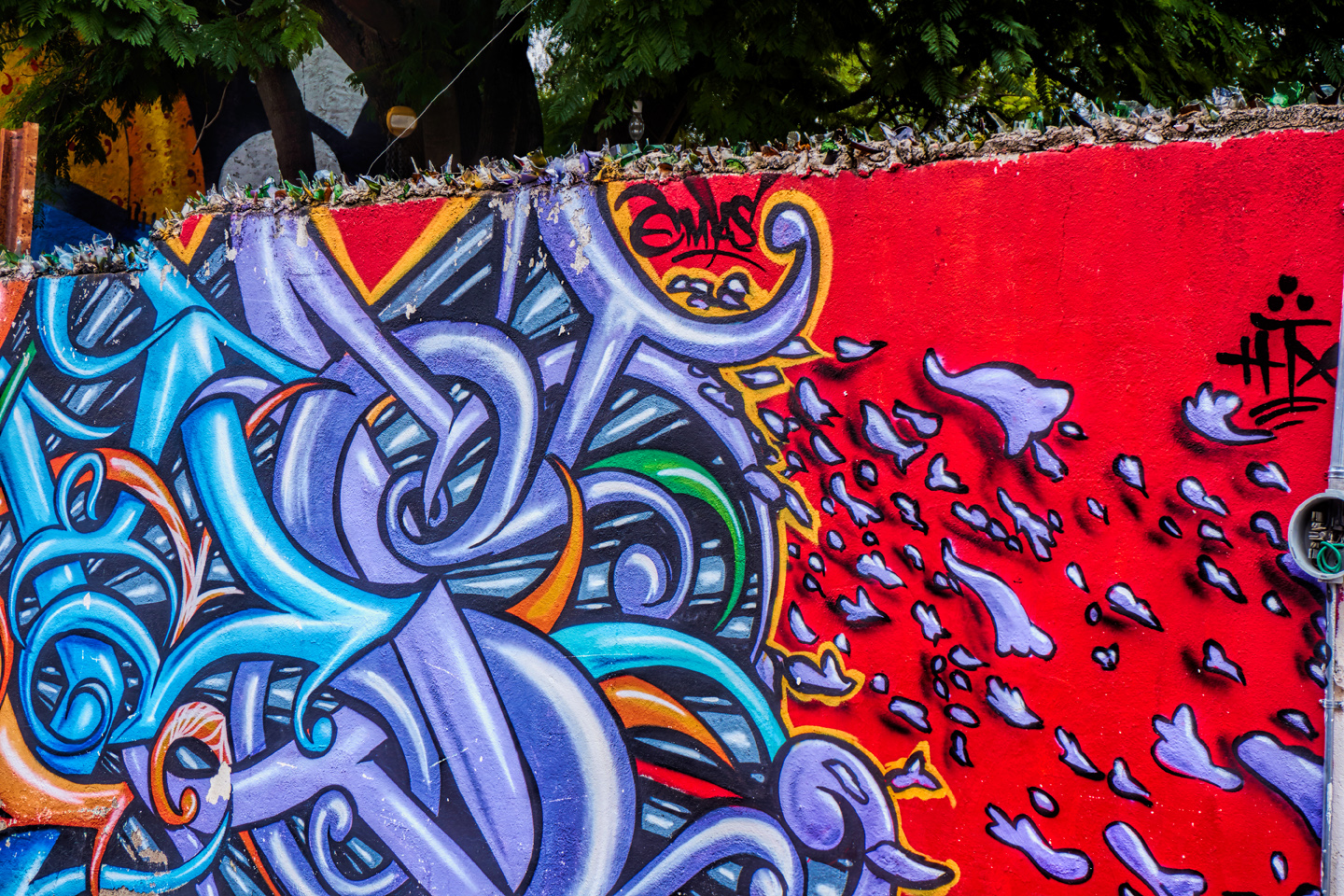

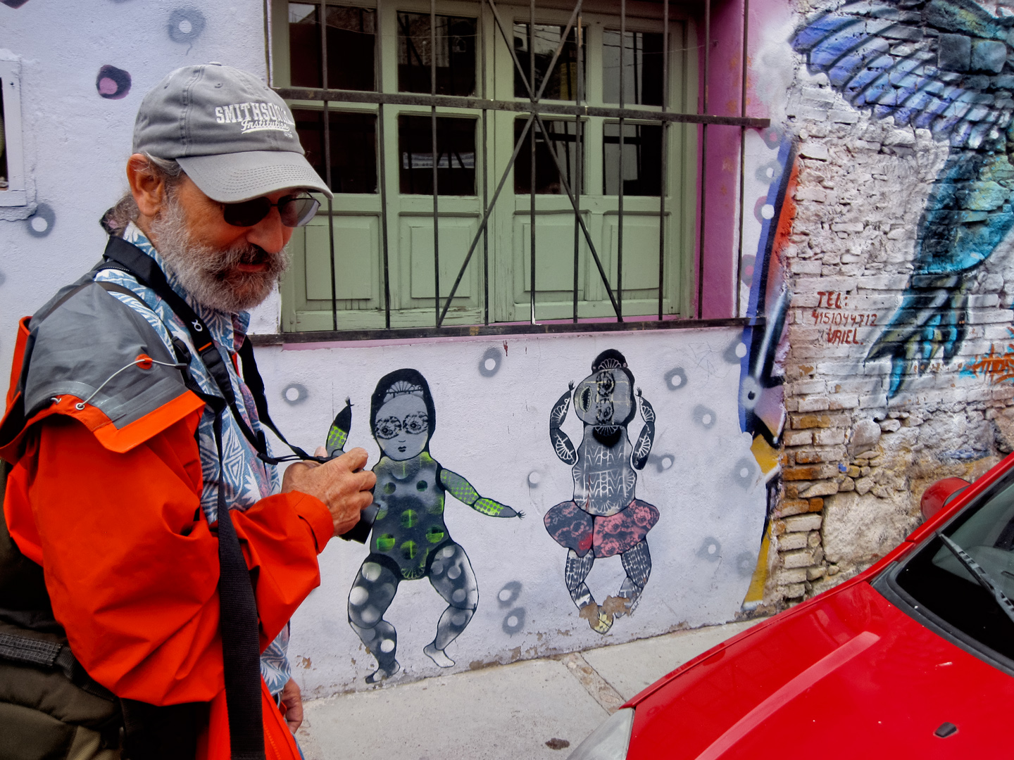
The murals are an evolving art form, and the artists have a tendency to upgrade their work, adding to, or simply painting over their original designs. What we saw on our stroll through the Colonia in 2015–the designs pictured here–have mostly been replaced (some more than once) during the ten years that have passed since then. San Miguel de Allende is justifiably proud of their vibrant art scene, and the murals are a wonderful example. This part of our walk set the tone for us. We hadn’t even reached the Plaza, and we were already feeling celebratory!
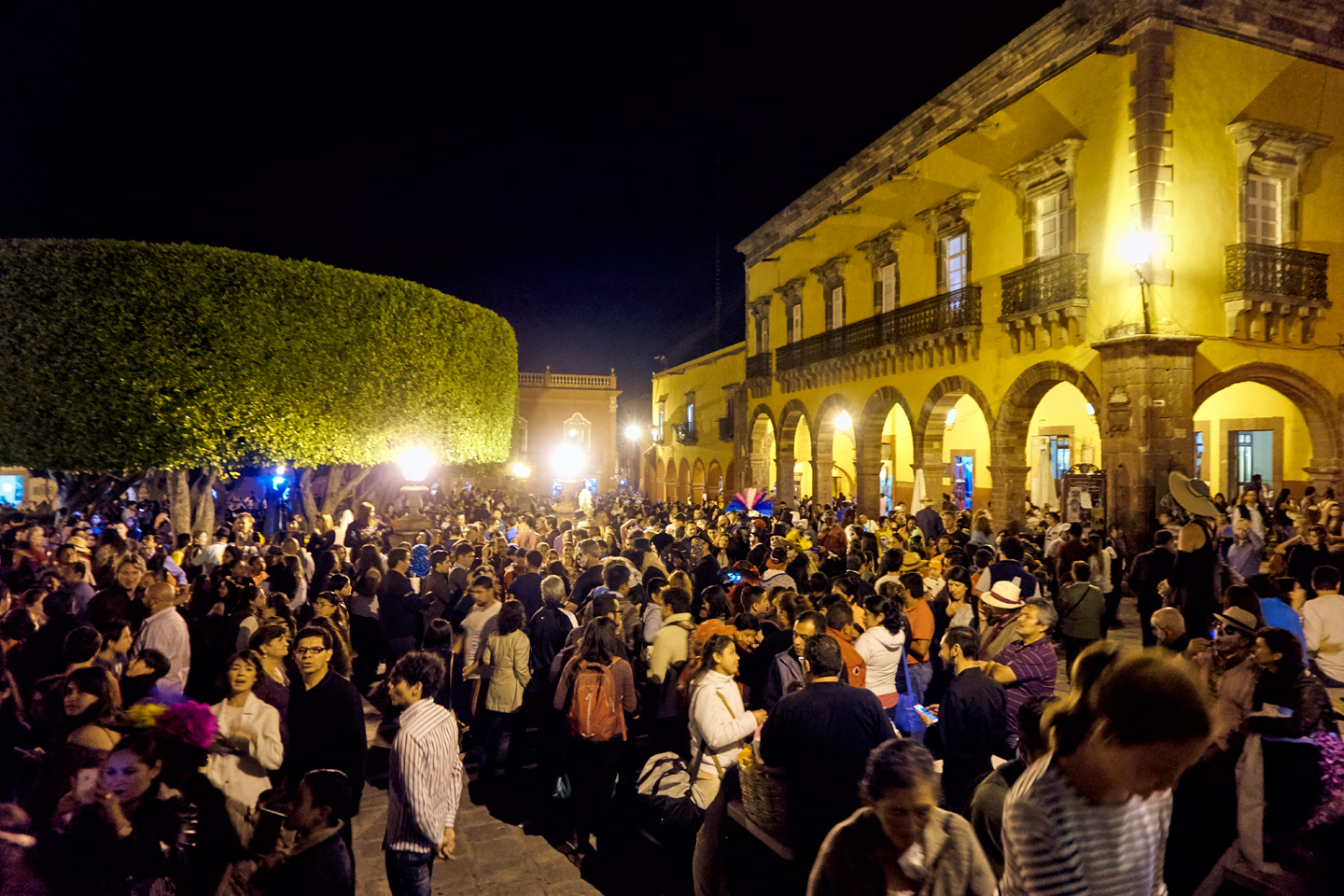
It’s fairly easy to get your bearings in San Miguel de Allende. The gothic tower of the church rises above the Jardin, the Plaza de Allende. It’s visible from practically everywhere, so all you have to do is walk toward it, and you’ll end up right where you need to be. From what we were told at our hotel, there wasn’t likely to be a lot going on just yet. The main celebration was scheduled for Saturday night, November 1st. Today, Friday, there would be a fiesta for families, with everyone in costume, but that wouldn’t start until sundown.

By the time we reached the Jardin, we discovered that there was plenty going on! Everything, in every direction, was Puro Mexico, sights you’d not see anywhere else!
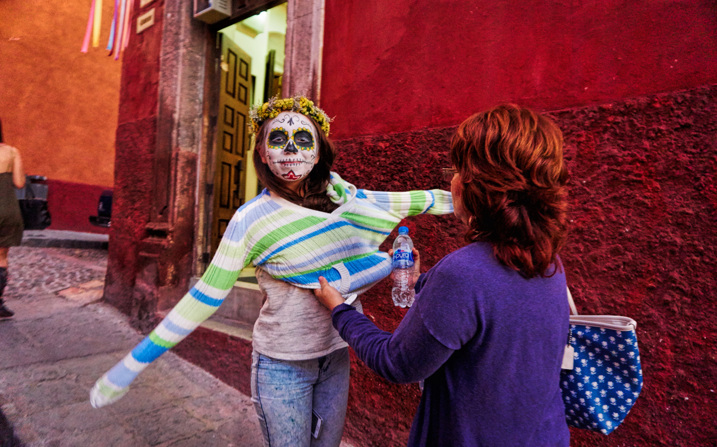
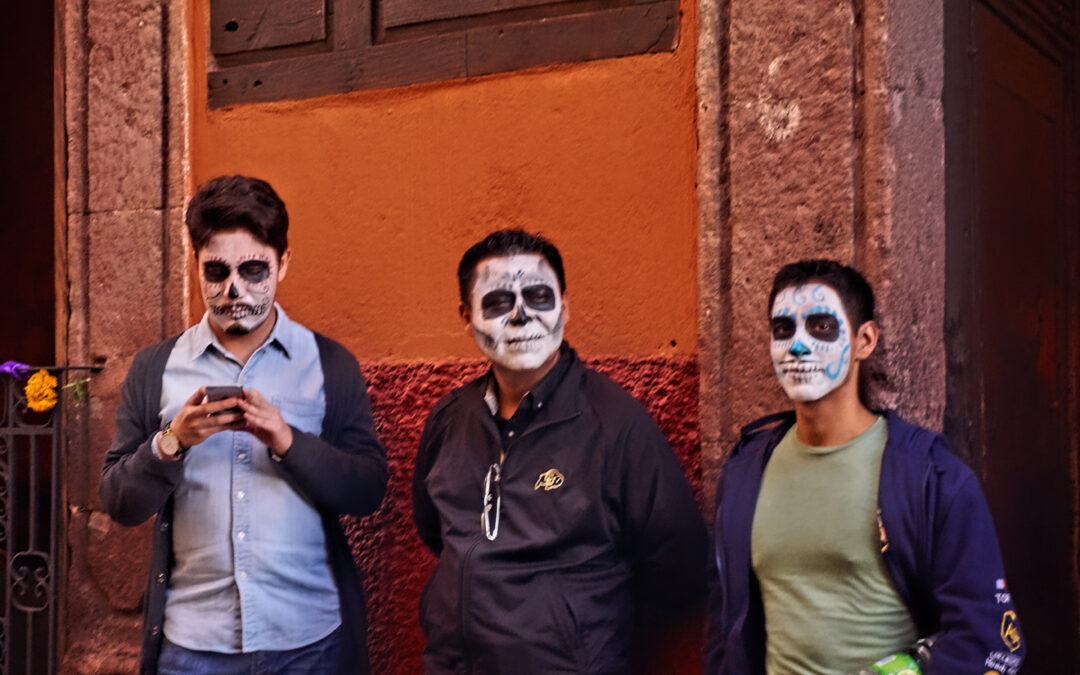
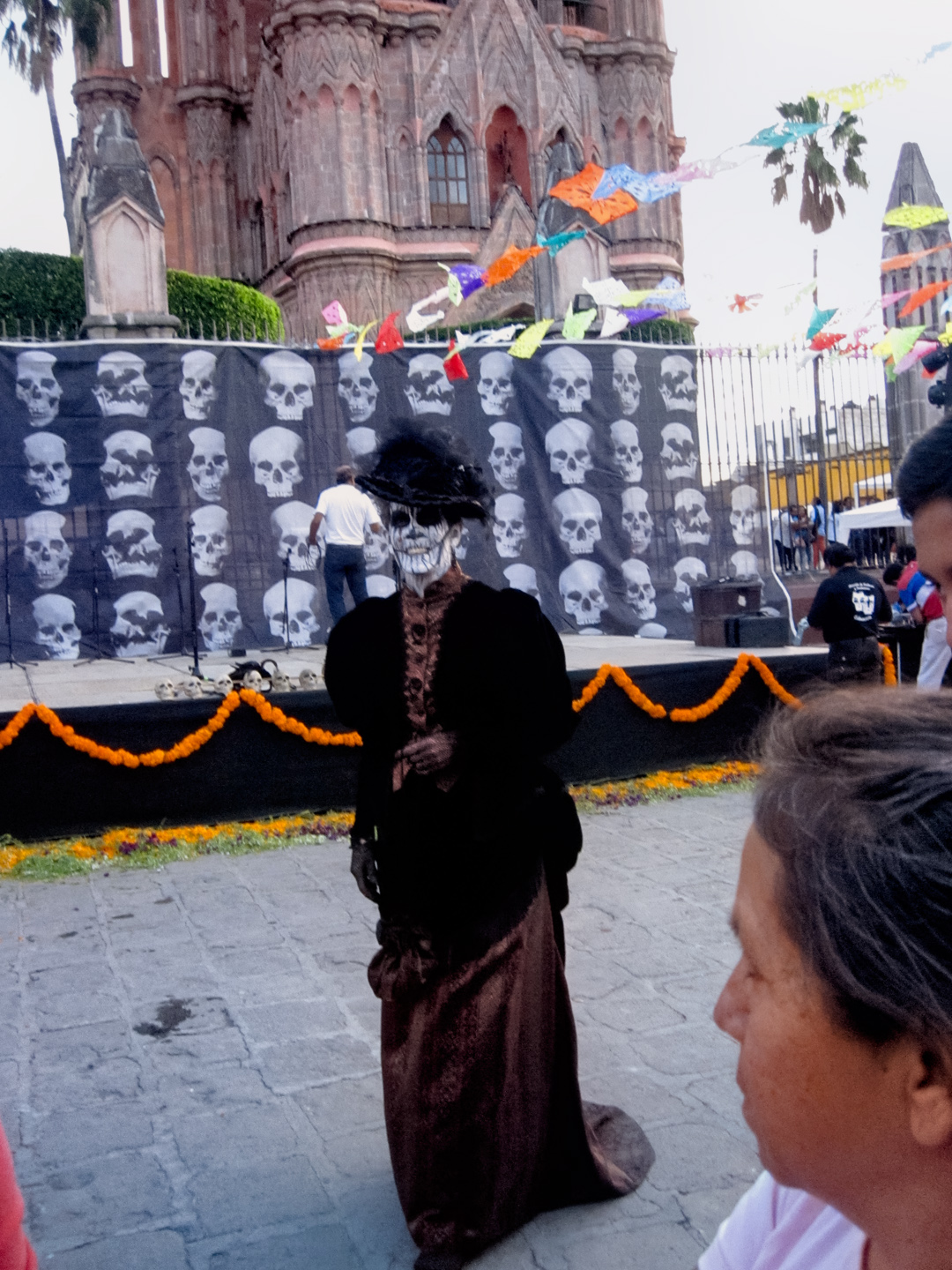
The folks at the San Ramon weren’t entirely wrong. There was nothing organized happening at the Jardin, but there were plenty of locals in costume, and the painted faces were pretty much everywhere. “Artists” were set up on every street corner, ready to accommodate all requests. Mike and I didn’t go for it; we didn’t want paint in our beards. In hindsight, we probably should have done it anyway, become participants, rather than just observers!
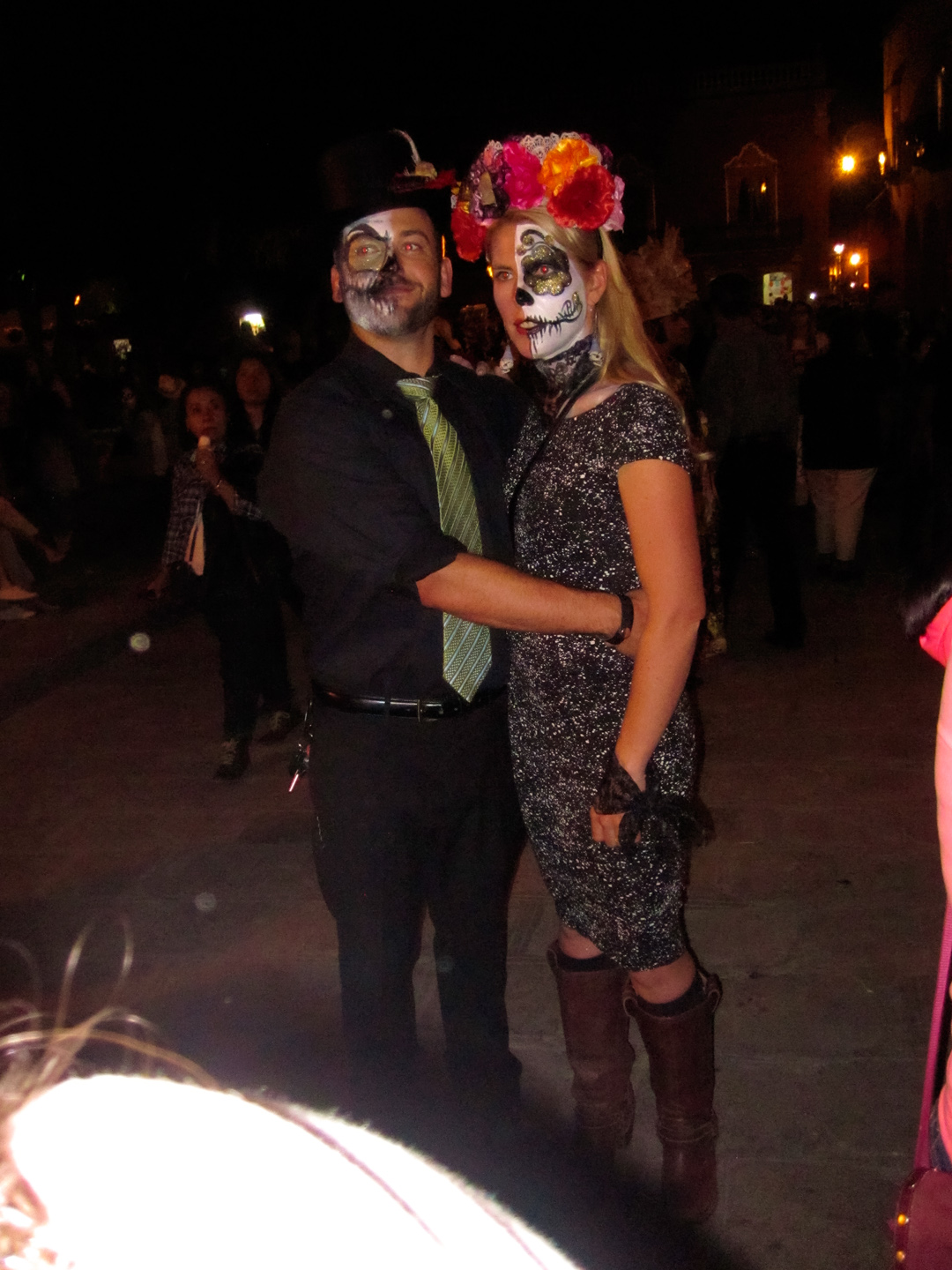
Mike Fritz and friend (La Catarina!)
The Day of the Dead is about much more than costumes and face paint. The actual national holiday, on November 2nd each year, is a day for honoring the memory of loved ones. It’s not a somber event, or a time for grieving. Rather, it’s a day when the living pray for the souls of departed family and friends, and honor and celebrate their memories. Mexico is primarily a Catholic country, and the Day of the Dead is directly tied to the Catholic celebration of All Soul’s Day. As practiced in Mexico, this is a day when families gather at the cemetery, bringing flowers, offerings of food and drink, and personal items that were favored by the deceased. Stories are told, memories are shared, there’s laughter, as well as a few tears. All in all, it’s a relatively healthy way of dealing with the loss of loved ones, and of keeping their memory alive.
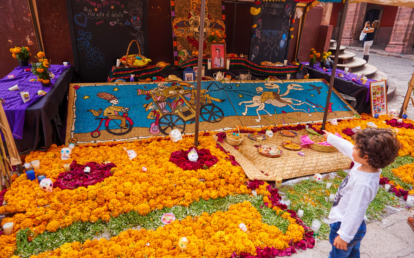
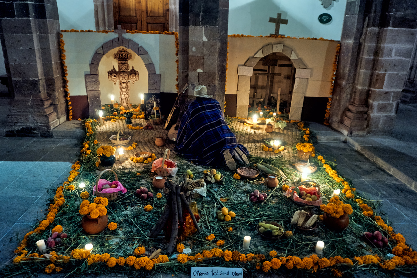
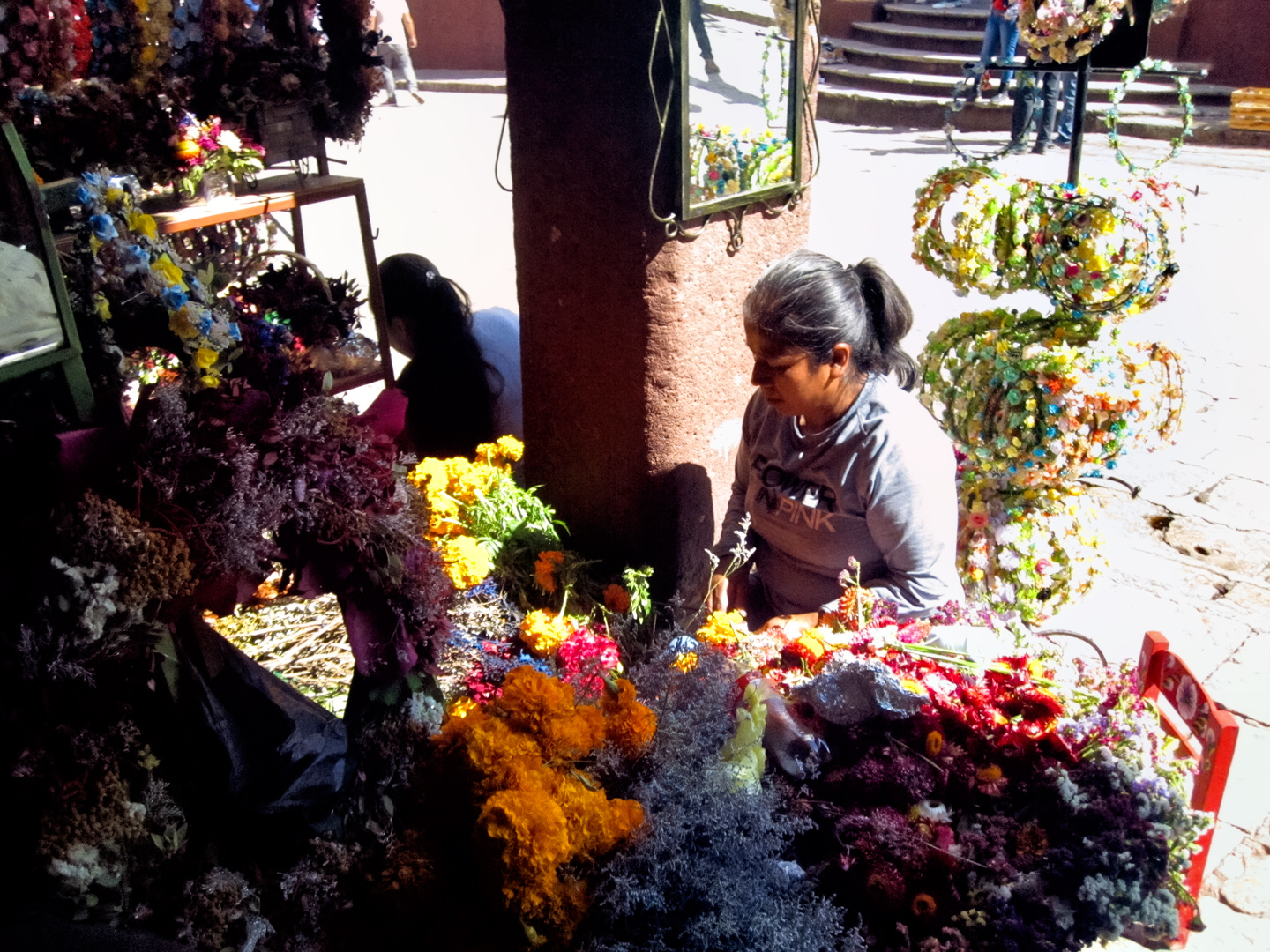
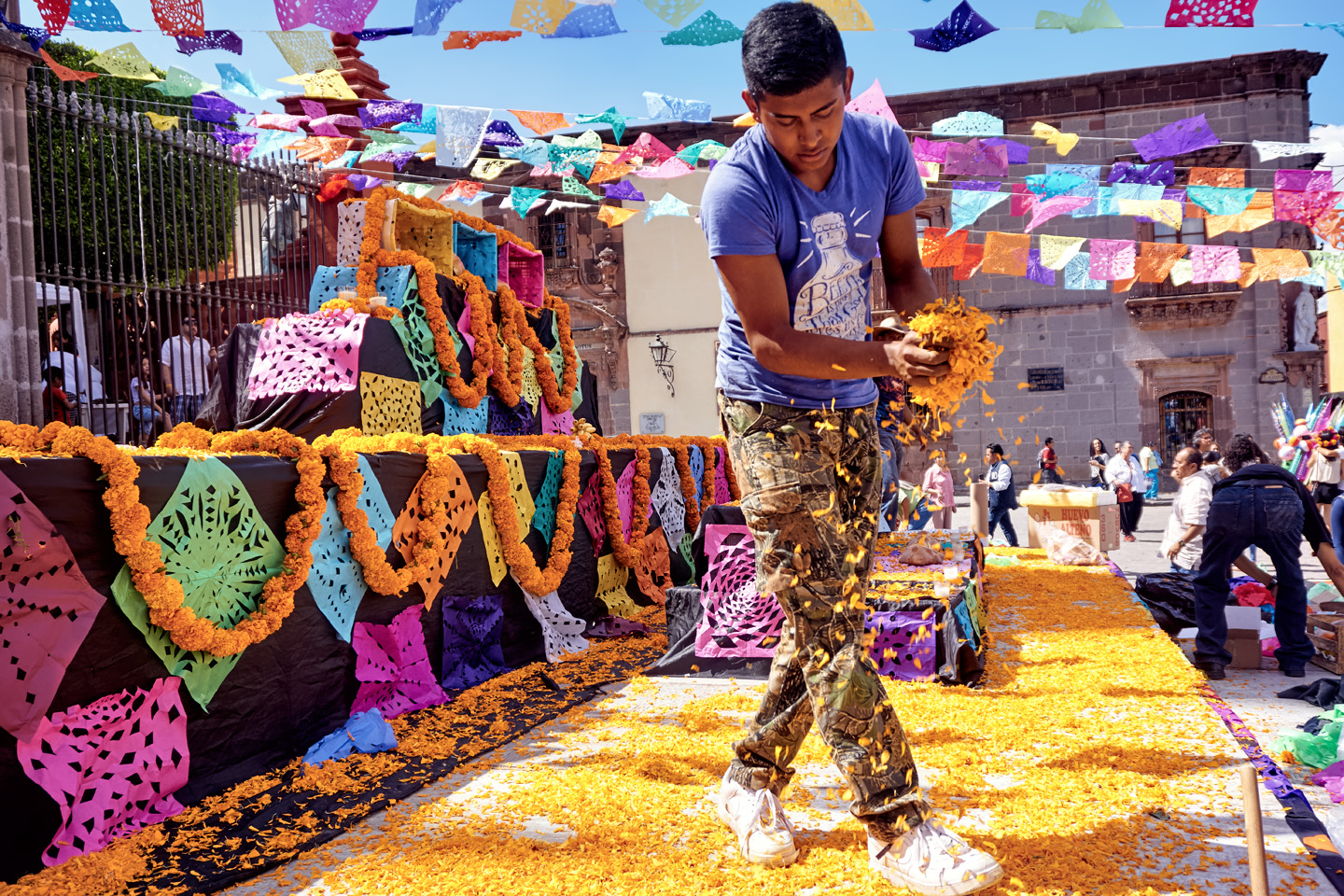
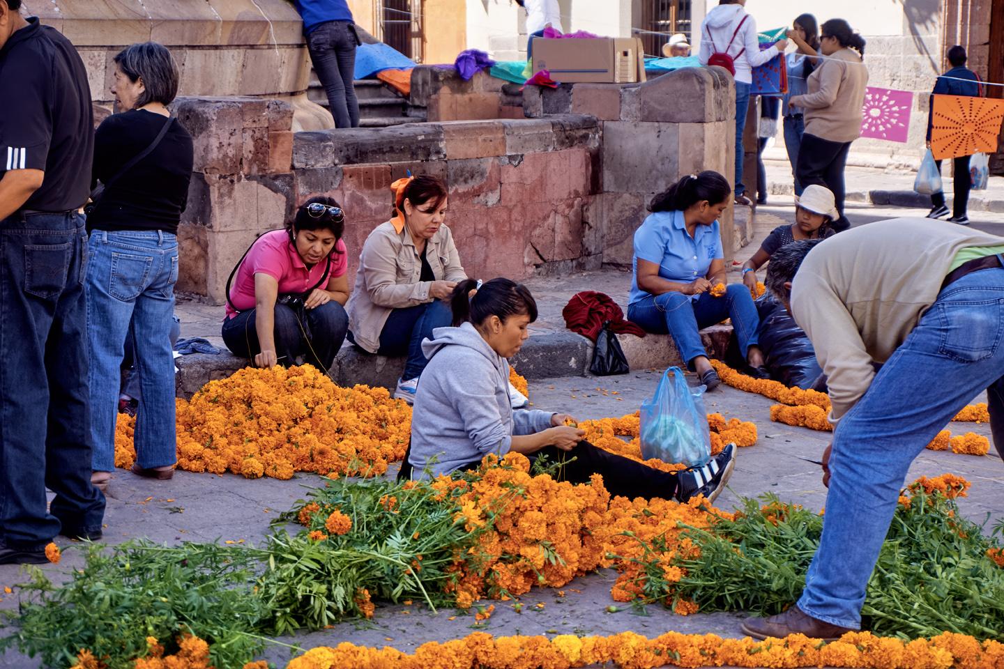
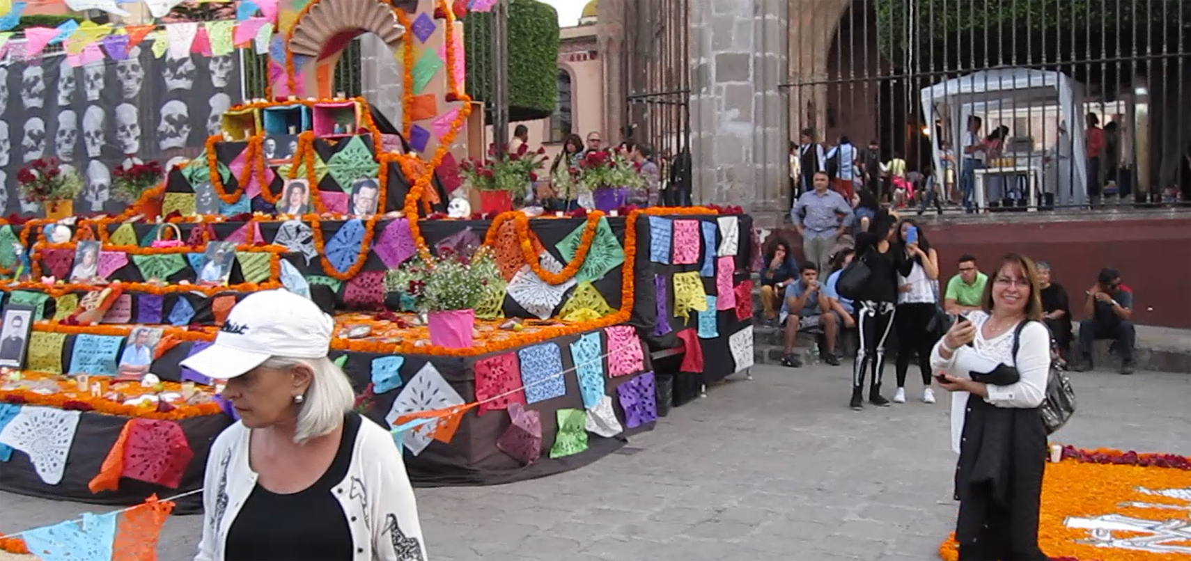
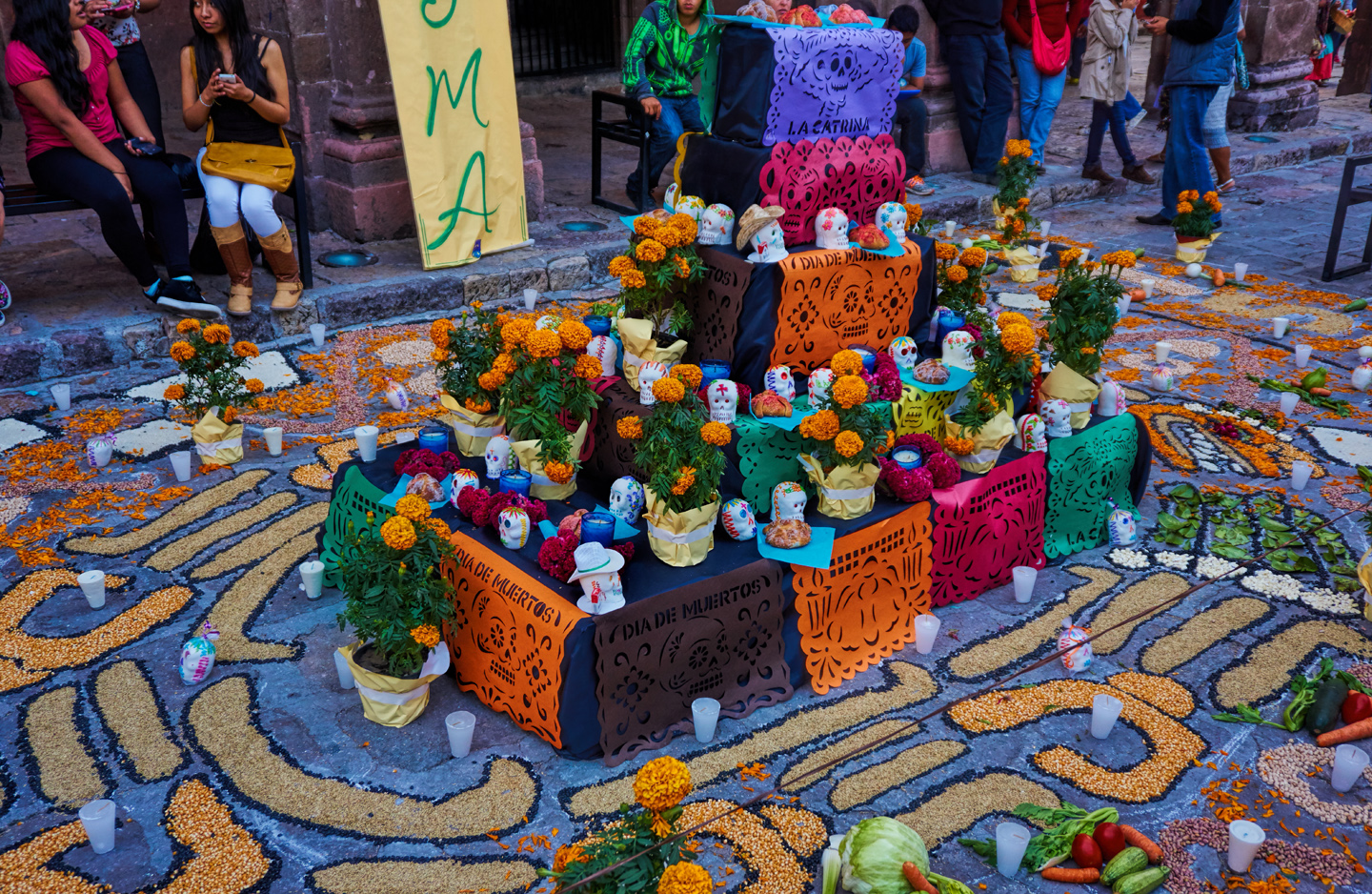
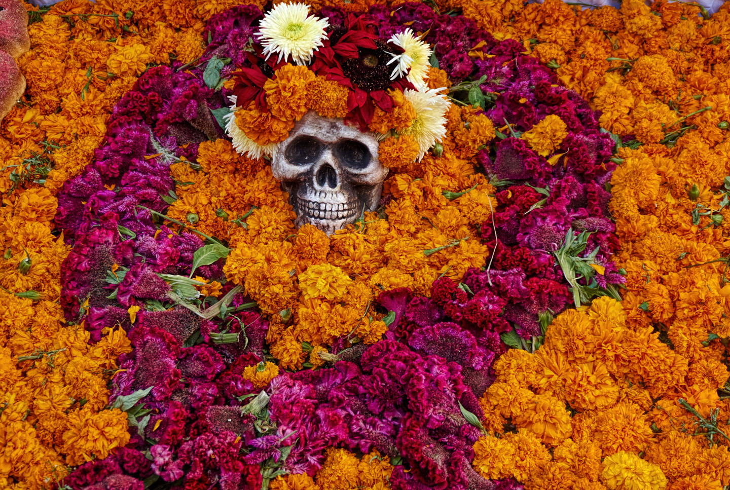
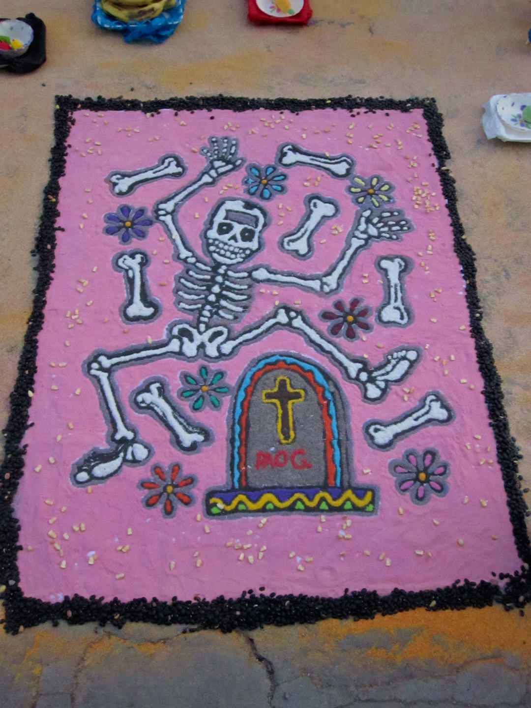
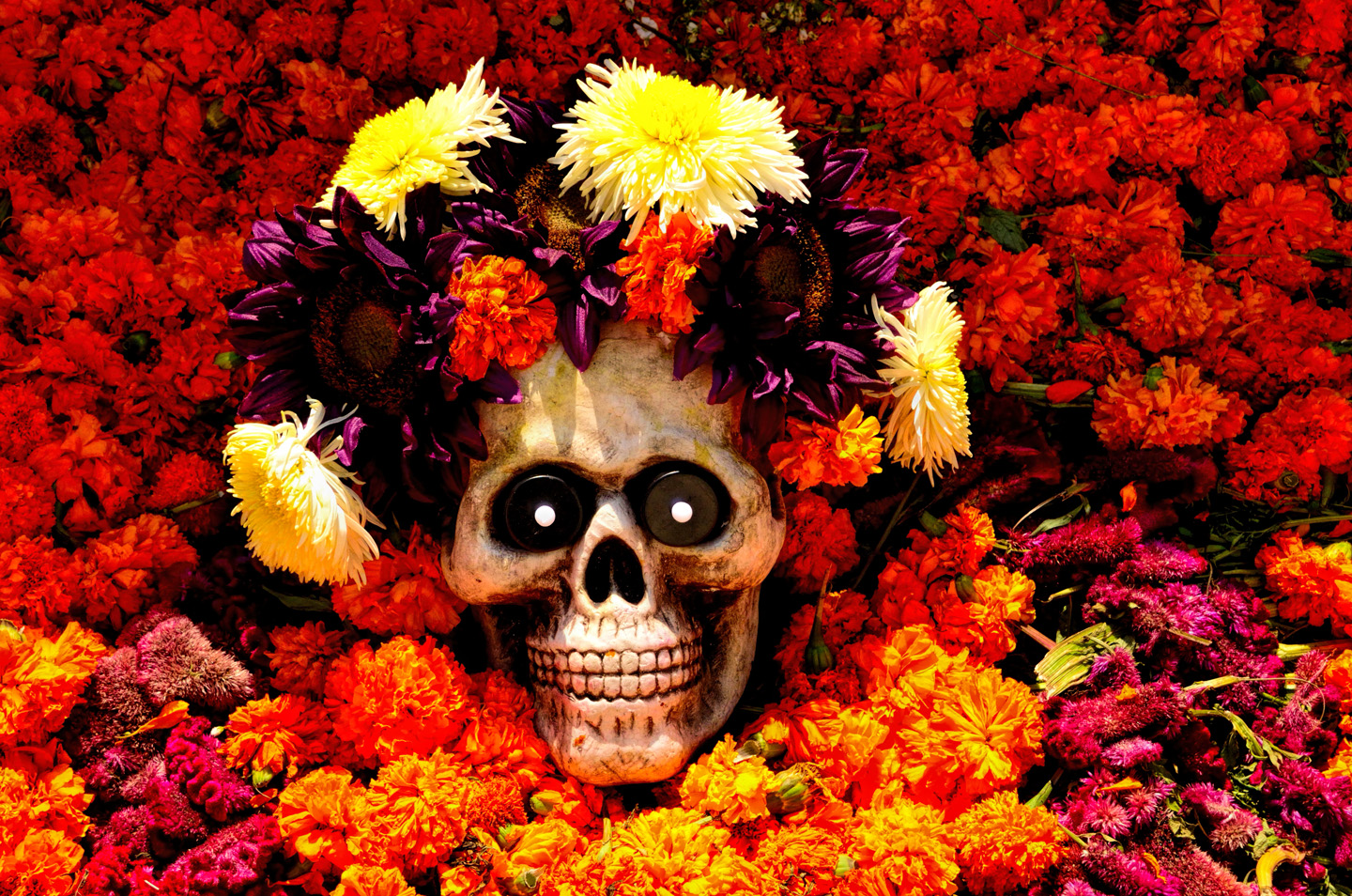
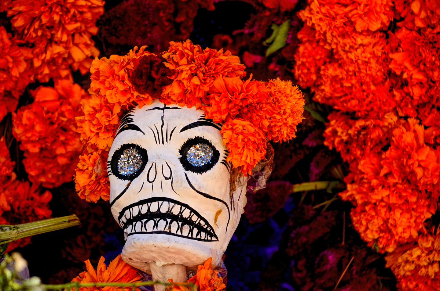
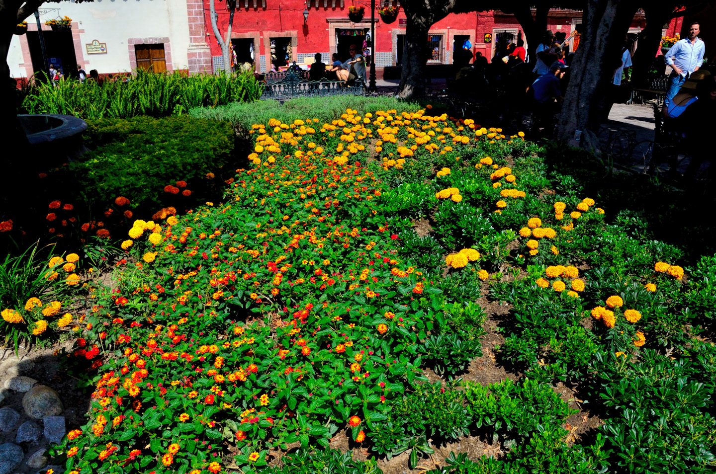
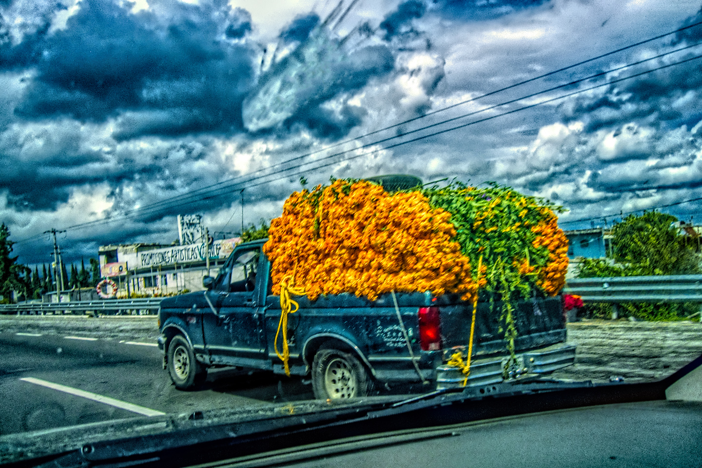
Throughout the three days of the Festival, hand-built altars known as “ofrendas” pop up in the Plaza, on street corners, in courtyards, anywhere there’s space. Families decorate the altars with photographs, objects, and artwork that would have been meaningful to the relative being honored. Ofrendas are always decked out with flowers, primarily marigolds, as the bright color and strong scent is said to be “strongly” attractive to spirits. Skeletons predominate!
The remarkable celebration that this holiday has become began centuries ago, as a tradition in central and southern Mexico. Originally, it was a springtime festival dedicated to an Aztec goddess. That native festival was subverted by the church–a fairly common practice–and the timing of the celebration was moved to the fall of the year, to coincide with an appropriate date on the Catholic calendar. The original Aztec traditions never held sway in northern Mexico, so in that region, the Catholic observance was never more than just that, a call to prayer that was private, and subdued, not at all a public spectacle.
Traditional Ofrenda, Graveside Offerings
All of that changed after the Mexican government created the national holiday. Today, the Dia de los Muertos has been declared to be an Intangible World Heritage by the United Nations, and it’s celebrated throughout Mexico, as well as in many other parts of the world–anywhere that is home to any significant number of Mexican immigrants. But there are a few spots that are justifiably famous for having the best, the gaudiest, and the most enthusiastic celebrations of all. Opinions vary, but everyone’s list includes the city of Oaxaca, in the state of Oaxaca. The town of Patzcuaro, in Michoacan, as well as Mérida, in the Yucatan. And then there’s this place: San Miguel de Allende. We chose it, from among all the other possibilities, and, so far, at least, it was looking like we chose well!
Computer and Tablet Users: Click on any Photo to Expand the Image to Full Screen
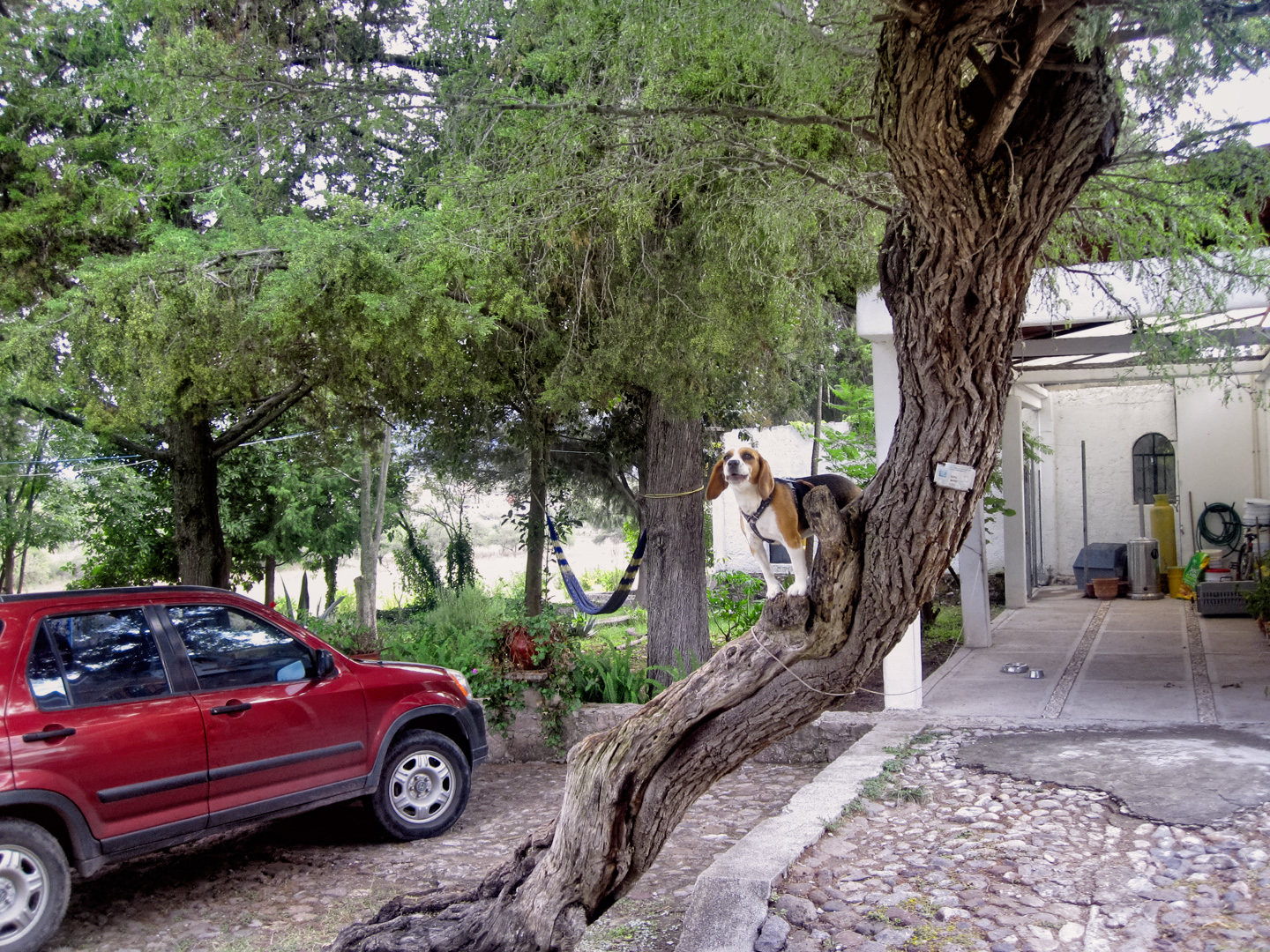
I’m not sure why this dog was in this tree, but he seemed at home!
After wandering the Plaza for a bit, we caught the bus back to our hotel, where we grabbed a bite to eat and changed clothes. Then we caught the bus back to town, just in time for the sunset, and the start of the festival!
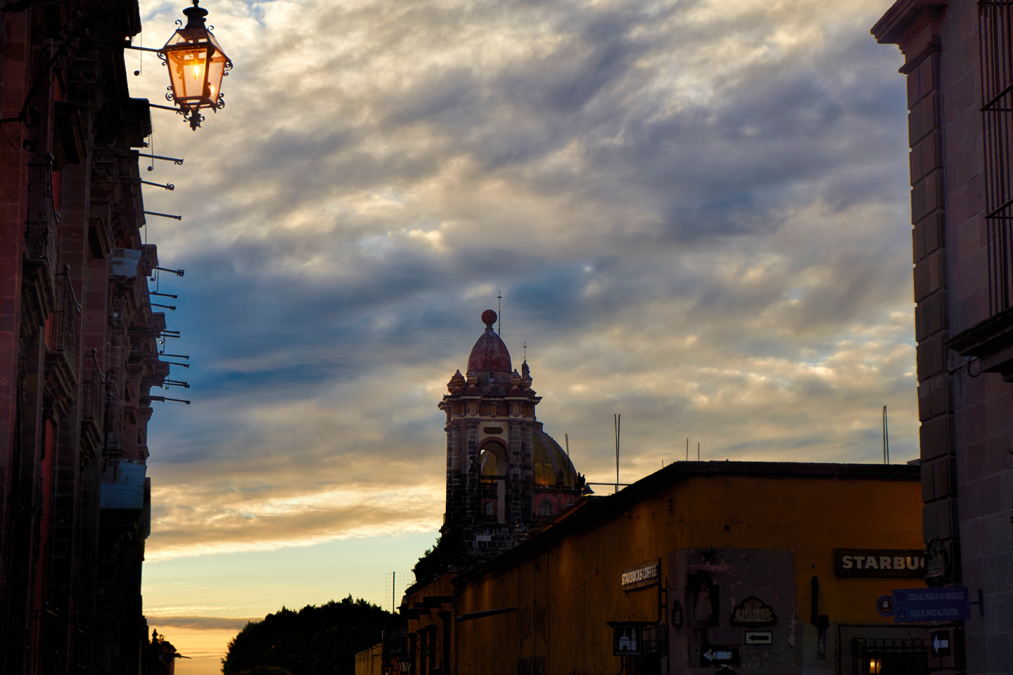
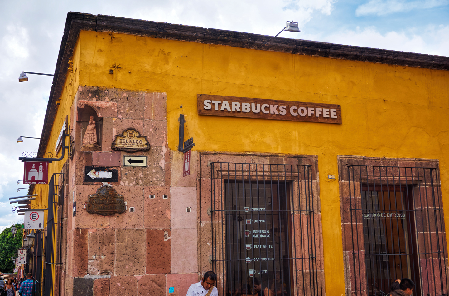
Sun going down over Starbucks in San Miguel de Allende!
The run-up to the Day of the Dead starts on October 31st, the date that we celebrate as Halloween in the U.S. That’s the day when our kids dress up as ghosts and goblins, super heroes and Disney princesses, and then wander around our neighborhoods extorting candy from our neighbors. (Okay, so it’s not REALLY extortion, but the whole notion of “Trick or Treat” implies a threat. “Give me candy, or I’ll soap your windows!” Even though nobody really does that anymore.) October 31st is also the date of another Catholic holiday, this one known as All Saint’s Eve, or All Hallow’s Eve. Officially, we’re referring to the night before All Saints Day, which is celebrated on November 1st, and is, for the Catholics, a day for the veneration of all saints and martyrs.
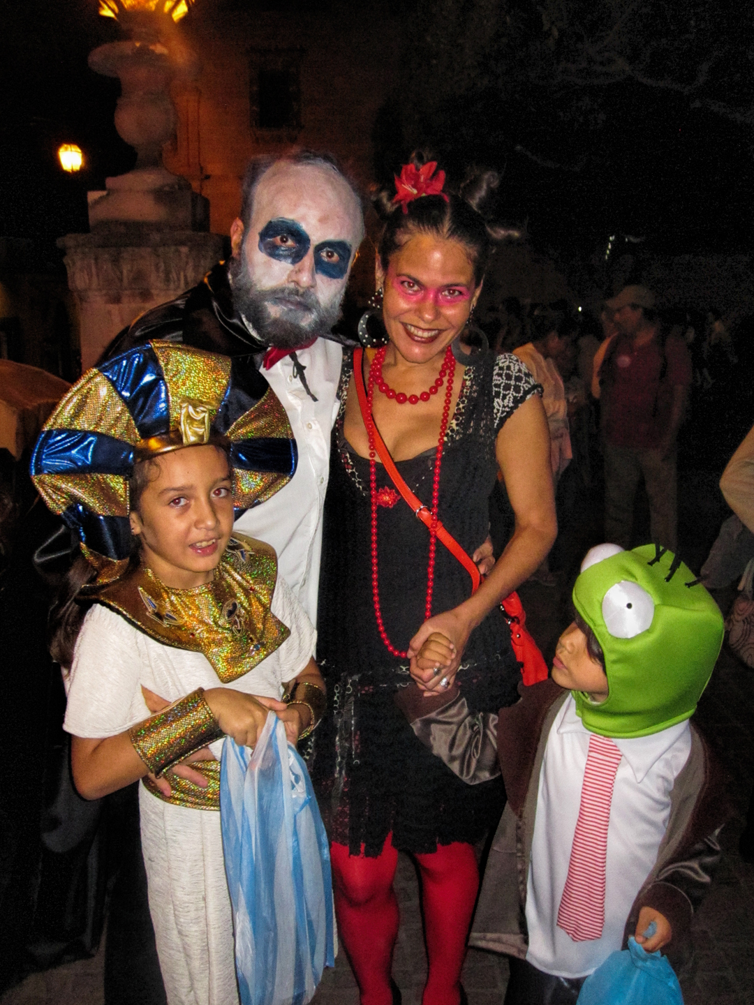
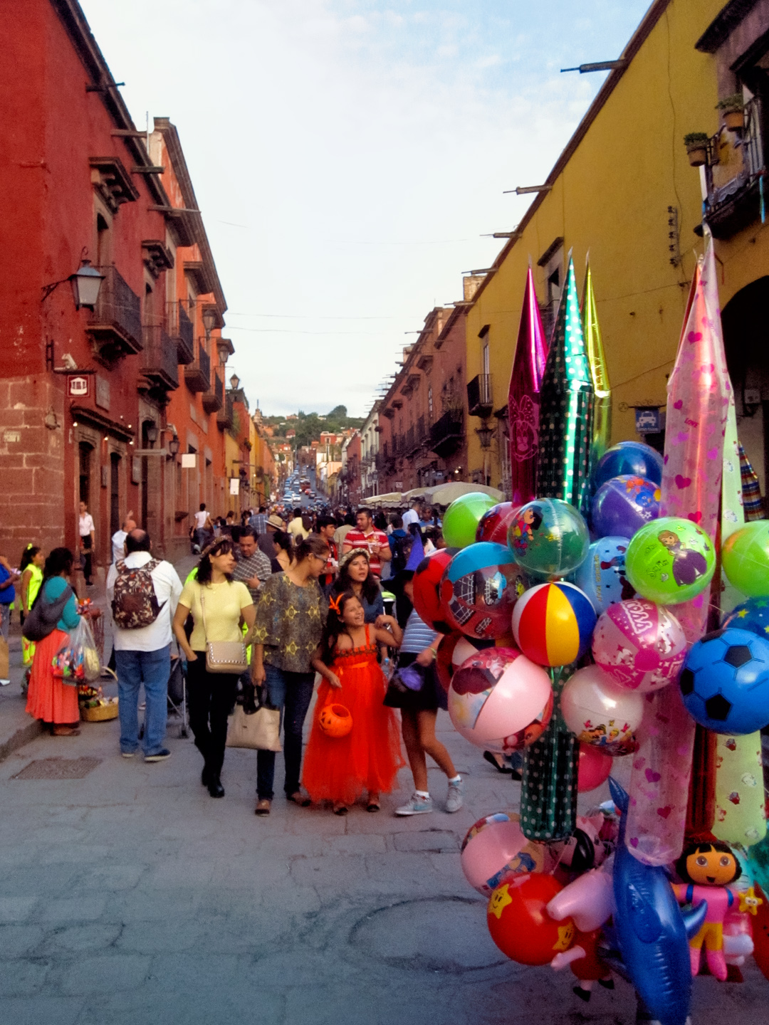
In Mexico, these three days are generally considered together as one big happy holiday, with discrete parts that happen in a particular sequence. I can’t say with any certainty that the structure and flow of the festivities is exactly the same in other parts of Mexico, but in San Miguel, the night of October 31st is all about costumed kids and candy:
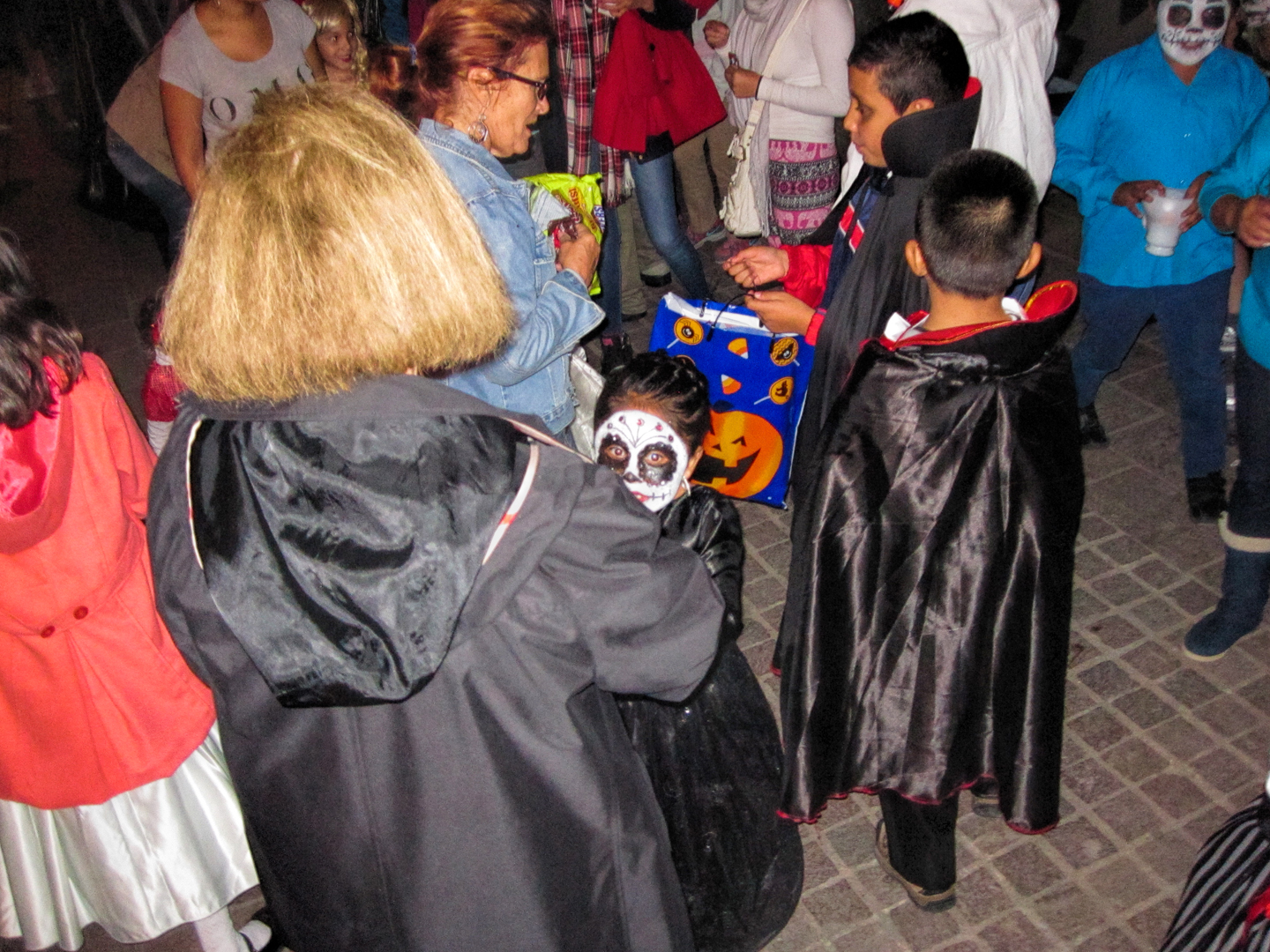
Local Seniors, mostly from the expatriate community, station themselves around the Plaza and pass out candy to the children from “Costco-sized” bags. It’s so much like Halloween, it was totally familiar!

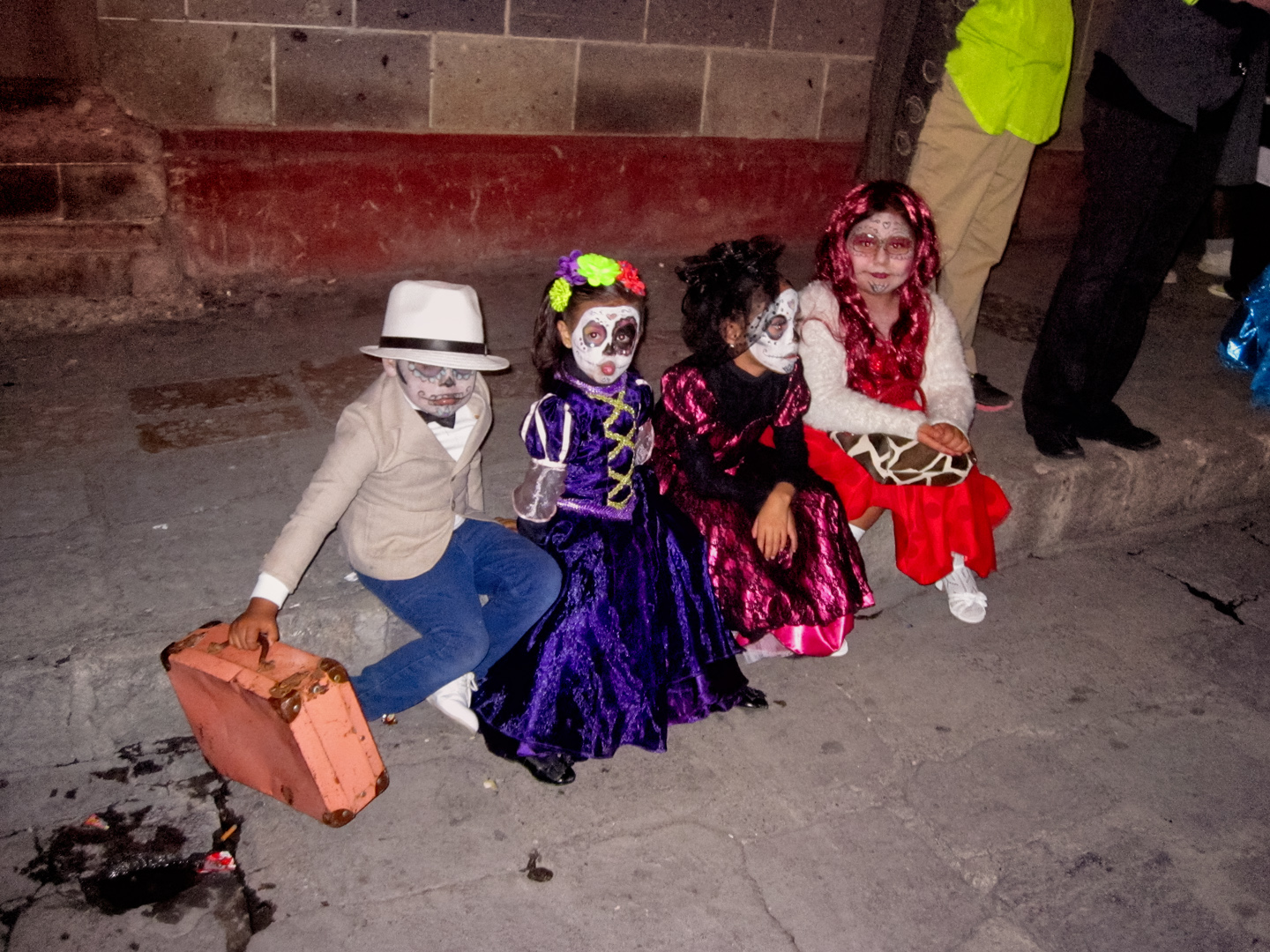
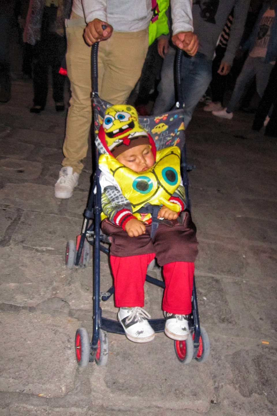
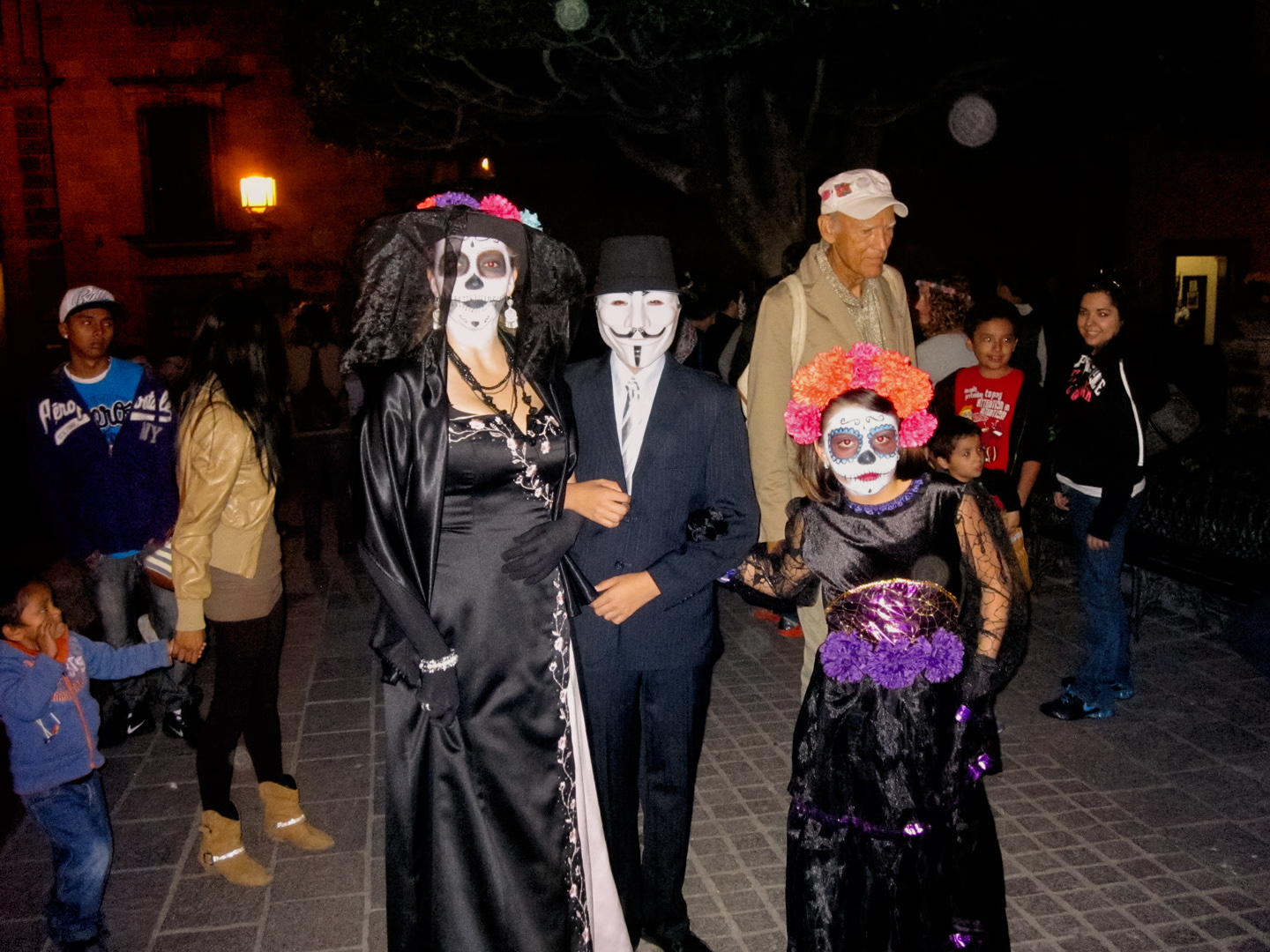
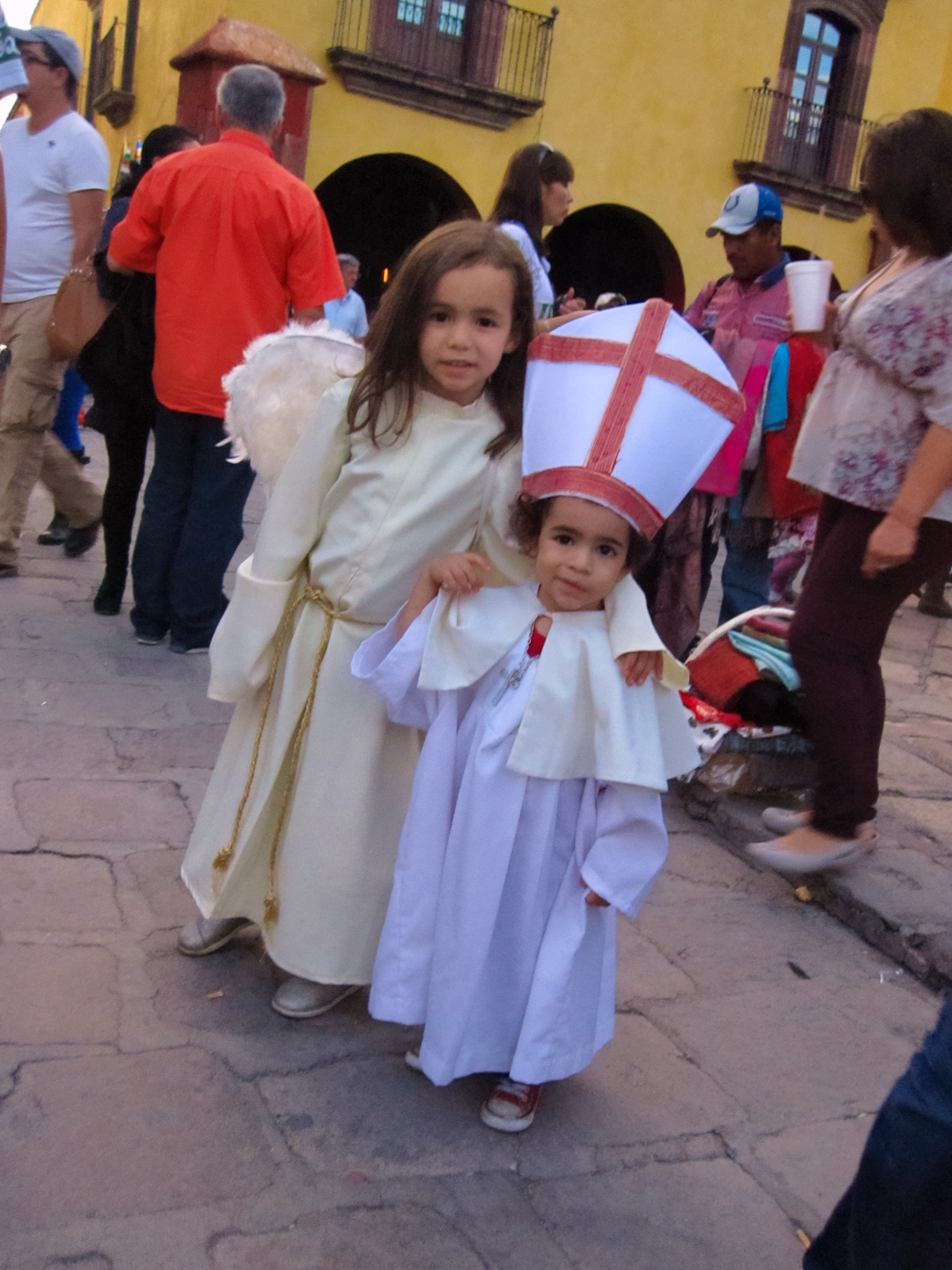
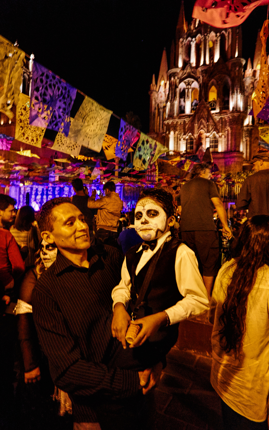
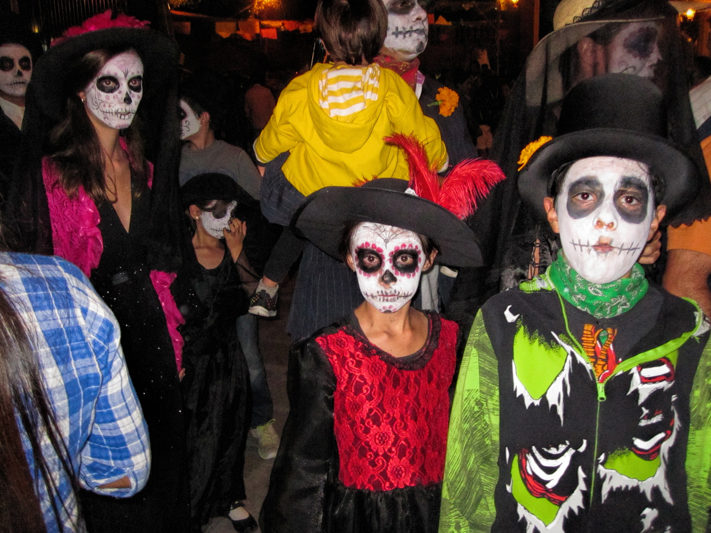
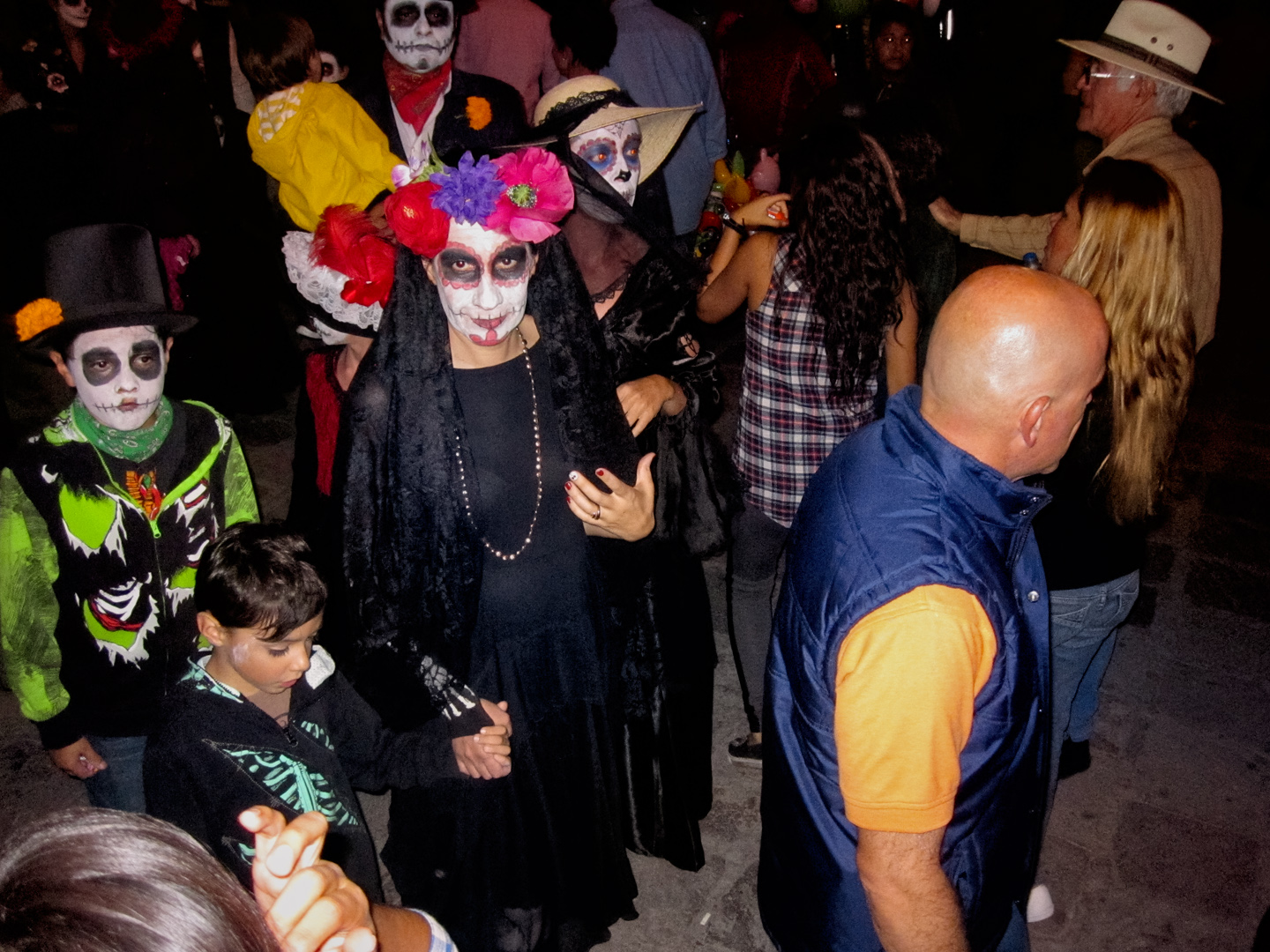
The children’s costumes are fantastic!
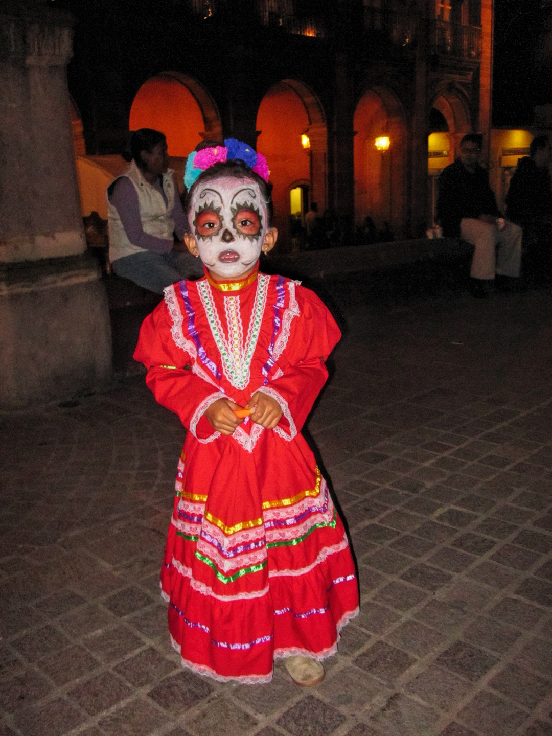
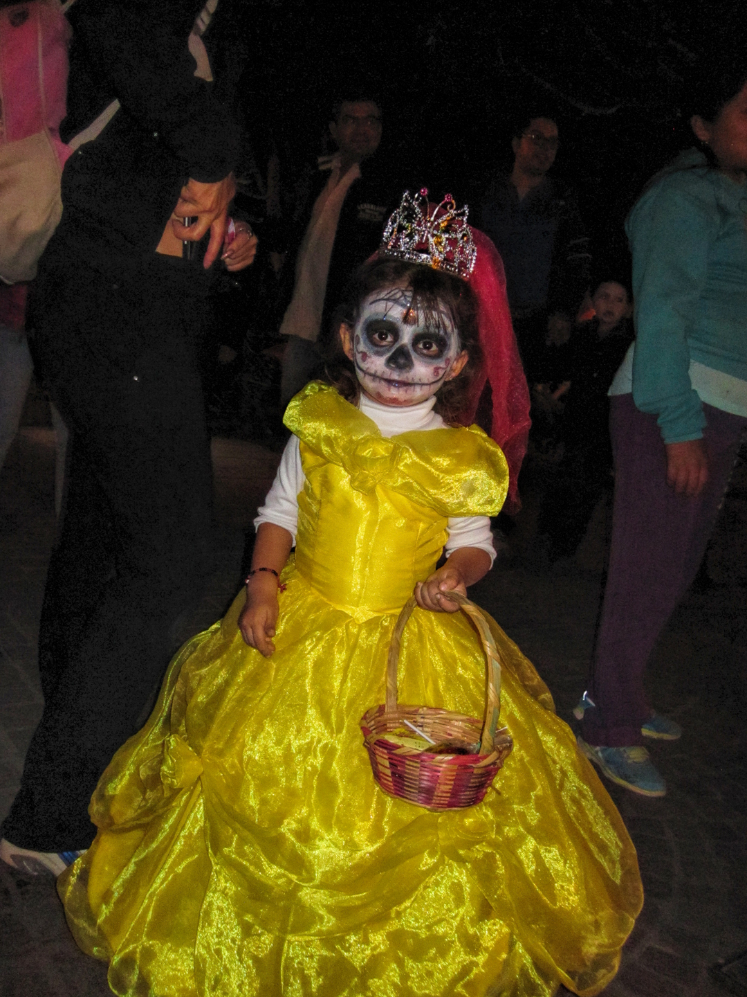

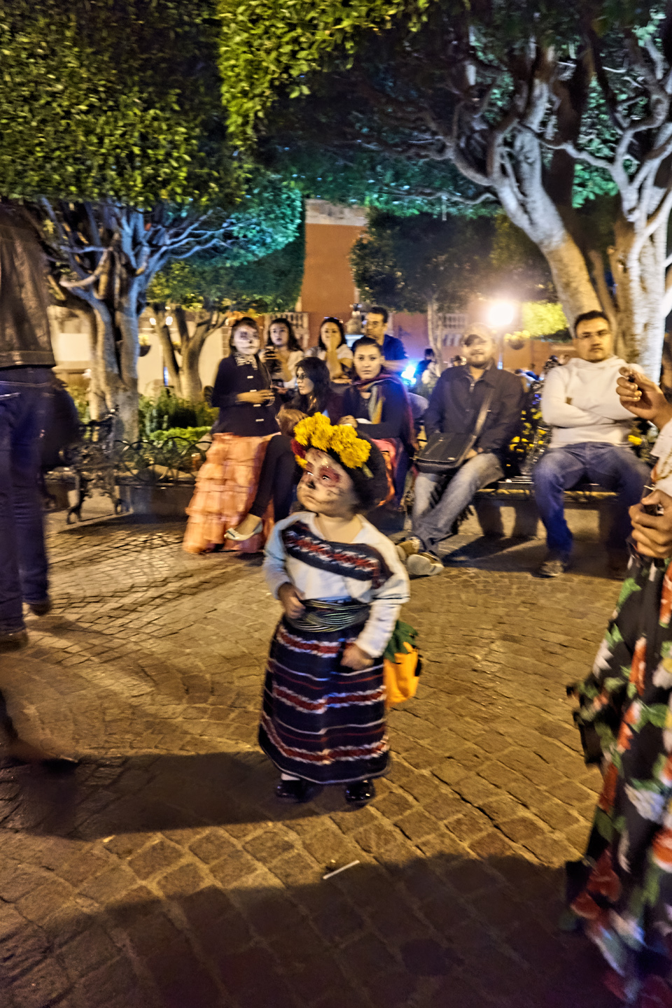
There are “store-bought” costumes that were probably purchased at Wal Mart, but the best ones are hand made, traditional clothing from the villages but in miniature sizes, along with fancy dresses that are in bizarre contrast with the painted faces and skull motifs. This is a costume parade that is unique to the Dia de Los Muertos. It’s not the sort of thing that you simply witness. It’s an experience of the sort that will leave you smiling for hours, if not for days! The whole scene on the Plaza may not have been entirely authentic. The gringo influence was obvious, but when people are having this much fun, who the heck cares?
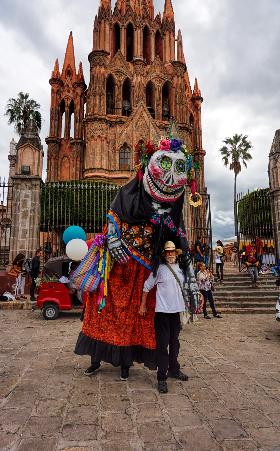
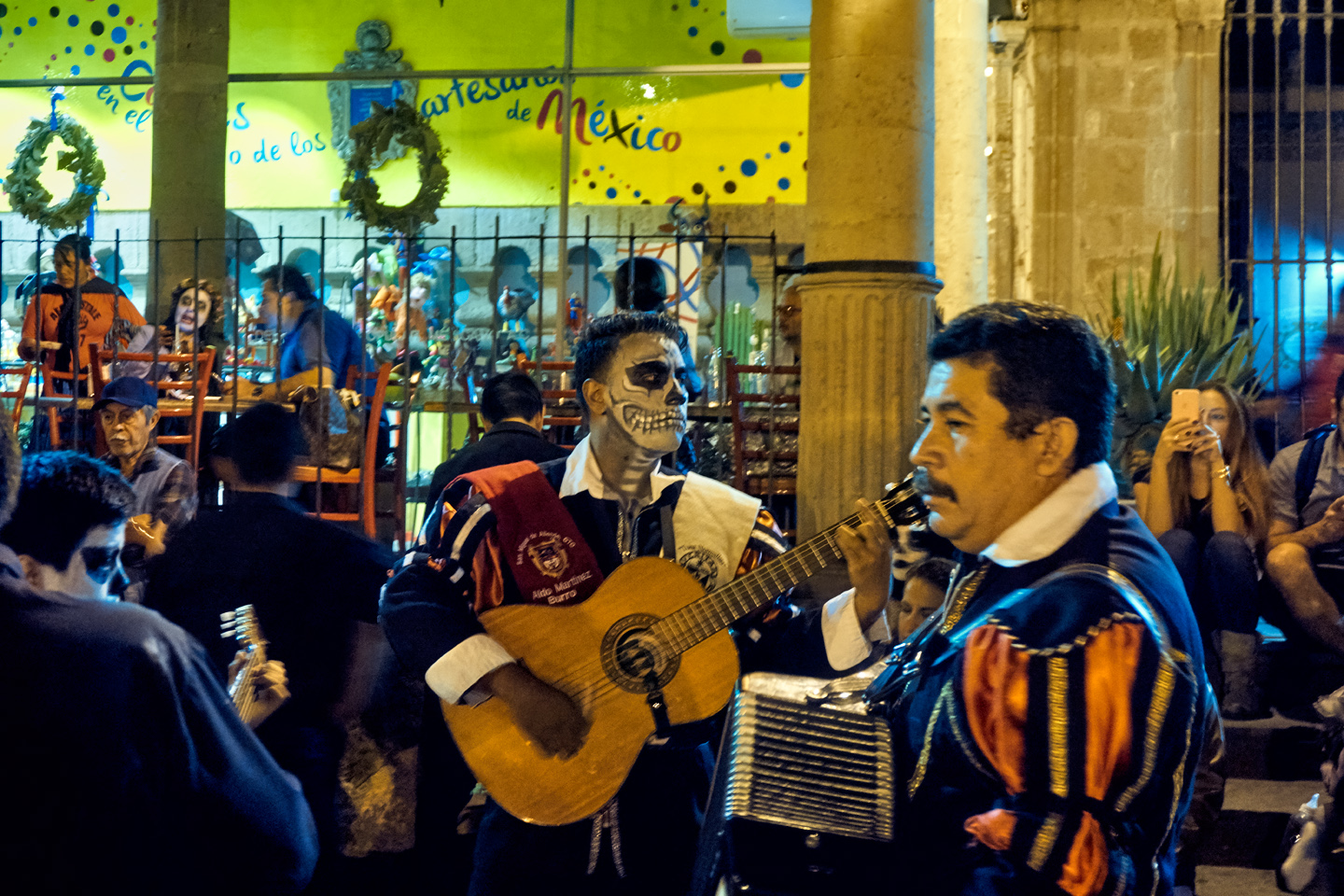
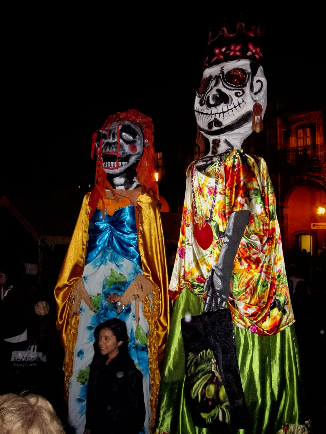
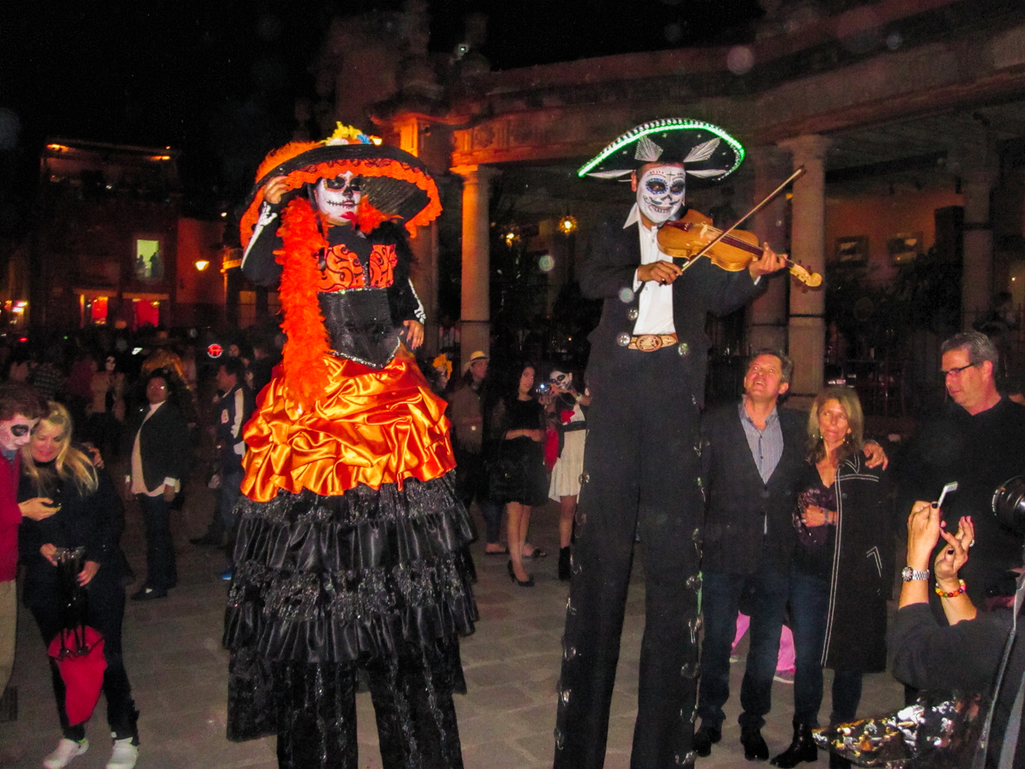
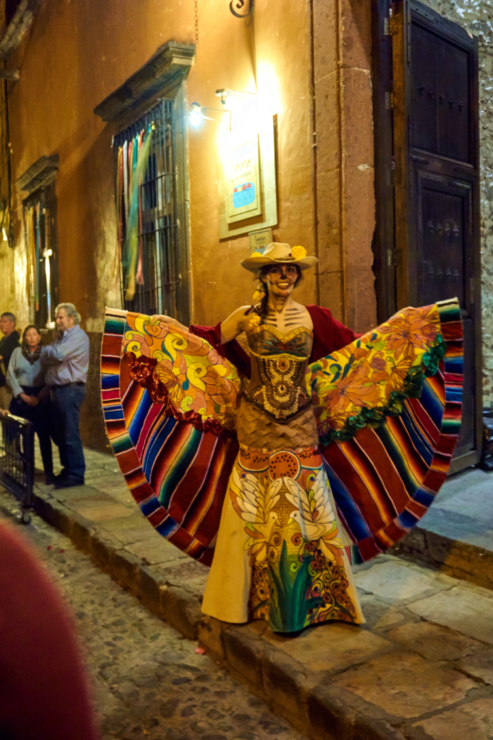
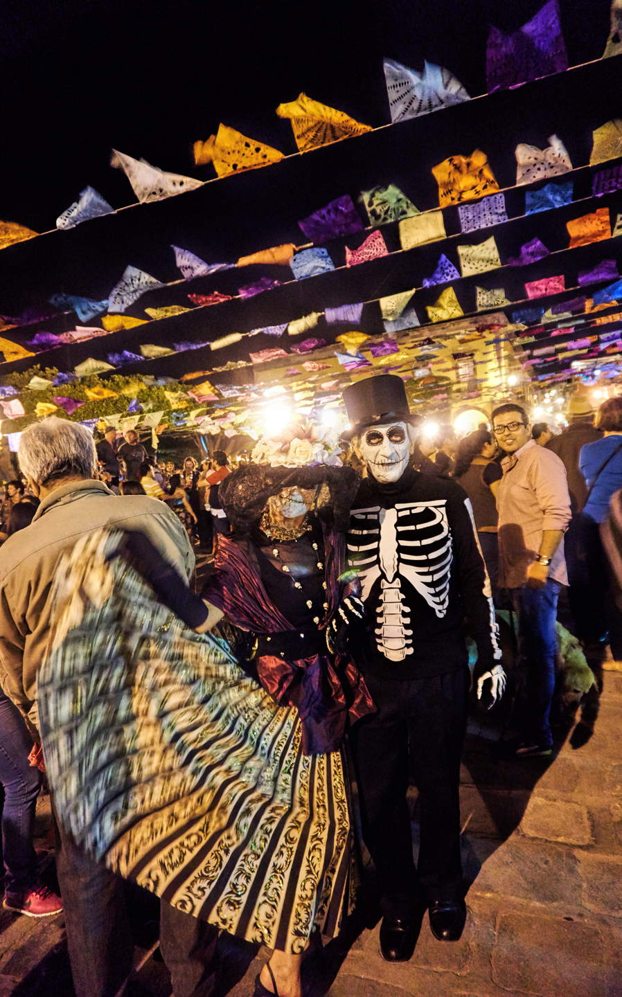
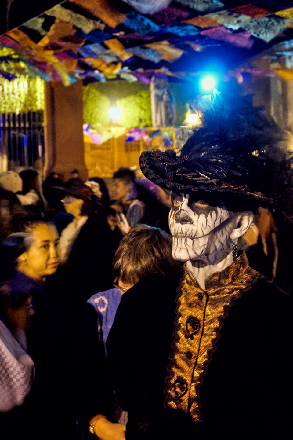
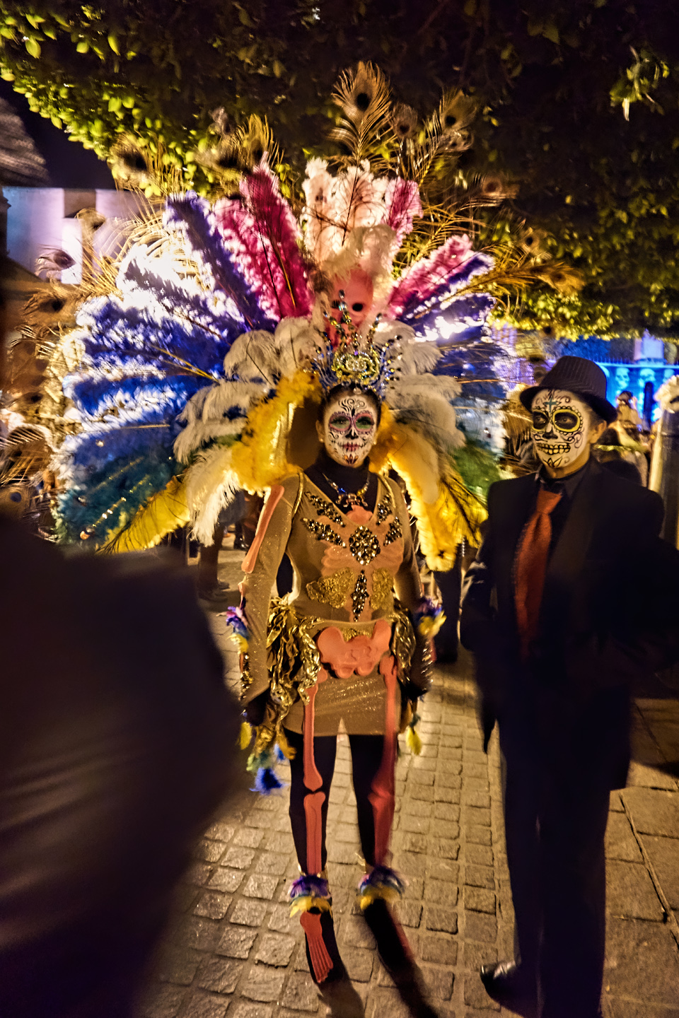
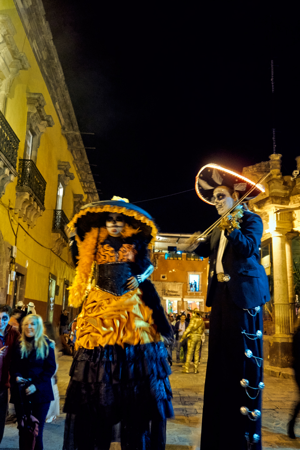
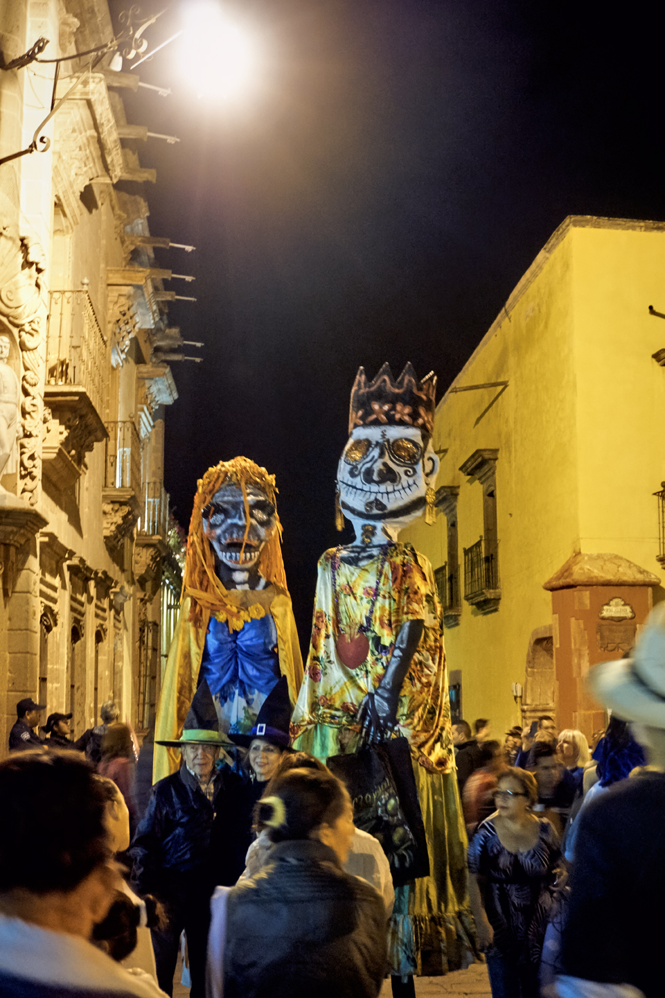
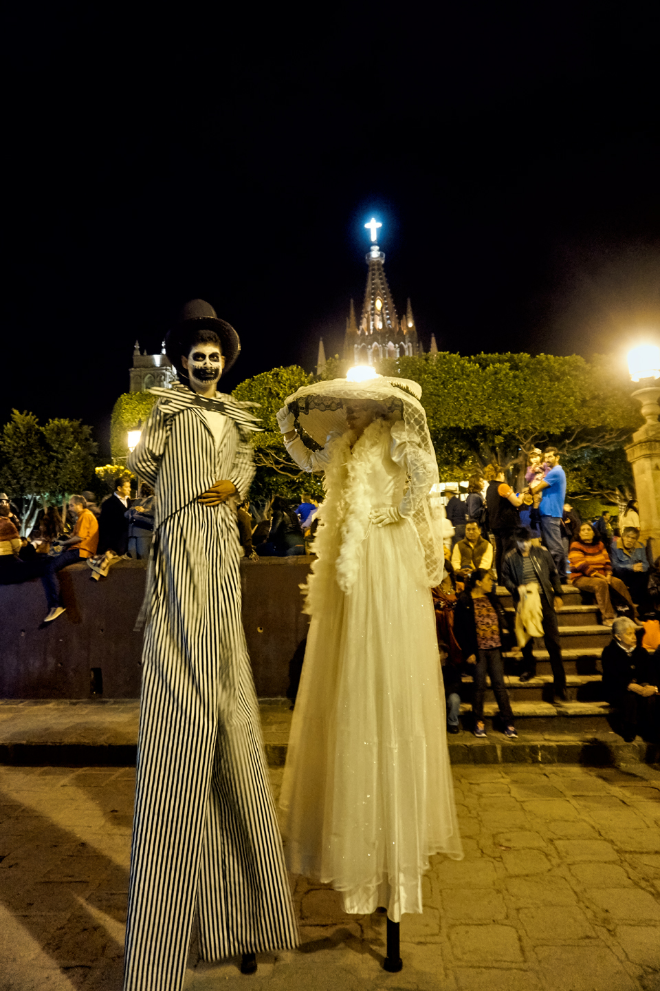
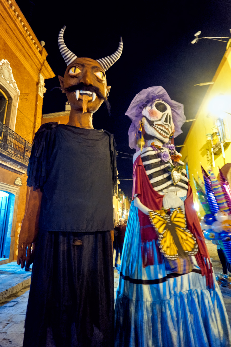
After an hour or two, the families with smaller children started drifting away, leaving the Plaza to the grownups. Musicians in costume entertained the crowd, and the “Tall Costumes” appeared, performers on stilts, and others walking beneath ten-foot tall costume-draped frameworks that they carried on their shoulders. Leering skulls were everywhere, but the face of death has never been this much fun!

It had been a long, very fulfilling day for Mike and me. When the party started winding down, we treated ourselves to a taxi in lieu of the bus, and we were back at the Hotel San Ramon in a matter of minutes.
DAY 2: NOVEMBER 1st: ALL SAINTS DAY
Hotel/RV Park San Ramon
Just like the previous day, most of the festival action was going to be in the evening, but considering how easy it was to hop a bus in to town, that’s exactly what we did, figuring we could get breakfast in one of the cafes around the Plaza.
We had the bus schedule down pat: they passed by the hotel every 30 minutes. The bus driver was already starting to recognize us, and greeted us a friendly good morning!

It was still early in the day, but the streets near the plaza were already crowded.
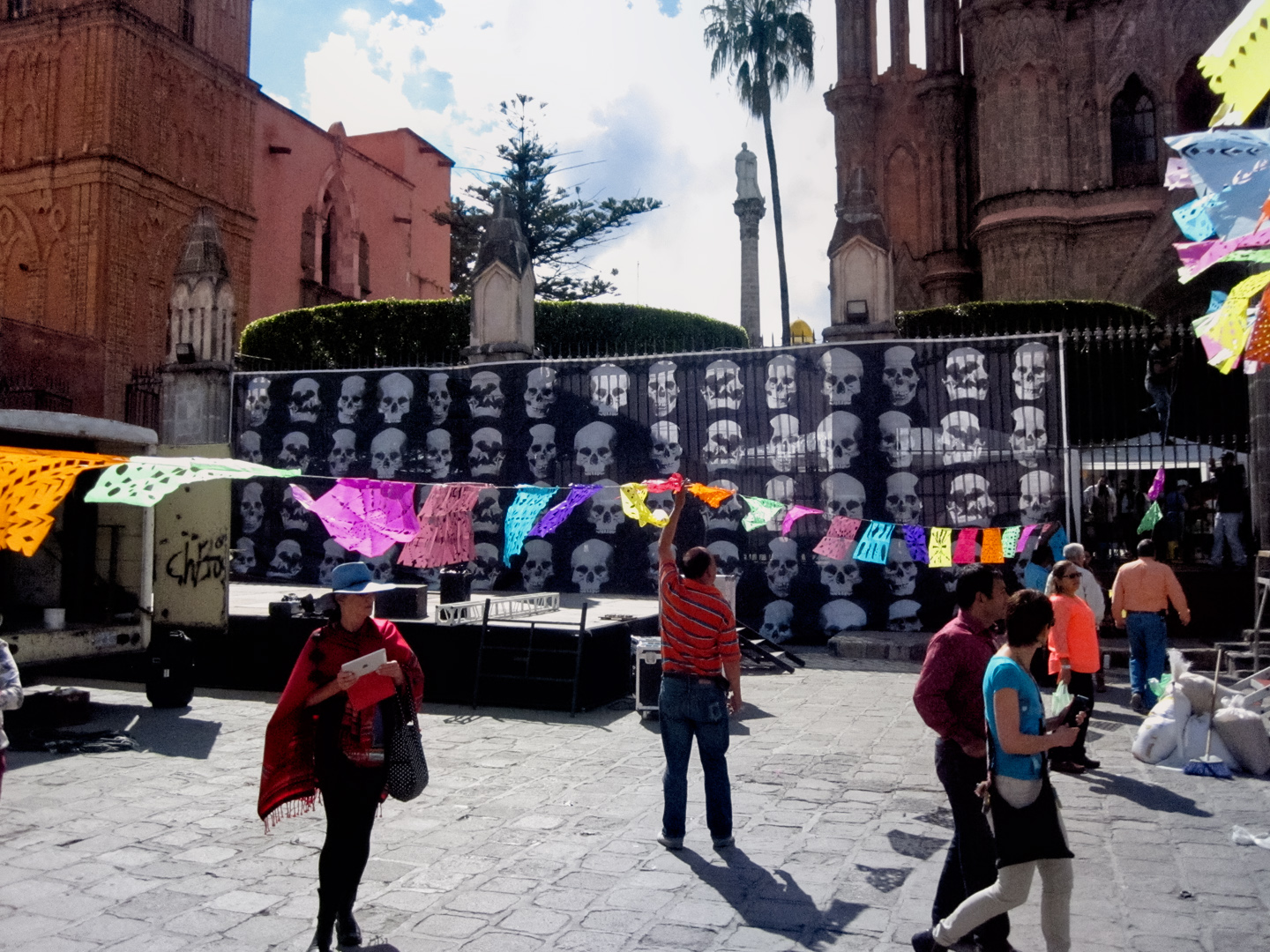
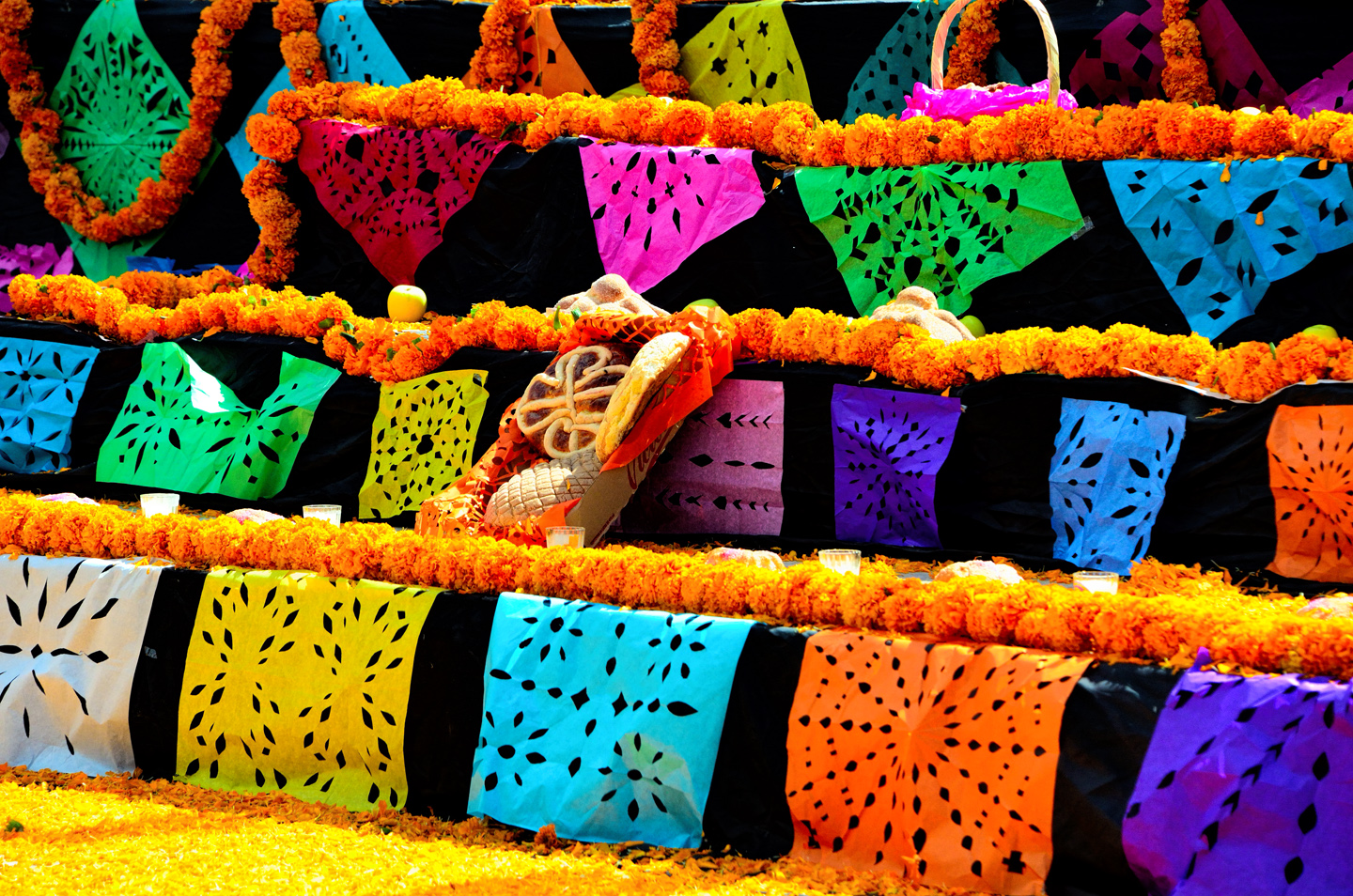
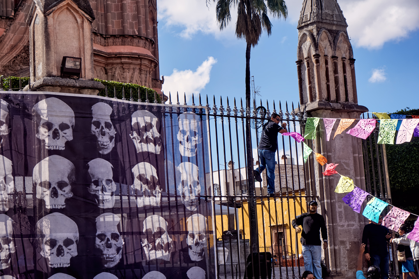
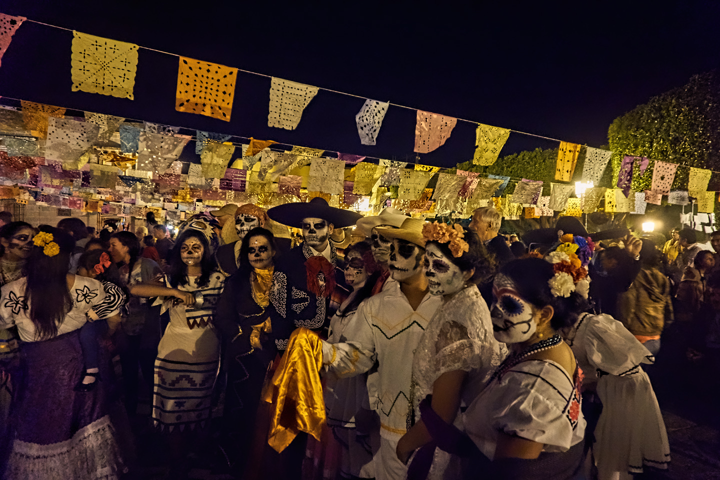
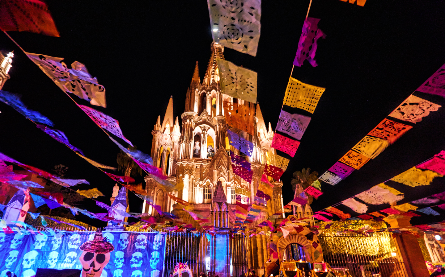
Papel Picado, vibrant colored paper squares trimmed into intricate patterns, are prepared by the hundreds and used to decorate the ofrendas, as well as the stage.

PREPARATION:
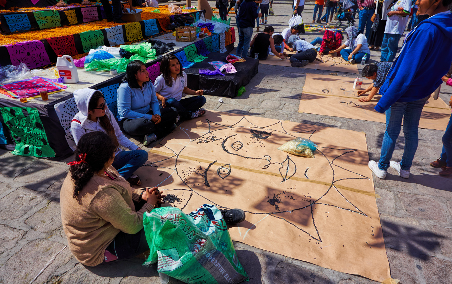
Because the city is so widely known for its Dia de Los Muertos celebration, there’s a fair bit of preparation required, in anticipation of large crowds coming in from Mexico City, among other places. Local residents work together to prepare the decorations that will brighten the plaza. There are depictions of skulls everywhere, and marigolds by the ton, including loose petals that form a carpet on the stage that will be used for performances. Once all that is set? The celebration begins in earnest!

Streamers hung with Papel Picado squares converge toward the stage, fluttering in a gentle breeze. (Good thing it didn’t rain!)

Streamers bedecked with colorful squares of Papel Picado appear to be attached to the church. (They’re not–they’re tied to a fence.)
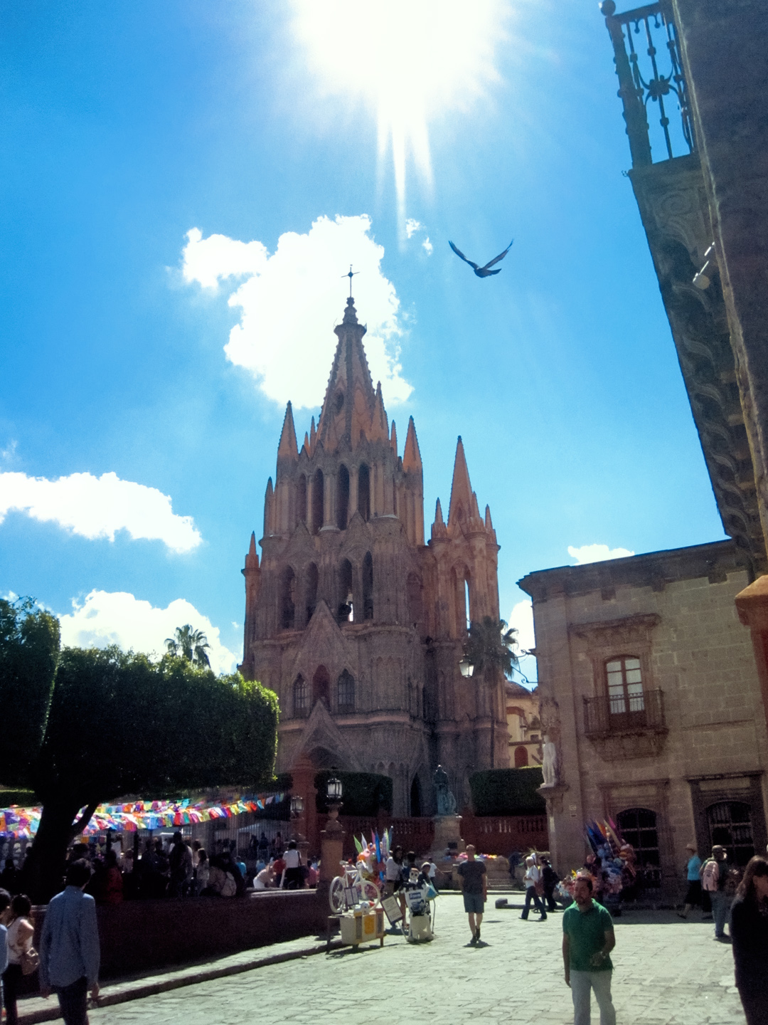
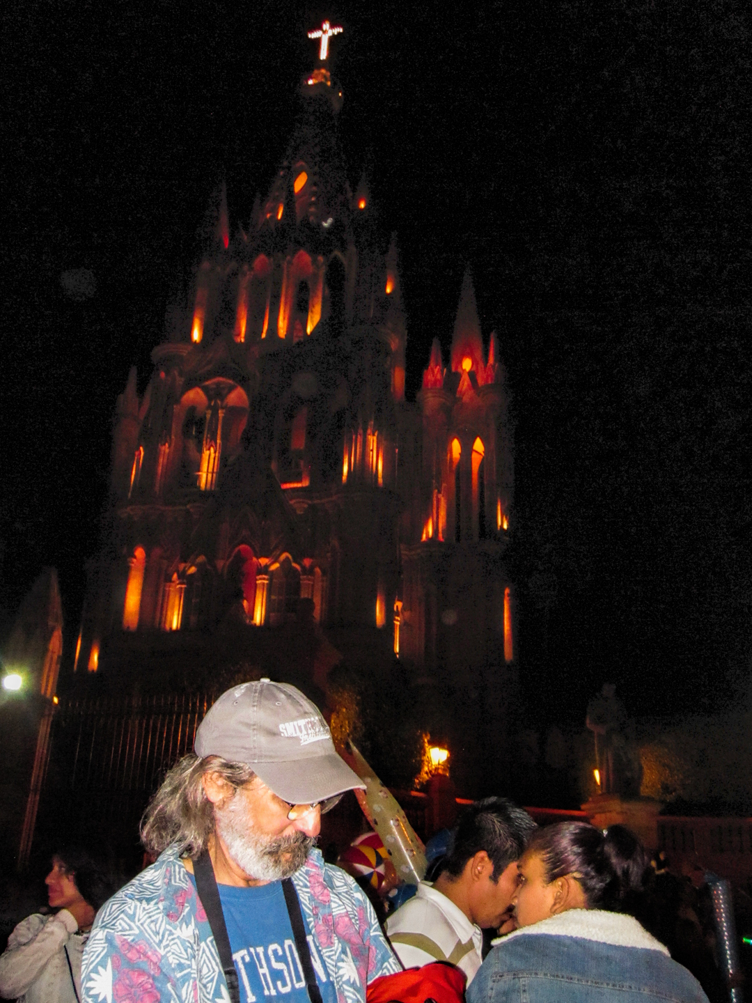
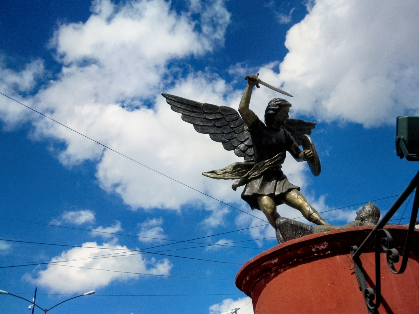
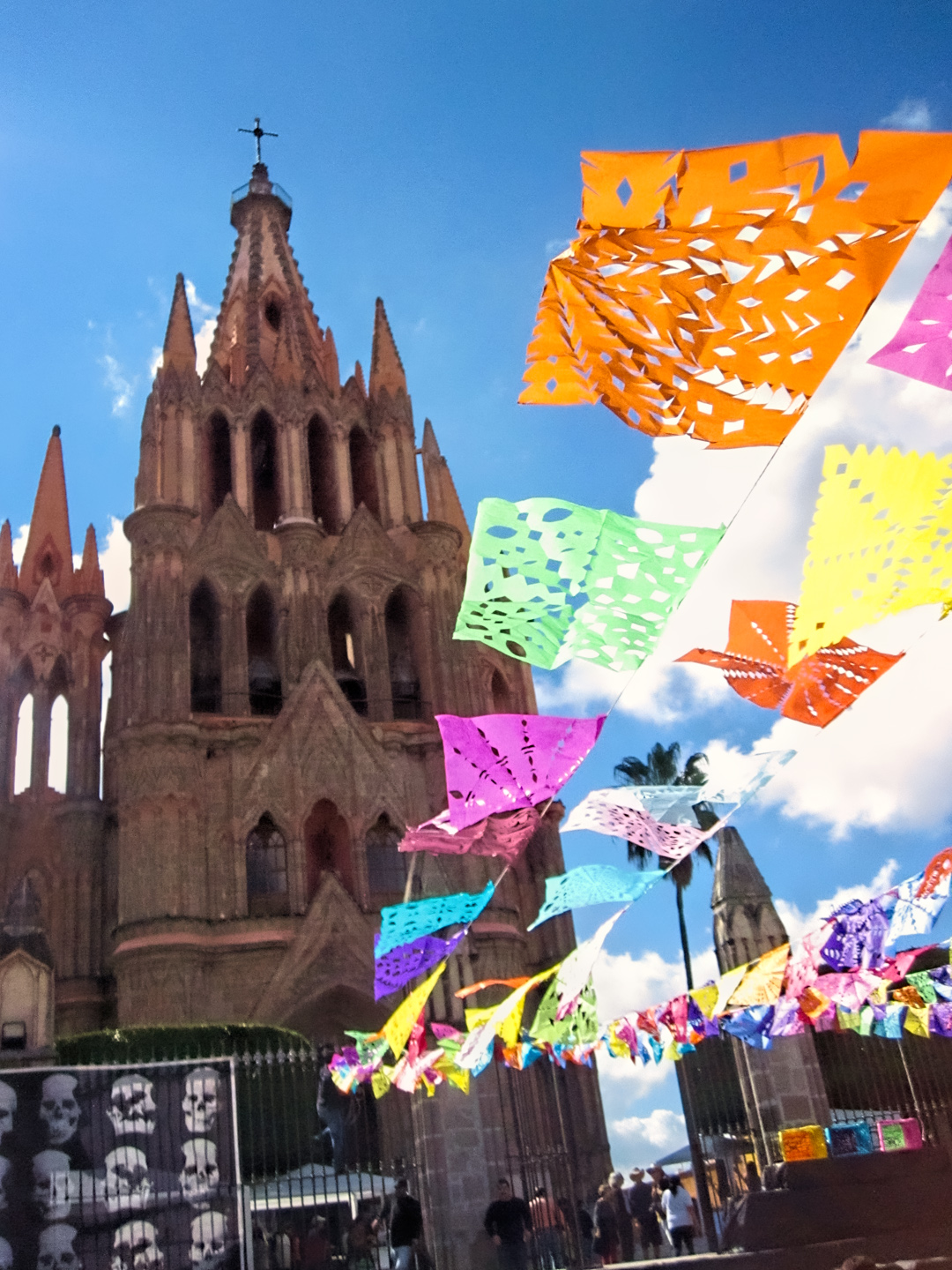
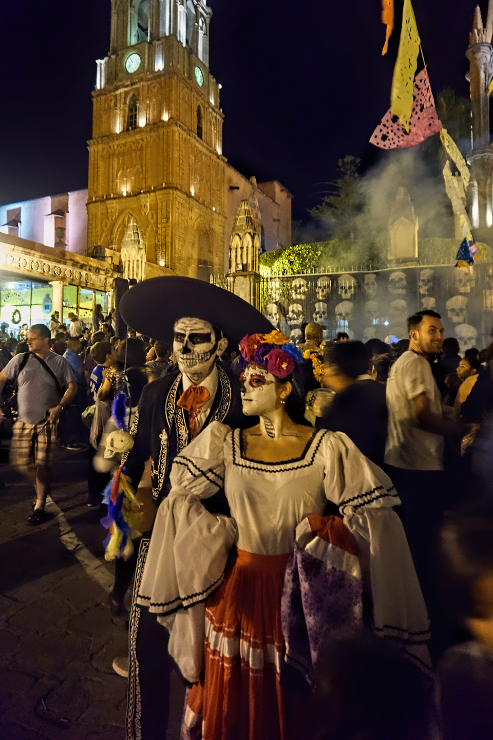
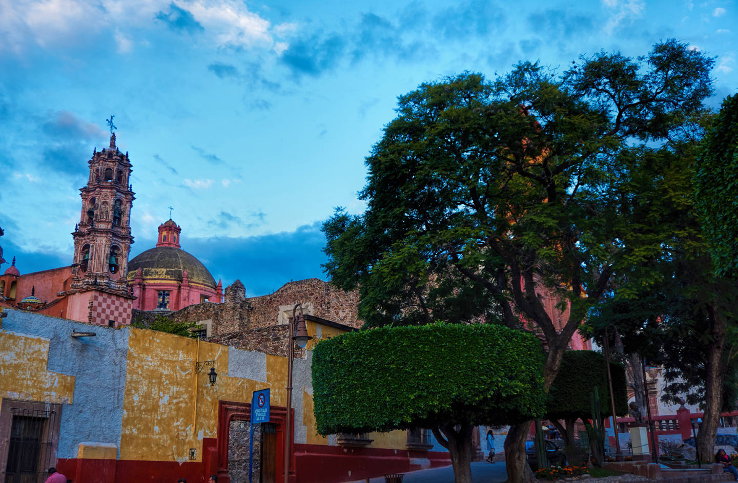
San Miguel’s iconic neo-gothic church, the Parroquia de San Miguel Arcángel, provides an elegant backdrop to the activities in the Plaza Allende. The church was first built more than 300 years ago, with several subsequent phases of construction. The pink limestone facade was added in the late 19th century, created by an indigenous stonemason who was inspired by postcard photos of the cathedrals in Europe. I’d say he did a masterful job of it!
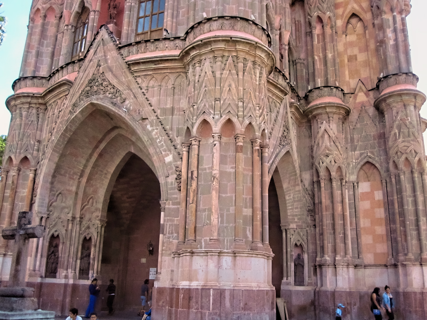
The Parroquia is a Catholic Parish church dedicated to St. Michael the Archangel. With those baroque pink limestone towers, it’s photogenic as the dickens! It’s one of the most photographed landmarks in all of Mexico, drawing shutterbugs from far and wide. (Including me!)
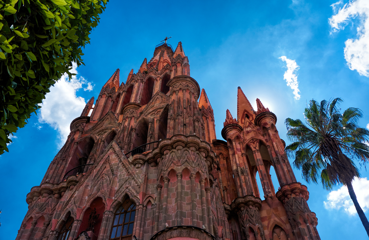
The Parroquia de San Miguel can’t be called a Cathedral, despite its imposing size, because San Miguel de Allende does not have Bishop, and that’s a requirement for a cathedral in the Catholic hierarchy.
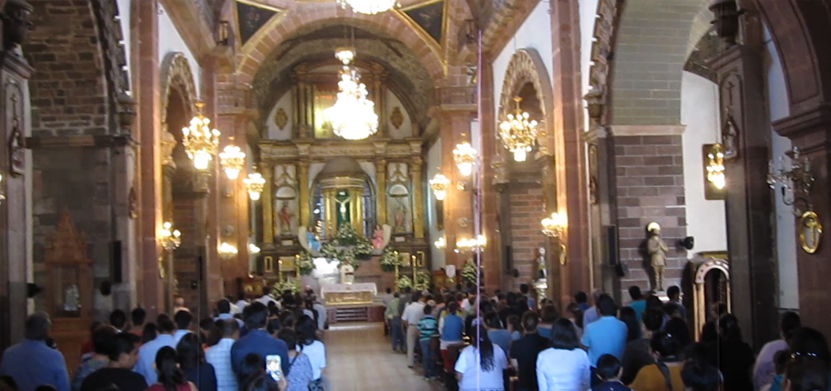
The Parroquia is in daily use as a parish church, holding services, hosting weddings and funerals. So much more than a mere monument, more than an iconic building; it’s truly the spiritual heart of the community.
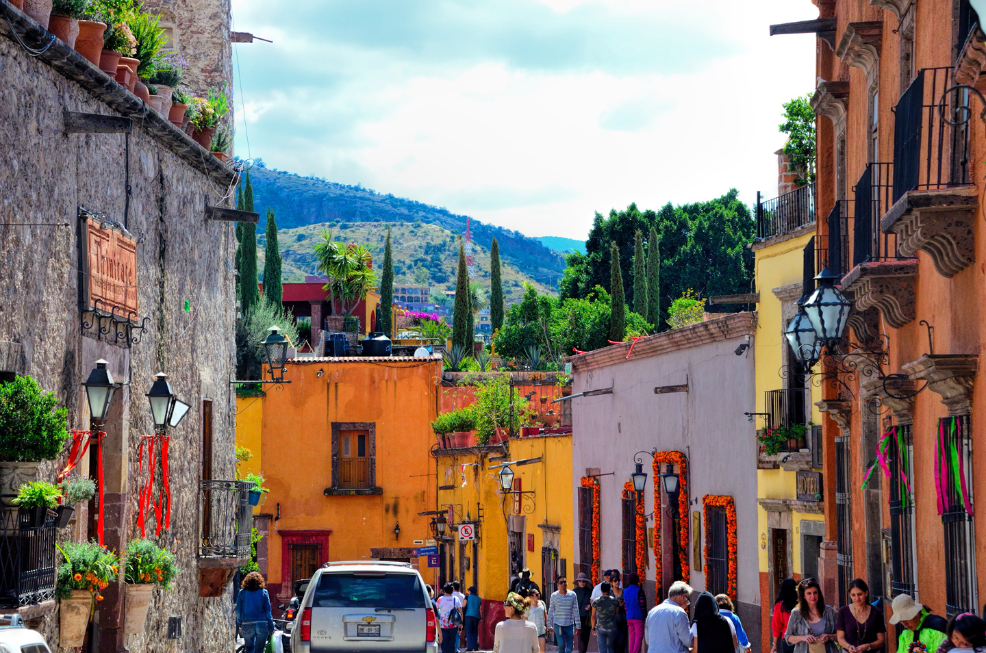
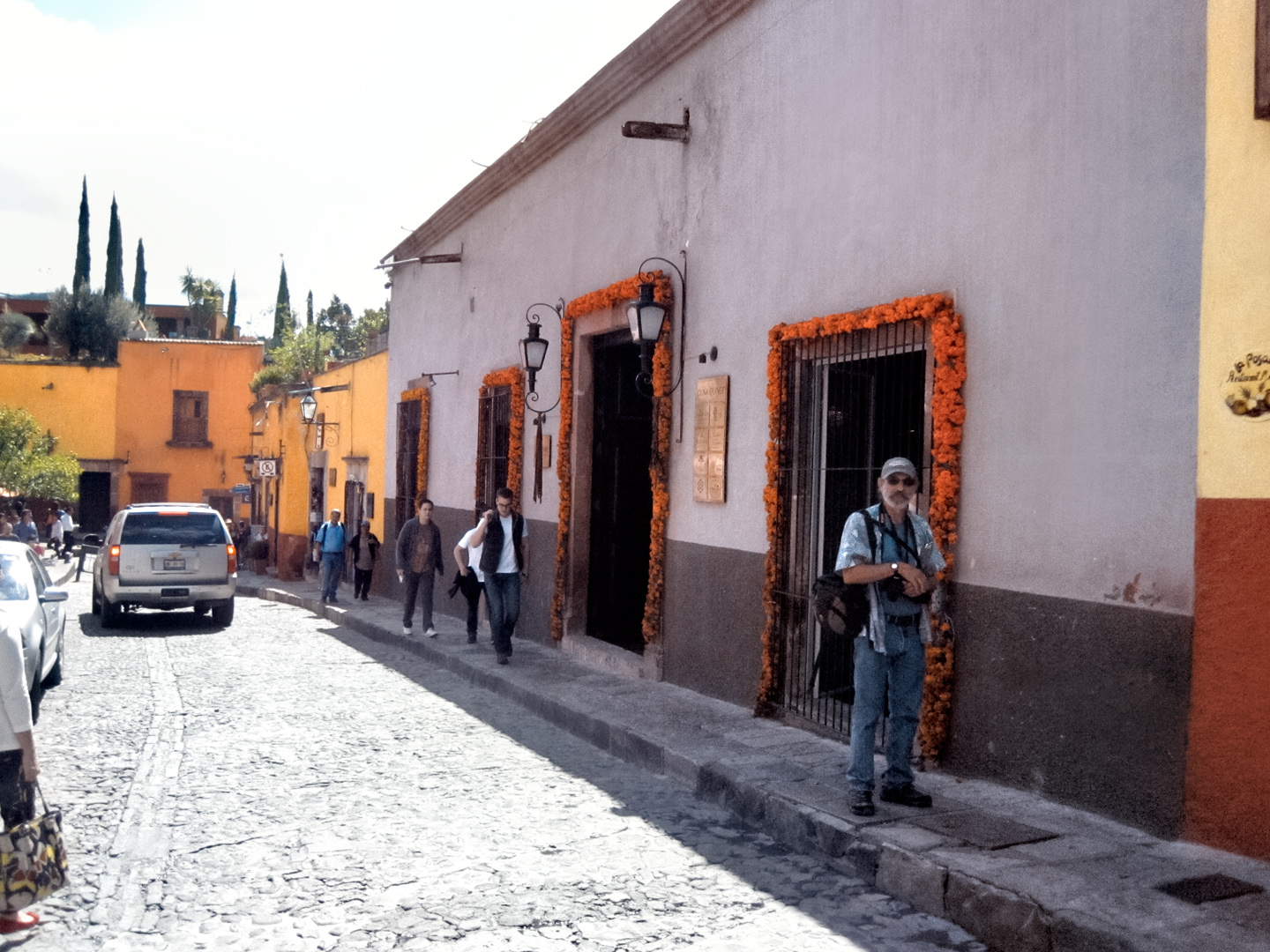
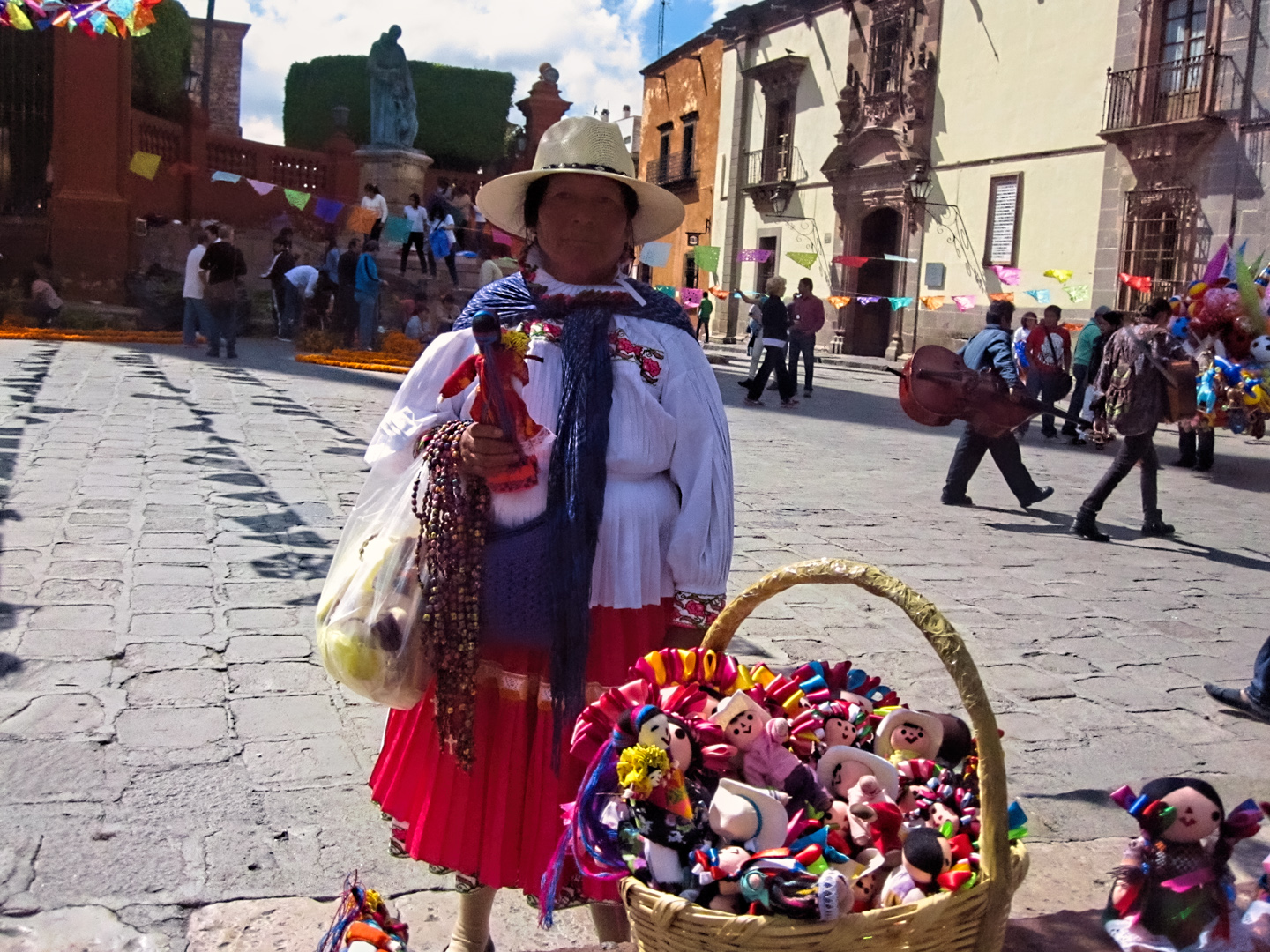
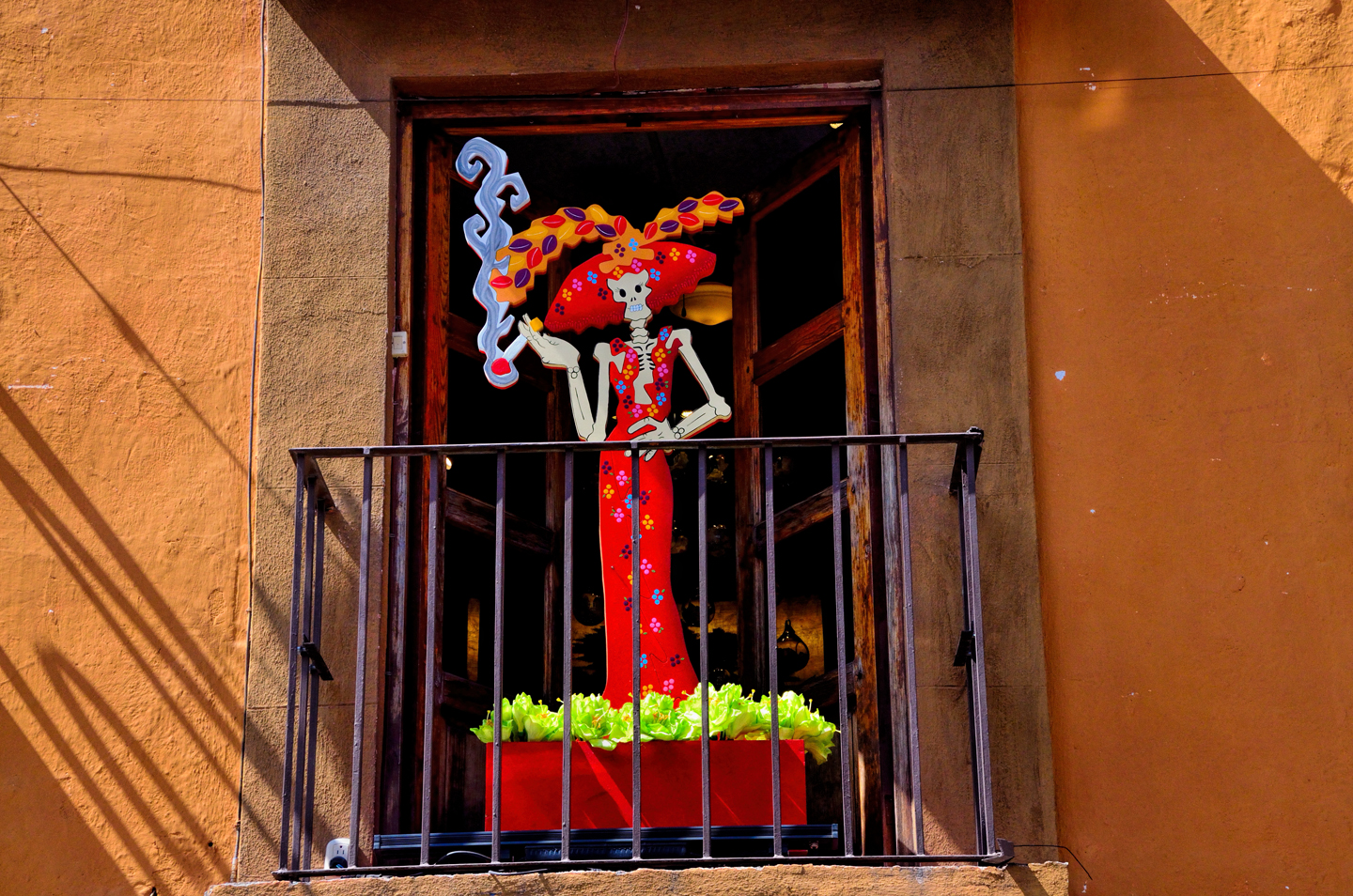
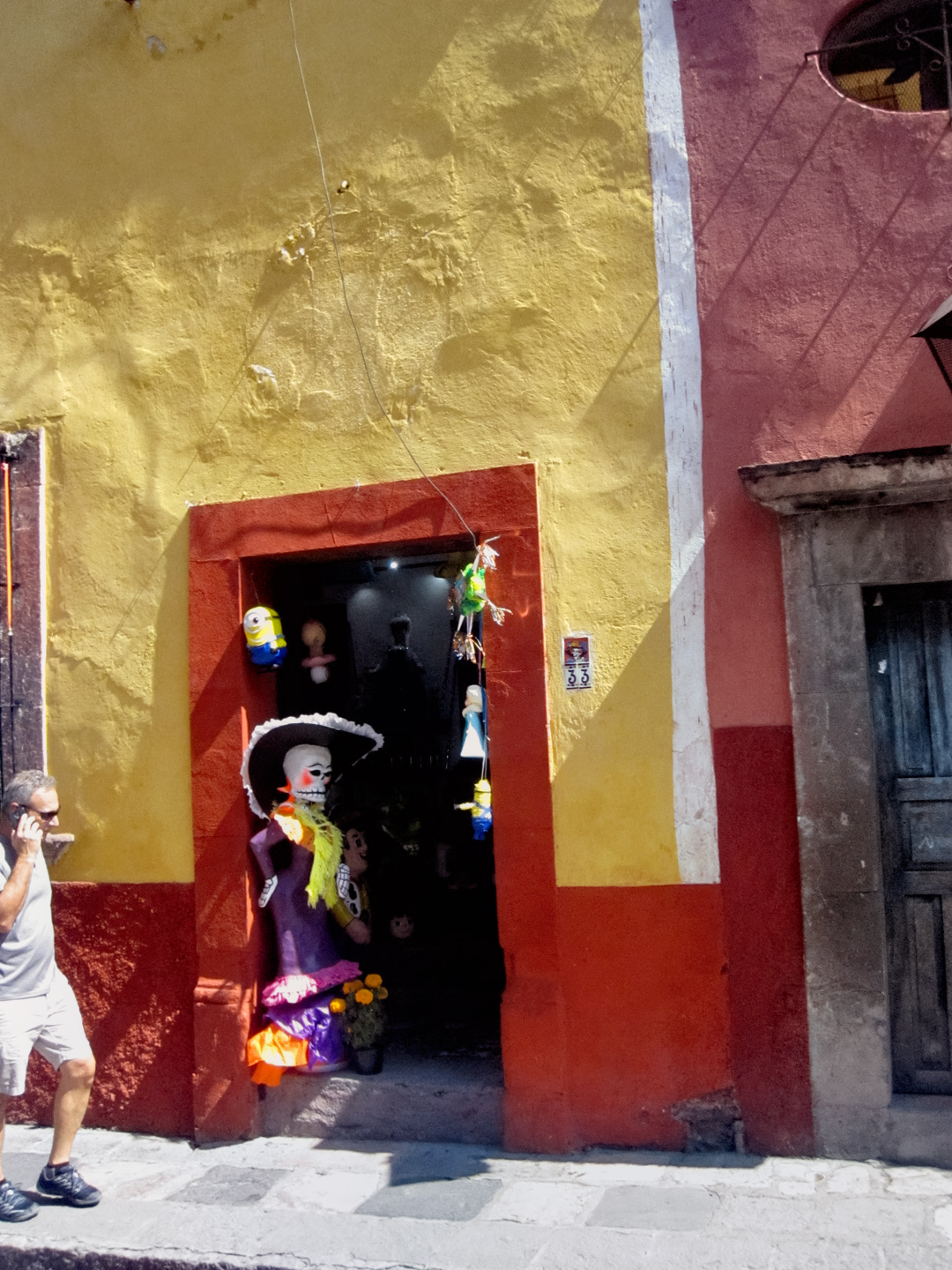
Many of the shops have Los Muertos style decorations around their doorways, heavy on the marigolds.
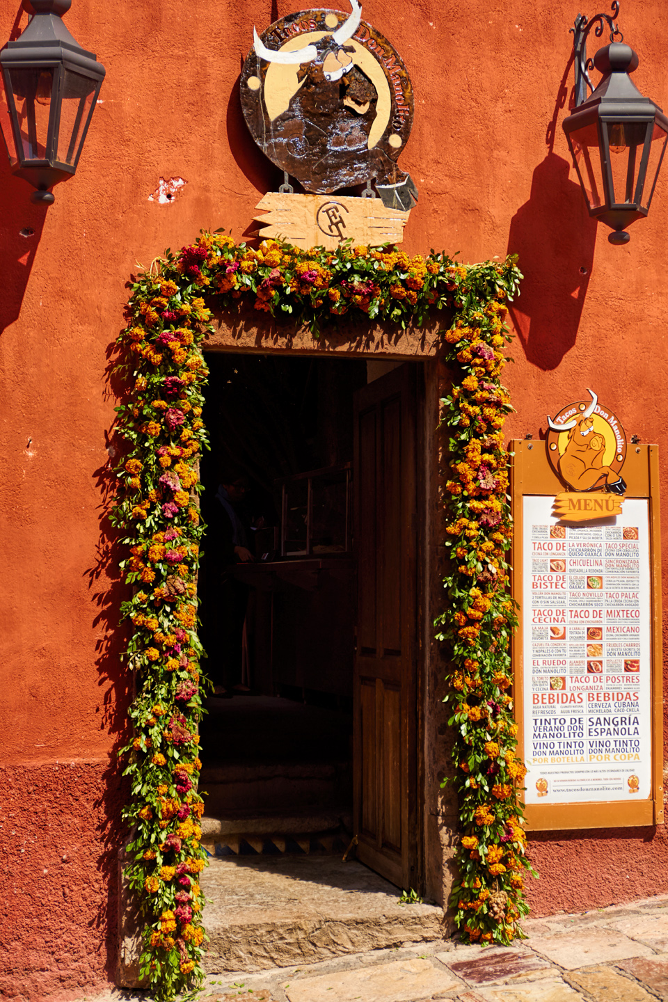
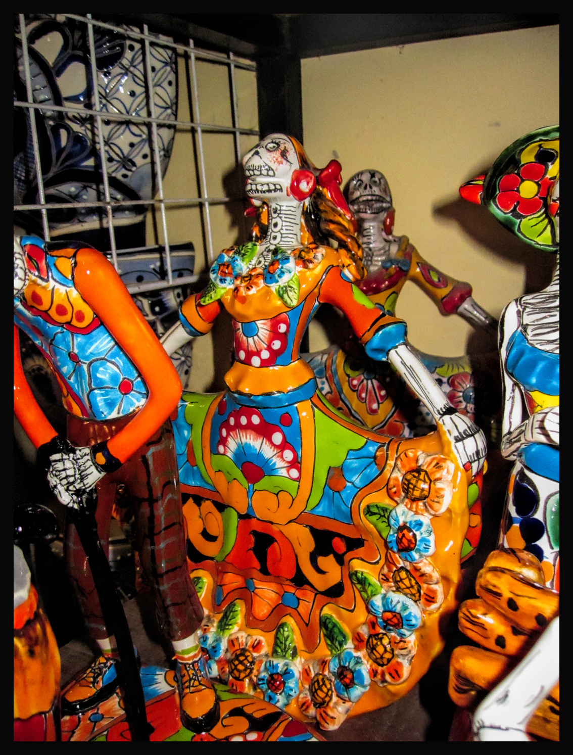
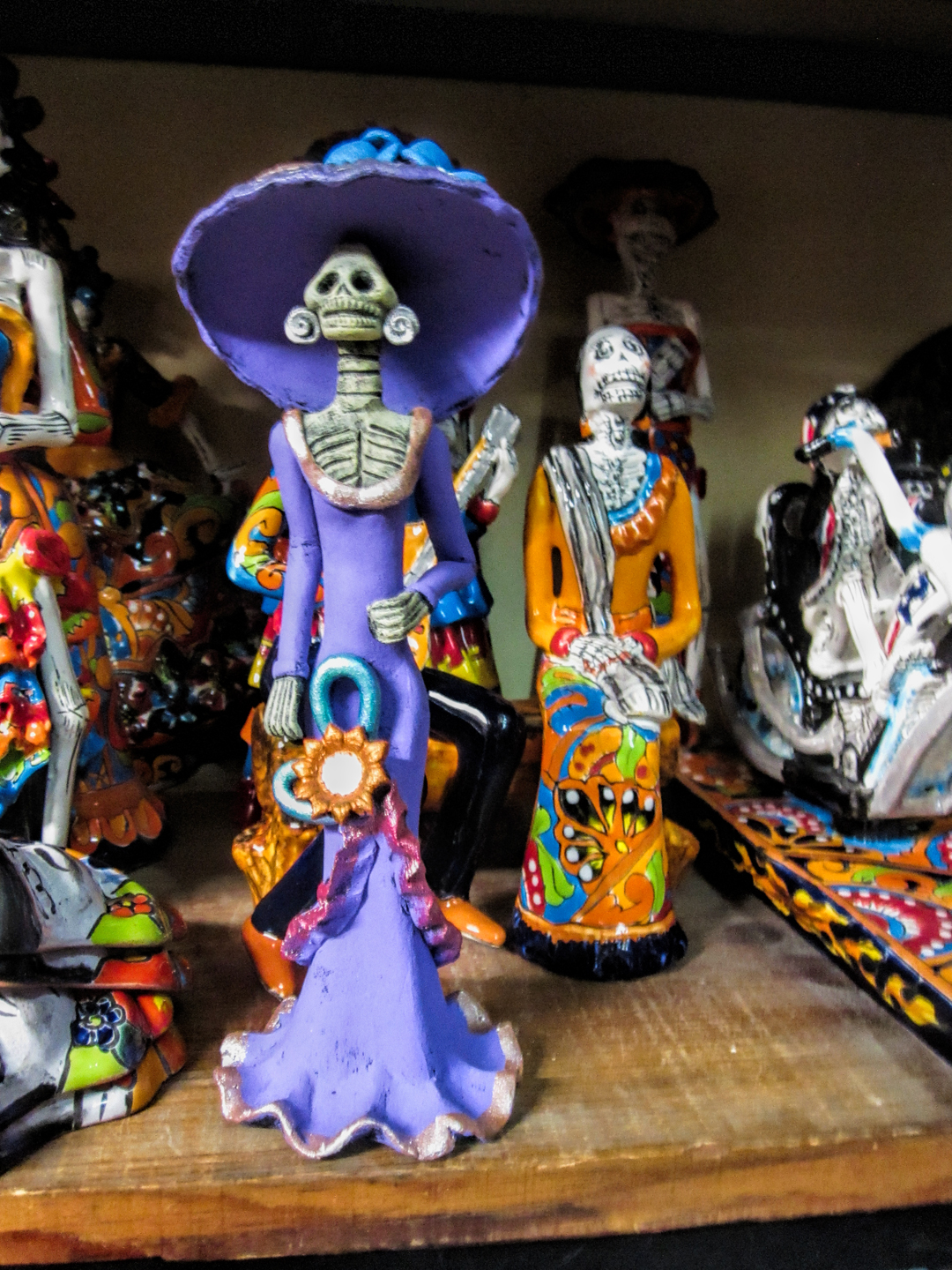
Skeleton-themed window displays add to the ambience. They’re for sale, and they make terrific souvenirs!
Christian themes form an uneasy alliance with the death heads of the Dia de los Muertos. The skeletons are not intended to be demonic. Death come to us all, a basic fact of life, not something to fear.


The Jardin Principal is a highly favored location for setting up an ofrenda, the flower-bedecked altars that honor deceased loved ones. By Day 2 of the festival, there were large, elaborate ofrendas surrounding the entire plaza.
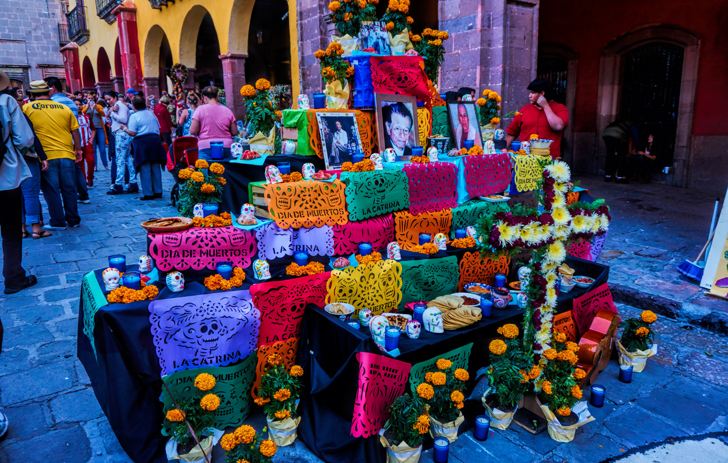
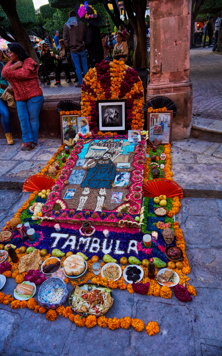
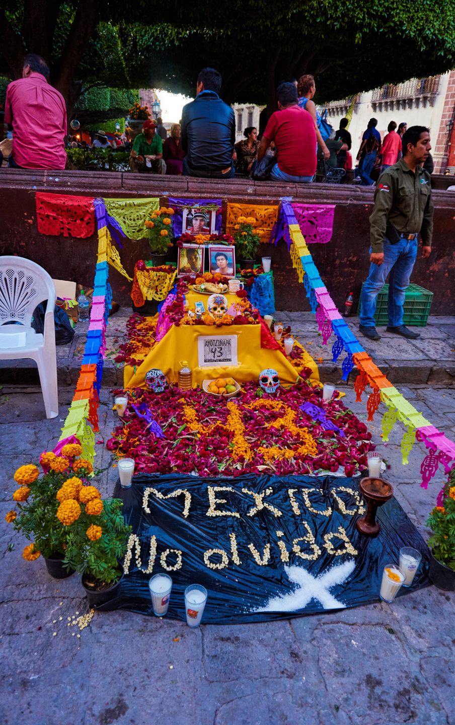
There were several displays dedicated to “Los 43,” referring to the 43 student protestors from a rural teacher’s college who disappeared under highly suspicious circumstances in 2014. They were almost certainly murdered by cartel thugs. What’s uncertain is the extent to which government troops may have been complicit in the elimination of “subversive” elements. The incident sparked a widespread outcry that is ongoing, more than ten years later.
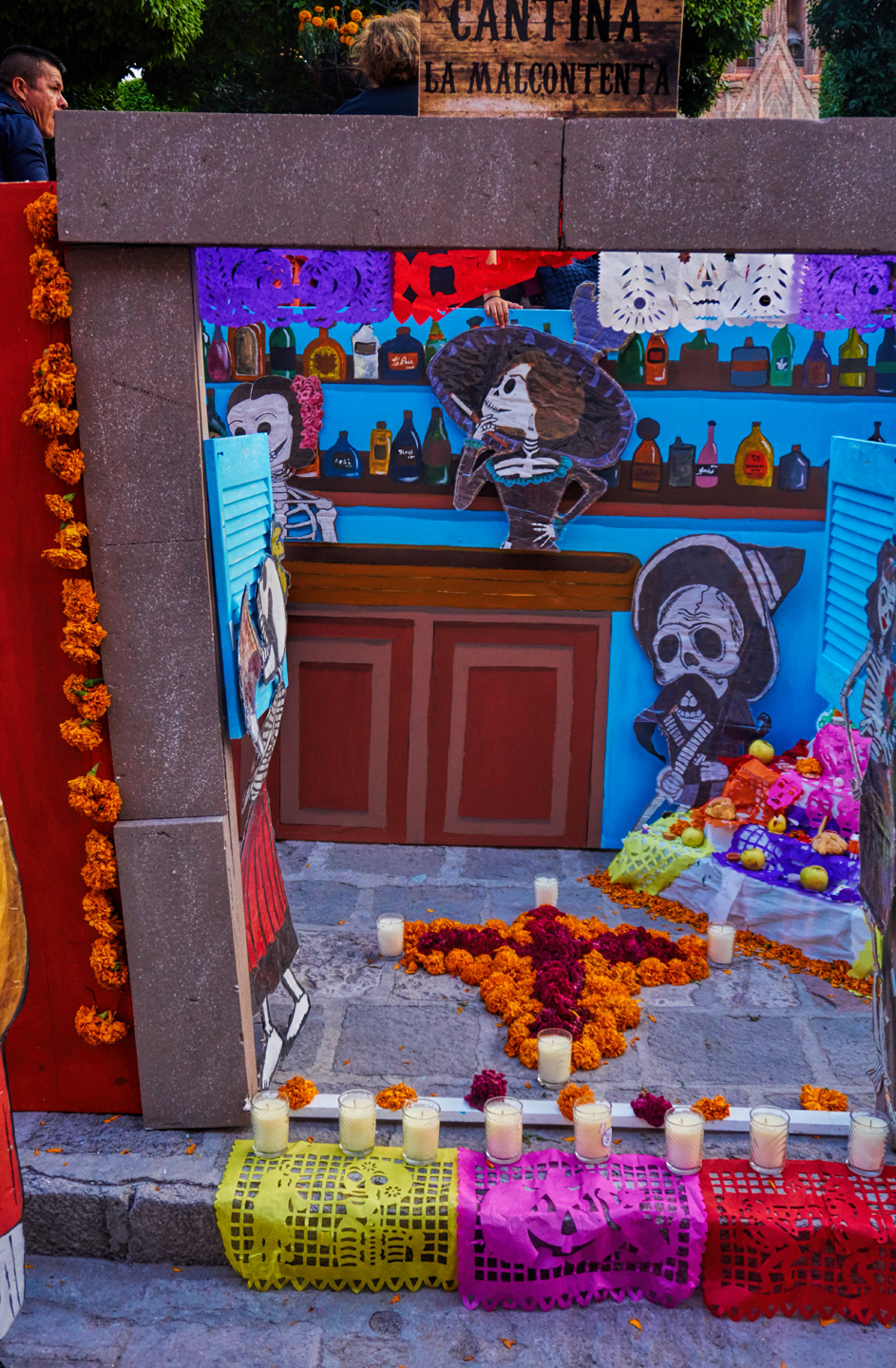
Many of the displays come across as humerous, and that’s half the point; they’re intended to bring a smile.


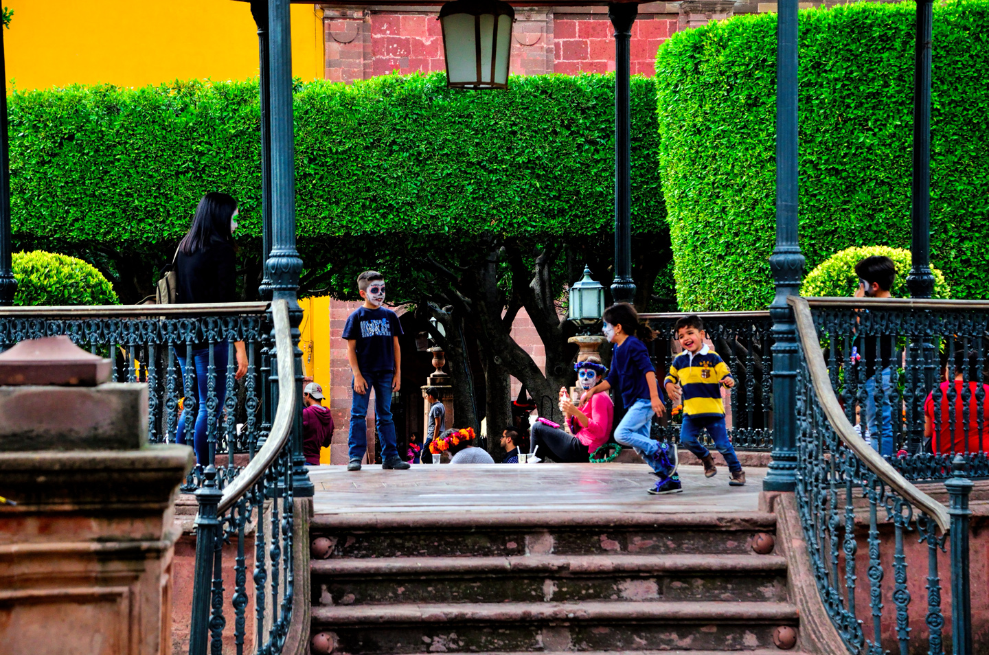
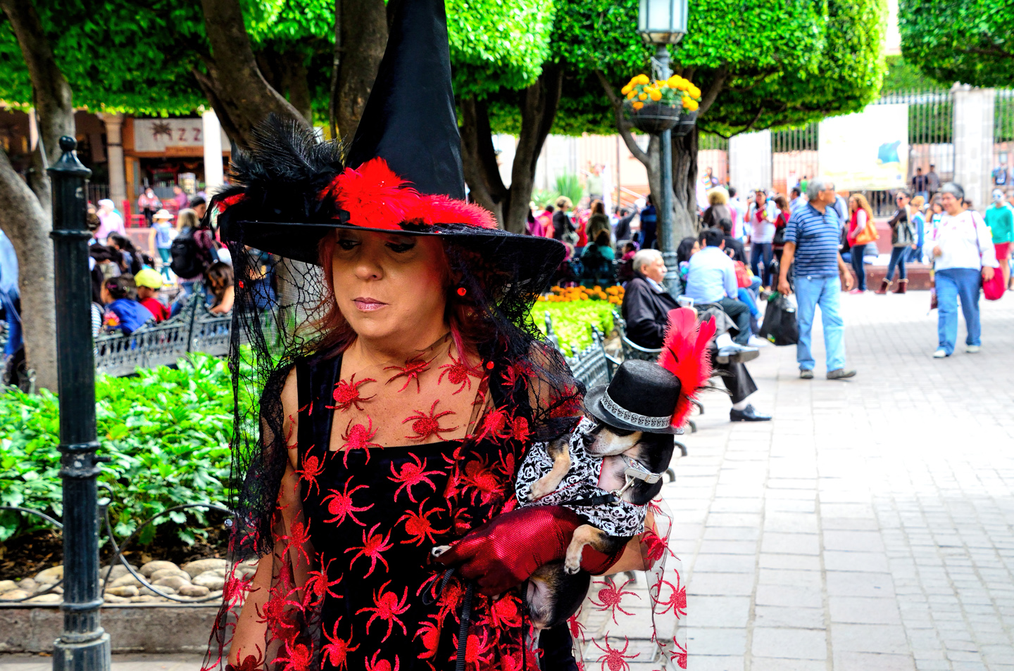
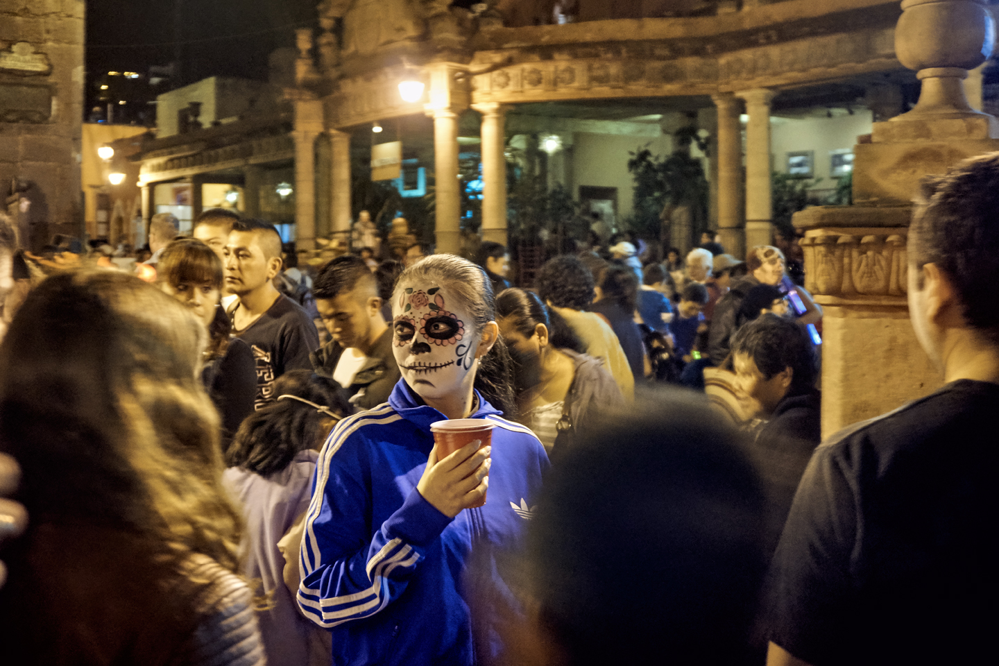
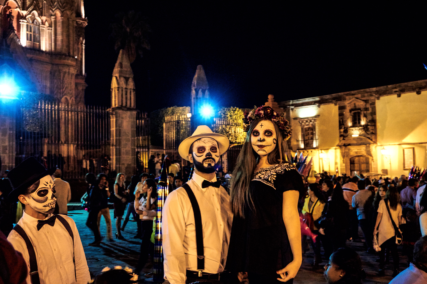
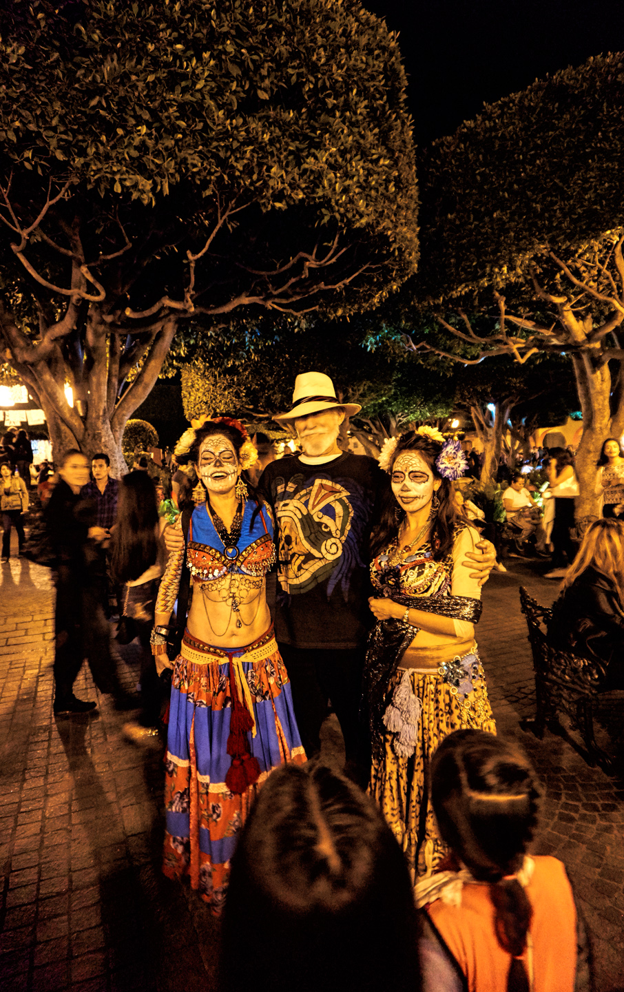
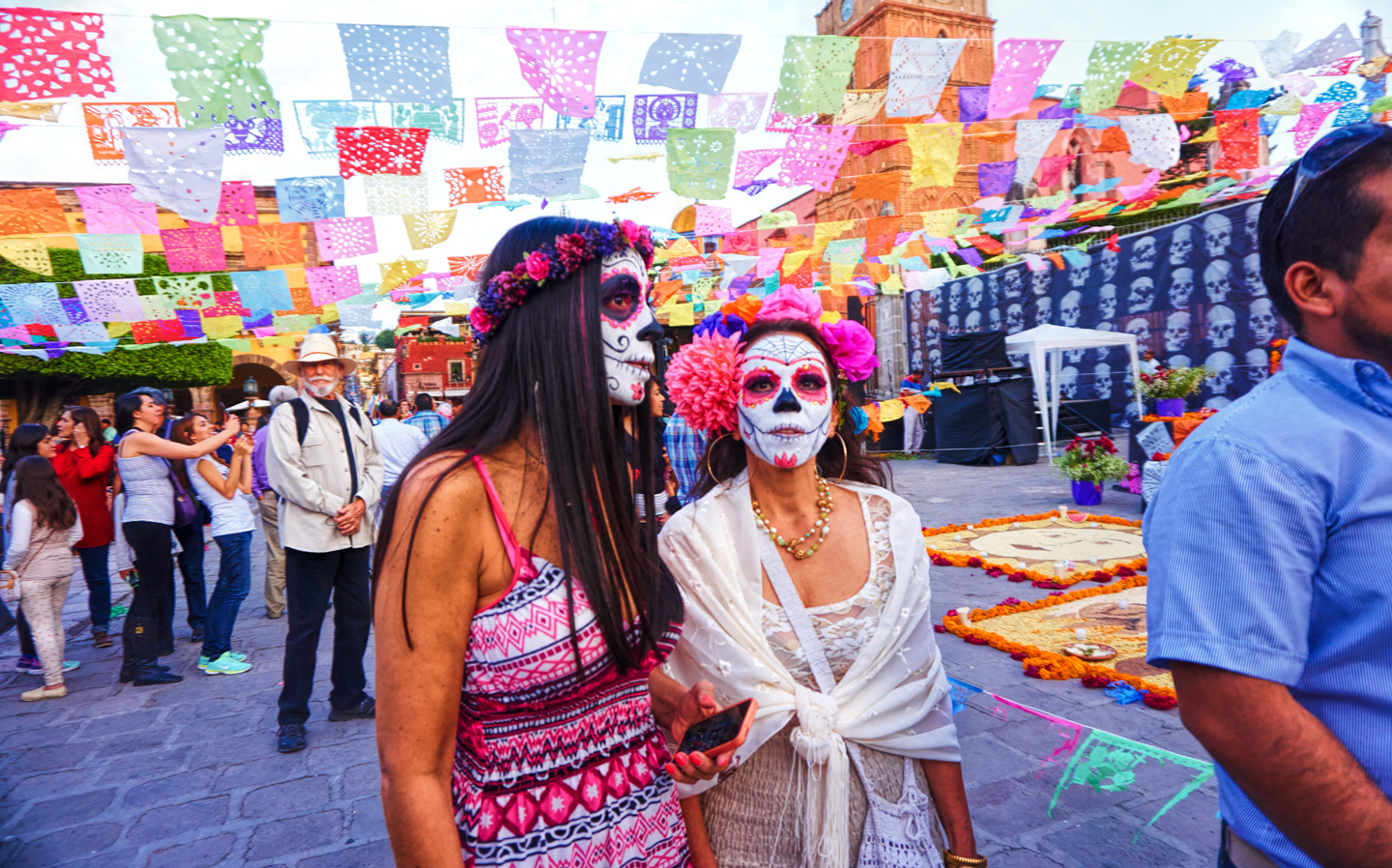
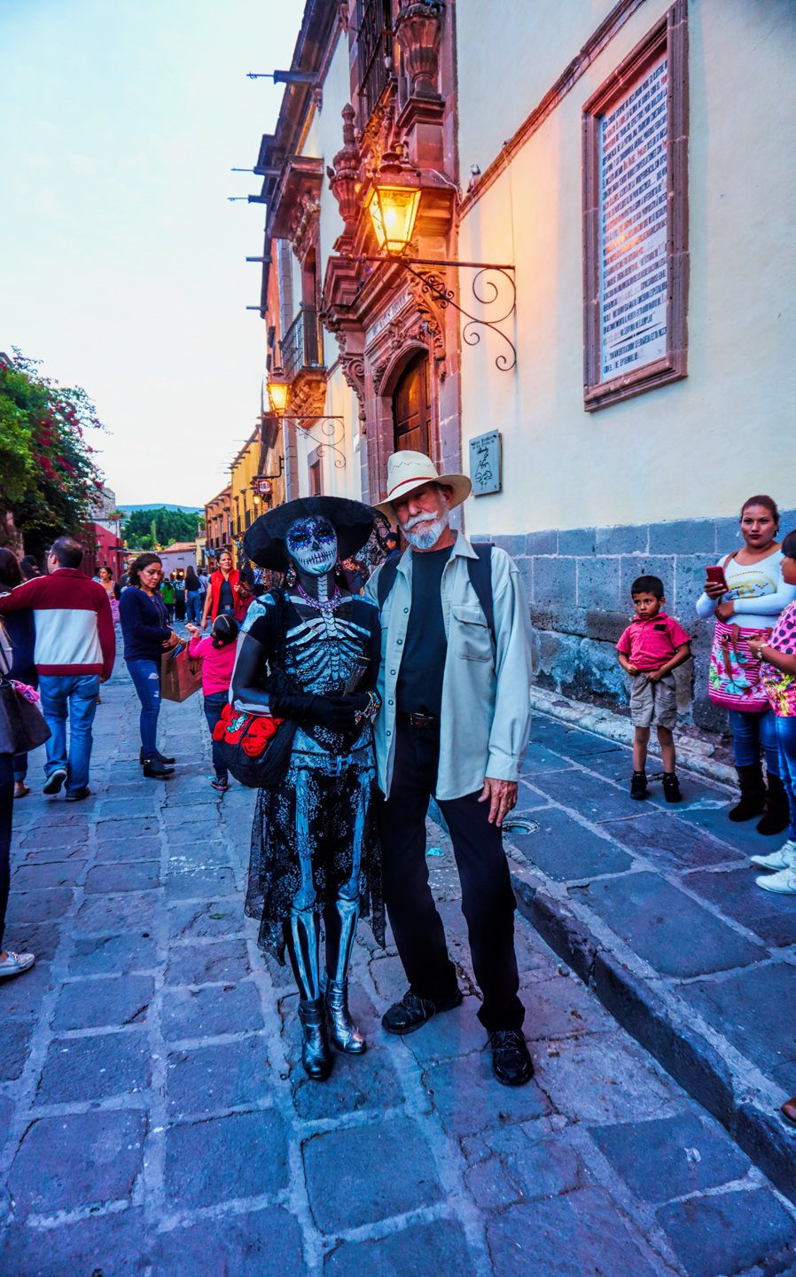
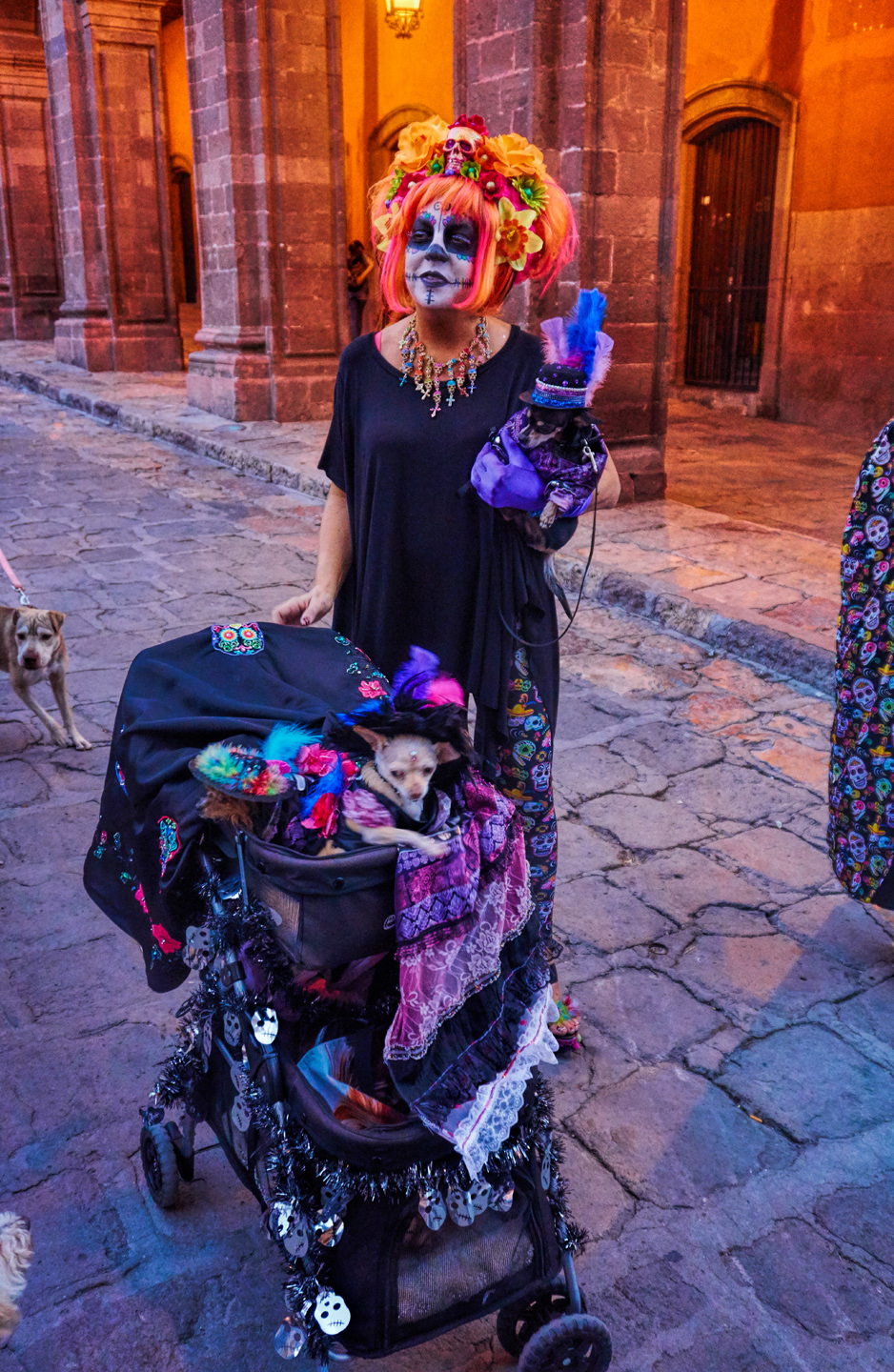
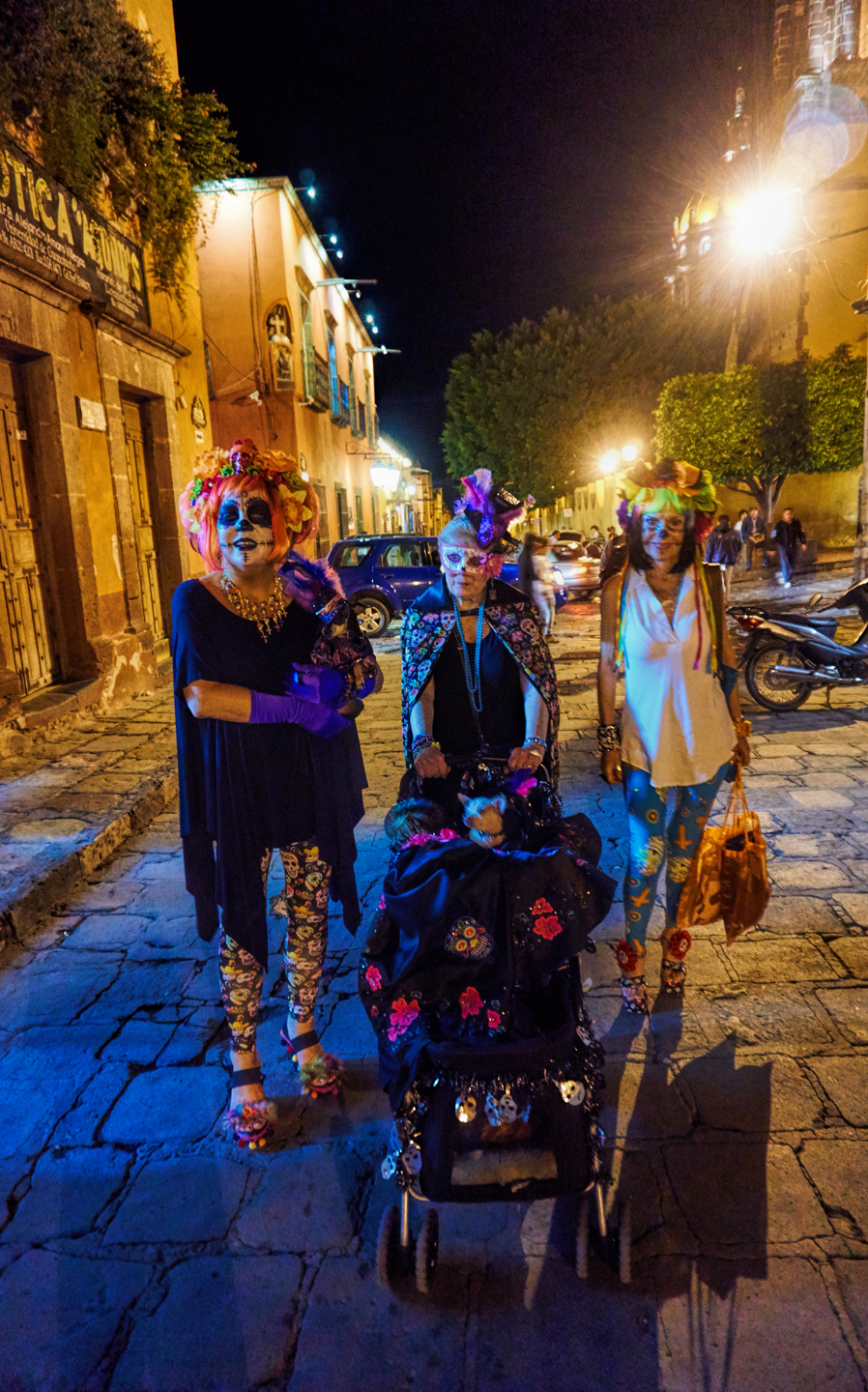
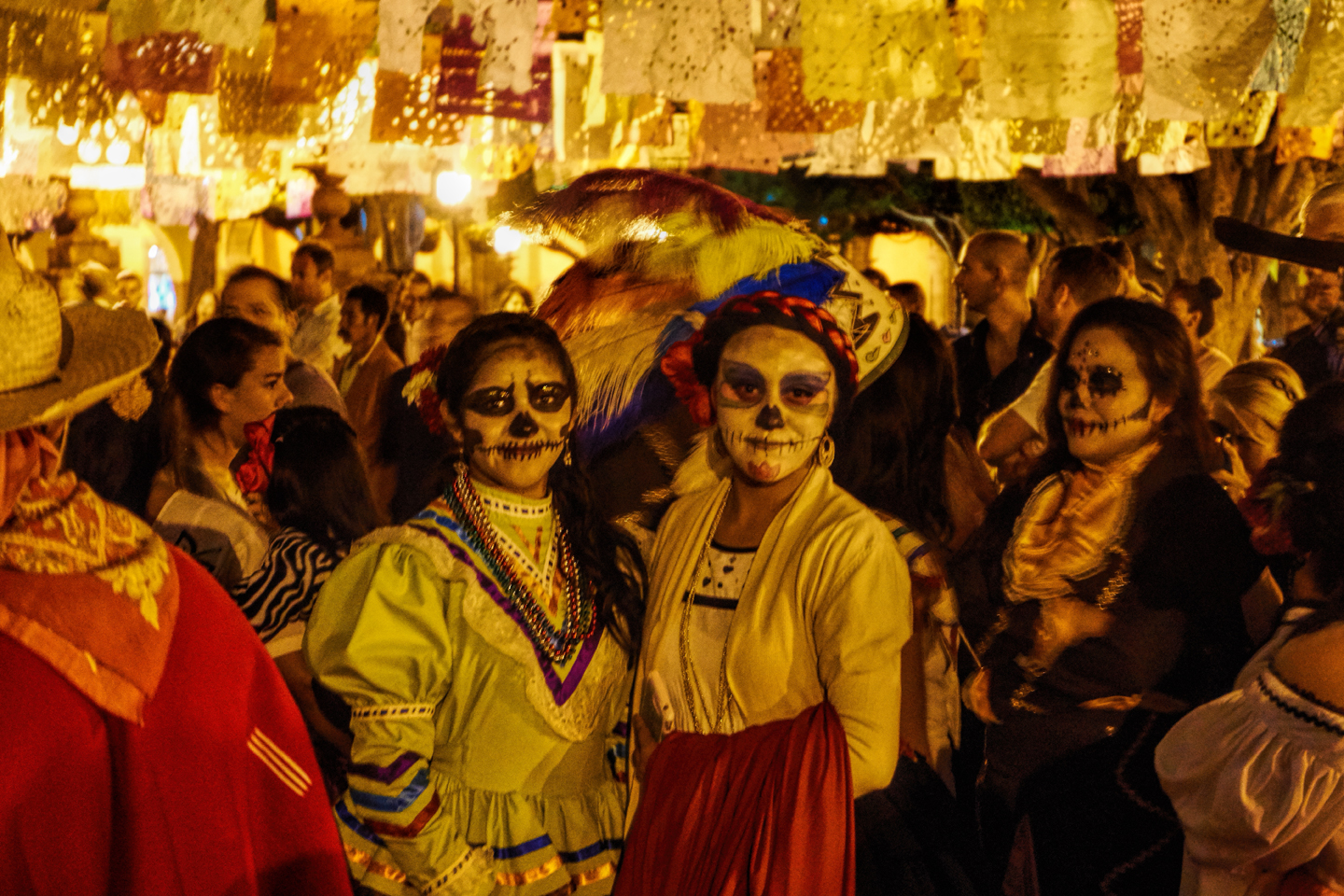
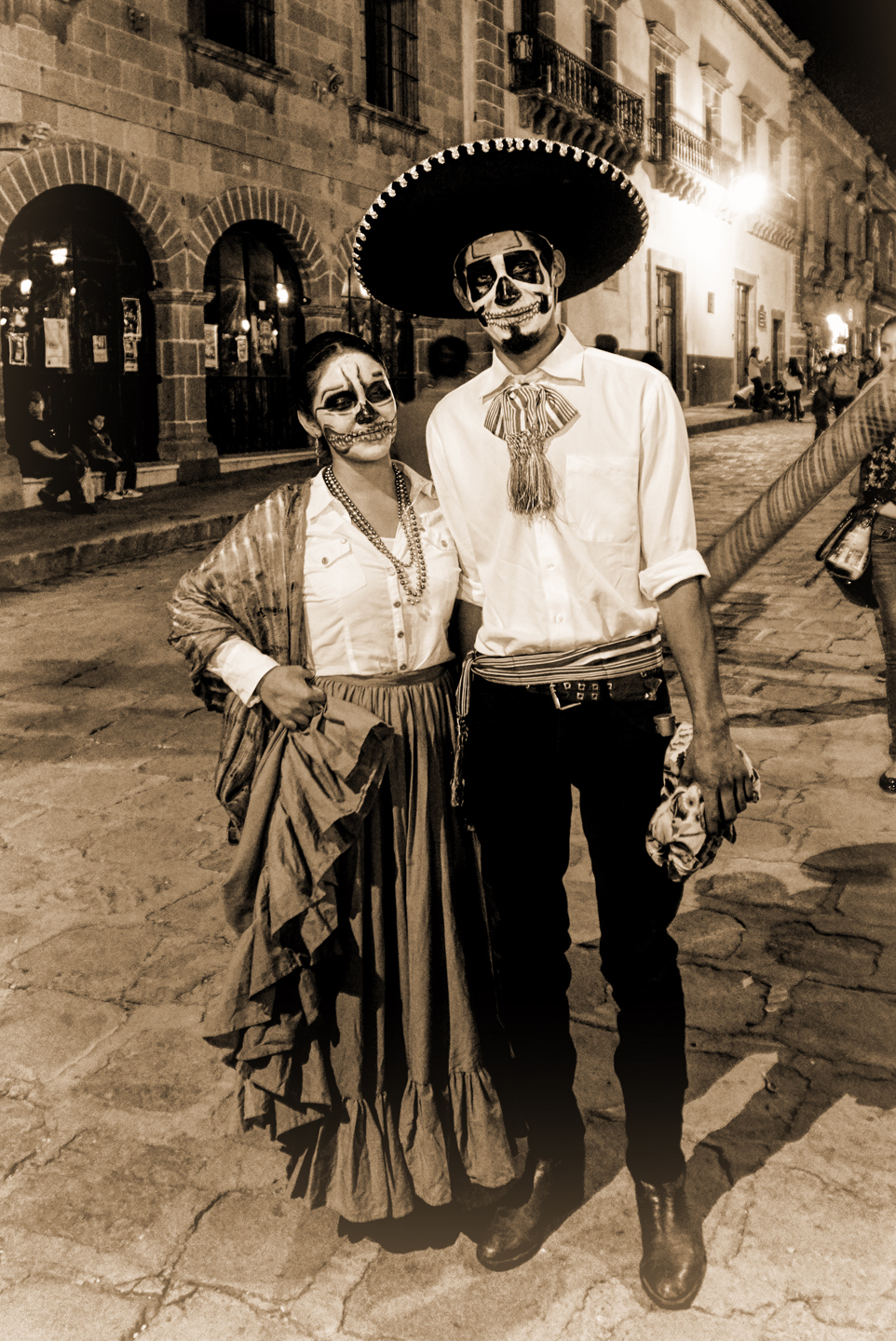
By mid-afternoon, the Jardin was beginning to fill with people. Painted faces were literally everywhere! It was like a costume party, but the venue wasn’t some hall or other indoor space, it was the whole entire town! Mike and I were definitely getting into the spirit of the thing–but we still drew the line at the notion of painting our beards.
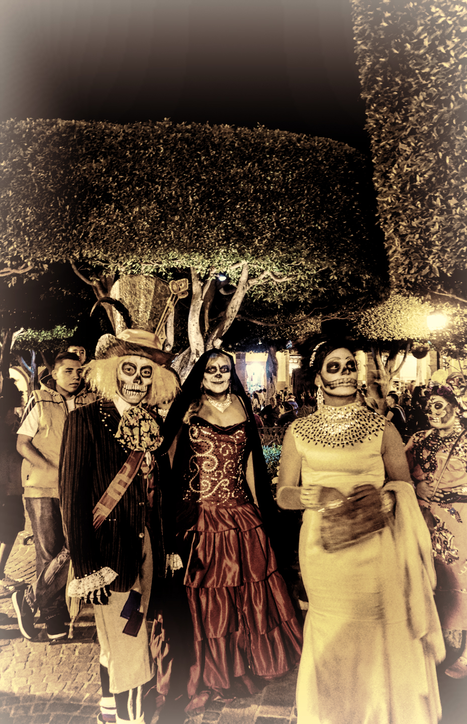
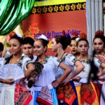
November 1st, the second day of the Festival, coincides with All Saints Day on the Catholic Calendar. In San Miguel de Allende, that’s the day for the grown-ups to get dressed-up, and parade themselves around the square. Families are still welcome, but the costumes get a whole lot fancier!
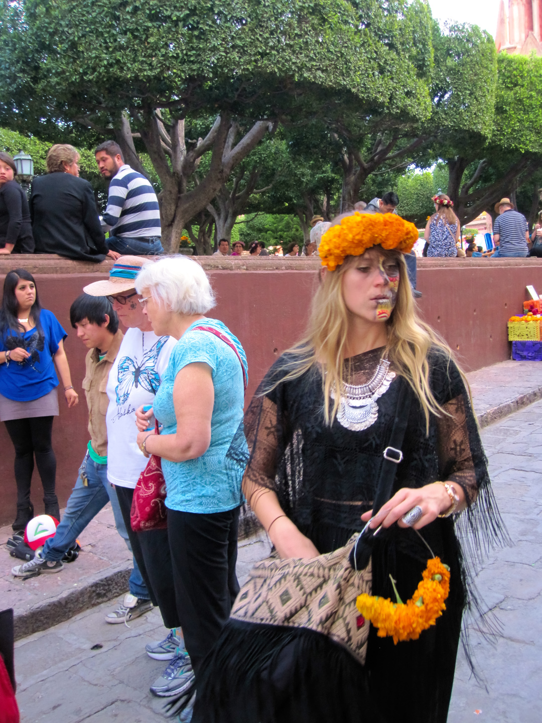
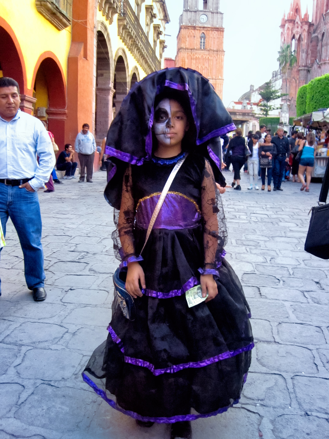
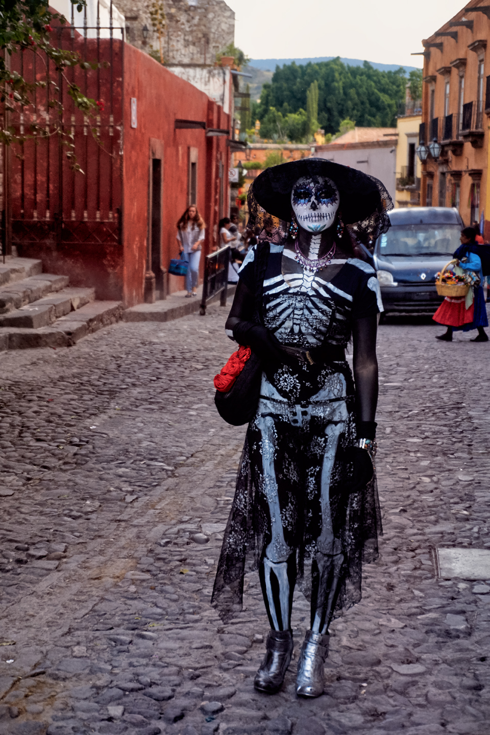
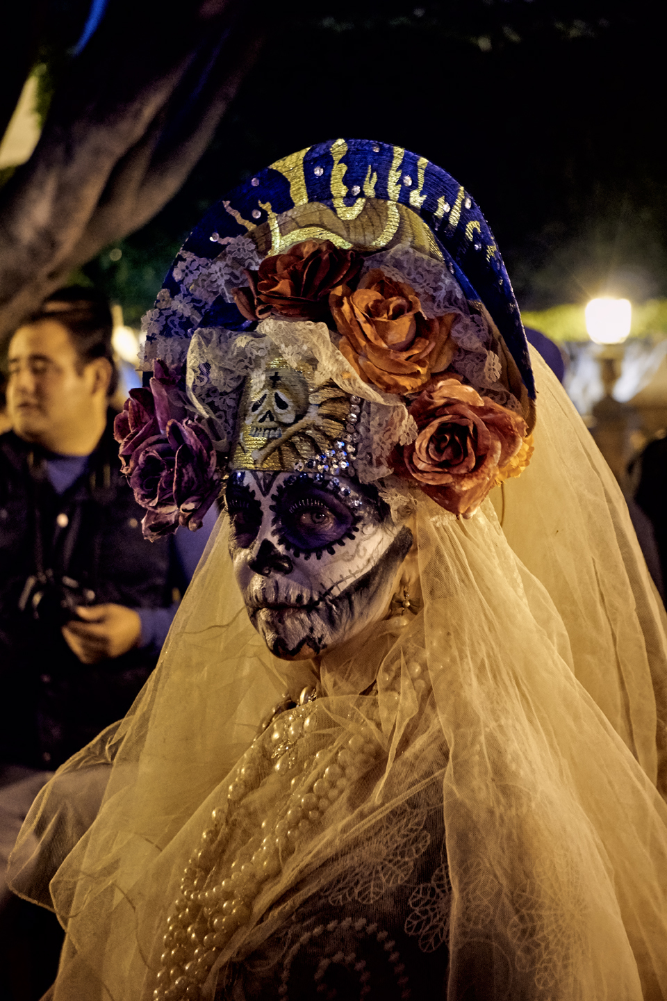
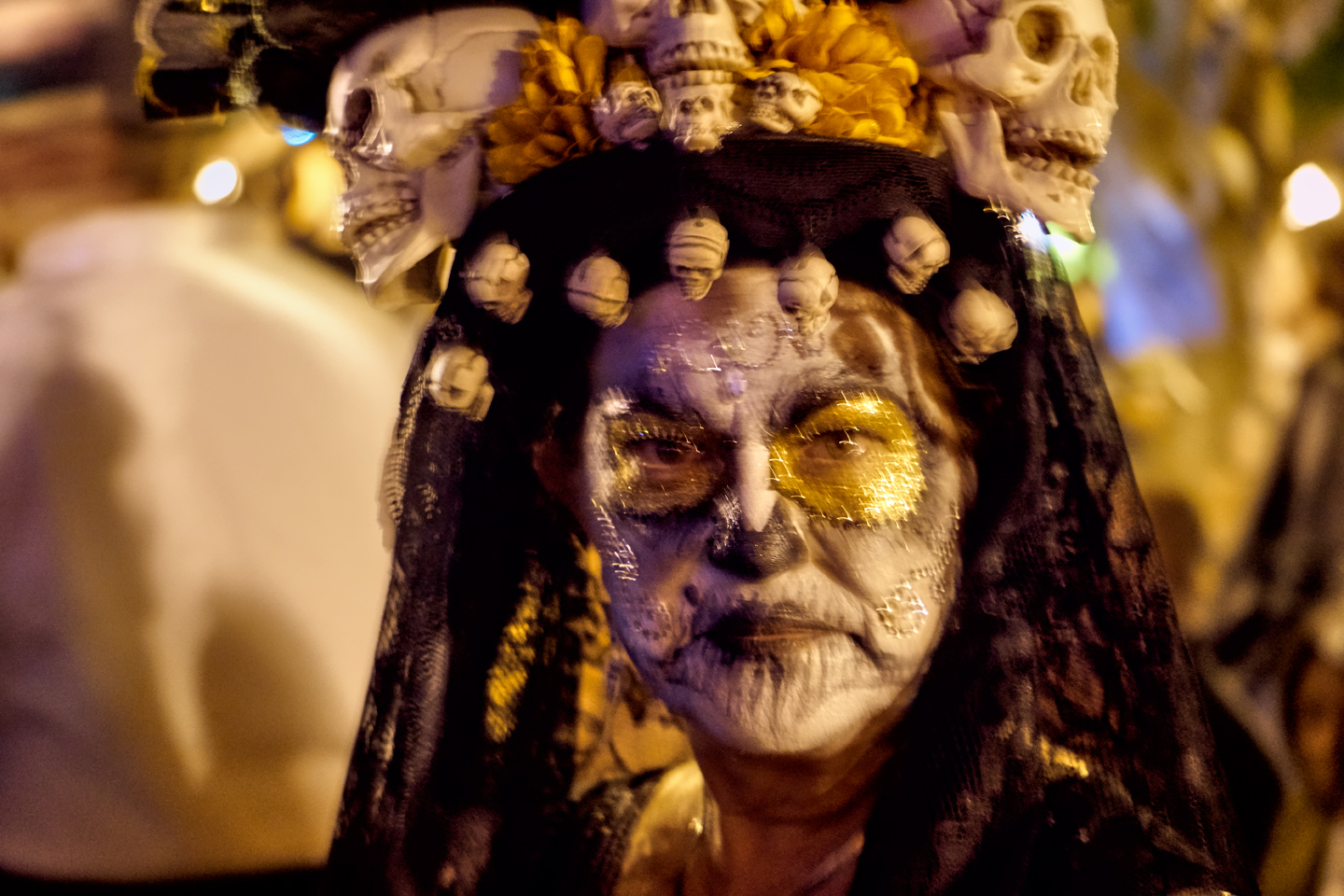
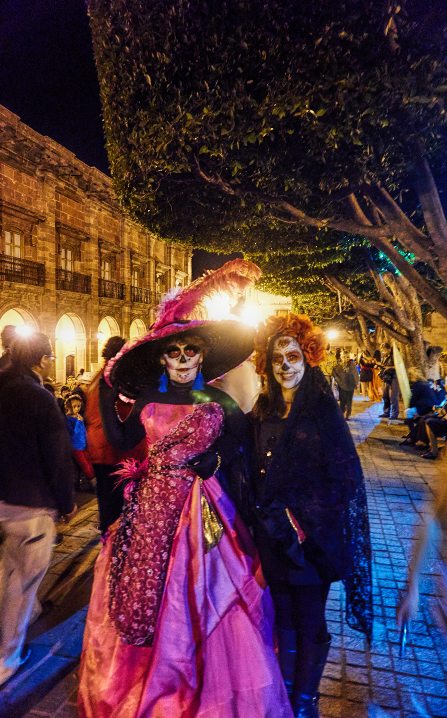
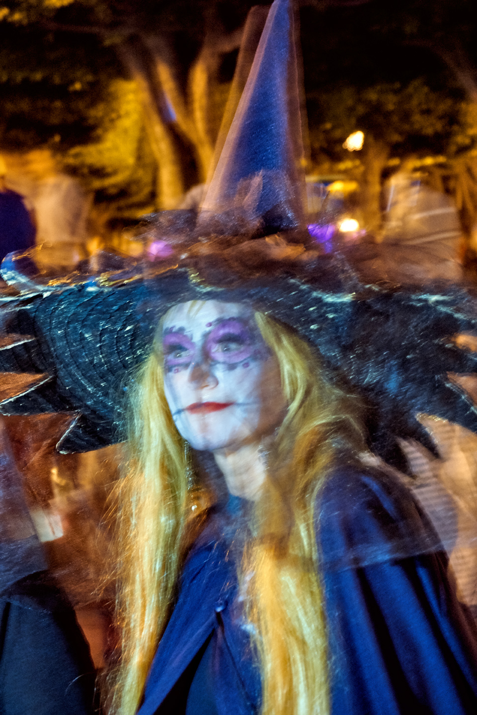
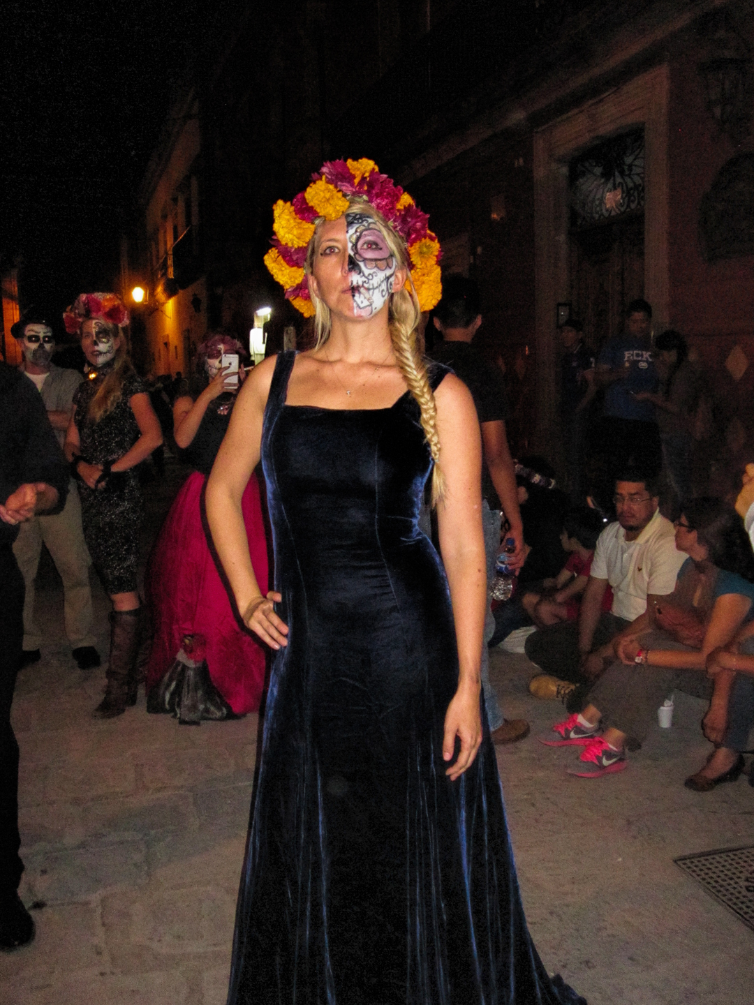
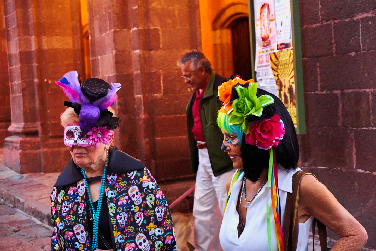
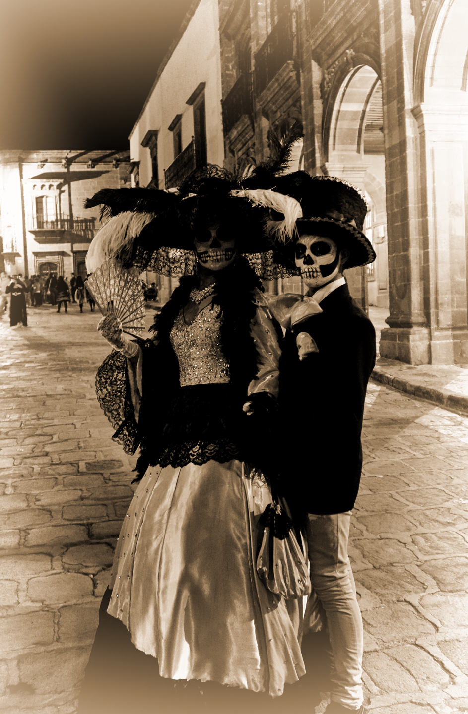
LA CATARINA
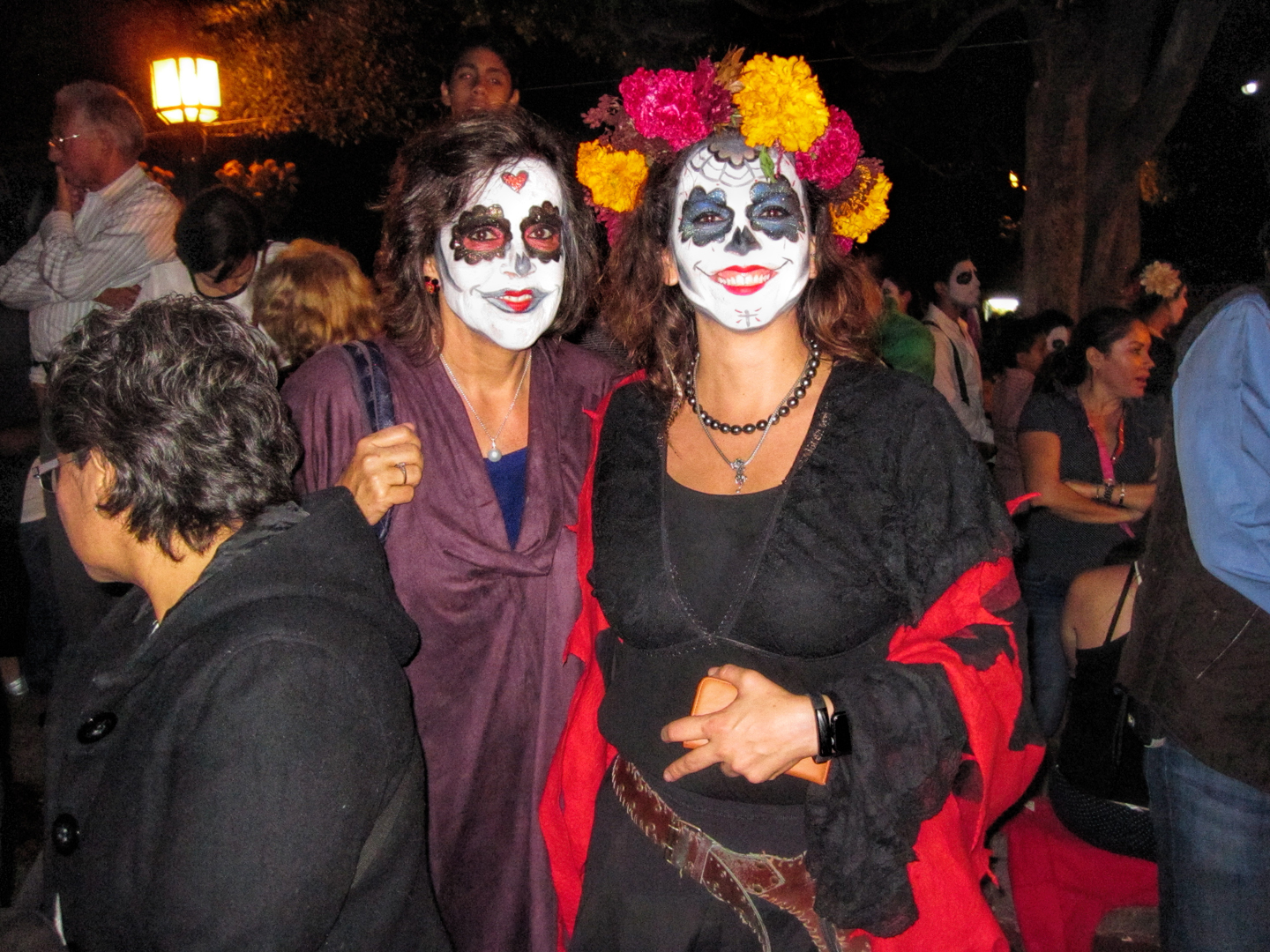
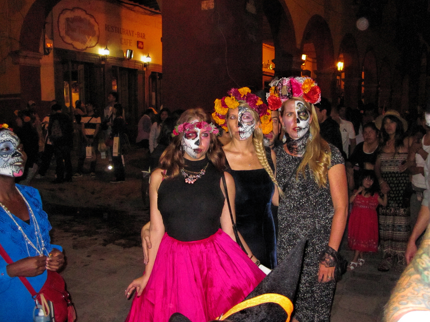
This is also the day they have the contest for the best Catarina, and the Desfile de Las Catarinas (the Catarina Parade). For the uninitiated, Catarina is the most enduring symbol of the Dia de Los Muertos, the dressed up sexy skeleton. Call her the non-threatening symbolic representation of death itself. Her fancy clothes show everyone that death is the great equalizer, affecting even the rich and beautiful.
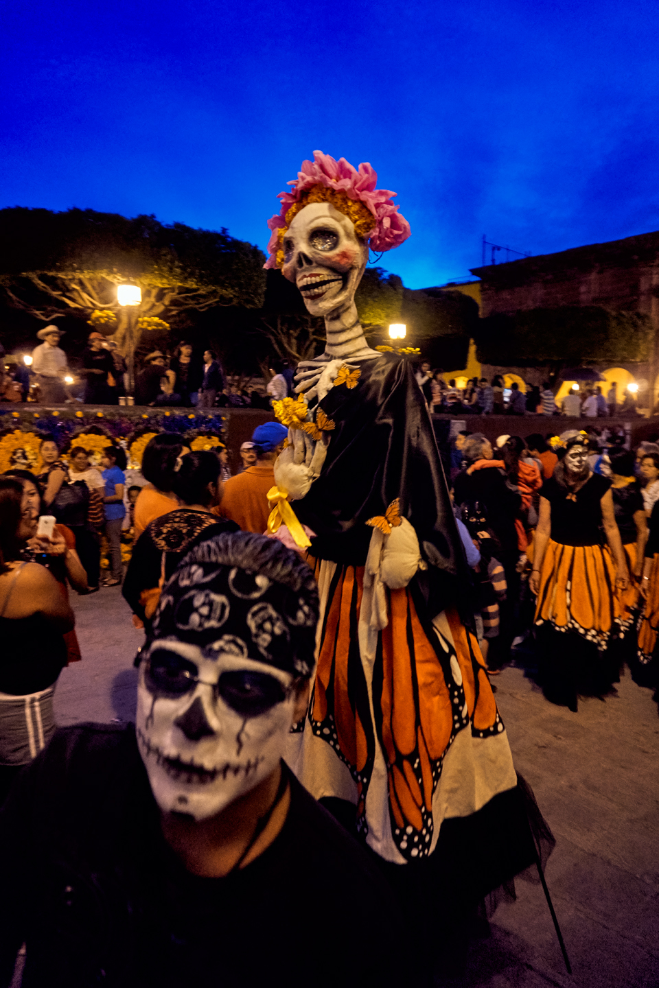
One group of costumed revelers escorted a Catarina dressed as a Monarch Butterfly.
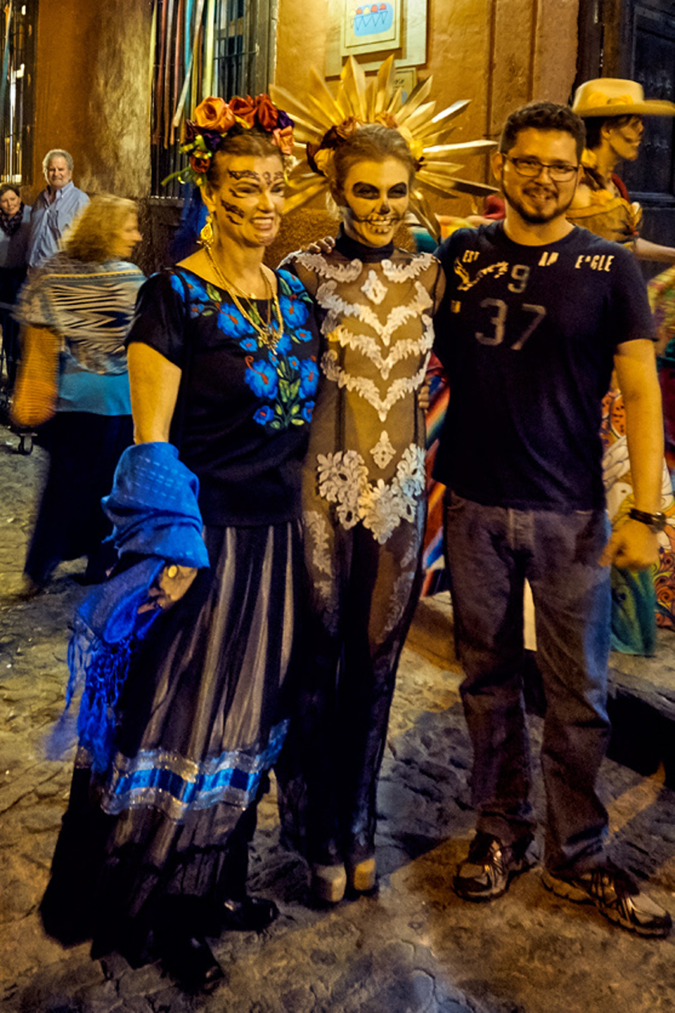
Some of the most elaborate costumes were worn by lovely ladies from San Miguel’s expat community.
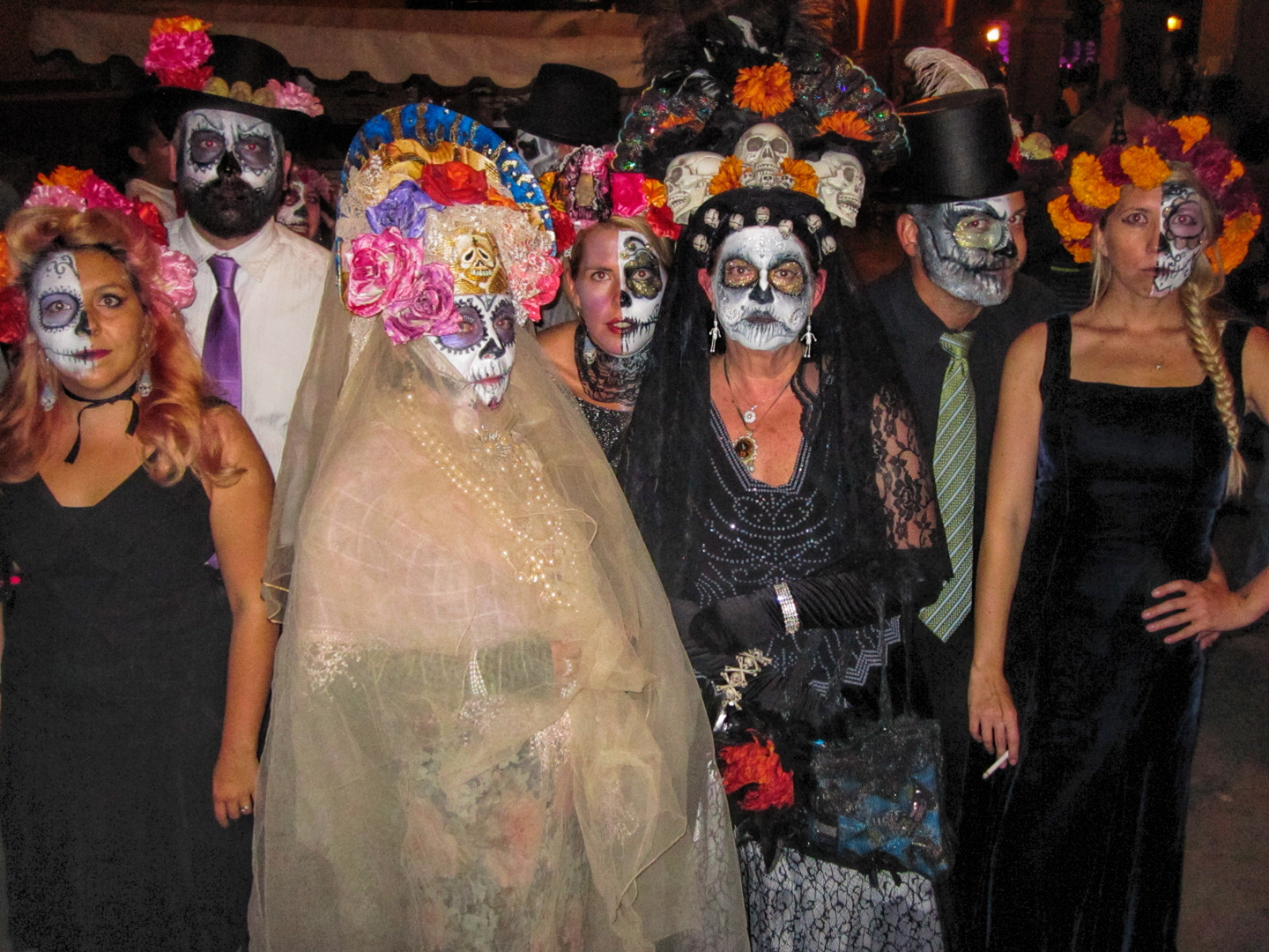
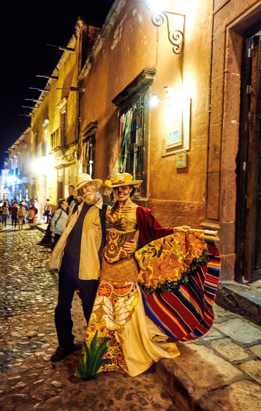
Everyone in the crowd was in awe of these ladies, untouchable in their extraordinary Catarina regalia. Mike walked right up and threw an arm around each of them. The man never missed an opportunity to give a pretty girl a hug!
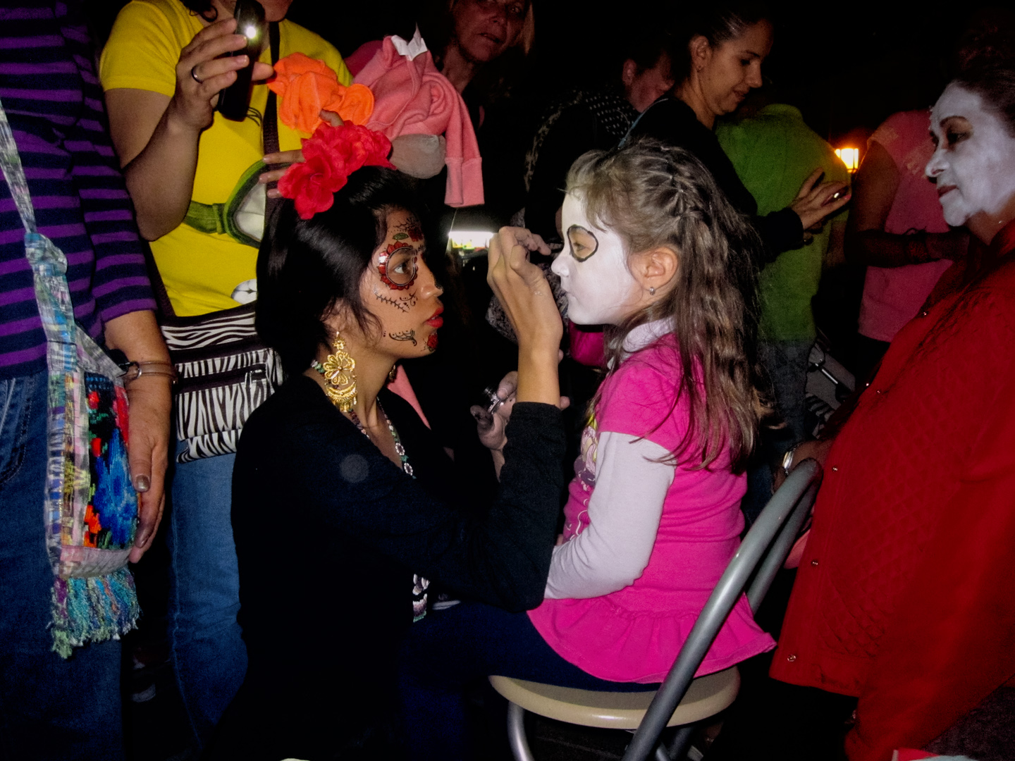
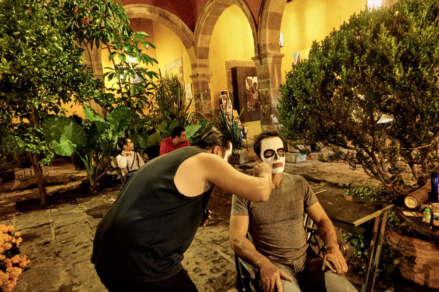
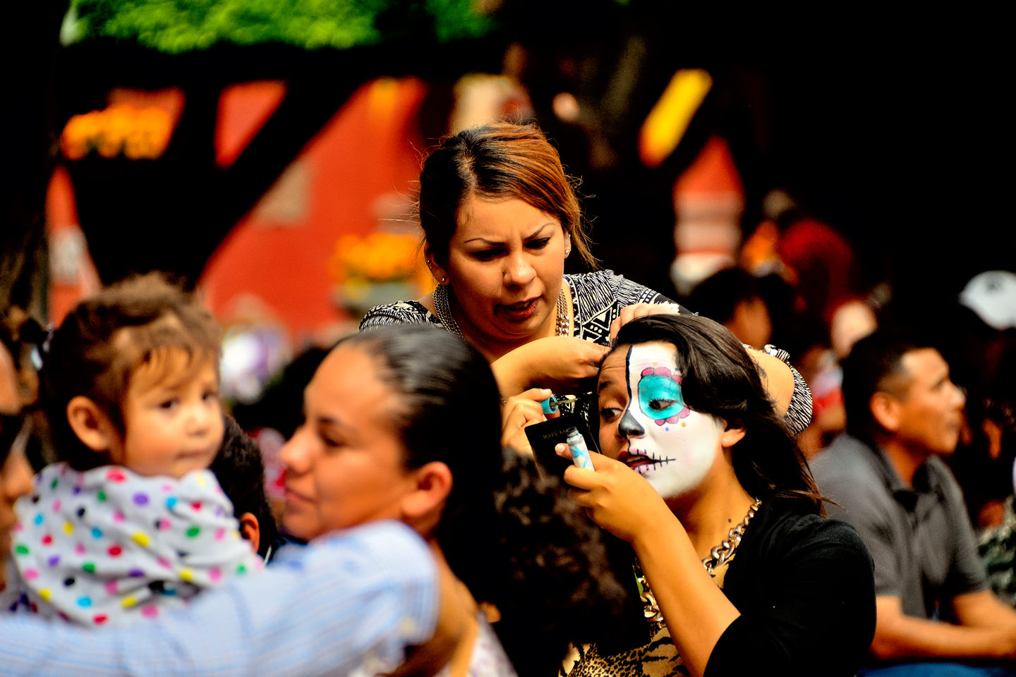
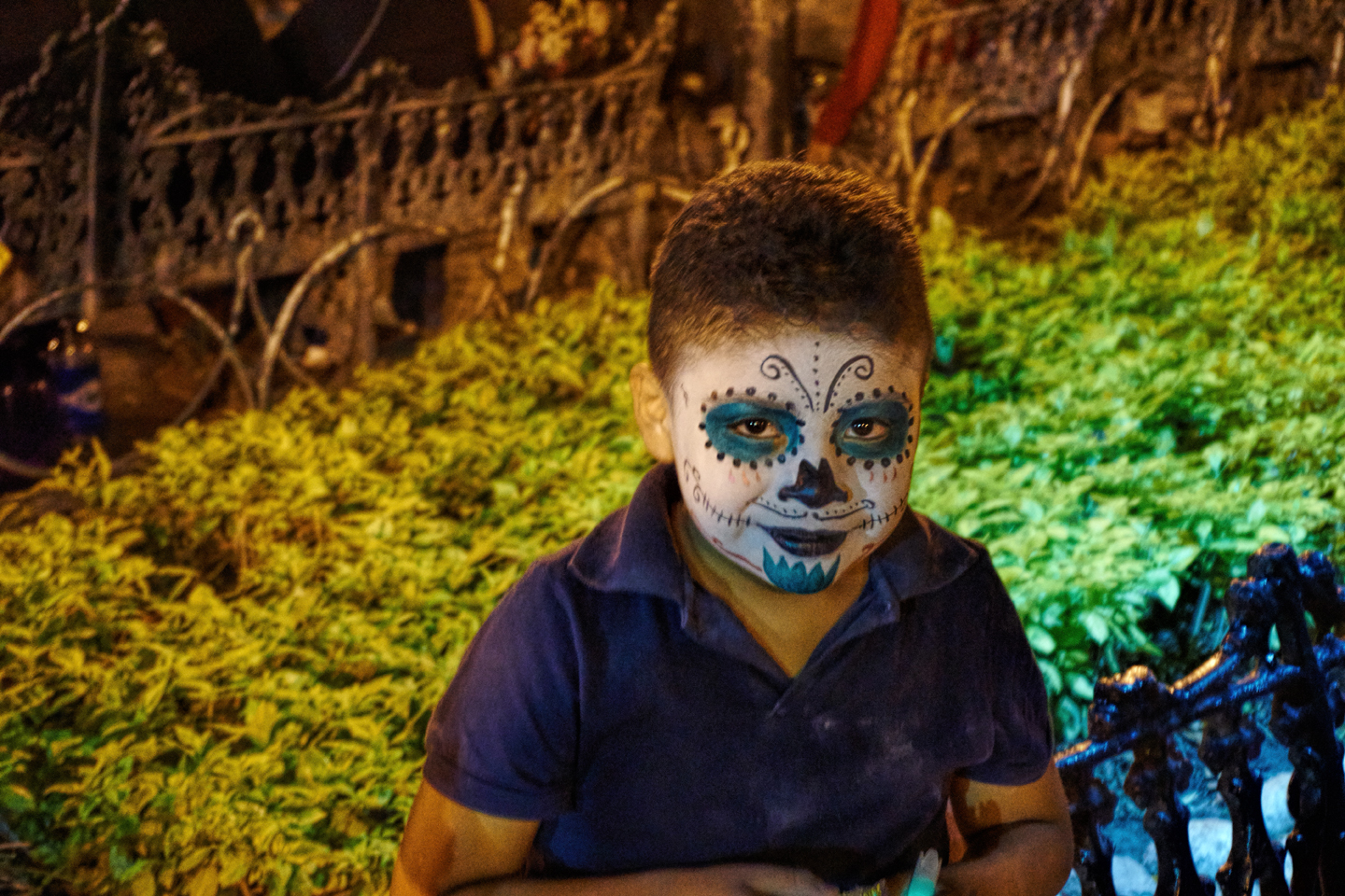
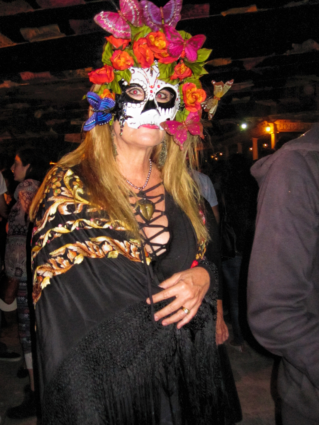
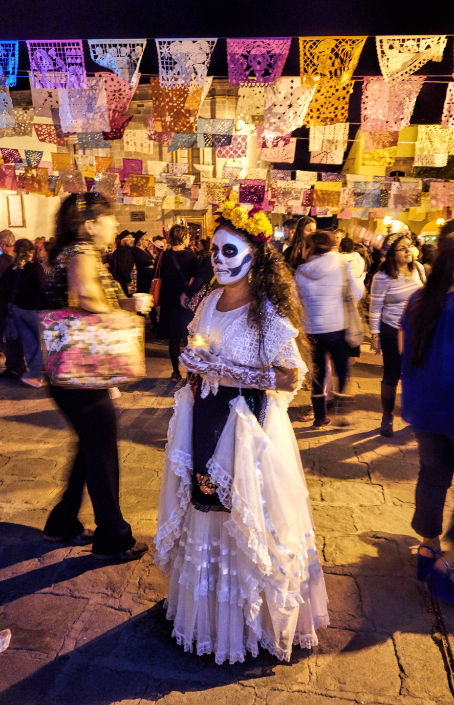
FACE PAINTING
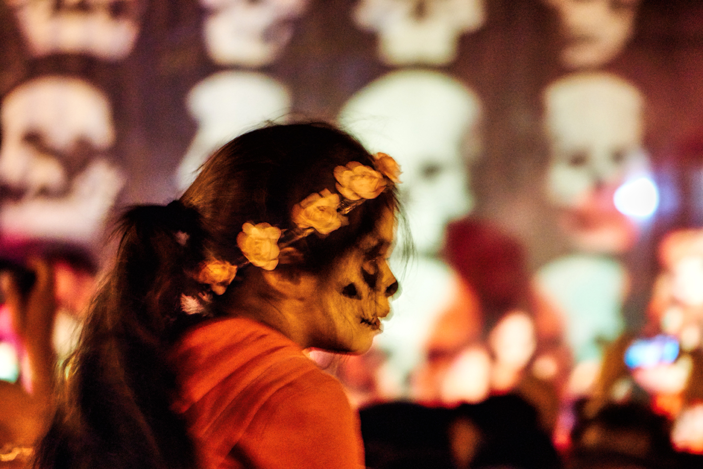
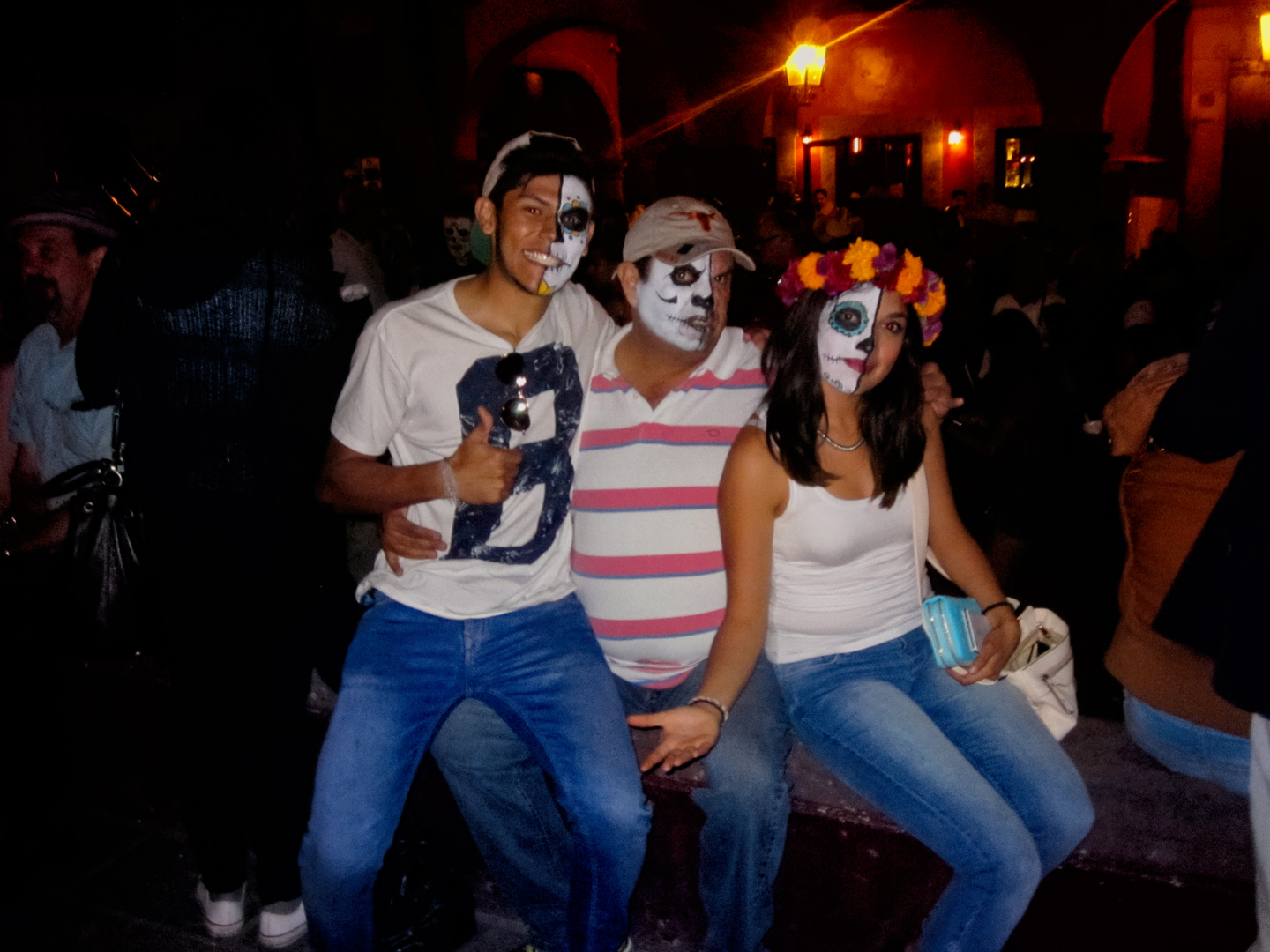
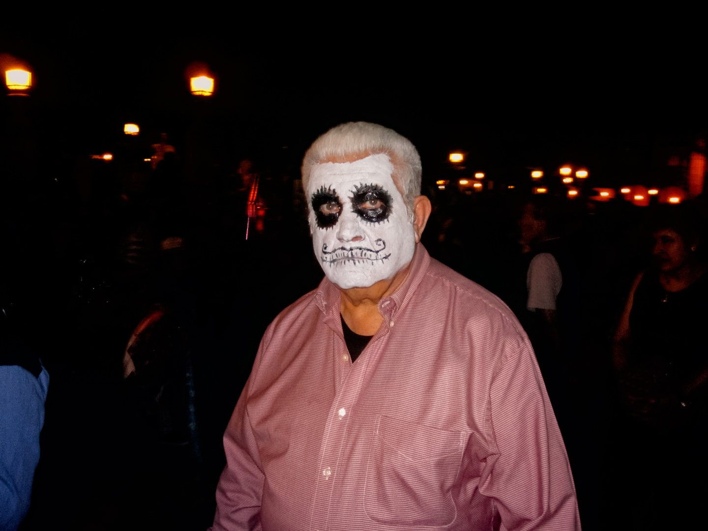
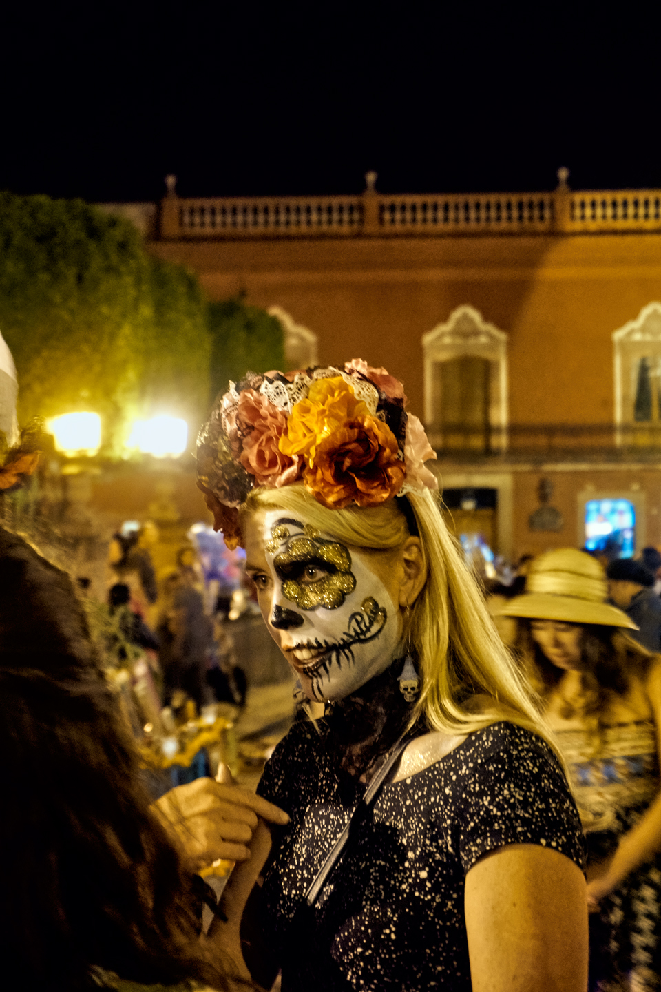
Everyone in town (okay, almost everyone), gets their face painted with that ghostly white makeup. Eyes, nose, and mouth are outlined in black, with other embellishments added, creating personalized variations on a general theme. The goal is to make one’s face look like a calavera, a human skull, but, trust me, you’ll never see a skull in nature that looks anything like these! The origins of the tradition are a little murky, but it’s widely believed that it started with the sugar skulls used to decorate the ofrendas, the altars set up to honor deceased loved ones through the course of the holiday.
The little skulls, made of molded sugar, are painted and decorated, presumably to make them less frightening for the children. At some point, people started painting their own faces to resemble those of the sugar skulls. It became a friendly competition, people trying to out-skull one another, and it caught on, spreading to all parts of Mexico, and becoming perhaps the most widely recognized aspect of this beloved national holiday.
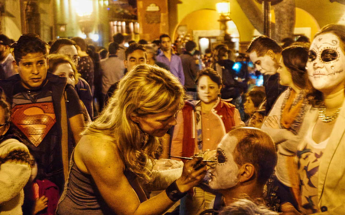
Having your face painted by a beautiful stranger is a uniquely itimate experience!
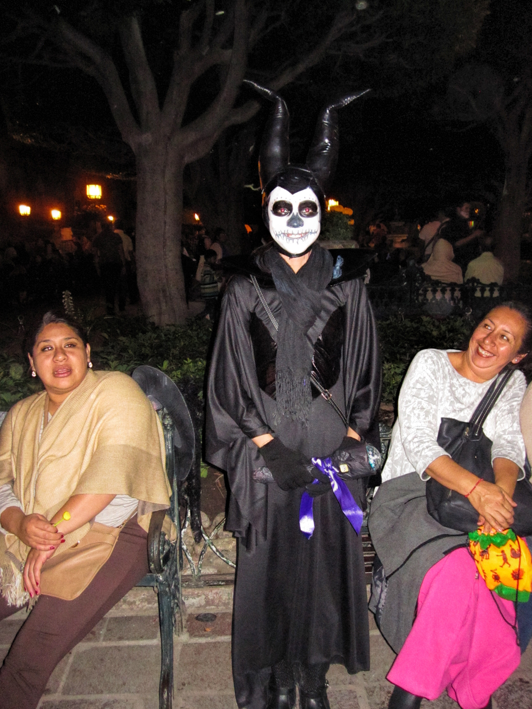

Some go with a plastic or fiberglass mask, rather than face paint, but it’s really not the same thing!
ENTERTAINMENT!
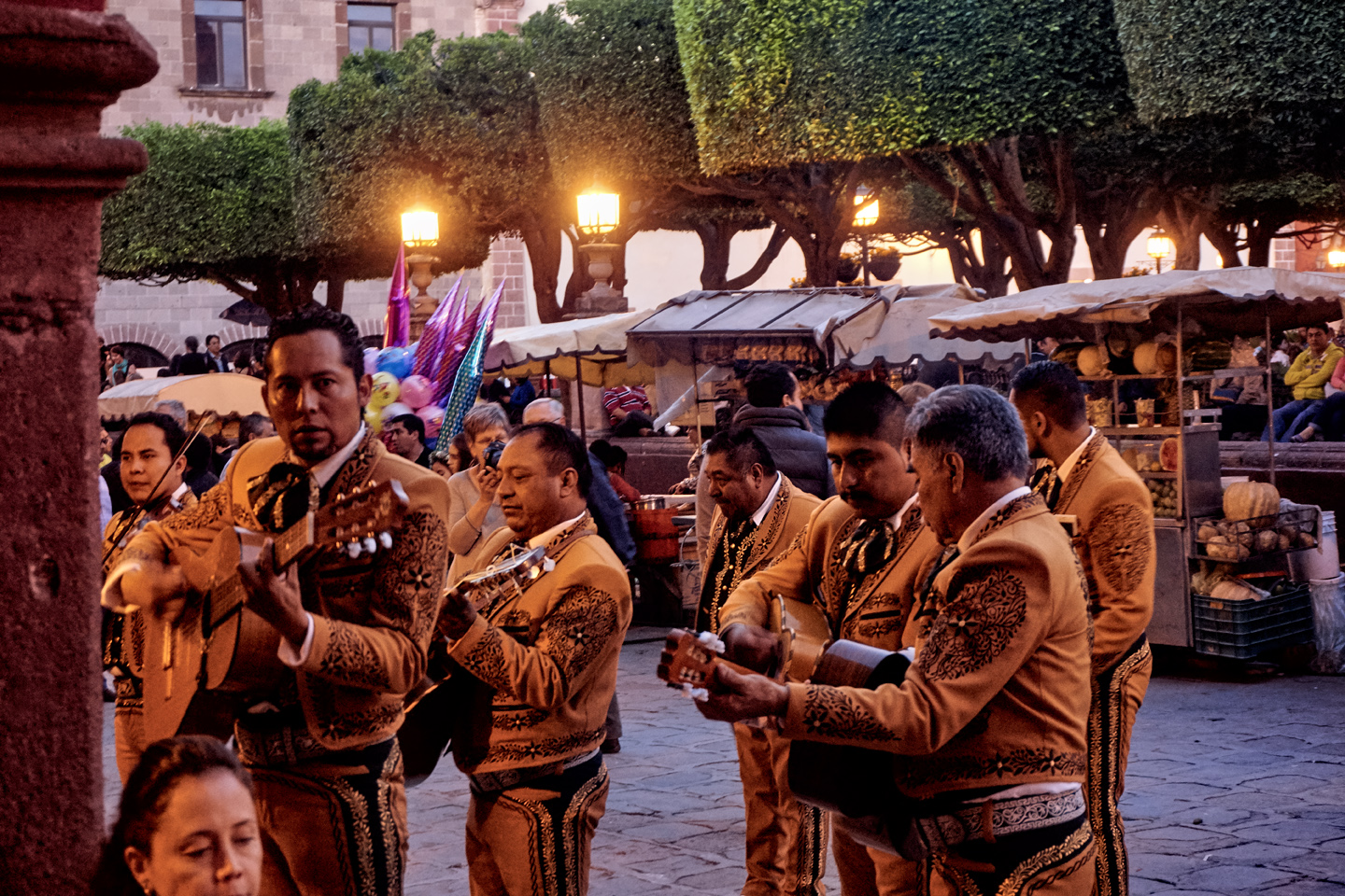
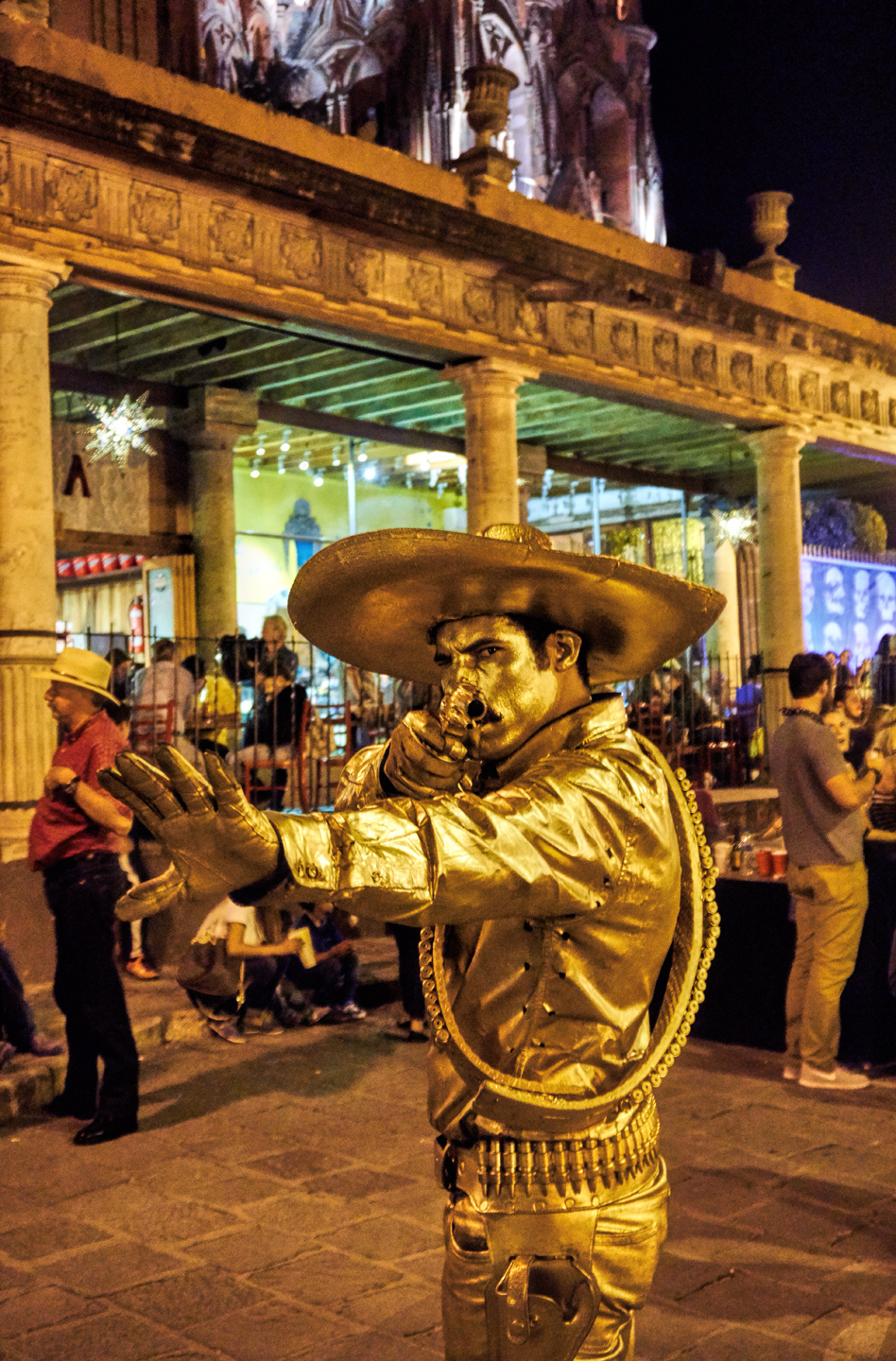
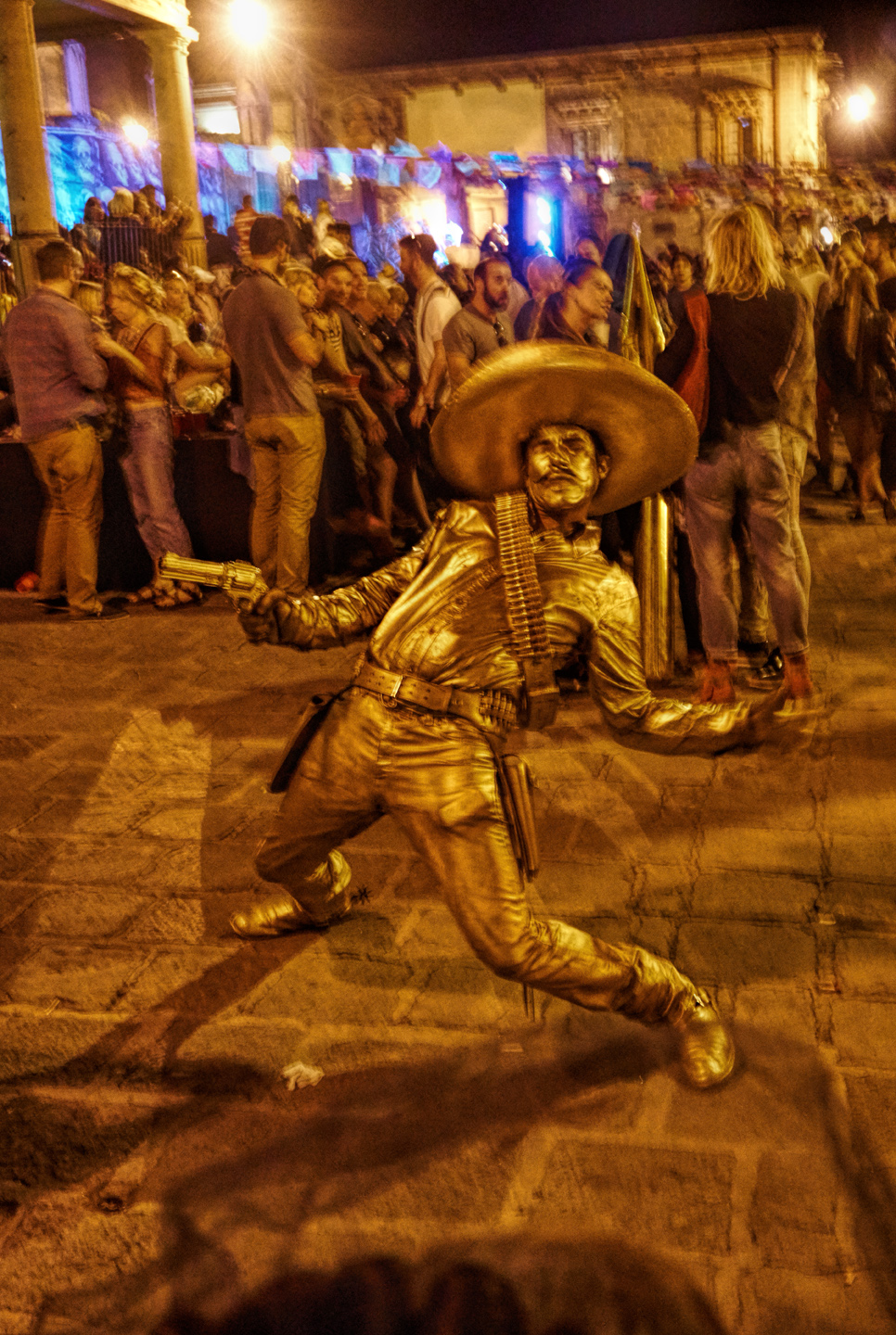
There’s a stage set up in the plaza, just in front of the Cathedral, and on the evening of All Saints Day, there’s a program with lights and sound, colored smoke, and dancing demons. The crowds in the Jardin swell to capacity with a convivial mixture of locals and tourists, many in costume or with faces painted, everyone equally welcome, everyone enjoying the show. Groups of mariachis and other musicians provide spontaneous entertainment on the perimeter of the plaza. Throughout the event there are people in those BIG costumes wandering through the crowd.

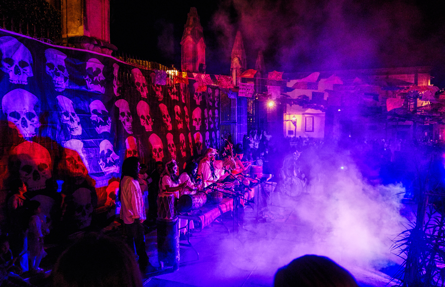
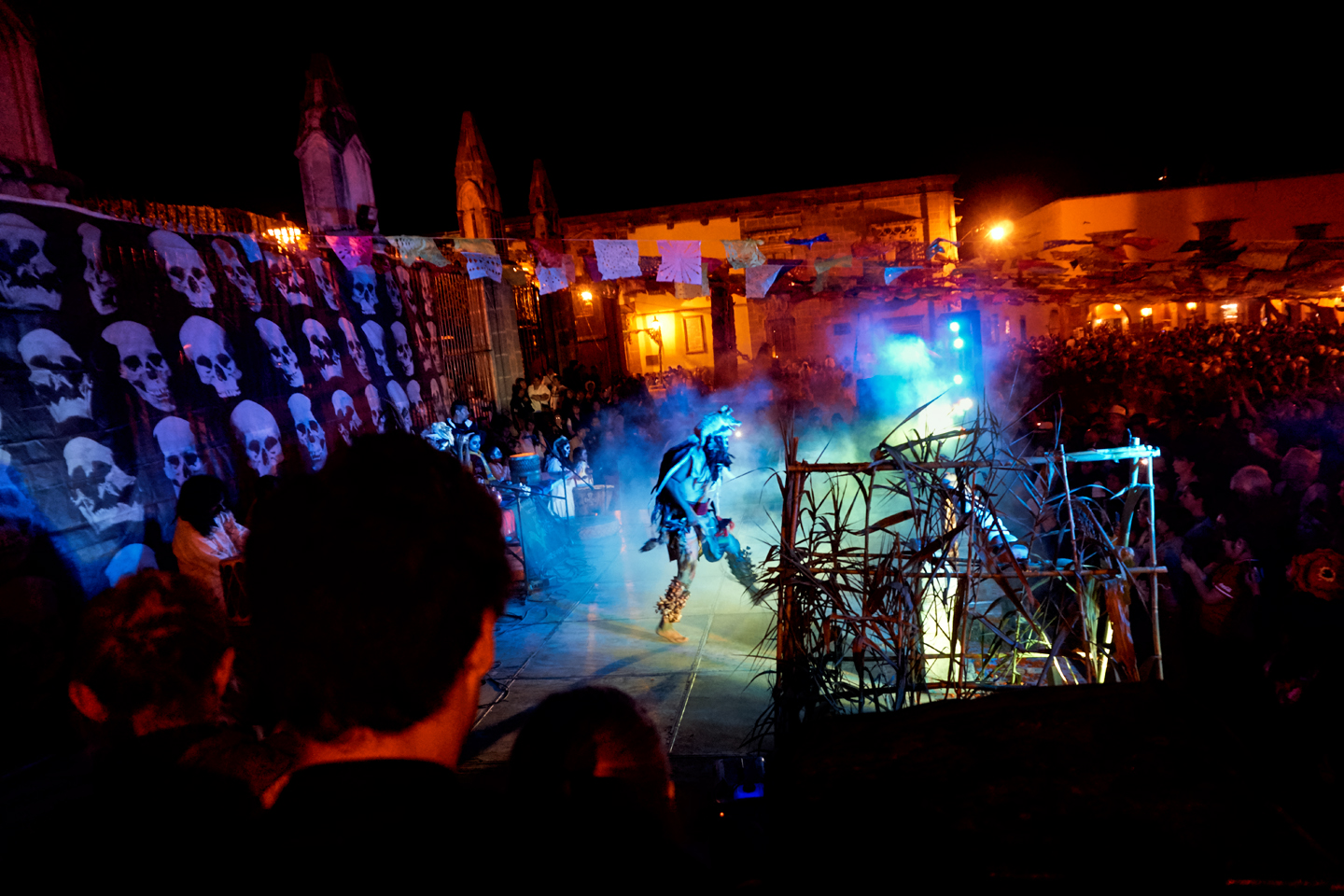
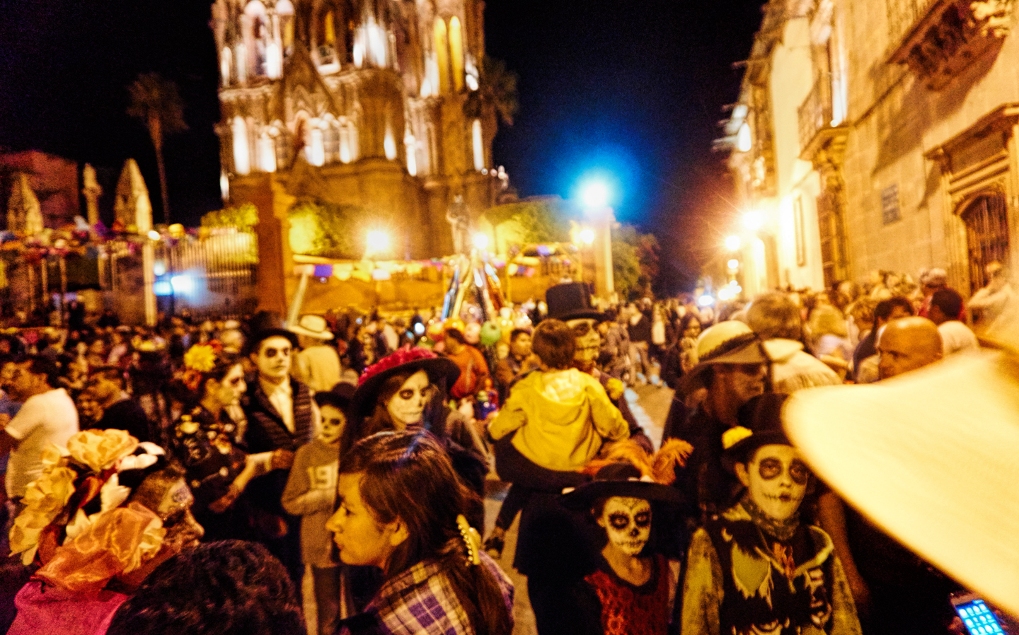
As the evening progresses, the crowds in the plaza pack the space like a sold-out rock concert, with the spotlights on the towers of the church providing a psychedelic light show.
The Fiesta was still going strong at midnight, but Mike and me were fading, so we flagged down a taxi, and had him take us to the San Ramon. There weren’t any meters in the taxis in San Miguel, at least not at that time. The fare was set based on the distance traveled, and both times we used taxis between the town and our hotel, we were charged 45 Pesos, just under $3.00. This time, I neglected to confirm the fare when we first got in the cab, assuming it would be the same as what we’d been paying. Big mistake! When we arrived at the San Ramon, the driver demanded TWO HUNDRED Pesos, claiming that was the rate, because the San Ramon was outside the city limits. That was an extra ten bucks, and I had no choice but to pay it, because the service had already been provided.
Another lesson learned the hard way: when traveling by taxi in Mexico, always confirm the fare before starting the trip. Otherwise, you run the risk of being overcharged by an unscrupulous driver!
DAY 3: NOVEMBER 2nd: DIA DE LOS MUERTOS
We had a liesurely breakfast at the San Ramon, in no big hurry to get going. There was very little happening in the Plaza on this day, Day 3 of the festival. This was All Souls Day, better known as “el Dia de los Muertos!” Today was the official holiday, and this part of the celebration was far more personal. This was the day when most families created their ofrendas, their own versions of the elaborate altars erected in the Jardin. The shrines pop up everywhere, in homes, in courtyards, and in the cemeteries, where families gather to celebrate the memories of their loved ones. We weren’t involved in any of that, so our plan for the day was to simply wander the town at our liesure, and take more photos of the decor and the people in costume. Everything we’d seen and done up to this point had been marvelous. Today, we were going to wrap it up, and tie it with a bow.
We took the bus into town, one last time, paying special attention to the Los Muertos decorations on every street in in the city.
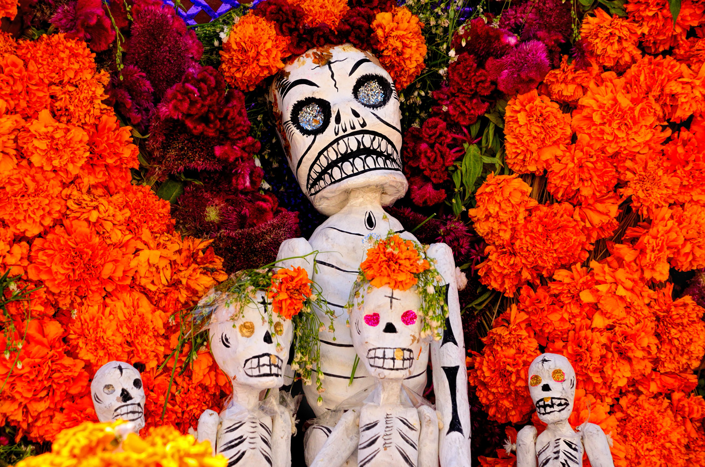
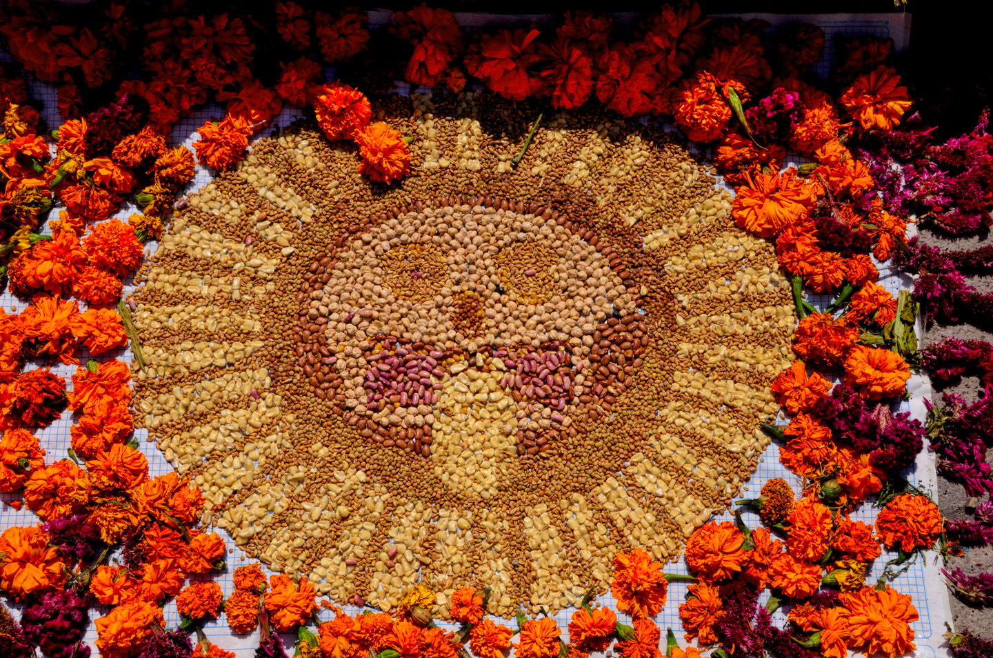
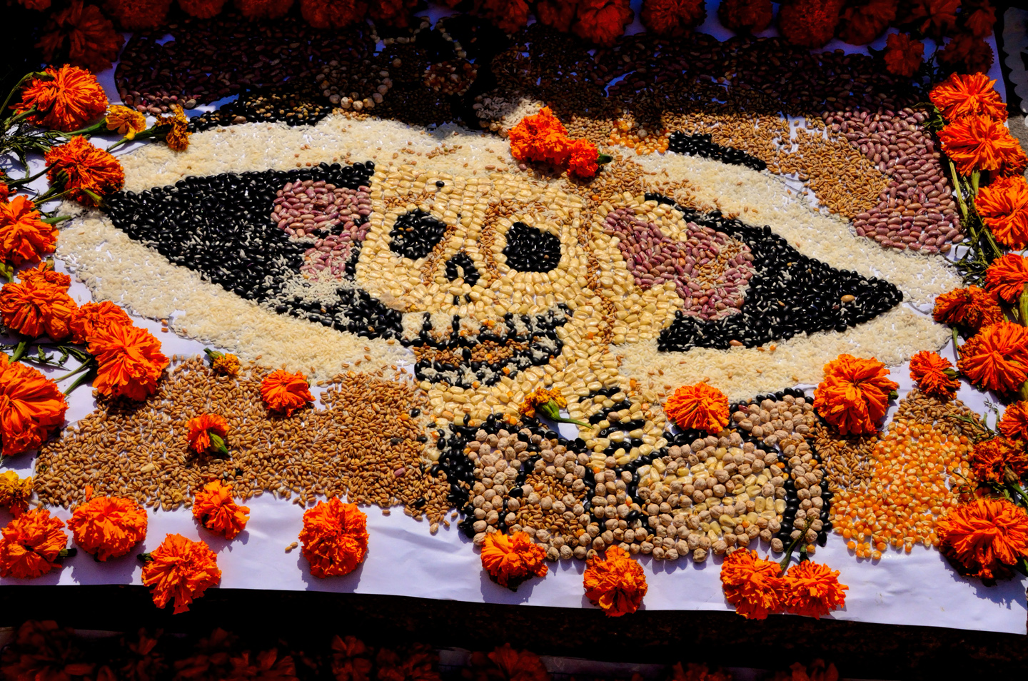
Considerable artistry goes into the making of the decorations. There are simple sugar skulls, along with entire sugar skeletons, and groups of skeletons arranged in tableaus. There are skeleton-themed mosaics made from multi-colored beans and seeds, all of it surrounded by intricate floral arrangements, extra heavy on the marigolds.
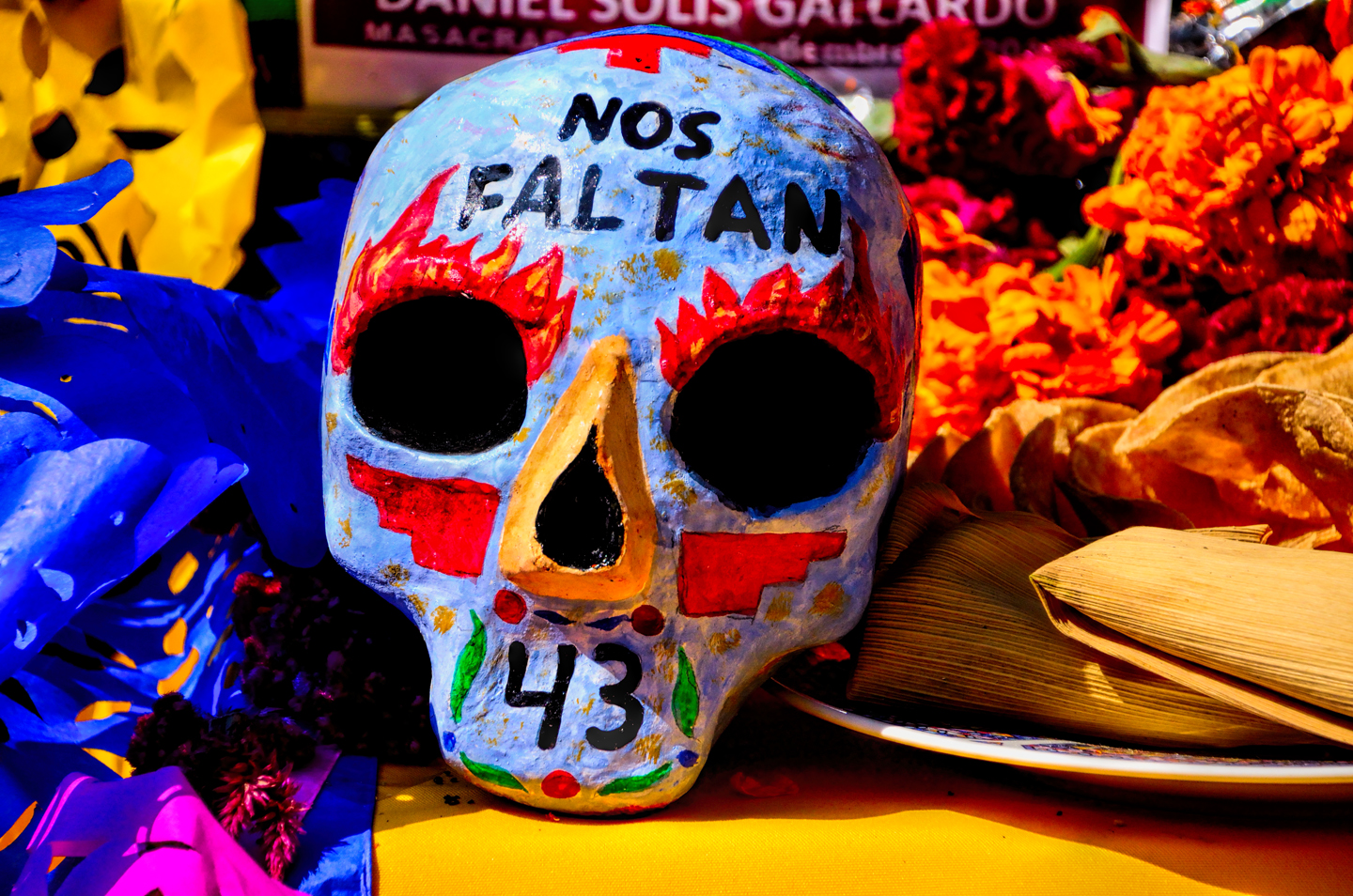
“Nos Faltan 43,” (we’re missing 43), another reference to the student protesters who “disappeared” in 2014.
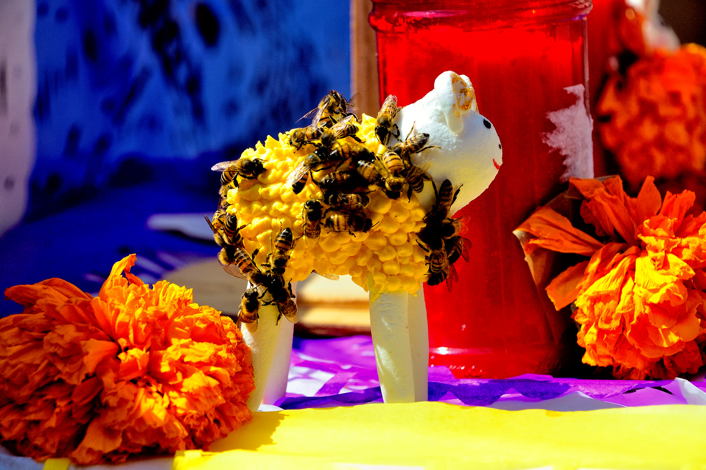
None of these skulls and skeletons are intended to be gruesome, definitely not fearsome, and the kids get into it in the same way that most kids love Halloween. The skulls, and many other elements on the altar displays, are sweet treats made of solid sugar, a fact that isn’t lost on the local bee population. In the spirit of the holiday, no one bothers to shoo them away. The bees, it is said, are entitled to a celebration of their own!

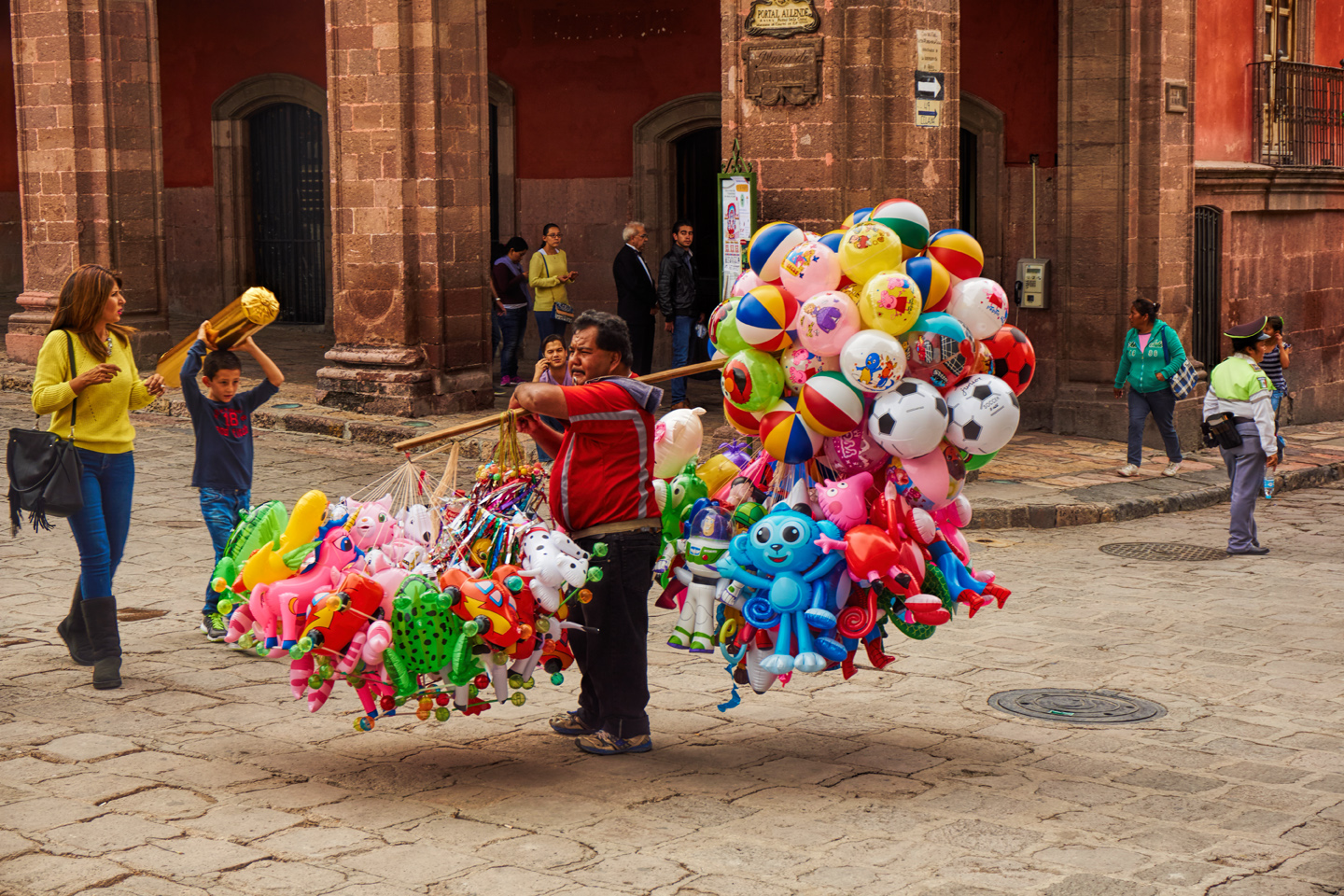
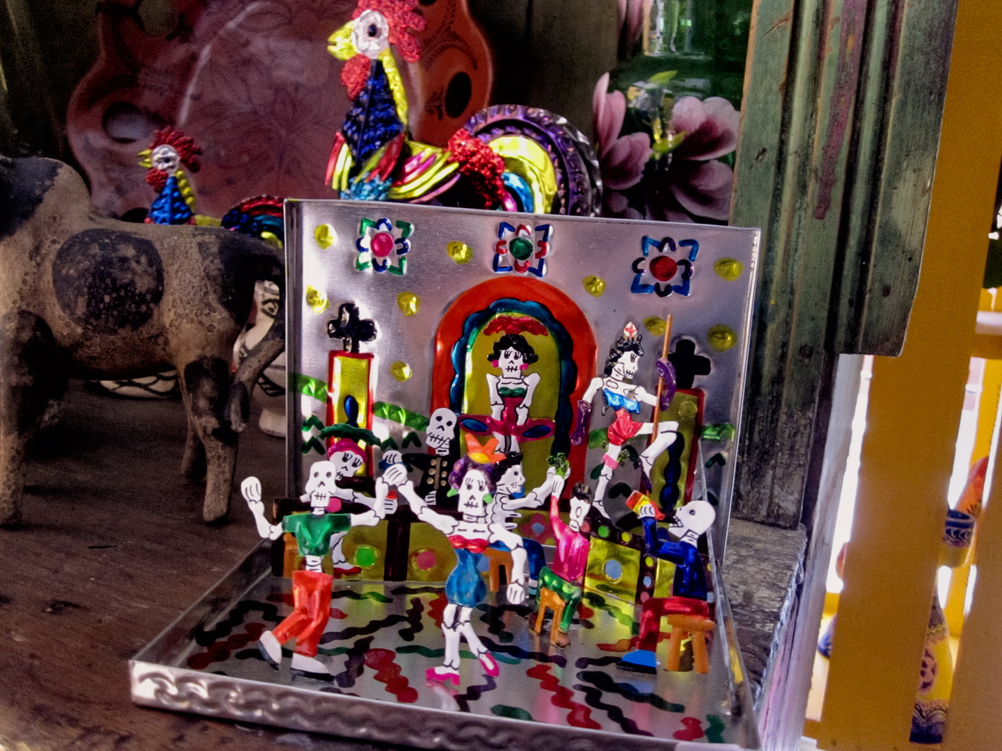
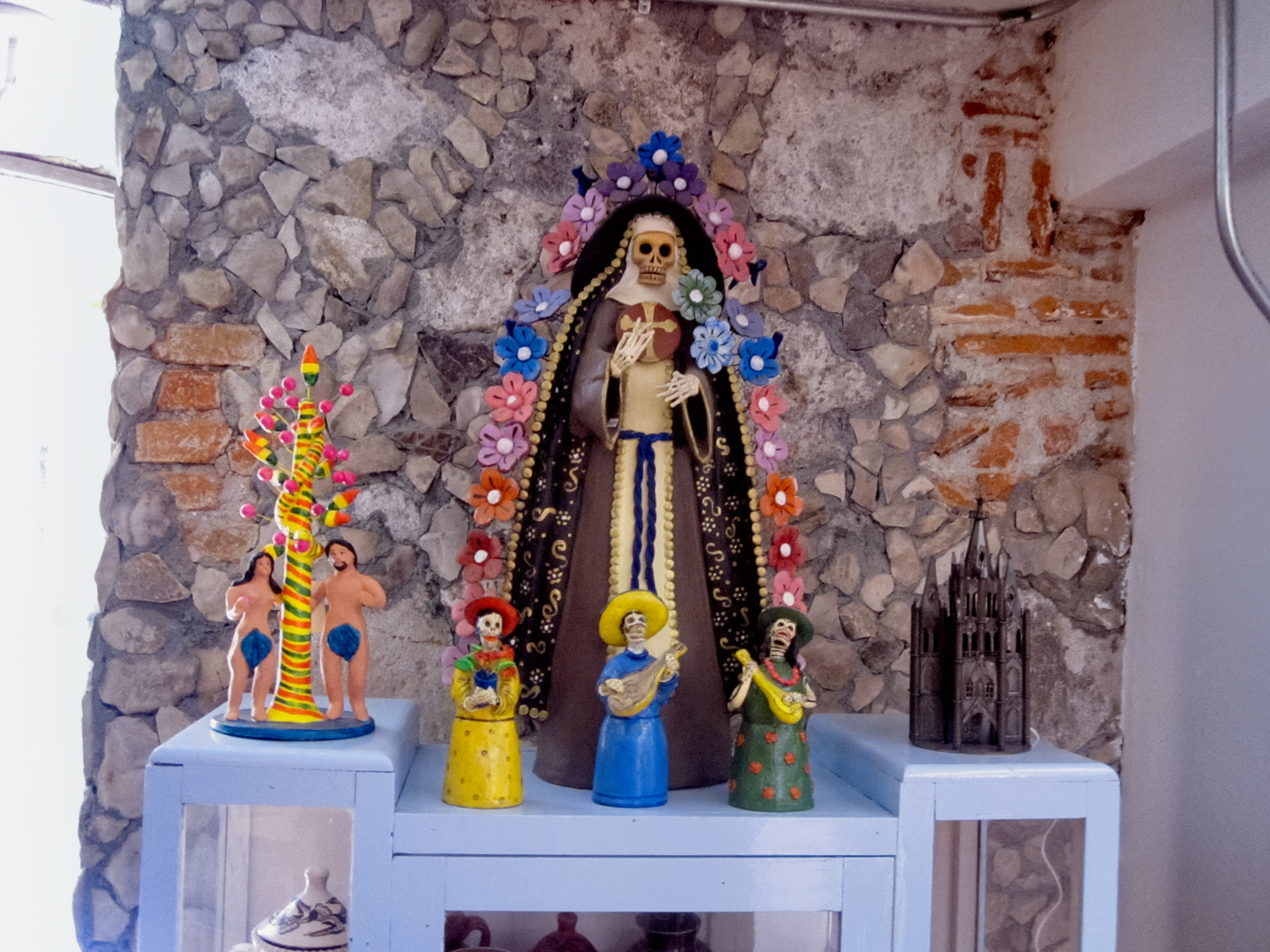
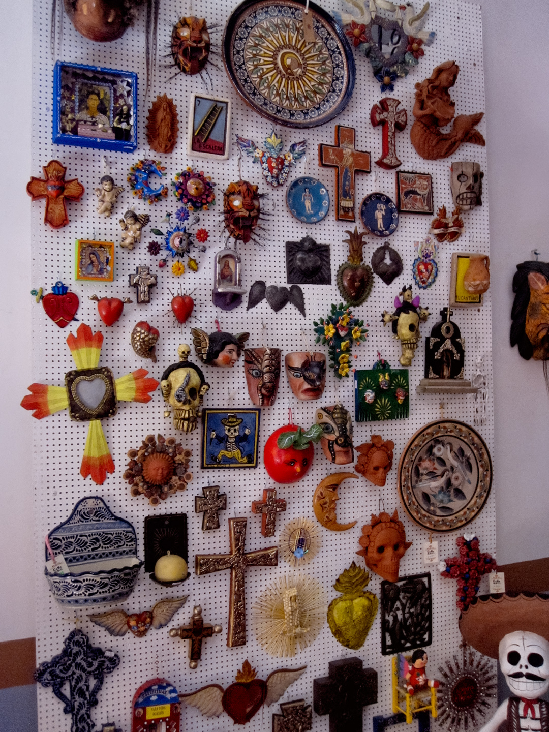
Like any other holiday, or like anything else that people enjoy, there’s merchandising that goes along with the Day of the Dead, and some of it is pretty wonderful, the craftsmanship superb. Since this is Mexico, we’re not talking about cheap plastic junk mass produced in China:
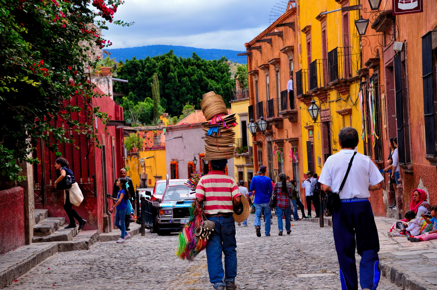
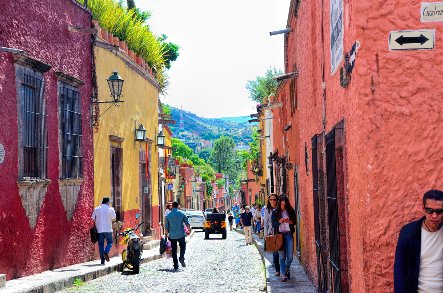
San Miguel de Allende is a very pretty town, with well preserved Spanish Colonial architecture and cobblestone streets that provide a charming ambience, and a palpable sense of history.


As the afternoon wore on into evening, painted and costumed locals appeared in the Jardin. It wasn’t anything close to the crowd that appeared on Friday and Saturday night, but it was still amazing, and great fun to observe!
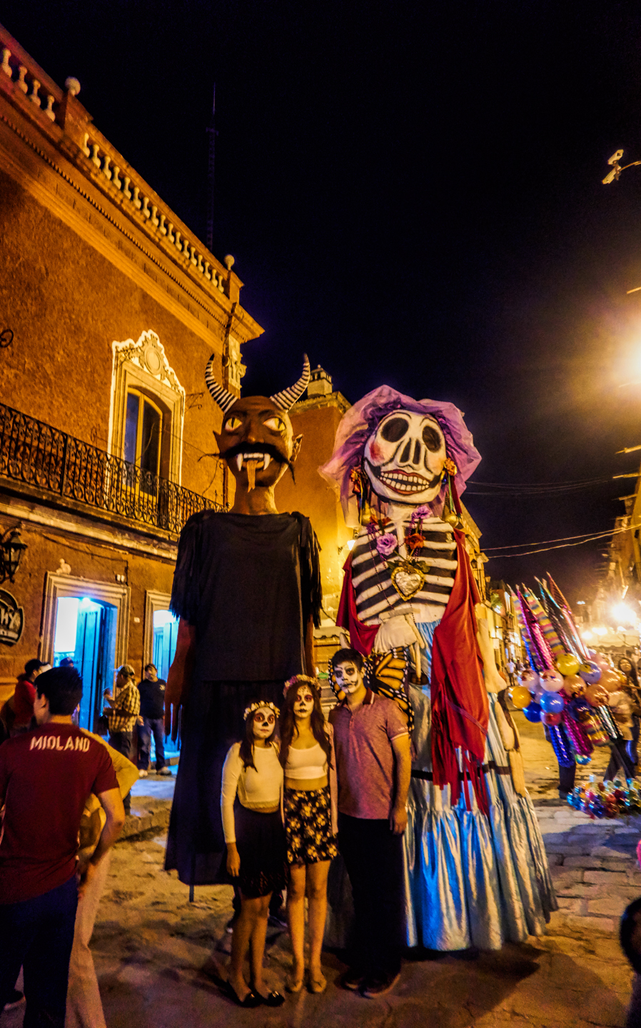
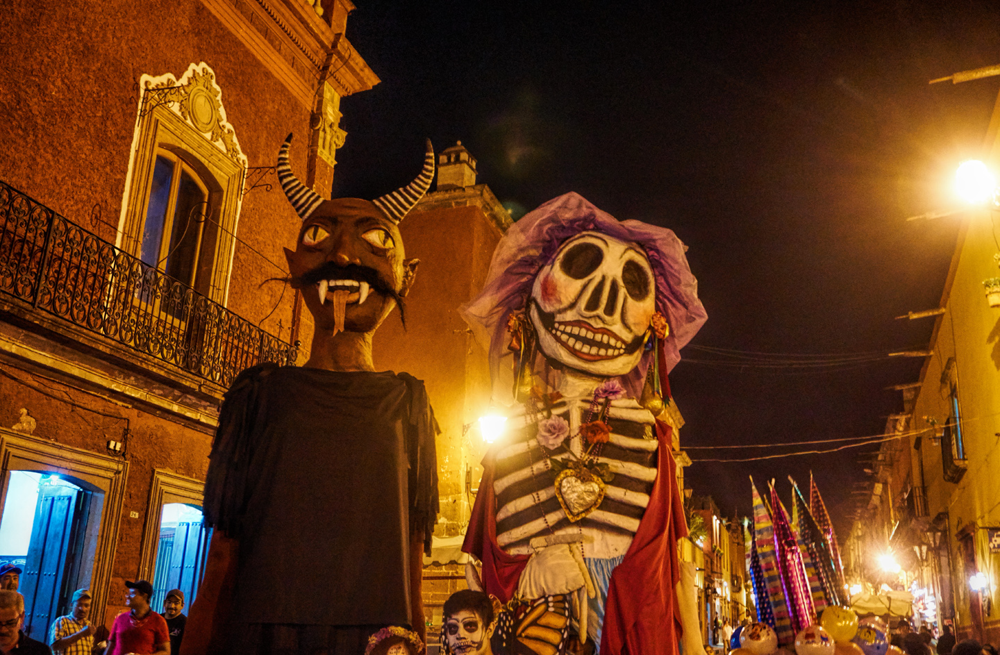
The “Tall Costumes” came back out for another turn around the square, La Catarina and her Devilish companion, posing for pictures with the kids in the crowd. Everything sort of dwindled after that. With no active entertainment going on, people wandered through, but didn’t stay, and before much longer, the party was over.
San Miguel de Allende is one of my favorite cities in Mexico, and it’s the perfect place to enjoy the festivities surrounding the Dia de Los Muertos, Mexico’s most celebrated holiday. If you’d like to go and see it for yourself, I recommend that you plan ahead, because the hotels in town tend to fill up well in advance.
The final post in my Mexican Road Trip series is coming right up: From San Miguel de Allende, we made a speed run to the border at Piedras Negras, where we crossed over into Texas. An anti-climactic end to the coolest road trip I’ve ever done.

If you enjoyed the photographs in this post, you might get a kick out of my Dia de los Muertos: Gallery of Photographs. There are more than 300 images, with minimal text. What you might call a smorgasbord of Dia de los Muertos!
Click any of the thumbnails below to link to the Gallery:
DIA DE LOS MUERTOS: A GALLERY OF PHOTOGRAPHS
<<CLICK to view Gallery>>


(Unless otherwise noted, all of the images in these posts are my (or Michael Fritz’s) original work, and are protected by copyright. They may not be duplicated for commercial purposes.)
The photo collage below contains random images from our month-long Mexican Road Trip.
Click any photo to expand the image to full screen
Michael Fritz, (“Elmo”) 1949-2025
READ MORE LIKE THIS:
This is an interactive Table of Contents. Click the thumbnails to open the pages.
ON THE ROAD IN MEXICO

MEXICAN ROAD TRIP: HOW TO PLAN AND PREPARE FOR A DRIVE TO THE YUCATAN
The published threat levels are a “full-stop” deal breaker for the average tourist. That’s unfortunate, because Mexican road trips are fantastic! Yes, there are risks, but all you have to do to reduce those risks to to an acceptable level is follow a few simple guidelines.
<<CLICK to Read More!>>

Mexican Road Trip: Heading South, From Laredo to Villahermosa
When it was our turn, soldiers in SWAT gear surrounded my Jeep, and an officer with a machine gun gestured for me to roll down my window. He asked me where we were going. I’d learned my lesson in customs, and knew better than to mention the Yucatan. “We’re going to Monterrey,” I said, without elaborating.
He checked our ID’s and our travel documents, then handed them back. “Don’t stop along the way,” he advised. “You need to get off this road and to a safe place as quickly as you can!”
<<CLICK to Read More!>>

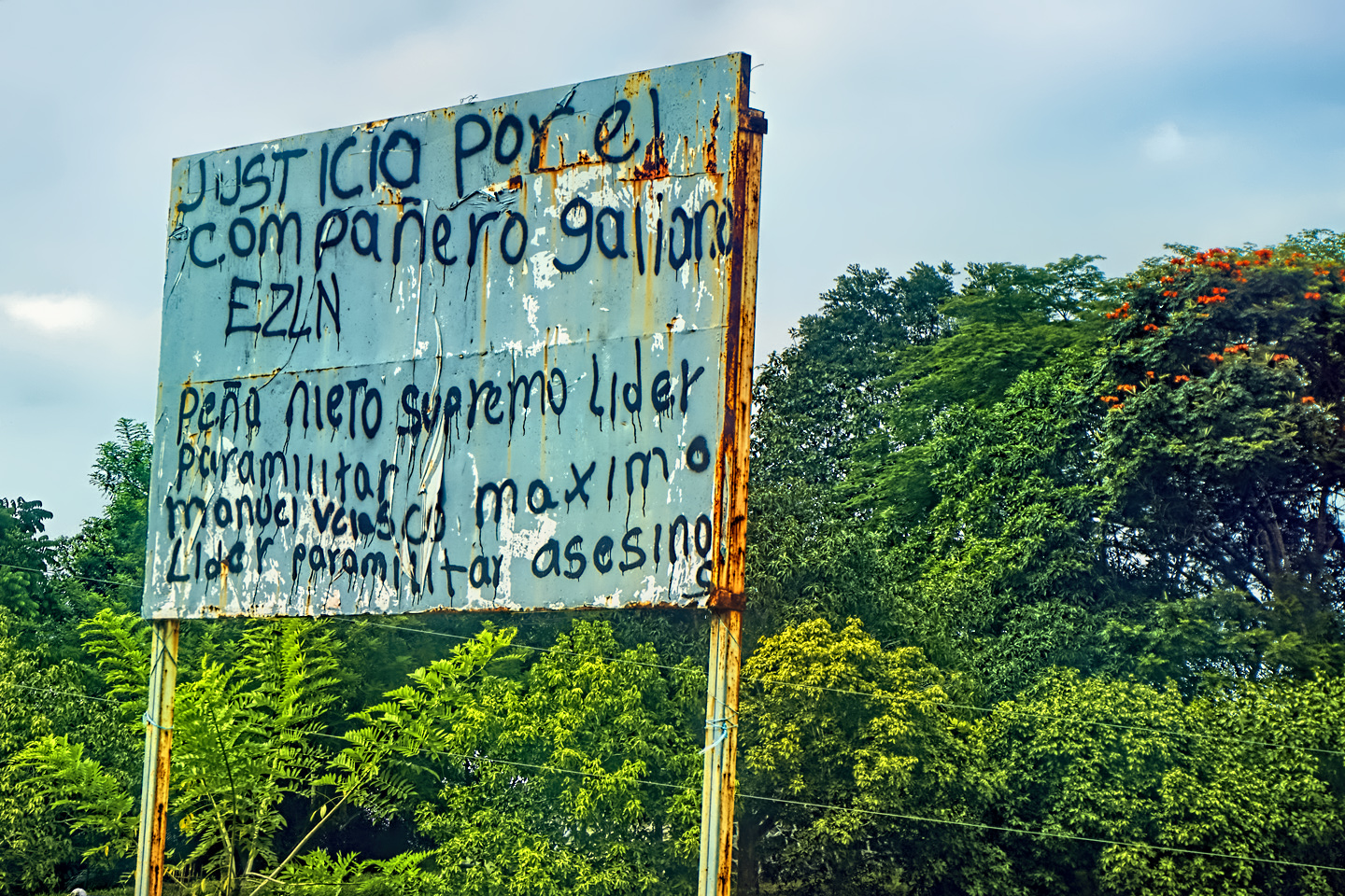
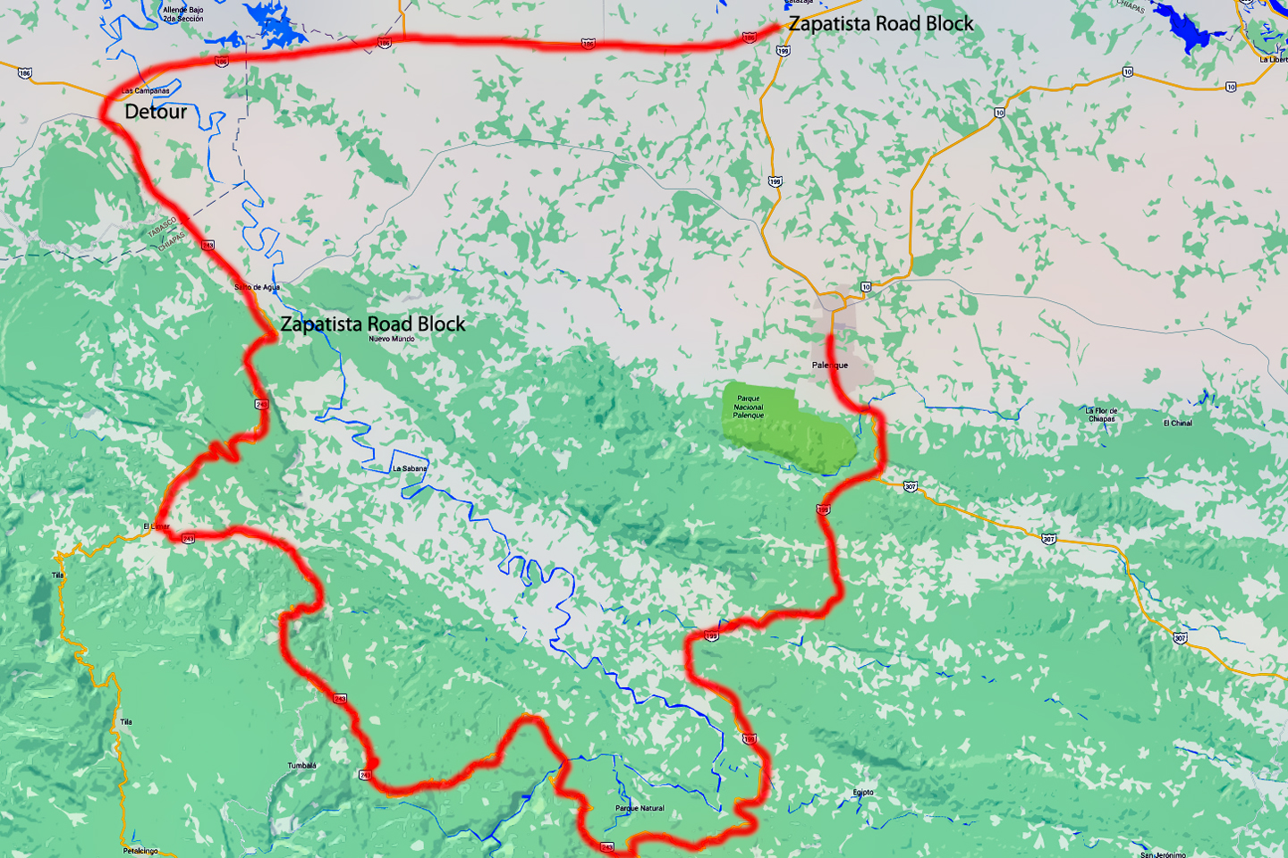
Mexican Road Trip: Zapatista Road Blocks in Chiapas
“Good morning,” I said. “We’re driving to Palenque. Will you allow us to pass?”
The leader of the group, a young Mayan lad, walked up beside my Jeep, and fixed me with a menacing glare. “The road is closed,” he said, keeping his hand on the hilt of his machete. “By order of the Ejército Zapatista de Liberación Nacional!”
“Is it closed to everyone?” I asked innocently. “How about if we pay a toll? How much would the toll be?”
He gave me an even more menacing glare. “That will cost you everything you’ve got,” he said gruffly, brandishing his machete, while his companions did the same.
<<CLICK to Read More!>>

Mexican Road Trip: Mayan Ruins and Waterfalls in the Lacandon Jungle
The next morning, we were waiting at the entrance to the Archaeological Park a half hour before they opened for the day. We were the only ones there, so they let us through early, and I had the glorious privelege of photographing that wonderful ruin in the golden light of early morning, without a single fellow tourist cluttering my view.
<<CLICK to Read More!>>

Mexican Road Trip: Merida and the Meridanos
Merida is the largest city in southern Mexico, with a population of almost a million. Statistically, Yucatan is the safest of Mexico’s states, and Merida is widely considered the safest of all Mexico’s cities.
<<CLICK to Read More!>>


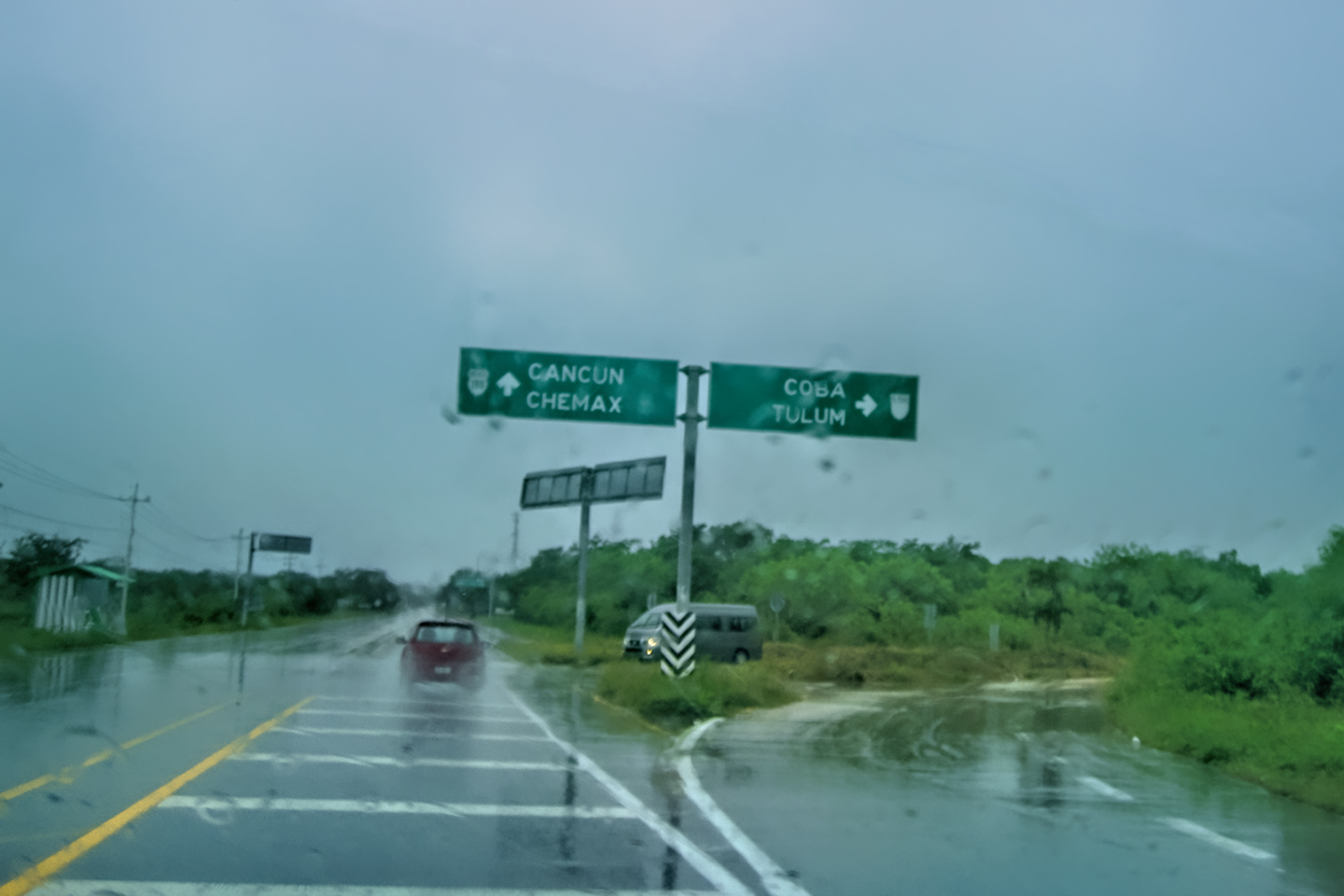
Mexican Road Trip: Cancún, Tulum, and the Riviera Maya
The millions of tourists who fly directly to Cancún from the U.S. or Canada are seeing the place out of context. They can’t possibly appreciate the fact that they’re 2,000 miles south of the border; a whole country, a whole culture, a whole history away from the U.S.A. Just looking around, on the surface? The second largest city in southern Mexico could easily pass for a beach town in Florida.
<<CLICK to Read More!>>

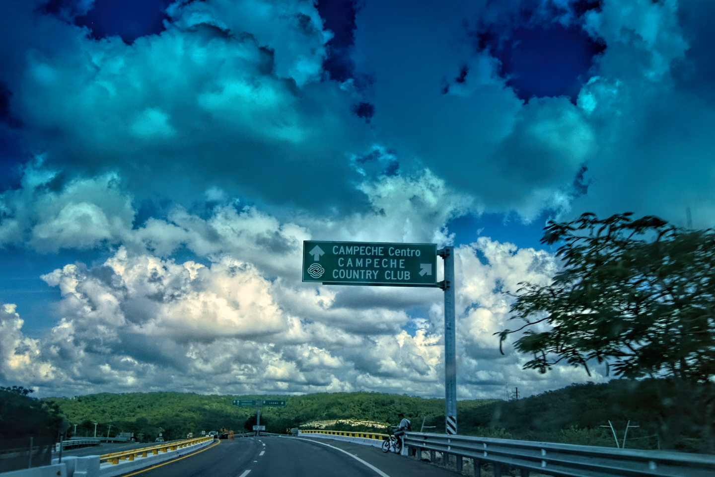
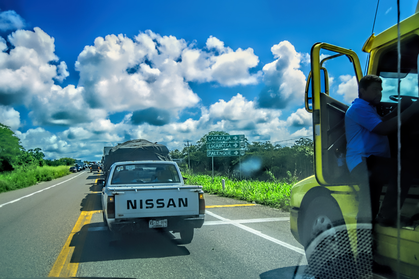
Mexican Road Trip: Circling the Yucatan, from Quintana Roo to Campeche
The Castillo at Muyil isn't huge, as Mayan pyramids go, topping out at just over 50 feet, but it’s definitely imposing. Try to imagine: the equivalent of a five story building, with a three story grand staircase, just appearing, out in the middle of nowhere? Boo-yah!
<<CLICK to Read More!>>

Mexican Road Trip: Edzná, and Campeche, Where They Dance La Guaranducha
La Guaranducha, a traditional dance from Campeche, is a celebration of life, community, and the joy of existence. On stage, there was a group of young men and women in traditional dress, but it was clear that the guys were little more than props, because all eyes were on the girls. So colorful, and so elegant, hiding coyly behind their pleated, folding hand fans.

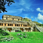
Mexican Road Trip: Adventures Along the Puuc Route
All of these communities in the Puuc region were allied, politically, culturally, economically, and socially. The Puuc was the cradle of the Golden Age of the Maya. Labna and Sayil were among the brightest jewels in the crown of a realm that never quite coalesced into an empire.
<<CLICK to Read More!>>

Mexican Road Trip: The Road to Bonampak
Rainwater seeping through the limestone walls of the temple soaked the Bonampak Murals with a mineral-rich solution that, each time it dried, left behind a sheen of translucent calcite. The built-up coating protected the paintings for more than 1200 years. As a result, we're left with the finest examples of ancient art from the Americas to have survived into our modern era.

Mexican Road Trip: Crossing the Chiapas Highlands, to San Cristobal de las Casas
MX 199 crosses the Chiapas Highlands from Palenque to San Cristobal de las Casas. The distance is only 132 miles, but it's 132 miles of curvy mountain roads with switchbacks, steep grades, slow trucks, and villages chock-a-block with topes and bloqueos, unofficial road blocks. Everything I read, and everything I heard, described the drive as alternatively spectacular, dangerous, and fascinating, in seemingly equal measure.

Mexican Road Trip: Cruising the Sierra Madre, from San Cristobal to Oaxaca
Today, we’d be driving as far as the city of Oaxaca, 380 miles of curves, switchbacks, and rolling hills that would require at least ten hours of our full attention, crossing the Sierra Madre de Chiapas, and entering the rugged, agave-studded landscape of the Sierra Madre de Oaxaca. If you’d like to know what that was like, read on!

Mexican Road Trip: Flashing Lights in the Rear View: Officer Plata and La Mordida
As we drove away from the toll plaza, a State Police car that had been parked off to one side made a fast U-Turn and started following me. A moment later, he turned on his flashers and gave me a short blast on his siren, motioning for me to pull over. Two uniformed policemen got out, and approached me on the driver's side. One of them hung back, apparently checking out my license plate before making a phone call.
I wasn't sure if I was being stopped for some infraction, or if these guys were just fishing...

Mexican Road Trip: Three Days of the Dead in San Miguel de Allende
By mid-afternoon, the Jardin was beginning to fill with people. Painted faces were literally everywhere! It was like a costume party, but the venue wasn’t some hall or other indoor space, it was the whole entire town! Mike and I were definitely getting into the spirit of the thing–but we still drew the line at the notion of painting our beards...
Mexican Road Trip: Back to the Border: San Miguel de Allende to Eagle Pass
Saltillo was our crossroads: if we turned east here, we’d be retracing our previous route to the border at Nuevo Laredo--along the Highway of Death! This time, we knew better, so we turned north, toward Monclova, and Piedras Negras.

Southern Colonials: Merida, Campeche, and San Cristobal
Visiting the Spanish Colonial cities of Mexico is almost like traveling back in time. Narrow cobblestone streets wind between buildings, facades, and stately old mansions that date back three hundred years or more, along with beautiful plazas, parks, and soaring cathedrals, all of similar vintage.
<<CLICK to Read More!>>

San Miguel de Allende, Mexico's Colonial Gem
If you include the chilangos, (escapees from Mexico City), close to 20% of the population of San Miguel de Allende is from somewhere else, a figure that includes several thousand American retirees.
<<CLICK to Read More!>>

Day of the Dead in San Miguel de Allende
In San Miguel de Allende, they've adopted a variation on the American version of Halloween and made it a part of their Day of the Dead celebration. Costumed children circle the square seeking candy hand-outs from the crowd of onlookers. It's a wonderful, colorful parade that's all about the treats, with no tricks!
<<CLICK to Read More!>>
DIA DE LOS MUERTOS: A GALLERY OF PHOTOGRAPHS
IN THE LAND OF THE MAYA

Palenque: Mayan City in the Hills of Chiapas
Palenque! Just hearing the name conjures images of crumbling limestone pyramids rising up out of the jungle, of palaces and temples cloaked in mist, ornate stone carvings, colorful parrots and toucans flitting from tree to tree in the dense forest that constantly encroaches, threatening to swallow the place whole.
<<CLICK to Read More!>>

Uxmal: Architectural Perfection in the Land of the Maya
The Pyramid of the Magician is one of the most impressive monuments I've ever seen. There's a powerful energy in that spot--maybe something to do with all the blood that was spilled on the altars of human sacrifice at the top of those impossibly steep steps--but more than any building or other structure at any ancient ruin I've ever visited, more than any demonic ancient sculpture I've ever seen, that pyramid at Uxmal quite frankly scared the hell out of me!
<<CLICK to Read More!>>

The Mayan City of Edzná: First House of the Itzás
The Mayan Edzná is nothing less than epic, lyrical poetry, an extraordinary sonnet comprised of temples and palaces carved in stone that have stood, in regal grandeur, for more than a thousand years.
<<CLICK to Read More!>>

Photographer's Assignment: Chichén Itzá
To get the best photos, arrive at the park before it opens at 8 AM. There will only be a handful of other visitors, and you’ll have the place practically all to yourself for as much as two hours! Take your time composing your perfect shot.There won’t be a single selfie stick in sight.
<<CLICK to Read More!>>

Chichén Itzá: Requiem for the Feathered Serpent
The feathered serpent with the unquenchable thirst for blood may be gone now, or at least fallen out of favor, but as long as the ruins of this ancient city remain standing, he won’t be forgotten.
<<CLICK to Read More!>>

Tulum: The City that Greets the Dawn
Tulum is not all that large, as Mayan sites go, but its spectacular location, right on the east coast of the Yucatan Peninsula, makes it one of the best known, and definitely one of the most picturesque.
<<CLICK to Read More!>>

Cobá and Muyil: Mayan Cities in Quintana Roo
Cobá was a trading hub, positioned at the nexus of a network of raised stone and plaster causeways known as the sacbeob, the white roads, some of which extended for as much as 100 kilometers, connecting far-flung Mayan communities and helping to cement the influence of this powerful city.
<<CLICK to Read More!>>

Becan and Chicanná: Mayan Cities in the Rio Bec Style
Much about the Rio Bec architectural style was based on illusion: common elements include staircases that go nowhere and serve no function, false doorways into alcoves that end in blank walls, and buildings that appear to be temples, but are actually solid structures with no interior space.
<<CLICK to Read More!>>

The Puuc Hills: Apex of Mayan Architecture
The Puuc style was a whole new way of building. The craftsmanship was unsurpassed, and some of the monumental structures created in this period, most notably the Governor’s Palace at Uxmal, rank among the greatest architectural achievements of all time.
<<CLICK to Read More!>>

The Amazing Mayan Murals of Bonampak
Out of that handful of Mayan sites where mural paintings have survived, there is one in particular that stands head and shoulders above the rest. One very special place. Down by the Guatemalan border, in a remote corner of the Mexican State of Chiapas: a small Mayan ruin known as Bonampak.
<<CLICK to Read More!>>
This series of posts is dedicated to my old friend Mike Fritz (aka Mr. Whiskers), my shotgun rider on my Mexican Road Trip. "Drive to the Yucatan and See Mayan Ruins" was at the top of my post-retirement bucket list, right after "Drive the Alaska Highway and see Denali." We checked off the whole Yucatan thing in a major way, and Mike was a heck of a good sport about it.
Michael passed away in February of 2025, after 75 years of a life well-lived. He was unique, and he'll be missed.

Michael Fritz ("Elmo") 1949-2025

There's nothing like a good road trip. Whether you're flying solo or with your family, on a motorcycle or in an RV, across your state or across the country, the important thing is that you're out there, away from your town, your work, your routine, meeting new people, seeing new sights, building the best kind of memories while living your life to the fullest.
Are you a veteran road tripper who loves grand vistas, or someone who's never done it, but would love to give it a try? Either way, you should consider making the Southwestern U.S. the scene of your own next adventure.
A few years ago I wrote a book about road trips in Arizona and New Mexico that's a lot like this website, packed with interesting information, and illustrated with beautiful photographs. Check it out! You can find it on Amazon, and at all other major booksellers.

ALASKA ROAD TRIP:
MEXICAN ROAD TRIP (IN THE LAND OF THE MAYA):
ARIZONA AND NEW MEXICO:
SOUTH AMERICA:
PHOTOGRAPHY:
TRIBAL LANDS:


Recent Comments