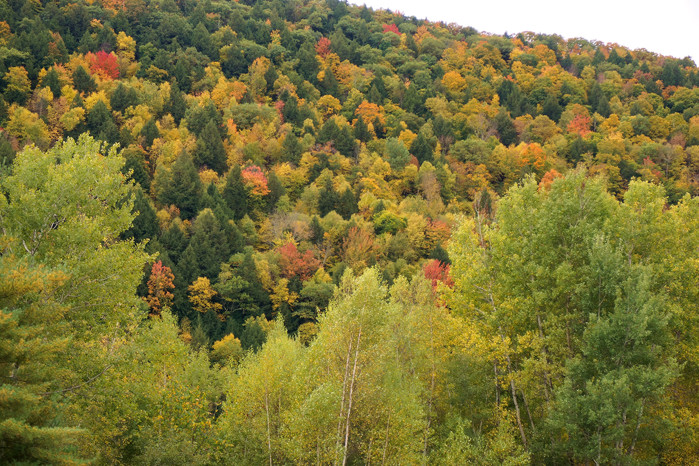
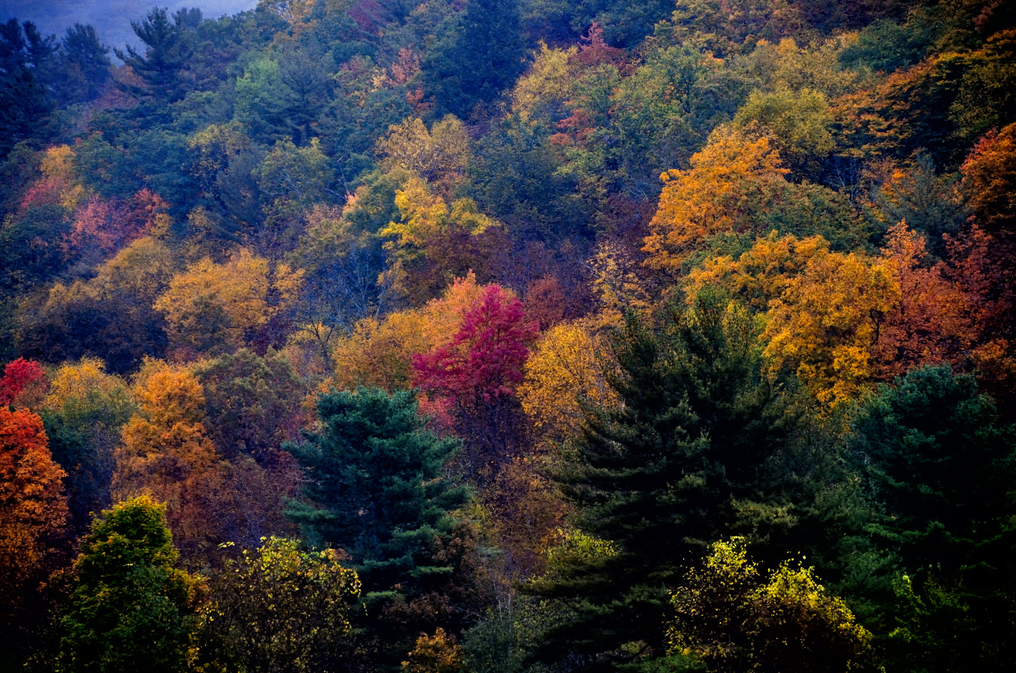
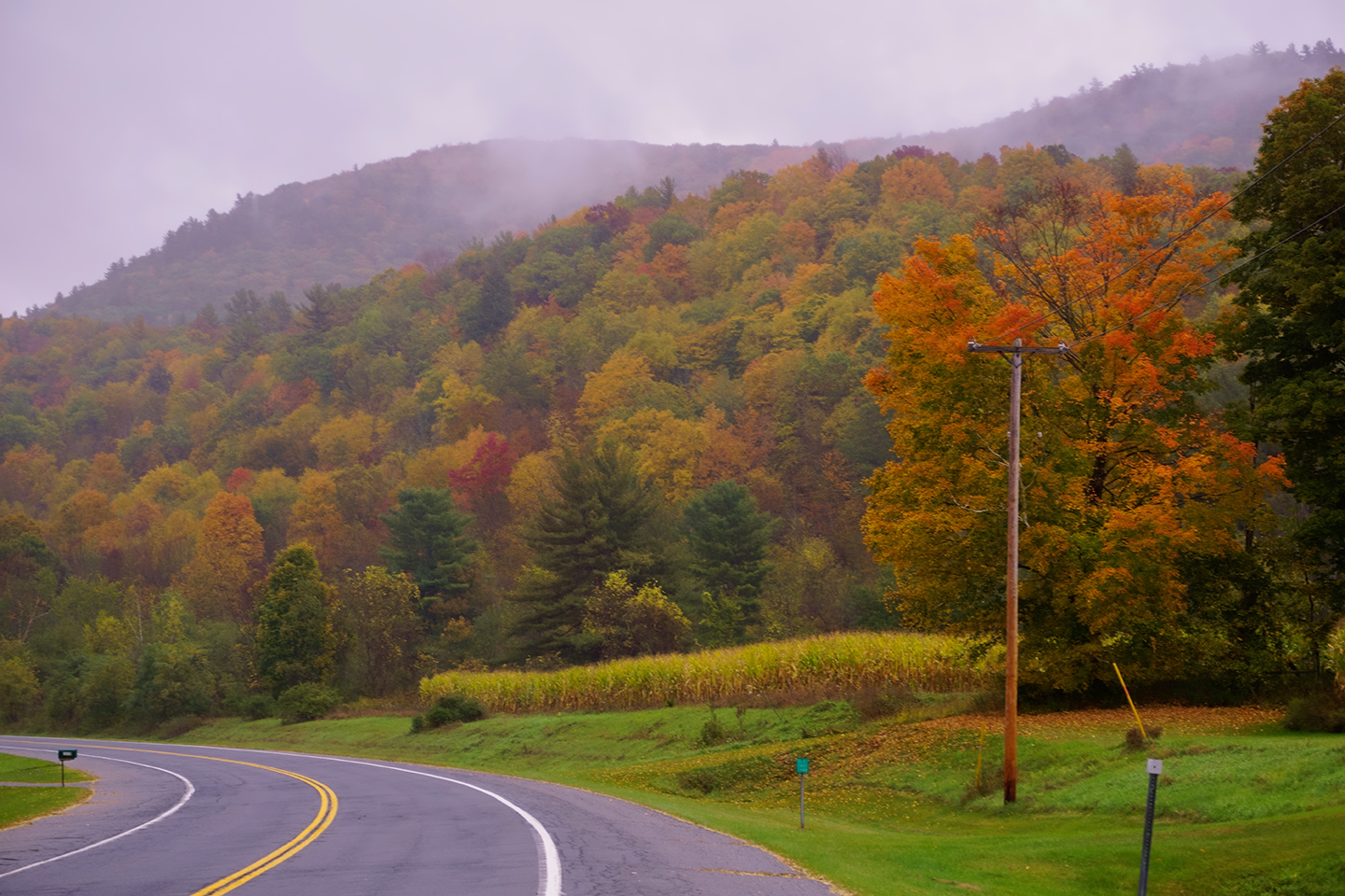
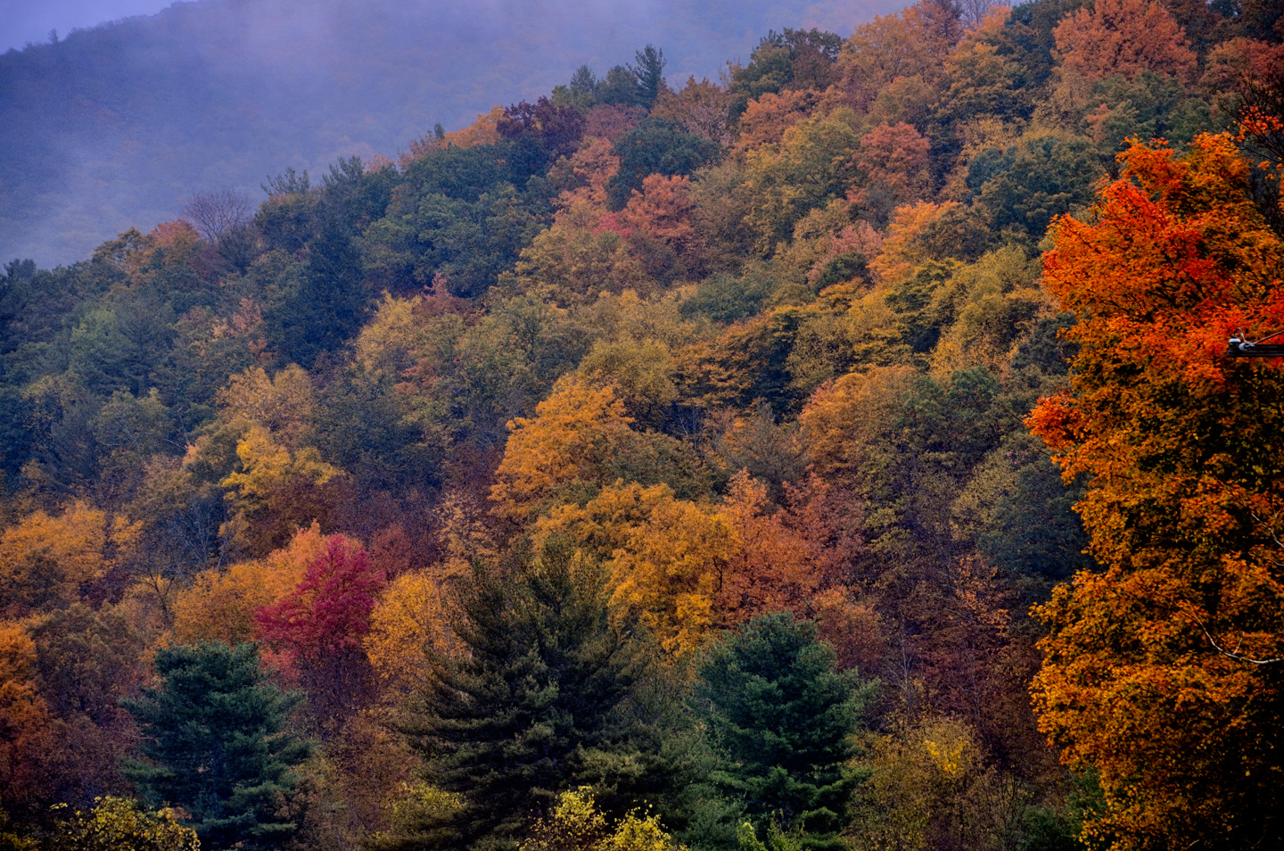
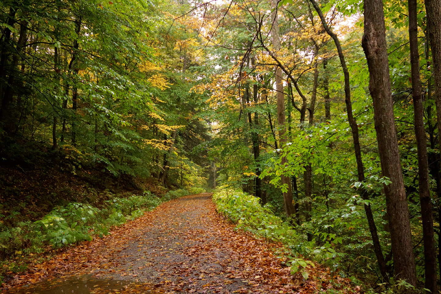
In my experience, spring is the best time for road trips, but autumn runs a very close second, and the best place to take an autumn road trip just has to be New England. There are mountains and valleys ablaze with reds, golds and yellows as the vast hardwood forests are transformed by their seasonal change, with the added bonus of quaint small towns, orderly farms with big red barns, and antique covered bridges that are still in daily use. You can see fall color in almost every part of the U.S., even in the desert southwest (see my earlier post, New Mexico’s Golden Autumn) but in New England, it’s concentrated, like nowhere else on the planet. The six New England states, taken together, support more than 28 million acres of dense, mature forests. Some of it is evergreen, but most of it is deciduous, so, come the fall, you have more than ten BILLION trees changing color and losing their leaves, all over the course of a couple of weeks. As a photographer, I felt an obligation to put a check mark in that box, so I created an opportunity, and proceeded to take advantage of it.
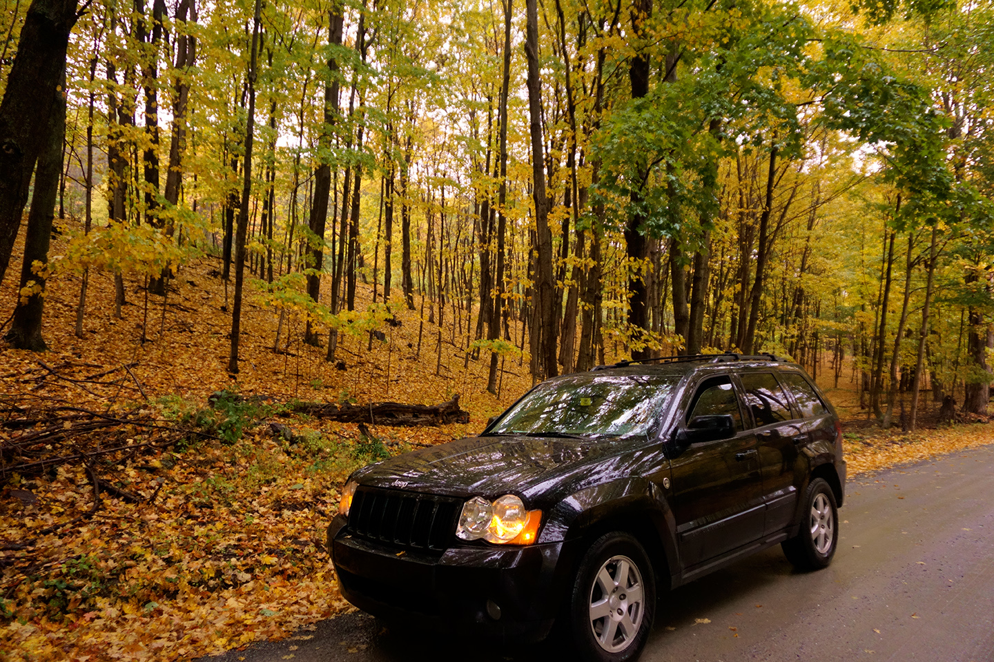
Back in 2014, I was living and working in Washington D.C., closing in on my long-awaited retirement. I had my Jeep with me, so I dipped into my stash of unused annual leave, and scheduled some time off during the first few days of October. I’d done my research, and decided that I should focus on Vermont, rather than trying to jam a multi-state marathon into a single week’s vacation. One of my old friends, Barry Hyman, is a native Vermonter who lives near Bennington. My plan was to stop there for a visit, and pick up some insider tips from Barry on the best roads to take on an autumn tour of the Green Mountain state. Since road trips with traveling companions are generally more enjoyable than road trips flying solo, I talked another old friend, John Deible, into riding along with me. The only problem with that, John was living in Erie at that time, and when I offered to pick him up on my way to Vermont, I added an extra 400 miles to my itinerary. (See my previous post: An Autumn Interlude in Erie, Pennsylvania).
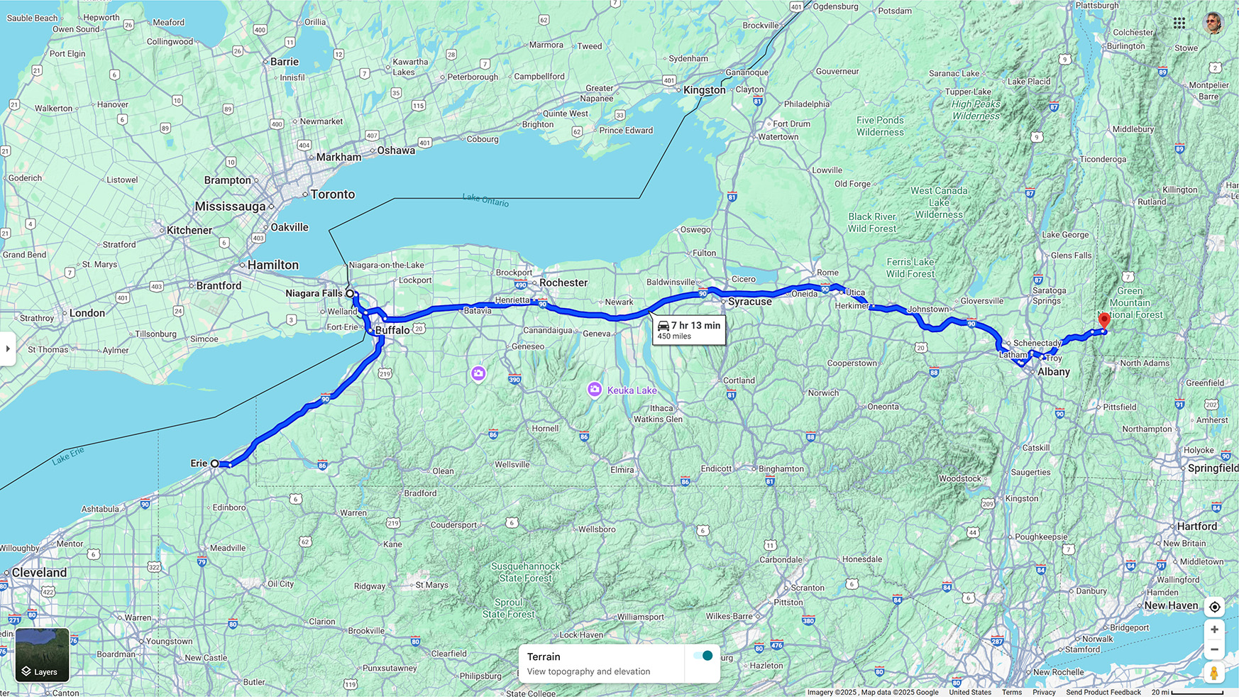
Erie PA to Bennington, VT, with a slight detour
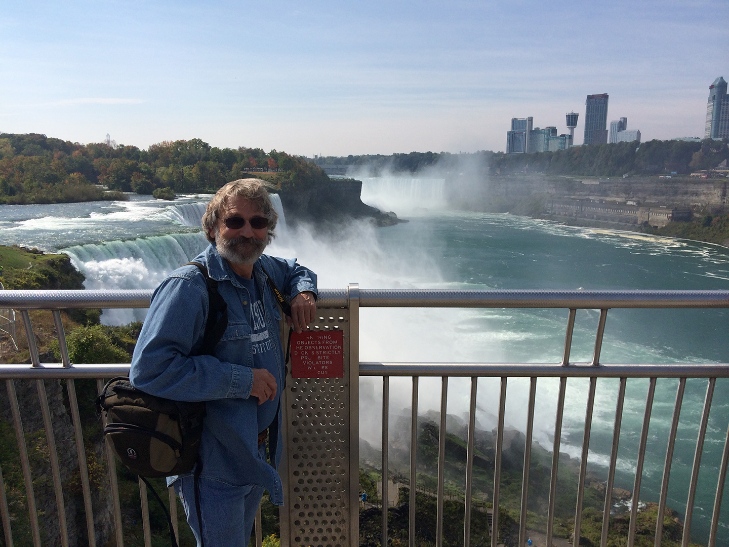
I only had a week for this trip, and figuring all the travel time, my detour to northern Pennsylvania was using up almost half of it. Since Vermont was the goal, I figured it best to get there as quickly as possible, and to that end, our drive from Erie to Bennington was a “blinders-on” speed run, sticking to Interstate 90. I have no doubt that there was wonderful stuff to see on the back roads and in the mountains of upstate New York, but there simply wasn’t enough time, so our only deviation off the Super Slab was a very quick side trip to Niagara Falls, which is a not-so-quick 20 miles north of Buffalo.
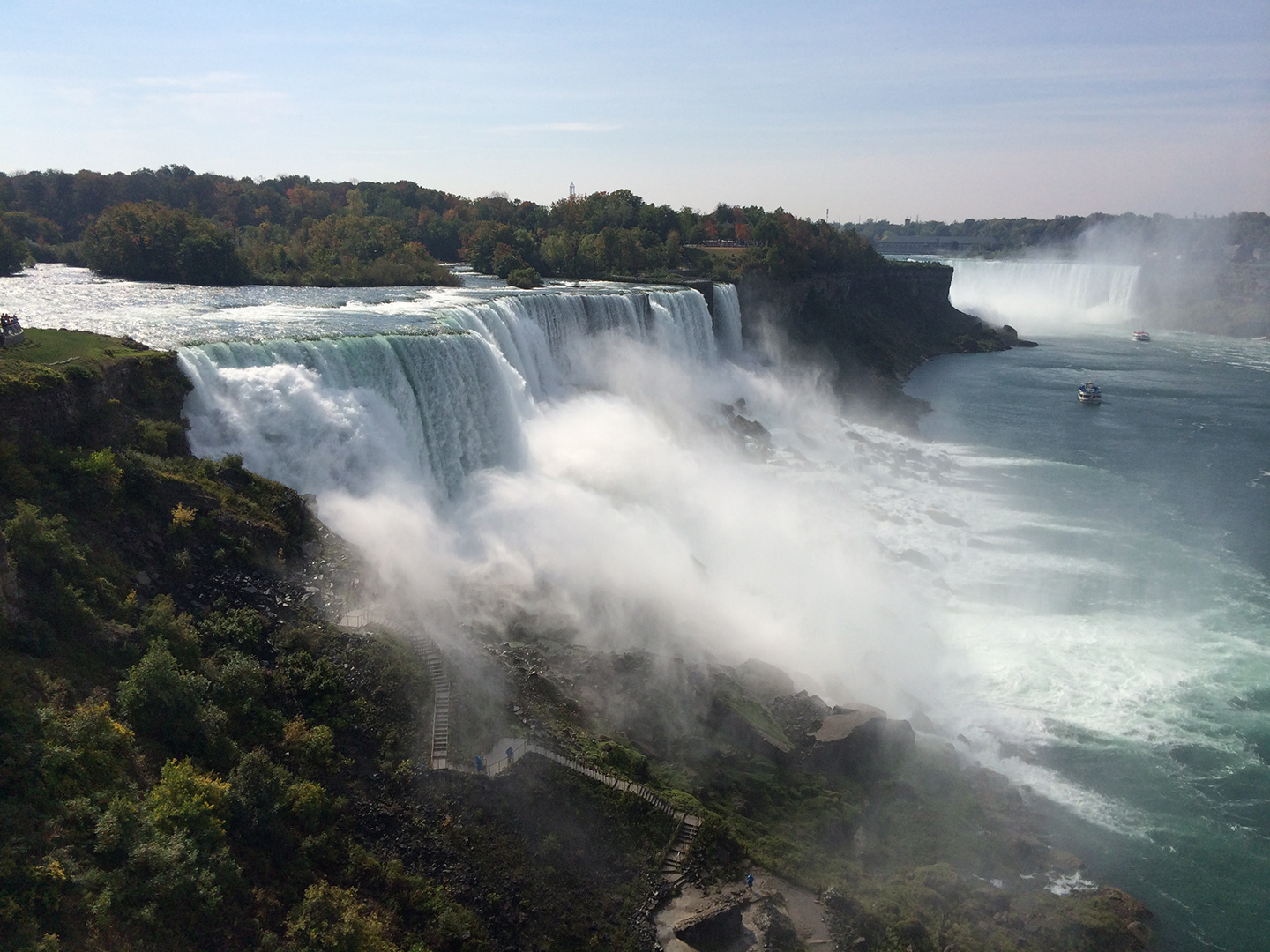
We’d both seen it before, but it’s an impressive sight, well worth the hour or so that we spent as tourists on the American side of one of the world’s largest waterfalls.
We arrived in Bennington in the evening, too late in the day to visit with Barry, so we holed up in the Hampton Inn until the next morning. Our Vermont Road Trip started off with a bang, just steps away from that motel.
VERMONT ROAD TRIP: PART 1:
THE (COVERED) BRIDGES OF BENNINGTON COUNTY
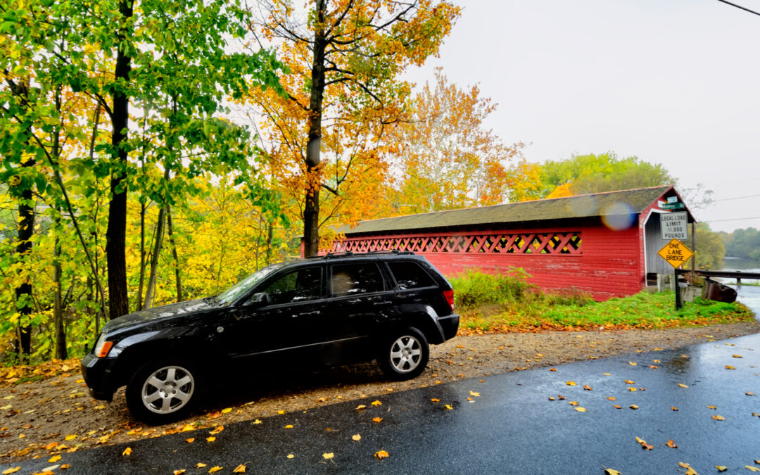
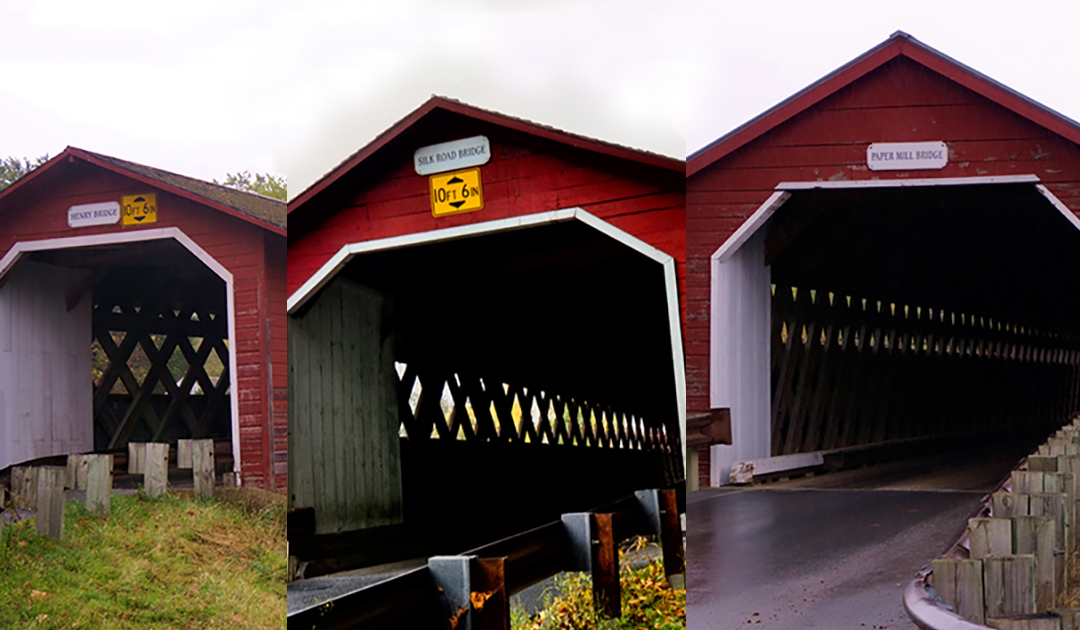
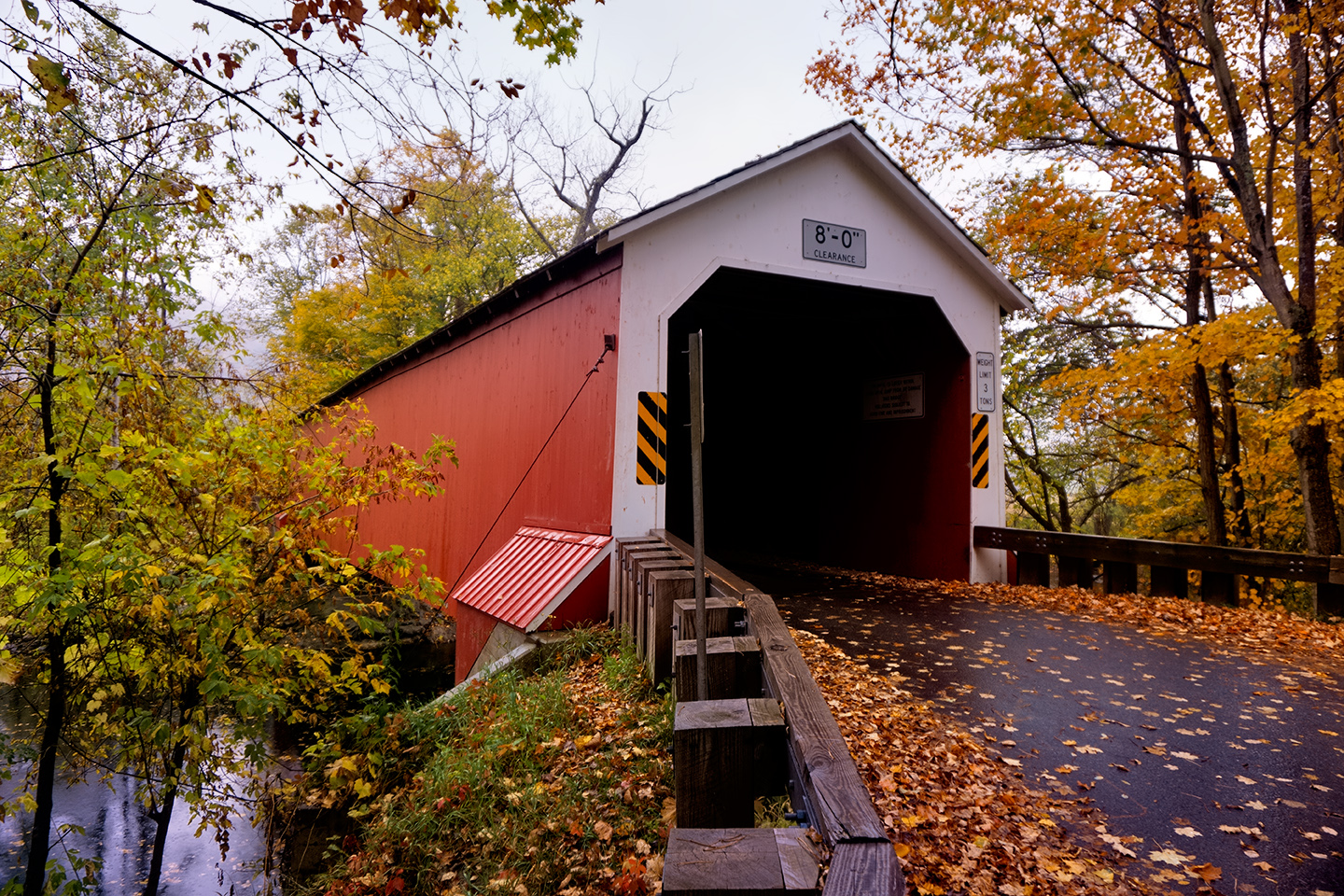
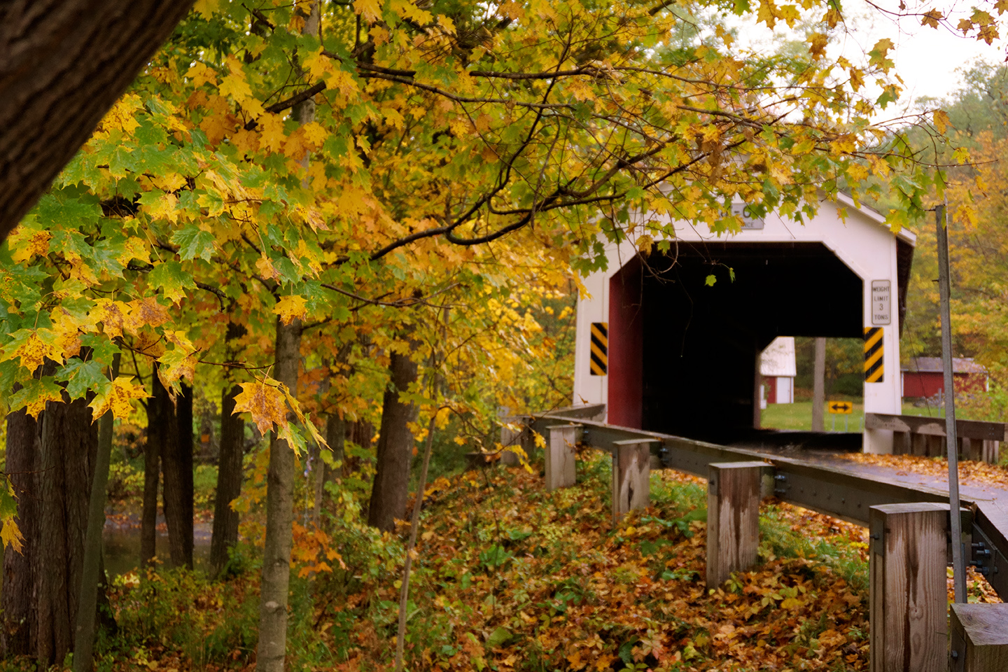
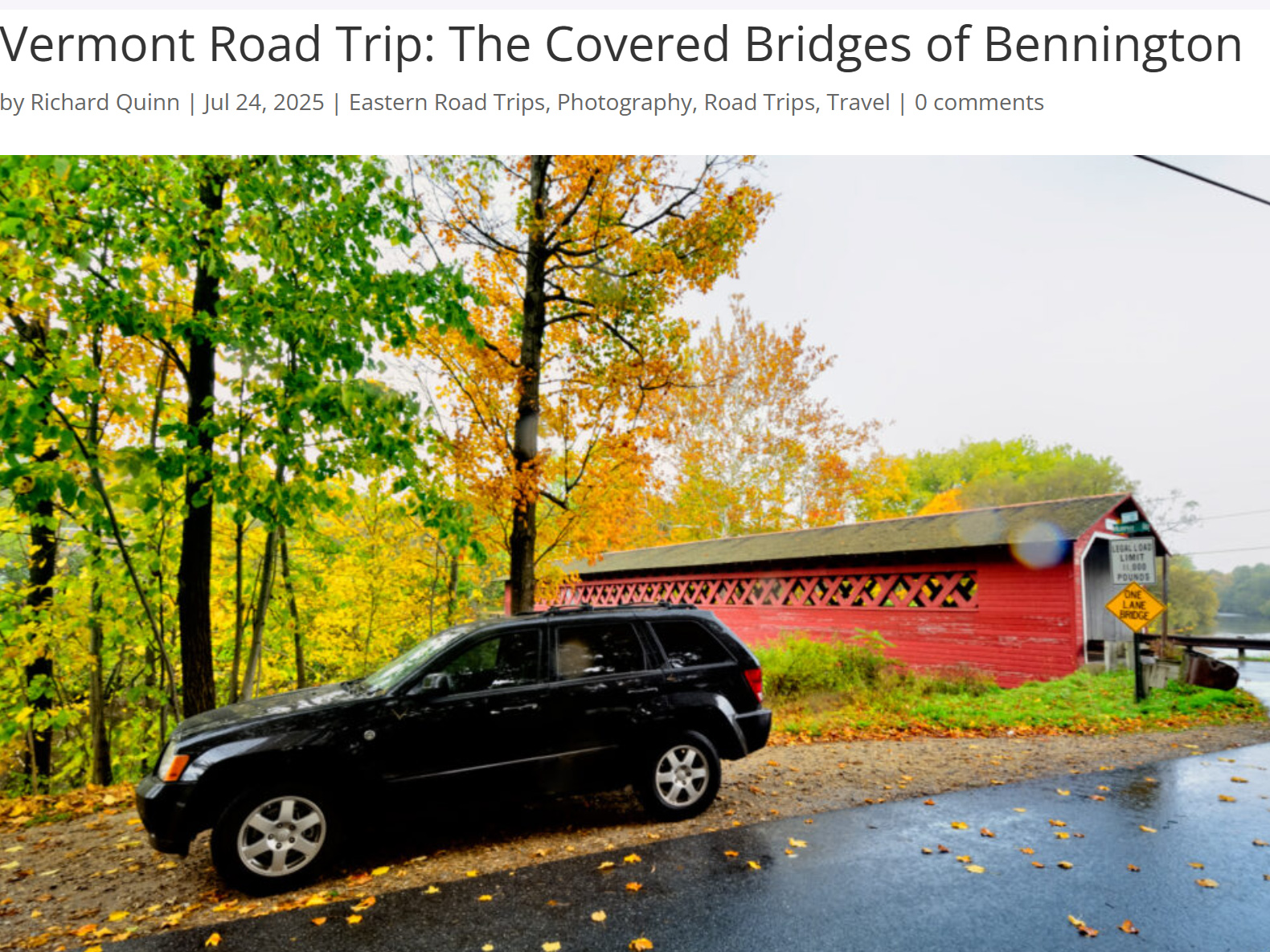
Vermont is famous for picturesque 19th Century covered bridges, and Bennington has three of them, all quite close together, and all crossing the Walloomsac River at various points. The first one we came to was:
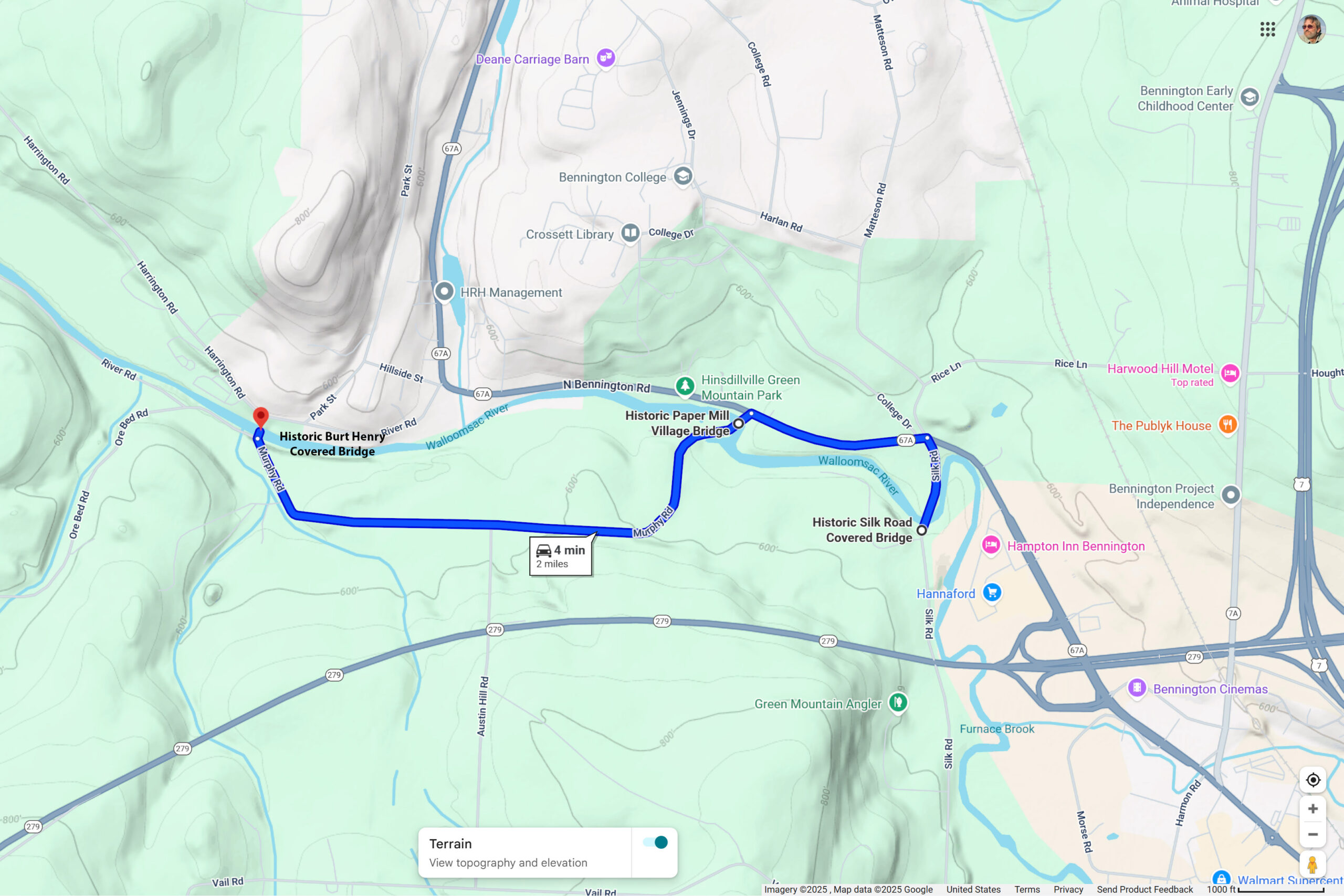
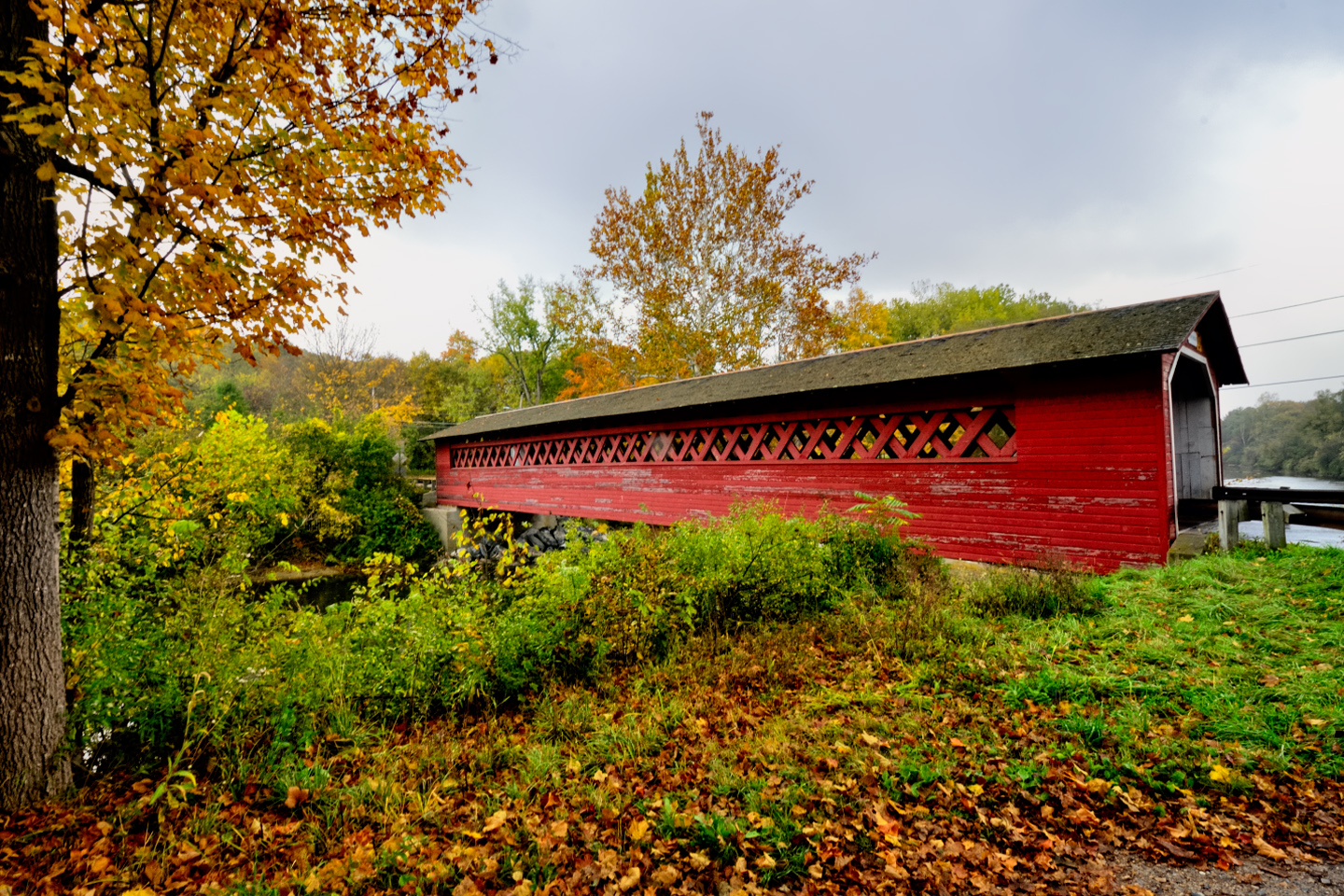
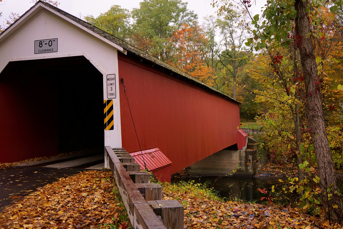
The Silk Road Covered Bridge
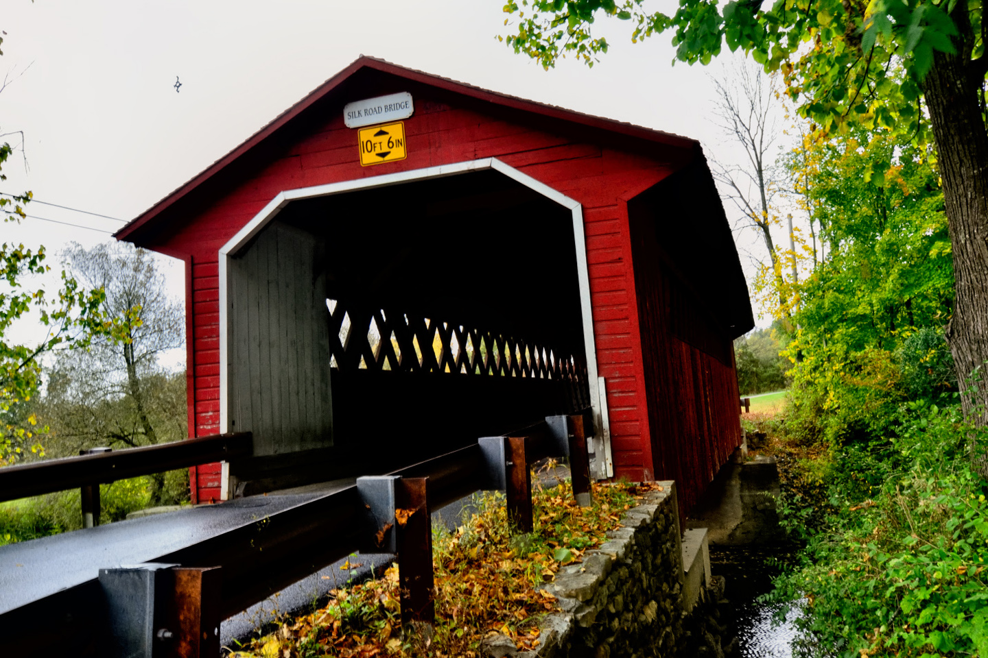
Built in 1840 (almost 200 years ago!), the Silk Road Bridge connects the Silk Road area south of the river with the rest of the town of Bennington. The bridge design is called Town lattice truss, which was patented in 1820 and prized for its strong, efficient structure that was lighter and less expensive than other designs of the time. Putting roofs on bridges was an innovative solution to the problem of weather damage, resulting in less need for maintenance, and greatly extending the lifespan of these iconic structures.

CLICK PHOTOS AND MAPS FOR AN EXPANDED VIEW
19th century construction techniques made bridges that have lasted almost 200 years
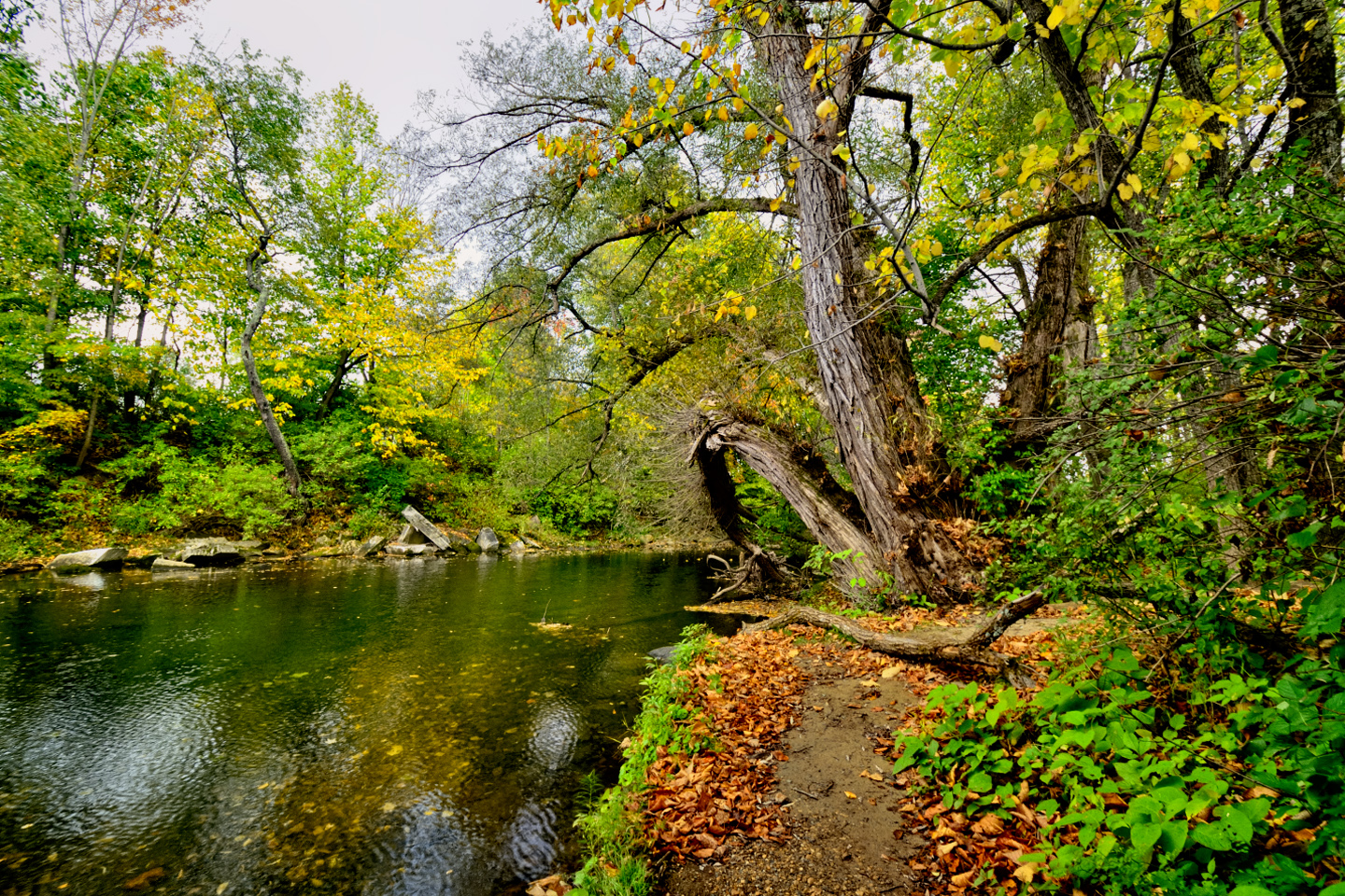
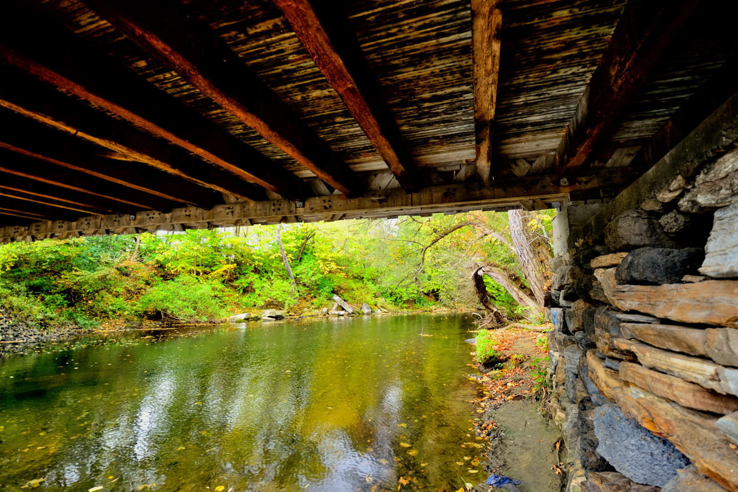
The Walloomsac River near the Silk Road Bridge
All three of Bennington’s covered bridges can be found within two miles of one another, and the fact that they were built so close together shows how important these bridges were to early residents of the town. Flowing water in the river was a cheap source of power, so multiple industries and communities developed along the riverbanks, necessitating multiple river crossings to connect different parts of Bennington for commerce, transportation, and daily travel. Which brings us to the second covered bridge on our tour:
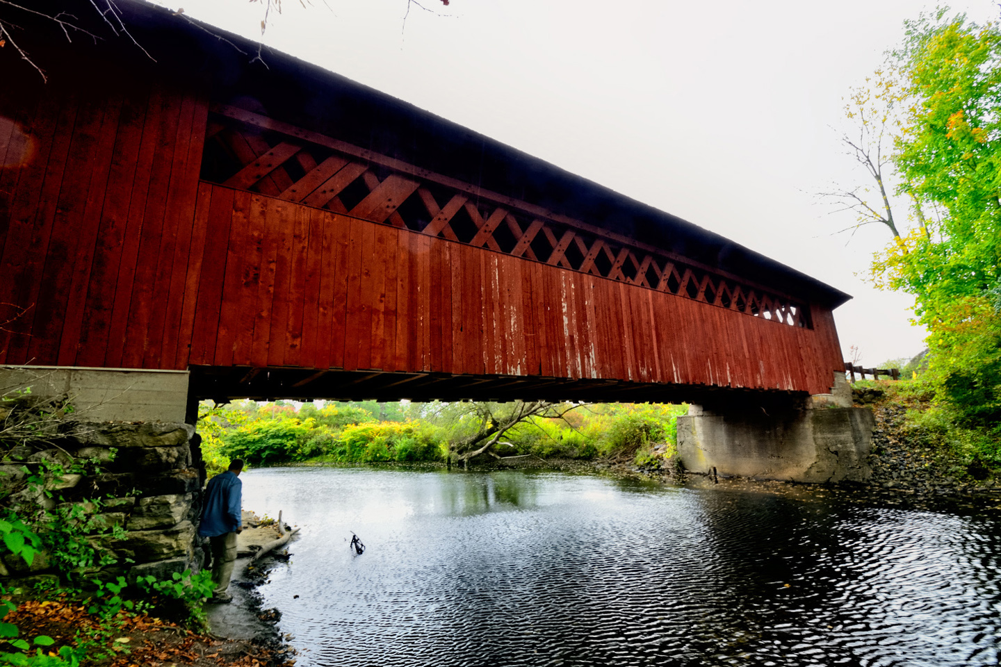
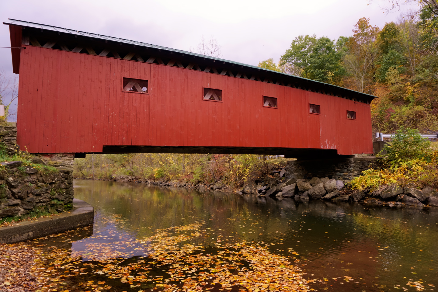
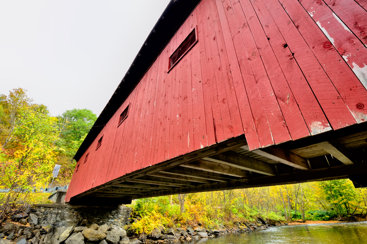
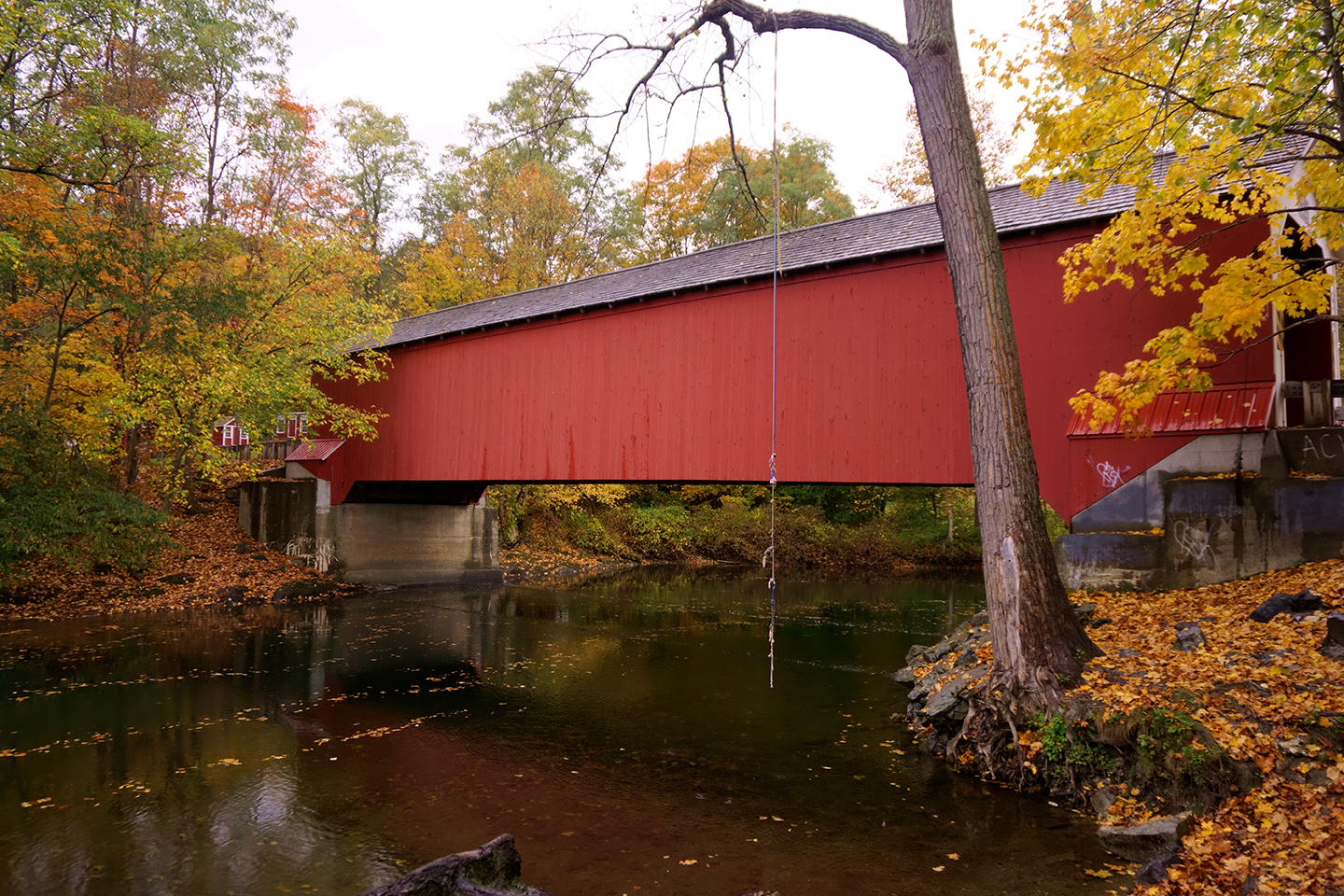
The Paper Mill Covered Bridge
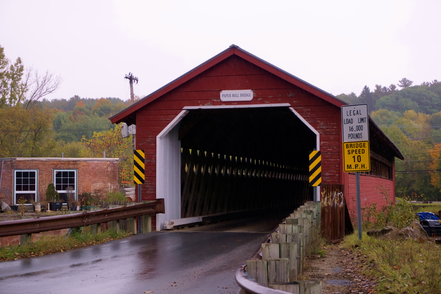
The Paper Mill Bridge is the youngest of the three bridges, built in 1889, and named for the pulp mill and paper factory that operated on the banks of the river in the late 1800’s. This is the longest of all the covered bridges in the area: the main span measures 125 feet, and the structure as a whole is a quite respectable 163 feet in length.
From the Paper Mill, we followed Murphy Road east for two miles to Bennington’s third and final entry in the “Historic Covered Bridges of Vermont” sweepstakes:
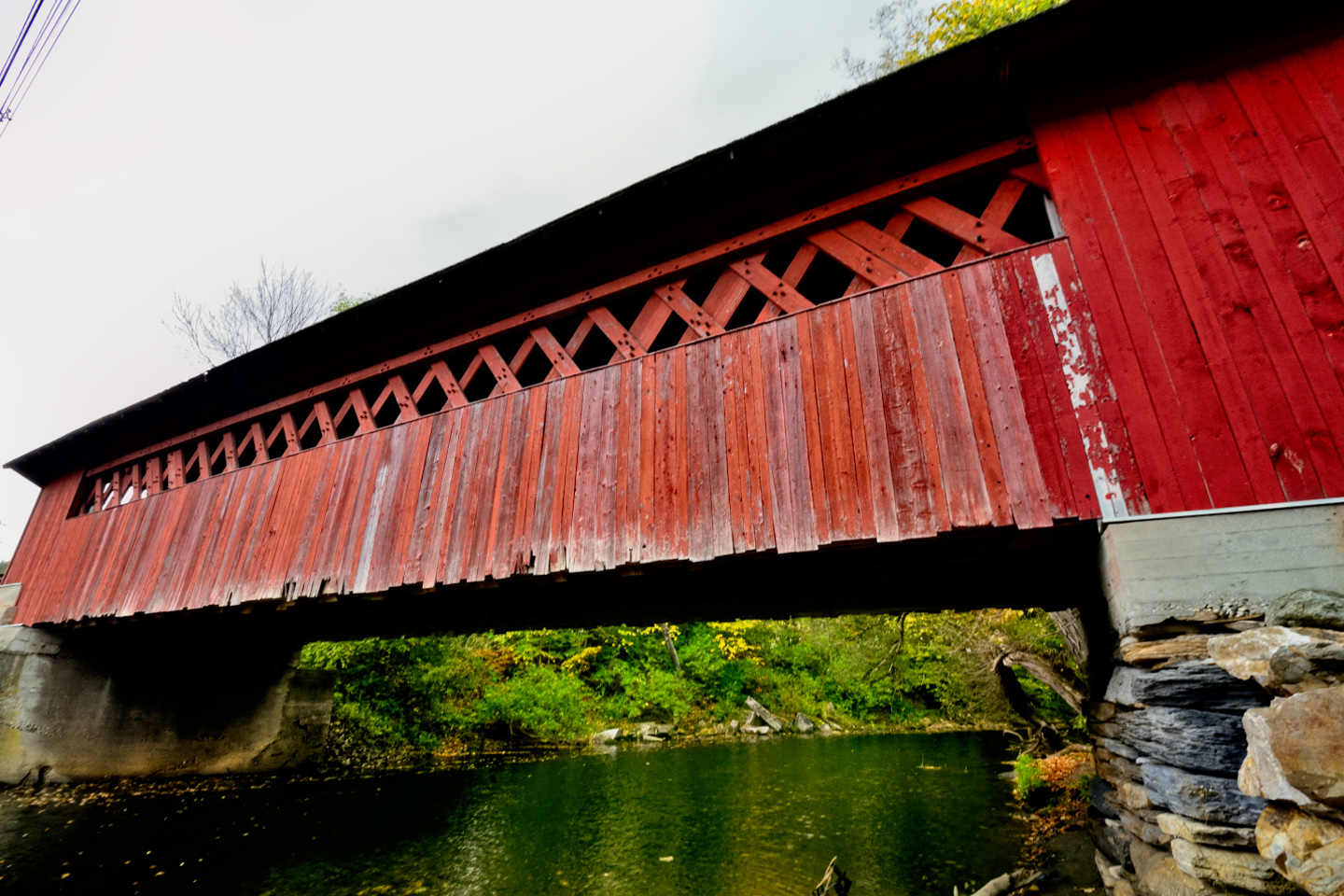
THE Burt Henry Covered Bridge
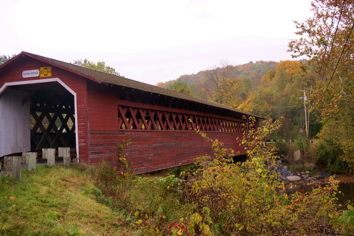
The Henry Bridge was built between 1835 and 1840, the first of Bennington’s bridges to be completed, and long a favorite crossing point for the people of the town.
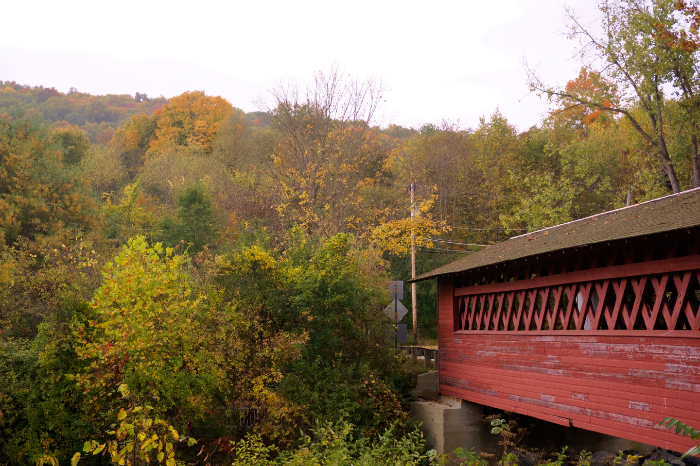
Weathered building near the Henry Bridge in Bennington, VT
Named for the Henry family, wealthy owners of a nearby grist mill, the Henry Bridge was rebuilt to its original specifications in 1989.
The Covered Bridges of Bennington are so much alike in form and function that they almost blend together, but don’t be fooled. Each of these structures is unique, with its own history, its own personality, and its own stories to tell.
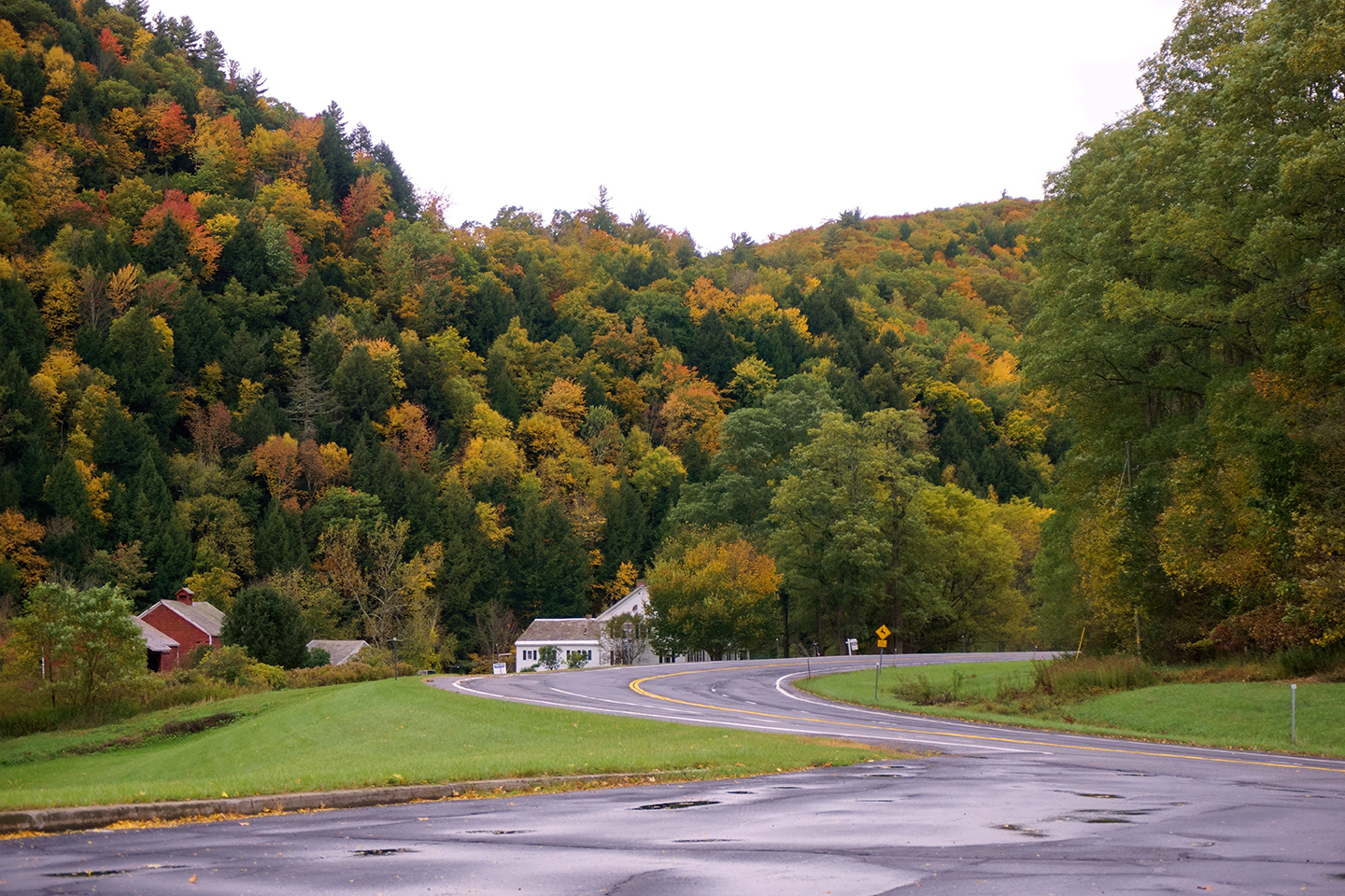
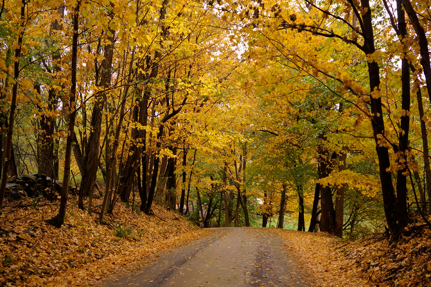
My friend Barry is a musician, and he had a gig that morning at a coffee house in the small town of Cambridge, just across the border in New York State. We made arrangements to meet him there at 11:00, and that gave us a couple of hours to explore the area on our own. We took US 7 north to Arlington, Vermont, and from there we followed Route 313 west through some very pretty mountains. There were at least two more covered bridges in the offing, and extraordinary Autumn foliage on both sides of the State border.
CLICK PHOTOS AND MAPS FOR AN EXPANDED VIEW
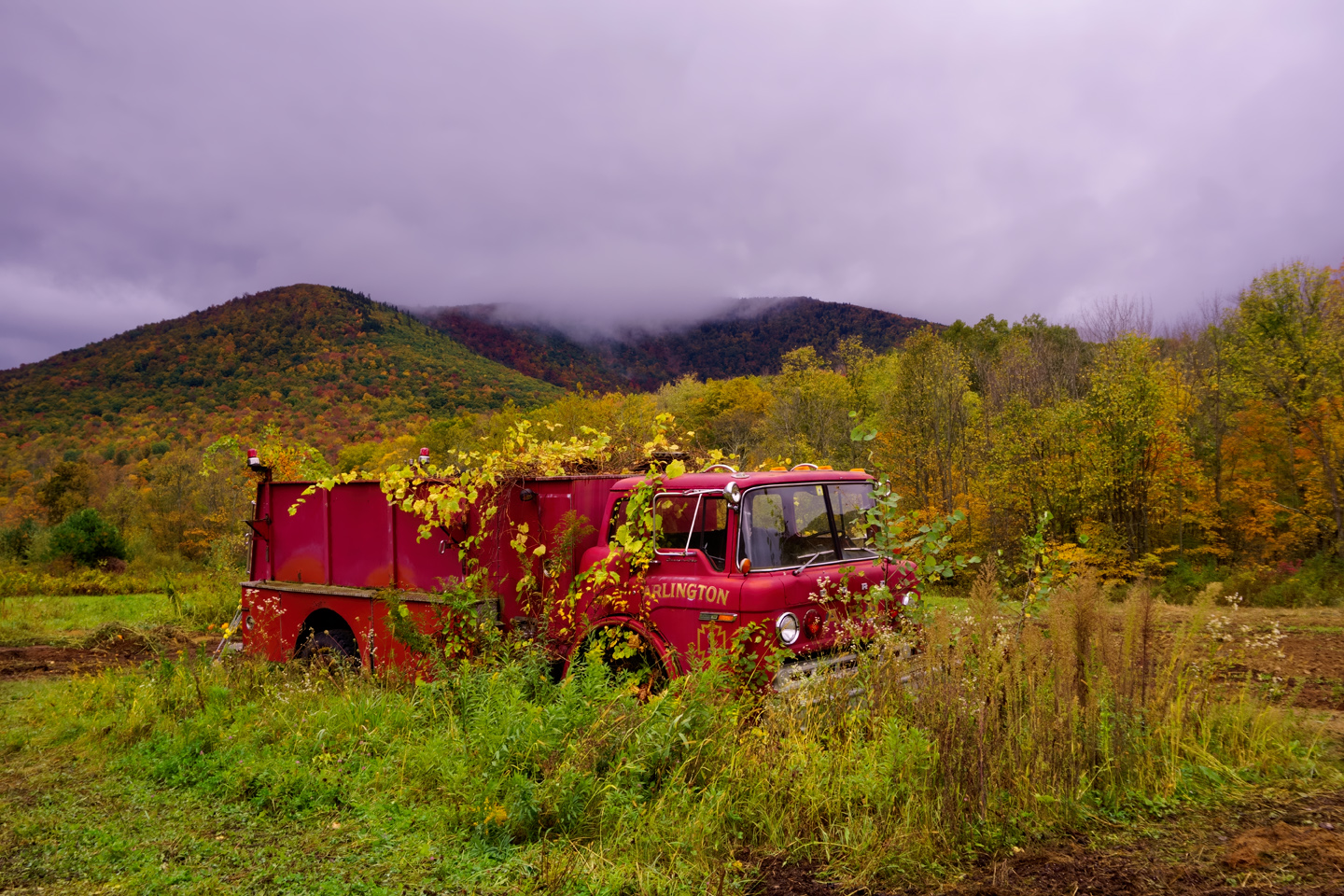
We saw something unusual in a field just off the road. I used my telephoto lens to get a closer look, and was pleasantly surprised by this overgrown abandoned fire engine.
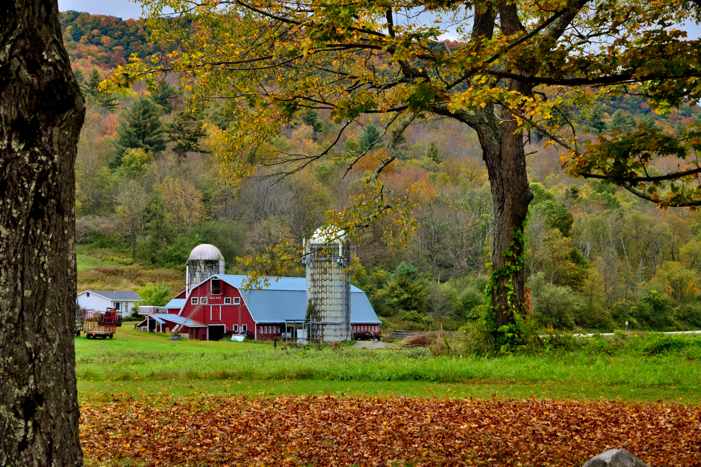
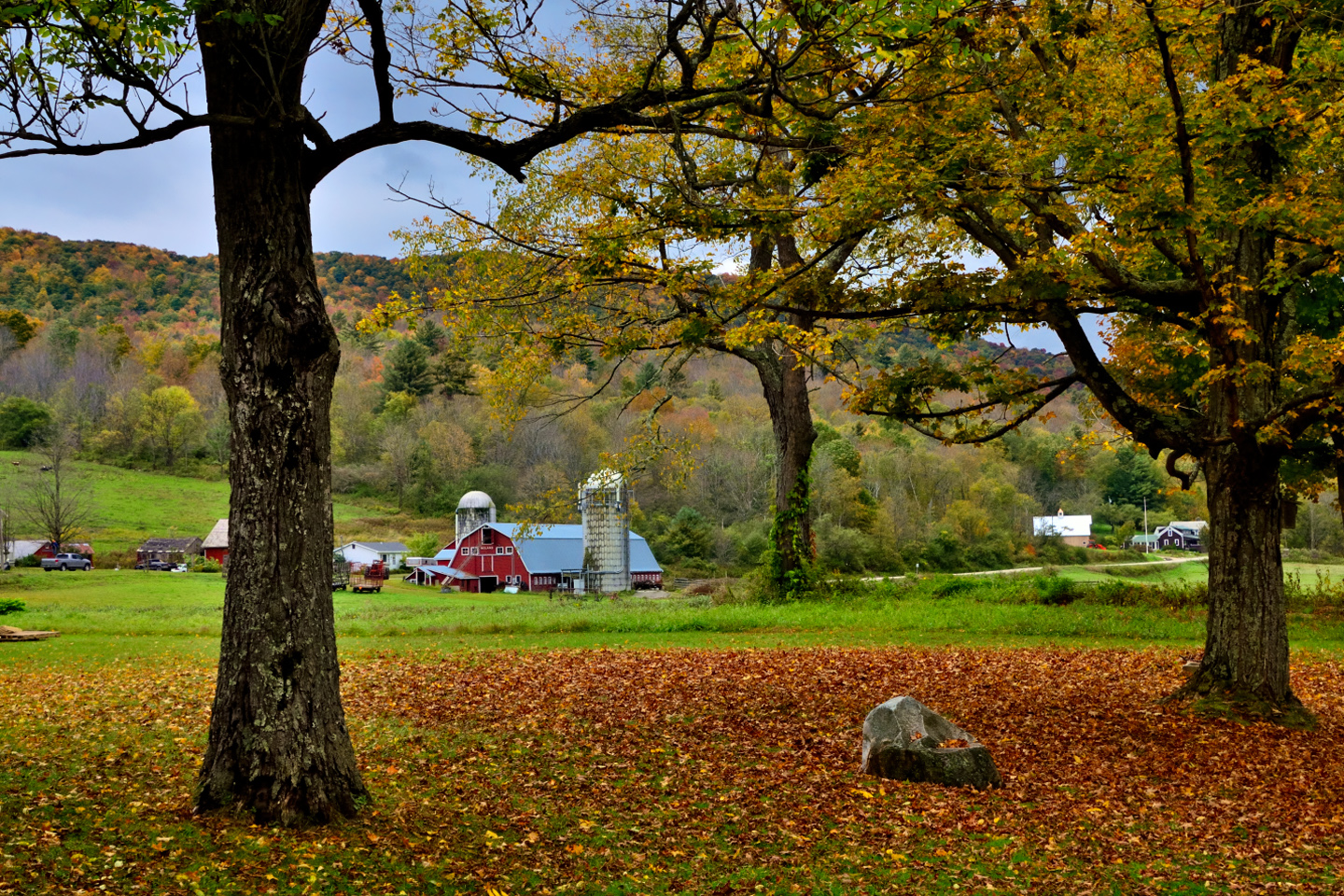
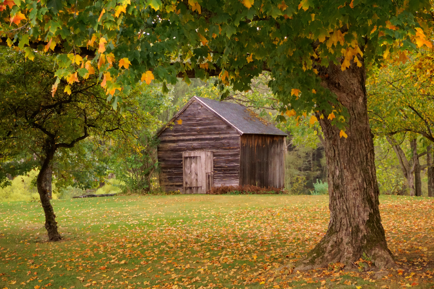
On the other side of that same road there was a working farm, with a perfect red barn flanked by silos. An iconic image of rural Vermont that transcends our modern era.
Just a little bit farther along, we ran into yet another classic example of 19th century bridge building:
THE ARLINGTON COVERED BRIDGE
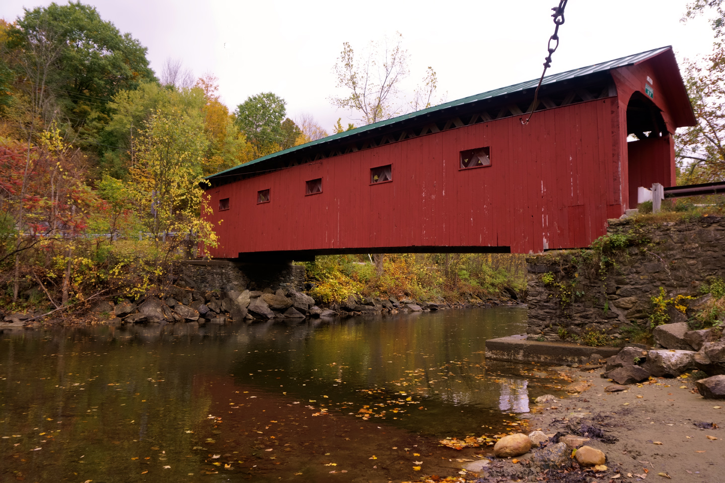
The Arlington Covered Bridge, often referred to as the Arlington Green Bridge, for its proximity to the village green of West Arlington, was built in 1852, and crosses the Batten Kill River. The bridge is directly across the road from a house that was once the home of famed American artist Norman Rockwell, who lived in the area during the 1940’s and early 1950’s. It’s interesting to note that Rockwell never painted the bridge, preferring to use people and scenes of small town life as his subjects, rather than landscapes. When asked about the scenery near his home in Vermont, he famously said, “Thank heavens I don’t have to paint it!”

The Batten Kill River near the Arlington Green Covered Bridge
The bridge sustained damage from flooding caused by Hurricane Irene in 2011, but it was repaired and reopened to traffic just a few months later. The design of the bridge is Town lattice truss, like the bridges we saw in Bennington. All of these bridges were added to the National Register of Historic Places in 1973; they rank among the most cherished, as well as the most photographed landmarks in the entire state.
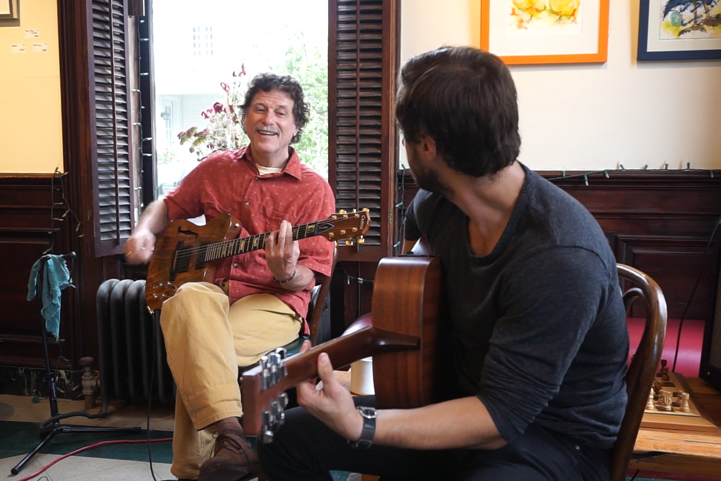
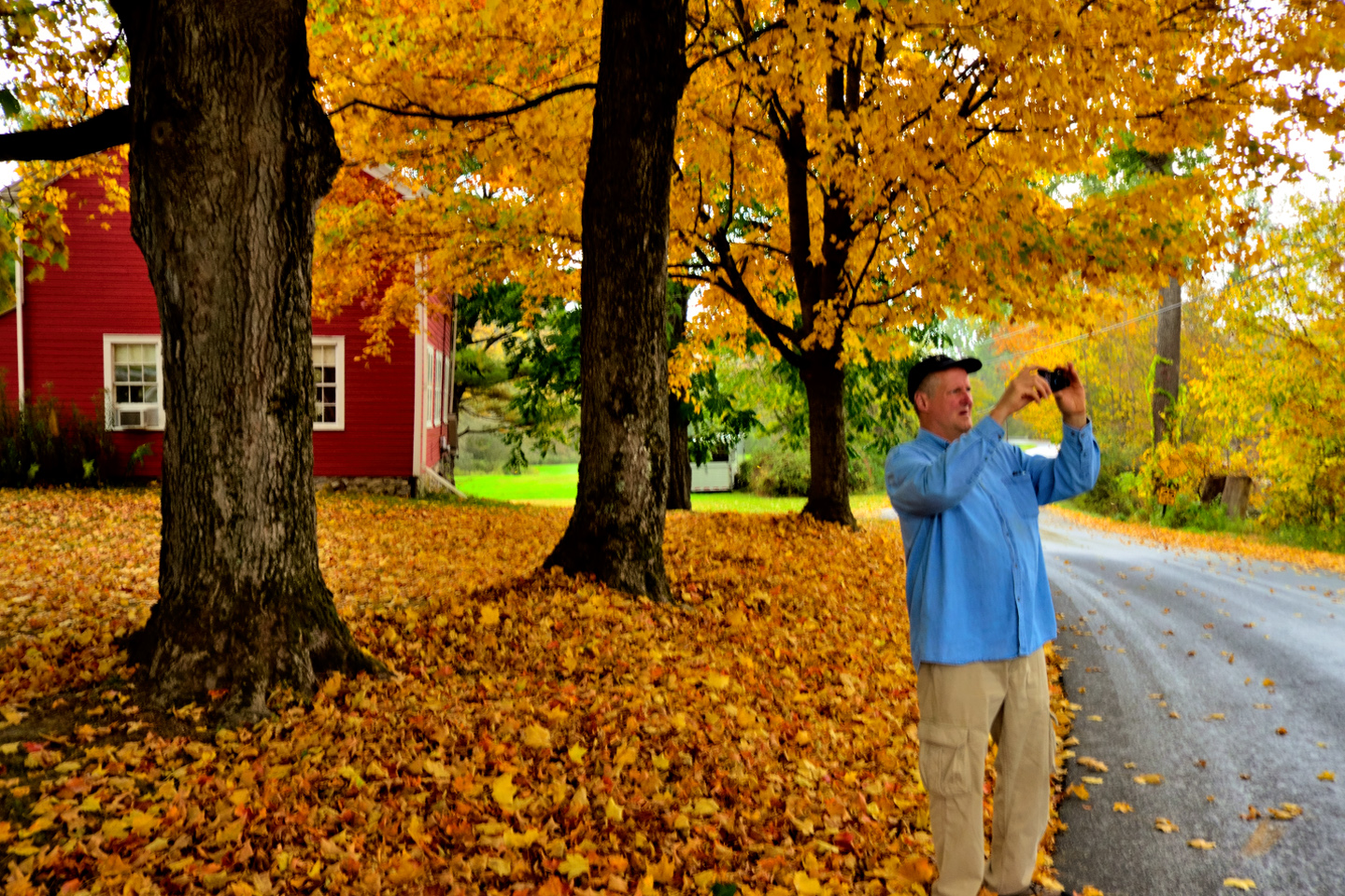
I’ve known Barry Hyman since we were kids in college, back in the late ’60’s. We were all a bunch of hippies in those days, and the music of our era was the glue that held our tribe together. Barry was a skilled practitioner of the musical arts, then, and still; the lad can play the frets off most anything with strings.
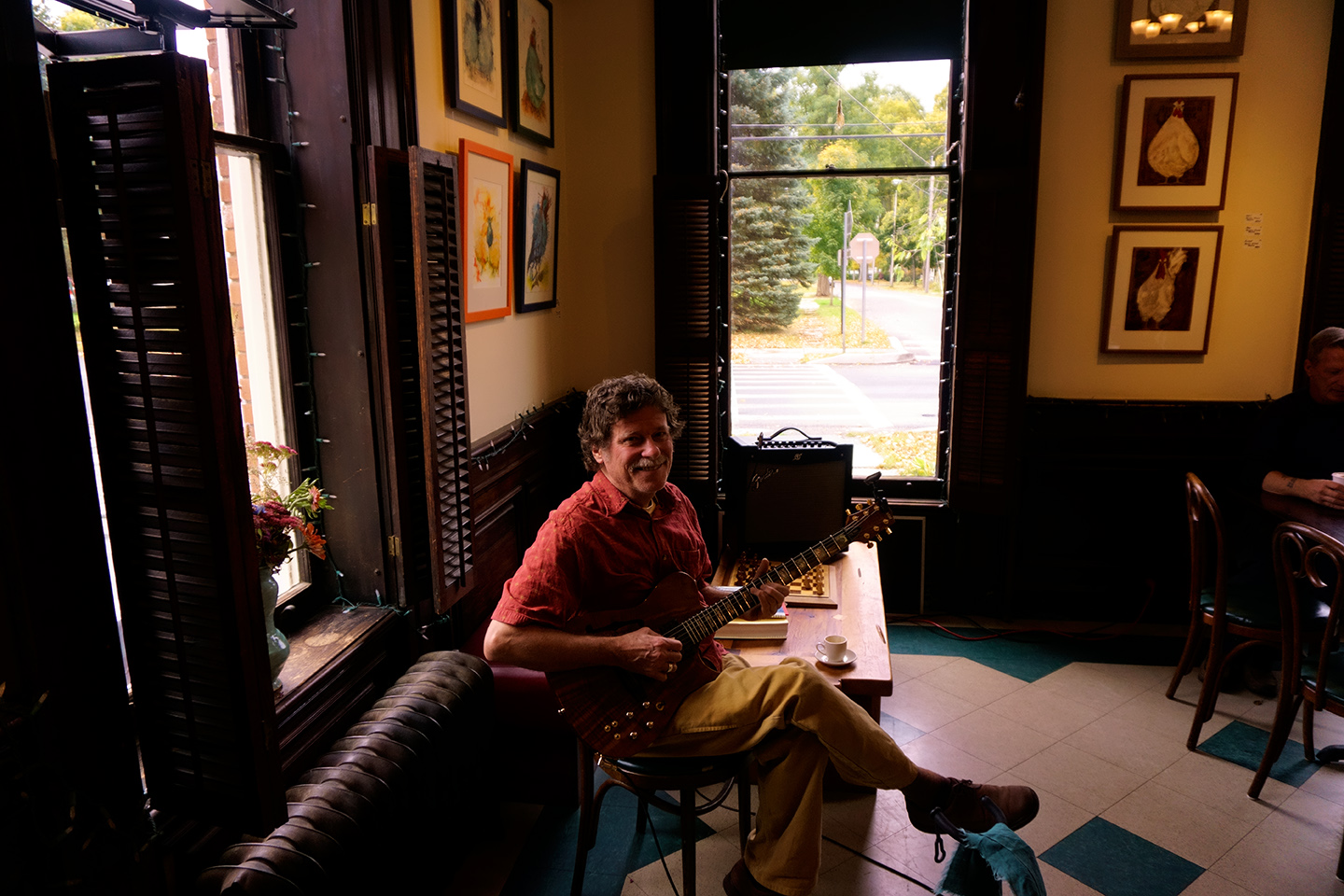
Barry Hyman in Cambridge, NY, October 4, 2014
We had coffee and pastries and enjoyed the music for an hour or so, but we hadn’t driven all the way to Vermont to sit around indoors, so we made plans to reconnect with Barry in the afternoon, and we headed back out to the hills. The weather was drizzling rain with patches of fog here and there, but it was still very pretty.
The foliage we saw along the way was amazing! There was one more covered bridge that I wanted to check out, this one on the New York side of the state line, so we followed route 313 back to the Batten Kill River, and the:
EAGLEVILLE COVERED BRIDGE
The Eagleville Covered Bridge was built in 1852 using the durable Town lattice truss design, and is one of just four historic covered bridges still standing in New York’s Washington County. The bridge has survived numerous floods and harsh winters; the original structure underwent substantial restoration in 2006–2007, including repairs for dry rot and structural improvements, This one was added to the National Register of Historic Places in 1972, a year earlier than the others.
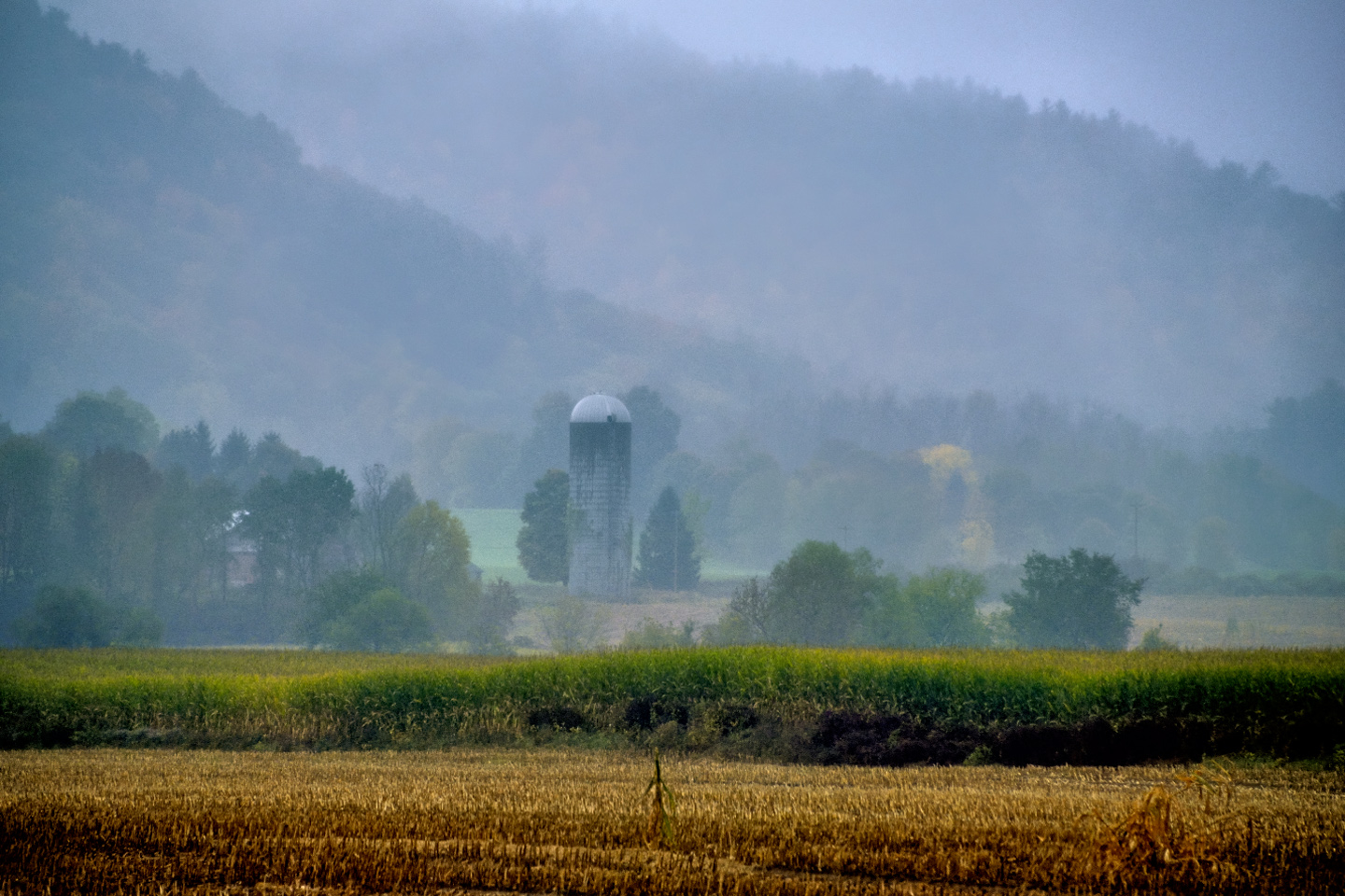
Barry no longer lived in Bennington proper. He and his wife had a house and some land in Washington County, just across the border in New York State, not far from Cambridge, where we watched him play that morning. It’s a relatively idyllic part of the world, a place where changes, other than those of a seasonal nature, tend to come quite slowly. My friend is very much at home here, and he wanted to show off his neighborhood, so we left the Jeep parked while Barry took us on a tour of the back roads near his home. That was a nice change of pace for me, having someone else doing the driving while I settled back and enjoyed the ride.
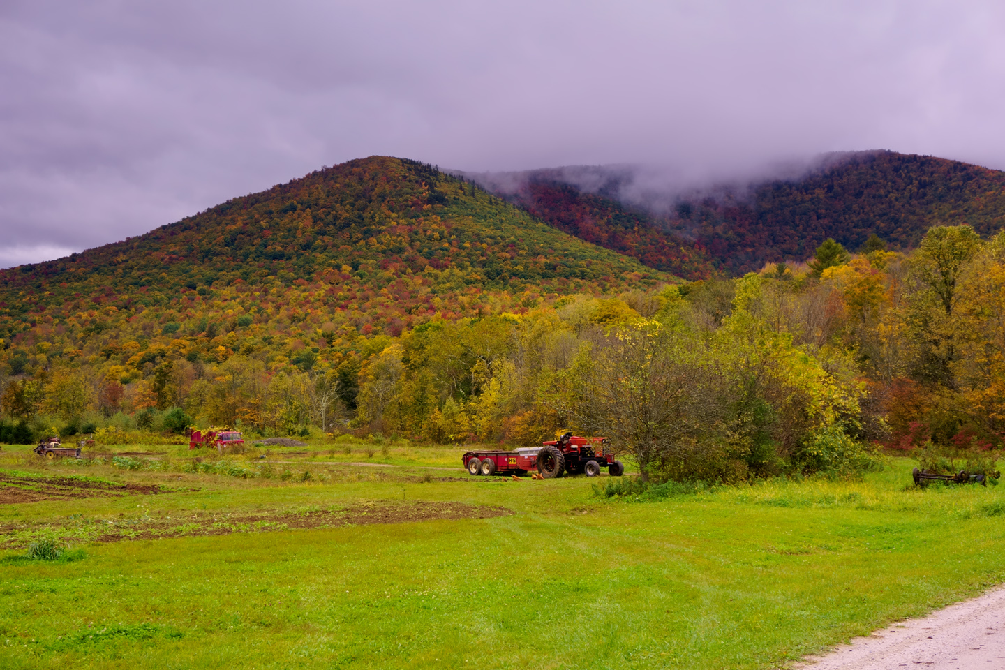
In the Arizona desert, where I was born and raised, we only have two seasons: hot, and less hot. Washington County, New York, by contrast, gets all four of the seasonal shifts, and we were smack dab in the middle of the best of the best. The weather was lousy that aternoon, drizzling rain throughout our drive, but the autumn woods were gorgeous, and there was a softer quality to the light that you don’t get when the sun is shining brightly on the scene.
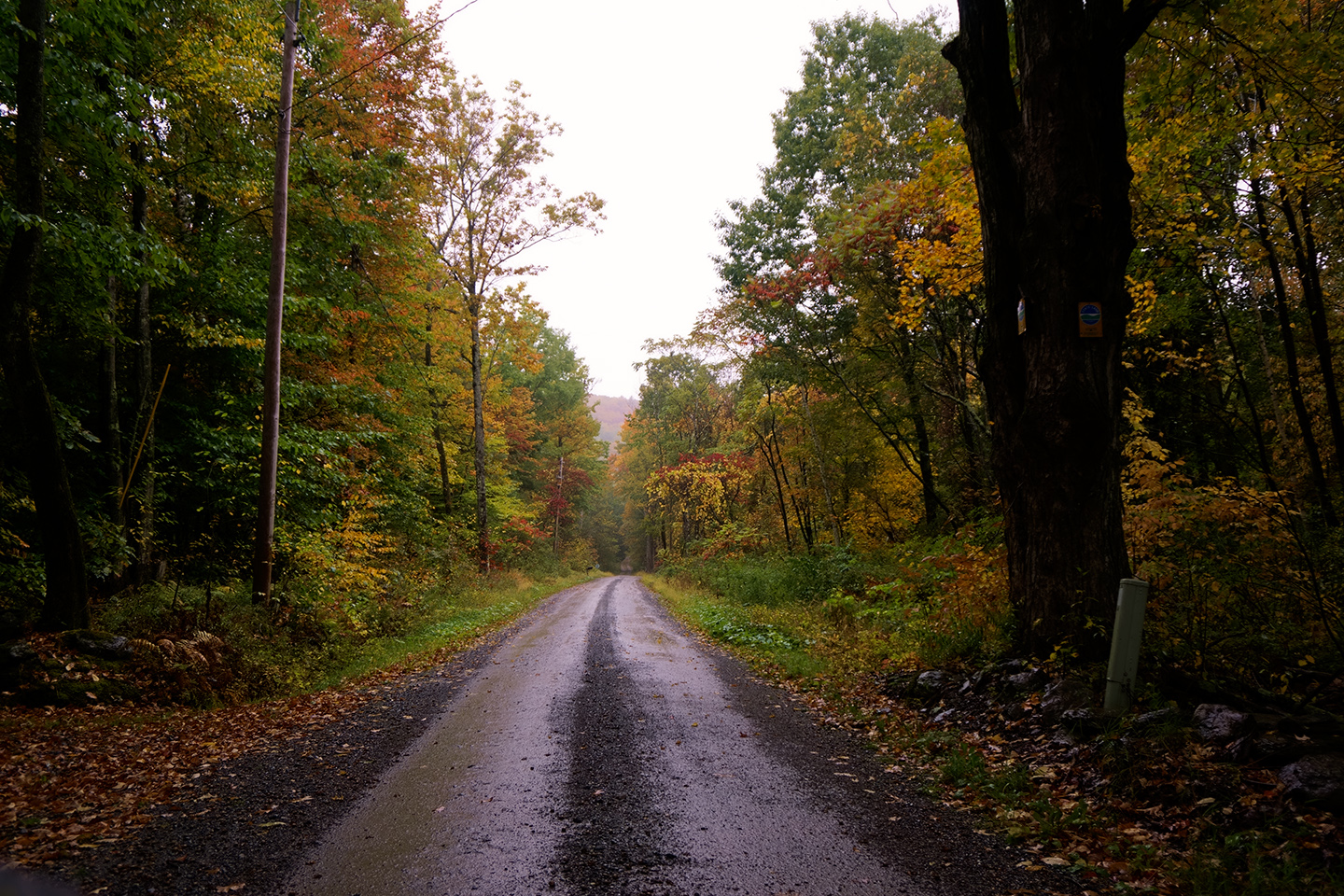
The Back Roads of Washington County
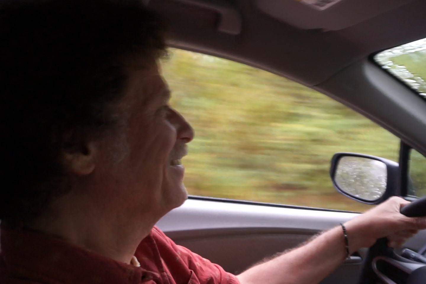
We spent a pleasant afternoon with Barry, tootling around through the woods, splashing through muddy puddles and reminiscing to the beat of steadily flapping windshield wipers. Ultimately, he drove us back to the place where I left my Jeep, and we parted ways, with a promise to keep in touch. John and I headed back to Bennington for a late dinner, and a second night at the Hampton Inn.
Next up: Route 100: Vermont’s Most Scenic Autumn Drive
Click any photo in this post to expand the image to full screen.
EASTERN ROAD TRIPS
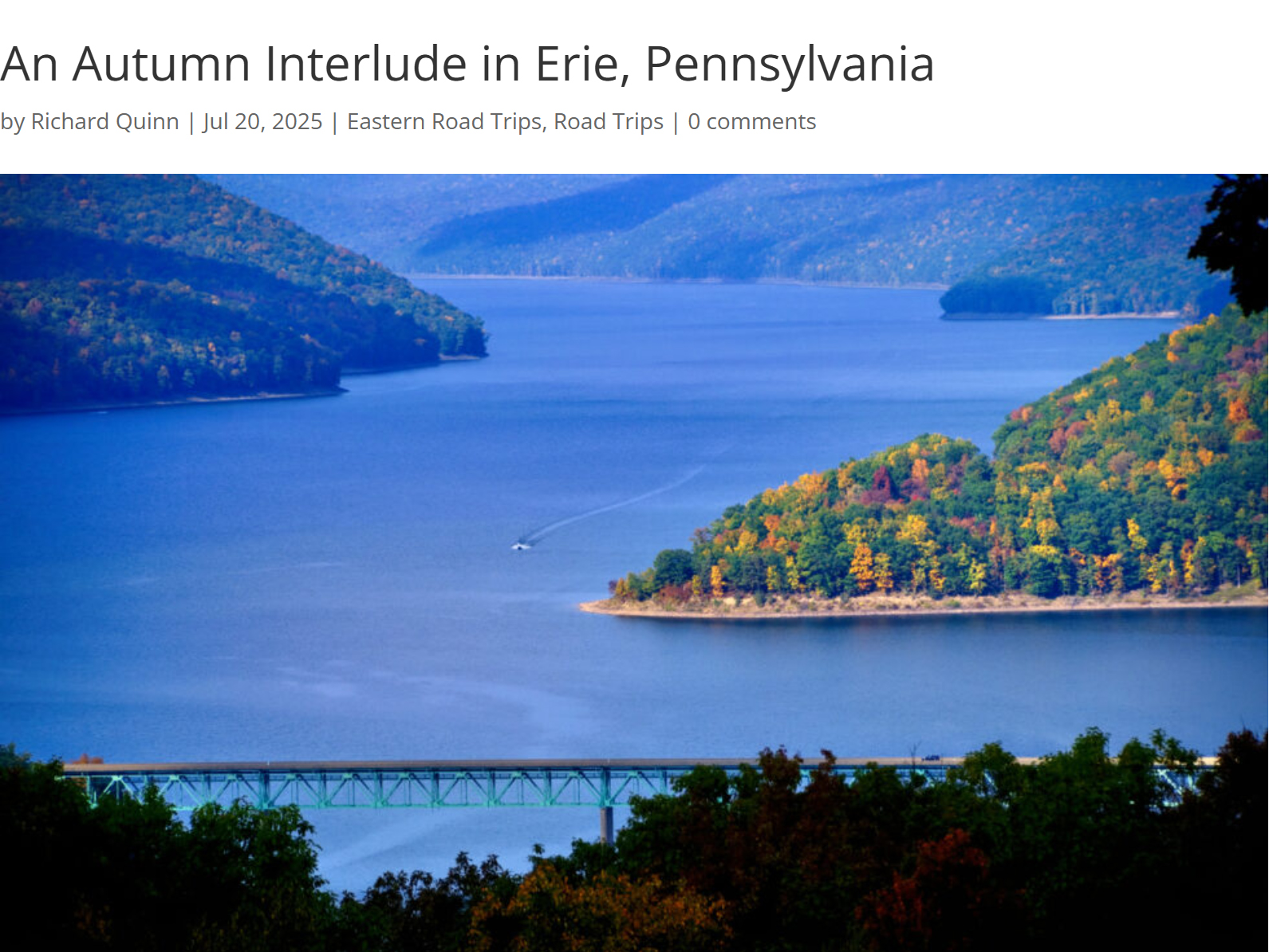
In Erie, Pennsylnania the natural world has been reclaiming lost territory: there are wetlands edging out those old shuttered factory sites, beautiful beaches on the shore of Lake Erie, a State Park (Presque Isle) offshore from the old port facilities, and creeks flowing into the big lake that are world class locations for catching Steelhead Trout.
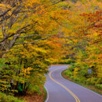
The six New England states, taken together, support more than 28 million acres of dense, mature forests. Some of it is evergreen, but most of it is deciduous, so, come the fall, you have more than ten BILLION trees changing color and losing their leaves, all over the course of a couple of weeks.
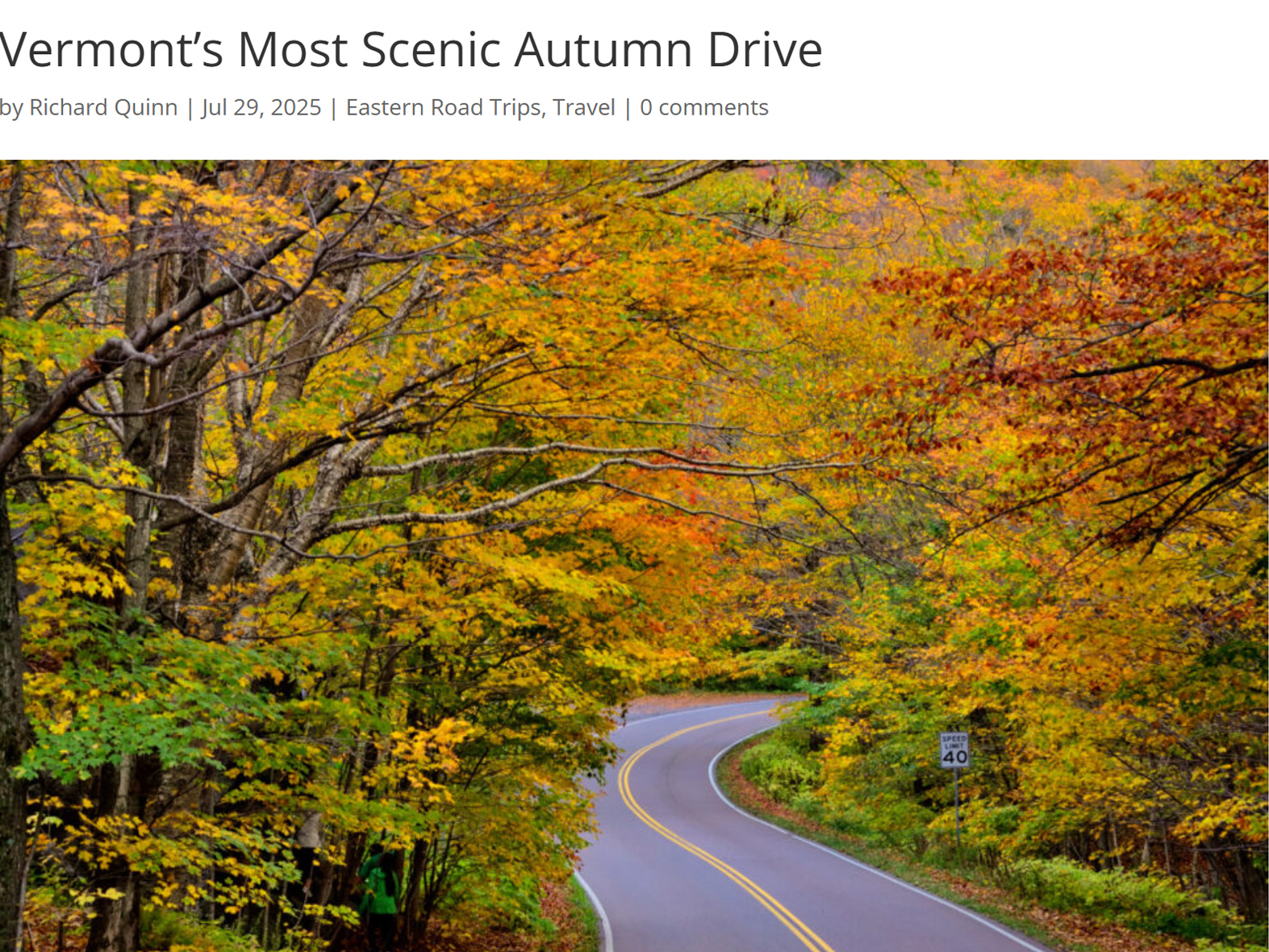
Route 100 is celebrated as one of the best routes in New England for leaf peeping. The variety of trees and uniterrupted swaths of forest provided us with a particularly vivid autumn display. It was easy to see why this drive is so often featured in travel guides as their top pick for an autumn road trip.
WASHINGTON D.C. FOR PHOTOGRAPHERS

Each weekend I’d focus on a different monument, and I’d shoot them from every conceivable angle, before, during, and after the golden hour of the sunrise. Why the weekend? Because, grasshopper, on weekend mornings, there are no commuters, so there is no traffic, no parked cars, no people in the way of your photo shoot!
<<CLICK to Read More!>>

The slightly elevated position of the Lincoln Memorial gives photographers a clear line of sight from every vantage point, with a multitude of options for interesting compositions. But if you want the very best light, and the smallest crowds, you're going to have to get out there at sunrise!
<<CLICK to Read More!>>

As a subject for photographers, the Jefferson has it all: columns and curves, sculpture, carved inscriptions, a dome! The Tidal Basin serves as a reflecting pool, and, for a couple of weeks every spring, the whole business is surrounded by flowering cherry trees.
<<CLICK to Read More!>>

Shoot the flower buds when they first emerge, shoot them again when they're in full florescence, and if you can swing it, one last time when they start to drop, and you have pink petals falling around you like rain...
<<CLICK to Read More!>>

There's nothing like a good road trip. Whether you're flying solo or with your family, on a motorcycle or in an RV, across your state or across the country, the important thing is that you're out there, away from your town, your work, your routine, meeting new people, seeing new sights, building the best kind of memories while living your life to the fullest.
Are you a veteran road tripper who loves grand vistas, or someone who's never done it, but would love to try? Either way, you should consider making the Southwestern U.S. the scene of your own next adventure.
A few years ago I wrote a book about road trips in Arizona and New Mexico that's a lot like this website, packed with interesting information, and illustrated with beautiful photographs. Check it out! You can find it on Amazon, and at all other major booksellers.

ALASKA ROAD TRIP:
MEXICAN ROAD TRIP (IN THE LAND OF THE MAYA):
ARIZONA AND NEW MEXICO:
SOUTH AMERICA:
PHOTOGRAPHY:
TRIBAL LANDS:


Recent Comments