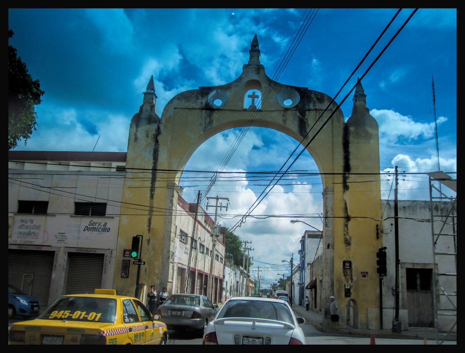
Visiting the Spanish Colonial cities of Mexico is almost like traveling back in time. Narrow cobblestone streets wind between buildings, facades, and stately old mansions that date back three hundred years or more. There are beautiful plazas, parks, and soaring cathedrals, all of similar vintage, and most of it is wonderfully well preserved and maintained, a source of considerable pride for the residents of these historic towns, and, truly, for all of Mexico. The modern infrastructure, and most of the 21st century conveniences that might otherwise spoil the ambiance, all that is tucked into existing spaces, and kept low-key, a discrete form of almost-camouflage:
It would be easy to imagine yourself walking those same streets in the Mexico of the 17th or 18th century, especially through the historic central neighborhoods of these older cities, places that were already well-established and thriving before the Pilgrims so much as set sail on the Mayflower. Easy to imagine that earlier time, I should say, if it wasn’t for the constant stream of cars, trucks, and lumbering buses clogging the mostly one-way streets (streets that were designed for horses and carriages) and tangling the intersections into impassable knots of horn-bleating traffic:
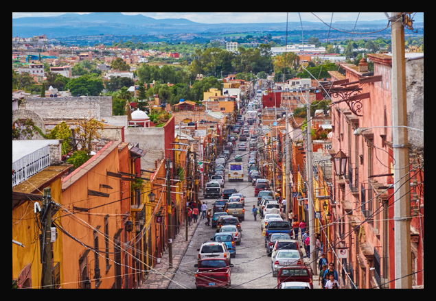
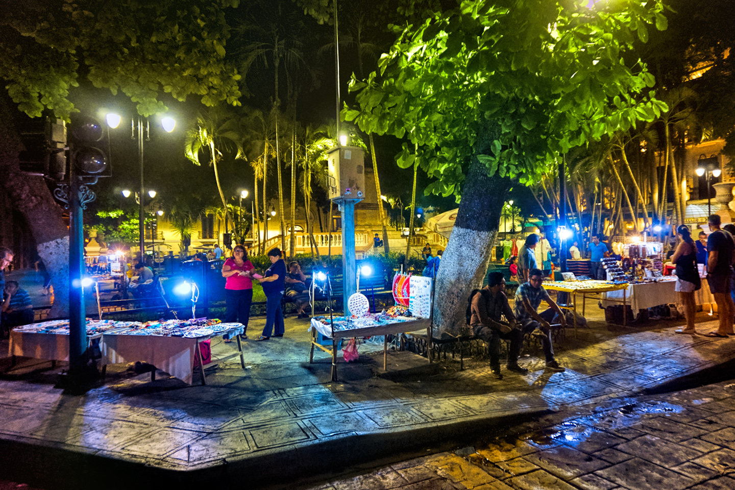
You can’t get away from the modern world simply by walking among old buildings, but these colonial gems have a character and a vitality that most definitely dates to a bygone era. The hard core colonials are the cities whose classic architecture is their predominant feature, and a big part of their civic identity. Several of them, such as San Miguel de Allende and Campeche, are classified as UNESCO World Heritage Sites and are literally protected by international treaty. There’s a strong incentive to keep all that going, at least to outward appearances, so from a visual perspective, those places have scarcely changed at all in all the centuries that have passed since their founding. The rest of modern Mexico is just like modern anywhere else: steel and glass, freeways and sprawl, McDonald’s and Subway, Walmart and Home Depot, but of course it’s still very much the third world, so the shiny, new, fancy stuff is generally surrounded by–um–not so fancy stuff.
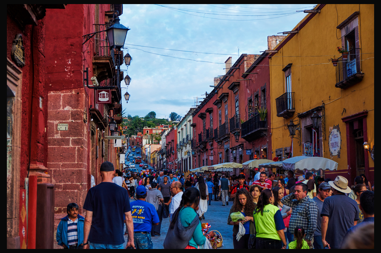
It helps when they block vehicles from entering the heart of the city center, as they’ve done in this scene from San Miguel de Allende. (Click for an expanded view).
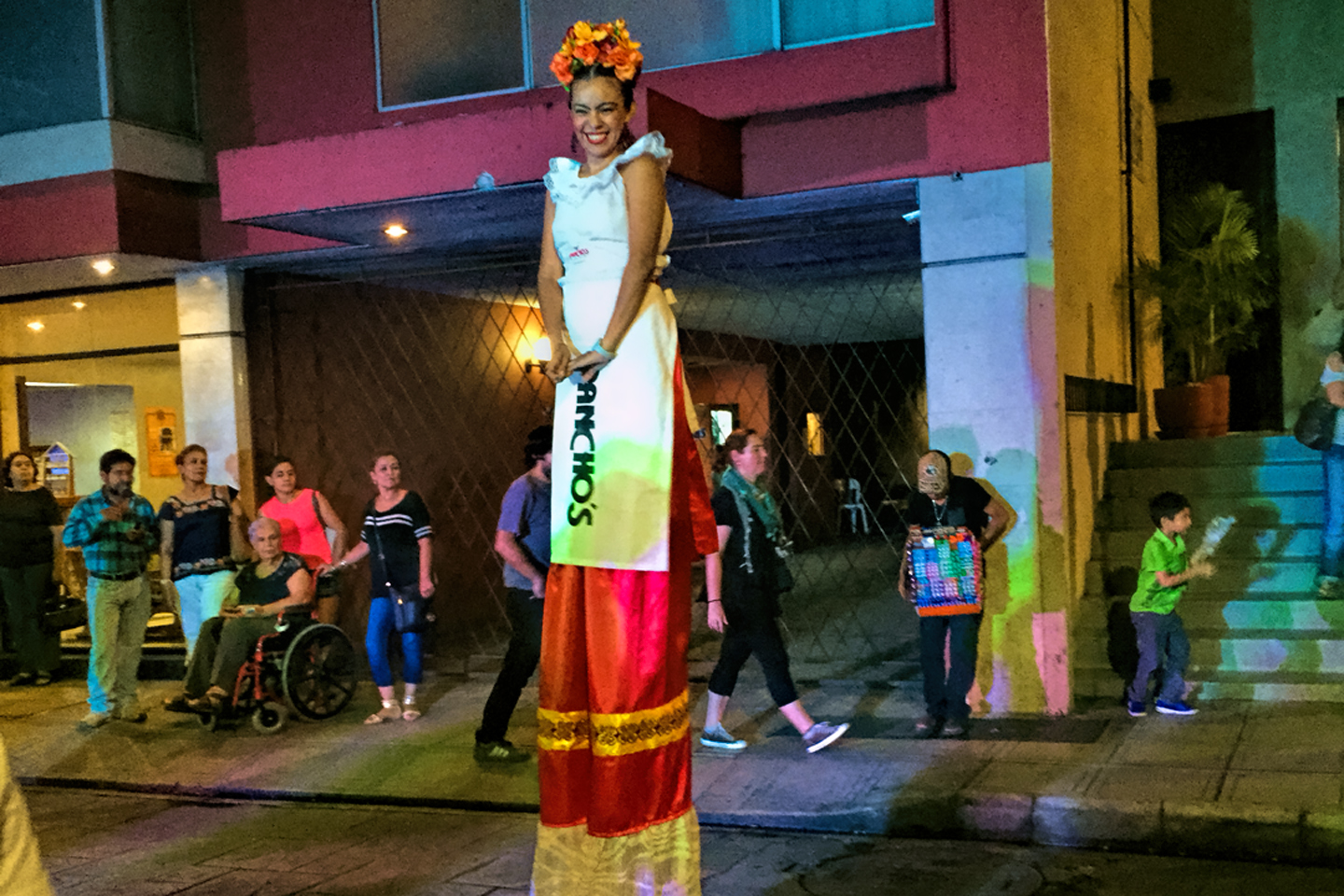
You’ll find examples of the old Mexico in every part of the country–even the most modern, upscale Mexican cities tend to have a historic center, an “old town”–but this article will focus on three in particular, places that I passed through on my recent tour of the Yucatan and southern Mexico. Mérida and Campeche, both on the Yucatan Peninsula, and San Cristobal de Las Casas, high in the mountains of the state of Chiapas. All three of these locations proved to be such an unexpected pleasure, and the photographic opportunities were superb! I mentioned that visiting Mexico’s Colonial cities is like traveling back in time? That went double for me personally. It had been more than forty years since I’d traveled in that very different world lying south of the U.S. border, and I had no idea what to expect. I was afraid that all the charm would be gone–modernized, homogenized, bearing little resemblance to my youthful memories. But I needn’t have worried. Aside from the traffic, which is much worse than it used to be, plus the damned cell phones that virtually every person you see is carrying around, I really could have been back in the Mexico of the 1970’s, rather than today’s Mexico of the ought-teens. In those old colonial cities, pretty much everything else is exactly the same as I remembered it, and they’ve gone to a lot of trouble to keep it that way. I felt instantly reconnected to a whole world that I’d all but forgotten–a world not just of old buildings, but a world that’s filled with music and laughter and bright colors, a world where families stroll, children smile, old men still sing for no reason, and lovers still dance in the streets by the sultry light of the tropical moon. I’m talking Festivals, Fiestas, National Holidays, Local Holidays, Saints Days, along with pretty much any day that ends in the letter Y. Sundown is all the reason anyone seems to need for a celebration, and everywhere we went, there was something going on, pretty much every night of the week, starting in:
Mérida
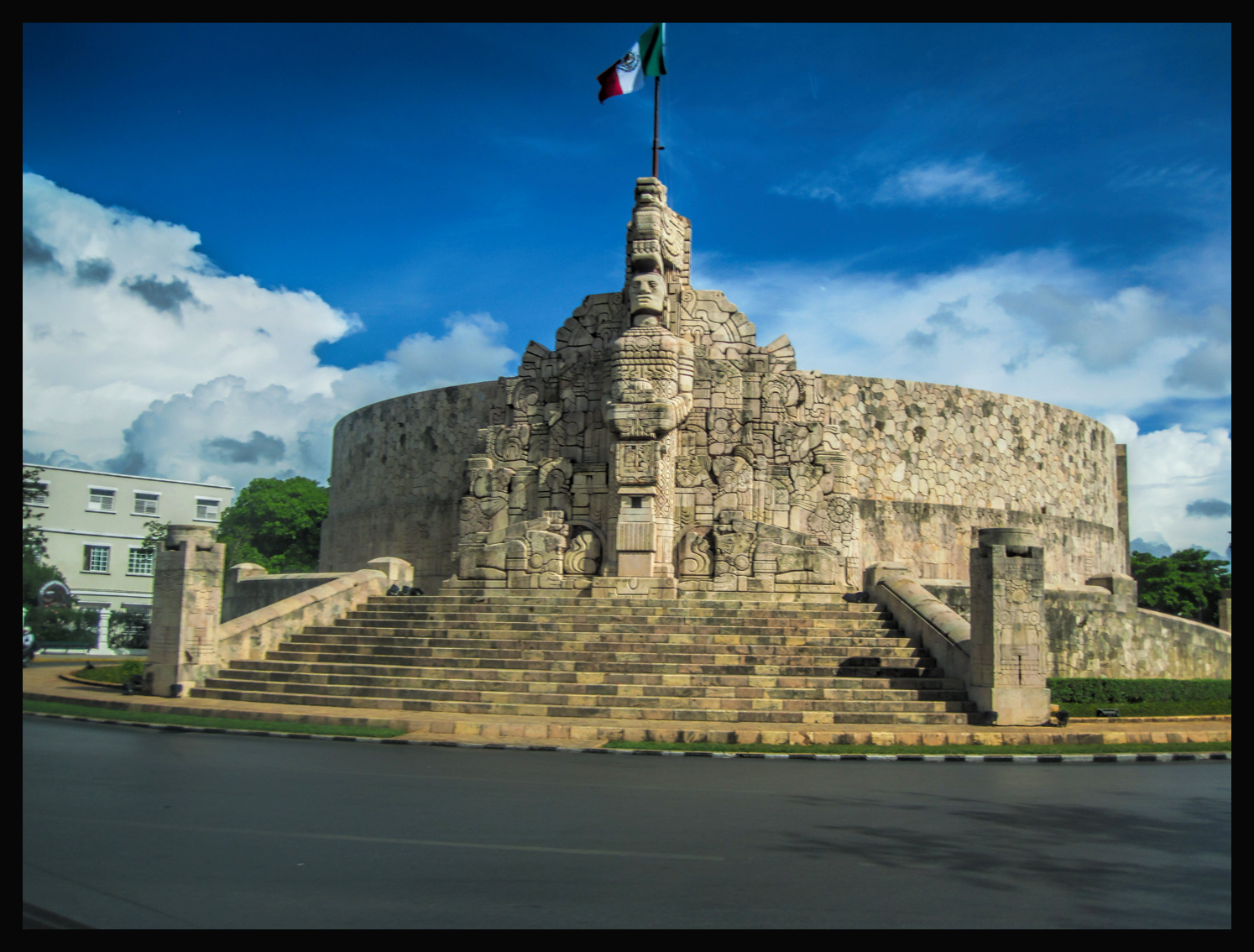
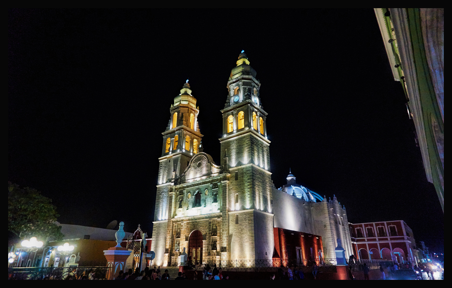
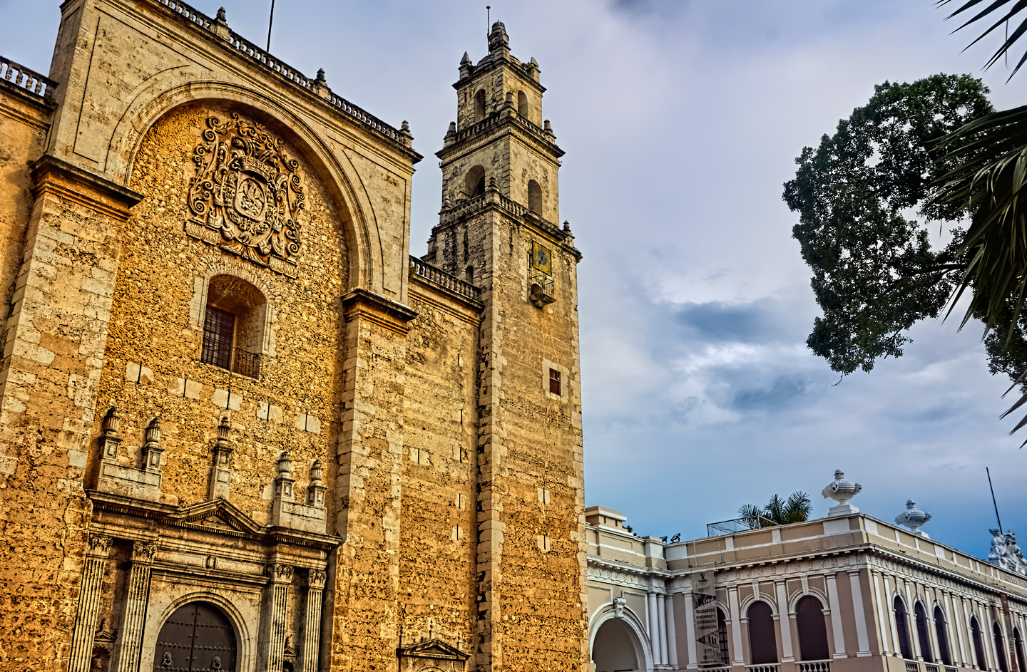
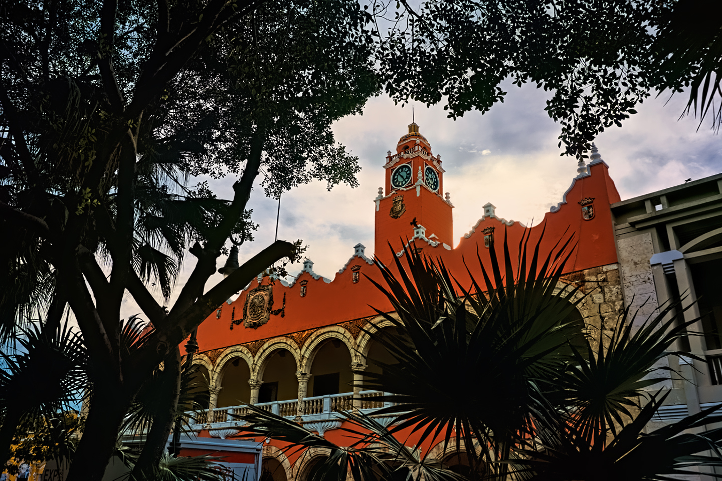
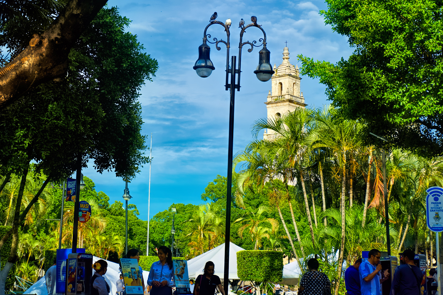
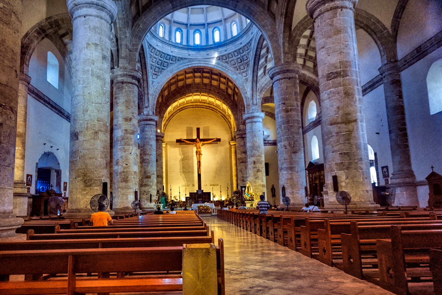
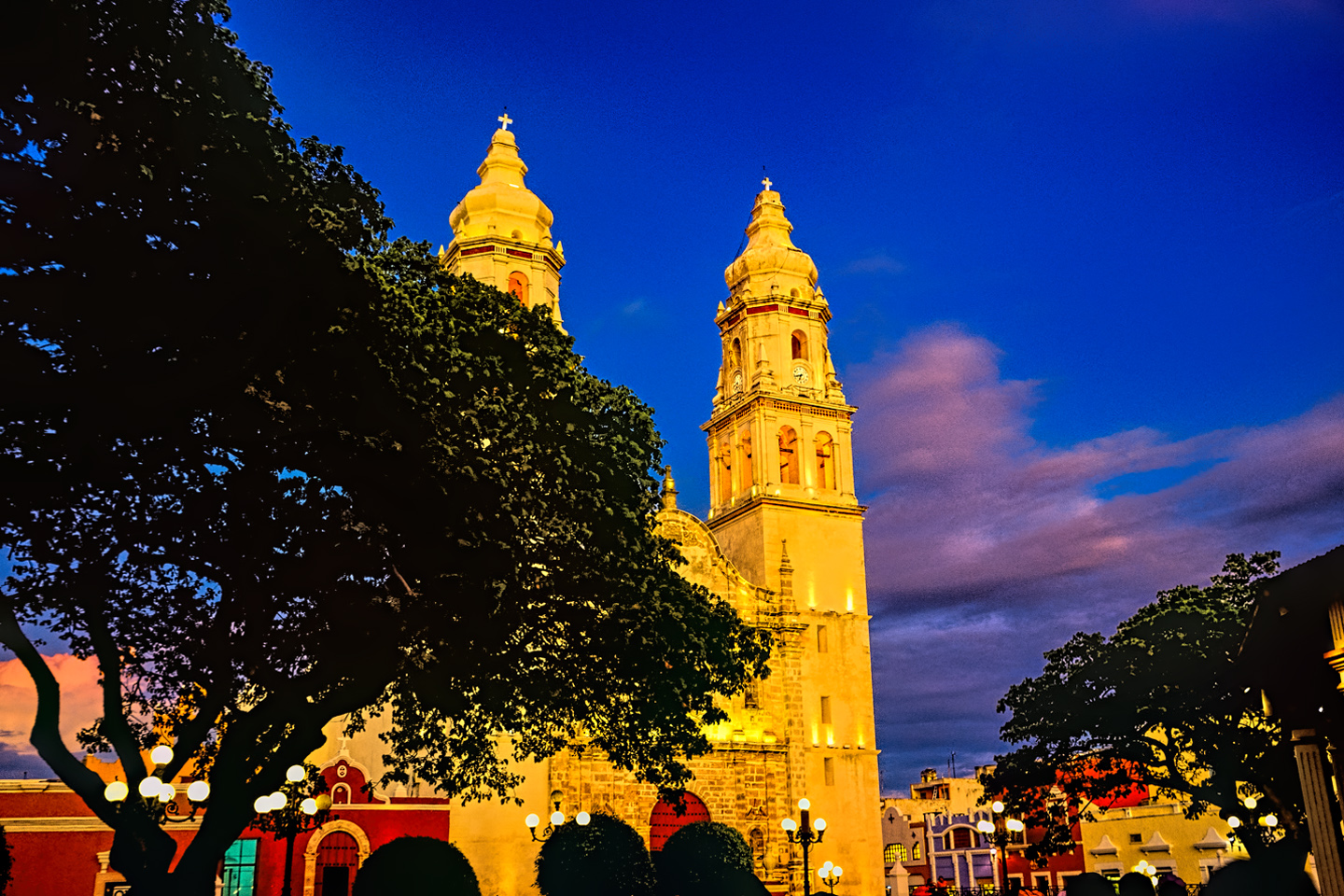
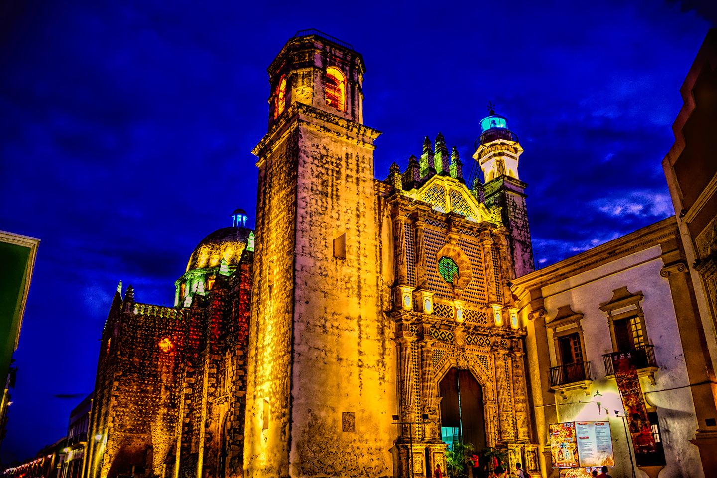
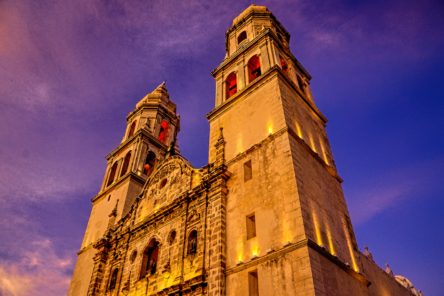
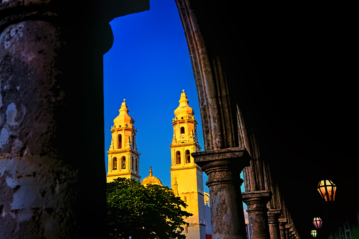
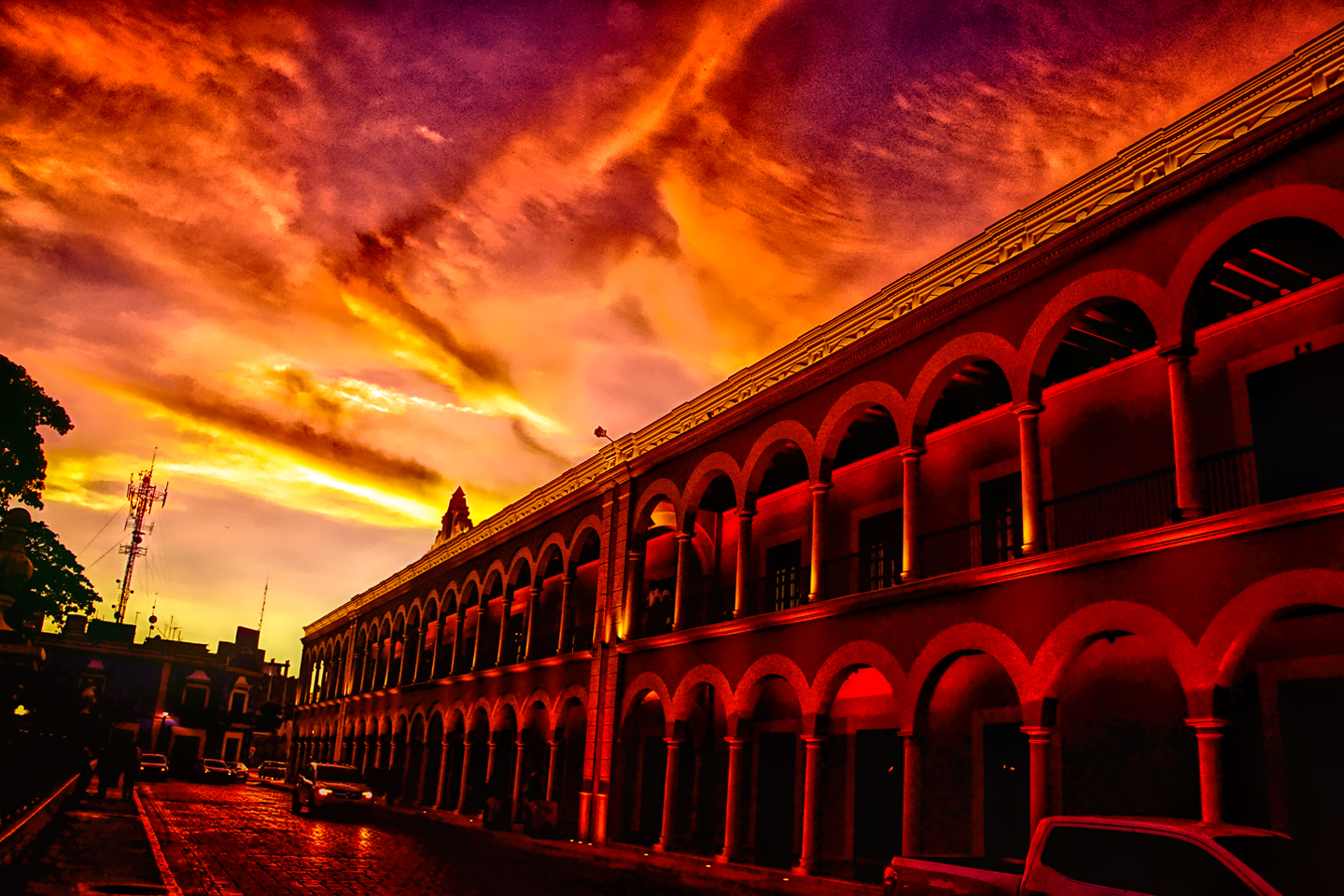
Mérida is the largest city in the south of Mexico, and the twelfth largest in the entire country. It’s the capital of the Estado (state) of Yucatan, with a modern day population of close to a million people. The historic center of the city radiates from the Grand Plaza, fronted by the Cathedral of San Ildefonso, the oldest cathedral in the Americas, built in the 16th century, and still in daily use:

The Catedral de San Ildefonso, oldest in the Americas, completed in 1598
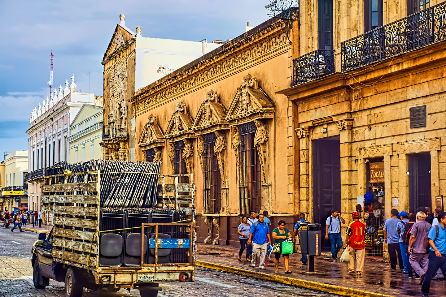
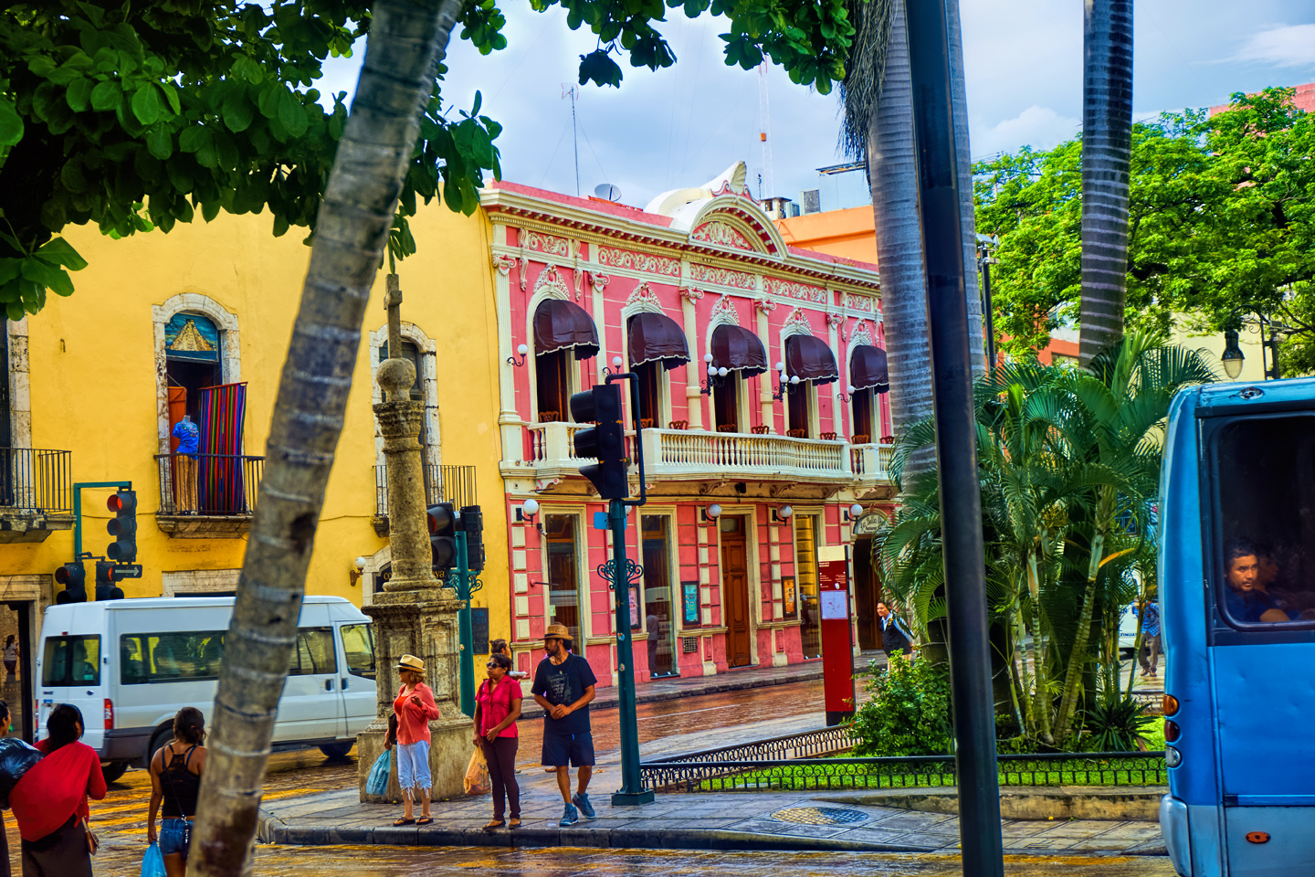
Mérida is not ALL a Spanish Colonial Disneyland. Not the whole place, but it doesn’t miss that mark by much. Known as the White City, Mérida has the third largest historic center in all of the Americas, right behind Havana de Cuba, and Mexico City itself. This is a city of grand old houses, particularly along the broad boulevard known as the Paseo de Montejo:
Traffic circle on the Paseo de Montejo in Mérida, the boulevard of the henequen millionaires
In the late 19th century, there were more millionaires in Mérida than any other city in the world, thanks to a boom in “green gold”, which is what they used to call henequen, an extra large variety of the agave plant that grows in abundance in the Yucatan. Before they invented nylon, there was henequen, and the tough fiber produced from those spiny leaves was used for everything from wrapping paper to rope–especially rope. (Prior to the age of the automobile, people apparently went through one whole heck of a lot of rope).
Mérida was founded in 1542, built on the site of an existing Maya settlement known as T’hó. The ceremonial center, with five pyramids and a number of temples, had been abandoned, like all the other Maya temple complexes, long before the Spaniards arrived, but native Mayans were still living among the ruins, leading some to contend that Mérida is the oldest continuously occupied settlement in the Americas. In any case, the original Mayan structures were dismantled, and the stones recycled in early construction of the new Spanish town. Some of them can still be seen, most notably in the walls of the main cathedral:
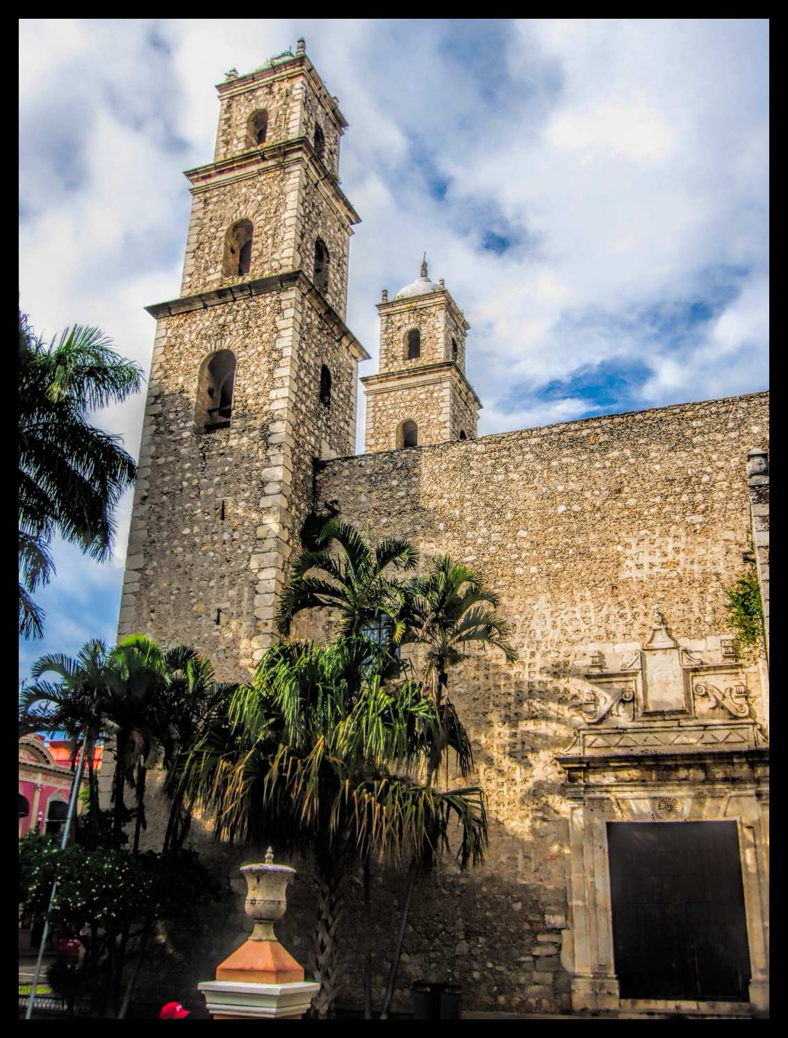
Catredal de San Ildefonso, in Mérida. Click to expand the photo, and note the stones at the corners of the tower, recycled from the Mayan temple that stood here before the church was built.
All of Mérida was a walled city at one point in its history. The Maya in the area weren’t always peaceful, and there were times when the white and creole settlers had to circle the wagons inside the city gates. Most notably, Merida was besieged at various times during the Caste War of the Yucatan, a bloody conflict that pitted native Mayans against non-native settlers and land owners. The fighting lasted, sporadically, for more than 50 years, from 1847 until a truce was finally called in 1901, and at one point, the portion of the Yucatan controlled by the Mayans actually split from the the rest of Mexico and formed their own Republic, just as the Texans had done, and at around the same time. (In fact, the same Mexican General, Antonio López de Santa Anna, led Mexican troops into battle against both of these rebellions) .
One of the old city gates, one of the last vestiges of the defensive wall that once surrounded the city of Mérida
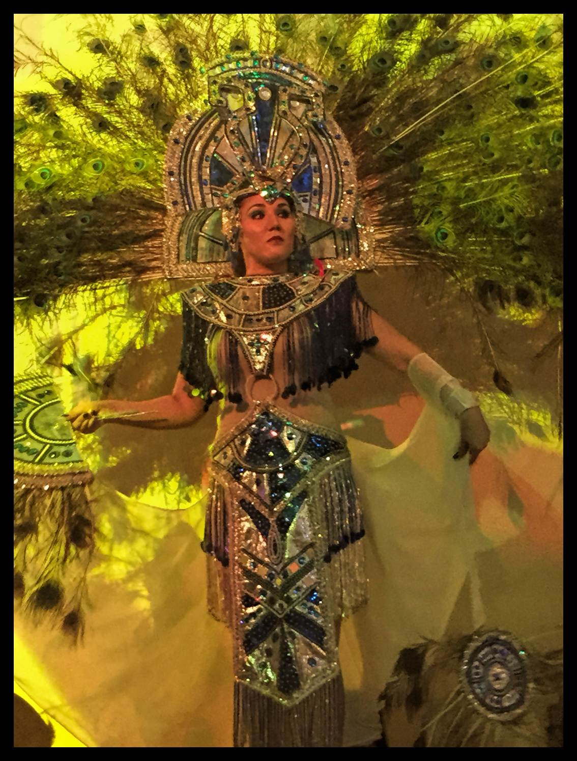
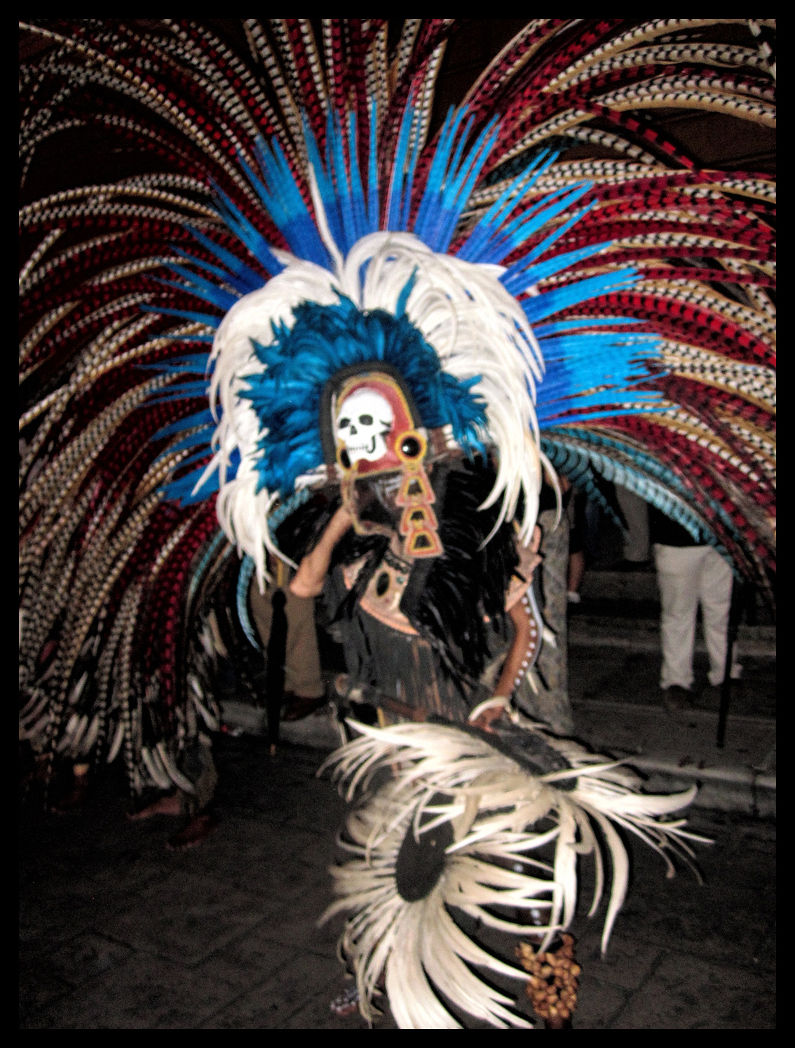
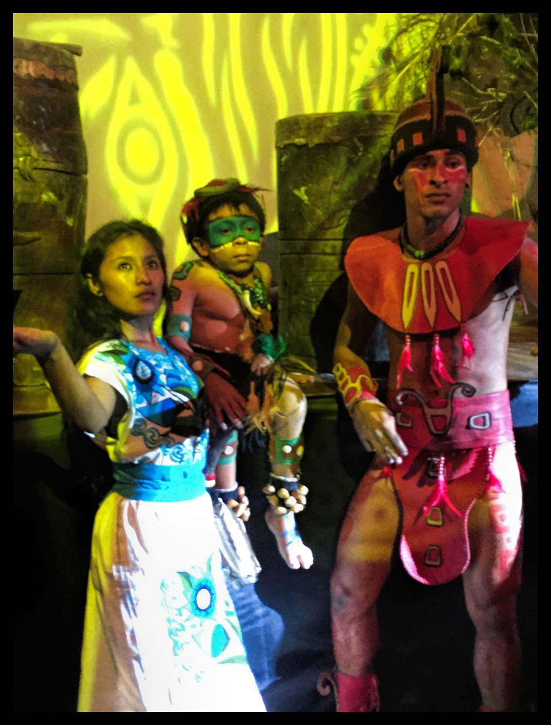
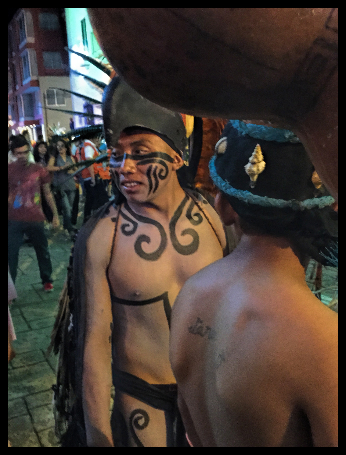
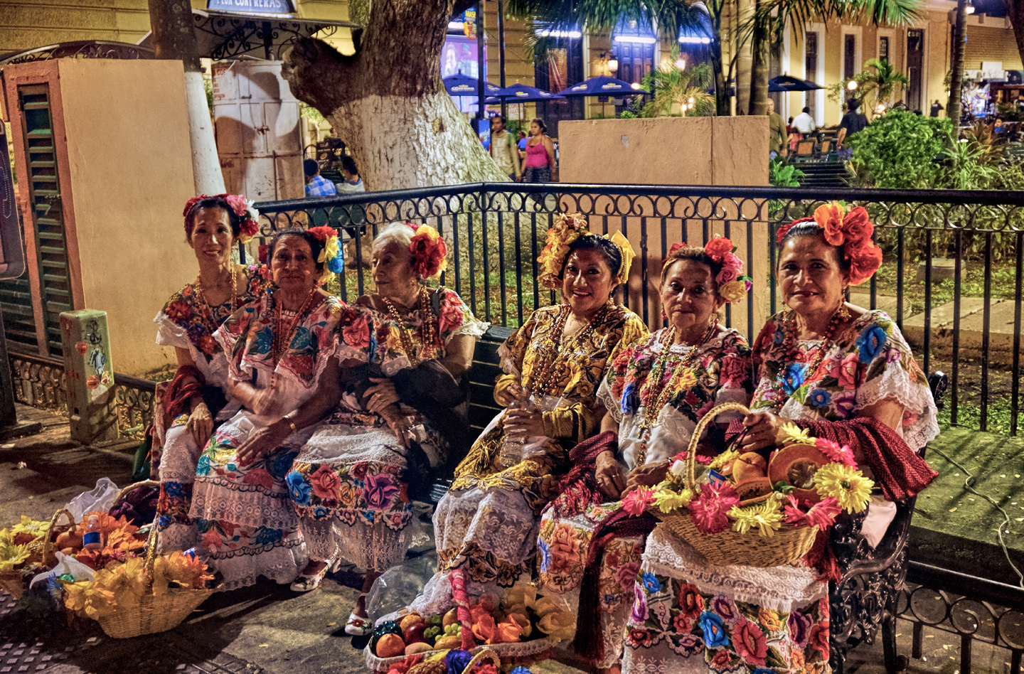
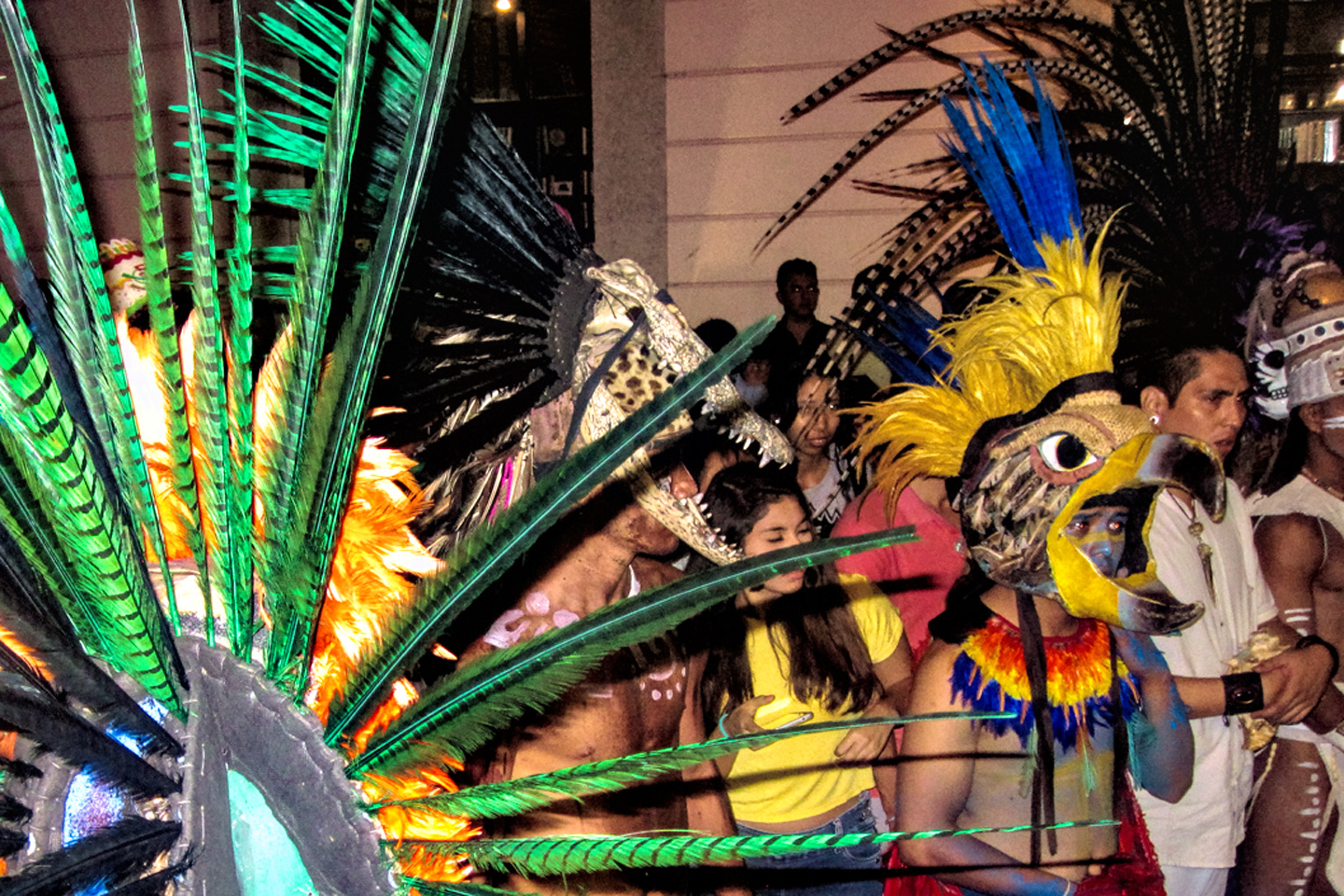
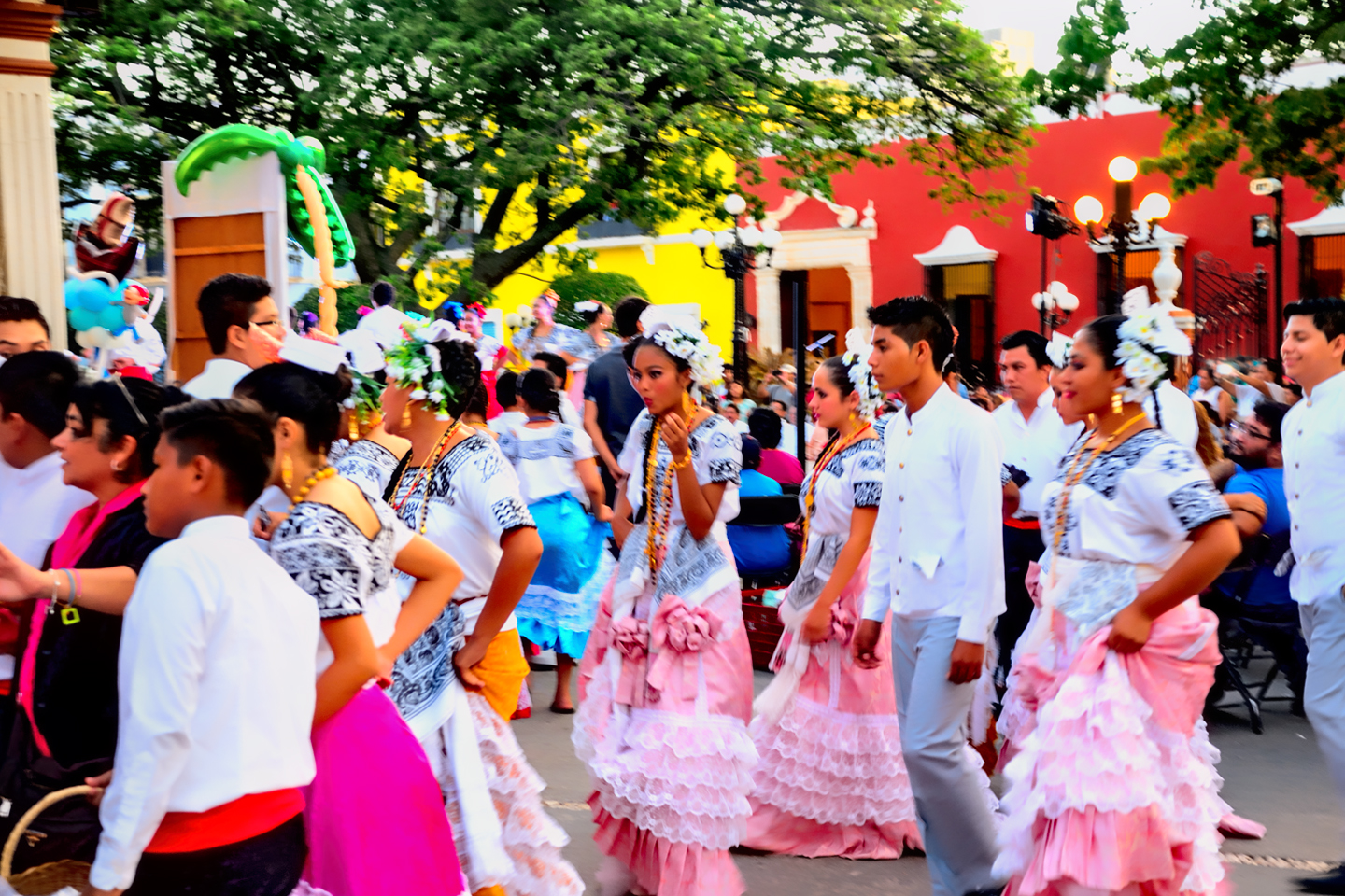
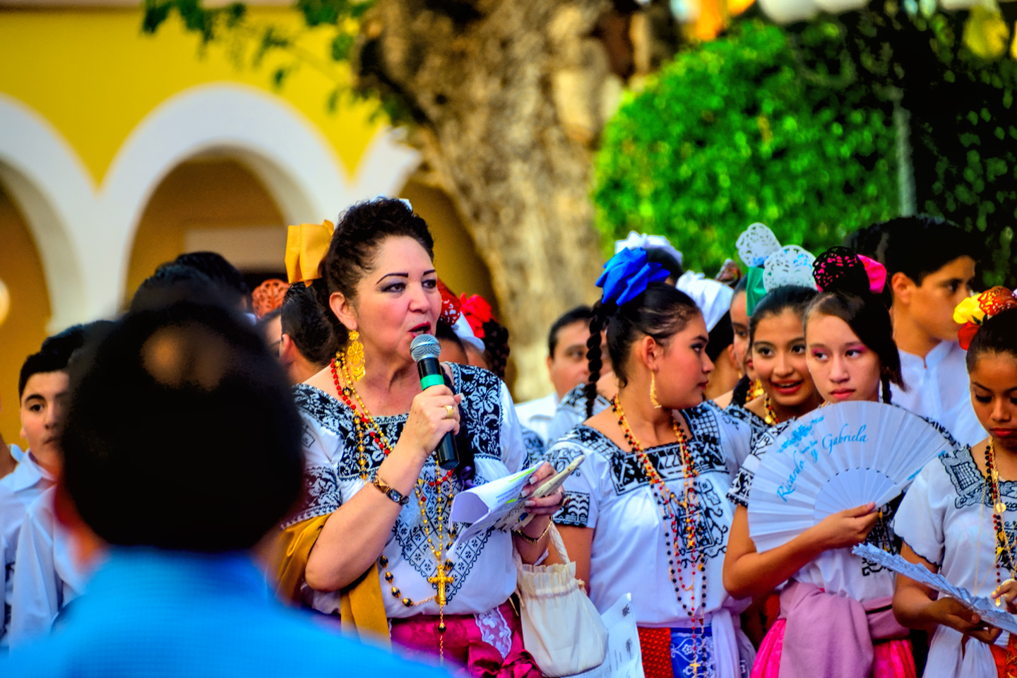
In the Mérida of today, fully 60% of the population is of Mayan descent, making it the logical place to host the “International Festival of Mayan Culture”, a ten day celebration of all things Mayan, featuring everything from scholarly Mayan language seminars to costumed dance routines splashy enough to rival the stage shows in Las Vegas. The festival took place in October, which, by pure coincidence, is when we were visiting. My friend and I had just finished dinner, and we walked right into the middle of the grand finale, with no clue about what was going on. I was suddenly surrounded by beautiful girls in beautiful costumes, dancing their hearts out! And me, with no camera aside from my phone? Ah, well, the experience was something I won’t soon forget, and, truthfully? It was nice to just enjoy the spectacle for a change, without worrying about camera settings and lenses and lighting and all the rest. There was a stage on the Grand Plaza with a variety of performing artists, but the real action was in the streets. It was primal, pounding drums, conga lines of costumed dancers swirling beneath theatrical spotlights set up for the occasion, while onlookers lining both sides of the street joined in, swaying and singing and clapping hands to the beat. There were no strangers in that crowd, no locals, no tourists, everyone was as much a part of the action as everyone else. Mérida doesn’t have a monopoly on that brand of joyous contagion–but you can tell: they’ve had plenty of practice!
The ‘White City’ is a place that’s well worth a visit. There are amazing Mayan ruins nearby–that was the main attraction for me personally–but Mérida itself is a wonderful colonial city to explore, and there are goings on in the plaza almost every night of the year. (Especially on weekends).
If you’re planning to go, and you need recommendations on hotels and restaurants and the like, there’s a brief section at the bottom of this post with some links.
I should also give you some practical advice: When you’re walking around the Grand Plaza, watch out for the hucksters trying to sell you Panama hats and Guayabera shirts, because the big store on the next block that they’re all trying to steer you to overcharges like crazy!
Come to my uncle’s/cousin’s/brother’s store! He’s got the best prices on hats/hammocks/hand-rolled cigars!
Campeche
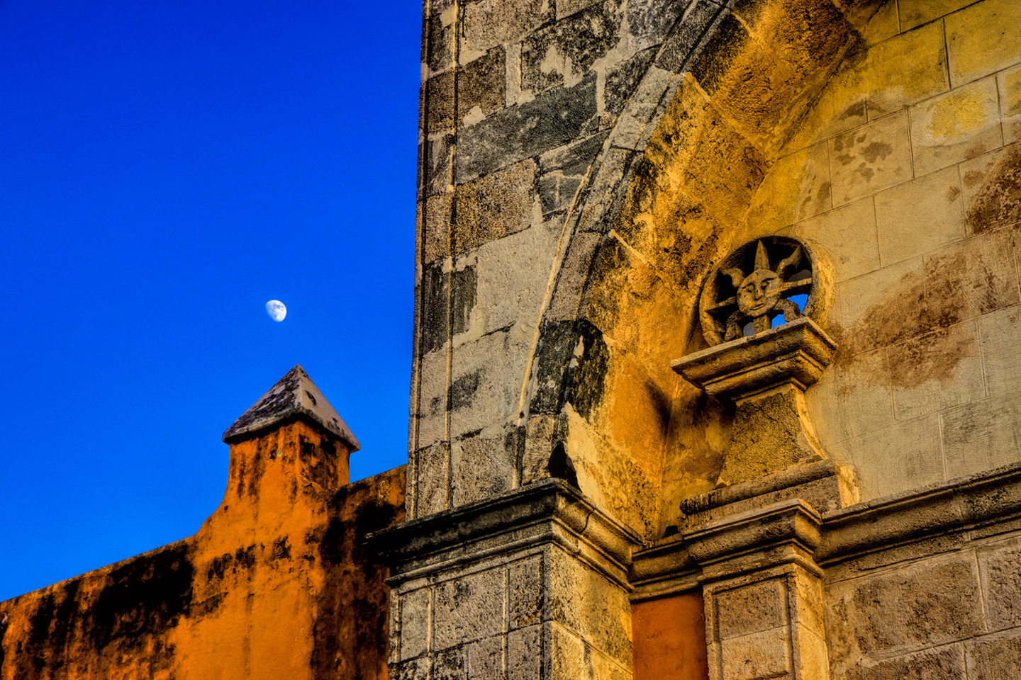
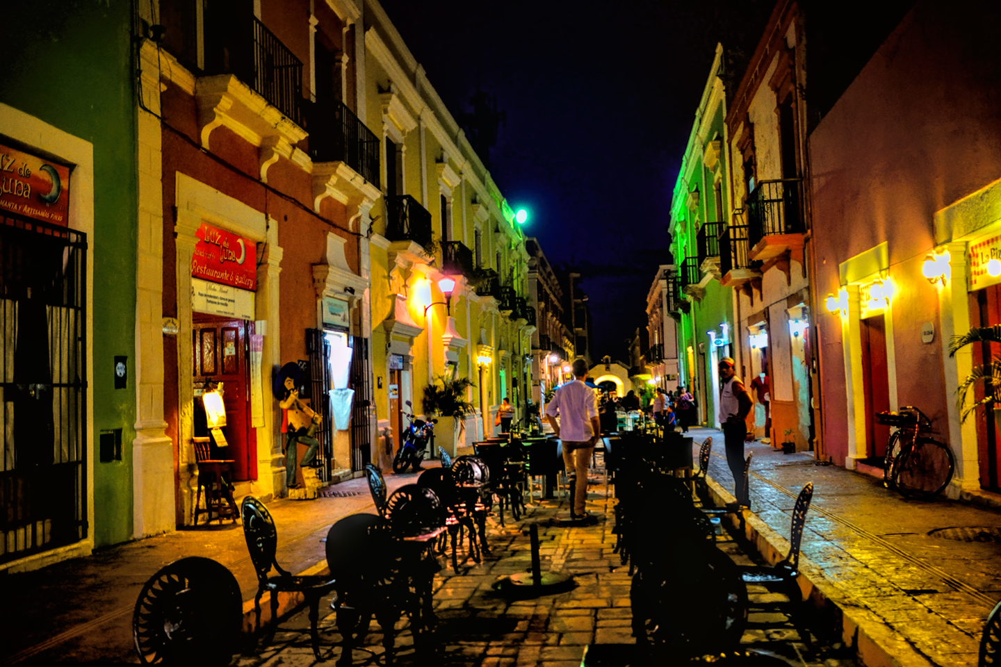
Campeche was another unexpected pleasure. We passed through it on our way to Mérida, stopping just long enough for lunch, but we made a spur of the moment decision to go back again a week or so later, and we used it as a base to explore some of the ruins that we’d missed on our first pass through the area. That turned out to be one of our better decisions. Like Mérida, Campeche is a colonial charmer. The city was founded in 1540 by Francisco de Montejo, the same busy conquistador who founded Mérida just two years later. Campeche was by far the more important of the two, particularly at first, as it has the distinction of being a port on the Gulf of Mexico. Being a port, this was one of the spots where the Spanish galleons took on cargo, most notably silver from the mines in the interior, and valuable tropical hardwoods. All that made Campeche a prime target for pirate attacks, which occurred with fearsome regularity. Constant threat of piracy prompted the construction of fortifications, in the form of a roughly hexagonal wall surrounding the old city center, more than 2500 meters in length, with eight defensive bastions–stone forts–at the corners, and astride the gates. Most of the wall and all but one of the bastions is still standing, and it’s the historic core of the city within those walls that’s of greatest interest to visitors. That’s the colonial heart of Campeche, officially designated a UNESCO World Heritage Site. More than a thousand of the original buildings are still standing in Colonial Campeche–well preserved, immaculately maintained, and painted in bright pastels. Charming? Oh, yeah.
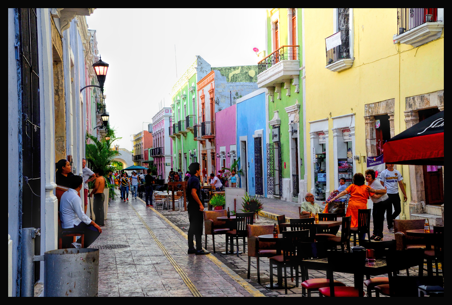
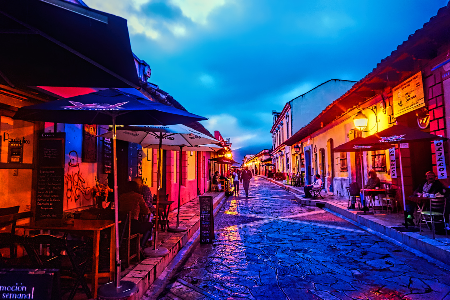
This street in the central part of Campeche is closed to automobiles, and the restaurants on either side of the road use the space for open air dining.
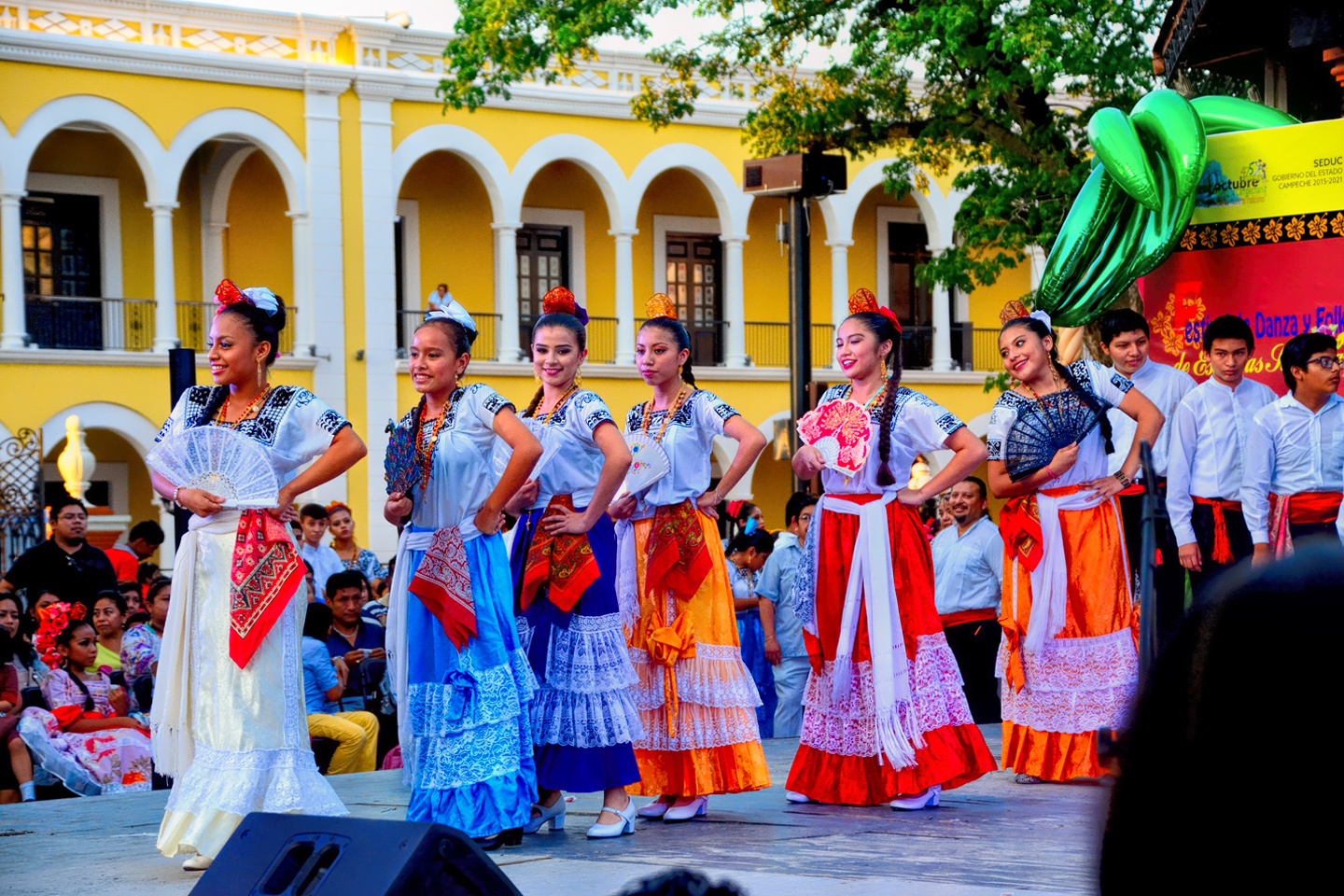
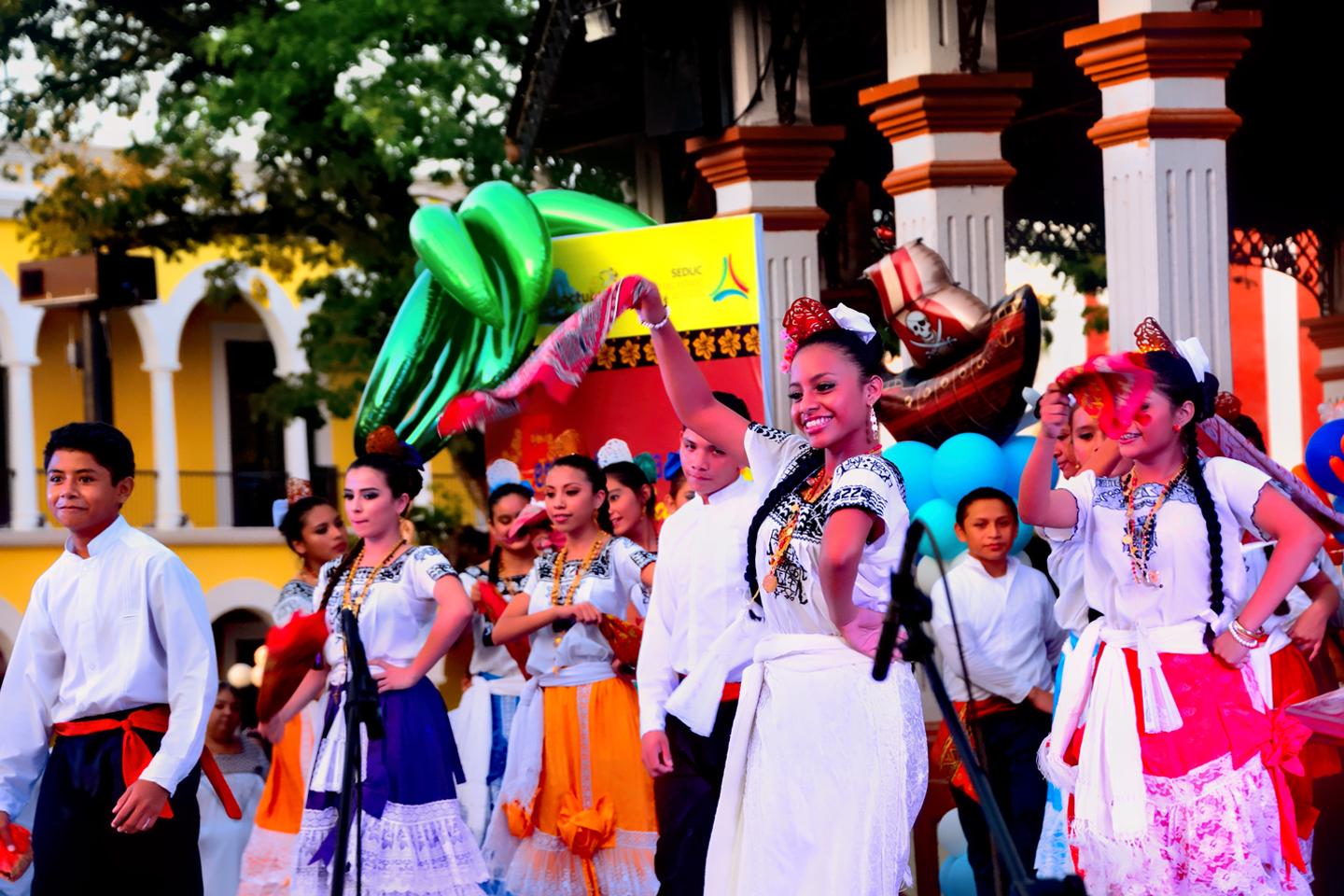
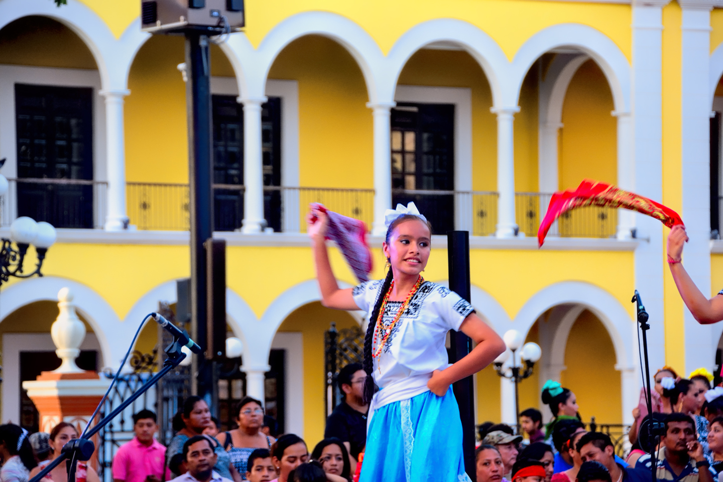
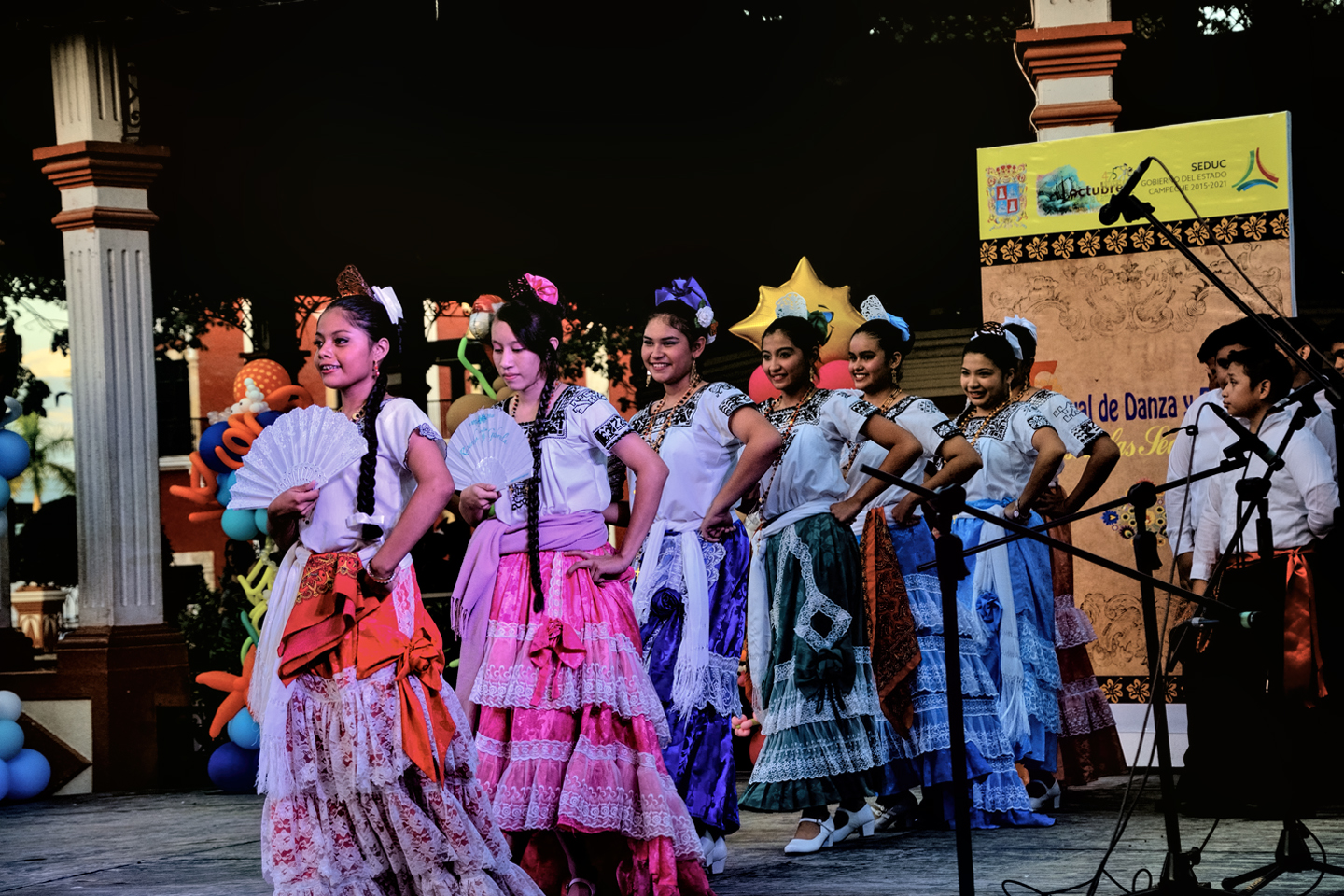
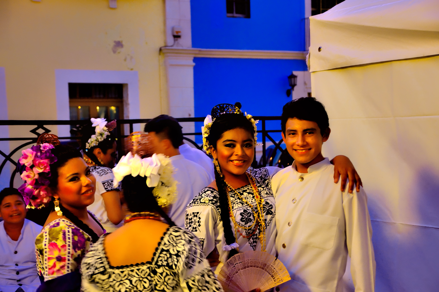
Just like in Mérida, they don’t seem to require a lot of provocation for holding a celebration. Our first night in the city, we heard music in the plaza, so we walked down that way, and ran smack into a folk dancing festival. Young people in traditional costume were performing a dance called the Guaranducha, in which beautiful young girls entrance young men with swirling scarves:


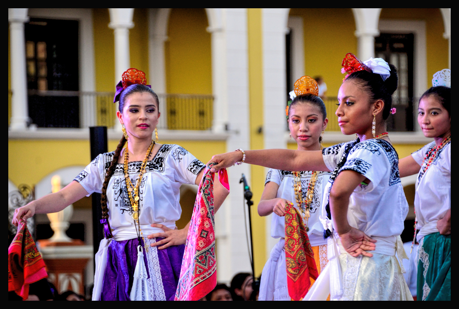

Folk dancing in the plaza in Colonial Campeche: La Guaranducha
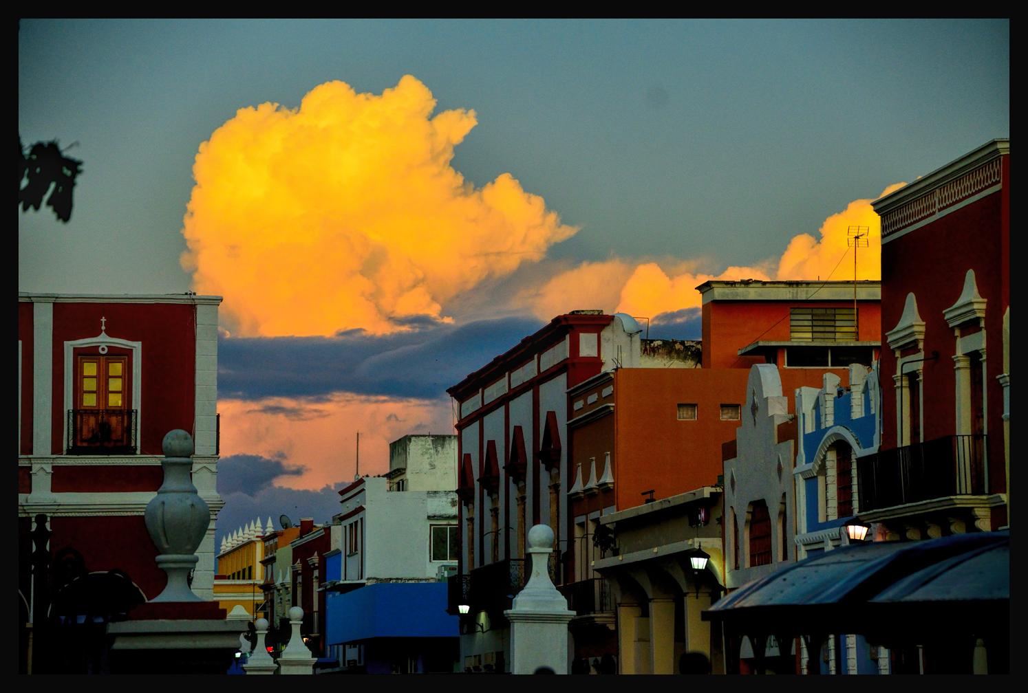
Followed by a beautiful sunset over the Bay of Campeche
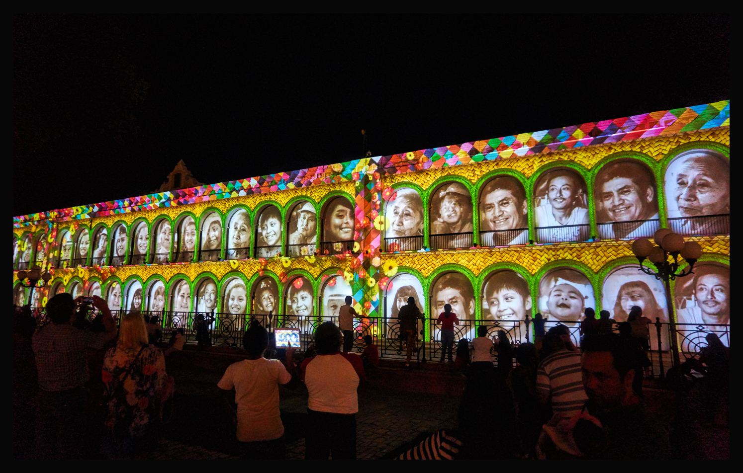
Followed by a light show in the plaza (the faces on the wall are projected portraits of people from the town)
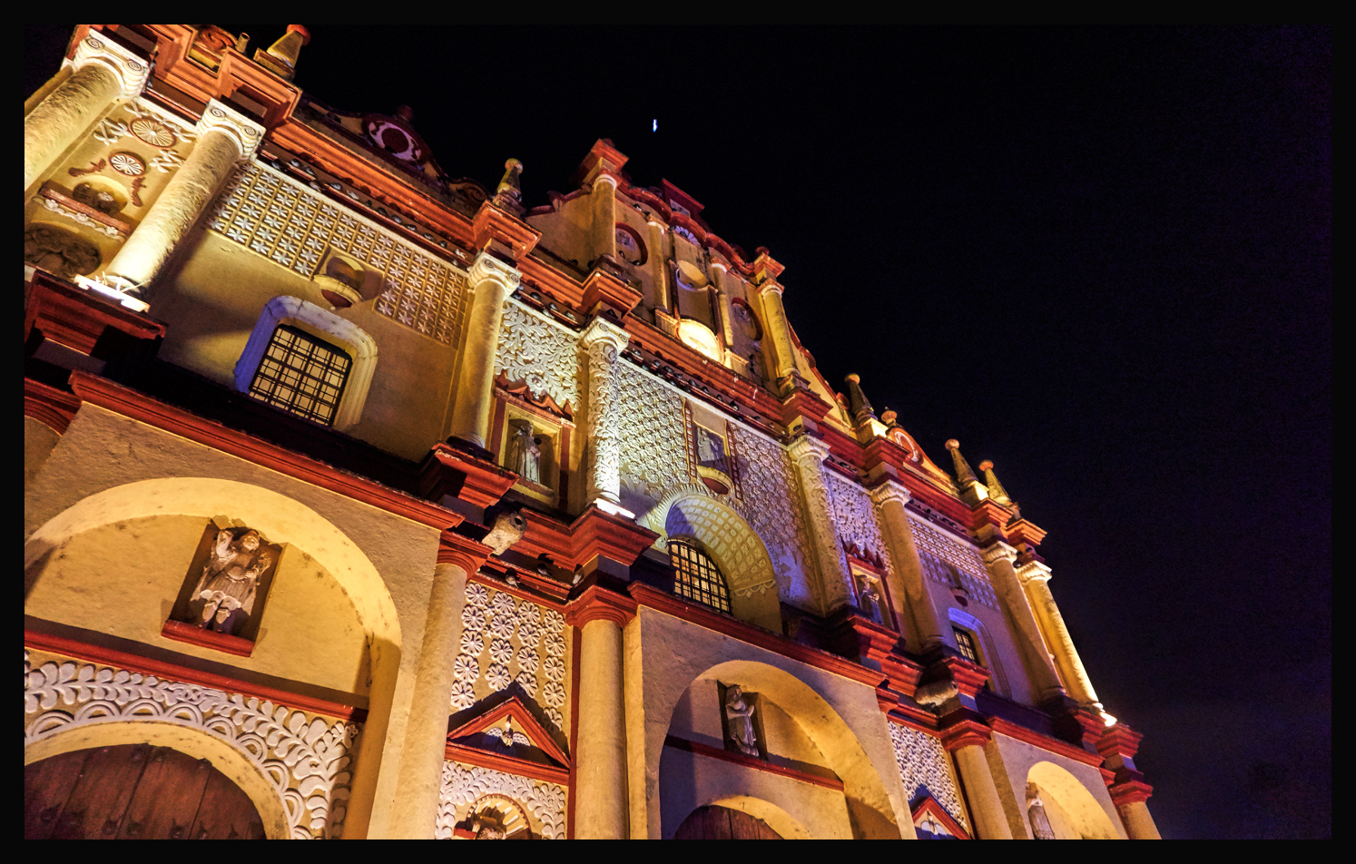
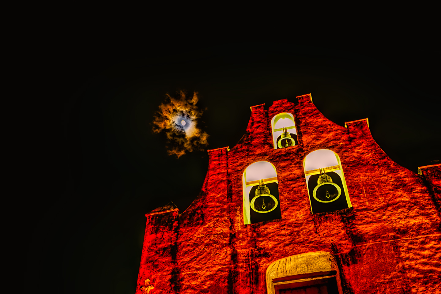
And colored floodlights set the Cathedral of Campeche aglow, every night of the year.
Campeche is greatly underrated as a tourist destination, and receives but a small fraction of the visitors who descend on Cancun each year. There are marvelous old hotels in the area near the old city center. The old fortifications are fascinating, reminiscent of San Juan Puerto Rico, Havana, or Cartagena, one of my favorite cities in the world, on the Caribbean coast of Colombia. And the seafood? You’ve never eaten fresh shrimp until you’ve had it in Campeche.
There are some links at the bottom of this post that will steer you to more specific information on what there is to see in Campeche, as well as information on hotels and restaurants.
San Cristobal de Las Casas
San Cristobal de las Casas, which was, at one time, the capitol of the state of Chiapas, is widely considered the prettiest of all the Colonial cities in Mexico. In 2010, then Mexican President Felipe Calderon declared it to be “the most magical of Mexico’s magical villages”. The old colonial buildings with their red tile roofs and wrought iron balconies fill the shallow bowl of a high mountain valley, covering low hills like a carpet and spreading up surrounding mountainsides that are cloaked in pine forest at the higher elevations. Narrow, cobblestone streets follow the contours of the land, twisting and turning among centuries old buildings with walls painted pale pink and yellow, burnt orange and pastel blue.
For me, just getting to the town was an adventure, a serious, honest to god adventure. My first destination in Mexico, after driving south from the Texas border, was Palenque, a major Mayan ruin in the state of Chiapas. We’d spent three full days driving from Austin, Texas to Villahermosa, which was quite close to Palenque, less than a hundred miles. Unfortunately, on the day we tried to cover that final two-hour stretch, a rebel group known as the ELZN, the Zapatista Liberation Army, elected to stage a massive protest against the social and environmental policies of the Mexican government. The mechanism of this protest was a blockade of all the highways leading into and through the State of Chiapas, which of course included the road we needed to travel, to get where we wanted to go. I recounted the story in some detail in my post titled Mexican Road Trip: 2015, so this will be more of a bare-bones version: we attempted to skirt the roadblock on the main highway by taking an alternate back road through a tiny town called Salto de Agua, (which means waterfall in Spanish). The road was absolutely terrible–we were warned by local police not to even attempt it–but I was determined, and it takes a lot to stop that Jeep of mine. We never did see the waterfall that gave the town its name. What we did see was another roadblock, this one on that primitive back road. Six young men of Mayan descent, all brandishing machetes, had a chain stretched across the way, blocking us from moving forward. After first threatening to confiscate everything I was carrying in my vehicle, the rebel leader ultimately accepted a bribe of ten Pesos (about sixty cents), and allowed us to pass. We spent a couple of days at Palenque (see my post: Palenque, for that whole story, and some beautiful pictures), and then we decided to check out San Cristobal de Las Casas before continuing on to the Yucatan.
The road between Palenque and San Cristobal de Las Casas is fairly notorious–but of course I didn’t know anything about that at the time. The distance isn’t all that great–just 130 miles, according to my map, so I figured we’d get there in a couple of hours? Ha! That highway had more curves than a sidewinder on amphetamines, and at least half of the traffic was big, lumbering trucks hauling stone and gravel up and down what had to be 15% grades. They couldn’t go much above 6 miles an hour, and passing on blind curves on a mountain road with no shoulders? That was heart-in-mouth kind of stuff–more adrenaline than I probably needed. I’d been driving as fast as I could manage–too fast, really–and after two hours we weren’t even halfway there. That’s when we ran into another Zapatista road block, this one consisting of logging trucks parked sideways across the road and a big crowd milling around. This time, there was no side road. This time, the guys manning the blockade were way too serious about their business to settle for a 60 cent bribe. While we were sitting there, contemplating what to do next, one of the truck drivers who was stopped in front of us (a local, who was likewise stuck), came over and talked to us about the situation, talked to us for quite some time. The Zapatistas grievances are entirely legitimate. It’s their methods–such as these road blocks–that most of the locals don’t agree with. The politicians who are in a position to effect positive change are not affected by the bloqueos. Local people, like this truck driver, are the only people being hurt by it, along with the occasional tourist, like myself, possibly being inconvenienced. In his view (the truck driver), the Zapatistas were giving the rest of the honest citizens of Chiapas a bad name. I commiserated, diplomatically expressed my support for the trucker’s point of view (without overtly denouncing the Zapatistas, which would not have been prudent). Then I turned my Jeep around and drove the two hours back to Palenque.
Two weeks later, after having finished a complete circuit of the Yucatan, we found ourselves back in Palenque yet again. Not to revisit the Palenque ruins–not this time. We were headed to a different Mayan ruin, a place called Bonampak, on the border with Guatemala, and the only practical way to get there was via Palenque. So we did that–took a day trip to Bonampak and back, and then, after first checking road conditions (weather was cloudy, with only a slight chance of Zapatistas), we took another run at San Cristobal de Las Casas. Even knowing what to expect, that road was something else. Between the slow trucks, the hairpin curves, and the topes (dangerously tall speed bumps, not always marked), it was impossible to make time on that stretch. It took forever just to get to the point where we were turned back the first time. There were no Zapatistas in sight–just an ordinary road junction in the middle of nowhere–so we sailed right through, with never a backward glance. I believe it took us a full five hours to travel that 130 miles, and even at such a slow speed, it was no casual cruise. On American highways, particularly the Interstates, you don’t hardly even drive. You can lock in your cruise control, and just steer–the biggest challenge is staying awake. Even our roads that pass through mountains (with some obvious exceptions) are relatively gentle. That road through the mountainous heart of Chiapas? That road was NOT gentle. After five hours of that kind of driving, I felt like I’d just run a marathon, so when we finally rolled into San Cristobal de Las Casas, it was not only much later than I expected, I was buzzing so hard it was tough to appreciate it.
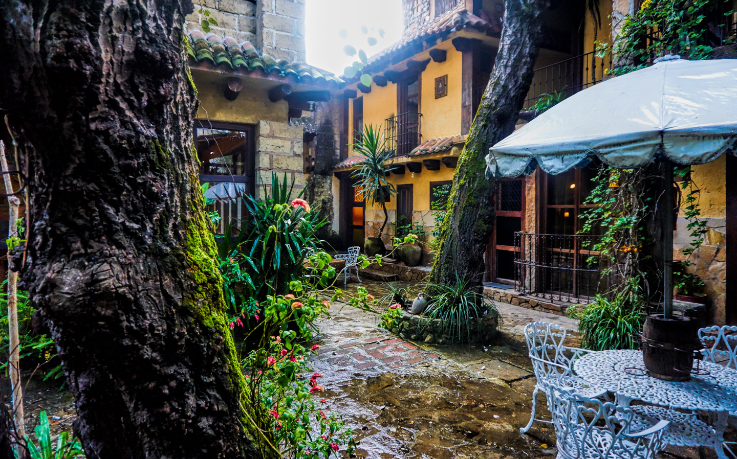
At this point in the trip, we were using the Mexican version of Expedia for all of our hotel rooms, and I was getting pretty good at interpreting the listings, finding some truly outstanding accommodations at incredibly reasonable prices. Our room in San Cristobal was probably the best of the lot, and there’s no way in the world that we would have even SEEN that place without the website. Finding it, even though we had the address, was another adventure! This hotel is nowhere near any of the other hotels (and there are a LOT of hotels in San Cristobal, which depends quite heavily on tourism). This place was off on what used to be the far edge of the colonial city. It was the main house and outbuildings of what was once an actual working Hacienda, more than 200 years old, with spacious grounds and ancient trees. The area around it has been built up since those old days, but it’s low end, and already fairly old development, very much a working class neighborhood, and not at all the part of town where you’d expect to find an elegant hotel. My friend used the android version of Google’s talking GPS, and it was all so incredibly unlikely–that thing had us driving down one-way alleys and crossing small bridges that barely had room for a car, then we turned right on to an obscure side street, drove through an arch into a long cobblestone driveway, and there it was–the Hotel Hacienda Don Juan. Just amazing:
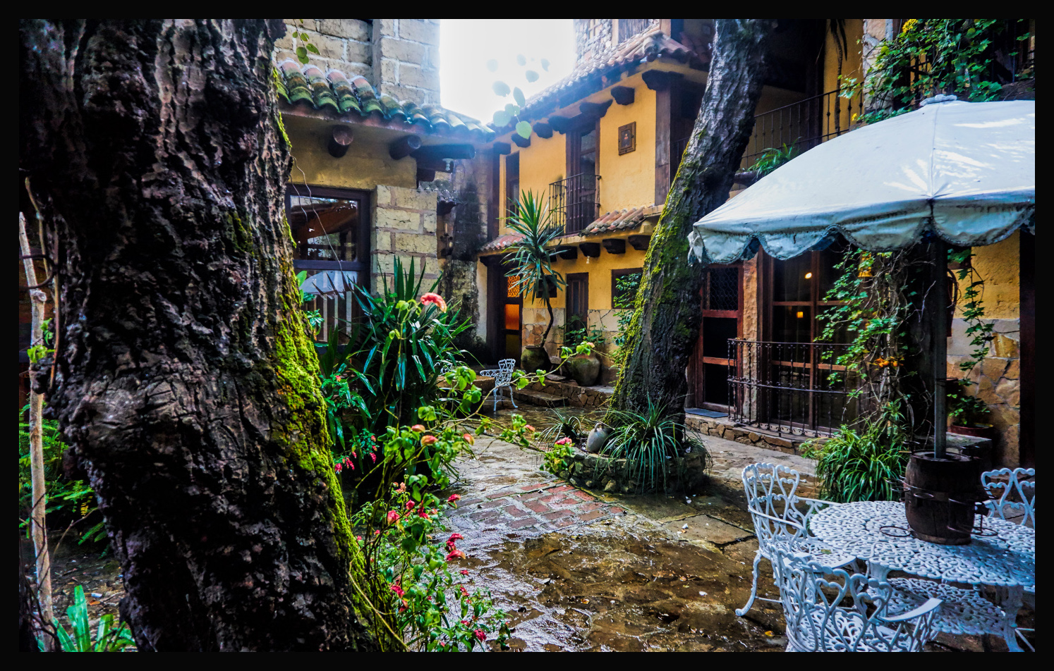
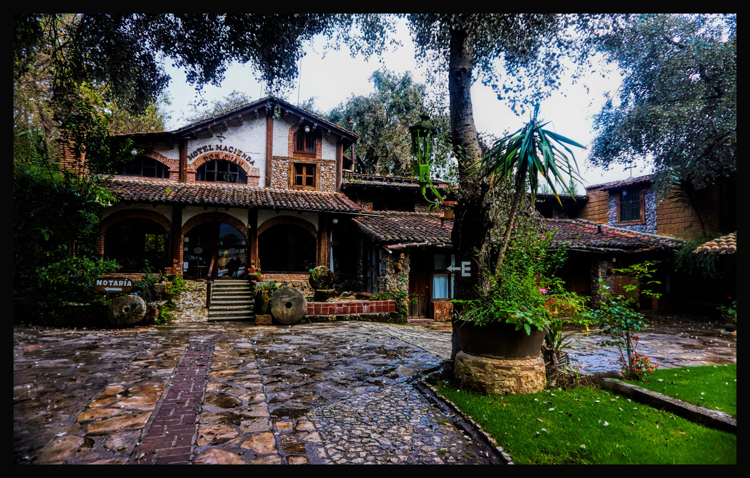
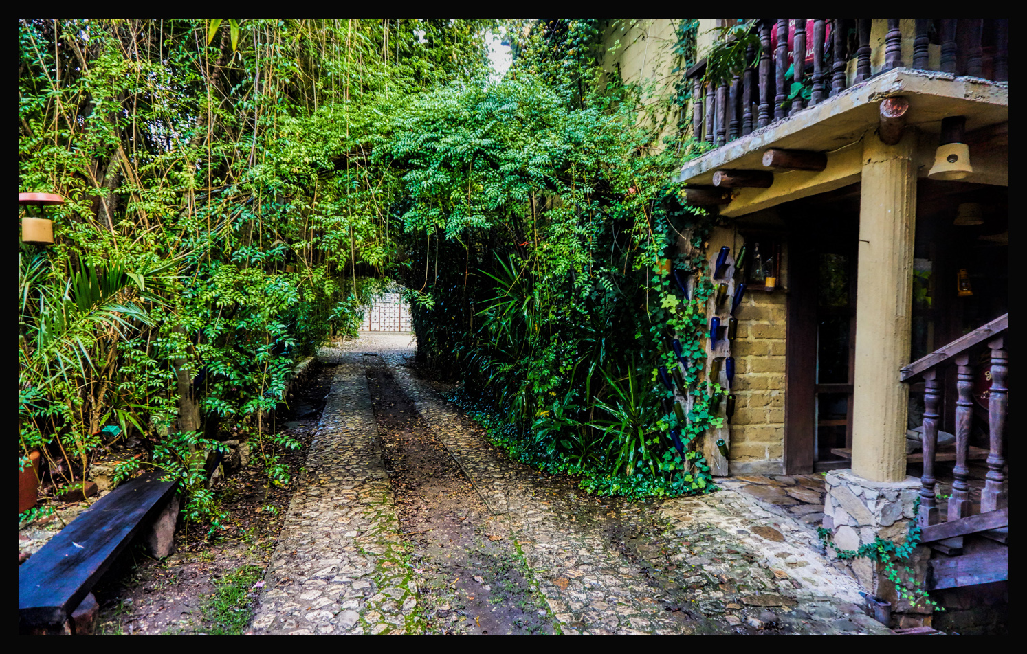
There are several more pictures of the hotel in the photo gallery that accompanies this post. Needless to say, I was quite taken with the place! At the time, October of 2015, a double room set us back the princely sum of about $45. This is one point where I break my usual rule: this is a place that I can personally recommend, without question–though if you’re there without a car, you’ll need a taxi to take you to and from most anywhere else–it would be a bit too far to walk. The altitude of the town itself is well above 7,000 feet, so San Cristobal is always cool, and the nights can be downright chilly.
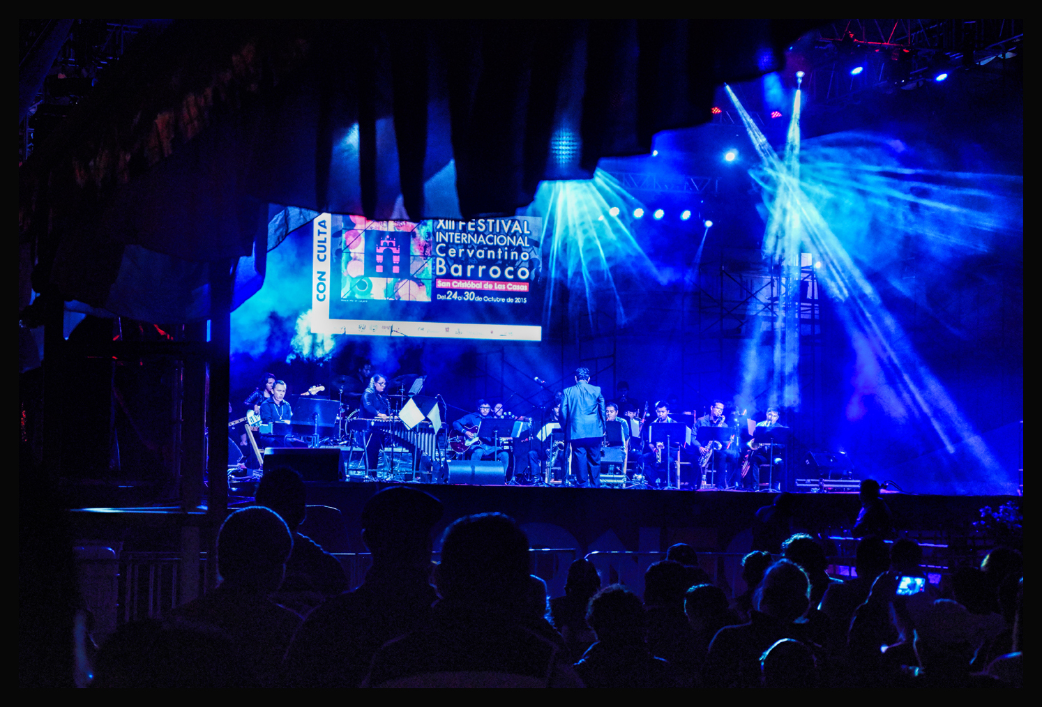
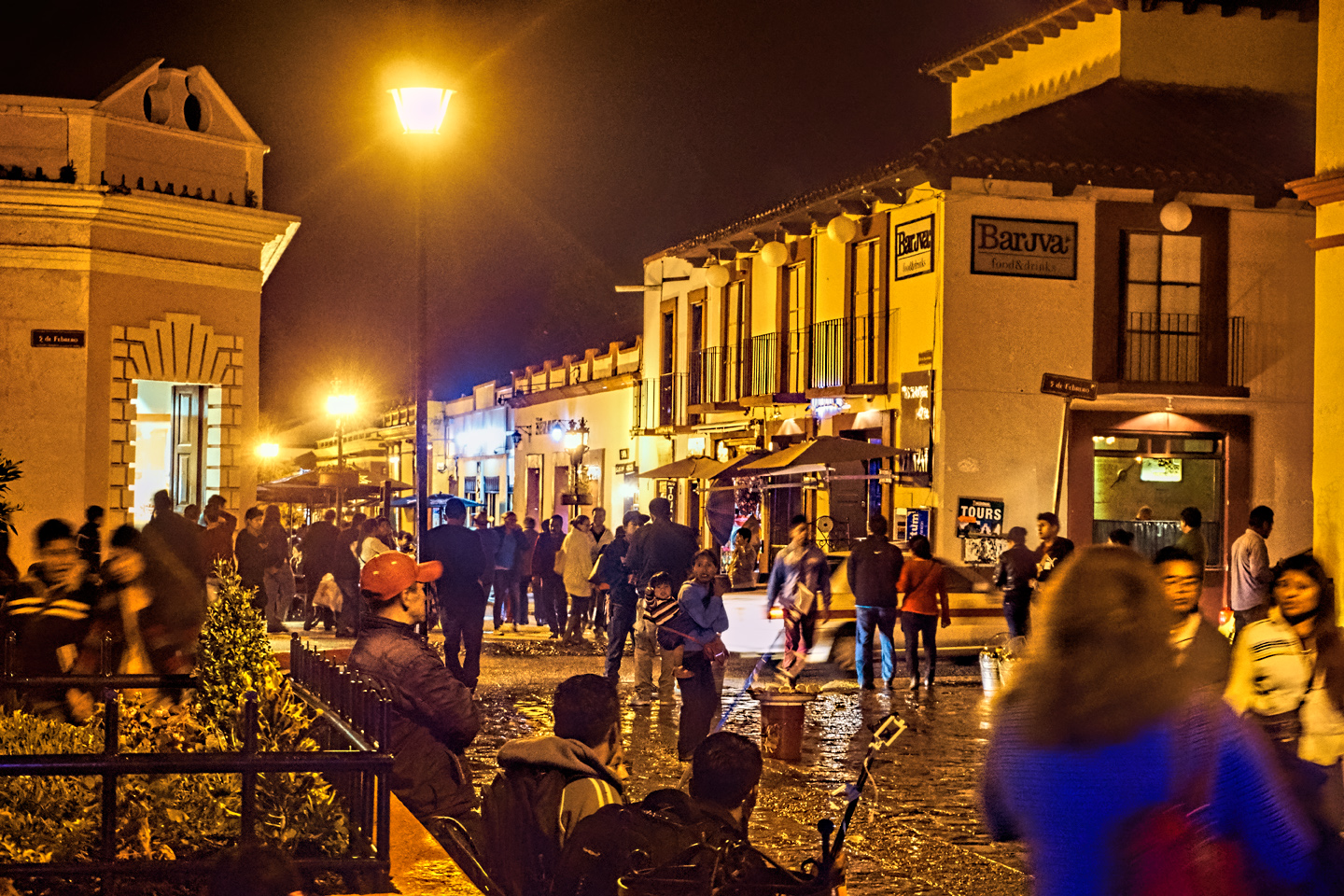
On our one night in SCDLC, there was a music festival on the main plaza:
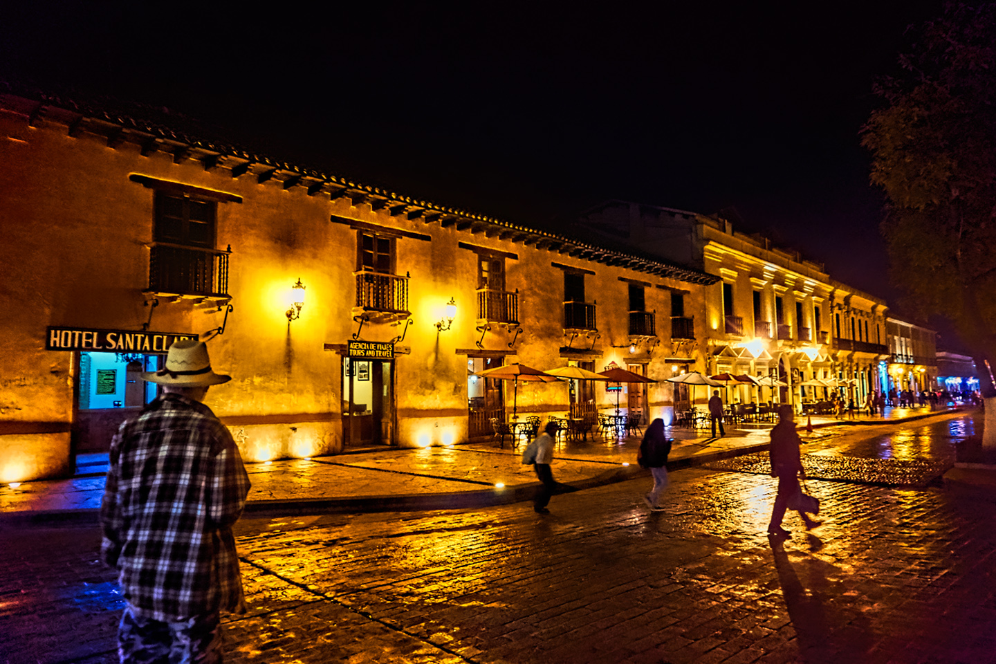
And there were plenty of people milling about the town center:
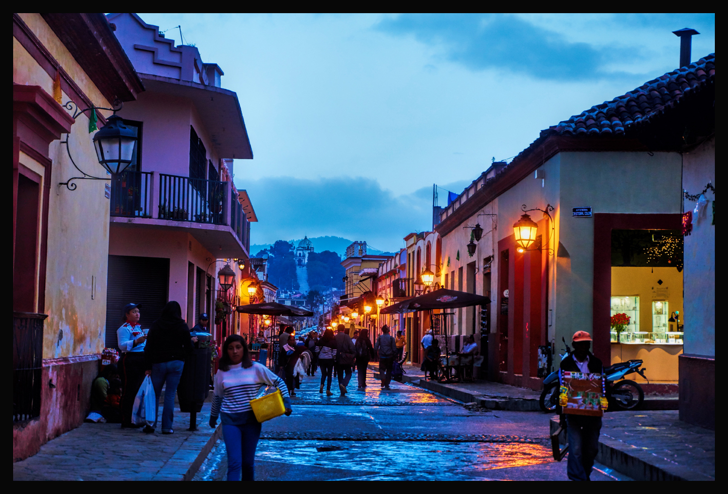
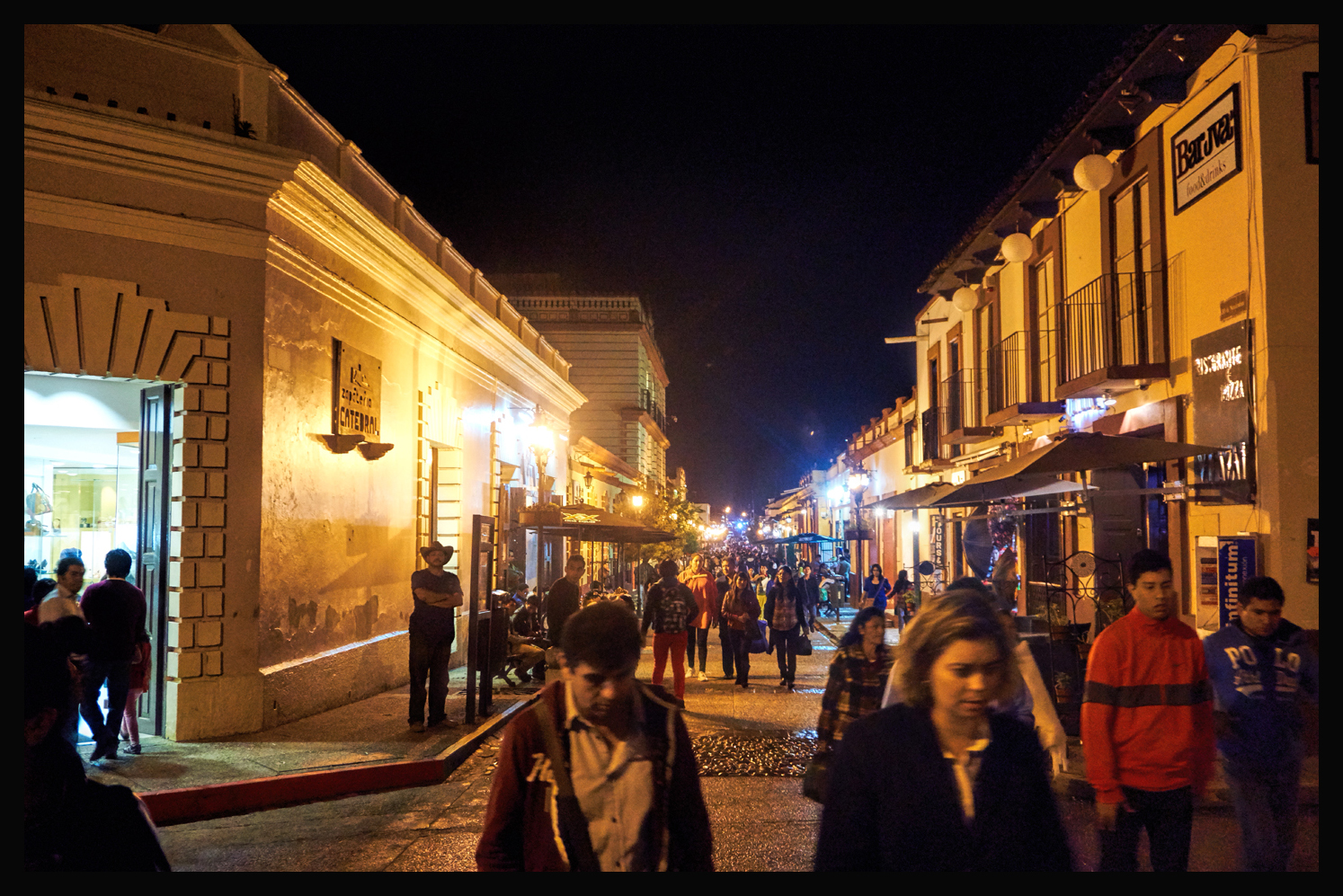
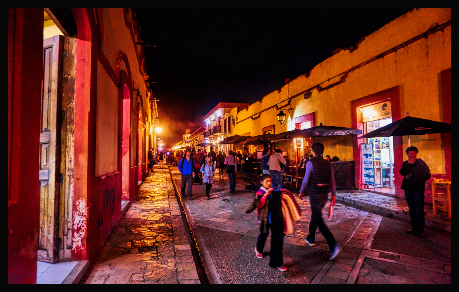
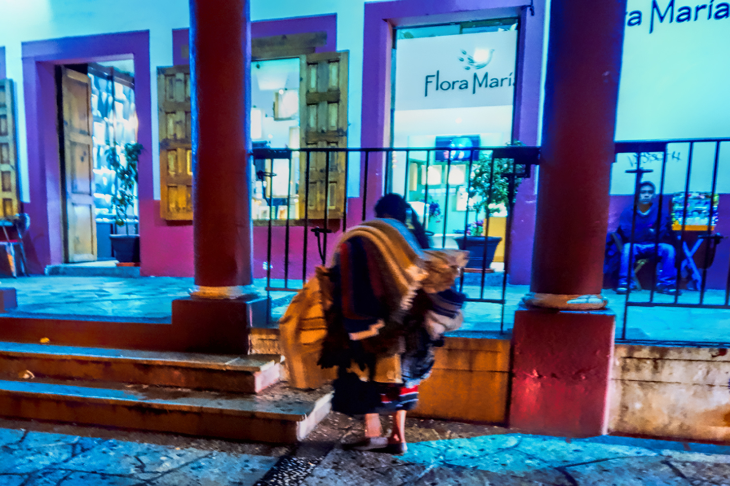
There are interesting restaurants, trendy shops, and at least a third of the people in the town are colorfully dressed Tzotzil Indians. It’s a marvelous place to walk around, and my only regret is that we didn’t get more time there. As it was, we left first thing the next morning, so this is yet another place that I’ll just have to come back to.
***
As I mentioned in a previous post, (Mexican Road Trip: 2015), I had fairly good luck with the Mexican version of Expedia, which seemed to have a broader range of hotel choices in Mexican cities and towns than the U.S. version of that site.
(Note: all of these logos are links).

Warning: this site is en Español!
Trip Advisor is my personal mainstay for advice on tourist attractions–I like the wide range of opinions:

And for hard copy guide books, you can’t go too far wrong with Lonely Planet:

I’ve seen a few moderately negative things published about NC2 Media, the company that recently purchased Lonely Planet from the BBC–but regardless of who owns it, LP is still the world’s largest publisher of travel guides, and they’re moving aggressively into the up and coming world of up to the minute, personalized information, at your fingertips, on the spot, using your smart phone or tablet? Yup, it’s a brave new world out there. Just keep in mind–everything you read, no matter where or how you read it, is really just somebody’s opinion.
The collage below features additional photos from Merida, Campeche, and San Cristobal.
Computer and Tablet Users: Click any photo to expand the images to full screen, with captions.
(Unless otherwise noted, all of these images are my original work, and are protected by copyright. They may not be duplicated for commercial purposes.)


READ MORE LIKE THIS:
This is an interactive Table of Contents. Click the thumbnails to open the pages.
ON THE ROAD IN MEXICO

MEXICAN ROAD TRIP: HOW TO PLAN AND PREPARE FOR A DRIVE TO THE YUCATAN
The published threat levels are a “full-stop” deal breaker for the average tourist. That’s unfortunate, because Mexican road trips are fantastic! Yes, there are risks, but all you have to do to reduce those risks to to an acceptable level is follow a few simple guidelines.
<<CLICK to Read More!>>

Mexican Road Trip: Heading South, From Laredo to Villahermosa
When it was our turn, soldiers in SWAT gear surrounded my Jeep, and an officer with a machine gun gestured for me to roll down my window. He asked me where we were going. I’d learned my lesson in customs, and knew better than to mention the Yucatan. “We’re going to Monterrey,” I said, without elaborating.
He checked our ID’s and our travel documents, then handed them back. “Don’t stop along the way,” he advised. “You need to get off this road and to a safe place as quickly as you can!”
<<CLICK to Read More!>>

Mexican Road Trip: Zapatista Road Blocks in Chiapas
“Good morning,” I said. “We’re driving to Palenque. Will you allow us to pass?”
The leader of the group, a young Mayan lad, walked up beside my Jeep, and fixed me with a menacing glare. “The road is closed,” he said, keeping his hand on the hilt of his machete. “By order of the Ejército Zapatista de Liberación Nacional!”
“Is it closed to everyone?” I asked innocently. “How about if we pay a toll? How much would the toll be?”
He gave me an even more menacing glare. “That will cost you everything you’ve got,” he said gruffly, brandishing his machete, while his companions did the same.
<<CLICK to Read More!>>

Mexican Road Trip: Mayan Ruins and Waterfalls in the Lacandon Jungle
The next morning, we were waiting at the entrance to the Archaeological Park a half hour before they opened for the day. We were the only ones there, so they let us through early, and I had the glorious privelege of photographing that wonderful ruin in the golden light of early morning, without a single fellow tourist cluttering my view.
<<CLICK to Read More!>>

Mexican Road Trip: Merida and the Meridanos
Merida is the largest city in southern Mexico, with a population of almost a million. Statistically, Yucatan is the safest of Mexico’s states, and Merida is widely considered the safest of all Mexico’s cities.
<<CLICK to Read More!>>


Mexican Road Trip: Cancún, Tulum, and the Riviera Maya
The millions of tourists who fly directly to Cancún from the U.S. or Canada are seeing the place out of context. They can’t possibly appreciate the fact that they’re 2,000 miles south of the border; a whole country, a whole culture, a whole history away from the U.S.A. Just looking around, on the surface? The second largest city in southern Mexico could easily pass for a beach town in Florida.
<<CLICK to Read More!>>

Mexican Road Trip: Circling the Yucatan, from Quintana Roo to Campeche
The Castillo at Muyil isn't huge, as Mayan pyramids go, topping out at just over 50 feet, but it’s definitely imposing. Try to imagine: the equivalent of a five story building, with a three story grand staircase, just appearing, out in the middle of nowhere? Boo-yah!
<<CLICK to Read More!>>

Mexican Road Trip: Edzná, and Campeche, Where They Dance La Guaranducha
La Guaranducha, a traditional dance from Campeche, is a celebration of life, community, and the joy of existence. On stage, there was a group of young men and women in traditional dress, but it was clear that the guys were little more than props, because all eyes were on the girls. So colorful, and so elegant, hiding coyly behind their pleated, folding hand fans.

Mexican Road Trip: Adventures Along the Puuc Route
All of these communities in the Puuc region were allied, politically, culturally, economically, and socially. The Puuc was the cradle of the Golden Age of the Maya. Labna and Sayil were among the brightest jewels in the crown of a realm that never quite coalesced into an empire.
<<CLICK to Read More!>>

Mexican Road Trip: The Road to Bonampak
Rainwater seeping through the limestone walls of the temple soaked the Bonampak Murals with a mineral-rich solution that, each time it dried, left behind a sheen of translucent calcite. The built-up coating protected the paintings for more than 1200 years. As a result, we're left with the finest examples of ancient art from the Americas to have survived into our modern era.

Mexican Road Trip: Crossing the Chiapas Highlands, to San Cristobal de las Casas
MX 199 crosses the Chiapas Highlands from Palenque to San Cristobal de las Casas. The distance is only 132 miles, but it's 132 miles of curvy mountain roads with switchbacks, steep grades, slow trucks, and villages chock-a-block with topes and bloqueos, unofficial road blocks. Everything I read, and everything I heard, described the drive as alternatively spectacular, dangerous, and fascinating, in seemingly equal measure.

Mexican Road Trip: Cruising the Sierra Madre, from San Cristobal to Oaxaca
Today, we’d be driving as far as the city of Oaxaca, 380 miles of curves, switchbacks, and rolling hills that would require at least ten hours of our full attention, crossing the Sierra Madre de Chiapas, and entering the rugged, agave-studded landscape of the Sierra Madre de Oaxaca. If you’d like to know what that was like, read on!

Mexican Road Trip: Flashing Lights in the Rear View: Officer Plata and La Mordida
As we drove away from the toll plaza, a State Police car that had been parked off to one side made a fast U-Turn and started following me. A moment later, he turned on his flashers and gave me a short blast on his siren, motioning for me to pull over. Two uniformed policemen got out, and approached me on the driver's side. One of them hung back, apparently checking out my license plate before making a phone call.
I wasn't sure if I was being stopped for some infraction, or if these guys were just fishing...

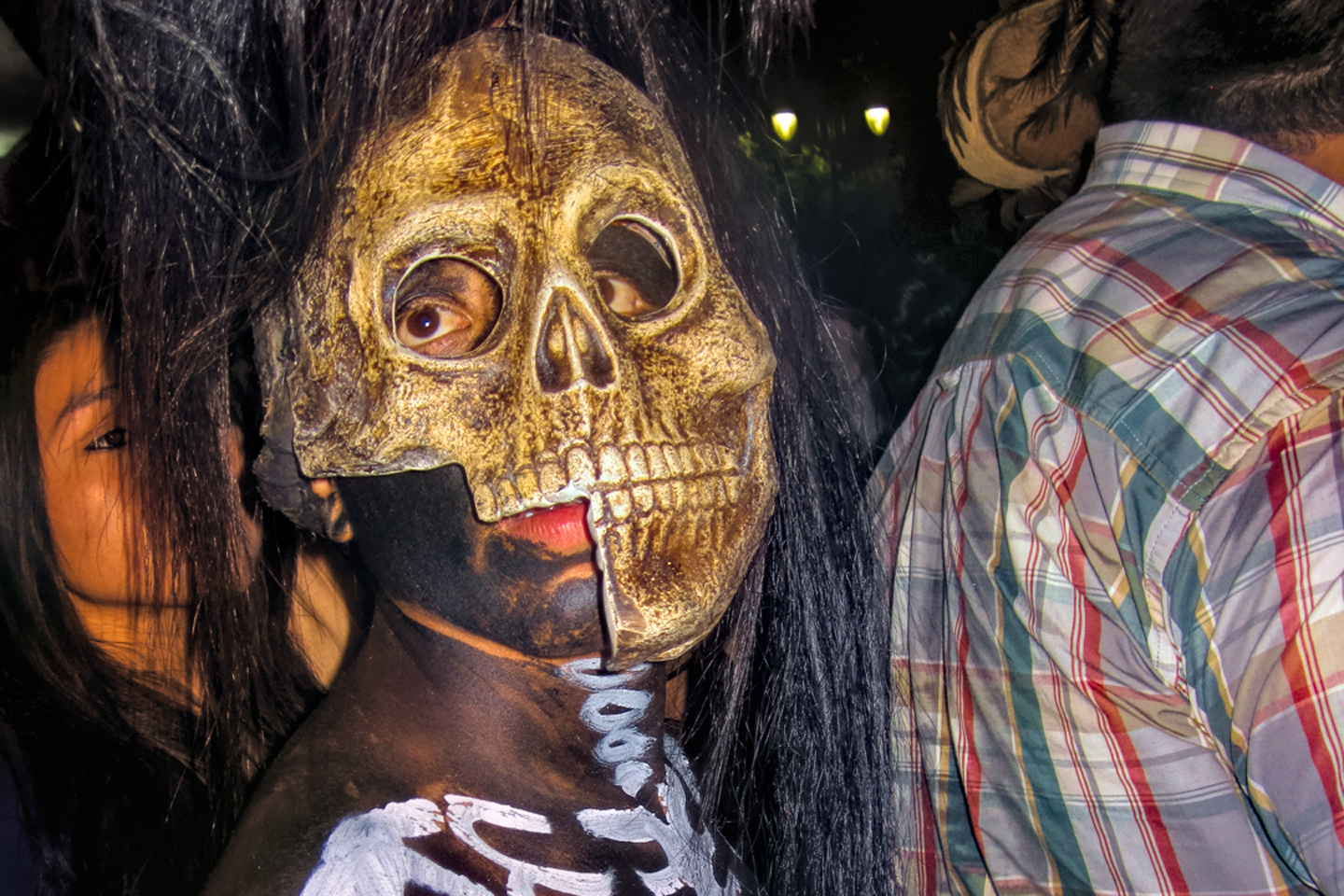
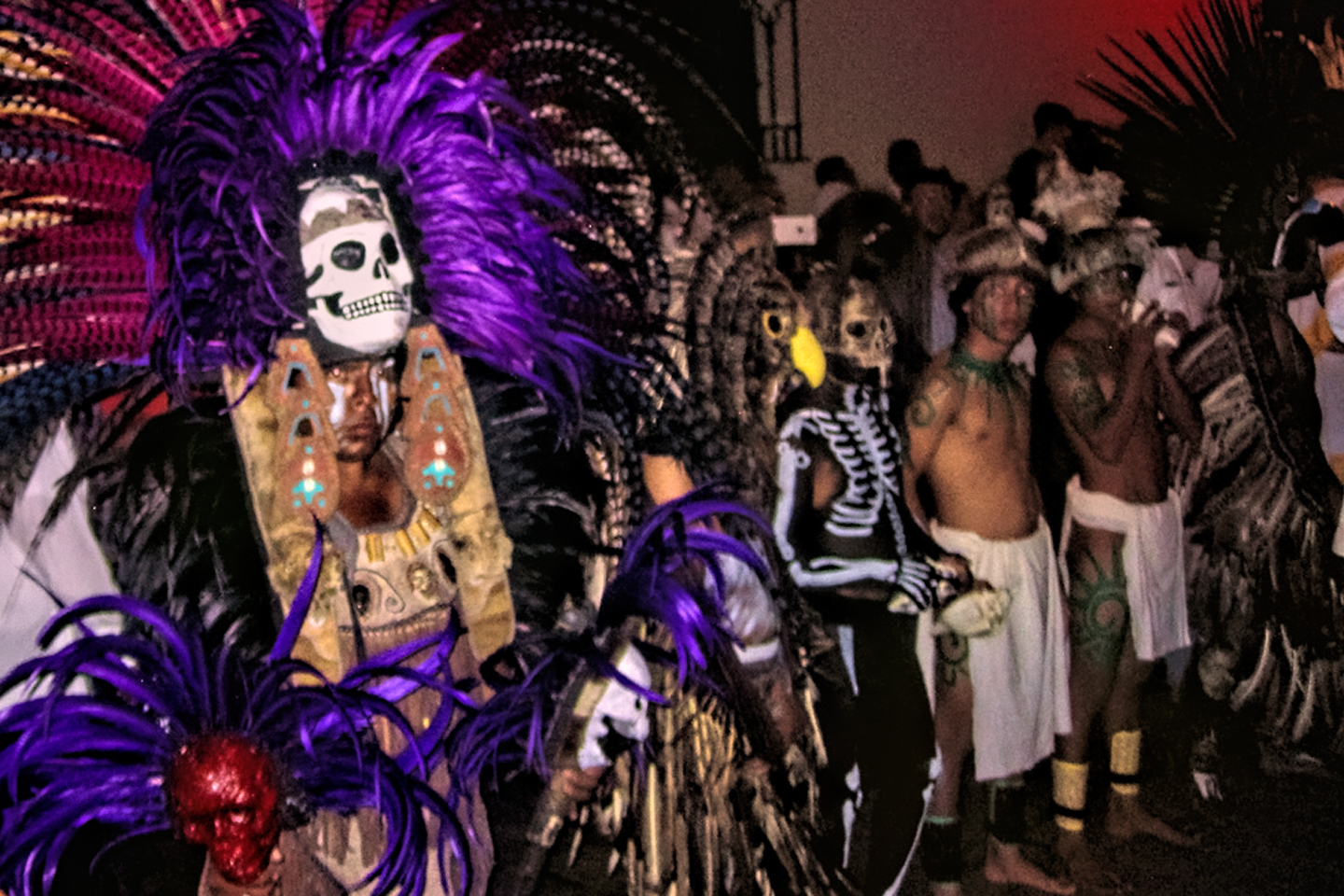
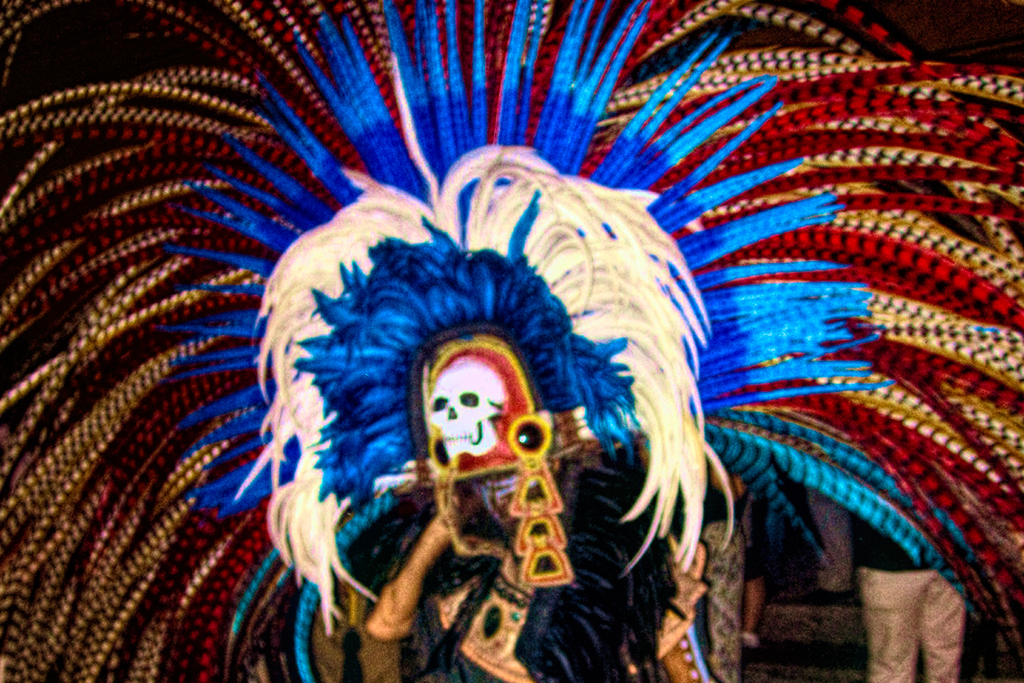
Mexican Road Trip: Three Days of the Dead in San Miguel de Allende
By mid-afternoon, the Jardin was beginning to fill with people. Painted faces were literally everywhere! It was like a costume party, but the venue wasn’t some hall or other indoor space, it was the whole entire town! Mike and I were definitely getting into the spirit of the thing–but we still drew the line at the notion of painting our beards...
Mexican Road Trip: Back to the Border: San Miguel de Allende to Eagle Pass
Saltillo was our crossroads: if we turned east here, we’d be retracing our previous route to the border at Nuevo Laredo--along the Highway of Death! This time, we knew better, so we turned north, toward Monclova, and Piedras Negras.


Southern Colonials: Merida, Campeche, and San Cristobal
Visiting the Spanish Colonial cities of Mexico is almost like traveling back in time. Narrow cobblestone streets wind between buildings, facades, and stately old mansions that date back three hundred years or more, along with beautiful plazas, parks, and soaring cathedrals, all of similar vintage.
<<CLICK to Read More!>>

San Miguel de Allende, Mexico's Colonial Gem
If you include the chilangos, (escapees from Mexico City), close to 20% of the population of San Miguel de Allende is from somewhere else, a figure that includes several thousand American retirees.
<<CLICK to Read More!>>

Day of the Dead in San Miguel de Allende
In San Miguel de Allende, they've adopted a variation on the American version of Halloween and made it a part of their Day of the Dead celebration. Costumed children circle the square seeking candy hand-outs from the crowd of onlookers. It's a wonderful, colorful parade that's all about the treats, with no tricks!
<<CLICK to Read More!>>
DIA DE LOS MUERTOS: A GALLERY OF PHOTOGRAPHS


IN THE LAND OF THE MAYA

Palenque: Mayan City in the Hills of Chiapas
Palenque! Just hearing the name conjures images of crumbling limestone pyramids rising up out of the jungle, of palaces and temples cloaked in mist, ornate stone carvings, colorful parrots and toucans flitting from tree to tree in the dense forest that constantly encroaches, threatening to swallow the place whole.
<<CLICK to Read More!>>

Uxmal: Architectural Perfection in the Land of the Maya
The Pyramid of the Magician is one of the most impressive monuments I've ever seen. There's a powerful energy in that spot--maybe something to do with all the blood that was spilled on the altars of human sacrifice at the top of those impossibly steep steps--but more than any building or other structure at any ancient ruin I've ever visited, more than any demonic ancient sculpture I've ever seen, that pyramid at Uxmal quite frankly scared the hell out of me!
<<CLICK to Read More!>>

The Mayan City of Edzná: First House of the Itzás
The Mayan Edzná is nothing less than epic, lyrical poetry, an extraordinary sonnet comprised of temples and palaces carved in stone that have stood, in regal grandeur, for more than a thousand years.
<<CLICK to Read More!>>

Photographer's Assignment: Chichén Itzá
To get the best photos, arrive at the park before it opens at 8 AM. There will only be a handful of other visitors, and you’ll have the place practically all to yourself for as much as two hours! Take your time composing your perfect shot.There won’t be a single selfie stick in sight.
<<CLICK to Read More!>>

Chichén Itzá: Requiem for the Feathered Serpent
The feathered serpent with the unquenchable thirst for blood may be gone now, or at least fallen out of favor, but as long as the ruins of this ancient city remain standing, he won’t be forgotten.
<<CLICK to Read More!>>

Tulum: The City that Greets the Dawn
Tulum is not all that large, as Mayan sites go, but its spectacular location, right on the east coast of the Yucatan Peninsula, makes it one of the best known, and definitely one of the most picturesque.
<<CLICK to Read More!>>

Cobá and Muyil: Mayan Cities in Quintana Roo
Cobá was a trading hub, positioned at the nexus of a network of raised stone and plaster causeways known as the sacbeob, the white roads, some of which extended for as much as 100 kilometers, connecting far-flung Mayan communities and helping to cement the influence of this powerful city.
<<CLICK to Read More!>>

Becan and Chicanná: Mayan Cities in the Rio Bec Style
Much about the Rio Bec architectural style was based on illusion: common elements include staircases that go nowhere and serve no function, false doorways into alcoves that end in blank walls, and buildings that appear to be temples, but are actually solid structures with no interior space.
<<CLICK to Read More!>>

The Puuc Hills: Apex of Mayan Architecture
The Puuc style was a whole new way of building. The craftsmanship was unsurpassed, and some of the monumental structures created in this period, most notably the Governor’s Palace at Uxmal, rank among the greatest architectural achievements of all time.
<<CLICK to Read More!>>

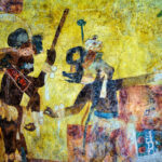
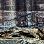
The Amazing Mayan Murals of Bonampak
Out of that handful of Mayan sites where mural paintings have survived, there is one in particular that stands head and shoulders above the rest. One very special place. Down by the Guatemalan border, in a remote corner of the Mexican State of Chiapas: a small Mayan ruin known as Bonampak.
<<CLICK to Read More!>>
This series of posts is dedicated to my old friend Mike Fritz (aka Mr. Whiskers), my shotgun rider on my Mexican Road Trip. "Drive to the Yucatan and See Mayan Ruins" was at the top of my post-retirement bucket list, right after "Drive the Alaska Highway and see Denali." We checked off the whole Yucatan thing in a major way, and Mike was a heck of a good sport about it.
Michael passed away in February of 2025, after 75 years of a life well-lived. He was unique, and he'll be missed.

Michael Fritz ("Elmo") 1949-2025

There's nothing like a good road trip. Whether you're flying solo or with your family, on a motorcycle or in an RV, across your state or across the country, the important thing is that you're out there, away from your town, your work, your routine, meeting new people, seeing new sights, building the best kind of memories while living your life to the fullest.
Are you a veteran road tripper who loves grand vistas, or someone who's never done it, but would love to give it a try? Either way, you should consider making the Southwestern U.S. the scene of your own next adventure.
A few years ago I wrote a book about road trips in Arizona and New Mexico that's a lot like this website, packed with interesting information, and illustrated with beautiful photographs. Check it out! You can find it on Amazon, and at all other major booksellers.

ALASKA ROAD TRIP:
MEXICAN ROAD TRIP (IN THE LAND OF THE MAYA):
ARIZONA AND NEW MEXICO:
SOUTH AMERICA:
PHOTOGRAPHY:
TRIBAL LANDS:


which city do you prefer?
San Cristobal for the climate (springtime temperatures by day, with crisp cool nights), but Campeche, definitely, for the ambiance! Merida is a big city with all the amenities, so if that’s important it’s something to consider as well.