For anyone living in the United States, a drive to Alaska on the Alaska Highway is the ultimate road trip, the longest point-to-point journey you can undertake without leaving North America. A lot of people talk about making that drive, but there are relatively few who follow through and actually do it. Why might that be? For most, the biggest issue is time. Considering the distance, you need a chunk of time—at least a month, preferably more—just to get up there and back at a reasonable pace. Arranging that much time off is difficult, if not impossible for the average working stiff.
Click Maps and Photos for an expanded view.
But let’s say you’ve cleared that hurdle, and found the time; you’ll discover another major hurdle right behind the first. The trip to Alaska is not only the longest drive, it’s also the most expensive drive per mile. The price of fuel in Canada, particularly in the Yukon, exceeds the highest prices in the U.S., and the cost of lodging in that part of the world, especially during the abbreviated summer season, is double what you’d pay anywhere else for even the most basic accommodation. On a trip that stretches thousands of miles over the course of a month or more, those expenses add up very quickly.
Even if you have the means, as well as the time, you’ll also need a reliable, well-maintained and reasonably rugged vehicle to cope with the road itself. The Al-Can is officially described as being paved from beginning to end, but the northern winters are hell on asphalt, so every year there are lengthy stretches of the highway that are either in dire need of, or actively undergoing major repairs. That means detours and delays, along with liberal helpings of potholes, gravel, and mud, as well as “frost heaves,” an undulating road surface caused by the freezing and thawing of permafrost under the road bed. (You haven’t really lived until you’ve hit unexpected frost heaves at highway speed).
Once you’ve covered all three of those bases, that’s when you can start actively planning, and the whole purpose of this blog is to help you with that. In this next series of posts I’m going to regale you with the tale of my own drive on the Alaska Highway: the joys of a longtime dream fulfilled, the highs, the lows, and the lessons learned–along with a bazillion photographs.
Getting to the Starting Point Can Be Half the Fun
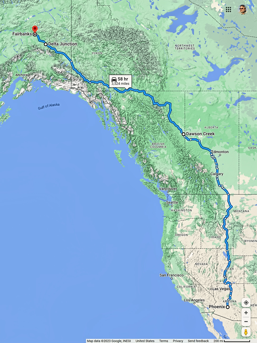
From my home in Phoenix to the ultimate end of the Alaska Highway in Fairbanks is a bit more than 3500 miles each way, but that’s by the most direct route, which looks something like this:
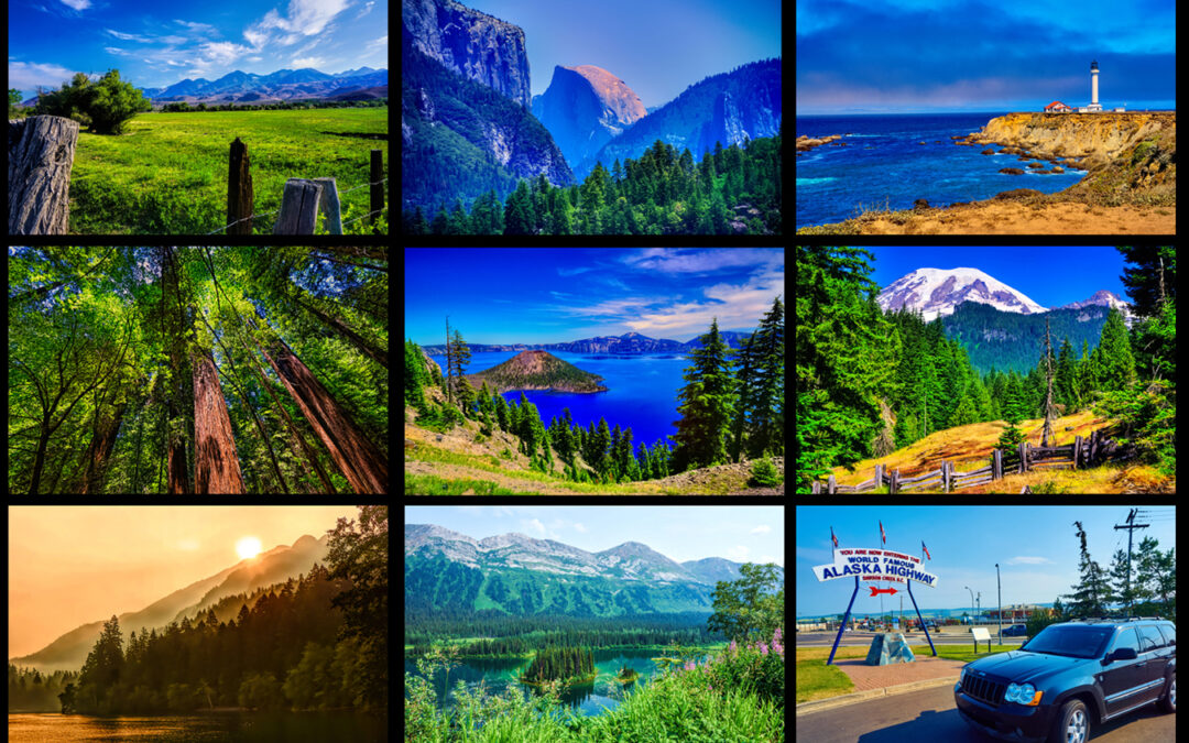
The thing is, there were dozens of places in between Phoenix and Fairbanks that I’d always wanted to see, and the direct route missed nearly all of them. I figured it would make more sense to do a loop, north up the Pacific coast, and then back south again through the Rockies, stopping at as many National Parks as possible, and making some serious progress on my bucket list.
I set no schedule, and I made no advance reservations, none at campgrounds, none at motels, even though I was planning my drive in the peak summer season, when the risk of sold-out accommodations is greatest. That’s a style of travel that would make a lot of people nervous, never knowing ahead of time where or even if you’ll be spending the night in any given place, but when I’m traveling solo, as I was on most of this trip, I’ve always preferred the freedom to make my choices on the fly, following my instincts, adjusting my pace to match conditions on the ground, as opposed to connecting the dots on a prescheduled itinerary.
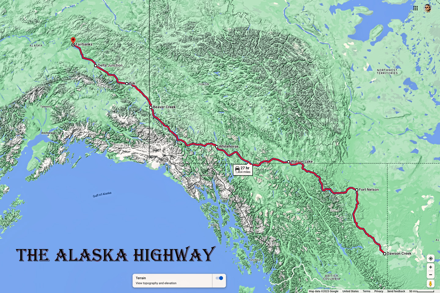
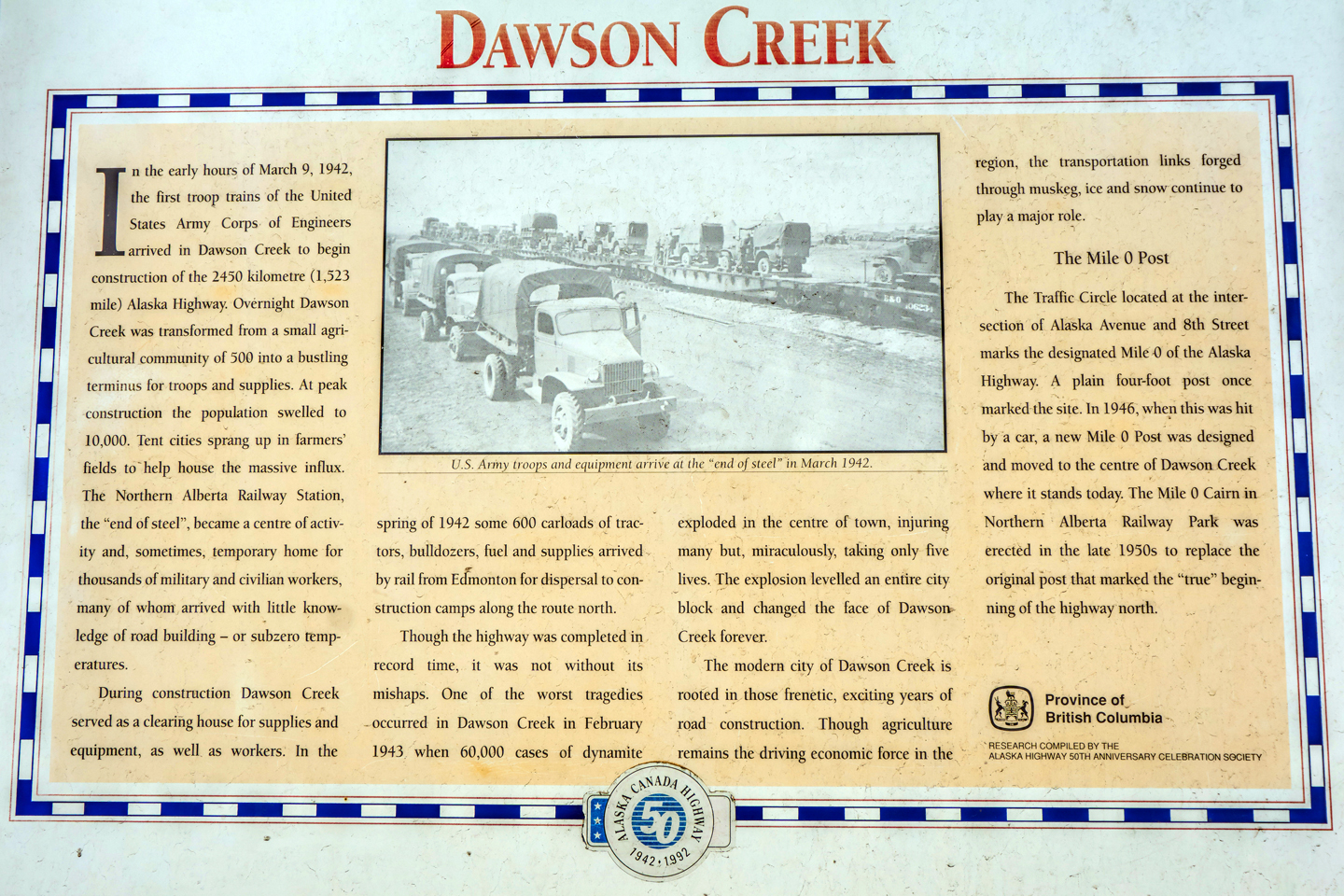
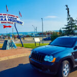
Your experience will be different, of course, unique to you and your own priorities, but there is one inescapable commonality: the Alaska Highway begins at Milepost Zero, an unassuming monument in the middle of a downtown intersection in Dawson Creek, British Columbia, a farming community of 13,000 souls on the western edge of the Canadian prairie. Regardless of your starting point, or your style of travel, the first leg of your Alaska Highway adventure involves getting to that spot.
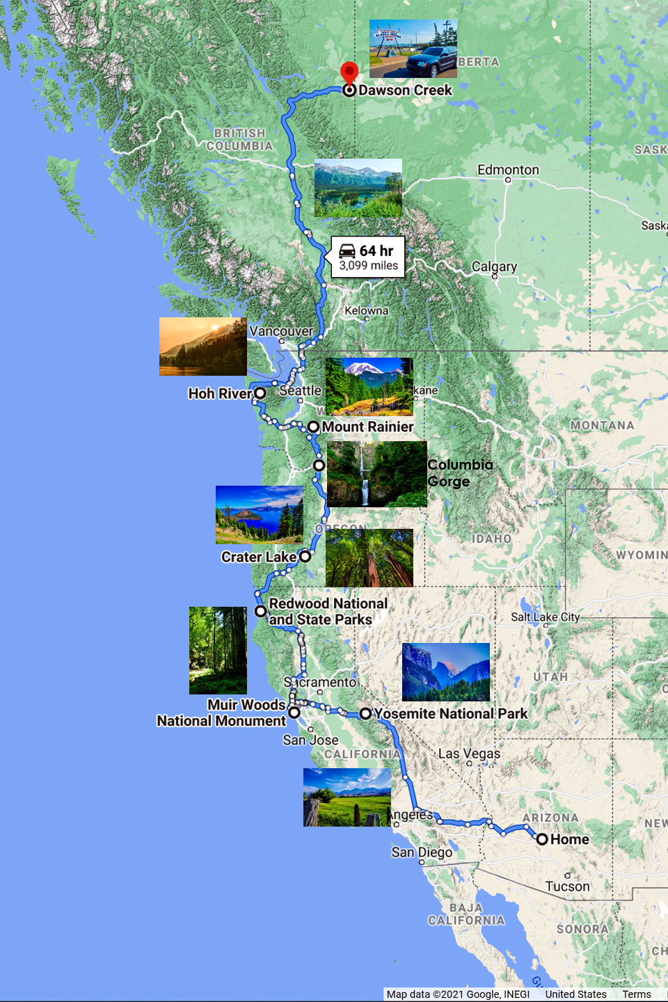
Phoenix to Dawson Creek, courtesy of Google Maps
Computerized mapping programs make it simple to figure out the best roads to take, and to calculate drive times, but you have to be careful: with Google Maps, Map Quest, and most other apps I’ve used, their time estimates are nothing more than the total miles divided by the average speed limit. They make no adjustments for food and fuel stops, rest breaks, or delays due to traffic, construction, or weather, so it’s wise to add 20% to their estimate, or even more if you plan to do any sightseeing.
I created a route to Dawson Creek that included five National Parks, a National Monument, and a National Scenic Area, as well as San Francisco and Seattle, two places where I had friends I planned to visit. As you can see on my map, the App says this is a 3,099 mile drive that will take 64 hours.
Adding that 20% cushion makes it 77 hours, which breaks down to ten days on the road, driving for almost eight hours a day. Add in extra days for dawdling and driving around in each of the seven parks and monuments, plus a couple days spending time with my friends, and there you have it. Looking back at my Trip Journal, my rough projection was remarkably close: I was actually on the road for 19 days before I arrived at the beginning of the Alaska Highway. The lesson? Always allow plenty of time on a trip like this. Odds are, you’ll use every bit of it.
From the east coast, it’s 2,700 miles or more to Dawson Creek, if you take the most direct route. That’s quite a haul, but even if you begin in Seattle, the closest American city, it’s still more than 800 miles of driving. To put that measure of distance in proper perspective, you have to consider the direction of travel. For most of that 800 miles from Seattle, you’re wending your way that much further north, so far north that there will be a noticeable change in the hours of daylight. It’s the latitude that distinguishes the north country, which includes every bit of Alaska. Dawson Creek is where it begins.
For me, this first part of the trip marked a major transition. I’d just retired from a government career that lasted 35 years, and I was still getting used to the notion of weekends that don’t end on Monday morning. This road trip was the first real test of my new found freedom, something I simply couldn’t have done while I was still working, and it was the point where I was finally able to fully appreciate the potential of this new phase of my life. So many of my work days had been dull routine, one after another, all of them running together in dreary sameness.This road trip was the polar opposite, an endless series of new experiences, sights I’d never seen before, and no two days the same. It was a metamorphosis of sorts, and I emerged from the cocoon of my working life, not with a butterfly’s wings…
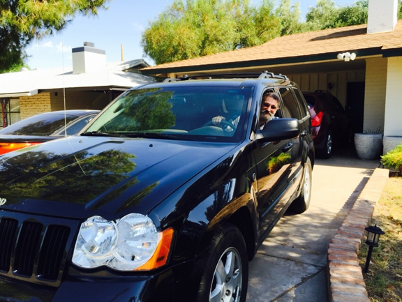
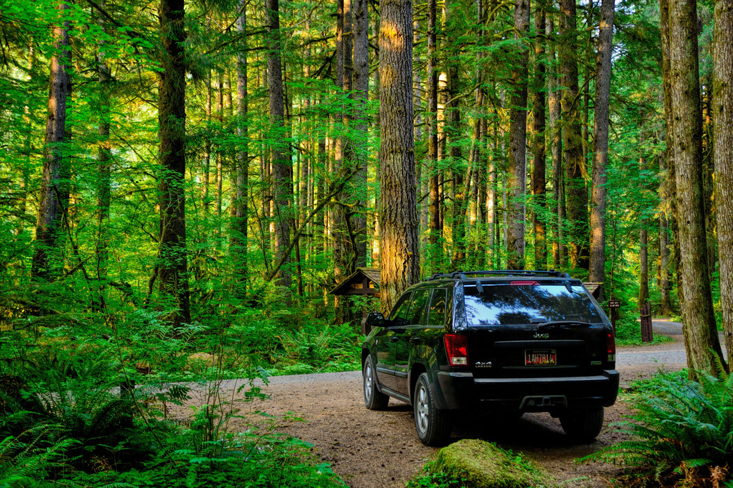
…but seated behind the wheel of La Reina Sucia, the Dirty Queen, my faithful Jeep Grand Cherokee.
On the Road with La Reina
On the first day of my trip I drove almost 600 miles, from Phoenix all the way to Bishop, California, following a beautiful stretch of highway that runs along the east side of the Sierra Nevada, with views of Mount Whitney, the tallest peak in the lower 48 states. I have a personal rule of thumb when I’m traveling alone: I try not to drive more than 500 miles in a single day, to minimize the risk of cumulative fatigue, and here I was pushing myself well beyond that limit on my first day out! But I had a good excuse: I was eager, and well rested, and those miles passed so smoothly, I just couldn’t bring myself to stop sooner.
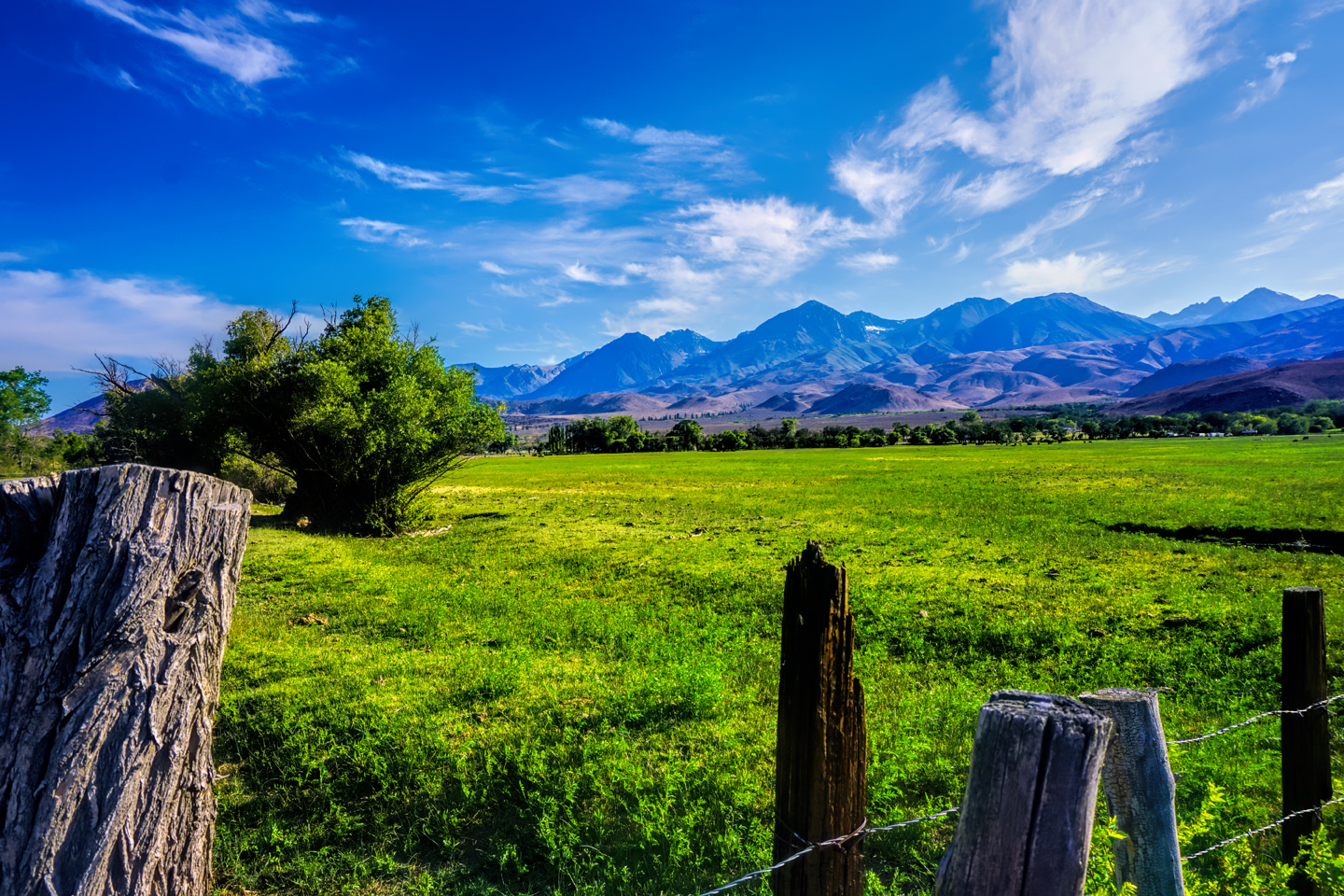
Sierra Nevada Mountains, near Mount Whitney
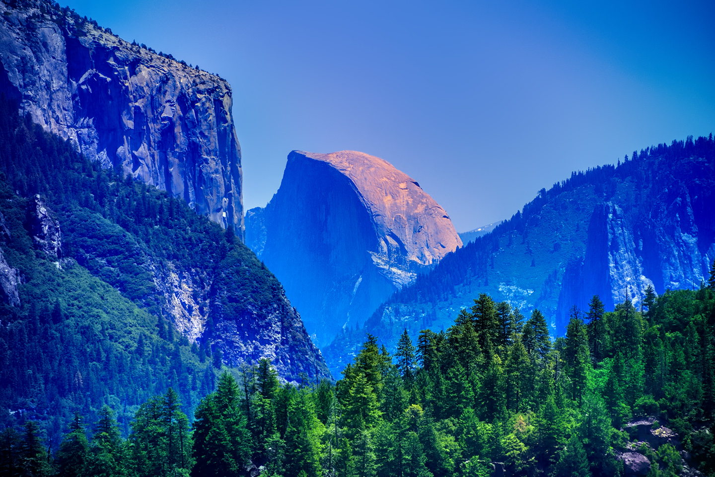
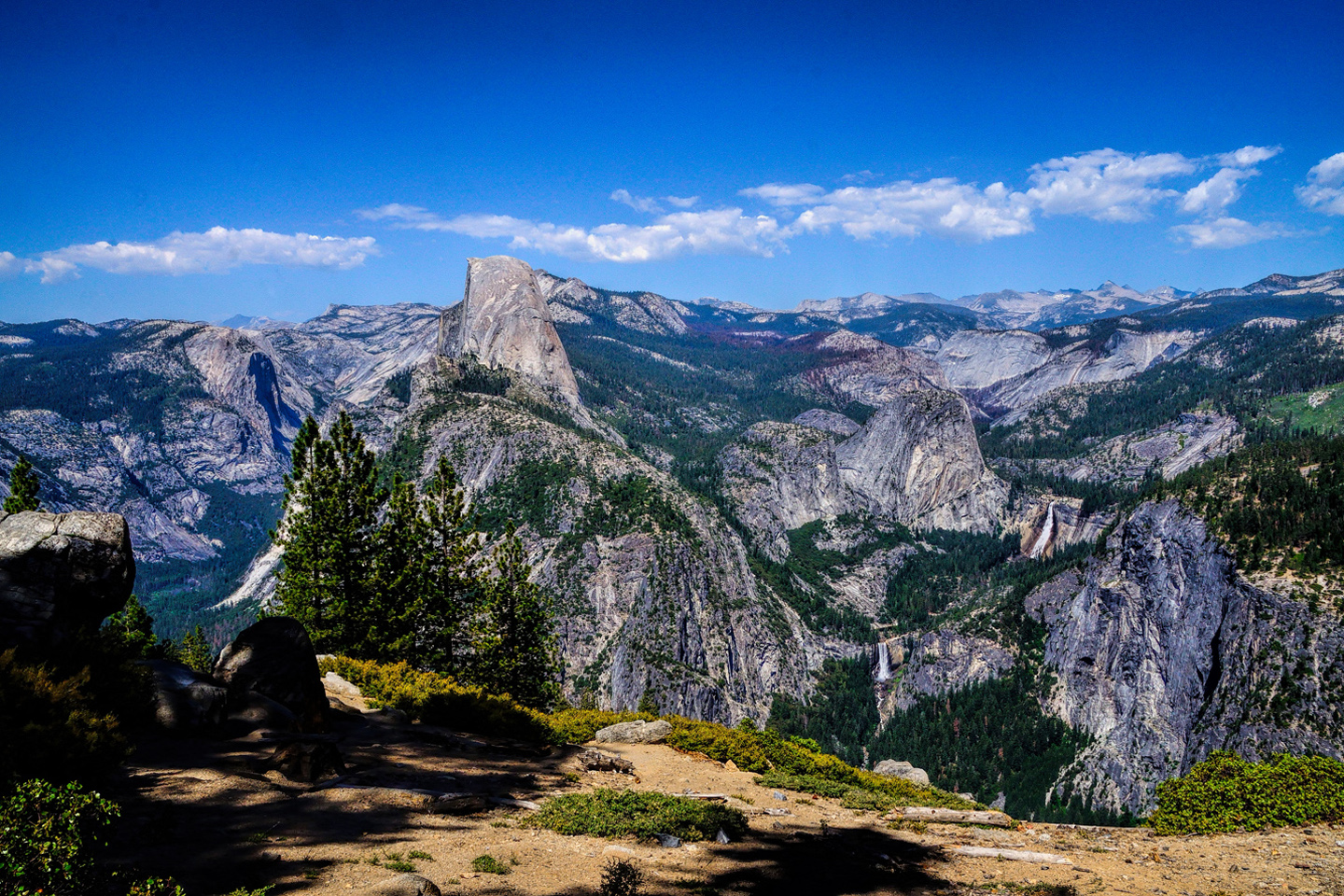
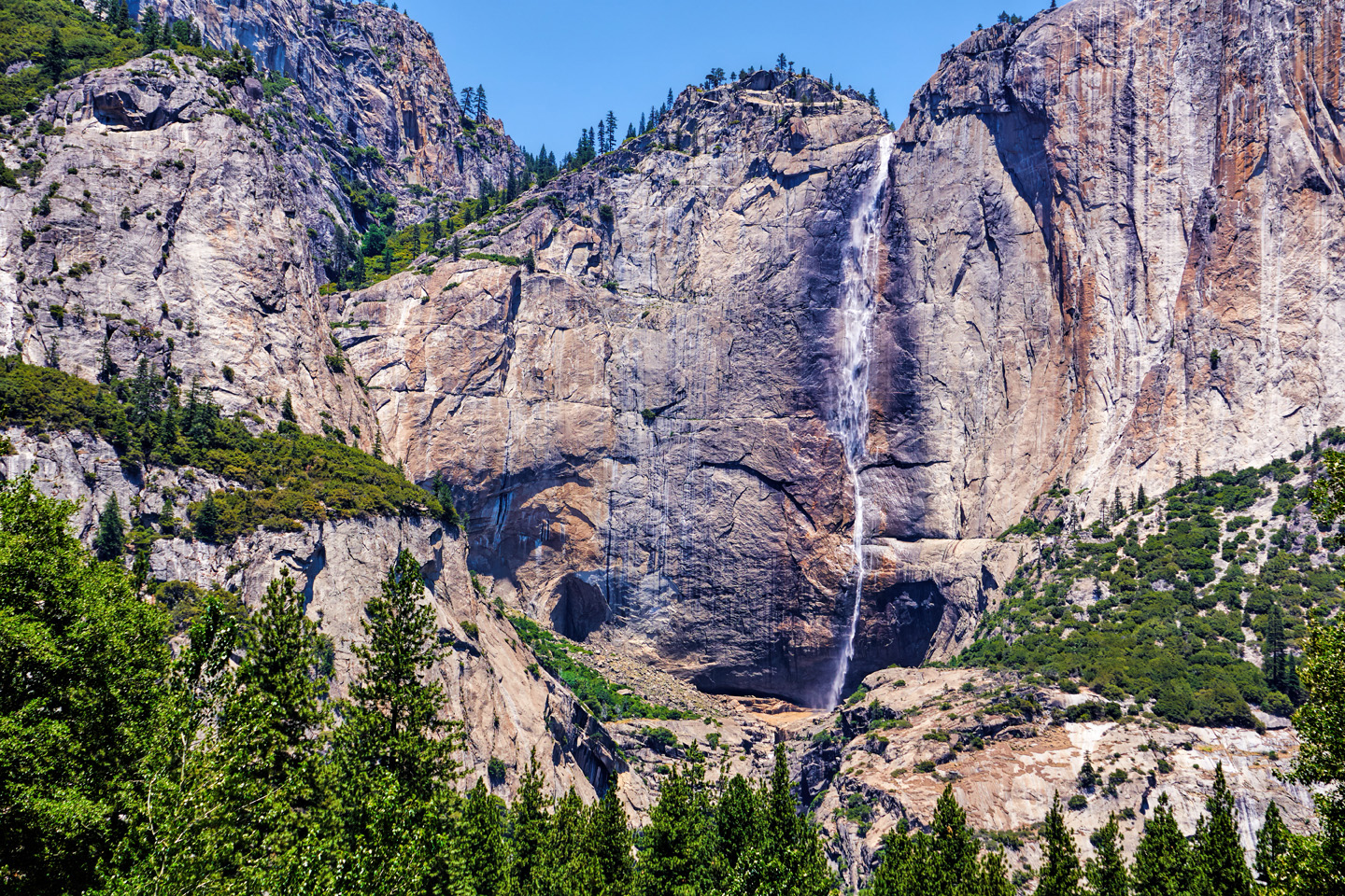
From Bishop, it was a hop and a skip to Tioga Pass, the eastern entrance to Yosemite National Park, a place I’d never been before, and had always wanted to see.
The National Park was everything I hoped it would be, but the crowds were definitely an issue, and I had an electrical problem with my vehicle that resolved itself, but left me a bit worried. I explored the park by road, and spent the night sleeping in my Jeep in one of the first-come, first-served campgrounds.
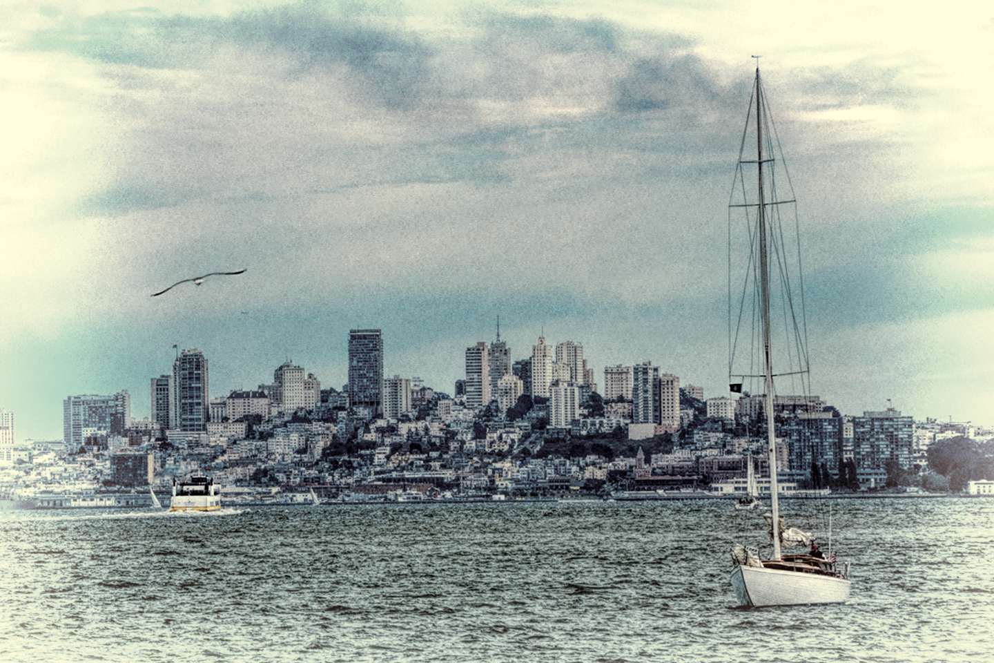
San Francisco Skyline, as seen from Tiburon
From Yosemite, I headed west to San Francisco, where I looked up an old friend. I lived there for a short while back in my college days, and it’s always been one of my favorite places. My friend and I had a great visit. We took in views of the skyline from Tiburon, near his home in Marin County, then went for a day hike in the Muir Woods National Monument. The next day, we drove up to Mendocino, where we camped in a grove of giant redwoods. That gave me a chance to test the new tent that I’d purchased for the trip; an interesting design from Napier called a BackRoadz SUV tent, which attaches to the back end of your vehicle with an elasticized boot.
CLICK PHOTOS FOR AN EXPANDED VIEW
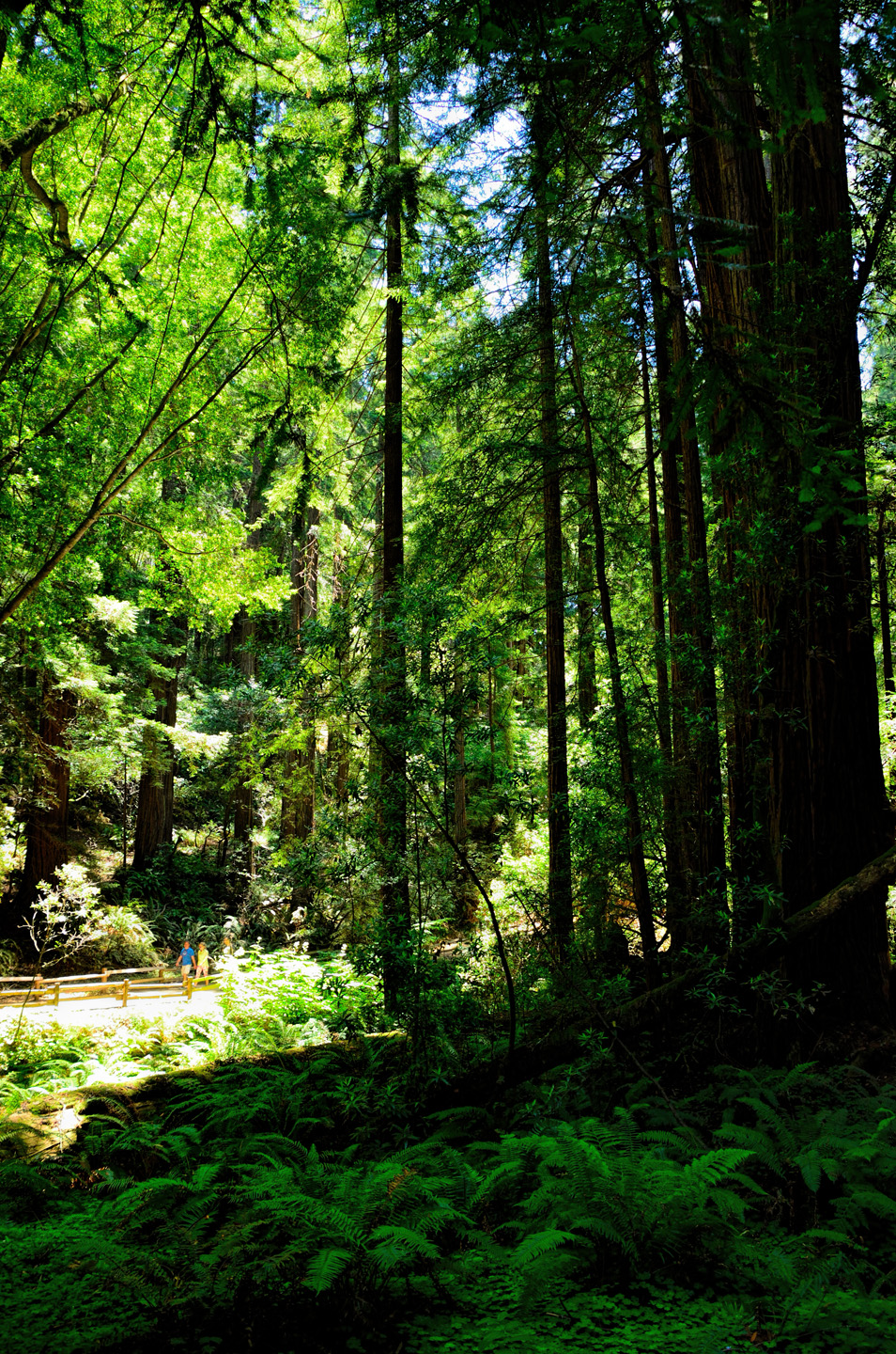
Muir Woods National Monument
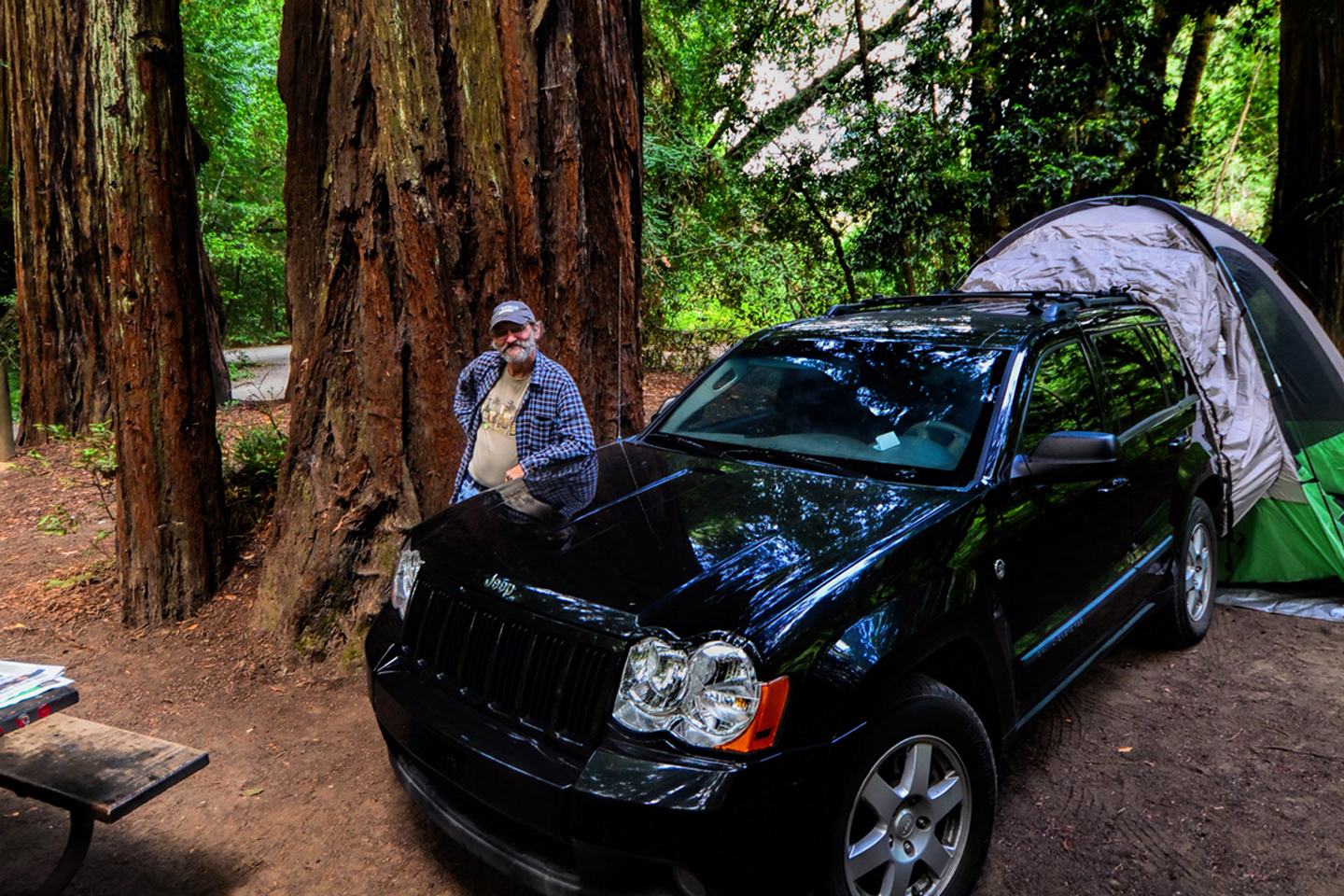
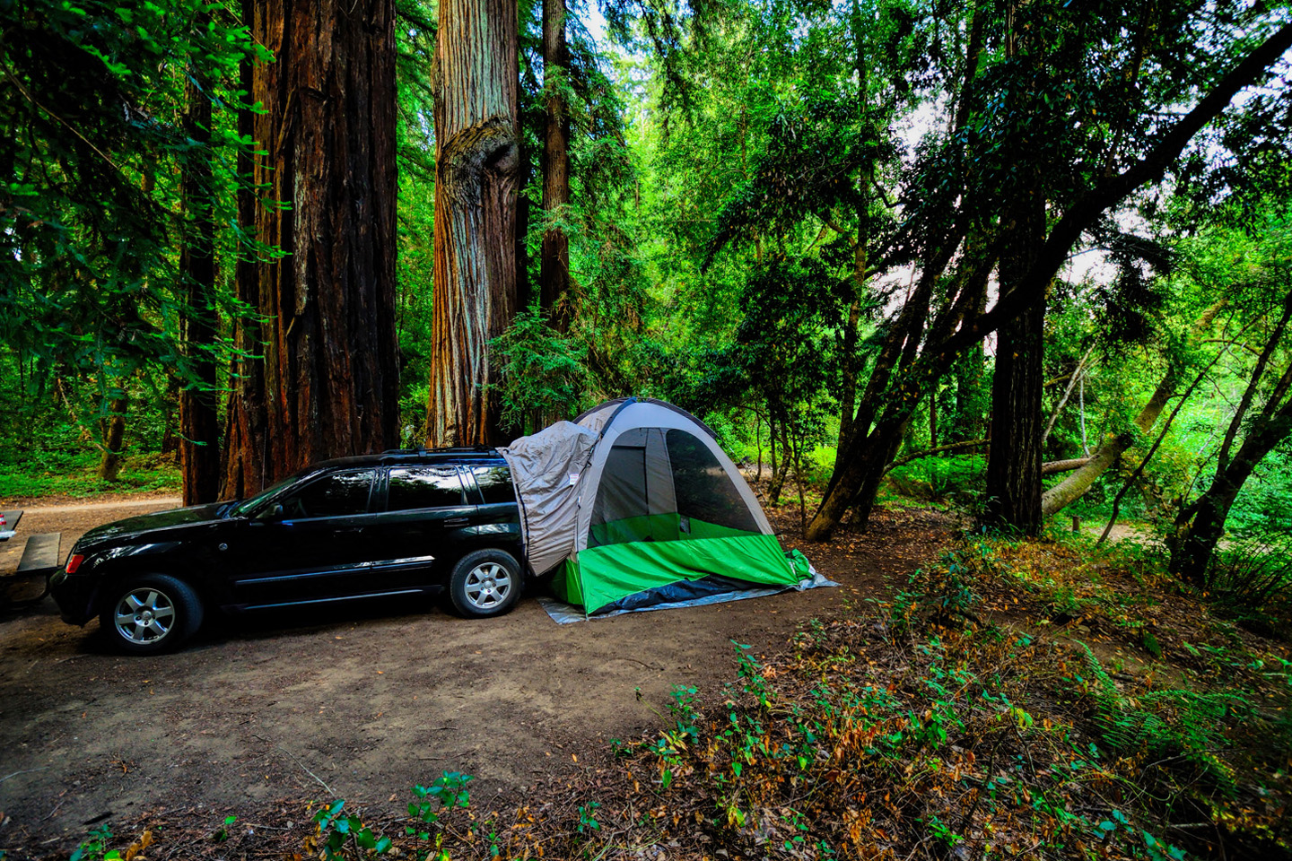
Camping in the redwoods, Mendocino County
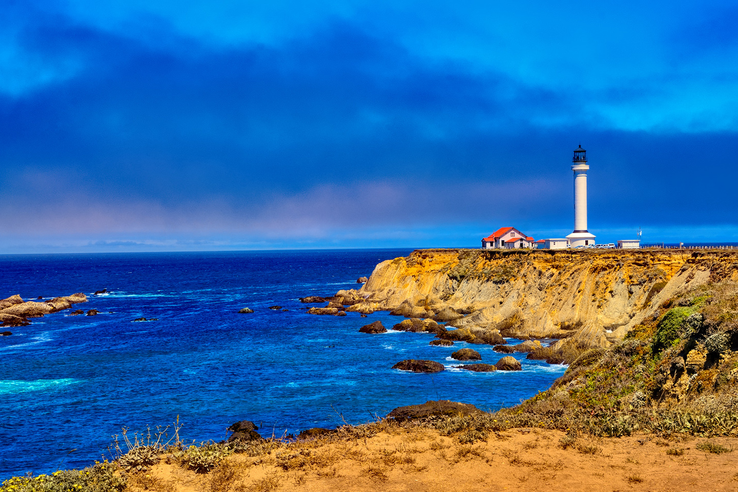
Point Arena Lighthouse, Mendocino coast
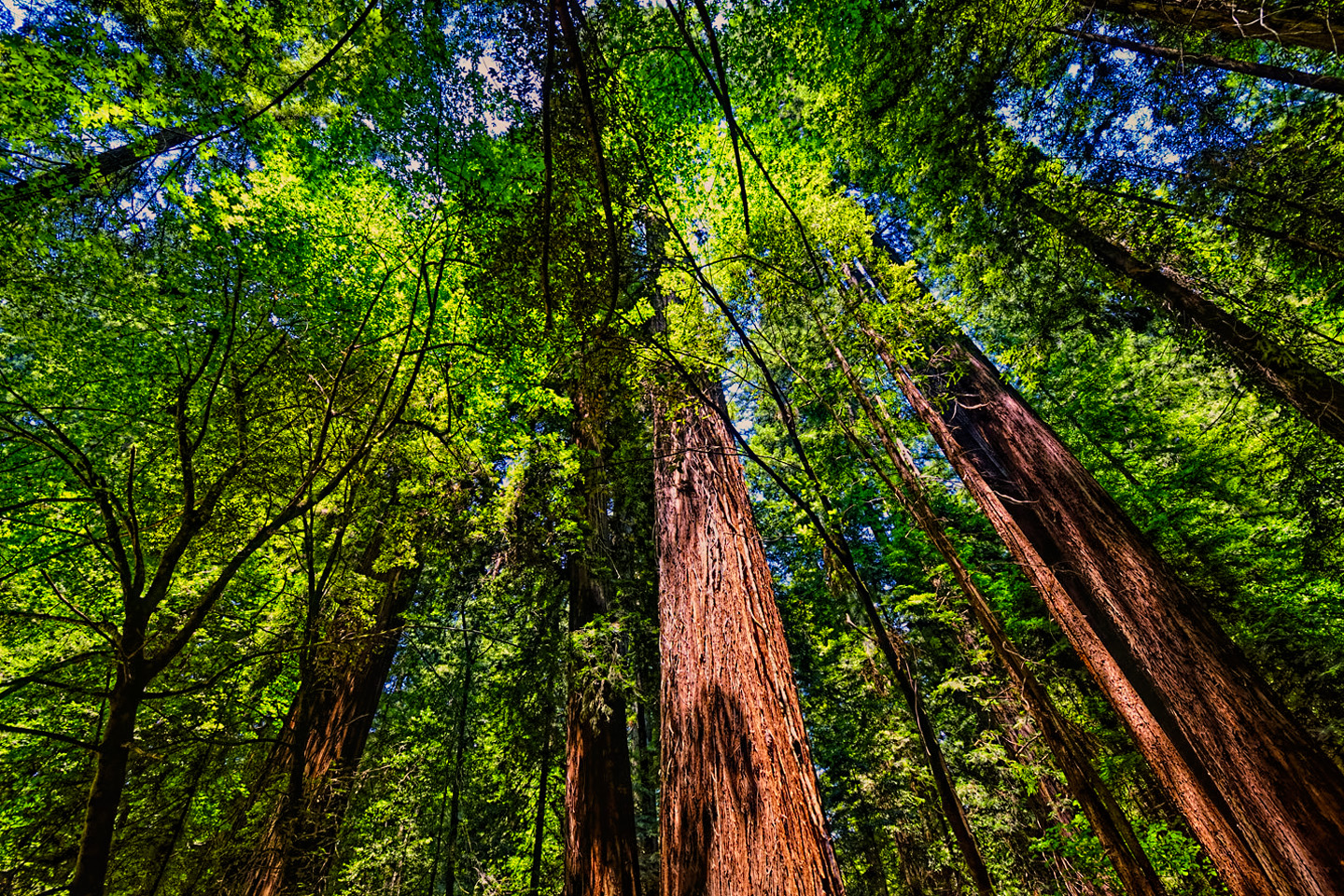
Avenue of the Giants, Redwoods National Park
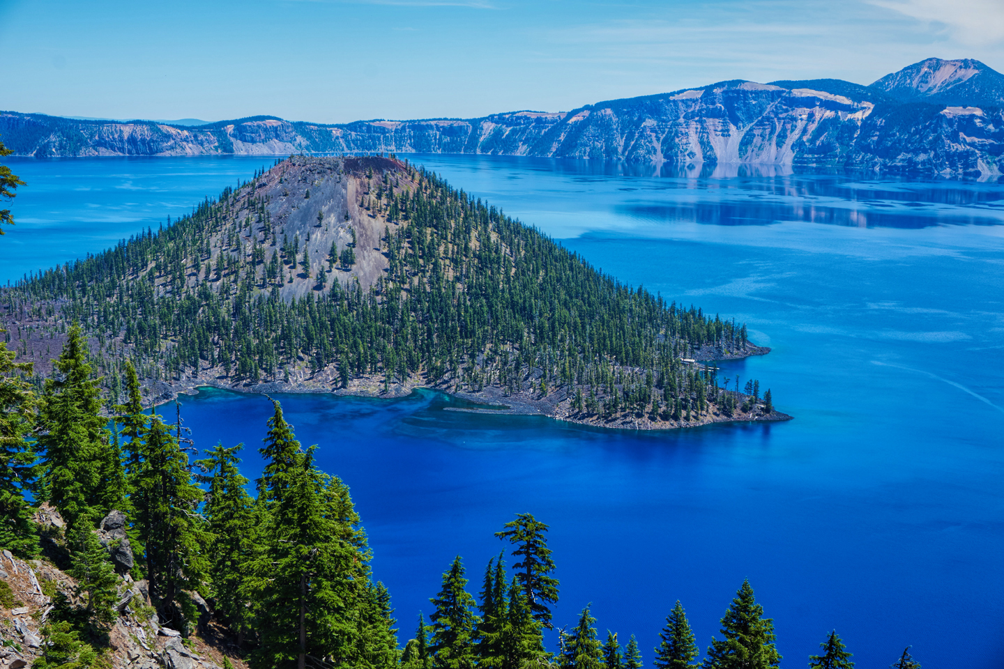
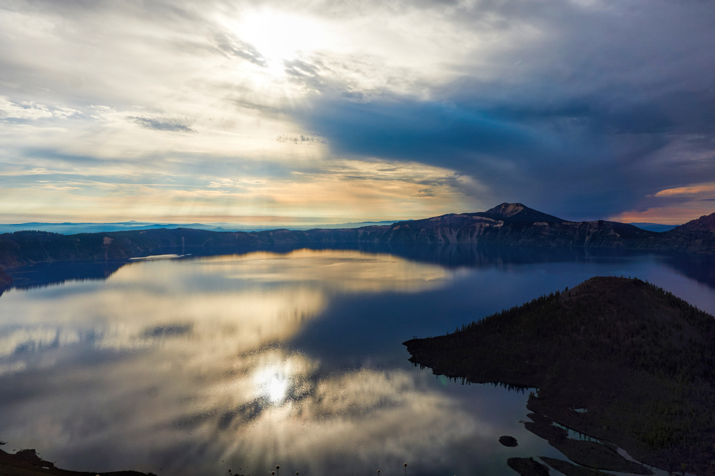
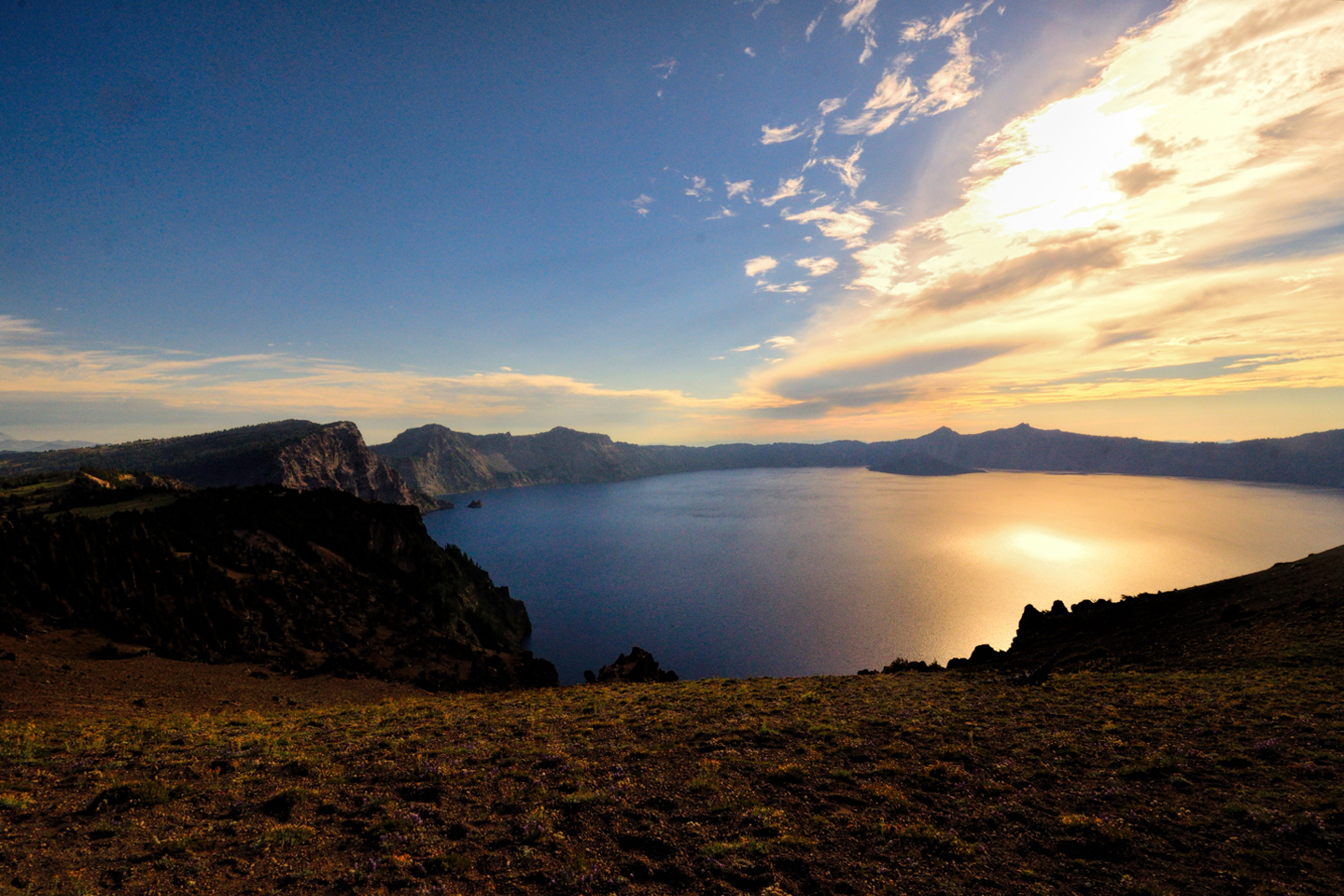
From San Francisco, I headed toward Oregon, passing through Redwoods National Park in northern California. From there, I drove to Crater Lake National Park, a place I’d seen several times before. It was one of my favorite spots, so there was no way I was going to pass that close to it without stopping! I was lucky enough to secure a space in one of the first-come, first-served “tents only” camp grounds, a small miracle, considering the fact that I was there during the 4th of July weekend! That gave me an opportunity to photograph the lake at all the different times of day, including the sunset on the day I arrived, and the sunrise the following morning. In my experience, it’s ALWAYS worth losing a little sleep to catch a beautiful view at sunrise!
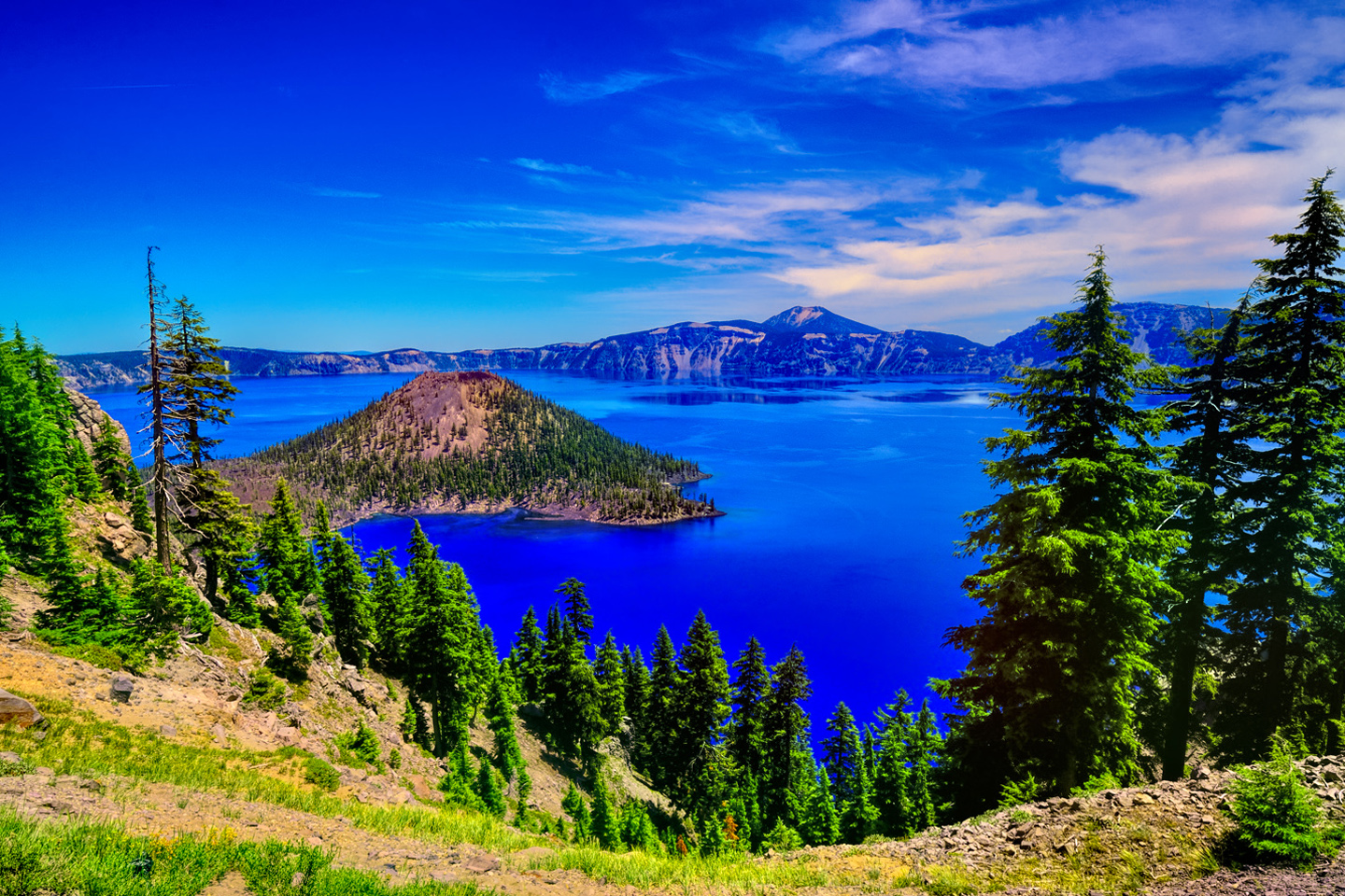
The many moods of Crater Lake, from Sunrise to Sunset
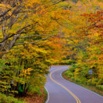
From Crater Lake, I moved on to Portland, and from Portland to the Columbia River Gorge National Scenic Area, another fondly remembered place I hadn’t been to in almost 45 years! Broken auto glass in the parking area, along with signs warning against leaving your vehicle unattended made me a little nervous, so as much as I would have loved to get closer to the waterfalls, I settled for taking photos at a distance.
The big city had obviously invaded this particular wilderness, so I didn’t linger. Instead, I crossed the river into Washington State, and followed some very cool back roads all the way to Mount Rainier. I hadn’t even realized it when I chose that route, but it was a perfect vantage point for views of the back side of Mount St. Helens, and I got some great photos:
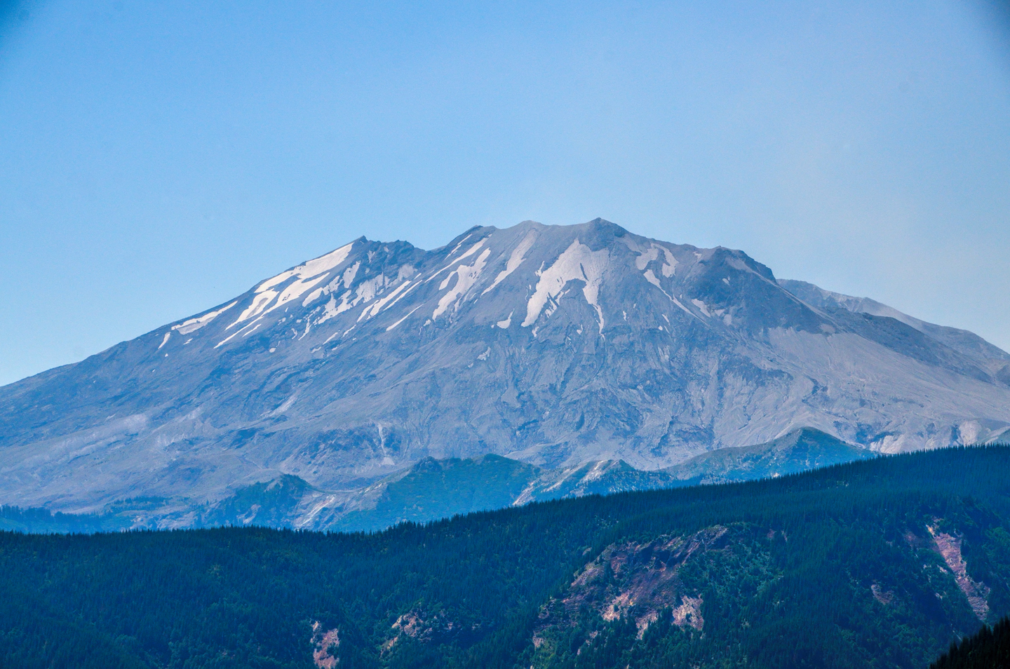
Mount Saint Helens
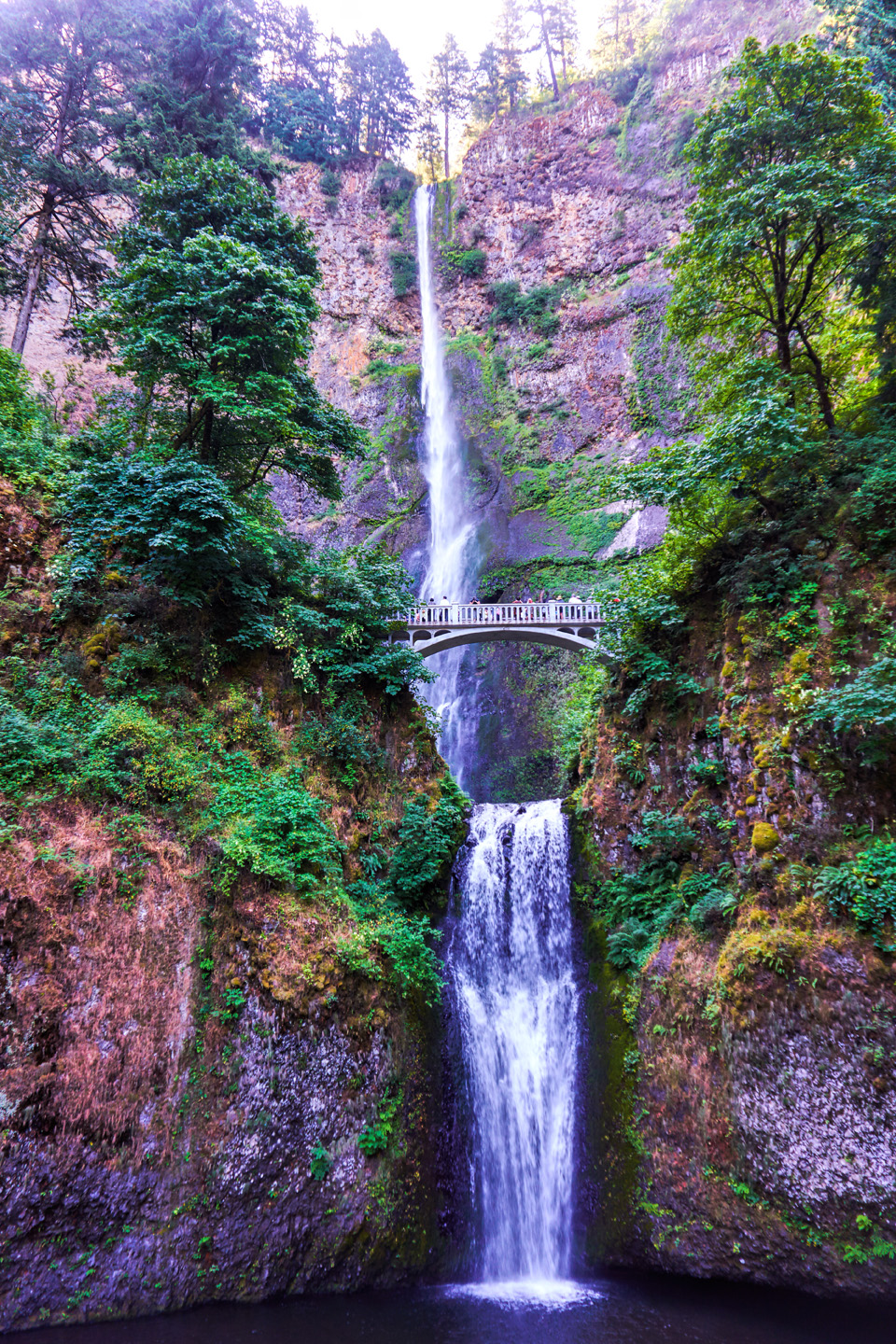
Multnomah Falls, Columbia Gorge
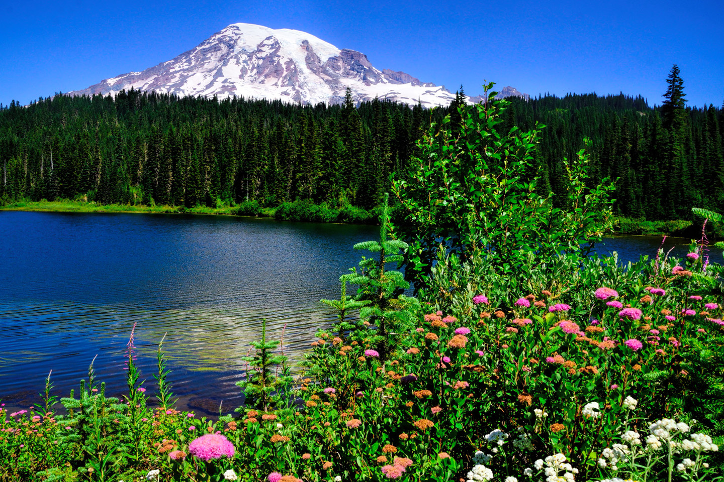
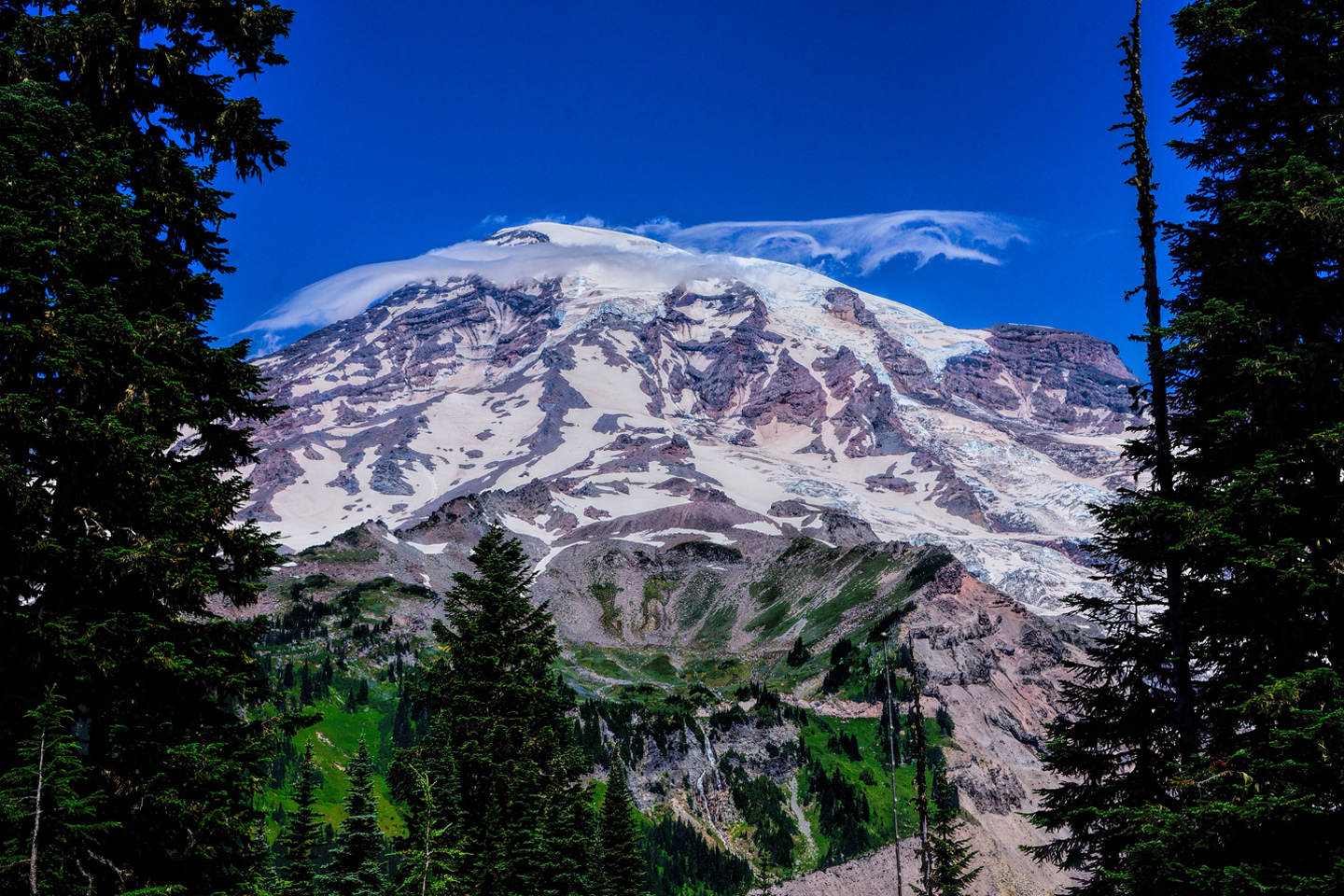
The next day, when I visited Mount Rainier National Park, the mountain cooperated beautifully. I had clear skies the whole time I was there, and I was blissfully unaware of how rare and lucky that was.
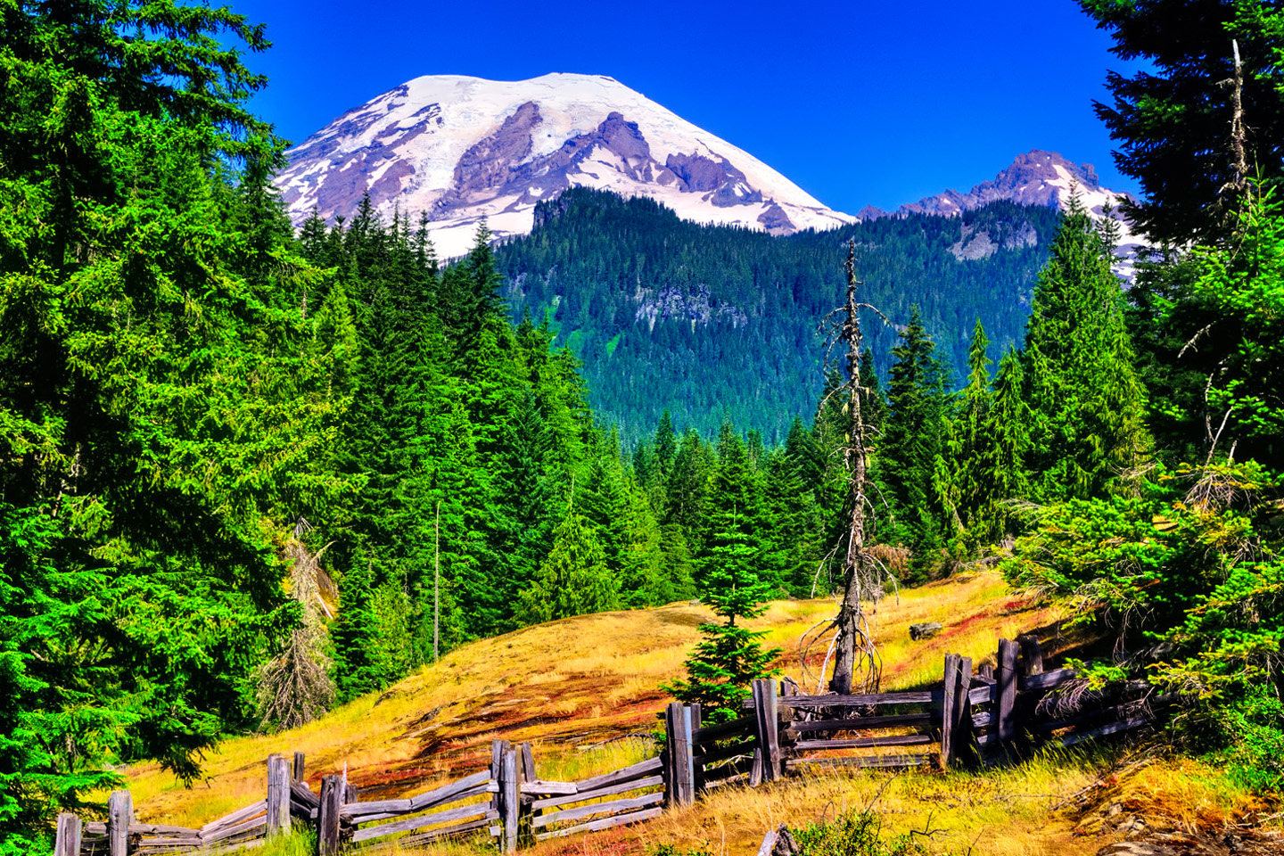
The many faces of Mount Rainier, on a sunny day in July
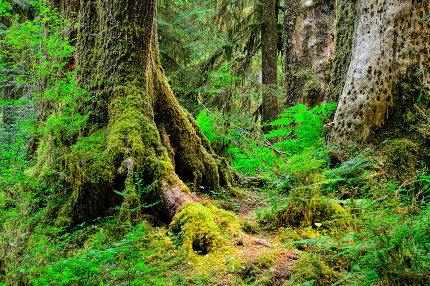
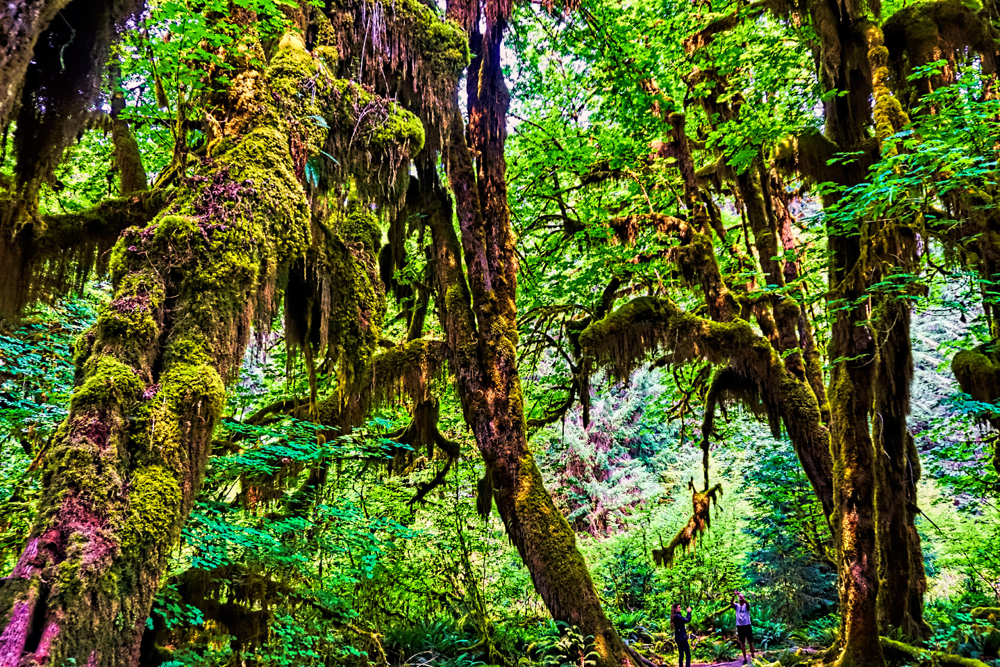
From there, I drove due west to Olympic National Park, which was another new one for me. I spent a fabulous day driving around Mount Olympus, and explored the Hoh Valley, the only temperate rain forest in the United States.
Olympic National Park is huge, and it really deserved more time. As it was, I racked up 300 miles that day, all of it inside the park, driving between the major points of interest.
After leaving the National Park, I took a ferry across Puget Sound to Seattle, where I looked up some friends I’d met on a Grand Canyon rafting trip two years before. Had a picnic, and watched a little Shakespeare in the Park (“As You Like It,” as I’d never seen it—complete with dreadlocks and banjos).
This was my first time in Seattle since passing through on a hitch-hiking adventure in 1970. Suffice to say that the city had changed, a LOT!
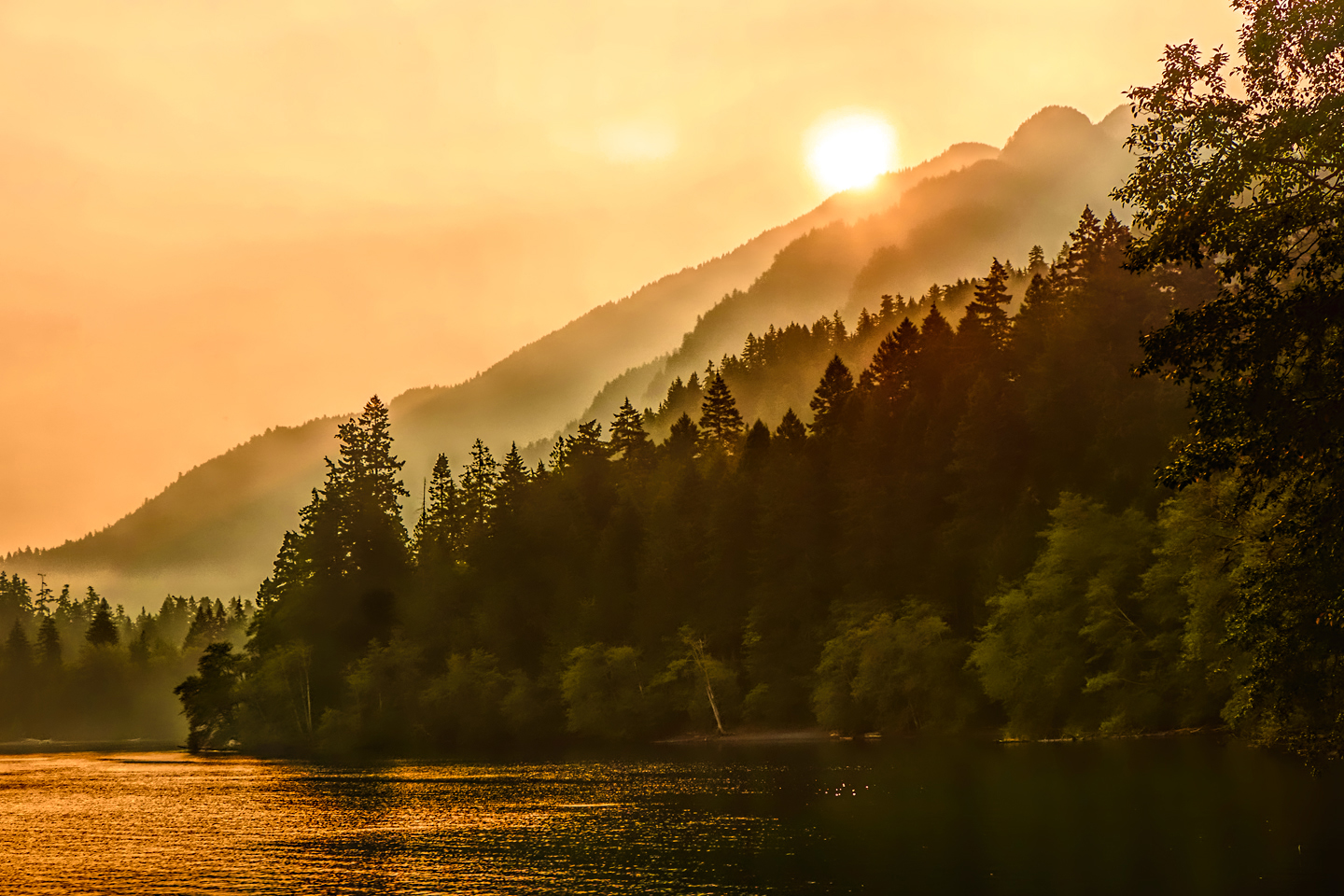
Sunrise at Olympic National Park
At the point when I left home, I hadn’t really planned any farther ahead than Seattle, because I wasn’t at all sure if my bad back was going to allow me to do so much driving day after day. Now, here I was in Seattle, and I had a decision to make. So far, I was doing okay, because I was holding down the number of hours I spent behind the wheel. Thing is, I was barely halfway to Alaska. Every mile I drove took me farther from my starting point, and all those miles would have to be retraced when I drove back home again. There wouldn’t have been any shame in turning back south that day, but I was dead certain that I would have had major regrets. After coming all this way? Of course I was going to push on with my trip. I changed the oil on my Jeep, checked out of my motel, and headed for the border.
THE CANADIAN BORDER
The Canadian border with the United States is the longest land border between any two countries anywhere in the world. It runs for 5,525 miles, in two discrete sections: the southern border with the contiguous U.S., and the western border with the State of Alaska. The border is considered “undefended” because of the lack of military presence–but there are many other forms of security in place to mitigate smuggling and illegal immigration.
Click this link for a current list of rules and restrictions:
Entering Canada? <<Click Here>>
On a drive to Alaska, the border is mostly a formality, but you will need a valid Passport, and there are some things you should be aware of. Don’t bring in any firearms or ammunition (not unless you’re a hunter, in possession of all the proper permits). Don’t bring in any form of Cannabis; even though it has been legalized in all parts of Canada, it’s still a criminal offense to cross the border with it. Don’t bring in a load of alcohol. A couple of leftover beers in your cooler is fine (speaking from experience), but you should avoid any attempt at circumventing Canadian liquor taxes. And speaking of alcohol: if you’ve ever been convicted of a DUI, anywhere in the world, even if it was years in the past: they’ll run a search of your records when they’re checking you through immigration, and if anything like that pops up, they will deny your entry into Canada. No excuses, no appeal; they send you back in the other direction. Otherwise, once you clear immigration, you get back in your vehicle. They probably won’t search you–but they do have the right, so it’s best to be prepared for it, by familiarizing yourself with the full list of restrictions in advance. Click the link (above) for the latest.
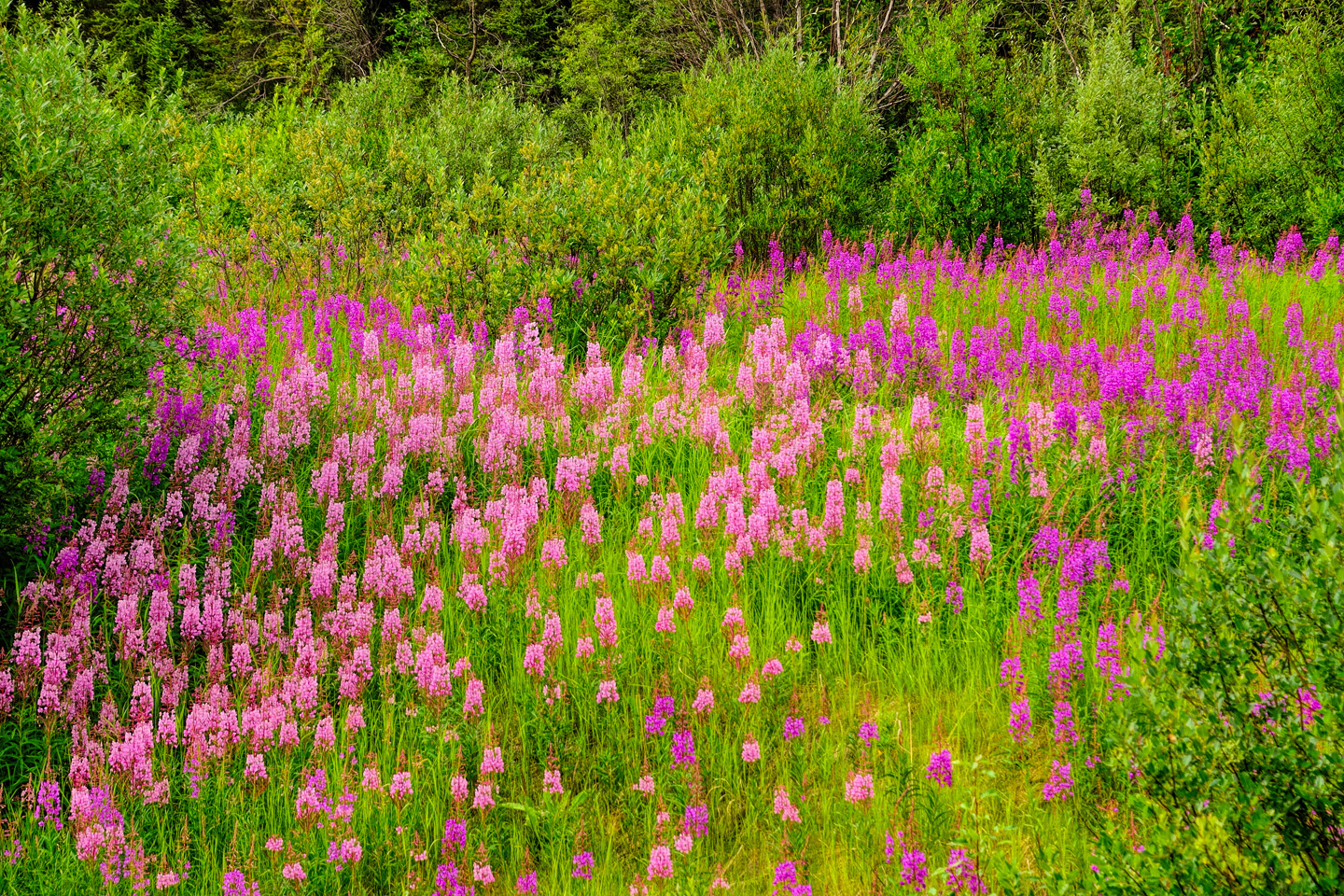
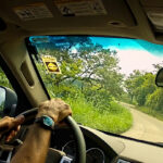
Driving away from Canadian Customs, that was when the trip started getting real to me: every mile I drove took me deeper into unfamiliar territory. Once I turned north, the highway ran roughly parallel to the western edge of the Canadian Rockies; that’s where I got my first glimpse of a pinkish lavender wildflower known as fireweed, something I was going to be seeing quite a lot of on my travels in this part of the world.
(In fact, I saw so MUCH fireweed that I decided to make a seperate post about it in this blog, complete with an over-sized slide show. Click here: Follow the Fireweed).
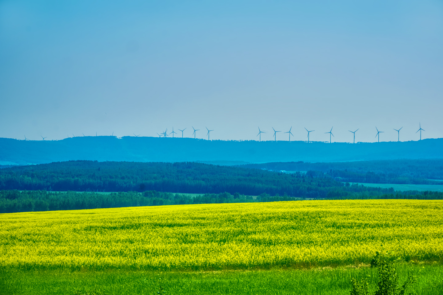
After most of two days of driving, the road finally veered to the east and crossed over the mountains. This was farm country, on the edge of the Canadian Prairie, with vast fields of yellow-flowered canola stretching off to the distant hills.
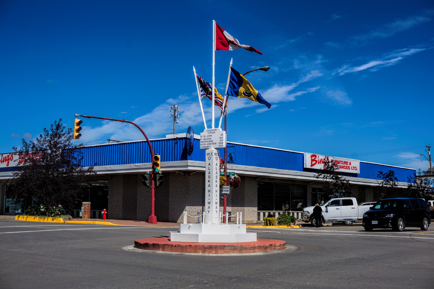
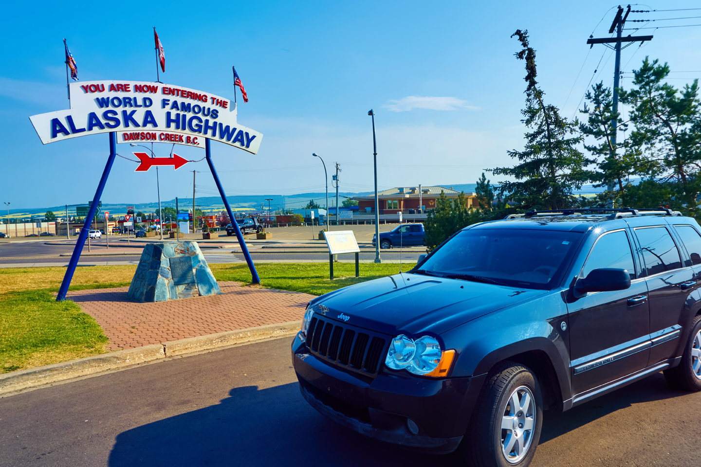
That brought me to the end of my beginning, and the beginning of my end: Dawson Creek, British Columbia, and Mile Zero of the Alaska Highway!
Click any photo in this post to expand the images to full screen.
To continue reading the series, click the button below:
MORE ABOUT THE ALASKA HIGHWAY:
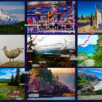
This is an interactive Table of Contents. Click the pictures to open the pages.
Alaska Road Trip

The Alaska Highway: Prelude: The Road to Dawson Creek
Even if you start in Seattle, the closest American city, it’s still more than 800 miles to Dawson Creek, wending your way that much further north, so far north that there will be a noticeable change in the hours of daylight. It’s the latitude that distinguishes the north country, including every bit of Alaska. Dawson Creek is where it all begins.
<<CLICK to Read More>>

The Alaska Highway: Day 1: Dawson Creek to Fort Nelson
Past Fort St. John, the terrain got a lot wilder. No more towns, very few people, and very little traffic. Saw a few U.S. license plates, Michigan, California, Oregon, South Carolina; people that were obviously headed to Alaska!
<<CLICK to Read More>>

The Alaska Highway: Day 2: Fort Nelson to Whitehorse
Every time I rounded a curve in the road there was another stupendous vista; it was nothing short of astonishing! I was literally yipping out loud, and a couple of times I actually pulled over and stopped while I pounded on my chest to “re-start” my heart!
<<CLICK to Read More>>

The Alaska Highway: Day 3: Whitehorse to Beaver Creek
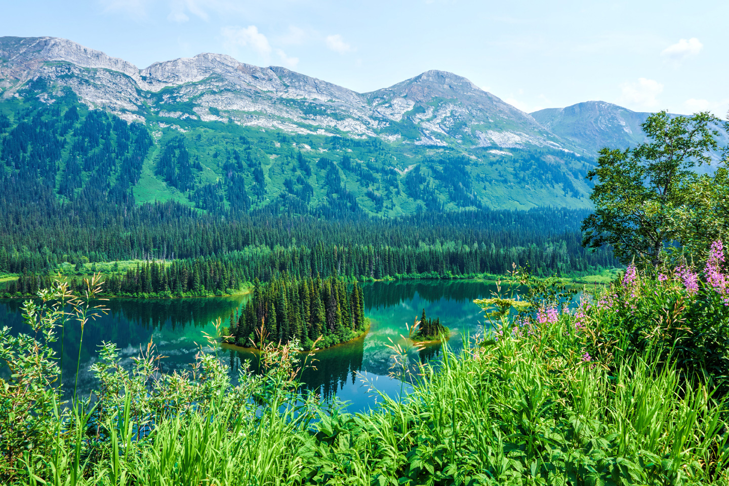
Approaching the mountains, I started pulling over with serious frequency, taking LOTS of photos! Mountains, clouds, lakes, flowers—I was pretty sure I must have died and gone to heaven, but I couldn’t for the life of me remember the fiery crash.
<<CLICK to Read More>>

The Alaska Highway: Day 4: Beaver Creek to Fairbanks
Delta Junction, the end of the Al-Can, was only 200 miles away, and the border? Twenty miles, maybe half an hour, and I was finally going to cross into Alaska! I’d been on the road more than three weeks, and in just half a day more, I’d be in Fairbanks.
<<CLICK to Read More>>

Chena Hot Springs: A Fairbanks Original
The Chena hot spring puts out steaming water at a temperature of 150 degrees, producing enough power to meet all the needs of the resort, as well as filling the hot springs pools used by the guests. In addition to the lodge and restaurant, they offer camping and horseback riding, and they have exhibits featuring sled dogs, greenhouses, ice sculptures, and geothermal energy.
<<CLICK to Read More>>

Two-Foot High Kick: World Eskimo Indian Olympics
Contestants take a running leap, then they make this crazy jackknife move, touch the ball suspended high above the floor with both feet, then come back down and stick the landing. If that sounds difficult? You have no idea.
<<CLICK to Read More>>

Dreaming of Denali
When I drove my Jeep to Alaska that first summer after I retired, my main goal, the single most important thing I wanted to do, was to see Denali, the biggest mountain in North America.
<<CLICK to Read More>>

Follow the Fireweed
Visualize a summertime journey through that part of the world, a world filled with mountains and glaciers and boreal forests, ice blue rivers, turquoise lakes, and billowing clouds that fill the sky. Imagine your vision as a beautiful piece of music. The fundamental, underlying theme of that symphony would be a gently rising swell of perfect harmony, pinkish lavender in its hue.
<<CLICK to Read More>>

Kenai Fjords National Park: Seabirds, Glaciers, and Whales on the Wild Coast of Alaska
At this latitude, during the summer months, the sun stays low in the sky all day, and never really goes down. The traditional “golden hour” when the light is best for landscape photos is extended accordingly, and there are more opportunities for great shots than you’ll know what to do with.
<<CLICK to Read More>>

Kenai Fjords National Park: Exit Glacier: Up Close and Personal
Compared to the huge tidewater glaciers that flow directly into the sea along the coast of Kenai Fjords, Exit Glacier is just a baby–a baby that’s getting smaller every year–but it’s still big enough to permanently alter the landscape through which it passes.
<<CLICK to Read More>>

Alaska Road Trip: Driving Alaska’s Grand Circle
Most of the major towns in Alaska, as well as three of the state’s incredible National Parks, can all be reached by driving Alaska’s Grand Circle: a loop route beginning in Tok that utilizes all four segments (1082 miles) of Alaska’s Interstate Highway system.
<<CLICK to Read More>>

Alaska Road Trip: The Grand Circle: From Tok to Denali
There are no icy mountains looming on the horizon, and Fairbanks is nowhere near Alaska’s ruggedly beautiful coast. The true beauty in Alaska’s second city is found below the surface, in the spirit and resiliance of the people who make the place their home.
<<CLICK to Read More>>

Alaska Road Trip: The Grand Circle: Anchorage and the Kenai Peninsula
The massive ice field in the park’s wild interior has spawned dozens of glaciers which, over the course of many millenia, have carved the landscape into fjords so heart-breakingly beautiful, humpback whales swim all the way from Hawaii just to cavort in the deep blue water.

Alaska Road Trip: The Grand Circle: Wrangell-St. Elias National Park
So, just exactly how big is Wrangell-St. Elias National Park? You could combine Yellowstone with Yosemite, throw in the entire country of Switzerland, and you still wouldn’t match it in terms of size.
<<CLICK to Read More>>

Alaska Road Trip: Driving to the Top of the World
The rough dirt road gave way to a newly paved modern highway. This was it, the Top of the World, and right on cue, the haze peeled back, just enough to give me a glimpse of the beauty my friends assured me would be there…

There’s nothing like a good road trip. Whether you’re flying solo or with your family, on a motorcycle or in an RV, across your state or across the country, the important thing is that you’re out there, away from your town, your work, your routine, meeting new people, seeing new sights, building the best kind of memories while living your life to the fullest.
Are you a veteran road tripper who loves grand vistas, or someone who’s never done it, but would love to give it a try? Either way, you should consider making the Southwestern U.S. the scene of your own next adventure.
A few years ago I wrote a book about road trips in Arizona and New Mexico that’s a lot like this website, packed with interesting information, and illustrated with beautiful photographs. Check it out! You can find it on Amazon, and at all other major booksellers.

ALASKA ROAD TRIP:
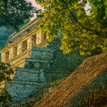
MEXICAN ROAD TRIP (IN THE LAND OF THE MAYA):
ARIZONA AND NEW MEXICO:
SOUTH AMERICA:
PHOTOGRAPHY:
TRIBAL LANDS:


Recent Comments