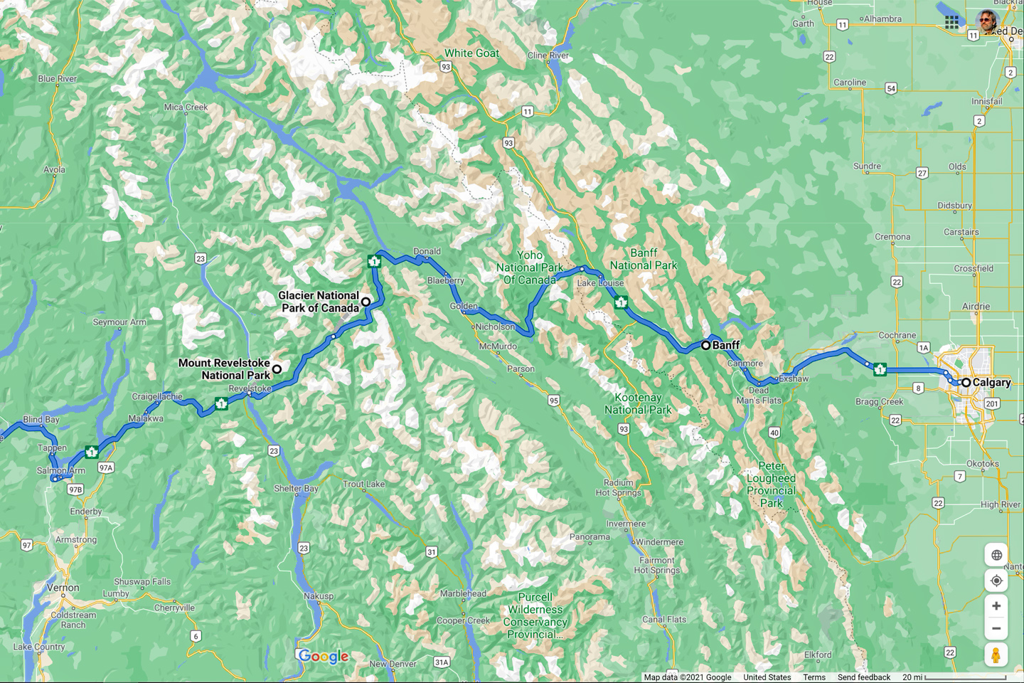
Traveling west from Calgary on the Trans Canada Highway, you’ll drive straight through the heart of the UNESCO World Heritage site known as the Canadian Rocky Mountain Parks, a contiguous assemblage of no less than four of Canada’s most spectacular National Parks, with three of British Columbia’s Provincial Parks thrown in as a bonus. This is one of the most wonderfully scenic areas on the entire planet, 75,000 square miles of beautiful forests, colorful lakes, rushing rivers, and jagged, ice-clad peaks, a bucket list destination for travelers from all over the world. You’ll leave the UNESCO site when you cross the boundary of Yoho National Park, but that shouldn’t be the end of your road trip. There are still two more Canadian National Parks right along your way, right there on the TCH, and even though they’re not included in the World Heritage site, they are absolutely worth a visit. (Headed east on the TCH from Kamloops? Make these two parks your first stop!)
The town of Golden, British Columbia, is just 17 miles west of Yoho, and if you drive 36 miles beyond Golden, you’ll crest Rogers Pass in the majestic Selkirk Range, and you’ll enter one of Canada’s best kept secrets:
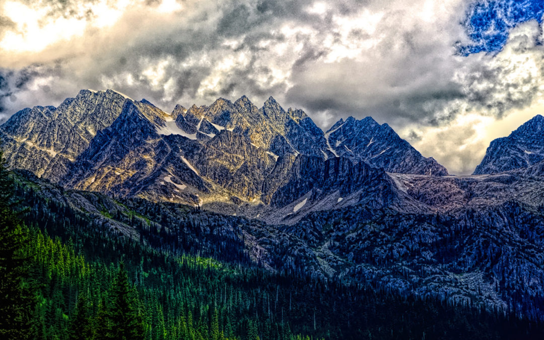
GLACIER NATIONAL PARK
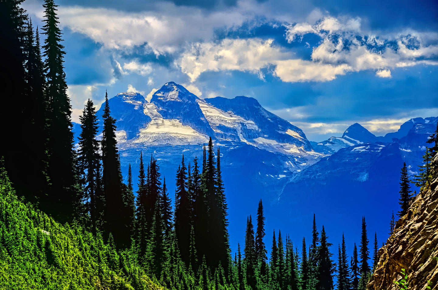
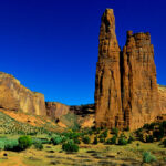
Canada’s Glacier National Park was founded several decades before the U.S. National Park of the same name. They bear no direct relation to each other, and they are certainly not connected, but, if spectacular mountains, rivers, lakes, and slowly flowing sheets of ice are taken into account, they bear more than a passing resemblance. Canada’s Glacier, about the same size as Yoho, consists of soaring peaks and beautiful valleys, all centered around Rogers Pass, a notch in the Selkirk Range that provides a crucial route through the great wall of the Rockies. The discovery of the pass in 1882 made possible the completion of the Canadian Pacific Railroad, a historic achievement that opened up the Province of British Columbia to economic development. The completion of the Trans-Canada Highway, which pushed through that same pass in 1963, was also a historic achievement, opening up the area west of the Selkirk Range to <<drumroll, please>> tourists!
Glacier N.P. is a wonderland for hikers, with fabulous trails at every level of difficulty, ranging from the barrier free Hemlock Grove Boardwalk, a trail for everyone that winds through a forest of ancient Hemlocks, to the Bald Hills hike, a four day back-country adventure rated as ‘difficult,’ best enjoyed by the experts. There’s a trail called The Meeting of the Waters, another called the Rock Garden, both short and easy hikes, suitable for families, kids, and seniors, along with many more day hikes and even multi-day hikes to entice the hard-core enthusiasts. The relative lack of crowds makes any hike in this area a true wilderness experience, of the sort that’s increasingly difficult to find these days.
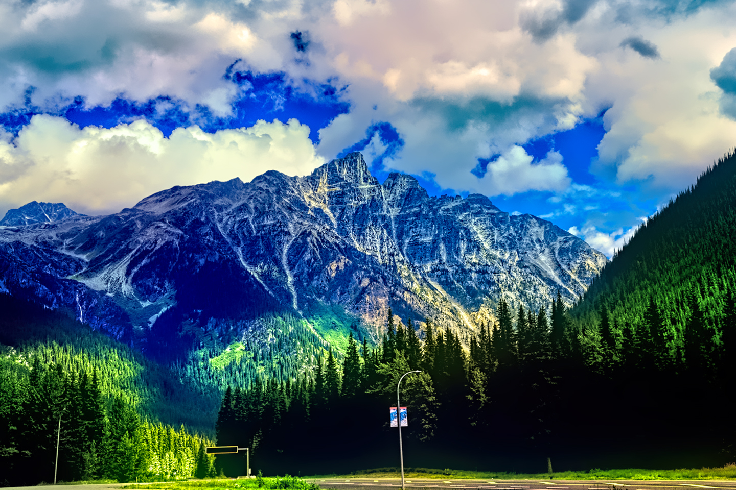
Not a hiker? If you’d prefer to stay in your car, the TCH travels right through the middle of Glacier National Park, and even if all you do is make the drive, you’ll enjoy stunning mountain views in every direction. Be sure to stop at the top of Rogers Pass to check out the monument, and when you get to the bottom, take a good look backwards, to marvel at where you’ve just been! Most of the lodging in the area is in or near Golden, east of the park, or Revelstoke, just west of the park, though there are numerous excellent campgrounds within the park.
MOUNT REVELSTOKE NATIONAL PARK
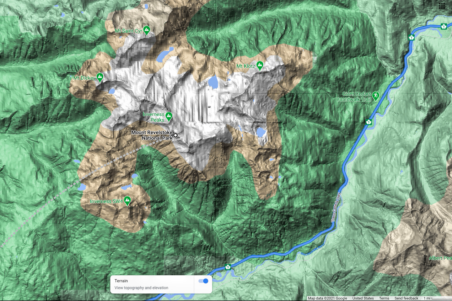
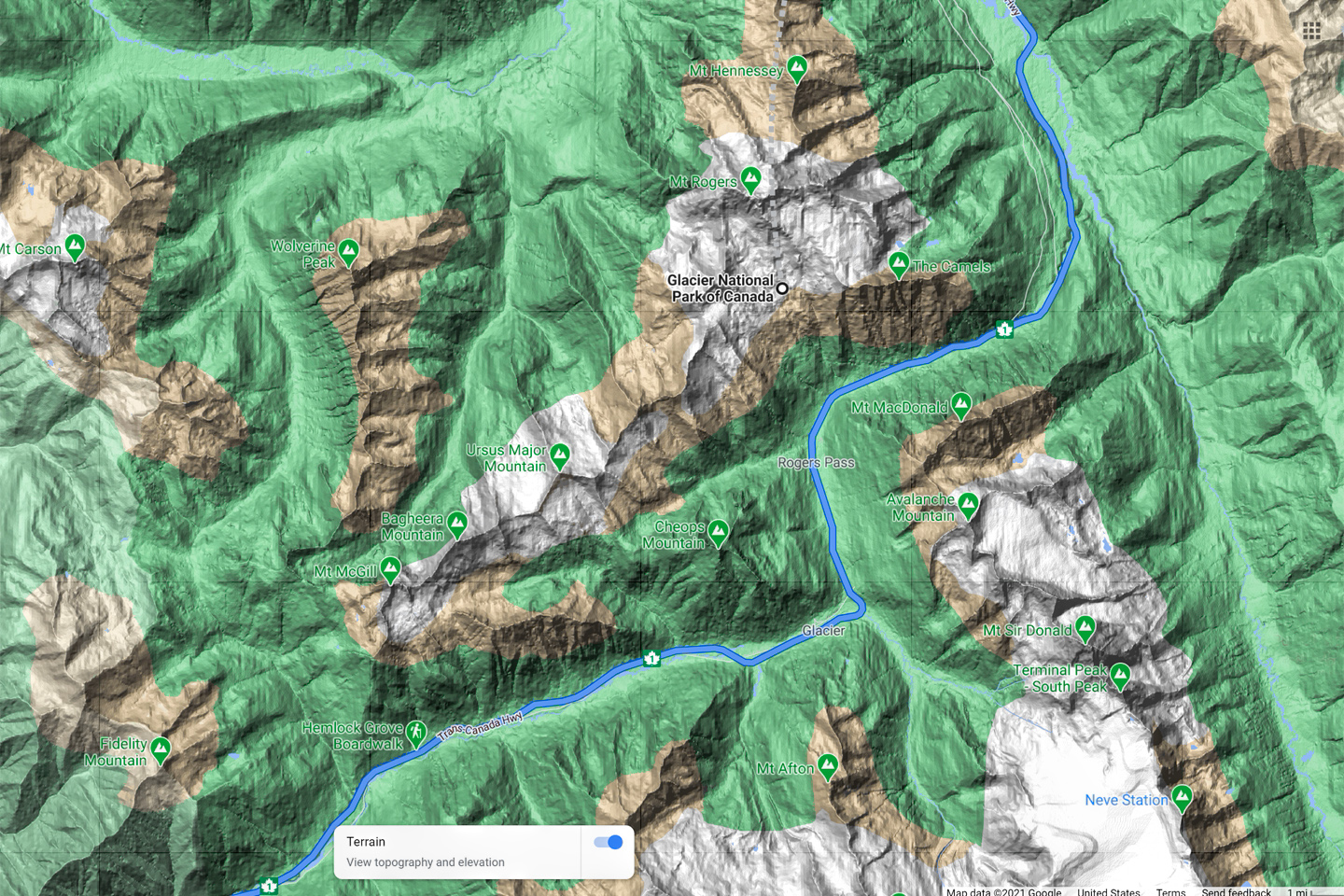
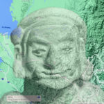
Mount Revelstoke. Topographical Map Data © Google
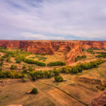
Meadows in the Sky Parkway, Mount Revelstoke National Park
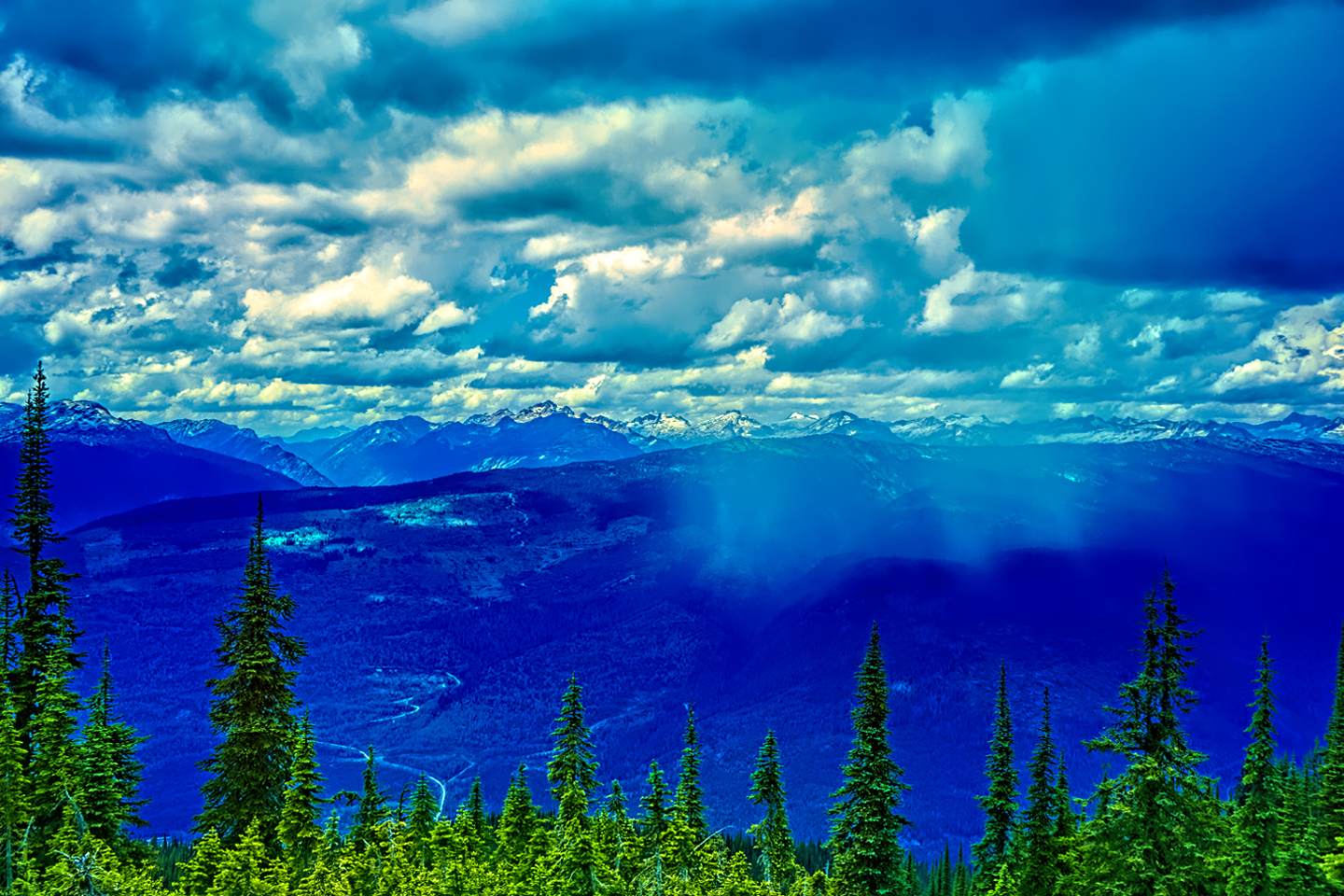
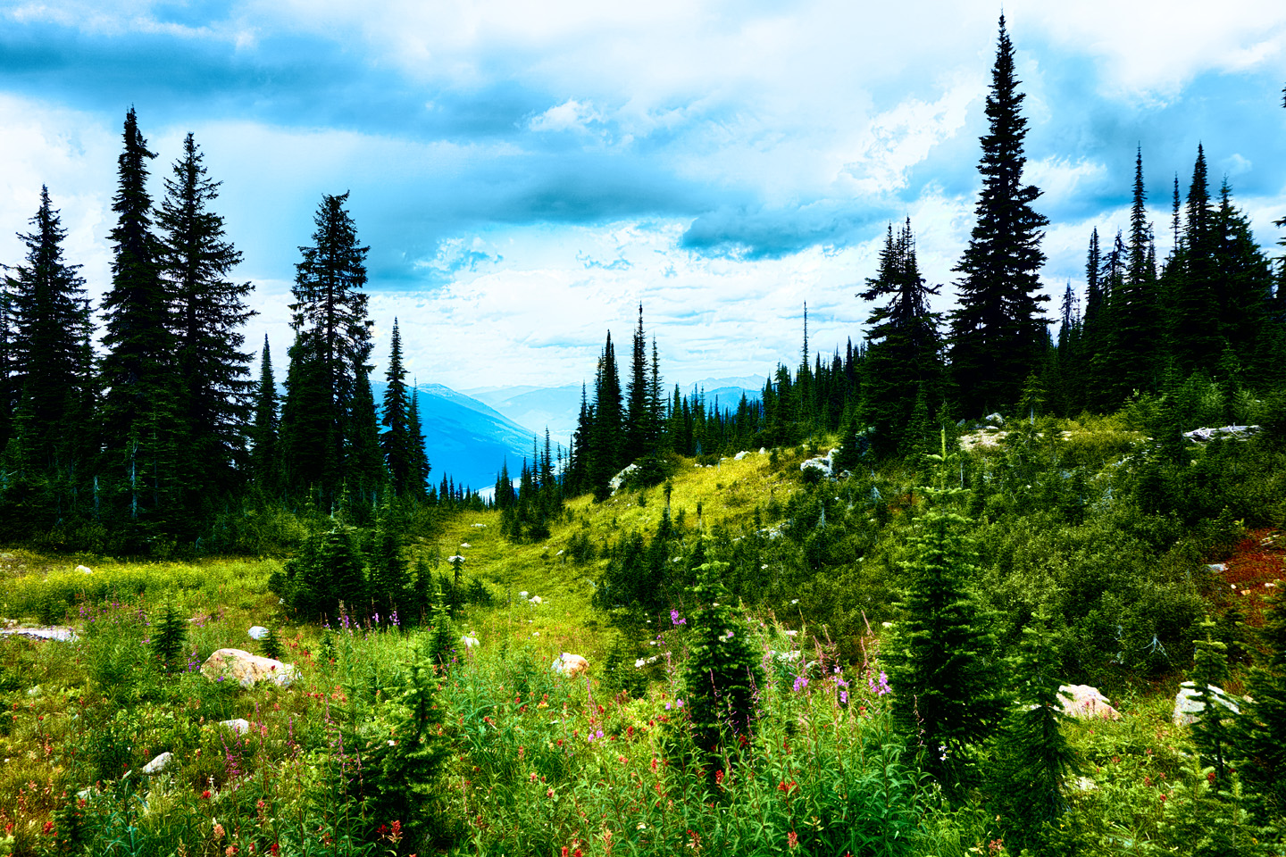
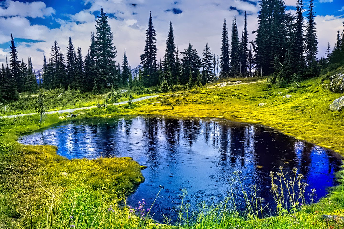
Some folks say that the most interesting attractions in Glacier National Park are actually in Mt. Revelstoke National Park. That is most definitely a matter of opinion, but the two are only 30 miles apart, in very similar terrain, so for a first time visitor, it’s easy to get confused. At a mere 100 square miles in total area, Revelstoke is the smallest of the mountain parks, and even though it’s been around for more than 100 years, it’s almost as if people never got the word about it. This little old park gets just a fraction of the visitors that you’ll see at Banff and Jasper. That makes it a more intimate experience in every respect, and to my taste, that alone makes it well worth the time required to see the best of it.
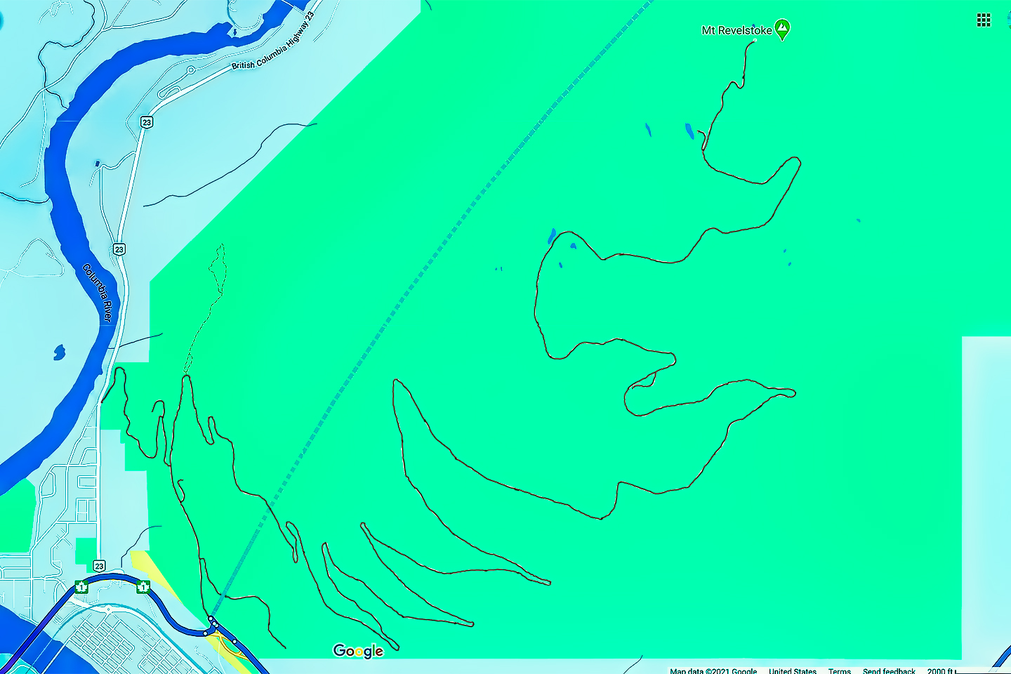
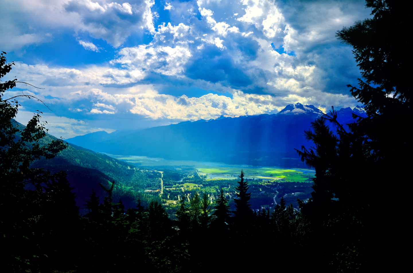
The centerpiece of Revelstoke is it’s namesake mountain, and the most popular activity is the drive up the Meadows in the Sky Parkway, a twisting, turning roller coaster of a road that climbs all the way to the top of the mountain. It’s only 16 miles long, and it’s paved the whole distance, but you’ll gain more than 4,000 feet in elevation, and there are enough hairpins to satisfy the needs of an old-fashioned beauty pageant. Give yourself plenty of time for the drive, and enjoy the heck out of the views! From the top you’ll see the Selkirk Range (of Rogers Pass fame) rising to the sky off to the east, and the majestic valley of the Columbia River curving away toward the northern horizon. Meadows in the Sky is more than just a catchy name for the road. The slopes and meadows near the summit are carpeted with blooms throughout the warmer months, and they will add a gorgeous chromatic counterpoint to your photos of the spectacular landscape.
There are a number of fine hiking trails accessible from the Meadows in the Sky Parkway, many rated as ‘easy’ and requiring no more than 30 minutes to complete. This is a small park, so there is limited access to camping.
Tip: When you come back down from the top of any mountain, mind your brakes on the downhill drive. Even (or especially) if you have an automatic, downshift from drive into a lower gear, and let your transmission slow you down. If you keep your foot on the brakes, you risk heating them up to the point where they won’t work when you need them most.
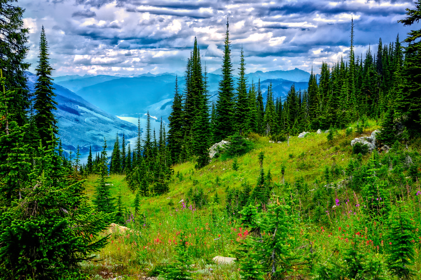
Some of the most expansive views in the Canadian Rockies can be seen from the top of Mount Revelstoke, and the Meadows of the Sky Parkway.
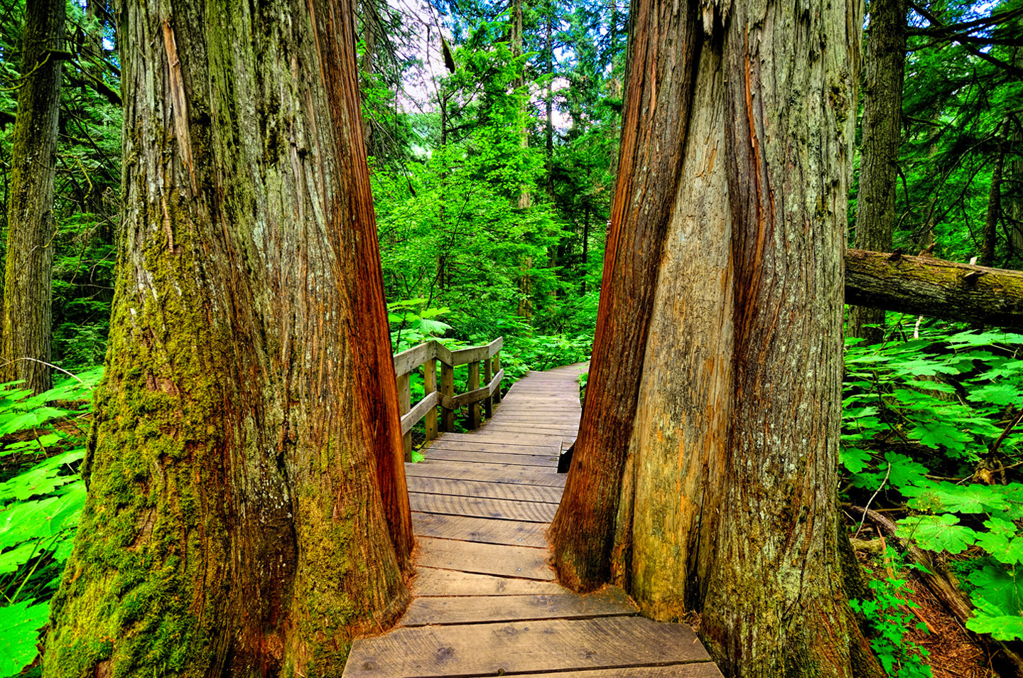
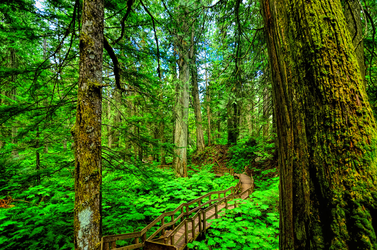
There is, of course, more to Mt. Revelstoke than just the mountain, and once you’re back down on the TCH, you’ll find several standout activities that are right there near the highway, and easy to get to. About 19 miles east of the town of Revelstoke you’ll come to the Giant Cedars Picnic Area, and the start of the half-kilometer long Giant Cedars Boardwalk. This is an absolutely gorgeous stroll through a stand of Giant Cedars that are as much as 500 years old, following a boardwalk made of cedar planks that almost seems like it’s a natural part of the forest, surrounded by lush green undergrowth kept pristine by the railings (which stop visitors from walking where they shouldn’t).
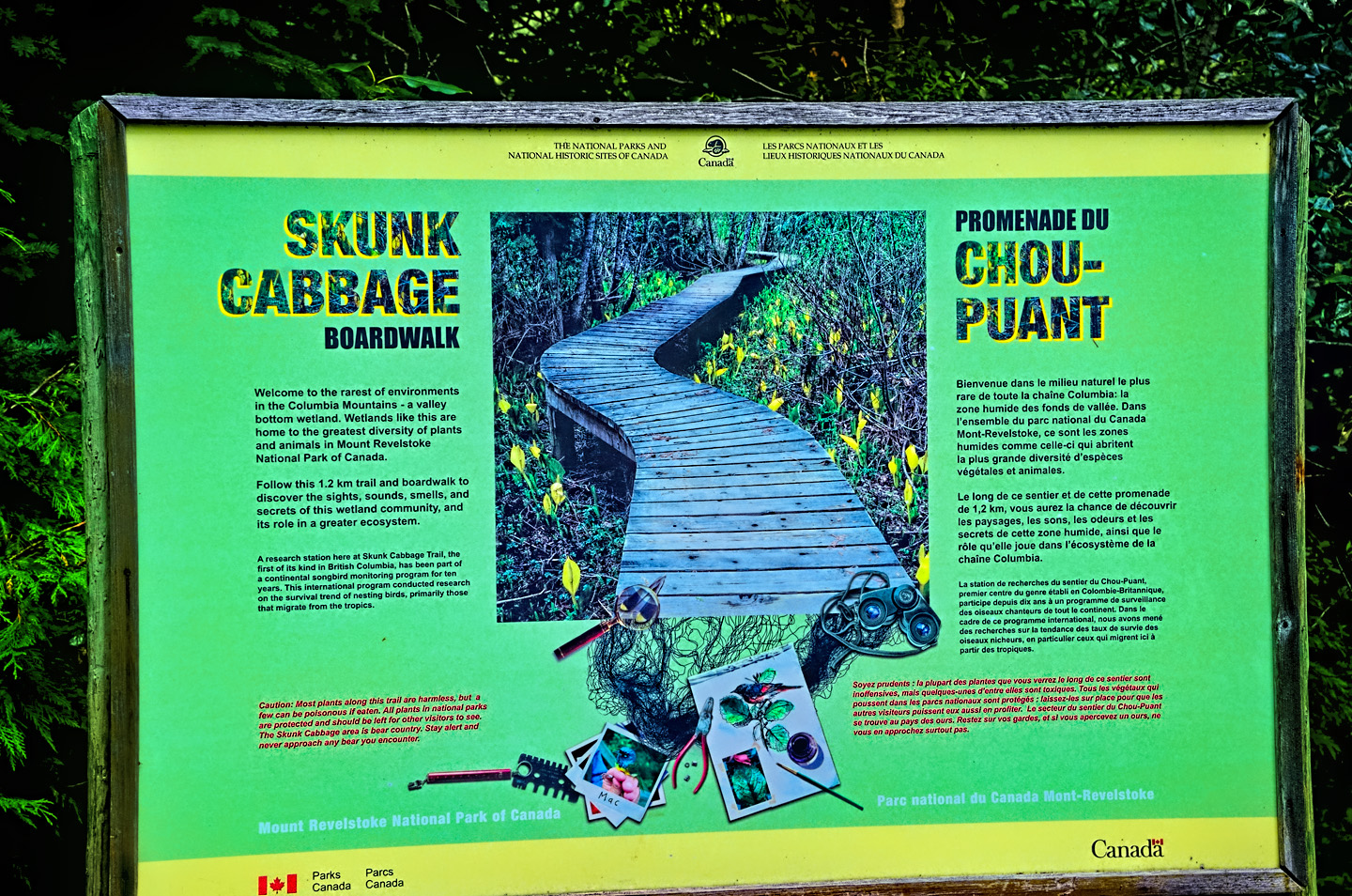
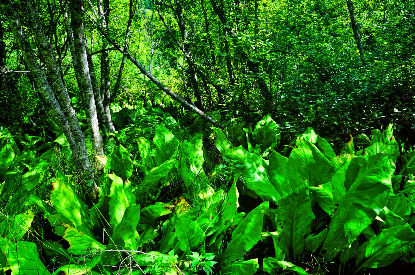
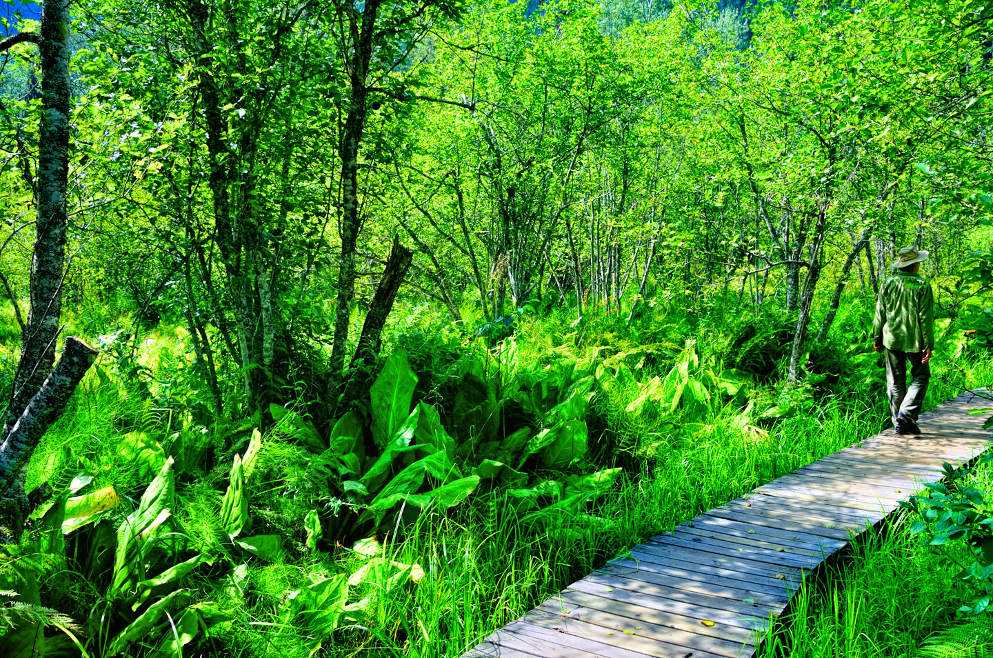
Close by the Giant Cedars Boardwalk is the Skunk Cabbage Boardwalk. This doesn’t sound all that enticing, but don’t let the name put you off. The boardwalk passes through a fascinating swampy ecosystem that’s alive with unusual plants and insects, the giant skunk cabbage being one of the larger examples. You might even spot a muskrat or a beaver, as there are plenty of both in the area. The skunky aroma for which the ‘cabbages’ are best known happens when they’re blooming, or when you crush the leaves. (So whatever you do, don’t crush the leaves!)
Note: if you’re coming from the west, and travelling east on the TCH headed for Banff and Calgary, these two “extra” Canadian National Parks will be right along your line of travel. Now that you know about them, you’ll have no excuse not to slow down and take a closer look!
If you live in Calgary or Edmonton, or even Vancouver, a road trip in the Canadian Rockies is simple to arrange. For the rest of us, it takes a bit of planning, but it’s well worth the trouble. You’ll come away with memories that will last a lifetime!
For more specific information on the Canadian Rocky Mountain Parks–and a LOT more photographs–check out the rest of my Canadian Road Trip series:
Unless otherwise noted, the images in these posts are my original work, and are protected by copyright. They may not be duplicated for commercial purposes.
CANADIAN ROAD TRIPS
This is an interactive Table of Contents. Click the pictures to open the pages.
Canadian Road Trips

Canadian Road Trips: Rolling through the Rockies
The goal here is to get you thinking about the different ways to tie these iconic parks together, and the distances involved, in order to get the most out of a visit to one of the most wonderfully scenic areas on the entire planet.
<<CLICK to Read More!>>

Canadian Road Trips: Banff and Kootenay National Parks
Banff gets four million visitors in an average year, and even though the park covers more than 1.6 million acres, 90% of those four million visitors head straight to the same spot, to Lake Louise, and the Fairmont Chateau.
<<CLICK to Read More!>>

Canadian Road Trips: Jasper and the Icefields Parkway
You'll see glaciers, waterfalls, rushing rivers and turquoise lakes surrounded by wildflowers, all of it fed by steadily melting ice. Snowclad peaks with vibrant green flanks line the road on both sides, and every turnout, every wide spot in the road offers a new and dramatic perspective.
<<CLICK to Read More!>>

Canadian Road Trips: Yoho National Park
Less than five miles along, the first break in the trees offered a glimpse, a flash of improbable color followed by a larger clearing that brought me screeching to a halt. There, beyond the spread of roadside wildflowers and a verge of spindly pines was the most extraordinary lake I had ever seen, backed by an ice-clad mountain.
<<CLICK to Read More!>>

Canadian Road Trips: Glacier and Mt. Revelstoke National Parks
The centerpiece of Revelstoke is it’s namesake mountain, and the most popular activity is the drive up the Meadows in the Sky Parkway, a twisting, turning roller coaster of a road that climbs all the way to the top of the mountain. It’s only 16 miles long, and it’s paved the whole distance, but you’ll gain more than 4,000 feet in elevation, and there are enough hairpins to satisfy the needs of an old-fashioned beauty pageant.
<<CLICK to Read More!>>

Follow the Fireweed
Visualize a summertime journey through that part of the world, a world filled with mountains and glaciers and boreal forests, ice blue rivers, turquoise lakes, and billowing clouds that fill the sky. Imagine your vision as a beautiful piece of music. The fundamental, underlying theme of that symphony would be a gently rising swell of perfect harmony, pinkish lavender in its hue.
<<CLICK to Read More!>>

There's nothing like a good road trip. Whether you're flying solo or with your family, on a motorcycle or in an RV, across your state or across the country, the important thing is that you're out there, away from your town, your work, your routine, meeting new people, seeing new sights, building the best kind of memories while living your life to the fullest.
Are you a veteran road tripper who loves grand vistas, or someone who's never done it, but would love to give it a try? Either way, you should consider making the Southwestern U.S. the scene of your own next adventure.
A few years ago I wrote a book about road trips in Arizona and New Mexico that's a lot like this website, packed with interesting information, and illustrated with beautiful photographs. Check it out! You can find it on Amazon, and at all other major booksellers.

ALASKA ROAD TRIP:
MEXICAN ROAD TRIP (IN THE LAND OF THE MAYA):
ARIZONA AND NEW MEXICO:
SOUTH AMERICA:
PHOTOGRAPHY:
TRIBAL LANDS:
This is an interactive Table of Contents. Click the pictures to open the pages.
Alaska Road Trip

The Alaska Highway: Prelude: The Road to Dawson Creek
Even if you start in Seattle, the closest American city, it’s still more than 800 miles to Dawson Creek, wending your way that much further north, so far north that there will be a noticeable change in the hours of daylight. It’s the latitude that distinguishes the north country, including every bit of Alaska. Dawson Creek is where it all begins.
<<CLICK to Read More>>

The Alaska Highway: Day 1: Dawson Creek to Fort Nelson
Past Fort St. John, the terrain got a lot wilder. No more towns, very few people, and very little traffic. Saw a few U.S. license plates, Michigan, California, Oregon, South Carolina; people that were obviously headed to Alaska!
<<CLICK to Read More>>

The Alaska Highway: Day 2: Fort Nelson to Whitehorse
Every time I rounded a curve in the road there was another stupendous vista; it was nothing short of astonishing! I was literally yipping out loud, and a couple of times I actually pulled over and stopped while I pounded on my chest to “re-start” my heart!
<<CLICK to Read More>>

The Alaska Highway: Day 3: Whitehorse to Beaver Creek
Approaching the mountains, I started pulling over with serious frequency, taking LOTS of photos! Mountains, clouds, lakes, flowers—I was pretty sure I must have died and gone to heaven, but I couldn’t for the life of me remember the fiery crash.
<<CLICK to Read More>>

The Alaska Highway: Day 4: Beaver Creek to Fairbanks
Delta Junction, the end of the Al-Can, was only 200 miles away, and the border? Twenty miles, maybe half an hour, and I was finally going to cross into Alaska! I’d been on the road more than three weeks, and in just half a day more, I’d be in Fairbanks.
<<CLICK to Read More>>

Chena Hot Springs: A Fairbanks Original
The Chena hot spring puts out steaming water at a temperature of 150 degrees, producing enough power to meet all the needs of the resort, as well as filling the hot springs pools used by the guests. In addition to the lodge and restaurant, they offer camping and horseback riding, and they have exhibits featuring sled dogs, greenhouses, ice sculptures, and geothermal energy.
<<CLICK to Read More>>

Two-Foot High Kick: World Eskimo Indian Olympics
Contestants take a running leap, then they make this crazy jackknife move, touch the ball suspended high above the floor with both feet, then come back down and stick the landing. If that sounds difficult? You have no idea.
<<CLICK to Read More>>

Dreaming of Denali
When I drove my Jeep to Alaska that first summer after I retired, my main goal, the single most important thing I wanted to do, was to see Denali, the biggest mountain in North America.
<<CLICK to Read More>>

Follow the Fireweed
Visualize a summertime journey through that part of the world, a world filled with mountains and glaciers and boreal forests, ice blue rivers, turquoise lakes, and billowing clouds that fill the sky. Imagine your vision as a beautiful piece of music. The fundamental, underlying theme of that symphony would be a gently rising swell of perfect harmony, pinkish lavender in its hue.
<<CLICK to Read More>>

Kenai Fjords National Park: Seabirds, Glaciers, and Whales on the Wild Coast of Alaska
At this latitude, during the summer months, the sun stays low in the sky all day, and never really goes down. The traditional “golden hour” when the light is best for landscape photos is extended accordingly, and there are more opportunities for great shots than you’ll know what to do with.
<<CLICK to Read More>>

Kenai Fjords National Park: Exit Glacier: Up Close and Personal
Compared to the huge tidewater glaciers that flow directly into the sea along the coast of Kenai Fjords, Exit Glacier is just a baby–a baby that’s getting smaller every year–but it’s still big enough to permanently alter the landscape through which it passes.
<<CLICK to Read More>>
There’s nothing like a good road trip. Whether you’re flying solo or with your family, on a motorcycle or in an RV, across your state or across the country, the important thing is that you’re out there, away from your town, your work, your routine, meeting new people, seeing new sights, building the best kind of memories while living your life to the fullest.
Are you a veteran road tripper who loves grand vistas, or someone who’s never done it, but would love to give it a try? Either way, you should consider making the Southwestern U.S. the scene of your own next adventure.
A few years ago I wrote a book about road trips in that area that’s a lot like this website, packed with interesting information, and heavily illustrated with beautiful photographs. Check it out! You can find it on Amazon, and at all other major booksellers.


Recent Comments