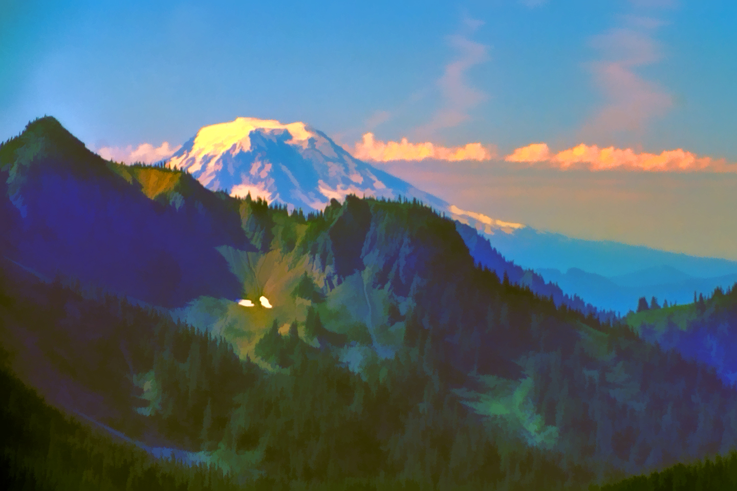
The State of Washington has a population of almost eight million people, and more than half of them live in or near Seattle, the 15th largest metropolitan area in the U.S. There are several things that all those folks have in common: An extremely high cost of living (it’s the 8th most expensive place to live in the U.S.); Mildew in their closets (from the damp, rainy weather); And! When it’s not hidden by clouds, a stunning view to the southeast of 14,411 foot Mount Rainier, an enormous stratovolcano that dominates the horizon, just 59 miles away. This iconic peak is part of the Cascade Range, and the “Ring of Fire,” the chain of volcanoes that encircles the Pacific Ocean.
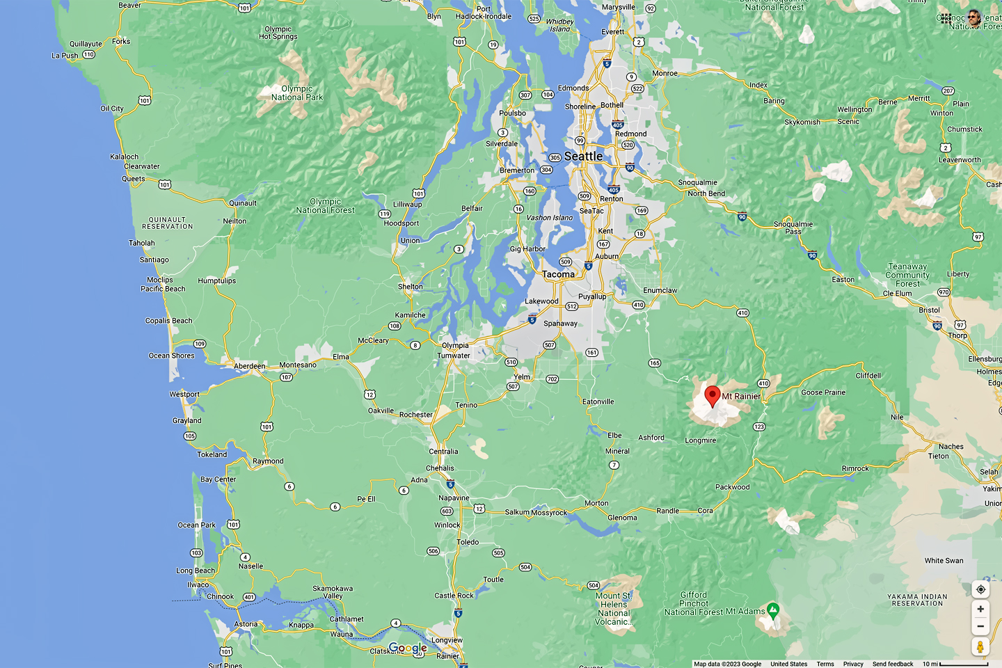
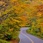
Seattle Area Highways
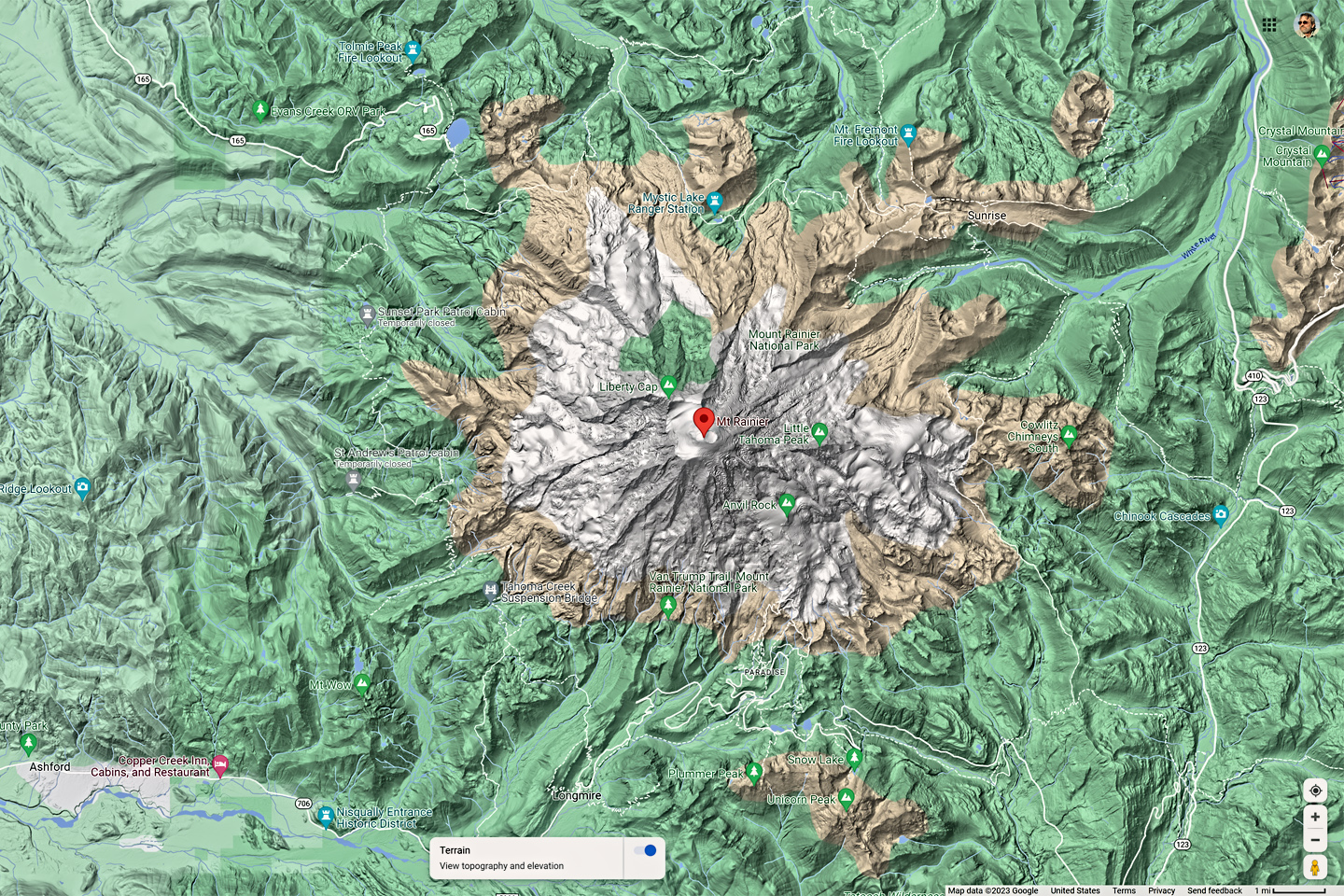
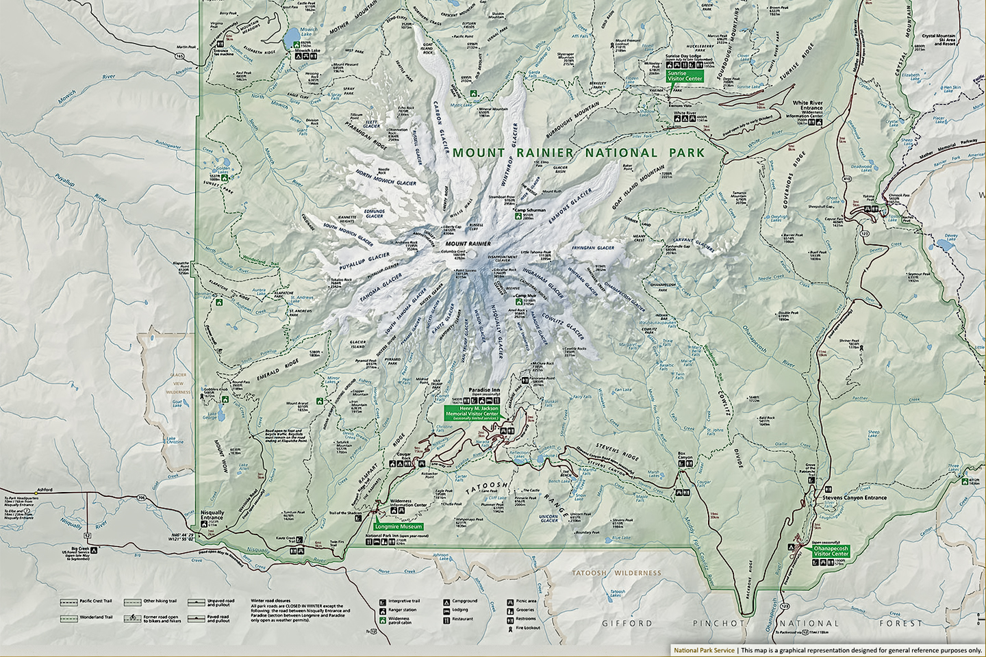
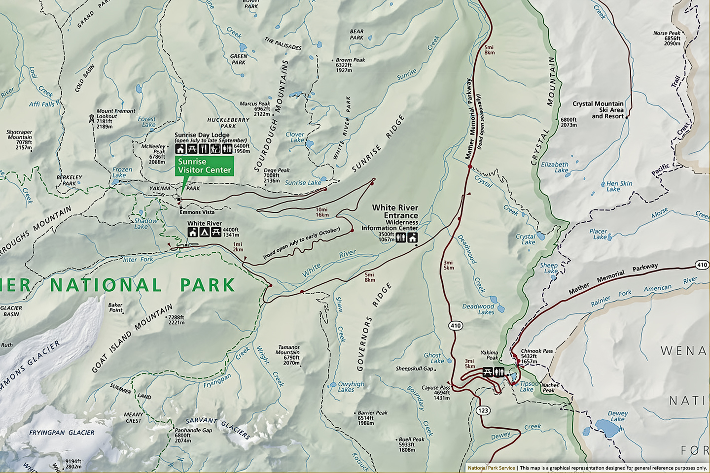
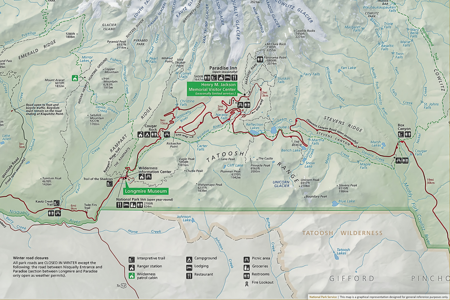
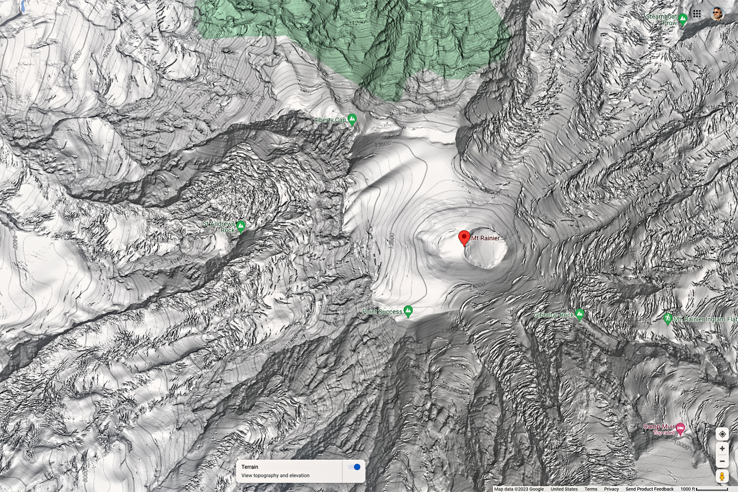
Satellite View of terrain © Google; Map of Mount Rainier National Park © N.P.S.
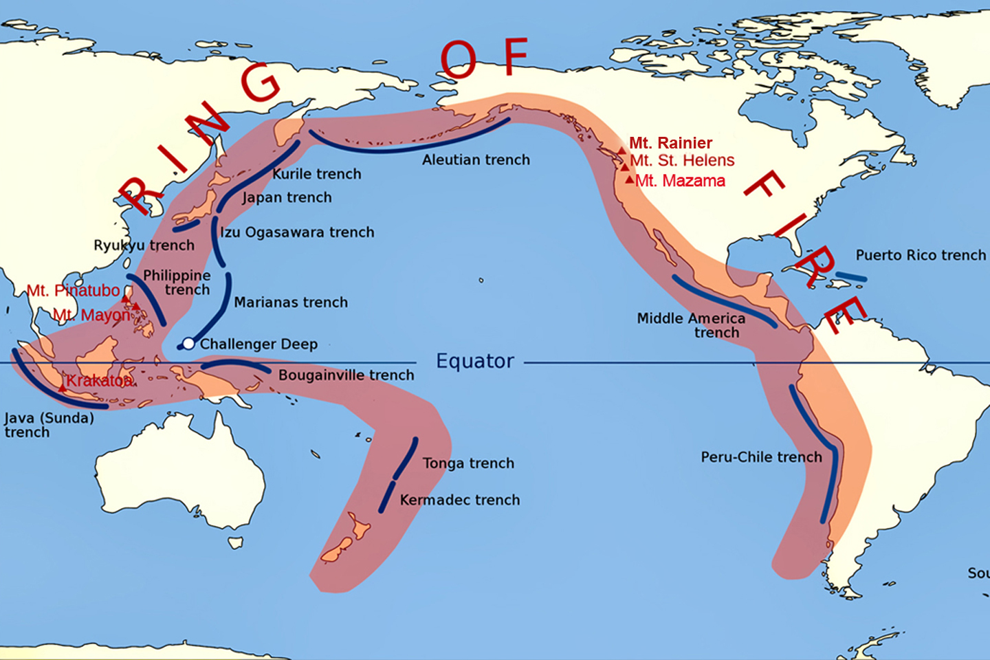
The Ring of Fire is a chain of active volcanoes, including Mount Rainier, that essentially encircles the Pacific Ocean.
It’s a beautiful mountain, especially when seen from a distance, but Mount Rainier is still very much an active, fire breathing volcano. When it erupts again, as it’s bound to do at some point, it will pose a major threat to life and property in the surrounding area. The last major eruption was more than 500 years ago, but there were a number of smaller events as recently as the 19th century, during the early days of Seattle’s modern history.
The biggest danger from the mountain isn’t from pyroclastic lava flows or clouds of ash; it’s from the glaciers that cloak the upper reaches of our nation’s tallest volcano. Rapid melting caused by even moderate amounts of lava would create potentially catastrophic mud flows, known as lahars, that would accelerate down the steep slopes, destroying everything in their path. Warming weather associated with climate change is slowly but surely reducing the size of the glaciers; if that trend continues, the danger from lahars may well be rendered moot. It’s a sad fact that even the oldest glaciers are disappearing, all over the world, and that’s just one symptom of a massive imbalance in our planet’s equilibrium.
The mountain is closely monitored by the Cascades Volcano Observatory (CVO), using sophisticated equipment that can detect even the slightest movement of molten rock, deep within the mountain. That, along with various other seismic indicators, provides an early warning of any potential eruption. As many as 80,000 people live in the danger zone; the warning system would give them anywhere from a few days to a week to evacuate. Some people might find that worrisome, but most local residents feel safe enough. Many have lived their entire lives there, for multiple generations, and it’s doubtful that they’d be happy anywhere else.
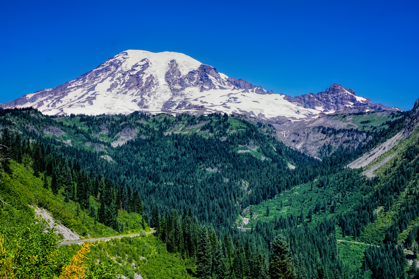
The potential threat is even less of a deterrant to the millions of people who visit the area every year, many of them all but unaware of the mountain’s sinister side. Most travelers enjoy Mount Rainier for what it is during its resting phase: a majestic mountain peak with a glistening crown of snow, surrounded by a pristine wilderness, where recreational opportunities abound.
MOUNT RAINIER NATIONAL PARK
Like any major mountain in any part of the world, Mount Rainier has always been sacred to the Native tribes living in the area, and that’s easy enough to understand. It’s an infallible landmark, and the home of mountain gods. It’s also a terrific place to hunt game, harvest wild berries, and gather cedar bark, commodities that were primally important to roving bands of hunter/gatherers. Archaeologists have discovered evidence of human occupation dating back as much as 9,000 years, and that’s some seriously deep roots, by any standard.
Captain George Vancouver of the British Navy first observed the mountain in 1792, while surveying the Pacific Coast for the British Crown, and he named it for his friend, Rear Admiral Peter Rainier. The mountain had many other names, epecially among the many different tribes that lived in its shadow, but Rainier is the one that stuck. That’s ironic, in a way, because the Admiral had no connection to the area, and never so much as laid eyes on the mountain that bears his name.
Efforts to preserve the pristine nature of the mountain and surrounding forests started early. As far back as 1893, a coalition of scientists, mountaineers, conservation groups, and local businesses, including several large railroad companies started lobbying Congress to make Mount Rainier a National Park. Parks managed by the government were still a new idea at the time, and a conservative Congress was reluctant to approve anything that was likely to cost money. Rainier’s backers were able to make the case that a National Park in the area would pay for itself in the long run, so in 1899, the bill was passed, and Mount Rainier National Park became the fifth location in the United States to receive the necessary convoluted approval. Today, largely because of its close proximity to a major urban center, Mount Rainier is one of the most popular National Parks in the U.S. system, with 2.4 million visitors annually.
GETTING THERE
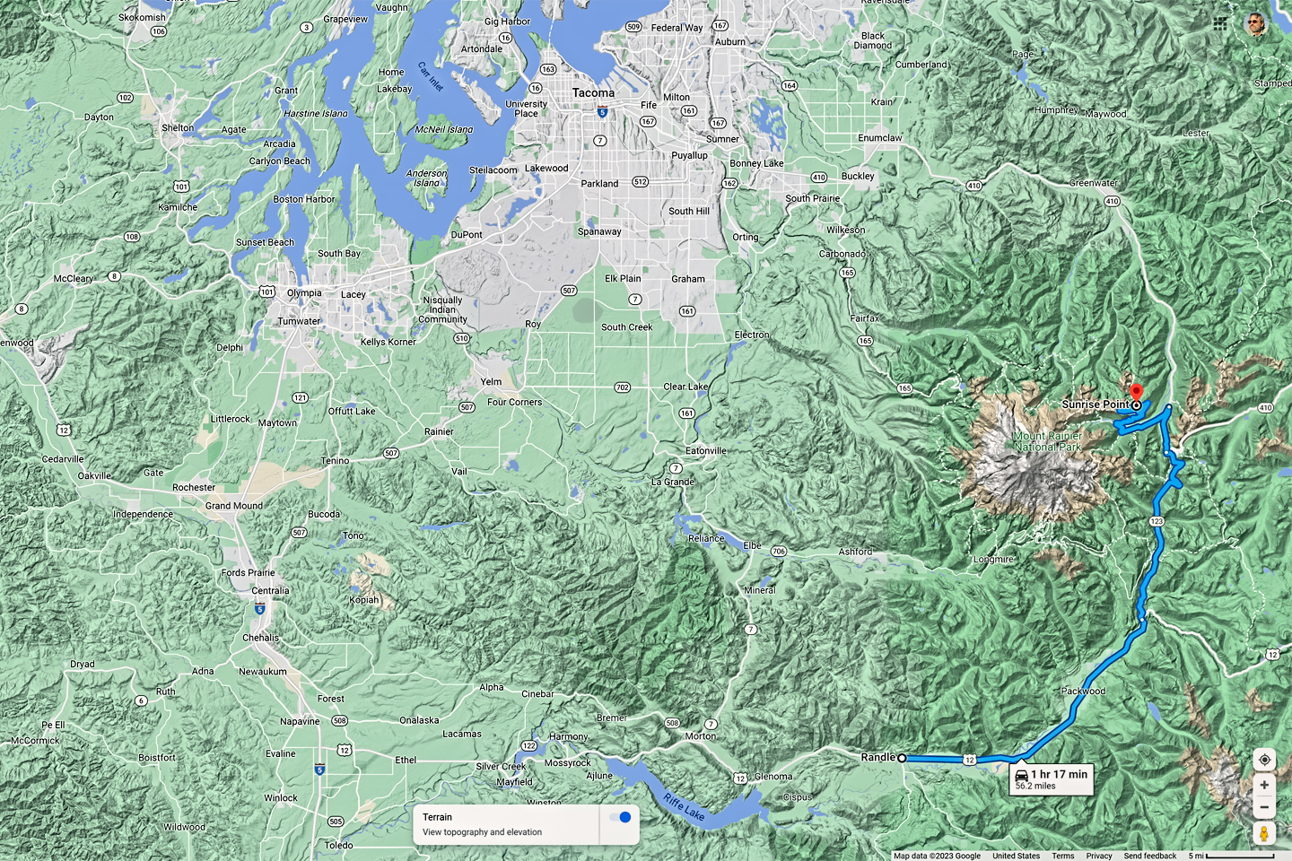
From anywhere in the Seattle Metropolitan Area, find Interstate 5, and take it toward Tacoma. Be on the lookout for Washington State Route 167, or SR 512, either of which will take you to Puyallup. From there, take SR 410 through Buckley, to Enumclaw. From Enumclaw, follow SR 410 east, then south for a total of 39 miles, to the White River and Sunrise access road on the east side of the National Park.
Keep going on SR 410, a few miles beyond the White River access road to SR 123, which will take you ten miles further south to Stevens Canyon Road. That’s where you’ll find the Stevens Canyon entrance to the National Park, and a beautiful drive, with numerous overlooks offering extraordinary views of the mountain. You can reach the National Park more directly from Tacoma by following SR 7 or SR 161 south to Elbe, and taking SR 706 east, through Ashford, into the park.
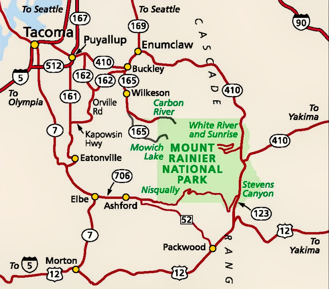
Mount Rainier National Park: Area Highways (map © NPS)
If you’re coming from the south, or from the east, look for US 12, which connects to both Interstate 5 and Interstate 82. US 12 passes quite near the Stevens Canyon entrance at the southeast corner of the National Park.
The web of Washington State Highways surrounding Mount Rainier can be confusing, especially for first time visitors. You should always carry good paper maps on any road trip, and you should know how to read them, but this is one of those situations where there’s no shame in using your GPS to point the way.
Tip: Bold Blue Text in narrative or captions always links to a web page with more information
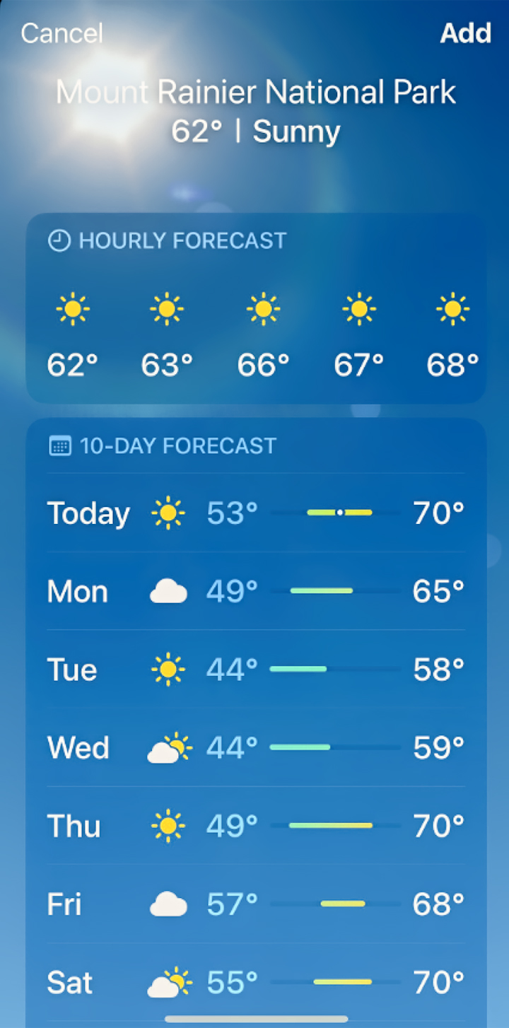
If the main purpose of your visit is photography, you’re going to need a sunny day, and the weather at Mount Rainier is notoriously fickle, with clouds obscuring the view more often than not, with snow possible every month of the year. Check the weather forecast before you go, and try to pick a day with good odds for clear skies.
The “golden hour” surrounding both the sunrise and the sunset is an ideal time for landscape photography. To take full advantage, stay the night as close to the National Park as possible.
There are two historic lodges inside the park: The National Park Inn, and the Paradise Inn. There are also three campgrounds with spaces that can be reserved: Cougar Rock, Ohanapecosh, and White River.
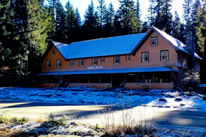
National Park Inn, Longmire Historic District; open all year.
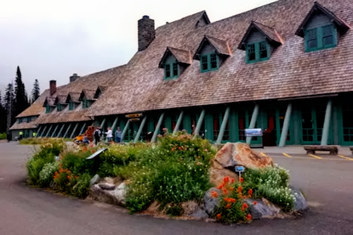
Paradise Inn, in Paradise; open in summer only
If you’re planning a trip to this, or any other popular National Park, be sure to make reservations for lodging or camp sites as far in advance as possible. One advantage to Mount Rainier over other, more remote National Parks is the availability of lodging alternatives. All of the nearby cities and towns have a wide variety of options; not quite as convenient as the campsites and historic lodges inside the park, but far more likely to be available on short notice.
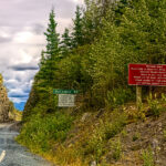
CLOSURES AND RESTRICTIONS: 2025 SEASON
Park Closures
SR165 Carbon River/Fairfax Bridge is closed: no access to Carbon River or Mowich Lake.
Information
-
Timed Entry Reservations will be required for the Sunrise Corridor ONLY in summer 2025.
A timed entry reservation is required only for the Sunrise Corridor in the northeast corner of the park from 7:00 am to 5:00 pm daily from July 11-Sept 1, 2025, then on weekends and holidays from Sept 2 through end of the season (typically mid-October).more
-
Ohanapecosh Campground area closed for construction in 2025.
The entire Ohanapecosh Campground area is CLOSED for the duration of the construction project, including all campsites, visitor center, restrooms, picnic area, & Ohanapecosh river access.more
-
Expect 30 min delays on SR123 in the southeast corner of the park.
Expect 30 min delays, gravel road, and reduced speed limits on a 2.8 mile section of SR123 from Laughingwater Creek Bridge (milepost 2.5) to Panther Creek Bridge (milepost 5.2).more
-
Expect travel delays due to pavement preservation work on the west side of Mount Rainier NP.
Pavement preservation work will include patching, resurfacing, and striping all roads, pullouts, and parking areas on the west side of the park, including Longmire, Paradise, & Stevens Canyon. Expect delays of up to 30 min, 7 am-7 pm, Mon-Fri.more
-
Expect long lines at entrances on weekends.
Lengthy delays are likely at the southwest park entrance on SR706 on weekends. Check Google Maps for backup (represented by the orange/red line) at link below. Please do not block driveways or roads while in line outside the park.more
-
Fire ban in effect June 10 until further notice.
All campfires and the ignition of wood, briquettes, or any fuel in fire pits, fire pans, and barbeque grills is prohibited. This ban is in place to reduce the risk of human-caused wildland fire.
- Grove of the Patriarchs – The Grove of the Patriarchs is CLOSED to all public entry due to flooding in November 2021 which caused significant damage to the suspension bridge that provides the only safe access to the area (News Release, 11/17/21). See the attached emergency regulation signed by the Deputy Superintendent. The Grove of the Patriarchs Trail will remain closed until the bridge can be replaced, which will first require a series of environmental evaluations and engineering work to reevaluate the bridge design. During the closure, the Grove of the Patriarchs parking lot and restrooms have normal seasonal access, along with the Eastside and Silver Falls Trails. Construction to replace the bridge is scheduled to begin summer 2027. Summers represent the only viable construction season in the park due to the heavy snow that blankets the park from roughly November through May.
- Please remain alert to your surroundings at all times and be aware of geohazards. Report any unusual stream flow or conditions to a park ranger.

TIPS FROM AN OLD PHOTOGRAPHER

 The automatic settings on modern digital cameras give you properly exposed images, just about every time, but you should resist the temptation to rely on them exclusively. Use aperture priority when you want to manually control the depth of field, and shutter priority when you want to blur or freeze motion. If you don’t have a tripod in a low light situation, don’t be afraid to manually increase the ISO.
If your camera is capable of shooting RAW image files, always choose that option. RAW files give you maximum versatility during post-processing, and can always be converted to shareable jpg after-the-fact.
Again, assuming your camera has this capability, you should always bracket your exposures: take a rapid series of three frames: one correctly exposed, one overexposed by one f stop, and one underexposed by one f stop (most better cameras have an automated setting that makes this very easy to do). You’ll find that the “correct” exposure doesn’t always yield the best result, especially in tricky lighting situations. (Also, if you ever want to try your hand at HDR (High Dynamic Range) image processing, you’ll need bracketed exposures to get you started.)
The brand name high speed memory cards are more expensive, but they’re built to a higher standard than the discount generics, so they’re well worth the difference. Buy only the best, and always carry plenty of spares.
FROM MY SOAP BOX:
There’s a difference between photos taken for documentary purposes, such as journalism, and photos taken as a means of artistic expression. Documentary photos are WYSIWYG’s (What You See Is What You Get). You don’t “Photoshop” an image that purports to represent an actual time. place, or event. When a photo is “art,” however, the sky is the limit, and modern day imaging software is magical. The “purists” who decline to use it are missing out, and missing the point!
PLANNING YOUR MOUNT RAINIER PHOTO SHOOT
Crowds are a fact of life in our National Parks, and the best way to minimize them is to get an early start. Not everybody likes to get moving before breakfast, but if you’re serious about your photography, you’ll come to accept it as necessary–or at the very least, desirable, because you not only get minimal crowds, you also get some of the best natural light of the day. Personally, I’ve always been big on sunrise photography. I’m fascinated by the whole sequence, from the misty gray dawn, through the first glow on the horizon, to the moment when the bright rays of the sun burst across the landscape and illuminate the scene with a golden glow.
All of those factors duly considered, sunrise is, in my opinion, the best time to begin your Mount Rainier photo shoot, and, as it happens, Sunrise is also the best place for you to start your day in the National Park. I’m talking about Sunrise Point, which, at 6,400 feet, is the highest spot you can drive to on the slopes of this sleeping volcano.
The itinerary that I’m about to describe makes a good day trip. You can take your time, and still cover it reasonably well in six hours or so, all from the road, with no hiking involved. If you’re able to spread your visit across more than one day, that’s even better, because you’ll be able to explore each of these locations in greater depth, taking in some of the trails.
The main point I’m making here is really very simple: by starting in Sunrise and finishing in Paradise, you’ll have good light on the mountain throughout the day. (As long as the weather cooperates).
SUNRISE
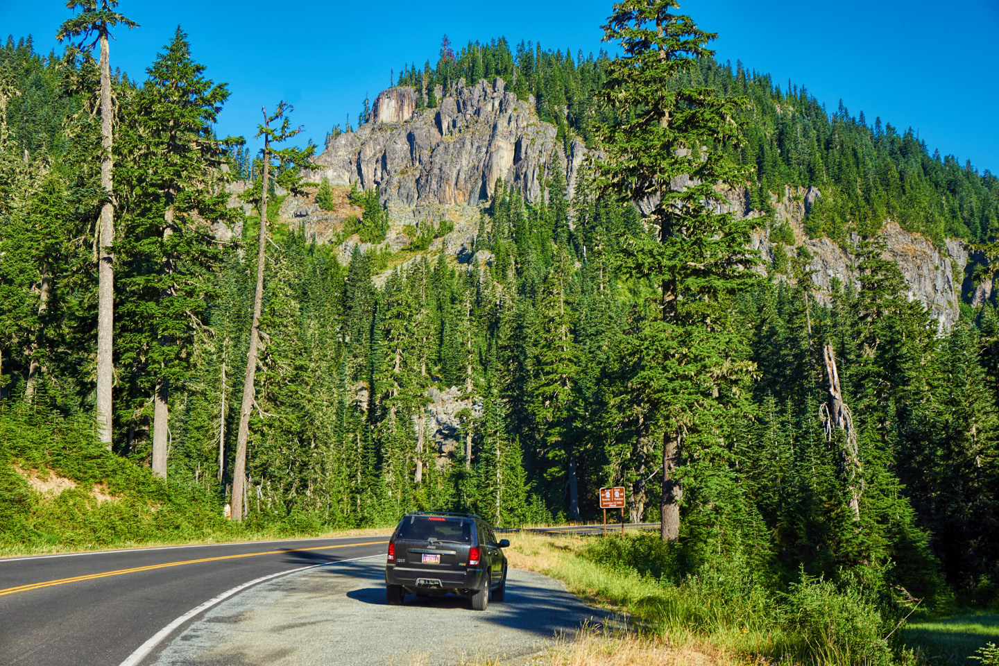
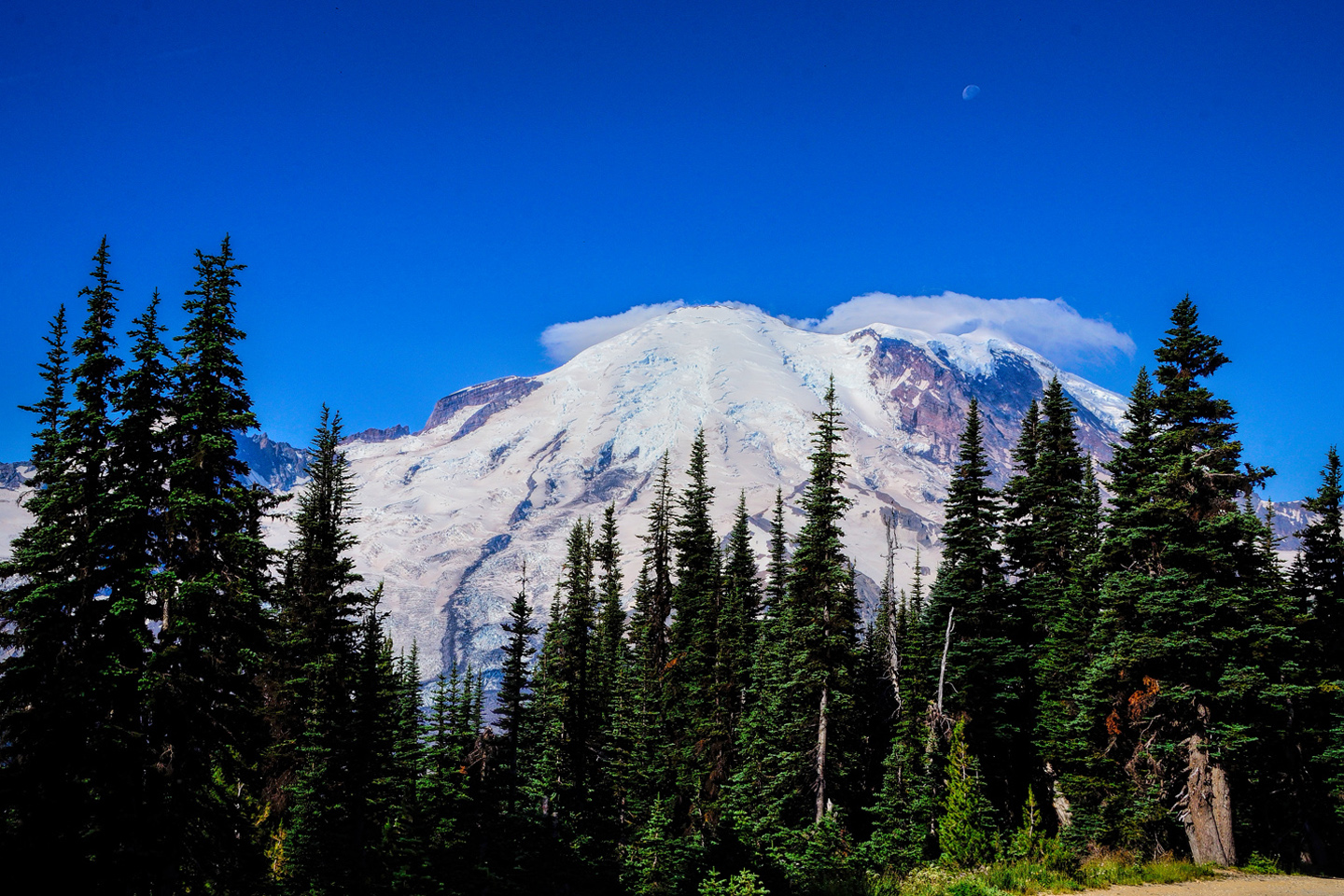
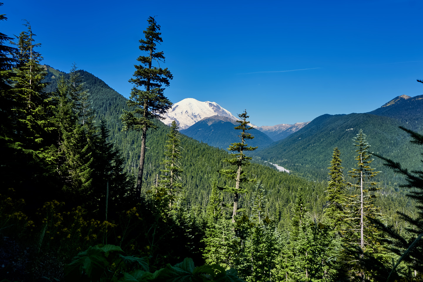
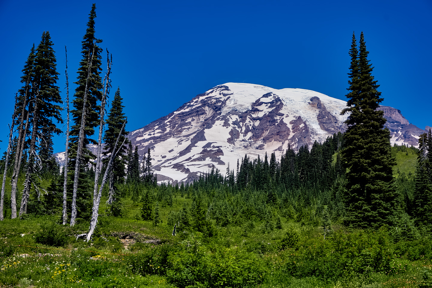
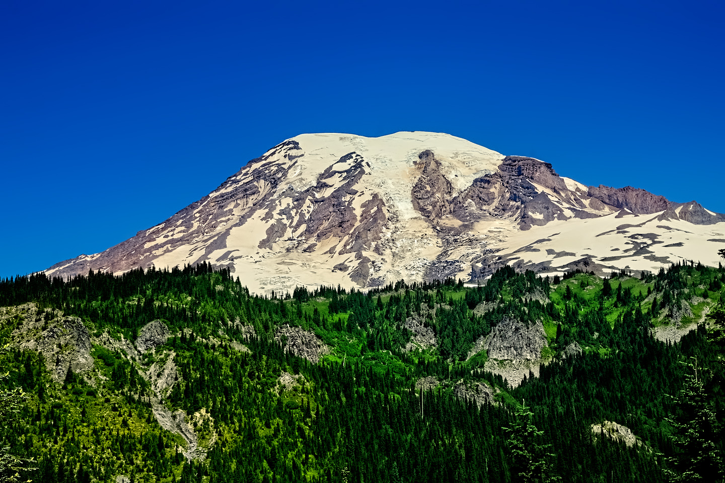
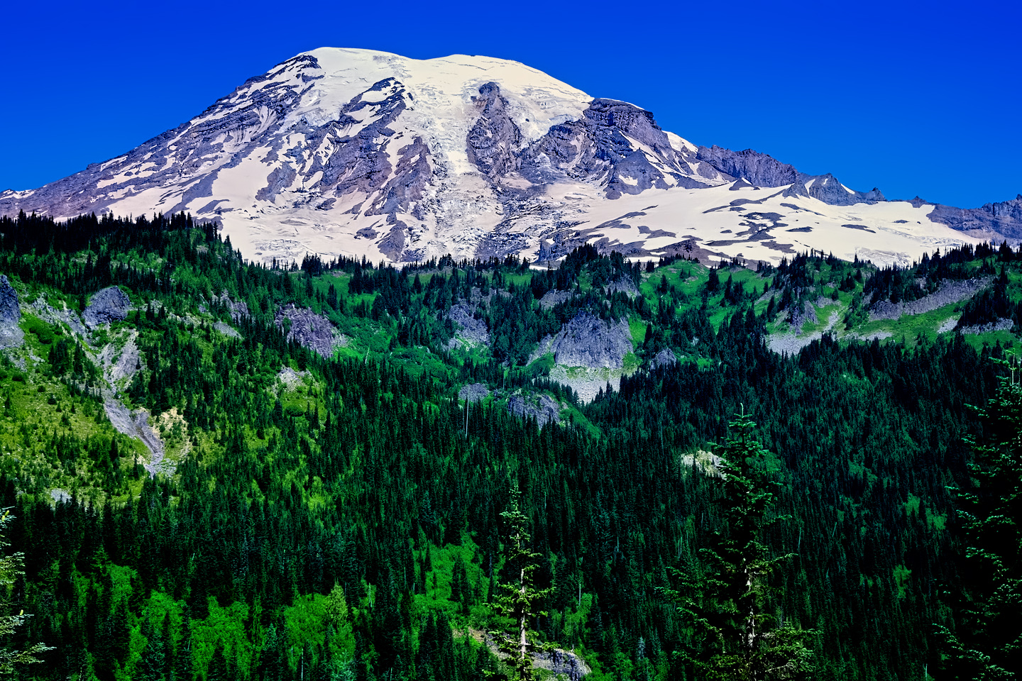
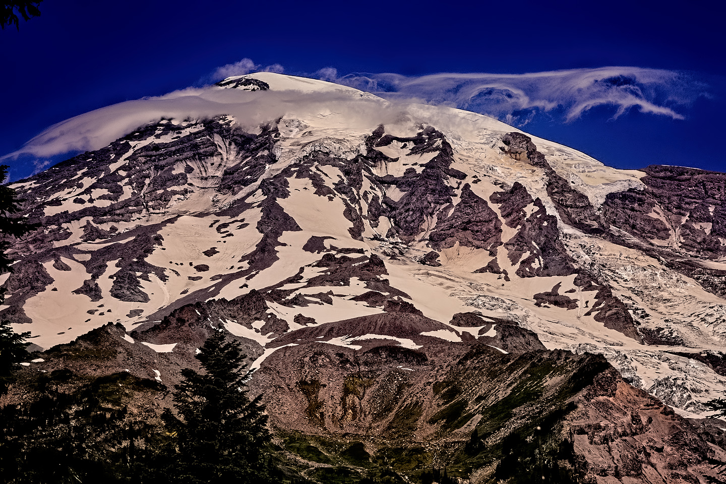
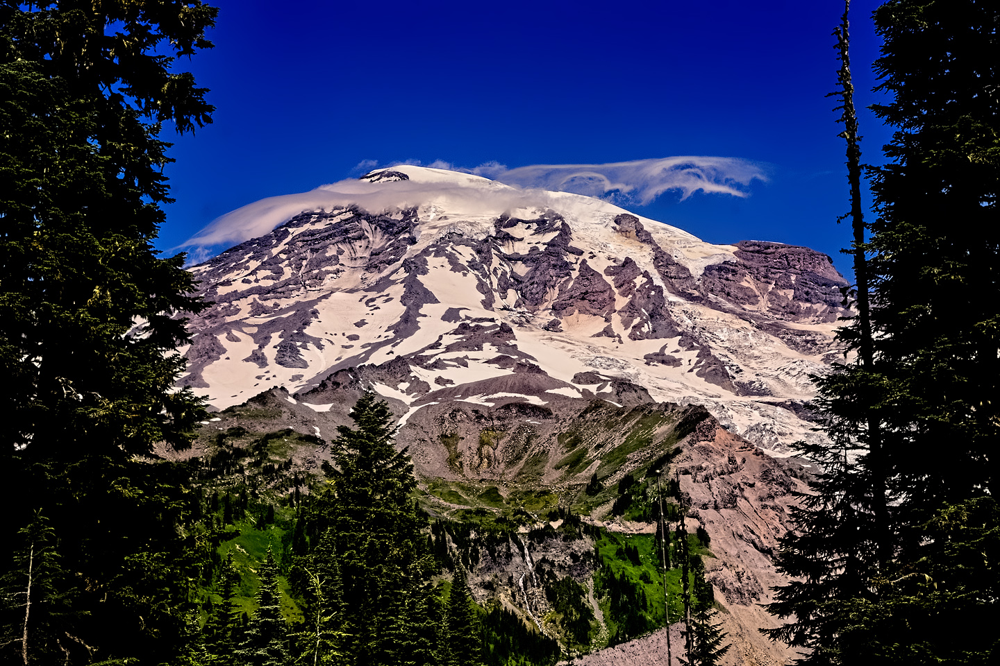
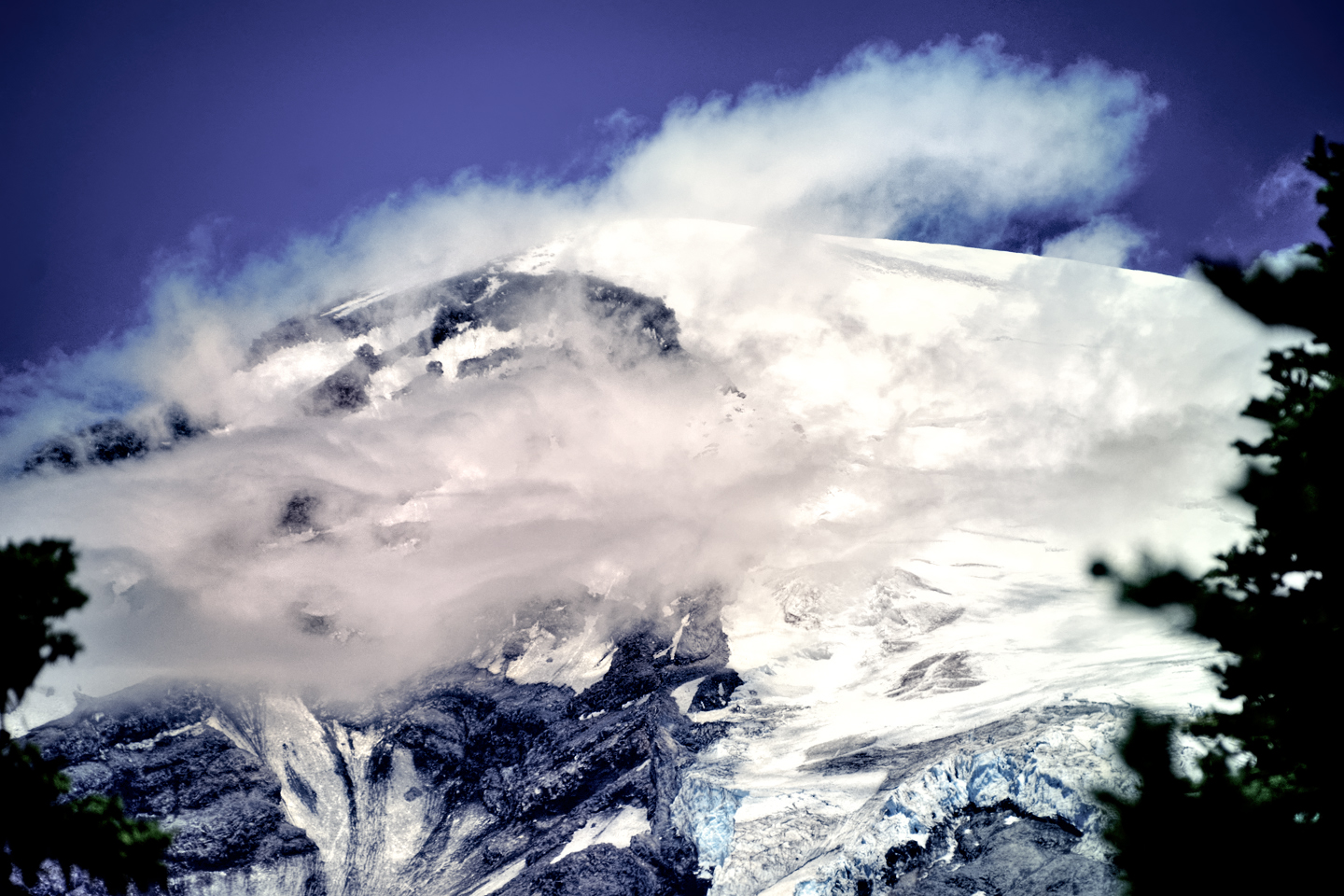
Washington State Route 410, also known as the Mather Memorial Parkway, takes you to the White River/Sunrise Park entrance to Mount Rainier N.P. From the highway, Sunrise Park Road, open seasonally, winds its way up the mountain some 15.5 miles to the Sunrise Visitor Center and Day Lodge. There are numerous hiking trails accessible from Sunrise Park Road, but you don’t even have to leave your vehicle to enjoy spectacular views of the mountain, which grows ever closer as you climb ever higher on switchbacks.
Getting to Sunrise Point, Mount Rainier National Park
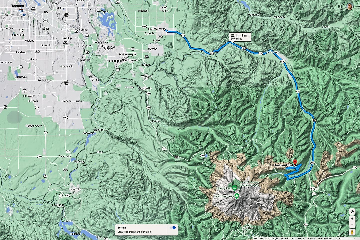
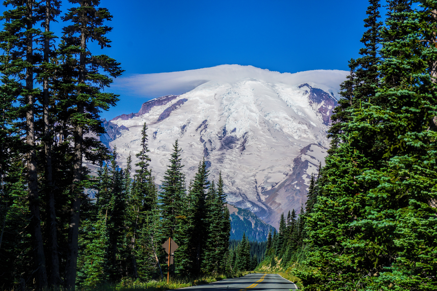
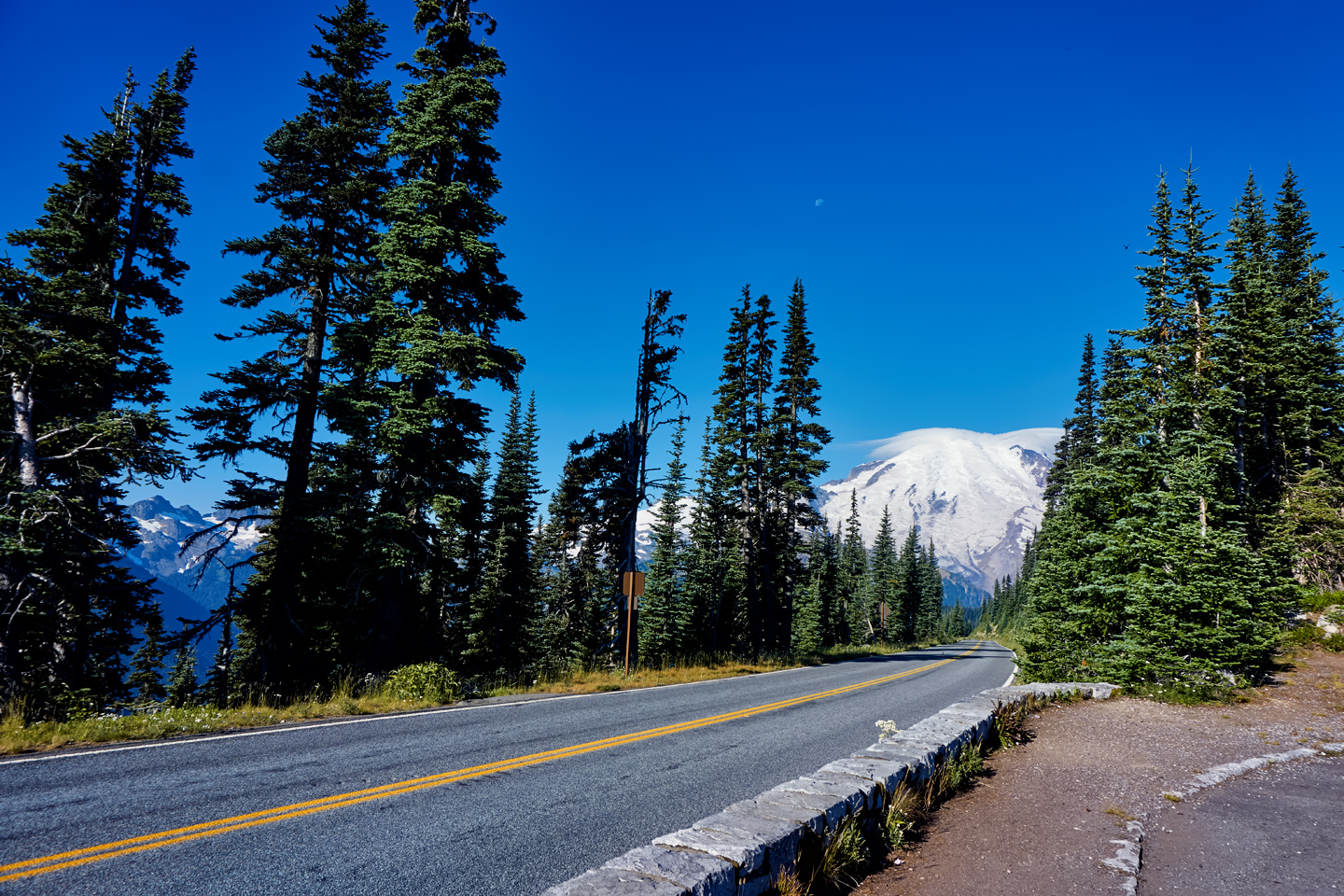
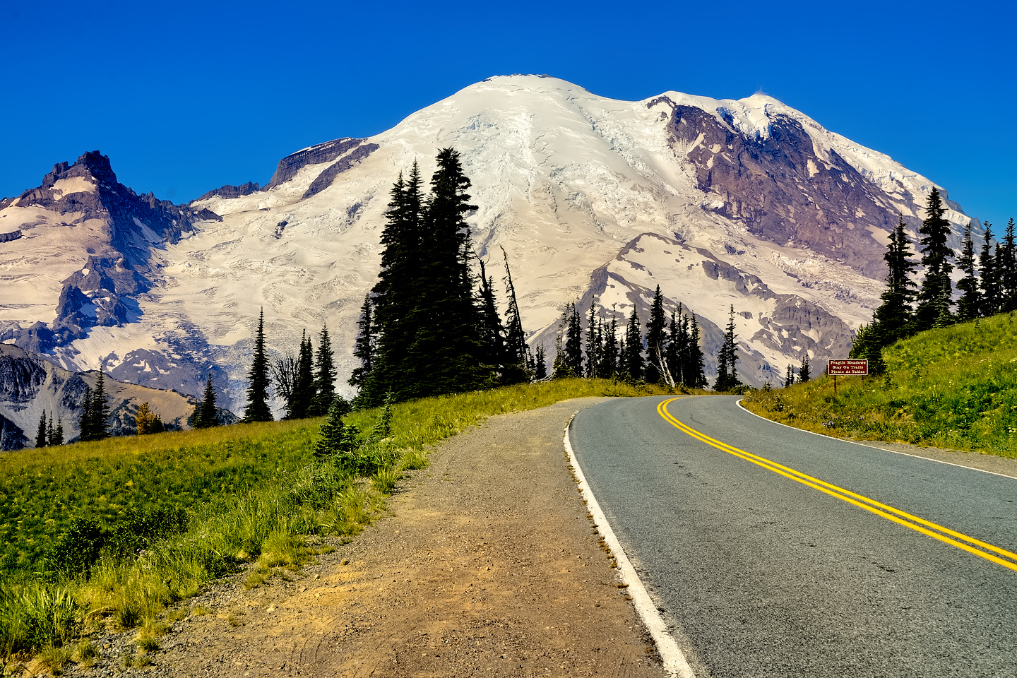
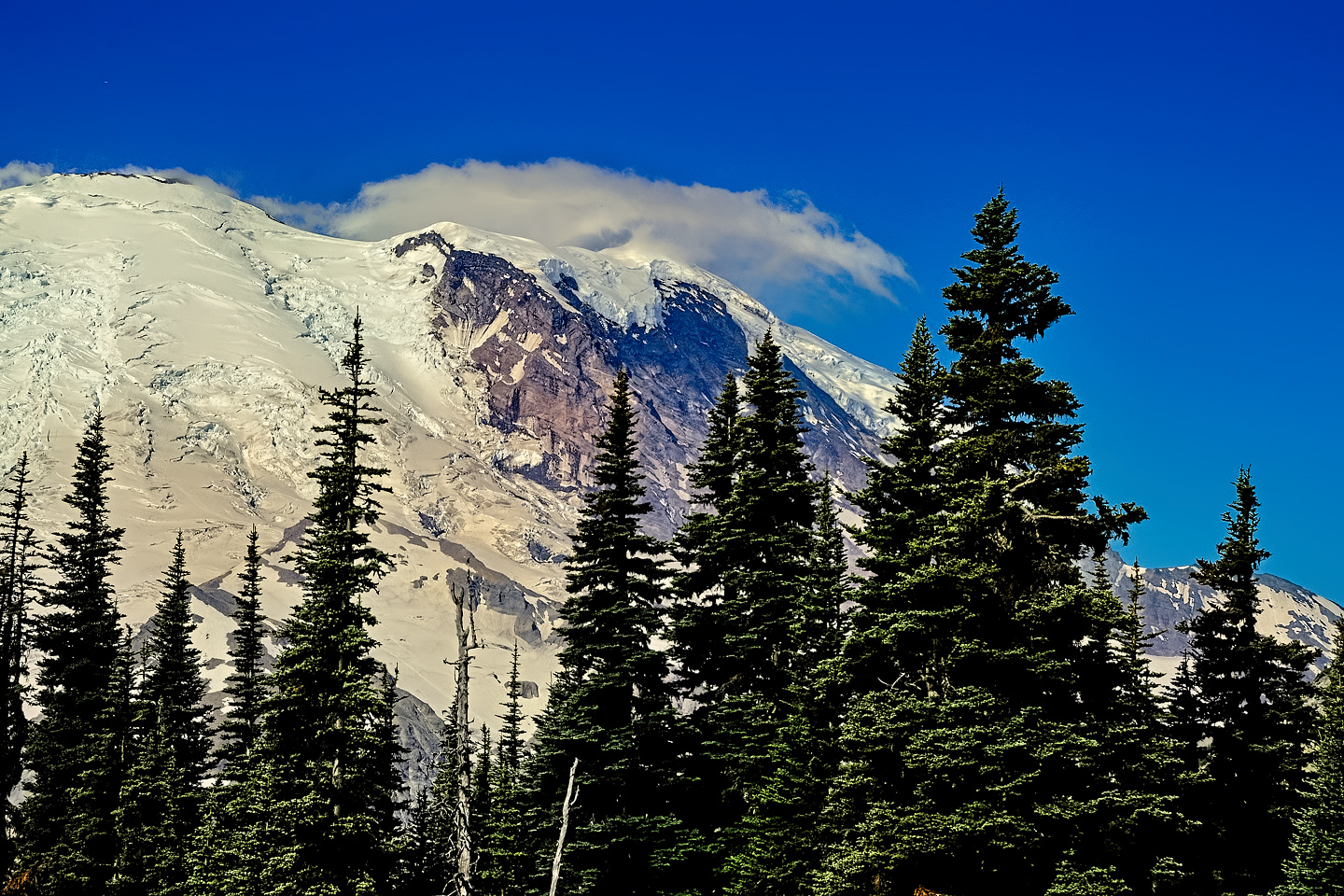
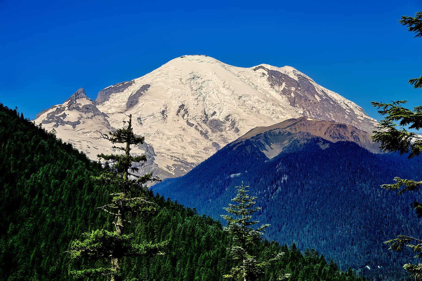
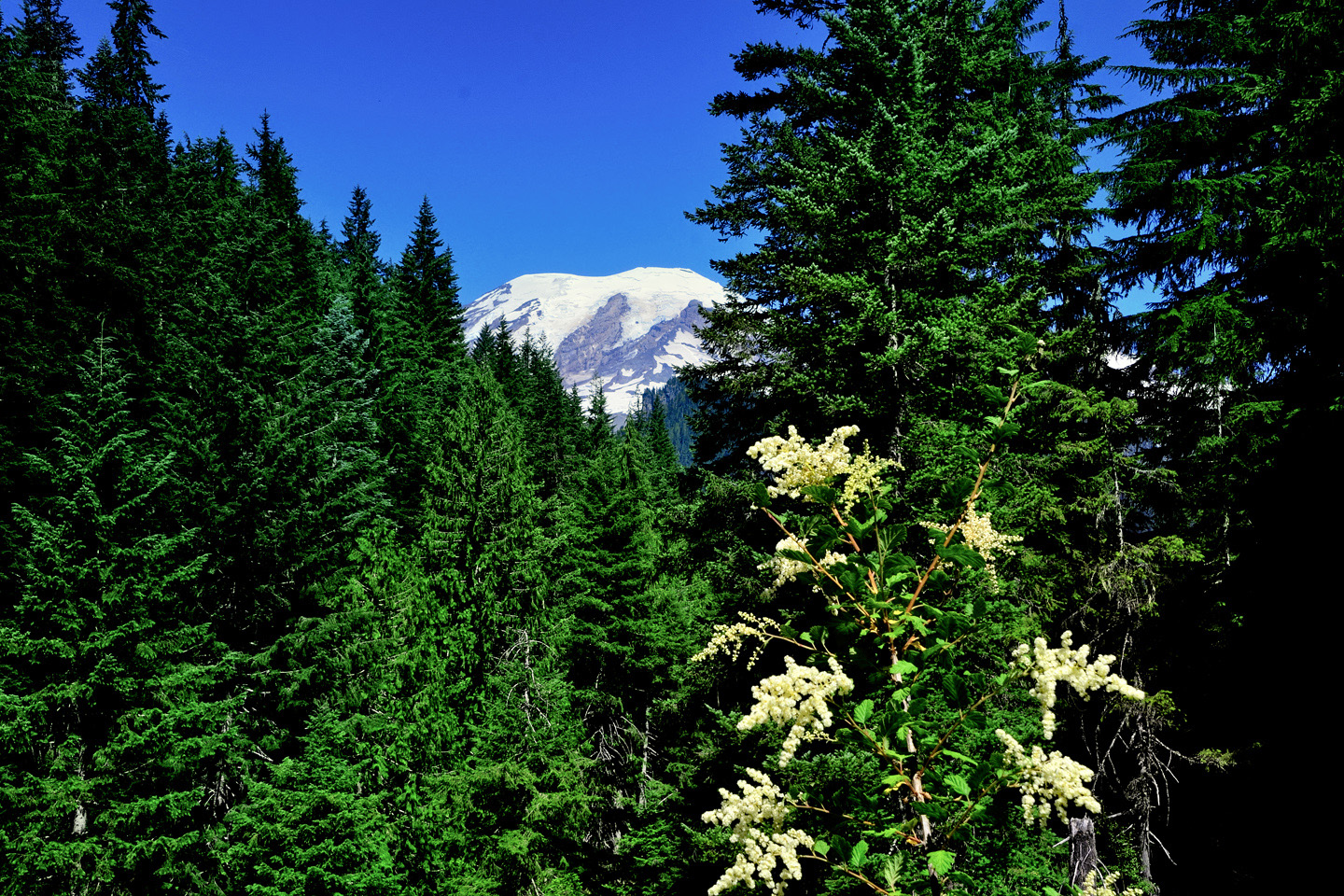
The road to Sunrise climbs into the foothills of Mount Rainier on the eastern side. The volcano is the biggest mountain around, and the treeless upper slopes, cloaked in glacial ice, catch and reflect the full brunt of the rising sun’s bright rays; a spectacle well worth the long drive, and the early wake-up call. My own photos from this drive, in the slideshow above, were taken a little too late in the morning for the sunrise glow, but the mountain, wearing a jaunty cloud chapeau, is beautifully illuminated against a crystal clear blue sky.
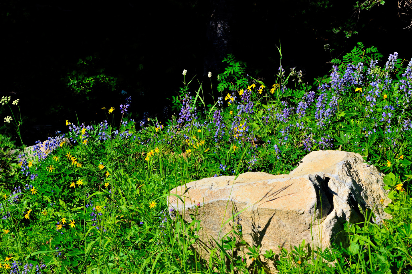
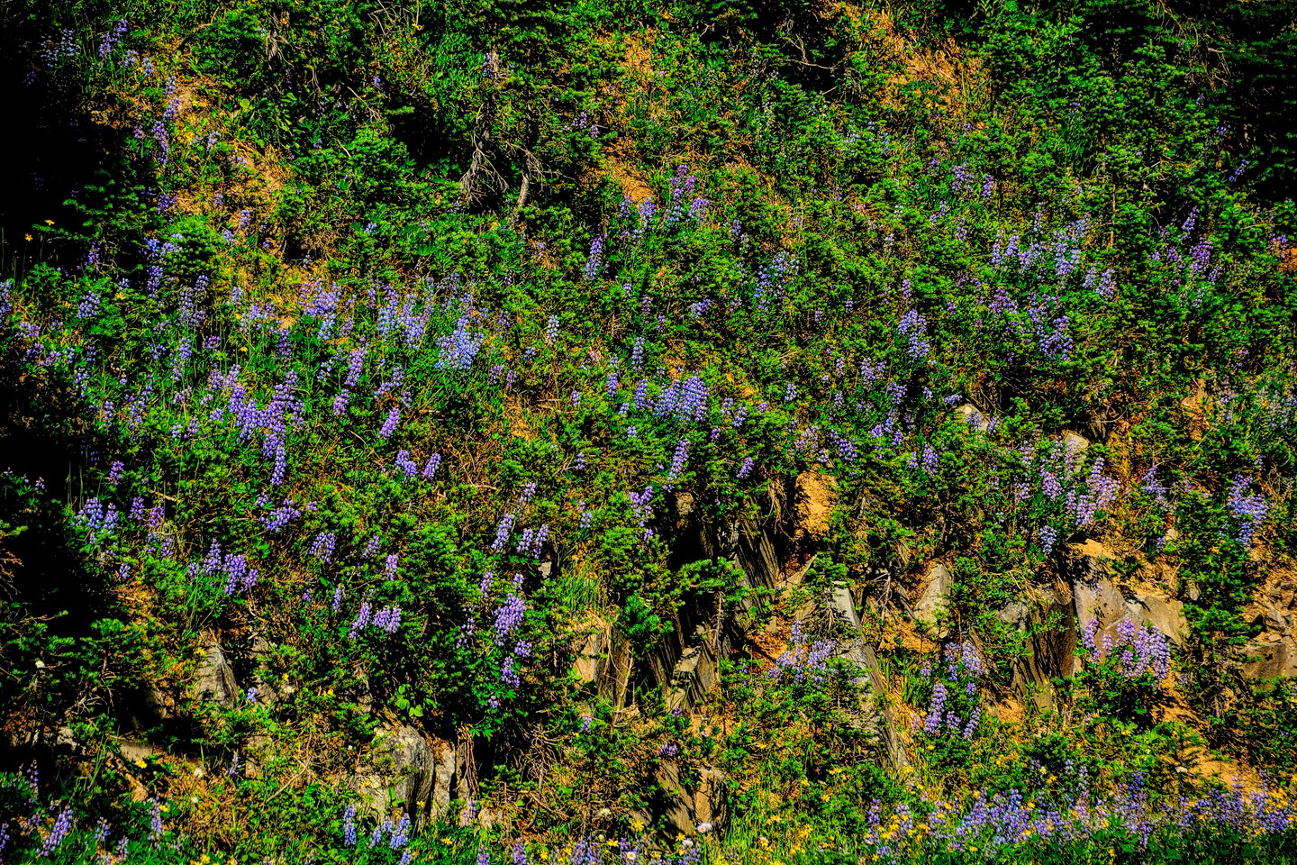
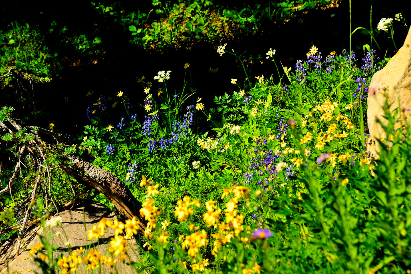
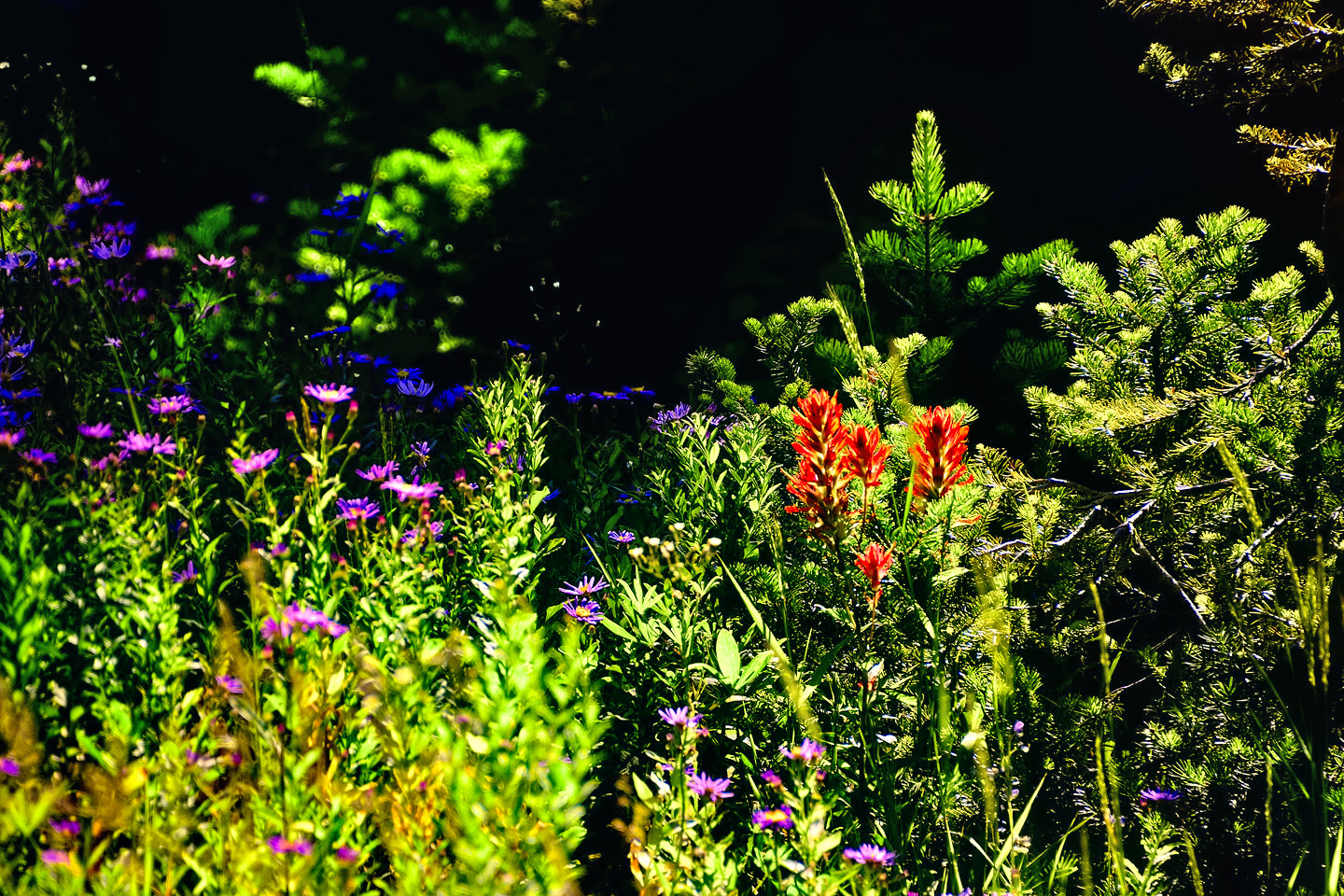
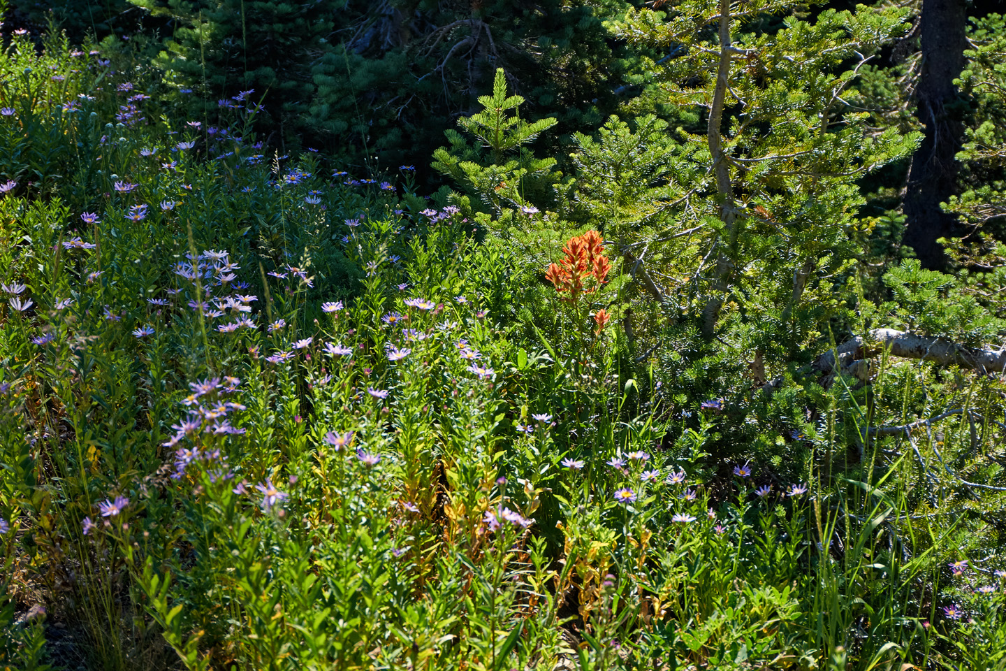
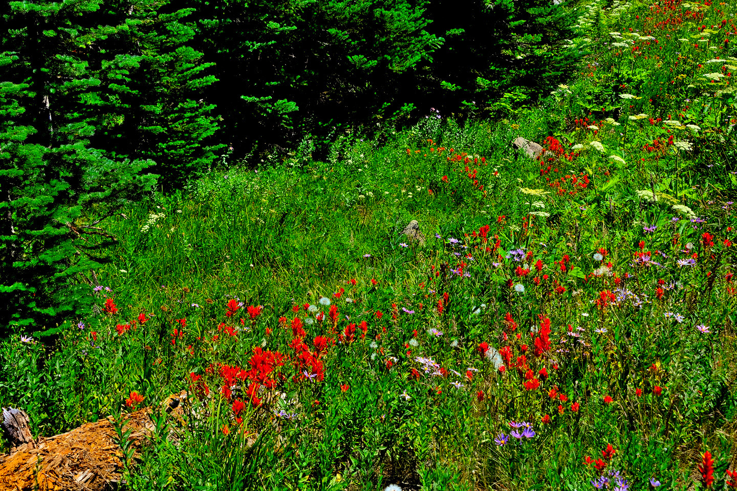
WILDFLOWERS
Summer, even more than spring, is the season for wildflowers in the high alpine meadows on the slopes of Mount Rainier. On both sides of the road, open fields are carpeted with purple, red and yellow blooms. The growing season is short, so the flowering plants live their lives in a hurry, and at full throttle. It’s a cosmic beauty contest, and the ultimate prize is survival of the species. The ecosystem producing this display is delicate; visitors are advised to stay on established trails.
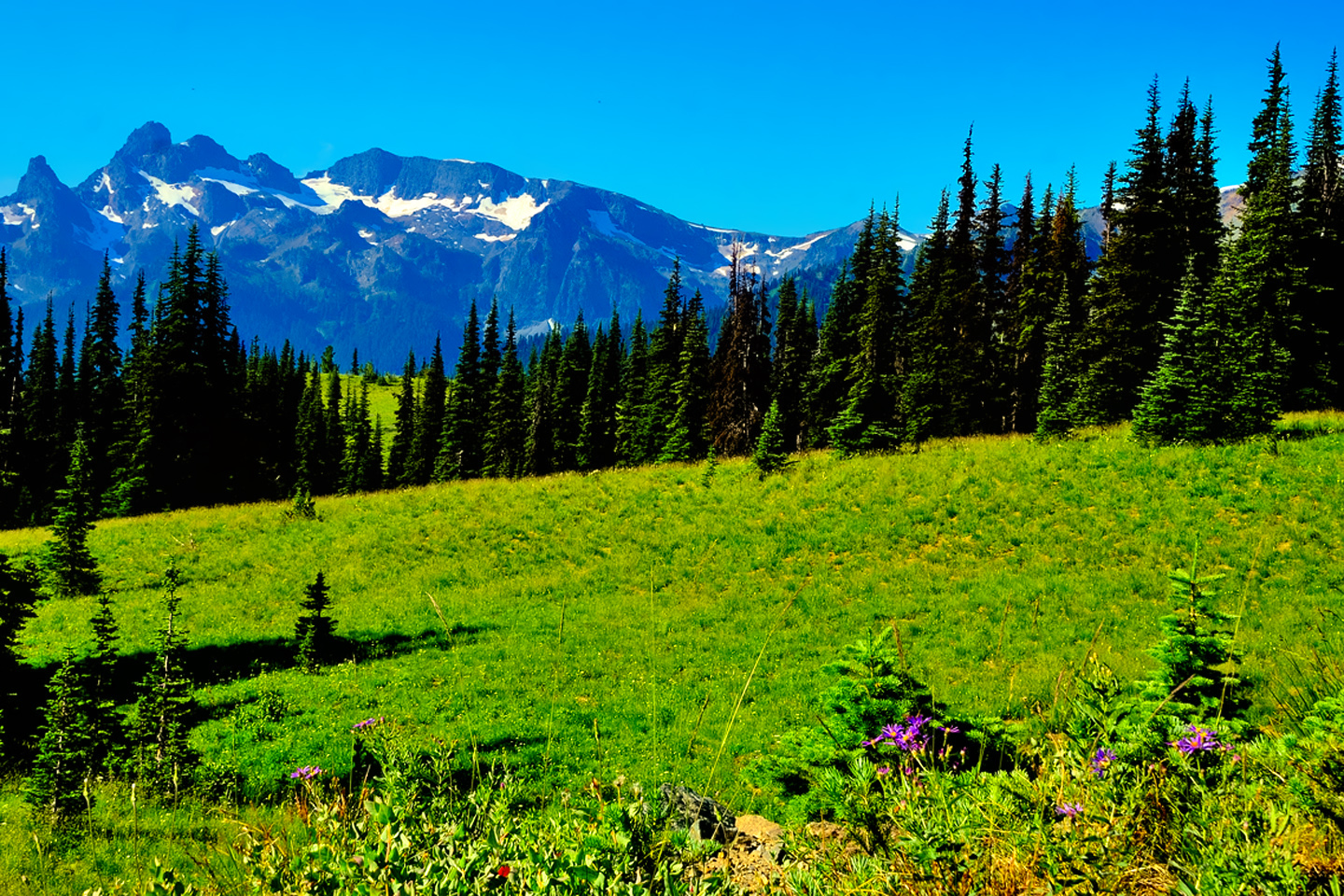
Summer Wildflowers near Sunrise on Mount Rainier: Lupine, asters, sunflowers and more!
WILDLIFE
The big mountain rises from a base no more than 1,000 feet above sea level to its summit, well above 14,000 feet. Along the way, the terrain, the vegetation, and the climate changes markedly with the altitude, encompassing a broad variety of habitats for a wide diversity of creatures. By the official count, Rainier is home to 65 species of mammals, 14 species of amphibians, another 14 of native fish, 5 kinds of reptiles, and no less than 182 different species of birds. In a busy National Park like Mt. Rainier, you’re not likely to find many of these on or near any of the roads (save for the occasional flattened specimen). Since I didn’t take the time to do any hiking on my single day Mount Rainier Photo Shoot, all I saw personally was a pair of Ravens, perched atop tall pines at the edge of a meadow, announcing themselves far and wide with their raucous squawks.
QUOTH THE RAVEN
The biggest difference between Ravens and Crows is their size. Ravens are the size of hawks, with a wing span of as much as four feet across, while crows are more closely akin to pigeons. The birds in these photos are clearly Ravens, and they’re putting on a show. All birds are smarter than most people think, and that goes double for the many species in the genus Corvus. The New Caledonian Crow, (NOT pictured here) has been extensively studied for it’s ability to not only use tools while foraging for food, but to actually manufacture tools, by plucking, smoothing, and bending twigs and grass stems into particular shapes.
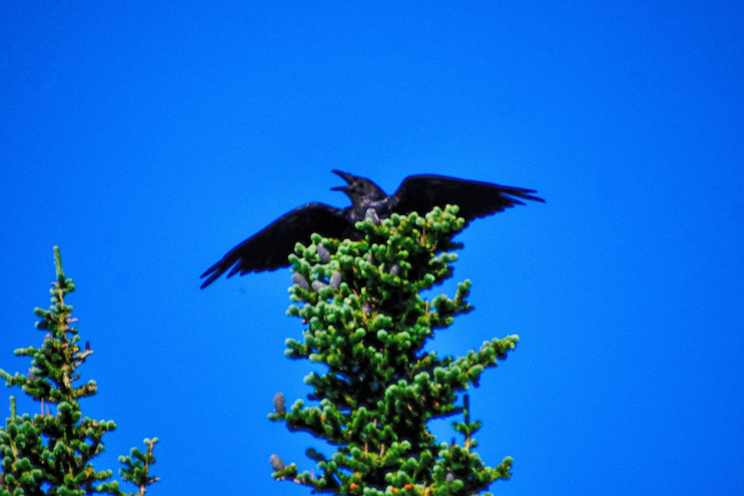
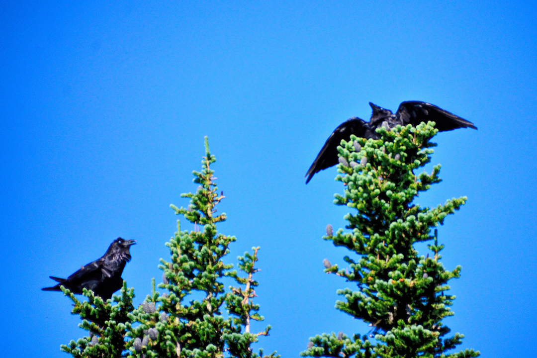
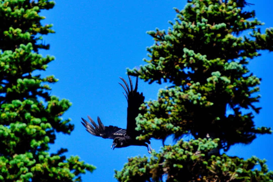
A pair of Ravens, hamming it up near Sunrise
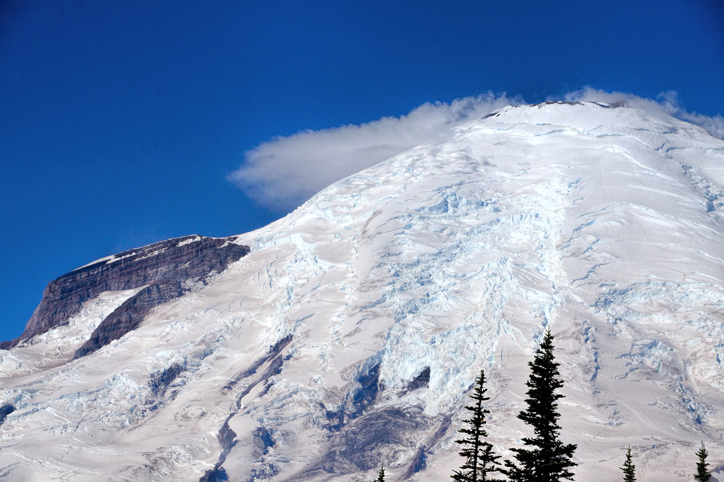
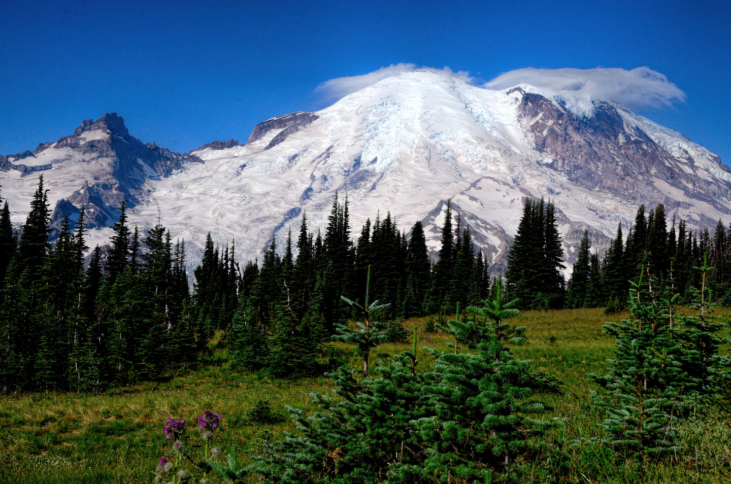
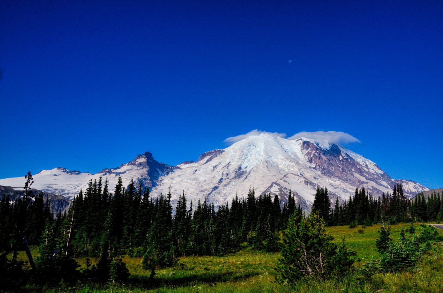
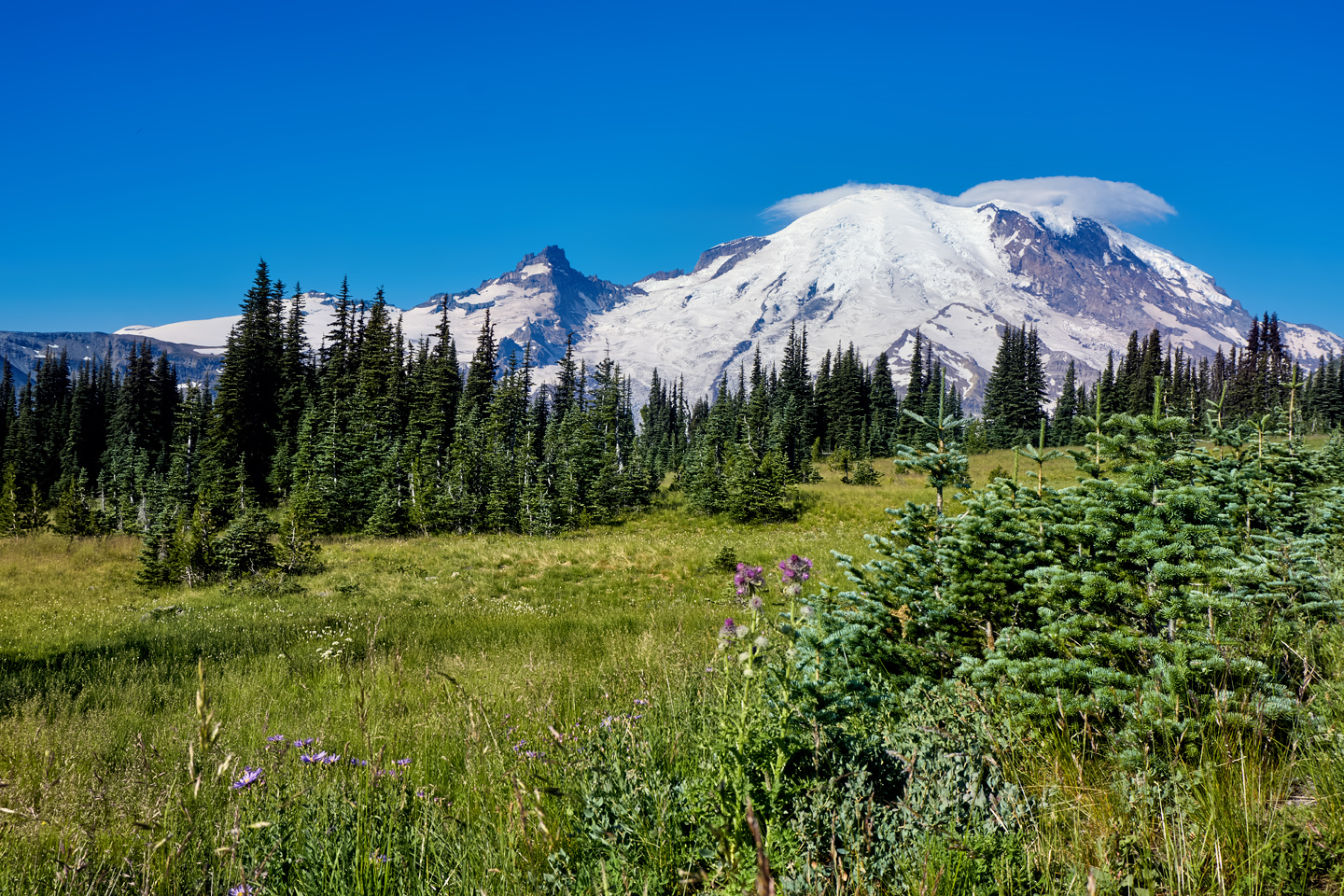
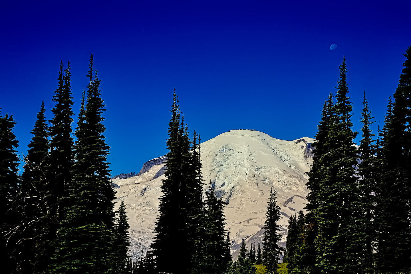
Views of Mount Rainier and surrounding area from Sunrise Point.
When you’re finished with Sunrise, head back down the mountain to the Mather Memorial Parkway (SR 410), and when you reach it, follow it south for 3.6 miles to SR 123. Follow SR 123 for another 10.8 miles, and you’ll reach Stevens Canyon Road, and the Stevens Canyon entrance to Mount Rainier National Park. This is it: the road to Paradise!
PARADISE
Paradise Recreation Area, Mount Rainier
James Longmire, an Oregon pioneer, was among the first to homestead the area on the south side of Mount Rainier. He built a small hotel near some mineral springs that he hoped would attract travelers. When his daughter Martha first saw the view, she remarked, “Oh! What a paradise!” That was another name that stuck, and today it applies to the primary tourist area of Mount Rainier National Park, the location of the main Visitors Center and the largest parking lot, as well as lodging, dining, and picnic areas. It’s also the primary winter-use area of the park, offering a full range of winter recreation, and, on average, 63 feet of snow!
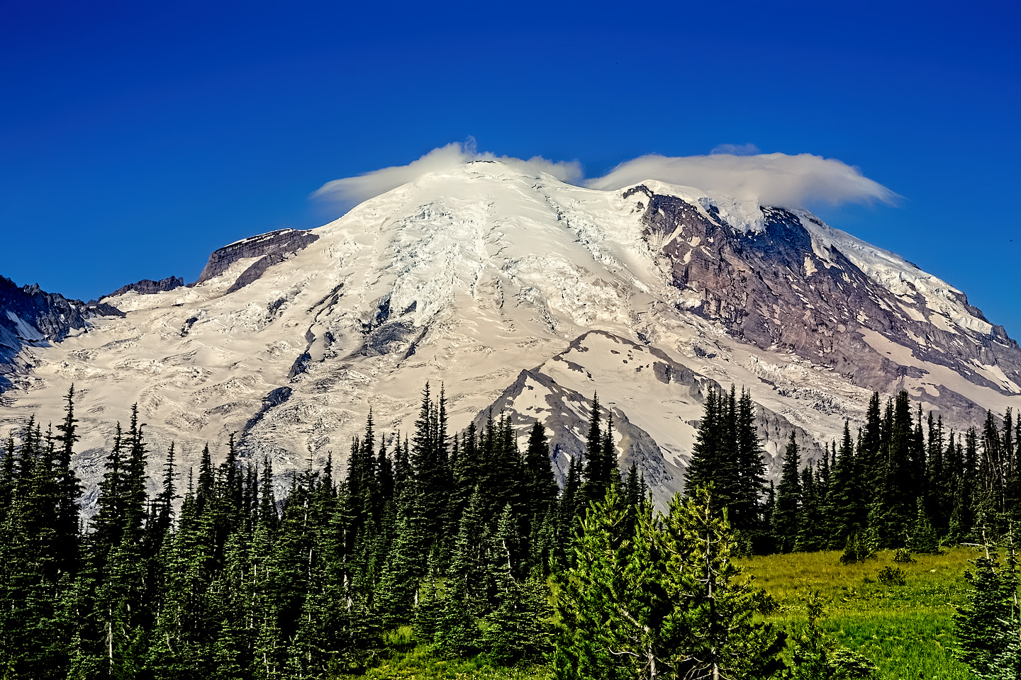
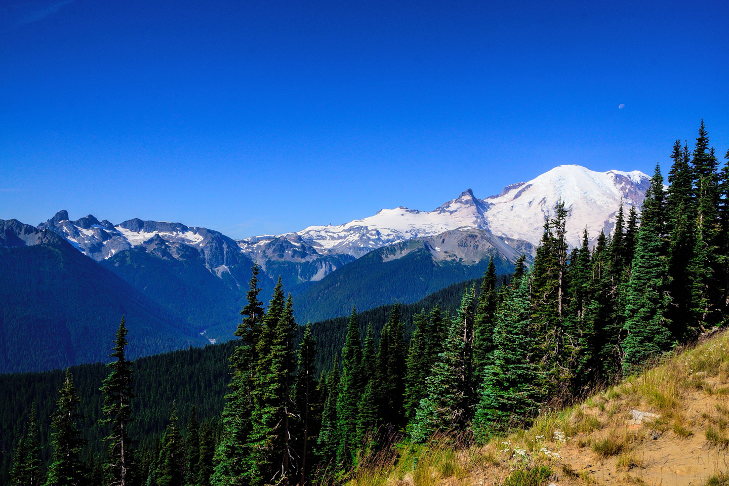
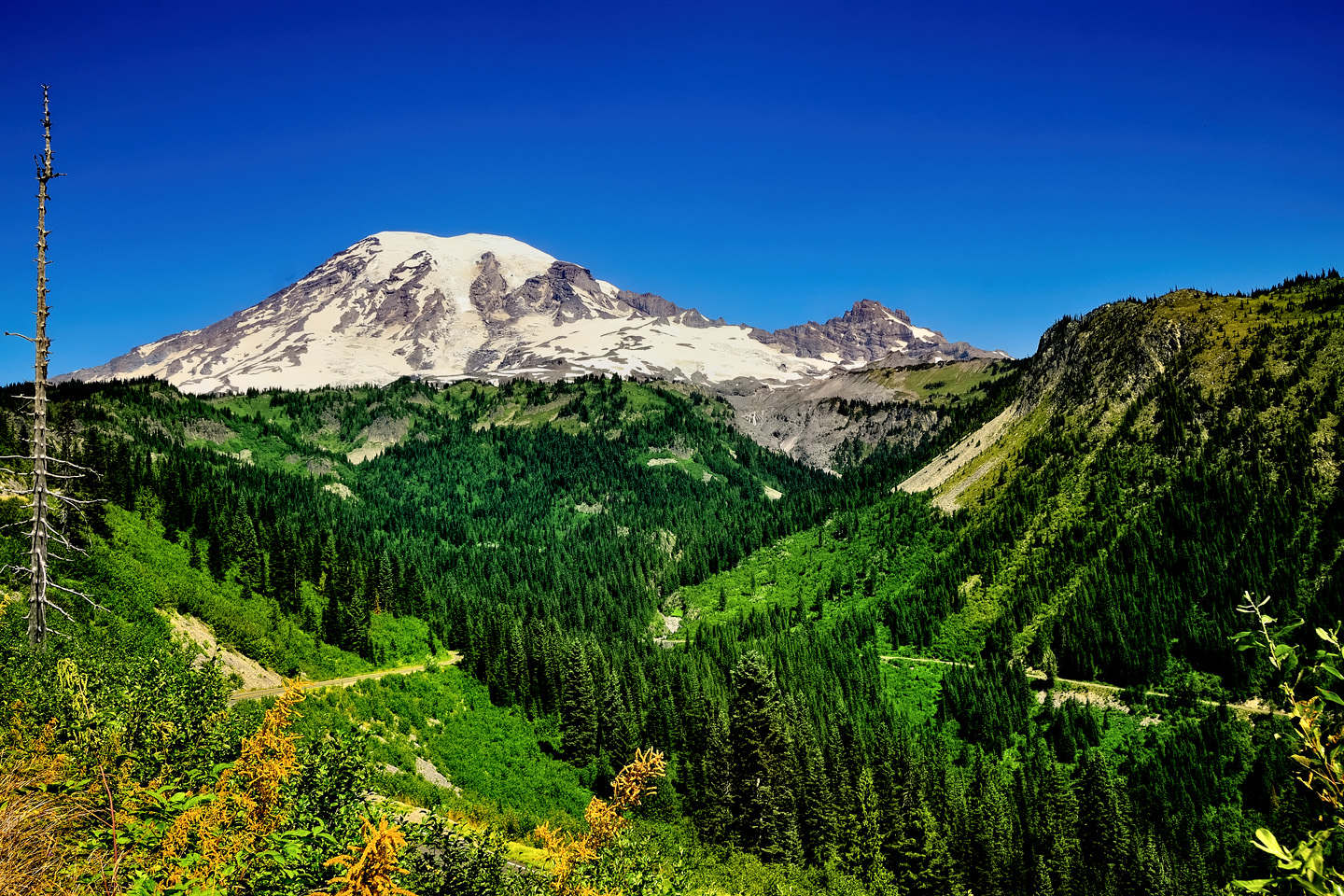
As you drive west into the park (or east, if you’re coming directly from Tacoma), the big mountain dominates the view. You’ll see the glaciated crown of the volcano peeking out from behind her own foothills, alternately hiding, then revealing herself. It’s not a sharp, obvious volcanic cone like Mount Fuji in Japan, or Osorno in southern Chile. Instead, the peak is flattened, with a distinct saddle at the top. You know that there’s a crater up there, but the only way to confirm that fact is to climb the mountain (or fly above it).
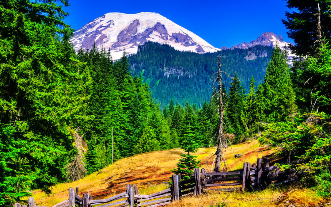
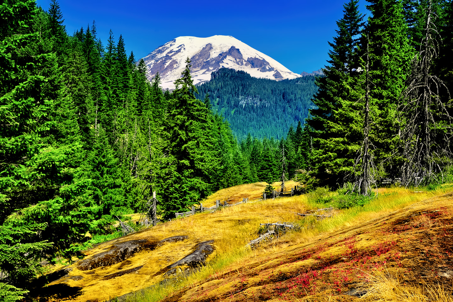
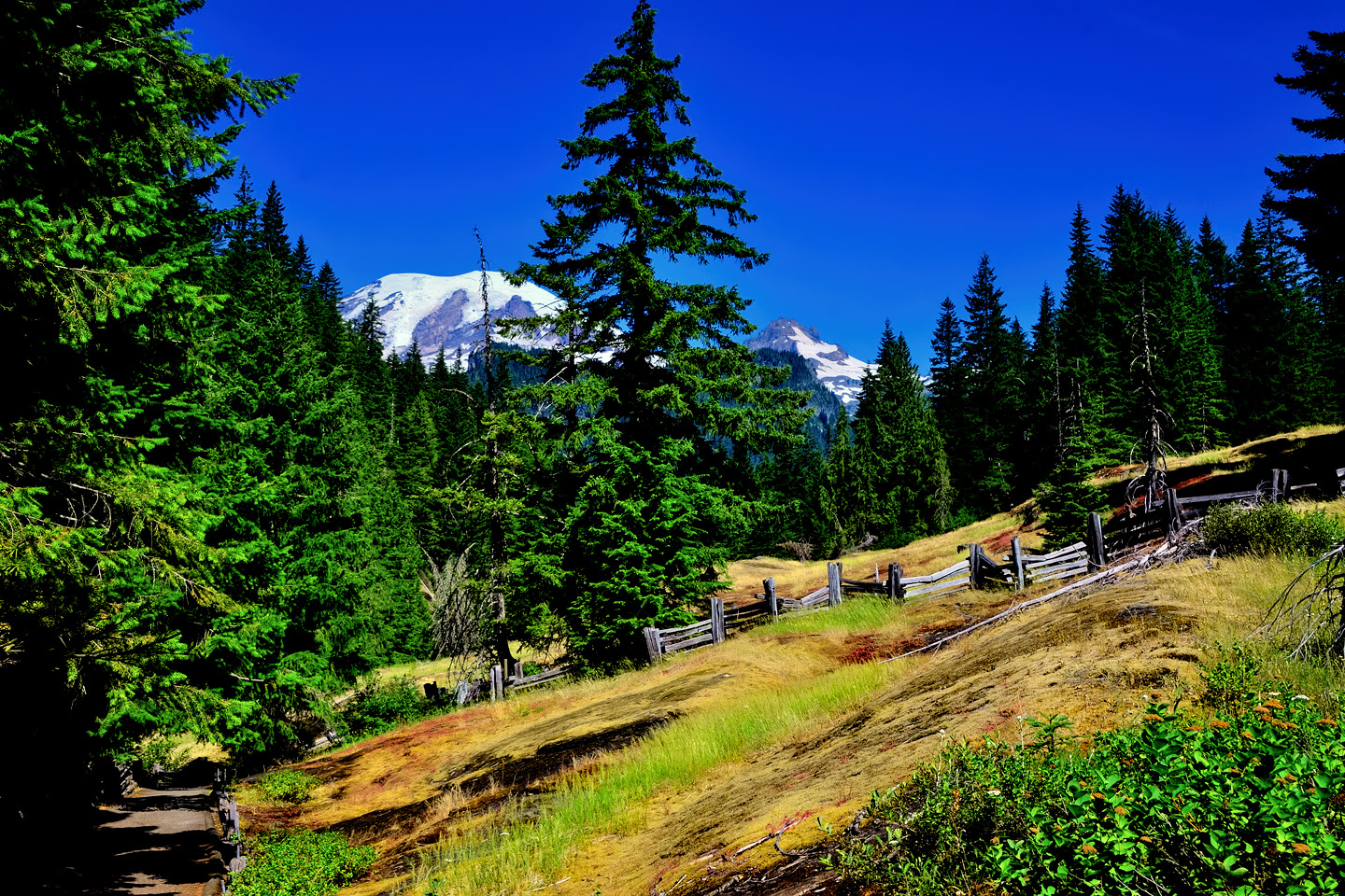
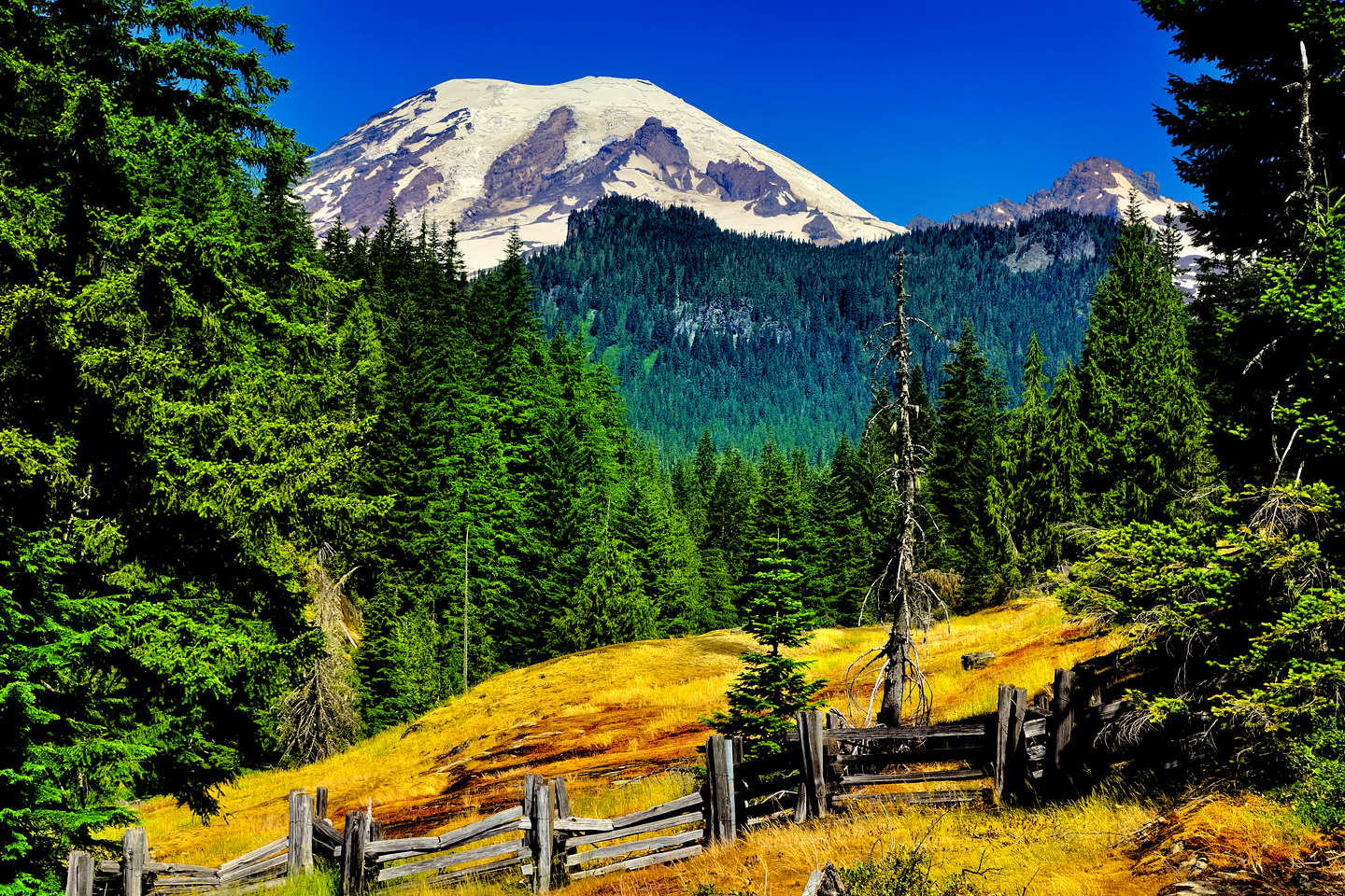
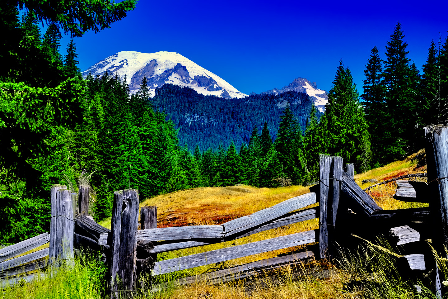
There are numerous overlooks offering terrific views of the mountain, but one of the most popular, as well as one of the most picturesque, is the Box Canyon Overlook, a bit more than 10 miles west of the east entrance to the park. From the overlook, you get a view of the mountain, beautifully framed by forested hills in the middle distance and tall pines on either side. In the foreground, there’s an old split rail fence zig-zagging its way across a clearing, the old wood adding texture and an interesting contrast to this otherwise natural scene.
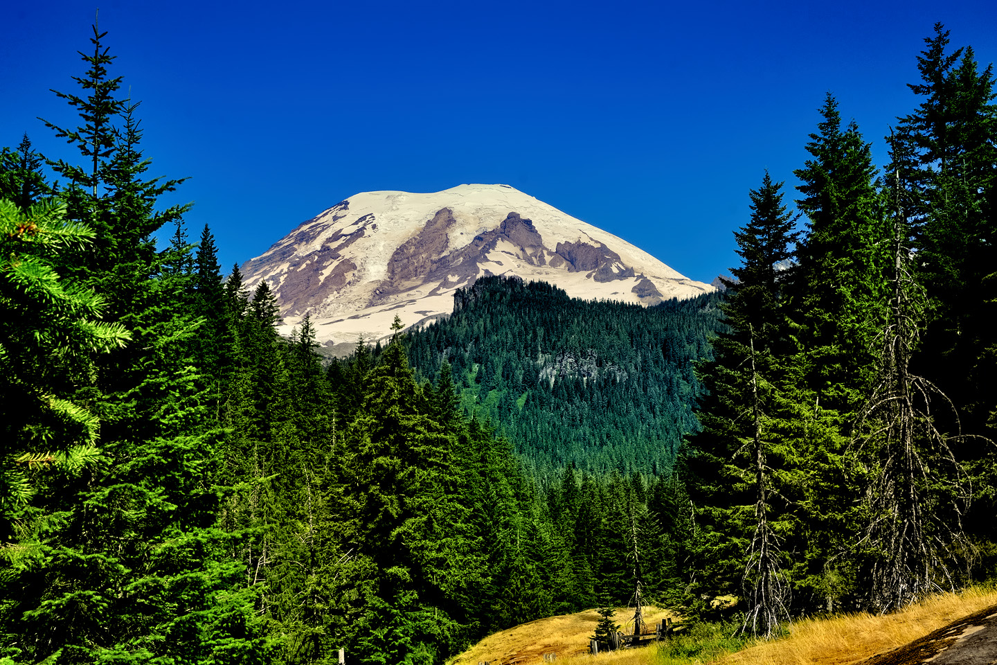
Views of Mount Rainier from the Box Canyon Viewpoint
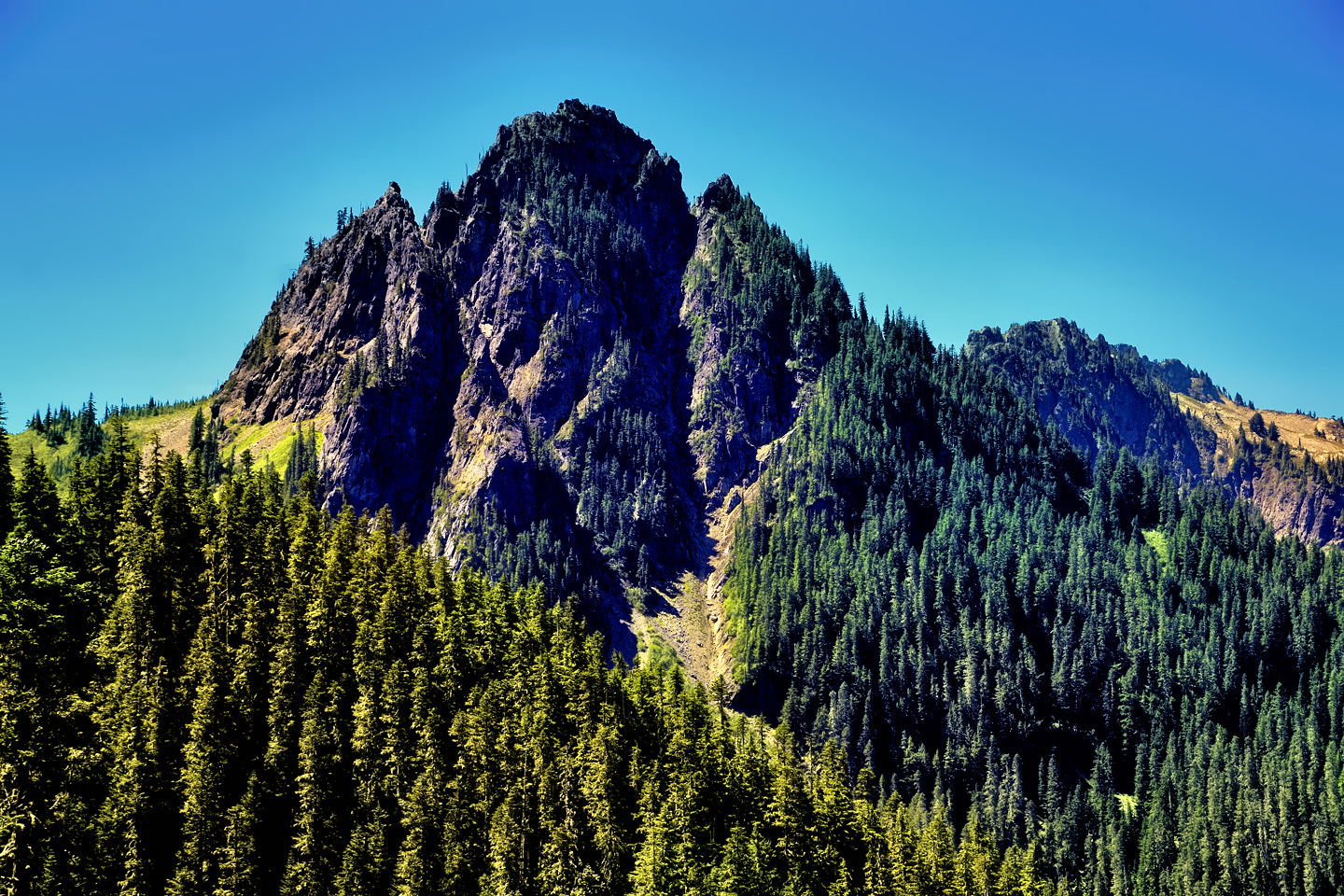
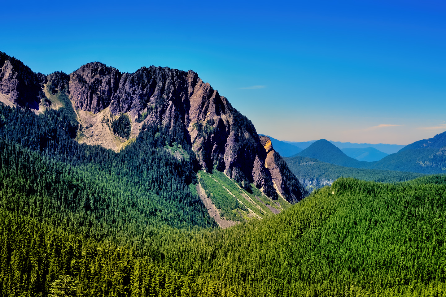
STEVENS CANYON ROAD
Stevens Canyon Road is the primary destination for the vast majority of visitors to the National Park, providing access to the most popular areas, amenities, and hiking trails. It snakes its way along the southern flanks of the mountain from the area near the Visitor’s Center, east to the Stevens Canyon entrance off SR 123. Along the way there are breath-taking views of the mountain, and many of her closest friends.
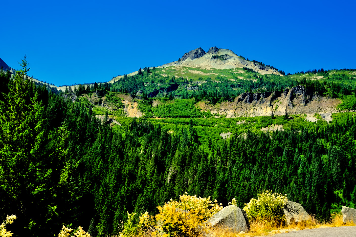
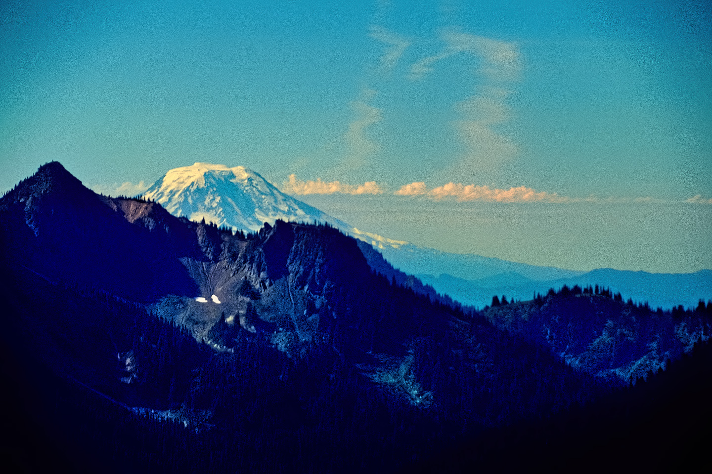
A mountain the size of Mount Rainier generates its own weather, spawning wisps of clouds off the glaciers that will often grow into blustery storms.
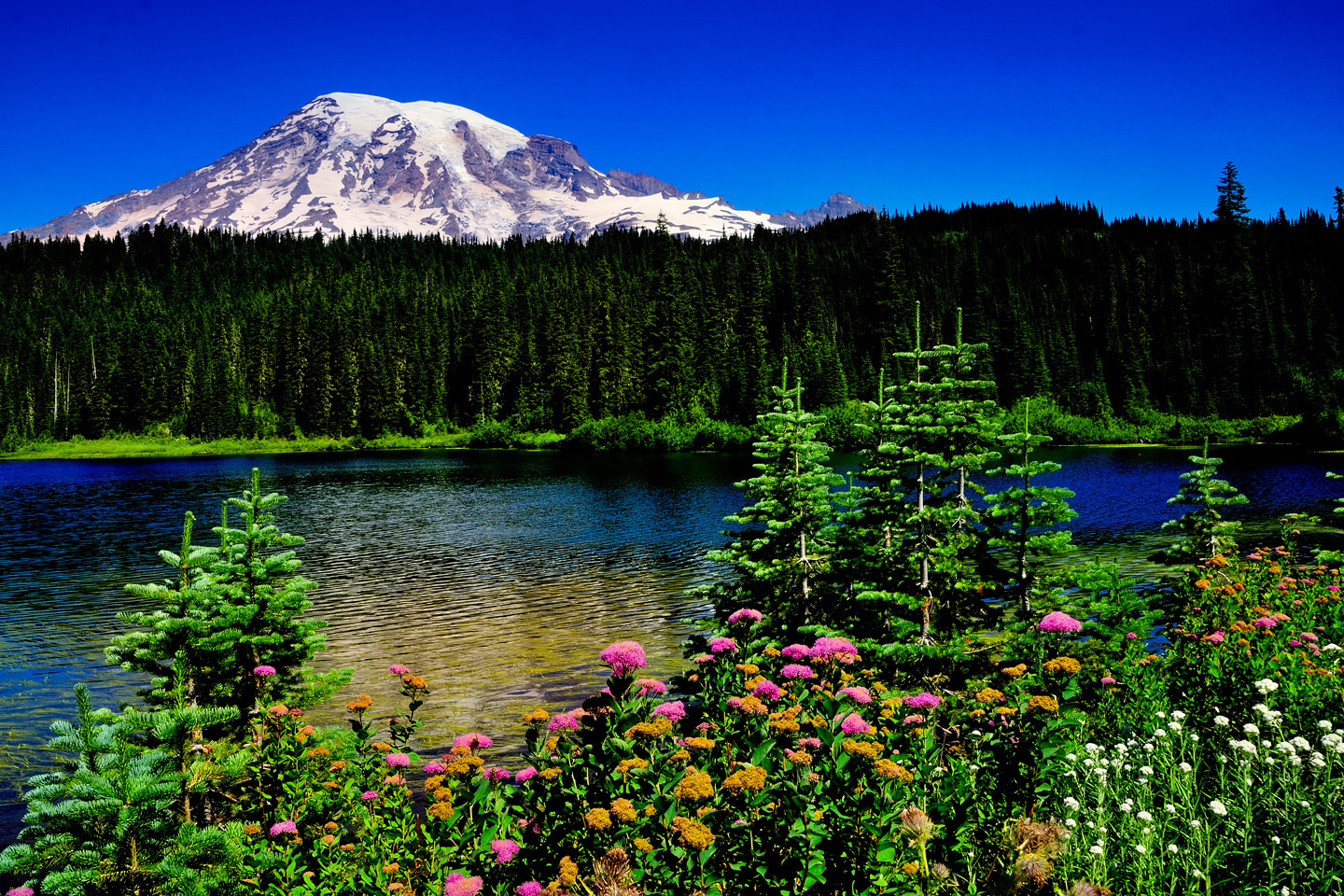
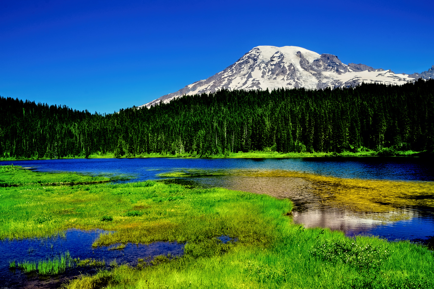
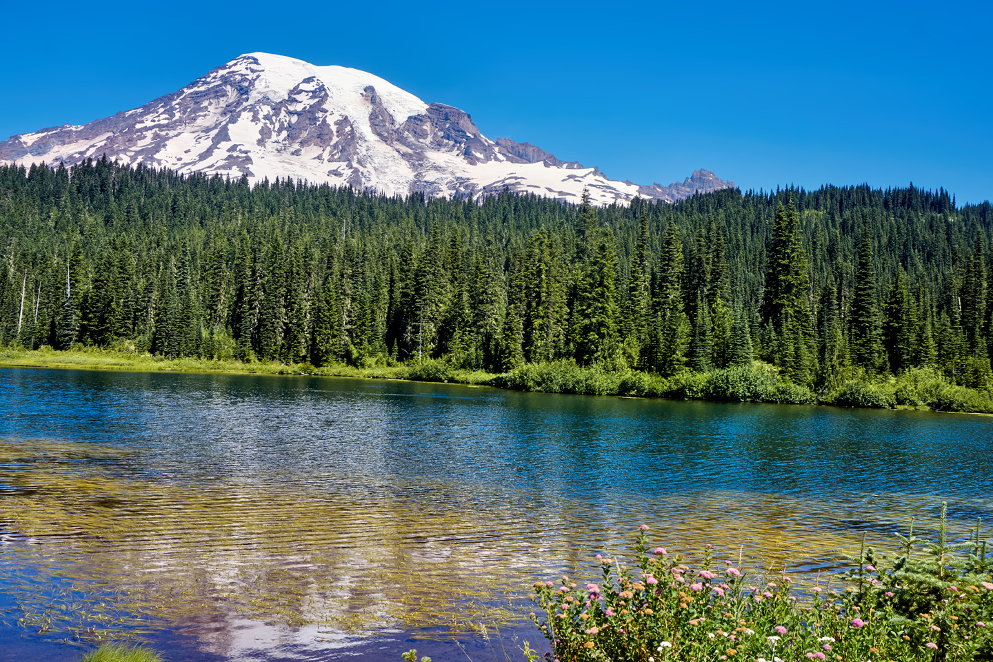
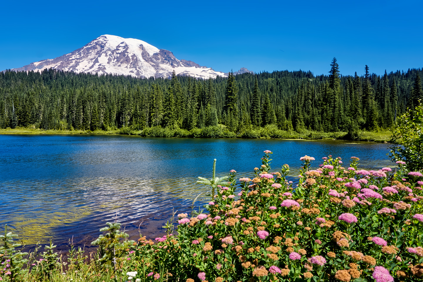
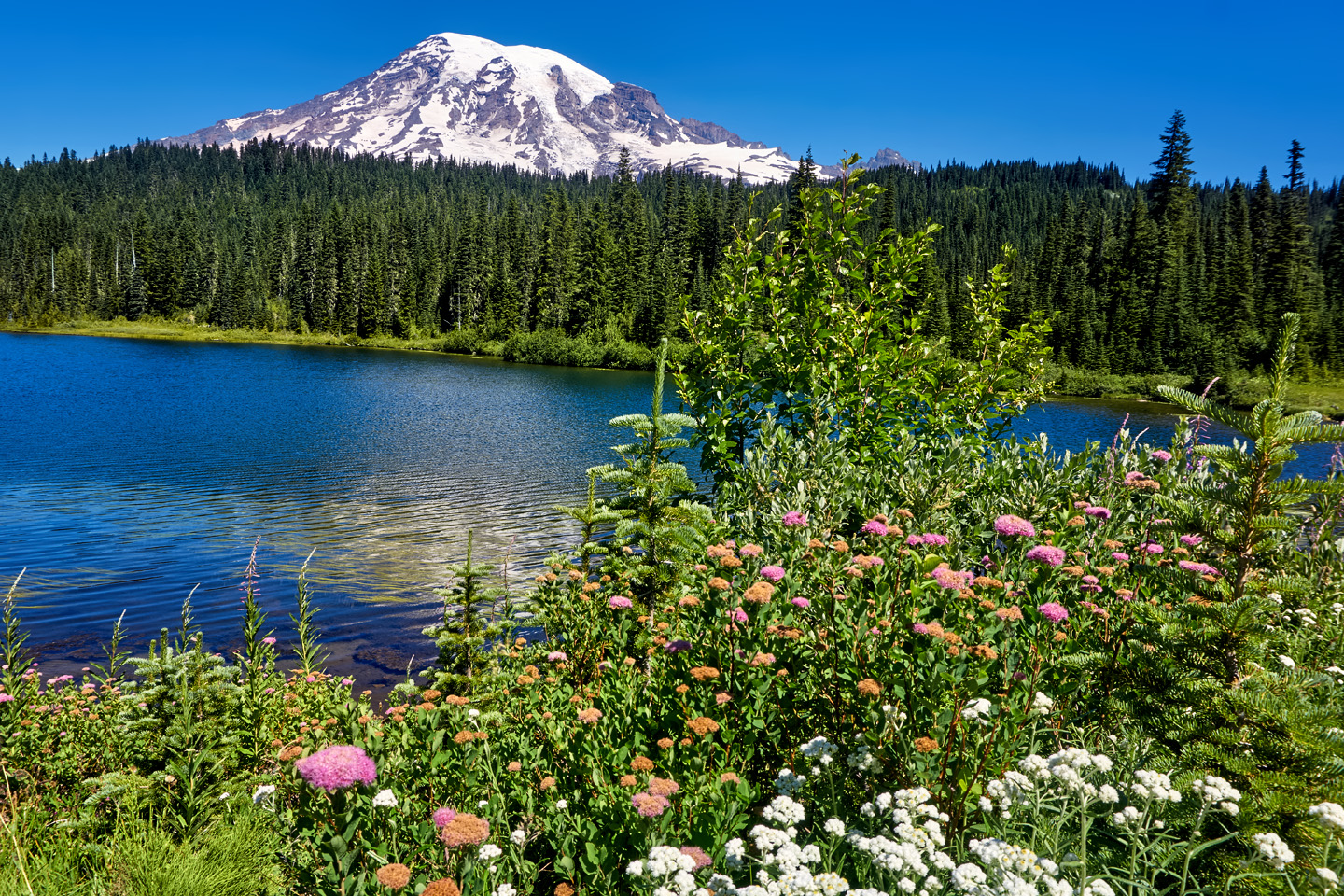
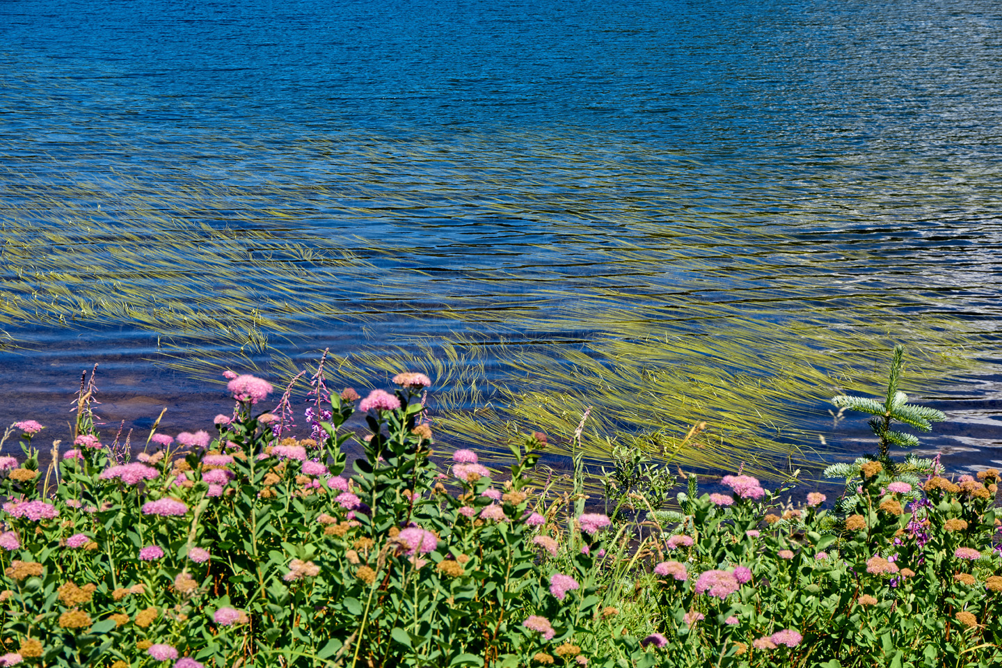
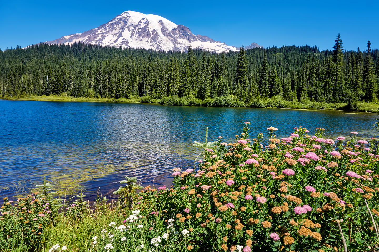
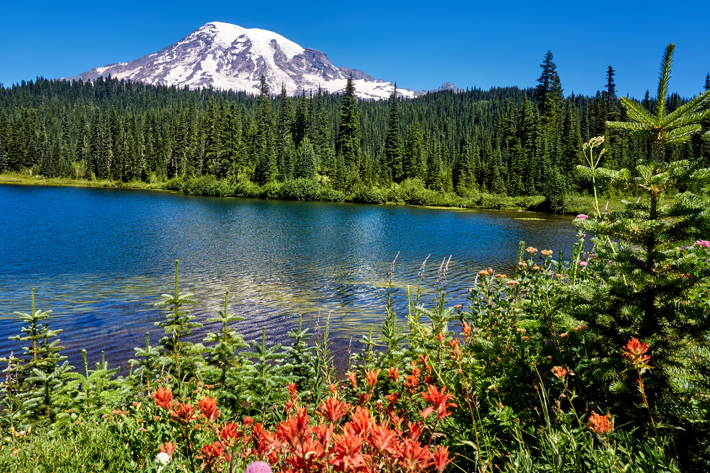
REFLECTION LAKES
Near the visitor’s center, at the western end of Stevens Canyon Road, you’ll come to the Reflection Lakes, a colorful melding of wildflowers and mountain scenery. There are small lakes along the roadside, and at the right time of day, if the sun is in the right place and there’s not too much breeze rippling the water, you can capture a fantastic composition, featuring Rainier in the background, flowers in the foreground, and a reflected scene in the middle. In my own photos (below) everything was right except the breeze, which was lovely at the time, but it spoiled what could have been a perfect mirror. But what the heck. It’s a beautiful scene, either way.
Depending on how much time you’ve spent at each of these various stops, and on how early you got started, you’ll be approaching the sunset hour around here somewhere. If you’re staying in the park, you’ve got it made. You can dawdle to your heart’s content, and capture even more great photos in the golden light of the late afternoon. If you’re NOT staying in the park, you’ll have to balance your desire to grab more images against any reluctance you might have when it comes to driving narrow mountain roads in the dark.
There’s a lot more to Mount Rainier National Park than what I’ve featured here. My personal goal was to capture at least a few great shots of the mountain, and by the end of the day, I felt like I’d succeeded in that. If you like the perspectives that I show in my photographs, try driving it just as I’ve laid it out, starting with Sunrise. If the weather cooperates, I can all but guarantee some excellent photographs.
Click any photo in this post to stop the slide shows and expand the images to full screen.
(Unless otherwise noted, all of the images in these posts are my original work, and are protected by copyright. They may not be duplicated for commercial purposes.)
PHOTO ROAD TRIP: PACIFIC NORTHWEST
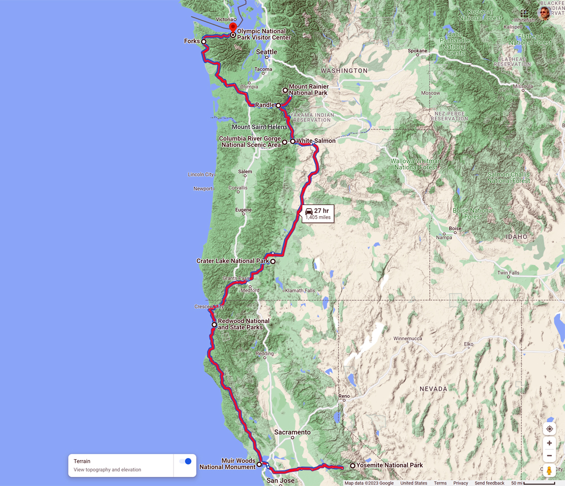
The Pacific Northwest is one of the best areas in the country for a Road Trip. When I drove my Jeep to Alaska, back in 2015, I traveled an extra thousand miles out of my way, just so that I could pass through northern California, Oregon, and Washington on my way to Canada. The route that I followed took in five National Parks, one National Monument, and a National Scenic Area, an ideal itinerary for a guy who loves landscape photography. In this brief series of posts, I'll walk you through the lessons that I learned in each remarkable location.

PHOTOGRAPHER'S ASSIGNMENT: CRATER LAKE
It simply isn’t possible to gaze upon Crater Lake and not be awed by the view. It’s like staring into the eye of the Creator, a heavenly vision reflected by water so clear, and so deep, and so intensely BLUE, you’ll find yourself neglecting to breathe.
<<CLICK to Read More>>

PHOTOGRAPHER'S ASSIGNMENT: MT. RAINIER
The road to Sunrise climbs into the foothills of Mount Rainier on the eastern side. The volcano is the biggest mountain around, and the treeless upper slopes, cloaked in glacial ice, catch and reflect the full brunt of the rising sun's bright rays; a spectacle well worth the long drive, and the early wake-up call.
<<CLICK to Read More>>

PHOTOGRAPHER'S ASSIGNMENT: OLYMPIC NATIONAL PARK
(Coming Soon!)
This is an interactive Table of Contents. Click the pictures to open the pages.
Alaska Road Trip

The Alaska Highway: Prelude: The Road to Dawson Creek
Even if you start in Seattle, the closest American city, it’s still more than 800 miles to Dawson Creek, wending your way that much further north, so far north that there will be a noticeable change in the hours of daylight. It’s the latitude that distinguishes the north country, including every bit of Alaska. Dawson Creek is where it all begins.
<<CLICK to Read More>>

The Alaska Highway: Day 1: Dawson Creek to Fort Nelson
Past Fort St. John, the terrain got a lot wilder. No more towns, very few people, and very little traffic. Saw a few U.S. license plates, Michigan, California, Oregon, South Carolina; people that were obviously headed to Alaska!
<<CLICK to Read More>>

The Alaska Highway: Day 2: Fort Nelson to Whitehorse
Every time I rounded a curve in the road there was another stupendous vista; it was nothing short of astonishing! I was literally yipping out loud, and a couple of times I actually pulled over and stopped while I pounded on my chest to “re-start” my heart!
<<CLICK to Read More>>

The Alaska Highway: Day 3: Whitehorse to Beaver Creek
Approaching the mountains, I started pulling over with serious frequency, taking LOTS of photos! Mountains, clouds, lakes, flowers—I was pretty sure I must have died and gone to heaven, but I couldn’t for the life of me remember the fiery crash.
<<CLICK to Read More>>

The Alaska Highway: Day 4: Beaver Creek to Fairbanks
Delta Junction, the end of the Al-Can, was only 200 miles away, and the border? Twenty miles, maybe half an hour, and I was finally going to cross into Alaska! I’d been on the road more than three weeks, and in just half a day more, I’d be in Fairbanks.
<<CLICK to Read More>>

Chena Hot Springs: A Fairbanks Original
The Chena hot spring puts out steaming water at a temperature of 150 degrees, producing enough power to meet all the needs of the resort, as well as filling the hot springs pools used by the guests. In addition to the lodge and restaurant, they offer camping and horseback riding, and they have exhibits featuring sled dogs, greenhouses, ice sculptures, and geothermal energy.
<<CLICK to Read More>>

Two-Foot High Kick: World Eskimo Indian Olympics
Contestants take a running leap, then they make this crazy jackknife move, touch the ball suspended high above the floor with both feet, then come back down and stick the landing. If that sounds difficult? You have no idea.
<<CLICK to Read More>>

Dreaming of Denali
When I drove my Jeep to Alaska that first summer after I retired, my main goal, the single most important thing I wanted to do, was to see Denali, the biggest mountain in North America.
<<CLICK to Read More>>

Follow the Fireweed
Visualize a summertime journey through that part of the world, a world filled with mountains and glaciers and boreal forests, ice blue rivers, turquoise lakes, and billowing clouds that fill the sky. Imagine your vision as a beautiful piece of music. The fundamental, underlying theme of that symphony would be a gently rising swell of perfect harmony, pinkish lavender in its hue.
<<CLICK to Read More>>

Kenai Fjords National Park: Seabirds, Glaciers, and Whales on the Wild Coast of Alaska
At this latitude, during the summer months, the sun stays low in the sky all day, and never really goes down. The traditional “golden hour” when the light is best for landscape photos is extended accordingly, and there are more opportunities for great shots than you’ll know what to do with.
<<CLICK to Read More>>

Kenai Fjords National Park: Exit Glacier: Up Close and Personal
Compared to the huge tidewater glaciers that flow directly into the sea along the coast of Kenai Fjords, Exit Glacier is just a baby–a baby that’s getting smaller every year–but it’s still big enough to permanently alter the landscape through which it passes.
<<CLICK to Read More>>

Alaska Road Trip: Driving Alaska’s Grand Circle
Most of the major towns in Alaska, as well as three of the state’s incredible National Parks, can all be reached by driving Alaska’s Grand Circle: a loop route beginning in Tok that utilizes all four segments (1082 miles) of Alaska’s Interstate Highway system.
<<CLICK to Read More>>

Alaska Road Trip: The Grand Circle: From Tok to Denali
There are no icy mountains looming on the horizon, and Fairbanks is nowhere near Alaska’s ruggedly beautiful coast. The true beauty in Alaska’s second city is found below the surface, in the spirit and resiliance of the people who make the place their home.
<<CLICK to Read More>>

Alaska Road Trip: The Grand Circle: Anchorage and the Kenai Peninsula
The massive ice field in the park’s wild interior has spawned dozens of glaciers which, over the course of many millenia, have carved the landscape into fjords so heart-breakingly beautiful, humpback whales swim all the way from Hawaii just to cavort in the deep blue water.

Alaska Road Trip: The Grand Circle: Wrangell-St. Elias National Park
So, just exactly how big is Wrangell-St. Elias National Park? You could combine Yellowstone with Yosemite, throw in the entire country of Switzerland, and you still wouldn’t match it in terms of size.
<<CLICK to Read More>>

Alaska Road Trip: Driving to the Top of the World
The rough dirt road gave way to a newly paved modern highway. This was it, the Top of the World, and right on cue, the haze peeled back, just enough to give me a glimpse of the beauty my friends assured me would be there…
<<CLICK to Read More>>
CANADIAN ROAD TRIPS
This is an interactive Table of Contents. Click the pictures to open the pages.
Canadian Road Trips

Canadian Road Trips: Rolling through the Rockies
The goal here is to get you thinking about the different ways to tie these iconic parks together, and the distances involved, in order to get the most out of a visit to one of the most wonderfully scenic areas on the entire planet.
<<CLICK to Read More!>>

Canadian Road Trips: Banff and Kootenay National Parks
Banff gets four million visitors in an average year, and even though the park covers more than 1.6 million acres, 90% of those four million visitors head straight to the same spot, to Lake Louise, and the Fairmont Chateau.
<<CLICK to Read More!>>

Canadian Road Trips: Jasper and the Icefields Parkway
You'll see glaciers, waterfalls, rushing rivers and turquoise lakes surrounded by wildflowers, all of it fed by steadily melting ice. Snowclad peaks with vibrant green flanks line the road on both sides, and every turnout, every wide spot in the road offers a new and dramatic perspective.
<<CLICK to Read More!>>

Canadian Road Trips: Yoho National Park
Less than five miles along, the first break in the trees offered a glimpse, a flash of improbable color followed by a larger clearing that brought me screeching to a halt. There, beyond the spread of roadside wildflowers and a verge of spindly pines was the most extraordinary lake I had ever seen, backed by an ice-clad mountain.
<<CLICK to Read More!>>

Canadian Road Trips: Glacier and Mt. Revelstoke National Parks
The centerpiece of Revelstoke is it’s namesake mountain, and the most popular activity is the drive up the Meadows in the Sky Parkway, a twisting, turning roller coaster of a road that climbs all the way to the top of the mountain. It’s only 16 miles long, and it’s paved the whole distance, but you’ll gain more than 4,000 feet in elevation, and there are enough hairpins to satisfy the needs of an old-fashioned beauty pageant.
<<CLICK to Read More!>>

Follow the Fireweed
Visualize a summertime journey through that part of the world, a world filled with mountains and glaciers and boreal forests, ice blue rivers, turquoise lakes, and billowing clouds that fill the sky. Imagine your vision as a beautiful piece of music. The fundamental, underlying theme of that symphony would be a gently rising swell of perfect harmony, pinkish lavender in its hue.
<<CLICK to Read More!>>

There's nothing like a good road trip. Whether you're flying solo or with your family, on a motorcycle or in an RV, across your state or across the country, the important thing is that you're out there, away from your town, your work, your routine, meeting new people, seeing new sights, building the best kind of memories while living your life to the fullest.
Are you a veteran road tripper who loves grand vistas, or someone who's never done it, but would love to give it a try? Either way, you should consider making the Southwestern U.S. the scene of your own next adventure.
A few years ago I wrote a book about road trips in Arizona and New Mexico that's a lot like this website, packed with interesting information, and illustrated with beautiful photographs. Check it out! You can find it on Amazon, and at all other major booksellers.

ALASKA ROAD TRIP:
MEXICAN ROAD TRIP (IN THE LAND OF THE MAYA):
ARIZONA AND NEW MEXICO:
SOUTH AMERICA:
PHOTOGRAPHY:
TRIBAL LANDS:

Recent Comments